
Title: Historical Tours in and about Boston
Author: American Oil Company
Release date: January 23, 2015 [eBook #48054]
Most recently updated: October 24, 2024
Language: English
Credits: Produced by Stephen Hutcheson, Dave Morgan, Carol Spears
and the Online Distributed Proofreading Team at
http://www.pgdp.net

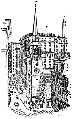
Compliments of
AMERICAN OIL COMPANY
Copyright 1935, American Oil Company
You are now in the Historic City of Boston, the Birthplace of American Liberty.
The Boston you see around you today is the capital city of the great Commonwealth of Massachusetts, with a population, in its Greater Boston area, of 2,307,897, and it covers 1022.6 square miles. The town was settled over three hundred years ago by a God-loving people of rugged character, industry and vision. Today it has grown into this great modern manufacturing and commercial center. It boasts of two hundred universities, colleges and schools, of which the major ones are Boston University, Harvard, Massachusetts Institute of Technology, Radcliffe, Wellesley, Tufts, Simmons, Boston College, New England Conservatory of Music, Northeastern, and Massachusetts School of Art. There are two hundred and twenty-four public libraries available with more than four million books. There are five museums open to the public.
This little book has been designed by the American Oil Company for your convenience during your stay in this historic town and has been divided into five tours, each of which may be made easily in a day’s time.
The Start: Leaving the Providence Street side of the Hotel Statler, walk directly ahead on Arlington Street one block to Boylston Street. Turn right, proceed on Boylston Street to Charles Street, at which point we cross to the
The Boston Common is a tract of land, containing nearly fifty acres, bought in 1634 by Governor Winthrop and others from William Blaxton, who held his title by right of possession gained prior to the settlement of Boston in 1630. It was set apart for common use as a cow pasture and training field, and amusingly still retains that status. As you enter the Common, pause for a moment at the little cemetery on the Boylston Street side for here lies buried Gilbert Stuart, the noted portrait painter, and also a number of prominent Boston citizens.
Proceeding through the Common, we view the Soldiers’ Monument which crowns Flagstaff Hill where British Artillery was stationed during the siege of Boston, when troops were quartered and entrenched there. From what is now Park Square, the British embarked for Lexington on April 18, 1775. On the Common, the British mustered before the Battle of Bunker Hill and here also gathered contingents for Colonial expeditions against Louisburg and Quebec. Many Massachusetts regiments assembled here prior to going to the front in the Civil War. On Beacon Street Mall, opposite the State House, stands the Shaw monument by Augustus 5 St. Gaudens, a memorial to Colonel Robert G. Shaw and the Fifty-fourth Massachusetts Infantry.
Continuing our stroll, we come to the Park and Tremont Street side of the Common and directly across the street we find the old
The Park Street Church was erected in 1810 on the site of the Granary where the sails of the “Constitution” were made. Brimstone was stored in the basement in 1812, giving the church the name of “Brimstone Corner.” Here, on July 4, 1832, “America” was first publicly sung.
Leaving the Park Street Church, we turn left on Tremont Street and move on to the
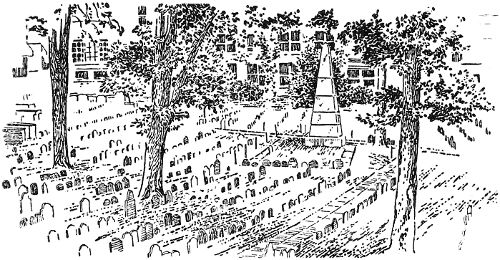
OLD GRANARY BURYING GROUND
Here lie buried most of the personages of Historic Boston. Nine early governors—Bellingham, Dummer, Hancock, Bowdoin, Eustis, Sumner, Adams, Sullivan and Gore. Also Peter Faneuil, Paul Revere, the parents of Benjamin Franklin, Robert Treat Paine, who was one of the signers of the Declaration of Independence, Mary Goose (Mother Goose), and Thomas Fleet, who arranged and published the Mother Goose Rhymes. Here also lie 6 buried in one grave Crispus Attucks, Patrick Carr, James Caldwell, Samuel Maverick and Samuel Gray, who were the victims of the Boston Massacre. Buried in the same grave with these men is Christopher Snyder, a twelve year old boy, the only person to lose his life at the famous Boston Tea Party.
Leaving the Granary Cemetery, we cross Tremont Street and turn left toward School Street, on the corner of which stands
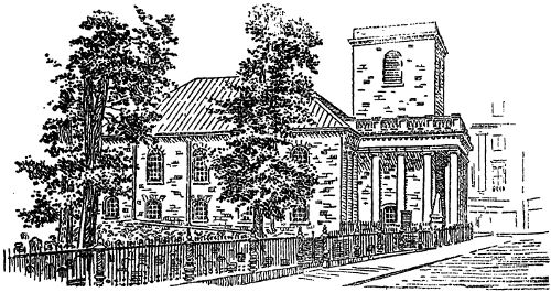
KING’S CHAPEL
King’s Chapel was founded in 1686. The first chapel was built in 1688 the present one in 1749 of old English architecture. Here the British worshipped during the siege. By a strange turn of events, this Tory Church became the First Unitarian Church in the United States in 1785. Although it is still considered Unitarian, it retains many of its Episcopal symbols such as the cross, communion table, Apostle’s Creed and Ten Commandments on the altar. This Chapel is open daily to the public from 9 a. m. to 4 p. m.
Leaving King’s Chapel, turn right on Tremont Street and enter the
This was the first burial ground in Boston. A stone bearing the inscription “Captain Welden, February 18, 1630” proves this statement. 7 Here lie buried Governor John Winthrop, Lady Andros, wife of Governor Andros, John Cotton, John Davenport, the founder of New Haven, Conn., William Dawes, who made the famous ride on another route with Paul Revere, Mary Chilton, who, according to tradition, was the first woman of the Mayflower’s little band to touch the American soil. It is interesting to know that Charles Dawes, the former Vice-President of the United States, may be buried in the same grave as William Dawes, if he so desires. Few burials have been made in King’s Chapel since 1796. This very interesting spot is open to the public from 9 a. m. to 5 p. m., daily.
Leaving the burial ground, we turn right on Tremont Street and proceed to Court Street where we turn right and walk down to the City Hall Annex, across from which is a tablet on the East corner of Franklin Avenue which marks the
It was here that young Benjamin Franklin learned the printer’s trade in the office of James Franklin, his brother, where the “New England Courant” was published.
We turn right, following the narrow alley and walk along the City Hall Annex to School Street, where, if you will face to the right, you will see a statue of Benjamin Franklin which marks the first location of
This gave the street its name. Here Franklin, Hancock, Samuel Adams, Cotton Mather, Henry Ward Beecher, Edward Everett Hale and many others received their early education.
Proceeding left on School Street, we come to Washington Street, on the north corner of which stood the Old Corner Book Store building, erected in 1712 and known far and wide as a center of literature and a meeting place for book lovers.
Cross Washington Street, turn right and we come to the
Here the men of Boston gathered to protest against forcing Massachusetts citizens into the English Navy, to demand the withdrawal of British troops and to decide the fate of the hated tax on tea. It was used by the British as a riding school during the siege 8 of Boston. The present building, erected in 1789, is open from 9 a. m. to 4 p. m., daily. Admission, twenty-five cents.
Leaving the Meeting House, turn left to Milk Street. Almost across the street, 17 Milk Street, was
It is occupied today by a building housing the Boston Transcript. Here is a bust of Franklin on the front of the building above the second floor windows.
Retracing our steps, we turn right on Washington Street and proceed to
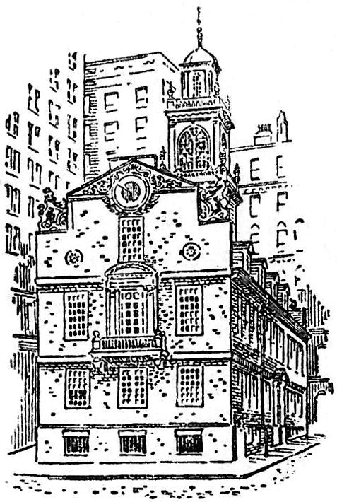
THE OLD STATE HOUSE
Here the first Town House was built in 1657 in the earliest market place of Boston. The present building was built in 1713, burned in 1747, and immediately rebuilt with walls of the former building being utilized. Here met Colonial Courts and Legislators, town and city governments and the General Court of the Commonwealth. It was used as a City Hall from 1830 to 1840. It is open to the public from 9 a. m. to 4 p. m., daily. From the windows, one may look out on the Washington Street side and see the site of Paul Revere’s Silver Shop.
Leaving the old State House, pause for a moment at Number 28 9 State Street. Here is another historic site where stood the Royal Exchange Tavern, from which the first stage coach started to New York on September 7, 1772, “to go once every fourteen days.” Across the street, at 27 State Street, stood the first meeting house, built by the Colonists in 1632. The church was a rude but substantial edifice of mud walls with a thatched roof. The first pastor was John Wilson, who had for his associate the Reverend John Cotton, the former pastor of old St. Botolph’s, Boston, England.
Proceeding down State Street to Number 30, we come to the site of
A tablet on the wall tells the story. A circle in the pavement marks the place where fell the first martyrs in the cause of American freedom. Continuing down State Street, we come to the
For the minute, let us forget historic Boston and take a rapid trip in the elevator to the tower 490 feet high where we may obtain a wonderful panorama of the city and take a splendid aerial photograph on a clear day.
Leaving the building, we turn right on Milk Street and proceed to Oliver Street. Turn left on Oliver and follow to Atlantic Avenue where you then turn right to Pearl Street. Here on a building is a marker to the
The marker reads “Here formerly stood Griffin’s Wharf at which lay moored December 16, 1773, three British ships with cargoes of tea. To defeat King George’s trivial but tyrannical tax of three pence per pound, about ninety citizens of Boston, partly disguised as Indians, boarded the ships, threw the cargoes, three hundred and forty-two chests in all, into the sea and made the world ring with the patriotic exploit of The Boston Tea Party.”
Leaving this most historic point, we retrace our steps back over Atlantic Avenue for some distance to Market Street. There we turn left and proceed along until we come to the Quincy Market where we turn right and then left to North Market Street where we find
Let us enter this old place. For over one hundred and fifty years it has been used as a restaurant. Your grandfather or even your great grandfather may have eaten here. We are met by a most gracious host and food is served to us fresh from the market. When you have eaten enough and absorbed a satisfying amount of the atmosphere of this fascinating spot, you will find almost diagonally across the street the famous old
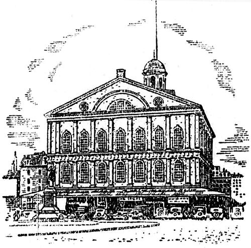
FANEUIL HALL
Faneuil Hall, affectionately called “The Cradle of Liberty,” was built in 1742 by Peter Faneuil. It was given to Boston as a Town Hall. Burned in 1761, it was rebuilt in 1763. This is one of the few buildings in Boston which is in the same condition today as it originally was, with the exception perhaps of steel staircases, electricity, and steam heat. The Hall is still used for public meetings. This was the center of Revolutionary movements in Boston and the Colonies, and was used by the British officers as a playhouse during the siege of Boston. The Hall has many historic paintings and portraits. Don’t fail to see the Military Museum and Library of the Ancient and Honorable Artillery Company. It is well worth the walk up to the third floor. Open week days from 9 a. m. to 5 p. m.
Leaving Faneuil Hall, proceed down North Street, passing the AMOCO Service Station on your right. Directly across the street and to the left we pass by the Sumner Tunnel which was opened to the public in 1934. Continuing on down North Street, crossing Cross Street and Richmond, we come to North Square where the little boys will not let you miss the famous
The oldest house in the City of Boston, built in 1660 and purchased by Paul Revere in 1770; here he resided until 1800. The immense fireplaces, the ancient wallpaper and many other features from the Colonial period make it a most interesting house to visit. Admission twenty-five cents. Open from 10 a. m. to 4 p. m., daily.
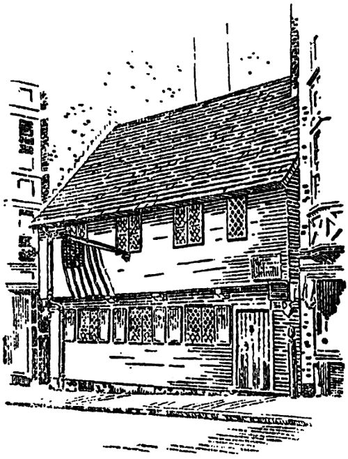
PAUL REVERE’S HOUSE
Leaving the Paul Revere House, we turn left at North Bennett Street and proceed to Salem Street where we turn right on our way to the
This is the oldest church edifice in Boston. It was built in 1723. The signal lanterns of Paul Revere displayed in the steeple of this church on April 18, 1775, warned the people of the march of the 12 British to Concord and Lexington. Don’t fail to ask the sexton to show you the old communion chest recently found, and the statues which are reported to have been seized from a French ship, bound for a monastery in Montreal. Illustrated history of the church and admission to the steeple will cost fifty cents. Otherwise, admission is free from 9 a. m. until 5 p. m. Regular services Sunday.
Leaving the church, follow down Hull Street to
Here is the tomb of Edmund Hartt, builder of “Old Ironsides,” Robert Newman, the patriot who displayed the signal lanterns in the tower of the Old North Church, and many other men of Colonial times.
Leaving Copp’s Hill Burying Ground, turn right on Charter Street and proceed to Commercial Street. Then turn left, following Commercial Street around to the Charlestown bridge, turning right on Chelsea Street, on the Charlestown side of the bridge, and right again at Navy Street, leading to the entrance gate of the
The Boston Navy Yard has been in continuous operation since 1800. It covers approximately 123½ acres and has nearly one and one-half miles of waterfront, three dry docks, a marine railway, ten ship piers, and about one hundred and fifty buildings within its enclosure. It is designated as a building yard. All rope used in the United States Navy is manufactured here. Another interesting fact is that the chains used overseas in planting mines that formed a net against German U boats were made at the forge shop. You will be asked to leave your camera with the guard at the gate who will also direct you to the famous
Built by Edmund Hartt and launched September 20, 1797, “Old Ironsides,” as she is familiarly known, was in about forty engagements and never suffered defeat. She has been rebuilt and restored to her former condition by the school children of the United States. Leaving the “Constitution,” we travel back to the main gate and 13 out on to Chelsea Street once more. Here we turn right on Chelsea Street and left on Tremont Street to the
Here you will see a granite obelisk, two hundred and twenty-one feet high on Breed’s Hill, within the lines of the American Redoubt which was the center of the Battle of Bunker Hill on June 17, 1775. Open to the public daily from 9 a. m. to 4 p. m., the admission fee being ten cents.
Leaving the monument, we go down Lexington Street to City Square where we take the elevated train to North Station. Arriving at North Station, go downstairs and take the subway back to Arlington Street where we leave the subway and return to our starting point.
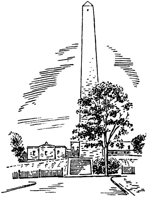
BUNKER HILL
Let us get into our automobile in front of the Hotel Statler on the Providence Street side. Swing left around the island and right at Arlington Street and again right at Boylston Street along which we drive to Charles Street, where we turn left. Proceed along Charles Street with the Boston Common on our right and the Public Gardens on our left and continue to the first rotary traffic circle where we swing around, by the AMOCO Service Station and cross the Longfellow Bridge (made famous by Longfellow’s poem “I stood on the bridge at midnight”). Arriving on the Cambridge shore, go sharp right and follow around to the right on to
This drive runs along the beautiful Charles River on which the Massachusetts Institute of Technology and Harvard University boat crews train. As we roll along the drive, we come to the famous Massachusetts Institute of Technology on our right. From this school have graduated many of our best technical men. On our left as we drive along, we see Harvard Bridge, the Tech Boat House and the Weld Boat House. Across the Charles, we see the Harvard Business School, while on our right we begin to pass the “houses” of Harvard College. Continuing along the drive to Mt. Auburn Street, we turn left. A short way down Mt. Auburn Street on our left we pass the Stillman Infirmary, maintained as a hospital for Harvard students, and the Cambridge Hospital. On the 15 river bank directly in the rear of this group of buildings is the supposed site of Leif Erickson’s old house built in the year 1001. Continue on Mt. Auburn Street two blocks to Coolidge Avenue and turn left. On our right is
Sometimes called “The Cemetery of Poets” for here are buried Henry Wadsworth Longfellow, James Russell Lowell, Oliver Wendell Holmes, Charles Sumner, Edward Everett, Louis Agassiz and Phillips Brooks. Run the car about one-tenth of a mile along the cemetery fence and stop. Through the fence one can see the beautiful tomb of Mary Baker Eddy, founder of the Christian Science Church. After admiring the beautiful setting, we turn our car about and travel back to Mt. Auburn Street, where we turn right and then left on Elmwood Avenue, on the corner of which stands
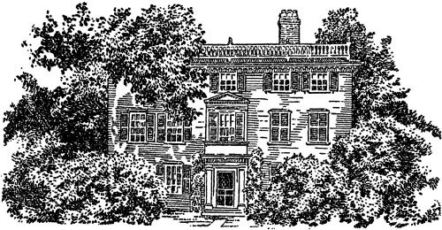
THE JAMES RUSSELL LOWELL HOUSE
Built in 1767. Used as a hospital during the Battle of Bunker Hill. Later Benedict Arnold used it as his headquarters for three weeks. James Russell Lowell was born here in 1819. Follow Elmwood Avenue to Brattle Street where we turn right. On our left we see 16 the Fayerweather House and the Nichols House, both built in 1660. Further down Brattle Street, we come to the Henry Wadsworth Longfellow House, built in 1759. Turning left at Mason Street we pass Radcliffe College. In 1894 the Society for the Collegiate Instruction of Women or more familiarly the “Harvard Annex” was incorporated as Radcliffe College. Named after Lady Moulson, née Ann Radcliffe, who was the first woman to make a gift of money to Harvard. We follow Mason Street to the
Directly in the center of the street we find the tablet which marks the spot where stood the famous elm under which Washington took command of the Army on July 3, 1775. The tree itself collapsed of old age in 1923. Turning right we come to
Built in 1761 by the Tories, it was used by the Provincial troops as a barracks during the siege of Boston and the lead pipe’s of the organ were melted for bullets. Washington attended services here New Year’s Eve 1775. We pass from the Church yard to the Old Burying Ground which contains the bodies of numerous Colonial people. At the edge of the cemetery we find an old granite milestone which bears the inscription “Boston 8 miles 1734.”
Entering our car we swing left around the Common following the traffic arrows and pass
This is the oldest and in many ways the most distinguished school of learning in the United States. Built in 1636. However, this priority is oftentimes disputed as William and Mary College in Virginia claims its date of charter to be 1617. In order to visit Harvard you should set aside a whole day. Secure a guide by applying to Room L in University Hall, and everything of interest will be included in this day’s adventure. Today let us continue by turning right on Kirkland Street, passing the Harvard Law School on our left and Memorial Hall on our right. Turn left at Oxford Street. That big building on your right is the University Museum. Here is located the Agassiz Museum of glass flowers, and 17 even if we must hurry, let us stop and view this unique collection. After our visit we continue to Everett Street where we turn left, passing the huge tennis courts on our left and continue to Massachusetts Avenue where we turn right.
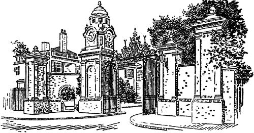
DUDLEY MEMORIAL GATEWAY—HARVARD
We are now on the famous course over which the British passed on their way to Lexington and Concord, April 18, 1775. We shall follow Massachusetts Avenue clear through to Concord. After passing through Cambridge and North Cambridge, the first town we come to is
Here at the corner of Pleasant and Massachusetts Avenue occurred a minor skirmish when Colonists attacked a British Commissary. Next we come to Jason Street on which stands
It was near this point that the first battle on the fateful day of April 19, 1775 was fought. Over half of the Colonists killed that day met their death here in a fearful hand to hand struggle with the British. This house is open to the public April to October, admission free, from 2 p. m. to 5 p. m.
We will continue on our way till we come to the Lexington Green. We park our car in front of
In this historic tavern the Minute Men gathered and waited in the tap room for the British. We stand in front of the old bar and almost seem to hear the clank of the tankards. There are the old bullet moulds, the powder horns, the bullet holes left in the old door from stray shots of the British, the old bedrooms and furnishings which carry you back to those days when the Colonists fought for liberty. Admission to the tavern is free.
Leaving the Tavern, cross the street to the Green and view the statue erected in honor of the Minute Men. Next walk over to that big boulder and read the immortal command:
“Stand your ground.
Don’t fire unless fired upon.
But if they mean to have war
Let it begin here.”
Captain Parker
We now go back to the car and drive past the Green to Hancock Street. Turn right and drive to the
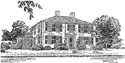
HARRINGTON HOUSE
Built in 1698 and enlarged in 1734. From 1698 to 1805 it was occupied 19 successively by Reverend John Hancock and Reverend Jonas Clark. Adams and Hancock were staying here the morning of April 19, 1775, when Paul Revere rode into town warning them that the British were coming. You will find the contents of the house most interesting. A historian is present to answer questions. Admission is free. House open 11 a. m. to 4 p. m.
Leaving the house turn the car around and drive back to Bedford Street. On the corner of Bedford Street and Elm Avenue stands the
Jonathan Harrington was the first mortally wounded Minute Man. He made his way from the Green to the house, falling dead at his wife’s feet.
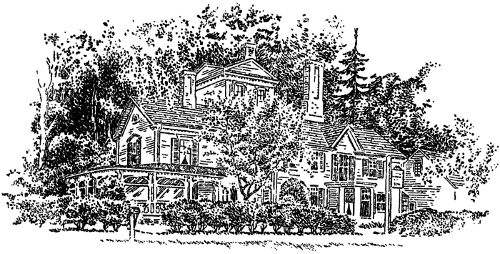
WAYSIDE
Passing by the house, we come to the old burial ground on our left. Turning right and following Massachusetts Avenue, we come to U. S. Route 2A, where you will see a marker on the right hand side of the road which reads as follows: “This bluff was used as a rallying point by the British April 19, 1775. After a sharp fight they retreated to Fiske Hill from which they were driven in great confusion.” We bear right here and continue. 8/10 of a mile from this point we come to two ice cream parlors, one on each side of the road. Drive in the right hand one. Here we find a monument telling the story of “The Capture of Paul Revere.” William Dawes, who also rode from Boston, escaped 20 the British, leaving Dr. Prescott alone to carry the news of the British advance. After being questioned, Revere returned home. As we approach Concord we come to
This was the only house ever owned by Nathaniel Hawthorne. It was also the girlhood home of Louisa M. Alcott and was later occupied by Margaret Sidney (Mrs. Daniel Lothrop), authoress of “Five Little Peppers.” It is interesting to know that three authors with no connection or relationship all occupied this house. Miss Margaret Lothrop, daughter of the authoress, now owns the house and will personally conduct you through it. Don’t fail to stop. You will live with Hawthorne, Alcott and Sidney under her guiding hand. Open 10 a. m. to 6 p. m., admission 25c. The next house on the right is the Louisa M. Alcott house. Drive on into Concord. Pass the Green and turn right at Monument Street. About one-half mile down this street, we come to the old Battle Field. Park your car in the space provided and walk through the Parkway to the
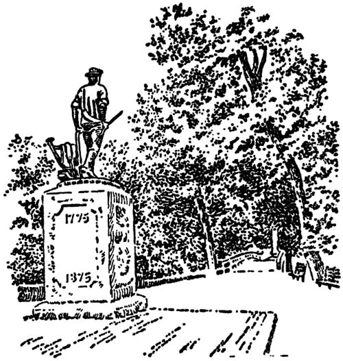
CONCORD BRIDGE
Here we see the grave of the unknown British soldiers and the Minute Man statue, erected to the heroes “who fired the shot heard round the world.” You will be impressed by the beautiful surroundings and the silence. When you have dreamed long enough, 21 get in the car, drive back to Concord Green, turn left on to Route 126. Follow 126 out of town. You will come to
Here the great nature author, Thoreau, wrote many of his works. Continuing for about 7 miles on Route 126 to Wayland, we come to Route 20, the old Boston & Albany Post Road. We turn right and drive westward about 5½ miles through So. Sudbury till we reach a roadway on the right leading to
Originally called Howe’s Tavern and later Red Horse Tavern, in 1863 it was named “The Wayside Inn.” It was here that Henry Wadsworth Longfellow wrote the “Tales of a Wayside Inn.” The house and grounds are now owned and maintained by Mr. Henry Ford. At the gatehouse you will find the stage coach used to bring General LaFayette to Boston for the laying of the cornerstone of Bunker Hill Monument in 1825.
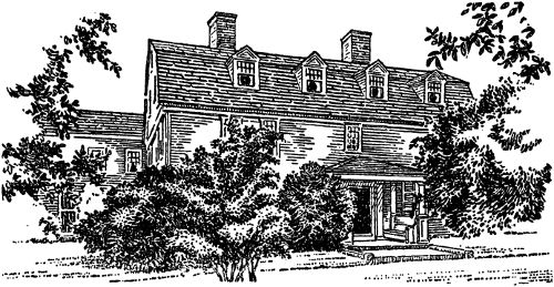
WAYSIDE INN
Register, step up to the bar and order your lunch, after which you may wander through the Inn until you are called by the host. After you have eaten in the dining room (built in 1800) walk out 22 through the gardens. You will find the old grist mill interesting and unique. Also, don’t fail to visit the Old School House spoken of in the famous poem “Mary Had a Little Lamb.”
After you have seen everything on this historic estate get back in the car and visit the old country store. Drive back to Boston over Route 20 to Commonwealth Avenue and Clarendon Street where you turn right crossing Newbury and Boylston Streets. Turning left at St. James Avenue will bring you back to the door of the Hotel Statler.
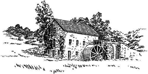
OLD MILL—SUDBURY
Ask the people at your hotel to direct you to the nearest subway and ride to Park Street. As you leave the car at Park Street, you are in the oldest subway in the world, except, perhaps, the one in Budapest which always has disputed with Boston this particular claim. This subway was opened in Boston in September, 1897. Going up the stairs, you will emerge from the subway onto the famous Boston Common. Turn left, and you will have no trouble in finding the
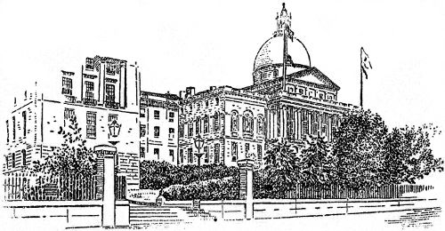
STATE HOUSE
Located on Beacon Street at the head of Park Street. The hill on which the State House stands was originally called Treamount, later this was changed to Sentry Hill when it was used as a lookout, and after the erection of the Beacon in 1634-1635, it received the name of Beacon Hill. The cornerstone of the “Bulfinch” front of the State House was laid on July 4, 1795, and the extension was 24 built in 1889 at a cost of four million dollars. The construction of the east and west wings was completed in 1916. The State House is decorated with statuary, historic paintings, battle flags and war relics. The House of Representatives contains the celebrated Cod Fish emblems. The gilded dome, lighted at night by four hundred and ninety-eight electric lights, makes a magnificent display. Open to the public on week days from 9 a. m. to 5 p. m., and on Saturday from 9 a. m. to 12 noon.
Leaving the State House, walk straight down Beacon Street with the Boston Common on your left. Cross Charles Street and enter the
This is about one-half the size of the Common and contains an artificial pond of irregular shape, the beauty of which is enhanced by the graceful swan boats which glide over its surface. A monument commemorating the discovery of ether is erected at one side of the Gardens; thousands of men and women visit this shrine yearly. Proceed through this beautiful Shrine of Nature, coming out at Arlington Street and Newbury Street, on the corner of which stands the
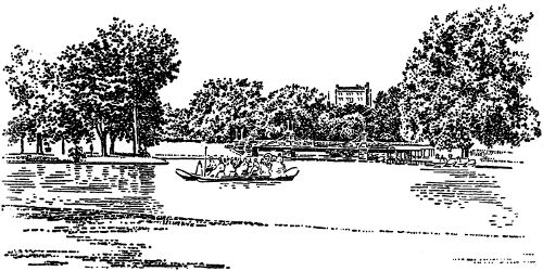
PUBLIC GARDENS
This is one of Boston’s finest hotels, noted for its hospitality, excellent food and social events.
Continuing on down Newbury Street, we come to Berkeley Street, on the corner of which stands
The building is full of New England economic, geological, and special mineral collections, mammals, birds, fishes, fossils, plants, marine invertebrates, and insects beautifully mounted. The building is open to the public free of charge daily from 9 a. m. to 4 p. m., and on Sundays from 1 to 4:30 p. m.
Leaving the Museum of Natural History, turn right at Boylston Street and proceed to
This is architecturally considered one of the finest municipal squares in the country, if not in the world. On your left is Boston’s famous
The facade of this church is one of the richest examples of ecclesiastical architecture in the city. Mr. H. H. Richardson was the architect. Interior decorative work by John LaFarge. St. Gaudens’ statue of Phillips Brooks is on the Huntington Avenue side. In the cloister are stones from old St. Botolph’s Church in Boston, England. Bishop Brooks was rector of Trinity from 1869 to 1891.
To the left of the church and across St. James Avenue is the
It is and has been for twenty years New England’s distinctive society hotel. The main ballroom is decorated in the style of Louis XIV with marble bases and gray Sienna stone for walls. The Sheraton Room opening directly off the lobby is furnished in Italian Renaissance style. The main cafe contains the celebrated Merry-Go-Round bar, a unique attraction. Directly in front of you is the
Designed after the style of the Italian Renaissance by McKim, Meade & White, the interior of the building is of great beauty and visitors come from all parts of the world to admire it. Famous 26 murals by Pierre Cecile Puvis de Chavannes, Edwin Austin Abbey, and John Singer Sargent will hold you spellbound. Visitors are advised to purchase the handbook of the Boston Public Library, on the second floor, for thirty-five cents in order to remember the various art treasures.
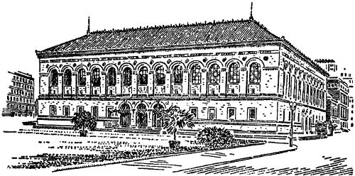
BOSTON PUBLIC LIBRARY
Leaving the Public Library, turning right on Huntington Avenue and proceeding past Mechanics Building, home of Boston Automobile Shows and other notable expositions, we continue on Huntington Avenue to Norway Street and turn right to the
Rising over the city’s roofs and spires is the great white dome of The First Church of Christ, Scientist, affectionately known as the “Mother Church.” In Boston, the Christian Science movement was founded, and its administrative center is there. The branch churches of Christ, Scientist, are to be found in almost every part of the civilized world.
The original edifice, completed and dedicated in 1895 with a seating capacity of 1,000 persons, soon became inadequate to accommodate those desiring to attend its services. Accordingly, in 1905 there was erected the extension, crowned by the majestic dome reaching to a height of two hundred and twenty-four feet above the street, having a diameter of eighty-two feet. The auditorium seats approximately five thousand. It required two years to 27 build and cost nearly two million dollars. It was dedicated in June, 1906, and like all Christian Science ventures, it was free of debt. No funerals, marriages or social entertainments add to its income. The church is built of Indiana limestone and New Hampshire granite, New Hampshire being the native state of Mary Baker Eddy, the discoverer and founder of Christian Science. The great organ is a notable instrument, its gilded pipes rising behind the quiet and dignified rostrum whereon stand the two desks for the readers who conduct the services. The general effect is one of breadth, spaciousness, and all pervading light. Within and without, the church demands attention and admiration as one of the largest and most impressive churches in the world.
Leaving the Christian Science Church, we go directly to Massachusetts Avenue, and turning left come to
Here Boston holds most of its famous flower shows. Across the street is the home of
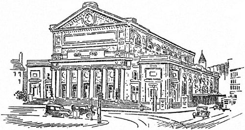
SYMPHONY HALL
The Boston Symphony Orchestra is something more than half a century old. More notable than the span of its years is its place in the growth of musical America. In 1881, the late Major Henry L. Higginson realized the first dream and aspiration of his life by 28 founding in Boston an orchestra of European standards, a phenomenon then unknown in America. The idea had come to him as a student in Vienna. It was an ambitious dream of an impecunious young man but after many years, having made his fortune as a banker, he was able to give the Boston Symphony Orchestra to the world. He engaged the finest musicians in Europe and brought to this country a succession of the greatest conductors of their time. He set a new precedent by exacting of the musicians entire devotion of their talent to the orchestra. He gave entire artistic freedom to the conductor. The wisdom of these policies soon showed as each conductor expended his genius to the cumulative improvement of an ensemble which soon had the world’s attention. The present director is the famous Dr. Serge Koussevitsky who began in 1924, and his term as conductor has extended far beyond any single term of the ten previous conductors. The long association of such an orchestra with such a leader is eloquently justified by the results. The great Russian conductor has brought new beauties to the Boston Symphony Orchestra, a fresh importance and distinction reflected in the greatly enlarged public. The festivals and special choral concerts, the broadened repertory, new and old, of the regular concerts and the quality of each performance are as indefinable as the genius which directs them. After you have viewed the auditorium and the huge organ, almost directly across the street on the corner of Gainsboro and Huntington Avenue, we find the famous
The New England Conservatory of Music was founded in 1867. Hand in hand with the development of modern America, it soon reached a leading position among music schools in this country. Students from many parts of the world have come to this seat of musical learning and, again, have departed with a thorough technical and artistic training in their possession.
The school buildings are especially adapted for the many details of thorough musical instruction. There are three concert halls, with a total seating capacity of over 2,000; a large library, with many rare volumes; a fine concert organ and fourteen other organs for teaching and practice purposes; and, added to these, seventy-five class rooms and private studios.
A walk through the buildings confirms the impression that here is a veritable beehive of musical activity.
From the Conservatory of Music, we cross Huntington Avenue once more and continue about one block south, reaching the
Located on the corner of Opera Place, which was formerly called St. Stephen’s, for years it has been used for the Metropolitan Opera singers, as well as local opera. Leaving the Opera House, we again turn right on Huntington Avenue and proceed to the
The Boston Museum of Fine Arts occupies the unique position of being one of the few museums in the world created and supported solely by private citizens. The Museum is well equipped with guides who are commissioned to explain to the visitors any part of the collection about which one wishes to know. In this little book, we cannot begin to describe the contents of the Museum of Fine Arts, but we hope you will discover its beauties for yourself.
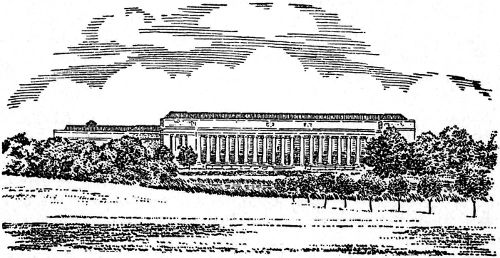
BOSTON MUSEUM OF FINE ARTS
After leaving the Museum of Fine Arts, we turn first to the left on Huntington Avenue, retracing our steps towards the Boston Opera House and then turn left on Forsythe Way to the Fenway, 30 turning left again and walking to the south end of the Fenway where we find the
Here is a marble palace, once the home of Mr. and Mrs. John Lowell Gardner, filled with rare treasures from all over the world. Catalogues may be purchased at the door for a small sum which will enable you to go through this beautiful museum which is open to the public on Tuesdays, Thursdays and Saturdays from 10 a. m. to 4 p. m., the charge of admission being twenty-five cents. On Sundays, the Museum is open from 1 to 4 p. m., admission free. It is closed on all national holidays and during the month of August.
Retracing our steps to Huntington Avenue and going to Ruggles Street, we find ourselves surrounded by colleges and schools. At our left on the corner of Ruggles Street and Huntington Avenue we find the Wentworth Institute. On our right we see Simmons College for Women, south of which, on the corner of Longwood Avenue, we find the Harvard Medical School. To the west of Simmons College, we see Emmanuel College.
If you board a Huntington Avenue car going east you can transfer at Park Street, and you will arrive back at your hotel regardless of what part of the city it is in.
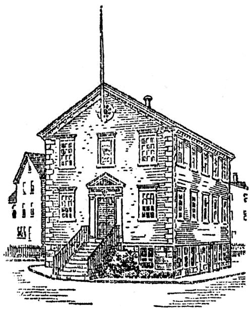
OLD TOWN HOUSE—MARBLEHEAD
Starting in front of the Hotel Statler, Providence Street side, get into your car and follow the island around to the left turning right at Arlington Street and again right at Boylston Street. The Boston Public Gardens will be on your left and after crossing Charles Street the Boston Common will be on the left. At the second stop light turn left at Tremont Street. Continue along Tremont Street, still passing the Common on the left, until we come to the Old Park Street Church, spoken of in one of our earlier chapters, the Granary Cemetery, the Parker House (made famous by Parker House rolls), opposite which is King’s Chapel and King’s Chapel burying ground. You come out at Scollay Square; cross in a straight line to Cornhill Street. Follow through to Washington Street, crossing Washington Street in a straight line for Faneuil Hall, commonly known as “The Cradle of Liberty.” Here turn left, turning right almost immediately, following the Sumner Tunnel sign on to North Street. Continue on North Street to the AMOCO Service Station, turning left and into the Tunnel which you go through to East Boston.
Leaving the Tunnel, turn right on Porter Street and go to Chelsea Street where you turn left following along to Bennington Street turning right on Bennington Street, proceed to Swift Street. Turn left and then right on to the Boulevard for Revere. The buildings seen over the top of the Mexican Petroleum tanks are the U. S. Marine Hospital buildings. Going along the Boulevard a short distance, you come to the
the latest and one of the largest race tracks to be built in America; a marvelous piece of engineering—the transformation of a city dump into a spot of beauty as well as a great place of amusement for a sport loving people.
Continue to the 1-A arrow and follow it around to the first stop light, then follow the car tracks to Revere Beach Parkway. Turn left, follow the Revere Beach Parkway with the ocean on your right, and
the famous Coney Island of New England on the left. It is here that thousands seek relief from the city’s heat during the summer and the sandy beach is crowded with people. Follow the shore line. The point of land seen extending out into the water as you approach the rotary traffic is Nahant. Follow the rotary traffic around to your left and you come to Route 1-A again, passing over the new General Edwards Memorial Bridge. Continue over Route 1-A to the town of Lynn, turning right at Washington Street and proceeding along same to the Lynn Shore Drive where you turn left, following the trail of Boston’s finest summer playground. Approaching
you will be pleased with the natural beauty of the surroundings, and it is here that artists come from all over the country to paint pictures of a “stern and rockbound coast.”
Follow Route 129, passing the Civil War Monument on your left, to Puritan Road and bear right, soon passing on your left the
famous for its cuisine and genuine New England hospitality. Now you begin to pass many beautiful summer estates, coming out once more at Route 129 where you turn right and follow along, admiring these lovely homes.
Swing right at Commercial Street in Marblehead, following to Gregory Street where you turn left, passing on the right the Hotel Marblehead and the Fo’cas’le, plainly marked by a huge anchor by the side of the road. You are now in historic
a typical old New England town with its narrow streets winding around like the cow paths of old. Here are interesting old houses and doorways and the rustic cottages of the fishermen which attract 33 artists from all over the world. Turn right and then left through these narrow streets, pausing where you will at gift shops, antique shops and boat yards.
Ride to the end of the town so that nothing may be missed in this quaint New England fishing village. When you come to a sign saying
park your car and walk down the narrow lane to view this fort built in 1742 for defense against French Cruisers. The U. S. S. Constitution sought shelter under the fort’s guns when chased by His Majesty’s ships Tenadoes and Endymion on April 3, 1814. The fort was named after Samuel Sewall of Marblehead, who was Chief Justice of Massachusetts in 1814.
Retrace your ride, admiring the Marblehead Yacht Club on the opposite side of the bay, to a sign which says “One Way Street” on the corner of which is a drugstore owned by H. Gilbride. Follow this street to the end, and turn left around the old Town House built in 1727. Then turn right and follow what was formerly Academy Way, now called Pleasant Street, through the center of the more modern town of Marblehead.
Take Route 129 to the historic town of Salem. Follow the car tracks on Lafayette Street to Washington Street where we bear left, following Washington to Essex. At this point, turn left coming soon to the
on the right. It is the oldest house in Salem, and is said to have been the home of Roger Williams as early as 1635.
Continue down Essex Street, admire the old doorways which are numerous and have been the inspiration for many paintings, to Boston Street. Turn around the Joseph Hodges Choate Monument and go back up Essex Street. At
pause for a minute and view a rare old Colonial house, the home of the Reverend Thomas Barnard, the first pastor of the North Church. At Summer Street, one is obliged to turn right and again left at Chestnut Street, passing the railroad depot on the right. 34 Turn right onto Washington Street and then left onto Derby Street which follows straight through to Turner Street. Turn right down Turner and
is located at the foot of the street. It has been restored to its ancient condition—a rare place to visit. A hidden stairway runs from the attic and it has many other thrilling features. The ancient garden adds much to its loveliness, and as a special treat for the visitors, they may also go through the Hooper Hathaway house, once known as the old bakery, and which formerly stood at Washington Street, north of the entrance to the tunnel.
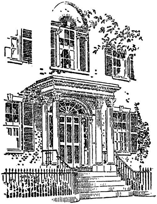
OLD DOORWAY—SALEM
Retracing your way along Turner Street, cross Derby Street and follow Turner to Essex where you turn left passing the Stevens Daniel House. Turn right at Washington Square, follow the Square around to the corner of Briggs Street where stands the house of
shipmaster, merchant and senator from Massachusetts 1773-1850. 35 Follow the Common around to the left and turn right on Mall Street traveling down to
It was here that Nathaniel Hawthorne wrote “The Scarlet Letter.” Turn right at the end of Mall following this street to Route 1-A, swinging left around the traffic dummy, follow Route 1-A toward Beverly. Bear right on Route 127 which you follow to Gloucester.
As you pass
you will see estates which rival the Arabian Nights for grace and beauty. Next in order is
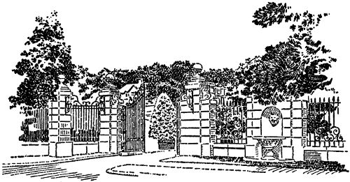
GATEWAY TO A NORTH SHORE ESTATE
One of the oldest towns on the North Shore. The old Town House built in 1809 is still used as a Congregational Church. The little one story houses scattered here and there carry you back to the days of the Puritan Fathers. The old cemetery in which the first interment was made in 1661 is also interesting.
Here is the scene of Norman’s Woe made famous by Longfellow’s poem “The Wreck of the Hesperus.”
You are now entering one of the most famous fishing ports in the world. You will find “The Tavern” a most delightful place to eat if you care for sea foods. At the traffic dummy swing right and then left at Thurston’s Spar Yard and follow Rogers Street along the waterfront to the main office of the
No one should pass through Gloucester without stopping here. Frank Davis is an old-fashioned fisherman who knows how to prepare fish in an appetizing manner. His mackerel, lobster and codfish are shipped by mail and Railway Express all over the United States. Here you may secure a souvenir booklet containing many delicious sea food recipes.
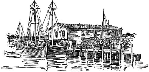
GLOUCESTER
Proceed to Pearce Street where turn right on to Main Street. Follow to the
To see the name Gorton is to think of fish. Here one can secure permission to visit the canneries. The history of this great company goes back to 1623 when the Pilgrim Fathers founded Gloucester. There is every evidence to prove that the present officers are descendants of the original settlers even though the present company had its organization in 1849. It is interesting to note that the pilgrims shipped the first cargo of fish to Spain in 1623.
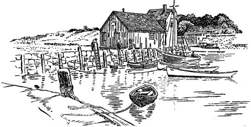
ROCKPORT
If you are not too tired you may continue on your way over the shore road making the complete trip around Cape Ann, a promontory which extends out into the Atlantic Ocean with its beautiful entrancing rocks, beaches and rolling sea. This route is a most interesting panorama. You will pass the largest lobster fishery in America. It is impossible for you to get lost as the road winds around and back into Gloucester, where you may retrace your ride along Route 127 to Beverly where you follow Route 1-A to Salem. At Salem swing right on to Essex Street, leaving Salem by way of Route 107 to Lynn. Leaving Lynn, pass over the famous marsh highway where the government has been carrying on extensive research for mosquito control. Continue to follow Route 107 through Revere to Route 1-A where turn right for Boston until you come to Route 1 which follow to the Charles River. Here, instead of turning right on Route 1, keep on across the bridge to the Boston side, turning right on Charles Street, soon passing the Massachusetts General Hospital on the left to Embankment Road where we turn right passing under the Longfellow Bridge to Beacon Street. At Beacon Street, turn right and again left at the second block which is Clarendon Street crossing Commonwealth Avenue, Newbury Street and Boylston Street; turn left on St. James Avenue, and you will arrive back at the Statler Hotel.
Starting at the Providence Street side of the Hotel Statler, swing your car around the island and go straight out St. James Avenue to Huntington Avenue where you bear left and follow Huntington Avenue to Jamaicaway. Pass under the underpass and turn right at fantail bearing right to get on to Routes 1 and 3.
One of the many beautiful parkways for which Boston is noted. As you ride along you come to Moraine Street, on the corner of which is
affectionate name for the home of the Honorable James Michael Curley, three times mayor of Boston and later governor of Massachusetts. His life has been one of romance and reads like a page from Alger—a poor boy, who through his own efforts became governor of the Commonwealth.
We continue on Route 3 to the junction of Route 37 and turn right on to Granite Avenue, soon crossing the
It is a salt water river which rises and falls with the tides. A little further along on your left is
Considered one of Boston’s finest clubs although it offers little in scenic beauty. The course is well laid out and the hazards good.
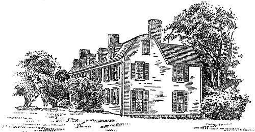
ADAMS MANSION
Follow Granite Avenue to East Milton. Turn left at Route 135. This is Adams Street. This street received its name from the two Presidents. Follow straight on this street until you come to
Both John Adams and John Quincy Adams made this old mansion their home during the later years of their lives. John Adams celebrated the fiftieth anniversary of Independence Day on July 4, 1826 in this old house. Open 9 a. m. to 4 p. m., admission 25c.
Leaving this charming old place, continue on Adams Street to Hancock Street which you follow to the
It was established in 1689. Both John Adams and John Quincy Adams are buried in this church. In order to go down to the crypt, it is necessary to get in touch with the janitor or sexton who is always willing to accommodate those desirous of visiting the final resting place of these two early Presidents.
Leaving the Church, follow Hancock Street to School Street and turn right. Follow the street car tracks along School Street, turning left at Franklin and continue to the
Here on October 19, 1735, John Adams, the second President of 40 the United States, was born. It is a most interesting house, having much of the old furniture, and is kept in good condition. Next door is the
Here on July 11, 1767, the sixth President of the United States was born. It is filled with antiques and evokes stirring memories. Historians are in both houses to answer questions. Both houses are open every day from 10 a. m. to 5 p. m. Admission 25c to each house.
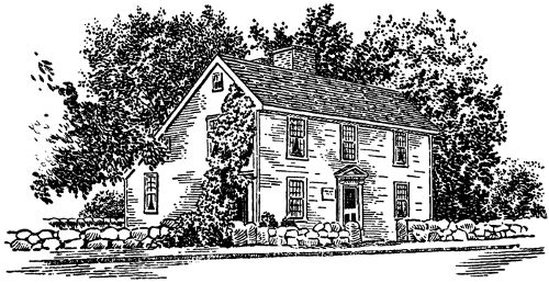
JOHN QUINCY ADAMS HOUSE
After you have visited these two historic houses, turn the car around and retrace your journey over Franklin to School Street, turning right and continue to Quincy Avenue where you again turn right and follow to Route 3. This route soon brings us to Weymouth Landing and then to
This town was noted in history for being the location of Arnold’s Tavern where the committee of safety met in the days of and before the Revolution. You pass the outskirts of Hingham, Duxbury, and soon come to the center of Kingston. You are now nearing Plymouth, whose historic doors are always open.
It is a city with thriving industries and all the pleasures to be found in New England’s summer resorts. If you wish to study the historic side, it would be wise for you to close your eyes to the modern side of this community and drive along Route 3 to Chilton Street where you turn left and then right again at the waterfront and continue to
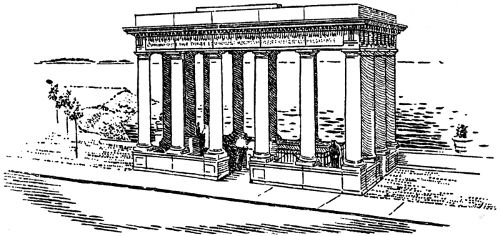
PLYMOUTH ROCK
The rock is located easily. A beautiful canopy of granite has been erected over the historic stone. To protect it from souvenir hunters, it was necessary to build a steel fence around it. To the stranger who does not know the true topography of Massachusetts but who recalls various poems and songs, it is always a surprise not to find a “stern and rock-bound coast.” Sand is in great abundance, the beaches and sand bluffs extending in all directions. Recalling your history, you can picture the Mayflower failing to weather the Cape, putting in to this safe but shallow harbor. Myles Standish had already explored and reported back at Provincetown, where the ship had anchored, “good water in the brook and timber on the hills for homes.” Winter was coming and it was 42 advisable to settle, and so these heroic people landed here. One hundred and two souls, according to history, had journeyed to this new country to find religious freedom for themselves. Turning from the rock, climb the stairway leading up the grassy bluff to
This is where the Pilgrims buried their fast diminishing band in the dead of night so that the Indians lurking in the forests could not determine how many were left. It is a recorded fact that of the one hundred and two Pilgrims who landed, nearly one-half were buried during that first sad winter. The Indian monument standing near the sepulchre is of Massasoit, the great sachem of the Wampanoags. He was the friend of the Pilgrims and, in reality, their preserver for, without his kindness, they all would have perished. From Cole’s Hill, go directly left on Carver Street to
Originally named First Street. Just to the left of the junction of Carver and Leyden Streets was the site of the first “Common House” raised in Plymouth. This interesting street has many markers on it telling the story of Goodman, Winslow, Brewster and Howland.
Walking straight up Leyden Street, crossing Main Street, we come to
This was the church organization of the Pilgrims. The first church on this site was erected in 1683. The present church is the fifth to be built on this site and was completed and dedicated on Forefather’s Day 1899. On your right when facing the First Parish Church is
This is the Congregational Church and was the result of a division over doctrinal matters in 1801. The present church was built in 1840. Proceed up the stone steps at the right of the First Parish Church and you will come to
Here you will find all the interesting graves marked plainly with yellow signs—Governor Bradford, Edward Gray, Thomas Clark, John Howland, John Cotton and others. As we stand here amid these historic and humble hero dead, we read these significant words on the obelisk in memory of Governor William Bradford: “Do not basely relinquish what the Fathers with difficulty attained.”
You will have no trouble locating the site of the first fort where five cannons were placed after great difficulty in 1621. Also, the grave of General James Warren, soldier, patriot and scholar.
Leaving the graveyard, retrace your steps down Leyden Street to Main Street. Turn left and then right when you come to
This street was once known as King. Little remains of Colonial days except the street to remind us of old Plymouth. Turn left at Carver on to
You will find the Edward Winslow House built in 1754. He was very loyal to the Crown during the Revolution and so the house was confiscated. Going back to your car, get in and go toward the Cape on Water Street and soon after you pass Leyden Street, you come to
Here was the drinking water of the Pilgrims. In days of yore, it was full of alewives, which gave the Puritans fish at their very door. Even today, trout lurk in many a dark corner of the brook. In 1909 the town purchased the land here and established the beautiful Brewster Gardens. Continue on Water Street to Sandwich Street. Almost in front of you is
It was built in 1666 and is called the house of the last Mayflower Pilgrims in Plymouth. It was restored and put in complete repair 44 by the Howland descendants in 1909. You may drive in and visit, admission 25c. Open 10 a. m. to 5 p. m. A little way towards the Cape and you come to Winter Street. Turn left and find
It is known better as the Kendall Holmes House after the last family to live there. It is extremely interesting. The architecture is simple and therein lies its beauty. The old stairways and open fireplaces all remain as they were built. The occupants have enjoyed and loved this old house and so during all these generations there has been no need to restore as loving hands have cared for it. Retrace your way towards Boston and on the corner of Chilton and Court Streets is
It was built in 1824 by the Pilgrim Society and rebuilt and enlarged in 1880. It is filled with many historic and antique articles. Park your car in the space provided a short way down Chilton Street that you may take your time visiting here. Open to the public daily, admission 25c.
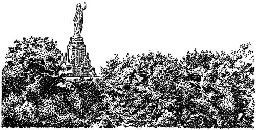
PILGRIM MONUMENT
After your visit here, drive your car across Court Street and up Clyfton Street, turning right on Allerton Street and you arrive at the
A national monument completed October, 1888, in honor of the Forefathers of Our Country. Total height eighty-one feet. When you have read the inscriptions and you have satisfied yourself regarding the humble beginning of this great country, drive down Cushman Street to Court, turn left and follow Route 3 to Kingston where on your right there is a sign marked “Duxbury-Marshfield.” Bear right on this road passing soon on your left the
built in 1675. It is open to the public and contains many interesting things. Continue on this old road to
Here is easily found the Myles Standish Monument, also the site of Myles Standish’s old house. After your visit here, retrace your journey to the center of Duxbury, taking the right hand road to Route 3-A which follow to Alden Street, turning right for the
Alden built this house in 1653. It is a quaint old house and has all the charm of the old Colonial homes. From here go back to Route 3-A. Turn right and follow to a triple fork in the road with signs marked “Marshfield.” Take right hand fork called Careswell Street to
It was built in 1699. Contains many antiques. Everything is arranged to look as if it were still 1700. It is interesting to note that some of the old colonists lived in sumptuous style. Excellent 46 luncheons, teas and dinners are served here at moderate prices. The dining room is the old carriage house and the barn has been turned into a beautiful modern kitchen. The house is open June 1st to October 1st, admission 25c. Leaving here turn left on Webster Road and see the final home of Daniel Webster. His tomb may also be visited in the Winslow Cemetery close to the house.
Follow Webster Street to Route 3-A, which will bring you back to Route 3 over which you retrace your ride to Jamaicaway and Huntington Avenue, Route 9-C. Turn right and follow to St. James Avenue. Bear right to the Hotel Statler.
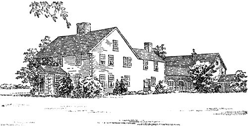
WINSLOW HOUSE—DUXBURY
Just as Boston is proud of the part it has played in the history of America, so the American Oil Company is proud of its part in the history of the gasoline and automotive industries.
Starting in 1910 with one horse-drawn tank wagon, the American Oil Company has grown until it reaches from Maine to Florida and inland. The American Oil Company developed Amoco-Gas, the first and original special motor fuel, in 1915. Amoco-Gas revolutionized the gasoline and automotive industries—made possible today’s high compression motor. The first company-operated filling station in the East was an American Oil Company station. American Oil Company introduced the first visible gasoline pump—enabling motorists to see what they’re buying.
The American Oil Company’s growth has been built on one cardinal principle: Honest Values, Honestly Described.
You can be sure you are getting the greatest possible value when you drive in at the Amoco Sign of Greater Values. American’s Big Three of Quality are: Amoco-Gas, which holds more official world’s records than any other motor fuel; American Gas, the best buy at regular gas price; Amoco Motor Oil, made from choice selected paraffine base crudes.
Drive in at the Sign of Greater Values—from Maine to Florida and inland.
American Oil Company
★
If you have enjoyed these trips as much as we hope you have, why not suggest them to your friends? Additional copies may be obtained from the American Oil Company, Park Square Building, Boston.
★
★ FROM MAINE TO FLORIDA
THE SIGN OF GREATER VALUES ★