Title: The Ancient Volcanoes of Great Britain, Volume 2 (of 2)
Author: Archibald Geikie
Release date: January 5, 2022 [eBook #66493]
Most recently updated: October 18, 2024
Language: English
Original publication: United Kingdom: Macmillan and Co, 1897
Credits: T Cosmas, MWS and the Online Distributed Proofreading Team at https://www.pgdp.net (This file was produced from images generously made available by The Internet Archive)
- i -
- ii -
- iii -
BY
D.C.L. Oxf., D. Sc. Camb., Dubl.; LL.D. St. And., Edinb.
DIRECTOR-GENERAL OF THE GEOLOGICAL SURVEY OF GREAT BRITAIN AND IRELAND;
CORRESPONDENT OF THE INSTITUTE OF FRANCE;
OF THE ACADEMIES OF BERLIN, VIENNA, MUNICH, TURIN, BELGIUM, STOCKHOLM, GÖTTINGEN, NEW YORK; OF THE
IMPERIAL MINERALOGICAL SOCIETY AND SOCIETY OF NATURALISTS, ST. PETERSBURG; NATURAL HISTORY
SOCIETY, MOSCOW; SCIENTIFIC SOCIETY, CHRISTIANIA; AMERICAN PHILOSOPHICAL SOCIETY; OF THE
GEOLOGICAL SOCIETIES OF LONDON, FRANCE, BELGIUM, STOCKHOLM, ETC.
WITH SEVEN MAPS AND NUMEROUS ILLUSTRATIONS
IN TWO VOLUMES
VOL. II
MACMILLAN AND CO., Limited.
NEW YORK: THE MACMILLAN COMPANY.
1897
All rights reserved
- iv -
- v -
|
CHAPTER XXIX The Carboniferous Volcanoes of England |
|
| PAGE | |
| The North of England: Dykes, Great Whin Sill—The Derbyshire Toadstones—The Isle of Man—East Somerset—Devonshire | 1 |
|
CHAPTER XXX The Carboniferous Volcanoes of Ireland |
|
| King's County—The Limerick Basin—The Volcanic Breccias of Doubtful Age in County Cork | 37 |
|
BOOK VII THE PERMIAN VOLCANOES CHAPTER XXXI The Permian Volcanoes of Scotland |
|
| Geographical Changes at the Close of the Carboniferous Period—Land and Inland-Seas of Permian time—General Characteristics and Nature of the Materials erupted—Structure of the several Volcanic Districts: 1. Ayrshire, Nithsdale, Annandale; 2. Basin of the Firth of Forth | 53 |
|
CHAPTER XXXII Permian Volcanoes of England |
|
| The Devonshire Centre—Eruptive Rocks of the Midland Coal-fields | 94 |
|
- vi - BOOK VIII THE VOLCANOES OF TERTIARY TIME CHAPTER XXXIII |
|
| Vast lapse of time between the close of the Palæozoic and beginning of the Tertiary Volcanic Eruptions—Prolonged Volcanic Quiescence—Progress of Investigation among the Tertiary Volcanic Series of Britain | 107 |
|
CHAPTER XXXIV The System of Dykes in the Tertiary Volcanic Series |
|
| Geographical Distribution—Two Types of Protrusion—Nature of component Rocks—Hade—Breadth—Interruptions of Lateral Continuity—Length—Persistence of Mineral Characters | 118 |
|
CHAPTER XXXV The System of Dykes—continued |
|
| Direction—Termination upward—Known vertical extension—Evidence as to the movement of the Molten Rock in the Fissures—Branches and Veins—Connection of Dykes with Intrusive Sheets—Intersection of Dykes—Dykes of more than one infilling—Contact metamorphism of the Dykes—Relation of the Dykes to the Geological Structure of the Districts which they traverse—Data for estimating the Geological Age of the Dykes—Origin and History of the Dykes | 145 |
|
CHAPTER XXXVI The Plateaux |
|
| Nature and Arrangement of the Rocks: 1. Lavas.—Basalts, Dolerites, Andesites—Structure of the Lavas in the Field—2. Fragmental Rocks.—Agglomerates, Conglomerates, and Breccias—Tuffs and their accompaniments | 181 |
|
CHAPTER XXXVII |
|
| The Several Basalt-Plateaux and their Geological History—Antrim, Mull, Morven and Ardnamurchan | 199 |
|
CHAPTER XXXVIII |
|
| The Basalt-Plateau of the Parish of Small Isles—Rivers of the Volcanic Period | 215 |
|
- vii - CHAPTER XXXIX |
|
| The Basalt-Plateaux of Skye and of the Faroe Isles | 249 |
|
CHAPTER XL |
|
| The Modern Volcanoes of Iceland as illustrative of the Tertiary Volcanic History of North-Western Europe | 260 |
|
CHAPTER XLI The Eruptive Vents of the Basalt-Plateaux |
|
| Vents filled with Basalt or other Lava-form Rock—Vents filled with Agglomerate | 270 |
|
CHAPTER XLII |
|
| The Basic Sills of the Basalt-Plateaux | 298 |
|
CHAPTER XLIII The Bosses and Sheets of Gabbro |
|
| Petrography of the Rocks—Relations of the Gabbros to the other members of the Volcanic series—Description of the Gabbro districts—Skye | 327 |
|
CHAPTER XLIV |
|
| The Bosses and Sheets of Gabbro in the Districts of Rum, Ardnamurchan, Mull, St. Kilda and North-East Ireland. History of the Gabbro Intrusions | 349 |
|
CHAPTER XLV The Acid Rocks |
|
| Their Petrography—Their Stratigraphical Position and its Analogies in Central France | 364 |
|
CHAPTER XLVI |
|
| Types of Structure in the Acid Rocks—Bosses | 378 |
|
- viii - CHAPTER XLVII |
|
| The Acid Bosses of Mull, Small Isles, St. Kilda, Arran, and the North-East of Ireland |
395 |
|
CHAPTER XLVIII |
|
| The Acid Sills, Dykes and Veins | 430 |
|
CHAPTER XLIX |
|
| The Subsidences and Dislocations of the Plateaux | 447 |
|
CHAPTER L |
|
| Effects of Denudation | 455 |
|
CHAPTER LI |
|
| Summary and General Deductions | 466 |
- ix -
| FIG. | PAGE | |
| 176. | Section from the great Limestone escarpment on the west to the Millstone Grit hills east of Teesdale |
4 |
| 177. | Sections of the Carboniferous Limestone series of Northumberland showing the variations in the position of the Whin Sill. By Messrs. Topley and Lebour |
6 |
| 178. | View of two volcanic necks in the Carboniferous Limestone series, at Grange Mill, five miles west of Matlock Bath, from the north |
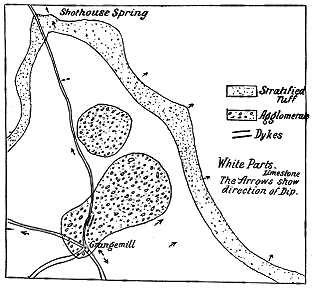
14 |
| 179. | Plan of necks and bedded tuff at Grange Mill, five miles west of Matlock Bath |
15 |
| 180. | Section across the smaller volcanic neck and the stratified tuff in Carboniferous Limestone, Grange Mill |
15 |
| 181. | Section of vesicular and amygdaloidal diabase resting on Carboniferous Limestone, Peak Forest Limeworks, Great Rocks Quarry |
19 |
| 182. | View of the superposition of Carboniferous Limestone upon toadstone, Raven's Tor, Millersdale (length about 100 feet) |
19 |
| 183. | Section at lime-kiln, south of Viaduct, Millersdale Station |
20 |
| 184. | Limestones passing under stratified tuffs, Poyll Vaaish, Isle of Man |
24 |
| 185. | Section of tuff, showing intercalations of black impure chert, west of Closenychollagh Point, near Castletown, Isle of Man |
25 |
| 186. | Section of intercalated dark limestone, shale and chert in the tuff south of Poyll Vaaish Bay, Isle of Man |
26 |
| 187. | Section of part of a volcanic neck on shore to the south-east of Poyll Vaaish Bay, Isle of Man |
29 |
| 188. | Section of successive discharges and disturbances within a volcanic vent. Scarlet Point, Isle of Man |
29 |
| 189. | Section of dyke and sill in the tuffs west of Scarlet Point, Isle of Man |
30 |
| 190. | Section on south side of vesicular sill west of Scarlet Point |
31 |
| 191. | Bands of vesicles in the same sill |
31 |
| 192. | Croghan Hill, King's County, from S.S.W. |
38 |
| 193. | Section in quarry on roadside east of Limerick, close to viaduct of the Limerick and Erris Railway |
44 |
| 194. | Section of the volcanic escarpment, east of Shehan's Cross-roads, south of Limerick |
45 |
| 195. | View of Derk Hill, a volcanic neck on the south side of the Limerick basin |
47 |
| 196. | Section across the Limerick volcanic basin |
48 |
| 197. | Section of a bed of volcanic breccia in the Carboniferous Slate; White Bull Head, County Cork |
50 |
| 198. | Volcanic breccia invading and enclosing Carboniferous slate, White Bull Head |
50 |
| 199. | General section across the Permian basin of Ayrshire - x - |
59 |
| 200. | Section of lavas, east side of Mauchline Hill |
60 |
| 201. | Section of the top of the volcanic series near Eastside Cottage, Carron Water, Nithsdale |
60 |
| 202. | Section of two outliers of the Permian volcanic series at the foot of Windyhill Burn, Water of Ae, Dumfriesshire |
61 |
| 203. | The Green Hill, Waterside, Dalmellington, from the south; a tuff-neck of Permian age |
62 |
| 204. | Patna Hill from the Doon Bridge, Ayrshire; a tuff-neck of Permian age |
63 |
| 205. | Ground plans of Permian volcanic vents from the Ayrshire Coal-field. On the scale of six inches to a mile |
64 |
| 206. | Section of sills traversing the Permian volcanic series. River Ayr, Ballochmyle |
66 |
| 207. | Section showing the relations of the later rocks of Arthur Seat |
68 |
| 208. | Section in brooks between Bonny town and Baldastard, Largo |
70 |
| 209. | View of Largo Law from the east |
71 |
| 210. | View of small neck in Calciferous Sandstones, on the shore, three miles east from St. Andrews |
72 |
| 211. | Ground-plan of Permian volcanic vents |
73 |
| 212. | Small neck in Calciferous Sandstones a little east from the "Rock and Spindle," two and a half miles east from St. Andrews |
74 |
| 213. | Plan of volcanic necks at Kellie Law, East of Fife, on the scale of three inches to one mile |
75 |
| 214. | Plan of the craters in Volcanello, Lipari Islands |
75 |
| 215. | Section of the strata at the edge of the volcanic vent on the east side of Elie Harbour |
76 |
| 216. | Agglomerate of neck on shore at Ardross, two miles east from Elie |
77 |
| 217. | Ground-plan of volcanic neck, Elie Harbour, showing circular disposition of the stratification |
80 |
| 218. | Section across the great vent of Kincraig, Elie, on a true scale, vertical and horizontal, of six inches to a mile |
81 |
| 219. | Dyke in volcanic neck, on the beach, St. Monans |
82 |
| 220. | Section of part of crater rim, Island of Volcano |
83 |
| 221. | Dyke rising through the agglomerate of a volcanic vent; Kincraig, Elie |
84 |
| 222. | Radiating columnar dyke in the tuff of a volcanic vent. Rock and Spindle, two and a half miles east from St. Andrews |
86 |
| 223. | View of part of the shore front of the great vent at Kincraig, looking westward, with the columnar basalt in front |
88 |
| 224. | Plan of volcanic neck on beach near St. Monans |
89 |
| 225. | Columnar basalt in the neck of Kincraig, Elie, seen from the west |
90 |
| 226. | Section across Largo Law |
91 |
| 227. | Vein of "white-trap" cutting black carbonaceous shales, a little west from St. Monans Church |
92 |
| 228. | Section at Belvedere, S. W. of Exeter |
97 |
| 229. | Diagram to show the unconformability and overlap of the Permian rocks in the Crediton Valley |
97 |
| 230. | Section of the volcanic series at Kellerton, Devonshire |
98 |
| 231. | Section of agglomerate overlain with sandstone and andesite, Posbury, Crediton |
99 |
| 232. | Diagrammatic section across Titterstone Clee Hill |
102 |
| 233. | Dyke on the south-east coast of the Island of Mull |
119 |
| 234. | Fissure left by the weathering out of a dyke |
120 |
| 235. | Plan of basalt-veins with selvages of black basalt-glass, east side of Beinn Tighe, Isle of Eigg - xi - |
126 |
| 236. | Arrangement of lines of amygdales in a dyke, Strathmore, Skye |
130 |
| 237. | Systems of joints in the dykes |
132 |
| 238. | Section of cylindrical vein or dyke, cutting the bedded lavas, east side of Fuglö, Faroe Islands |
133 |
| 239. | Joint-structures in the central vitreous portion of the Eskdale Dyke (B. N. Peach) |
133 |
| 240. | Microscopic structure of the vitreous part of the Eskdale Dyke |
136 |
| 241. | Section along the line of the Cleveland Dyke at Cliff Ridge, Guisbrough (G. Barrow), scale, 12 inches to 1 mile |
147 |
| 242. | Section along the course of the Cleveland Dyke, at the head of Lonsdale, Yorkshire (G. Barrow, in the Memoirs of the Geol. Survey, Geology of Cleveland, p. 61) |
148 |
| 243. | Section across the extreme upper limit of Cleveland Dyke, on the scale of 20 feet to one inch (Mr. G. Barrow) |
149 |
| 244. | Upper limit of Cleveland Dyke in quarry near Cockfield (after Mr. Teall) |
149 |
| 245. | Section along the course of the Cleveland Dyke across the Cross Fell escarpment (scale of one inch to one mile) |
150 |
| 246. | Branching portion of the great dyke near Hawick (length about one mile) |
153 |
| 247. | Branching dyke at foot of Glen Artney (length about four miles) |
153 |
| 248. | Basic veins traversing Secondary limestone and sandstone on the coast cliffs, Aidnamurchan |
155 |
| 249. | Section showing the connection of a Dyke with an Intrusive Sheet, Point of Suisnish, Skye |
156 |
| 250. | Section to show the connection of a Dyke with an Intrusive Sheet, Stirlingshire Coal-field |
157 |
| 251. | Intersection of dykes in bedded basalt, Calliach Point, Mull |
158 |
| 252. | Basalt veins traversing bedded dolerites, Kildonan, Eigg |
159 |
| 253. | Ground-plan of intersecting dykes in Lias limestone, Shore, Harrabol, East of Broadford, Skye |
159 |
| 254. | Compound dyke, Market Stance, Broadford, Skye |
162 |
| 255. | Section of coal rendered columnar by intrusive basalt, shore, Saltcoats, Ayrshire |
164 |
| 256. | Dolerite dyke with marginal bands of "white trap," in black shale, Lower Lias, Pabba |
166 |
| 257. | Map of the chief dykes between Lochs Ridden and Striven (C. T. Clough, Geological Survey, Sheet 29) |
170 |
| 258. | Basalt-veins traversing granophyre, St. Kilda |
173 |
| 259. | Section of scoriaceous and prismatic basalt, Camas Tharbernish, north shore of Canna Island |
187 |
| 260. | Banded amygdaloidal basalt showing layers of elongated and steeply inclined vesicles, Macleod's Maidens, Skye |
191 |
| 261. | Termination of basalt-beds, Carsaig, Mull |
193 |
| 262. | Breccia and blocks of mica-schist, quartzite, etc., lying between bedded basalts, Isle of Mull |
197 |
| 263. | Section of Knocklayd, an outlier of the Antrim basalt-plateau lying on Chalk |
202 |
| 264. | Diagram-Section of the Antrim Plateau |
203 |
| 265. | View Of Basalt escarpment, Giant's Causeway, with the Amphitheatre and Chimneys. (From a photograph by Mr. R. Welch) |
207 |
| 266. | Basalt-capping on the top of Ben Iadain, Morven |
209 |
| 266a. | View of the south side of Staffa, showing the bedded and columnar structure of the basalt - xii - |
210 |
| 267. | View of Rum from the harbour of Canna |
216 |
| 268. | Section of the cliffs below Compass Hill, Isle of Canna |
218 |
| 269. | Lava cutting out conglomerate and shale. Shore below Canna House |
224 |
| 270. | Section of shales and tuffs, with a coniferous stump lying between two basalt-sheets, Cùl nam Marbh, Canna |
225 |
| 271. | Dùn Mòr, Sanday. (From a photograph by Miss Thom) |
226 |
| 272. | View of the Dùn Beag, Sanday, seen from the south. (From a Photograph by Miss Thom) |
230 |
| 273. | View of Dùn Beag, Sanday, from the north. The island of Rum in the distance. (From a Photograph by Miss Thom) |
231 |
| 274. | Section of eastern front of Dùn Beag |
232 |
| 275. | Enlarged section on the western side of Dùn Beag |
233 |
| 276. | Geological map of the Island of Eigg |
235 |
| 277. | Section of the geological structure of the Island of Eigg |
236 |
| 278. | View of the Scuir of Eigg from the east |
237 |
| 279. | Natural section at the cliff of Bideann Boidheach, north-west end of the Scuir of Eigg |
239 |
| 280. | View of the Scuir of Eigg from the south |
242 |
| 281. | View of the Scuir of Eigg from the south-west of the Loch a Bhealaich, showing the bedded character of the mass |
243 |
| 282. | Section at the base of the Scuir of Eigg (east end) |
244 |
| 283. | Terraced hills of basalt plateau (Macleod's Tables), Skye |
250 |
| 284. | "Macleod's Maidens" and part of basalt cliffs of Skye |
251 |
| 285. | Intercalated group of strata between Basalts, An Ceannaich, western side of Skye |
252 |
| 286. | Escarpment of Plateau-basalts, Cliffs of Talisker, Skye |
253 |
| 287. | Section of the largest of Macleod's Maidens |
254 |
| 288. | Dying out of lava-beds, east side of Sandö, Faroe Isles |
257 |
| 289. | Lenticular lavas, western front of Hestö, Faroe Isles |
257 |
| 290. | Lenticular lavas, east side of Svinö, Faroe Isles |
258 |
| 291. | Section at Frodbonyp, Suderö, Faroe |
258 |
| 292. | Fissure (gjá) in a lava-field, Iceland. (From a photograph by Dr. Tempest Anderson) |
262 |
| 293. | Cones on the great Laki fissure, Iceland. (From a photograph by Dr. Tempest Anderson) |
263 |
| 293a. | Plan of small craters along the line of great Laki fissure, Iceland. (After Mr. Helland, reduced) |
264 |
| 294. | Slemish, a volcanic neck or vent on the Antrim plateau, seen from the north |
272 |
| 295. | Section of volcanic vent at Carnmony Hill (E. Hull) |
272 |
| 296. | Section of the east side of Scawt Hill, near Glenarm |
273 |
| 297. | Section of Neck of basalt, Bendoo, Ballintoy |
273 |
| 298. | Volcanic Neck of dolerite near Cushendall |
274 |
| 299. | Section of Volcanic Neck at 'S Airde Beinne, near Tobermory, Mull |
274 |
| 300. | Interior of the Volcanic Neck of 'S Airde Beinne, near Tobermory, Mull |
275 |
| 301. | Diagram to show the probable relation of the Neck at Carrick-a-raide, Antrim, to an adjacent group of tuffs |
277 |
| 302. | Section of agglomerate Neck at Maclean's Nose, Ardnamurchan |
279 |
| 303. | Diagram to show the probable relations of the rocks on the southern flank of Beinn Dearg Bheag |
282 |
| 304. | Section of Volcanic Vent and connected lavas and tuffs, Scorr, Camas Garbh, Portree Bay, Skye - xiii - |
284 |
| 305. | Section of the Volcanic Series at Ach na Hannait, south of Portree, Skye |
288 |
| 306. | View of part of a Volcanic Neck at the eastern end of the island of Canna. (From a photograph by Miss Thom) |
289 |
| 307. | Columnar Basalt invading agglomerate of Volcanic Vent, Coroghon Mòr, Isle of Canna. (Height above 20 feet) |
291 |
| 308. | Columnar Basalt invading Volcanic conglomerate, north side of Alman Islet, Canna |
291 |
| 309. | View of neck-like mass of breccia, Brochel, Raasay |
292 |
| 310. | View of Volcanic Neck piercing and overlain by the Plateau-Basalts, Stromö, entrance of Vaagöfjord, Faroe Islands. (From a photograph by Colonel Evans) |
294 |
| 311. | Section of the same Neck as that shown in Fig. 310 |
295 |
| 312. | 296 | |
| 313. | Section of wall of another Neck of agglomerate in the same group with those represented in Figs. 310, 311, and 312 |
296 |
| 314. | View of "Segregation-Veins" in a dolerite sill, Portrush, Antrim |
300 |
| 315. | View of Fair Head, from the east, showing the main upper sill and a thinner sheet cropping out along the talus slope |
301 |
| 316. | View of Fair Head from the shore. (From a photograph by Mr. R. Welch) |
302 |
| 317. | Section at Farragandoo cliff, west end of Fair Head, showing the rapid splitting up and dying out of an Intrusive Sheet |
304 |
| 318. | View of the Trotternish Coast, showing the position of the band of Sills |
305 |
| 319. | Columnar Sill intrusive in Jurassic Strata east of Kilmartin, Trotternish, Skye |
306 |
| 320. | View of the northern precipice (500 feet high) of the largest of the Shiant Isles. (From a photograph by Colonel Evans) |
308 |
| 321. | Section of thin Intrusive Sheets and Veins in carbonaceous shales lying among the Plateau-basalts, cliffs north of Ach na Hannait, between Portree Bay and Loch Sligachan |
311 |
| 322. | Upper part of Sill, Moonen Bay, Waternish, Skye, showing the divergence of veins |
313 |
| 323. | Section of the base of the Basalt-plateau with sill and dykes, Sound of Soa, Skye |
314 |
| 324. | Section of Dolerite Sill cut by another sill, both being traversed by dykes, Rudh' an Iasgaich, western side of Sleat, Skye |
316 |
| 325. | Section to show Bedded and Intrusive Sheets, Eigg |
318 |
| 326. | Ground plan of Sills at Ben Hiant, Ardnamurchan |
321 |
| 327. | Section of two Sills in schistose grits, west end of Beinn na h-Urchrach, Ardnamurchan |
322 |
| 328. | Sill traversing bedded Basalts, cliffs of Stromö, at entrance of Vaagöfjord |
323 |
| 329. | View of the same Sill seen from the channel opposite the island of Kolter |
324 |
| 330. | Granulitic and coarsely foliated Gabbro traversed by later veins of felspathic Gabbro, Druim an Eidhne, Cuillin Hills, Skye |
331 |
| 331. | Scuir na Gillean, Cuillin Hills, showing the characteristic craggy forms of the Gabbro. (From a photograph by Mr. Abraham, Keswick) |
335 |
| 332. | Section across Glen Brittle, to show the general relations of the Bedded Basalts and the Gabbros |
336 |
| 333. | View of the crest of the Cuillin Hills, showing the weathering of the Gabbro along its joints and of a compound basic dyke which rises through it. (From a photograph by Mr. Abraham, Keswick) |
338 |
| 334. | Section across the Coire Uaigneich, Skye |
341 |
| 335. | Banded and puckered gabbro, Druim an Eidhne, Glen Sligachan, Skye |
342 |
| 336. | Banded structure in the Gabbro, from the ridge of Druim an Eidhne, between Loch Coruisk and Glen Sligachan - xiv - |
343 |
| 337. | Banded and doubly folded Gabbro, Druim an Eidhne, 10 feet broad |
345 |
| 338. | Sketch of banded structure in the Gabbros of the hills at the head of Loch Scavaig |
347 |
| 339. | Outline of the hills of the Island of Rum, sketched from near the Isle of Eigg |
350 |
| 340. | View of Allival, Rum, sketched from the base of the north-east side of the cone |
352 |
| 341. | Section of foliated Gabbros in the Tertiary volcanic series of Allival, Rum |
353 |
| 342. | Altered Plateau-Basalts invaded by Gabbro, and with a Dyke of prismatic Basalt cutting both rocks, north slope of Ben Buy, Mull |
357 |
| 343. | Theoretical representation of the structure of one of the Gabbro bosses of the Inner Hebrides |
362 |
| 344. | Section through the Puy de la Goutte and Puy de Chopine |
374 |
| 345. | View of the Huche Pointue and Huche Platte west of Le Pertuis |
376 |
| 346. | View of Glamich, 2537 feet, Glen Sligachan. (From a photograph by R. J. A. Berry, M.D., lent by the Scottish Mountaineering Club) |
380 |
| 347. | Section across the north slope of Beinn an Dubhaich, Skye |
383 |
| 348. | Section from Beinn Dearg to Beinn an Dubhaich, Skye |
385 |
| 349. | Section at north end of Beinn na Cro, Skye |
388 |
| 350. | Ground-plan of basic dyke in Cambrian limestones truncated by granophyre which encloses large blocks of the dyke, Torrin, Skye |
393 |
| 351. | Section on south side of Beinn an Dubhaich, Skye, showing the truncation of a basalt-dyke |
394 |
| 352. | View of the hills on the south side of the head of Loch na Keal, showing the junction of the Granophyre and the bedded basalts |
396 |
| 353. | Section on south side of Cruach Tòrr an Lochain, Mull |
398 |
| 354. | Section at head of Allt na Searmoin, Mull |
398 |
| 355. | Section on south side of Beinn Fhada, Mull |
399 |
| 356. | Section to south of Loch na Dàiridh, Mull |
400 |
| 357. | Section of junction of south side of Loch Ba' Granophyre boss, with the bedded basalts, Mull |
401 |
| 358. | Mass of dark gabbro about two feet in diameter traversed by pale veins of Granophyre, lying on north slope of Creag na h-Iolaire, Mull |
402 |
| 359. | Section at Creag na h-Iolaire, Glen More, Mull, showing basalts and gabbros resting on and pierced by Granophyre |
402 |
| 360. | Section on north side of Orval, Rum |
404 |
| 361. | Junction of Quartz-porphyry (Microgranite) and basic rocks, south-east side of Orval, Rum |
404 |
| 362. | Junction of Granophyre and gabbro, north side of St. Kilda |
410 |
| 363. | Veins of Granophyre traversing gabbro and splitting up into thin threads, north side of St. Kilda |
411 |
| 364. | Pale Granophyre injected into dark basalt, South Bay, St. Kilda |
412 |
| 365. | Veins of Granophyre traversing a fine-grained gabbro and scarcely entering a coarse-grained sheet, west side of Rueval, St. Kilda |
413 |
| 366. | View of sills and veins of pale Granophyre traversing sheets of gabbro, west side of St. Kilda. (From a photograph by Colonel Evans) |
414 |
| 367. | Section of the sea-cliff below Conacher, St. Kilda, showing basic dykes in Granophyre |
417 |
| 368. | Triple basic dyke, sea-cliff, east side of St. Kilda |
417 |
| 369. | Jointed structure of the Granite near the top of Goatfell, Arran. (From a photograph by Mr. W. Douglas, lent by the Scottish Mountaineering Club) |
419 |
| 370. | Intrusive Rhyolite in the lower basalt group of Antrim, Templepatrick |
427 |
| 371. | Section across the southern slope of Carnearny Hill, Antrim - xv - |
427 |
| 372. | Section across the Granophyre Sills at Loch a' Mhullaich, above Skulamus, Skye |
433 |
| 373. | Section to show the connection of a sill of Granophyre with its probable funnel of supply, Raasay |
436 |
| 374. | Granophyre sill resting on Lower Lias shales with a dyke of basalt passing laterally into a sill, Suisnish Point, Isle of Raasay |
436 |
| 375. | Weathered surface of spherulitic Granophyre from dyke in banded gabbros, Druim an Eidhne, Meall Dearg, Glen Sligachan, Skye. Natural size |
438 |
| 376. | Plan of portion of the ridge north of Druim an Eidhne, Glen Sligachan, Skye, showing three dykes issuing from a mass of Granophyre |
439 |
| 377. | Weathered surface of spherulitic Granophyre, from dyke in banded gabbros, Druim an Eidhne, Meall Dearg, Glen Sligachan, Skye. Natural size |
440 |
| 378. | Plan of pale Granophyric dyke, with spherulitic and flow-structure, cutting and enclosing dark gabbro, Druim an Eidhne |
441 |
| 379. | Dyke (six to ten feet broad) proceeding from a large body of Granophyre and traversing gabbro, from the same locality as Figs. 375 and 377 |
442 |
| 380. | Section of intruded veins of various acid rocks above River Clachaig, Mull |
443 |
| 381. | Pitchstone vein traversing the bedded basalts, Rudh an Tangairt, Eigg |
445 |
| 382. | Reversed fault on the eastern side of Svinö, Faroe Isles |
454 |
| 383. | Reversed fault on the north-east headland of Sandö, Faroe Isle |
454 |
| V. | Map of the Permian volcanic districts of Scotland | To face p. 106 |
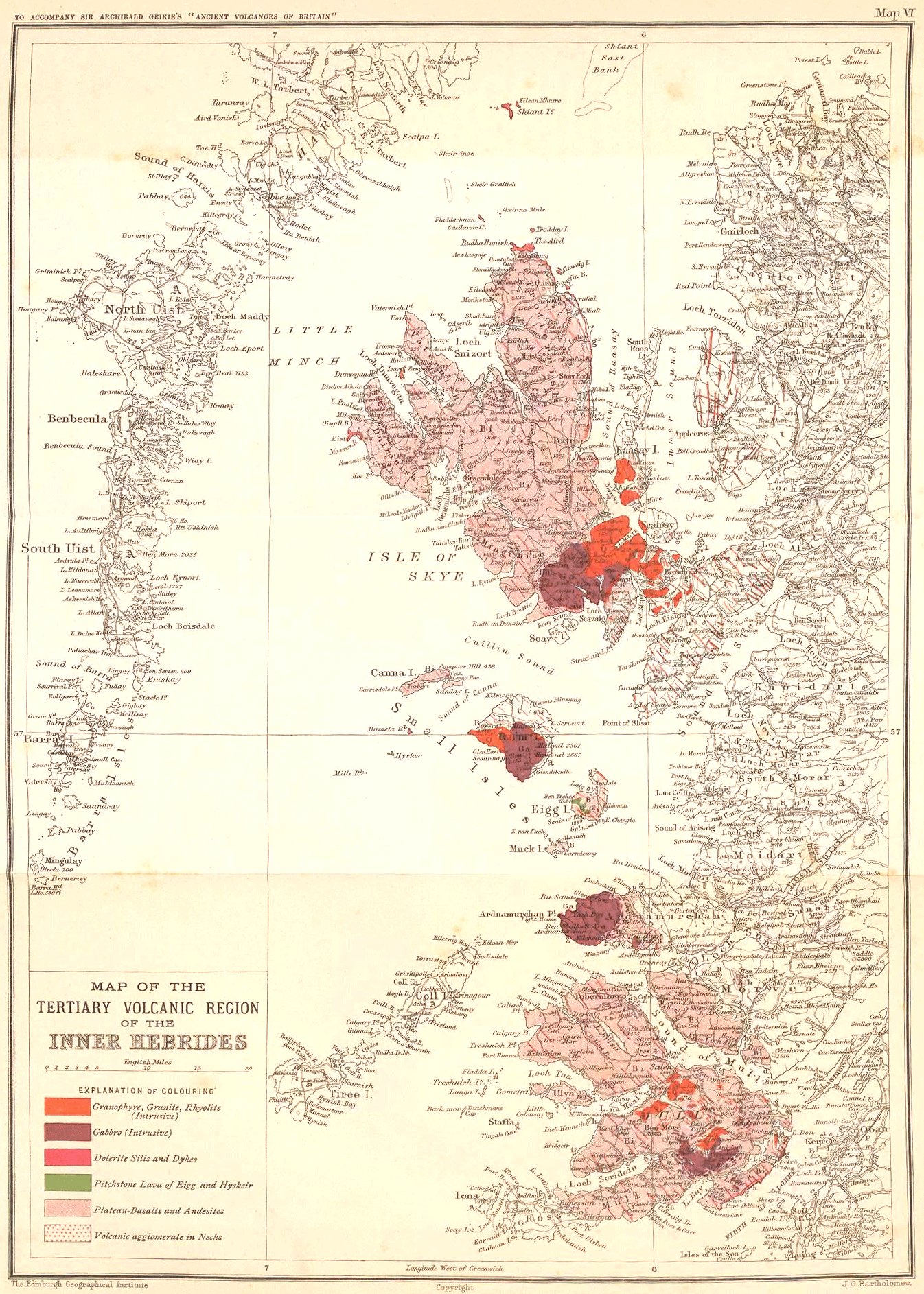
| VI. | Map of the Tertiary volcanic region of the West of Scotland | To face p. 296 |
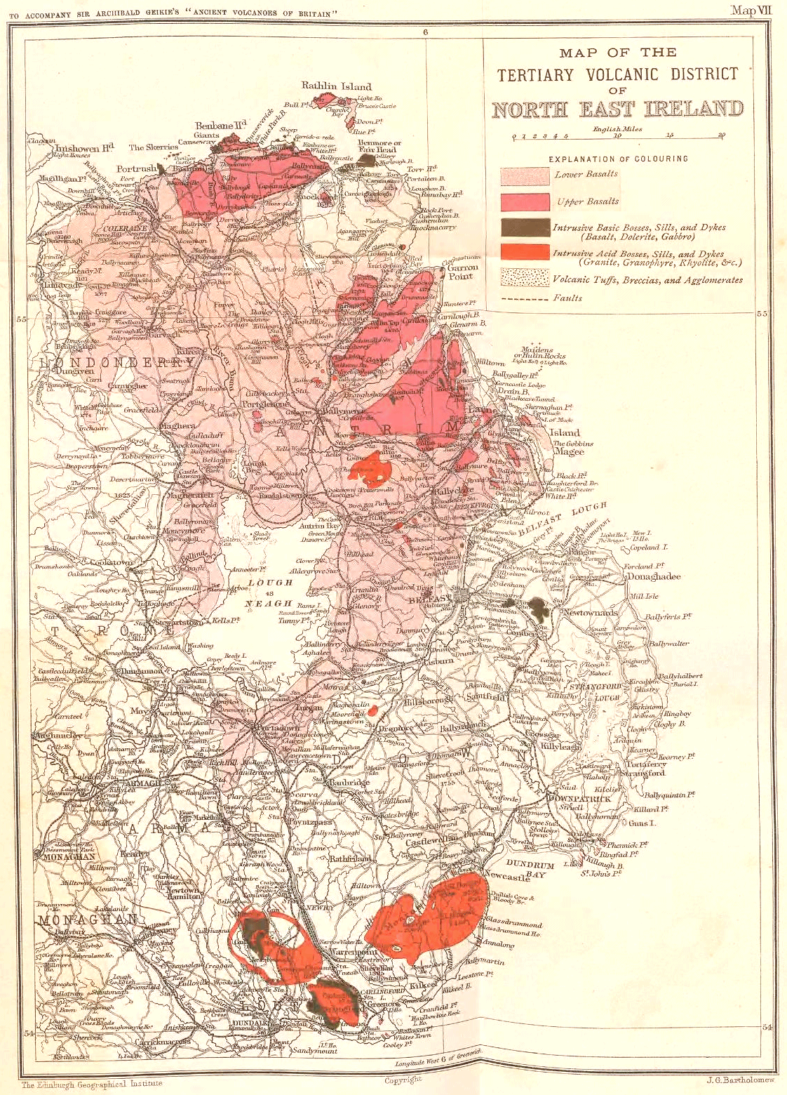
| VII. | Map of the Tertiary volcanic district of the North-East of Ireland | To face p. 446 |
- 1 -
- xvi -
The North of England: Dykes, The Great Whin Sill—The Derbyshire Toadstones—The Isle of Man—East Somerset—Devonshire
The volcanic intercalations which diversify the Lower Carboniferous formations of Southern Scotland extend but a short way across the English Border, and although, over the moors and hills of the north of Cumberland and Northumberland, the Carboniferous sandstones, limestones and shales are well exposed, they present no continuation of either the plateau or puy-eruptions which play so prominent a part in the geology of Roxburghshire and Dumfriesshire. This deficiency is all the more noticeable seeing that the Carboniferous system is exposed down to its very base, in the deep dales of the North of England. Had any truly interstratified volcanic material existed in the system there, it could hardly fail to have been detected.
But while contemporaneous volcanic rocks are absent, the northern English counties contain many intrusive masses of dolerite, diabase, andesite or other eruptive rocks, which may be found traversing all the subdivisions of the Carboniferous system. These eruptive materials have taken two forms: in some cases they rise as Dykes, in others they appear as Sills.
Dykes.—With regard to the dykes, some are probably much later than the Carboniferous period, and consequently will be more appropriately considered in Chapters xxxiv. and xxxv. The great Cleveland dyke, for example, which runs across the Carboniferous, Permian, Triassic and Jurassic formations, is probably referable to the Older Tertiary volcanic period. One dyke known as the Hett Dyke, has been plausibly claimed as possibly of Carboniferous age. It runs in a W.S.W. direction from the Magnesian Limestone escarpment at Quarrington Hill, a few miles to the east of Durham, through the great Coal-field, across the Millstone Grit and Carboniferous Limestone, disappearing near Middleton in Teesdale. Its total length is thus about 23 miles. It varies in breadth from about 6 to about 15 feet, and appears to increase in dimensions as it goes westward.[1]
[1] Sedgwick, Trans. Geol. Soc. 2nd series, iii. part 1 (1826-28), p. 63; Trans. Cambridge Phil. Soc. ii. (1822), p. 21. Sir J. Lowthian Bell, Proc. Roy. Soc. xxiii. (1875), p. 543.
- 2 -
The age of this dyke cannot at present be satisfactorily fixed. It must be later than the Coal-measures through which it rises. Sedgwick long ago pointed out that though it reaches the escarpment of the Magnesian Limestone, it does not cut it; yet it is found in coal-mining to traverse the Coal-measures underlying the Limestone. He was accordingly inclined to believe it to be of older date than the Magnesian Limestone. At its western extremity it approaches close to the Great Whin Sill of Teesdale, though no absolute connection between the two has been established. Mr. Teall, however, has called attention to the similarity between the microscopic structure of the rock forming the Hett Dyke and that of the mass of the Whin Sill, and he is strongly inclined to regard them as belonging to the same period of intrusion.[2]
[2] Quart. Journ. Geol. Soc. xl. (1884), p. 230.
It is especially worthy of remark that in the course of its nearly rectilinear course across the Durham Coal-field, the Hett Dyke, where it crosses the Wear, is flanked on the north at a distance of a little more than two miles by a second parallel dyke of nearly identical composition. Between the two dykes, during mining operations, a sill about 20 feet thick has been met with, lying between two well-known coal-seams at a depth of about 60 fathoms from the surface, and extending over an area of at least 15 acres.[3] Microscopic examination of this sill by Mr. Teall proved that the rock presents the closest resemblance to that of the Hett Dyke.[4] In this case, it may be regarded as probable that the two dykes and the intermediate sill form one related series of intrusions, and the conjecture that the Hett Dyke may be connected with the Whin Sill thus receives corroboration. The age of the Whin Sill itself will be discussed a few pages further on.
[3] Sir Lowthian Bell, Proc. Roy. Soc. xxiii. (1875), p. 544.
[4] Quart. Journ. Geol. Soc. xl. (1884), p. 230.
Of the other dykes which may possibly be coeval with the Hett Dyke we may specially note those which follow the same W.S.W. trend, for that strike differs from the general W.N.W. direction of most of the dykes. Two conspicuous examples of the south-westerly trend may be seen, one near Morpeth, the other north of Bellingham. The former dyke, as regards microscopic structure, is more nearly related to the majority of the series in the North of England. But that north of Bellingham (High Green) presents affinities both in structure and composition with the Hett Dyke,[5] and may perhaps belong to the same period of intrusion.
[5] Mr. Teall, op. cit. p. 244. Quart. Journ. Geol. Soc. xxxix. (1884), p. 656, and Proc. Geol. Assoc. (1886). See also Prof. Lebour, Geology of Northumberland and Durham, chap. xi.
The Great Whin Sill.—The geologist who, after making himself acquainted with the abundant sills among the Carboniferous rocks in the centre of Scotland, finds his way into Northumberland, meets there with geological features that have become familiar to him further north. The sea-cliffs of Bamborough and Dunstanborough, the rocky islets of Farne, the long lines of brown crag and green slope that strike inland through the Kyloe Hills and wind across the cultivated lowlands and the moorlands beyond, remind him at every turn of the scenery in the basin of the Forth. - 3 - But not until he has traced these ridges for many miles southwards and found their component rocks to form there an almost continuous sheet does he realize that nothing of the kind among the Scottish Carboniferous rocks can be compared for extent to this display in the North of England.[6]
[6] The Whin Sill has been the subject of much discussion, and a good deal of geological literature has been devoted to its consideration. The writings of Trevelyan, Sedgwick, W. Hutton, Phillips and Tate are especially deserving of recognition. The intrusive character of the Sill, maintained by some of these writers, was finally established by the mapping of the Geological Survey, and was discussed and illustrated by Messrs. W. Topley and G. A. Lebour in a paper in the 33rd volume of the Quart. Journ. Geol. Soc. (1877), in which references to the earlier observers will be found. See also Prof. Lebour's Outlines of the Geology of Northumberland, 2nd edit. (1886), p. 92. The petrography of the Whin Sill is fully treated by Mr. Teall in Quart. Journ. Geol. Soc. xl. (1884), p. 640, where a bibliography of the subject is also given.
From the furthest skerries of the Farne Islands southwards to Burton Fell on the great Pennine escarpment, a distance in a straight line of about 80 miles, this intrusive sheet may be traced in the Carboniferous Limestone series (Map I.). There are intervals where its continuity cannot be actually followed at the surface, but that it really runs unbroken from one end to the other underground cannot be doubted by any one who has examined the region. This singular feature in the geology and scenery of the North of England is known locally as the Great Whin Sill.[7] From the rocky islets and castle-crowned crags of the coast-line it maintains its characteristic topography, structure and composition throughout its long course in the interior. So regularly parallel with the sedimentary strata does it appear to lie, that it was formerly regarded by many observers as a true lava-sheet, poured out upon the sea-floor over which the limestones and shales were laid down. But its really intrusive character has now been clearly demonstrated. Not a vestige of any tuff has been detected associated with it, nor does it ever present the usual characters of a true lava-stream.[8] Its internal structure and the wonderful uniformity in its character mark it out as a typical intrusive sheet.
[7] "Whin" is a common term in Scotland and the North of England for any hard kind of stone, especially such as can be used for making and mending roads. "Sill" denotes a flat course or bed of stone, and was evidently applied to this intrusive sheet from its persistent flat-bedded position and its prominence among the other gently inclined strata among which it lies. It is from this example in the North of England that the word "sill" has passed into geological literature.
[8] On the coast at Bamborough and the Harkess Rocks the usual petrographical characters of the Whin Sill are exchanged for those of fine-grained amygdaloidal diabases arranged in distinct sheets, which in their upper parts are highly vesicular and show ropy surfaces—peculiarities suggestive of true lava-streams. But according to Professor Lebour the rocks are intrusive into limestone and shale (Geology of Northumberland and Durham, p. 98). Mr. Teall has expressed the suspicion that these rocks must have consolidated under conditions somewhat different from those which characterized the normal Whin Sill (Quart. Journ. Geol. Soc. xl. p. 643). They seem to be the only parts of the sill which present features that might possibly indicate superficial outflow.
Among the manifestations of the subterranean intrusion of igneous rocks in the British Isles the Great Whin Sill, next after the Dalradian sills of Scotland, is the most extensive. Its striking continuity for so great a distance, and the absence around it of any other trace of igneous action, save a few dykes, place it in marked contrast to the ordinary type of Carboniferous sills. The occasional gaps on its line of outcrop in the - 4 - northern part of its course do not really affect our impression of the persistence of the sheet. They not improbably indicate merely that in its protrusion it had a wavy irregular limit, which in the progress of denudation has occasionally been not yet reached. For mile after mile the sill has been mapped by the Geological Survey in lines of crag across the moorlands, and as a conspicuous band among the limestones and shales that form the steep front of the Pennine escarpment, where it has long been known in the fine sections exposed among the gullies by which that noble rock-face has been furrowed.
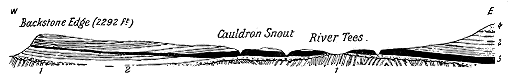
Along its main outcrop, the sill dips gently eastwards below the portion of the Carboniferous Limestone series which overlies it. But so slight are the inclinations, so gentle the undulations of the rocks in this part of the country, that far to the east of that outcrop the sill has been laid bare by the streams which in the larger dales have cut their way through the overlying cake of Carboniferous strata down to the Silurian platform on which they rest (Fig. 176). Among these inland revelations of the eastward continuation of the sill under Carboniferous Limestone strata, the most striking and best known are those which have been made by the River Tees, and of which the famous waterfalls of the High Force and Cauldron Snout are the most picturesque features. The distance of the remotest of these denuded outcrops or "inliers" from the main escarpment is not less than 20 miles.
It is not possible to form an accurate estimate of the total underground area of the Whin Sill. In the southern half of the district, south of the line of the Roman Wall, where, the inclination of the strata being generally low, the same stratigraphical horizons are exposed by denudation far to the east of the main outcrops of the rocks, we know that the sill must have a subterranean extent of more than 400 square miles. Yet this is probably only a small part of the total area over which the molten material was injected. In the northern part of the district, the Carboniferous Limestone series is not exposed over so broad a stretch of country, and denudation has not there revealed the eastward extension of the sill. But there is no reason to suppose the sheet to be less continuous and massive there. We must remember also that the present escarpment has been produced by denudation, and that the intrusive sheet must have once extended westwards beyond its present limits at the surface. If, therefore, we were to state broadly that the Great Whin Sill has been intruded into the Carboniferous Limestone - 5 - series over an area of 1000 square miles we should probably be still below the truth.
The rock composing this vast intrusive sheet is a dolerite or diabase, which maintains throughout its wide extent a remarkable uniformity of petrographical characters. In this and other respects it illustrates the typical features of sills. Thus it is coarsest in texture where it is thickest, and somewhat finer in grain towards its upper and lower surfaces than in the centre. Among the coarser varieties the component crystals of augite are not infrequently an inch in length and occur in irregular patches.[9] Occasional amygdaloidal portions are observable, but these are not more marked than those to be found in the "whin-dykes" of the same region.[10] The amygdaloidal and vesicular fine-grained rocks of the Bamborough district may possibly be quite distinct from the main body of the Whin Sill.
[9] Sedgwick, Cambridge Phil. Trans. ii. p. 166. Mr. Teall, Quart. Journ. Geol. Soc. xl. p. 643.
[10] Messrs. Topley and Lebour, Quart. Journ. Geol. Soc. xxxiii. p. 418.
Under the microscope the rock is seen to consist essentially of the usual minerals—plagioclase, augite and titaniferous magnetic iron-ore. An ophitic intergrowth of the augite and felspar is observable, likewise a certain quantity of micropegmatite which plays the part of groundmass between the interstices of the lath-shaped felspars. Full details of the characteristics of the component minerals and their arrangement are given by Mr. Teall in the paper already cited.
The main body of the sill is a sheet which sometimes diminishes to less than 20 feet in thickness and sometimes expands to 150 feet, but averages from 80 to 100 feet. It occasionally divides, as near Great Bavington, where it appears at the surface in two distinct beds separated by an intervening group of limestones and shales. Occasionally, as at Elf's Hill Quarry, it gives out branches which send strings into the adjacent limestone.[11]
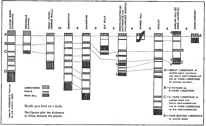
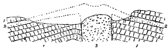
Although in most natural sections it seems to lie quite parallel with the strata above and below, yet a number of examples of its actual intrusion have been observed. When traced across the country, it is found not to remain on a definite horizon, but to pass transgressively across considerable thicknesses of strata. Its variations in this respect are well shown in the accompanying table of comparative sections constructed by Messrs. Topley and Lebour.[12] It will be seen that while at Harlow Hill the sill is found overlying the Great Limestone of Alston Moor, at Rugley, five miles off it lies about 1000 feet lower down, far below the position of the Tyne-bottom Limestone. Still farther north, however, the sill west of Holy Island is said to lie 800 feet above the Great Limestone and to come among the higher beds of the Carboniferous Limestone series.[13]
The Whin Sill appears generally to thicken in an easterly or north-easterly direction. There are further indications that it was intruded from east to west. Thus, at Shepherd's Gap, on the Great Roman Wall, the - 6 - dolerite, coming evidently from an easterly quarter, has broken up and thrust itself beneath a bed of limestone. Again, when the sill bifurcates the branches unite towards the east or north-east.[14] The sill can be proved to thin away to the west from Teesdale to the Pennine escarpment, and in Weardale the "Little Whin Sill" diminishes from 20 feet, till in three miles it disappears.[15]
- 7 -
The strata in contact with the Whin Sill, both above and below, have been more or less altered. Sandstones have been least affected; shales have suffered most, passing into a kind of porcellanite, with development of garnet and other minerals.[16] Limestone often shows only slight traces of change, though here and there it has become crystalline.
[16] Mr. Teall, op. cit. xxxix. (1884), p. 642, and authors cited by him.
No trace of any boss or neck has been detected in the whole region which might be supposed to mark a funnel of ascent for the material of the Whin Sill. The Hett Dyke and the High Green Dyke, already noticed, may, however, have been possibly connected with the injection of this great intrusive sheet. No other visible mass of igneous rock in the region has been even plausibly conjectured to indicate a point or line of emission for the sill.
It is certainly singular that in so wide a territory, where the whole succession of strata has been so admirably laid bare by denudation in thousands of natural sections, and where, moreover, much additional information has been obtained from lead-mining as to the nature of the rocks below ground, not a single vestige of tuff, agglomerate or interstratified lava has been up to the present time recorded, unless the Harkess rocks already alluded to can be so regarded.
Judging, however, from the analogy of the other districts of igneous rocks in Britain, we can hardly resist the conclusion that the Great Whin Sill is essentially a manifestation of volcanic action, that it was connected with the uprise of basic lava in volcanic orifices, and that the subterranean energy may quite probably have succeeded in reaching the surface and ejecting there both lavas and tuffs.
It appears to be certain that any vents which existed cannot have lain to the west of the present escarpment of the sill, for no trace of them can be found there piercing the Carboniferous or older formations. They must have lain somewhere to the east in the area now overspread with Millstone Grit and Coal-measures, or still farther east in the tract now concealed under the North Sea. The evidence of the sill itself, as we have seen, corroborates this view of the probable situation of the centre of disturbance.
The question of the geological age of the sill is one of considerable difficulty, to which no confident answer can be given.[17] The injection of the diabase must obviously be considerably later than the highest strata through which it has risen; that is, it must be younger than some of the higher members of the Carboniferous Limestone series. But here our positive evidence fails.
The Sill is traversed by the same faults which disrupt the surrounding Carboniferous rocks. It is therefore of older date than these dislocations. Its striking general parallelism with the shales and limestones - 8 - probably proves that it was intruded before the rocks were much disturbed from their original horizontal position. But the manner in which the intrusive rock has been thrust into and has involved the shales and limestones seems to indicate that these strata had already become consolidated and lay under the pressure of a great thickness of superincumbent Carboniferous strata.
In the absence of all certainty on the subject it seems most natural to place the Whin Sill provisionally among the Carboniferous volcanic series with which petrographically and structurally it has so much in common. In Scotland the puy-eruptions continued till the time of the Coal-measures. If, before the close of the Carboniferous period, volcanic vents were opened somewhere to the east of the coal-fields of Northumberland and Durham, they might be accompanied with basic sills injected into the Carboniferous Limestone series, which was then lying still approximately horizontal under a thickness of from 3500 to 5000 feet of Carboniferous sedimentary deposits. These still undiscovered volcanoes seem to have been endowed with even more energy than those of Central and Southern Scotland, at least nowhere else among the Carboniferous records of Britain is there such a colossal manifestation of subterranean intrusion as the Great Whin Sill.
In the absence of any certain evidence that the Whin Sill belongs to the Carboniferous period, we must advance southward into the very heart of England before any clear vestiges can be found of contemporaneous volcanic eruptions among the members of the Carboniferous system. After quitting the lavas and tuffs of Roxburghshire and their brief continuations across the English border, we do not again meet with any truly bedded volcanic rocks in that system until we reach the middle of Derbyshire. In this picturesque district, famous for its lead-mines and its mineral waters, a feebly developed but interesting group of intercalated lavas, locally called "toadstones," has long been known. There is thus a space of some 150 miles across which, though the formations are there so fully developed and so abundantly trenched by valleys from the top to the bottom of the system, no volcanic vents nor any trace of Carboniferous volcanic ejections has yet been found. On the other hand, after the district of the "toadstones" is passed, the Carboniferous rocks are again destitute of any volcanic intercalations across the centre and south-west of England and over Wales, until after a space of about 150 miles they reappear in Somerset.
The volcanic group of Derbyshire thus stands out entirely isolated. Lying in the Carboniferous Limestone, where that formation is typically developed, it presents an admirable example of a thoroughly marine phase of volcanic action (Map I.).
One of the most prominent features in the geology of the centre of England is the broad anticlinal fold which brings up the lower portion of the Carboniferous system to form the long ridge of the Pennine chain that runs - 9 - from Yorkshire to the Midland plain, and separates the eastern from the western coal-fields. This fold widens southwards until not only the Millstone Grit and Yoredale rocks, but the underlying Mountain Limestone is laid bare. A broad limestone district is thus exposed in the very heart of the country, ranging as a green fertile undulating tableland, deeply cut by winding valleys, which expose admirable sections of the strata, but nowhere reach the base of the system. The total visible depth of the limestone series is computed to be about 1500 feet; the Yoredale shales and limestones may be 500 feet more; so that the calcareous formations in which the volcanic phenomena are exhibited reach a thickness of at least 2000 feet.
It is not yet definitely known through what vertical extent of this thickness of sedimentary material the volcanic platforms extend, but where most fully developed they perhaps range through 1000 feet, lying chiefly in the Carboniferous Limestone, but apparently in at least one locality extending up into the lower division of the Yoredale group. The area within which they can be studied corresponds nearly with that in which the limestone forms the surface of the country, or a district measuring about 20 miles from north to south, with an extreme breadth of 10 miles in an east and west direction.
A special historical interest belongs to the Derbyshire "toadstones."[18] They furnished Whitehurst with material for his speculations, and were believed by him to be as truly igneous rocks as the lava which flows from Hecla, Vesuvius or Etna. But he thought that they had been introduced among the strata and "did not overflow the surface of the earth, according to the usual operations of volcanoes."[19]
[18] This word has by some writers been supposed to be corrupted from tod-stein, dead-stone, in allusion to the dying out of the lead veins there; by others the name has been thought to be derived from the peculiar green speckled aspect of much of the rock, resembling the back of a toad.
[19] An Enquiry into the Original State and Formation of the Earth, 1778, Appendix, pp. 149, et seq.
His views were published as far back as 1778, three years after Hutton read the first outline of his theory of the earth and made known his observations regarding the igneous origin of whinstones.[20] The first detailed account of the Derbyshire eruptive rocks was that given by Fairey,[21] which has served as the basis of all subsequent descriptions. Conybeare, in particular, prepared a succinct narrative from Fairey's more diffuse statements, and thus placed clearly before geologists the nature and distribution of these volcanic intercalations.[22] Subsequently the district was mapped by De la Beche and the officers of the Geological Survey, and the areas occupied by the several outcrops of igneous rock could then be readily seen.[23]
[20] Trans. Roy. Soc. Edin. i. p. 275, et seq. Hutton specially mentions the toadstone of Derbyshire as one of the rocks produced by fusion, p. 277.
[21] General View of the Agriculture and Minerals of Derbyshire (1811).
[22] Outlines of the Geology of England and Wales (1822), p. 448.
[23] See Sheets 71 N.W., 72 N.E., 81 N.E. and S.E. and 82 S.W. of the Geological Survey of England and Wales.
- 10 -
Though the "toadstones" were believed to form definite platforms among the limestone strata, and thus to be capable of being used as reliable horizons in the mineral fields of Derbyshire, they appear to have been generally regarded as intrusive sheets like the Whin Sill of the north. Thus De la Beche in his Manual of Geology, giving a summary of what was known at the time regarding intercalated igneous rocks, remarks with regard to the Derbyshire toadstones that they may from all analogy be considered to have been injected among the limestones which would be easily separated by the force of the intruded igneous material.[24] But the same observer, after his experience among the ancient volcanic rocks of Devonshire, came fully to recognize the proofs of contemporaneous outflow among the Derbyshire toadstones. In his subsequently published Geological Observer, he described the toadstones as submarine lavas that had been poured out over the floor of the sea in which the Carboniferous Limestone was deposited, and had been afterwards covered up under fresh deposits of limestone.[25] It is remarkable, however, that he specially comments on the absence, as he believed, of any contemporaneously ejected ashes and lapilli, such as occur in Devonshire. That true tuffs or volcanic ashes are associated with the toadstones was noticed by Jukes in 1861,[26] and afterwards by the Geological Survey.[27] Since that time geologists have generally recognized these Derbyshire igneous rocks as truly contemporaneous intercalations. But very little has recently been written on the structure of the district, our information regarding it being still based mainly on the early observations of Fairey and the mapping of the Geological Survey.
[26] Student's Manual of Geology, 2nd edit. (1863), p. 523. For a general résumé of the proofs of contemporaneity furnished by the toadstones, see "The Geology of North Derbyshire," by Messrs. A. H. Green and A. Strahan (Memoirs of the Geological Survey, 2nd edit. (1887), p. 123).
[27] In the first edition of the Memoir on the Geology of North Derbyshire, published in 1859, the authors of which were Messrs. A. H. Green, C. le Neve Foster and J. R. Dakyns.
The subject, however, has now been resumed by Mr. H. Arnold Bemrose, who in 1894, after a prolonged study of the petrography of the rocks, communicated the results of his researches to the Geological Society.[28] In his excellent paper, to which I shall immediately make fuller reference, he mentions the localities at which lava-form and fragmental rocks may be observed, but does not enter on the discussion of the geological structure of the region or of the history of the volcanic eruptions. Before the announcement of his paper, hearing that I proposed to make for the first time a rapid traverse of the toadstone district, for the purpose of acquainting myself with the rocks on the ground, he kindly offered to conduct me over it. My chief object, besides that of seeing the general nature of the volcanic phenomena of the region, was to examine more particularly the areas of the volcanic fragmental rocks, with the view of discovering whether among them some remains might not be found of the actual vents of discharge. In this search I was entirely successful. Aided by Mr. Bemrose's intimate knowledge of - 11 - the ground, I was enabled to visit in rapid succession those tracts which seemed most likely to furnish the required evidence, and in a few days was fortunate enough to obtain proofs of six or seven distinct vents, ranging from the extreme northern to the furthest southern boundary of the volcanic district. Mr. Bemrose has undertaken to continue the investigation, and will, I trust, work out the detailed stratigraphy of the Carboniferous Limestone so as eventually to furnish an exhaustive narrative of the whole volcanic history of Derbyshire. Meanwhile no adequate account of the area can be given. But I will here state all the essential facts which up to the present time have been ascertained.
[28] Quart. Journ. Geol. Soc. vol. l. (1894), p. 603.
1. THE ROCKS ERUPTED.—Mr. Allport has described the microscopic character of some of the toadstones,[29] and further details have been supplied by Mr. Teall.[30] The fullest account of the subject, however, is that given by Mr. Bemrose in the paper above referred to. This observer distinguishes the lava-form from the fragmental rocks, and gives the minute characters of each series. He does not, however, separate true interstratified lavas from injected sills, nor the bedded tuffs from the coarse agglomerates which fill up the vents. These distinctions are obviously required in order that the true nature and sequence of the materials in the volcanic eruptions may be traced, and that the phenomena exhibited in Derbyshire may be brought into comparison with those found in other Carboniferous districts. But to establish them satisfactorily the whole region must be carefully re-examined and even to some extent re-mapped.
The lavas (including, in the meantime, sheets which there can be little doubt are sills) show three main types of minute structure and composition, which are discriminated by Mr. Bemrose as—(a) Olivine-dolerites; these, the most abundant of the series, consist of augite in grains, olivine in idiomorphic crystals, plagioclase giving lath-shaped and tabular sections, and magnetite or ilmenite in rods and grains; (b) Ophitic olivine-dolerites, consisting of augite in ophitic plates forming the groundmass, in which are imbedded idiomorphic olivine, plagioclase (often giving large lath-shaped sections and magnetite or ilmenite); (c) Olivine-basalts; these rocks are distinguished by containing crystals of augite and olivine in a groundmass of small felspar-laths, granular augite and magnetite or ilmenite, with very little interstitial matter. They have been noticed only in two of the outcrops of toadstone.
The fragmental rocks have been shown by Mr. Bemrose to cover a much more extensive space than had been previously supposed. He has found them to be distinguished by an abundance of lapilli varying from minute fragments up to pieces about the size of a pea, and composed of a material that differs in structure from the dolerites and basalts with which the tuffs are associated. These lapilli consist largely of a glassy base more or less altered, which is generally finely vesicular and encloses abundant skeleton crystals and crystallites. The tuffs thus very closely resemble - 12 - some of the Carboniferous basic tuffs of Fife, already referred to (vol. i. p. 422), and like these they include abundant blocks of dolerite and basalt.
2. GEOLOGICAL STRUCTURE OF THE TOADSTONE DISTRICT.—As the volcanic rocks of Derbyshire lie among the Carboniferous Limestones of a broad anticlinal dome, they are only exposed where these limestones have been sufficiently denuded, and as the base of the limestones is nowhere laid bare, the lowest parts of the volcanic series may be concealed. Over the tract where the toadstones can be examined they appear as bands regularly intercalated with the limestones, but varying in thickness in the course of their outcrops. As they are prone to decay, they usually form smooth grassy slopes between the limestone scarps, though isolated blocks of the dull brown igneous rocks may often be seen protruding from the surface. Now and then a harder bed of toadstone caps a hill, and thus forms a prominent feature in the landscape, but as a rule these igneous bands play no distinguishing part in the scenery, and are indeed less conspicuous than the white escarpments of limestone which overlie them.
It was the opinion of the older geologists that three distinct platforms of toadstone extend without break throughout the district, and subdivide the limestones into four portions. But this opinion does not seem to have been based on good evidence either of sequence or of continuity. Various facts were brought forward by the officers of the Geological Survey to show that the supposed persistence of the three platforms of toadstone did not really exist, but that these sheets of igneous material are found at different spots on very different horizons, and are of limited horizontal range.[31] So far as my own limited observations go, they entirely corroborate this view. There can be little doubt, I think, that the identity of certain outcrops of toadstone has been assumed, and the assumption has been carried throughout the district. The truth is that the number of successive platforms on which igneous materials appear will never be satisfactorily determined until the stratigraphy of the Derbyshire Carboniferous Limestone is worked out in detail. When the successive members of this great calcareous formation have been identified by lithological and palæontological characters over the district, it will be easy to allocate each outcrop of toadstone to its true geological horizon. When this labour has been completed, it will probably be found that instead of three, there have been many discharges of volcanic material during the deposition of the limestone series; that these have proceeded from numerous small vents, and that they are all of comparatively restricted horizontal extent. Such a detailed examination will also determine how far the toadstones include veritable sills, and on what horizons these intrusive sheets have been injected.
[31] Geol. Surv. Mem. on North Derbyshire, by Messrs. Green and Strahan (1887), p. 104.
In the meantime, we know that the lowest visible bands of toadstone are underlain by several hundred feet of limestone, thus proving that the earliest known volcanic explosions took place over the floor of the Carboniferous Limestone sea, after at least 700 or 800 feet of calcareous sediment had accumulated there. The latest traces of volcanic activity are - 13 - found in a part of the Yoredale group of shales and limestones which form the uppermost member of the Carboniferous Limestone of this region. But it is not quite clear whether the vesicular diabase found there is interstratified or intrusive. Certainly no contemporaneous tuffs have yet been found among the Yoredale rocks, nor in any higher subdivision of the Carboniferous system, though coarse agglomerates marking the position of vents do traverse the Yoredale group at Kniveton.
It may be remarked that in the district over which the toadstones can be seen, two areas are recognizable, in each of which the exposures of the igneous rocks are numerous, while between them lies an intervening tract wherein there is hardly any visible outcrop of these rocks. The northern and much the more extensive area stretches from Castleton to Sheldon, while the southern spreads from Winster to Kniveton. This distribution not improbably points to the original position of the vents, and indicates a northern more numerous group of volcanic orifices, and a southern tract where the vents were fewer, or at least spread their discharges over a more limited space.
3. THE VENTS.—It had always appeared to me singular that, in ground so deeply trenched by valleys as the toadstone district of Derbyshire, no trace had been recognized of any bosses or necks from which these volcanic sheets might have been erupted. It is true that in mining operations masses of toadstone had been penetrated to a considerable depth without their bottom being reached, and the suggestion had been made that in such cases a shaft may actually have been sunk on one of the vents through which the toadstone came up.[32] One instance in particular was cited where, at Black Hillock, on Tideswell Moor, close to Peak Forest Village, a mass of toadstone was not cut through, though pierced to a depth of 100 fathoms. In that neighbourhood, however, several of the sheets of eruptive material are probably sills, and the shaft at Black Hillock may have been sunk upon the pipe or vein that supplied one or more of these intrusive sheets.
[32] Geol. Surv. Mem. on North Derbyshire, p. 134.
It was therefore with no little interest that I detected a series of vents at four separate localities, viz. Castleton, Grange Mill, Hopton, and Kniveton Wood. I have no doubt that a more extended search will bring others to light. Those observed by me are all filled with coarse agglomerate, the blocks in which are mostly composed of different lavas, sometimes with the addition of blocks of limestone, while the matrix consists mainly of lapilli of basic devitrified glass.
The most typical examples form a group of two, possibly three, vents which rise into two isolated, smooth, grassy dome-shaped hills at Grange Mill, five miles west from Matlock Bath.[33] In external form and colour, these eminences present a contrast to the scarped slopes of limestone around them. They at once recall the contours of many of the volcanic necks in Central Scotland. On examination it is found that the material composing - 14 - them is a dull green agglomerate, the matrix of which is a compact substance weathering spheroidally, and full of small lapilli of minutely vesicular diabase. The larger stones consist, for the most part, of various vesicular dolerites or diabases, together with some pieces of limestone and occasionally large blocks of the latter rock, altered into a saccharoid condition. Two dykes of dolerite or basalt traverse the margin of the larger vent.
[33] This is Mr. Bemrose's outcrop, No. 46, op. cit. p. 633.
The steep sides of these agglomerate domes rise from the low ground around them to a height of 100 to 180 feet, their summits being a little more than 900 feet above the sea. The smaller neck is nearly circular, and measures about 1000 feet in diameter. The larger mass is less regular in shape, and is prolonged into such a bulge on the south-east as to suggest that its prolongation in that direction may really mark the position of a third and much smaller vent contiguous to it. The longer diameter of the larger mass is 2300 and the shorter 1300 feet.
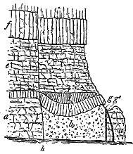
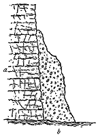
On the south and west sides, the surrounding limestone can be traced up to within a few feet of the edge of the agglomerate, and its strata are there found to be much jumbled and broken, while their texture is rather more crystalline than usual, though not saccharoid. The two necks are separated by a narrow valley in which no rock is visible. Their opposite declivities meet at the bottom of this hollow, and are so definitely marked off that, even in the absence of proof that they are disjoined by intervening limestone, there can be little hesitation in regarding each hill as marking a distinct vent. - 15 - A wider valley extends along the eastern base of the necks, and slopes upward on its east side until it is crowned by a long escarpment of limestone, which reaches a height of 1000 feet above the sea, or about 100 feet above the valley from which it rises. Unfortunately, the bottom and slopes of this depression are thickly covered with soil, but at one or two places debris of fine tuff may be observed, and at the northern and southern ends of the hollow well-bedded green and reddish tuff appears, dipping gently below the limestone escarpment. This band of volcanic detritus evidently underlies the limestone, and forms most of the gentle slope on the east side of the valley. It may be from 70 to 100 feet thick. That it was discharged from one or both of the necks seems tolerably clear. Its material resembles that forming the matrix of the agglomerate. The general arrangement of the rocks at this interesting locality is represented in Fig. 179, which is reduced from my survey on the scale of six inches to a mile. A section across the smaller vent would show the structure represented in Fig. 180.
- 16 -
This group of vents lies in the southern of the two tracts of the volcanic district. In the northern tract a mass of agglomerate pierces the base of the limestone escarpment about a quarter of a mile west from the entrance to the Peak Cavern at Castleton.[34] It is rudely semicircular in area, stretching down the slope until its northern extension is lost under the lower ground. The agglomerate is not well exposed, but it can be seen to be a green, granular crumbling rock, made up in great part of minutely vesicular lapilli, enclosing blocks of various diabases two feet long or more. From the abrupt way in which this agglomerate rises through the limestone, there can be little doubt that it marks the position of one of the volcanic vents of the time. As it stands on the extreme northern verge of the limestone area, the ground further north being covered with the Yoredale rocks and Millstone Grit, it is the most northerly of the whole volcanic district.
[34] This is outcrop No. 1 of Mr. Bemrose's paper, p. 625.
Along the southern margin of the limestone country a group of agglomerate masses probably marks another chain of vents. These are specially interesting, inasmuch as they abut on the Yoredale series, and may thus be looked upon as among the latest of the volcanic chimneys. One of them is seen at Hopton,[35] where along the side of the road a good section is exposed of coarse tumultuous agglomerate, having a dull green matrix, composed of green, brown, and black, minutely cellular, basic, devitrified, glassy lapilli, showing under the microscope abundant microlites and crystals or calcareous pseudomorphs of olivine, augite, and felspar, and much magnetite dust. Through this matrix are distributed blocks of slaggy basalt and dolerite. An interesting feature of this mass is the occurrence in it of some veins, two or three inches broad, of a compact black porphyritic basalt. I did not trace the relations of this agglomerate to the stratified rocks around it. But its internal structure and composition mark it out as a true neck. It extends, according to the Geological Survey map, for about half a mile along the edge of the limestone, and is represented as being separated by two faults from the Yoredale series immediately to the south. So long as the belief is entertained that the toadstones are contemporaneous outflows of lava lying on certain definite horizons, far below the summit of the limestones, the position of the Hopton agglomerate is only explicable on the assumption of some dislocation by which the Yoredale shales have been brought down against it. But when we realize that the rock is an unstratified agglomerate, probably marking the place of a volcanic vent, and therefore rising transgressively through the surrounding strata, the necessity for a fault is removed, or if a fault is inserted its existence should be justified on other evidence than the relations of the igneous rock to the surrounding strata.
[35] Geol. Surv. Mem. North Derbyshire, p. 24. This is outcrop No. 53 of Mr. Bemrose's paper, p. 635.
Four miles to the south-west of Hopton, on the slope of the hill at Kniveton Wood, another remarkable mass of agglomerate forms a rounded ridge between the two forks of a small stream.[36] Its granular matrix, like that of the other necks, consists of lapilli of minutely vesicular basic glassy - 17 - lava or pumice, and encloses large and small rounded blocks of finely cellular basalt and pieces of limestone. The rock is unstratified, and in all respects resembles that of ordinary Carboniferous necks in Scotland. Its relations to the Yoredale rocks are laid bare in the channels of the streamlets. There the shales and thin limestones may be seen much broken and plicated, their curved and fractured ends striking directly at the agglomerate. They may be traced to within a yard of the agglomerate. On the Geological Survey map the igneous rock is represented as bounded by two parallel faults. But I hardly think that this explanation suffices to account for the relations of the rocks and their remarkable boundary-line, which seems to me to be undoubtedly the wall of a volcanic vent. To the east of the streams, another mass of agglomerate may mark another neck, while to the north, a third detached area of the same kind of rock, rising among the limestones, may be regarded as likewise a distinct mass. At this locality, therefore, there are two, possibly three, vents. One of these, from the way in which it cuts across the Yoredale shales and limestones, is to be assigned to a time later than the older part of the Yoredale series, and thus, like the Hopton mass, it indicates that in the south of the volcanic area eruptions did not cease with the close of the deposition of the thick limestones, but were prolonged even into the time of the Yoredale rocks.
[36] Outcrop No. 56, p. 638 of Mr. Bemrose's paper.
A further proof of the late age of these southern patches of volcanic material is shown by two bands of vesicular toadstone in the Yoredale series, a little south from the village of Kniveton. These rocks are traced on the Survey Map, and are shown in a diagram in the Memoir, where their position is sought to be explained by a system of parallel faulting.[37] I was able to trace the actual contact of the western band with the strata underneath it, and satisfied myself that there is no fault at the junction. The igneous material is regularly bedded with the Yoredale shales and limestones. Either, therefore, these bands are intercalated lava-streams or intrusive sills. If mere vesicular structure were enough to distinguish true outflowing lavas, then there could be no doubt about these Kniveton rocks. But this structure is found in so many Carboniferous sills, particularly in those thin sheets which have been injected into coals and black shales, that its presence is far from decisive. The vesicles in the Kniveton rocks are small and pea-like, tolerably uniform in size and shape, and crowded together. They are thus not at all like the irregular cavities in the ordinary cellular and scoriaceous lavas of the toadstone series.
Whether or not the question of their true relations be ever satisfactorily settled, these Kniveton bands are certainly younger than the lower portion of the Yoredale group. Their evidence thus agrees with that of the southern agglomerates in showing that the volcanic activity of this region was continued even after the thick calcareous masses of the Carboniferous Limestone series had ceased to be deposited.
Besides the six necks to which I have referred, a rock in Ember Lane, above Bonsall, probably belongs to another vent.[38] It is particularly interesting - 18 - from the great preponderance of limestone fragments in it. The volcanic explosions at this locality broke up the already solidified limestones on the floor of the Carboniferous Limestone sea, and strewed them around, mingled with volcanic blocks and dust of the prevailing type.
[38] This is outcrop No. 39 of Mr. Bemrose's paper, p. 632.
When the district has been more carefully searched, other centres of eruption will no doubt be discovered. It may then be possible to depict the distribution of the active vents, and to connect with them the outflow of the bedded lavas. So far as I have been able to ascertain, there are no necks of dolerite or basalt, though, as I have shown, dykes or veins of molten rock are occasionally to be found in the agglomerates of the necks.
4. THE LAVAS AND TUFFS.—I have referred to the opinion of De la Beche that the toadstones of Derbyshire were poured out as lava-streams without any accompanying fragmentary discharges, and to the correction of this opinion by the subsequent observations of Jukes and of the Geological Survey. But though the existence of interbedded tuffs has long been known, it was not until Mr. Bemrose's more careful scrutiny that the relative importance of the tuffs among the lavas was first indicated. He has shown that a number of the bands mapped as "toadstone" are tuffs, and he has discovered other bands of tuff which have not yet been placed on any published map.
In examining the outcrops of the various toadstones of Derbyshire we learn that some of them are lavas without tuffs, probably including a number of bands, which are really sills; that others are formed of both lavas and tuffs, and that a third type shows only bedded tuff. Each of these developments will deserve separate description. But before entering into details, we may take note of the varying thicknesses of the different toadstones which have been determined by observation at the surface or by measurement underneath in mining operations. In some cases a distinct band of toadstone, separated by many feet or yards of limestone from the next band, and therefore serving to mark a separate volcanic discharge, may not exceed a yard or two in total thickness, and from that minimum may swell out to 100 feet. The majority of the bands probably range between 50 and 100 feet in thickness. In one exceptional case at Snitterton, a mass of "blackstone" is said to have been proved to be 240 feet thick, but this rock may not improbably have been a sill.[39] The true contemporaneous intercalations seem to be generally less than 100 feet in thickness.
[39] A difference is made by the mining community between "toadstone" and what is called "blackstone." The former name appears to be restricted to the amygdaloidal green and generally more or less decayed lavas; the latter, so far as I can learn, is applied to the dark, more solid and crystalline rocks. If this distinction be well founded the one name may perhaps serve to mark the open cellular lavas, the other the more compact, dark, and heavy intrusive sheets.
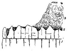
(a) Lavas without Tuffs.—Examples occur of sheets of toadstone which consist entirely of contemporaneously ejected diabase, basalt or dolerite. This rock is then dull green or brown in colour, more or less earthy in texture, and irregularly amygdaloidal. The vesicles are extremely varied in size, form and distribution, sometimes expanding until the rock becomes a slaggy mass. A central more solid portion between a scoriaceous bottom and top - 19 - may sometimes be observed, as at the Great Rocks Quarry, Peak Forest Limeworks (Fig. 181). In this, as in other examples, a remarkably hummocky and uneven surface of limestone lies below the igneous band, the calcareous rock presenting knobs and ridges, separated by cauldron-shaped cavities and clefts, some of which are several yards deep. These inequalities are filled in and covered over with a soft yellow and brown clay, varying up to three or four feet thickness, and passing upwards into the more solid toadstone. There can hardly be any doubt that this singularly uneven limestone surface is due to the solvent action of water lying between the limestone and the somewhat impervious toadstone above, and that the clay represents partly the insoluble residue of the calcareous rock, but chiefly the result of the action of the infiltrating water on the bottom of the igneous band.[40]
[40] Geological Survey Memoir on North Derbyshire, p. 20 and footnote.
Junctions of the upper surfaces of the lava-sheets with the overlying limestone show that the igneous material sometimes assumed hummocky forms, which the calcareous deposits gradually overspread and covered.[41] A good example of this kind may be observed by the roadside at the foot of Raven's Tor, Millersdale. As shown in the subjoined figure, the limestone has here been worn into a cave, the floor of which is formed by the toadstone. The latter rock, of the usual dull green, slaggy and amygdaloidal character, is covered immediately by the limestone, but I did not observe any fragments of the toadstone, nor any trace of ashy materials in the overlying calcareous strata. This section shows that after the outflow of the lava, the sedimentation of the limestone was quietly resumed, and the igneous interruption was entirely buried.
[41] Compare De la Beche, Geological Observer, pp. 559, 560, and North Derbyshire Memoir, p. 123.
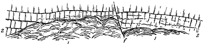
- 20 -
In some cases there is evidence of more than one outflow of lava in the same band of toadstone. Jukes believed that each band "was the result, not of one simultaneous ejection of igneous matter, but of several, proceeding from different foci uniting together to form one band," and he found that near Buxton, two solid beds of toadstone could be seen to have proceeded from opposite quarters towards each other without overlapping.[42]
[42] Student's Manual of Geology, 2d edit. (1862), p. 523.
In Millersdale the authors of the Geological Survey Memoir on North Derbyshire observed that a band of toadstone about 100 feet thick showed six distinct divisions, which they were disposed to regard as marking so many separate beds.[43] In Tideswell Dale, on the west side of the valley, immediately to the south of the old toadstone quarry, two bands of toadstone are seen to be separated by a few yards of limestone.
[43] Op. cit. p. 19.
(b) Lavas with Tuffs.—It will probably be found that in many, if not in most cases, the outflow of lava was preceded, accompanied or followed by fragmental discharges. As far back as 1861, Jukes noticed that a toadstone band, about 50 feet thick, near Buxton consisted of two solid beds of lava "with beds of purple and green ash, greatly decomposed into clay, both above and below each bed and between the two."[44]
[44] Op. cit. p. 523>.
An interesting section, showing this intercalation of the two kinds of material is exposed at the lime-kilns beyond the southern end of the railway viaduct at Millersdale Station. Over a mass of solid blue limestone (1 in Fig. 183) lies a band of bright yellow and brown clay (2), varying from six inches to two feet in thickness. This may be compared with the clay found above the limestone at Peak Forest (Fig. 181). But it is probably a layer of highly decomposed tuff. It is succeeded by a thin band of greenish limestone (3) containing an admixture of fine volcanic detritus, and partially cut out by an irregular bed, four to eight feet thick, of a highly slaggy, greenish, decomposing, spheroidal and amygdaloidal diabase (4). This unmistakable lava-sheet is followed by a bed of green granular tuff (5), which in some places reaches a thickness of three feet, but rapidly dies out. Over a space several yards in breadth, the succeeding strata are concealed, and the next visible rock is a dark, compact dolerite which weathers spheroidally (6).
(c) Tuffs without Lavas.—Mr. Bemrose has shown that some of the bands of toadstone consist entirely of bedded tuff. In these cases, so far as the present visible outcrops allow us to judge, no outflow of lava accompanied the eruption of fragmentary materials. But that the ejection of these materials was not the result of a sudden spasmodic explosion, but of a continued series of discharges varying in duration and intensity, is indicated by the well-bedded character of the tuff and the alternation of finer and - 21 - coarser layers. Large blocks of lava, two feet or more in diameter, may mark some of the more vigorous paroxysms of the vents, while the usual fine granular nature of the tuff may point to the prevailing uniformity and less violent character of the eruptions. Bands of tuff 70 feet or more in thickness, without the intercalation of any limestone or other non-volcanic intercalation, point to episodes of such continued volcanic activity that the ordinary sedimentation of the sea-bottom was interrupted, or at least masked, by the abundant fall of dust and stones.
One of the best exposures of such intercalations of bedded tuffs was pointed out to me by Mr. Bemrose, immediately to the east of the village of Litton. The matrix is crowded with the usual minutely vesicular glassy lapilli, and encloses fragments of diabase of all sizes, up to blocks more than a foot in diameter. The rock is well stratified, and the layers of coarse and fine detritus pass beneath a group of limestone beds. The actual junction is concealed under the roadway, but only two or three feet of rock cannot be seen. The lowest visible layer of limestone is nodular and contains decayed bluish fragments which may be volcanic lapilli. Immediately above the lower limestones the calcareous bands become richly fossiliferous. Some of their layers consist mainly of large bunches of coral; others are crowded with cup-corals, or are made up mainly of crinoids with abundant brachiopods, polyzoa, lamellibranchs, gasteropods and occasional fish-teeth. This remarkable profusion of marine life is interesting inasmuch as it succeeds immediately the band of volcanic ash.
Another well-marked zone of tuff, with no traceable accompaniment of lava, has already been referred to as connected with the Grangemill vents. In this case also, the limestone that lies directly upon the volcanic material is rather impure and nodular in character. The tuff itself is well bedded, perhaps from 70 to 100 feet thick and dips underneath an overlying series of marine limestones.
I did not observe thin partings of tuff and disseminated volcanic lapilli among the limestones, such as are so marked in the Lower Carboniferous formations of West Lothian, and in the Limerick basin, to be described in the following chapter. But a diligent search might discover examples of them, and thus prove that, besides the more prolonged and continuous eruptions that produced the thick bands of tuff, there were occasional feeble and intermittent explosions during the accumulation of the thick sheets of limestone. Some of the layers of "red clay" observed in shafts sunk for mining purposes may perhaps represent such spasmodic discharges of fine fragmental material.
5. THE SILLS.—No attempt has yet been made to determine whether and to what extent the toadstone bands include true intrusive sheets. My own brief examination of the ground does not warrant me in making any positive statement on this subject. I can hardly doubt, however, that some, perhaps not a few, of the toadstone bands are really sills. In the accounts of these rocks contained in the mining records a distinction, as already remarked, appears to have been generally drawn between "toadstone" and "blackstone." The latter term is applied to the black, fresh, more coarsely crystalline, and - 22 - generally non-amygdaloidal rocks, which, so far as I have been able to examine them, have the general external and many of the internal characters of the Carboniferous sills of Central Scotland. At Snitterton near Matlock one of these "blackstones," as already mentioned, is said to have been found to be 240 feet thick.[45]
[45] North Derbyshire Memoir, p. 23.
It is stated that the toadstones, though subject to great variations in thickness, are never seen to cut across the limestones.[46] But I suspect that proofs of intrusion and transgression will be found when diligently sought for. It appeared to me that the dark, compact, crystalline dolerite, which was formerly quarried in the middle of Tideswell Dale, may be separated from the vesicular toadstone of that valley, which is undoubtedly a true lava-flow, and that it does not always occupy the same horizon there, being sometimes below and sometimes above the amygdaloid. Where it rests on a band of red clay the latter rock has been made columnar to a depth of nine feet.[47] Alteration of this kind is very rare among the Carboniferous bedded lavas, but is by no means infrequent in the case of sills. But the most important proof of alteration which I have myself observed occurs at Dale Farm near the village of Peak Forest, where the limestone above a coarsely crystalline dolerite has been converted into a white saccharoid marble for about two yards from the junction.
Rising from the middle of the Irish Sea, within sight of each of the three kingdoms, with a history and associations so distinct, yet so intimately linked with those of the rest of Britain, this interesting island presents in its geological structure features that connect it alike with England, Scotland and Ireland, while at the same time it retains a marked individuality in regard to some of the rocks that form its framework. Its great central ridge of grits and slates, which still rises 2000 feet above the sea in the summit of Snaefell, must have formed a tract of dry land in Carboniferous time, until it sank under sea-level, and was buried beneath the Carboniferous and later formations. Along the southern margin of this ancient land, a relic of the floor of the Carboniferous sea has been preserved in a small basin of Carboniferous Limestone which covers about seven or eight square miles. This remnant has a special interest in geological history, for it has preserved the records of a series of volcanic eruptions which took place contemporaneously with the deposition of the Carboniferous Limestone.
The geology of the Isle of Man was sketched in outline by J. F. Berger,[48] J. Macculloch,[49] and J. S. Henslow,[50] and was afterwards more fully illustrated by J. G. Cumming.[51] To the last-named observer we owe the - 23 - recognition of true intercalated volcanic rocks among the calcareous formations of the southern end of the island. These rocks have subsequently been studied in greater detail by a number of geologists. An excellent general account of them was published in 1874 by Mr. John Horne, of the Geological Survey.[52] A few years later some further observations on them were prepared by J. Clifton Ward.[53] More recently their petrography has been studied by Messrs. E. Dickson, P. Holland and F. Rutley,[54] and in more detail by Mr. B. Hobson.[55] To some of the observations of these writers reference will be made in the succeeding pages. During the progress of the Geological Survey in the Isle of Man, the rocks in question have been mapped in detail by Mr. A. Strahan and Mr. G. W. Lamplugh, and I have had an opportunity of examining the coast-sections with the last-named geologist. The following description of these sections is taken mainly from my field note-book. The full details will appear in the official Memoirs.
[48] Trans. Geol. Soc. 1st ser. vol. ii. (1814), p. 29.
[49] Western Islands of Scotland (1819), vol. ii. p. 571.
[50] Trans. Geol. Soc. 1st ser. vol. v. (1821), p. 482.
[51] The Isle of Man (1848), chap. x.
[52] Trans. Geol. Soc. Edin. ii. (1874), p. 332.
[53] Geol. Mag. 1880, p. 4.
[54] Proc. Liverpool Geol. Soc. vol. vi. (1888-89), p. 123.
[55] Quart. Journ. Geol. Soc. xlvii. (1891), p. 432. This paper was reprinted with additions and corrections in Yn Lioar Manninagh, Douglas, Isle of Man, vol. i. No. 10, April 1892.
It may be remarked at the outset that the last outcrop of the plateau-lavas of the Solway basin occurs only 60 miles from the south end of the Isle of Man, at the foot of the hills of Galloway, the blue outline of which can be seen from that island. The distance from the Manx volcanoes to the nearest of the puys of Liddesdale is about 100 miles. Though the fragment which has been left of the ejections is too small to warrant any confident parallelism, there appears to be reason to believe that, alike in geological age and in manner of activity, the Manx volcanoes may be classed with the type of the puys.
The Carboniferous strata of the Isle of Man lie in a small trough at the south end of the island. The lowest members of the series consist of red conglomerates and sandstones, which pass upward into dark limestones full of the characteristic fossils of the Carboniferous Limestone. As the bottom of the basin is on the whole inclined seawards, the highest strata occur along the extreme southern coast. It is there that the volcanic rocks are displayed. They occupy a narrow strip less than two miles in length, which is almost entirely confined to the range of cliffs and the ledges of the foreshore. Yet though thus extremely limited in area, they have been so admirably dissected along the coast, that they furnish a singularly ample body of evidence bearing on the history of Carboniferous volcanic action.
Unfortunately the bottom of the volcanic group is nowhere visible. At the east or lower end of the series, exposed on the shore, an agglomerate with its dykes appears to truncate the Castletown Limestones. No trace of any tuff has been noticed among these lower limestones. We may infer that the volcanic activity began after they were deposited. The highest accessible portions of the volcanic group, as Mr. Horne showed, are clearly - 24 - exposed on the coast at Poyll Vaaish, intercalated in and overlying the dark limestones of that locality (Fig. 184), which have been assigned, from their fossil contents, to the upper part of the Carboniferous Limestone series.[56] The Manx volcanoes may therefore be regarded as having probably been in eruption during the later portion of the Carboniferous Limestone period.
[56] R. Etheridge jun., in Mr. Horne's paper above cited.
Owing to irregularities of inclination, the thickness of the volcanic group can only be approximately estimated. It is probably not less than 200 or 300 feet. But as merely the edge of the group lies on the land, the volcanic rocks may reach a considerably greater extent and thickness under the sea.
The volcanic materials consist mainly of bedded tuffs, but include also several necks of agglomerate and a number of dykes and sills. So far as I have observed, they comprise no true lava-streams.[57] These Manx tuffs present many of the familiar features of those belonging to the puy-eruptions of Central Scotland, but with some peculiarities worthy of attention. They are on the whole distinctly bedded, and as their inclination is generally in a westerly direction, an ascending order can be traced in them from the eastern end of the section to the highest parts of the group associated with the Poyll Vaaish limestones. Their colour is the usual dull yellowish-green, varying slightly in tint with changes in the texture of the materials, the palest bands consisting of the finest dust or volcanic mud. Great differences in the size of their fragmentary constituents may be observed in successive beds, coarse and fine bands rapidly alternating, with no admixture of non-volcanic sediment, though occasional layers of fine ash or mudstone, showing distinct current-bedding, may be noticed.
[57] The occurrence of intercalated lavas has been described in this series, but, as I shall show in the sequel, they are probably intrusive masses.
Pauses in the succession of eruptions are marked by the intercalation of seams of limestone or groups of limestone, shale and black impure chert. Such interstratifications are sometimes curiously local and interrupted. They may be observed to die out rapidly, thereby allowing the tuff above and below them to unite into one continuous mass. They seem to have been accumulated in hollows of the tuff during somewhat prolonged intervals of volcanic quiescence, and to have been suddenly brought to an end by a renewal of the eruptions. There are some four or five such intercalated groups of calcareous strata in the thick series of tuffs, and we may regard them as marking the chief pauses in the continuity or energy of the volcanic explosions.
An attentive examination of these interpolated sedimentary deposits - 25 - affords some interesting information as to the submarine conditions in which the eruptions took place. The intercalations, sometimes 12 feet or more in thickness, consist mainly of dark limestones, enclosing the usual Carboniferous Limestone fossils; black shales, sometimes showing very fragmentary and much macerated remains of ferns and other land-plants; and black impure argillaceous chert or flint, arranged in bands interposed between the other strata, and also in detached lumps and strings. The dark flaggy limestones and black shales may be paralleled lithologically with those of Castletown and Poyll Vaaish. Indeed, there seems to be little doubt that they represent the contemporaneous type of marine sediment that was gathering on the sea-floor outside the volcanic area, and which during intervals of quiescence or feeble eruptivity spread more or less continuously into that area. The thick mass of tuff must thus have been strictly contemporaneous with a group of calcareous muddy and siliceous deposits which gathered over the bottom beyond the limits of the showers of ashes.
One of the most singular features of these sedimentary intercalations is the occurrence of the black cherty material. It may generally be observed best developed at the bottom and top of each group of included strata. Looking at the lumps of this substance scattered through the adjoining tuffs, we might at first take them for ejected fragments, and such no doubt may have been the derivation of some of them. But further examination will show that, as a rule, they are of a concretionary nature, and were formed in situ contemporaneously with or subsequent to the deposition of the tuffs. The accompanying section (Fig. 185) represents the manner in which the chert is distributed through two or three square yards of tuff overlying one of the calcareous groups. The material has been segregated not only into lumps, but into veins and bands, which, though on the whole parallel with the general stratification-planes of the deposits, sometimes run irregularly in tongues or strings across these planes, as shown in Fig. 186, where the dark chert band which overlies the limestones and shales sends a tongue upwards for several inches into the overlying tuff.
- 26 -
That these interstratified calcareous and muddy strata were laid down in water of some considerable depth may be inferred from their general lithological characters. The dark carbonaceous aspect of the limestones points to the probable intermingling of much decayed vegetation with the remains of the calcareous organisms of which these strata chiefly consist. The thin unimportant bands or partings of dark shale show that only the finest muddy sediment reached the quiet depths in which the strata were deposited, while the macerated fern-fragments suggest a long flotation and ultimate entombment of terrestrial vegetation borne seawards from some neighbouring land.
The cherty bands and nodules, like the flints of the chalk, bear their testimony to the quiet character of the sedimentation in rather deep water beyond the limits within which the sediment from the land was mainly accumulated on the sea-bottom. The origin of these siliceous parts of the series of deposits has still to be investigated. Whether or not they are to be referred to organic causes like chalk-flints, and the radiolarian cherts of the Lower Silurian system, they furnish a fresh example of the remarkable association of such siliceous material with volcanic phenomena, which has now been observed in many widely separated areas all over the world.
If we next turn to the stratification of the tuffs, we obtain further evidence of undisturbed conditions of deposition on the sea-floor. The bedding of these volcanic masses, though distinct, appears for the most part to be due rather to the eruption and settlement of alternately finer and coarser detritus than to any marked drifting and rearrangement of these materials by current-action into different layers. Throughout the series of tuffs, indeed, there is, on the whole, a notable absence of any structure suggestive of strong currents or of wave-action in the dispersal and reassortment of the volcanic detritus. The ashes and stones were discharged in such a way as to gather irregularly over the sea-floor into ridges and hollows. There does not seem to have been sufficient movement in the bottom water to level down these inequalities of surface, for we find that they remained long enough to allow twelve feet or more of calcareous and siliceous ooze to gather in the hollows, while the intervening ridges still stood uneffaced until buried under the next fall of ashes. At rare intervals some transient current or deeper wave may have reached the bottom and spread out the volcanic detritus lying there. Such exceptional disturbances of the still water are not improbably indicated by occasional well-defined stratification, and even by distinct false-bedding, in certain finer layers of tuff.
The materials of the tuffs are remarkably uniform in character and - 27 - conspicuously volcanic in origin. With the exception of occasional blocks of limestone, which range up to masses several feet, and occasionally several yards, in diameter, the dust, lapilli and included stones consist entirely of fragmentary basic lava, so persistent in its lithological features that we may regard its slightly different varieties as merely marking different conditions of the same rock. The accumulation of pumiceous ash in this southern coast of the Isle of Man is one of the most remarkable in Britain. As Mr. Hobson has well shown, the matrix of this tuff consists of irregular lapilli, representing what may have been various conditions of solidification in one original volcanic magma. This magma he has described as an "augite-porphyrite" or olivine-basalt. Some of the lapilli, as he noted, consist of a pumice "crowded with vesicles which occupy more space than the solid part"; others show nearly as many vesicles, but the glass is made brown by the number of its fine dust-like inclusions; a third type presents the cells and cell-walls in nearly equal proportions. The same observer found that where the substance is most cellular the vesicles, fairly uniform in size, measure about a tenth of a millimetre in longest diameter.
An interesting feature of the tuffs is the abundant occurrence of loose felspar crystals throughout the whole group up to the highest visible strata. These crystals, sometimes nearly an inch in length, appear conspicuously as white spots on weathered surfaces of the rock. They are so much decayed, however, that it is difficult to extract them entire. On the most cursory inspection they are observed to enclose blebs of a greenish substance like the material that fills up the vesicles in the pumiceous fragments and in the pieces of cellular lava.
I have not ascertained the original source of these scattered felspars. In one of the dykes on the north side of the agglomerate at Scarlet Point, as was pointed out by Mr. Hobson, large crystals of plagioclase occur in the melaphyre, but the felspars in the tuffs and agglomerates differ so much from these that we cannot suppose them to have come from the explosion of such a rock. I failed to detect any other mineral in detached crystals in the tuffs, but a more diligent search might reveal such, and afford some grounds for speculating on the probable nature of the magma from the explosion of which the scattered crystals were derived. It is at least certain that this magma must have included a large proportion of plagioclase crystals.
Between the lapilli and the minute pumice-dust that constitute the matrix of this tuff much calcite may be detected. Though this mineral may have been partly derived from the decay of the felspar in the lava-fragments, I believe that it is mainly to be attributed to the intermingling of fine calcareous ooze with the ash accumulated on the sea-floor. A more remarkable association of the same kind will be described in later pages from King's County in Ireland. That abundant calcareous organisms peopled the sea in which the Manx Carboniferous volcanoes were active is shown by the contemporaneously deposited limestones. The tuffs themselves are occasionally fossiliferous. Species of Spirifer, Productus and - 28 - other brachiopods, together with broken stems of encrinites, may be found in them, and doubtless the diffused calcite, though now crystalline, as in the limestones, and showing no organic structure, owes its presence to the detritus of once living organisms.
The stones imbedded in the tuff consist almost exclusively of slightly different varieties of the same pale, always vesicular rock, and sometimes pass into a coarse slag. They vary up to six feet or more in length. In many cases, they appear to have been derived from the disruption of already solidified lava, for their vesicles are not elongated or arranged with reference to the form of the block, but have been broken across and appear in section on the outer surface. In other instances, however, the cavities are large and irregular in the centre of the block, while on the outside they are smaller and are drawn out round the rudely spherical shape of the mass, as in true volcanic bombs.
The limestone fragments enclosed in the tuff include pieces of the dark carbonaceous and of the pale encrinal varieties. In no case did I observe any sensible alteration of these fragments. They seem to have been derived from material disrupted and ejected during the opening of successive vents, and not to have been exposed for any considerable time to the metamorphic influence of volcanic heat and vapours.
Narrow though the strip of volcanic material is along the south coast of the Isle of Man, it has fortunately preserved for us some of the vents from which the tuffs were ejected. A group of these vents, three or four in number, may be traced along the shore in a general W.N.W. and E.S.E. line from Scarlet Point for rather more than a mile. Their margins are in some places exceedingly well defined. The most striking example of this feature occurs in the most westerly vent, where a neck of remarkably coarse volcanic agglomerate rises vertically through well-bedded, westerly-dipping tuff (Fig. 187). In other portions of their boundaries no sharp line can be drawn between the material filling the vent and that of the surrounding tuffs. Hence it is difficult to define precisely the form and size of the vents. I am inclined to believe from this indefiniteness of outline, and from the remarkable structure of the dykes, to which I shall afterwards refer, that the presently visible parts of these necks must lie close to the mouths of the original vents, if indeed they do not actually contain parts of the craters and of their surrounding walls.
The materials that have filled up the eruptive vents consist chiefly of agglomerate, but partly also of intrusive portions of vesicular lava. The agglomerate is composed of similar materials to the tuffs. Its matrix shows the same extraordinarily abundant fine greenish-grey basic pumiceous lapilli, with the same kind of plentiful loose felspar-crystals. The large blocks of lava, too, resemble in composition and structure those of the bedded tuffs, but greatly exceed them in size and abundance.
Besides the fragments of vesicular lava, there occur also occasional blocks of limestone. Some of these are several yards in length. Messrs. Strahan and Lamplugh have mapped a large mass of limestone at the Scarlet vent, which, - 29 - so far as can be observed, lies in the agglomerate—a large cake of white limestone with pebbles of quartz, which has probably been broken off from some underlying bed and carried up in the chimney of the volcano.
As a rule the agglomerate is a tumultuous, unstratified mass. But in many places it shows lines of bedding and, as already stated, passes outward into ordinary bedded tuff, the number and size of the ejected blocks rapidly diminishing. Where this transition occurs we seem to see a remnant of the base of the actual volcanic cone. Thus, in the most westerly vent already cited, while the wall of the vent has been laid bare on the side next the sea, so that the agglomerate on the beach descends vertically through the surrounding bedded tuffs, on the western side the cliffs have preserved a portion of the material that accumulated outside the orifice (Fig. 187). In this section we observe that the coarse agglomerate which fills up the main part of the vent has been left with a hummocky, uneven surface, and that a subsequent and perhaps feebler eruption of finer material has covered over these inequalities, and has extended to the left above the fine tuffs through which the agglomerate has been drilled.
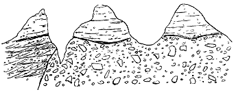
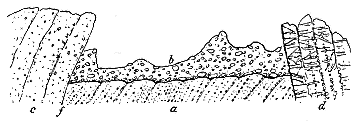
Again, in the largest of the vents, that near Scarlet Point, still clearer proof of successive eruptions and dislocations within a volcanic chimney may be noticed. At one point the accompanying section (Fig. 188) has been laid bare by the waves. The oldest accumulation is a fine green granular tuff (a), rudely and faintly arranged in layers inclined at high angles, like the fine materials in many of the vents of the basin of the Firth of Forth. This peculiar stratification, due not to the assortment of - 30 - materials in water, but to the deposition of coarser and finer detritus by successive explosions, and to subsequent slipping or tilting, is a characteristic feature of the detritus which has filled up ancient volcanic funnels. A later explosion from some adjacent part of the same vent has given rise to the discharge of a coarse agglomerate (b), which with blocks sometimes six feet long, overspreads the earlier material. A third detrital accumulation in the same vent, consisting of a firm brecciated tuff (c) with much calcite in its matrix, has been brought down by a slip (f) which cuts across both of the previous deposits. A broad dyke (d) of vesicular diabase (augite-porphyry) traverses the vent, and is probably later than any of the other rocks in the section.
I will conclude this account of the Manx Carboniferous volcanic rocks with a brief reference to the intrusive masses which form a prominent feature of the coast-line. From the picturesque headland of Scarlet Point the broad dyke which forms that promontory may be traced for some distance westwards. Several other parallel dykes run in the same direction which, it will be observed, is also that of the chain of vents. It might be said that the vents are, as it were, strung together by a line of dykes. These eruptive masses traverse both the agglomerates and the bedded tuffs. They probably belong, therefore, to a comparatively late part of the volcanic history. That they are truly intrusive and not lava-flows is, I think, clearly shown by their vertical walls which descend through the surrounding rocks, and by the greater closeness of their texture, as well as the diminution in the size of their vesicles along the contact surfaces. But it must be admitted that in their remarkably developed vesicular structure they look more like streams of lava than ordinary dykes.
It is this structure which gives to these dykes their peculiar interest. Bands of vesicles, from an inch or less to several inches in breadth, run along the dykes parallel to the outer walls. Unlike the familiar rows of little amygdaloidal cells in ordinary basalt dykes, such as those of the Tertiary series in Scotland, these vesicles, though small and pea-like in the narrower bands towards the margins of the dykes, became so large, numerous, and irregular in the broader and more central bands, that the rock passes there into a rough slag.
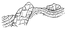
While the intrusive material has for the most part risen in the form of dykes, in one part of the coast-section, a little to the west of Scarlet Point, it has been injected as a sill among the bedded tuffs.[58] A section taken at this locality gives the structure represented in Fig. 189. On the north side of the great dyke, the strata of tuff which dip under it, roll over and support an outlying sheet of the same material. The slaggy structure of parts of this sill give - 31 - it some resemblance to a true lava-flow. But it is the same structure which can be seen in the dykes, while the closer grain along the contact-surface further connects it with these intrusions.
[58] It is this sheet which has been described as a lava-stream.
Fig. 190.—Section on south side
of vesicular sill
west of Scarlet Point. |

Fig. 191.—Bands of vesicles in
the same sill.
|
There is, however, a peculiarity about the development of the vesicular structure in this sill which I have not observed anywhere else. If we examine the southern side of the crag near its eastern end we observe that the successive bands of vesicles are arranged in the same direction as the surface of contact with the underlying tuffs, precisely as they are ranged in dykes parallel to the bounding walls. So far the structure is quite normal. But, moving a few yards westwards, we find that the bands begin to curve, and, instead of following the contact surface, strike it first obliquely and then at right angles, until we have the structure shown in Fig. 191. The bands here vary from less than an inch to more than a foot in breadth, and where broadest assume a slaggy texture. I sought in vain for any evidence of subsequent disturbance such as might have truncated these parallel rows of vesicles and pushed the rock bodily over the tuffs. The perfect parallelism of the bands with the surface of the tuff at the east end, and the absence of all trace of a thrust-plane at the base of the sill, seem to show that, though the rows of vesicles were undoubtedly at first arranged parallel to the surfaces between which the intrusion took place, the mass, before completely consolidating and coming to rest, was ruptured, and a portion of it was driven onwards at right angles to its previous line of movement.
A consideration of the singularly slag-like structure of the injected masses in the tuffs and agglomerates leads to the conclusion that though what we now see of these rocks did not actually flow out at the sea-bottom in streams of lava, it was intruded so close to the surface that the imprisoned vapours had opportunity to expand, as in superficial outflows.[59] This inference is in accord with that derived from an examination of the necks, wherein we find evidence of the probable survival of parts of the actual craters and volcanic cones.
[59] As illustrative of the occurrence of the vesicular structure in superficial intrusions, I may again cite the dyke which cuts the ash of the outer crater-wall of the Puy de Pariou in Auvergne. The andesite of this dyke is in places as vesicular as the lava-stream with which it was doubtless connected, but the vesicles have been flattened and drawn out parallel to the walls of the dyke. In this instance it is quite certain that there could never have been any great depth of detrital material above the fissure into which the material of the dyke was injected (see vol. i. p. 66).
- 32 -
As the records of the earliest eruptions during the Carboniferous Limestone period in the district of the Isle of Man are concealed, so also those of the last of the series lie under the sea. Where the highest visible tuffs overlie the Poyll Vaaish limestones they show no change in the nature of the materials ejected, or in the energy of eruption. They lie so abruptly on the dark calcareous deposits as to show that a considerable pause in volcanic activity was followed by a violent explosion. The same abundant grey-green pumice, the same kind of loose crystals of felspar, the same type of lava-blocks and bombs as had characterized the foregoing eruptions remained as marked at the end. But the further volcanic records cannot be perused, and we are left to speculate whether the coast-sections reveal almost the whole chronicle, or if they merely lay before us the early chapters of a great volcanic history of which the main records lie buried under the waves of the Irish Sea.
Various limited outcrops of igneous rocks have long been known to occur in the eastern part of Somerset. The largest of these lies in the midst of the Old Red Sandstone, on the crest of the axis of the Mendip Hills, between Downhead and Beacon Hill. Smaller patches occur in the Carboniferous Limestone near Wrington Warren, on the north side of Middle Hope, on Worle Hill and at Uphill. These rocks have been mapped as intrusive, though some of them have been described as conglomeratic or as volcanic breccias. While some of the masses are probably intrusive, others appear to be truly contemporaneous with the deposition of the Carboniferous Limestone. The highly vesicular basalt of Middle Hope looks much more like a superficial lava than an intrusion. Mr. Aveline gave a section showing three alternations of limestone and "igneous rock" at Middle Hope. A recent examination of that coast-line by Mr. A. Strahan shows that there are undoubted tuffs interstratified with the calcareous strata. There is thus proof that one or more small volcanic vents were in eruption on the floor of the Carboniferous Limestone sea in the neighbourhood of Weston-super-Mare.[60]
[60] See Geological Survey Memoir "On East Somerset," by H. B. Woodward, 1876, and authorities there cited. Mr. Aveline's section above referred to will be found on p. 22.
The change from the typical Old Red Sandstone of South Wales to the Devonian system of Devonshire, to which I have already referred, is hardly more striking than the contrast between the Carboniferous formations of these two areas.[61] The well-marked threefold subdivisions of Carboniferous Limestone, Millstone Grit and Coal-measures, so persistent throughout Britain, and nowhere more typically developed than in South Wales, are - 33 - replaced in a distance of less than forty miles by the peculiar "Culm-measures" of Devonshire—a series of black shales, grey sandstones and thin limestones and lenticular seams of impure coal (culm), which are not only singularly unlike in original characters to the ordinary Carboniferous formations, but have been made still more unlike by the extensive and severe cleavage to which the Palæozoic rocks of Devon and Cornwall have been subjected. That these Culm-measures are truly Carboniferous is made abundantly clear by their fossil contents, though it has not yet been possible to determine how far they include representatives of the great stratigraphical subdivisions in other parts of the country.
[61] In the centre of England numerous outlying areas of igneous rocks are found in the Carboniferous Limestone, Millstone Grit and Coal-measures. These will be considered by themselves in Chap. xxxii.
It is to De la Beche that geology owes the first intimation of the occurrence of interstratified igneous rocks in the Carboniferous series of Devonshire. As far back as the year 1834, in his singularly suggestive treatise, Researches in Theoretical Geology, this eminent geologist expressed his opinion that not only were the "trappean" bands regularly intercalated in the sedimentary series and continuously traceable with the general stratification, but that they occurred at various localities in such a manner as to raise the suspicion that these points may mark some of the centres of eruption. He particularly cited the example of Brent Tor as a remarkable volcanic-looking hill, composed in part of a conglomerate "having every appearance of volcanic cinders."[62]
In his subsequently published Report on the Geology of Cornwall, Devonshire and West Somerset, De la Beche dwelt in more detail on the results of his study of these rocks, which he had traced out on the ground and expressed upon the maps of the Ordnance Geological Survey.[63] Hardly any additions have since been made to our knowledge of the field-relations of the rocks. It is to the maps and Report of De la Beche that we must turn for nearly all the published information on the subject. I shall therefore give here a summary of what can be gathered from these publications.
[63] Sheets 22, 23, 24, 25, 30, 31, 32 and 33.
In tracing the limits of the Culm-measures, De la Beche found that no well-defined line could be drawn between these strata and the "grauwacke" or Devonian formations underneath. The Carboniferous series lies in a great trough, of which the axis runs nearly east and west, so that the lowest members of the series rise along the northern and southern margins. But De la Beche was struck with one remarkable contrast between the two opposite sides of the trough—a contrast which marks the Devonian as well as the Carboniferous formations of this region. On the south side an abundant and persistent group of intercalated bands of igneous, or as he called them, "trappean," materials can be followed along the whole line of boundary, while no such group occurs on the north side. He found these bands to be lenticular, traceable sometimes for a number of miles, then dying out and reappearing on the same or other horizons. He mapped them the whole way from Boscastle on the west to near Exeter on the east, and found that though the individual sheets might be short, the - 34 - trappean zone was continuous as far as the southern margin of the Carboniferous series could be seen, except where it had been broken through by the great granitic mass of Dartmoor. He ascertained that the intercalated trappean rocks are not confined to the Culm-measures, but occur also in the contiguous portions of the "grauwacke" or Devonian system.
But further, he clearly recognized that the bands of igneous material which he mapped included both "greenstones," together with other varieties of massive eruptive rocks, and also volcanic ash or tuff, though he did not attempt to separate these out upon the maps, but contented himself with representing them all under the same colour. He admitted that some doubt might be entertained as to the age of the greenstones, for some of them might be intrusive and therefore later than the sedimentary deposits between which they lie. But he contended that there could be no uncertainty with regard to the trappean ash or tuff, which being regularly interstratified in the Carboniferous series, must be contemporaneous with it. He pointed out that many of the greenstones, as well as fragments in the conglomerates or ashes, were highly vesicular and must originally have been in the condition of pumice.
As an illustration of the centres of eruption from which these materials were ejected, De la Beche drew special attention once more to the conspicuous eminence of Brent Tor and the rocks in its neighbourhood. His remarks on this subject are well worthy of being quoted—"The idea that in the vicinity of Brent Tor a volcano has been in action, producing effects similar to those produced by active volcanoes, forcibly presents itself. That this volcano projected ashes, which, falling into adjacent water, became interstratified with the mud, silt and sand there depositing, seems probable. That greenstones and other solid trappean rocks constituted the lavas of that period and locality, here and there intermingled with the ash, appears also a reasonable hypothesis. Upon the whole there seems as good evidence as could be expected that to the north and north-west of Tavistock, ash, cinders and liquid melted rocks were ejected and became intermingled with mud, silt and sand during this ancient geological epoch, corresponding with the phenomena exhibited in connection with volcanoes of the present day, more particularly when they adjoin or are situated in the sea, or other waters where ejected ashes, cinders and lava can be intermingled with ordinary mud, silt and sand."[64]
It remains for some future observer to fill up the outlines thus sketched by De la Beche, by tracing the respective areas of lavas and tuffs, distinguishing the various petrographical types, separating the intrusive from the interstratified sheets, identifying the necks and bosses that may mark centres of eruption, and expressing these various details upon maps on a sufficiently large scale.
A serious difficulty in this research arises from the effect of the profound alteration which has been produced on the igneous rocks by the cleavage of - 35 - the region. Many of the "greenstones" have been so cleaved as to become slaty or almost schistose. De la Beche recognized this change and wrote of the "schistose trappean ash." A result of this metamorphism has been to impart to rocks originally massive the same fissile structure as the adjacent slates possess; and in this condition it is often hardly possible to distinguish between "greenstone" and fine-grained "ash." There can indeed be little doubt that among these Carboniferous volcanic rocks, as we have seen to be the case with those of the Devonian system in the same region, many lavas or sills have been mapped as tuffs.
The chief additions to our knowledge of the Carboniferous volcanic group of Devonshire since the time of De la Beche have been made by Mr. F. Rutley, Mr. W. A. Ussher and General M'Mahon. Mr. Rutley[65] has endeavoured to trace the respective areas occupied by the different varieties of volcanic rocks in the district around Brent Tor, near Tavistock, and to show the probable connection of the successive bands of lavas and tuffs with a central vent of discharge situated at that hill. He believes that these bands occur on four different horizons in the sedimentary series. He has studied the microscopic structure of the rocks, which in his view include "amphibolites, gabbros, basalts, pitchstones and schistose ashes, or clastic rocks of a doubtful nature."[66]
[65] "The Eruptive Rocks of Brent Tor and its Neighbourhood," Mem. Geol. Surv. 1878. "On the Schistose Volcanic Rocks occurring on the west of Dartmoor, with some Notes on the Structure of the Brent Tor Volcano," Quart. Journ. Geol. Soc. xxxvi. (1880), p. 286.
[66] "The Eruptive Rocks of Brent Tor," p. 45.
Mr. Ussher has re-mapped the tract of Culm-measures on the east side of the Dartmoor granite, besides visiting some of the other areas outside of the granite mass. While confirming the general accuracy of De la Beche's survey, he has been able to improve the mapping by inserting more detail, separating especially the tuffs from the "greenstones." The latter have been found by him to be mostly dolerites, some of which, from their parallelism the bands of tuff, may be in his opinion contemporaneous lavas, though the majority of them are evidently intrusive. The tuffs are regularly interstratified among the Culm-measures, their most important band in this district having an average breadth of about 100 yards, and being traceable for at least two miles, possibly considerably further.[67] In going over this tract with Mr. Ussher I was led to regard many of the sheets of diabase (dolerite) or gabbro as true sills and bosses. Most of them occur as short lenticular or oval patches tolerably numerous, but not traceable for more than a short distance, though a connection may often exist which cannot be detected by the scanty evidence on the surface. One sheet which has been followed by Mr. Ussher from Combe to beyond Ashton, a distance of nearly two miles, presents in the centre a somewhat coarsely crystalline texture which rapidly gives way to a much closer grain, and the rock then becomes highly vesicular. It is overlain with dark Culm-shales and bands of fine shaly tuff, passing upward into a granular tuff. Some layers of this tuff assume a finely - 36 - foliated appearance by the development of pale leek-green folia, which show slickensided surfaces parallel with the bedding. The rock then presents one of the usual appearances of schalstein. This structure seems obviously due to mechanical movement along the planes of stratification.
[67] "The British Culm-measures," Proc. Somerset Archæol. and Nat. His. Soc. xxxviii. (1892), p. 161.
Bands of black chert and cherty shale are interpolated among the tuffs, which also contain here and there nodular lumps of similar black impure earthy chert—an interesting association like that alluded to as occurring in the Carboniferous volcanic series of the Isle of Man, and like the occurrence of the radiolarian cherts with the Lower Silurian volcanic series already described.[68]
[68] Cherts containing numerous species of radiolaria have recently been found by Dr. Hinde and Mr. Howard Fox to form an important part of the Lower Culm-measures of Devonshire, Quart. Journ. Geol. Soc. vol. li. (1895), p. 609.
The volcanic belt in the valley of the Teign can be followed for about two miles. It is undoubtedly interstratified among the dark Culm-measures, which are distinctly seen dipping under and overlying it.
General M'Mahon has recently shown what may be done by careful and detailed examination of the ground broadly sketched in by De la Beche. He chose for study a strip of "greenstone" shown on the Geological Survey Map to extend for about three and a half miles along the north-west margin of the Dartmoor granite. He has found that what is represented under one wash of colour on that map includes both tuffs and lavas. The tuffs, in spite of the alteration which they appear to have undergone from the proximity of the great granite mass, are found by microscopic investigation to be made up of fine volcanic dust containing minute lapilli of various lavas. Sometimes as many as six or seven different kinds of lava may be represented in the same microscopic slide. These include felsitic or rhyolitic and trachytic rocks together with fragments of dark glassy lava full of magnetite dust. With the tuffs are intercalated sheets of felsite and trachyte. In the same district coarse volcanic agglomerate occur, made up of blocks of different lavas and pieces of different sedimentary rocks.[69]
[69] Quart. Journ. Geol. Soc. vol. l. (1894), p. 338.
These observations are of special interest, inasmuch as they point to the eruption of a much more acid series of volcanic lavas and tuffs than had previously been known to exist in the Culm-measures. Until the ground has been more accurately mapped, it is impossible to say whether these rocks are older or younger than those that lie around Brent Tor, a few miles to the south-west. General M'Mahon has noted the presence of more basic eruptive rocks in the same district. He specially cites the occurrence of mica-diorite, of basaltic lavas altered into a serpentinous mass, and of a dolerite which may possibly mark the actual vent of the old Brent Tor volcano. His observations on the influence of the Dartmoor granite in inducing new mineral rearrangements in the igneous rocks of the Culm-measure series are full of interest.
- 37 -
King's County—The Limerick Basin—The Volcanic Breccias of Doubtful Age in County Cork.
Although the Carboniferous system spreads over by far the larger part of the surface of Ireland, and is laid bare in many thousands of natural and artificial sections, it displays undoubtedly contemporaneous igneous rocks, so far as at present known, at only one locality—the region around Limerick. A second district, however, lies in King's County, where some vents occur which may be of Carboniferous age, and of which a description will be given in the following pages. That the relics of volcanic action should be so few, while the exposures of the Carboniferous formations are so numerous and so completely disclose the geological history of the whole system, must be regarded as good evidence that while volcanoes abounded and continued long active in Scotland and in parts of the Centre and South-west of England, they hardly appeared at all in Ireland. It is worthy of remark, also, that the Irish eruptions belong to the time of the Carboniferous Limestone—a period distinguished by volcanic activity in Scotland and England—that the nature of the materials erupted bears a close resemblance to that of the lavas and tuffs of the sister island, and that the manner of their eruption finds a close counterpart in the Puy-eruptions, already described.
In the progress of the Geological Survey several small tracts of "greenstone ash" and "greenstone" were mapped within an area of a few square miles lying to the north of Philipstown. These igneous rocks were shown to form Croghan Hill, which, rising into a conical eminence 769 feet above the sea, and some 450 feet above the general level of the great limestone plain around it, forms the only conspicuous feature in the landscape for many miles. In the maps and their accompanying Explanations, the "greenstones" are treated as intrusive masses, but the "greenstone ash" or breccia appears to have been regarded as interstratified in the Carboniferous Limestone, - 38 - though the admission is made that "from the scanty exposures of the rocks and the total absence of any connected section, it has been found impossible to arrive at any definite conclusion as to the relations existing between these traps and ashes with regard to each other or to the surrounding limestone."[70]
[70] See Sheets 109 and 110 of the Geological Survey of Ireland and Explanation to accompany Sheets 98, 99, 108 and 109, by F. J. Foote and J. O'Kelly (1865), pp. 7-18.
In the course of a brief visit to this locality I did not succeed in obtaining any certain proof of the age of the igneous rocks, but I found their structures to be more varied and interesting than would be inferred from the way in which they have been mapped, and I came to the conclusion that the strong balance of probability was in favour of regarding them as of the age of the Carboniferous Limestone.
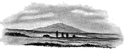
The first and most important fact to be announced regarding the district is that it includes a group of volcanic necks which rise through the Carboniferous Limestones. The chief of these forms Croghan Hill. It is nearly circular in ground-plan, and measures about 4000 feet in diameter from the limestone on one side to that on the other. It rises with steep grassy slopes out of the plain, the naked rock projecting here and there in crags and low cliffs. Its general outward resemblance to the Carboniferous necks of Scotland strikes the eye of the geologist as he approaches it (Fig. 192).
But Croghan Hill, though the chief, is not the only vent of the district. It forms the centre round which a group of subsidiary vents has been opened. These form smaller and lower eminences, the most distant being one and a half miles E.S.E. from the summit of Croghan Hill, and measuring approximately 1200 feet in its longest and 800 feet in its shortest diameter.
That the igneous materials of these necks really break through the limestones may be clearly seen in several sections. Thus by the roadside at Gorteen, on the south-western side of Croghan Hill, the limestones have been thrown into a highly inclined position, dipping towards the east at 60° or more, and their truncated ends abut against the side of the neck. Again, on the eastern side of the same hill the limestones have been much - 39 - disturbed close to the margin of the neck, sometimes dipping towards the volcanic centre, and sometimes striking at it. Among these strata a small neck of breccia, of which only a few square yards are visible, rises close to the edge of the bog that covers the adjacent part of the great plain.
The material which chiefly forms these necks is one of the most remarkable breccias anywhere to be found in the volcanic records of the British Isles. The first feature noticeable in it is the pumiceous character of its component fragments. These consist of a pale bluish-grey basic pumice, and are generally about the size of a hazel-nut, but descend to mere microscopic dust, while sometimes exceeding a foot in length. They are angular, subangular and rounded. Occasionally they stand out as hollow shells on weathered surfaces, and in one instance I noted that the vesicles were flattened and drawn out parallel to the surfaces of the shell, as if deformed by gyration, like a true bomb.
The breccia remains singularly uniform in character throughout all the necks. Its basic pumice presents much resemblance to that so characteristic of the Carboniferous necks of Scotland, Derbyshire and the Isle of Man. The abundant vesicles are generally spherical, and as they have been filled with calcite or chlorite, they look like small seeds scattered through a grey paste. Though I broke hundreds of the lapilli, I did not notice among them any volcanic rock other than this pumice. I am not aware of any other neck so homogeneously filled up with one type of pyroclastic material, and certainly there is no other example known in the British Isles of so large and uniform a mass of fragmentary pumice.
Limestone fragments are not uncommon in this breccia. They resemble the strata around the vents. Pieces of the adjacent cherts may also be observed. In one or two cases, the limestone fragments were found by me to have an exceptionally crystalline texture, which may possibly indicate a certain degree of marmarosis, but on the whole there is little trace of alteration.
The fragments of pumice in the breccia are bound together by a cement of calcite. In fact the rock is, so to speak, saturated with calcareous material, which, besides filling up the interstices between the lapilli, has permeated the pumice and filled up such of its vesicles as are not occupied by some chloritic infiltration.
I did not observe unmistakable evidence that any part of the breccia is stratified and intercalated among the limestones, nor any vestige of ashy material in these limestones. But it is possible that traces of such interstratification may occur in the low ground to the north-west of Croghan Hill, which I did not examine.
In only two places did I notice even a semblance of the intercalation of limestone in the breccia. One of these is at Gorteen, where a band of limestone strata a few feet thick is underlain and overlain by breccia. But though the superposition of the layers of finely stratified dark limestone and chert on the breccia is well seen and thoroughly defined, no lapilli or ashy material are to be seen in the limestone. Detached pieces of similar limestone - 40 - and chert occur in the breccia. The band of stratified rock, if in situ, may be a tongue projecting from the wall into the body of the neck, like some instances already cited from Scotland, but more probably it is really a large included mass lying within the vent itself. The breccia here as elsewhere is entirely without any trace of stratification. The second locality occurs at the most easterly neck north of Coole House, where the limestones, rapidly undulating, seem at last to plunge below the breccia, which shows a series of parallel divisional planes suggestive of bedding. But these may be only joint-structures, for there is no stratification of the component materials of the rock.
In the necks, and also through the limestone surrounding them, masses of eruptive rock have been intruded as irregular bosses and veins. The material of these intrusions presents little variety, and, so far as I could note, gives no indication of the successive protrusion of progressively different lava. It varies from a deep blue-black fine-grained basalt to a dolerite where the plagioclase is distinct. Some portions, however, are more basic and pass into limburgite. Externally there is nothing worthy of special remark in these rocks unless it be their prevalent amygdaloidal structure. The amygdales, generally of calcite, vary from small pea-like forms in the basalts up to kernels half an inch long or more in the dolerites. From a microscopic examination Mr. Watts found that some of the basalts have a base of felspar and augite rich in brown mica, and that their porphyritic felspars enclose idiomorphic crystals of augite.
Perhaps the most noticeable feature in these later parts of the volcanic series is the occurrence in them at one locality in Croghan Demesne of lumps of a highly crystalline material quite distinct from the surrounding rock. These enclosures vary from an inch or two to a foot or more in diameter. They must be regarded as blocks which have been carried up in the ascent of the basic lava. Their composition has been ascertained by Mr. Watts from microscopic examination to be somewhat singular. One specimen "contains relics of garnets, surrounded by rings of kelyphite, imbedded in a mosaic of felspar, with a mineral which may possibly be idocrase." Another specimen from the same locality (south-east from Gorteen) "contains the relics of garnets preserved as kelyphite, set in a matrix of quartz-grains, much strained, and containing a profusion of crystals of greenish-yellow or red sillimanite. This appears to be a metamorphic rock, and may be a fragment of some sediment enclosed in the igneous rocks."[71]
[71] Guide to the Collections of Rocks and Fossils belonging to the Geological Survey, in the Museum of Science and Art, Dublin (1895), pp. 38, 39.
As regards the history of volcanic action in Britain one of the chief points of interest connected with these Irish breccias and lavas relates to their geological age. As no proof has been produced that any portion of them is contemporaneously interstratified in the Carboniferous Limestone which surrounds them, we cannot definitely affirm that the volcanic eruptions which they record took place during the accumulation of that - 41 - formation. The vents must, of course, be later than that portion of the limestone which they pierce. But the evidence seems to me to be on the whole most favourable to the view that they are of Carboniferous Limestone age, for the following reasons:—
1. The breccias of Croghan Hill do not present a resemblance to any of those belonging to the Tertiary volcanic series in Antrim or the Inner Hebrides. The possibility of their being of Tertiary age may therefore be dismissed from consideration.
2. There are no known Permian volcanic rocks in Ireland. Nor does the Croghan Hill breccia show any resemblance to the ordinary material of the breccias in the Permian necks of Scotland. It is thus not likely to be of Permian age.
3. The peculiar basic pumice of these Croghan Hill vents has many points in common with the palagonite fragments so abundant among the volcanic breccias and tuffs of Carboniferous age in Scotland, Derbyshire, and the Isle of Man, and which occurs also among the Carboniferous tuffs of the Limerick basin. It differs from the general type of the material in its pale colour, in its uniformity of character, in its calcareous cement, and above all in its vast preponderance over all the other materials in the breccia.
4. The saturation of the Croghan Hill breccia with calcite is a singular feature in the composition of the rock. Had the vents been opened long subsequent to the deposition of the Carboniferous Limestone, it is difficult to understand how this calcite could have been introduced. Mere percolation of meteoric water from the adjacent limestone does not seem adequate to account for the scale and thoroughness of the permeation. But if the vents were opened on the floor of the Carboniferous Limestone sea, it is intelligible that much fine calcareous silt should have found its way down among the interstices of the breccia and into the pores of the pumice which, being caked together within the vent, did not all float away when the sea gained access to the volcanic funnel. The effect of subsequent percolation would doubtless be to carry the lime into still unfilled crevices, and to impart to the cement a crystalline structure similar to that which has been developed in the ordinary limestones.
About 70 miles to the south-west of the area just described lies the most compact, and, for its size, one of the most varied and complete, of all the Carboniferous volcanic districts of Britain (Map I.). It takes the form of an oval basin in the Carboniferous Limestone series near the town of Limerick, about twelve miles long from east to west and six miles broad from north to south. Round this basin the volcanic rocks extend as a rim about a mile broad. A portion of a second or inner rim, marking a second and higher volcanic group, partially encloses a patch of Millstone Grit or Coal-measures, which lies in the heart of the limestone basin. (See the section in Fig. 196.)
- 42 -
But it is evident that, as the denuded edges of the volcanic sheets emerge at the surface all round the basin, the present area over which these rocks extend must be considerably less than that which they originally covered. Some indication of their greater extension is supplied by outliers of the bedded lavas and tuffs, as well as by bosses which doubtless indicate the position of some of the eruptive vents. The distance between the furthest remaining patches is 24 miles. The original tract over which the volcanic materials were spread cannot have been less than 24 miles long by 10 miles broad. If we assume its area to have been between 250 and 300 square miles we shall probably be under the truth.
This volcanic centre made its appearance on the floor of the Carboniferous Sea in the same district which had witnessed the eruptions of Upper Old Red Sandstone time. The two visible vents that crown the Knockfeerina and Ballinleeny anticlines (Chapter xxii.), are only some ten miles distant, and there may be others of the same age even under the Limerick basin. This district thus supplies another instance of that recurrence of volcanic energy in the same area, after a longer or shorter geological interval, which stands out as a conspicuous feature in the history of volcanic action in Britain. That a prolonged interval elapsed between the extinction of the Old Red Sandstone volcanoes and the outbreak of their successors during the accumulation of the Carboniferous limestone series, may be inferred from the thickness of strata which separate their respective tuffs. From the published sections of the Geological Survey there would appear to be about 500 feet of Old Red Sandstone above the volcanic series of that formation. Then comes the Lower Limestone shale, which is computed to be about the same thickness. From the scarcity of observable dip among the Lower Limestones and their variable inclination, it is not easy to form any satisfactory estimate of the depth of this group up to the base of the volcanic series. It may be as much as 800 feet,[72] and if so there would thus intervene a mass of sedimentary material nearly 2000 feet in thickness between the two volcanic platforms. Throughout this thick accumulation of stratified deposits no trace of contemporaneous volcanic activity has been detected. From the descriptions published more than thirty years ago by Jukes and his colleagues in the Geological Survey of Ireland, geologists learnt how full and interesting are the proofs of great volcanic activity contemporaneous with the deposition of the Carboniferous Limestone series in the Limerick district.[73] Nowhere, indeed, is the evidence - 43 - more complete for the occurrence of a long succession of volcanic eruptions during a definite period of geological time. The officers of the Survey showed that two epochs of activity during the older part of the Carboniferous period were each marked by a group of tuffs and lavas, while the interval of quiescence between them is represented by a thousand feet of limestone. The same observers likewise mapped outside the volcanic ring a number of eruptive bosses, which they regarded as probably marking some of the actual vents of that time.
[72] This is the thickness given in the Explanation to Sheet 144 of the Geological Survey of Ireland, p. 8. A still greater thickness is claimed in Explanation to Sheet 154, p. 8.
[73] See especially Explanations of Sheets 143, 144, 153 and 154, Geol. Surv. Ireland (1860, 1861). The geology of the district had been previously noticed by earlier observers, to whose writings reference is made on p. 26 of the Explanation of Sheet 144. See also Jas. Apjohn, Journ. Geol. Soc. Dublin, vol. i. (1832), p. 24; Prof. Hull, Geol. Mag. for 1874, p. 205. Jukes (Student's Manual of Geology, 2nd edit. 1862, p. 325) gave subsequently an excellent epitome of the volcanic history. The microscopic structure of some of the Limerick volcanic rocks has been described by Mr. Allport, Quart. Journ. Geol. Soc. vol. xxx. (1874), p. 552, and by Prof. Hull, Geol. Mag. for 1873, p. 153. See also Mr. Watts' account of these rocks in the Guide to the Collections of Rocks and Fossils (Dublin, 1895), p. 93.
The lower volcanic group, which forms a complete ring round the Upper Limestones of the Limerick basin, is estimated to reach a thickness of 1000 feet in some parts of its course.[74] Its base appears to coincide generally with the upward termination of the Lower Limestone group of this district, though here and there small patches of volcanic rocks in that group have been regarded as interstratified and contemporaneous bands.[75] It consists of a series of lavas and tuffs, the alternations and rapid incoming and dying out of which were well made out by the Geological Survey.
[74] Explanation of Sheet 144, p. 27.
[75] Some of them, however, have characters that rather seem to place them with the intrusive materials of the district, and therefore not necessarily earlier than the bedded lavas and tuffs. The boundary line of the volcanic series is not consistently followed along the same horizon on the Survey maps. Thus to the east of Caherconlish, a strip of the Upper Limestone is inserted below the base of the tuffs for a distance of about four miles. Unless a different horizon has been in some places taken for the boundary between the two groups of limestones, it would appear that the eruptions had not extended over the north and north-east of the district until some time after the deposition of the Upper Limestone had begun. The division between the two limestone groups is taken at a set of chert-bands, but as these are not constant it is sometimes difficult to draw a satisfactory line of division.
Tuffs.—The base of the volcanic series is generally formed by a band of tuff sometimes as much as 350 feet thick,[76] which may be traced nearly continuously round the basin as well as in detached outliers even as far as Carrigogunnel overlooking the alluvial plain of the Shannon. The manner in which the bottom of this tuff is interstratified with the limestone below it may be instructively examined in many quarries around the town of Limerick. Striking evidence is there supplied that the first eruptions were comparatively feeble and spasmodic, and were separated by intervals of longer and shorter duration, during which the limestone with its fragmentary organisms was deposited, little or no volcanic detritus falling at that time. Yet even in some of the limestones the microscope reveals fine broken needles of felspar, representing doubtless the finest ejected dust.[77]
[76] Explanation of Sheet 154, p. 21.
[77] For the details of the microscopic structure of the Limerick volcanic rocks I am mainly indebted to the examination of them made for me by my Survey colleague, Mr. W. W. Watts.
As an illustration of the way in which the volcanic and organic detritus alternated over the sea-floor, the following section from a quarry in the townland of Loch Gur on the southern side of the basin is here given:[78]—
[78] Explanation of Sheet 154, pp. 21, 22.
- 44 -
| Cherty limestone more than | 20 | feet | 0 | in. |
| Decomposed green tuff | 2 | " | 6 | " |
| Bluish-green, calcareous laminated tuff | 4 | " | 0 | " |
| Limestone, slightly ashy | 1 | " | 8 | " |
| Green tuff | 0 | " | 2 | " |
| Fine-grained decomposed tuff | 0 | " | 4 | " |
| Green tuff, obliquely laminated | 1 | " | 7 | " |
| Fine laminated tuff | 0 | " | 8 | " |
| Green compact tuff | 1 | " | 8 | " |
| Obliquely laminated shaly tuff | 0 | " | 10 | " |
| Concretionary ashy limestone | 1 | " | 4 | " |
| Compact ashy limestone | 2 | " | 0 | " |
| Green shaly tuff, much weathered | 0 | " | 5 | " |
| Ashy limestone | 0 | " | 7 | " |
| Compact green tuff more than | 4 | " | 0 | " |
| 41 | feet | 9 | in. |
The tuffs which in the southern part of the basin underlie the less basic lavas differ in some respects from those which further north are associated with the Upper Limestones. They are green, sometimes dull purplish-red, finely granular rocks, made up in large part of andesitic debris. They are full of loose felspar crystals, minute, somewhat rounded and subangular lapilli of andesite or some less basic lava, together with bits of grit and baked shale. Though generally much decomposed, they are sometimes compact enough to be used for building-stone. Under the microscope these tuffs are seen to abound in andesite-lapilli, with a few pieces of felsitic rocks enclosed in an opaque base, through which are scattered broken felspars and occasional vesicular lapilli.
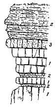
The tuffs around Limerick, interbedded with the Black (Upper) Limestone, are distinguished by a scarcity of andesitic debris, by their persistent dull greenish-grey colour, and more particularly by the abundance of minute lapilli and larger fragments of an epidote-green, finely vesicular, easily sectile basic pumice. Under the microscope much of this material is found to be an altered basic glass of the nature of palagonite. These tuffs are in evident relation with the more basic lavas that accompany them. The manner in which they alternate with the black limestone shows that the conditions for the eruption of this more basic detritus continued to be very similar to those that existed when the andesitic tuffs were ejected. As a good illustration of this feature the accompanying section (Fig. 193) is given from a quarry on the side of the high-road between Limerick and Annacotty. The total depth of strata here represented is about 15 feet. The black limestone at the bottom is a tolerably pure calcareous rock. It is divided into bands by thin partings of a fine greenish calcareous tuff, each marking a brief discharge of ashes from some neighbouring - 45 - vent. Half-way up the succession of strata, the ashy material rapidly increases until it usurps the place of the limestone, though its calcareous composition shows that the accumulation of calcareous sediment had not been entirely suspended during the eruption of ash.
Among these tuffs I have noticed fragments of fine, dark, flinty felsite, grit and other rocks. The stones are for the most part small, but vary up to blocks occasionally a foot in diameter.
Lavas.—The lavas occur in numerous sheets, sometimes separated by thin partings or thicker beds of tuff and volcanic conglomerate. On the northern rim of the basin Mr. G. H. Kinahan has described the volcanic series east of Shehan's Cross-roads as composed of six zones of tuff, each bed varying from about 50 to 250 feet in thickness, alternating with as many sheets of lava ranging from 27 to 180 feet in thickness, the total depth of tuff being estimated at nearly 500 feet and that of the lavas at about 800 feet.[79] Some of these tuffs are coarse conglomerates or agglomerates, with blocks of lava occasionally 10 feet long.
[79] Explanation of Sheet 144, p. 28.
Some of the lavas in the lower volcanic group are andesites quite like those of the plateau series in the Carboniferous system of Scotland. Externally they appear as dull reddish-brown or purplish-red compact rocks, with abundant porphyritic felspars scattered through the fine-grained base. They are generally much decomposed, showing on a fresh fracture pseudomorphs of chlorite, hæmatite and calcite after some of the minerals, with abundant hæmatitic staining through the body of the rock. Amygdaloidal structure is commonly developed.
These andesites, when examined microscopically, were found by Mr. Watts to present the characteristic base of minute felspar-laths with magnetite and enstatite, and with porphyritic crystals, often large, of zoned plagioclase, as well as of ilmenite and hæmatite.
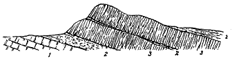
But besides the andesites there occur also, and, so far as I have observed, in larger number, sheets of true basalt. This rock is typically black, exceedingly close-grained in the central portion of each sheet, but becoming highly slaggy and vesicular along the upper and lower parts. Under the microscope it is found to contain granular augite and magnetite, set in a more or less devitrified glass, with microlites of felspar, porphyritic plagioclase, serpentinized olivine, and some well-marked augite. These rocks form distinct escarpments along the northern rim of the basin as in - 46 - the foregoing section east from Shehan's Cross-roads (Fig. 194). From the summit of this ridge, which is about 600 feet above the sea, the eye looks northward over the plain, across which low outliers of the volcanic series are scattered, and southwards across the basin to the corresponding line of volcanic heights forming the southern rim.
The upper volcanic group has been estimated by the officers of the Geological Survey to lie about 1000 feet higher in the Carboniferous system than the lower, the intervening strata consisting of the Upper Limestone.[80] It is possible that the interval is greater in some parts of the district than in others, and if so, the difference may be due either to greater local accumulation of volcanic materials, or to local prolongation of the eruptions into higher stratigraphical horizons. The outcrop of the upper volcanic band forms about half of a ring round the little cup of Millstone Grit or Coal-measures which lies within the volcanic basin. On the north-west side of the cup the volcanic rocks disappear. Hence the upper band has a much more restricted area than the lower. But if the tuffs immediately around Limerick are assigned to the upper group, its extent will be proportionately increased. There can be little doubt, however, that neither in thickness nor in superficial area did the lavas and tuffs of the second group equal those of the first. The volcanic energy was gradually dying out.
[80] Explanation of Sheet 154, p. 24.
The lavas of the second period are characteristic dull, black, compact basalts, like those of the first period, becoming here and there strongly amygdaloidal, and being occasionally separated by slaggy or conglomeratic partings. But they include also certain rocks wherein the felspar diminishes in quantity, while augite and olivine become conspicuous, together with a little enstatite. The augite occurs in large porphyritic forms, as well as of medium size and in small prisms. The olivine, as usual, is now in the condition of serpentine. These rocks are more basic than the ordinary basalts, containing only 38·66 per cent of silica, and thus approaching the limburgites. With these basic lavas are associated dull green tuffs and conglomerates, made up largely of basalt-debris, together with abundant pieces of finely vesicular basic pumice and lapilli of a palagonitic material.
The manner in which the lavas and tuffs have alternated with each other, and also with the limestones, is well seen on Nicker Hill above Pallas Grean.[81] The Survey sections show eight sheets of lava, separated by six bands of tuff and eight intercalations of limestone, the whole passing under the Coal-measures.
[81] See Explanation of Sheet 144, p. 30, where a description with detailed map and sections of this ground will be found.
The upper volcanic group may be as much as 600 or 800 feet thick. It appears to have been left, at the close of the eruptions, with a very uneven surface, some portions being so low as to be overspread with the Upper Limestones, other parts so high as not to be covered until the Coal-measure shales and flagstones came to be deposited.[82]
[82] Explanation of Sheet 154, pp. 24, 35.
- 47 -
Vents.—All round the edges of the Limerick basin, where the escarpments of the volcanic groups, rising abruptly above the plain, show that these rocks once extended beyond their present limits, the progress of denudation has revealed a number of bosses which, as above stated, Jukes and his associates looked upon as marking some of the vents from which the lavas and tuffs were erupted. Especially striking is the line of these vents along the southern margin. The rocks now filling them present some unusual and rather anomalous features. They are decidedly more acid than the lavas of the basin, some of them even containing free quartz. Mr. Watts remarks that "though they have a good deal in common with the trachytes, they are crystalline throughout. They are red granite-looking rocks, which are made up chiefly of stumpy idiomorphic prisms of felspar which is mainly orthoclase. Some plagioclase also occurs, and the two felspars are imbedded in interstitial quartz. A trace of hornblende or mica is frequently present, and the rocks contain about 65 per cent of silica." These characters are specially observable in the necks furthest removed from the basin, which may possibly have been connected with the andesitic outflows. Nearer to the basin the necks "contain about 60 per cent of silica, seldom show any interstitial quartz, and stand between trachytes and porphyrites, some perhaps being bostonites."[83]
[83] Guide to the Collections of Rocks, etc., Geol. Survey, Ireland, p. 93, Dublin 1895.
A geologist, familiar with the Carboniferous and Permian necks of Scotland, has no hesitation in confirming the surmise of Jukes and his colleagues that the cones and domes around the Limerick basin mark the sites of eruptive vents. On the south side of the basin, at least nine such necks rise into view, partly from among the lavas and tuffs, but - 48 - chiefly through the limestones that emerge from below these volcanic sheets. One of the most conspicuous of them, Derk Hill (Fig. 195), rises to a height of 781 feet above the sea, and comes through the bedded andesites, as represented in Fig. 196, which gives, in diagrammatic form, the general structure of the Limerick volcanic basin. Around the northern side of the basin a smaller number of necks has been observed, consisting of similar acid rocks.
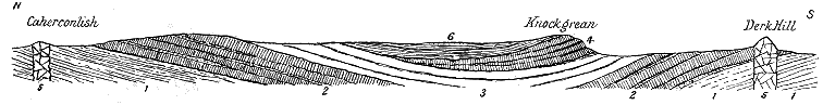
A few of the necks appear to be filled with volcanic agglomerate. Here and there detached patches of fragmental volcanic material have been shown on the Survey maps, and referred to in the Explanations, as if they were outliers of the bedded tuffs; though in some cases the coarseness of their materials and the want of any distinct bedding, together with the absence of any indication of their relation to the nearest limestones, have evidently offered considerable difficulty in their mapping. One of the best examples occurs about two miles to the south-east of the village of Oola. The boundaries of this patch, as put on the map, are confessed to be "entirely speculative." It was only seen on the side of the railway where it appeared as "a very coarse brecciated purple ash."[84]
[84] Explanation of Sheet 154, p. 25.
On comparing the maps of the Limerick basin with those of the Carboniferous districts of Scotland, the main difference will probably be acknowledged to be the absence of any recognizable sills in the Irish ground. That no sills actually occur, I am not prepared to affirm. Indeed some of the more acid rocks, both outside the basin and among the rocks of the older volcanic group, appeared to me during my traverses of the ground to have much of the character of sills. A more critical examination of the area would not improbably detect some truly intrusive sheets which have hitherto been mapped among the interstratified lavas. Some appear to exist among the surrounding Lower Limestones.
An intrusive mass, like a sill or dyke, is represented on the Geological Survey Map as traversing the Coal-measures in the inner basin south of Ballybrood. But as the strata are on end along its southern margin, it may possibly be only a - 49 - portion of the upper volcanic series which has been thrown into its present position by one or more faults.[85]
[85] Sheet 154 and Explanation to the same, p. 24.
In the south-western headlands of Ireland, from Bear Island to Dursey Island, various igneous rocks have been traced on the maps of the Geological Survey. They have been described as consisting of "greenstone," "felstone," and "ash" or "breccia," and as including both interstratified and intrusive masses.[86] If contemporaneous with the strata in which they occur, they would prove the existence of a group of volcanic rocks in the Carboniferous slate, or lowest division of the Carboniferous system. After an examination of the coast-line I came to the conclusion that while there is undoubtedly evidence of former volcanic activity in this part of Ireland, no proof has been obtained that the eruptions occurred in the Carboniferous period. The felsites and dolerites appeared to me to be all intrusive, the former having certainly been injected before the terrestrial movements that have disturbed the rocks, for some of them share very markedly in the cleavage of the region. The dolerites and diabases, on the other hand, so far as I observed, are not cleaved, and are thus probably of later date.
[86] See Sheets 197 and 198 of the Geological Survey of Ireland, and the Explanation of these Sheets by Messrs. Jukes, Kinahan, Wilson, and O'Kelly, 1860.
The most interesting rocks are undoubtedly the "ash" and "breccia," for they are obviously of volcanic as distinguished from plutonic origin. On the coast north of White Bull Head, a bed of volcanic breccia may be seen made up of rounded and angular fragments of different sandstones, shales and limestones, with pieces of felsite and andesite wrapped up in a dull-grey fine-grained sandy felspathic matrix. The rock weathers with a rough or rugged surface, owing to the dropping out of the more decomposable stones. This bed, about five feet thick, runs with the bedding of the strata around it, and like these dips S.S.W. at an angle of 70°. If no other evidence were obtainable, this breccia would be naturally set down as a truly interstratified deposit of volcanic detritus. A short distance from it, a second, rather thicker band of similar material occurs, specially distinguished by its abundant worn crystals of hornblende, sometimes three inches in diameter, as well as large crystals of muscovite. These minerals are not unknown elsewhere in volcanic agglomerates. The occurrence of lumps of augite in the vents of Upper Old Red Sandstone age in Caithness has been already alluded to, and a still larger series of ejected minerals will be shown in a later chapter to characterize the younger necks of Central Scotland.
In parts of its course, this second band appears to run so perfectly parallel with the bedding of the strata between which it lies that the observer would readily believe it to be a part of the same series of deposits, and might therefore regard it as affording good evidence of - 50 - volcanic action contemporaneous with the formation of these deposits. A transverse section of the bed, where thus apparently conformable, is shown in Fig. 197.
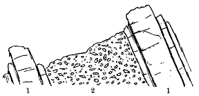
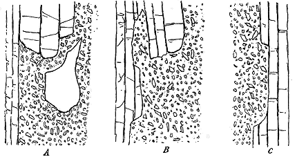
Further examination, however,reveals that this seemingly regular sequence is entirely deceptive. At various points the breccia abruptly truncates the sandstones, and involves large pieces of them, as shown in Fig. 198 A. At other places, the lower side of the breccia, or what would be its base if it were a regular bed, cuts out the strata and sends veins into them (B). And the same structure is visible, on its upper side, or what would be its top (C).
It is clear that these highly-inclined bands of breccia are not contemporaneous with the deposition of the Carboniferous Slate, but have been introduced into their position at some time subsequent not only to the deposition, but to the disturbance and elevation of the strata. The peninsula of White Bull Head is crossed by several other similar bands. On Black Bull Head, also, together with abundant felsitic and doleritic intrusions, a similar breccia or agglomerate is to be seen. In some parts it is compact in texture with spheroidal flinty lumps, and weathers somewhat - 51 - like a nodular felsite. This variety ends off rather abruptly to the north, but swells out southward, and then runs out into a high, narrow headland, in which it contains asbestos, as well as rounded crystals of hornblende. It has here disrupted the shales and sandstones, and near the junction is largely composed of fragments of them, the strata themselves being jumbled, bent, and broken up.
The only semblance of a neck-like mass of this volcanic fragmental material occurs on White Bull Head, where one of the bands expands about the centre of the ridge, and is there full of large blocks of grey sandstone. The breccia appears to have filled fissures which have been opened between the bedding planes of the highly tilted strata, giving rise to long narrow dyke-like intercalations. We have seen that among the Carboniferous volcanic phenomena such dyke-like masses of agglomerate occasionally present themselves in the vents both of the plateaux and the puys.
In one or two places I noticed what may be traces of cleavage in the breccia. The rock is not one that would yield easily to the rearrangements required for the production of this structure, and the doubtful cleavage may be deceptive. If we are justified in regarding the introduction of this volcanic material as having necessarily taken place after the tilting of the strata, we may not unreasonably infer further that the eruptions could only have been effected at no great distance from the surface. But the Carboniferous Slate in which these agglomerates lie is the lowest member of the Carboniferous system. As there is no known unconformability throughout this system in the south of Ireland, the whole of the rest of the pile of Carboniferous strata, amounting to a depth of several thousand feet, once probably extended over this region. It must, therefore, have been not only after the plication, but after extensive denudation of the formations that the fissures were filled with agglomerate. These geological changes no doubt occupied a vast period of time. While, therefore, no positive evidence has yet been gathered to fix the age of these volcanic eruptions of the south-west of Ireland, it is tolerably clear that they cannot be assigned to the Carboniferous period, but must belong to some later volcanic epoch. They may be of Permian age, perhaps even as late as the Tertiary volcanic series.
- 53 -
Geographical Changes at the Close of the Carboniferous Period—Land- and Inland-Seas of Permian time—General Characteristics and Nature of the Materials erupted—Structure of the several Volcanic Districts: 1. Ayrshire, Nithsdale, Annandale; 2. Basin of the Firth of Forth.
The close of the Carboniferous portion of the geological record in Britain is marked by another of those great gaps which so seriously affect the continuity of geological history. No transitional formation, such as in other countries marks the gradation from the Carboniferous into the succeeding period, has been definitely recognized in this country. The highest Carboniferous strata are here separated from all younger deposits by an unconformability, indicating the lapse of vast periods of time whereof, within the British area, no chronicle has been preserved.
When we pass from the Carboniferous system to that which comes next to it in order of time, we soon become sensible that great changes in geography, betokening an immense interval, took place between them. The prolonged subsidence during which the Coal-measures were accumulated, not only carried down below sea-level all the tracts over which the Carboniferous system was deposited, but possibly submerged the last of the islets, which, like those of Charnwood Forest, had survived so many geological changes. Eventually, however, and after what may have been a vast period of quiescence, underground movements began anew, and the tracts of Coal-measures were unequally ridged up into land. The topography thus produced appears to have resulted in the formation of a series of inland seas somewhat like those of the Old Red Sandstone, but probably less in area and in depth. In these basins the water seems to have been on the whole unfavourable to life, for the red sand and mud deposited in them are - 54 - generally unfossiliferous, though, when the conditions became more suitable, calcareous or dolomitic sediment accumulated on the bottom, to form what is now known as the "Magnesian Limestone," and muddy sediment was deposited which is now the "Marl Slate." In these less ferruginous strata, betokening a less noxious condition of water, various marine organisms are met with.[87]
[87] In some recent borings around Hartlepool the Magnesian Limestone has been found to be interstratified with thick bands of gypsum and anhydrite, and to be overlain by more than 250 feet of the latter substance. Nothing could show more forcibly the exceedingly saline and insalubrious character of the Permian lakes or inland seas.
The vegetation of the land surrounding these basins was still essentially Palæozoic in character. It presented a general resemblance to that of Carboniferous time, but with some notable differences. The jungles of Sigillaria seem to have disappeared, while on the other hand, conifers increased in number and variety. The sediments of the water-basins have handed down only a scanty remnant of the animal life of the time. Along the sandy shores walked various amphibians which have left their footprints on the sand. A few genera of ganoid fishes have been found in some of the shales, and a comparatively poor assemblage of crinoids and molluscs has been obtained from the Magnesian Limestone. To the geological period distinguished by these geographical and biological characters the name of Permian is assigned.
In his survey of the progress of volcanic history in the area of Britain, the geologist finds that the long period of quiescence indicated by the deposition of the Coal-measures, and probably also by the unconformability between the Coal-measures and the Permian formations, was at length terminated by a renewed volcanic outbreak, but on a singularly diminished scale and for a comparatively brief period of time. Whether, had the Permo-Carboniferous strata which connect the Coal-measures with the Permian formations on the Continent been found in this country, they would have filled up the gap in the geological record, and would have supplied any trace of contemporaneous volcanic action, cannot even be surmised. All that we know is that, after a vast interval, and during the deposition of the breccias and red sandstones which unconformably overlie the Coal-measures, a few scattered groups of little volcanoes appeared in the area of the British Isles.
It is unfortunate that in those districts where these volcanic relics have been preserved, the stratigraphical record is singularly imperfect, and that on the eastern side of England, where this record is tolerably complete, there are no intercalated volcanic rocks. The latter occur in tracts where the strata are almost wholly destitute of fossils, and where therefore no palæontological evidence is available definitely to fix the geological age of the eruptions. Nevertheless there is usually ample proof that the strata in question are much later than the Coal-measures, while their geological position and lithological characters link them with the undoubted Permian series of the north-east of England. They may, however, belong to a comparatively late part of the Permian period, if indeed some of them may not be referable to the succeeding or Triassic period.
- 55 -
The comparatively feeble and short-lived volcanoes now to be described are found in two regions wide apart from each other. The more important of these lies in the south-west and centre of Scotland. A second group rose in Devonshire. It is possible that a third group appeared between these two regions, somewhere in the midlands. The evidence for the history of each area will be given in a separate section in the following pages.
The chief district for the display of volcanic eruptions that may be assigned to the Permian period lies in the centre of Ayrshire and the valleys of the Nith and Annan. But, for reasons stated below, I shall include within the same volcanic province a large part of the eastern half of the basin of the Firth of Forth (see Map V.).
Unfortunately the interesting volcanic rocks now to be considered have suffered severely from the effects of denudation. They have been entirely removed from wide tracts over which they almost certainly once extended. But this enormous waste has not been wholly without compensations. The lavas and tuffs ejected at the surface, and once widely spread over it, during the deposition of the red sandstones, have been reduced to merely a few detached fragments. But, on the other hand, their removal as a superficial covering has revealed the vents of discharge to an extent unequalled in any older geological system, even among the puys of the Carboniferous period. The Permian rocks, escaping the effects of those great earth-movements which dislocated, plicated and buried the older Palæozoic systems of deposits, still remain for the most part approximately horizontal or only gently inclined. They have thus been more liable to complete removal from wide tracts of country than older formations which have been protected by having large portions of their mass carried down by extensive faults and synclinal folds, and by being buried under later sedimentary accumulations. We ought not, therefore, to judge of the extent of the volcanic discharges during Permian time merely from the small patches of lava and tuff which have survived in one or two districts, but rather from the number, size and distribution of the vents which the work of denudation has laid bare.
The evidence for the geological age of the volcanic series now to be described is less direct and obvious than most of that with which I have been hitherto dealing. It consists of two kinds. (a) In the first of these comes the series of lavas and tuffs just referred to as regularly interstratified with the red sandstones, which, on the grounds given in the next paragraph, it is agreed to regard as Permian. (b) Connected with these rocks are necks which obviously served as vents for the discharge of the volcanic materials. They pierce not only the Coal-measures, but even parts of the overlying bedded lavas. So far there is not much room for difference of opinion; but as we recede northward from Ayrshire and Nithsdale, where the - 56 - intercalation of the volcanic series in the red sandstones is well displayed, we enter extensive tracts where these interstratified rocks have disappeared and only the necks remain. All that can be positively asserted regarding the age of these necks is that they must be later than the rocks which they pierce. But we may inferentially connect them with the interstratified lavas and tuffs by showing that they can be followed continuously outward from the latter as one prolonged group, having the same distribution, structure and composition, and that here and there they rise through the very highest part of the Coal-measures. It is by reasoning of this kind that I include, as not improbably relics of Permian volcanoes, a large number of vents scattered over the centre of Scotland, in the East of Fife.
The red sandstones among which the volcanic series is intercalated cover several detached areas in Ayrshire and Dumfriesshire. Lithologically they present a close resemblance to the Penrith sandstone and breccias of Cumberland, the Permian age of which is generally admitted. They lie unconformably sometimes on Lower and Upper Silurian rocks, sometimes on the lower parts of the Carboniferous system, and sometimes on the red sandstones which form the highest subdivision of that system. They are thus not only younger than the latest Carboniferous strata, but are separated from them by the interval represented by the unconformability. On these grounds they are naturally looked upon as not older than the Permian period. The only palæontological evidence yet obtained from them in Scotland is that furnished by the well-known footprints of Annandale, which indicate the existence of early forms of amphibians or reptiles during the time of the deposition of the red sand. The precise zoological grade of these animals, however, has never yet been determined, so that they furnish little help towards fixing the stratigraphical position of the red rocks in which the footprints occur.
The stratigraphical relations of the red sandstones of Ayrshire and Nithsdale were discussed by Murchison, Binney and Harkness.[88] These observers noticed certain igneous rocks near the base of the sandstones, to which, however, as being supposed intrusive masses, they did not attach importance. They regarded the volcanic tuffs of the same district as ordinary breccias, which they classed with those of Dumfries and Cumberland, though Binney noticed the resemblance of their cementing paste to that of volcanic tuff, and in the end was doubtful whether to regard the igneous rocks as intrusive or interstratified.
[88] See Murchison's Siluria, 4th edit. p. 331; Quart. Journ. Geol. Soc. vol. vii. (1851), p. 163, note; vol. xii. (1856), p. 267; Binney, ibid. vol. xii. (1856), p. 138; vol. xviii. (1862), p. 437; Harkness, ibid. vol. xii. (1856), p. 262.
In the year 1862, on visiting the sections in the River Ayr, I recognized the breccia as a true volcanic tuff. During the following years, while mapping the district for the Geological Survey, I established the existence of a series of contemporaneous lavas and tuffs at the base of the Permian basin of Ayrshire, and of numerous necks marking the vents from which these materials had been erupted. An account of these observations was published in the - 57 - year 1866.[89] Since that time the progress of the Survey has extended the detailed mapping into Nithsdale and Annandale, but without adding any new facts of importance to the evidence furnished by the Ayrshire tract.[90]
[89] Geol. Mag. for 1866, p. 243; and Murchison's Siluria, 4th edit. (1867), p. 332.
[90] The rocks are shown in Sheets 9, 14 and 15 of the Geological Survey of Scotland, to which, and their accompanying Explanations, reference is made. The Ayrshire basin was mapped by me, the necks in the Dalmellington ground by Mr. James Geikie, the Nithsdale area by Mr. R. L. Jack, Mr. H. Skae and myself.
The materials erupted by the Scottish Permian volcanoes display a very limited petrographical range, contrasting strongly in this respect with the ejections of all the previous geological periods. They consist of lavas generally more or less basic, and often much decayed at the surface; and of agglomerates and tuffs derived from the explosion of the same lavas.
The lavas are dull reddish or purplish-grey to brown or almost black rocks; sometimes compact and porphyritic, but more usually strongly amygdaloidal, the vesicles have been filled up with calcite, zeolites or other infiltration. The porphyritic minerals are in large measure dull red earthy pseudomorphs of hæmatite, in many cases after olivine. These rocks have not yet been fully studied in regard to their composition and microscopic structure. A few slides, prepared from specimens collected in Ayrshire and Nithsdale, examined by Dr. Hatch, were found to present remarkably basic characters. One from Mauchline Hill is a picrite, composed chiefly of olivine and augite, with a little striped felspar. Others from the Thornhill basin in Dumfriesshire show an absence of olivine, and sometimes even of augite. The rock of Morton Castle consists of large crystals of augite and numerous grains of magnetite in a felspathic groundmass full of magnetite. Around Thornhill are magnetite-felspar rocks, composed sometimes of granular magnetite with interstitial felspar. Throughout all the rocks there has been a prevalent oxidation of the magnetite, with a consequent reddening of the masses.
The pyroclastic materials consist of unstratified agglomerates and tuffs, generally found in necks, and of stratified tuffs, which more or less mingled with non-volcanic material, especially red sandstone, are intercalated among the bedded lavas or overlie them, and pass upward into the ordinary Permian red sandstones.
The agglomerates, though sometimes coarse, never contain such large blocks as are to be seen among the older Palæozoic volcanic groups. Their composition bears reference to that of the bedded lavas associated with them, pieces of the various basalts, andesites, etc., which constitute these lavas being recognizable, together with others, especially a green, finely-vesicular, palagonitic substance, which has not been detected among the sheets of lava. In general the agglomerates contain more matrix than blocks, and pass readily into gravelly tuffs. A series of specimens collected by me from necks which pierce the Dalmellington coal-field has been sliced and examined under the microscope by Mr. Watts, who finds it to consist of basic tuffs, in which the lapilli include various types of olivine-basalt, sometimes glassy, sometimes palagonitic, and occasionally holocrystalline, also pieces of grit, shale and limestone. In one case a crinoid joint detached from its - 58 - matrix was noticed. A specimen from Patna Hill consists of "a clear irregularly cracked aggregate of carbonates and quartz with hornblende, and its structure reminds one of that of olivine. The hornblende is in small irregular patches surrounded by the clear mineral, and is probably a replacement of a pyroxene, perhaps diallage." If this stone was once an olivine nodule, the agglomerate might in this respect be compared with some of the tuffs of the Eifel so well known for their lumps of olivine.
The stratified tuffs are generally more or less gravelly deposits, composed of lapilli varying in size from mere grains up to pea-like fragments, but with numerous larger stones and occasional blocks of still greater dimensions. They often pass into a tough dull compact mudstone. In colour they are greenish or reddish. They have been largely derived from the explosion of lavas generally similar to those of which fragments occur in the agglomerates. They often contain non-volcanic detritus, derived from the blowing up of the rocks through which the vents were opened. Occasionally they include also various minerals such as pyrope, black mica, sanidine, augite, and others which appear to have been ejected as loose and often broken crystals. This character is more fully described in regard to its occurrence among the necks of the east part of Fife.
The intrusive rocks, probably referable to the same volcanic period, consist chiefly of dolerites and basalts which occur as dykes, sills and bosses, and are more particularly developed in the south-west of Ayrshire.
1. Ayrshire, Nithsdale and Annandale
(1) Interstratified Lavas and Tuffs.—It will be convenient to consider first the volcanic chronicle as it has been preserved in the south-west and south of Scotland, where the existence of Permian volcanoes in Britain was first recognized. The volcanic rocks in the middle of the Ayrshire coal-field rise from under a central basin of red sandstone, which they completely enclose. Their outcrop at the surface varies up to about a mile or rather more in breadth, and forms a pear-shaped ring, measuring about nine miles across at its greatest width (Map V.).[91]
[91] Mr. Gunn has recently detected among the newest red sandstones of Arran a small patch of volcanic rocks which may be of this age. Mr. A. Macconochie has also found what may be traces of a similar volcanic band below the Permian sandstones of Loch Ryan, in Wigtonshire.
This volcanic ring runs as a tract of higher ground encircling the hollow in which the Permian red sandstones lie, and forming a marked chain of heights above the Carboniferous country around. It is built up of a succession of sheets of different lavas, with occasional partings of tuff or volcanic breccia, which present their escarpments towards the coal-field outside, and dip gently into the basin under the inner trough of brick-red sandstones. Good sections of the rocks are exposed in the ravines of the River Ayr, particularly at Ballochmyle, in the Dippol Burn near Auchinleck House, and in the railway cutting near Mossgiel.
- 59 -
That these are true lava-flows, and not intrusive sills, is sufficiently obvious from their general outward lithological aspect, some of them being essentially sheets of slag and scoriæ. Their upper surfaces may be found with a fine indurated red sand wrapping round the scoriform lumps and protuberances, and filling in the rents and interspaces, as in the case of the Old Red Sandstone lavas already referred to. As an example of these characteristics, I may cite the section represented in Fig. 200. At the bottom lies a red highly ferruginous and coarsely amygdaloidal basalt (a). Over it comes a volcanic conglomerate three feet thick, made up of balls of vesicular lava like that below, wrapped in a brick-red sandy matrix (b). Lenticular bands of sandstone without blocks occur in the conglomerate, and others lie in hollows of its upper surface (c). This intercalation of detrital material is followed by another basic lava (d), about six feet thick, highly amygdaloidal in its lower and upper parts, more compact in the centre. The amygdales and joints are largely filled with calcite. The slaggy bottom has caught up and now encloses some of the red sand of the deposit below. Another lava from three to six feet thick next appears (e), which is remarkable for its slaggy structure, and is so decomposed that it crumbles away. Like the others it is dull-red and ferruginous and full of calcite. It must have been at the time of its outflow a sheet of rough slag that cracked into open fissures. That it was poured out under water is again shown in the same interesting way just referred to, by the red sand which has been washed into the interspaces between the clinkers and has filled up the fissures, in which it is stratified horizontally between the walls. Above this band, and perhaps passing into it as its slaggy base, lies another more compact lava (f) like the lower sheets.
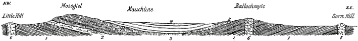
Throughout the series of lavas, as indicated in the foregoing section, traces of the pauses that elapsed between the separate outflows may be seen in the form either of layers of red sandstone or of tuff and volcanic breccia. Here and there, under the platform of bedded lavas, the brick-red sandstone is full of fragments of slag and fine volcanic dust. But the most abundant accumulation of such detritus is to be seen at the top of the volcanic series, where it contains the records of the closing phases of eruption. Thick beds of - 60 - tuff and volcanic breccia occur there, interleaved with seams of red sandstone, like the chief mass of that rock, into which they gradually pass upward. Yet, even among the sandstones above the main body of tuff, occasional nests of volcanic lapilli, and even large bomb-like lumps of slag, point to intermittent explosions before the volcanoes became finally extinct and were buried under the thick mass of red Permian sandstone.
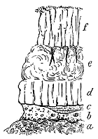
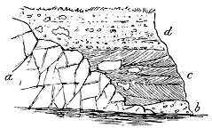
There is good reason to believe that both the volcanic sheets and the red sandstones overlying them, instead of being restricted to an area of only about 30 square miles, once stretched over the lowlands of Ayrshire; and not only so, but that they ran down Nithsdale, and extended into several of its tributary valleys, if indeed, they were not continuous across into the valley of the Annan.[92] Traces of the lavas and tuffs are to be found at intervals over the area here indicated. The most important display of them, next to their development in Ayrshire, occurs in the vale of the Nith at Thornhill, whence they extend continuously up the floor of the Carron Valley for six miles. They form here, as in Ayrshire, a band at the base of the brick-red sandstones, and consist mainly of bedded lavas with the basic characters above referred to. These lavas, however, are followed here by a much thicker development of fragmental volcanic materials. Abundant volcanic detritus is diffused through the overlying sandstones, sometimes as a gravelly intermixture, sometimes in large slaggy blocks or bombs, and sometimes in intercalated layers of tuff, while an occasional sheet of one of the dull red lavas may also be detected. The final dying-out of the volcanic energy in a series of intermittent explosions, while the ordinary red sandy sediment was accumulating, is here also admirably chronicled. As an illustration of these features the accompanying section is given (Fig. 201). The last of the lavas (a) presents an uneven surface against which the various kinds of detritus have been laid down. First comes a coarse volcanic breccia (b) made up of angular and subangular blocks of different lavas imbedded in a matrix of red ashy sand. This deposit is succeeded by a band of dull red tufaceous sandstone, evidently formed of ordinary red sandy sediment, into which a quantity of volcanic dust and lapilli fell at the time of its accumulation. Some of the ejected blocks which lie inclosed in the finer sediment are upwards of a - 61 - foot in length. A more vigorous discharge of fragmental material is shown by the next bed (d), which consists of a coarse nodular tuff, mingled with a little red sandstone and crowded with blocks of the usual lavas. Beyond the locality of this section these tuffs are found to pass up insensibly into the ordinary Permian sandstone.
[92] See Memoirs of Geol. Surv. Scotland, Sheet 15 (1871), p. 35; Sheet 9 (1877), p. 31.
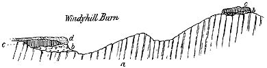
But we can detect the edges of yet more distant streams of lava emerging from under the red sandstones and breccias to the east of the Nith. On the farther side of the Silurian ridge that forms the eastern boundary of the Nith valley, above which it rises some 700 or 800 feet, there is preserved at the bottom of the valley of the Capel Water, which flows into Annandale, another small outlier of a similar volcanic band. Three miles to the south-east of it two little fragments of the volcanic group lie on the sides of a small tributary of the Water of Ae. Since these may serve as a good illustration of the extent to which denudation has reduced the area of the Permian volcanic series, a section of the locality is here given (Fig. 202). The general foundation rocks of the country are the Silurian greywackes and shales in highly inclined and contorted positions (a). Each outlier has, as its basement material, a volcanic breccia (bb) in which, together with the usual lava-fragments, are mingled pieces of the surrounding Silurian strata. In the smaller outlier lying to the north-east, this detrital layer is only about one foot thick. It is overlain by a slaggy amygdaloid of the usual character (cc), which in the lower outlier is covered with boulder clay (d). There can be little doubt that these detached fragments were once united in a continuous sheet of lava which filled the valley of the Water of Ae and that of its tributary. That the lava stretched down the Ae valley for some distance is proved by the occurrence of another outlier of it two miles below.
But there is still additional evidence for the wide extension of these volcanic sheets. It appears to be certain that they stretch far to the eastward, under the Permian sandstones of the Lochmaben basin of Annandale, for breccias largely made up of pieces of the bedded lavas are found close to the northern edge of the basin on the west side of the River Annan. To this remarkable adherence of the lavas and tuffs to the bottom of the Permian valleys I shall afterwards more specially refer.
The thickness of the whole volcanic group cannot be very accurately determined. It reaches a maximum in the Ayrshire basin, where, at its greatest, it probably does not exceed 500 feet, but is generally much less; - 62 - while in the Nithsdale and Annandale ground the detached and much denuded areas show a still thinner development.
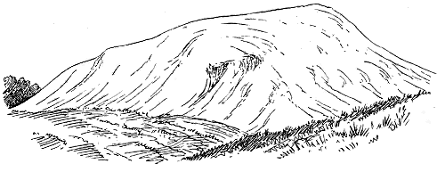
(2) Vents.—One of the most interesting features in this south-western district of Scotland is the admirable way in which the volcanic vents of Permian time have been preserved. Their connection with the lavas and tuffs can there be so clearly traced that they serve as a guide in the interpretation of other groups of vents in districts where no such connection now remains. In Ayrshire, the lower part of the Permian volcanic band is pierced by several small necks of agglomerate. There cannot, I think, be any doubt that these necks mark the positions of some of the vents from which the later eruptions took place. Immediately beyond them necks of precisely similar character rise through the upper division of the Coal-measures. There can be as little hesitation in placing these also among the Permian vents. And thus step by step we are led away from the central lavas, through groups of necks preserving still the same features, external and internal, and rising indifferently through rocks of any geological age from the Coal-measures backward. Thus, although if we began the investigation at the outer limits of the chain of necks, we might well hesitate as to their age, yet, when we can fix their geological position in one central area, we are, I think, justified in classing, as parts of one geologically synchronous series, all the connected groups that retain the same general characteristics. It is to denudation that we owe their having been laid bare to view; but at the same time, denudation has removed the sheet of ejected materials which may have originally connected most of these vents together.
In this regard, it is most instructive to follow the vents south-eastwards from the Ayrshire basin into Nithsdale for a distance of some eighteen miles. If we traced them down that valley to Sanquhar, without meeting with any vestige of superficial outflows to mark their stratigraphical position, we might possibly hesitate whether the age of those which are so far removed from the evidence that would fix it should not be left in doubt. But if we continued our traverse only a few hundred yards farther, we should find - 63 - some fragmentary outliers of the Permian lavas capping the Upper Coal-measures; and if we merely crossed from the Nith into the tributary valley of the Carron Water, we should see preserved in that deep hollow a great series of Permian lavas, tuffs and agglomerates. It is only by a happy accident that here and there these superficial volcanic accumulations have not been swept away. There was probably never any great thickness of them, but they no doubt covered most, if not all, of the district within which the vents are found.
The Permian necks are, on the whole, smaller than those of the Carboniferous period. The largest of them in the Ayrshire and Nithsdale region do not exceed 4000 feet in longest diameter; the great majority are much less in size, while the smallest measure 20 yards, or even less. Those of Fife, to be afterwards described, exhibit a wider range of dimensions, and have the special advantage of being exposed in plan along the shore.
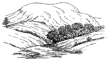
These necks, from their number and shapes, form a marked feature in the scenery. They generally rise as prominent, rounded, dome-shaped, or conical hills, which, as the rock comes close to the surface, remain permanently covered with grass (Figs. 203 and 204). Such smooth green puys are conspicuous in the heart of Ayrshire, and likewise further south in the Dalmellington coal-field, where some of them are locally known as "Green Hill," from their verdant slopes in contrast to the browner vegetation of the poorer soil around them (Fig. 203).
As in those of older geological periods, the necks of this series are, for the most part, irregularly circular or oval in ground-plan, but sometimes, like those of the Carboniferous system, they take curious oblong shapes, and occasionally look as if two vents had coalesced (Fig. 205). Here and there also the material of the vents has consolidated between the walls of a fissure or the planes of the strata, so as to appear rather as a dyke than as a neck. Descending, as usual, vertically through the rocks which they pierce, the necks have the form of vertical columns of volcanic material, ending at the surface in grassy rounded hillocks or hills.
- 64 -
In almost all cases, the necks of the Ayrshire region consist of a gravelly tuff or agglomerate, reddish or greenish in colour, made up of blocks of such lavas as form the bedded sheets, together with fragments of the stratified rocks through which the chimneys have been blown out. Thus, in some of the necks, pieces of black shale are abundant, as at Patna. In other cases, there are proofs of the derivation of the stones from much greater depths, as in the Green Hill of Waterside, where fragments of fine greywacke are not infrequent, probably derived from the Silurian formations which lie deep beneath the Carboniferous and Old Red Sandstone series.
The fragmentary material of the necks is generally unstratified, but a rude stratification may sometimes be noticed, the dip being irregularly inward at high angles towards the middle of the vent. This structure, best seen in the vents of the Fife coast, as will be shown in the sequel, may be detected in some of the necks of the Dalmellington district.
1. Neck half a mile north-west from Dalmellington; 2. Neck at Auchengee, four miles north-east from Patna; 3. Neck at head of Drumbowie Burn, five and a half miles due north from Dalmellington; 4. Patna Hill, 853 feet above sea-level (for outline of this hill see the preceding Fig.); 5. Neck on Kiers Hill (1005 feet above the sea), two miles south from Patna, with lava adhering to part of the wall.
Occasionally some form of molten rock has risen in the funnel, and has partially or wholly removed or concealed the agglomerate. This feature is especially noticeable among the necks that pierce the Dalmellington coal-field. Portions of basic lavas traverse the agglomerate or intervene between it and the surrounding strata. These have probably in most cases been forced up the wall of the funnel, while here and there sills run outward from the necks into the surrounding Coal-measures. Sometimes a thin sheet of lava, adhering to the wall of a funnel, may be the remnant of a mass of rock that once filled up the orifice. In one of the necks of the Muirkirk Coal-field, which was pierced by a mine driven through it from side to side, - 65 - fingers and sheets of "white trap," or highly altered basalt, were found to run out from the neck into the surrounding strata.[93] Dark heavy basalt, or some still more basic rock, has here and there filled up a vent. As so many of the necks rise through the coal-fields, opportunities are afforded of studying the effects of volcanic action upon the coal-seams, which for some distance from them have been destroyed.
[93] Explanation of Sheet 23, Geol. Surv. Scotland, p. 39.
Another feature, which can be recognized from the information obtained in mining operations, is that, in the great majority of instances, no connection is traceable between the positions of the vents and such lines of dislocation as can be detected at the surface or in the underground workings. Some vents, indeed, have evidently had their positions determined by lines of fault, as, for instance, that of the Green Hill below Dalmellington. Yet in the same neighbourhood a number of other examples may be found where the volcanic funnels seem to have avoided faults, though these exist close to them.
In this south-western district of Scotland upwards of sixty distinct vents have been mapped in the course of the Geological Survey. They run from the north of Ayrshire to the foot of the Southern Uplands, and descend for some distance the vale of the Nith. The area over which they are distributed measures roughly about forty miles from north-west to south-east, and at its greatest breadth twenty miles from south-west to north-east. Within this tract the vents are scattered somewhat sporadically in groups, sometimes numbering twenty necks in a space of sixteen square miles, as in the remarkable district of Dalmellington.
In considering their distribution we cannot but be impressed by the striking manner in which these necks keep to the valleys and low grounds. I have already alluded to this characteristic, as shown by the volcanoes of the Old Red Sandstone and Carboniferous periods. But it is displayed by the Permian volcanoes in a still more astonishing way. Beginning at the northern end of the long chain of necks in the West of Scotland, we find a row of them on the plains fronting the volcanic plateau of the Ardrossan, Dunlop and Stewarton Hills. Thence we may follow them, as single individuals or in small groups, across the broad lowland of Ayrshire, southward to the very base of the great chain of the Southern Uplands. There, a cluster of some two dozen of them may be seen rising out of the Carboniferous rocks on the low grounds, but they abruptly cease close to the base of the hills; not one has been detected on the adjacent Silurian heights. Moreover, if we turn into the valleys that lead away from the great Ayrshire plain to the interior, we find necks of the same character in these depressions. They ascend the valley of Muirkirk, and may be met with even at its very head, near the base of the Hagshaw Hills. Again, on the floor of the remarkable transverse valley trenched by the Nith across the Southern Uplands, Permian necks pierce the Coal-measures, while the outlying fragments of bedded lava show that these vents flooded the bottom of that valley with molten rock. Turning out of Nithsdale into the long - 66 - narrow glen of the Carron Water, we observe its floor and sides to be covered with the sheets of lava and tuff already noticed. And so travelling onward from the vale of the Nith into that of the Capel Water, thence into the Water of Ae and across into the great strath of Annandale, we may detect, if not actual vents, at least the beds of lava and layers of volcanic detritus that were ejected from them.
All along these valleys, which were already valleys in Carboniferous time, traces of the volcanic activity of this epoch may be detected. But, so far as I am aware, in not a single case has any vent been observed to have been opened on the high surrounding ridges. There has obviously been a determining cause why the volcanic orifices should have kept to the plains and the main valleys with their tributaries, and should have avoided the hills which rise now to heights of 500 to 1000 feet or more above the bottoms of the valleys that traverse them. It might be said that the valleys follow lines of fracture, and that the vents have been opened along these lines. But my colleagues in the Geological Survey, as well as myself, have failed, in most cases, to find any evidence of such dislocations among the rocks that form the surface of the country, while it is sometimes possible to prove that they really do not exist there.
Though only a few scattered patches of the Permian bedded lavas and tuffs have been preserved, enough is left to indicate that the vents were active only in the early part of the period represented by the Scottish Permian red sandstones, for it is entirely in the lower part of these strata that volcanic rocks occur. The eruptions gradually ceased, and the sheets of ejected material, probably also the volcanic cones, were buried under at least several hundred feet of red sandstone. Whether or not any portion of the erupted material was for a time built up above the level of the water, there seems to be no question that the vents were, on the whole, subaqueous.
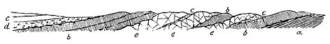
3. Sills.—The phenomena of sills and dykes are less clearly developed among the Permian volcanic rocks of the Ayrshire basin than among those of older formations. In the section exposed in the course of the River Ayr at Howford Bridge, a coarsely crystalline dolerite which extends for nearly 300 yards up the stream, cuts the Permian lavas, of which it encloses patches as well as pieces of sandstone. At the contact, the rock becomes fine-grained (Fig. 206). Through the coarsely crystalline material run long parallel "segregation veins" of a paler, more acid substance, as among the Carboniferous sills. Similar rocks are well seen in the Dippol Burn near Auchinleck House.
Passing outward into the Coal-measures, we encounter a much larger - 67 - display of similar intrusive sheets. The best district for the study of these sills lies around Dalmellington. The Coal-measures are there traversed by many intrusions, which have produced great destruction among the coal-seams. Some of the rocks are extremely basic, including a beautiful picrite like that of Inchcolm (Letham Hill, near Waterside). The age of these sills must be later than the Coal-measures into which they have been injected. Some of them are obviously connected with the agglomerate-necks, and the whole or the greater number should thus probably be assigned to the Permian period.[94] The phenomena of intrusion presented by these rocks reproduce the appearances already described in connection with the basic intrusive sheets of Carboniferous age.
[94] Explanation of Sheet 14, Geol. Surv. Scotland, p. 22.
2. Basin of the Firth of Forth
The other district of Southern Scotland, where traces of volcanic action later in age than the Coal-measures may be observed, lies in the basin of the Firth of Forth (Map V.). They include no bedded lavas, and only at one locality do any relics of a covering of stratified tuffs overspread the Carboniferous formations. The evidence for the old volcanoes consists almost entirely of necks of tuff, which mark the position of vents of eruption.
(1) Vents.—On the south side of the estuary of the Forth there is only one neck which may be plausibly placed in this series. It forms the upper part of Arthur Seat, at Edinburgh. This hill has already been cited as consisting of two distinct portions. The lower, built up of bedded tuffs, basalts and andesites, forms part of the Midlothian volcanic plateau of Carboniferous time. The vent from which these materials were ejected must lie at some little distance, and its site has not been certainly ascertained. The upper part of the hill is formed of a distinct group of rocks which has now to be described.
The geological structure of Arthur Seat has long been well known. It served as a theme for discussion in the Neptunist and Plutonist controversy, and was often referred to in the various mineralogical or geognostical writings of the time. The first thorough examination of it as a relic of ancient volcanic action was that of Charles Maclaren, published in 1839.[95] This author clearly recognized the later age and unconformable position of the coarse mass of agglomerate pierced by the basalt of the apex, and pointed out the evidence of the upheaval and denudation of the older volcanic series during a long interval of repose before the latest eruptions took place. Subsequently Edward Forbes suggested that the upper part of the hill might be of Tertiary age.[96] Thereafter I mapped the ground in - 68 - detail for the Geological Survey, entirely confirming the observations of Maclaren.[97] In the end it seemed to me that the interval between the two epochs of volcanic activity might not be so great as Forbes had supposed; and after tracing the Permian vents of Ayrshire, I came to the conclusion that the younger unconformable agglomerate of Arthur Seat was not improbably Permian.
[95] Geology of Fife and the Lothians, p. 34. In a reprint of this work, published in 1866, the venerable author briefly remarked in a footnote that he no longer believed in the second period of volcanic activity. This view was adopted in 1875 by Professor Judd, Quart. Journ. Geol. Soc. xxxi. p. 131. For the reasons stated in the text I believe Maclaren's original explanation of the structure of the hill to be correct.
[96] Forbes never published his views regarding Arthur Seat, but expounded them to his class, and explained them in diagrams, some of which are preserved in the Edinburgh Museum of Science and Art, in association with the specimens which he collected from the hill.
[97] Sheet 32, Geol. Survey of Scotland and descriptive Memoir. See also Rep. Brit. Assoc. 1867, address Geol. Sect., and Murchison's Siluria, 4th edit. p. 331.
The older volcanic series of this hill has been broken through by the agglomerate which occupies a true neck, and is abruptly marked off from all the rocks older than itself. There is no trace of any of the older lavas or tuffs thickening towards this vent. On the contrary they are completely truncated by it, and their outcrops on the north side reappear from under the agglomerate on the south side. Their escarpments are wrapped round by the agglomerate which likewise fills the head of the hollow that had been previously worn by denudation out of the stratified deposits between the oldest lavas. There is thus a violent unconformability between the later and the older volcanic rocks of Arthur Seat.
The length of time indicated by this stratigraphical break must be great. There is no known discordance in the Carboniferous system of the Lothians, yet the Coal-measures, Millstone Grit, Carboniferous Limestone series and much of the Calciferous Sandstones were stripped from this hill before the eruption of the agglomerate. It will be shown in the sequel that a nearly similar amount of denudation preceded some of the probably Permian eruptions of Fife.
The agglomerate contains abundant fragments of the older volcanic series. Its matrix is a dull red gravelly detritus, crowded with blocks of all sizes up to a yard or more in diameter. It is pierced by a column or plug of basalt, which sends veins into it, and rises to the apex of the hill. A beautiful olivine-basalt forms the lateral mass of the Lion's Haunch, which rests on the agglomerate.
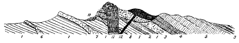
1. Grey and reddish sandstones and shales (Calciferous Sandstones); 2. The lava of the Long Row: the oldest of the Carboniferous volcanic series; 3. Tuffs of the Dry Dam; 4. Columnar basalts overlying the tuffs; 5. Andesite lavas of the eastern half of Arthur Seat; 6. Sill of Heriot Mount; 7. Sill of Salisbury Crags; 8. Sill of the Dasses. These complete the Lower Carboniferous volcanic series (compare Fig. 112). 9. White sandstones and black shales, upper division of the Calciferous Sandstones; 10. Younger volcanic agglomerate resting on the denuded ends of the older volcanic series; 11. Basalt of the summit sending veins into the agglomerate; 12. Basalt of the Lion's Haunch.
In general characters the agglomerate of Arthur Seat resembles that of some of the younger vents of Fife which pierce the Coal-measures and are connected with tuffs that lie unconformably on the Carboniferous Limestone. On these various grounds I think that it may be reasonably assigned to the same geological period.
- 69 -
That a new vent should be opened, after the lapse of one or more geological periods, on or near the site of more ancient volcanic orifices is an incident of which, as we have seen, the geological history of the British Isles furnishes a number of examples. It will be remembered that little more than a mile to the south of Arthur Seat lies the great vent of the Braid Hills, which in the time of the Lower Old Red Sandstone gave forth such a huge pile of lavas and tuffs. Volcanic energy thereafter entirely died away, and in this district was succeeded by a prolonged period of quiescence, during which the Lower Old Red Sandstone was upraised and extensively denuded, while the Upper Old Red Sandstone was deposited. At length, in the immediate neighbourhood, from one or more vents, the exact site of which is not certainly known, the older lavas and tuffs of Arthur Seat, Calton Hill and Craiglockhart Hill were erupted. Again, after another vast interval, a new volcano appeared, and the agglomerate and younger basalts of Arthur Seat were ejected from it. This is one of the most striking examples in this country of the remarkable persistence of volcanic energy in the same locality.
There is no evidence at Arthur Seat itself to fix the geological date of the last volcanic activity of the hill. If the group of younger rocks stood alone, with no other trace of post-Carboniferous eruptions in the surrounding district, a plausible conjecture as to its age would not be easily offered. But in reality it is not a solitary example of such rocks; for within sight, on the opposite side of the Firth of Forth, its counterparts may be seen. To the description of these numerous and clearer illustrations I now proceed.
The East of Fife is remarkable for a large assemblage of volcanic vents, which, unlike those in Ayrshire and Nithsdale, stand alone, their superficial ejections having been removed by denudation, and no connection being traceable between them and any Permian sandstones. The vents filled up with agglomerate and pierced with plugs and veins of basalt, rise through the Carboniferous rocks, but have left no record for precisely defining their geological age. On the one hand, it is quite certain that in this district volcanic eruptions took place during the earlier half of the Carboniferous period. To the north of Largo, and still more distinctly to the north-east of Leven, sections occur to show the contemporaneous outpouring of volcanic rocks during the time of the Carboniferous Limestone. The Leven section, seen in a ravine a little to the north-east of the town, is specially important. It presents a succession of red and green fine sandy tuffs, interstratified with fire-clays and sandstones, and containing a zone of basalt in the centre. These rocks lie not far from the top of the Carboniferous Limestone series.
On the other hand, there is equally clear proof of far later eruptions. From St. Andrews to Elie a chain of necks may be traced, having the same general characters, and piercing alike the Calciferous Sandstones, and the older part of the Carboniferous Limestone series. That these vents must in many cases be long posterior to the rocks among which they rise, is indicated by some curious and interesting kinds of evidence. - 70 - They are often replete with angular fragments of shale, sandstone and limestone, of precisely the same mineral characters as the surrounding strata, and containing the same organic remains in an identical state of fossilization. It is clear that these strata must have had very much their present lithological aspect before the vents were opened through them. Again, the necks may often be observed to rise among much contorted strata, as, for example, along the crest of a sharp anticlinal arch, or across a synclinal basin. The Carboniferous rocks must thus have been considerably plicated before the time of the volcanic eruptions. In the next place, the vents often occur on lines of dislocation without being affected thereby. They must be posterior, however, not only to these dislocations, but also to much subsequent denudation, inasmuch as their materials overspread the rocks on each side of a fault without displacement. Hence we conclude with confidence, that a great deal of volcanic activity in the East of Fife must have been posterior to most, if not all, of the Carboniferous period.
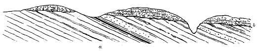
In the neighbourhood of Largo, further important evidence is presented, confirming and extending this conclusion. The highest member of the Upper Coal-measures, consisting of various red sandstones, with red and purple clays, shales, thin coals and ironstones, is prolonged from the Fife coal-field in a tongue which extends eastward beyond the village of Lower Largo. It is well displayed on the shore, where every bed may be followed in succession along the beach for a space of nearly two miles. Two volcanic necks, presenting the same features as those which pierce the older portions of the Carboniferous system to the east, rise through these red rocks. We are thus carried not only beyond the time of the Carboniferous Limestone, but beyond the close of the very latest stage of the Carboniferous period in Central Scotland. Connected with these and other vents farther north, there is a large area of tuff which has been thrown out upon the faulted and greatly denuded Carboniferous rocks. It may be traced passing from the red Upper Coal-measures across the large fault which here separates that formation from the Carboniferous Limestone, and extending inland athwart different horizons of the latter series. Outlying fragmentary cakes of it may be seen resting on the upturned edges of the sandstones, shales and coal-seams, even at a distance of some miles towards the north-west, proving that the fragmentary materials discharged from the vents spread over a considerable area. The accompanying section (Fig. 208) may serve as an illustration of the relation between this sheet of bedded tuff and the underlying rocks.
- 71 -
Though interstratified volcanic rocks occur in the Carboniferous system of the East of Fife, no connection has been traced between them and any of the vents now referred to. While none of these vents can be proved to be of Carboniferous age, it is of course possible that such may be the true date of some of them. Others, nevertheless, and probably much the largest number, judged from the data just given, may be regarded as probably post-Carboniferous. Those which happen to rise through the uppermost Coal-measures do not appear to be distinguishable by any essential characters from those which pierce indifferently the Carboniferous Limestone series and Calciferous Sandstones of the East of Fife. They seem to be all one connected aggregate, resembling each other alike in their external characters, internal structure and component materials, and the limit of their age must be determined by the geological horizon of the youngest formation which they traverse. By this process of reasoning I reach the conclusion that this remarkable series of old volcanoes in the East of Scotland not improbably dates from the same time as that of Ayrshire and Nithsdale, already described.
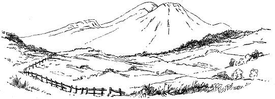
Some idea of the importance and interest of the volcanic area of Eastern Fife may be gathered from the fact that in a space of about 70 square miles no fewer than 60 necks may be counted, and others are probably concealed below the drift-deposits which cover so much of the interior of the country. The area of this remarkable display extends from St. Andrews Bay and the Vale of the Eden southwards to the coast of the Firth of Forth between Lundin Links and St. Monans. All over the inland tract the necks form more or less marked eminences, of which the largest are conspicuous landmarks from the southern side of the Firth. But the distinguishing characteristic of the area is the display of the necks along the coast, where, in a series of natural dissections, their form, composition, internal structure and relations to the surrounding rocks have been laid open in such clearness and variety as have been met with in the volcanic records of no other geological period within the compass of these islands. As this district thus possesses a singular interest and value for the study of volcanic vents, I shall enter in some detail into the description of the sections so admirably laid bare.
- 72 -
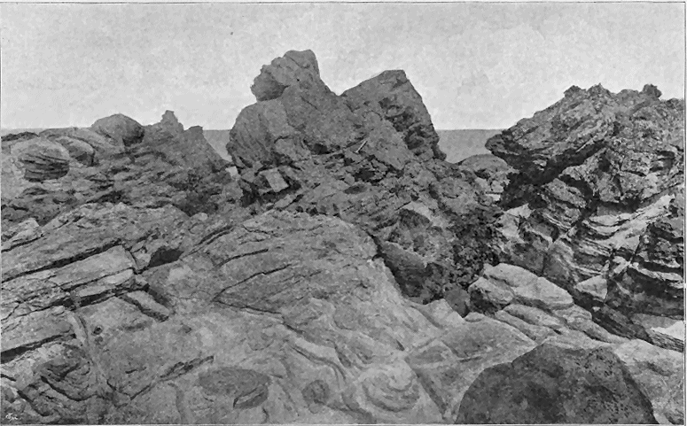
- 73 -
As in Ayrshire, the necks in the East of Fife generally rise as isolated conical or dome-shaped hills, with smooth grassy slopes, but where a dyke or boss of basalt occurs in them, it usually stands out as a crag or knoll. Largo Law (Fig. 209) may be taken as a singularly perfect example of the cone-shaped neck. This hill, however, comprises more than one vent. The mass of tuff of which it consists probably includes at least three distinct funnels of discharge, and surrounding it there still remains a good deal of the fragmental material that gathered around these vents and is now seen to lie unconformably upon the Carboniferous formations (Fig. 208). There must be a total area of not much less than four square miles over which tuff occupies the surface of the ground.
While the Fife necks possess the great advantage of having been laid bare by the sea, their frequent small size on the coast allows their whole area to be examined. As illustrations of these little vents, two plates are here given from the coast-line to the east of St. Andrews, where a number of small necks of agglomerate have been planted among the plicated Calciferous Sandstones. In Fig. 210 the abrupt truncation of the sandstones by the volcanic rock is well shown. The strata on the right have been broken through, and the sea has indented a small gully along the wall of the old volcanic funnel. The sandstones in front, however, still adhere firmly to the agglomerate, which rises above them as a rugged mass of rock.
In Fig. 212 the edge of the vent can be traced partly in section and partly in plan for about half of its circumference. On the right hand, the actual wall of the funnel is visible where the false-bedded sandstones are sharply cut off by the agglomerate. In front the strata appear in plan on the beach, and their ledges can be seen to the left striking at the margin of the neck.
- 74 -
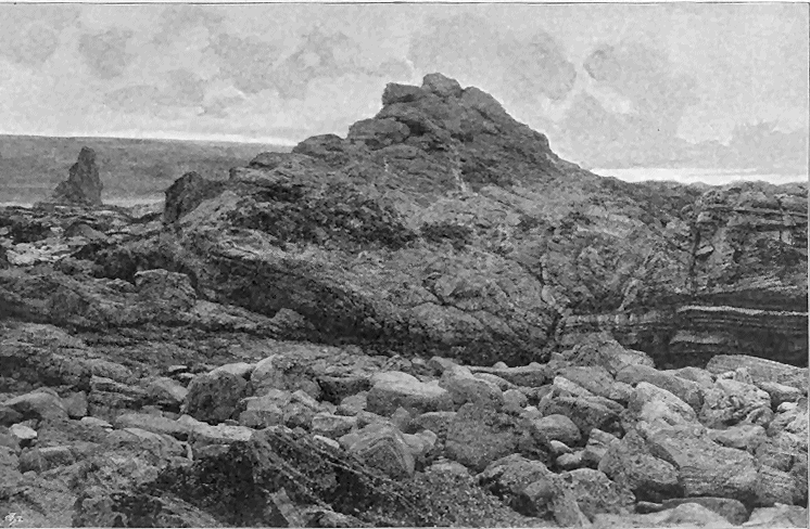
- 75 -
The shape of the Fife vents is, as usual, generally circular or oval; but is subject to considerable irregularity. The coast-section between Largo and St. Monans exposes many ground-plans of them, and permits their irregularities to be closely examined. The accompanying figure (Fig. 211) exhibits some characteristic forms. Eccentricities of outline no doubt arose from the irregular way in which the rocks yielded to the forces of explosion during the piercing of a volcanic orifice. This is often well shown by the veins and nests of tuff or agglomerate which have been forced into the rents or sinuosities of the orifices. In other cases, however, it is probable that, as among the Ayrshire necks, and those of Carboniferous age already cited, what appears now as one volcanic neck was the result of a shifting of the actual funnel of discharge, so that the neck really represents several closely adjacent vents. The case of Largo Law has been already noticed. The necks at Kellie Law (Fig. 213) show clearly the same structure, the Law itself (1) probably consisting of two contiguous vents, while a third (2) forms a smaller cone immediately to the east. Such a slight lateral displacement of the vent has been noticed at many Tertiary and recent volcanic orifices. In the island or peninsula of Volcanello, for example, three craters indicate successive shiftings of the vent, the most perfect of them marking the latest and diminishing phase of volcanic activity (Fig. 214, compare Fig. 29, vol. i., p. 70).
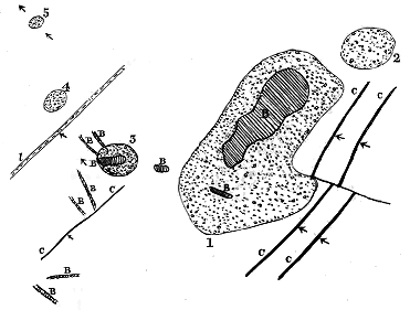
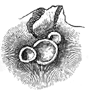
The Fife necks vary from only a few yards up to perhaps 4000 feet in diameter. One of the smallest and most completely exposed occurs on the shore at Newark Castle, near St. Monans. It measures only 60 yards in length by about 37 yards in breadth. A ground-plan of it is given in Fig 224. Still smaller is - 76 - the neck at Buddo Ness, on the coast east of St. Andrews, which measures only 20 yards across.
From the way in which the vents have been dissected by the sea along the Fife coast, the geologist is enabled to study in minute detail the effects of the volcanic operations upon the strata through which the funnels have been drilled. Considerable variation may be observed in the nature and amount of change. Sometimes the orifice has been made without any noticeable alteration of the sandstones, shales and limestones, which retain their dip and strike up to the very wall of the chimney. Usually there is more or less jumbling and crushing of the stratification, and often a considerable amount of induration. As a typical example of these effects I give a section from the margin of the neck of tuff on the east side of Elie Harbour (Fig. 215). Here the sandstones and shales (a) have been doubled over and dragged down against the tuff (b). They have likewise been hardened into a kind of quartzite, and this alteration extends for about 20 to 30 feet from the edge of the neck.
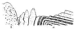
The material which has filled up the vents is almost entirely fragmental, varying from a coarse agglomerate to a fine volcanic tuff. Some minor necks have been completely or in great part filled with angular debris of the ordinary rocks of the neighbourhood. In the western neck on the Largo shore, for example, which rises through the red rocks of the Upper Coal-measures, the material consists largely of fragments of red sandstone, clay and shale. Between Elie and St. Monans, some of the necks are filled almost wholly with debris of black shale and encrinal limestone.
There does not appear to be any relation between the diameter of a funnel and the size of the blocks that now fill it. Some of the larger necks, for example, consist of comparatively fine tuff. The Buddo Ness, on the other hand, though so small a vent, is packed with blocks of shale six feet long, while the sandstone through which the orifice has been drilled passes, as usual, into quartzite for several yards away from the edge. As an example of the general aspect presented by one of the coarse agglomerates in the necks of the Fife coast, a view is given in Fig. 216 of a portion of the neck at Ardross, about two miles east from Elie. This thoroughly volcanic accumulation is here shown to consist of blocks of all sizes heaped together without any definite arrangement.
- 77 -
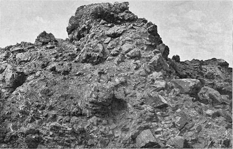
- 78 -
Since the first stage in the history of the vents has been the perforation of the solid crust by explosion, and the consequent production of debris from the disrupted rocks, we may hope to detect underneath the pile of thoroughly volcanic ejections, traces of the first explosions. I have been much struck with the fact that in the East of Fife such traces may frequently be found here and there within the outer border of the vents. At Largo, and again between Elie and St. Monans, it may be noticed that the mass of material adhering to the wall of a neck, exposed in ground-plan upon the beach, often consists largely, or even wholly, of debris of sandstone, shale and limestone, while the central and chief mass is made up of green tuff or agglomerate, with occasional pieces of the surrounding stratified rocks scattered through it. It seems probable, therefore, that the sections of these Fife necks, laid bare on the present shore, do not lie far below the original crater-bottoms.
Some light might be expected to be thrown upon the phenomena in an active volcanic chimney by the condition of the fragments of recognizable sedimentary rocks imbedded in the ejected debris which has filled up the orifice. But the assistance from this source is neither so full nor so reliable as could be wished. In some of the Fife vents, indeed, the fragments of shale, sandstone and other sedimentary strata are so unchanged that they cannot on a fresh fracture be distinguished from the adjacent parent strata. The Spirifers, Lingulæ, crinoids, cyprid-cases, ganoid scales and other fossils are often as fresh and perfect in the fragments of rock imbedded in tuff as they are in the rock in situ. In some cases, however, distinct, and occasionally even extreme, metamorphism may be detected, varying in intensity from mere induration to the production of a crystalline texture. The amount of alteration has depended not merely upon the heat of the volcanic vent, but also in great measure upon the susceptibility of the fragments to undergo change and the duration of their exposure to it.
Dr. Heddle has computed the temperature to which fragments of shale, etc., in tuff-necks of the Fife coast have been subjected. He found that the bituminous shales have lost all their illuminants, and of organic matter have retained only some black carbonaceous particles; that the encrinal limestones have become granular and crystalline; that the sandstones present themselves as quartzite, and that black carbonaceous clays show every stage of a passage into Lydian-stone. He inferred from the slight depth to which the alteration has penetrated the larger calcareous fragments, that the heat to which they were exposed must have been but of short continuance. As the result of his experiments, he concluded that the temperature at which the fragments were finally ejected from the volcanic vents probably lay between 660° and 900° Fahr.[98]
[98] Trans. Roy. Soc. Edin. vol. xxviii. p. 487.
It may be perhaps legitimate to infer that, while the fragments that fell back into the volcanic funnel, or which were detached from the sides of the vent, after having been exposed for some time to intense heat under considerable pressure, would suffer more or less metamorphism, those, on the other hand, which were discharged by the æriform explosions from the cool upper crust, on the first outburst of a vent, would not exhibit any trace of such a change. Where, therefore, we meet with a neck full of fragments of unaltered stratified rocks, we may suppose it to have been that of a short-lived volcano; where, on the other hand, the fragments are few and much altered, they may mark the site of a vent which continued longer active. - 79 - The metamorphism of the fragmentary contents of a volcanic funnel by the action of ascending vapours has already been described in the case of one of the vents of the Carboniferous plateaux (vol. i. p. 404).
One of the most curious and puzzling features in the contents of the tuff necks of the Fife coast is the occurrence there of crystals and fragments of minerals, often of considerable size, which do not bear evidence of having-been formed in situ, but have undoubtedly been ejected with the other detritus. Dr. Heddle has noticed the fact, and has described some of the minerals which occur in this way. The following list comprises the species which he and I have found:—
Hornblende, in rounded fragments of a glassy black cleavable variety.
Augite, sometimes in small crystals, elsewhere in rounded fragments of
an augitic glass.
Orthoclase (Sanidine), abundant in worn twin crystals in the tuffs of
the east of Fife.
Plagioclase.
Biotite.
Pyrope, in the tuffs (and more rarely in the basalts) of Elie.
Nigrine, common in some of the dykes, more rarely in the tuffs of Elie.
Saponite, Delessite and other decomposition products.
Semi-opal, one specimen found in the later (Permian?) agglomerate of
Arthur's Seat.
Asphalt, abundant at Kincraig, near Elie.
Fragments of wood, with structure well preserved, may be included here.
Dr. Heddle has described from the neck of tuff at Kinkell, near St. Andrews, large twin crystals of a glassy orthoclase, which are invariably much worn, and preserve only rudely the form of crystals. He justly remarks that they have no connection with drusy cavity, exfiltration vein, or with any other mineral, and look as if a portion of their substance has been dissolved away. Internally, however, they are quite fresh and brilliant in lustre, though sometimes much fissured.[99]
[99] Trans. Roy. Soc. Edin. vol. xxviii. p. 223.
The tuffs at Elie are full of similar crystals. I obtained from one of the necks east of that village a specimen which measures 4 inches in length, 31/2 in breadth, and 21/4 in thickness, and weighs about 2 lbs. It is, however, a well-striated felspar. From the same tuff I procured an orthoclase twin in the Carlsbad form. All the felspar pieces, though fresh and brilliant internally, have the same rounded and abraded external appearance.
The fragments of hornblende form a characteristic feature in several of the Elie dykes (to be afterwards described), and in the neighbourhood of these intrusive rocks occur more sparingly in the tuff. It is a glossy-black cleavable mineral, in rounded pieces of all sizes, up to that of a small egg. Dr. Heddle obtained a cleavage angle of 124° 19', and found on analysis that the mineral was hornblende.[100]
[100] Op. cit. xxviii. p. 522.
Augite occurs sparingly in two forms among the rocks. I have obtained small crystals from the red agglomerate on the south side of Arthur Seat, recalling in their general appearance those of Somma. Lumps of an augitic glass have been found by Dr. Heddle, sometimes as large as a pigeon's egg, in two of the dykes at Elie, and in the tuff at the Kinkell neck, near St. - 80 - Andrews. He observed the same substance at the Giant's Causeway, both in the basalt and scattered through one of the interstratified beds of red bole. Much larger rounded masses of a similar augitic glass, but with a distinct trace of cleavage, have already been referred to as occurring in a volcanic vent of Upper Old Red Sandstone age at John o' Groat's House.[101]
[101] Op. cit. xxviii. pp. 481 et seq., and ante, vol. i. p. 352.
Biotite is not a rare mineral in some tuffs. It may be obtained in Lower Carboniferous tuffs of Dunbar, in plates nearly an inch broad; but the largest specimen I have obtained is one from the same Elie vent which yielded the large felspar fragment. It measures 21/2 × 2 × 1/2 inches. These mica tables, like the other minerals, are abraded specimens.
That these various minerals were ejected as fragments, and have not been formed in situ, is the conclusion forced upon the observer who examines carefully their mode of occurrence. Some of them were carried up to the surface by liquid volcanic mud, and appear in dykes of that material like plums in a cake. But even there they present the same evidence of attrition. They assuredly have not been formed in the dykes any more than in the surrounding tuff. In both cases they are extraneous objects which have been accidentally involved in the volcanic rocks. Dr. Heddle remarks that the occurrence of the worn pieces of orthoclase in the tuff is an enigma to him. I have been as unable to frame any satisfactory explanation of it.[102]
[102] Occasionally the crystals can be matched in some lava-form rock of the same volcanic area; but many of them have no such counterparts. See vol. i. p. 62 and note.
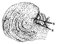
It might have been thought that within the throat of a volcano, if in any circumstances, loose materials should have taken an indefinite amorphous aggregation. And, as has been shown in the foregoing chapters, this is usually the case where the materials are coarse and the vent small. Oblong blocks are found stuck on end, while small and large are all mixed confusedly together. But in numerous cases where the tuff is more gravelly in texture, and sometimes even where it is coarse, traces of stratification may be observed. Layers of coarse and fine material succeed each other, as they are seen to do among the ordinary interstratified tuffs. The stratification is usually at high angles of inclination, often vertical. So distinctly do the lines of deposit appear amid the confused and jumbled masses, that an observer may be tempted to explain the problem by supposing the tuff to belong not to a neck, but to an interbedded deposit which has somehow been broken up by dislocations. That the stratification, however, belongs to the original volcanic vents themselves is made exceedingly clear by some of the coast-sections in the East of Fife. On both sides of Elie, examples occur in which a distinct circular disposition of the bedding can be traced corresponding to the general form of the - 81 - neck. The accompanying ground-plan (Fig. 217) represents this structure as seen in the neck which forms the headland at Elie harbour. Alternations of coarse and fine tuff with bands of coarse agglomerate, dipping at angles of 60° and upwards, may be traced round about half of the circle. The incomplete part may have been destroyed by the formation of another contiguous neck immediately to the east. To the west of Earlsferry another large, but also imperfect, circle may be traced in one of the shore necks. A quarter of a mile farther west rises the great cliff-line of Kincraig, where a large neck has been cut open into a range of precipices 200 feet high, as well as into a tide-washed platform more than half a mile long. The inward dip and high angles of the tuff are admirably laid bare along that portion of the coast-line. The section in which almost every bed can be seen, and where, therefore, there is no need for hypothetical restoration, is as shown in Fig. 218.
I have already referred to the frequently abundant pieces of stratified tuff, found as ejected blocks in vents filled with tuff, and to the derivation of these blocks from tuff originally deposited within the crater. There can, I think, be little hesitation in regarding the stratification of these Fife vents as a record of successive deposits of volcanic detritus inside the vents. The general dip inwards from the outer rim of the vent strikingly recalls that of some modern volcanoes. By way of illustration, I give here a section of part of the outer rim of the crater of the Island of Volcano, sketched by myself in the year 1870 while ascending the mountain from the north side (Fig. 220). The crater wall at this point consists of two distinct parts—an older tuff (a), which may have been in great measure cleared out of the crater before the ejection of the newer tuff (b). The latter lies on the outer slope of the cone at the usual angle of 30°. It folds over the crest of the rim, and dips down to the flat tuff-covered crater bottom, at an angle of 37°. These are its natural angles of repose.
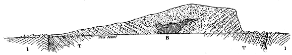
- 82 -
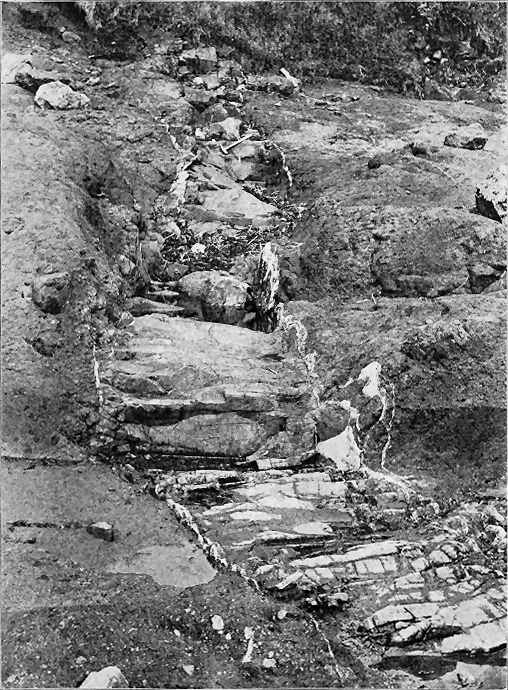
- 83 -
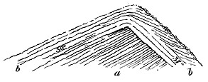
Applying modern analogies of this kind, I have been led to conclude that the stratification so conspicuous in the tuff of the vents in the east of Fife and in the Carboniferous series of the Lothians belongs to the interior of the crater and the upper part of the volcanic funnel.[103] These stratified tuffs, on this view of their origin, must be regarded as remains of the beds of dust and stones which gathered within the crater and volcanic orifice, and which, on the cessation of volcanic action, sometimes remained in their original position, or were dislocated and slipped down into the cavity beneath. That the tuffs consolidated on slopes, perhaps quite as steep as those of Volcano, is now and then indicated by an interesting structure. The larger stones imbedded in the layers of tuff may be observed to have on their fronts in one direction a small heap of coarse gravelly debris, while fine tuff is heaped up against their opposite side. This arrangement doubtless points to deposit on a slope of loose debris, from which the larger blocks protruded so as to arrest the smaller stones, and allow the fine dust to gather behind.
[103] Further illustrations of this characteristic structure of some vents will be found in the account of the Tertiary vents of the Faroe Isles in Chapter xli. See also the remarks in the introductory chapters, vol. i. p. 63.
If the inference be correct, that the stratification here described belongs to the old craters or the upper parts of the funnels, it furnishes additional evidence of the wide interval of time that elapsed between the deposition of the Carboniferous strata and the outbreak of these vents. During that interval prolonged denudation reduced the upturned Carboniferous Limestone series to nearly its present form of surface, and any materials discharged from the vents over the surrounding ground would obviously lie with a violent unconformability on the rocks below.
The frequent great disturbance in the bedding of the tuff within the vents may be connected with some kind of collapse, subsidence or shrinkage of the materials in the funnel below. That a movement of this nature did take place is shown by the remarkable bending down of the strata round the margins of the vents, which has been already described.
The minor vents for the most part contain only fragmentary materials; but those of larger size usually present masses of lava in some characteristic forms. In not a few cases, the lava has risen in the central pipe and has hardened there into a column of solid rock. Subsequent denudation, by removing most of the cone, has left the top of this thick column projecting as a round knoll upon the hill-top. Arthur Seat presents a good example of this structure. Where the denudation has not proceeded so far, we may still meet with a remnant of the cake of lava which sometimes overflowed the bottom of a crater. The summit of Largo Law affords indications of this arrangement, the cone of tuff being there capped with basalt, evidently the product of successive streams, which welling out irregularly covered the crater bottom with hummocks and hollows (Fig. 226). The knolls are beautifully columnar, and sometimes show a divergent arrangement of the prisms.
- 84 -
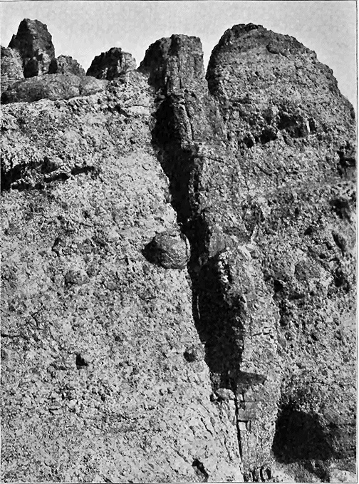
- 85 -
But the most frequent form assumed by the lava in the necks is that of veins or dykes running as wall-like bands through the tuff or agglomerate. Many admirable examples may be cited from the shore between Largo and St. Monans. Two illustrations of them are given in Figs. 219 and 221. In Fig. 219 the dyke is about four feet broad, and is seen to present the common transverse jointing as it pursues its way through the tuff. White veins of calcite along its margin serve to define its limits. Its position in reference to the general body of the neck is shown in the ground-plan Fig. 224. The second instance (Fig. 221) is that of a dyke of basalt only one foot wide, which runs like a wall up the agglomerate of the Kincraig neck near Elie. It is seen at the bottom of the cliff projecting from the agglomerate; but higher up it has decayed, leaving its fissure as a gaping chasm. Here the general character of the pyroclastic material is well brought out. One or two large blocks may be seen imbedded in it, the largest lying above where the dyke bends away to the left.
The intruded masses vary in breadth from mere threadlike veins up to dykes several yards in breadth, which sometimes expand into large irregular lumps. They generally consist of some form of basalt; now and then, as at Ruddon Point, near Elie, they are amygdaloidal; and it may be observed among them, as among dykes in general, that where the amygdaloidal texture is developed, it is apt to occur most markedly in the central part of the vein, the amygdales running there in one or more lines parallel with the general trend of the mass.
That the basalt of these veins and dykes was sometimes injected in an extremely liquid condition is shown by its frequently exceedingly close homogeneous texture. Within the neck on the shore to the west of Largo, the basalt assumes in places an almost flinty character, which here and there passes into a thin external varnish of basalt-glass. A farther indication of the liquidity of the original rock seems to be furnished by the great number of included extraneous fragments here and there to be observed in the basalt.
But besides basalt, other materials may more rarely be detected assuming the form of dykes or veins within the necks. Thus, at the Largo neck just referred to, strings of an exceedingly horny quartz-felsite accompany the basalt—a remarkable conjunction of acid and basic rock within the same volcanic chimney. To the east of Elie some dykes, which stand out prominently on the beach from a platform worn by the sea in a neck, consist of an extremely compact volcanic mudstone, stuck full of the worn twin crystals of orthoclase and pieces of hornblende and biotite already noticed. So like is this rock to one of the decomposing basalts that its true fragmental nature may easily escape notice, and it might be classed confidently as a somewhat decayed basalt. A considerable amount of a similar fine compact mudstone is to be seen round the edges of some of the Elie vents. This material must have been injected into open fissures, where it solidified. There is further evidence of the presence of "mud-lava" in some of the vents of East Fife, where these orifices contain a remarkable compact volcanic sandstone, composed of the usual detritus, but weathering into spheroidal crusts, so as externally to be readily mistaken for some form of basalt.
- 86 -
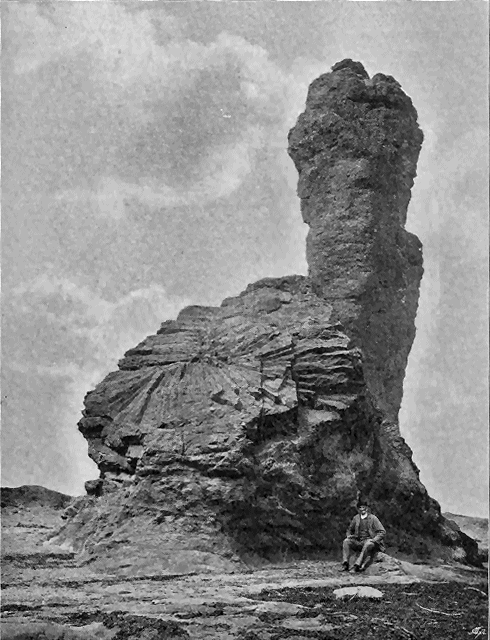
- 87 -
A columnar arrangement may often be observed among the basalt dykes. When the vein or dyke is vertical, the columns of course seem piled in horizontal layers one above the other. The exposed side of the dyke then reveals a wall of rock, seemingly built up of hexagonal or polygonal, neatly fitting blocks of masonry, as in the Lower Carboniferous vent of the Binn of Burntisland (Figs. 166, 168). An inclination of the dyke from the vertical throws up the columns to a proportional departure from the horizontal. Sometimes a beautiful fan-shaped grouping of the prisms has taken place. Of this structure the Rock and Spindle, near St. Andrews, presents a familiar example (Fig. 222). Much more striking, however, though less known, is the magnificent basalt mass of Kincraig, to the west of Elie, where the columns sweep from summit to base of the cliff, a height of fully 150 feet, like the Orgues d'Expailly, near Le Puy in Auvergne. The general position of this basalt in the vent is represented in the section (B, Fig. 218). The curvature of the basalt is shown in Fig. 223, which is taken from the Elie side looking westward, beyond the intrusions, to the picturesque cliffs of tuff. The details of the cliff are given in Fig. 225.
That many of the dykes served as lines of escape for the basalt to the outer slopes of the cones is highly probable, though denudation has usually destroyed the proofs of such an outflow. A distinct radiation of the dykes from the centre of a neck is still sometimes traceable. This structure is most marked on the south cone of Largo Law, where a number of hard ribs of basalt project from the slopes of the hill. Their general trend is such that if prolonged they would meet somewhere in the centre of the cone. On the south-east side of the hill a minor eminence, termed the Craig Rock, stands out prominently (Fig. 209). It is oblong in shape, and, like the dykes, points towards the centre of the cone. It consists of a compact columnar basalt, the columns converging from the sides towards the top of the ridge. It looks like the fragment of a lava-current which flowed down a gully on the outer slope of the cone (B' in Fig. 226).
Veins of basalt are not confined to the necks, but may be seen running across the surrounding rocks. The shore at St. Monans furnishes some instructive examples of this character. As the veins thin away from the main mass of basalt they become more close-grained and lighter in colour, and when they enter dark shales or other carbonaceous rocks they pass, as usual, into the white earthy clay-like "white-trap." The influence of carbonaceous strata in thus altering basic dykes and sills may be instructively studied along the shore of the East of Fife. A good instance occurs near St. Monans Church (Fig. 227), where a vein of "white-trap" traverses black shales which have been somewhat jumbled.
- 88 -
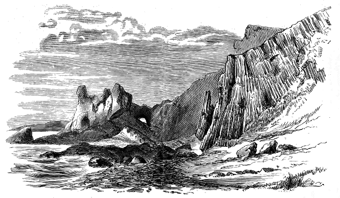
- 89 -
In a modern volcano no opportunity is afforded of examining the contact of the erupted material with the rocks through which the vent has been opened. But in the basin of the Firth of Forth, within the area now under description, a numerous series of coast-sections lays bare this relation in the most satisfactory manner. The superincumbent cones of tuff have been swept away, and we can examine, as it were, the very roots of the old volcanoes. The margin of a neck or volcanic vent is thus found to be almost always sharply defined. The rocks through which the funnel has been drilled have been cut across, as if a huge auger had been sunk through them. This is well displayed in the beautifully perfect neck already cited at Newark Castle, near St. Monans (Fig. 224). The strata through which this neck rises consist of shales, sandstones, thin coal and encrinal limestones, dipping in a westerly direction at angles ranging from 25° to 60°. At the south end of the neck they are sharply truncated, as if by a fault. Elsewhere they are much jumbled, slender vein-like portions of the tuff being insinuated among the projecting strata. A large vertical bed of sandstone, 24 yards long by 7 yards broad, stands up as a sinuous reef on the east side of the vent (s). It is a portion of some of the surrounding strata, but, so far as can be seen at the surface, is entirely surrounded with agglomerate. Here and there the shales have been excessively crumpled, and at the north end have been invaded by a vein of basalt which, where it runs through them, assumes the usual clay-like character. The strata have been blown out, and their place has been occupied by a corresponding mass of volcanic agglomerate. But their remaining truncated edges round the margin of the orifice have undergone comparatively little alteration. In some places they have been hardened, but their usual texture and structure remain unaffected.
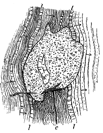
In a few examples, the progress of denudation has not advanced so far that the cone cannot still be partially made out amidst its surrounding masses of tuff. One of the most interesting of these is Largo Law, of which an outline has been given in Fig. 209. The accompanying section (Fig. 226) represents what appears to me to be the structure of this hill. Each of the two now conjoined cones was probably in succession the vent of the volcano. The southern and rather lower eminence, as already mentioned, is traversed by rib-like dykes of basalt, which point towards its top, where there is a bed of the same rock underlying a capping of tuff. On its eastern declivity lies the basalt stream already described (p. 87). The higher cone is surmounted by a cake of basalt which, as I have above suggested, may have solidified at the bottom of the latest crater. Of course all trace of the crater has disappeared, but the general conical form of the volcanic mass remains. Doubtless, still more of the old volcano would have been removed by denudation but for the protection afforded to the tuff by the intrusion of the basalt. The upper dotted lines in the figure are inserted merely to indicate hypothetically how the cone may originally have stood. On the west side the sheets of tuff which were thrown out over the surrounding country have been almost entirely removed, but on the east and south they still cover an extensive area. (See Fig. 208).
- 90 -
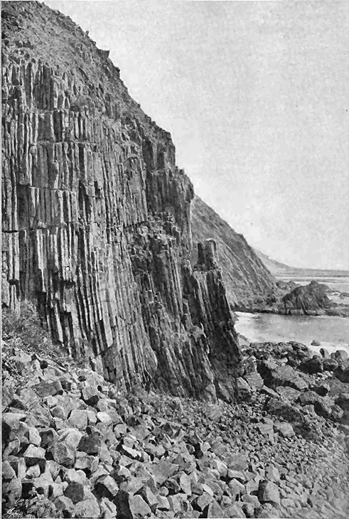
- 91 -
(2) Sills.—In the Clyde coal-field and in the basin of the Firth of Forth, among the vast number of sills which there traverse the Carboniferous formations, it is possible that some belong to the Permian volcanic period (see vol. i. p. 474). Where the sheets have been intruded along horizons that lie below the upper stratigraphical limit of the puy eruptions, they may not unnaturally be held to belong to these manifestations of volcanic energy, though it is obviously quite conceivable that some of them may be of much later date. But where they lie above the highest platforms of Carboniferous lavas and tuffs, they may be assigned to a younger volcanic period. We know as yet of only two such periods after the deposition of the Carboniferous Limestone series in Scotland—Permian and older Tertiary. Unless, therefore, these higher sills formed part of some other display of subterranean activity which is not known to have culminated in eruptions at the surface, they must be looked upon as probably either Permian or Tertiary.
In the great coal-field of Stirlingshire and Lanarkshire, among the large sills that break into the Millstone Grit and the Coal-measures, one lies entirely in the Coal-measures, and covers about six square miles of ground, stretching from near Caldercruix Station, a little east of Airdrie, to near Kirk of Shotts, a distance of about four miles. A group of smaller sheets, possibly connected with the larger mass, runs for four miles further west to beyond New Monkland. Another chain of sills, which may also be part of the same great intrusion, extends from the Cant Hills, near the Kirk of Shotts, for more than eight miles in a north-easterly direction. The largest mass in this chain stretches from Blackridge, west of Bathgate, for upwards of three miles, covering an area of about three square miles and terminating on the north at the line of dislocation which has been followed by one of the east and west dykes. Another large sill, which appears nearly two miles further east on the north side of that dyke, lies on a lower stratigraphical horizon, for it cuts the Carboniferous Limestone series, and does not reach the top of the Millstone Grit. This sill is cut through by two of the later dykes.
- 92 -
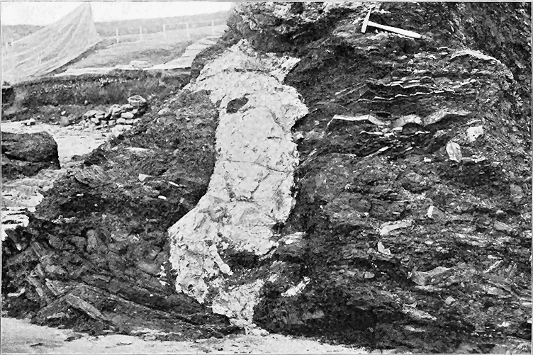
- 93 -
That these great intrusions took place later than the deposition of the Coal-measures is obvious. There is no satisfactory evidence to enable us to decide to which of the two post-Carboniferous volcanic periods they may with most probability be assigned. As one of them is distinctly cut by dykes that have been referred to the Tertiary series, it might be plausibly argued that it at least is of pre-Tertiary date, and therefore probably Permian. On the other hand, as will be shown in a later chapter, some portion of the sills appears to be connected with the younger or Tertiary dykes. This problem must for the present remain unsolved.
In Ayrshire where, as already described, basic sills traverse the Permian volcanic series, other large intrusive sheets are found around the Permian basin. On the north side an important group of them, passing through the Coal-measures into the Carboniferous Limestone series, runs from Troon eastward for more than eight miles to beyond Craigie. On the south side a much more extensive series may be traced from the River Ayr southwards into the Dalmellington coal-field, and thence north-eastwards in a wide semicircular sweep into the coal-field of New Cumnock and Airds Moss. That some of these sills proceed from the Permian necks has been definitely ascertained, and this fact has been already alluded to in connection with the vents. I have little doubt that the great majority, if not the whole, of these intrusive sheets are to be referred to the Permian period.
Some of the sills must be later than a part of the Permian volcanic eruptions, for they are found in at least three places intercalated in the zone of lavas and tuffs. But no instance has been observed of their traversing the basin of Permian sandstone which overlies that zone, though a few dykes, possibly of Tertiary age, do cut this sandstone.
- 94 -
The Devonshire Centre—Eruptive Rocks of the Midland Coal-fields.
From the south of Scotland we need to pass to the extreme south-west of England before we again encounter a group of volcanic rocks which may be referred with some confidence to the Permian period. An interesting group of lavas and tuffs has been preserved in some of the valleys over a limited area in the east of Devonshire. The Midland coal-fields, however, are traversed by a series of basic eruptive rocks which are younger than the Coal-measures, and may possibly be Permian. Their mode of occurrence, and the arguments regarding their geological age, will be given in the present chapter.
The counties of Devon and Cornwall furnish one of the most striking examples to be met with in Britain of the persistence of volcanic action over a limited area through a long succession of geological periods. The extensive eruptions in Devonian time were followed after a long interval by a diminished series in the Carboniferous period. But the subterranean energy was not then wholly exhausted, for it showed itself on a feeble scale in at least one limited tract of the same region during the Permian period. Thus throughout the later half of Palæozoic time the extreme south-west of England continued to be a theatre of volcanic action.
The geological age of the igneous rocks now to be referred to depends upon the particular place in the geological record to which we assign the remarkable breccias and sandstones with which they are associated. By many geologists who have been unable to recognize any true break in the red rocks from their base up to the bottom of the Lias, these strata have been grouped as one great series referable to the "New Red Sandstone" or Trias. This is the classification adopted on the one-inch maps of the Geological Survey. On the other hand, various able observers have pointed out the close resemblance of the coarse and fine breccias at the bottom of - 95 - the series to recognized Permian deposits in the centre of England and to parts of the typical Rothliegende of Germany. I need only refer to the strongly expressed views of Murchison, in which, as he stated in his Siluria, he "entirely agreed with Conybeare and Buckland, who, after a journey in Germany in 1816, distinctly identified the Heavytree conglomerate, near Exeter, with the Rothliegende of the Germans."[104] In the absence of any fossil evidence, we have only lithological characters and sequence to guide us, and though the known facts hardly warrant a very positive opinion, my inclination is to regard these red Devonshire breccias as probably Permian, and to follow Murchison in looking upon their associated igneous masses as furnishing additional reason for assigning them to that particular geological platform.[105]
[104] Siluria, 4th edit. (1867), p. 333. See also Berger, Trans. Geol. Soc. vol. i. (1811), pp. 98-102; Conybeare and Phillips, Geology of England and Wales, p. 313, footnote; De la Beche, Report on the Geology of Cornwall, Devon and West Somerset (1839), chap. vii. p. 193. Messrs. Hull and Irving (Quart. Journ. Geol. Soc. vol. xlviii. 1892, pp. 60, 68) have more recently discussed the subject, and follow the view of Murchison.
[105] Murchison cogently argued that as no signs of volcanic activity were known in the Trias, but were abundant in the Permian system, the Devonshire rocks might be regarded as appertaining to the older series, op. cit. Triassic volcanic rocks, however, are now well known on the Continent.
No proper account has yet been written of the volcanic group which I now propose to describe.[106] De la Beche was, I think, the first to recognize the true volcanic nature of the rocks and their contemporaneous interstratification in the red sandstone series.[107] As traced by him on the Geological Survey maps, these rocks lie at or near the base of the red sedimentary deposits, resting sometimes directly on the Culm-measures, sometimes on an intervening layer of red strata. He found them in three separate districts in the neighbourhood of Exeter, the most northerly lying near Tiverton, the central extending from Kellerton for a few miles up the Yeo Valley, beyond Crediton, and the third stretching from the City of Exeter to Pen Hill, about five miles to the south-west. He recognized the amygdaloids as slaggy lavas, and saw that the volcanic breccias and tuffs are interleaved with the sandstones. With regard to the probable vents from which these materials were ejected, he thought that the chief centre of activity lay at Kellerton Park, while in other localities he believed the bosses of igneous rock "to descend in mass downwards, as if filling up some crater or fissure through which these rocks had been vomited."[108] He speaks also of "quartziferous porphyries" occurring among them, a statement which, if petrographically accurate, would suggest the uprise of a later more acid lava in some of the vents.
[106] An outline of some of their characters will be found in a paper by Mr. W. Vicary in Trans. Devonshire Assoc. 1865, vol. i. part iv. p. 43.
[107] See his "Report" cited in the note above. De la Beche quotes J. J. Conybeare as pointing out the intimate connection of these igneous and stratified rocks (Annals of Philosophy, 2nd series, vol. ii. (1821) p. 165); but this author wrote at the time of the Plutonist and Neptunist controversy, and does not commit himself to any distinct expression of opinion on the subject.
[108] Report, p. 201.
More recently the ground has been revised by Mr. W. A. E. Ussher of the Geological Survey, who has ascertained that the volcanic rocks appear in - 96 - many more places than those where they were noted on the older maps, and likewise extend for some miles further to the north and west.
It now appears that in the central and chief district the lavas can be followed westward from Spray Down near Kellerton to Greenslade near North Tawton, a distance of about twenty-one miles. Their most northerly outcrop is at Thorn above Loxbere in the Tiverton district, and their most southerly visible portion passes under the Cretaceous rocks of Pen Hill. The distance between these extreme points is likewise about twenty-one miles. The whole display of volcanic phenomena is comprised within an area of less than 400 square miles.
One of the most obvious features in this volcanic tract is the way in which the erupted materials lie along the lines of hollow or valley in which the red rocks were deposited. This is most distinctly exhibited in the central district. Here a belt of breccias and sandstones, varying from one to three and a half miles in breadth, runs for about five and twenty miles westward in a depression of the Culm-measures. At intervals, the lavas which lie near the base of the red rocks crop out along the margin of the belt throughout most of its extent. But they do not spread out over the older rocks, and they have evidently been erupted from orifices situated along the line of the valley. It is another example of the relation between the trend of hollows and the outbreak of volcanic vents, which I have referred to as so strikingly displayed in the distribution of the Permian volcanic rocks of south-western Scotland.
The volcanic materials of the Devonshire Permian district consist mainly of lavas, but include also red sandy and gravelly tuffs. The whole volcanic group is remarkably thin, never attaining even the limited development of the Ayrshire series. No adequate petrographical investigation of these rocks has yet been made. Externally, as seen in the quarries and lanes, the lavas present the closest resemblance to those of the Permian basins of Ayrshire and Nithsdale. They show considerable differences of texture even within the same mass, some portions being dull, fine-grained purplish-red rocks, with scattered pseudomorphs of hæmatite and a few porphyritic felspars, other parts passing into an exceedingly coarse amygdaloid or slaggy pumice. Dr. Hatch, after a microscopical examination of a small collection of specimens, found that while most are olivine-basalts, containing ferruginous pseudomorphs after olivine (Raddon Court, Pocombe, and near Budlake), others are true andesites (Ide, Kellerton Park) and even mica-trachytes (Copplestone, near Knowle Hill).[109] As already remarked, some of the older writers mention the existence of quartz-porphyries.[110]
[109] Geol. Mag. 1892, p. 250. The rocks have been more recently described by Mr. B. Hobson, Quart. Jour. Geol. Soc. vol. xlviii. (1892), p. 502. The rock of Kellerton Park is called by Mr. Hobson "mica-augite-andesite," and he gives a chemical analysis of it by Mr. E. Haworth, op. cit. p. 507. Mr. Watts has lately found one of the orthoclase rocks to be rich in olivine.
[110] See De la Beche, Report, pp. 203, 204. My colleague, Mr. Ussher, found close to the Thurlestone outlier of conglomerate near Kingsbridge, Devonshire, a small boss of quartz-porphyry which rises through and alters the Devonian rocks. The actual junction of this mass with the conglomerate is not seen, nor have any fragments of the porphyry been noticed among the pebbles.
Mr. Ussher informs me that in the quarry the visible exposure of the acid rock is surrounded an covered by mica-porphyrite, probably andesite.
- 97 -
The geographical conditions in which the red rocks of Devonshire accumulated were those so characteristic of the Permian and Trias formations throughout Britain. The red sandstones and sandy marls gathered in inland basins, where the water seems to have become too saline and bitter to support animal life. The strata are consequently singularly devoid of organic remains. The climate was probably arid, and the absence or scarcity of traces of terrestrial vegetation indicates that the land around the water-basins stretched in wide sandy and rocky wastes. In the dry atmosphere and under the influence of rapid radiation the cliffs and crags of Culm-measures would disintegrate into angular rubbish, and this material, slipping into the lakes or washed down by occasional rain-storms, forms now the breccias that constitute so typical a feature in the Permian system.
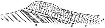
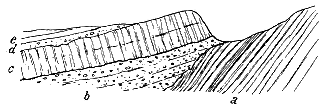
It was while this geographical type continued in the South-west of England that the volcanic eruptions took place which we are now considering. De la Beche correctly referred these eruptions to the early part of the red sandstone series. A brief examination of the ground suffices to show that although, as he pointed out, the volcanic rocks lie towards the base of that series, as shown in Fig. 228, they do not all occupy the same platform. That in some cases the lavas lie directly on the Culm-measures, while in others they are separated from these strata by 100 feet or more of red sandstones and breccias (Fig. 229), would not in itself be proof of any difference of age or stratigraphical position in the igneous rocks, for the floor on which the Permian formations were here laid down can be shown to have been - 98 - singularly uneven. Prominent hills of Culm grit, several hundred feet high, rose above the basins in which the earliest Permian sediments were deposited, and these eminences were gradually submerged and buried under the detritus.
But that the volcanic zone includes in some places more than one outflow of lava with layers of sandstone, breccia and tuff between the successive sheets may be proved in different parts of the district. Thus the two conspicuous hills at Kellerton are composed of several sheets of highly slaggy lava, separated by breccia, and a third much thinner sheet lies above these, intercalated in a mass of breccia, sandstone and sandy tuff (Fig. 230). Again, at Budlake the sandstones and fine breccias include a thin band of vesicular lava, while farther to the east they are interrupted by a higher and thicker zone of similar material.
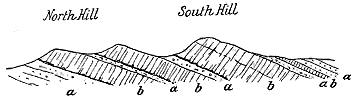
These igneous sheets can be shown by many interesting sections to have been poured out contemporaneously with the deposit of the sedimentary material among which they occur. At Crabtree, for instance, near Kellerton, the uppermost lava is a thin sheet of highly slaggy texture, which rests immediately on the gravelly red sandstone and catches up parts of it, while the pebbles include fragments of some of the andesites below. The dark lavas are occasionally traversed by veins of fine hard sandstone, which descending from above, like those in the Old Red Sandstone and Permian lavas of Scotland, have been produced by the silting or drifting of fine sand into cracks in the lava, before the igneous material was entirely buried. These features are well exposed in the high ridge of the Belvedere near Exeter (Fig. 228), where, over a thin and inconstant band of red breccia and marl which rests on the upturned ends of the Culm-measures, a band of dull-red andesite may be seen. This rock, partly compact and partly highly amygdaloidal, is in some portions full of irregular fissures and cavities filled with sandstone.
Nowhere among the Palæozoic volcanic rocks of Britain are more remarkable examples of the slaggy structure to be found than in these Devonshire lavas of probably Permian age. I would especially cite the rock of Knowle Farm, a few miles to the west of Crediton, as in part a mere spongy pumice, blocks of which would originally have floated in water.
One of the best sections in the district for the exemplification of the internal structures of these lavas is that in the large quarry at the top of Posbury Hill. On the west side of this quarry the rock is tolerably compact, - 99 - but contains vesicles and irregular steam-holes. On the east side it passes upward and laterally into a coarse agglomerate of its own fragments, and in its mass it encloses similar agglomerate. No sharp passage can be traced between the two rocks. So far as I could judge, it seemed to me that the lava had broken up as it moved along, possibly shattered by coming in contact with water. The agglomerate is overlain by some reddish ashy sandstone, which fills up the interstices between the slags, and is immediately covered by a bed of lilac andesite, marking another distinct outflow.
As in Ayrshire, the lavas of Devonshire are not accompanied by any thick accumulation of tuff. The fragmentary discharges consisted in both areas of fine dust and gravelly detritus of small lapilli, which were not ejected in such quantities as entirely to conceal the ordinary non-volcanic sediment of the water-basin. The dust and cinders mingled with the red sand and angular scree-material, so that we now see a group of red, somewhat ashy sandstones and breccias. Among the component fragments of the breccias, a considerable variety of igneous material may be observed. While the most of the non-volcanic stones may have been derived by ordinary processes of weathering from rocks exposed at the surface, it is by no means improbable that some of them, including even pieces of Culm grit, killas and baked slate, may have been ejected from volcanic vents.[111]
[111] On the composition of the Devonshire breccias see Mr. R. N. Worth, Quart. Journ. Geol. Soc. vol. xlvi. (1890), p. 69. This author has adopted the view that the granite of Dartmoor represents the neck of a great volcano from which these later volcanic materials were ejected. But all the evidence seems to me in favour of numerous small vents situated not far from the outcrops of the lavas, as stated in the text. See Mr. B. Hobson, Quart. Journ. Geol. Soc. vol. xlviii. (1892), p. 498. The Dartmoor granite is later than the surrounding Carboniferous rocks, but no good evidence has been obtained to connect it with the Permian volcanic phenomena of Devonshire.
Taking the volcanic rocks of this district as a whole, I regard them as the mere edges of sheets that have flowed from vents which not improbably lie concealed somewhere along the centres of these old Permian valleys. No visible necks have been described from any part of the area, and though I have not examined the whole of it, nothing of that nature was detected by me either in the Crediton Valley or between Silverton and the Exeter neighbourhood. The Tiverton district, which has not yet been searched, appears to be the only tract where any chance remains of finding some of the vents.
No indication of any sills has been met with among the Devonshire Permian rocks. None of the lavas which I have seen have the internal characters of true sills, while in the field their association with the sandstones and breccias in no observed case points to intrusion.
Though much remains to be done in this region before an adequate account can be given of the interesting series of eruptions which concludes - 100 - the long volcanic history of the South-west of England, enough is known to indicate the general character of the phenomena. The eruptions were on even a feebler scale than those of the Permian period in Scotland, but they seem to have resembled them in their general character. Small puy-like vents were opened, from which dark scoriaceous lavas and showers of gravelly tuff and stones were discharged over the floor of the inland sea or lake-basin in which the red sandstones and breccias were accumulated. These outflows and explosions took place too, as in Scotland, towards the beginning of the deposition of the red strata, and entirely ceased long before that deposition came to an end. In each area the eruptions mark the close of Palæozoic volcanic activity in Britain. The varied and recurrent volcanic episodes which distinguished each successive geological period from the Archæan onwards now definitely terminate, not to be resumed until after the passing of the whole of the vast cycle of Mesozoic ages.
Between the thick and thoroughly marine development of the Carboniferous Limestone in Derbyshire and in South Wales, there lies the region, already referred to, wherein both the Carboniferous Limestone and Millstone Grit die out against what must have been a ridge of land or group of islands that stretched in a general east and west direction from the high grounds of Wales through Shropshire, Staffordshire and Leicestershire. On the slopes of this ridge the limestone is gradually overlapped by the Millstone Grit, and both are in turn overlapped by the Coal-measures, which are then found lying immediately on the more ancient rocks of the region—Cambrian or pre-Cambrian, Silurian and Old Red Sandstone. The gradual subsidence that led to the deposit of several thousand feet of Carboniferous strata over the regions to north and south, before the beginning of the Coal-measure period, does not seem to have sensibly affected the persistence of this old terrestrial surface, which probably lay on an axis of upward movement, so that, amidst the surrounding depression, its position above water was on the whole maintained. But there are indications that the inequality of movement in this part of the earth's crust was of much older date than the Carboniferous period. The Old Red Sandstone is conformably continuous below the base of the Carboniferous system, and in Wales is estimated to be some 10,000 feet thick. No break has yet been detected in this vast accumulation of sedimentary material, though it is highly probable that some such unconformability must exist in it as that between the Scottish Lower Old Red Sandstone, which passes down into the Upper Silurian shales, and Upper Old Red Sandstone, which graduates upward into the base of the Carboniferous formations. But even if such a break should be discovered, it will not account for the position of the Coal-measures on Cambrian or even perhaps older rocks. It is hardly conceivable that, had these rocks been covered with a full development of Old Red Sandstone, they could have - 101 - been stripped of it by denudation before the deposition of the Coal-measures. It seems much more probable that the discrepancy in the terrestrial movements had commenced in Old Red Sandstone time, and that these ridges of ancient Palæozoic rocks never sank below the waters in which the vast thickness of red sandstones, marls and conglomerates was laid down.[112]
[112] See a discussion of this subject in Jukes' Preface to his South Staffordshire Coal-field.
But apart from the question of its antiquity, this tract of persistent land has a special interest in the history of volcanic action in Britain, for it was the scene of some remarkable protrusions of eruptive material which took place after a part, and possibly after the whole, of the Coal-measures were accumulated. The date of these protrusions cannot be fixed with greater precision; but there can be no doubt that they belong to one of the later volcanic periods in the geological history of Britain, and the account of them is therefore included in the present Chapter of this work.
In the English Midlands south of Stafford, over a tract of country about 700 square miles in extent, stretching from Birmingham on the east, across the vale of the Severn, to the uplands of Shropshire on the west, the Coal-measures, partly isolated into outliers by denudation and partly separated by overlying younger formations, are pierced by masses of intrusive igneous rocks. Many of these masses have long been familiar to geologists. Those, for example, of the Clee Hills of Shropshire, and the Rowley, Barrow and Pouk Hills of Staffordshire and Worcestershire, have been frequently described, their relations to the surrounding strata have been minutely sought out, their composition has been chemically determined, and their microscopic structure has been investigated. But they have been studied rather as individual masses of local importance. No attempt has yet been made to ascertain how far they are capable of being grouped together as one connected series, linked with each other in chemical and mineralogical characters, and containing a definite record in the volcanic history of the country. This is a task which, it is to be hoped, some competent inquirer will before long undertake.
In the meantime it is only possible to review here the already published information, and to gather from it what may at present be surmised to have been the history of these later eruptions of the Midlands.
The areas where the igneous rocks now to be described are exhibited may be conveniently placed in the following five groups:—1st, Titterstone Clee Hill; 2nd, Brown Clee Hill; 3rd, The Forest of Wyre Coal-field; 4th, The Coalbrookdale Coal-field; and 5th, The South Staffordshire Coal-field.
1. The Titterstone Clee Hill forms a ridge about seven miles long and a mile and a quarter broad, running in a north-easterly direction over the Old Red Sandstone uplands of the south of Shropshire. The ground rises gradually towards the south-west, until it reaches there a height of 1754 feet (Fig. 232). On the north-western side of the ridge, the last vanishing representative of the Carboniferous Limestone can be seen to be overlapped the Millstone Grit, which, as it is traced towards the south-west, is in turn overlapped by the Coal-measures, and these, about 400 feet thick, then - 102 - rest immediately on the Old Red Sandstone. Two sheets of columnar olivine-dolerite, possibly originally connected, lie as cakes on the summit and eastern slope of the ridge, and cover in all a space of about a square mile and a half. The larger sheet, which varies from 60 to 180 feet in thickness, overlies the Coal-measures, and the coals of the Cornbrook coal-field have been worked underneath it. The smaller mass, which may be 300 feet in thickness, forms the summit of the ridge. On its eastern side it reposes on Coal-measures, which are there much disturbed; but on the west side, where it forms a bold capping to the escarpment, it is underlain at once by the Old Red Sandstone. There cannot be any doubt that these masses of eruptive material are sills, which have been injected into the Carboniferous strata, and partly between these strata and the Old Red Sandstone. One or more dykes of eruptive rock have been met with in mining, and the coal on approaching them undergoes alteration.[113]
[113] See J. R. Wright, Trans. Geol. Soc. (2nd ser.) iii. (1832), p. 487. Titterstone Clee Hill is shown on Sheet 55 N.E. and N.W. of the Geological Survey, and in Horizontal Sections, Sheets 33 and 36, from which Fig. 232 is reduced. The microscopic structure of the dolerite has been described by Mr. Allport, Geol. Mag. 1870, p. 159; Quart. Journ. Geol. Soc. xxx. (1874), p. 550.
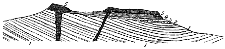
2. Brown Clee Hill consists of two outliers of Coal-measures, each about a mile long, placed on the summit of a broad ridge of Old Red Sandstone, and rising to a height of 1800 feet above the sea. Both of the outliers is capped with a cake of dolerite, and a third smaller patch of the same material lies on the southern outlier between the cappings. Neither at this locality nor around Titterstone Clee have any eruptive rocks been observed rising through the older strata. It is evident that in both cases the orifices or fissures up which the molten material rose lie concealed under the surviving cakes of dolerite.[114]
[114] Brown Clee Hill is mapped in Sheet 61 S.W. of the Geological Survey, and its structure is shown in Sheet 36 of the Horizontal Sections.
3. Forest of Wyre Coal-field.—On both sides of this extensive tract of Coal-measures, the strata near the base of the series are traversed by sills or dykes of olivine-dolerite like that of the Clee Hills. The sandstones in contact with the eruptive rock have been indurated. In this district, also, the evidence shows that the sheets are intrusive, and later than the portion of the Coal-measures there visible.[115]
[115] This district is represented in Sheets 55 N.E. and 61 S.E. of the Geological Survey. The microscopic structure of the larger mass on the west side of the coal-field, and the variations in the minute structure of the intrusion which forms a long ridge on the east side, are described by Mr. Allport, Quart. Journ. Geol. Soc. xxx. pp. 550, 551.
- 103 -
4. Coalbrookdale Coal-field.—In this interesting district a sill of rather finely crystalline olivine-dolerite, which is estimated to be nearly 200 feet thick, is traceable from near Little Wenlock for three miles to the north, intercalated between the Carboniferous Limestone and the Silurian rocks underneath. It appears to underlie the western part of the Coal-field, for it is exposed by denudation in several valleys between Little Wenlock and Great Dawley. Owing to the thinning out of the Carboniferous Limestone in an easterly direction, the sill gradually comes to have the Millstone Grit on its upper surface, and at one point is represented on the Geological Survey map as even intruded into the Coal-measures. Here again we have an intrusive sheet of later date than at least the earlier part of the Coal-measures, and no evidence of any superficial outflow of volcanic material.[116]
[116] The Coalbrookdale coal-field has been described by Sir Joseph Prestwich, Trans. Geol. Soc. (2) v. p. 428; and Prof. E. Hull, Quart. Jour. Geol. Soc. xxxiii. (1877), p. 629. The minute structure of the sill at Little Wenlock is referred to by Mr. Allport, op. cit. p. 550. The ground is mapped on Sheet 61 N.E. of the Geological Survey, and its structure is shown on Sheet 54 of the Horizontal Sections.
5. South Staffordshire Coal-field.—This district, in respect to its igneous intercalations, has been much more fully examined and described than any of the others. It forms the subject of an exceedingly able memoir by Jukes, who carefully studied its geology and delineated it on the maps and sections of the Geological Survey. Since his time the rocks have been studied microscopically, but no material facts regarding the stratigraphy have been obtained in addition to those which he patiently collected and generalized upon.[117]
[117] Jukes, "South Staffordshire Coal-field," Mem. Geol. Surv. 2nd edit. (1859). The area is embraced in Sheet 62 N.W. and S.W. of the Geological Survey, and is illustrated in Sheets 23, 24 and 25 of the Horizontal Sections.
This coal-field is above 20 miles long and 5 miles broad. Its strata rest unconformably on Upper Silurian strata, which, as part of the ancient ridge or island already referred to, project here and there from amidst the Coal-measures. The boundaries of the field on the east and west sides are chiefly made by faults which bring down Permian and Triassic formations against the Carboniferous strata.
Throughout this coal-field sheets of igneous rock are abundant. In the detailed account of them given by Jukes in his admirable essay on the South Staffordshire Coal-field,[118] he distinguished two kinds of igneous material—"basalt," which comes out at the surface, and sometimes overlies the Coal-measures in large cakes like that of the Rowley Hills, which extends for two miles in one direction and more than a mile in another; and "greenstone," which burrows among the coal-bearing strata, and gives off dykes and veins of "white rock-trap." There does not appear, however, to be any essential difference in composition, age or origin between these contrasted kinds of igneous material. They not improbably all belong to one series of extrusions, their distinctions being due rather to - 104 - the conditions under which they were erupted, and in particular to their comparative thickness, and the influence of adjacent coals and carbonaceous shales upon them.
The igneous rocks seen at the surface in this district form a series of well-marked eminences. Of these the largest extends as a ridge from Dudley to beyond Rowley Regis, a distance of more than two miles. To the west of this tract, a number of small patches of the same material crop out at the surface, the most important forming Barrow Hill. Six miles farther north another group of similar patches may be seen. Of these the largest occurs at Wednesfield, but the most noted forms the Pouk Hill, which has long been noted for the beauty of its columnar structure.
The sheets of "greenstone" met with in the coal-field are more numerous and extensive than the detached areas of more compact rock visible above ground, a single sheet being sometimes traceable in the coal-workings for two miles in one direction.
The eruptive rocks of this district, when examined in their freshest form, consist of well-preserved olivine-dolerite. An examination of the "greenstone" and the "white rock-trap," which runs in fingers and threads through the coal, shows that these are really the same dolerite which has undergone alteration, the ferruginous silicates having especially been decomposed.[119]
[119] Allport, Quart. Journ. Geol. Soc. xxx. (1874), p. 547. Chemical analysis also shows the identity of the rocks and the nature of the alteration of the "white rock." See Jukes, "South Staffordshire Coal-field," pp. 117, 118.
The sills of greenish decomposed material that have been injected amongst and alter the coals, vary from 15 feet to 80 or 90 feet in thickness. The largest of the dolerite cakes on the surface, that of the Rowley Hills, is somewhat irregular in its thickness, but may reach as much as 100 feet.
That nearly the whole of the igneous material is intrusive is admitted by all observers who have studied the ground. The manner in which the "basalts" and "greenstones" send out veins into the Coal-measures shows conclusively that they have been injected into the strata. The only rock about which some doubt has been expressed is that of the Rowley Hills, which Jukes was disposed, though not without some hesitation, to consider as part of an actual lava-stream. He based this inference chiefly on the occurrence, immediately under the dolerite, of what he looked upon as a "trappean breccia or brecciated ash, containing rounded and angular fragments of igneous rock lying in a brown rather ferruginous paste, that looks like the debris of a basaltic rock."[120] This breccia he regarded as belonging to and passing into the Coal-measures, and he was thus inclined to regard the dolerite as a lava of Coal-measure age.
It is possible, however, that the "trappean breccia" may be of the same nature as the "uncompressed balls of basalt bedded in a mass of decomposed basalt or basaltic 'wacke' or clay"[121]—that is, a decayed contact layer of the eruptive rock. But if it be regarded as the fragmental accompaniment of a lava-stream, it can hardly belong to the Coal-measures. If - 105 - the dolerite had been a lava of that age, it ought to be found lying conformably on the Coal-measures. But this it does not appear to do. Making every allowance for the way in which an advancing current of lava might plough up soft sediment on the bottom of the sea or of a lake, we can hardly thus account for the very uneven surface of Coal-measures on which the sheet of igneous rock rests. If the Rowley rock be looked upon as a lava which flowed out at the surface, it must, I think, be assigned to a time subsequent to that of the Coal-measures, when these strata had been upraised and had suffered some amount of denudation. I confess, however, that the petrographical characters of the rock, the alteration of the coals which have been worked underneath it, and the abundant veins of "white rock" which there traverse the seams, induce me to regard this rock as forming no exception to the general rule in the Midlands, but as having been intruded as a sill, now laid bare by denudation. Its fresher condition may arise from its thickness, or from some other circumstance which has not been ascertained.
We have now to consider the probable geological date of the various intrusions of basic igneous material which can be traced over so wide an area in the centre of England. In discussing the subject, Jukes pointed out that in the surrounding district "no igneous rocks of any kind are found in any formation newer than the Coal-measures."[122] This statement is, with the exception of one locality, undoubtedly true.[123] But on any view there must have been a long interval of time between the formation of the highest strata of the South Staffordshire coal-field and that of the lowest Permian deposits of the district. It is quite conceivable, though at present incapable of proof, that the extravasation of eruptive material took place after the close of the Carboniferous period and during the earlier part of the Permian period.
Jukes further shows that "at whatever period these igneous rocks were produced, they were all existent before the production of the faults and dislocations that have traversed the Coal-measures, and before any great denudation had been effected on the country." This argument may be readily granted. But, so far as we know, many, if not most, of the faults traverse also the surrounding Permian and Triassic rocks, so that igneous masses protruded during those periods would be affected by the same dislocations.
When we consider the history of Palæozoic time in this country, and especially the proof, obtainable everywhere else in Britain, that volcanic energy became quiescent during the accumulation of the Coal-measures, we may well demand better evidence than has hitherto been forthcoming that any portion of the dolerites of the Midlands is of Carboniferous age. It is important to notice that though the dolerite sills and veins are so abundant in the South Staffordshire coal-field, coming even in many places up to the present surface of the ground, no single case has been observed where they rise into the Permian rocks that overlie the Coal-measures unconformably. It is difficult to believe that, had these intrusions taken place after the deposition of the - 106 - younger formation, they should not be found penetrating it.[124] It seems almost certain that they must be of an age intermediate between the Coal-measures of South Staffordshire and the surrounding breccias and sandstones of the Permian series. And as there is clear evidence of contemporaneous volcanic action in the lowest part of the Permian system to the north in Scotland and to the south in Devonshire, the inference seems not unreasonable that these intrusive basalts of the Midlands are most probably of Permian age.
[124] Only one instance is known where in Staffordshire any igneous rock has been intruded into rocks younger than the Coal-measures (Allport, Quart. Journ. Geol. Soc. vol. xxx. p. 551; Sheet 72 S. W. of the Geological Survey, and Horizontal Sections, Sheet 57). It forms a dyke which has been traced near Norton Bridge, Swinnerton and Butterton, running for 8 miles in a N.N.W. direction, and rising through Permian, Bunter and Keuper strata. It is a highly basic olivine-basalt, and is unquestionably a dyke. Mr. J. Kirkby, who has recently mapped and described it (Trans. North Staffordshire Naturalists' Field-Club, xxviii. (1894), p. 129), suggests that it may be connected with the igneous rocks of the South Staffordshire coal-field. But of this idea there is no evidence. The last point to which the dyke has been traced is some five-and-twenty miles from the nearest known portion of the dolerites of the coal-field. I have little doubt that this dyke is really an outlying member of the great system of Tertiary dykes described in Book VIII. of the present work.
No trace of vents has been met with in the Coal-measures of the Midland district or among the surrounding older rocks, nor any proof that the abundant sills and veins were connected with the eruption of volcanic materials at the surface. Nevertheless, from the analogy of the structure of these intrusive sheets to that of the sills in such volcanic districts as the southern half of Scotland, we may well believe that they were connected here and there with eruptive vents, and thus that besides the northern and southern districts of Permian volcanoes, there rose a central group among the lagoons of the heart of England. Though no vestige of any such group has been detected, we must remember that a large portion of the Midlands is overspread with Permian and Triassic deposits, and that much more igneous rock may be concealed than appears at the surface. Possibly there may be buried under these younger sheets of red sandstone and marl, lavas and tuffs with their connected vents, such as may be seen where the Permian volcanic series has been laid bare by denudation in Ayrshire and Devonshire. In this respect it would be interesting to make a thorough examination of the Permian breccias of the district, with the view of discovering whether, though the volcanic rocks in situ may still lie covered up, fragments of them may not be found in these deposits.
| TO ACCOMPANY SIR ARCHIBALD GEIKIE'S "ANCIENT VOLCANOES OF BRITAIN" | Map V. | |
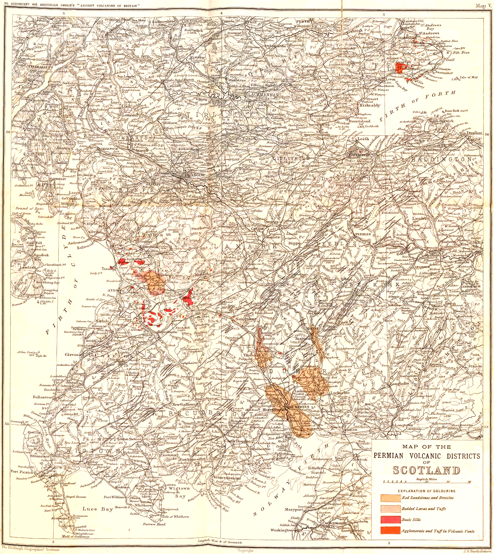 |
||
| The Edinburgh Geographical Institute | Copyright | J. G. Bartholomew |
| MAP OF THE PERMIAN VOLCANIC DISTRICTS OF SCOTLAND Click on map to view larger sized. |
||
- 107 -
Vast lapse of time between the close of the Palæozoic and beginning of the Tertiary Volcanic Eruptions—Prolonged Volcanic Quiescence—Progress of Investigation among the Tertiary Volcanic Series of Britain.
From the evidence which has been led in the foregoing chapters it is clear that during the later stages of the Palæozoic period there was a gradual enfeeblement of volcanic vigour over the area of the British Isles. When the last puys of the Permian series became extinct a remarkable volcanic quiescence settled down on the region. This interval of rest lasted throughout the whole of the long succession of the Mesozoic ages. Though the geological record of this section of geological time is singularly complete in Britain, not a single vestige has yet been found in it of any contemporaneous eruption. And what is true of this country is, on the whole, true of the entire European continent. With some trifling exceptions there were no volcanoes in Europe, so far as we know, during the enormous lapse of time between the last of the Palæozoic and the earliest of the Tertiary eruptions.
When the geologist attempts to form an estimate of the chronological value of this interval of time he is soon lost in bewilderment over its obvious vastness, and the impossibility of discovering any standards of measurement by which to reckon its duration. On the one hand, he sees that it lasted long enough to admit of the gradual elaboration of many thousands of feet of various sedimentary deposits, which, from their remarkable diversities of character, were evidently accumulated, on the whole, with extreme slowness and amidst many geographical vicissitudes. On the other hand, he perceives that the interval sufficed to bring about an entire change in the fauna and flora of the globe. Indeed, the more he investigates the details of this biological transformation, the more he is impressed with the length of time that it must have required. For it is not merely one complete change, but a multifold succession of changes. The stratigraphical - 108 - records of the long array of geological periods over which it was spread show that the biological evolution advanced through a vast series of species, genera and orders which one by one appeared and disappeared.
The ages that elapsed between the final dying out of the Palæozoic volcanoes and the outburst of those of Tertiary time were so protracted that many revolutions of the geography of Europe were comprised within them. Land and sea changed places again and again. First came the singular topography of the Trias, which prolonged and accentuated the characteristics of the closing Palæozoic ages. Next arose the more genial climate and more varied geography of the Jurassic period, when comparatively shallow seas overspread the site of most of the European continent, and tracts of old land stretched away to the west and north. Another crowded succession of changes in the disposition of land and sea filled the long Cretaceous period, at the close of which a more rapid and complete transformation in European geography took place.
Yet during all these transitions and vicissitudes, so far as we know, volcanic energy remained quiescent throughout Western Europe. It was not until some time after the great terrestrial movements that raised so much of the Cretaceous sea-floor into land, and laid the foundations of the modern continent, that the subterranean fires once more awoke to vigorous action.
The renewal of eruptions in the early ages of Tertiary time was as widespread as it was energetic. Over many regions of the European continent volcanoes broke out either in new areas or on old sites. For the most part they appeared as scattered puys or as Vesuvian vents, generally not of the first magnitude, like those of Central France, Hungary, Würtemberg and Italy. But in the north-west they assumed more colossal proportions, and took the form of fissure-eruptions by which many thousands of square miles of country were deluged with lava. From the South of Antrim all along the West of Scotland to the north of the Inner Hebrides remains of these basalt-floods form striking features in the existing scenery. The same kind of rocks reappear in the Faroe Islands and in Iceland, so that an enormous tract of North-western Europe, much of it now submerged under the sea, was the scene of activity of the Tertiary volcanoes. In entering, therefore, upon a consideration of the British Tertiary volcanic rocks, we are brought face to face with the records of the most stupendous succession of volcanic phenomena in the whole geological history of Europe. Fortunately these records have been fully preserved in the British Isles, so that ample materials remain there for the elucidation of this last and most marvellous of all the volcanic epochs in the evolution of the continent.
As the remains of the Tertiary series of volcanic eruptions are the youngest of all the volcanic records of Britain, they are naturally the freshest and most abundantly preserved. They consequently reveal with singular clearness multitudes of volcanic phenomena that are less distinctly recognizable, or not to be found at all, among the Palæozoic systems. Hence they will be discussed in greater detail in the following chapters.
- 109 -
As a consequence of their greater freshness and wider extent, and largely also because of the way in which they have been exposed along many leagues of picturesque sea-cliffs in the North of Ireland and the West of Scotland, they attracted attention at an earlier time than the less obvious volcanic memorials of older ages. The gradual development of opinion regarding the nature and history of volcanic rocks is thus in no small measure bound up with the progress of observation and inference in regard to the Tertiary volcanic series. I shall therefore begin this narrative by offering a rapid sketch of the history of inquiry respecting the Tertiary volcanic areas of the British Isles.
The basaltic cliffs of Antrim and the Inner Hebrides had attracted the notice of passing travellers, and their striking scenery had become more or less familiar to the reading public, before any attention was paid to their remarkable geological structure and history. In particular, the wonders of the Giant's Causeway and the Antrim coast had already begun to draw pilgrims, even from distant countries, at a time when geology had not come into existence. The scientific tourist of those days who might care to look at rocks was, in most cases, a mineralogist, for whom their structural relations and origin were subjects that lay outside of the range of his knowledge or habits of thought. In the year 1772 Sir Joseph Banks, together with Solander and a party, visited Staffa and brought back the earliest account of the marvels of that isle as they appeared to the sober eyes of science. His narrative was communicated to Pennant, together with a number of drawings of the cliffs and of Fingal's Cave. These were inserted by that geographer in his Second Tour, published in 1774, and from their careful measurements of the basaltic pillars and their delineation of the basaltic structure, are of special interest in the history of volcanic geology.
An intelligent appreciation of some of the geological interest of the region is to be found in the writings of Whitehurst,[125] who gave a good account of the basalt-cliffs of Antrim, and regarded the basaltic rocks as the results of successive outflows of lava from some centre now submerged beneath the Atlantic. More important are the observations contained in two letters of Abraham Mills.[126] This writer had been struck with the dykes on the north coast of Ireland, and was led to examine also those in some of the nearer Scottish islands. He believed them to be of truly volcanic origin, and spoke of them as veins of lava. A few years later, Faujas St. Fond made his well-known pilgrimage to the Western Isles. Familiar with the volcanic rocks of Central France, he at once recognized the volcanic origin of the basalts of Mull, Staffa and the adjoining islands.[127] His account of the journey, published in Paris in 1797, may be taken as the beginning of the voluminous geological literature which has since gathered round the subject. Three years afterwards (1800) appeared Jameson's Outline of the Mineralogy of the Scottish Isles. Fresh from the teaching of Werner at - 110 - Freiberg, the future distinguished Professor of Natural History in the Edinburgh University naturally saw everything in the peculiar Wernerian light. He gave the first detailed enumeration of some of the eruptive rocks of the Hebrides, but of course ridiculed the idea of their igneous origin. Having heard of a reported "crater of a volcano" near Portree, he ironically expressed a hope that "there may be still sufficient heat to revive the spirits of some forlorn fire-philosopher, as he wanders through this cold, bleak country."[128]
[125] Inquiry into the Original State and Formation of the Earth, 2nd edit. 1786.
[126] Philosophical Transactions for 1790.
[127] Voyage en Angleterre, en Écosse et aux Îles Hébrides. Paris, 1797.
[128] It will be shown in a later chapter that there is a remarkably perfect volcanic vent near Portree, but the supposed crater referred to by Jameson was probably some little corry among the sheets of basalt.
The advent of Jameson to Edinburgh gave a fresh impetus to the warfare of the Plutonists and Neptunists, for he brought to the ranks of the latter a mineralogical skill such as none of their Scottish opponents could boast. The igneous origin of basalt, which the Plutonists stoutly maintained, was as strongly denied by the other side. For some years one of the most telling arguments against the followers of Hutton was derived from the alleged occurrence of fossil shells in the basalt of the north coast of Ireland. Kirwan[129] quoted with evident satisfaction Richardson's observation of "shells in the basalts of Ballycastle," and Richardson[130] himself, though the true explanation, that the supposed basalt is only Lias shale altered by basalt, had been stated in 1802 by Playfair,[131] continued for ten years afterwards to reiterate his belief in the aqueous origin of basalt. Thus the Tertiary volcanic rocks furnished effective weapons to the combatants on both sides. The dispute regarding the black fossiliferous rocks of Portrush had the effect of drawing special attention to the geology of the North of Ireland. Among the more noted geologists who were led to examine them, particular reference must be made to Conybeare and Buckland, who, in the year 1813, studied the interesting coast-sections of Antrim. The report of their observations gives an excellent summary of the arguments for the truly igneous origin of basalt, and a statement of opinion in favour of the view that the bedded basalts are the products of submarine volcanoes. Berger also about the same time described in fuller detail the geology of the Antrim district, and showed the rocks of the basalt-plateau to be younger than the Chalk. He likewise made a study of the basalt-dykes of the North of Ireland, and was the first to point out their prevalent north-westerly direction. The memoirs of these geologists[132] may justly be regarded, to quote the words of Portlock, as "the first effectual step made in Irish - 111 - geology." Portlock's own description is still the most complete summary of the geology of that interesting region.[133]
[129] Geological Essays, 1799, p. 252, footnote.
[130] Richardson lived on the Antrim coast, and had daily opportunities of examining the admirable rock-sections there exposed. It was he who found the shells in supposed basalt, and led the geologists of his day astray on this subject. He made a clever but irrelevant reply to Playfair's plain statement of facts (Trans. Roy. Irish Acad. vol. ix. 1803, p. 481). His elaborate attack on "the Volcanic Theory" will be found in Trans. Roy. Irish Acad. vol. x. (1806), pp. 35-107. Though lively enough as a specimen of controversial writing, it forms, when seriously considered, rather a melancholy chapter in geological literature.
[131] Illustrations of the Huttonian Theory, § 252.
[132] They are contained in the third volume of the Transactions of the Geological Society.
[133] "Report on the Geology of the County of Londonderry and parts of Tyrone and Fermanagh," Mem. Geol. Survey, 1843.
While such advances were being made in the knowledge of the structure of the volcanic rocks of the North of Ireland, the geologist had already appeared who was the first to attempt a systematic examination of the Western Islands, and whose published descriptions are still a chief source of information regarding the geology of this extensive region. Dr. Macculloch seems to have made his first explorations among the Hebrides some time previous to the year 1814, for in that year he published some remarks on specimens from that district transmitted to the Geological Society.[134] For several years in succession he devoted himself with great energy and enthusiasm to the self-imposed task of geologically examining and mapping in a generalized way all the islands that lie to the westward of Scotland, from the remote St. Kilda even as far as the Isle of Man. From time to time, notices of parts of his work were given in the Transactions of the Geological Society. But eventually in 1819 he embodied the whole in his Description of the Western Islands of Scotland, including the Isle of Man.
[134] Trans. Geol. Soc. vol. ii. 1814.
This great classic marks a notable epoch in British geology. Properly to estimate its value, we should try to realize what was the state of the science in this country at the time of its appearance. So laborious a collection of facts, and so courageous a resolution to avoid theorizing about them, gave to his volumes an altogether unique character. His descriptions were at once adopted as part of the familiar literature of geology. His sections and sketches were reproduced in endless treatises and text-books. Few single works of descriptive geology have ever done so much to advance the progress of the science in this country. With regard to the special subject of the present memoir, Macculloch showed that the basalts and other eruptive rocks of the Inner Hebrides pierce and overlie the Secondary strata of these islands, and must therefore be of younger date. But though he distinguished the three great series of "trap-rocks," "syenites" and "hypersthene-rocks" or "augite-rocks," and indicated approximately their respective areas, he did not attempt to unravel their relations to each other. Nor did he venture upon any speculations as to the probable conditions under which these rocks were produced. He claimed that those who might follow him would find a great deal which he had not described, but little that he had not examined. Subsequent observers have noted many important facts, of which, had he observed them, he would at once have seen the meaning, and which he certainly would not have passed over in silence. But as a first broad outline of the subject, Macculloch's work possesses a great value, which is not lessened by the subsequent discovery of details that escaped his notice, and of important geological relations which he failed to detect.
It has already been pointed out that some of the earliest and ablest observations among the volcanic rocks of this country, especially in Scotland, were made by foreigners. Students who had repaired from abroad to Edinburgh - 112 - for education sometimes caught the geological enthusiasm, then so marked in that city, and made numerous journeys through the country in search of further knowledge of Scottish rocks and minerals. In other instances, geologists of established reputation, attracted by the interest which the published accounts of the geology of Scotland had excited, were led to visit the country and to record their impressions of its rock-structure. Of the first class of observers the two most noted were Ami Boué and L. A. Necker; of the second, special acknowledgment is due to Faujas St. Fond and to Von Oyenhausen and Von Dechen.
The labours of Boué[135] have already been referred to in connection with the literature of the Scottish Old Red Sandstone (vol. i. p. 269). In his treatment of the Tertiary Volcanic series of Scotland he appears to have relied mainly on the then recently published volumes of Macculloch.
[135] Essai géologique sur l'Écosse. Paris, 1820.
L. A. Necker, as the grandson of the illustrious De Saussure, had strong claims on the friendly assistance of the School of Geology at Edinburgh when he went thither in 1806, at the age of twenty, to prosecute his studies. He was equally well received by the Plutonists and Neptunists, and devoted some time to the exploration of the geology not only of the Lowlands, but of the Highlands and the Inner Hebrides. Most of his observations appear to have been made in the year 1807, but it was not until fourteen years afterwards that he published the account of them.[136] The geological part of this work must be admitted to be somewhat disappointing. The author's caution not to commit himself to either side of the geological controversy then waging makes his descriptions and explanations rather colourless. He adds little to what was previously known. Even as regards the origin of the basalts of the Western Islands, he could not make up his mind whether or not to regard them as volcanic, but contented himself by referring them to "the trappean formation." Yet these islands had so fascinated him that eventually he returned to them as his adopted home, passed the last twenty years of his life among them, and died and was buried there. Besides his Voyage, he published in French an account of the dykes of the Island of Arran.[137]
[136] Voyage en Écosse et aux Îles Hébrides. See also biographical notice of L. A. Necker, by Principal J. D. Forbes, Proc. Roy. Soc. Edin. v. (1862), p. 53.
[137] Trans. Roy. Soc. Edin. vol. xiv. (1840), p. 667.
Among the foreign geologists who have been drawn to the Scottish mountains and islands by the interest of their Tertiary volcanic rocks, I have already spoken of Faujas St. Fond. Much more important, however, were the observations made some thirty years later by two German men of science, Von Oyenhausen and Von Dechen. Their careful descriptions of the geology of Skye, Eigg and Arran added new materials to the knowledge already acquired by native geologists.[138] To some of the more interesting parts of their work reference will be made in later pages.
[138] Karsten's Archiv (1829), vol. i. p. 56.
The numerous trap-dykes of Northumberland, Durham and Northern - 113 - Yorkshire at an early date attracted the attention of geologists. As far back as 1817, they had been the subject of a memoir by N. J. Winch,[139] who gave an account of their effects on the adjacent rocks. More important were the subsequent papers on the same subject by Sedgwick, who, discussing the lithological characters, probable origin and geological age of the dykes, pointed out that while the Cleveland dyke was undoubtedly younger than a large part of the Jurassic rocks, there was no direct evidence to determine whether dykes farther north were earlier or later than the time of the Magnesian Limestone.[140] Subsequent accounts of the dykes of the same region were given by Buddle,[141] M. Forster,[142] N. Wood,[143] H. T. M. Witham,[144] Tate [145] and others, while in more recent years important additions to our knowledge of these dykes and of their effects have been made by Sir J. Lowthian Bell[146] and Mr. J. J. H. Teall.[147]
[139] Trans. Geol. Soc. vol. iv. (1817), p. 21. See also Tilloch's Phil. Mag. vols. xlix. and l.
[140] Cambridge Phil. Trans. vol. ii. (1827), pp. 21, 139.
[141] Trans. Nat. Hist. Soc. Northumberland, i. (1831), p. 9.
[142] Op. cit. i. p. 44.
[143] Op. cit. i. pp. 305, 306, 308, 309.
[144] Op. cit. ii. (1838), p. 343.
[145] Trans. Northumberland and Durham, ii. (1868), p. 30.
[146] Proc. Roy. Soc. xxiii. (1875), p. 543.
[147] Quart. Journ. Geol. Soc. xl. (1884), p. 209.
The geological age of the great series of Tertiary volcanic rocks has only been determined district by district, and at wide intervals. That some part of the Antrim basalts is younger than the Chalk of that region was clearly shown by Berger, Conybeare and Buckland. Portlock, however, referred to the occurrence of detached blocks of basalt which he supposed to be immersed in the Chalk near Portrush, and which inclined him to believe that "the basaltic flows commenced at a remote period of the Cretaceous system."[148] Macculloch showed that the corresponding basaltic plateaux of the Inner Hebrides were certainly younger than the Oolitic rocks of that region. But no nearer approximation to their date had yet been made when in the year 1850 the Duke of Argyll announced the discovery of strata containing fossiliferous chalk-flints and dicotyledonous leaves, lying between the bedded basalts of Ardtun Head, in the Isle of Mull.[149] In the following year these fossil leaves were described by Edward Forbes, who regarded them as decidedly Tertiary, and most probably Miocene. This was the first palæontological evidence for the determination of the geological age of any portion of the basalt-plateaux, and it indicated that the basalts of the south-west of Mull were of older Tertiary date. Taken also in connection with the occurrence of lignite-beds between the basalts of Antrim, it suggested that these volcanic plateaux were not due to submarine eruptions, - 114 - as the earlier geologists had supposed, but were rather the result of the subærial outpouring of lava at successive intervals, during which terrestrial vegetation sprang up upon the older outflows.
[148] Report on the Geology of Londonderry, p. 93. There can be no doubt that this was an error of observation. The Antrim basalts are all certainly younger than the Chalk. The supposed "lumps of basalt" were probably the ends of veins intruded into the Chalk, and perhaps partially disconnected from the main parts of the veins. Such apparently detached masses of intrusive rock are not infrequent occurrence in connection with the Tertiary intrusive sills. An example will be found represented in Fig. 321.
[149] Brit. Assoc. Report, 1850, Sections, p. 70; and Quart. Jour. Geol. Soc. vii. (1851), p. 87.
While Forbes brought forward palæontological proofs of the Tertiary age of the volcanic rocks of the south-west of Mull, he at the same time laid before the Geological Society a paper on the Estuary Beds and the Oxford Clay of Loch Staffin, in Skye, wherein, while admitting the existence of appearances which might be regarded as favourable to the view that the intercalated basalts of that region were of much later date than the Oolitic strata between which they might have been intrusively injected, he stated his own belief that they were really contemporaneous with the associated stratified rocks, and thus marked an outbreak of volcanic energy at the close of the Middle Oolitic period.[150] The Duke of Argyll, in the paper which he on the same occasion communicated to the Geological Society, adopted this view of the probable age of most of the basalts of the Western Islands. He looked upon the Tertiary volcanic rocks of Mull as occupying a restricted area, the great mass of the basalt of that island, like that of Skye, being regarded by him as probably not later than some part of the Secondary period.
[150] Quart. Journ. Geol. Soc. vol. vii. (1851), p. 104.
It must be granted that the appearances of contemporaneous intercalation of the basalt among the Secondary strata are singularly deceptive. When, several years after the announcement of the Tertiary age of the basalts of Ardtun, I began my geological work in the Inner Hebrides, I was led to the same conclusion as Edward Forbes, and expressed it in an early paper.[151] All over the north of Skye I traced what appeared to be evidence of the contemporaneous interstratification of basalts with the Jurassic rocks and I concluded (though with some reservation) that the whole of the vast basaltic plateaux of that island were not younger than some late part of the Jurassic period. In that same paper the attention of geologists was called to the probable connection of the great system of east-and-west dykes traversing Scotland and the North of England, with the basalt-plateaux of the Inner Hebrides, and as I believed the latter to be probably of the age of the Oolitic rocks, I assigned the dykes to the same period in geological history. But subsequent explorations enabled me to correct the mistake into which, with other geologists, I had fallen regarding the age of the volcanic phenomena of the Western Islands. In 1867 I showed that instead of being confined to a mere corner of Mull, the Tertiary basalts, with younger associated trachytic or granitic rocks, covered nearly the whole of that island, and that in all likelihood the long chain of basaltic masses, extending from the North of Ireland along the west coast of Scotland to the Faroe Islands, and beyond these to Iceland, was all erupted during the Tertiary period. At the same time I drew special attention to the system of east-and-west dykes as proofs of the vigour of volcanic action at that period, and - 115 - I furnished evidence that this action was prolonged through a vast interval of time, during which great subærial denudation of the older lavas took place before the outflow of the younger.[152] Later in the same year, in an address to the Geological Section of the British Association, I reiterated these views, and more particularly emphasized the importance of the system of dykes, which in my opinion was possibly the most striking manifestation of the vigour of Tertiary volcanic action.[153] In 1871, after further explorations in the field, I gave a detailed account of the structure which had led to the mistake as to the age of the Tertiary volcanic rocks of the Western Islands; and in a description of the island of Eigg, I brought forward data to show the enormous duration of the Tertiary volcanic period in the west of Britain.[154]
[151] "On the Chronology of the Trap-rocks of Scotland," Trans. Roy. Soc. Edin. xxii. (1861), p. 649.
[152] Proc. Roy. Soc. Edin. vi. (1867), p. 71.
[153] Brit. Assoc. Report (Dundee), 1867, Sections, p. 49.
[154] Quart. Journ. Geol. Soc. xxvii. (1871), p. 279.
Three years later Mr. J. W. Judd read before the Geological Society a paper "On the Ancient Volcanoes of the Highlands."[155] The most novel feature of this paper was the announcement that the author had recognized the basal wrecks of five great central volcanoes in the Western Islands, among which that of Mull was inferred by him to have been at least 14,500 feet high. He was led to the conclusion that the volcanic period in these regions was divisible into three sections—the first marked by the outburst of acid rocks (felspathic lavas and ashes, connected with deeper and more central granitic masses); the second by the extrusion of basic lavas and tuffs (the basaltic plateaux); the third by the appearance of small sporadic volcanic cones ("felspathic, basaltic, or intermediate in composition") after the great central cones had become extinct. It will be seen in the following pages that these conclusions of Professor Judd are not supported by a more detailed study of the region.
[155] Quart. Journ. Geol. Soc. xxx. (1874), p. 220.
In the year 1879, during a traverse of some portions of the volcanic region of Wyoming, Montana and Utah, I was vividly impressed by the identity of structure between the basaltic plateaux of these territories and the youngest volcanic areas of Britain. It then appeared to me that some of the puzzling features in the Tertiary volcanic series of the Inner Hebrides might be explained by the structures so admirably displayed in these lava-fields of the Far West.[156] Riding over the great basalt-plains of the Snake River and looking at the sections cut by the river through the thick series of horizontal basalt-beds, I appreciated for the first time the significance of Baron von Richthofen's views regarding "massive" or "fissure" eruptions, as contradistinguished from those of great central cones of the type of Etna or Vesuvius, and I gathered so many suggestions from my examination of these American regions that I renewed with increased interest the investigation of the Tertiary volcanic tracts of Britain. At last, after another interval of nine years, during which my weeks of leisure were given to the - 116 - task, I was able to complete a discussion of the whole history of Tertiary volcanic action in this country, which was communicated to the Royal Society of Edinburgh in the early summer of 1888.[157] Since that time I have continued the research, and have from time to time communicated my results to the Geological Society. These various memoirs are combined with hitherto unpublished details in the following account of the British Tertiary Volcanic Rocks.
[156] Geological Essays at Home and Abroad (1882), pp. 271, 274; Nature, November 1880.
[157] Trans. Roy. Soc. Edin. vol. xxxv. part ii. (1888), pp. 23-184.
Professor Judd has also prosecuted the investigation of the petrography of the rocks, and has published his observations in the Quarterly Journal of the Geological Society.[158] To these papers by him more detailed reference will be made in later Chapters.
[158] Quart. Journ. Geol. Soc. vols. xlv. (1889), xlvi. (1890), xlix. (1893). In the first of these volumes Professor Judd offered a detailed criticism of my views as to the order of succession and history of the volcanic rocks of the Inner Hebrides. Subsequent investigation having entirely confirmed my main conclusions, it is not necessary to enter here upon matters of controversy. Reference, however, will be made in subsequent Chapters to some of the points in dispute.
In describing the geological history of a great series of rocks, chronological order is usually the most convenient method of treatment. Where, however, the rocks are of volcanic origin, and do not always precisely indicate their relative age, and where moreover the same kinds of rock may appear on widely-separated geological horizons, it is not always possible or desirable to adhere to the strict order of sequence. With this necessary latitude, I propose to follow the chronological succession from the older to the newer portions of the series. I shall treat first of the system of dykes, by which so large a part of Scotland and of the north of England and Ireland is traversed. Many of the dykes are undoubtedly among the youngest members of the volcanic series, and in no case has their age been as yet determined except relatively to the antiquity of the rocks which they traverse. They must, of course, be posterior to these rocks, and hence it would be quite logical to reserve them for discussion at the very end of the whole volcanic phenomena. My reason for taking them at the beginning will be apparent in the sequel. After the dykes, I shall describe the great volcanic plateaux which, in spite of vast denudation, still survive in extensive fragments in Antrim, the Inner Hebrides and the Faroe Islands. The eruptive bosses of basic rocks that have broken through the plateaux will next be discussed. An account will then be given of the protrusions of acid rocks which have disrupted these basic bosses. The last chapters will contain a sketch of the subsidences and dislocations which the basalt-plateaux have suffered, and of the denudation to which they have been subjected.
As has been explained in Chapter iii., the volcanic cycle of any district, during a given geological period, embraces the whole range of erupted products from the beginning to the end of a complete series of eruptions. Reference was made in Book I. to the remarkable variation in the character of the lavas successively poured out from the same volcanic reservoir during the continuance of a single cycle, and it was pointed out that Richthofen's law generally holds good that while the first eruptions may be - 117 - of a basic or average and intermediate nature, those of succeeding intervals become progressively more acid, but are often found to return again at the close to thoroughly basic compounds.
This law is well illustrated by the volcanic history of Tertiary time in Britain. We shall find that the earliest eruptions of which the relative date is known consisted generally of basic lavas (dolerites and basalts), but including also more sparingly andesites, trachytes and rhyolites; that the oldest intrusive masses consisted of bosses, sills and dykes of dolerite and gabbro; that these intrusions were followed by others of a much more acid character—felsites, pitchstones, quartz-porphyries or rhyolites, granophyres and granites; that the latest lava is a somewhat acid rock, being a vitreous form of dacite; and that the most recent volcanic products of all are dykes of a thoroughly basic nature, like some of the earlier intruded masses.
- 118 -
Geographical Distribution—Two Types of Protrusion—Nature of Component Rocks—Hade—Breadth—Interruptions of Lateral Continuity—Length—Persistence of Mineral Characters.
If a geologist were asked to select that feature in the volcanic geology of the British Isles which, more than any other, marks this region off from the rest of the European area, he would probably choose the remarkable system of wall-like masses of erupted igneous rock, to which the old Saxon word "dykes" has been affixed. From the moors of eastern Yorkshire to the Perthshire Highlands, and from the basins of the Forth and Tay to the west of Donegal and the far headlands of the Hebrides, the country is ribbed across with these singular protrusions to such an extent that it may be regarded as a typical region for the study of the phenomena of dykes. That all the dykes in this wide tract of country are of Tertiary age cannot be maintained. It has been shown in previous Chapters that each of the great volcanic periods has had its system of dykes, even as far back as the time of the Lewisian Gneiss.
But when all the dykes which can reasonably be referred to older geological periods are excluded, there remains a large series which cannot be so referred, but which are connected together by various kinds of evidence into one great system that must be of late geological date, and can be assigned to no other than the Tertiary period in the volcanic history of Britain. As far back as the year 1861, when I first drew attention to this great system of dykes in connection with the progress of volcanic action in the country, I pointed out the grounds on which it seemed to me that these rocks belong to a comparatively recent geological period.[159] My own subsequent experience and the full details of structure collected by my colleagues of the Geological Survey in all parts of the country, have amply confirmed this view. The characters which link this great series of dykes together as one connected system of late geological date are briefly enumerated in the following list, and will be more fully discussed in later pages.
[159] Trans. Roy. Soc. Edin. vol. xxii. (1861), p. 650.
1. The prevalent tendency of the dykes to take a north-westerly course. There are exceptions to this normal trend, especially where the - 119 - dykes are small and locally numerous; but it remains singularly characteristic over the whole region.
2. The increasing abundance of the dykes as they are traced to the west coast and the line of the great Tertiary volcanic plateaux of Antrim and the Inner Hebrides.
3. The rectilinear direction so characteristic of them and so different from the tortuous course of local groups of dykes. The exceptions to this normal feature are as a rule confined to the same localities where departures from the prevalent westerly trend occur.
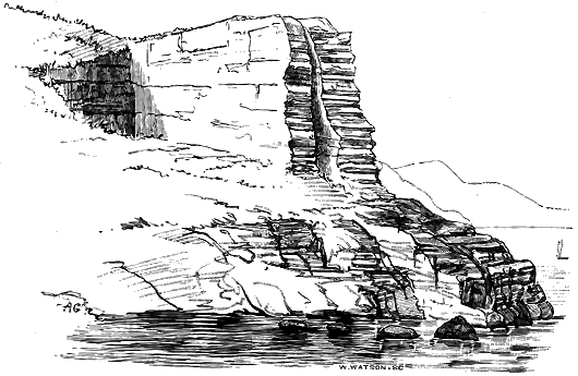
4. The great breadth of the larger dykes of the system and their persistence for long distances. This is one of their most remarkable and distinctive characters.
5. The posteriority of the dykes to the rest of the geological structure of the regions which they traverse. They are not only younger than the other rocks, but younger than nearly all the folds and faults by which the rocks are affected.
6. The manner in which they cut the Jurassic, Cretaceous and older Tertiary rocks in the districts through which they run. At the south-eastern end of the region they rise through the Lias and Oolite formations, in the west they intersect the Chalk and also the Tertiary volcanic plateaux together with their later eruptive bosses.
7. Their petrographical characters, among which perhaps the most distinctive is the frequent appearance of the original glass of the plagioclase-pyroxene-magnetite (olivine) rock, of which they mostly consist. This - 120 - glass, or its more or less completely devitrified representative, often still recognizable with the microscope among the individualized microlites and crystals throughout the body of a dyke, is also not infrequent as a black vitreous varnish-like coating on the outer walls, and occasionally appears in strings and veins even in the centre.
It is the assemblage of dykes presenting these features which I propose to describe. Obviously, the age of each particular dyke can only be fixed relatively for itself. But when this remarkable community of characters is considered, and when the post-Mesozoic age of at least a very large number of the dykes can be demonstrated, the inference is reasonable that one great system of dykes was extravasated during a time of marked volcanic disturbance, which could not have been earlier than the beginning of the Tertiary period. And this inference may be maintained even when we frankly admit that every dyke within the region is by no means claimed as belonging to the Tertiary series.
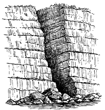
In spite of their number and the extraordinary volcanic activity to which they bear witness, the dykes form a much less prominent feature in the landscape than might have been anticipated. In the lowlands of the interior, they have for the most part been concealed under a cover of superficial accumulations, though in the water-courses they not infrequently project as hard rocky barriers across the channels, and occasionally form picturesque waterfalls. On the barer uplands, they protrude in lines of broken crag and scattered boulders, which by their decay give rise to a better soil covered by a greener vegetation than that of the surrounding brown moorland. Among the Highland hills, they are often traceable from a distance as long black ribs that project from the naked faces of crag and corry. Along the sea-coast, their peculiarities of scenery are effectively displayed. Where they consist of a close-grained rock, they often rise from the beach as straight walls which, with a strangely artificial look, mount into the face of the cliffs on the one side, and project in long black reefs into the sea on the other (Fig. 233). Every visitor to the islands of the Clyde will remember how conspicuous such features are there. But it is among the Inner Hebrides that this kind of scenery is to be found in greatest perfection. The soft dark Lias shales of the island of Pabba, for example, are ribbed across with scores of dykes which strike boldly out to sea. Where, on the other hand, the material of the dykes is coarse in grain, or is otherwise more susceptible to the disintegrating influences of the weather, it has often rotted away and left yawning clefts behind, the vertical - 121 - walls of which are those of the fissures up which the molten rock ascended (Fig. 234). Some good instances of this kind are well known to summer visitors on the eastern shores of Arran. Others, on a large scale, may be seen in the interior of the same island along the crests of the granite ridges, and still more conspicuously on the jagged summits of Blath Beinn and the Cuillin Hills (Fig. 333), and intersecting the Jurassic strata along the cliffs of Strathaird in Skye.
The limits of the region within which the dykes occur cannot be very precisely fixed. There can be no doubt, however, that on their southern side they reach to the Cleveland Hills of Yorkshire and the southern borders of Lancashire, perhaps even as far as North Staffordshire (p. 106), and on the northern side to the farther shores of the island of Lewis—a direct distance of 360 miles. They stretch across the basin of the Irish Sea, including the Isle of Man, and appear in Ireland north of a line drawn from Dundalk Bay to the Bays of Sligo and Donegal. Dykes are of frequent occurrence over the north of England and south of Scotland, at least as far north as a line drawn from the coast of Kincardineshire along the southern flank of the Grampian Hills, by the head of Glen Shee and Loch Tay, to the north-western coast of Argyleshire. They abound all along the line of the Inner Hebrides and on parts of the adjacent coasts of the mainland, from the remoter headlands of Skye to the shores of County Louth. They traverse also the chain of the Long Island in the Outer Hebrides. So far as I am aware, they are either absent or extremely rare in the Highlands north of the line I have indicated. But a good many have been found by my colleagues in the course of the Geological Survey of the northern lowlands of Aberdeenshire and Banffshire. The longest of these has been traced by Mr. L. Hinxman for rather more than two miles running in a nearly east and west direction through the Old Red Sandstone of Strathbogie, with an average width of about 35 feet. Another in the same district has a width of from 45 to 90 feet, and has been followed for a third of a mile. But far beyond these northern examples, I have found a number of narrow basalt-veins traversing the Old Red flagstones of the Mainland of Orkney, which I have little doubt are also a prolongation of the same late series. Taking, however, only those western and southern districts in which the younger dykes form a notable feature in the geology, we find that the dyke-region embraces an area of upwards of 40,000 square miles—that is, a territory greater than either Scotland or Ireland, and equal to more than a third of the total land-surface of the British Isles (Map I.).
Of this extensive region the greater portion has now been mapped in detail by the Geological Survey. Every known dyke has been traced, and the appearances it presents at the surface have been recorded. We are accordingly now in possession of a larger body of evidence than has ever before been available for the discussion of this remarkable feature in the - 122 - geology of the British Isles. I have made use of this detailed information, and besides the data accumulated in my own note-books, I have availed myself of those of my colleagues in the Survey, for which due acknowledgment is made where they are cited.
The Tertiary basalt-plateaux of Britain have their counterpart in the Faroe Islands and in Iceland, and whether or not the lava-fields stretched throughout North-western Europe from Antrim to the farthest headlands of Ultima Thule, there can hardly be any doubt that, if not continuous, these volcanic areas were at least geologically contemporaneous in their activity. Their characteristic scenery and structure are prolonged throughout the whole region, reappearing with all their familiar aspects alike in Faroe and in Iceland. I have not seen the latter island, but in the Faroe archipelago I have found the dykes to be sufficiently common, and to cut the basalt-plateaux there in the same way as they do those of the Inner Hebrides. On the whole, however, dykes do not play, in these northern isles, the important part which they take in the geology and scenery of the West of Scotland. I have not had sufficient opportunity to ascertain whether there is a general direction or system among the Faroe dykes. In the fjords north of Thorshaven, and again along the west side of Stromö, many of them show an E. and W. strike or one from E.N.E. to W.S.W.
The dykes are far from being equally distributed over the wide region within which they occur. In certain limited areas they are crowded together, sometimes touching each other to the almost entire exclusion of the rocks through which they ascend, while elsewhere they appear only at intervals of several miles. Viewed in a broad way, they may be conveniently grouped in two types, which, though no hard line can be drawn between them, nevertheless probably point to two more or less distinct phases of volcanic action and to more than one period of intrusion. In the first, which for the sake of distinction we may term the Solitary type, there is either a single dyke separated from its nearest neighbours by miles of intervening and entirely dykeless ground, or a group of two or more running parallel to each other, but sometimes a mile or more apart. The rock of which they consist is, on the whole, less basic than in the second type; it includes the andesitic varieties. It is to this type that the great dykes of the north of England and the south and centre of Scotland belong. The Cleveland dyke, for example, at its eastern end has no known dyke near it for many miles. The coal-field of Scotland is traversed by five main dykes, which run in a general sense parallel to each other, with intervals of from half a mile to nearly five miles between them. Dykes of this type display most conspicuously the essential characters of the dyke-structure, in particular the vertical marginal walls, the parallelism of their sides, their great length, and their persistence in the same line.
- 123 -
In the second, or what for brevity may be called the Gregarious type, the dykes occur in great abundance within a particular district. They are on the whole narrower, shorter, less strikingly rectilinear, more frequently tortuous and vein-like, and generally more basic in composition than those of the first type. They include the true basalts and dolerites. Illustrative districts for dykes of this class are the islands of Arran, Mull, Eigg and Skye.
The great single or solitary dykes may be observed to increase in number, though very irregularly, from south to north, and also in Central Scotland from east to west. They are specially abundant in the tract stretching from the Firth of Clyde along a belt of country some thirty miles broad on either side of the Highland line, as far at least as the valley of the Tay. They form also a prominent feature in the islands of Jura and Islay.
Dykes of the gregarious type are abundantly and characteristically displayed in the basin of the Firth of Clyde. Their development in Arran formed the subject of the interesting paper by Necker, already mentioned, who catalogued and described 149 of them, and estimated their total number in the whole island to be about 1500.[160] As the area of Arran is 165 square miles, there would be, according to this computation, about nine dykes to every square mile. But they are far from being uniformly distributed. While appearing only rarely in many inland tracts, they are crowded together along the shore, particularly at the south end of the island, where the number in each square mile must far exceed the average just given. The portion of Argyleshire, between the hollow of Loch Long and the Firth of Clyde on the east and Loch Fyne on the west, has been found by my colleague, Mr. C. T. Clough, to contain an extraordinary number of dykes (see Fig. 257). The coast line of Renfrewshire and Ayrshire shows that the same feature is prolonged into the eastern side of the basin of the Clyde estuary. But immediately to the westward of this area the crowded dykes disappear from the basin of Loch Fyne. In Cantire their scarcity is as remarkable as their abundance in Cowal.
[160] Trans. Roy. Soc. Edin. xiv. (1840), p. 677.
Both in the North of Ireland and through the Inner Hebrides, dykes are singularly abundant in and around, but particularly beneath, the great plateaux of basalt. Their profusion in Skye was described early in this century by Macculloch, who called attention more especially to their extraordinary development in the district of Strathaird. "They nearly equal in some places," he says, "when collectively measured, the stratified rock through which they pass. I have counted six or eight in the space of fifty yards, of which the collective dimensions could not be less than sixty or seventy feet." He supposed that it would not be an excessive estimate to regard the igneous rock as amounting to one-tenth of the breadth of the strata which it cuts.[161] This estimate, however, falls much short of the truth in some parts of Strathaird, where the dykes are almost or quite contiguous, - 124 - and the Jurassic strata, through which they rise, are hardly to be seen at all.
[161] Trans. Geol. Soc. iii. (1815), p. 79. This locality is further noticed on p. 164.
Among the districts where dykes of the gregarious type abound at a distance from any of the basalt-plateaux, reference should be made to the curious isolated tract of the central granite core of Western Donegal. In that area a considerable number of dykes rises through the granite, to which they are almost wholly confined. Again, far to the east another limited district, where dykes are crowded together, lies among the Mourne Mountains. These granite hills are probably to be classed with those of Arran, as portions of a series of granite protrusions belonging to a late part of the Tertiary volcanic period which will be treated of in Chapter xlvii.
Though the dykes may be conveniently grouped in two series or types, which on the whole are tolerably well marked, it is not always practicable to draw any line between them, or to say to which group a particular dyke should be assigned. In some districts, however, in which they are both developed, we can separate them without difficulty. In the Argyleshire region above referred to, for example, which Mr. Clough has mapped, he finds that the abundant dykes belonging to the gregarious type run in a general N.W. or N.N.W. direction, and distinctly intersect the much scarcer and less basic dykes of the solitary type, which here run nearly E. and W. (Fig. 257). Hence, besides their composition, distinction in number, breadth, rectilinearity and persistence, the two series in that region demonstrably belong to distinct periods of eruption.[162]
[162] Mr. Clough is inclined to suspect that the E. and W. dykes are older than the Tertiary series and may be later Palæozoic.
The characteristic habit in gregarious dykes of occurring in crowded groups which are separated from each other by intervals of variable dimensions, marked by the presence of comparatively few dykes, is well illustrated in the district of Strath in Skye, which indeed may be taken as a typical area for this peculiarity of distribution. While the dykes are there singularly abundant in the Cambrian Limestone and the Liassic strata, they have been found by Mr. Clough and Mr. Harker to be comparatively infrequent in the tracts of Torridon Sandstone. It is not easy to understand this peculiar arrangement. As the Torridon Sandstone is the most ancient rock of the district, it probably underlies all the Cambrian and Jurassic formations, so that the dykes which penetrate these younger strata must also rise through the Torridonian rocks. Some formations appear to have been fissured more readily than others, and thus to have provided more abundant openings for the uprise of the basaltic magma from below. To the effect of such local differences in the structure of the terrestrial crust we have to add the concentration of the volcanic foci in certain areas, though there seems no means of ascertaining what part each of these causes has played in the distribution of the dykes of any particular district.
- 125 -
The Tertiary dykes of Britain include representatives of four distinct groups of igneous rocks. 1st, The vast majority of them consist of plagioclase-pyroxene-magnetite rocks with or without olivine. These are the normal basalts and dolerites. 2nd, A number of large dykes have a rather more acid composition and are classed as andesites. 3rd, A few dykes of trachyte have been observed in Cowal and in Skye cutting the dykes of basalt (p. 138). 4th, In some districts large numbers of still more acid dykes occur. These are sometimes crystalline in structure (granophyre), more frequently felsitic (felsite, spherulitic quartz-porphyry), and often glassy (pitchstone). In some exceptional cases the basic and acid materials are conjoined in the same dyke. Such compound varieties are described at p. 161. The acid dykes, connected as they so generally are with the large bodies of granophyre or granite, are doubtless younger than the great majority of the basic dykes. They will be treated in connection with the acid intrusions in Chapter xlviii.
By far the greater number of the dykes of the Tertiary volcanic series belong to the first group, and it is these more especially which will be discussed in the present and the following Chapter. As, however, the andesitic group is intimately linked with the basaltic it will be here included with them.
1. Basalt, Dolerite and Andesite Dykes.—To the field-geologist, who regards merely their external features, the Tertiary dykes present a striking uniformity in general petrographical character. They vary indeed in fineness or coarseness of texture, in the presence or absence of porphyritic crystals, amygdales, glassy portions and other points of structure. But there is seldom any difficulty in perceiving that they generally belong to one or other of the types of the basalts, dolerites, diabases or andesites. This sameness of composition, traceable from Yorkshire to Skye and from Donegal to Perthshire, is one of the strongest arguments for referring this system of dykes to one geological period. At the same time, there are enough of minor variations and local peculiarities to afford abundant exercise for the observing faculties alike in the field and in the study, and to offer materials for arriving at some positive conclusions regarding the geological processes involved in the uprise of the dykes.
There appears to be reason to believe that, when the petrography of the dykes is more minutely studied, marked differences of material will be found to denote distinct periods of eruption. Already Mr. A. Harker of the Geological Survey, who is engaged in mapping the interesting and complicated district of Strath in Skye, has observed that the dykes which are older than the great granophyre bosses of that tract may be distinguished from those which are later than these protrusions. The older basic dykes are not conspicuously porphyritic, are frequently marked by a close-grained margin or even with a veneer of basalt-glass, sometimes have an inclination of as much as 45°, are occasionally discontinuous, and not infrequently - 126 - branch or send out veins. The younger dykes, on the other hand, as will be more particularly noticed in the following chapter, are distinguished by the frequent and remarkable character of their porphyritic inclusions, by the presence of foreign fragments in them, by the greater perfection of their jointing, and by their seldom departing much from the vertical.[163] They are likewise often markedly acid in composition, including such rocks as granophyre, felsite and pitchstone.
[163] In the Blath Bheinn group of gabbro-hills, however, it is the youngest dykes which have been found by Mr. Harker to possess the lowest hade.
(1) External Characters.—As regards the grain of the rock, every gradation may be found, from a coarsely crystalline mass, in which the component minerals are distinctly traceable with the naked eye, to a black lustrous basalt-glass. Each dyke generally preserves the same character throughout its extent. As a rule, broad and long dykes are coarser in grain than narrow and short ones. For the most part, there runs along each side of a dyke a selvage of finer grain than the rest of the mass. This marginal strip varies in breadth from an inch or less up to a foot or more, and obviously owes its origin to the more rapid chilling of the molten rock along the walls of the fissure. It usually shades away inperceptibly into the larger-grained inner portion. Even with the naked eye its component materials can be seen to be more finely crystalline than the rest of the dyke, though where dispersed porphyritic felspars occur they are as large in the marginal strip as in any other part of a dyke, for they belong to an earlier period of crystallization than the smaller felspars of the groundmass and were already floating in the magma while it was still in a molten state.
This finer-grained external band, so distinctive of an eruptive and injected rock, is of great service in enabling us to trace dykes when they traverse other dykes or masses of igneous rock of similar characters to their own. When one dyke crosses another, that which has its marginal band of finer grain unbroken must obviously be the younger of the two.
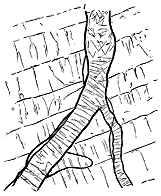
But in many examples in the south of Scotland, Argyleshire and the Inner Hebrides, the fineness of grain of the outer band culminates in a perfect volcanic glass. Where this occurs, the glass is usually jet black, more rarely greenish or bluish black in tint, and varies in thickness from about a couple of inches to a mere varnish-like film on the outer face of the dyke, the average width being probably less than a quarter of an inch (Fig. 235). On their weathered surface these external glassy layers generally present a pattern of rounded or polygonal prominences, varying up to four or five lines or even more in diameter, and separated by depressions or narrow ribs. The transition from the glass to the crystalline part of the marginal fine-grained strip is - 127 - usually somewhat abrupt, insomuch that on weathered faces it is often difficult to get good specimens, owing to the tendency of the vitreous portion to fly off when struck with the hammer. The glass doubtless represents the original condition of the rock of the dyke. It was suddenly chilled and solidified by contact with the cold walls of the fissure. Inside this external glassy coating, the molten material could probably still move, and had time to assume a more or less completely crystalline condition before solidification. Not infrequently the glass shows spherulitic forms, visible to the naked eye, and likewise a more or less distinctly developed perlitic structure. These features, however, are best studied in thin sections of the rock with the aid of the microscope, as will be subsequently referred to.
In some dykes, the glass is not confined to the edges, but runs in strings or broader bands along the central portions, or has been squeezed into little cavities like steam-holes or into minute fissures. One of the most remarkable examples of this peculiarity occurs in the well-known dyke of Eskdale, which runs for so many miles across the southern uplands of Scotland.[164] This dyke throughout most of its course is a crystalline rock of the andesitic type. At Wat Carrick, in Eskdale, it presents an arrangement into three parallel bands. On either side, a zone about eight feet broad consists of the usual crystalline material. Between these two marginal portions lies an intercalated mass 16 to 18 feet broad, of a very compact and more or less vitreous rock. The demarcation between this central band and the more crystalline zones of the outside is quite sharp, and the two kinds of rock show a totally distinct system of jointing. There can, therefore, be little doubt that the glassy centre belongs to a later uprise than the outer portions, though possibly it may still have been included in the long process of solidification of one original injected mass of molten material. If the marginal parts adhered firmly to the walls, the centre, which with its band of vesicles seems often to have been a line of weakness, might be ruptured and subsequent intrusions would find their way along the rent. Examples of this splitting of dykes with the intrusion of later eruptive Material will be cited in later pages.
[164] See Proc. Roy. Phys. Soc. Edin. v. (1880), p. 241.
Mr. Clough, while mapping for the Geological Survey the extraordinarily numerous dykes in the eastern part of Argyleshire between the Firth of Clyde and Upper Loch Fyne, observed six or seven examples of dykes showing glassy bands in their centres, with characters similar to those of the Eskdale dyke. He found an absence of definite and regular joints in the central glassy band, and on the other hand, an irregular set of divisional planes by which the rock is traversed, and which he compared to those seen in true perlitic structure.
While, as a general rule, the external portions of a dyke are closer-grained than the centre, rare cases occur where the middle is the most finely crystalline part. I am disposed to regard these cases and the glassy centres as forming in reality no true exceptions to the rule, that the outer portions - 128 - of a dyke consolidated first, and are therefore finest in texture. For the most part, each dyke appears to be due to a single uprise of molten matter, though considerable movements may have taken place within its mass before the whole stiffened into stone. Some particulars regarding these movements will be given in section 12 of the next Chapter. It has already been mentioned that in large dykes which have served as volcanic pipes, it is conceivable that while the material next the outside consolidated and adhered to the walls, the central portion may have remained liquid, and may even have been propelled upward and have been succeeded by a different kind of magma, as has been suggested by Mr. Iddings. In such cases, which, if they occur, are probably excessively rare, we may expect that the earlier and later material will not be sharply marked off from each other, unless we suppose that the whole of the earlier liquid magma was so entirely ejected that only its congealed marginal selvage was left as bounding walls for the newer injection.
Where, after more or less complete consolidation had taken place, the fissure opened again, or from any other cause the dyke was split along its centre, any lava which rose up the rent would tend to take a finer grain than the material of the rest of the dyke, and might even solidify as glass.
Large scattered crystals of felspar, of an earlier consolidation than that of the minuter forms of the same mineral in the general groundmass of the rock, give a porphyritic structure and andesitic character to many dykes. Occasionally such crystals attain a considerable size. Mr. Clough has observed them in some of the Argyleshire dykes reaching a length of between three and four inches, with a thickness of two inches. Sometimes they are distributed with tolerable uniformity through the substance of the dyke. But not infrequently they may be observed in more or less definite bands parallel with the boundary walls. Unlike the younger lath-shaped and much smaller felspars of the groundmass, they show no diminution either in size or abundance towards the edge of the dyke. On the contrary, as already mentioned, they are often conspicuous in the close-grained marginal strip, and may be found even in the glassy selvage, or touching the very wall of the fissure. Indeed, they are sometimes more abundant in the outer than in the inner portions of a dyke, having travelled outwards to the surfaces of earliest cooling and crystallization.
Mr. Clough has given me the details of an interesting case of this kind observed by him in Glen Tarsan, Eastern Argyleshire:—"For an inch or so from the edge of this dyke," he remarks, "porphyritic felspars giving squarish sections, and ranging up to one-third of an inch in length, are so abundant as nearly to equal in bulk the surrounding groundmass. For the next inch and a half, they are decidedly fewer, occupying perhaps hardly an eighth of the area exposed. Then for a breadth of three inches they come in again nearly as abundantly as at the sides; after which they diminish through a band 27 inches broad, where they may form from 1/8 to 1/12 of the rock." He found another case where, in a dyke several yards wide, porphyritic felspars, sometimes an inch long, are common along the eastern - 129 - margin of the dyke in a band about two inches broad, but nearly absent from the rest of the rock. Elsewhere the crystals are grouped rather in patches than in bands. Among the dykes south of Oban some similar instances of coarsely porphyritic felspars may be observed.
Not only are these porphyritic felspars apt to occur in bands parallel with the outer margins of the dykes, but they tend to range themselves with their longer axis in the same direction, thus even on a large scale, visible at some distance, showing the flow-structure, which is so often erroneously regarded as essentially a microscopic arrangement, and as specially characteristic of superficial lava-streams.
Mr. Harker in his survey of Strath, Skye, has met with some remarkable examples of the enclosure and incorporation of foreign materials in the younger group of dykes which in that district traverse the granophyres and gabbros. He remarks that the great majority of these dykes are basic, and he has found them to be capable of convenient division into two groups. 1st, Non-porphyritic basic dykes with a specific gravity between 2·87 and 2·97, and an amygdaloidal structure affording clear indication of flowing movement, either at the sides or along a central band. These dykes do not greatly differ from those of pre-granophyre eruption. 2nd, Porphyritic basic dykes which present features of peculiar interest. The porphyritic (or pseudo-porphyritic) elements, according to Mr. Harker's observations, are constantly felspar, frequently subordinate augite, and exceptionally quartz. The felspars have for the most part rounded outlines with a bordering zone of glass cavities apparently of secondary origin. The augite, in rounded composite crystal-grains, differs from that of the groundmass and resembles the augite of the gabbros. The quartz-grains are likewise rounded, and show sometimes a distinct corroded border.
These characters, Mr. Harker observes, are those of crystals derived from some foreign source, and it can scarcely be doubted that this is the explanation of their presence. He noticed that the dykes in question frequently enclose fragments, varying up to several inches in diameter, of gabbro, granite or granophyre, bedded lava, quartzite, etc., which show clear evidence of having been rounded and corroded by an enveloping magma, and recognizable crystals from some of the fragments may be observed in the surrounding parts of the matrix of the dykes. Most of the felspar and augite crystals disseminated through these porphyritic basic dykes may be referred to the partial reabsorption of enclosed fragments of gabbro. The same observer has found that many of the dykes which rise through the basalt-plateau of Strathaird are crowded with gabbro fragments.
Another megascopic character of the material composing the dykes is the frequent presence of amygdales. It has sometimes been supposed that amygdaloidal structure may be relied upon as a test to distinguish a mass of molten rock which has reached the surface from one which has consolidated under considerable pressure below ground. That this supposition, however, is erroneous is demonstrated by hundreds of dykes in the great system which I am now describing. But the amygdales of a dyke offer certain - 130 - peculiarities which serve in a general way to mark them off from those of an outflowing lava. They are usually smaller and more uniform in size than in the latter rock. They are also more regularly spherical and less frequently elongated in the direction of flow. Moreover, they are not usually distributed through the whole breadth of a dyke, but tend to arrange themselves in lines especially towards its centre (Fig. 236). In these central bands the cavities are largest and depart farthest from the regular spherical form, so that for short spaces they may equal in bulk the mass of enclosing rock. In some rare instances, a whole dyke is composed of cellular basalt, like one of the lava-sheets in the plateaux, as may be seen on the north flank of Beinn Suardal, Skye. Mr. Harker has observed that an amygdaloidal structure is more common among the earlier than among the later dykes of that district.
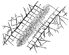
Besides the common arrangement of fine-grained edges and a more coarsely crystalline centre, instances are found where one of the contrasted portions of a dyke traverses the other in the form of veins. Of these, I think, there are two distinct kinds, probably originating in entirely different conditions. In the first place, they may be of coarser grain than the rest of the rock; but such a structure appears to be of extremely rare occurrence. I have noticed some examples on the coast of Renfrewshire, where strings of a more coarsely crystalline texture traverse the finer-grained body of the rock. Veins of this kind are probably of the same nature as the so-called "segregation-veins," to be afterwards referred to as of frequent occurrence among the thicker Tertiary sills. They consist of the same minerals as the rest of the rock, but in a different and more developed crystalline arrangement, and they contain no glassy or devitrified material, except such portions of that of the surrounding groundmass as may have been caught between their crystalline constituents.
The second kind of veins, which, though not common, is of much more frequent occurrence than the first, is more particularly to be met with among the broader dykes, and is distinguished by a remarkable fineness of grain, sometimes approaching the texture of felsite or jasper, and occasionally taking the form of actual glass. Such veins vary from half an inch or less, up to four or five inches in breadth. They run sometimes parallel with the walls of the dyke, but often irregularly in all directions, and for the most part avoid the marginal portions, though now and then coming up to the edge. They never extend beyond the body of the dyke itself into the surrounding rock. Though they have obviously been injected after the - 131 - solidification of the rock which they traverse, they may quite possibly be extrusions of a deeper unconsolidated portion of the same rock into rents of the already stiffened overlying parts. The field-geologist cannot fail to be struck with the much greater hardness of these fine-grained veins and strings that ramify through the coarsely crystalline dolerite, andesite or other variety of the broader dykes. He can readily perceive in many cases their more siliceous composition, and the inferences he deduces from the rough observations he can make in the field are confirmed by the results of chemical analysis (see p. 137).
In connection with veins of finer material, that may belong to a late stage of the consolidation of the general body of a dyke, reference may be made here to the occasional occurrence of patches of an exceedingly compact or homogeneous texture immersed in the usual finely crystalline marginal material. They look like angular and subangular portions of the more rapidly cooled outer edge, which have been broken off and carried upward by the still moving mass in the fissure.[165]
[165] See Mr. J. J. H. Teall, Quart. Journ. Geol. Soc. xl. (1884), p. 214.
In general, each dyke is composed of one kind of rock, and retains its chemical and mineralogical characters with singular persistence. The difference of texture between the fine-grained chilled margin, with its occasional glassy coating, and the more coarsely crystalline centre is due to cooling and crystalline segregation in what was no doubt originally one tolerably uniform molten mass. The glassy central bands, too, though they indicate a rupture of the dyke up the middle, may at the same time quite conceivably be, as I have said, extrusions from a lower portion of the dyke before the final solidification of the whole. The ramifying veins of finer grain that now and then traverse one of the large dykes are likewise explicable as parts of a stage towards entire consolidation. All these vitreous portions, whether still remaining as glass or having undergone devitrification, are more acid than the surrounding crystalline parts of the rock. They represent the siliceous "mother-liquor," so to speak, which was left after the separation from it of the crystallized minerals, and which, perhaps, entangled here and there in vesicles of the slowly cooling and consolidating rock, was ready to be forced up into cracks of the overlying mass during any renewal of terrestrial disturbance.
But examples occur where a dyke, instead of consisting of one rock, is made up of two or more bands of rock which, even if they resemble each other closely, can be shown to be the results of separate eruptions. These, which are obviously not exceptions to the general rule of the homogeneity of dykes, I will consider in the next Chapter.
Among the petrographical varieties observable in the field is the occasional envelopment of portions of the surrounding rocks in the body of a dyke. Angular fragments torn off from the fissure-walls have been carried upwards in the ascending lava, and now appear more or less metamorphosed, the amount of alteration seeming to depend chiefly upon the susceptibility of the enclosed rock to change from the effects of heat. Cases of such - 132 - entanglement, however, are of less common occurrence than those already referred to, where pieces of some deep-seated rock, such as the gabbros of Skye, have been carried up in the ascending magma. Occasionally, where the enclosed fragments are oblong, they are arranged with their longer axes parallel to the walls of the dyke, showing flow-structure on a large scale. Mr. Clough has found some dykes near Dunoon which enclose fragments of schist nearly three feet in length.
One of the most interesting of the megascopic features of the dykes is the joints by which they are traversed. These divisional planes are no doubt to be regarded as consequences of the contraction of the original molten rock during cooling and consolidation between its fissure-walls. They are of considerable interest and importance, inasmuch as they furnish a ready means of tracing a dyke when it runs through rock of the same nature as itself, and also help to throw some light on the stages in the consolidation of the material of the dyke.
Two distinct systems of joints are recognizable (Fig 237). Though sometimes combined in the same dyke, they are most conspicuously displayed when each occurs, as it generally does, by itself. The first and less frequent system of joints (a) has been determined by lines of retreat, which are parallel to the walls of the dyke. The joints are then closest together at the margin, and may be few or altogether absent in the centre. They are sometimes so numerous, parallel and defined towards the borders of the dyke, as to split the rock up into thin flags. Where transverse joints are also present these flags are divided into irregular tesseræ.
In the second or transverse system of joints (b), which is the more usual, the divisional lines pass across the breadth of the dyke, either completely from side to side, or from one wall for a longer or shorter distance towards the other. Where this series of joints is most completely developed the dyke appears to be built up of prisms piled horizontally, or nearly so, one above another. These prisms, in rare instances, are as regular as the columns of a basalt-sheet (see Fig. 166). Usually, however, they have irregularly defined faces, and merge into each other. Where the prismatic structure is not displayed, the joints, starting sharply at the wall of the dyke, strike inwards in irregular curving lines. It is such transverse joints that enable the eye, even from a distance, to distinguish readily the course of a dyke up the face of a cliff of basalt-beds, for they belong to the dyke itself, are often at right angles to those of the adjacent basalt, and by their alternate projecting and re-entering angles seam the dyke with - 133 - parallel bars of light and shade (see the double dyke in Fig. 333). Where they traverse not only the general mass of a dyke, but also the "contemporaneous veins" which cross it, it may be inferred that these veins were injected before the final solidification and contraction of the whole dyke.
An interesting modification of the transverse joints may sometimes be observed, where, as in the case of the Palæozoic "Rock and Spindle," at St. Andrews (Fig. 222), the molten material has solidified in a tubular or spherical cavity. The joints then radiate inwards from the outer curved surface. The most remarkable instance of this structure which I have found among the Tertiary volcanic plateaux occurs on the east side of the island Fuglö, the most north-easterly of the group of the Faroes. It is cut in section by the face of the precipice, where it appears as a round mass about 40 or 50 feet in diameter piercing the plateau-basalts. A selvage of finer material round its outer edge shows the effect of rapid chilling, while the joints diverge from the periphery and extend in fan-shape towards the centre (Fig. 238).
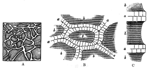
One of the most remarkable exhibitions of joint-structure hitherto noticed among the Tertiary dykes is that which occurs in the central vitreous band of the Eskdale dyke already referred to. The rock is divided into nearly horizontal prisms, each of which consists of an inner more vitreous - 134 - core and an outer more lithoid sheath. By the coherence of their polygonal and irregular faces, and the greater durability of their material, these sheaths project on the weathered wall of the vitreous centre of the dyke in a curiously reticulated grouping of prominent ribs each about two inches broad (Fig. 239, A), while the vitreous cores, being more readily acted on by the weather, are hollowed out into little cup-shaped depressions. Each rib is thus composed of the sheaths or outer lithoid portions of two prisms, the line of separation being marked by a suture along the centre (B). Between this median suture and the inner glassy core the rib is further cut into small segments by a set of close joints, which are placed generally at right angles to the course of the rib (C). Examined with a lens, the lithoid substance of these sheaths has a dull finely granular aspect, like that of felsitic rocks, with scattered felspars. It is obviously a more devitrified condition of the material which forms the core of each prism. This material presents on a fresh fracture a deep iron-black colour, dull resinous lustre and vitreous texture. It at once recalls the aspect of many acid pitchstones, and in the early days of petrography was naturally mistaken for one of these rocks. Through its substance numerous kernels of more glassy lustre are dispersed, each of which usually contains one or more amygdales of dull white chalcedony, but sometimes only an empty black cavity. These black glistening kernels of glass, of all sizes up to that of a small bean, scattered through the dull resinous matrix, form with the white amygdales the most prominent feature in the cores; but crystals of felspars may also be observed. Some details of the microscopic characters of this remarkable structure will be given in a subsequent page. The relation of the cores and sheaths to the prismatic jointing of the rock seems to show that devitrification had not been completed when these joints were established, and that it proceeded from the faces of each prism inwards.
(2) Microscopic Characters.—Much information has now been obtained regarding the microscopic structure of the basaltic, doleritic and andesitic dykes. The crystalline characters of those in the North of England have been studied by Mr. Teall,[166] and some of those from the West of Scotland have been investigated by Professors Judd and Cole.[167] Taken as a whole, the rocks composing the dykes are found, when examined microscopically, to consist essentially of mixtures of a plagioclase felspar, pyroxene and iron oxide, with or without olivine, and usually with more or less interstitial matter.
[166] Quart. Journ. Geol. Soc. vol. xl. (1884).
[167] Op. cit. vol. xxxix. (1883) p. 444 (basalt-glass); xlii. (1886) p. 49, where Professor Judd discusses the gabbros, dolerites and basalts as a whole.
The felspar appears to be in some cases labradorite, in others anorthite, but there may be a mingling of several species in many of the dykes, as in the augite-andesite of the Santorin eruption in 1866, wherein Professor Fouqué found that the larger porphyritic felspars were mainly labradorite, but partly anorthite, while those of the groundmass were microlites of albite and oligoclase.[168] The large felspars scattered porphyritically through the groundmass - 135 - are evidently the result of an early consolidation, unless where they are survivals from fragments of older porphyritic rocks which have been enveloped and partially dissolved in the dykes. They are often cracked, penetrated by the groundmass, or even broken into fragments, and have corroded borders. They sometimes include portions of the groundmass, and present the zonal growth structure in great perfection. The small felspars of the groundmass, on the other hand, are as obviously the result of a later crystallization, for they vary in size and crystallographic development according to their position in the dyke. Those from the centre are often in well-formed crystals, which sometimes pass round their borders into acicular microlites. Those in the marginal parts of the dyke occur chiefly in the form of these microlites, forming the felted aggregate so characteristic of the andesites. Curious skeleton forms, composed of aggregates of microlites, connect the latter with the more completely developed crystals, and illustrate the mode of crystallization of the felspathic constituents of the dykes.[169]
[168] Santorin et ses Éruptions, 1879, p. 203.
[169] See Mr. Teall's excellent description of the Cleveland dyke, in the paper above cited.
The pyroxene is probably in most cases monoclinic (black or common augite), but is sometimes rhombic (usually enstatite, less frequently perhaps hypersthene). It occurs in (a) well-developed crystals, (b) crystalline masses with some of the faces of the crystals developed, (c) granular aggregates which polarise in one plane, (d) separate granules and microscopic microlites, which may be spherical (globulites) or oblong (longulites).
The black iron-oxide is sometimes magnetite, sometimes ilmenite, or other titaniferous ore. Apatite not infrequently occurs among the original constituents. Olivine is entirely absent from most of the large solitary dykes, especially at a distance from the great volcanic centres, and no serpentinous matter remains to indicate that it was ever present in them. But it is to be met with in numerous basalt-dykes in the volcanic areas, either in sparsely scattered or in tolerably abundant crystals. Biotite occasionally appears. Among the secondary products, calcite and pyrites are doubtless the most common. To these must be added quartz, chalcedony and various zeolitic substances, besides the aggregates which result from the decomposition of the ferro-magnesian constituents and the oxidation of the ferrous oxides.
In many dykes there is little or no interstitial matter between the crystalline constituents of the groundmass. In others this matter amounts to a half or more of the whole composition, and from such cases a series of gradations may be traced into a complete glass containing only the rudimentary forms of crystals (globulites, longulites, etc.), with scattered porphyritic crystals of an earlier consolidation. The process of the disappearance of this original glass may be admirably studied in many dykes. At the outer wall, the glass remains nearly as it was when contact with the cold walls of the fissure solidified it. From that external vitreous layer the successive devitrification products and crystalline growths may be - 136 - followed inwards until in the central parts of a broad dyke little or no trace of the interstitial matter may be left.
 |
Fig. 240.—Microscopic structure of the
vitreous part of the Eskdale Dyke.
This section shows a crystal of augite, enclosing
magnetite and surrounded with
microlites, each of which consists of a central
pale yellow rod crusted with pale
yellow isotropic globulites. The glass
around this aggregation is clear, but at a
little distance globulites (many of them
elongated and dichotomous) abound,
with here and there scattered microlites,
some of which are curved and spiral.
(800 diameters.)[170]
|
[170] Proc. Roy. Phys. Soc. Edin. v. (1880), p. 255.
The most instructive example of the process of devitrification which has come under my observation occurs in the Eskdale dyke. The central "cores" already referred to present a true glass, which in thin sections is perfectly transparent and almost colourless, but by streaks and curving lines of darker tint shows beautiful flow-structure. The devitrification of this glass has been accomplished by the development of crystallites and crystals, which increase in number until all the vitreous part of the rock disappears. What seems under a low power to be a structureless or slightly dusty glass can be resolved with a higher objective into an aggregate of minute globules or granules (globulites), which average perhaps 1/20,000 of an inch in diameter. Some of these bodies are elongated and even dichotomous at the ends. These granules are especially crowded upon clear yellow dart-shaped rods, which in turn are especially prominent upon crystals and crystalline grains of augite that bristle with them, while the immediately surrounding glass has become clear. There can be little doubt that these rudimentary bodies are stages in the arrested development of augite crystals. There occur also opaque grains, rods and trichites, which no doubt consist in whole of magnetite (or other iron oxide), or are crusted over with that mineral.
At least two broad types of microscopic structure may be recognized among the basic and intermediate dykes. (1) Holocrystalline, or with only a trifling proportion of interstitial matter. This type includes the dolerites and basalts, as well as rocks which German petrographers would class as diabases or diabase-porphyrites. The rocks are very generally characterized by ophitic structure, where the lath-shaped felspars penetrate the augite, and are therefore of an earlier consolidation. In such cases there is a general absence of any true interstitial matter. The rocks of this type are often rich in olivine, and appear to be on the whole considerably more basic than those of the second group. It is observable that they increase in numbers from the centre of Scotland westwards, and throughout the region of the basalt-plateaux they form the prevailing type. (2) In this type there is a marked proportion of interstitial substance, which is inserted in wedge-shaped portions among the crystallised constituents ("intersertal structure" of Rosenbusch). The ophitic structure appears to be absent, and olivine is either extremely rare or does not occur at all. The rocks of - 137 - this group are obviously less basic than those of the other. They form the large dykes that rise so conspicuously through the South of Scotland and North of England, and their general characters are well described by Mr. Teall in the paper already cited. In some instances they enclose abundant porphyritic felspars of earlier consolidation, and then present most of the characters of andesites. Professor Rosenbusch has extended the name of "Tholeiites" to rocks of this group in the North of England.[171] The vitreous condition is found in both types, but is perhaps more frequent in the second. The glass of the basalts, however, even in thin slices, is characteristically opaque from its crowded inclusions; while that of the andesitic forms, though black in hand specimens, appears perfectly transparent and sometimes even colourless in thin slices.
[171] Mikroskopische Physiographie, 3rd edit. 1071 et seq.
(3) Chemical Characters.—The only one of these to which reference will be made here is the varying proportion of silica. While the dykes as a whole are either intermediate or basic, some of them contain so high a percentage of silica as to link them with the acid rocks. The average proportions of this ingredient range from less than 50 to nearly 60 per cent. The rocks with the lower percentage of acid are richer in the heavy bases, and have a specific gravity which sometimes rises above 3·0. They include the true dolerites and basalts. Those, on the other hand, with the higher ratio of silica, are poorer in the heavy bases, and have a specific gravity from 2·76 to 2·96. They comprise the tholeiites, andesites and other more coarsely crystalline rocks of the great eastern and south-eastern dykes.[172]
[172] For analyses of dykes, see Sir I. L. Bell, Proc. Roy. Soc. xxiii. p. 546; Mr. J. S. Grant Wilson, Proc. Roy. Phys. Soc. Edin. v. p. 253; Mr. Teall, Quart. Journ. Geol. Soc. xl. p. 209; Professors Judd and Cole, Quart. Jour. Geol. Soc. xxxix. p. 444.
Not only do the dykes differ considerably from each other in their relative proportions of silica, but even the same dyke may sometimes be found to present a similar diversity in different parts of its mass. It has long been a familiar fact that the glassy parts of such rocks are more acid than the surrounding crystalline portions. The original magma may be regarded as a natural glass or fused silicate, in which all the elements of the rock were dissolved, and which necessarily became more acid as the various basic minerals crystallised out of it.[173] In the Eskdale dyke the silica percentage of this glassy portion is 58·67, that of the little kernels of black glass dispersed through the rock as much as 65·49.[174] In the Dunoon dyke observed by Mr. Clough the siliceous finer-grained veins contain no less than 68·05 per cent of silica, while the mass of the dyke itself shows on analysis only 47·36 per cent.[175] Similar red strings have been noticed by the same careful observer in an east and west dyke near Lochgoilhead. From Mr. Teall's examination a large part of the felspar in - 138 - these veins is probably orthoclase. It forms a much larger percentage of the entire rock than the felspar does in normal dolerites.
[173] On this subject see a paper by Dr. A. Lagorio, "Über die Natur der Glasbasis sowie der Krystallisationsvorgänge im eruptiven Magma," Tschermak's Mineralog. Mittheil. viii. (1887), p. 421.
[174] Mr. J. S. Grant Wilson, Proc. Roy. Soc. Phys. Edin. v. (1880) p. 253.
[175] Unpublished analyses made by the late Professor Dittmar of Glasgow, and communicated to me by Mr. Clough.
2. Trachyte Dykes.—In the Cowal District of Argyleshire, and in the south of Skye, Mr. Clough has encountered a limited number of dykes of trachyte. On a hasty inspection these are not always readily distinguished from the basalt-dykes with which they agree in general external aspect and in direction. Where their relation to these dykes, however, can be determined they are found to traverse them, and thus to be on the whole later, though one case has been observed where a trachytic dyke is in turn traversed by one of the basic series. Mr. Clough has supplied me with the following notes of his observations regarding the trachytic dykes. They are all characterized by the possession of spherulitic structures near their margins. These features, easily perceptible to the naked eye, afford the readiest means of distinguishing the dykes of this group. So abundant are the spherulites that they not infrequently impinge on each other in long parallel rows forming rod-like aggregates. Thus in a dyke near Craigendavie, at the head of Loch Striven, numerous planes about a quarter of an inch apart, and composed of such close-set rods, may be observed running parallel to the marginal wall for a distance of several inches from the edge. Most of these planes show on their surfaces that the rods are always parallel to each other, but may run in different directions in the different layers, being sometimes horizontal, sometimes vertical, or at any angle between. On examination, each rod is found to be made up of polygonal bodies, the angles of which are quite sharp, but with their sides often slightly curved, as if they had assumed their forms from the mutual pressure of original spherical bulbs. Further scrutiny shows that the polygonal bodies often exhibit an internal radiate structure.
In the central parts of the dyke the spherulitic arrangement is not traceable. About a foot from the margin it begins to be recognizable. At a distance of three or four inches the spherulites are about the size of peas, and gradually diminish towards the edge until they can no longer be seen.
Another characteristic of the trachyte dykes has been found by Mr. Clough to be a useful guide in discriminating them from the basalt-group. While the amygdales in the latter are generally rudely spherical, those in the trachytes are commonly elongated in the direction of the length of the dyke, and are frequently three quarters of an inch, sometimes even an inch and a half, in length, though less than a quarter of an inch in breadth.
A good example of these trachytic dykes, which occurs at Dunans, about the head of Glendaruel, has been examined microscopically and chemically. The central better crystallised portion was found by Mr. Teall to be composed mainly of small lath-shaped crystals of orthoclase, together with scales of brown biotite, a few prismatic crystals of pale somewhat altered pyroxene and scattered granules of magnetite. The chemical analysis of this rock by Mr. J. H. Player gave the following composition:—
- 139 -
| Silica | 56·4 |
| Alumina | 19·0 |
| Ferric oxide | 3·5 |
| Ferrous oxide | 4·8 |
| Lime | 2·6 |
| Magnesia | 1·5 |
| Soda | 4·5 |
| Potash | 5·0 |
| Loss on ignition | 2·6 |
| 99·9 |
In the majority of cases, especially among the great single dykes, the intrusive rock has assumed a position nearly or quite vertical. But occasionally, where one of these solitary examples crosses a deep valley, a slight hade is perceptible by the deviation of the line of the dyke from its normal course. Sedgwick long ago noticed that the Cleveland dyke has, in places, an inclination of at least 80° to its N.E. side.[176] In the coal-workings, also, a trifling deviation from the vertical is sometimes perceptible, especially where a dyke has found its way along a previously existing line of fault, as in several examples in Stirlingshire. But in those districts where the dykes are gregarious, departures from the vertical position are not infrequent, more particularly near the great basalt-plateaux. It was noticed by Necker, that even in such a dyke-filled region as Arran, almost all of the dykes are vertical, though sometimes deviating from that position to the extent of 20°.[177] Berger found that the angle of deviation among those of the north of Ireland ranges from 9° to 20°, with a mean of 13°.[178] The most oblique examples are probably those which occur in the basalt-plateaux of the Inner Hebrides, where the same dyke in some parts of its course runs horizontally between two beds, across which it also descends vertically (see Figs. 251, 252, 374). But with these minor exceptions, the verticality of the great system of dykes, pointing to the perpendicular fissure-walls between which the molten rock ascended, is one of the most notable features in their geological structure. In the Strath district of Skye Mr. Harker has noticed that while the earlier dykes have sometimes a hade of 45°, those younger than the granophyre are generally vertical or nearly so. In the Blath Bheinn group of hills, however, as already alluded to, he has observed that it is the youngest dykes which are inclined in a north-westerly direction, with a hade of as much as 40° from the horizon.
[176] Cambridge Phil. Trans. ii. p. 28.
[177] Trans. Roy. Soc. Edin. xiv. p. 677.
[178] Trans. Geol. Soc. iii. p. 227.
An obvious characteristic of most dykes is the apparent uniformity of their breadth. Many of them, as exposed along shore-sections, vary as little in dimensions as well-built walls of masonry do. Departures from such uniformity may often indeed be noted, whether a dyke is followed - 140 - laterally or vertically. The largest amount of variation is, of course, to be found among the dykes of the gregarious type, the thinner examples of which may diminish to a width of only one inch or less, while their average breadth is much smaller than in the case of the great solitary dykes. In the district of Strathaird, in Skye, Macculloch estimated that the remarkably abundant dykes there developed vary from 5 to 20 feet in breadth, but with an average breadth of not more than 10 feet.[179] In the isle of Arran, according to Necker's careful measurements, most of the dykes range from 2 or 3 to 10 or 15 feet, but some diminish to a few inches, while others reach a width of 20, 30, or even 50 feet.[180] In the North of Ireland, Berger observed that the average breadth of thirty-eight dykes traversing primitive rocks (schist, granites, etc.) was 9 feet; and of twenty-four in Secondary rocks, 24 feet.[181]
[179] Trans. Geol. Soc. iii. p. 80.
[180] Trans. Roy. Soc. Edin. xiv. p. 690 et seq.
[181] Trans. Geol. Soc. iii. p. 226. He believed that dykes in Secondary rocks reach a much greater thickness than in other formations. My own observations do not confirm this generalisation.
But when we pass to the great solitary dykes, that run so far and so continuously across the country, we encounter much thicker masses of igneous rock. Most of the measurements of these dykes have been made at the surface, and the variations noted in their breadth occur along their horizontal extension. The Cleveland dyke, which is the longest in Britain, varies from 15 feet to more than 100 feet, with perhaps an average width of between 70 and 90 feet.[182] Some of the great dykes that cross Scotland are of larger dimensions. Most of them, however, like that of Cleveland, are liable to considerable variations in breadth when followed along their length. The dyke which runs from the eastern coast across the Cheviot Hills and Teviotdale to the head of the Ale Water, is in some places only 10 feet broad, but at its widest parts is probably about 100 feet. The Eskdale and Moffat dyke is in parts of its course 180 feet wide, but elsewhere it diminishes to not more than 40 feet. These variations are repeated at irregular intervals, so that the dyke alternately widens and contracts as its course is traced across the hills. Some of the dykes further to the north and west attain yet more gigantic proportions. That which crosses Cantyre opposite Ardlamont Point has been measured by Mr. J. B. Hill, of the Geological Survey, who finds it to be from 150 to 180 feet broad on the shore of Loch Fyne, and to swell out beyond the west side of Loch Tarbert to a breadth of 240 to 270 feet. A dyke near Strathmiglo, in Fife, is about 400 feet wide. The broadest dyke known to me is one which I traced near Beith, in Ayrshire, traversing the Carboniferous Limestone. Its maximum width is 640 feet.
[182] At Cockfield, where it has long been quarried, it varies from 15 to 66 feet; at Armathwatie, in the vale of the Eden, it is about 54 feet (Mr. Teall, Quart. Journ. Geol. Soc. xl. p. 211).
Unfortunately, it is much less easy to get evidence of the width of dykes at different levels in their vertical extension. Yet this is obviously an important point in the theoretical discussion of their origin. Two means - 141 - are available of obtaining information on the subject—(a) from mining operations, and (b) from observations at precipices and between hill-crests and valley-bottoms.
(a) In the Central Scottish coal-field and in that of Ayrshire, some large dykes have been cut through at depths of two or three hundred feet beneath the surface. But there does not appear to be any well-ascertained variation between their width so far below ground and at the surface. In not a few cases, indeed, dykes are met with in the lower workings of the coal-pits which do not reach the surface or even the workings in the higher coals. Such upward terminations of dykes will be afterwards considered, and it will be shown that towards its upper limit a dyke may rapidly diminish in width.
(b) More definite information, and often from a wider vertical range, is to be gathered on coast-cliffs and in hilly districts, where the same dyke can be followed through a vertical range of many hundred feet. But so far as my own observations go, no general rule can be established that dykes sensibly vary in width as they are traced upward. Every one who has visited the basalt-precipices of Antrim or the Inner Hebrides, where dykes are so numerous, will remember how uniform is their breadth as they run like ribbons up the faces of the escarpments.[183] Now and then one of them may be observed to die out, but in such cases (which are far from common) the normal width is usually maintained up to within a few feet of the termination.
[183] This point did not escape the attention of that excellent observer, Berger, in his examination of the dykes in the North of Ireland. We find him expressing himself thus:—"The depth to which the dykes descend is unknown; and after having observed the sections of a great many along the coast in cliffs from 50 to 400 feet in height, I have not been able to ascertain (except in one or two cases) that their sides converge or have a wedgeform tendency" (Trans. Geol. Soc. iii. p. 227).
All over the southern half of Scotland, where the dykes run along the crests of the hills and also cross the valleys, a difference of level amounting to several hundred feet may often be obtained between adjacent parts of the same dyke. But the breadth of igneous rock is not perceptibly greater in the valleys than on the ridges. The depth of boulder clay and other superficial deposits on the valley bottoms, however, too frequently conceals the dykes at their lowest levels. Perhaps the best sections in the country for the study of this interesting part of dyke-structure are to be found among the higher hills of the Inner Hebrides, such as the quartzites of Jura and the granophyres and gabbros of Skye. On these bare rocky declivities, numerous dykes may be followed from almost the sea-level up to the rugged and splintered crests, a vertical distance of between 2000 and 3000 feet. The dykes are certainly not as a rule sensibly less in width on the hill-tops than in the glens. So far, therefore, as I have been able to gather the evidence, there does not appear to me to be, as a general rule, any appreciable variation in the width of dykes for at least 2000 or 3000 feet of their descent. The fissures which they filled must obviously have had nearly parallel walls for a long way down.
- 142 -
In tracing the great solitary dykes across the country, the geologist is often surprised to meet with gaps, varying in extent from a few hundred feet to several miles, in which no trace whatever of the igneous rock can be detected at the surface. This disappearance is not always explicable by the depth of the cover of superficial accumulations; for it may be observed over ground where the naked rocks come almost everywhere to the surface, and where, therefore, if the conspicuous material of the dykes existed, it could not fail to be found. No dyke supplies better illustrations of this discontinuity than that of Cleveland. Traced north-westward across the Carboniferous tracts that lie between the mouth of the Tees and the Yale of the Eden, this dyke disappears sometimes for a distance of six or eight miles. In the mining ground round the head of the South Tyne the rocks are bare, so that the absence of the dyke among them can only be accounted for by its not reaching the surface. Yet there can be no doubt that the various separated exposures, which have the same distinctive lithological characters and occur on the same persistent line, are all portions of one dyke which is continuous at some depth below ground. We have thus an indication of the exceedingly irregular upward limit of the dykes, as will be more particularly discussed further on.
But there are also instances where the continuity is interrupted and then resumed on a different line. One of the best illustrations of this character is supplied by the large dyke which rises through the hills about a mile south of Linlithgow and runs westward across the coal-field. At Blackbraes it ends off in a point, and is not found again to the westward in any of the coal-workings. But little more than a quarter of a mile to the south a precisely similar dyke begins, and strikes westward parallel to the line of the first one. The two separated strips of igneous rock overlap each other for about three-quarters of a mile. But that they are merely interrupted portions of what is really a single dyke can hardly be questioned. A second example is furnished by another of the great dykes of the same district, which after running for about twelve miles in a nearly east and west direction suddenly stops at Chryston, and begins again in the same direction, but on a line about a third of a mile further north. Such examples serve to mark out irregularities in the great fissures up which the materials of the dykes rose.
In those districts where the small and crowded dykes of the gregarious type are developed, one cannot usually trace them for more than a short distance. The longest examples known to me are those which have been mapped with much patience and skill by Mr. Clough in Eastern Argyleshire. Some of them he has been able to track over hill and valley for four or five miles, though the great majority are much shorter. In Arran and in the Inner Hebrides, it is seldom possible to follow what we can be sure is the same dyke for more than a few hundred yards. This difficulty - 143 - arises partly, no doubt, from the frequent spread of peat or other superficial accumulation which conceals the rocks, and partly also from the great number of dykes and the want of sufficiently distinct lithological characters for the identification of any particular one. But making every allowance for these obstacles, we are compelled, I think, to regard the gregarious dykes as essentially short as well as relatively irregular.
In striking contrast to these, come the great solitary dykes. In estimating their length, as I have already remarked, we must bear in mind the fact that they occasionally undergo interruptions of continuity owing to the local failure of the igneous material to rise to the level of what is now the surface of the ground. A narrow wall-like mass of andesite or dolerite, which sinks beneath the surface for a few hundred yards, or for several miles, and reappears on the same line with the same petrographical characters, while there may be no similar rock for miles to right and left, can only be one dyke prolonged underneath in the same great line of fissure. But even if we restrict our measurements of length to those dykes or parts of dykes where no serious interruption of continuity takes place, we cannot fail to be astonished at the persistence of these strips of igneous rock through the most diverse kinds of geological structure. A few illustrative examples of this feature may be selected. It will be observed that the longest and broadest dykes are found furthest from the basalt-plateaux, while the shortest and narrowest are most abundant near these plateaux.
Not far from what I have taken provisionally as the northern boundary of the dyke region, two dykes occur which have been mapped from the head of Loch Goil by Arrochar across Lochs Lomond and Katrine by Ben Ledi to Glen Artney, whence they strike into the Old Red Sandstone of Strathmore, and run on to the Tay near Perth—a total distance of about 60 miles. If the dyke which continues in the same line on the other side of the estuary of the Tay beyond Newburgh, is a prolongation of one of these, then its entire length exceeds 70 miles. A few miles further south, one of a group of dykes can be followed from the heart of Dumbartonshire by Callander across the Braes of Doune to Auchterarder—a distance of 47 miles, with an average breadth of more than 100 feet. In the district between the Forth and Clyde a number of long parallel dykes can be traced for many miles across hill and plain, and through the coal-fields. One of these is continuous for 25 miles from the heart of Linlithgowshire into Lanarkshire. Still longer is the dyke which runs from the Firth of Forth at Grangemouth westward to the Clyde, opposite Greenock—a distance of about 36 miles. Coming southward, we encounter a striking series of single dykes on the uplands between the counties of Lanark and Ayr, whence they strike into the Silurian hills of the southern counties. One of these runs across the crest of the Haughshaw Hills, and can be followed for some 30 miles. But if, as is probable, it is prolonged in one of the dykes that traverse the moorlands of the north of Ayrshire and south of Renfrewshire to the Clyde, its actual length must be at least twice that distance. The great Moffat and Eskdale dyke strikes for more than 50 miles across the South of Scotland - 144 - and North of England. The Hawick and Cheviot dyke runs for 26 miles in Scotland and for 32 miles in Northumberland.
But the most remarkable instance of persistence is furnished by the Cleveland dyke. From where it is first seen near the coast-cliffs of Yorkshire the strip of igneous rock can be followed, with frequent interruptions, during which for sometimes several miles no trace of it appears at the surface, across the North of England as far as Dalston Hall south of Carlisle, beyond which the ground onwards to the Solway Firth is deeply covered with superficial deposits. The total distance through which this dyke can be recognized is thus about 110 miles. But it probably goes further still. On the opposite side of the Solway, a dyke which runs in the same line, rises through the Permian strata a little to the east of the mouth of the Nith. Some miles further to the north-west, near Moniaive, Mr. J. Horne, in the progress of the Geological Survey, traced a dark compact dyke with kernels of basalt-glass near its margin, running in the same north-westerly direction. Still further on in the same line, another similar rock is found high on the flanks of the lofty hill known as Windy Standard. And lastly, in the Ayrshire coal-field, a dyke still continuing the same trend, runs for several miles, and strikes out to sea near Prestwick. It cannot, of course, be proved that these detached Scottish protrusions belong to one great dyke, or that if such a continuous dyke exists, it is a prolongation of that from Cleveland. At the same time, I am on the whole inclined to connect the various outcrops together as those of one prolonged subterranean wall of igneous rock. The distance from the last visible portion of the Cleveland dyke near Carlisle to the dyke that runs out into the Firth of Clyde near Prestwick, is about 80 miles. If we consider this extension as a part of the great North of England dyke, then the total length of this remarkable geological feature will be about 190 miles.
Not less remarkable than their length is the preservation of their normal petrographical characters by some dykes for long distances. In this respect the Cleveland dyke may again be cited as a typical example. The megascopic and microscopic structures of the rock of this dyke distinguish it among the other eruptive rocks of the North of England. And these peculiarities it maintains throughout its course.[184] Similar though less prominent uniformity may be traced among the long solitary dykes of the South of Scotland, the chief variations in these arising from the greater or less extent to which the original glassy magma has been retained. The same dyke will at one part of its course show abundant glassy matter even to the naked eye, while at a short distance the vitreous groundmass has been devitrified, and its former presence can only be detected with the aid of the microscope. Where a dyke has caught up and absorbed abundant foreign materials its composition naturally varies considerably from point to point. Mr. Harker has observed some good examples of this variation in Skye.
[184] See the careful examination of this dyke by Mr. Teall, Quart. Journ. Geol. Soc. xl. p. 209.
- 145 -
Direction—Termination upward—Known vertical Extension—Evidence as to the movement of the Molten Rock in the Fissures—Branches and Veins—Connection of Dykes with Intrusive Sheets—Intersection of Dykes—Dykes of more than one infilling—Contact Metamorphism of the Dykes—Relation of the Dykes to the Geological Structure of the Districts which they traverse—Data for estimating the Geological Age of the Dykes—Origin and History of the Dykes.
Another characteristic feature of the dykes is their generally rectilinear course. So true are the solitary dykes to their normal trend that, in spite of varying inequalities of surface and wide diversities of geological structure in the districts which they traverse, they run over hill and dale almost with the straightness of lines of Roman road. In the districts where the gregarious type prevails, the dykes depart most widely from the character of the great solitary series, but still tend to run in straight or approximately straight lines, or, if wavy in their course, to preserve a general parallelism of direction.
Yet even among the great persistent dykes instances may be cited where the rectilinear trend is exchanged for a succession of zig-zags, though the normal direction is on the whole maintained. In such cases, it is evident that the fissures were not long straight dislocations, like the larger lines of fault in the earth's crust, but were rather notched rents or cracks which, though keeping, on the whole, one dominant direction, were continually being deflected for short distances to either side. As a good illustration of this character, reference may be made to the Cheviot and Hawick dyke. In Teviotdale, this dyke can be followed continuously among the rocky knolls, so that its deviations can be seen and mapped. From the median line of average trend the salient angles sometimes retire fully a quarter of a mile on either side. Some examples of the same feature may be noticed in the Eskdale dyke. The large dyke which runs westward from Dunoon has been observed by Mr. Clough to change sharply in direction three times in four - 146 - miles, running occasionally for a short distance at a right angle to its general direction (see Fig. 257).
Among these solitary dykes also, though the persistence of their trend is so predominant, there occur instances where the general direction undergoes great change. Some of the most remarkable cases of this kind have been mapped by Mr. B. N. Peach and Mr. R. L. Jack, in the course of the Geological Survey of Perthshire. Several important dykes strike across the Old Red Sandstone plain for many miles in a direction slightly south of west. But when they approach the rocks of the Highland border in Glen Artney, they bend round to south-west, and continue their course along that new line.
Many years ago I called attention to the dominant trend of the dykes from north-west to south-east.[185] Subsequent research has shown this to be on the whole the prevalent direction throughout the whole region of dykes. But the detailed mapping, carried on by my colleagues and myself in the Geological Survey, has brought to light some curious and interesting variations from the normal trend. In the districts where dykes of the gregarious type abound there is sometimes no one prevalent direction, but the dykes strike to almost all points of the compass. Of the Arran dykes, so carefully catalogued by Necker, only about a third have a general north-westerly course. But in Eastern Argyleshire the abundant dykes mapped by Mr. Clough trend almost without exception towards N.N.W. In the North of Ireland, Berger found the direction of thirty-one dykes to vary from 17° to 71° W. of N., giving a mean of N. 36° W.[186] In Islay, Jura, Eigg, Mull, and Skye the mean of several hundred observations has given me similar results. Among the Inner Hebrides, however, though the general north-westerly trend is characteristic, many of the later dykes show marked departures from it. Thus in Strath, Skye, some of the youngest follow a nearly north and south direction (Fig. 253). In the Blath Bhein hill-range, Mr. Harker has found that the latest dykes cut the gabbro at right angles to the prevalent trend and are further distinguished by their low hade.
It appears, therefore, that though there is sometimes extraordinary local diversity in the direction of the dykes in those districts where they present the gregarious type, the general north-westerly trend can usually still be recognized. But when we turn to the long massive solitary dykes, we soon perceive a remarkable change in their direction as we follow them northward into Scotland. I formerly pointed out how the general north-westerly trend becomes east and west in the Lothians, with a tendency to veer a little to the south of west and north of east.[187] This departure from the normal direction is now seen to be part of a remarkable radial arrangement of the dykes. Beginning at the southern margin of the dyke-region, we have the notable example of the Cleveland dyke, which in its course from Cleveland to Carlisle runs nearly W. 15° N. The Eskdale dyke has an average trend - 147 - of W. 32° N., and the same general direction is maintained by the group of dykes which run from the Southern Uplands across the south-west of Lanarkshire and north-east of Ayrshire. But proceeding northwards we observe the trend to turn gradually round towards the west. The dyke that runs from near the mouth of the Coquet across the Cheviot Hills to beyond Hawick has a general course of W. 8° N. In the great central coal-field of Scotland the average direction may be taken to be nearly east and west, the same dyke running sometimes to the north, and sometimes to the south of that line. But immediately to the north a decided tendency to veer round southwards makes its appearance. Thus the long dyke which runs from the Carse of Stirling through the Campsie Fells to the Clyde west of Leven, has a mean direction of W. 5° S. This continues to be the prevalent trend of the remarkable series of dykes which crosses the Old Red Sandstone plains, though some of these revert in whole or in part to the more usual direction by keeping a little to the north of west. Even as far as Loch Tay and the head of Strathardle, the course of the dykes continues to be to the south of west. Tracing these lines upon a map of the country we perceive that they radiate from an area lying along the eastern part of Argyleshire and the head of the Firth of Clyde (see Map I.).
[187] Trans. Roy. Soc. Edin. xxii. p. 651.
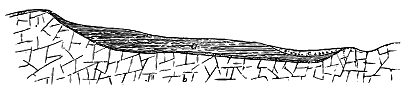
It was pointed out many years ago by Winch that some of the dykes which traverse the Northumberland coal-field do not cut the overlying Magnesian Limestone. The Hett dyke, south of Durham, is said to end off abruptly against the floor of the limestone.[188] Here and there, among the precipices of the Inner Hebrides, a dyke may be seen to die out before it reaches the top of the cliff. But in the vast majority of cases, no evidence remains as to how the dykes terminated upwards. I have referred to the occasional interruptions of the continuity of a dyke, where, though the rock does not reach the surface, it must be present in the fissure underneath. Such interruptions show that, in some places at least, there was no rise of the rock even up to the level of what is now the surface of the ground, and that the upward limit of the dykes must have been exceedingly irregular.
[188] This is expressed in the Geological Survey Map, Sheet 93, N.E.
Excellent illustrations of this feature are supplied by sections on the line of the Cleveland dyke. Towards its south-easterly extremity, this great band of igneous rock ascends from the low Triassic plain of the Tees into - 148 - the high uplands of Cleveland. Its course across the ridges and valleys there has been carefully traced for the Geological Survey by Mr. G. Barrow, who has shown that over certain parts of its course it does not reach the surface, but remains concealed under the Jurassic rocks, which it never succeeded in penetrating. But that in places it comes within a few feet of the soil is shown by the baked shale at the surface, for the alteration which it has induced on the surrounding rocks only extends a few feet from its margin. These interruptions of continuity show how uneven is the upper limit of the dyke. The characteristic porphyritic rock may be observed running up one side of a hill to the crest, but never reaching the surface on the other side. At Cliff Ridge, for example, about three miles south-west of Guisbrough, Mr. Barrow has followed it up to the summit on the west side; but has found that on the east side it does not pierce the shales, which there form the declivity. This structure is represented in Fig 241. The vertical distance between the summit to the left, where the dyke (b) disappears, and the point to the right, where the Lias shale (a) of the hillside is concealed by drift (c), amounts to 250 feet, the horizontal distance being a little more than 900 feet. But as the shale when last seen at the foot of the slope is quite unaltered, the dyke must there be still some little distance beneath the surface, so that the vertical extension of this upward tongue of the dyke must be more than 250 feet. Mr. Barrow, to whom I am indebted for these particulars, has also drawn the accompanying section (Fig. 242) along the course of the dyke for a distance of nearly 11 miles eastward from the locality represented in Fig. 241. From this section it will be observed that in that space there are at least three tongues or upward projections of the upper limit of the dyke. Several additional examples of the same structure are to be seen further east towards the last visible outcrop of the dyke.
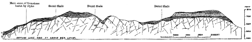
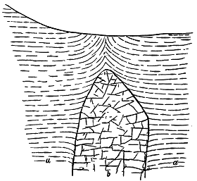
Another feature connected with the upward termination of the dyke is well seen in some parts of the ground through which the two foregoing - 149 - sections are taken. Mr. Barrow informs me that at Ayton a level course has been driven into the hill for mining operations, at a height of 400 feet above sea-level, and the dyke has there been ascertained to be 80 feet broad. Higher on the hill, close to the 750 feet contour—line, its breadth is only 20 feet, so that it narrows upward as much as 60 feet in a vertical height of 350 feet. Its contraction in width during the last twenty feet is still more rapid, and in the last few yards it diminishes to two or three feet, and has a rounded top over which the strata are bent upward. The accompanying section (Fig. 243) across the upper part of the dyke will make these features clear.
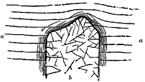
Further to the west an exposure of the upper limit of the dyke has been described and figured by Mr. Teall. In 1882, at one of the Cockfield quarries (Fig. 244), the dyke was "seen to terminate upwards very abruptly in the form of a low and somewhat irregular dome, over which the Coal-measure shales passed without any fracture, and only with a slight upward arching."[189]
[189] Quart. Jour. Geol. Soc. xl. p. 210.
Near the other or north-western termination of this great dyke, similar evidence is found of an uneven upper limit. After an interrupted course through the Alston moors, the dyke reaches the ground that slopes eastward from the edge of the Cross Fell escarpment. Its highest visible outcrop is at a height of 1700 feet. But westwards from that point the dyke disappears under the Carboniferous rocks, and does not emerge along the front of the great escarpment that descends upon the valley of the Eden, where among the naked scarps of rock it would unquestionably be visible if it reached the surface. Its upper edge must rapidly descend somewhere behind the face of the escarpment, for the igneous rock crops out a little to the west of the foot of the cliff, about 1000 feet below the point where it is last seen on the hills above. Here the top of the dyke has a vertical drop of not less than 1000 feet, in a horizontal - 150 - distance of five miles, as shown in Fig. 245, which has been drawn for me by Mr. J. G. Goodchild.
It will be observed that in these sections (Figs. 241, 242 and 245) there is a curiously approximate coincidence between the inequalities in the upper surface of the dyke and those in the form of the overlying ground. The coincidence is too marked and too often repeated to be merely accidental. Whether the ancient topographical features had any influence in determining, by cooling or otherwise, the limit of the upward rise of the lava, or whether the dyke, even though concealed, has affected the progress of the denudation of the ground overlying it, is a question worthy of fuller investigation.

Closely connected with the determination of the upper limit reached by the dykes, is the total vertical distance to which they can be traced. Of course, the depth of the original reservoir of molten rock which supplied them remains unknown, and probably undiscoverable. But it is possible, in many cases, to determine at least the inferior limit of the thickness of rock through which the molten material of the dykes has ascended. Along the great basalt-escarpments of Mull and Skye, the ascent of dykes from base to summit may often be observed. Thus, on the cliffs of Dunvegan Head, on the west coast of Skye, which rise out of the sea to a height of about 1000 feet, several dykes may be observed rising through the whole series of basalts up to the crest of the precipice. In the dark gabbro hills of the same island, numerous dykes may be seen climbing from the glens right up the steep rugged acclivities and over the crests, through a vertical thickness of more than 3000 feet of rock (Fig. 333). The dykes which cross Loch Lomond, and ascend the hills on either side of that deep depression, must rise through at least as great a thickness. But where a knowledge of the geological structure of the ground enables us to estimate the bulk of the successive rock-formations which underlie the surface, it can be shown that the lava ascended through a much greater depth of rock. Measurements of this kind can best be made towards the eastern end of the Cleveland dyke, where the different sedimentary groups have not been seriously disturbed, and where, from natural sections and artificial borings, their thicknesses are capable of satisfactory computation. The highest bed of the - 151 - Jurassic series anywhere touched by the dyke is the Cornbrash. It is certain, therefore, that the igneous rock rises through all the subjacent members of the Jurassic series up to that horizon. There can be no doubt also that the Trias and Magnesian Limestone continue in their normal thickness underneath the Jurassic strata. To what extent the Coal-measures exist under Cleveland has not been ascertained; possibly they have been entirely denuded from that area, as from the ground to the west. But the Millstone Grit and Carboniferous Limestone probably extend over the district in full development; and below them there must lie a vast depth of Upper and Lower Silurian strata, probably also of still older Palæozoic rocks and beneath all the thick Archæan platform. Tabulating these successive geological formations, and taking only the ascertained thickness of each in the district, we find that they give the results shown in the subjoined table.[190]
[190] Drawn up for me by Mr. G. Barrow.
STRATA CUT BY THE CLEVELAND DYKE
| Cornbrash— |
Feet. |
| Lower Oolite and Upper Lias, as proved by bore-hole on Gerrick Moor, |
950 |
| Middle and Lower Lias, ascertained from measurement of cliff-sections and from mining operations to be more than |
850 |
| New Red Sandstone and Marl, found by boring close to the Tees to exceed |
1,600 |
| Magnesian Limestone, at least | 500 |
| Coal-measures, possibly absent | 0 |
| Millstone Grit, not less than | 500 |
| Carboniferous Limestone series at least | 3,000 |
| Silurian rocks, probably not less than | 10,000 |
| 17,400 |
There is thus evidence that this dyke has risen through probably more than three miles of stratified rocks. How much deeper still lay the original reservoir of molten material that supplied the dyke, we have at present no means of computing.
It is usual to speak of the molten material of the dykes as having risen vertically within the fissures. And doubtless, on the whole, the expression is sufficiently accurate. In the case of such long dykes as those of Central Scotland and the North of England, where the petrographical character of the material remains so uniform throughout, it is obvious that the andesite or dolerite cannot have come from a mere single pipe like a volcanic orifice. Nor can we easily understand how it could have been supplied even from a series of such pipes. The general aspect and structure of the dykes suggest that the fissures were rent so profoundly in the crust of the earth as to reach down to a reservoir of molten rock which straightway rose in them. The roof of such a reservoir, however, may have been irregular and uneven, so that a fissure need not have traversed it continuously, - 152 - but may have only touched its upward projecting vaults. Hence gaps would arise in the continuity of the dyke-material.
The ascent of lava from a line of such separate openings along a fissure would necessarily involve lateral as well as vertical movements in the molten mass which would be forced along the open rent until the several streams united and filled it up. We might therefore expect somewhere to find instances of flow-structure in the dykes pointing to these movements. I have already referred to the lines of amygdales frequently noticed in dykes, especially towards the centre. Occasionally these steam-vesicles may be observed to be drawn out in one general direction indicative of the trend of motion of the molten rock.
Some of the best examples of this feature which have come under my observation occur among the trachytic dykes of the south-east coast of Skye between Kyle Rhea and Loch na Daal, where they have been mapped and carefully investigated by Mr. Clough, who has conducted me over the sections. In some of these dykes, as already narrated, the marginal portions display a finely spherulitic structure, the small pea-like spherulites being grouped into fine ribs or rods. It is also observable that the steam-vesicles which may retain their spherical forms in the centre are elongated in the same direction as the rows of spherulites. Where this lineation is developed vertically, it no doubt points to the vertical ascent of the lava between the two walls of the fissure.
But in other examples, the elongation is nearly horizontal, and between the two positions Mr. Clough has registered many intermediate trends. It would thus appear that in some places the lava has certainly flowed laterally between the fissure-walls. Moreover, the trend of the spherulitic rods and of the amygdales is found to vary in closely adjoining planes at different distances from the margin, as if after the outer portions of the dyke had consolidated into position, there was still movement enough to drag the rows of spherulites and vesicles up or down along the trend of the fissure.
Mr. Clough has observed that in some dykes, while the amygdaloidal vesicles are large and undeformed in the centre, they become elongated and inclined downward in the direction of the margin, as if the central portions had not only remained fluid longer than the rest, but had a tendency to rise upwards in the fissure, though there was obviously less motion after these central vesicles appeared than in the marginal parts where the vesicles are so much drawn out.
It might have been anticipated that the uprise of such abundant masses of molten rock, in so many long and wide fissures, would generally be attended with the intrusion of the same material into lateral rents and irregular openings, so that each dyke would have a kind of fringe of offshoots or processes striking from it into the surrounding ground. It might have been expected also that dykes would often branch, and that the arms would - 153 - come together again and enclose portions of the rocks through which they rise. But in reality such excrescences and bifurcations are of comparatively rare occurrence. As a rule, each dyke is a mere wall of igneous rock, with little more projection or ramification than may be seen in a stone field-fence. Among the short, narrow and irregular dykes of the gregarious type branchings are occasionally seen, and in some districts are extraordinarily abundant. But among the great single dykes such irregularities are far less common than might have been looked for. A few characteristic examples from each type of dyke may here be given.
The Cleveland dyke, which in so many respects is typical of the great solitary dykes of the country, has been traced for many miles without the appearance of a single offshoot of any kind. Yet here and there along its course, it departs from its usual regularity. As it crosses the Carboniferous tracts of Durham and Cumberland, there appear near its course lateral masses of eruptive rock, most of which doubtless belong to the much older "Whin Sill." But there is at least one locality, at Bolam near Cockfield, in the county of Durham, where the dyke, crossing the Millstone Grit, suddenly expands into a boss, and immediately contracts to its usual dimensions. Around this knot several short dykes or veins seem to radiate from it. The dyke has been quarried here, and its relations to the surrounding strata have been laid bare, as will be again referred to a little further on.[191]
[191] This locality was well described by Sedgwick, in his early paper on Trap-Dykes in Yorkshire and Durham, Trans. Cambridge Phil. Soc. ii. p. 27.
Among the great persistent dykes of Scotland the absence of bifurcation and lateral offshoots offers a striking contrast to the behaviour of the dykes in those districts where they are small in size and many in number. But exceptions to the general rule may be gathered. Thus the Eskdale dyke is flanked at Wat Carrick with a large lateral vein, which is almost certainly connected with the main fissure. The Hawick and Cheviot dyke splits up on the hill immediately to the east of the town of Hawick, sends off some - 154 - branches, and then resumes its normal course (Fig. 246). Again, one of the two nearly parallel dykes which run from Lochgoilhead across Ben Ledi into Glen Artney bifurcates at the foot of that valley, its northern limb (about two miles long) speedily dying out, and its southern branch throwing off another lateral vein, and then continuing eastward as the main dyke (Fig. 247).
In the districts of gregarious dykes, however, abundant instances may be found of dykes that branch, and of others that lose the parallelism of their walls, become irregular in breadth, direction, and inclination, so as to pass into those intrusive forms that are more properly classed as veins. Excellent illustrations of bifurcating dykes may be observed along the shores of the Firth of Clyde, particularly on the eastern coast-line of the isle of Arran. The venous character has become familiar to geologists from the sketches given by Macculloch from the lower parts of the cliffs of Trotternish in Skye.[192] Still more striking examples are to be seen in the breaker-beaten cliffs of Ardnamurchan. The pale Secondary limestones and calcareous sandstones of that locality are traversed by a series of dark basic veins, and the contrast of tint between the two kinds of rock is so marked as even to catch the eye of casual tourists in the passing steamboats. The veins vary in width from less than an inch to several feet or yards. They run in all directions and intersect each other, forming such a confused medley as requires some patience on the part of the geologist who would follow out each independent ribbon of injected material in its course up the cliffs, or still more, would sketch their ramifications in his note-book. A good, though perhaps somewhat exaggerated, illustration of their general character was given by Macculloch.[193] The accompanying figure (Fig. 248) is less sensational, but represents with as much accuracy as I could reach, the network of veins near the foot of the cliffs. One conspicuous group of veins, which, seen from a distance, looks like a rude sketch of a lug-sail traced in black outline upon a pale ground, is known to the boatmen as "M'Niven's Sail." Another admirable locality for the study of dykes and tortuous veins is the northern coast of the Sound of Soa, where an extraordinary number of injections traverse the Torridon Sandstones on which the plateau-basalts rest (Fig. 323).
As a general rule, the narrower the vein the finer in grain is the rock of which it consists. This compact dark homogeneous material has commonly passed by the name of "basalt." Its minuteness of texture probably in most cases arises from local rapidity of cooling, and it is doubtless the same substance which, where in larger mass in the immediate neighbourhood, has solidified as one of the other pyroxene-plagioclase-magnetite rocks.
With regard to the places where such abundant tortuous veins are more especially developed, I may remark that they are particularly prominent under a thick overlying mass of erupted rock, such as a great intrusive sheet, or the bedded basalts of the plateaux, or where there is good reason - 155 - to believe that such a deep cover, though now removed by denudation, once overspread the area in which they appear. It will be shown in the sequel that such horizons have been peculiarly liable to intrusions of igneous material of various kinds, and at many different intervals, during the volcanic period. A thick cake of crystalline rock seems to have offered such resistance to the uprise of molten material through it, that when the subterranean energy was not sufficient to rend it open by great fissures, and thus give rise to dykes, the lavas were either forced into such irregular cracks as were made partly in the softer rocks underneath and partly in the cake itself, or found escape along pre-existing divisional planes. In Ardnamurchan, round the Cuillin Hills of Skye, and in Rum, the overlying resisting cover now consists mainly of gabbro sheets. In the east of Skye, in Eigg, and in Antrim, it is made up of the thick mass of the plateau-basalts.
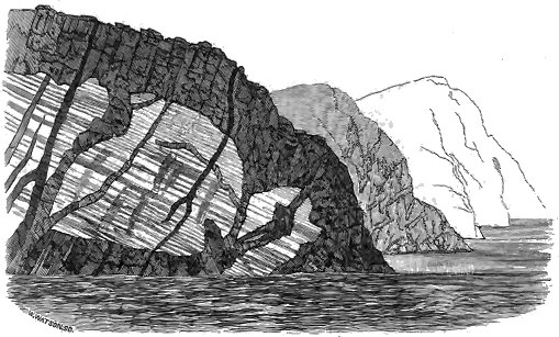
Every field-geologist is aware how seldom he can actually find the vent or pipe up which rose the igneous rock that supplied the material of sills and laccolites. He might well be pardoned were he to anticipate that, in a district much traversed by dykes, there should be many examples of intrusive sheets and frequent opportunities of tracing the connection of such sheets with the fissures from which their material might be supposed to have been supplied. But such an expectation is singularly disappointed by an actual examination of the Tertiary volcanic region of Britain. That there are many intrusive sheets belonging to the great volcanic period with - 156 - which I am now dealing, I shall endeavour to show in the sequel. But it is quite certain that though these sheets have of course each had its subterranean pipe or fissure of supply, they can only in rare instances be directly traced to the system of dykes. On the other hand, the districts where great single dykes are most conspicuous, are for the most part free from intrusive sheets, except those of much older date, like the Carboniferous Whin Sill of Durham and those of Linlithgowshire, Stirlingshire and Fife.
Yet a few interesting examples of the relation of dykes to sheets have been noticed among British Tertiary volcanic rocks. The earliest observed instances were those figured and described by Macculloch. Among them one has been familiar to geologists from having done duty in text-books of the science for more than half a century. I allude to the diagram of "Trap and Sandstone near Suishnish."[194] In that drawing seven dykes are shown as rising vertically through the horizontal sandstone, and merging into a thick overlying mass of "trap." The author in his explanation leaves it an open question "whether the intruding material has ascended from below and overflowed the strata, or has descended from the mass," though from the language he uses in his text we may infer that he was inclined to regard the overlying body as the source of the veins below it.[195]
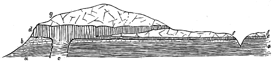
The section given by Macculloch, however, does not quite accurately represent the facts. The narrow dykes there drawn have no connection with the overlying sheet, but are part of the abundant series of basaltic dykes found all over Skye. The feeder of the gabbro sill was presumably the broad dyke which descends the steep bank immediately on the southern front of Carn Dearg (636 feet high). The accompanying figure (Fig. 249) shows what seemed to me to be the structure of the locality, but the actual junction of the dyke and sheet is concealed under the talus of the slope.[196] I shall have occasion in a later Chapter to refer again to this - 157 - section in connection with the history of intrusive sheets, and also to cite from the neighbouring island of Raasay another good example of the same relation between dyke and sill.
[196] In more recently surveying this ground, Mr. Harker has been led to regard the coarse sill as independent of the other intrusions, and as almost certainly later than the basalt-sheets of the same locality. When it reaches the base of these sills it turns so as to pass beneath them as a gabbro-sill, which is conspicuous near the summit of Carn Dearg. It runs westward for some distance, almost immediately breaking across the bedding so as to leave the basalt, and rapidly tapering until it dies out.
Sedgwick, in the paper above quoted, gave an account and figure of the expansion of the Cleveland dyke at Bolam, to which allusion has already been made. He showed that from a part of the dyke which is unusually contracted a great lateral extension of the igneous rock takes place on either side over beds of shale and coal. While in the dyke the prisms are as usual directed horizontally inward from the two walls, those in the connected sheet are vertical, and descend upon the surface of highly indurated strata on which the sheet rests.
The most important examples known to me are those which occur in the coal-field of Stirlingshire. In that part of the country, the remarkable group of dykes already referred to, lying nearly parallel to each other and from half a mile to about three miles apart, runs in a general east and west direction. From one of these dykes no fewer than four sills strike off into the surrounding Coal-measures. The largest of them stretches southwards for three miles, but the same rock is probably continued in a succession of detached areas which spread westwards through the coal-field and circle round to near the two western sheets that proceeded from the same dyke. Another thick mass of similar rock extends on the north side of the dyke for two and a half miles down the valley of the river Avon. These various processes, attached to or diverging from the dyke, are unquestionably intrusive sheets, which occupy different horizons in the Carboniferous series. The one on the north side has inserted itself a little above the top of the Carboniferous Limestone series. Those on the south side lie on different levels in the Coal-measures, or, rather, they pass transgressively from one platform to another in that group of strata.
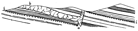
No essential difference can be detected by the naked eye between the material of the dyke and that of the sheets. If a series of specimens from the different exposures were mixed up, it would be impossible to separate those of the dyke from those of the sheets. A microscopical examination of the specimens likewise shows that they are perfectly identical in composition and structure, being chiefly referable to rocks of the dolerite, but - 158 - partly of the tholeiite type. I have therefore little doubt that these remarkable appendages to this dyke are truly offshoots from it, and are not to be classed with the general mass of the sills of Central Scotland, which are of Carboniferous, partly of Permian, age. The accompanying diagrammatic section (Fig. 250) explains the geological structure of the ground.
An interesting and important fact remains to be stated in connection with these sheets. They are traversed by some of the other east and west dykes. This is particularly observable in the case of the sheet which extends northwards from the dyke through the parish of Torphichen. Two well-marked dykes can be seen running westwards among the ridges of the sheet. It is obvious, therefore that these particular dykes are younger than the sheet. But, as will be shown in the sequel, there is abundant evidence that all the dykes of a district are not of one eruption. The intersection of one eruptive mass by another does not necessarily imply any long interval of time between them. They mark successive, but it may be rapidly successive, manifestations of volcanic action. Hence the cutting of the sheets by other dykes does not invalidate the identification of these sheets as extravasations from the great dyke by which they are bounded.
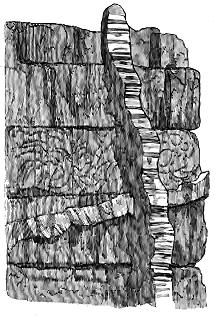
Innumerable instances may be cited, where one dyke, or one set of dykes, cuts across another. To some of these I shall refer in discussing the data for estimating the relative ages of dykes. In considering the intersection from the point of view of geological structure, we are struck with the clean sharp way in which it so generally takes place. The rents into which the younger dykes have been injected seem, as a rule, not to have been sensibly influenced in width and direction by the older dykes, but go right across them. Hence the younger dykes retain their usual breadth and trend (Fig. 251). In trying to ascertain the relative ages of such dykes we obtain a valuable clue in studying the respective "chilled edges" of the two intersecting masses, as has already been pointed out.
Not only do dykes cross each other, but still more is this the case among the narrower tortuous intrusions known as Veins (Fig. 252). Among the illustrations which the dykes of the Inner Hebrides supply of these features one further characteristic - 159 - example may be culled from the shore of Skye, near Broadford, where the gently-inclined sheets of Lias limestone are traversed by three systems of dykes (Fig. 253). One of these systems runs in a N.W. or N.N.W. direction, a second follows a more nearly easterly trend, while the third and youngest runs nearly north and south.
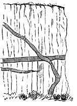
Fig. 252.—Basalt Veins traversing
bedded dolerites, Kildonan, Eigg.
|
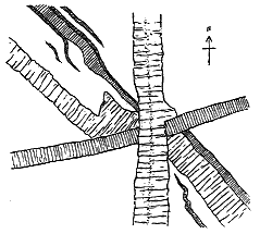
Fig. 253.—Ground-plan of intersecting Dykes in
Lias limestone, Shore, Harrabol, East of
Broadford, Skye.
|
The intersections of dykes prove that the process of fissuring in the earth's crust took place at more than one period, and prepare us for the reception of evidence that the same line of fissure might be again re-opened, even after it had been filled with molten material. Numerous instances have now been accumulated in which dykes are not single or simple intrusions, but where the original dyke-fissure has been re-opened and has been invaded by successive uprisings of lava.[197] Compound dykes have thus been formed, consisting of two or more parallel bands of similar or dissimilar rock.
[197] See an example figured by Macculloch, Western Isles, plate xviii. Fig. 1.
While it is not difficult to conceive of the re-opening of a vertical fissure during terrestrial strain, and the injection into it of later intrusions of a volcanic magma, it is not so easy to understand the mechanism where the line of weakness has been slightly inclined or horizontal, and where, consequently, there has been the enormous superincumbent pressure of the overlying part of the earth's crust to overcome. Yet gently inclined compound dykes exhibit their parallel bands with hardly less regularity than do those that are vertical. The difficulty of explanation is felt most strongly in the attempt to realize the origin of the compound sills described in Chapter xlviii.
In the re-opening of dyke-fissures the later intrusions have generally - 160 - taken place along the walls, or where the dykes were already compound, between some of the component bands. Less frequently the first dyke has been split open along the middle, and a second injection has forced its way along the rent.
Of the first of these two types, numerous instances have now been observed in the West of Scotland. If the portion of a compound dyke exposed at the surface be limited in extent, we may be unable to determine which is the older of two parallel bands of igneous rock, though the fact that they present to each other the usual fine-grained edge due to more rapid cooling, shows that they are not one but two dykes, belonging to distinct eruptions. So far as I have noticed, where one of the dykes can be continuously traced for a considerable distance, the other is comparatively short. I infer that the shorter one is the younger of the two.
In the Strath district of Skye, Mr. Harker has recently observed that many of the basic dykes, both those older and those younger than the granophyre protrusions, are double, triple or multiple. Thus in a conspicuous dyke, more than 100 feet wide, to the south-east of Loch Kilchrist, belonging to the older series, he has detected at least six contiguous dykes which as they are traced south-eastward, in spite of their interruption by the Beinn an Dubhaich granite, can be seen to separate and take different courses, or successively die out. He remarks, further, that "many cases of apparent bifurcation of dykes are really due to the separation of distinct dykes which have run for some distance in one fissure. Sometimes apparent variations in the width of a dyke are to be explained by this dying out of one member of a double dyke. These multiple dykes are less easily detected in the newer than the older set, owing to greater uniformity of lithological type in the prevalent kinds and to the frequent absence of chilled selvages."[198] An example of a compound basic dyke cutting the crest of the gabbro-mass of the Cuillin Hills is shown in Fig. 333.
[198] MS. notes supplied by Mr. Harker.
Instances of the second type of compound dykes are less common. Here, instead of being re-opened along one of the walls, the fissure has been ruptured along the centre of the dyke, and a second injection of molten material has then taken place. This structure may be observed where the materials of the compound dyke are on the whole similar, such as varieties of dolerite, basalt, diabase or andesite. In these cases the rock of the central dyke is generally rather fine-grained, sometimes decidedly porphyritic, and often a true basalt. Where broad enough to show the difference of texture between margin and centre, it exhibits the usual close grain along its edges, indicative of quicker cooling. The older dyke presenting no such change at its junction with the younger, was obviously already cooled and consolidated before its rupture.
Whilst the centre of a dyke has occasionally proved to be a line of weakness which has given way under intense strains in the terrestrial crust, this rupture and the accompanying or subsequent ascent of molten material in the re-opened fissure may sometimes have been included as phases of one - 161 - connected volcanic episode. In those instances, for example, which have been above described, where a central vitreous band has risen along the heart of a dyke, the petrographical affinities of the rocks may be so close as to suggest that although the main dyke had consolidated and had subsequently been ruptured along its centre by powerful earth-movements, these changes all belonged to the same period of dyke-making, and the subsequent uprise of glassy material was merely a later phase in the movements of the same subterranean magma.
But where, as probably happens in the large majority of compound dykes, there is a strongly marked difference between the respective bands of rock, we must either infer that two essentially different magmas co-existed in the volcanic reservoirs underneath, and were successively injected into the same fissures, or that a sufficient lapse of time occurred to permit a total renewal of the nature of the magma, and an uprise of this changed material into fissures which sometimes coincided with older dykes. If any interlocking of the crystals of the several bands of a compound dyke could be detected, we might suppose that the first-injected material had not become consolidated and cold before the uprise of the newer rock. But in general it would seem that so sharp a line of demarcation can be drawn between the two rocks as to indicate that their protrusion was due to two distinct and perhaps widely-separated volcanic paroxysms.
Compound dykes of basic material occur not only among the ordinary straight north-westerly series, but also among the less regular gregarious dykes and veins, such as abundantly intersect the gabbro bosses. Moreover they are to be found among the youngest intrusions, for they traverse the masses of granophyre. Conspicuous examples of such late compound dykes are displayed along the cliffs of St. Kilda, as will be more particularly described in a later Chapter. These St. Kilda dykes often occupy not vertical fissures but parallel rents with a gentle inclination (see Figs. 367, 368).
The Tertiary volcanic series of Scotland furnishes many examples of compound dykes of a much more complex character where parallel bands of some acid (granophyre, felsite, quartz-porphyry) or intermediate (andesite) rock is associated with others of the more usual basic material (dolerite, basalt, diabase). As the acid intrusions belong to a comparatively late part of the volcanic history, their modes of occurrence will be discussed in Chapters xlvi., xlvii. and xlviii. But no account of the general system of dykes would be complete without some reference to these compound examples, which will therefore be briefly described in the present section of this work.
Early in this century some striking illustrations of the association of acid and more basic rocks within the same fissure were noticed by Jameson in the island of Arran. He described and figured instances at Tormore, on the west side of that island, where a group of pitchstones and "basalts" or andesites have been successively protruded into the same fissures in the (probably Permian) red sandstones of that district.[199]
[199] Mineralogy of the Scottish Isles, 1800.
- 162 -
In some instances the more basic rock has been first injected, and has subsequently been disrupted, by the more acid pitchstone. In other cases the order has been the reverse. The successive ruptures have taken place sometimes along the centre, sometimes at the margins, and sometimes irregularly along the breadth of the dykes. Professor Judd has recently studied these rocks, and has given descriptions of their chemical composition and microscopic characters. He regards them as having been successively injected into the fissures from the same subterranean reservoir, in which two magmas of very different chemical constitution were simultaneously present.[200]
[200] Quart. Jour. Geol. Soc. vol. xlix. (1893), p. 536. Full details of the compound dykes of Tormore and Cir Mhor in Arran, and references to previous writers will be found in this paper. The probable age of the youngest eruptive rocks of this island will be discussed in Chapter xlvii. p. 418.
Nowhere in the Tertiary volcanic regions of Britain do compound dykes appear to be so abundant as in the centre and southern part of the island of Skye. During the progress of the Geological Survey in that district, Mr. Clough and Mr. Harker have mapped a large number in the ground between the Sound of Sleat and the Red Hills. With regard to these dykes Mr. Harker observes that the several members are generally petrographically different, some being basic, others intermediate, and others acid. "There is usually," he remarks, "a symmetrical disposition, two similar and more basic dykes being divided by a more acid one; for example, two andesites separated by a pitchstone. Thus at the mouth of the little stream which runs from Torran into the bay east from Dùn Beag a dyke, apparently 18 feet wide, is found on examination to consist of a central dyke (specific gravity 2·86) flanked by two more basic dykes (specific gravity 3·02)."
In the great majority of examples hitherto observed in Skye the two lateral dykes consist of some basic rock (diabase or basalt), while the central and thickest band is of some acid material (granophyre or quartz-felsite). This triple arrangement occurs both in dykes and sills.
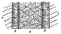
As an illustration of the association of the two kinds of rock in dykes I may cite an example which appears on the southern edge of the Market Stance of Broadford (Fig. 254). Here the characteristic triple arrangement is typically developed. A central light-coloured band, about eight to ten feet broad, consists of a spherulitic granophyre in which the spherulites are crowded together and project from the weathered surface like peas, though they do not here show the curious rod-like aggregation so marked in some other dykes. On either side of this acid centre a narrow basalt dyke intervenes as a wall next to the Torridon sandstone which here forms the country-rock. Such compound dykes have sometimes a total width of 100 feet or more.
- 163 -
In this instance, and generally throughout the district, there is nothing to indicate that the different bands of the dyke have any relation to each other as connected uprises of material from the same original magma which was either heterogeneous or was undergoing a process of differentiation beneath the terrestrial crust. On the contrary, the several parts of each dyke are as distinctly marked off from each other as they could have been had they been injected at widely separated intervals of volcanic activity.
Mr. Harker, in the course of his survey of this Skye ground, has observed that "where evidence is available, the central acid dyke is found to be newer than the basic ones. It has not split a single basic dyke, but has insinuated itself between the two members of a double dyke. This is more clearly seen when the acid magma has been forced into a triple or multiple basic dyke; the perfect symmetry of arrangement may in this case be lost. For instance, on the shore north-east of Corry, Broadford, a 13 feet dyke of granophyre occurs in a multiple dyke of basalt, but it has taken its line so as to leave only a one-foot dyke on one side, and a group with a total width of 12 feet on the other. Also it has not accurately kept its course, but has cut obliquely across one of the group of dykes alluded to. In some cases it is certain that the acid magma has to some extent dissolved a portion of the wall of a basic dyke with which it has come in contact. This may account for the magma finding its easiest path along, and especially between, pre-existing more basic dykes." This subject will be again referred to in Chapter xlviii., when the phenomena of compound sills are discussed.
Before closing this account of compound dykes, I may remark that no examples have yet been observed among the ordinary Tertiary dykes of Britain where, by a process of differentiation between the walls of a fissure, successive zones have been developed in the dyke, differing from each other in structure and composition, but becoming progressively and insensibly more acid towards the centre, such as have been described from the older rocks of Norway and Canada. Among the Tertiary gabbro bosses, indeed, there occur sheets or dykes which present a remarkably banded structure, to which full reference will be made in later pages. But I have never seen anything at all resembling such a structure among the dykes of andesite, dolerite, or basalt.
A geologist might naturally expect that such abundant intrusions of igneous rock as those of the dykes should be accompanied with plentiful proofs of contact-metamorphism. But in actual fact, evidence of any serious amount of alteration is singularly scarce. A slight induration of the rocks on either side of a dyke is generally all the change that can be detected.
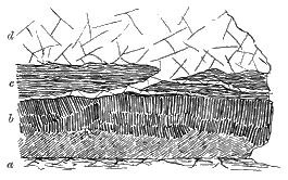
Some of the larger dykes, however, show more marked metamorphism, the nature of which appears in many cases to be chiefly determined by the chemical composition of the rock affected. Thus a considerable alteration - 164 - has been superinduced on carbonaceous strata, particularly on seams of coal. In the Ayrshire coal-field the alteration of the coal extends sometimes 150 feet from the dyke, the extent of the change depending not merely on the mass of the igneous rock, but on the nature of the coal, and possibly on other causes. Close to a dyke, coal passes into a kind of soot or cinder, sometimes assumes the form of a finely columnar coke (Fig. 255), and occasionally has become vesicular after being fused.[201] Shales are converted into a hard flinty substance that breaks with a conchoidal fracture and rings under the hammer. Fireclay is baked into a porcelain-like material. Limestone is changed for a few inches into marble. As an illustration of this alteration, I may cite a dyke ten feet broad which cuts through the chalk in the Templepatrick Quarry, Antrim. For about six inches from the igneous rock the chalk has passed into a finely saccharoid condition, and its organisms are effaced. But beyond that distance the crystalline structure rapidly dies away, the micro-organisms begin to make their appearance, and within a space of one foot from the dyke the chalk assumes its ordinary character.
[201] Explanation of Sheet 22, Geological Survey of Scotland, p. 26.
Sandstones are indurated by dykes into a kind of quartzite, sometimes assume a columnar structure (the columns being directed away from the dyke-walls), and for several feet or yards have their yellow or red colours bleached out of them. The granite of Ben Cruachan where quarried on Loch Awe, as I am informed by Mr. J. S. Grant Wilson, is traversed by a basic dyke, and for a distance of about 20 feet is rendered darker in colour, becomes granular, and cannot be polished and made saleable.
Where many dykes have been crowded together, their collective effects in the alteration of the strata traversed by them have sometimes been strongly developed. One of the most remarkable illustrations of this influence is presented by the district of Strathaird, which was cited by Macculloch for the abundance of its dykes. In recently mapping this ground for the Geological Survey, Mr. Harker has observed in some places a score or more dykes in actual juxtaposition, while over considerable distances he found it difficult to detect any trace of the Jurassic strata, through which the igneous rocks have ascended. As might be expected under these circumstances, such portions of the strata as can be seen display an altogether exceptional amount of contact-metamorphism. Mr. Harker has noticed some limestones at Camasunary which have been changed into very remarkable lime-silicate rocks, with singular bunches of diopside crystals.
- 165 -
These, however, are the extremes of contact-metamorphism by the Tertiary basic dykes. A geologist visiting the Liassic shores of Strath in Skye will not fail to be surprised at the very slight degree of alteration in circumstances where he would have expected to find it strongly pronounced. The dark shales, though ribbed across with dykes, are sometimes hardly even hardened, and at the most are only indurated from an inch or two to about two feet. These baked bands project above the rest of the more easily denuded shales, and so adhere to the dykes as almost to seem part of them. Again the limestones, where traversed by dykes some distance apart, are not rendered in any appreciable degree more crystalline even up to the very margin of the intrusive rock. Where the igneous material has been thrust between the strata in sills, it has produced far more general and serious metamorphism than when it occurs in the form of single dykes. The famous rock of Portrush, already referred to as having been once gravely cited as an example of fossiliferous basalt, is a good illustration of the way in which Lias shale is porcellanized when the intruded igneous material has been thrust between the planes of bedding.
In the West of Scotland, where dykes are so abundantly developed, considerable differences can be observed between the amount of metamorphism superinduced by adjacent dykes which may be of the same thickness, and cut through the same kind of strata. Such variations have not probably arisen from differences in the temperature of the original molten rock. Perhaps they are rather to be assigned to the length of time occupied by the ascent of the lava in the fissure. If, for instance, the fissure opened to the surface and discharged lava there, the rocks of its walls would be exposed to a continuous stream of molten rock as long as the outflow lasted. They would thus have their temperature more highly raised, and maintained at such an elevation for a longer time than where the magma, at once arrested within the fissure, immediately proceeded to cool and consolidate there. It would be an interesting and important conclusion if we could, from the nature or amount of their contact-metamorphism, distinguish those dykes which for some time served as channels for the discharge of lava above ground.
Some dykes which have caught up fragments of older rocks in their ascent have exercised a considerable solvent action on these inclusions. Examples of this feature have already been cited from Skye, where they have been studied by Mr. Harker (pp. 129, 163).
In connection with the metamorphism superinduced by dykes, reference may again be made to the alteration which they themselves undergo where they have invaded a carbonaceous shale or coal. The igneous rock, as we have seen, loses its dark colour and obviously crystalline structure, and becomes a pale yellow or white, dull, earthy substance, or "white trap." The chemical changes involved in this alteration have been described by Sir J. Lowthian Bell.[202] Dr. Stecher has also discussed the alterations traceable by - 166 - the aid of the microscope.[203] Though most of the instances of such transformation in Britain occur in the Carboniferous system, and have taken place in intrusive rocks of probably, for the most part, Carboniferous or Permian age, yet they are not unknown in the Tertiary volcanic series. Some of the "white trap" of the Coal-measures may indeed belong to the Tertiary period, but the coals and carbonaceous shales interstratified in the Tertiary basalt-plateaux have reacted on both the superficial lavas and the sills, and have given rise to the same kind of alteration as in the Carboniferous system, as will be shown in a later Chapter.
[202] Proc. Roy. Soc. xxiii. (1875), p. 543.
[203] Tschermak's Mineralogische Mittheilungen, ix. (1887), p. 145, and Proc. Roy. Soc. Edin. 1888.
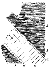
Some marked examples of this alteration of intrusive igneous material are to be observed among the basalt dykes which cut the Lower Lias Shales of Skye. These shales, where black and carbonaceous, as in the island of Pabba, have exercised an unmistakable influence on the abundant dykes which intersect them. The chilled selvage of each dyke has assumed the dull earthy pale-grey or yellowish aspect, which extends for a few inches from the wall into the interior, where it rapidly passes into the ordinary black crystalline basalt. These features will be readily understood from the accompanying diagram (Fig. 256). Where the dykes give off narrow veins a few inches broad, these consist entirely of the "white trap." The shales are often traversed with strong joints parallel to the walls of the dykes, and the transverse joints of the dykes are sometimes prolonged into the bands of indurated shale.
In no respect do the Tertiary dykes of Britain stand more distinguished from all the other rocks of the country than in their extraordinary independence of geological structure. The successive groups of Palæozoic and Mesozoic strata have been so tilted as to follow each other in approximately parallel bands, which run obliquely across the island from south-west to north-east. The most important lines of fault take the same general line. The contemporaneously included igneous rocks follow, of course, the trend of the stratified deposits among which they lie, and even the intrusive sills group themselves along the general strike of the whole country. But the Tertiary dykes have their own independent direction, to which they adhere amid the extremest diversities of geological arrangement.
- 167 -
In the first place, the dykes intersect nearly the whole range of the geological formations of the British Islands. In the Outer Hebrides and north-west Highlands, they rise through the most ancient (Lewisian) gneisses, through the red pre-Cambrian (Torridon) sandstones, and through the oldest members of the Cambrian system. In the southern Highlands, they pursue their course across the gnarled and twisted schists of the younger crystalline (Dalradian) series. In the South of Scotland and North of England, they traverse the various subdivisions of the Lower and Upper Silurian rocks. In the basins of the Tay, Forth, and Clyde they cross the plains and ridges of the Old Red Sandstone, with its deep pile of intercalated volcanic material. In Central Scotland, and the northern English counties, they occur abundantly in the Carboniferous system, and have destroyed the seams of coal. In Cumberland and Durham, they traverse the Permian and Trias groups. In Yorkshire, and along the West of Scotland, they are found running through Jurassic strata. In Antrim, they intersect the Chalk. Both in the North of Ireland, and all through the chain of the Inner Hebrides, they abound in the great sheets and bosses of Tertiary volcanic rocks. These are the youngest formations through which they rise. But it is deserving of note, that they intersect every great group of these Tertiary volcanic products, so that they include in their number the latest known manifestations of eruptive action in the geological history of Britain.[204]
[204] They have not been found cutting the pitchstone-lava of the Scuir of Eigg.
In the second place, in ranging across groups of rock belonging to such widely diverse periods, the dykes must necessarily often pass abruptly from one kind of material and geological structure to another. But, as a rule, they do so without any sensible deviation from their usual trend, or any alteration of their average width. Here and there, indeed, we may observe a dyke to follow a more wavy or more rapidly sinuous or zig-zag course in one group of rocks than in another. Yet, so far as I have myself been able to observe, such sinuosities may occur in almost any kind of material, and are not satisfactorily explicable by any difference of texture or arrangement in the rocks at the surface. No dyke traverses a greater variety of sedimentary formations than that of Cleveland. In the eastern part of its course, it rises through all the Mesozoic groups up to the Cornbrash. Further west it cuts across each of the different subdivisions of the Carboniferous system; and, of course, it must traverse all the older formations which underlie these. But the occasional rapid changes noticeable in its width and direction do not seem to be referable to any corresponding structure in the surrounding rocks. The Cheviot dyke crosses from the Carboniferous area of Northumberland into the Upper Silurian rocks and Lower Old Red Sandstone volcanic tract of the Cheviot Hills. It then strikes across the Upper Old Red Sandstone of Roxburghshire, and still maintaining the same persistent trend, sweeps westward into the intensely plicated Silurian rocks of the Southern Uplands. Its occasional deviations have no obvious reference to any visible change of structure in the adjacent - 168 - formations. Again, some of the great dykes at the head of Clydesdale furnish striking illustrations of entire indifference to the nature of the rock through which they run. Quitting the Silurian uplands, they keep their line across Old Red Sandstone and Carboniferous rocks, and through large masses of eruptive material.
In the third place, not only are the dykes not deflected by great diversities in the lithological character of the rocks which they traverse, they even cross without deviation some of the most important geological features in the general framework of the country. Some of the Scottish examples are singularly impressive in this respect. Those which strike north-westward from the uplands of Clydesdale cross without deflection the great boundary-fault which, by a throw of several thousand feet, brings the Lower Old Red Sandstone against Silurian rocks. They traverse some large faults in the valley of the Douglas coal-field, pass completely across the axis of the Haughshaw Hills, where the Upper Silurian rocks are once more brought up to the surface, and also the long felsite ridge of Priesthill. The dykes in the centre of the kingdom maintain their line across some of the large masses of igneous rock that protrude through the Carboniferous system. Further north, the dykes of Perthshire cut across the great sheets of volcanic material that form the Ochil Hills, as well as through the piles of sandstone and conglomerate of the Lower Old Red Sandstone, and then go right across the boundary-fault of the Highlands, to pursue their way in the same independent manner through grit, quartzite, or mica-schist, and across glen and lake, moor and mountain.
No one can contemplate these repeated examples of an entire want of connection between the dykes and the nature and arrangement of the rocks which they traverse without being convinced that the lines of rent up which the material of the dykes rose were not, as a rule, old fractures in the earth's crust, but were fresh fissures, opened across the course of the older dislocations and strike of the country by the same series of subterranean operations to which the uprise of the molten material of the dykes was also due.
In the fourth place, the dykes for the most part are not coincident with visible lines of fault. After the examination of hundreds of dykes in all parts of the country, and with all the help which bare hillsides and well-exposed coast-sections can afford, the number of instances which have been met with where dykes have availed themselves of lines of fault is surprisingly small. Some of these cases will be immediately cited. To whatever cause we may ascribe the rupture of the solid crust of the earth, which admitted the rise of molten rock to form the dykes, there can be no doubt that it was not generally attended with that displacement of level on one or both sides of the dislocation, which we associate with the idea of a fault. Nowhere can this important part of dyke-structure be more clearly illustrated than along the Cleveland dyke, where the igneous rock rises through almost horizontal Jurassic strata and gently inclined Coal-measures (Figs. 241, 242, 243, 244). Besides the localities already cited, mining operations both for coal and for - 169 - the Liassic ironstone have proved over a wide area that the dyke has not risen along a line of fault. Again, in Skye, Raasay, Eigg, and other parts of the west coast, where Jurassic strata and the horizontal basalts of the plateaux are plentifully cut through by dykes, the same beds may generally be seen at the same level on either side of them.
In the fifth place, while complete indifference to geological structure is the general rule among the dykes, instances do occur in which the molten material has found its way upward along old lines of rupture. Most of such instances are to be found in districts where previously existing faults happened to run in the same general direction as that followed by the dykes. These lines of fracture might naturally be re-opened by any great earth-movements acting in their direction, and would afford ready channels for the ascent of the lava, as we have seen to have not infrequently happened in the case of dyke-fissures, which are shown by compound dykes to have sometimes been re-opened several times in succession even after having been filled up with basalt. Yet it is curious that, even when their trend would have suited the line of the dykes, faults have not been more largely made use of for the purpose of relief. Some of the best examples of the coincidence of dykes with pre-existing faults in the same direction are to be found in the Stirlingshire coal-field. The dyke that runs from Torphichen for 23 miles to Cadder occupies a line of fault which at Slamannan has a down-throw of more than 70 fathoms. The next dyke further south has also risen along an east and west fault.
But other examples may be observed where pre-existing fissures have served to deflect dykes from their usual line of trend. Thus the Cleveland dyke, after crossing several faults in the Coal-measures, at last encounters one near Cockfield Fell, which lies obliquely across its path. Instead of crossing this fault it bends sharply round a few points south of west, and after keeping along the southern flank of the fault for about a mile, sinks out of reach. Some of the Scottish examples are more remarkable. One of the best of them occurs in the Sanquhar coal-field, where a dyke runs for two miles and a half along the large fault that here brings down the Coal-measures against the Lower Silurian rocks. At the north-western end of the basin, this fault makes an abrupt bend of 60° to W.S.W., and the dyke turns round with it, keeping this altered course for a mile and a half, when it strikes away from the fault, crosses a narrow belt of Lower Silurian rocks, and finds its way into the parallel boundary fault which defines the north-western margin of the Southern Uplands.
- 170 -
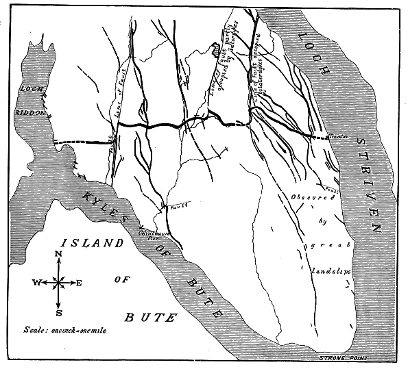
Some of the Perthshire dykes, where they reach the great boundary-fault of the Highlands, present specially interesting features. There can be no doubt that this dislocation is one of the most important in the general framework of the British Isles, though no definite estimate has yet been formed of how much rock has been actually displaced by it. The fact that in one place the beds of Old Red Sandstone are thrown on end for some two miles back from it, shows that it must be a very powerful fracture. Here, therefore, if anywhere, either an entire cessation of the dykes, or at least a complete deflection of their course might be anticipated. It would require, we might suppose, a singularly potent dislocation to open a way for the ascent of the lava through such crushed and compressed rocks, and still more to prolong the general line of a fracture across the old fault. Two great dykes, about half a mile apart, run in a direction a little south of west across the plain of Strathearn. Passing to the south of the village of Crieff, they hold on their way until they reach the highly-inclined beds of sandstone and conglomerate which here lean against the Highland fault in - 171 - Glen Artney. They then turn round towards south-west, and run up the glen along the strike of the beds, keeping approximately parallel to the fault for about three miles, when they both strike across the fault, and pursue a W.S.W. line through the contorted crystalline rocks of the Highlands. About two miles further south, another dyke continues its normal course across the belt of upturned Old Red Sandstone; but when it reaches the fault it bends round and follows the line of dislocation, sometimes coinciding with, sometimes crossing or running parallel with that line, at a short distance (see Fig. 247).
Some remarkable examples have been mapped by Mr. Clough in Eastern Argyleshire, where broad bands of basalt or other allied rock run in a N. and S. direction, and are formed by the confluence of N.W and S.E. or N.N.W. and S.S.E. dykes, where these are drawn into a line of fault (Fig. 257). These broad bands, he has found to be not usually traceable for more than a mile or so, for the dykes of which they are made up will not be diverted from their regular paths for more than a certain distance, so that one by one the dykes leave the compound band to pursue their normal course. He has observed that the occasional great thickness of these compound bands depends partly on the size and partly on the number of separate dykes that are diverted into the line of transverse fissure; for, where the fissure crosses an area with fewer north-west dykes, the band becomes thinner or ceases altogether.
In some rare cases, the dykes have been shifted by more recent faults. I shall have occasion to show that faults of more than 1000 feet have taken place since the Tertiary basalt-plateaux were formed. There is therefore no reason why here and there a fault with a low hade should not have shifted the outcrop of a dyke. But the fact remains, that, as a general rule, the dykes run independently of faults even where they approach close to them. Mr. Clough has observed some interesting cases in South-eastern Argyleshire, where the apparent shifting of a dyke by faults proves to be deceptive, and where the dyke has for short distances merely availed itself of old lines of fracture. One of the most remarkable of these is presented by the large dyke which runs westward from Dunoon. No fewer than three times, in the course of four miles between Lochs Striven and Riddon, does this dyke make sharp changes of trend nearly at right angles to its usual direction, where it encounters north and south faults (Fig. 257). It would be natural to conclude that these changes are actual dislocations due to the faults. But the careful observer just cited has been able to trace the dyke in a very attenuated and uncrushed form along some of these cross faults, and thus to prove that the faults are of older date, but that they have modified the line of the long east and west fissure up which the material of the dyke ascended.
I have already assigned reasons for regarding the system of north-west and south-east or east and west dykes as belonging to the Tertiary volcanic - 172 - period in the geographical history of the British Islands. But I have no evidence that they were restricted to any part of that period. On the contrary, there is every reason to consider the uprise of the earliest and latest dykes to have been separated by a protracted interval. That they do not all belong to one epoch has been already indicated, and may now be more specially proved.
The intersection of one dyke by another furnishes an obvious criterion of relative age. Macculloch drew attention to this test, and stated that it had enabled him to make out two distinct sets of dykes in Skye and Rum. But he confessed that it failed to afford any information as to the length of the interval of time between them.[205] It is not always so easy as might be thought to make sure which of two intersecting dykes is the older. As was explained in Chapter vi. (vol. i. p. 81), we have to look for the finer-grained marginal strip at the edge of a dyke, which, where traceable across another dyke, marks at once their relative age. The cross joints of the two dykes also run in different directions. Reference may again be made to the illustration given in Fig. 253 where three distinct groups of dykes intersect each other as they traverse the Lias limestones of Skye. The chilled edges and the different arrangement of joints mark these dykes out from each other, while the order in which they cross each other furnishes a clue to their relative age. If from such sections, repeated in different parts of a district, certain persistent petrographical characters can be ascertained to distinguish each particular system of dykes, a guide may thereby be obtained for the chronological grouping of the intrusions even where evidence of actual intersection is not visible. In the case just cited from Skye, the later north and south dykes are characterized by their lines of vesicular cavities and by the large porphyritic felspars which they contain.
[205] Trans. Geol. Soc. iii. p. 75.
It is obvious, however, that although sections of this kind suffice to prove the dykes to belong to distinct periods of intrusion, no longer interval need have elapsed between their successive production than was required for the solidification and assumption of a joint-structure by an older dyke before a younger broke through it. They may both belong to one brief period of volcanic activity. But when we pass to a series of dykes traversing a considerable district of country, and find that those which run in one direction are invariably cut by those which run in another, the inference can hardly be resisted that they do not belong to the same period of eruption, but mark successive epochs of volcanic energy. An excellent example of this kind of evidence is furnished by Mr. Clough from Eastern Argyleshire. The east and west dykes in that district are undoubtedly older than those which run in a N.N.W. direction (Fig. 257).[206] The latter are by far the most abundant, and are on the whole much narrower, less persistent, and finer in grain. On the opposite coast of the Clyde, a similar double set of dykes may be traced through Renfrewshire, those in an east - 173 - and west direction being comparatively few, while the younger N.N.W. series is well developed. The great sheets or "sills" connected with one of the Stirlingshire dykes, already described, appear to me to furnish similar evidence in the younger dykes which run through them. And this evidence is peculiarly valuable, for it shows a succession even among adjacent dykes which all run in the same general direction.
[206] As already stated, Mr. Clough and also Mr. Gunn are inclined to separate these older east and west dykes from the Tertiary series and to regard them as probably of late Palæozoic age.
But in all these cases it is obvious that we have little indication of the length of time that intervened between the successive injections of the dykes. In Skye, however, more definite evidence presents itself that the interval must have been in some cases a protracted one. As far back as the year 1857,[207] I showed that the basic dykes of Strath in Skye are of two ages; that one set was erupted before the appearance of the "syenite" (granophyre) of that district, and was cut off by the latter rock; and that the other arose after the "syenite" which it intersected. Recent re-examination has enabled me to confirm and extend this observation. The younger series which traverses the granophyre is much less numerous than the older series in the same districts. In Chapter xlvi., where the relations of the granophyres to other members of the volcanic series will be discussed, further details will be given from that region of Skye to demonstrate that there is a pre-granophyre and a post-granophyre series of basic dykes. As a good illustration of the younger series I may refer to the way in which these rocks make their appearance in the island group of St. Kilda, where both the gabbros and granophyres of the Tertiary volcanic series are characteristically developed. Numerous dykes traverse both these rocks. Those in the gabbro are more abundant than those in the granophyre—a circumstance which is exactly paralleled among the basic and acid bosses of Skye. It is not improbable that in these remote islands a similar difference in age and in petrographical character may be made out between two series of dykes, one older and the other younger than the granophyre. There is ample proof, at all events, of a post-granophyre series.
[207] Quart. Jour. Geol. Soc. vol. xiv. p. 16.
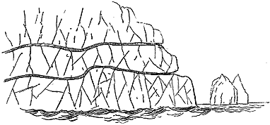
The pale colour of the precipices in which the St. Kilda granophyre plunges into the sea gives special prominence to the dark ribbon-like - 174 - streaks which mark the course of basalt-dykes through that rock. Moreover the greater liability of the material of the dykes to decay causes them to weather into long lines of notch or recess. Four or five such dykes follow each other in nearly parallel bands, which slant upward from the sea-level on the eastern face of the hill Conacher to a height of several hundred feet.[208] (Fig. 258, see also Fig. 367.)
[208] This relation of the later dykes to the granophyre was observed here by Macculloch (Western Isles, vol. ii. p. 55).
The acid eruptions of the Inner Hebrides are marked by so varied a series of rocks, and so complex a geological structure, that they may, with some confidence, be regarded as having occupied a considerable interval of geological time. Yet we find that this prolonged episode in the volcanic history was both preceded and followed by the extravasation of basic dykes.
Reference has already been made to recent observations by Mr. Harker, who, in mapping the Strath district of Skye for the Geological Survey, has not only confirmed the generalization as to the existence of a series of dykes earlier, and another later, than the great granophyre protrusions of the Inner Hebrides, but has made some progress towards the detection of a means of distinguishing the two series even where no direct test of their relative age may be available. He thinks that the general habit and petrographical characters of the dykes may on further investigation be found to afford a sufficiently reliable basis for discrimination. He finds that where the relative ages of the dykes with reference to the granophyre can be fixed, the earlier or pre-granophyre series is without exception basic. It consists of fine-textured basalts or diabases, without any conspicuous porphyritic crystals. Its dykes are less regular and persistent in their bearing than those of the later series; have frequently a considerable hade, even as much as 45°, and often show chilled edges with tachylitic selvages. In Skye many of these earlier dykes may be connected with the gabbro. They appear to be more basic and to have a higher specific gravity than those of the later series which most resemble them.
The later or post-granophyre dykes include several types, the relative ages of which are not yet definitely fixed. They run in straight parallel lines, and thus seldom intersect each other. They are generally vertical or highly inclined, and are much more frequently characterized by amygdaloiclal structure than the earlier series. Mr. Harker distinguishes the following varieties among them: (a) Quartz-felsites and other acid rocks; these are not very common. (b) Pitchstones and various spherulitic and variolitic rocks: the actual pitchstones observed are comparatively few in number, but it is certain that some of spherulitic varieties are devitrified pitchstones. (c) Basic rocks, not conspicuously porphyritic and less decidedly basic than the dykes of the pre-granophyre series; most of the later groups come into this or the next group, (d) Porphyritic basic dykes not infrequently carrying inclusions of gabbro, granophyre or other rocks. The porphyritic felspars seem to be in great part of foreign derivation, and - 175 - the same is certainly true of the augite which occasionally accompanies them and of the quartz that appears in some examples.[209]
[209] Annual Report of the Director-General of the Geological Survey in Report of Science and Art Department for 1895.
In the Carlingford district of the North-east of Ireland, similar evidence has been obtained that one series of dykes preceded and another followed the protrusion of the granites and granophyre which are in all probability geologically coeval with the acid bosses of the Inner Hebrides. The distinction was observed and mapped by Mr. Traill for the Geological Survey. Professor Sollas in recently confirming these observations has not noticed any striking difference between the pre-granite and post-granite dykes, the whole appearing to consist of the same coarsely porphyritic material.[210]
[210] See Sheets 59, 60, and 71 of the Geological Survey Map of Ireland; Professor Sollas, Trans. Roy. Irish Acad. vol. xxx. (1894), p. 477; and Annual Report of the Director-General of the Geological Survey for 1895.
While the eruption of the granophyre bosses furnishes proof that the dykes are not all of the same age, other evidence may be gathered to show how much older some of the dykes are than the youngest lava-streams in the volcanic history of Tertiary time in Britain. The Scuir of Eigg, to which fuller reference will be made in Chapter xxxviii., is formed of a mass of pitchstone, which has filled up an ancient valley eroded out of the terraced basalts of the plateaux. At both ends of the ridge, these basalts are seen to be traversed by dykes that are abruptly cut off by the shingle of the old river-bed which the pitchstone has occupied (Figs. 279, 282). It is thus evident that, though these dykes are younger than the plateau-basalts, they are much older than the excavation of the valley out of these basalts, and still older than the eruption of pitchstone. The latter rock probably belongs to the close of the period of lava-eruptions. The enormous denudation of the basalt-plateaux after the injection of the dykes and before the outflow of the pitchstone affords a convincing proof of the vastness of the interval between the eruption of the two kinds of rock.[211]
[211] Quart. Jour. Geol. Soc. xiv. p. 1.
It is thus demonstrable that the dykes which in Britain form part of the great Tertiary volcanic series, were not all produced at one epoch, but belong to at least two (and probably to many more) episodes in one long volcanic history. As they rise through every member of that series of rocks (save the pitchstones), some of them must be among the latest records of the prolonged volcanic activity. But, on the other hand, some probably go back to the very beginning of the Tertiary volcanic period.
Reference has already been made to the doubt expressed by Macculloch whether the dykes in Skye had been filled in from above or from below. That the dykes of the country as a whole were supplied from above, was the view entertained and enforced by Boué. He introduces the subject with - 176 - the following remarks:—"Scotland is renowned for the number of its basaltic veins, which gave Hutton his ideas regarding the injection of lava from below; but, as the greatest genius is not infallible, and as volcanic countries present us with examples of such veins arising evidently from accidental fissures that were filled up by currents of lava which moved over them, and as the Scottish instances are of the same kind, we regard it as infinitely probable that all these veins have been formed in the same way notwithstanding the enormous denudation which this supposition involves; and that only rarely do cases occur where they have been filled laterally or in some other irregular manner."[212] I need not say that this view, which, except among Wernerians, had never many supporters, has long ago been abandoned and forgotten. There is no further question that the molten material came from below.
[212] Essai Géologique sur l'Écosse, p. 272.
1. In discussing the history of the dykes, we are first confronted with the problem of the formation of the fissures up which the molten material rose. From what has been said above regarding the usual want of relation between dykes and the nature and arrangements of the rocks which they traverse, it is, I think, manifest that the fissures could not have been caused by any superficial action, such as that which produces cracks of the ground during earthquake-shocks. The fact that they traverse rocks of the most extreme diversities of elasticity, structure, and resistance, and yet maintain the same persistent trend through them all, shows that they originated far below the limits to which the known rocks of the surface descend. We have seen that in the case of the Cleveland dyke, the fissure can be proved to be at least some three miles deep. But the seat of the origin of the rents no doubt lay much deeper down within the earth's crust.
It is also evident that the cause which gave rise to these abundant fissures must have been quite distinct from the movements that produced the prevalent strike and the main faults of this country. From early geological time, as is well known, the movements of the earth's crust beneath the area of Britain, have been directed in such a manner as to give the different stratified formations a general north-east and south-west strike, and to dislocate them by great faults with the same average trend. But the fissures of the Tertiary dykes run obliquely and even at a right angle across this prevalent older series of lines and are distinct from any other architectonic feature in the geology of the country. They did not arise therefore by a mere renewal of some previous order of disturbances, but were brought about by a new set of movements to which it is difficult to find any parallel in the earlier records of the region.[213]
[213] The only other known example of such a dyke-structure in Britain is that of the Pre-Cambrian series of dykes in the Lewisian gneiss of Sutherland, described in Chapter viii.
We have further to remember that the fissures were not produced merely by one great disturbance. The evidence of the dykes proves beyond question that some of them are earlier than others, and hence that the cause to which the fissures owed their origin came into operation repeatedly during - 177 - the protracted Tertiary volcanic period. One of the most instructive lessons in this respect is furnished by the huge eruptive masses of gabbro and granitoid rocks in Skye. These materials have been erupted through the plateau-basalts. The granitoid bosses are the younger protrusions, for they send veins into the gabbros; but their appearance was later than that of some of the dykes and older than that of others. Nevertheless, the youngest dykes generally maintain the usual north-westerly trend across the thickest masses of the granophyre. Thus we perceive that, even after the extrusion of thousands of feet of such solid crystalline igneous rocks, covering areas of many square miles, the fissuring of the ground was renewed, and rents were opened through these new piles of material. From the evidence of the dykes also we learn that some fissures were repeatedly re-opened and admitted a new ascent of molten magma between their walls. The general direction of the fissures remained from first to last tolerably uniform. Here and there indeed, where one set of dykes traverses another, as in Skye and the basin of the Clyde, we meet with proofs of a deviation from the normal trend. But it is remarkable that dykes which pierce the latest eruptive bosses of the Inner Hebrides rose in fissures that were opened in the normal north-westerly line through these great protrusions of basic and acid rock.
Such a gigantic system of parallel fissures points to great horizontal tension of the terrestrial crust over the area in which they are developed. Hopkins, many years ago, discussed from the mathematical side the cause of the production of such fissures.[214] He assumed the existence of some elevatory force acting under considerable areas of the earth's crust at any assignable depth, either with uniform intensity at every point or with a somewhat greater intensity at particular points. He did not assign to this force any definite origin, but supposed it "to act upon the lower surface of the uplifted mass through the medium of some fluid, which may be conceived to be an elastic vapour, or, in other cases, a mass of matter in a state of fusion from heat."[215] He showed that such an upheaving force would produce in the affected territory a system of parallel longitudinal fissures, which, when not far distant from each other, could only have been formed simultaneously, and not successively; that each fissure would begin not at the surface but at some depth below it, and would be propagated with great velocity; that there would be more fissures at greater than at lesser depths, many of them never reaching the surface; that they would be of approximately uniform width, the mean width tending to increase downwards; that continued elevation might increase these fissures, but that new fissures in the same direction would not arise in the separated blocks which would now be more or less independent of each other; that subsequent subsidences would give rise to transverse fissures, and by allowing the separated blocks to settle down would cause irregularities in the width of the great parallel fissures. He considered also the problem presented by those cases where the ruptures of the terrestrial crust have been filled with igneous - 178 - matter, and now appear as dykes. "The results above obtained," he says, "will manifestly hold equally, whether we suppose the uplifted mass acted upon immediately through the medium of an elastic vapour or by matter in a state of fusion in immediate contact with its lower surface. In the latter case, however, this fused matter will necessarily ascend into the fissures, and if maintained there till it cools and solidifies, will present such phenomena as we now recognize in dykes and veins of trap."
The existence of a vast lake or reservoir of molten rock under the fissure-region of Britain is demonstrated by the dykes. But, if we inquire further what terrestrial operation led to the uprise of so vast a body of lava towards the surface in older Tertiary time, we find that as yet no satisfactory answer can be given.
2. In some districts the dykes can be connected with the gabbros which occur as intrusive sills and irregular bosses in the basalt-plateaux and among older rocks. The gabbros, however, are traversed by still later dykes, which must then be independent of any visible mass of these rocks. The connection of dykes with the gabbros is what we might naturally expect to find, if the more coarsely crystalline rock represents portions of the basic magma which consolidated at some depth below the surface. If we could penetrate deep enough, it is not improbable that the dykes might be found in large measure to shade downward into vast bodies of gabbro. Such a relation has been observed in the Yellowstone district, where Mr. Iddings has noticed that the centre toward which the dykes of the Old Crandale volcano converge is a large mass of granular gabbro, passing into diorite, the dykes becoming rapidly coarser in grain as they approach the gabbro-core.[216]
[216] Journ. Geol. i. (1893), p. 608.
3. The rise of molten rock in thousands of fissures over so wide a region is to my mind by far the most wonderful feature in the history of volcanic action in Britain. The great plateaux of basalt, and the mountainous bosses of rock by which they have been disrupted, are undoubtedly the most obvious memorials of Tertiary volcanism. But, after all, they are merely fragments restricted to limited districts. The dykes, however, reveal to us the extraordinary fact that, at a period so recent as older Tertiary time, there lay underneath the area of Britain a reservoir or series of reservoirs of lava, the united extent of which must have exceeded 40,000 square miles.
That the material of the dykes rose in general directly from below, and was not, except locally, injected laterally along the open fissures, may be inferred, although proof of such lateral injection on a small scale may here and there be detected. The narrowness of the rents, and their enormous relative length, make it physically impossible that molten rock could have moved along them for more than short distances. The usual homogeneous character of the dyke-rocks, the remarkable scarcity of any broken-up consolidated fragments of them immersed in a matrix of different grain, the general uniformity of composition and structure from one end of a long dyke to another, the spherical form of the amygdales, the usual paucity of fragments from the fissure walls—all point to a quiet welling of the lava upward. - 179 - Over the whole of the region traversed by the dykes, from the hills of Yorkshire and Lancashire to the remotest Hebrides, molten rock must have lain at a depth, which, in one case, we know to have exceeded three miles, and which was probably everywhere considerably greater than that limit.
Forced upwards, partly perhaps by pressure due to terrestrial contraction and partly by the enormous expansive force of the gases and vapours absorbed within it, the lava rose in thousands of fissures that had been opened for it in the solid overlying crust. That in most cases its ascent terminated short of the surface of the ground may reasonably be inferred. At least, we know, that many dykes do not reach the present surface, and that those which do have shared in the enormous denudation of the surrounding country. That even in the same dyke the lava rose hundreds of feet higher at one place than at another is abundantly proved. When, however, we consider the vast number of dykes that now come to the light of day, and reflect that the visible portions of some of them differ more than 3000 feet from each other in altitude, we can hardly escape the conviction that it would be incredible that nowhere should the lava have flowed out at the surface. Subsequent denudation has undoubtedly removed a great thickness of rock from what was the surface of the ground during older Tertiary time, and hundreds of dykes are now exposed that doubtless originally lay deeply buried beneath the overlying part of the earth's crust through which they failed to rise. But some relics, at least, of the outflow of lava might be expected to have survived. I believe that such relics remain to us in the great basalt-plateaux of Antrim and the Inner Hebrides. These deep piles of almost horizontal sheets of basalt, emanating from no great central volcanoes, but with evidence of many local vents, appear to me to have proceeded in large measure from dykes which, communicating with the surface of the ground, allowed the molten material to flow out in successive streams with occasional accompaniments of fragmentary ejections.[217] The structure of the basalt-plateaux, and their mode of origin, will form the subject of the next division of this volume.
[217] It is interesting to note that in the great paper on Physical Geology already cited, Hopkins considered the question of the outflow of lava from the fissures which he discussed. "If the quantity of fluid matter forced into these fissures," he says, "be more than they can contain, it will, of course, be ejected over the surface; and if this ejection take place from a considerable number of fissures, and over a tolerably even surface, it is easy to conceive the formation of a bed of the ejected matter of moderate and tolerably uniform thickness, and of any extent" (op. cit. p. 71).
We can hardly suppose that the lava flowed out only in the western region of the existing plateaux. Probably it was most frequently emitted and accumulated to the greatest depth in that area. But over the centre of Scotland and North of England there may well have been many places where dykes actually communicated with the outer air, and allowed their molten material to stream over the surrounding country, either from open fissures or from vents that rose along these. The disappearance of such outflows need cause no surprise, when we consider the extent of the denudation which many dykes demonstrate. I have elsewhere shown that all over Scotland there is abundant proof that hundreds and even thousands - 180 - of feet of rock have been removed from parts of the surface of the land since the time of the uprise of the dykes.[218] The evidence of this denudation is singularly striking in such districts as that of Loch Lomond, where the difference of level between the outcrop of the dykes on the crest of the ridges and in the bottom of the valleys exceeds 3000 feet. It is quite obvious, for example, that had the deep hollow of Loch Lomond lain, as it now does, in the pathway of these dykes, the molten rock, instead of ascending to the summits of the hills, would have burst out on the floor of the valley. We are, therefore, forced to admit that a deep glen and lake-basin have been in great measure hollowed out since the time of the dykes. If a depth of many hundreds of feet of hard crystalline schists could have been removed in the interval, there need be no difficulty in understanding that by the same process of waste, many sheets of solid basalt may have been gradually stripped off the face of Central Scotland and Northern England.
[218] Scenery of Scotland, 2nd edit. (1887), p. 149. But see the remarks already made (p. 150) on the curious coincidence sometimes observable between the upper limit of a dyke and the overlying inequalities of surface.
The association of fissures and dykes with the accumulation of thick and extensive volcanic plateaux, over so wide a region of North-western Europe as from Antrim to the North of Iceland, finds its parallel in different parts of the world. One of the closest analogies presents itself among the Ghauts of the Bombay Presidency, where vast basaltic sheets, probably of Cretaceous age, display topographical and structural features closely similar to those of the Tertiary volcanic plateaux of the British Isles. The dykes connected with these Indian basaltic outflows correspond almost exactly in their general character and stratigraphical relations to those of this country. They occur in great numbers, rising through every rock in the district up to the crests of the Ghauts, 4000 feet above the sea. They vary from 1 or 2 to 10, 20, 40, and even occasionally 100 or 150 feet in width, and are often many miles in length. They observe a general parallelism in one average direction, and show no perceptible difference in character even when traced up to elevations of 3000 and 4000 feet.[219]
[219] Mr. G. T. Clark, Quart. Journ. Geol. Soc. xxv. (1869) p. 163. For remarks on the connection of dykes with superficial lavas, see postea, p. 268.
Thousands of square miles in the Western States and Territories of the American Union have been similarly flooded with basic lavas. Denudation has not yet advanced far enough to lay bare much of the platform on which these lavas rest. But the dykes that traverse the rocks outside of the lava-deserts afford an example of the structure which will ultimately be revealed when the wide and continuous basalt-plains shall have been trenched by innumerable valleys and reduced to fragmentary plateaux with lofty escarpments (p. 267).
It is to the modern eruptions of Iceland, however, that we turn for the completest illustration of the phenomena connected with dykes and fissures. An account of these eruptions will therefore be given in Chapter xl. as an explanation of the history of the Tertiary basalt-plateaux of Britain.
- 181 -
Nature and Arrangement of the Rocks: 1. Lavas.—Basalts, Dolerites, Andesites—Structure of the Lavas in the Field—2. Fragmental Rocks.—Agglomerates, Conglomerates, and Breccias—Tuffs and their accompaniments.
We have now to consider the structure and history of those volcanic masses which, during Tertiary time, were ejected to the surface within the area of the British Islands, and now remain as extensive plateaux. Short though the interval has been in a geological sense since these rocks were erupted, it has been long enough to allow of very considerable movements of the ground and of enormous denudation, as will be more fully discussed in Chapters xlviii. and xlix. Hence the superficial records of Tertiary volcanic action have been reduced to a series of broken and isolated fragments. I have already stated that no evidence now remains to show to what extent there were actual superficial outbursts of volcanic material over much of the dyke-region of Britain. The subsequent waste of the surface has been so enormous that various lava-fields may quite possibly have stretched across parts of England and Scotland, whence they have since been wholly stripped off, leaving behind them only that wonderful system of dykes from which their molten materials were supplied.
There can be little doubt, however, that whether or not other Phlegrean fields extended over portions of the country whence they have since been worn away, the chief volcanic tract lay in a broad and long hollow that stretched from the south of Antrim to the Minch. From the southern to the northern limit of the fragmentary lava-fields that remain in this depression is a distance of some 250 miles, and the average breadth of ground within which these lava-fields are preserved may be taken to range from 20 to 50 miles. If, therefore, the sheets of basalt and layers of tuff extended over the whole of this strip of country, they covered a space of some 7000 or 8000 square miles. But they were not confined to the area of the British Islands. Similar rocks rise into an extensive plateau in the Faroe Islands, and it may reasonably be conjectured that the remarkable submarine ridge which extends thence to the North-west of Scotland, and separates the basin of the Atlantic from that of the Arctic Ocean, is partly - 182 - at least of volcanic origin. Still further north come the extensive Tertiary basaltic plateaux of Iceland, while others of like aspect and age cover a vast area in Southern Greenland. Without contending that one continuous belt of lava-streams stretched from Ireland to Iceland and Greenland, we can have no doubt that in older Tertiary time the north-west of Europe was the scene of more widely-extended volcanic activity than had shown itself at any previous period in the geological history of the whole continent. The present active vents of Iceland and Jan Mayen are not improbably the descendants in uninterrupted succession of those that supplied the materials of the Tertiary basaltic plateaux, the volcanic fires slowly dying out from south to north. But so continuous and stupendous has been the work of denudation in these northern regions, where winds and waves, rain and frost, floe-ice and glaciers reach their highest level of energy, that the present extensive sheets of igneous rock can be regarded only as magnificent relics, the grandeur of which furnishes some measure of the magnitude of the last episode in the extended volcanic history of Britain.
The long and wide western valley in which the basalt-plateaux of this country were accumulated seems, from a remote antiquity, to have been a theatre of considerable geological activity. There are traces of some such valley or depression even back in the period of the Torridon Sandstone of the north-west. This formation, as we have seen, was laid down between the great ridge of the Outer Hebrides and some other land to the east, of which a few of the higher mountains, once buried under the sandstone, are now being revealed by denudation between Loch Maree and Loch Broom, and also in Assynt. The conglomerates and volcanic rocks of Lorne may represent the site of one of the older water-basins of this ancient hollow. The Carboniferous rocks, which run through the North of Ireland, cross into Cantyre, and are found even as far north as the Sound of Mull, mark how, in later Palæozoic time, the same strip of country was a region of subsidence and sedimentation. During the Mesozoic ages, similar operations were continued; the hollow sank several thousand feet, and Jurassic strata to that depth filled it up. Before the Cretaceous period, underground movements had disrupted and irregularly upheaved the Jurassic deposits, and prolonged denudation had worn them away, so that when the Cretaceous formations came to be laid down on the once more subsiding depression, they were spread out with a strong unconformability on everything older than themselves, resting on many successive horizons of the Jurassic system, and passing from these over to the submerged hillsides of the crystalline schists. Yet again, after the accumulation of the Chalk, the sea-floor along the same line was ridged up into land, and the Chalk, exposed to denudation, was deeply trenched by valleys, and entirely removed from wide tracts which it once covered.
It was in this long broad hollow, with its memorials of repeated subsidences and upheavals, sedimentation and denudation, that the vigour of subterranean energy at last showed itself in volcanic outbreaks, and in the gradual piling up of the materials of the basalt-plateaux. So far as we - 183 - know, these outbursts were subærial. At least no trace of any marine deposit has yet been found even at the base of the pile of volcanic rocks. Sheet after sheet of lava was poured out, until several thousand feet had accumulated, so as perhaps to fill up the whole depression, and once more to change entirely the aspect of the region. But the volcanic period, long and important as it was in the geological history of the country, came to an end. It, too, was merely an episode during which denudation still continued active, and since which subterranean disturbance and superficial erosion have again transformed the topography. In wandering over these ancient lava-fields, we see on every hand the most stupendous evidence of change. They have been dislocated by faults, sometimes with a displacement of hundreds of feet, and have been hollowed out into deep and wide valleys and arms of the sea. Their piles of solid rock, hundreds of feet thick, have been totally stripped off from wide tracts of ground which were once undoubtedly buried under them. Hence, late though the volcanic events are in the long history of the land, they are already separated from us by so vast an interval that there has been time for cutting down the wide plateaux of basalt into a series of mere scattered fragments. But the process of land-sculpture has been of the utmost service to geology, for, by laying bare the inner structure of these plateaux, it has provided materials of almost unequalled value and extent for the study of one type of volcanic action.
The superficial outbursts of volcanic action during Tertiary time in Britain are represented by a comparatively small variety of rocks. These consist almost wholly of basalts, but include a number of less basic rocks which may be classed as andesites. Many andesitic sheets, like the andesitic dykes, have been intruded into the basalts, and are really sills.
Besides the lavas of the basaltic-plateaux there are intercalated deposits of tuffs and breccias and large masses of agglomerate. A brief notice of the general petrography of the various constituents of the plateaux and their mode of occurrence will here be given. The intrusive bosses which have disrupted the superficial lavas will be discussed in subsequent chapters.
(a) Basalts and Dolerites.—In external characters these rocks range from coarsely crystalline varieties, in which the constituent minerals may be more or less readily detected with the naked eye or a field-lens, to dense black compounds in which only a few porphyritic crystals may be megascopically visible. One of their characteristic features is the presence of the ophitic structure, sometimes only feebly developed, sometimes showing itself - 184 - in great perfection. Many of the rocks are holocrystalline, but usually show more or less interstitial matter; in others the texture is finer, and the interstitial matter more developed; in no case, as far as I have observed, are there any glassy varieties, which are restricted to the dykes and sills, though in some of the basalts the proportion of glassy or incompletely devitrified substance is considerable. The felspars are generally of the characteristic lath-shaped forms, and are usually quite clear and fresh. The augite resembles that of the dykes, occurring sometimes in large plates that enclose the felspars, at other times in a finely granular form. Olivine is frequently not to be detected, even by green alteration products. Magnetite is sometimes present in such quantity as to affect the compass of the field-geologist. Porphyritic varieties occur with large felspar phenocrysts; but such varieties are, I think, less frequent among the plateau-rocks than among the dykes. They are well developed in the west part of the island of Canna, and have been described from the Faroe islands. Occasionally the plateau lavas are full of enclosed fragments of other rocks which have been carried up in the ascending magma.
(b) Andesites and Trachytes.—Probably the majority of these rocks where they occur intercalated between the basalts of the plateaux are, as already remarked, intrusive sheets rather than true lavas. But they have also been poured out intermittently among the basalts and dolerites. The most extensive development of lavas which are readily distinguishable from the group of plateau-basalts, and must be placed in the present series, occurs in the island of Mull. These rocks form part of a group of pale lavas which overlie the main mass of the plateau-basalts, and cap the mountain Ben More, together with several of its lofty neighbours. They are interstratified with true ophitic dolerites, and basalts showing characteristic granular augite. They are not so heavy as the ordinary plateau-lavas, their specific gravity ranging from 2·55 to 2·74. Externally they are light grey in colour and dull in texture, sometimes strongly amygdaloidal, sometimes with a remarkable platy structure, which, in the process of weathering, causes them to split up like stratified rocks. In some of their amygdaloidal varieties the cells are filled with epidote, which also appears in the fissures, and sometimes even as a constituent of the rock.
Specimens from this "pale group" of Ben More, when examined in thin slices under the microscope, were found by Dr. Hatch to consist almost wholly of felspar in minute laths or microlites, but in no instance sufficiently definite for satisfactory determination. In one of them he observed that each lath of felspar passed imperceptibly into those adjacent to it; the double refraction being very weak, and the twin-striation, if present, not being traceable.[220] More recently my colleague, Mr. W. W. Watts, has looked at some of the same slides. He is disposed to class the - 185 - rocks rather with the trachytes than the andesites. He remarks that "in the apparent holocrystalline character, the size and shape of the felspars, the sort of damascened appearance in polarized light, the finely scattered iron-ores and the presence of a pale green hornblende, possibly augite, in small, often complex, grains, these rocks much resemble the Carboniferous trachytes of the Garlton Hills in Scotland."
[220] In the course of my investigations I have had many hundreds of thin slices cut from the Tertiary volcanic rocks for microscopic determination. These I have myself studied in so far as their microscopic structure appeared likely to aid in the investigation of those larger questions of geological structure in which I was more especially interested. But for further and more detailed study I placed them with Dr. Hatch, who submitted to me the results of his preliminary examination, and where these offered points of geological import I availed myself of them in the memoir published in 1888 in the Transactions of the Royal Society of Edinburgh. I have retained most of these citations in their place in the present volume, and have supplemented them by notes supplied to me from fresh observations by Mr. Watts and Mr. Harker. Professor Judd, in a series of valuable papers, has discussed the general petrography of the Tertiary volcanic rocks (Quart. Jour. Geog. Soc. vols. xxxix. xli. xlii. xlvi. xlix.)
One of the most interesting lavas of the Tertiary volcanic series is the "pitchstone-porphyry" of the Scuir of Eigg. This rock, the latest known outflow of lava in any of the volcanic areas of Britain, was formerly classed with the acid series. Microscopical and chemical analyses prove it, however, to be of intermediate composition, and to be referable to the andesites or dacites. It is more particularly described in Chapter xxxviii.
Professor Judd, collecting the andesitic rocks as a whole (both lavas and sills), has grouped them into amphibole and mica-andesites, and pyroxene-andesites.[221] The thick lumpy and non-persistent sheets of these rocks sometimes found near the centres of protrusion of the gabbros and granophyres are probably sills.
[221] Quart. Journ. Geol. Soc. vol. xlvi. (1890), p. 356. Professor Judd has there described under the name of "propylites" various members of the volcanic series which he believes to have undergone alteration from solfataric action. I have not been able to discover any trace of such action, but I have found that the lavas of the plateaux assume a peculiar condition where they have been affected by large intrusive masses of granophyre or gabbro. (See postea, Chapter xlvi.)
(c) Rhyolites.—In the Antrim plateau a group of rhyolite bosses occurs, some of which have been claimed as superficial lavas. In some cases it can be demonstrated that they are intrusive, and in no instance can they be decisively shown to have escaped in streams at the surface. It is probable, however, that some of these bosses did actually communicate with the outer air, for between the lower and upper group of basalts in this plateau, bands of rhyolitic conglomerate occur which may indicate the degradation of exposed masses of rhyolite. The description of these Antrim bosses will be given in Chapter xlvii., in connection with the acid eruptive rocks of the Tertiary volcanic series.
Passing now to the consideration of the lavas as they are built up into the plateaux, we have to note their distinctive characters as individual sheets of rock, and their influence on the topography of the regions in which they occur. Every tourist who has sailed along the cliffs of Antrim, Mull, Skye, or the Faroe Islands is familiar with the singular terraced structure of the great volcanic escarpments which stretch as mural precipices - 186 - along these picturesque shores. Successive sheets of lava, either horizontal or only gently inclined, rise above each other from base to summit of the cliffs as parallel bars of brown rock with intervening strips of bright green grassy slope.
The geologist who for the first time visits these coast-lines is impressed by the persistence of the same lithological characters giving rise to the same topographical features. He soon realises that the plateaux, so imposingly truncated by the great escarpments that spring from the edge of the sea, are built up essentially of dark lavas—basalts and dolerites—and that fragmental volcanic accompaniments, though here and there well developed, play, on the whole, a quite insignificant part in the structure and composition of these thick piles of volcanic material. Closer examination in the field enables him to ascertain that, regarded as rock-masses, the lavas include four distinct types:—
1st. Thick, massive, prismatic or rudely-jointed sheets, rather more coarsely crystalline and obviously more durable than the other types, inasmuch as they project in tabular ledges and tend to retain perpendicular faces owing to the falling away of slices of the rock along lines of vertical joints. Many rocks of this type are undoubtedly intrusive sheets, and as such will be further referred to in a later chapter. But the type includes also true superficial lavas which show the characteristic slaggy or vesicular bands at their upper and lower surfaces. The mere presence of such bands may not be enough, indeed, absolutely to establish that the rock possessing them flowed at the surface as a lava, for they are occasionally, though it must be confessed rarely, exhibited by true sills. But the rough scoriaceous top of a lava-stream, and the presence of fragments of this surface in the overlying tuff, or wrapped round by the next succeeding lava, sufficiently attest the true superficial outflow of the mass.
2nd. Prismatic or columnar basalts, which, as at the Giant's Causeway and Staffa, have long attracted notice as one of the most striking topographical elements of the plateaux. Columnar structures are typical of the more compact heavy basalts. A considerable variety is observable in the degree of perfection of their development. Where they are least definite, the rock is traversed by vertical joints, somewhat more regular and close-set than those in the dolerites, by the intersection of which it is separated into rude quadrangular or polygonal columns. The true columnar structure is shown in two chief forms. (a) The rock is divided into close-fitting parallel, usually six-sided columns; the number of sides varying, however, from three up to nine. The columns run the whole thickness of the bed, and vary from 8 or 10 to 40 or even 80 feet in length. They are segmented by cross joints which sometimes, as at Giant's Causeway, take the ball-and-socket form. Occasionally they are curved, as at the well-known Clam-shell cave of Staffa. (b) The prisms are much smaller, and diverge in wavy groups crowded confusedly over each other, but with a general tendency upwards. This starch-like aggregation may be observed superposed directly upon the more regular columnar form as at the Giant's Causeway and also - 187 - at Staffa. Excellent illustrations of both these types may be seen at many points along the sea-cliffs of the Inner Hebrides; the western coast of Skye, the south-west side of Mull, and the cliffs of the island of Canna may be specially cited.
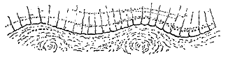
Though generally rather compact, becoming indeed dense, almost vitreous rocks in some sheets, the columnar basalts are often more or less cellular throughout, and highly slaggy along their upper and under surfaces. In some cases, as in that of a prismatic sheet which overlies the rough scoriaceous lava of Camas Tharbernish, in the island of Canna, the rows of vesicles are disposed in lines parallel to the under surface of the sheet (Fig. 259.)
As already remarked with regard to the massive, rudely-jointed sheets, many of the most perfectly columnar rocks of the plateaux are not superficial lavas, but intrusive sills, bosses or dykes. Conspicuous examples of such sills are displayed on the coast of Trotternish in Skye, and of the bosses and dykes at the eastern end of Canna. To these further reference will be made in the sequel. It is not always possible to be certain that columnar sheets which appear to be regularly intercalated among the undoubted lavas of the volcanic series may not be really intrusive. In some instances, indeed, we can demonstrate that they are so, when after continuing perfectly parallel with the lavas above and below them, they eventually break across them. One of the most remarkable examples of this feature is supplied by the great sill of the south-west of Stromö, in the Faroe Islands, of which I shall give some account in Chapter xlii. (Figs. 312, 328, 329).
3rd. Slaggy or amygdaloidal lavas without any regular jointed structure, but often with roughly scoriform upper and under layers, and tending to decay into brown earthy debris. Some of the upper surfaces of such sheets among the Tertiary basalt-plateaux must have resembled the so-called "Aa" of the Sandwich Islands. A striking example of the structure may be noticed at Camas Tharbernish, on the north coast of the Island of Canna. There the hummocks on the upper surface of a slaggy basalt measure about 15 feet in breadth, and rise about three feet above the hollows between them, like a succession of waves (see Fig. 259). The steam-holes are disposed in a general direction parallel to the strike of the hummocks.
Great variety obtains in the size and shape of the vesicles. Huge cavities a foot or more in diameter may occasionally be found, and from such extremes every gradation may be traced down to minute pore-like vacuoles that can hardly be made out even with a strong lens. In regard to the deformation of the vesicles, it is a familiar general rule that they have been drawn out in the direction of the flow of the original lava. Occasionally they have become straight, narrow, sometimes bifurcating pipes, several - 188 - inches long, and only an eighth of an inch or so in diameter.[222] A number of such pipes, parallel to each other, resembles a row of worm-burrows (see Fig. 2).
[222] Some examples have been deposited by me in the Museum of Practical Geology, Jermyn Street, in the case illustrating rock-structures. The elongation of the vesicles into annelide-like tubes may also be observed among the stones in the volcanic agglomerates.
It may often be noticed that, even where the basalt is most perfectly prismatic, it presents a cellular and even slaggy structure at the bottom. The rock that forms the Giant's Causeway, for instance, is distinctly vesicular, the vesicles being drawn out in a general east and west direction. The beautiful columnar bed of Staffa is likewise slaggy and amygdaloidal for a foot or so upwards from its base, and portions of this lower layer have here and there been caught up and involved in the more compact material above it. Even the bottom of the confusedly prismatic bed above the columnar one on that island also presents a cellular texture. A similar rock at Ardtun, in Mull, passes upward into a rugged slag and confused mass of basalt blocks, over which the leaf-beds lie.
Amygdaloidal structure is more or less developed throughout the whole series of basalts. But it is especially marked in certain abundant sheets, which, for the sake of distinction, are called amygdaloids. These beds, which form a considerable proportion of the materials of every one of the plateaux, are distinguished by the abundance and large size of their vesicles. In some places, the cavities occupy at least as much of the rock as the solid matrix in which they lie. They have generally been filled up with some infiltrated mineral—calcite, chalcedony, zeolites, etc. The amygdales of the west of Skye and of Antrim have long been noted for their zeolites. As a consequence of their cellular texture and the action of infiltrating water upon them, these amygdaloidal sheets are always more or less decomposed. Their dull, lumpy, amorphous aspect contrasts well with the sharply-defined columnar sheets above and below them, and as they crumble down they are apt to be covered over with vegetation. Hence, on a sea-cliff or escarpment, the green declivities between the prominent columnar basalts usually mark the place of such less durable bands.
Exceedingly slag-like lavas are to be seen among the amygdaloids, immediately preceded and followed by beds of compact black basalt with few or no vesicles. From the manner in which such rocks yield to the weather, they often assume a singularly deceptive resemblance to agglomerates. One of the best examples of this resemblance which have come under my notice is that of the rock on which stands Dunluce Castle, on the north coast of Antrim. Huge rounded blocks of a harder consistency than the rest of the rock project from the surface of the cliffs, like the bombs of a true volcanic agglomerate, while the matrix in which they are wrapped has decayed from around them. But an examination of this matrix will soon convince the observer that it is strongly amygdaloidal, and that the apparent "bombs" are only harder and less cellular portions of it. The contrast between the weathering of the two parts of the rocks seems to have arisen - 189 - from an original variety in the relative abundance of steam-cavities. The origin of such nodular or pillow-like blocks has been already referred to at pp. 26 and 193. Another singular instance occurs at the foot of the outlier of Fionn Chro (Fig. 360), in the island of Rum. A conspicuous band underlying the basalts there might readily be taken for a basalt-conglomerate. But in this case, also, the apparent matrix is found to be amygdaloidal, and the rounded blocks are really amygdales, sometimes a foot in length, filled or lined with quartz, chalcedony, &c.
A somewhat different structure, in which, however, the appearance of volcanic breccia or agglomerate due to explosion from a vent is simulated, may be alluded to here. The best instance which I have observed of it occurs at the south end of Loch-na-Mna, in the island of Eigg, within a basalt which is remarkable for a streaky flow-structure. On the weathered faces the streaky layers may be observed to have been broken up, and their disconnected fragments have been involved in ordinary basalt wherein this flow-structure is not developed, while large blocks and irregular masses are wrapped round in a more decomposing matrix. There can be no doubt that in such cases we see the effects of the disruption of chilled crusts, and the entanglement of the broken pieces in the still fluid lava.
It is a common belief that the filling in of the steam-cavities has taken place long subsequent to the volcanic period, by the slow percolation of meteoric water through the rock. I believe, however, that at least in some cases, if not in all, the conversion of the vesicular lavas into amygdaloids was effected during the volcanic period. Thus it can be shown that the basalts which have been disrupted by the gabbros and granophyres were already amygdaloids before these basic intrusions disturbed them, for the kernels of calcite, zeolite, etc., have shared in the general metamorphism induced in the enclosing rock. Again, the blocks of amygdaloid contained in the agglomerates of the volcanic series are in every respect like the amygdaloidal lavas of the plateaux. It would thus seem that the infilling of the cavities with mineral secretions was not merely a long secular process of infiltration from the cool atmosphere, but was more rapidly completed by the operation of warmer water, either supplied from volcanic sources or heated by the still high temperature of the cellular lavas into which it descended from the surface.[223]
[223] Professor J. D. Dana, originally an advocate of infiltration from above, subsequently supported the view that the kernels of amygdaloids were filled in by the action of moisture within the rocks during the time of cooling.—Amer. Journ. Sci. ser. 3, vol. xx. (1880), p. 331. Messrs. Harker and Marr have demonstrated that the Lower Silurian vesicular lavas of the Lake district had already become amygdaloids before the uprise of the Shap granite.—Quart. Journ. Geol. Soc. vol. xlix. (1893).
4th. Banded or stratiform lavas, consisting of successive parallel layers or bands which weather into projecting ribs and flutings. The deceptive resemblance to sedimentary rocks thus produced has no doubt frequently led to these lavas being mistaken for tuffs. As I have recently found them to be much more plentiful than I had supposed, a more detailed description of them seems to be required.
- 190 -
The banded character arises from marked distinctions in the texture of different layers of a lava-sheet. In some cases (a) these distinctions arise from differences in the size of the crystals or in the disposition of the component minerals of the rock; in others (b) from the varying number and size of the vesicles, which may be large or abundantly crowded together in some layers, and small or only sparsely developed in others. The structure thus points to original conditions of the lava at the time of its emission and may be regarded as, to some extent, a kind of flow-structure on a large scale.
(a) Where the banding is due to differences of crystalline texture, the constituent felspars, augites, and iron-ores may be seen even with the naked eye as well-defined minerals along the prominent surfaces of the harder ribs, while the broader intervening flutings of finer material show the same minerals in minuter forms. The alternating layers of coarser and finer crystallization lie, on the whole, parallel with the upper and under surfaces of the sheets in which they occur. But they likewise undulate like the streaky lines in ordinary flow-structure.
Banded structure of this type may be seen well developed in the lower parts of the basalt-plateaux throughout the Inner Hebrides and the Faroe Islands. A specimen taken from the west end of the island of Sanday, near Canna, which showed the structure by a conspicuous parallel fluting on weathered surfaces, was sliced for microscopical examination. Mr. Harker has been kind enough to supply me with the following observations regarding this slice:—
"In the slice [6660][224] the banding becomes less conspicuous under the microscope. The rock is of basaltic composition, and, with reference to its micro-structure, might be styled a fine-grained olivine-diabase or olivine-dolerite in some parts of the slice, an olivine-basalt in others. It consists of abundant grains of olivine, imperfect octahedra and shapeless granules of magnetite, little simple or twinned prisms of labradorite, and a pale brown augite. The last-named mineral is always the latest product of consolidation, but it varies in habit, being sometimes in ophitic patches moulded upon or enclosing the other minerals, sometimes in small granules occupying the interstices between the felspars and other crystals. The ophitic habit predominates in the slice, while the granulitic comes in especially along certain bands. If the former be taken as indicative of tranquil conditions, the latter of a certain amount of movement in the rock during the latest stages of its consolidation, the banding, though not strictly a flow-structure, may be ascribed in some degree to a flowing movement of the nearly solidified rock. There is, however, more than this merely structural difference between the several bands. They differ to some extent in the relative proportions of the minerals, especially of olivine and augite; which points to a considerable flowing movement at an early stage in a magma which was initially not homogeneous."
[224] The figures within square brackets throughout the following pages refer to the numbers of the microscopic slides in the Geological Survey collection, where I have deposited all those prepared from my specimens.
- 191 -
(b) Where the banding arises from the distribution of the vesicles, somewhat similar weathered surfaces are produced. In some instances, while the basalt is throughout finely cellular, interposed bands of harder, rather finer-grained and less thoroughly vesicular character serve to give the stratified appearance. Instances may be observed where the vesicles have been crowded together in certain bands, which consequently weather out differently from the layers above and below them. An excellent illustration of this arrangement occurs in the lowest lava but one of the largest of the three picturesque stacks known as Macleod's Maidens on the west coast of Skye (Figs. 260, 283, 284 and 287). This lava is thoroughly amygdaloidal, but the vesicles are specially crowded together in certain parallel bands from an inch to three or four inches thick. Some of these layers lie close to each other, while elsewhere there may be a band of more close-grained, less vesicular material between them. But the most singular feature of the rock is to be seen in the shape and position of the vesicles that are crowded together in the cellular bands. Instead of being drawn out into flattened forms in the general direction of banding, they are placed together at high angles. Each layer remains parallel to the general bedding, but its vesicles are steeply inclined in one direction, which was doubtless that of the flow of the still unconsolidated lava.[225] Weathering along these bands, the lava might easily be mistaken at a little distance for a tuff or other stratified intercalation.
[225] This elongation of vesicles, more or less perpendicular to the general bedding, may be noticed sometimes even in sills, as will be shown in a later Chapter.
Banded lavas possessing the characters now described are of frequent occurrence among the Inner Hebrides. Many striking examples of them may be seen along the west coast of Skye. Still more abundant in Faroe, they form one of the most conspicuous features in the geology of that group of islands. Along the whole of its western seaboard, on island after island, they are particularly prominent in the lower parts of the precipices, while the upper parts consist largely of amorphous or prismatic sheets. So much do they resemble stratified rocks that it was not until I had landed at various points that I could satisfy myself that they are really banded lavas.[226]
[226] For recent contributions to the Geology of the Faroe Islands, see Prof. James Geikie, Trans. Roy. Soc. Edin. vol. xxx. (1880), p. 217, where the banding of the basalts is noticed; Prof. A. Helland, Dansk. Geografisk. Tidskr. (1881); R. Bréon, Notes pour servir à l'étude de la Géologie de l'Islande et des Isles Faeroe (1884); Mr. J. Lomas, Proc. Geol. Soc. Liverpool, vol. vii. (1895), p. 292. Various writers have treated of the petrography of Faroe, particularly A. Osann, Neues Jahrb. (1884), vol. i. p. 45, and M. Bréon in the volume here cited.
5th. Ordinary flow-structure, save in these banded lavas, is rather rare among the plateaux. It may, however, be occasionally observed, where there is no distinct banding. On a weathered surface it appears in fine, widely parallel streaks, which are sometimes wavy, puckered and broken up, as in - 192 - rhyolites and felsites, while the porphyritic felspars are arranged with their long axes in the direction of flow. A good example of these characters may be seen on the summit of the Dùn Can—the remarkable truncated cone which forms the highest point on the Island of Raasay. The rock is a black olivine-basalt, partly amygdaloidal, with zeolites filling up the cavities, and its flow-lines are prominent on the weathered faces where they lie parallel to the general bedding of the lavas. Another illustration may be observed in the basalt already cited from Loch-na-Mna, in the island of Eigg, where the rock presents in places a remarkable streaky structure which, though hardly visible on a fresh fracture, reveals itself on a weathered face in thin nearly parallel ribs coincident in direction with the upper and under surfaces of the mass.
Great variety is to be found in the thickness of different sheets of lava in the plateaux. Some of them are not more than 6 or 8 feet; others reach to 80 or 100 feet, and sometimes, though rarely, to even greater dimensions. In Antrim, the average thickness of the flows is probably from 15 to 20 feet.[227] In the fine coast-sections at the Giant's Causeway, however, some bands may be seen far in excess of that measurement. The bed that forms the Causeway, for instance, is about 60 or 70 feet thick, and seems to become even thicker further east. Along the great escarpment, 700 feet high, which rises from the shores of Gribon, on the west coast of Mull, there are twenty separate beds, which give an average of 35 feet for the thickness of each flow. On the great range of sea-precipices along the west coast of Skye, which present the most stupendous section of the basalts anywhere to be seen within the limits of the British Islands, the average thickness of the beds can be conveniently measured. At the Talisker cliffs some of the flows are not more than 6 or 8 feet; others are 30 or 40 feet. The chief precipice, 957 feet high (Fig. 286), contains at least 18 or 20 separate lava-sheets, which thus average of from 47 to 53 feet in thickness. In the cliffs that form the seaward margin of the tableland of Macleod's Tables (Fig. 283) fourteen successive beds of basalt can be counted in a vertical section of 400 feet, which is equal to an average thickness of about 28 feet. But some of the basalts are only about 6 feet thick, while others are 50 or 60. The Hoe of Duirinish, 759 feet high, is composed of about sixteen distinct beds, which thus have a mean thickness of 46 feet. The average thickness of the successive flows on Dunvegan Head, which is 1000 feet high and contains at least twenty-five separate sheets, is about 40 feet. Still further north, the cliffs, 800 feet high, comprise sixteen successive flows, which have thus an average of 50 feet each. Among the Faroe Islands the average thickness of the basalt-sheets seems to be nearly the same as in Britain. Thus in the magnificent ranges of precipices of Kalsö, Kunö and Borö, forty or more sheets may be counted in the vast walls of rock some 2000 feet high, giving a mean of about 50 feet.
[227] See Explanation of Sheet 20, Geol. Survey, Ireland, p. 11.
Each bed appears, on a cursory inspection, to retain its average thickness, and to be continuous for a long distance. But I believe that this - 193 - persistence is in great measure deceptive. We can seldom follow the same bed with absolutely unbroken continuity for more than a mile or two. Even in the most favourable conditions, such as are afforded by a bare sea-cliff on which every sheet can be seen, there occur small faults, gullies where the rocks are for the time concealed, slopes of debris, and other failures of continuity; while the rocks are generally so like each other, that on the further side of any such interruption, it is not always possible to make sure that we are still tracing the same bed of basalt which we may have been previously following. On the other hand, a careful examination of one of these great natural sections will usually supply us with proofs that, while the bedded character may continue well marked, the individual sheets die out, and are replaced by others of similar character. Cases may not infrequently be observed where the basalt of one sheet abruptly wedges out, and is replaced by that of another. Where both are of the same variety of rock, it requires close inspection to make out the difference between them; but where one is a green, dull, earthy, amorphous amygdaloid, and the other is a compact, black, prismatic basalt, the contrast between the two beds can be recognized from a distance (Fig. 261). In the basaltic cliffs of the west coast of Skye, the really lenticular character of the flows can be well seen. I may especially cite the great headland south of Talisker Bay, already referred to, where, in the pile of nearly horizontal sheets, two beds may be seen to die out, one towards the north, the other towards the south. Further north, in the cliff of the Hoe of Duirinish, a similar structure presents itself. Along the coast-cliffs of Mull, Morven and Canna the same fact is clearly displayed. Thus on the west side of the Sound of Mull the slopes above Fishnish Bay show a group of basalts, which die out southward, and are overlapped by a younger group that has been poured over their ends. Such sections are best seen in the evening, when the grass-covered lavas show their successive sheets by their respective shadows, their individuality being lost in the full light of day. A more striking example occurs beyond the west end of Glen More in Mull, where one series of basalts has been tilted up, probably during some volcanic episode, and has had a younger series banked up against its edges.
In Antrim also, remarkable evidence is presented of the rapid attenuation - 194 - not of single beds only, but of a whole series of basalts. Thus, at Ballycastle, the group of lavas known as the Lower Basalts, which underlie the well-known horizon of iron-ore, are at least 350 feet thick. But, as we trace them westwards, bed after bed thins out until, a little to the west of Ballintoy, in a distance of only about 6 miles, the whole depth of the group has diminished to somewhere about 40 feet. A decrease of more than 300 feet in six miles or 50 feet per mile points to considerable inequalities in the accumulation of the lavas. If the next series of flows came from another vent and accumulated against such a gentle slope, it would be marked by a slight unconformability. Structures of this kind are much rarer than we should expect them to be, considering the great extent to which the plateaux have been dissected and laid open in cliff-sections.
The basalt-plateau of the Faroe Islands exhibits with remarkable clearness the lenticular character of the basalt-sheets, and a number of examples will be cited in the description of that region to be given in Chapter xxxix. In these northern climes vegetation spreads less widely over rock and slope than it does in the milder air of the Inner Hebrides. Hence the escarpments sweep in precipices of almost bare rock from the level of the sea up to the serrated crests of the islands, some 2000 feet in height. Each individual bed of basalt can thus be followed continuously along the fjords, and its variation or disappearance can be readily observed. Coasting along these vast natural sections, we readily perceive that, as among the Western Isles, the successive sheets of basalt have proceeded from no one common centre of eruption. They die out now towards one quarter, now towards another, yet everywhere retain the universal regularity and gentle inclinations of the whole volcanic series.
While the plateaux are built up mainly of successive flows of basaltic lavas, they include various intercalations of fragmental materials, which, though of trifling thickness, are of great interest and importance in regard to the light which they cast on the history of the different regions during the volcanic period. I shall enumerate the chief varieties of these rocks here, and afterwards give fuller details regarding their stratigraphical relations and mode of occurrence in connection with the succession of beds in each of the plateaux.
(a) Volcanic Agglomerates.—In the tumultuous unstratified masses of fragmentary materials which fill eruptive vents in and around the plateaux, the stones, which vary in size up to blocks several feet in diameter, consist for the most part of basalts, often highly slaggy and scoriaceous. They include also fragments of different acid eruptive rocks (generally felsitic or rhyolitic in texture), with pieces of the non-volcanic rocks through which the volcanic pipes have been drilled. The paste is granular, dirty-green or brown in colour, and seems generally to consist chiefly of comminuted basalt. As in the Carboniferous and Permian necks, the Tertiary - 195 - agglomerates contain abundant detritus of a basic minutely cellular pumice.
(b) Volcanic Conglomerates and Breccias in beds intercalated between the flows of Basalt.—These are of at least three kinds. (a) Basalt-conglomerates, composed mainly of rounded and subangular blocks of basalt (or allied basic lava), sometimes a yard or more in diameter, not unfrequently in the form of pieces of rough slag or even of true bombs, imbedded in a granular matrix of comminuted basalt-debris. In some cases, the stones form by far the most abundant constituents of the rock, which then resembles some of the coarse agglomerates just described. Perhaps the most remarkable accumulations of this kind are those intercalated among the basalts in the islands of Canna and Sanday, of which a detailed account will be given in Chapter xxxviii. These conglomerates, besides their volcanic materials, contain rounded blocks of Torridon sandstone and other rocks, which must have been carried from the east by some tolerably powerful river that flowed across the basalt-plains during the volcanic period. Again, on the east side of Mull, the slaggy basalts of Beinn Chreagach Mhor are occasionally separated by volcanic conglomerates. As a rule, however, such intercalations are seldom more than a few feet or yards in thickness. Their coarseness and repetition on successive horizons indicate that they probably accumulated in the near neighbourhood of one or more small vents, from which discharges of fragmentary materials took place at the beginning or at the close of an outflow of lava, and that the stones were sometimes swept away from the cones and rolled about by streams before being buried under the succeeding lava-sheets. More commonly the dirty-green or dark-brown granular matrix exceeds in bulk the stones embedded in it. It has obviously been derived mainly from the trituration of already cooled basalt—masses, and probably also from explosions of the still molten rock in the vents. A striking illustration of this type of rock may be seen on the south side of Portree Harbour, where a mass of dark-green basalt-conglomerate, with a coaly layer above it, lies near the base of the bedded basalts, and attains at one part of its course a thickness of about 200 feet. This rock will be again referred to in connection with the vent from which its materials were probably derived. As in the case of the agglomerates of the vents, pieces of older acid lavas, and still more of the non-volcanic rocks that underlie the plateaux, are found in the bedded conglomerates and breccias. In Antrim and Mull, for instance, fragments of flint and chalk are of common occurrence. A characteristic example of this kind of rock forms the platform of the columnar bed out of which Fingal's Cave, Staffa, has been excavated (Fig. 266a).
(β) Felsitic Breccia.—This variety, though of rare occurrence, is to be seen in a number of localities in the island of Mull. It is composed in great measure of angular fragments of close-grained flinty felsitic or rhyolitic rocks, sometimes showing beautiful flow-structure, together with pieces of quartzite and amygdaloidal basalt, the dull dirty-green matrix appearing to be made up chiefly of basalt-dust.
(γ) Rhyolitic Conglomerate.—Between the upper and lower group of - 196 - basalts in the Antrim plateau there occur bands of a pale fawn-coloured conglomerate largely made up of more or less rounded fragments of rhyolite, like some of the varieties of the rock which occur in place on the plateau. The rhyolitic debris is often mixed with pebbles of basalt. Sometimes it becomes so fine as to pass into pale clays.
(δ) Breccias of non-volcanic materials.—These, the most exceptional of all the fragmentary intercalations in the plateaux, consist almost wholly of angular blocks of rocks which are known to underlie the basalts, but with a variable admixture of basalt fragments. They are due to volcanic explosions which shattered the subjacent older crust of rocks, and discharged fragments of these from the vents or allowed them to be borne upwards on an ascending column of lava. Pieces of the non-volcanic platform are of common occurrence among the fragmentary accumulations, especially in the lower parts of the plateaux basalts. But I have never seen so remarkable an example of a breccia of this kind as that which occurs near the summit of Sgurr Dearg, in the south-east of Mull. The bedded basalt encloses a lenticular band of exceedingly coarse breccia, consisting mainly of angular pieces of quartzite, with fragments of amygdaloidal basalt. In the midst of the breccia lies a huge mass or cake of erupted mica-schist, at least 100 yards long by 30 yards wide, as measured across the strike up the slope of the hill. To the west, owing to the thinning out of the breccia, this piece of schist comes to lie between two beds of basalt. A little higher up, other smaller but still large blocks of similar schist are involved in the basalt, as shown in Fig. 262. As the huge cake of mica-schist plunges into the hill, its whole dimensions cannot be seen; but there are visible, at least, 15,000 cubic yards, which must weigh more than 30,000 tons. Blocks of quartzite of less dimensions occur in the basalts on Loch Spelve, in the same district. There can be no doubt, I think, that these enormous fragments were torn off from the underlying crystalline schists which form the framework of the Western Highlands, and were floated upward in an ascending flow of molten basalt. Had the largest mass occurred at or near the base of the volcanic series, its size and position would have been less remarkable. But it lies more than 2000 feet up in the basalts, and hence must have been borne upward for more than that height. A similar but less striking breccia occurs on the south coast of the same island, near Carsaig, made up chiefly of pieces of quartzite and quartz.[228]
[228] This is noticed by Mr. Starkie Gardner, Quart. Journ. Geol. Soc. xliii. (1887), p. 283, note.
Some remarkable agglomerates, near Forkhill, Armagh, probably belonging to the Tertiary volcanic series, will be described in the account of the Irish acid rocks (Chapter xlvii.). They consist entirely of non-volcanic stones and dust and are traceable for some miles along the line of a fissure. Where they have been discharged through granite they consist entirely of the detritus of that rock, but where they have been erupted in the Silurian area they consist of fragments of grits and shales. They seem to have been produced by æriform discharges, without the uprise of any volcanic magma, - 197 - though eventually andesite and rhyolite ascended the fissure and became full of granitic and Silurian fragments.
Some remarkable necks filled almost entirely with fragments of Torridon Sandstone have been observed in the west of Applecross, Ross-shire, and some curious plug-like masses of breccia, also made up of fragments of Torridonian strata, occur in the island of Raasay. These examples will be more particularly described on later pages (pp. 292, 293).
(c) Tuffs.—The tuffs intercalated in the basalt-plateaux generally consist essentially of basic materials, derived from the destruction of different varieties of basalts, though also containing occasional fragments of older felsitic rocks, as well as pieces of chalk, flint, quartz, and other non-volcanic materials. They are generally dull, dirty-green in colour, but become red, lilac, brown, and yellow, according to the amount and state of combination and oxidation of their ferruginous constituents. They usually contain abundant fragments of amygdaloidal and other basalts. As a rule, they are distinctly stratified, and occur in bands from a few inches to 50 feet or more in thickness. The matrix being soft and much decomposed, these bands crumble away under the action of the weather, and contribute to the abruptness of the basalt-escarpments that overlie them.

In the group of strata between the two series of basalts in Antrim, some of the tuffs consist chiefly of rhyolitic detritus, both glassy and lithoid.
Where the tuffs become fine-grained and free from imbedded stones, they pass into variously-coloured clays. Among these are the "bauxite" and "lithomarge" of Antrim, probably derived from pale rhyolitic tuffs and conglomerates (p. 204). Associated with these deposits in the same district, is a pisolitic hæmatite, which has been proved to occur over a considerable area on the same horizon. Many of the clays are highly ferruginous. The red streaks that intervene between successive sheets of basalt are of this nature (bole, plinthite, etc.). The source of the iron-oxide is doubtless to be traced to the decomposition of the basic lavas during the volcanic period.
- 198 -
(d) There occur also grey and black clays and shales, of ordinary sedimentary materials, containing leaves of terrestrial plants (leaf-beds), with occasional wing-cases of beetles, sometimes associated with impure limestones, but more frequently with sandstones and indurated gravels or conglomerates containing pieces of fossil wood. These intercalated bands undoubtedly indicate the action of running water, sometimes even of river-floods, and the accumulation of sediment in hollows of the exposed flows of basalt at intervals during the piling up of the successive lava-sheets that form the plateaux. The alternation of fluviatile gravels with volcanic tuffs, fluviatile conglomerates, and lava-streams, is admirably displayed in the island of Canna, as will be narrated in detail in Chapter xxxviii.
The vegetable matter has in some places gathered into lenticular seams of lignite, and even occasionally of black glossy coal. Amber also has been found in the lignite. Where the vegetation has been exposed to the action of intrusive dykes or sheets, it has sometimes passed into the state of graphite.
The remarkable terrestrial flora found in the leaf-beds, and in association with the lignites, was first made known by the descriptions of Edward Forbes already referred to, and has subsequently been studied and described by Heer, W. H. Baily, and Mr. Starkie Gardner.[229] It was regarded by Forbes as of Miocene age, and this view has generally been adopted by geologists. Mr. Starkie Gardner, however, contends that it indicates a much wider range of geological time. He believes that a succession of floras may be recognised, the oldest belonging to an early part of the Eocene period. Terrestrial plants, it must be admitted, are not always a reliable test of geological age, and I am not yet satisfied that in this instance they afford evidence of such a chronological sequence as Mr. Gardner claims, though I am convinced that the Tertiary volcanic period was long enough to have allowed of the development of considerable changes in the character of the vegetation.
[229] On this subject consult Duke of Argyll, Quart. Journ. Geol. Soc. vol. vii. (1851), p. 89; E. Forbes, Ibid. p. 103; W. H. Baily, op. cit. xxv. (1869), pp. 162, 357; Brit. Assoc. Rep. (1879) p. 162; (1880) p. 107; (1881) p. 151; (1884) p. 209; Mr. J. Starkie Gardner, Palæontographical Society, vols. xxxviii. xxxix. In the last of Mr. Baily's papers he notices that "the Rev. Dr. Grainger found a portion of a fish (Percidæ, possibly Lates)." The discovery of the remains of a fresh-water fish is an important additional testimony to the terrestrial conditions under which the lavas were erupted. The genus Lates now inhabits the Nile and the Ganges.
For the purpose of the present volume, however, the precise stage in the geological record, which this flora indicates, is of less consequence than the broad fact that the plants prove beyond all question that the basalts among which they lie were erupted on land during the older part of the long succession of Tertiary periods. Their value in this respect cannot be overestimated. Stratigraphical evidence shows that the eruptions must be later than the Upper Chalk; but the imbedded plants definitely limit them to the earlier half of Tertiary time.
- 199 -
There are five districts in North-western Europe where the original widespread Tertiary lava-fields have been less extensively eroded than elsewhere, or at least where they have survived in larger and thicker masses. Whether or not each of them was an isolated area of volcanic activity cannot now be determined. Their several outflows of lava within the area of the British Isles may have united into one continuous volcanic tract, and their present isolation there may be due entirely to subterranean movements and denudation. There is a certain convenience, however, in treating the districts separately. They are—1. Antrim; 2. Mull, Morven and Ardnamurchan; 3. Small Isles; 4. Skye; 5. The Faroe Islands.
[230] The basalts of Antrim are the subject of an abundant literature. I may refer particularly to the papers of Berger and Conybeare (Trans. Geol. Soc. iii.), the Geological Report of Portlock, and the Explanations of the Sheets of the Geological Survey of Ireland. Other papers will be afterwards cited. The general features of the Antrim plateau are shown on Map VII.
The largest of the basalt-plateaux of Britain is that which forms so prominent a feature in the scenery and geology of the North of Ireland, stretching from Lough Foyle to Belfast Lough, and from Rathlin Island to beyond the southern margin of Lough Neagh. Its area may be roughly computed at about 2000 square miles. But, as its truncated strata rise high along its borders, and look far over the surrounding low grounds, it must be regarded as a mere fragment of the original volcanic plain. It may be described as an undulating tableland, which almost everywhere terminates in a range of bold cliffs, but which, towards the centre and south, sinks gently into the basin of Lough Neagh. The marginal line of escarpment, however, presents considerable irregularity both in height and form, besides being liable to frequent local interruptions. It is highest on the west side, one of its crests reaching at Mullaghmore, in County Londonderry, a height of 1825 feet. It sinks down into the valley of the Bann, east of which it gradually ascends, forming the well-known range of cliffs from the Giant's Causeway and Bengore Head to Ballycastle. - 200 - It then strikes inland, and making a wide curve in which it reaches a height of more than 1300 feet, comes to the sea again at Garron Point. From that headland the cliffs of basalt form a belt of picturesque ground southwards beyond Belfast, interrupted only by valleys that convey the drainage of the interior of the plateau to the North Channel. Above the valley of the Lagan the crest of the plateau rises to a height of more than 1500 feet.
Throughout most of its extent the basalt-escarpment rests on the white limestone or Chalk of Antrim, beneath which lie soft Lias shales and Triassic marls. Here and there, where the substratum of Chalk is thin, the action of underground water on the crumbling shales and marls below it has given rise to landslips. The slopes beneath the base of the basalt are strewn with slipped masses of that rock, almost all the way from Cushendall to Larne, some of the detached portions being so large as to be readily taken for parts of the unmoved rock. On the west side also, a group of huge landslips cumbers the declivities beneath the mural front of Benevenagh.
I have found some difficulty in the attempt to ascertain what was the probable form of surface over which the volcanic rocks of this plateau began to be poured out. The Chalk sinks below the sea-level on the north coast, but, in the outlier of Slieve Gallion, three miles beyond the western base of the escarpment, it rises to a height of 1500 feet above the sea. On the east side also, it shows remarkable differences of level. Thus, below the White Head at the mouth of Belfast Lough, it passes under the sea-level, but only 16 miles to the south, where it crops out from under the basalt, its surface is about 1000 feet above that level. If these variations in height existed at the time of the outpouring of the basalt, the surface of the ground over which the eruptions took place was so irregular that some hundreds of feet of lava must have accumulated before the higher chalk hills were buried under the volcanic discharges. But it seems to me that much of this inequality in the height of the upper surface of the Chalk is to be attributed to unequal movements since the volcanic period, which involved the basalt in their effects, as well as the platform of Chalk below it. Had the present undulations of that platform been older than the volcanic discharges, it is obvious that upper portions of the basalt-series would have overlapped lower, and would have come to rest directly on the Chalk. But this arrangement, so far as I am aware, never occurs, except on a trifling scale. Wherever the Chalk appears, it is covered by sheets of the lower and not of the upper of the two groups into which the Antrim basalts are divisible. We have actual proof of considerable terrestrial disturbance, subsequent to the date of the formation of the volcanic plateau. Thus, near Ballycastle, a fault lets down the basalt and its Chalk platform against the crystalline schists of that district. On the east side of the fault, the Chalk is found far up the slope, circling round the base of the beautiful cone of Knocklayd—an outlier of the basalt which reaches a height of 1695 feet (Fig. 263). The amount of vertical displacement of - 201 - the volcanic sheets is here 700 feet.[231] Many other displacements, as shown by the mapping of my colleagues in the Geological Survey, have shifted the base of the escarpment from a few inches up to several hundred feet. Besides actual dislocations, the Antrim plateau has undergone some marked subsidences of which the most notable is that of Lough Neagh.[232]
[231] Explanatory Memoir of Sheets 7 and 8, Geological Survey, Ireland, by Messrs. Symes, Egan, and M'Henry (1888), p. 37.
[232] These inequalities in the level of the base of the Antrim plateau will be more particularly discussed in Chapter xlix., in connection with the subsidences and dislocations which have affected the region since the close of the volcanic period.
It is evident, therefore, that the present position of the Chalk platform is far from agreeing with that which it presented to the outflow of the sheets of basalt. But, on the other hand, there can be no doubt that its surface at the beginning of the volcanic outbursts was not a level plain. It was probably a rolling country of low bare chalk-downs, like parts of the South-east of England. The Irish Chalk attains its maximum thickness of perhaps 250 feet at Ballintoy. But it is liable to rapid diminution. On the shore at Ballycastle about 150 feet of it can be seen, its base being concealed; but only two and a half miles to the south, on the outlier of Knocklayd, the thickness is not quite half so much. On the west side of the plateau also, there are rapid changes in the thickness of the Chalk. Such variations appear to be mainly attributable to unequal erosion before the overflow of the basalts. So great indeed had been the denudation of the Cretaceous and underlying Secondary formations previous to the beginning of the volcanic eruptions, that in some places the whole of these strata had been stripped off the country, so that the older platform of Palæozoic or still more ancient masses was laid bare. Thus, on the west side of the escarpment, the basalt steals across the Chalk and comes to rest directly upon Lower Carboniferous rocks.
The authors who have described the junction of the Chalk and basalts in Antrim have generally referred to the uneven surface of the former rock as exposed in any given section. The floor on which the basalt lies is remarkably irregular, rising into ridges and sinking into hollows or trenches, but almost everywhere presenting a layer of earthy rubbish made of brown ferruginous clays, mixed with pieces of flint, chalk, and even basalt.[233] The flints are generally reddened and shattery. The chalk itself has been described as indurated, and its flints as partially burned by the influence of the overlying basalt. But I have not noticed, at any locality, evidence of alteration of the solid chalk, except where dykes or intrusive sheets have penetrated it.[234] There can be no doubt that the hardness of the rock is an original peculiarity, due to the circumstances of its formation. The irregular earthy rubble, that almost always intervenes between the chalk and the base of the basalt, like the "clay with flints" so general over the Chalk of Southern England, no doubt represents long-continued subærial weathering previous to the outflow of the basalt. Even, therefore, if there - 202 - were no other evidence, we might infer with some confidence from this layer of rubble, that the surface over which the lavas were poured was a terrestrial one. Here and there, too, we may detect traces of the subsidence of the basalt into swallow-holes dissolved in the chalk subsequent to the outflow of the basalt-sheets.
[233] Portlock, Report on Geology of Londonderry, etc. (Geological Survey), p. 117.
The Antrim plateau is not only the largest in the British Islands, it is also the most continuous and regular. It may be regarded, indeed, as one unbroken sheet of volcanic material, not disrupted by any such mountainous masses of intrusive rock as in the other plateaux interrupt the continuity of the horizontal or gently inclined sheets of basalt. Around its margin, indeed, a few outliers tower above the plains, and serve as impressive memorials of its losses by denudation. Of these, by much the most picturesque and imposing, though not the loftiest, is Knocklayd already referred to, which forms so striking a feature in the north-east of Antrim (Fig. 263).
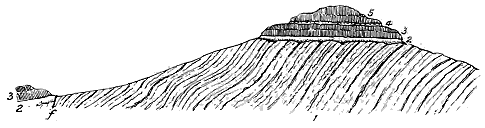
The total thickness of volcanic rocks in the Antrim plateau exceeds 1000 feet; but, as the upper part of the series has been removed by denudation, the whole depth of lava originally poured out cannot now be told. A well-marked group of tuffs and clays, traceable throughout a large part of Antrim, forms a good horizon in the midst of the basalts, which are thus divisible into a lower and upper group (Fig 264).
The Lower Basalts have a thickness of from 400 to 500 feet. But, as already mentioned (p. 194), they die out in about six miles to no more than 40 feet at Ballintoy. They are distinguished by their generally cellular and amygdaloidal character, and less frequently columnar structure. The successive flows, each averaging perhaps above 15 feet in thickness, are often separated by thin red ferruginous clayey partings, sometimes by bands of green or brown fine gravelly tuff. The most extensive of these tuff-bands occurs in the lower part of the group at Ballintoy, and can be traced along the coast for about five miles. In the middle of its course, near the picturesque Carrick-a-raide, it reaches a maximum thickness of about 100 feet and gradually dies out to east and west. The neck of coarse agglomerate at Carrick-a-raide, is doubtless the vent from which this mass of tuff was discharged (see Fig. 301). Owing to the thinning out of - 203 - the sheets of basalts, as they approach the vent, the tuff comes to rest directly on the Chalk, and for some distance westwards forms the actual base of the volcanic series.[235] Occasional seams of carbonaceous clays, or of lignite, appear in different horizons among the basalts. Beneath the whole mass of basalt, indeed, remains of terrestrial vegetation here and there occur. Thus, near Banbridge, County Down, a patch of lignite, four feet ten inches thick, underlies the basalt, and rests directly on Silurian rocks. Such fragmentary records are an interesting memorial of the wooded land-surface over which the earliest outflows of basalt spread.
[235] See Explanation of Sheets 7 and 8 of the Geological Survey of Ireland (1888), p. 23.
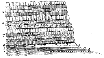
In looking at the great basalt-escarpments of Antrim, the Inner Hebrides or the Faroe Islands, and in following with the eye the successive sheets of lava in orderly sequence of level bands from the breaking waves at the base to the beetling crest above, we are apt to take note only of the proofs of regularity and repetition in the outflows of molten rock and to miss the evidence that these outflows did not always rapidly follow each other, but were separated by intervals of varying, sometimes even of long duration. One of the most frequent and conspicuous proofs of such intervals is to be found in the red layers or partings above referred to which, throughout all the basalt-plateaux, so commonly intervene between successive sheets of basalt. These red streaks cannot fail to arrest the eye on the coast-precipices where by their brilliant contrast of colour, they help to emphasize the bedded character of the whole volcanic series.
Examined more closely, they are found to consist of clay or bole which shades into the decomposed top of the bed whereon it lies, and is usually somewhat sharply marked off from that which covers it. This layer has long, and I think correctly, been regarded as due to the atmospheric disintegration of the surface of the basalt on which it rests, before the eruption of the overlying flow. It varies in thickness from a mere line up to a foot or more, and it passes into the tuffs and clays which are sometimes interposed - 204 - between the sheets of basalts. It may be looked upon as probably furnishing evidence of the lapse of an interval sufficiently extended to permit a considerable subserial decay of the surface of a lava-sheet before the outflow of the next lava. But an attentive study of the plateaux discloses other and even more remarkable indications that the pauses between the consecutive basalt-beds were frequently so prolonged as to allow extensive topographical changes to be made in a district. Nowhere is the long duration of some of these intervals more impressively taught than in the central zone of sedimentary strata in Antrim.
This persistent group of tuffs, clays, and iron-ore is generally from 30 to 40 and sometimes as much as 70 feet thick. From the occurrence of the ore in it, it has been explored more diligently in recent years than any other group of rocks in the district, and its outcrop is now known over most of the plateau. The iron-ore bed varies from less than an inch up to 18 inches in thickness, and consists of pisolitic concretions of hæmatite, from the size of a pea to that of a hazel nut, wrapped up in a soft ochreous clayey matrix.[236] Where it is absent, its place is sometimes taken by an aluminous clay, worked as "bauxite," which has yielded stumps of trees and numerous leaves and cones. Beneath the iron-ore or its representative, lies what is called the "pavement,"—a ferruginous tuff, 8 to 10 feet thick, resting on "lithomarge,"—a lilac or violet mottled aluminous earth sometimes full of rounded blocks or bombs of basalt. The well-known horizon for fossil plants at Ballypallidy is a red tuff in this zone. The section of strata between the two basalt-groups at this locality may serve as an illustration of the nature and arrangement of the deposits.[237]
[236] Consult a good essay on the Iron-ore and Basalts of North-east Ireland by Messrs. Tate and Holden, Quart. Journ. Geol. Soc. xxvi. (1870), p. 151. In this paper the nature, composition and modes of origin of the iron-ore and its associated strata are fully discussed.
[237] A. M'Henry, Geol. Mag. (1895), p. 263.
In some of the Ballypallidy tuffs the most frequent lapilli are pieces of green and brown glass, which Mr. Watts compares with the pitchstone of Sandy Braes, though rarely containing phenocrysts as that rock does. He has found also in these strata a smaller proportion of lithoidal rhyolites and occasionally fragments of basic rock.
The pale and coloured clays that occur in this marked sedimentary intercalation have doubtless been produced by the decomposition of the - 205 - volcanic rocks and the washing of their fine detritus by water. Possibly this decay may have been in part the result of solfataric action. From true bauxite or aluminium-hydrate, the sediments vary in composition and specific gravity and pass into aluminous silicates and iron-ores. They seem to indicate a prolonged interval of volcanic quiescence when the lavas and tuffs already erupted were denuded and decomposed.[238]
[238] See a note on Bauxite by Professor G. A. Cole, Scientif. Trans. Royal Dublin Soc. vol. vi. series ii. (1896), p. 105.
The area over which this interesting series of stratified deposits now extends is obviously much less than it was originally. It has indeed been so reduced by denudation into mere scattered patches that it probably does not exceed 170 square miles. But the group can be traced from Divis Hill, near Belfast, to Rathlin Island, a distance of 50 miles, and from the valley of the Bann to the coast above Glenarm, more than 20 miles. There can be little doubt that it was once continuous over all that area, and that it probably extended some way further on each side. If the so-called Pliocene clays of Lough Neagh be regarded as parts of this group of strata, its extent will be still further increased. Hence the original area over which the iron-ore and its accompanying tuffs and clays were laid down can hardly have been less than 1000 square miles. This extensive tract was evidently the site of a lake during the volcanic period, formed by a subsidence of the floor of the lower basalts. The salts of iron contained in solution in the water, whether derived from the decay of the surrounding lavas or from the discharges of chalybeate springs, were precipitated as peroxide in pisolitic form, as similar ores are now being formed on lake-bottoms in Sweden. For a long interval, quiet sedimentation went on in this lake, the only sign of volcanic energy during that time being the dust and stones that were thrown out and fell over the water-basin, or were washed into it by rains from the cones of the lava-slopes around.
It may here be remarked that the tendency to subsidence in the Antrim plateau seems to have characterized this region since an early part of the volcanic period. The lake in which the deposits now described accumulated was entirely effaced and overspread by the thick group of upper basalts. But long after the eruptions had ceased, a renewed sinking of the ground gave rise to the sheet of water which now forms Lough Neagh.[239]
[239] This subject will be discussed in Chapter xlix.
Nowhere else among the Tertiary basalt-plateaux of Britain has any trace been found of so marked and prolonged a pause in the volcanic activity as is indicated by the Antrim zone of tuffs and clays. Throughout the Inner Hebrides, indeed, numerous intercalations of sedimentary material occur among the basalts, but these consist mainly of tuffs and volcanic conglomerates with less frequent shales and coal-seams, and they never suggest so distinct and lengthened an interval as is indicated by the Antrim deposit.
It is not improbable that this interval was marked by the outbreak of rhyolitic eruptions somewhere in the region. The abundance of rhyolite - 206 - fragments in some of the tuffs is striking evidence that acid rocks were in one way or other brought to the surface at this time. At Glenarm one of the members of the stratified series is a marked rhyolitic conglomerate, composed of rounded pebbles of a rock not unlike the well-known rhyolite of Tardree and Carnearny. These fragments, obviously of local origin, must either have been derived from a surface of acid rock laid bare by denudation, or from rhyolite ejected in lapilli or poured out in streams. I formerly believed that all the Antrim rhyolites had been injected into the basalts after the close of the plateau-period. But the proved abundance and wide extent of the rhyolitic detritus among the sediments associated with the iron-ore point to a possible outflow of acid lavas with accompanying tuffs during the sedimentary interval between the two groups of basalt. The characters of the Antrim rhyolites, however, will be more particularly discussed in Chapter xlvii., in connection with the acid rocks of the Tertiary volcanic series.
Immediately above the iron-ore of Antrim, or separated from it in places by only a few inches of tuff, comes the group of Upper Basalts, which varies up to 600 feet in thickness, though as the upper portion has been everywhere removed by denudation, no measure remains of what may have been the original depth of the group. The general character of these basalts is more frequently columnar, black and compact, and with fewer examples of a strongly amygdaloidal structure than in the lower group. But this distinction is less marked in the south than in the north of Antrim, so that where the intervening zone of tuffs and iron-ore disappears, no satisfactory line of division can be traced between the two groups of basalt. The occurrence of that zone, however, by giving rise to a hollow or slope, from which the upper basalts rise as a steep bank or cliff, furnishes a convenient topographical feature for mapping the boundary of these rocks. Among the upper basalts, also, there is perhaps a less frequent occurrence of those thin red partings of bole between successive flows, so conspicuous in the lower group. But the flows are not less distinctly marked off from each other. Nowhere can their characteristic features be better seen than along the magnificent range of cliffs from the Giant's Causeway eastwards. The columnar bed that forms the Causeway is the lowest sheet of the upper group, and may be seen resting directly on the zone of grey and red tuffs. It is about 60 or 70 feet thick; and, while perfectly regular in its columnar structure at the Causeway and the "Organ," assumes further eastward the confusedly starch-like arrangement of prisms already referred to. But in the great cliff section of the "Amphitheatre," the more regular structure is resumed, the bed swells out to about 80 feet in thickness, and columns of that length run up the face of the precipice, weathering out at the top into separate pillars, which, perched on the crest of an outstanding ridge, are known as the "Chimneys." The basalt-beds that succeed the lowest one are each only about 10 to 15 feet thick (Fig. 265).
- 207 -
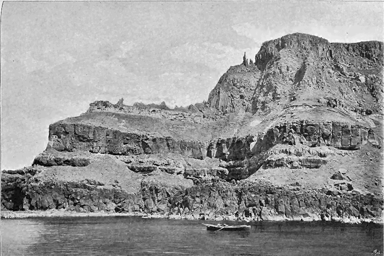
- 208 -
Between the successive sheets of the Upper Basalts thin seams of red ferruginous clay though, as I have said, less frequent perhaps than in the lower group, continue to show that the intervals between successive eruptions were of sufficient duration to admit of some subærial decay of the surface of a lava before the outflow of the next bed. Occasional thin layers of tuff also, and even of pisolitic iron-ore, have been observed among these higher basalts. But the most interesting and important intercalations are inconstant seams of lignite. One of the most conspicuous of these lies immediately above the basalt of the "Causeway," where it was long worked for fuel, and was found to be more than six feet thick. But it is quite local, as may be seen at the "Organ" over which it lies, having a thickness of only 12 inches and rapidly dying out so as to allow the basalts above and below it to come together. The removal of the upper portion of the basalts by denudation has destroyed the records of the latest part of the volcanic history of the Irish plateaux.
It is obvious that nowhere in Antrim does any trace exist of a central vent or cone from which the volcanic materials were discharged. There is no perceptible thickening of the individual basalt-sheets, nor of the whole series in one general direction, in such a manner as to point to the site of some chief focus of eruption. Nor can we place reliance on the inclination of the several parts of the plateau. I have pointed out that the varying dip of the beds must be attributed mainly to post-volcanic movements, or at least to movements which, if not later than all the phases of volcanic action, must have succeeded the outpouring of the plateau-basalts. There has been a general subsidence towards the central and southern tracts now occupied by the valley of the Bann and Lough Neagh. But nowhere in the depression is there any trace of the ruins of a central cone or focus of discharge.
The Antrim plateau, in these respects, resembles the others. But as has already been remarked, it differs from them in one important particular. It has nowhere been disrupted by huge bosses of younger rocks, such as have broken up the continuity of the old lava-fields further north. Yet it also is not without its memorials of younger protrusions. It contains not a few excellent examples of true volcanic vents, and, as above stated, it includes some small acid bosses that may represent the great protrusions of the Inner Hebrides, and may have been connected with superficial outflows of rhyolitic lava and showers of rhyolitic tuff.
ii. MULL, MORVEN AND ARDNAMURCHAN
This plateau covers nearly the whole of the island of Mull, embraces a portion of Morven on the Argyleshire mainland, and, stretching across Loch Sunart, includes the western part of the peninsula of Ardnamurchan (Map VI.). That these now disconnected areas were once united into a continuous lava-field which extended far beyond its present limits is impressively indicated by their margin of cliffs and fringe of scattered islands and outliers. The plateau went west, at least, as far as the Treshnish Isles, which are composed of basalt. On its eastern border, a capping of basalt on the top of Beinn Iadain - 209 - (1873 feet) in Morven, and others further north, prove that its volcanic sheets once spread into the interior of Argyleshire (Fig. 266). On the south, its fine range of lofty cliffs, with their horizontal bars of basalt, bear witness to the diminution which it has undergone on that side; while, on the north, similar sea-walls tell the same tale. Not only has it suffered by waste along its margin, it has also been deeply trenched by the excavation of glens and arms of the sea. The Sound of Mull cuts it in two, and the mainland portion is further bisected by Loch Sunart, and again by Loch Aline. The island of Mull is so penetrated by sea-lochs and divided by deep valleys that a comparatively slight depression would turn it into a group of islands. But, besides its enormous denudation, this plateau has been subjected to disruption, and perhaps also to subsidence, from subterranean movements. In the southern portion of the island of Mull it has been broken up by the intrusion of large bosses and sheets of gabbro, and by masses as well as innumerable veins of various granitoid and felsitic rocks. In Ardnamurchan, it has suffered so much disturbance from the same cause that its original structure has been almost obliterated over a considerable area. Moreover, it has been dislocated by many faults, by which different portions have been greatly shifted in level. The most important of these breaks is one noticed by Professor Judd, and visible to every tourist who sails up the Sound of Mull. It traverses the cliffs on the Morven side, opposite Craignure, bringing the basalts against the crystalline schists, and strikes thence inland, wheeling round into the long valley in which Lochs Arienas and Teacus lie. On its western side, the base of the basalt-series is almost at the sea-level; on its eastern side, that platform rises high into the outliers of Beinn na h-Uamha (1521 feet) and Beinn Iadain. The amount of displacement is probably more than 1000 feet. Many other minor faults in the same district show how much the crust of the earth has been fractured here since older Tertiary time.
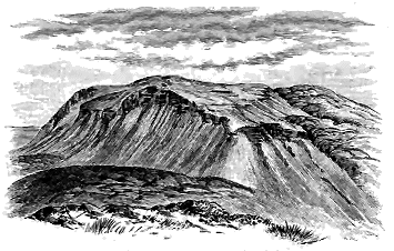
[240] There are no fewer than three faults in the basalt-capping on the summit of Beinn Iadain. By bringing the basalts and schists into juxtaposition, they have given rise to topographical features that can be seen even from a distance.
- 210 -
A little to the west of Mull, and belonging originally to the same plateau, lies the isle of Staffa, the famous columnar basalts of which first attracted the attention of travellers, and gave to the Tertiary volcanic rocks of Scotland their celebrity (Fig. 266a).
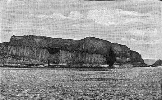
In spite of the extent to which it has suffered from denudation and subterranean disturbance, and indeed in consequence thereof, the Mull plateau presents clear sections of many features in the history of the basalt-outflows and of the subsequent phases of Tertiary volcanic action which cannot be seen in the more regular and continuous tableland of Antrim. Moreover, it still possesses in its highest mountain, Ben More (3169 feet), a greater thickness, and probably a higher series, of lavas than can now be seen in any other of the plateaux.
The difficulties, already referred to in regard to Antrim, of tracing the probable form of ground on which the volcanic eruptions began, are even greater in the case of the Mull plateau. We can dimly perceive that the depression in the crystalline rocks of the Highlands which had, from at least the older part of the Jurassic period, stretched in a N.N.W. direction along what is now the western margin of Argyleshire, lay beneath the sea in Jurassic time, and was then more or less filled up with sedimentary - 211 - deposits. The hollow appears thereafter to have become a land-valley, whence the Jurassic strata were to a large extent cleared out by denudation before its subsequent submergence under the sea in which the upper Cretaceous deposits accumulated. Professor Judd has shown that relics of these Cretaceous strata appear on both sides of the plateau from under the protecting cover of basalt-sheets. But, before the volcanic eruptions began, the area had once again been raised into land, and the youngest Secondary formations had been extensively eroded.
In their general aspect the basalts of Mull agree with those of Antrim, and the circumstances under which they were erupted were no doubt essentially the same. But considerable differences in detail are observable between the succession of rocks in the two areas. When I first visited the island in 1866, the only available maps, with any pretensions to accuracy, were the Admiralty charts; but, as these do not give the interior except in a generalized way, it was difficult to plot sections from them, and to arrive at satisfactory conclusions as to the thickness of different groups of rock. Accordingly, as the successive nearly flat flows of basalt can be traced from the sea-level up to the top of Ben More, I contented myself with the fact that the total depth of lava-beds in Mull was at least equal to the height of that mountain, or 3169 feet. The publication of the Ordnance Survey Maps now enables us to make a nearer approximation to the truth. From the western base of the magnificent headland of Gribon, the basalts in almost horizontal beds rise in one vast sweep of precipice and terraced slope to a height of over 1600 feet, and then stretch eastwards to pass under the higher part of Ben More, at a distance of some eight miles. They have a slight easterly inclination, so that the basement sheets seen at the sea-level, at the mouth of Loch Scridain, gradually sink below that level as they go eastward. It is not easy to get a measurement of dip among these basalts, except from a distance. If we take the inclination at only 1°, the beds which are at the base of the cliff on the west, must be about 700 feet below the sea on the line of Ben More, which would give a total thickness of nearly 3900 feet of bedded lava below the top of that mountain. We shall not probably overestimate the thickness of the Mull plateau if we put it at 3500 feet.
The base of the volcanic series of Mull can best be seen on the south coast at Carsaig, and at the foot of the precipices of Gribon. As already stated, it is there found resting above Cretaceous and Jurassic rocks. The lowest beds are basalt-tuffs, of the usual dull green colour. They are in places much intermingled with sandy and gravelly sediment, as if the volcanic debris had fallen into water where such sediment was in course of deposition. One of the most interesting features, indeed, in this basement part of the series, is the occurrence of bands of non-volcanic material which accumulated after the tuffs and some of the lavas had been erupted, but before the main mass of basalts. Those at Carsaig include a lenticular bed, 25 feet thick, of rolled flints, which, with some associated sandy bands, lies between sheets of basalt. On the opposite side of the promontory is the - 212 - well-known locality of Ardtun, from which the first land-plants in the volcanic series were determined. The actual base of the basalts is not there seen, being covered by the sea. The "leaf-beds," with their accompanying sandstones, gravels, and limestone, lie upon a sheet of basalt, which in some parts is exceedingly slaggy on the top, passing down into a black compact structure, and assuming at the base of the cliff a columnar arrangement, with the prisms curved and built up endways towards each other. Some of the gravels exceed 30 feet in thickness, and consist of rolled flints, bits of chalk, and pieces of basalt and other basic igneous rocks. But some of their most interesting ingredients are pebbles of sanidine lavas, which have been recognized in them by Prof. G. Cole.[241] No known protrusions of such lavas occur anywhere beneath or interstratified with the plateau-basalts of this district. As will be afterwards shown, all the visible acid rocks, the geological relations of which can be ascertained, are here of younger date than these basalts. I am disposed to regard the fragments found in the Ardtun conglomerates as probably derived from some of the basalt-conglomerates of the plateau, in which fragments of siliceous igneous rocks do occur. Though there is no evidence that any lavas of that nature were here poured out at the surface before or during the emission of the basalts, the contents of these fragmental volcanic accumulations suggest that such lavas, already consolidated, lay at some depth beneath the surface, and that fragments were torn off from them during the explosions that threw out the materials of the basalt-conglomerates to the surface.
[241] Quart. Jour. Geol. Soc. xliii. (1887) p. 277.
The succession of strata at the Ardtun headland varies considerably in a short distance, some of the sedimentary deposits rapidly increasing or diminishing in thickness. The section as measured by Mr. Starkie Gardner is as follows[242]:—
Mr. Starkie Gardner has called attention to the extraordinarily fresh condition of the vegetation in some of the layers of the Ardtun section. One of the leaf-beds he has found to be made up for an inch or two of a pressed mass of leaves, lying layer upon layer, and retaining almost the colours of dead vegetation. Among the plants represented is a large purple Ginkgo and a fine Platanites, one leaf measuring 151/2 inches long by 101/2 broad. - 213 - The characteristic dicotyledonous leaves at this locality possessed relatively large foliage.[243]
[243] For fuller local details regarding the Ardtun leaf-beds, I may refer to the original paper by the Duke of Argyll (Quart. Jour. Geol. Soc. vii. p. 89), and to the memoir by Mr. Starkie Gardner (op. cit. xliii. (1887), p. 270).
To the early observations of Macculloch we are indebted for the record of an interesting fact in connection with the vegetation of the land-surface over which the first lava-flows spread. He figured a vertical tree trunk, imbedded in prismatic basalt, and rightly referred it to some species of fir.[244] This relic may still be seen under the basalt precipices of Gribon. Mr. Gardner found it to be "a large trunk of a coniferous tree, five feet in diameter, perhaps Podocarpus, which has been enveloped, as it stood, in one of the flows of trap to the height of 40 feet. Its solidity and girth evidently enabled it to resist the fire, but it had decayed before the next flow passed over it, for its trunk is a hollow cylinder filled with debris, and lined with the charred wood. A limb of another, or perhaps the same tree, is in a fissure not far off."[245]
[244] Western Islands, vol. i. p. 568, and plate xxi. Fig. 1.
[245] Quart. Jour. Geol. Soc. xliii. p. 283.
At different levels in the volcanic series of Mull, beds of lignite and even true coal are observable. These seem to be always mere lenticular patches, only a few square yards in extent. The best example I have met with lies among the basalts near Carsaig. It is in part a black glossy coal, and partly dull and shaly. Some years ago it was between two and three feet thick, but now, owing to its having been dug away by the shepherds, only some six or eight inches are to be seen. It lies between two basalt-flows, and rapidly disappears on either side.
More frequent than these inconstant layers of fossil vegetation are the thin partings of tuff and layers of red clay, sometimes containing iron-ore, which occur at intervals throughout the series between different flows of basalt. But even such intercalations are of trifling thickness, and only of limited extent. The magnificent precipices of M'Gorry's Head and Gribon expose a succession of beds of columnar amorphous and amygdaloidal basalt, which must attain a thickness of at least 2500 feet, before they are overlain by the higher group of pale lavas in Ben More. On the east side of the island, thin tuffs and bands of basalt-conglomerate occur on different horizons among the bedded basalts, from near the sea-level up to the summit of the ridge which culminates in Beinn Meadhon (2087 feet), Dùn-da-Ghaoithe (2512 feet), and Mainnir-nam-Fiadh (2483 feet). Reference has already been made to the remarkably coarse character of some of the breccias intercalated among the basalts in this part of Mull, and to the enormous dimensions of some of the masses of mica-schist and quartzite which have been carried up from a depth of 2000 feet or more by volcanic agency (see ante, p. 196, and Fig. 262).
Above the ordinary compact and amygdaloidal basalt comes the higher group of pale lavas already referred to as forming the uppermost part of Ben More, whence it stretches continuously along the pointed ridge of - 214 - A'Chioch, and thence northwards into Beinn Fhada. The same lavas are likewise found in two outliers, capping Beinn a' Chraig, a mile further north, and I have found fragments of them on some of the loftier ridges to the south-east. This highest and youngest group of lavas in the plateaux has been reduced to mere isolated patches, and a little further denudation will remove it altogether. Yet it is not less than about 800 feet thick, and consists of bedded andesitic or trachytic lavas, which alternate with and follow continuously and conformably upon the top of the ordinary plateau-basalts. These dull, finely crystalline or compact, light-grey rocks weather with a characteristic platy form, which has been mistaken for the bedding of tuffs. The fissility, however, has none of the regularity or parallelism of true bedding, and may be observed to run sometimes parallel with the bedding of the sheets, sometimes obliquely or even at right angles to it. Even where this structure is best developed, the truly crystalline nature of the rocks can readily be detected. Some of them are porphyritic and amygdaloidal, the very topmost bed of the mountain being a coarse amygdaloid. Intercalated with these curious rocks there are others in which the ordinary characters of the dolerites and basalts of the plateaux can be recognised. The amygdaloids are often full of delicate prisms of epidote.
In Mull, as in the other areas of terraced basalts, we everywhere meet with gently inclined sheets, which do not thicken out individually or collectively in any given direction, except as the result of unequal denudations. So far as I have been able to discover, they afford no evidence of any great volcanic cone from which they proceeded. Their present inclinations are unquestionably due, as in Ireland, to movements subsequent to the formation of the plateau. In Loch-na-keal they dip gently to the E.N.E.; in Ulva and the north-west coast to N.N.E.; near Salen to W.S.W. on the one side, and N.W. on the other. Round the southern and eastern margins of the mountainous tract of the island, they dip generally inwards to the high grounds.
The Mull plateau presents a striking contrast to that of Antrim, in the extraordinary extent to which it has been disrupted by later protrusions of massive basic and acid rocks over a rudely circular area, extending from the head of Loch Scridain to the Sound of Mull, and from Loch-na-keal to Loch Buy. The bedded basalts have been invaded by masses of dolerite, gabbro, and granophyre, with various allied kinds of rock. They have not only been disturbed in their continuity, but have undergone considerable metamorphism.
Again, further to the north, in the promontory of Ardnamurchan, the plateau has been disrupted in a similar way, and only a few recognisable fragments of it have been left. These changes will be more appropriately discussed in connection with similar phenomena in the other plateaux further north.
- 215 -
The parish of Small Isles includes the islands of Eigg, Rum, Canna, Sanday and Muck (Map VI.). The fragmentary basalt-plateau which it contains, although the smallest of the whole series, is surpassed by none in the variety and interest of its geology. It contains by far the most complete records of the rivers which, during the volcanic period, flowed across the lava plains. And it alone has preserved a relic of the latest lava which, after the basalt-plateau had been built up and had been greatly eroded, flowed over the denuded surface in streams of volcanic-glass that found their way into a river-channel and sealed it up.
That the fragments of the basaltic plateau preserved in each member of the group of the Small Isles were once connected as a continuous volcanic plain can hardly be doubted. Indeed, as already stated, they were not improbably united with the plateau of Skye on the north, and with that of Mull, Morven and Ardnamurchan oh the south. Taking the whole space of land and sea within which the basalt of Small Isles is now confined, we may compute it at not much less than 200 square miles. In Eigg, Muck, Canna and Sanday the basalts retain their almost horizontal position, and from underneath them the Jurassic strata emerge in the first of these islands. The central part of the plateau in the island of Rum has suffered greatly from denudation. It now consists of four small outliers of basalt, which lie at levels of 1200 feet and upwards, on the western slope. The basalt is underlain by a thick mass of red Torridon Sandstone, which, with some gneisses and schists, forms the general underlying platform of this island. These rocks are doubtless a continuation of the red sandstone and schists of Sleat, in Skye, and like them have been subjected to those post-Cambrian convolutions and metamorphism whereby the Lewisian Gneiss and Torridon Sandstone have been brought above younger rocks, and have been crushed and rolled out so as to assume a new schistose arrangement. Before the time when volcanic action began, a mass of high ground, consisting of these ancient rocks, stood where the island of Rum is now - 216 - situated. The streams of basalt spread around it, not only covering the surrounding low tracts of Jurassic rocks, but gradually accumulating against the hills, and thus reducing them both in area and in height above the plain.[246] Viewed from Canna the western coast of Rum presents a striking picture of the general relations of the volcanic masses of the Inner Hebrides and of the enormous denudation which they have undergone (Fig. 267). The Torridon Sandstones are there seen to mount into ranges of hills, capped with outliers of the basalt-plateau, while behind rise the great eruptive bosses of gabbro and granophyre. The edges of the sheets that form the outliers would, if prolonged, cover the northern or lower half of the island, where pre-Cambrian rocks form the surface. In the southern half, the continuity of the basalt has been partly obscured and partly destroyed by the protrusion of the great masses of gabbro that form the singularly picturesque mountain group to which this island owes its prominence as a landmark far and wide along the West Coast of Scotland.
[246] That the lava-fields did not completely bury this nucleus of older rocks has been supposed to be shown by the fragments of red sandstone found in the ancient river-bed of Eigg, which was scooped out of the basalt-plateau and sealed up under pitchstone. But I am disposed to think that these fragments, together with those of Jurassic sandstone, came, not from Rum, but from some district more to the north and east, as will be explained in a later page. At Canna, a few miles to the west, fragments of red sandstone not improbably derived from Rum are abundant in the conglomerates between the basalts.
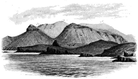
The most varied and interesting of the fragments of the basaltic plateau in the area of the Small Isles is that which forms the island of Canna, with its appendage Sanday. Canna measures five miles in length by from half a mile to a mile in breadth, and consists entirely of the rocks of the plateau and their accompaniments. The basalts are exposed along the north coast - 217 - in a range of mural precipices rising to a height of about 600 feet above the sea. From the top of that escarpment the ground falls by successive rocky terraces and grassy slopes to the southern shore-line. Sanday, connected with the large island by a shoal and foot-bridge, is two miles long and 220 to about 1200 yards broad. Its highest cliffs range along its southern shore to a height of 193 feet, whence they slope gently northward into the hollow between the two islands. This peculiar topography accounts for the manner in which the geological sections of most interest are distributed.
The first, and still the best, account of the geology of these islands is that of Macculloch. He showed that the rocks all belong to the series of the plateau-basalts, and he described the presence among them of a "trap-conglomerate." He noticed the occurrence also of trap-tuff and the occasional appearance of carbonized wood in these deposits. Reasoning upon these observations in his characteristically vague and verbose manner, "bewildered in the regions of conjecture," he concludes that the basalts instead of belonging to "one general formation" have been successively deposited on the same spot, "since lapse of time is evidently implied in the formation of a conglomerate." He inclines to believe that they have been discharged by ancient volcanoes from which in the course of time all traces of their original outline have been more or less completely removed, the existing basalts being merely fragments of once more extensive masses.[247]
[247] Western Isles, vol. i. pp. 448-459, and pl. xix. Figs. 2, 3 and 4. See also Jameson's Mineralogy of the Scottish Isles.
Macculloch regarded the intercalated-conglomerates as having been arranged under water and as marking pauses in the deposition of the sheets of "trap." He gave two diagrams in illustration of the relations of these detrital deposits, but he expressed no definite opinion as to their origin, though from one passage it would seem that he inclined towards the belief that they were formed in the sea.[248] Since his time, so far as I am aware, no fresh light has been thrown upon the subject.
[248] Op. cit. pp. 449, 457, pl. xix. Figs. 2 and 3.
During a yachting cruise in the summer of 1894 I visited Canna for the first time and found so much that was new to me in regard to the history of Tertiary volcanic action, and which demanded a careful survey, that I returned to the locality the following summer and remained in the island until I had mapped it and its dependencies upon the Ordnance Survey sheets on the scale of six inches to a mile. The following narrative is the result of the observations then made.
As far back as the year 1865 I published an account of an ancient river-channel which, during the volcanic period, had been eroded on the surface of the basalt-plateau, and of which a small portion had been preserved under a stream of pitchstone-lava that had flowed into and buried it.[249] This water-course, now marked by the picturesque ridge of the Scuir of Eigg, was shown to have been excavated by a stream which came from the north-east or east, and to be younger, not only than the plateau-basalts of the district, but than even the dykes which cut these basalts. Yet that it - 218 - belonged to the volcanic period was proved by the manner in which it had been sealed up and preserved under the black glassy lava of the Scuir. Its history and the data from which this history is compiled will be narrated in a later part of this chapter.
[249] Scenery of Scotland (1865); Quart. Journ. Geo. Soc. vol. xxvii. (1871), p. 303.

My examination of the islands of Canna and Sanday, however, brought to light other and more abundant evidence of river-action in the same region of the Inner Hebrides, but belonging to an earlier part of the volcanic period. This evidence reveals that a powerful river, flowing westwards from the Highland mountains, swept over the volcanic plain, while the sheets of basalt were still being poured forth, and while volcanic eruptions were taking place from cones of slag.
The basalt-plateau of Canna resembles in all essential particulars those of the other Western Isles. Its base is everywhere concealed under the sea, but from the fragments of Torridon Sandstone in its agglomerates we may infer that it probably rests on that formation, like the volcanic outliers in Rum. It is formed of successive sheets of different basalts including the usual banded, amygdaloidal and columnar forms. Some of them towards the west are specially marked by the great abundance and large size of their porphyritic felspars. The magnetic properties of the basalts at the east end of the island have long been known, and have given rise to various modern myths regarding their influence on the compasses of passing vessels.
But it is in its conglomerates, tuffs and agglomerates and the light they cast on some aspects of the volcanic period, elsewhere hardly recorded, that the geology of Canna possesses a special importance. To these, therefore, we may at once turn.
The conglomerates are best developed at the eastern end of the island, - 219 - where the cliffs present the structure represented in Fig. 268. At the base, and passing under the level of the sea, lies the agglomerate (a) of a vent which will be described in Chapter xli., together with other eruptive orifices of the various plateaux (p. 288). This rock has a somewhat uneven upper surface which rises in places about 150 feet above high tide-mark. Here and there it shades off upward into the conglomerate that overlies it; water-worn pebbles appear among its contents, and rude traces of bedding begin to show themselves, until, within the course of a few feet, we pass upward into an undoubted conglomerate. Elsewhere, however, and particularly along the precipices west of Compass Hill, the two deposits are more distinctly marked off from each other. The agglomerate has there a hummocky, irregular upper surface, as if it had been thrown down in heaps. The hollows between these protuberances have been filled up with conglomerate and sandstone, forming the base of the thick overlying deposit.
It is thus clear that the loose materials of the vent were directly exposed at the surface when the conglomerate was accumulated, and, indeed, that these materials served to supply some of the detritus of which the conglomerate consists. The absence of any trace of a cone and crater at the vent may perhaps be explicable on the supposition that their incoherent material was washed down by the currents that swept along and deposited the conglomerate.
The mass of sedimentary material (b) which overlies the agglomerate of the vent forms a conspicuous feature along the lower half of the precipices at the eastern end of Canna. It rises to a height of 250 to 300 feet above sea-level, and must reach a maximum thickness of probably not less than 100 to 150 feet. It gradually descends in a westward direction, both along the northern cliffs and in the lower ground round Canna Harbour, insomuch that in about a mile, owing to the gentle westerly dip of the whole volcanic series, combined with the effect of a number of small faults, it passes under the level of the sea.
Great variation in the character of the detritus composing this thick group of strata may be observed as it is followed westward. On the cliffs below Compass Hill, as represented in Fig. 268, the coarse conglomerate with water-worn stones, hardly to be distinguished from the volcanic agglomerate of the vent, shows more or less distinct bedding, or at least a succession of coarser and finer bands. Towards its base it encloses numerous pieces of Torridon Sandstone, sometimes subangular, but often so well and smoothly rounded as to show that they must have been long subjected to the action of moving water. It is further observable that, while in the agglomerate the volcanic stones have rough surfaces, those in the conglomerate begin to show increasing evidence of attrition, until, as the deposit is traced upwards, they become almost as well rounded and water-worn as the non-volcanic stones.
Yet amidst and overlying these proofs of transport from some little distance lie abundant huge slags and blocks of amygdaloidal lava, sometimes closely aggregated, sometimes scattered through a volcanic tuff or ashy sandstone. - 220 - The composition and structure of these stones, and the manner of their dispersion through the deposit, leave little doubt that they were ejected from the vent. We are thus confronted with the interesting fact that, while the materials of the volcanic cone were being washed down by running water, eruptions were still taking place. But by degrees these indications of contemporaneous volcanic activity diminish. The detrital materials become coarser and more distinctly water-rolled until they pass into greenish sandstones and fine conglomerates. Yet the matrix even of these higher sediments is largely composed of fine volcanic detritus, and probably points to occasional discharges of dust and ashes.
Various sills or intrusive sheets have been injected into this sedimentary group along the precipices at the east end of Canna, and form there lenticular bands. One of these (c) is shown in Fig. 268.
Immediately above the massive greenish pebbly sandstone (d) which caps the stratified series lies a group of basalts (e), composed of several distinct beds, having a united thickness of from 80 to 100 feet. The lowest of these has a regular columnar structure, while those overlying it exhibit the confused starch-like grouping of curved and rather indistinctly-formed prisms.
The next band in upward succession is one of conglomerate (f), which runs as a continuous and conspicuous feature along the upper part of the cliff. This rock presents in many respects a strong contrast to the conglomerates underneath. It is dull-green to yellow in colour, and is well stratified, being marked by the interstratification of finer layers, and passing down into a band of pebbly sandstone, which rests immediately on the basalt (e). Its component stones are thoroughly water-worn, ranging up to six inches or even more in length. But its most distinctive character lies in the nature of its pebbles. Instead of consisting mainly of volcanic materials, these stones have almost all been transported for some distance. They include abundant fragments of Torridon Sandstone, gneiss, schists, grits, and other rocks like those in Rum and Western Inverness-shire. No such rocks exist in situ in Canna. The nearest tract of Torridon Sandstone is in Rum, about four miles to the eastward. But the pieces of schist and epidotic grit like the rocks of the Western Highlands, have probably travelled at least 30 miles.
It is important to observe that all these transported stones indicate a derivation from some source lying to the eastward of Canna. The evidence in this respect agrees with that furnished by the ancient river-gravel under the pitchstone of the Scuir of Eigg. It is clear that the waters which found their way across the lava-fields of this part of the Inner Hebrides took their rise somewhere to the eastward, probably among the mountains of Inverness-shire.
The conglomerate now described is from 40 to 50 feet thick. It can be followed along the face of the cliffs for more than a mile on the north side of Canna. Less persistent on the south side, its outcrop strikes from the edge of the precipice inland, keeping to the south of the top of Compass - 221 - Hill. It is well seen in the ravine above the Coroghon, but cannot be followed further westward among the basalt-terraces. Yet, though this stratified intercalation is not traceable far as a band of conglomerate, the same stratigraphical horizon is probably indicated elsewhere by other kinds of sedimentary deposits, to which further reference will be made in the sequel.
The section now described establishes the existence of at least two successive platforms of conglomerate in the volcanic series. Following these platforms along their outcrop, we obtain additional light on their origin, and on the topographical conditions under which they were deposited, and we learn further that other prolonged intervals, which were likewise marked by intercalations of sedimentary material, occurred in the outpouring of the basalts.
Taking first the lower conglomerate of Compass Hill and tracing it westward, we find it to form the depression in which the sheltered inlet of Canna Harbour lies. It is exposed along the shores and also in the islands enclosed within the same bay. But it is not traceable further west, possibly because it seems to sink beneath the level of the sea. To the south-east, though it is there likewise for the most part concealed under the waves, it rises above them in one or two parts of the coast-line of Sanday, particularly at the Uamh Ruadh or Red Cave, and likewise on a surf-beaten skerry off Ceann an Eilein, the highest part of the Sanday cliffs—a distance of about a mile and a half from Compass Hill. Throughout this space it retains its remarkably coarse character and is mainly made up of volcanic material.
The numerous sections exposed in Canna Harbour enable us to study the composition and local variations of this curious deposit. On the north side of the basin, while the lower part of the sedimentary series continues to be an exceedingly coarse volcanic conglomerate, it passes upward into finer conglomerates, tuffs, and shales. In front of Canna House the imbedded blocks are of large size, occasionally as much as three or four feet in diameter. They are still more gigantic on the island of Eilean a' Bhaird, where I found one to contain 150 cubic feet in the exposed part, the rest being still concealed in the matrix. As they are generally somewhat rounded, here and there markedly so, most of these stones have probably undergone a certain amount of attrition in water. The great majority of them, and certainly all those of larger size, are pieces of basalt, dolerite, andesite, etc. Among them huge blocks of amygdaloid and coarsely vesicular lava are specially abundant. Some of these look like pieces of slag torn from the upper surface of lava-streams. Others, displaying a highly vesicular centre and a close-grained outer crust, are suggestive of bombs. It is interesting to note here again that the amygdaloidal blocks present their zeolitic infiltrations so precisely like those of the amygdaloids of the plateau that it seems reasonable to suppose the carbonate of lime, zeolites, etc. to have been introduced before the blocks were imbedded in the conglomerate.
The whole aspect of this deposit is eminently volcanic. It looks like a vast sheet of lava-fragments swept away from one or more cones of slags and - 222 - cinders, or from the scoriaceous surface of a lava-stream. Where the vesicles were still empty, the large boulders could be more easily swept along by moving water. But a powerful current must have been needed to transport and wear down into more or less rounded forms blocks of basic lava, many of which must weigh several tons. The large block on Eilean a' Bhaird probably exceeds 12 tons in weight.
Besides the obviously volcanic contents of the conglomerate there occur here also, as in the Compass Hill cliffs, abundant pieces of Torridon Sandstone. These stones are notably smaller in size and more perfectly water-worn and even polished than the blocks of lava. Obviously they have travelled further and have undergone more prolonged attrition.
The matrix of the rock consists essentially of the fine detritus of basic lavas, probably mingled with true volcanic dust. The coarser parts display only the feeblest indication of stratification; indeed, in a limited exposure the rock might be regarded as a tumultuous agglomerate. But the manner in which the deposit is intercalated with, and sometimes overlies, green tuffs and shales, together with the water-worn condition of its stones, shows that it has not been accumulated in a volcanic chimney, but has been thrown down by some powerful body of water, with probably the co-operation of volcanic discharges.
While the composition of the conglomerate suffices to indicate that this deposit was formed at a time when some volcano was active in the immediate neighbourhood, singularly convincing proofs of the work of this vent are to be seen in the form of intercalated sheets of lava. Thus on Eilean a' Bhaird the boulders of the conglomerate are overlain and wrapped round by a sheet of rudely prismatic basalt, with lines of vesicles arranged in the direction of the bedding. A similar relation can be traced along the beach between Canna House and the wooden pier, where successive sheets of basalt have flowed over the conglomerate (Fig. 269).
But, besides coarse volcanic detritus, the sedimentary platform represented by the lower conglomerate of Compass Hill includes other deposits of which good sections may be examined all round Canna Harbour. Beds of fine well-stratified dull-green tuff pass by an admixture of pebbles into fine ashy conglomerate or pebbly sandstone, and by an increase in the proportion of their fine detritus into volcanic mudstone and fine shales. The shales vary from a pale grey or white tone into blackish grey, brown, and black. They are well stratified and are frequently interleaved with layers of fine tuff. The darker bands are carbonaceous, and are not infrequently full of ill-preserved vegetation. Indeed, leaves and stems in a rather macerated condition are of common occurrence in all the shaly layers. Here and there, especially in some ashy shales in front of Canna House, I observed a recognisable Sequoia. The mudstones are dull green, close-grained shattery rocks composed of fine volcanic detritus, and pass both laterally and vertically into shales, tuffs, and conglomerates. They suggest showers of fine dust or streams of volcanic mud. They, too, contain fragmentary plants.
- 223 -
It is a noteworthy fact that the sedimentary intercalations among the Canna basalts generally end upward in carbonaceous shales or coaly layers. The strong currents and overflows of water, which rolled and spread out the coarse materials of the conglomerates, gave way to quieter conditions that allowed silt and mud to gather over the water-bottom, while leaves and other fragments of vegetation, blown or washed into these quiet reaches, were the last of the suspended materials to sink to the bottom. Good illustrations of this sequence in the case of the lower conglomerate zone of Canna may be studied along the shores of Sanday, from the Catholic Chapel eastwards. The fine pebbly sandstones, tuffs, and shales, which there overlie the coarse conglomerate, are surmounted by dark brown or black carbonaceous shale, with lenticles of matted vegetation that pass into impure coal. Immediately overlying this coaly layer comes a sheet of prismatic vesicular basalt, followed by another with an exceedingly slaggy texture.
Lenticles of shale and mudstone likewise occur in the heart of the finer parts of the conglomerate, especially towards the top, as may be seen in the section exposed beneath the basalt behind the first cottage west from Canna House. One of the most interesting layers in this section is a seam of tuff, varying up to about two inches in thickness, which lies at the top of the lenticular band of tuffs and shales, and immediately beneath the band of basalt-conglomerate, on which a basalt, carrying a vesicular band near its bottom, rests. Traced laterally, the dark brown tuff of this seam gradually passes into a series of rounded bodies and flattened shells composed of a colourless mineral which has evidently been developed in situ after the deposition of the tuff. Mr. Harker's notes on thin slices made from this band are as follows:—
"This is a rusty-brown, dull-looking rock, rather soft and seemingly light, but too absorbent to permit of its specific gravity being tested. The dark brown mass is in great part studded with little spheroidal bodies, 1/50 to 1/10 inch in diameter, of paler colour, but the larger ones having a dark nucleus. In other parts larger flat bodies have been formed, as if by the coalescence of the spheroids, extending as inconstant bands in the direction of lamination for perhaps 1/2 inch, with a thickness of 1/10 inch or less. The appearance is that of a spherulitic rather than an oolitic structure.
"A slice [6658 A] shows the general mass of the rock to be of an extremely finely divided but coherent substance of brown colour, which can scarcely be other than a fine volcanic dust, composed of minute particles of basic glass or 'palagonite' compacted together. Scattered through this are fragments of crystals recognizable as triclinic and perhaps monoclinic felspars, green hornblende, augite, olivine (?), and magnetite, usually quite fresh.
"The curious spheroidal and elongated growths already mentioned are better seen in another slide [6658 B], where they occupy the larger part of the field, leaving only an interstitial framework of the brown matrix. The substance of the little spheroids is clear, colourless, and apparently structureless. The centre is often occupied by an irregularly stellate patch of brown - 224 - colour, and sometimes cracks tend to run in radiating fashion, but these are the only indications of radial structure. The outer boundary is sharply defined, and where the slice is shattered the spheroids have separated from the matrix. The matrix is darker than in the normal rock, being obscured by iron-oxide which we may conceive as having been expelled from the spaces occupied by the spheroids. The little crystal-fragments are enclosed in the spheroids as well as in the matrix, but there is no appearance of their having served as starting-points for radiate growths. The flat elongated bodies are like the spheroids, with merely the modifications implied in their different shape.
"The identity of the clear colourless substance seems to be rather doubtful. It is sensibly isotropic and of refractive power distinctly lower than that of felspar. These characters would agree with analcime, which is not unknown as a contact-mineral; but it is difficult to understand how analcime, even a lime-bearing variety like that of Plas Newydd,[250] could be formed in abundance from palagonitic material. An alternative supposition, perhaps more probable, is that the clear substance is a glass, modified from its former nature, especially by the expulsion of the iron-oxide into the remaining matrix. A comparison is at once suggested with certain types of 'Knotenschiefer,' but respecting the thermal metamorphism of fine volcanic tuffs there seems to be little or no direct information."
[250] Henslow, Trans. Camb. Phil. Soc. (1821), vol. i. p. 408; Mr. Harker, Geol. Mag. (1887), p. 414. Mr. W. W. Watts suggests a comparison with the hexagonal bodies figured by Mr. Monckton in an altered limestone from Stirlingshire: Quart. Journ. Geol. Soc., vol. li. p. 487.
Lenticular interstratifications of shale and mudstone make their appearance even in the coarser parts of the conglomerate, as may be observed on the beach below Canna House where, as shown in Fig. 269, some shales and tuffs (a) full of ill-defined leaves are surmounted by a conglomerate (b). The deposition of this overlying bed of boulders has given rise to some scooping-out of the finer strata underneath. Subsequently both the conglomerate and shales have been overspread by a stream of dolerite (c), the slaggy bottom of which has ploughed its way through them.
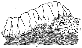
Before discussing the probable conditions under which the group of sedimentary deposits now described was formed, we may conveniently follow the upper conglomerate band of the Compass Hill, and note the variations in structure and composition which its outcrop presents.
This yellowish conglomerate can be traced along the cliffs for more than a mile, when it descends below the sea-level at the solitary stack of Bod an Stòl. A few hundred yards further west, what is probably the same band - 225 - appears again at the base of the precipice overlain by prismatic basalts. But the conglomerate, here only 12 feet thick, is made of much finer detritus which, largely composed of volcanic material, includes small well-rounded and polished pebbles of Torridon Sandstone. Beneath it lies a bed of dark shale, with remains of plants, resting immediately on a zeolitic amygdaloid which plunges into the sea. The chief interest of this locality is to be found in the shale which, instead of being at the top of the sedimentary group, lies at the bottom. I was informed by Mr. A. Thom that leaves had been obtained from this shale; but I was not successful in my search for them. The locality is only accessible by boat, and, as the coast is fully exposed to the Atlantic swell, landing at the place is usually difficult and often impossible.
About a mile and a half still further west, where a foreshore fronts the precipice of Earnagream at the Camas Tharbernish, a band of intercalated sedimentary material underlies the great escarpment of basalts and rests upon the slaggy sheet with the singular surface already referred to (p. 187). This band not improbably occupies the same platform as the upper conglomerate of Compass Hill. It is only about seven feet thick, the lower four feet consisting of a dull green pebbly tuff or ashy sandstone, with small rounded pieces of Torridon Sandstone, while the upper three feet are formed of dark shale with crowded but indistinct remains of plants. Here the more usual order in the sequence of deposition is restored. The shale is indurated and shattery, so that no slabs can be extracted without the use of quarrying tools.
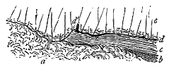
Rather less than half a mile towards the south, on the roadside at the gully of Cùl nam Marbh, the basalts enclose a sedimentary interstratification which not improbably lies on the same horizon as those just described along the northern shore. The relations of the rocks at this locality are shown in Fig. 270. A remarkable slaggy basalt (a) rises into a hummock, against which have been deposited some fine granular tuffs (b) whereof only a few inches are visible, that pass up into a thin band of dark shale (c), including a layer of pebbly ferruginous tuff, with small rounded pea-like pieces of basalt, basic pumice, bole, limonite, etc. At the top of this shale an irregular parting of coaly material (d) lies immediately under the slaggy base of the succeeding basalt (e). It will be observed that this upper lava cuts out the shale and thus comes to rest directly upon the lower sheet. At the point where it begins to descend it has caught up and enclosed a small tree-stump (d′) which stands upright on the coaly parting and shale. This stump, at the time of my visit, measured five inches in height by three inches in breadth; it had been thoroughly charred and was crumbling away on exposure, but among the pieces which I took from it sufficient trace of structure - 226 - can be detected with the microscope to show the tree to have been a conifer.
We have here another instance of the deposition of volcanic dust and fine mud in a pool that filled a hollow in the lava-field. Again we see that the closing act of sedimentation was the subsidence of vegetable matter in the pool, which was finally buried under another outflow of basalt.
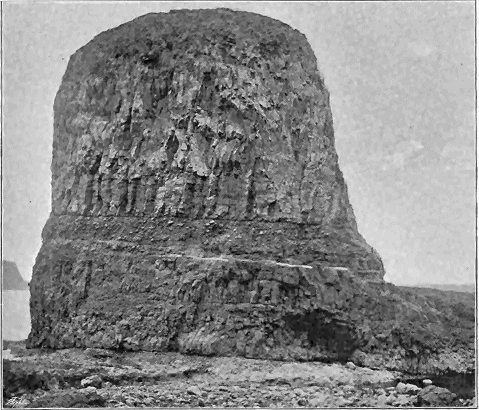
It is on the southern coast of the isle of Sanday that the higher intercalations of sedimentary material among the basalts are most instructively displayed. At the eastern end of this island, as already stated, the lowest and coarsest conglomerate is visible on a skerry immediately to the south of the headland Ceann an Eilein. It doubtless underlies the Sanday cliffs, but is not there visible, for the basalts descend below sea-level. These volcanic sheets have a slight inclination westward; hence in that direction we gradually pass into higher parts of the series. In the Creag nam Faoileann (Seamews' Crag) and the gully that cuts its eastern end, likewise in the two singularly picturesque stacks of Dùn Mòr and Dùn Beag (Big and Little Gull Rocks), which here rise from the foreshore, two distinct platforms of detrital - 227 - material may be noticed among the basalts. Both of these can be well seen on Dùn Mòr, about 100 feet high, which is represented in Fig. 271. The lower band, four or live feet thick, is here a rather coarse conglomerate which lies upon a sheet of scoriaceous basalt that extends up to the base of the Creag nam Faoileann. It is directly overlain by another basalt, about 30 feet thick, which dips seawards and forms a broad shelving platform, whereon the tides rise and fall. On this stack a second coarse conglomerate, about 10 feet thick, forms a conspicuous band about a third of the height from the bottom; it is composed mainly of well-rounded blocks of various lavas up to 18 inches or more in diameter, but it contains also pieces of Torridon Sandstone. It is covered by about 60 feet of basalt, which towards the base is somewhat regularly columnar, but passes upward into the wavy, starch-like, prismatic structure.
If now we trace these two intercalated zones of conglomerate along the shore, we find them both rapidly to change their characters and to disappear. The lower, though formed of coarse detritus under the Dùn Mòr, passes on the opposite cliff in a space of not more than 60 yards, into fine tuff and shale, about six feet thick, which become carbonaceous at the top where they are overlain by the next basalt. A hundred yards to the east, the band likewise consists of tuffs and ashy shales, which underlie the basalts on the Dùn Beag, and again show the usual coaly layers at the top. On the east side of the gully in the coast, about 160 yards to the north-east of Dùn Mòr, the same band is reduced to not more than three feet in thickness, consisting chiefly of fine conglomerate, wherein well water-worn pebbles of Torridon Sandstone and epidotic grit appear among the predominant volcanic detritus. This conglomerate is surmounted by a few inches of dark carbonaceous mudstone or shale. Rough slaggy basalts lie above and below the band.
The upper conglomerate dies out, both towards the east and the west, in the cliff opposite to Dùn Mòr, dwindling down at last to merely a few pebbles between the basalts. It lies in a kind of channel or hollow among these lavas. This depression, in an east and west direction, cannot be more than about 65 yards broad.
Probably still higher in the series of basalts is another intercalation of sedimentary layers which may be seen in the little bay to the east of Tallabric, rather more than a mile to the west of the Creag nam Faoileann. It rests upon a coarsely slaggy amygdaloid, and is from six to ten feet in thickness. The lower and larger part of the deposit consists of greenish pebbly sandstone and fine conglomerate, largely composed of basaltic detritus, but including abundant well-smoothed and polished pebbles of Torridon Sandstone, green grit, quartzite, etc. The stones vary from mere pea-like pebbles up to pieces two or three inches long, the largest being generally fragments of slag and amygdaloid which are less water-worn than the sandstones and other foreign ingredients. The uppermost two or three feet of the intercalation consist of dark carbonaceous mudstone or shale, made up in large measure of volcanic detritus, which may have been - 228 - derived partly from eruptions of fine dust, partly from subærial disintegration of the basalt-sheets. Some layers of these finer strata are full of remains of much macerated plants.
Other thin coaly intercalations have been observed among the basalts of Canna, some of which may possibly mark still higher horizons than those now described. But, confining our attention to the regular sequence of intercalations exposed along the Sanday coast, we find at least four distinct platforms of interstratified sediment among the plateau-basalts of this district. Each of these marks a longer or shorter interval in the outflow of lava, and points to the action of moving-water over the surface of the lava-fields.
We may now consider the probable conditions under which this intervention of aqueous action took place. The idea that the sea had anything to do with these conglomerates, sandstones, and shales may be summarily dismissed from consideration. The evidence that the basalt-eruptions took place on a terrestrial surface is entirely convincing, and geologists are now agreed upon this question.
Excluding marine action, we have to choose among forms of fresh water—between lakes on the one hand and rivers on the other. That the agency concerned in the transport and deposition of these strata was that of a river may be confidently concluded on the following grounds:—
1. The large size and rolled shape of the boulders in the conglomerates. To move blocks several tons in weight, and not only to move them but to wear them into more or less rounded forms, must have required the operation of strong currents of water. The coarse detritus intercalated among the basalts is quite comparable to the shingle of a modern river, which descends with rapidity and in ample volume from a range of hills.
2. The evidence that the materials of the conglomerates are not entirely local, but include a marked proportion of foreign stones. The proofs of transport are admirably exhibited by pieces of Torridon Sandstone, epidotic grit, quartzite, and other hard rocks none of which occur in situ except at some distance from Canna. These stones are often not merely rounded, but so well smoothed and polished as to show that they must have been rolled along for some considerable time in water.
3. The lenticular character and rapid lithological variations of the strata, both laterally and vertically. The coarse conglomerates die out as they are followed along their outcrop and pass into finer sediment. They seem to occur in irregular banks, which may not be more than 200 feet broad, like the shingle-banks of a river. The coarser sediment generally lies in the lower part of the sedimentary group. But cases may be observed, such as that shown in Fig. 269, where fine sediment, laid down upon the bottom conglomerate, has subsequently been overspread by another inroad of coarse shingle. Such alternations are not difficult to understand if they are looked upon as indicating the successive floods and quieter intervals of a river.
For these reasons I regard the platforms of sedimentary materials intercalated - 229 - among the basalts of Canna and Sanday as the successive flood-plains of a river which, like the rivers that traverse the lava-deserts of Iceland, flowed perhaps in many separate channels across the basalt-fields of the Inner Hebrides, and was liable to have its course shifted from time to time by fresh volcanic eruptions. That this river came from the east or north-east and had its source among the Western Highlands of Inverness-shire, may be inferred from the nature of the stones which it has carried for 30 miles or more along its bed. And that it crossed in its course the tract of Torridon Sandstone, of which a portion still remains in Rum, is manifest from the abundance of the fragments of that formation in the conglomerates.
With the remarkable exception of the section on Dùn Beag, to be immediately referred to, no trace of any eroded channel of this river through the lavas of the great volcanic plain has been preserved. Possibly frequent invasions of its bed by streams of basalt from different vents hindered it from remaining long enough in one course to erode anything like a gorge or canon. But, in any case, the main channel of the river probably lay rather to the east of the present islands of Canna and Sanday, on ground which is now covered by the sea. The banks or sheets of boulder-conglomerate undoubtedly show where its current swept with great force over the lava-plain, but the manner in which these coarser materials are so often covered with fine silt suggests that the sedimentary materials now visible were rather deposited on the low grounds over which the steam rushed in times of flood. Pools of water would often be left after such inundations, and in these depressions silt would gradually accumulate, partly carried in suspension by the river, partly washed in by rain, while drift-wood that found its way into these eddies, and leaves blown into them from the trees and shrubs of the surrounding country, would remain for some time afloat and would be the last of the detritus to sink to the bottom. Hence, no doubt, the carbonaceous character of the hardened silt in the upper part of each intercalation of sediment.
If we were to look upon the volcanic materials in the conglomerates as derived from the subærial disintegration of the fields of basalt, we should be compelled to admit a very large amount of erosion of the surface of the volcanic plain during the period when the river flowed over that tract. It would be necessary to suppose not only that there was a considerable rainfall, but that the differences of temperature, either from day to night, or from summer to winter, were so great as to split up the lavas at the surface, in order to provide the river with the blocks which it has rolled into rounded boulders. I do not think, however, that such a deduction would be sound. If we compare the materials that have filled up the large eruptive vent at the east end of Canna (to be afterwards described) with the great majority of the blocks in the coarse conglomerates, we cannot fail to note their strong resemblance. The abundance of lumps of slaggy lava in the river-shingle corresponds with their predominance in the agglomerate of the vent. The boulders of basalt, dolerite, and andesite which crowd the conglomerates - 230 - need not have been derived from the action of atmospheric waste on the lava-fields, but might quite well have been mainly supplied by the demolition of volcanic cones of fragmental materials.
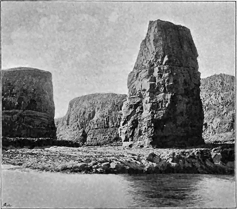
That such has really been the chief source of the blocks in the conglomerates I cannot doubt. At the east end of Canna we actually detect a volcanic cone, partly washed down and overlain by a pile of river-shingle. There were probably many such mounds of slag and stones along lines of fissure all over the lava-fields. The river in its winding course might come upon one cone after another, and during times of flood, or when its waters burst through any temporary barrier created by volcanic operations it would attack the slopes of loose material and sweep their detritus onward. At the same time, the current would carry forward its own natural burden of far-transported sediment, and hence on its flood-plains, buried and preserved under sheets of basalt, we find abundant pebbles of the old Highland rocks which it had borne across the whole breadth of the basaltic lowland.
But the destruction of volcanic cones was probably not the only source of the basaltic detritus in the conglomerates of Canna and Sanday. I have shown that these conglomerates pass laterally into tuffs, and are sometimes - 231 - underlain, sometimes overlain, with similar material. It is quite obvious that their deposition was contemporaneous with volcanic action in the immediate neighbourhood, and that at least part of their finer sediment was obtained directly from volcanic explosions. In wandering over the coast-sections of these coarse deposits, I have been impressed with the enormous size of many of the stones, their resemblance to the ejected blocks of the agglomerate, and the distinction that may sometimes be made with more or less clearness between their rather angular forms and the more rounded and somewhat water-worn aspect of the other boulders. It seems to me not improbable that some of the remarkably coarse masses of unstratified conglomerate in Canna Harbour consist largely of ejected blocks from the adjacent vent.
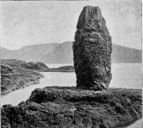
The only instance which I have observed of erosion of the basalt contemporaneous with the operations of the river that spread out this conglomerate is to be found in the striking stack of Dùn Beag already alluded to. - 232 -[251] This extraordinary monument of geological history forms an outlying obelisk which rises from the platform of the shore to a height of about 70 feet. Seen from the south-west, it appears to consist entirely of bedded basalt resting on some stratified tuff and shale which intervene between these lavas and that of the broad platform of basalt on which the obelisk stands. On that side it presents no essential difference from the structure of the Dùn Mòr to the west, save that the lower conglomerate of that outlier is here represented by fine sediment, and the upper conglomerate is wanting. The general aspect of this south-western front of the stack is shown in Fig. 272. If, however, we approach the rock from the coast-gully to the north, we form a very different impression of its structure. It then appears to consist chiefly of conglomerate with a capping of basalt on the top (Fig. 273). Not until a close scrutiny is made of the eastern and western faces of the column do the true structure and history of this singular piece of topography become apparent.
[251] This pinnacle of rock is referred to by Macculloch in his account of Canna, and is figured in Plate xix. Fig. 3 of his work already cited. But neither his description nor his drawing conveys any idea of the real structure of the rock.

On the eastern front, the section represented in Fig. 274 is exposed. At the bottom, forming the pediment of the column, lies a sheet of slaggy and vesicular or amygdaloidal basalt (a), which shelves gently in a south-westerly direction into the sea. The lowest band (b) in the structure of the stack is a thin group of lilac, brown, and green shale and volcanic mudstone or tuff, which encloses pieces of coniferous wood, and becomes markedly carbonaceous in its uppermost layers. Above these strata on the south - 233 - front comes the pile of bedded basalts (c) with their slaggy lower and upper surfaces. But as we follow them round the east side, we find them to be abruptly cut off by a mass of conglomerate (d). That the vertical junction-line is not a fault is speedily ascertained. The lower platform of slaggy basalt runs on unbroken under both shales and conglomerate. Moreover, the line of meeting of this conglomerate with the basalts that overlie the shales is not a clean-cut straight wall, but displays projections and recesses of the igneous rocks, round and into which the materials of the conglomerate have been deposited. The pebbles may be seen filling up little crevices, passing under overhanging ledges of the basalts, and sharply truncating lines of scoriaceous structure in these rocks. The same relations may be observed on the west front of the stack. There the ashy shales and tuffs are sharply cut out by the conglomerate, which wraps round and underlies a projecting cornice of the slaggy bottom of the basalt that rests on the stratified band (Fig. 275).
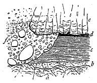
The conglomerate is rudely stratified horizontally, its bedding being best shown by occasional partings of greenish sandstone. It consists of well-rounded, polished, and water-worn stones, chiefly of members of the volcanic series—basalts, and dolerites, both compact and amygdaloidal or slaggy—but with a conspicuous admixture of Torridon Sandstone, gneiss, grey granite, grit and different schists. The coarsest part of the deposit lies toward the bottom where the volcanic blocks, some of them being six and eight feet in diameter, may have originally fallen from the basalts against which the conglomerate now reposes. The far-transported stones are also of considerable size, pieces of granite and gneiss frequently exceeding a foot in length. The well-rounded pebbles of foreign materials have been washed into the interstices between the large volcanic blocks.
It is, I think, tolerably clear that the wall of basalt against which this conglomerate has been laid down is one of erosion. The beds of basalt have here been trenched by some agent which has likewise scooped out the soft underlying shales, and even cut them away from under their protecting cover of basalt. There can be little hesitation in regarding this agent as a water-course, which for some considerable interval of time continued to dig its channel through the hard basalts. There is not room enough between the basalt-wall of Dùn Beag and the opposite cliffs of the shore (where no trace of this conglomerate is to be seen) for any large stream to have found its way. I do not therefore seek to identify this relic of an ancient waterway with the channel of the main river which deposited the conglomerate bands of Canna and Sanday. More probably it was either a mere torrential chasm, or a tributary stream draining a certain part of the volcanic plateau - 234 - and allowed to retain its channel long enough to be able to erode it to a depth of nearly 50 feet. Erosion had reached down through the underlying tuffs to the slaggy basalt below, but before it had made any progress in that sheet its operations were brought to an end at this locality by the floods that swept in the coarse shingle, and by the subsequent stream of basalt of which a mere outlying fragment now forms the upper third of the stack (e, Fig. 274).
That the ravine or gully of Dùn Beag probably lay within the reach of the floods of the main river, may be inferred from the number and size of the far-transported rocks in its conglomerate. It was filled up gradually, but the conditions of deposition remained little changed during the process, except that the largest blocks of rock were swept into the chasm in the earlier part of its history, while much smaller and more water-worn shingle were introduced towards the close.
Denudation, which has performed such marvels in the topography of the West of Scotland since older Tertiary time, has here obliterated every trace of this ancient gully, save the little fragment of one of the walls which survives in the stack of Dùn Beag. When in the course of centuries this picturesque obelisk shall have yielded to the action of the elements, the last leaflet of one of the most interesting chapters in the geological history of the Inner Hebrides will have been destroyed.
The question naturally arises—What was the subsequent history of the river which has left so many records of its floods entombed among the basalts of Canna and Sanday? In particular, can any connection be traced or plausibly conjectured between it and the river-bed preserved under the Scuir of Eigg? To this question I shall return after the evidence for the existence and date of the latter stream has been laid before the reader.
In the chain of the Inner Hebrides, broken as it is in outline and varied in its types of scenery, there is no object more striking than the island of Eigg. Though only about five miles long and from a mile and a half to three miles and a half broad, and nowhere reaching a height of so much as 1300 feet, this little island, from the singularity of one feature of its surface, forms a conspicuous and familiar landmark. Viewed in the simplest way, Eigg may be regarded as consisting of an isolated part of the basaltic plateau which, instead of forming a rolling tableland or a chain of hills with terraced sides, as in Antrim, Mull and Skye, has been so tilted that, while it caps a lofty cliff about 1000 feet above the waves at the north end, it slopes gently along the length of the island to the south end. In its southern half, however, the ground rises, owing to the preservation of an upper mass of lavas, which denudation has removed from the northern half. On this thicker part of the plateau stands the distinguishing feature of the island, the strange fantastic ridge of the Scuir, which, seen from the north or south, looks like a long steep hill-crest, ending in a sharp precipice on the east. Viewed from the east, this precipice is seen to be the end of a huge mountain-wall, which rises vertically above the basalt-plateau to a height of more than 350 feet. The accompanying map (Fig. 276) shows - 235 - that the ridge of the Scuir corresponds with the area occupied by a mass of pitchstone, and that while the basaltic rocks cover the whole of the rest of the southern half of the island, they gradually rise towards the north, successive members of the Jurassic series making their appearance until, at the cliffs of Dunan Thalasgair, the latter cover the greater part of the surface, and leave the volcanic rocks as a mere stripe capping the cliffs. In the section (Fig. 277) the general structure of the island is represented.
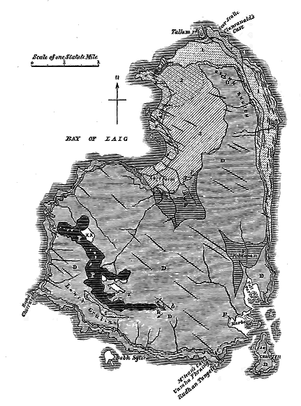
- 236 -
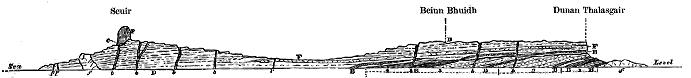
In Eigg the fragment of the basalt-plateau which has been preserved, rests unconformably on successive platforms of the Jurassic formations. Its component sheets of lava rise in cliffs around the greater part of the island. As they dip gently southwards their lower members are seen along the northern and eastern shores, while on the south-west side their higher portions are exposed in the lofty precipices which there plunge vertically into the sea. The total thickness of the volcanic series may here be about 1100 feet. The rocks consist of the usual types—black, fine-grained, columnar and amorphous basalts, more coarsely crystalline dolerites, dull earthy amygdaloids with red partings, and occasional thin bands of basalt-conglomerate or tuff. The individual beds range in thickness from 20 to 50 or 60 feet. Though they seem quite continuous when looked at from the sea, yet, on closer examination, they are found not unfrequently to die out, the place of one bed being taken by another, or even by more than one, in continuation of the same horizon. The only marked petrographical variety which occurs among them is a light-coloured band which stands out conspicuously among the darker ordinary sheets of the escarpment on the east side of the island. The microscopic characters of this rock show it to belong to the same series of highly felspathic, andesitic, or trachitic lavas as the "pale group" of Ben More, in Mull. It is strongly vesicular, and the cells are in some parts so flattened and elongated as to impart a kind of fissile texture to the rock. There can be no doubt that this band is a true lava, and that it was poured out during the accumulation of the basalt-plateau. It supplies an interesting example of the intercalation of a lighter and less basic lava among the ordinary heavy basic basalts and dolerites.
That feature of the island of Eigg which renders it so remarkable and conspicuous an object on the west coast is the long ridge of the Scuir. Rising gently from the valley which crosses the island from Laig Bay to the Harbour, the basaltic plateau ascends south-westwards in a succession of terraces, until along its upper part it forms a long crest, from 900 to 1000 feet above the sea, to which it descends on the other or south-west side, first by a sharp slope, and then by a range of precipices. Along the watershed of this crest runs, in a graceful double curve, the abrupt ridge of the Scuir, - 237 - terminating on the north-west at the edge of the great sea-cliff (975 feet), and ending off on the south-east in that strange well-known mountain-wall (1272 feet high) which rises in a sheer cliff nearly 300 feet above the basalt-plateau on the one side and more than 400 feet on the other (Fig. 278). The total length of the Scuir ridge is two miles and a quarter, its greatest breadth 1520, its least breadth 350 feet. Its surface is very irregular, rising into minor hills and sinking into rock-basins, of which nine are small tarns, besides still smaller pools, while six others, also filled with water, lie partly on the ridge and partly on the basaltic plateau. No one, indeed, who looks on the Scuir from below, and notes how evenly it rests upon the basalt-plateau, would be prepared for so rugged a landscape as that which meets his eye everywhere along the top of the ridge. Two minor arms project from the east side of the ridge; one of these forms the rounded hill called Beinn Tighe (968 feet), the other the hill of A chor Bheinn.
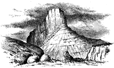
Singular as the Scuir of Eigg is, regarded merely as one of the landmarks of the Hebrides, its geological history is not less peculiar. The natural impression which arises in the mind when this mountain comes into view for the first time is, that the huge wall is part of a great dyke or intrusive mass which has been thrust through the older rocks.[252] It was not until after some time that the influence of this first impression passed off my own mind, and the true structure of the mass became apparent.
[252] Hay Cunningham remarks:—"In regard to the relations of the pitchstone-porphyry of the Scuir and the trap-rocks with which it is connected, it can, after a most careful examination around the whole mass, be confidently asserted that it exists as a great vein which has been erupted through the other Plutonic rocks—thus agreeing in age with all the other pitchstones of the island." Macculloch leaves us to infer that he regarded the rock of the Scuir to be regularly interstratified with the highest beds of the dolerite series (Western Isles, i. p. 522). Hugh Miller speaks of the Scuir of Eigg as "resting on the remains of a prostrate forest."—Cruise of the Betsy, p. 32.
The ridge of the Scuir, presenting as it does so strong a topographical - 238 - contrast to the green terraced slopes of the plateau-basalts on which it rests, consists of some very distinct bands of black and grey lava, long known as "pitchstone-porphyry." To the nature and history of these rocks I shall return after we have considered a remarkable bed of conglomerate which lies below them. On the lower or southern side of the ridge the bottom of the pitchstone, dipping into the hill, is exposed on the roof of a small cave where the ends of its columns form a polygonal reticulation. It is there seen to repose upon a bed of breccia or conglomerate, having a pale-yellow or grey felspathic matrix like the more decomposing parts of the grey devitrified parts of the pitchstone. Through this deposit are dispersed great numbers of angular and subangular pieces of pitchstone, some of which have a striped texture. Fragments of basalt, red (Torridon) sandstone, and other rocks are rare; and the bed suggests the idea that it is a kind of brecciated base or floor of the main pitchstone mass. A similar rock is found along the bottom of the pitchstone on both sides of the ridge (c, in Fig. 279). Here and there where this breccia is only a yard or two in thickness, it consists of subangular fragments of the various dolerites and basalts of the neighbourhood, together with pieces of red sandstone, quartzite, clay-slate, etc. The matrix is in some places a mass of hard basalt debris; in others it becomes more calcareous, passing into a sandstone or grit in which chips and angular or irregular-shaped pieces of coniferous wood are abundant.[253] A little further east, beyond the base of the Scuir, a patch of similar breccia is seen, but with the stones much more rounded and smoothed. This outlier rests against the denuded ends of the basalt-beds forming the side of the hill. Its interest arises from the evidence it affords of the prolongation of the deposit eastward, and consequently of the former extension of the precipice of the Scuir considerably beyond its present front.
[253] The microscopic structure of this wood was briefly described by Witham (Fossil Vegetables, p. 37), and two magnified representations were given to show its coniferous character. Lindley and Hutton further described it in their "Fossil Flora," naming it Pinites eiggensis, and regarding it as belonging to the Oolitic series of the Hebrides—an inference founded perhaps on the erroneous statement of Witham to that effect. William Nicol corrected that statement by showing that the wood-fragments occurred, not among the "lias rocks," but "among the debris of the pitchstone" (Edin. New Phil. Journal, xviii. p. 154). Hay Cunningham, in the paper already cited, states that the fossil wood really lies in the pitchstone itself! The actual position of the wood, however, in the breccia and conglomerates underlying the pitchstone is beyond all dispute. I have myself dug it out of the bed. The geological horizon assigned to this conifer, on account of its supposed occurrence among Oolitic rocks, being founded on error, no greater weight can be attached to the identification of the plant with an Oolitic species. Our knowledge of the specific varieties of the microscopic structure of ancient vegetation is hardly precise enough to warrant us in definitely fixing the horizon of a plant merely from the examination of the minute texture of a fragment of its wood. From the internal organization of the Eigg pine, there is no evidence that the fossil is of Jurassic age. From the position of the wood above the dolerites and underneath the pitchstone of the Scuir it is absolutely certain that the plant is not of Jurassic but of Tertiary date.
It is at the extreme north-western extremity of the pitchstone ridge, however, that the most remarkable exposure of this intercalated detrital band is now to be seen. Sweeping along the crest of the plateau the ridge reaches the edge of the great precipice of Bideann Boidheach, by which its - 239 - end is truncated, so as to lay open a section of the gravelly deposit along which the pitchstone flowed.
The accompanying diagram (Fig. 279) represents the natural section there exposed. Rising over each other in successive beds, with a hardly perceptible southerly dip of 2°, the sheets of basalt form a mural cliff about 700 feet high. The bedded character of these rocks and their alternations of compact, columnar, amorphous and amygdaloidal beds are here strikingly seen. They are traversed by veins and dykes of an exceedingly close-grained, sometimes almost flinty, basalt. But the conspicuous feature of the cliff is the hollow which has been worn out of these rocks, and which, after being partially filled with coarse conglomerate, has been buried under the huge pitchstone mass of the Scuir. The conglomerate consists of water-worn fragments, chiefly of dolerite and basalt, but with some also of the white Jurassic sandstones, imbedded in a compacted sand derived from the waste of the older volcanic rocks. The grey devitrified bands in the pitchstone, so conspicuous at the east end of the Scuir, here disappear and leave the conglomerate covered by one huge overlying mass of glassy pitchstone.
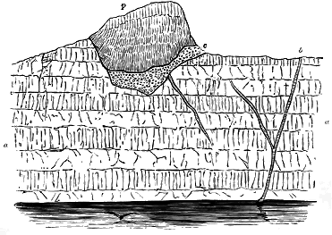
If any doubt could arise as to the origin of the mass of detritus exposed under the pitchstone at the east end of the Scuir it would be dispelled by the section at the west end, which shows with unmistakable clearness that the conglomerate is a fluviatile deposit and lies in the actual channel of the ancient river which was eroded out of the basalt plateau, and was subsequently sealed up by streams of pitchstone-lava.
An examination of the fragments of rock found in the conglomerate affords here, as in Canna and Sanday, some indication of the direction in which the river flowed. The occurrence of pieces of red sandstone, which - 240 - no one who knows West-Highland geology can fail to recognize as of Torridonian derivation, at once makes it clear that the higher grounds from which they were borne probably lay to the north or north-east. The fragments of white sandstone may also have been derived from the same quarter, for the thick Jurassic series of Eigg once extended further in that direction. The pieces of quartzite and clay-slate bear similar testimony to an eastern or north-eastern source. In short, there seems every probability that this old Tertiary river flowed through a forest-clad region, of which the red Torridon mountains of Ross-shire, the white sandstone cliffs of Raasay and Skye, and the quartzite and schist uplands of Western Inverness-shire are but fragments, that it passed over a wide and long tract of the volcanic plateau, and continued to flow long enough to be able to carve out for itself a channel on the surface of the basalt. Its course across what is now the island of Eigg took a somewhat north-westerly direction, probably guided by inequalities on the surface of the lava-plain. It is there marked by the winding ridge of the Scuir, the pitchstone of which flowed into the river-bed and sealed it up. Several minor spurs, which project from the eastern side of the main ridge, show the positions of small tributary rivulets that entered the principal channel from the slopes of the basaltic tableland. One of these, on the south-east side of the hill called Corven, must have been a gully in the basalt with a rapid or waterfall. The pitchstone has flowed into it, and some of the rounded pebbles that lay in the channel of this vanished brook may still be gathered where the degradation of the pitchstone has once more exposed them to the light. That the Eigg river here flowed in a westerly direction may be inferred from the angle at which the beds of the small tributaries meet the main stream, and also from the fact that the old river-bed at the east end of the Scuir is considerably higher than at the west end.
Several features in the geological structure of this locality serve to impress on the mind the great lapse of time represented by the erosion of the river-channel of Eigg. Thus at the narrowest point of the pitchstone ridge, near the little Loch a' Bhealaich, the bottom of the glassy lava is about 200 feet above its base on the south side, so that the valley cut out of the plateau-basalts must have been more than 200 feet deep. Even the little tributaries had cut ravines or cañons in the basalts before the ground was buried under the floods of pitchstone. In the most northerly spur of the ridge, for example, the hill of Beinn Tighe, which represents one of these tributaries, shows a considerable difference between the level of the bottom of the pitchstone on the east and west sides.
Again, all along the ridge of the Scuir, the basalt-dykes are abruptly cut off at the denuded surface on which the pitchstone rests. This feature is conspicuously displayed on the great sea-wall at the west end (Fig. 279). The truncation of the dykes demonstrates that a considerable mass of material must have been eroded before these lava-filled fissures could be laid bare at the surface. And the removal of this material shows that the denudation must have been continued for a long period of time.
- 241 -
The river-channel of Eigg, since it was eroded long after the cessation of the outflows of basalt in the plateau of Small Isles, must be much later in origin than those of Canna and Sanday which, as we have seen, were contemporaneous with the basalt-eruptions. But the river that excavated the channels and deposited the gravels may have been the same in both areas.
In dealing with this subject, though the evidence is admittedly scanty, we are not left wholly to conjecture. A consideration of the general topographical features of the wide region of the Inner Hebrides, from the beginning of the volcanic period onward, will convince us that, in spite of the effects of prolonged basalt-eruptions, the persistent flow of the drainage of the Western Highlands must have taken a westerly direction. It was towards the west that the low grounds lay. Though the long and broad valley which stretched northwards from Antrim, between the line of the Outer Hebrides and the West of Scotland, was gradually buried under a depth of two or three thousand feet of lava, the volcanic plain that overspread it probably remained even to the end lower than the mountainous Western Highlands. Hence the rivers, no matter how constantly they may have had their beds filled up and may have been driven into new channels, would nevertheless always seek their way westwards into the Atlantic.
On Canna and Sanday the traces of a river are preserved which poured its flood-waters across the lava-fields in that part of the volcanic region, while streams of basalt were still from time to time issuing from vents and fissures. Not more than fourteen miles to south-east stands the Scuir of Eigg, with its buried river-channel and its striking evidence that there, also, a river flowed westwards, but at a far later time, when the basalt-eruptions had ceased and the volcanic plain had been already deeply trenched by erosion, yet before the subterranean fires were finally quenched, as the pitchstone of the Scuir abundantly proves.
When one reflects upon the enormous denudation of this region, to which more special reference will be made in the sequel, one is not surprised that many connecting links should have been effaced. The astonishment rather arises that so continuous a story can still be deciphered. Even, however, had the original record been left complete, it would have been exceedingly difficult to trace the successive mutations of a river-channel during long ages of volcanic eruptions. Such a channel would have been concealed from view by each lava-stream that poured into it, and would not have been again exposed save by the very process of erosion that destroys while it reveals.
While, therefore, there is not and can never be any positive proof that in the fluviatile records of Canna, Sanday and Eigg successive phases are registered in the history of one single stream, I believe that this identity is highly probable. It was a river which seems to have risen among the mountains of Western Inverness-shire, and it had doubtless already taken its course to the sea before any volcanic eruptions began. It continued to flow westwards across the lava-floor that gradually spread over the plains. - 242 - Its channel was constantly being filled up by fresh streams of basalt or deflected by the uprise of new cinder-cones. But, fed by the Atlantic rains, it maintained its seaward flow until the general subsidence which carried so much of the volcanic plain below the sea. Yet the higher part of this ancient water-course is no doubt unsubmerged, still traversing the schists of the Western Highlands as it has done since older Tertiary time. It may, perhaps, be recognized in one of the glens which carry seaward the drainage of the districts of Morar, Arisaig, or Moidart.
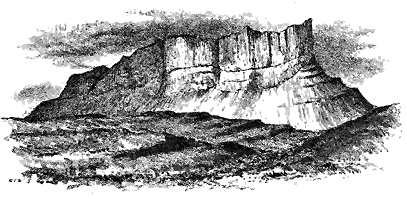
Let us now turn to the remarkable lava which has sealed up the river-channel of Eigg, and of which the remaining fragment stands up as the great ridge of the Scuir. This rock presents characters that strongly distinguish it from the surrounding basalts. It is not one single uniform mass, but consists of a number of distinct varieties, some of which are a volcanic glass, while others are a grey "porphyry," or devitrified pitchstone. These are arranged in somewhat irregular, but well-marked, and, in a general sense, horizontal sheets. On the great eastern terminal gable of the Scuir this bedded structure is not clearly displayed, for the cliff seems there to be built up of one homogeneous mass, save a markedly columnar band that runs obliquely up the base of the precipice (Fig. 278). If, however, the ridge is looked at from the south, the truly bedded character of its materials becomes a conspicuous feature. Along the cliffs on that side the two varieties of rock are strongly distinguished by their contrasting colour and mode of weathering, the sombre-hued pitchstone standing up in a huge precipice striped with columns, and barred horizontally with bands of the pale-grey "porphyry," which, from its greater proneness to decay, seems sunk into the face of the cliff. At the south-east end of the ridge the bedding is especially distinct. West of the precipices, to the south of the Loch a' Bhealaich, the dark pitchstone which forms the main mass is divided by two long parallel intercalations of grey rock, and two other short lenticular seams of the same material (see Figs. 280, 281). It is clear from these features, which are not seen by most travellers who pass - 243 - Eigg in the tourist-steamer that the Scuir is in no sense of the word a dyke.
But although the Scuir is thus a bedded mass, the bedding is far different from the regularity and parallelism of that which obtains among the bedded basalt-rocks below. Even where no intervening "porphyry" occurs, the pitchstone can be recognized as made up of many beds, each marked by the different angle at which its columns lie. And when the "porphyry" does occur and forms so striking a division in the pitchstone, its beds die out rapidly, appearing now on one horizon, now on another, along the face of the cliffs, and thickening and thinning abruptly in short distances along the line of the same bed. Perhaps the best place for examining these features is at the Bhealaich, the only gully practicable for ascent or descent, at the south-eastern face of the ridge.
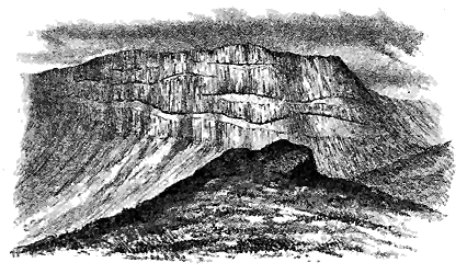
By much the larger part of the mass of the Scuir consists of vitreous material. As a rule this rock is columnar, the columns being much slimmer and shorter than those of the basalt-rocks. They rise sometimes vertically, and often obliquely, or project even horizontally from the face of the cliff. They are seldom quite straight, but have a wavy outline; and when grouped in knolls here and there along the top of the ridge they remind one of gigantic bunches of some of the Palæozoic corals, such as Lithostrotion. In other cases they slope out from a common centre, and show an arrangement not very unlike that of a Highland peat-stack.
The pitchstone of the Scuir differs considerably in petrographical character from other pitchstones of the island which occur in dykes and veins. Its base is of a velvet-black colour, and is so much less vitreous in aspect than ordinary pitchstone as to have been described by Jameson - 244 - and later writers as intermediate between pitchstone and basalt.[254] A chemical analysis of the rock by Mr. Barker North,[255] gave the following composition:—
| Silica | 65·81 |
| Alumina | 14·01 |
| Ferric oxide | 4·43 |
| Lime | 2·01 |
| Magnesia | 0·89 |
| Soda | 4·15 |
| Potash | 6·08 |
| Loss in ignition | 2·70 |
| 100·08 |
[254] Mineralogy of the Scottish Isles, vol. ii. p. 47. See also Macculloch, Western Isles, vol. i. p. 521, and Hay Cunningham, Mem. Wern. Soc. vol. viii. p. 155.
[255] Quart. Journ. Geol. Soc. vol. xlvi. (1890), p. 379.
The grey devitrified bands, which occur as a subordinate part of the mass of the Scuir ridge, are usually somewhat decomposed. Where a fresh fracture is obtained, the material shows a fine-grained, sometimes almost flinty, grey felsitic base, containing clear granules of quartz, and facets of glassy felspar. In some places the rock is strongly porphyritic. Examined under the microscope it presents a more thoroughly devitrified groundmass, with the minutest depolarizing microlites, large porphyritic crystals of plagioclase and sanidine, grains of augite, and sometimes exceedingly abundant particles of magnetite.[256]
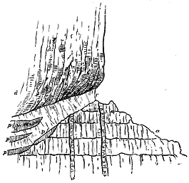
Although the line of separation between the grey dull felsitic sheets and the more ordinary glassy pitchstone is usually well defined, the two rocks may be observed to shade into each other in such a manner as to show that the lithoid material is only a devitrified and somewhat decomposed condition of the glassy rock. This connection is particularly to be observed under the precipice at the east end of the Scuir. At that locality the pitchstone is underlain by a very hard flinty band, varying in colour from white through various shades of flesh-colour and brown into black, containing a little free quartz and crystals of glassy felspar. Where it becomes black it passes into a rock like that of the main mass of the Scuir. Such vitreous parts - 245 - of the bed lie as kernels in the midst of the more lithoid and decomposed rock. The lower six feet of the "porphyry" are white and still more decomposed. The relations of this mass are represented in Fig. 282, where the basalt-rocks of the plateau (a) are shown to be cut through by basalt dykes (b b), and overlain by the "porphyry" (c) and the pitchstone (d). In the porphyry are shown several pitchstone kernels (p, p). It is deserving of remark also that in different parts of the Scuir, particularly along the north side, the bottom of the pitchstone beds passes into a dull grey earthy lithoid substance, like that now under description.
The bedded character of the rock of the Scuir and the well-marked lithological distinction between its several component sheets show the lava to have been the product of a number of separate outflows that found their way one after another into the river-valley, which was the lowest ground in the vicinity of the active vent. There can be little doubt, I think, that the lava flowed down the valley. Its successive streams are still inclined from east to west. The vent of eruption, therefore, ought to be looked for towards the east. Nowhere within the Tertiary volcanic region is there any boss of pitchstone or any mass the shape or size of which is suggestive of this vent. In the island of Eigg no boss of any kind exists, save those of granophyric porphyry to be afterwards referred to. But none of these affords any satisfactory links of connection with the rock of the Scuir. More probably the vent lay somewhere to the east on ground now overflowed by the sea. The pitchstone veins of Eigg may represent some of the subterranean extrusions from the same volcanic pipe, and if so, its site could not be far off.
The rock of the Scuir of Eigg has a special importance in the history of the volcanic plateaux. It is, so far as we know, the latest of all the superficial lavas of Britain.[257] From the basalts on which it rests it was separated by an enormous interval of time, during which these older lavas were traversed by dykes and were worn down into valleys. Its presence shows that long after the basalts of Small Isles had ceased to be erupted, a new outbreak of volcanic activity took place in this district, when lavas of a more acid composition flowed out at the surface. Whether this outburst was synchronous with the appearance of the great granophyric protrusions of the Inner Hebrides, or with the still later extravasation of pitchstone dykes, can only be surmised.
[257] The rocks of Beinn Hiant in Ardnamurchan have been claimed by Professor Judd as superficial lavas. For reasons to be afterwards given (p. 318) I regard them as intrusive sheets. Professor Cole believes the rhyolites and pitchstones of Tardree to be probably evidence of a volcano later than the basalts of Antrim. As I have not been able to detect any actual proofs of superficial outflow there, I relegate the description of the rocks to a future chapter, in which the acid protrusions will be discussed (p. 426).
When one scans the great precipice on the west side of Eigg, with its transverse section of the pitchstone-lava, buried river-bed and basalt-plateau underneath, there seems no chance of any further westward trace of the pitchstone being ever found. The truncated end of the Scuir looks from the top of the cliff out to sea, and the progress of denudation might - 246 - have been supposed to have effectually destroyed all evidence of the continuation of the rock in a westerly direction. Some years ago, however, my friend Prof. Heddle, while cruising among the Inner Hebrides, landed upon the little uninhabited islet of Hysgeir, which, some eighteen miles to the westward of Eigg, rises out of the open sea. He at once recognized the identity of the rock composing this islet with that of the Scuir, and in the year 1892 published a brief account of this interesting discovery.[258]
[258] Appendix C to A Vertebrate Fauna of Argyle and the Inner Hebrides, by Messrs. J. A. Harvie-Brown and Thomas E. Buckley, p. 248.
I have myself been able to land on Hysgeir in two successive summers, and can entirely confirm Prof. Heddle's identification. The islet stands on the eastern edge of the submarine ridge which, running in a north-easterly direction, culminates in the island of Canna. Hysgeir is a mere reef or skerry, of which the top rises only 38 feet above the Ordnance datum-level. Its surface is one of bare rock, save where a short but luxuriant growth of grasses has found root on the higher parts of two or three of its ridges, and on the old storm-beach of shingle which remains on the summit. The rock undulates in long low swells, that run in a general direction 20° to 45° west of north, and are separated by narrow channels or hollows. The place is a favourite haunt of gulls, terns, eider-ducks and grey seals, and is used by the proprietor of Canna for the occasional pasturage of sheep or cattle. So numerous are the sea-fowl during the breeding-season that the geologist, intent upon his own pursuits, may often tread on their nests unawares, while he is the centre of a restless circle of white wings and anxious cries.
The pitchstone of Hysgeir, like that of Eigg, is columnar, the columns being irregularly polygonal and varying from three to ten inches in diameter. They are packed so close together that the domes of rock on which their ends appear look like rounded masses of honeycomb. They may here and there be observed to be arranged radially with their ends at right angles to the curved exterior of the ridges, as if this external surface represented the original form of the cooled pitchstone, and were not due to mere denudation. There can be no doubt, however, that the island has been well ice-worn.
At the north-west promontory a beautiful example of fan-shaped grouping of columns may be observed on a face of rock which descends vertically into the sea. Here, too, is almost the only section on which the sides of the columns may be examined, for, as a rule, it is merely their ends on the rounded domes which are to be observed, and which everywhere slip under the waves. The columns in a cliff from 15 to 20 feet high show the slightly wavy, starch-like arrangement so often to be met with among the plateau-basalts.
The rock presents a tolerably uniform texture throughout, though in some parts it is blacker, more resinous, and less charged with porphyritic enclosures than in the general body of the rock. Large fresh felspars are generally scattered through it. To the naked eye it reproduces every feature of the pitchstone of the Scuir of Eigg.
A microscopic examination completes our recognition of the identity of - 247 - these two rocks. Mr. Harker has examined a thin slice prepared from the Hysgeir pitchstone, and remarks regarding it that "the large felspars are not the only porphyritic element. The microscope shows the presence also of smaller imperfect crystals of augite, very faint green in the slice, and small grains of magnetite. The felspars have been deeply corroded by the enveloping magma, and irregular included patches of the groundmass occupy nearly half the bulk of some of the crystals. This latter feature is seen especially in some of the larger crystals, which seem to be sanidine. They are, for the most part, apparently simple crystals, but in places there is a scarcely defined lamellar twinning, or, again, small patches not extinguishing with the rest; so that we are probably dealing with some perthitic intergrowth on a minute scale.[259]
[259] Comp. Prof. Judd's remarks on the Scuir of Eigg rock, Quart. Journ. Geol. Soc. vol. xlvi. (1890), p. 380.
"Rather smaller felspar-crystals are rounded by corrosion, but lack the inclusions of groundmass; these have albite-and sometimes pericline-lamellation, and may be referred to oligoclase-andesine. The groundmass of the rock is a brown glass with perlitic cracks, enclosing very numerous microlites of felspar about ·001 inch in length [6619]. The rock is probably to be regarded as a dacite rather than a rhyolite, and thus agrees with Mr. Barker North's analysis of the Eigg pitchstone."[260]
There is no trace of any conglomerate in situ like that under the Scuir of Eigg, nor of any other rock, aqueous or igneous. As the pitchstone everywhere slips under the sea, its geological relations are entirely concealed.
The great variety of materials met with in the form of boulders on the island is a testimony to the transport of erratics from the neighbouring islands and the mainland during the Glacial Period. The most abundant rock in these boulders is Torridon Sandstone, derived no doubt from the hills of Rum, but there occur also various kinds of schist, gneisses, quartzites, granites, porphyries, probably from the west of Inverness-shire, as well as pieces of white sandstone, probably Jurassic, which may have come from Eigg.
That the pitchstone of Hysgeir is a continuation of that of the Scuir may be regarded as highly probable. If not a continuation, it must be another stream of the same kind, and doubtless of the same date. If it be regarded as probably a westward prolongation of the Eigg rock, and if it be about as thick as that mass at the west end of the Scuir, then its bottom lies 200 or 300 feet under the waves. The river-channel occupied by the Eigg pitchstone undoubtedly sloped from east to west. The position of Hysgeir, 18 miles further west, may indicate a further fall in the same direction at the rate of perhaps as much as 35 feet in the mile.[261] Unfortunately, however, as no trace of the river-bed can now be seen on this island, any statement in regard to it must rest on mere conjecture.
[261] Rep. Brit. Assoc. 1894, p. 653.
Although the question of the denudation of the basalt-plateaux since - 248 - the close of the volcanic period will be the subject of a special chapter in a later part of this volume, I cannot here refrain from calling attention to the pitchstone of Eigg and Hysgeir as one of the most impressive monuments of denudation to be found within the British Isles. Though now so prominent an object in the West Highlands, this rock once occupied the bottom of a valley worn out of the basaltic tableland. Prolonged and stupendous denudation has destroyed the connection with its source, has cut down its ends into beetling precipices, has reduced the former surrounding hills into gentle slopes and undulating lowland, and has turned the bottom of the ancient valley into a long, narrow and high crest. Moreover, we see that the erosion has not been uniform. The great wall of the Scuir does not stand fairly on the crest of the basalt-plateau but on the south side of it, so that the southern half of the old valley, with all its surrounding hills, has been entirely cut away. That subsidence has also come into play in the destruction of even the youngest parts of the volcanic plateaux will be more fully discussed in a later chapter. I need only remark here that the submergence of Hysgeir probably points to extensive depression of the land-surface on which the lavas were poured out.
- 249 -
This largest and geologically most important of all the Scottish plateaux comprises the island of Skye, at least as far south as Loch Eishort, and the southern half of Raasay, but is shown by its sills to stretch as far as the Shiant Isles on the north, and the Point of Sleat on the south (see Map VI.). It may be reckoned to embrace an area of not less than 800 square miles. The evidence that its limits, like those of the other plateaux, are now greatly less than they originally were, is abundant and impressive. The truncated edges of its basalts, rising here and there for a thousand feet as a great sea-wall above the breakers at their base, and presenting everywhere their succession of level or gently inclined bars, are among the most impressive monuments of denudation in this country. But still more striking to the geologist is the proof, furnished beyond the margins of the plateau, that the Jurassic and other older rocks there visible were originally buried deep under the basalt-sheets, which have thus been entirely stripped off that part of the country.
Throughout most of the district, wherever the base of the basalts can be seen, it is found to rest upon some member of the Jurassic series, but with a complete unconformability. The underlying sedimentary strata had been dislocated and extensively denuded before the volcanic period began. On the southern margin, however, the red (Torridon) sandstones emerge from under the basalts of Loch Scavaig, and extending into the island of Soay are prolonged under the sea into Rum. This ridge probably represents the range of the ancient high ground of the latter island already referred to.
Nowhere are the distinctive topographical features and geological structure of the basalt-plateaux better displayed than in the northern half of the island of Skye. The green terraced slopes, with their parallel bands of brown rock formed by the outcrop of the nearly flat basalt-beds, rise from the bottoms of the valleys into flat-topped ridges and truncated cones (Fig. 283). The hills everywhere present a curiously tabular form that bears witness to the horizontal sheets of rock of which they are composed.[262] And - 250 - along the sea-precipices, each excessive sheet of basalt can be counted from base to summit, and followed from promontory to promontory (Figs. 284, 286). In the district of Trotternish, the basalt hills reach a height of 2360 feet. Further west, the singular flat-topped eminences, called "Macleod's Tables" (Fig. 283) ascend to 1600 feet.
[262] These features are more fully described in my Scenery of Scotland, 2nd edit (1887), pp. 74, 145, 216.
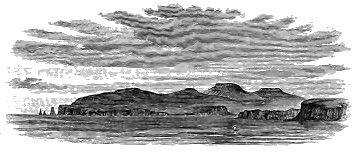
Along the western side of Skye, the basalts descend beneath the level of the Atlantic, save at Eist in Duirinish, where the Secondary strata, with their belt of intrusive sills, rise from underneath them, and at the Sound of Soa, where they rest on the Torridon Sandstone. Along the eastern side, their base runs on the top of the great Jurassic escarpment, whose white and yellow sandstones rise there, and on the east side of Raasay, into long lines of pale cliffs. To the south-east, the regularity of the volcanic plateau is effaced, as in Mull and Ardnamurchan, by the protrusion of extensive masses of eruptive rocks constituting the Cuillin and Red Hills, east of which the basalts have been almost entirely removed by denudation, so as to expose the older rocks which they once covered, and through which the younger eruptive bosses made their way. This is undoubtedly the most instructive district for the study of that late phase in the volcanic history of Britain comprised in the eruptive bosses of basic and acid rocks.
The magnificent plateau of this island has been so profoundly cut down into glens and arms of the sea, and its component layers are exposed along so many leagues of precipice, that its structure is perhaps more completely laid open than that of any of the other Tertiary volcanic areas in Britain. It is built up of a succession of basalts and dolerites of the usual types, which still reach a thickness of more than 2000 feet, though in this instance, also, denudation has left only a portion of them, without any evidence by which to reckon what their total original depth may have been. In rambling over Skye, the geologist is more than ever struck with the remarkable scarcity and insignificance of the interstratifications of tuff or of any other kind of sedimentary deposit between the successive lava-sheets. One of the thickest accumulations of volcanic tuff and conglomerate has already been referred to as occurring on the south side of Portree Harbour, where it attains a depth of about 200 feet. As it is in immediate connection with its parent vent, it will be more fully alluded to in Chapter xli. Here, as is so generally observable among the basalt-plateaux, traces of - 251 - vegetation are plentiful among the stratified intercalations, even forming thin seams of lignite and coal, one of which was formerly worked. That volcanic eruptions, though possibly of a feebler kind, continued during the interval between the basalt-outflows at this locality, is shown by the thick accumulation of tuff and by the occurrence of abundant lapilli of fine basic pumice among the shales, even to a distance of several miles from the vent.
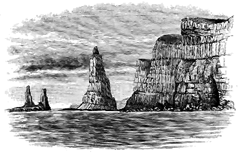
Another conspicuous intercalation of sedimentary materials in the Skye plateau occurs on the Talisker cliffs at the mouth of Loch Bracadale, where, on the face of the great precipice of Rudha nan Clach, some conspicuous bands of lilac and red are interspersed among the basalts. These bands were noticed by Macculloch, who described them as varieties of "iron-clay."[263] I have not had an opportunity of examining them except from the sea at a little distance. But they suggest a similarity to some of the variegated clays between the upper and lower basalt series of Antrim.
[263] Western Islands, vol. i. p. 376.

Though good coal is not well developed in the Tertiary volcanic plateaux of the British Isles, it has already been pointed out that coaly layers are abundant, and that as the vegetable matter may confidently be assumed always to indicate terrestrial vegetation, the presence of the carbonaceous bands may be regarded as good evidence of some lapse of time between the eruption of the basalts which they separate. I have also called attention to the fact that the vegetable material is more especially observable in the highest parts of a group of intercalated sediments between two sheets of basalt. This relation, so strikingly exhibited in the isle of Canna, as already observed, is also to be remarked in the Skye plateau. I may here cite an interesting example which occurs at the base of the lofty sea-cliff of An Ceannaich, to the south of Dunvegan Head, on the west coast of Skye (Fig. 285). At the base of the precipice, ledges of a highly cellular basalt (a) show a singularly scoriaceous and amygdaloidal structure, with - 252 - abundant and beautiful zeolites, the hollows of the upper surface of the sheet being filled in with dark brown carbonaceous shale, forming a layer from one to fourteen inches thick, marked by coaly streaks and lenticles (b). A band of green and yellow sandstone (c) next supervenes, which, from its pale colour, attracts attention from a distance, and led me, while yachting along the coast, to land at the locality in the hope that it might prove to be a plant-bearing limestone. This sandy stratum is only some three or four inches thick at the north end of the section, but increases rapidly southward to a thickness of as many feet or more, when, owing to the cessation of the underlying shale, it comes to lie directly on the amygdaloid and to enclose slaggy portions of that rock. Immediately above the sandstone two or three feet of fissile shale, black with plant-remains (d), include brown layers that yield to the knife like some oil-shales. The next stratum is a seam of coal (e) about a foot thick, of remarkable purity. It is glossy, hard, and cubical, including layers that break like jet. It has been succeeded by a deposit of green sand (f), but while this material was in course of deposition another outpouring of lava (g) took place, whereby the terrestrial pool or hollow of the lava-field, in which the group of sedimentary materials accumulated, was filled up and buried. This lava is about 20 feet thick, and consists of a coarsely-crystalline, jointed dolerite with highly amygdaloidal upper and under surface. Its slaggy bottom has caught up or pushed aside the layer of green sand, so as to lie directly on the coal, and has there been converted into the earthy modification so familiar under the name of "white trap" among our coal-fields. It is interesting to find that this kind of alteration, where molten rock comes in contact with carbonaceous materials, is not confined to subterranean sills, but may show itself in lavas that have flowed over a terrestrial surface.
From the frequent intercalation of such local deposits of sedimentary material between the basalts, we may reasonably infer that during older Tertiary time the rainfall in North-Western Europe was copious enough to supply many little lakes and streams of water. As the surface of the lava-fields decayed into soil, vegetation spread over it, so that, perhaps for long intervals, some tracts remained green and forest-clad. But volcanic action still continued to show itself, now from one vent, now from another. These wooded tracts were buried under overflows of lava, and, the water-courses being filled up, their streams were driven into new channels, and other pools and lakes were formed.
- 253 -
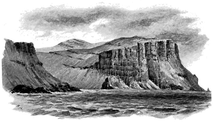
In no part of the Tertiary volcanic area of Britain can the characters of the lavas and the structure of the plateaux be better seen than along the west side of Skye, north of Loch Bracadale. The precipices rise sheer out of the sea, to heights of sometimes 1000 feet, and from base to summit every individual bed may be counted. Some particulars have already been given (p. 192) regarding the average thickness of the basalt-sheets on this coast-line. The general aspect of these cliffs and the arrangement of their - 254 - component lavas is shown in Fig. 286. As a further detailed illustration of the general succession of the basalts in the Skye plateau, I give a diagrammatic view of the largest of Macleod's Maidens—the three weird sea-stalks that rise so grandly in front of the storm-swept precipice at the mouth of Loch Bracadale. The height of the stack must be at least 150 feet (Figs. 284 and 287). About ten distinct sheets of igneous rock can be counted in it, which gives an average thickness of 15 feet for the individual beds. It will be observed that there is a kind of alternation between the compact, prismatic basalts and the more earthy amygdaloids, but that the former are generally thickest.[264]
[264] A striking and illustrative contrast between the relative thickness of the beds of the two kinds of rock is supplied by the fine sections of this district. The amygdaloids range from perhaps 6 or 8 to 25 or 30 feet; but the prismatic basalts, while never so thin as the others, sometimes enormously exceed them in bulk. In the island of Wiay, for example, a bed of compact black basalt, with the confused starch-like grouping of columns, reaches a thickness of no less than 170 feet. Its bottom rests upon a red parting on the top of a dull greenish earthy amygdaloid. It is possible, however, that some of these columnar sheets of basalt are really sills.
These features, which are repeated on cliff after cliff, may be considered typical for all the plateaux. Another characteristic point, well displayed here, is the intervening red parting between the successive beds. If the occurrence and thickness of this layer could be assumed - 255 - as an indication of the relative lapse of time between the different flows of lava, it would furnish us with a rude kind of chronometer for estimating the proportionate duration of the intervals between the eruptions. It is to be noticed on the top both of the compact prismatic and of the earthy amygdaloidal sheets; but it is more frequent and generally thicker on the latter than on the former, which may only mean that the surfaces of the cellular lavas were more prone to subærial decay than those of the compact varieties. Nevertheless, I am disposed to attach some value to it, as an index of time. In the present instance, for example, it seems to me probable that the lavas in the lower half of Macleod's Maiden, where the red layers are very prominent, were poured out at longer intervals than those that form the upper half. The remarkable banded arrangement of the vesicles in one of the cellular lavas of this sea-stack has been already referred to (p. 191).
Another characteristic plateau-feature is admirably displayed in Skye—the flatness of the basalts and the continuity of their level terraces (though not of individual sheets) from cliff to cliff and hillside to hillside. This feature may be followed with almost tiresome monotony over the whole of the island, north of a line drawn from Loch Brittle to Loch Sligachan. Throughout that wide region, the regularity of the basalt-plateau is unbroken, except by minor protrusions of eruptive rock, which, as far as I have noticed, do not seriously affect the topography. But south of the line just indicated, the plateau undergoes the same remarkable change as in Rum, Ardnamurchan and Mull. Portions of it which have survived indicate with sufficient clearness that it once spread southwards and eastwards over the mountainous district, and even farther south into the low parts of the island. Its removal from that tract has been of the utmost value to geological research, for some of the subterranean aspects of volcanism have thereby been revealed, which would otherwise have remained buried under the thick cover of basalt. Denudation has likewise cut deeply into the eruptive bosses, and has carved out of them the groups of the Red Hills and the Cuillins, to whose picturesque forms Skye owes so much of its charm.
In this, as in each of the other plateaux, there is no trace of any thickening of the basalts towards a supposed central vent of eruption. The nearly level sheets may be followed up to the very edge of the great mountainous tract of eruptive rocks, retaining all the way their usual characters; they do not become thicker there either collectively or individually, nor are they more abundantly interstratified with tuffs or volcanic conglomerates. On the contrary, their very base is exposed around the mountain ground, and the thickest interstratifications of fragmentary materials are found at a distance from that area. So far as regards the structure of the remaining part of the plateau, the eruption of the gabbros and granitoid rocks might apparently have taken place as well anywhere further north.
- 256 -
[265] For references to the recent geological literature connected with these islands see the footnote ante, p. 191.
Though these islands lie beyond the limits of the region embraced by the present work, I wish to cite them for the singular confirmation and extension they afford to observations made among British Tertiary volcanic rocks. Over a united extent of coast-cliffs which may be roughly estimated at about 500 English miles, the nearly level sheets of basalts, with their occasional tuffs, conglomerates, leaf-beds and coals, can be followed with singular clearness. Although the Faroe Islands have been so frequently visited and so often described that their general structure is sufficiently well known, they present in their details such a mass of new material for the illustration of volcanic action that they deserve a far more minute and patient survey than they have yet received. They cannot be adequately mapped and understood by the traveller who merely sails round them. They must be laboriously explored, island by island and cliff by cliff.
While I cannot pretend to more than a mere general acquaintance with their structure, I have learnt by experience that one may sail near their precipices and yet miss some essential features of their volcanic structure. In the summer of the year 1894 I passed close to the noble range of precipices on the west side of Stromö, at the mouth of the Vaagöfjord, and sketched the sill which forms so striking a part of the geology of that district (Figs. 312, 328 and 329). But I failed to observe a much more remarkable and interesting feature at the base of the same sea-cliffs. The following summer, probably under better conditions of light, I was fortunate enough to detect with my field-glass, from the deck of the yacht, what looked like a mass of agglomerate, and found on closer examination the interesting group of volcanic vents described in Chapter xli. The magnificent precipices of Faroe, which in Myling Head reach a height of 2260 feet, present a series of natural sections altogether without a rival in the rest of Europe. They are less concealed with verdure than those of Mull and Skye, and therefore display their geological details with even greater clearness than can be found either in Scotland or in Ireland. I would especially refer to the bare precipitous sides of the long narrow islands of Kalsö and Kunö, as admirable sections wherein the characters of the plateau-basalts are revealed as in a series of gigantic diagrams. The scarcity of vegetation, and the steepness of the declivities which prevents the abundant accumulation of screes of detritus, enable the observer to trace individual beds of basalt with the eye for several miles. Thus on the west side of Kunö, one conspicuous dark sheet in the lower part of the section can be followed from opposite Mygledahl in Kalsö to the southern end of the island. There is one concealed space at the mouth of the corrie behind Kunö village, but the same, or at least a similar band of rock at the same level, emerges from the detritus on the further side, and may possibly run into the opposite - 257 - promontory of Bodö. It extends in Kunö for at least six geographical miles.
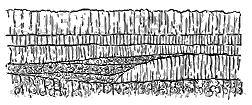
These vast escarpments of naked rock show, with even greater clearness than the precipices of the Inner Hebrides, how frequently the basalts die out, now in one direction now in another. The two sides of the Kalsöfjord exhibit many examples of this structure, and some striking instances of it are to be seen on the west side of Haraldsfjord. In these cliffs, which must be about 2000 feet high, upwards of forty distinct flows can sometimes be traced from the sea-level to the crest. The average thickness of each bed is thus somewhat less than 50 feet. Such vast escarpments, with wide semicircular corries scooped out of their sides, such serrated crests and dark rifts in the precipices, such deep fjords winding through nearly horizontal basalts, of which the parallel sheets can be followed by the eye from island to island, fill the mind with a vivid conception at once of the enormous scale of the volcanic eruptions and of the stupendous denudation which this portion of North-Western Europe has undergone since Tertiary time.
As the lenticular character of the basalts, and the evidence they supply of having been discharged from many small local vents are of great importance in the comprehension of the volcanic history of the plateaux, some further illustrations of these features may with advantage be given here. Thus the traveller who skirts the western precipices of Suderö will notice some good examples to the north of the highest part of the cliffs. On Stromö he will detect other cases of the same structure. Similar features will arrest his attention on the precipices of Sandö, where, though at first sight the basalts seem to be regular and continuous, a nearer view of them reveals such sections as that shown in Fig. 288, where a group of sheets rapidly dies out towards the north against a thicker band that thins away in the opposite direction. Further north he will come upon other examples in the range of low cliffs between Kirkebonaes and Thorshaven, and more impressive still in the rugged precipices that front the Atlantic on the western front of Hestö (Fig. 289), where the disappearance is in a northerly direction.
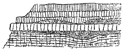
But it is in the northern part of the Faroes, where the basalt-plateau has been so deeply trenched by parallel fjords as to be broken up into a group of long, narrow, lofty, and precipitous insular ridges, that the really local and non-persistent character of the lavas can best be seen. The eastern cliffs of Svinö present admirable examples, where in the - 258 - same vertical wall of rock some of the basalts die out to the south, others to the north, while occasionally a shorter sheet may be seen to disappear in both directions as if it were the end of a stream that flowed at right angles to the others (Fig. 290).
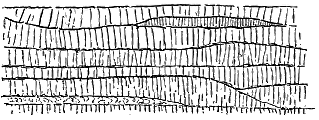
The more the basalt-plateaux of Britain and the Faroe Islands are studied, the more certain does the conclusion become that these widespread sheets of lava never flowed from a few large central volcanoes of the type of Etna or Vesuvius, but were emitted from innumerable minor vents or from open fissures. In a later chapter an account will be given of the vents, which may still be seen under the overlying sheets of basalt, and, in particular, a remarkable group in the Faroe Islands will be described.
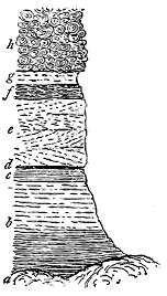
The occurrence of tuffs, leaf-beds and thin coals between the plateau-basalts of the Faroe Islands has long been known. These stratified deposits are well seen in the island of Suderö, where they serve to divide two distinct series of basalts, like the iron-ore and its accompaniments in Antrim. As a characteristic illustration of the same diversity of deposits observable between the lava-sheets of the basalt-plateaux of the British Isles I give here a section exposed on the east side of this island—a locality often visited and described in connexion with its coal-seams (Fig. 291). At the base lies a sheet of basalt (a) with an irregularly lumpy upper surface. It may be remarked that the lower group of basalts is marked by the occurrence of numerous columnar sheets, some of them possibly sills, and also more massive, solid, and durable basalts than the sheets above. The lowest of the intercalated sediments are light-coloured clays, passing down into dark nodular mudstone and dark shale, the whole having a thickness of at least 20 feet (b). These strata are succeeded by (c) pale clays with black plant-remains, about three feet thick. Immediately above this band comes the coal or coaly layer (d), here about six inches thick, which improves in thickness and quality further inland, where it has been occasionally worked for economic purposes. A deposit of green and brown volcanic mudstone (e), twelve feet in thickness, overlies the coal and passes under a well-bedded granular green tuff and mudstone three feet thick (f). The uppermost band is another volcanic mudstone (g) four feet in - 259 - thickness, dark green in colour, and more or less distinctly stratified, with irregular concretions, and also pieces of wood. Above this layer comes another thick overlying group of basalts (h) distinguished by their abundantly amygdaloidal character, and by their weathering into globular forms which at a little distance give them a resemblance to agglomerates.
We have here an intercalated group of strata upwards of 40 feet thick, consisting partly of tuffs and partly of fine clays, which may either have been derived from volcanic explosions or from the atmospheric disintegration of basaltic lavas. Through some of these strata abundant carbonaceous streaks and other traces of plants are distributed, while among them lies a band almost wholly composed of compressed vegetation. Unfortunately none of the strata at this locality seem to have preserved the plant-remains with sufficient definiteness for identification. There can be no doubt, however, that they were terrestrial forms like those of Mull and Antrim.
This coal, with its accompanying sedimentary deposits, has been traced through Suderö, and another outcrop, possibly of the same horizon, occurs on Myggenaes, the extreme western member of the group of islands, at a distance of some 40 miles.[266]
[266] See in particular Prof. J. Geikie, Trans. Roy. Soc. Edin. vol. xxx. (1880), p. 229.
- 260 -
From the facts stated in the foregoing chapters concerning the structure of the basalt-plateaux of North-Western Europe, it is evident that in none of these areas have the eruptions come from one great central volcano like Etna or Vesuvius. On the contrary, in every instance there is abundant evidence that the basalt has flowed from many scattered points of eruption. The uniformity of the lava-sheets in petrographical characters, their continuity when viewed in mass, their general horizontality, and their constant thinning away in different directions, show that the eruptive vents must have been distributed over the whole plateau-areas.
The conditions under which such eruptions took place can be most readily understood by a comparison of the phenomena with those observable in modern volcanic tracts where extensive outflows of lava have taken place without the existence of any great central cones. Of these regions the most instructive is undoubtedly to be found among the recent lava-deserts of Iceland. There the parallels to the structures described from the British and Faroe plateaux are so numerous and so close that an account of the Icelandic region may appropriately be inserted here.
The evidence furnished by Iceland is of special value in our present enquiry, inasmuch as that island, besides its modern eruptions, includes vast basaltic plateaux of Tertiary age. These areas of nearly level sheets of basalt belong to the same geological period as those of the British and Faroe Islands, and display the same internal structure and external features. But they have this distinguishing peculiarity that the volcanic fires beneath them are not yet extinguished. They have been broken through again and again in recent times by volcanic eruptions which have repeated many of the characteristics of their Tertiary predecessors. The old and the new development of the same volcanic type are thus visible side by side.
The Tertiary volcanic series of Iceland reaches a thickness of upwards of 3000 metres, or nearly 10,000 English feet, but as its base is nowhere seen, it may be still thicker. Its successive sheets, piled over each other in parallel layers, form terraced hills and bold escarpments along the coast, whence they slope gently inland. The plateau, as in the Faroe Islands and in Scotland, - 261 - has been extensively eroded, and has been trenched by many long valleys and fjords The composition of the basalts remains remarkably uniform over the island. The lava sheets are often decomposing, amygdaloidal, and filled with zeolites; while higher in the series compact basalts abound, the uppermost fine-grained sheets being especially constant in structure and composition. Numerous dykes traverse the plateau, and some of them cut even its highest members. The parallel with the geological structure of the Inner Hebrides is continued in Iceland by the appearance of intrusive masses of gabbro and granophyre, which represent the deeper parts of the Tertiary volcanic series, while the basalts were poured out at the surface. Thus, at Papafjord, the gabbro rises into mountainous peaks and, like the similar rock in Mull and Skye, is intersected by dykes of a coarse-grained granitoid liparite or granophyre. Large dykes and ramifying veins of the same acid material, often with a thoroughly granitic aspect, extend into the basalts.[267]
[267] Mr. Thoroddsen, Dansk. Geografisk Tidsskrift, vol. xiii.
A long series of eruptions has taken place in Iceland since the Glacial Period. There were likewise pre-glacial eruptions. The glaciated lava-streams are found underneath the modern lavas. So far indeed as is known, no evidence exists of any important cessation of subterranean activity there since Tertiary time.[268] The existing volcanic phenomena may with probability be regarded as the survival of those which were so widely manifested over the Icelandic area and the north-west of Europe in the older Tertiary ages. A careful study of them may therefore be expected to throw light on the history of the Tertiary basaltic plateaux; while, on the other hand, the thorough dissection of these plateaux by the denuding agencies will not improbably be found to explain some parts of the subterranean mechanism of the modern Icelandic volcanoes.
[268] See Dr. Johnston-Lavis, Scottish Geographical Magazine, 1895, p. 442.
In calling attention to some of the more obvious analogies which may be traced between the modern and the ancient volcanoes, I am more particularly indebted to the excellent memoirs of the resident Icelandic geologist, Mr. Th. Thoroddsen, who has examined so large a part of the island.[269] The account given by Mr. A. Holland of the Laki craters has likewise been of much service to me.[270] Among other recent observers I may cite Dr. Tempest Anderson,[271] who has made himself familiar with extensive tracts of Iceland. He was accompanied one year by Dr. Johnston-Lavis, who has published a narrative of the journey.[272]
[269] See In particular his paper on the volcanoes of north-east Iceland (Bihang till. k. Svensk. Vet. Akad. Handl. xiv. ii. No. 5, 1888) and that on Snaefell and Faxebugt in the south-west of the island (op. cit. xvii. ii. No. 2, 1891); also papers in Dansk. Geografisk Tidsskrift, vols. xii. xiii. (1893-95); Verhand. Gesellsch. Erdkunde zu Berlin, 1894-95.
[270] "Lakis Kratere og Lavaströmme, Universitætsprogram," Christiania, 1885. See Mr. Thoroddsen's remarks on this paper, Verhand. Gesell. Erdkunde, 1894, p. 289.
[271] Brit. Assoc. Rep. 1894, p. 650.
[272] Dr. Johnston-Lavis, Scottish Geographical Magazine, September 1895.
It is a mistake to suppose that the Icelandic volcanoes are generally built on the plan of such mountains as Vesuvius or Etna. Mr. Thoroddsen can evidently hardly repress his impatience to find these two Italian cones - 262 - cited in almost every handbook of geology as types of modern volcanoes and their operations. The regular volcanic cone, composed of alternations of lavas and tuffs, plays a very subordinate part in Iceland.
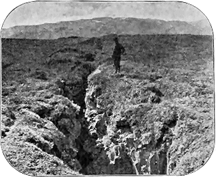
The fundamental feature in the Icelandic eruptions is the production of fissures which reach the surface and discharge streams of lava from many points. Two systems of such fissures appear to be specially marked, one in southern Iceland running from south-west to north-east, the other, in the north part of the island, stretching from south to north.[273] Hekla and Laki belong to the former. The dislocations have often followed the boundaries of the "horsts," or solid blocks of country which have withstood terrestrial displacement. The vast outbreaks of Odádahraun and Myvatn have almost all issued from fissures of that nature.
[273] In the Snaefell promontory they run nearly east and west. Mr. Thoroddsen, Bihang. Svensk. Akad. xvii. (ii.) No. 2, p. 91.
The violent eruption of 1875 in Askja found its exit at the intersection of two lines of fissures. Many large fissures were opened on the surface in a nearly north and south direction, which could be followed for 80 kilometres or nearly 50 English miles. Some of them became the theatre of intense volcanic activity.[274]
[274] Mr. Thoroddsen, op. cit. xiv. ii. No. 5, p. 63.
Many lines of fissure are traceable at the surface as clefts or "gjás," that run nearly straight for long distances, with a width of one to three yards, and sometimes of unknown depth.[275] The most stupendous example of the structure yet discovered is probably the Eldgjá found by Dr. Thoroddsen in the year 1893, below the Mýrdalsjökull. This gigantic chasm has a length - 263 - of 30 kilometres (more than 18 English miles), and a depth of 130 to 200 metres (426 to 656 feet). Over its vertical walls lofty waterfalls plunge from the crest to the bottom.
[275] On the various modes of origin of these chasms, see Dr. Tempest Anderson, Brit. Assoc. Rep. p. 650. The gjá shown in Fig. 292 is not an eruptive fissure. For this and the following illustration I am indebted to the kindness of Dr. Tempest Anderson, who himself photographed the scenes.
Occasionally a fissure has not been continuously opened to the surface. An interesting example of such intermittent chasms is supplied by the great rent which gave forth the enormous volume of lava in 1783. The mountain of Laki, composed of palagonite tuff, stands on the line of this dislocation, but has not been entirely ruptured. The fissure has closed up beneath the mountain, a short distance above the bottom of the slope, as is shown by the position of a couple of small craters.[276]
Some fissures have remained mere open chasms without any discharge of volcanic material; others have served as passages for the escape of lava and the ejection of loose slags and cinders.[277]
[277] Mr. Thoroddsen has observed that in the Reykjanes peninsula in the south-west of Iceland, by the subsidence of one side of a fissure, a row of four craters has been cut through, leaving their segments perched upon the upper side. Globus. vol. lxix. No. 5.
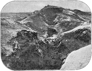
In some instances, according to Mr. Thoroddsen, lava wells out from the whole length of a fissure without giving rise to the formation of cones, the molten material issuing either from one or from both sides and flowing out tranquilly. Thus from three points on the great Eldgjá chasm lava spread out quietly without giving rise to any craters, though at the southern prolongation of the fissure, where it becomes narrower, a row of low slag-cones was formed. The three lava-streams flooded the low ground over an area of 693 square kilometres, or 270 English square miles. In the great majority of cases, however, the lava as it ascends in the fissure gives rise to long ramparts of slags and blocks of lava piled up on either side, or to a row of cones along the line of the open chasm. Thus, on the Laki - 264 - fissure, which runs for about 20 miles in a north-east direction, the cones amount to some hundreds in number.
The cones consist generally of slags, cinders, and blocks of lava. They are on the whole not quite circular but oblong, their major axis coinciding with the line of the chasm on which they have been piled up, as along the marvellous line of the Laki fissure. In many places they are exceedingly irregular in form, changes in the direction of outflow of lava or of escape of steam having caused the cones partially to efface each other.
As regards their size, the cones present a wide range. Some of them are only a few yards in diameter, others several hundred yards. Generally they are comparatively low mounds. On a fissure hardly 30 feet long, Mr. Thoroddsen found a row of twelve small cones built exactly like those of largest size, but with craters less than three feet in diameter. On the Laki fissure some are only a couple of yards high; the majority are much less than 50 yards in height, and hardly one is as much as 100 yards.[278] And yet these little monticules, as Mr. Helland remarks, represent the pipes from which milliards of cubic metres of lava have issued. While other European volcanoes form conspicuous features in the landscape, the Icelandic volcanoes of the Laki district, from which the vastest floods of lava have issued in modern times, are so low that they might escape notice unless they were actually sought for.[279]
[278] Mr. Thoroddsen, however, states that there are about 100 ranging between 20 and 100 metres in height.
As they have generally arisen along lines of fissure, the cones are, for the most part, grouped in rows. The hundreds of cones that mark the line of the Laki fissure present an extraordinary picture of volcanic energy of this type. In other instances the cones occur in groups, though this distribution may have arisen from the irregular uprise of scattered vents along a series of parallel fissures. Thus to the north-east of Laki a series of old cones entirely surrounded by the lavas of 1783 lie in groups, the most northerly of which consists of about 100 exceedingly small craters that have sent out streams of lava towards the N.N.E.[280]
[280] Op. cit. p. 25. The great lava-fields of Iceland are likewise dotted over with secondary craters or "hornitos" which have no direct connection with the magma below, but arise from local causes affecting the outflowing lava. They are grouped in hundreds over a small space.
It would appear from Mr. Helland's observations that the same fissure has sometimes been made use of at more than one - 265 - period of eruption. He describes some old craters on the line of the Laki fissure, which had been active long before the outbreak of 1783.[281]
When the lava issues from fissures it is in such a condition of plasticity that it can be drawn out into threads and spun into ropes. When the slope over which it flows is steep it often splits up into blocks on the surface. Where the ground is flat the lava spreads out uniformly on all sides, forming wide plains as level as a floor. Thus the vast lava-desert of Odádahraun covers a plain 3640 square kilometres in area, or, if the small-lava-streams north from Vatnajökull be included, 4390 square kilometres. This vast flood of lava (about 1700 English square miles in extent) would, according to Mr. Thoroddsen, cover Denmark to a depth of 16 feet. The whole of this enormous discharge has been given forth from more than twenty vents situated for the most part on parallel fissures.
Not less striking is the picture of fissure-eruption to be met with at Laki—the scene of the great lava-floods of 1783. "Conceive now," says Mr. Helland, "these hundreds of craters, or, as they are called by the Icelanders, 'borge,' lying one behind another in a long row; every one of them having sent out two or more streams of lava, now to the one side, now to the other. Understand further that these streams merge into each other, so as to flow wholly round the cones and form fields of lava miles in width, which, like vast frozen floods, flow down to the country districts, and you may form some idea of this remarkable region."[282]
[282] Op. cit. p. 24. Mr. Helland allows an average thickness of 30 metres for the mass of lava which issued in two streams, one 80 kilometres (nearly 50 miles), the other 45 kilometres (about 28 miles) long. He estimates the total volume of lava discharged in the 1783 eruption at 27 milliards of cubic metres, equal to a block 10 kilometres (6 miles 376 yards) long, 5 kilometres (3 miles 188 yards) broad, and 540 metres (1771 feet) high; op. cit. p. 31. Mr. Thoroddsen remarks that the older estimates of the volume of lava discharged by this eruption have been greatly exaggerated. He puts the area covered by lava at 565 square kilometres and the contents at 121/3 cubic kilometres. Verhand. Gesell. Erdkunde Berlin, 1894, p. 296.
The basaltic lavas have issued in a comparatively liquid state, form thin sheets and reach to great distances. The western stream from the Laki eruption of 1783 flowed for upwards of 40 miles; a prehistoric lava from Trölladyngjá in Odádahraun flowed for more than 60 miles.
In the course of time the successive streams of lava poured out upon one of these wide volcanic plains gradually increase the height of the ground, while preserving its generally level aspect. The loose slag-cones of earlier eruptions are effaced or swallowed up, as one lava-stream follows another. Eventually, when, by the operation of running water or by fissure and subsidence, transverse sections are cut through these lava-sheets, the observer can generally notice only horizontal beds of lava piled one above another, including the dykes connected with them and intercalated masses of loose slag, that remain as relics of the old craters.
In some places the lava has gradually built up enormous domes, like those of Hawaii, having a gentle inclination in every direction, as may be seen especially in the district between Floderne Skjalfanafljot and Jökulsà Most of the large volcanic piles of North Iceland are of this - 266 - nature. The highest of them are 1209 and 1491 metres high by from 6 to 15 kilometres in diameter. The elliptical crater of the highest of these eminences measures 1100 by 380 metres.[283]
[283] Mr. Thoroddsen, op. cit. xiv. ii. No. 5, pp. 10, 23.
Large conical volcanoes of the Vesuvian type built up of alternating lavas and tuffs are not common in Iceland, but some occur and rise into lofty glacier-covered mountains, such as Öræfajökull (6241 feet), Eyjafjallajökull (5432), and Snaefellsjökull (4577). Hekla (4961) also is similarly composed of sheets of lava and tuffs, but has not been built as a cone. It forms an oblong ridge which has been fissured in the direction of its length and bears a row of craters along the fissure.[284]
[284] Mr. Thoroddsen, Dansk. Geograf. Tidsskrift, vol. xiii.
Explosion-craters likewise occur among the modern volcanic phenomena of Iceland. One of these was formed by a violent explosion at Askja on 29th March 1875. It has a diameter of only about 280 feet, yet so great was the vigour of the outburst that pumiceous stones were spread over an area of more than 100 Danish (468 English) square miles, and the dust was carried as far as Norway and Sweden. Nine years later Mr. Thoroddsen found the bottom of this crater filled with bluish-green boiling mud, which will probably in the end become a sheet of still water. The borders of these Icelandic explosion-craters seem to be very little higher than the ground around them. Most of the ejected material is expelled with such force and to such a distance that only a small fraction of it falls down around the orifice of eruption.[285]
[285] Mr. Thoroddsen, op. cit.
There is still another feature of the Icelandic volcanic regions which may be cited as an interesting parallel to the sequence of eruptive discharges among the Inner Hebrides. While the lavas are as a rule more or less basic—many of them being true basalts—they have been at different times pierced by much more acid liparites and obsidians. Examples of these rocks of post-Glacial age have recently been traced on the ground by Mr. Thoroddsen,[286] and their petrographical characters have been studied by Mr. Bäckström.[287] The wide distribution of such rocks all over the island, their occurrence in isolated bosses among the more basic lavas, and their remarkable internal structures have been noted by several observers.[288] The liparites and obsidians are contrasted with the basalt by the colours and forms of their streams. Some of them are so black as to look like heaps of coal, though their surfaces pass into grey pumice. They have flowed out in a much less liquid condition than the basalts, and have consequently formed short, thick and irregular sheets. The liparites and basalts appear to have been nearly contemporaneous. They certainly belong to the same volcanic cycle and their vents lie close to each other. Though none of the - 267 - acid eruptions are known to have occurred in modern times, some of the liparites are crusted with sulphur and from the connected fissures steam still rises.
[286] Geol. Fören. Stockholm Förhandl. xiii. (1891), p. 609; Bihang. Svensk. Vet. Akad. Handl. xvii. ii. p. 21 (1891); Dansk. Geograf. Tidsskrift, xiii. (1895).
[287] Geol. Fören. Stockholm Förhandl. xiii. (1891), p. 637.
[288] See in particular C. W. Schmidt, Zeitsch. Deutsch. Geol. Gesellsch. xxxvii. (1885), p. 737.
It will thus be seen how entirely the modern volcanic eruptions of Iceland agree with the phenomena presented by our Tertiary basalt-plateaux. It is, therefore, to the Icelandic type of fissure-eruptions, and not to great central composite cones like Vesuvius or Etna that we must look for the modern analogies that will best serve as commentary and explanation for the latest chapter in the long volcanic history of the British Isles.[289]
[289] In his memoir of 1874, Professor Judd announced his conclusion that there were formerly five great volcanoes amongst the Western Isles, and that the lavas of the plateaux had issued from these. He subsequently reiterated this view (Quart. Journ. Geol. Soc. xlv., 1890, p. 187), and ridiculed the explanation of fissure-eruptions. The evidence adduced by me in a paper published in 1896 (same journal, vol. lii. p. 331) and reprinted with additions in this chapter, will, I trust, be regarded by geologists as having finally settled this question.
As a further but more ancient illustration of the type of volcanic action which appears to have been prevalent during the formation of the Tertiary volcanic plateaux of Britain, I may again refer to the vast basalt-fields of Western America. The basalt of Idaho stretches out as an apparently limitless plain. Along its northern boundary, this sea of black lava runs up the valleys and round the promontories of the older trachytic hills with almost the flatness of a sheet of water. It has been deeply trenched, however, by the streams that wind across it, and especially by the Snake River, which has cut out a gorge some 700 feet deep, on the walls of which the successive beds of basalt lie horizontally one upon another, winding along the curving face of the precipice exactly as those of Antrim and the Inner Hebrides do along their sea-worn escarpments. Here and there, a low cinder-cone on the surface of the plain marks the site of a late outflow. One is struck, however, with the singular absence of tuffs and volcanic conglomerates. The basalts appear to have flowed out stream after stream with few fragmentary discharges.
These characteristic features of one distinctive type of volcanic action have been repeated over a vast region, or rather a whole series of regions, in Western America, the united area of which must equal that of a considerable part of Europe. From Idaho, the basalt-fields may be followed southwards interruptedly into Utah and Nevada, and across the great plateau-country of the cañons into Arizona and New Mexico, northwards into Montana, and westwards into Oregon. The tract which has as yet been most carefully traversed and described is probably that of the high plateaux of Utah and Arizona. Thus on the Uinkaret plateau, which measures some 45 to 50 miles in length by 8 to 12 in breadth, a thick covering of basalt has been spread composed of many successive flows. Between 160 and 170 separate cones have been counted on this area, most of them quite small, mere low mounds of scoriæ, though a few reach a height of 700 or 800 feet, with a diameter of a mile. From three to seven or eight may be found in a row, as if springing from a single line of fissure. But generally the - 268 - grouping is quite irregular.[290] My friend Captain C. E. Dutton, from whose admirable memoir these details are quoted, remarks further that among the Utah plateaux no trace of a cone is to be found at or near some of the most recent basalt-fields, and that the most extensive outpours are most frequently without cones. "The lavas," he adds, "appear to have reached the surface and overflowed like water from a spring, spreading out immediately and deluging a broad surface around the orifice."[291] The deep gorges cut by the rivers through these thick accumulations of horizontal or nearly horizontal basalts, have here and there revealed parallel dykes that traverse the rocks, and in at least one case have shown the dyke running for half a mile up a cliff and actually communicating with a crater of scoriæ at the top.[292] Again, in New Mexico, Captain Dutton noticed vast tracts of younger basalt, about which "a striking fact is the entire absence of all distinguishable traces of the vents from which they came. Some of them, however, indicate unmistakably their sources in small depressed cones of very flat profiles. No fragmental ejecta (scoriæ, lapilli, etc.) have been found in connection with these young eruptions."[293] Such I believe to have been the general conditions under which the basalts of the Tertiary plateaux of the British Isles were also erupted.[294]
[290] Captain C. E. Dutton, "Tertiary History of the Grand Cañon District," U.S. Geol. Survey (1882), p. 104.
[291] Captain C. E. Dutton, "Geology of the High Plateaux of Utah," U.S. Geol. Survey of the Rocky Mountain Region (1880), pp. 198, 200. See also pp. 232, 234, 276 of the same Monograph for additional examples.
[292] Tertiary History of the Grand Cañon, etc., p. 95.
[293] Nature, xxxi. (1884), p. 49.
[294] I may again refer to Hopkins's Researches in Physical Geology, where the conditions of the problem here discussed have been distinctly realized. Speaking of the ejection of lava from a number of fissures, he remarks that the imperfect fluidity of the melted material "would seem to require a number of points or lines of ejection as a necessary condition." "If there were only a single centre of eruption, a bed of such matter approximating to uniformity of thickness, could only be produced on a surface of a conical form." "Where no such tendency to this conical structure can be traced, it would probably be in vain to look for any single centre of eruption. On the supposition, too, of ejection through continued fissures, or from a number of points, that minor unevenness of surface which must probably have existed under all circumstances during the formation of the earth's crust, would not necessarily destroy the continuity of a comparatively thin extensive bed of the ejected matter, in the same degree in which it would inevitably produce that effect in the case of central ejection" (Cambridge Phil. Trans. vi. 1835, p. 71).
Although we may be convinced, from their general structure and relations, that the stratified lavas of these plateaux have been poured out from fissures and not from great central cones, it must obviously be difficult to obtain demonstrative evidence of this origin from any single section. Of the thousands of dykes which traverse the British plateaux and the ground around them, I am not aware of a single one which can be actually seen to have ever communicated with the surface. The very process of denudation which has revealed these dykes has at the same time removed all trace of any former connection they may have had with the surface. The only places where we may hopefully search for the missing evidence are the fronts of the escarpments. On these precipices dykes may sometimes be seen to end off at some particular platform - 269 - among the basalt-sheets, but I have never found a case which could be confidently cited as an example of lava rising in a fissure and spreading out as a superficial sheet. That this connection may eventually be found when a more detailed survey is made of these great sea-walls I fully anticipate.
In recently mapping the basalt-plateau of Strathaird in Skye, Mr. Harker has made some interesting observations regarding the probable connection of the dykes with the plateau basalts. He has noticed that the flanks of Slat Bheinn, a portion of the plateau, are abundantly traversed by dykes containing numerous enclosed pieces of gabbro, while the basalt on the summit of the plateau is full of similar fragments—an occurrence not observed elsewhere. It is conceivable that the gabbro-bearing basalt-sheets are sills, but Mr. Harker has found no proof that they are so, the evidence so far as it has been collected being rather in favour of the view that these sheets are superficial lavas, and that they have been supplied from the dyke-fissures.
Various considerations suffice to assure us that actual instances of the outflow of the basalt from its parent fissures should be expected to be exceptional. The absence or scarcity of beds of scoriæ among the basalt-plateaux may be taken as an indication that the lava as a rule flowed out without the formation of cinder-cones, and therefore that these conspicuous monuments of the eruptive vents were probably always rare in Britain. If the lava was poured out tranquilly from one or two points along a fissure which were subsequently buried under floods of similar lava issuing from other fissures, the chances that such points of emission should be laid open along the front of any escarpment are small. And, even when so exposed, it might be difficult to feel sure that the dyke below was really the feeder of the basalt above, unless the cliff were accessible and the rocks could be scrutinized foot by foot. These elements of uncertainty are happily removed where the volcanic energy has drilled well-marked funnels of discharge and left them filled with the erupted materials, as will be narrated in the next chapter.
- 270 -
Vents filled with Basalt or other Lava-form Rock—Vents filled with Agglomerate
It is one of the most interesting points in the Tertiary volcanic history that, in spite of the enormous geological revolutions that have passed since they became extinct, the sites of many scattered vents can still be recognized. A far greater number must lie buried under the basalts, and of others the positions are concealed by the sea, which now covers so large an area of the old lava-fields. Nevertheless, partly within the area of the plateaux, but still more on the surrounding tracts from which the basalts have been removed by denudation, the traces of unmistakable vents of discharge may be recognized amid the general wreck.
In Britain and the Faroe Isles, it is chiefly along the coast-line that the process of denudation has revealed the volcanic vents of Tertiary time. The interior of the country is often loaded with peat, covered with herbage, or strewn with glacial detritus: and even where indications of the vents are to be detected, it is not always possible to ascertain their true limits and connections. But where the structure of the plateaux has been laid bare along ranges of rocky precipice, the vents have sometimes been so admirably dissected by the sea that every feature of their arrangements can be satisfactorily determined.
As the actual physical connexion of these volcanic orifices with the plateaux has been in most cases removed by denudation, we can usually only by inference place them in what was probably their true relation to the plateau-eruptions. Those which project from the surface of the plateaux must, of course, be younger than the basalts through which they rise; how much younger we cannot tell. They may possibly be later than any of the plateau-sheets; they may even belong to a subsequent and waning condition of volcanic action. On the other hand, the vents which can now be traced outside of the present limits of the edges of the plateaux may, like those just mentioned, be younger than the basalt-sheets, or, on the contrary, they may be records of a period of eruptivity anterior to the emission of any of the rocks of the plateaux, and may have been deeply buried under a mass of basalt-beds subsequently removed. Positive demonstration is, from the - 271 - nature of the case, impossible in these instances. But examples will be cited from the Western Isles and from Faroe, where the vents can be proved to belong to the time of the plateau-eruptions, for they are seen to have broken through some of the basalt-sheets and to have been buried under others. With this clear evidence of relationship in some cases, there need be little hesitation in believing that in other instances where no such positive connexion can be found, but where the vents are obviously such as the general structure of the plateaux would have led us to expect, they may be confidently regarded as part of the phenomena of the plateau-eruptions.
Sometimes the vents can be linked with lines of fissures or dykes. This is especially the case where they are small in size. More usually, however, no such relation can be demonstrated. It will be remembered that among the modern Icelandic eruptions, some eruptive vents, like the later cinder-cones of Laki, are ranged in a linear direction along the great fissure, while others, of an older series in the same district, almost engulphed amidst the more recent lavas, are clustered irregularly in groups. A similar diversity of arrangement has been observed among the volcanic cones of the Velay in Central France.
Considering as a whole the volcanic necks or eruptive vents which rise from the older rocks around the Tertiary basalt-plateaux, and sometimes even from the surface of these plateaux themselves, we may conveniently follow the same classification as was adopted in dealing with those of Palæozoic age, and, according to the nature of the material that now fills them, arrange them in two series: (1) Those occupied by some form of crystalline eruptive rock, and (2) those filled with volcanic agglomerate.
These, as the composition of the plateaux would lead us to anticipate, are numerous. They perhaps attain their most conspicuous development in Antrim, either on the tableland or among the underlying rocks round its edges. The finest example in that district is undoubtedly furnished by the lofty eminence called Slemish, which rises above the surrounding basalt-terrace, to a height of 1437 feet above the sea (Fig. 294). It is elliptical in ground-plan, measuring some 4000 feet in length by 1000 in breadth. Seen from the north, it appears as a nearly perfect cone. The material of which it consists is a coarsely crystalline olivine-dolerite, presenting under the microscope a nearly holocrystalline aggregate, in which the lath-shaped felspars penetrate the augite, with abundant fresh olivine, and wedge-shaped patches of interstitial matter. The rock is massive and amorphous, except that it is divided by parallel joints into large quadrangular blocks like a granitic rock, and wholly different from the character of the surrounding basalts. The latter, which possess the ordinary characters of the rocks of the plateaux, can be followed to within 80 yards of this neck, which rises steeply from them, but their actual junction with it is concealed under the depth of talus.
- 272 -
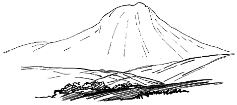
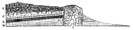
At the nearest point to which the two rocks are traceable, the basalts appear somewhat indurated, break with a peculiar splintery fracture, and weather with a white crust. These characters are still better shown on abundant fragments which may be picked up among the debris further up the slope. There can be no doubt, I think, that a ring of flinty basalt, differing considerably in texture from the usual aspect of that rock in the district, surrounds the neck. The meaning of this ring will be more clearly seen from the description of another example in Mull. About four miles to the north-east of Slemish, a smaller and less conspicuous neck rises out of the plateau-basalts. The rock of which it consists is less coarsely crystalline than that of Slemish, but its relations to the surrounding volcanic rocks are obviously the same. On the west side of Belfast Lough a boss of similar rock, about 1200 feet in diameter, rises at the very edge of the basalt escarpment into the eminence known as Carnmony Hill (Fig. 295). On its northern side it presents along its wall a mass of interposed volcanic agglomerate.[295] On visiting with Mr. M'Henry the quarry opened on the eastern face of this vent, I was much struck with the remarkable cellular structure of some parts of the dolerite. Many of the vesicles are lined with a thin pellicle of black glass, and the same substance occurs in minute patches in the body of the rock. A thin slice exhibiting this structure was found by Mr. Watts to possess the following characters:—"The - 273 - rock is an ophitic dolerite consisting of plagioclase, augite, and iron ores, without olivine, enclosing one or two patches of finer basalt. The vesicles in the latter, and certain angular spaces between the crystals of the former, have been wholly or partially filled with brown glass, the outer part of which has been converted into radiating crystals of a brown mineral." The occurrence of patches of glass which seem to have been squeezed into vesicles or cracks in the body of a dolerite or andesite has been noticed in some of the Tertiary dykes. But in the present case the glass occurs as a mere coating on the walls of the larger spheroidal vesicles, the interior of which generally remains empty.
[295] This neck was recognised by Du Noyer in 1868 as "one of the great pipes or feeders of the basaltic flows." See Prof. Hull, Explanation of Sheets 21, 28 and 29, Geol. Survey of Ireland (1876), p. 30.
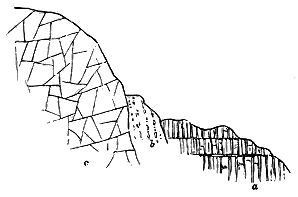
Of the other doleritic necks scattered over the surface of the Antrim plateau, I will refer to only one which occurs on the hillslopes between Glenarm and Larne. It forms a prominence known as the Scawt Hill, and consists of a boss of basalt, which, in rising through a vent in the plateau-sheets, has carried up with it and converted into marble a large mass of chalk which is now exposed along its eastern wall (Fig. 296).
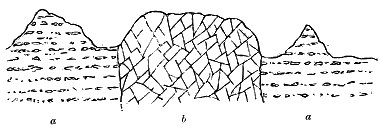
As examples of similar necks which have been exposed by denudation outside the present limits of the same plateau, I may allude to those which rise through the Cretaceous and other Secondary strata on the northern coast near Ballintoy. One of the most striking of these may be seen at Bendoo, where a plug of basalt, measuring about 1400 feet in one diameter and 800 feet in another, rises through the Chalk, and alters it around the line of contact (Fig. 297). Another remarkably picturesque example is to be seen near Cushendall, where a prominent doleritic cone rises out of the - 274 - platform of Old Red Sandstone, some distance to the north of the present edge of the volcanic escarpment (Fig. 298).

The greater coarseness of grain of the material filling these pipes, compared with that of the sheets in the terraces, is only what the very different conditions of cooling and consolidation would lead us to expect. There is no essential difference of composition between the two rocks. Where the erupted material has been poured out at the surface, it has assumed a finely crystalline texture, while, where it has slowly solidified within a volcanic pipe at some depth beneath the surface, and where consequently its component crystals have had more time for development, the resulting structure is much more largely crystalline, with a more or less complete development of the ophitic structure.
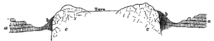
In the island of Mull, another instance of the same kind of vent has been observed and described by Professor Judd.[296] It rises in the conspicuous hill, 'S Airde Beinne (Sarta Beinn), about two miles south-west from Tobermory, and consists of a coarsely crystalline dolerite, which becomes finer in grain towards the outer margin (Fig. 299). No bedding, or structure of any kind beyond jointing, is perceptible in it. Examined in thin sections under the microscope, this rock is found to be another typical ophitic dolerite, consisting of lath-shaped felspars embedded in augite, with here and there wedge-shaped portions of interstitial matter and grains of olivine. Dr. Hatch found the felspars to contain spherical inclusions of devitrified glass, filled with black granules and trichites, and he observed that, - 275 - under a high power, the interstitial matter is seen to consist mainly of a greenish-brown isotropic substance, in which are inclosed small crystals of augite, skeleton-forms and microlites of felspar, sometimes in stellate aggregates, as well as club-shaped, cruciform, arrow-headed and often crested microlites of magnetite.
[296] Quart. Jour. Geol. Soc., xxx. (1874), p. 264.
Towering prominently above the flat basalt sheets, this neck has an oval form, measuring about half a mile in length by a quarter of a mile in breadth. Its central portion, however, instead of rising into a rugged hill-top, as is usually the case, sinks into a deep hollow, which is filled with water, and reminds one of a true crater-lake (Figs. 299, 300). The middle of the neck is thus concealed from view, and we can only examine the hard prominent ring of dolerite that surrounds the tarn. The material occupying the hollow may be softer than that of the ring, and may have been scooped out by denudation. What we now see may not be the original surface, but may have been exposed after the removal of possibly hundreds of feet of overlying material. On the other hand, it is conceivable that the hollow is really a crater-lake which was filled up with detritus and may have been overspread with basalt, since removed. It may be suggestively compared with the crater-hollows revealed by denudation on the cliffs of Stromö and Portree Harbour, which will be described in a later part of this chapter. Possibly some more easily removable agglomerate, representing an eruption later than that of the dolerite, may occupy the centre of the volcanic pipe.
One of the most interesting features of this vent is to be found in its relation to the surrounding basalts. The marginal parts of the rock along - 276 - the line of contact are much finer in grain than the rest, and have obviously cooled more rapidly. The contrast between them and the ordinary dolerite nearer the centre, however, cannot be properly understood, except in thin sections under the microscope. Dr. Hatch, to whom I submitted my specimens, observed that, in place of the structure above described, the marginal parts show an absence of the ophitic grouping except in small isolated patches. Instead of occurring in large grains or plates enveloping the felspars, the augite is found in numerous small roundish grains, together with grains of magnetite, in equal abundance and of similar size. The felspars are speckled over with opaque particles; olivine has not been detected.
For miles around the vent, the plateau-rocks are of the usual type—black, compact, sometimes amygdaloidal, alternating with more coarsely crystalline decomposing bands, the separation between different sheets being often marked by the ordinary red ferruginous partings. But around the margin of the neck, they have undergone a remarkable metamorphism. The portions of them which adhere to the outer wall of the neck have lost their distinct bedding, and have been, as it were, welded together into an indurated compact, black to dull-grey rock, so shattery and jointed that fresh hand-specimens, three or four inches in length, are not easily obtainable. Especially marked is one set of joints which, running approximately parallel, cause the rock to split into plates or slabs. These joints are sometimes curved. Yet, in spite of the alteration from its normal character, the basalt retains in places some of its more usual external features, such, for instance, as its amygdaloidal structure, the amygdales consisting of calcite, finely acicular mesotype, and other minerals.
Examined under the microscope, this altered basalt presents "a confused aggregate of colourless microlites (felspar?) and innumerable minute granules of magnetite, these two constituents being very unequally distributed. Sometimes the colourless portions preponderate, in other places the opaque granules are heaped together in black patches, which may possibly mark the position of fused augites."[297]
[297] Notes by Dr. Hatch.
In the zone of contact-metamorphism around some of the volcanic pipes in the plateaux, we see changes analogous to, but less developed than, those which have been superinduced on so large a scale round the great eruptive bosses of gabbro, granophyre, etc., that have broken up the terraced basalts along the west coast of Scotland. I shall accordingly return to this subject in connection with phenomena presented by these younger rocks (p. 386).
While the necks of dolerite or basalt cannot always be satisfactorily discriminated from bosses which may never have established a connection with the surface, there is no room for any doubt in this respect in the case of those filled with fragmentary materials. As has been already pointed out, - 277 - the occurrence of true volcanic agglomerate may be accepted as evidence of the existence of an eruptive vent communicating with the surface of the earth. The agglomerate in the vents associated with the basalt-plateaux, like that of the Palæozoic vents, is generally exceedingly coarse, and without any trace of structure. Blocks of all sizes up to masses some yards in length, and of the most diversified materials, both volcanic and non-volcanic, are dispersed confusedly through a granular paste of similar miscellaneous composition.
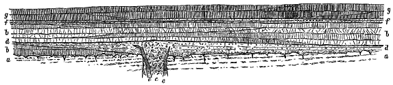
An instructive example of the general characteristics of agglomerate-vents, and of the relation of these vents to the surrounding tuffs and basalts, is to be found at the island of Carrick-a-raide, on the north coast of Antrim, and on the opposite mainland. The visible mass of this neck is about 1000 feet in diameter, but the boundaries, except on the land side, are concealed by the sea. The material filling up the vent is a coarse agglomerate, in which blocks and bombs of basalt, with pieces of chalk and flint, are stuck at all angles in a dull dirty-green granular tuff. Some large and small intrusions of basalt rise through it. Owing partly to these intrusions, and partly to the grass-covered slope that separates it from the line of cliff, the actual contact of this neck with the volcanic beds of the escarpment cannot be seen. I have no doubt, however, that the tuff, which has already been referred to as so conspicuous a member of the series here, was discharged from this vent.[298] The materials are as usual coarser in the pipe than beyond it, but the finer portion or matrix of the agglomerate is similar to many bands of the tuff. The structure of the locality may be diagrammatically represented as in Fig. 301. The bedded tuff is thickest in the neighbourhood of the vent, and gradually dies away on either side of it.
[298] See Explanation of Sheets 7 and 8, Geol. Survey of Ireland (1888), p. 31.
But another important inference may be drawn from this locality. I have already pointed out that the lower basalts here reach their minimum thickness. Their basement beds thin away towards the vent as markedly as the tuff thickens. Obviously they cannot have proceeded from that point of eruption. Yet, that they had begun to be poured out before the discharge of the tuff is shown by their underlying as well as overlying - 278 - that rock, though westward, owing to the thinning away of the undermost basalts, the tuff comes to lie directly on the Chalk. Hence, we may legitimately infer that in this neighbourhood one or more other vents supplied the sheets of the lower basalts.
In the island of Mull a number of detached bosses or patches of agglomerate much obscured by invasions of granophyre probably mark the sites of volcanic vents. They will be more particularly noticed in Chapter xlvii. One of their most interesting features is the large number of fragments of felsitic or rhyolitic rocks which they contain.
In the promontory of Ardnamurchan, where the basalt-plateau has been invaded and displaced by later intrusions of crystalline rocks, and has likewise been reduced to such a fragmentary condition by denudation, some interesting examples of agglomerate necks have been laid bare. One of the largest of these occurs on the north shore at Faskadale. Cut open by the sea for more than a quarter of a mile, this neck is seen to be filled with a coarse agglomerate, composed mainly of basalt-blocks and debris, but crowded also with angular and subangular pieces of different close-grained andesitic, felsitic and porphyritic rocks belonging to the acid series to be afterwards described.[299] Some of these stones exhibit a very perfect flow-structure, and closely resemble certain fine-grained, flinty, intrusive rocks in Mull, to which allusion will subsequently be made. The matrix of the agglomerate is of the usual dull dirty-green colour, but is so intensely indurated that on a fresh fracture it can hardly be distinguished from some of the crystalline rocks of the locality. The neck is pierced in all directions with dykes and veins of basalt, dolerite, andesite, gabbro, and felsitic rocks. Similar intrusions continue and increase in numbers farther west until the cliffs become a labyrinth of dykes and veins running through a mass of rocks which appears to consist mainly of dull dolerites and fine gabbros. Though the relations of this vent to the plateau-basalts are not quite plain, the agglomerate seemed to me to rise out of these rocks. At least the basalts extend from Achateny to Faskadale, but, as they are followed westwards, they are more and more invaded by eruptive sheets, and assume the indurated character to which I have already referred.
[299] One of these felsites when viewed under a high magnifying power is seen to present an abundant development of exceedingly minute micropegmatite arranged in patches and streaks parallel with the lines of flow-structure in the general cryptocrystalline groundmass. The close relationship between the felsites, quartz-porphyries, and granophyres will be afterwards pointed out in the description of the acid rocks. It is remarkable that, though these rocks occur abundantly in fragments in the volcanic necks and agglomerates of the plateaux, not a single instance has been observed of their intercalation as contemporaneous sheets among the basic lavas. The analogous case of the interstratification of felsitic tuffs among basic lavas in the volcanic series of the Old Red Sandstone of Central Scotland has been described (vol. i. p. 279). It is interesting to note that liparitic pumice and dykes have been erupted by some of the basaltic craters of Iceland, for example at Askja, Öræfajökull and Snaefellsjökull. (Mr. Thoroddsen, Dansk. Geograf. Tidsskrift, vol. xiii. 7th and 8th parts.)
On the south side of the peninsula of Ardnamurchan, another agglomerate, noticed by Professor Judd,[300] rises into the bold headland of - 279 - Maclean's Nose, at the mouth of Loch Sunart, and affords better evidence of its relation to the bedded basalts. It measures about 1000 yards in length by 300 in breadth, and its summit rises more that 900 feet above the sea, which washes the base of its southern front. It is filled with an agglomerate even coarser than that on the northern coast. The blocks are of all sizes, up to eight or ten feet in diameter. By far the largest proportion of them consists of varieties of basalt and andesite, slaggy and vesicular structures being especially conspicuous. There are also large blocks of different andesitic porphyries and felsitic rocks like those just referred to, a porphyry with felspar crystals two inches long being particularly abundant. All the stones are more or less rounded, and are wrapped up in a dull-green compact matrix of basalt-debris. There is no stratification or structure of any kind in the mass. Numerous dykes or veins of basalt, of andesite, and of a porphyry, resembling that of Craignure, in Mull, traverse the agglomerate. Some of the narrow basalt-dykes cut through the others.
[300] Quart. Journ. Geol. Soc. xxx. (1874), p. 261. Professor Judd has subsequently (op. cit. xlvi. 1890, pp. 374 et seq.) given a map, section and description of what he believes to be the structure of this ground, with numerous details as to the petrography of the rocks. The geological structure of this area is more fully referred to on pp. 318 et seq.
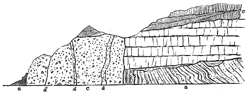
The position of the vent, with reference to the surrounding rocks, will be understood from the accompanying section (Fig. 302). On the eastern side, the agglomerate can be seen to abut against the truncated ends of the flat beds of the plateau-basalts, which are of the usual bedded compact and amygdaloidal character. There can be no doubt, therefore, that the vent has been opened through these basalts. But it will be observed that the latter belong to the lower part of the volcanic series. These lowest sheets are exposed on the slope, resting upon yellowish and spotted grey sandstone, with seams of jet and a reddish breccia, which, lying in hollows of the quartzites, quartz-schists, and mica-schists, form no doubt the local base of the Jurassic rocks of the district. Hence, the vent, though younger than the older sheets of the plateau, may quite well be contemporaneous with some of the later sheets.[301]
[301] It may here be remarked that there is evidence of great differences in the level of the base of the Jurassic series and the bottom of the volcanic plateau in this district. On the south and west sides of Ben Hiant the Jurassic conglomerates may be seen lying on the edges of the crystalline schists only a little above high-water mark, while on the north side, the schists, with their overlying unconformable cake of limestones, rise several hundred feet above sea-level. The surface on which the basalts were poured out was probably very uneven, but there may also have been some considerable displacements of these basalts either before or during the injection of the dolerite sills of Ben Hiant.
- 280 -
An interesting feature at this locality is the peculiar grouping of some of the large dykes in the area around the agglomerate. They run in the direction of the vent, and one or other of them may represent the fissure or fissures on which the volcanic orifice was blown open to the surface. Another notable element in the geological structure of the ground is the vast amount of intrusive material, both in dykes and sheets, which has been erupted. The intrusive sheets of Ben Hiant form the most prominent eminence in this part of Ardnamurchan. Reserving them for description in the following Chapter (p. 318), I will only remark here that they partly overlie the agglomerate, and are therefore, to some extent at least, younger than the vent. They belong to that late stage in the history of the basalt-plateaux when the molten material, no longer getting ready egress to the surface, forced its way among the rocks about the base of the bedded basalts, and more especially on the sites of older vents, which were doubtless weak places, where it could more easily find relief.
The large neck now described is only one of a group scattered around it in the ground to the north. Two of these may be seen rising through a detached area of Jurassic limestones and shales at the northern base of Ben Hiant. A third, almost obliterated by the intrusive sheets, may be traced at the western end of that mountain above Coiremhuilinn. Two others rising through the schists on either side of Beinn na h-Urchrach, have been much invaded by the sills of that eminence (Fig. 326). It is doubtless owing to the extensive denudation of the basalt-plateau, and the consequent uncovering of the rocks underneath it, that this series of vents has been laid bare.[302]
[302] Professor Judd has united these scattered vents into a continuous platform of volcanic agglomerates, which he represents as underlying the supposed lavas of Ben Hiant. Since the publication of his map and description, I have re-examined the ground without being able to discover any trace of this platform. All the visible agglomerates are separate necks, their actual walls being sometimes exposed, as in the neck immediately north of the base of Ben Hiant, where the limestone in contact is marmorised, though twelve yards of it is an ordinary dull blue rock.
By far the largest mass of agglomerate in any of the Tertiary volcanic areas of Britain is that which occurs on the north side of the main valley of Strath, in Skye.[303] Unfortunately, it has been so seriously invaded by the eruptive rocks of the Red Hills, that its original dimensions and its relations to the surrounding rocks, especially to the bedded basalts, are much obscured (see Fig. 348). It can be followed continuously from the lower end of Loch Kilchrist along the southern slopes of Beinn Dearg Bheag round - 281 - to the western roots of Beinn Dearg Mhor—a distance of more than two miles in a straight line, and from Kilbride to the flank of Beinn na Caillich above Coire-chat-achan—a direct distance of two miles and a quarter. A similar rock, possibly a portion of the same mass, appears in Creagan Dubha, on the north side of the Red Hills. If the whole of this agglomerate forms part of one originally continuous mass, it must have been upwards of two miles in diameter. There may, however, have been two or three closely adjacent vents. The Beinn na Caillich patch, for example, appears to belong to a different area, and that of Creagan Dubha is also probably distinct. But there seems no reason to doubt that the mass which forms Cnoc nam Fitheach, and all the long declivity on the southern flank of Beinn Dearg Bheag, occupies part of the site of a single volcano. Owing to the absence of sufficient sections, it is hardly possible to determine how much of this fragmentary material should be assigned to the actual chimney. The diameter of the whole mass is almost two miles. But possibly a considerable proportion of this accumulation belongs to the external cone which gathered round the vent, so that the eruptive pipe might thus be of much smaller dimensions than the superficial area of the agglomerate. The subsequent invasion of so much granophyre, not only that of the Red Hills, but that of numerous smaller intrusions, has indurated the agglomerate and made the investigation of its structure somewhat unsatisfactory.
[303] This extensive mass was not separated from the "syenite" of the Red Hills by Macculloch. Von Oeynhausen and Von Dechen noticed it as a conglomerate with quartz pebbles, but did not realise its volcanic nature (Karsten's Archiv, i. p. 90). In my map of Strath (Quart. Jour. Geol. Soc. xiv. plate i.) I distinguished it from the rock of the Red Hills, but no name for it appears in the legend of the map, nor is it referred to in the text. Its character as a true volcanic agglomerate was recognised by Professor Judd, op. cit. p. 255. See postea, pp. 384 et seq.
It might be supposed that the mere existence of intrusive bosses and veins rather furnishes an argument in favour of considering the visible agglomerate to belong to a deeper-seated part of the erupted material than the external cone. But, as will be afterwards shown, there is some reason to regard the present conical or dome-shaped outlines of the granophyre hills as not far from their original forms, and to believe that, like the trachytic Puys of Auvergne, they were much more superficial than plutonic eruptions. A study of the cinder cones of Central France shows that even these superficial accumulations have been invaded not only by bosses but by dykes.[304]
[304] The existence of a small dyke of andesite on the northern rim of the well-known crater of the Puy Parion has already been noticed.
The agglomerate of the great Strath vent is a coarse tumultuous assemblage of blocks and bombs, imbedded in the usual dull, dirty-green matrix. Among the stones, grit and sandstone, together with scoriaceous, vesicular and amygdaloidal basalts are specially abundant; also pieces of various quartz-porphyries and granophyres, among which a black felsite like that of Mull may often be recognised. In some places, large masses of altered limestone and quartzite (Cambrian) are included; in others, pieces of yellow sandstone and dark shale (Jurassic), or of the bedded lavas. Some of these masses may be 100 yards or more in length. Occasionally a breccia, mainly made up of acid materials—granophyre or granite,—has been noticed by Mr. Harker along the north side of the Red Hills, which he thinks may rather be of the nature of a crush-breccia than a part of the true agglomerate.
The agglomerate of this district is wholly without stratification or structure of any kind. On the north-west side of Loch Kilchrist, indeed, it - 282 - weathers into large tabular forms, the parallel surfaces of which dip to south-west; but this is probably due only to jointing. Here and there, dykes of basalt cut the rock in a general north-westerly direction, but their number is remarkably small when compared with the prodigious quantity of them in the limestone at the bottom and opposite side of the valley, some of which may possibly mark the fissure on which the vent was placed. More abundant and extensive are the masses of granophyre that rise particularly along the outer margin of the agglomerate near Loch Kilchrist. These may be connected with the great boss that forms the Red Hills, of which further details will be given in Chapter xlvi.[305]
[305] The granophyre intrusions in this agglomerate have been found by Mr. Harker to have taken up and dissolved a considerable proportion of fragments of gabbro, Chapter xlvi. p. 392.
The important question of the relation of this agglomerate to the plateau-basalts does not admit of satisfactory treatment, owing to destruction of the evidence by the intrusion of the granophyre, and likewise to enormous denudation. Nevertheless, some traces still remain to indicate that the basalts once stretched over the site of the vent, which probably rose through them. Looking westward from the Hanks of Beinn Dearg Bheag to the other side of Loch Slapin, the geologist sees the bold basalt-escarpment of Strathaird presenting its truncated beds to him at a distance of only two miles. That these lavas were once prolonged eastwards beyond their present limits is obvious, and that they stretched at least over these two intervening miles can hardly be doubted. But we can still detect relics of them on the flanks of Beinn Dearg. As we follow the agglomerate round the margin of the granophyre that mounts steeply from it, we lose it here and there under beds of amygdaloidal basalt. The rocks next the great eruptive mass of the mountain are so indurated and shattered that it is difficult to separate them from each other and determine their relative positions. But, so far as I could ascertain, these basalts are fragments of beds that overlie the agglomerate (Fig. 303). This is not the only place along the flanks of the Red Hills where portions of the bedded basalts have survived. Other localities will be subsequently alluded to.
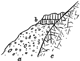
The Strath vent has been drilled through the Cambrian limestone, and as the result of protracted denudation it now towers steeply 500 or 600 feet above that formation on the floor of the valley. Of the material discharged from it over the surrounding country no certain trace now remains. We may infer from the nature of the rock which fills it that towards the end, if not from the beginning of its activity, its discharges consisted mainly of dust and stones. A cone, of which the remains are two miles in diameter, must surely have sent its fragmentary materials far and wide over the surrounding region. But on the bare platform of older rocks to the - 283 - south, beyond the bottom of the agglomerate declivities, not a vestige of these erupted materials can now be found. Westward the escarpment of Strathaird remains to assure us that no thick showers of ashes fell at even so short a distance as two miles, either before or during the outpouring of the successive basalt sheets still remaining there. We may therefore conclude with some confidence that here, as at Ardnamurchan, the vent is younger than at least the older parts of the basalt-plateau. Unfortunately the uprise of the large bosses of granophyre that stretch from the Red Hills to Loch Sligachan has entirely destroyed the vent and its connections in that direction. There is no certain proof that any molten rock ever issued from this orifice, unless we suppose the fragmentary patches of amygdaloid on the southern flank of Beinn Dearg Bheag to be portions of flows that proceeded from this centre of eruption. The basalt-plateau which still remains in Strathaird no doubt formerly extended eastwards over Strath and northwards across the site of the Red Hills and Cuillins, joining on to the continuous tableland north of Lochs Brittle and Sligachan. How much of the plateau had been built up here before the outburst of the vent cannot be ascertained. The agglomerate may possibly, of course, belong to the very latest period of the plateau-eruptions, or even to a still younger phase of Tertiary volcanic history. The impression, however, made on my mind by a study of the evidence from the Western and Faroe Isles is that the necks of agglomerate, like those of dolerite and basalt, really belong to different epochs of the plateau period itself; and mark some of the vents from which the materials of the plateaux were successively emitted.
The example of Carrick-a-raide (p. 277) is peculiarly suggestive when we regard it in connexion with the great Strath vent. Already the progress of denudation has removed at least half of the layer of dust and stones which, thrown out from that little orifice, fell over the bare chalk-wolds and black basalt-fields of Antrim. The neck that marks the position of the volcanic funnel has been largely cut away by the waves, and is almost entirely isolated among them. The vents at Canna, Portree and the Faroe Isles, to be afterwards described, unquestionably belong to the eruptions of the plateau-period, for their connection with the basalts can be clearly established. At the Strath vent, however, the march of destruction has been greater. The connexion between this vent and the materials ejected from it has been entirely removed, and we can only guess from the size of the remaining neck what may have been the area covered by the discharges from this largest of all the volcanic cones of the Inner Hebrides.
Other masses of similar agglomerate are observable in the same region of Skye, where they not improbably mark the sites of other vents. Unfortunately their original limits and relations to the rocks through which the eruptive orifices were drilled have been much obscured by the uprise of the great masses of gabbro and granophyre of the Cuillin Hills. Several of these isolated intrusions occur in the midst of the gabbro, as in Harta Corry and on the west side of the Blaven ridge. Another mass is interposed between the gabbro and granophyre on Druim an Eidhne and at the base - 284 - of the lavas between Druim an Eidhne and the Camasunary valley. Mr. Harker has found a huge mass of agglomerate underlying the bedded basalts to the north and west of Belig, one of the hills on the west side of the large valley that runs from the head of Loch Slapin to Loch Aynort. This mass has its bottom concealed by the granophyre which underlies it; but it reaches a maximum thickness of perhaps 1000 feet, rapidly thinning out and disappearing. It generally resembles the Strath agglomerate, but is distinguished by including a large proportion of fragments of gabbro. Mr. Harker remarks that "a study of these agglomerates points to the existence of both gabbros and granophyres older than the volcanic series, and therefore distinct from the gabbros and granophyres now exposed at the surface."
It is a suggestive fact that so many detached masses of agglomerate should occur around and within the areas of the great eruptive bosses of gabbro and granophyre. They seem to indicate the former existence of groups of volcanic vents in these tracts, and may thus account for the uprise of such large bodies of intrusive material through what must have been a weakened part of the terrestrial crust.
Further north in Skye a much smaller but more perfectly preserved vent has been laid open by denudation on the south side of Portree Bay—a deep inlet which has been cut out of the plateau-basalts and their underlying platform of Jurassic sandstones and shales. The great escarpment of the basalts has, at the recess of Camas Garbh, been trenched by a small rivulet, aided by the presence of two dykes. The gully thus formed exposes a section of a neck of agglomerate that underlies the basalts of the upper half of the cliff. This neck is connected with a thick deposit of volcanic conglomerate and tuff which, lying between the basalts, extends from the neck to a considerable distance on either hand. The general relations of the rocks at this locality are represented in Fig. 304.
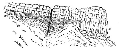
The agglomerate (b) is quite tumultuous, and here and there strikingly coarse. Some of its included blocks measure five feet in length. These - 285 - fragments represent most of the varieties of the lavas of the district. Large slaggy masses are abundant among them, and sometimes exhibit the annelide-like elongation of the vesicles which I have referred to as occasionally displayed by the plateau-basalts. More than 60 feet of agglomerate are visible in vertical height from where its base is concealed by debris and vegetation to where its upper surface passes under a banded rock to be afterwards described. That this unstratified mass of volcanic detritus marks the site of a vent can hardly be doubted, although denudation has not revealed the actual walls of the chimney. The steep grassy slopes do not permit the relations of the rocks to be everywhere seen, but the agglomerate appears to pass laterally into finer, rudely-stratified material of a similar kind, which extends towards east and west as a thick deposit between the bedded basalts. Possibly denudation has only advanced far enough to lay bare the crater and its surrounding sheets of fragmentary material, while the chimney lies still buried underneath.
To the east or left of the agglomerate the detritus becomes less coarse, and shows increasing indications of a bedded arrangement. Close to the agglomerate the dip of the coarse tuff is towards that rock at about 10°. A few yards further east a sheet of very slaggy basalt is seen to lie against the tuff, which it does not pierce. The vesicles in this adhering cake of lava have been pulled out in the direction of the slope till they have become narrow tubes four or five inches long and parallel to each other. Some parts of this rock have a curved ropy surface, like that of well-known Vesuvian lavas, suggestive of the molten rock having flowed in successive thin viscous sheets down the slope, which has a declivity of about 30°. This part of the section may possibly preserve a fragment of the actual inner slope of the crater formed of rudely-bedded tuffs.
Continuing still eastward, we find the feebly stratified tuff (a) to be perhaps 200 feet thick. It forms a grassy declivity that descends from the basalt-escarpment above to the grass-covered platform which overlies a lower group of basalts. The visible portion of this tuff presents a thoroughly volcanic character, being made up of the usual dull dirty-green granular paste, through which are dispersed angular and rough lumps of slag and pieces of more solid basalt, varying up to a foot or two feet in length. These stones are generally disposed parallel to the indistinct bedding, but are sometimes placed on end, as if they had assumed that position on falling from an explosive shower. Among the smaller stones, pieces of a finely vesicular basic pumice are frequent and are among the most strikingly volcanic products of the deposit. From a characteristic sample of these stones, a thin slice was prepared and placed in Mr. Harker's hands. The following are his observations on it:—"A very compact dark grey rock, amygdaloidal on a minute scale. The lighter grey crust is probably due merely to weathering, and the specimen seems to be a distinct fragment, not a true bomb. The slice shows it to be essentially a brown glass with only occasional microscopic crystals of a basic plagioclase. It has been highly vesicular, and the vesicles are now filled by various secondary products, - 286 - including a chloritic mineral, nearly colourless and singly refracting in thin section, and a zeolite."
Tracing now the tuff from the west or right side of the vent, we can follow it to a greater distance. No abrupt line can be detected here, any more than on the other side, between the agglomerate and the tuff. The latter rock extends under the overlying plateau of basalt, at least as far west as Portree Loch, a distance of fully a mile, but rapidly diminishes in thickness in that direction. Traces of what is probably the same tuff can be detected between the basalts at Ach na Hannait, more than three miles to the south (Fig. 305). It is thus probable that from the Portree vent fragmentary discharges took place over an area of several square miles.
Above the agglomerate of this vent two lavas may be seen to start towards opposite directions. One of these (c), already referred to, is a dull prismatic basalt with a slaggy bottom, its vesicles being pulled out in the direction of the general bedding of the section. It descends by a twist or step, and then lies on the inclined surface of the tuff which dips towards the agglomerate and seems to pass into that rock. Further east this basalt increases in thickness and forms the lowest of the basalt-sheets of the cliff. The lava that commences on the west side of the agglomerate (d) is a massive jointed basalt, which, though not seen at the vent, appears immediately to the west of it and rapidly swells out so as to become one of the thickest sheets of the locality. It lies upon the rudely-bedded tuff, and is covered by the other basalts of the cliff.
That these two basalts came out of this vent cannot be affirmed. If they did so at different times, their emission must have been followed by the explosion which cleared the funnel and left the central mass of agglomerate there. But that some kind of saucer-shaped depression was still left above the site of the vent is indicated by the curious elliptical mass of rock (e) that lies immediately above the agglomerate, from which it is sharply marked off. This is one of the most puzzling rocks in the district, probably in large measure owing to its advanced state of decay. It is dull-red in colour, and decomposes into roughly parallel layers, so that at a short distance it looks like a bedded tuff, or like some of the crumbling varieties of banded lavas. I could not obtain specimens fresh enough to put its nature and origin beyond dispute. Whatever may have been its history, this ferruginous rock rests in a flat basin-shaped hollow directly above the agglomerate of the vent. The form of this depression corresponds fairly well with what we may suppose to have been the final position and shape of the crater of the little volcano. The rock that occupies the bowl dies out towards the east on the face of the cliff, and the prismatic basalt (c) is then immediately covered by the rest of the basalt-sheets of the plateau (f). On the west side its precise termination is concealed by grass. But it must rapidly dwindle in that direction also, for not many yards away it is found to have disappeared, and the basalts (d and f) come together.
Though the decayed state of this rock does not warrant any very confident opinion regarding its history, I am inclined to look upon it as a - 287 - deposit of much disintegrated volcanic detritus washed into the hollow of the old crater when it had become filled with water, and had passed into the condition of a maar. The peculiarly oxidized condition of its materials points probably to long atmospheric exposure, and an examination of the surrounding parts of the district furnishes more or less distinct evidence that a considerable lapse of time did actually intervene between the cessation of the eruptions of the Portree volcano and the next great basalt-floods of this part of Skye.
That volcanic eruptions from other vents continued after the Portree vent had become extinct is proved by the great sheets of basalt (f) that overspread it, and still bury a large tract of the fragmentary material which it discharged. At a later time a fissure that was opened across the vent, allowed the uprise of a basalt dyke (g), and subsequently another injection of similar material took place along the same line of weakness (h).
Before leaving this interesting locality we may briefly take note of the distribution of the ashes and stones ejected by the volcano, and the evidence for the relative length of the interval between the outflow of the lavas below and that of those above the tuff and volcanic conglomerate. These deposits may be traced in clear sections along the base of the cliffs for a mile to the west of the vent. They thin away so rapidly in that direction that at a distance of three-quarters of a mile they do not much exceed fifty feet in thickness. At Camas Bàn they consist mainly of a fine, dull-green, granular, rudely-stratified basalt-tuff, through which occasional angular pieces of different lavas and rough slags are irregularly dispersed. These stones occur here and there in rows, suggestive of more vigorous discharges, the layers between the platforms of coarser detritus being occupied by fine tuff. Some of the ejected blocks are imbedded on end—an indication of the force with which they were projected so as to fall nearly a mile from the crater.
The upper parts of the tuff pass upward into fine yellow, brown, and black clays a few feet in thickness, the darker layers being full of carbonaceous streaks. On this horizon the coal of Portree was formerly mined. The workings, however, have long been abandoned, and, owing to the fall of large blocks from the basalt-cliff overhead, the entrance to the mine is almost completely blocked up. One wooden prop may still be seen keeping up the roof of the adit, which is here a slaggy basalt.
To the east and south-east of the Portree vent, extensive landslips of the volcanic series and of the underlying Jurassic formations make it hardly possible to trace the continuation of the tuff-zone in that direction. To the south, however, at a distance of rather more than three miles, what is probably the same stratigraphical horizon may be conveniently examined from Ach na Hannait for some way to the north of Tianavaig Bay. At the former locality the calcareous sandstones of the Inferior Oolite are unconformably covered by the group of rocks represented in Fig. 305. At the bottom of the volcanic series lies a sheet of nodular dolerite with a slaggy upper surface (a). Wrapping round the projections and filling up the - 288 - depressions of this lava comes a thin group of sedimentary strata from an inch or two to eighteen inches or more in thickness (b). These deposits consist of hardened shale charged with macerated fragments of linear leaves and other plant-remains, including and passing into streaks of coal, which may be looked upon as probably occupying the same horizon with the coal of Portree. But here, instead of reposing on a mass of stratified tuff, the carbonaceous layers lie on one of the bedded lavas. The tuff has died out in the intervening three miles, yet that some of the discharges of volcanic detritus reached even to this distance, and that they took place during the accumulation of these layers of mud and vegetation, is shown by the occurrence in the shales of pieces of finely amygdaloidal basalt, from less than an inch to six inches in length, likewise lapilli of a fine minutely cellular basic pumice, like some varieties of palagonite. The overlying dolerite (c) becomes finely prismatic at its junction with the sedimentary layers and has probably indurated them.
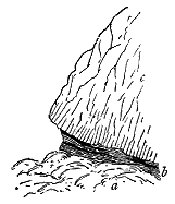
This intercalation of a shaly and coaly band among the lavas can be followed northward along the coast. In some places it has been invaded by dykes, sills, and threads of basalt on the most remarkably minute scale, of which I shall give some account in Chapter xlii. (see Fig. 321). North of Tianavaig Bay—that is, about three-quarters of a mile nearer to the Portree vent—a perceptible increase in the amount of volcanic material is observable among the shales and leaf-beds. Not only are lapilli of basic pumice abundant, but the volcanic detritus has accumulated here and there in sufficient amount to form a band of dull greenish-brown tuff.
These coast-sections in the neighbourhood of Portree afford additional illustrations of the characteristic fact, on which I have already insisted, that the interstratifications of sedimentary material in the basalt-plateaux frequently terminate upward in leaf-beds, thin coals, or layers of shale, full of indistinctly preserved remains of plants. As I have endeavoured to show, this vegetation, which was undoubtedly terrestrial, probably grew not far from the sites where its remains have been preserved. Leaves and seeds would naturally be blown or washed into pools on the lava-fields, and would gather there among the mud and sand carried by rain from the surrounding ground. Such a topography and such a sequence of events point to intervals of longer or shorter duration between the successive outpourings of basalt. It was probably during one of these intervals of quietude that the crater of the Portree volcano became a maar and was finally silted up.
Reference has already been made to a conspicuous mass of agglomerate which occurs at the east end of the island of Canna, and marks the site of an important volcanic vent belonging to the Small Isles plateau. A portion of it projects from the grassy slopes, and rises vertically above the beach as - 289 - a picturesque crag, in front of the precipice of Compass Hill (Fig. 306). But the same rock may be traced southward to the Coroghon Mòr, and north-westward in the lower part of the cliffs to a little beyond the sea-stack of An Stòll. It has thus a diameter of at least 3000 feet. Westward it passes under the conglomerate described in Chapter xxxviii. Its eastern extension has been concealed by the sea.
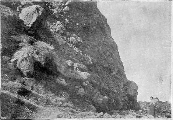
The materials that fill this vent consist of a typical agglomerate composed entirely, or almost entirely, of volcanic detritus. The embedded blocks vary up to eight feet in diameter or even more. They are chiefly fragments of various basalts and andesites, generally vesicular or amygdaloidal. Some - 290 - of these, which have evidently been broken off from already consolidated lavas, are angular or subangular in shape, and their steam-holes are cut across by the outer surfaces of the stones. Where they consist of calcite, zeolite, etc., the amygdales so exactly resemble those of the bedded basalts of the plateaux that, as already remarked, we must believe them to have been already filled by infiltration before the disruption of the rocks by volcanic explosions. Other blocks are true bombs, with a fine-grained crust outside and a more cellular texture inside, the vesicles of the outer crust being sometimes dragged round the surface of the stone. The variety of materials included among the ejected blocks and the abundance of pieces of the red bole which so generally separates the plateau-basalts indicate that a considerable thickness of bedded lavas has probably been broken through by the vent.
Beside the volcanic materials, occasional angular pieces of red (Torridon) sandstone may be observed in the agglomerate. The paste is a comminuted mass of the same material as the blocks, tolerably compact, and entirely without any trace of stratification.
The actual margin of this vent has nowhere been detected by me. We never reach here the base of the volcanic series, for it is sunk under the sea-level. On the other hand, the upper limits of the agglomerate have been partially effaced or obscured by the conglomerates which overlie it. From the breadth of ground across which the agglomerate can be followed along the shore, the vent might be regarded as having been perhaps not less than three-quarters of a mile in diameter. But there is the same difficulty here as at the Strath vent in Skye in determining the actual limits of the volcanic funnel. Possibly there may have been more than one vent in close proximity. Even if there was only one, the existing agglomerate may include not only what filled the chimney, but also a portion of what had accumulated round the orifice and formed the external cone. That the volcano continued for some time in vigorous eruption may be judged from the amount of material ejected from it, the large size of its blocks, and the distance to which they were sometimes thrown.
The pieces of Torridon Sandstone were no doubt derived from the extension of that formation underneath Canna. On the opposite island of Rum, where these pre-Cambrian red sandstones are copiously developed, they form the platform through which the Tertiary volcanic series has been erupted. The several remaining outliers of the bedded basalts, referred to in a previous chapter (p. 215 and Fig. 267) as visible on the west side of this island, show that the basalt-plateau of Small Isles, which once covered that area, rested immediately on the inclined edges of the Torridon Sandstones. Probably the same structure stretches westward under Canna and Sanday. No traces of any Jurassic strata have been detected beneath the volcanic rocks of Rum, though they are so well developed a few miles to the east in the island of Eigg. Either they were not deposited over the pre-Cambrian rocks of Rum, or they had been removed from that ancient ridge before the beginning of the Tertiary volcanic period. Certainly I have not detected - 291 - a single recognizable fragment of any Jurassic sedimentary rock in the agglomerate of Canna.
This Canna vent exhibits, better than is usually shown, the occurrence of dykes and irregular injections of lava through the agglomerate. A large mass of a finely columnar basalt runs up from the beach at Garbh Asgarnish. A similar rock forms several detached crags a little further south, particularly in the headland of Coroghon Mòr and the island of Alman. Here the basalt is beautifully columnar, its slender prisms curving from a central line until their ends abut against the agglomerate. The truly intrusive character of this basalt is well shown on the southern front of Coroghon Mòr, and on the northern face of Alman, as represented in the accompanying diagrams (Figs. 307 and 308).
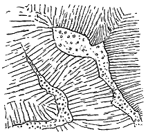
Fig. 307.—Columnar Basalt invading Agglomerate
of Volcanic Vent, Coroghon Mòr,
Isle of Canna. (Height above 20 feet.)
|
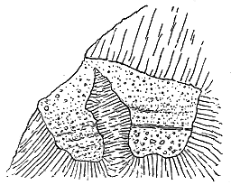
Fig. 308.—Columnar Basalt invading Volcanic
Conglomerate, north side of Alman Islet,
Canna.
|
Although there is no conclusive evidence that these intrusions belong to the time of the activity of the vent, yet they differ so much from the ordinary dykes (one of which also cuts the agglomerate and ascends through the conglomerates and basalts above), are confined so markedly to the vent and its immediate proximity, and resemble so closely the basalt-injections of other vents, such as those of the Carboniferous and Permian necks of Scotland, that they may with probability be regarded as part of the mechanism of the Canna volcano.
Though the form and size of the vent of this volcano cannot be precisely defined, the upper part of its agglomerate, as we have seen (ante, p. 219), is dovetailed in the most interesting way with the series of coarse conglomerates, which indicate strong river-action in this part of the volcanic area during the time of the eruption of the plateau-basalts.
The agglomerate vents described in the foregoing pages as occurring in Antrim and among the Inner Hebrides all appear either in the midst of the plateau-basalts or in close proximity to them. Before quitting the Scottish examples, I may refer to some that rise through much more ancient formations at a distance from any portion of the volcanic plateaux, and yet may with probability be assigned to the Tertiary volcanic period.
- 292 -
During the progress of the Geological Survey through the district of Applecross, in the western part of the mainland of Ross-shire, and far away from the basalt-plateau of Skye, Mr. John Horne[306] has found two small necks rising on each side of a line of fracture, through gently inclined Torridon Sandstones. They are conspicuous from a distance by the verdure of their slopes, in contrast with the brown tints of the surrounding moorland. The larger of the two necks measures about 180 by 150 feet, and abruptly truncates the beds of Torridon Sandstone, which as they approach it assume a bleached aspect and become indurated. The material filling this vent is an agglomerate made up mainly of pieces of Torridon Sandstone and grit which, though generally small, occasionally measure a foot across, and in one case were found to reach a length of four feet. They are not as a rule markedly altered, but some of them have acquired a glazed or vitreous texture. Besides these fragments of the general rock of the district, there occur abundant lapilli of a basic volcanic rock, found by Mr. Teall to consist of porphyritic felspar, extremely minute acicular microlites of felspar, somewhat irregular transparent spaces now occupied by a yellowish-green substance, and interstitial matter. At the south end of the vent a small mass of decayed basalt appears to pierce the agglomerate.
[306] Trans. Geol. Soc. Edin. vii. (1894), p. 35.
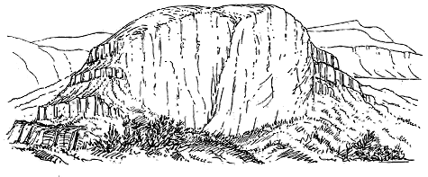
Though there is no indication of the age of these necks, they agree so closely in general character with known vents of the Tertiary volcanic plateaux that there cannot be much hesitation in regarding them as dating from the same great period of basalt-eruption. But no relic now exists anywhere around of lavas or tuffs ejected from them. They rise on the bare Applecross hills, 1000 feet above sea-level, two miles from the shore, and about ten miles from the nearest outlier of the basalt-plateau in the Dùn Can of Raasay. If they once discharged streams of lava that united with the rest of the plateau, the total destruction of this lava affords another impressive picture of the waste which the volcanic rocks of the Inner Hebrides have undergone.
The large proportion of Torridon Sandstone blocks in these two Applecross necks suggests, however, that the orifices never became active volcanic - 293 - vents. They may have been mere spiracles, or blow-holes, where the funnels drilled by explosive vapours were filled up with the debris of the rocks that were blown out. But that lava did rise within them is shown by the basic lapilli in the agglomerate, and by the basalt which in both vents has found its way up the chimney.
In the island of Raasay Mr. Teall, during the summer of 1894, observed a group of curious neck-like masses of breccia which pierce the Torridon Sandstone near Brochel (Fig. 309). The blocks in them are large angular unaltered pieces of the surrounding sandstones and shales, sometimes ten feet or more in length, and the matrix is sometimes pure crystalline calcite like Iceland spar. The breccia is generally coarsest towards the outer margin. But though the Lewisian gneiss exists immediately below the thin cake of Torridonian strata, not a fragment of it could either Mr. Teall or I, when I visited the locality with him, find among the components of the breccia. Nor did we detect any trace of volcanic material. The general ground-plan of these masses is elliptical, the most northerly measuring 30 yards in diameter. Where the junction of the breccia with the Torridon strata can be seen it is a nearly vertical one, the sandstones and shales being much jumbled and broken, but not sensibly indurated. This little cluster of patches of breccia can hardly be due to local crushing of the rocks. Their definite outlines and composition seem rather to indicate spiracles of Tertiary time, which never became vents erupting lava or ashes. The absence of fragments of the underlying gneiss may be accounted for if we suppose that the orifices were completely cleared out by the violence of the explosions and were afterwards filled up by the falling in of the walls of the higher parts now removed by denudation, which consisted of Torridon Sandstone and shale.[307]
[307] It is on one of these neck-like patches of breccia that Brochel Castle stands, of which Macculloch gave so sensational a picture in one of the plates of his Western Isles.
Further research may detect at still greater distances from the basalt-plateaux ancient volcanic necks that might, with more or less probability, be referred to the Tertiary period. As an instance of this kind, I refer to the neck at Bunowen, County Galway, recently described by Mr. M'Henry and Professor Sollas. Though so remote from the Tertiary basalt-plateaux, the rock of this boss is an olivine-basalt presenting a close resemblance to some of the rocks of Antrim.[308]
[308] Trans. Roy. Irish Acad., 1896
As a final illustration of Tertiary volcanic vents I will now describe the Faroe group already alluded to (vol. i. p. 63, vol. ii. p. 256). It was almost by a kind of happy accident that these vents were discovered. Noticing at a distance of a mile or more from the deck of a steam-yacht that the base of the great basalt cliffs on the west side of Stromö were varied by what looked like agglomerate, I steamed inshore, and was delighted to find, as the vessel drew near to the cliff, that the agglomerate assumed definite boundaries and occurred in several distinct patches, until at last it presented the unmistakable outlines of a group of vents underlying and overspread by the bedded - 294 - basalts of the plateau. Favoured by an unusually calm sea, I was enabled to boat into every nook and round every buttress and islet of this part of the coast-line.
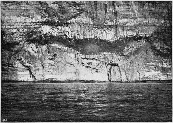
The basalt-plateau here presents to the western ocean a nearly vertical escarpment which must reach a height of at least 1000 feet (see Fig. 328), and displays a magnificent section of the bedded lavas. The lower part of this section shows chiefly the banded structure already described, the layers of different consistency being etched out by the weather in such a way as to give them the look of stratified rocks. In the upper part of the precipice - 295 - columnar and jointed or prismatic sheets are more common, but the most prominent band is the great sill, to which further reference will be made in the next Chapter.
In the course of the gradual retreat of the cliff, as the waves tunnel its base, and slice after slice is detached from its vertical front, a group of at least five small vents has been uncovered lying along a nearly north and south line. Of two of these a segment remains still on the cliff-wall and passes under the basalts; the others have been dissected and half cut away from the cliff, while groups of stacks and rocky islets of agglomerate may mark the position of others almost effaced. The horizontal distance within which the vents are crowded is probably less than half a mile, but the lofty proportions of the precipice tend to lead the eye to underestimate both heights and distances.
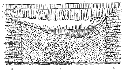
The agglomerate is a thoroughly volcanic rock, consisting of large and small blocks of various basalts, among which large slags are specially conspicuous, the whole being wrapped in a granular matrix of comminuted volcanic detritus. The arrangement of this material is best seen in the fourth vent (Figs. 310 and 311). In this characteristic volcanic neck (b in Fig. 311) the boundary walls, as laid bare on the face of the precipice, are vertical, and are formed of the truncated ends of the banded lavas (a a) which have been blown out at the time of the formation of the orifice. The visible diameter of the vent was roughly estimated by me to be about 100 yards. No appreciable alteration was observed in the ends of the lavas next the vent.
The agglomerate is coarsest in the centre, where huge blocks of slaggy lava lie imbedded in the amorphous mass of compacted debris. On either side of this structureless central portion the agglomerate is distinctly stratified from the walls towards the middle, at angles of 30° to 35°. Even from a distance it can be observed that the upper limit of the agglomerate is saucer-shaped, the sloping sides of the depression dipping towards the centre - 296 - of the neck at about the same angle as the rudely-stratified agglomerate underneath. From the bottom of this basin to the sea-level may be a vertical distance of some 30 yards. The basin itself has been filled up by three successive flows of basalt, of which the first (c) has merely overflowed the bottom, the second (d), entering from the northern rim of the basin, extends across to the southern slope, while the third (e), also flowing from the north, has filled up the remainder of the hollow and extended completely across it. The next succeeding lava (f) stretched over the site in such a way as to bury it entirely, and to provide a level floor for the piling up of the succeeding sheets of basalt.
The second vent, which is represented in Fig 312, exhibits the same features, but with some additional points of interest. It measures roughly about 20 yards in diameter at the sea-level, rises through the same group of banded basalt (a a), and is filled with a similar agglomerate (b). Its more northerly wall is now coincident with a line of fault (h) which ascends the cliff, and probably marks some subsidence after the eruptions had ceased. The southern wall shows that a dyke of basalt (g) has risen between the agglomerate and the banded basalts, and that a second dyke (g′) traverses the latter at a distance of a few feet. In this instance, also, the upper surface of the agglomerate forms a cup-shaped depression which has been filled in by two successive streams of lava (c, d). Among the succeeding lavas (e) the prominent sill (f) has been intruded, to which further allusion is made on p. 323.
These necks are obviously volcanic vents belonging to the time of the basaltic eruptions. They have been drilled through the basalts of the lower part of the cliff, but have been buried under those of the central and higher parts. The arrangement of their component materials in rude beds dipping towards the middle of each vent shows that the ejected dust and stones must have fallen back into the orifice so as to be rudely stratified towards the centre of the chimney, which was finally closed by its own last discharges of coarse detritus. The saucer-shaped upper limit of the agglomerate seems to indicate, as has been suggested above in the case of the Portree volcano, that after the eruptions ceased each vent remained as a hollow or maar on the surface of the lava-fields. And the manner in which they are filled with successive sheets of basalt shows that in course of time other eruptions from neighbouring orifices gave forth streams of lava which, in flowing over the volcanic fields, eventually buried and obliterated each of the vents.
- 297 -
In the destruction of the precipice some of the vents have been so much cut away that only a small part of the wall is left, with a portion of the agglomerate adhering to it. The third neck, for instance, affords the section represented in Fig. 313, where the horizontal sheets of basalt (a) have still a kind of thick pellicle of the volcanic detritus (b) adhering to what must have been part of the side of the orifice of eruption. The waves have cut out a cave at the base, so that we can, by boat, get behind the agglomerate and see the margin of the volcanic funnel in the roof overhead.
The fragment of geological history so picturesquely laid bare on the Stromö cliffs presents a significant illustration of what seems to have been a frequent, if not the normal type of volcanic vent in the Tertiary basalt-plateaux. By the fortunate accident that denudation has not proceeded too far, we are able to observe the original tops of at least two of the vents, and to see how such volcanic orifices, which were doubtless abundant all over these plateaux, came to be entombed under the ever-increasing pile of accumulating basalt.
There is still one feature of interest in these cliff-sections which deserves notice here. Every geologist who has studied the composition of the basalt-plateaux has remarked the comparatively insignificant part played by tuffs in these volcanic accumulations. Hundreds of feet of successive basalt-sheets may often be examined without the discovery of any intercalation of fragmental materials, and even where such intercalations do occur they are for the most part quite thin and extremely local. I found it impossible to scale the precipice for the purpose of ascertaining whether around the Stromö vents, and connected with them, there might not be some beds of tuff interstratified between the basalts. If such beds exist, they can only be of trifling thickness and extent. Here, then, are examples of once active vents, the funnels of which are still choked up with coarse fragmentary ejections, yet from which little or no discharge of ashes and stones took place over the surrounding ground. They seem to have been left as crater-like hollows on the bare surface of the lava-fields.
- 298 -
We have now followed the distribution of the basalt-plateaux, the arrangement of their component materials which were erupted at the surface, and the character of the dyke-fissures and vents from which these materials were ejected. But there remains to be considered an extensive series of rocks which display some of the underground phenomena of the Tertiary volcanoes. The injection of many basaltic sheets had been clearly enforced by Macculloch. In 1871 I pointed out that at different horizons in the plateau-basalts, but especially at their base and among the stratified rocks underneath them, sheets of basalt and dolerite occur which, though lying parallel with the stratification of the volcanic series, are not truly bedded, but intrusive, and therefore younger than the rocks between which they lie.[309] The non-recognition of their true nature had led to their being regarded as proofs of volcanic intercalations in the Jurassic series of Scotland. There is, however, no trace of the true interstratification of a volcanic band in that series, every apparent example being due to the way in which intrusive sheets simulate the characters of contemporaneous flows.
[309] Quart. Jour. Geol. Soc. xxvii. (1871), p. 296.
If such sheets had been met with only at one or two localities, we might regard them as due to some mere local accident of structure in the overlying crust through which the erupted material had to make its way. But when we find them everywhere from the cliffs of Antrim to the far headlands of Skye and the Shiant Isles, and see them reappear among the Faroe Islands, it is obvious that, like those of Palæozoic time, they must be due to some general cause, and that they contain the record of a special period or phase in the building up of the Tertiary volcanic tablelands. I will first describe some typical examples of them from different districts, and then discuss their probable relations with the other portions of the plateaux.
First to be examined, and now most familiar to geologists, are the remarkable sheets that underlie the plateau of Antrim, and project at various parts of the picturesque line of coast between Portrush and Fair Head. - 299 - From the shore at Portrush, as I have already remarked, came the evidence that was supposed to prove basalt to be a rock of aqueous origin, inasmuch as shells were obtained there from what was believed to be basalt. The long controversy to which this supposed discovery gave rise is one of the most curious in the history of geology.[310] It continued even after the illustrious Playfair had shown that the pretended basalt was in reality highly indurated shale, and hence that, instead of furnishing proof of the aqueous formation of basalt, the Portrush sections only contributed another strong confirmation of the Huttonian theory, which claimed basalt to be a rock of igneous origin.
[310] For an excellent summary of this controversy and an epitome of the descriptions of the Portrush section, see the Report on the Geology of Londonderry, etc. (Mem. Geol. Survey), by J. E. Portlock (1843), p. 37.
It is now well known that the rock which yielded the fossils is a Liassic shale, that it is traversed by several sheets of eruptive rock, and that by contact-metamorphism it has been changed into a highly indurated substance, breaking with a splintery, conchoidal fracture, but still retaining its ammonites and other fossils. The eruptive material is a coarse, distinctly crystalline dolerite, in some parts of which the augite, penetrated by lath-shaped crystals of plagioclase, is remarkably fresh, while the olivine has begun to show the serpentinous change along its cracks.[311] This rock has been thrust between the bedding planes of the shales, but also breaks across them, and occurs in several sheets, though these may all be portions of one subterranean mass. Some of the sheets are only a few inches thick, and might at first be mistaken for sedimentary alternations in the shale. But their mode of weathering soon enables the observer readily to distinguish them. It is to be noticed that these thin layers of eruptive material assume a fine grain, and resemble the ordinary dykes of the district. This closeness of texture, as Griffith long ago pointed out,[312] is also to be noticed along the marginal portions of the thicker sheets where they lie upon or are covered by the shales. But away from the surfaces of contact, the rock assumes a coarser grain, insomuch that in its thickest mass it presents crystals measuring sometimes an inch in length, and then externally resembles a gabbro. A more curious structure is shown in one of these coarsely crystalline portions by the occurrence of a band a few inches broad which is strongly amygdaloidal, the cells, sometimes three inches or more in diameter, being filled with zeolites.[313] The general dip of the shales and of the intrusive sheets which have been injected between them is towards the east. From underneath them a thick mass of dolerite rises up to form the long promontory that here projects northwards from the coast-line, and is prolonged seawards in the chain of the Skerries.
[311] Dr. F. Hatch, Explanation of Sheets 7 and 8, Geol. Survey of Ireland, p. 40.
[312] "Address to Geological Society of Dublin, 1835," p. 13, Jour. Geol. Soc. Dublin, vol. i. The varieties of the Portrush rock were described by the late Dr. Oldham, in Portlock's Report on the Geology of Londonderry, p. 150; see also the same work for Portlock's own remarks, p. 97.
[313] For a list of the minerals in this rock, see Oldham, op. cit. p. 151.
An interesting feature of the Portrush sections is the clear way in - 300 - which they exhibit the phenomena of "segregation-veins"—so characteristic of the thicker and more coarsely crystalline sills. These veins or seams here differ from the rest of the rock mainly in the much larger size and more definitely crystalline form of their component minerals. Though sharply defined, when looked at from a little distance, they are found on closer inspection to shade into the surrounding rock by a complete interlacing of crystals. On the shore, they can be seen to lie, on the whole, parallel with the bedding of the sheets in which they occur, but without rigidly following it, since they undulate and even ramify. A good section across their dip has been exposed in a quarry near the end of the promontory, and shows that they are considerably less regular than the plan of their outcrop on the shore would have led us to anticipate. The accompanying drawing (Fig. 314) represents the veins laid bare on a face of rock nine feet in length by five feet in height. It will be seen that while there is a general tendency to conform to the dip-slope, which is here from right to left, the seams or layers unite into a large rudely-bedded mass, which sends out processes at different angles. The peculiar aggregation of minerals which distinguishes such veins is perhaps best seen at Fair Head, and I reserve for the description of that locality what I have to say on the subject, only remarking with regard to the Portrush rock that the felspar shows a disposition to collect in the centre of the veins with the augite and the other dark minerals at the outer margins.
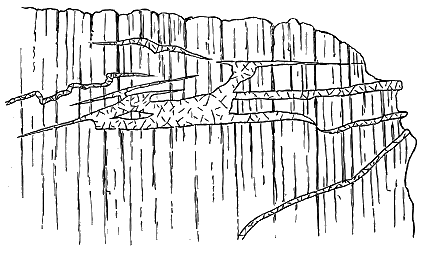
The contact-metamorphism at this locality is of more historical interest in connection with the progress of geological theory than of scientific importance. It consists mainly in an intense induration of the argillaceous strata. These pass here from their usual condition of fissile, laminar, dull, dark shales into an exceedingly compact, black, flinty substance, which in its fracture, colour and hardness reminds one of Lydian stone. Yet the - 301 - ammonites and other organic remains have not been destroyed. They are preserved in pyrites.

Of all the examples of Tertiary sills in Britain few are more imposing than that of the noble range of precipices which form the promontory of Fair Head. Leaving out of account the minor masses of eruptive rock which occur underneath it, we find the main sheet to extend along the coast for nearly four miles, to rise to a height of 636 feet above the sea, and to attain a maximum thickness of 250 feet. This enormous bed dies out rapidly both to the east and west, and seems also to thin away inland. Seen from the north, it stands upon a talus of blocks as a sheer vertical wall, 250 feet high, and the rude prisms into which it is divided are continuous from top to bottom (Fig. 315). So regular is this prismatic structure, and so much does it recall the more minute columnar grouping of the bedded basalts, that at a little distance we can hardly realize the true scale of the structure. It is only when we stand at the base of the cliff or scramble down its one accessible gully, the "Grey Man's Path," that we appreciate how long and thick each of the prisms actually is (Fig. 316). It may here be remarked that this regular prismatic jointing is one of the distinguishing features of the large sills, and serves to mark them off from the bedded basalts, even when these have assumed a columnar structure. The prisms are much larger than the basalt-columns, and never display the irregular starch-like arrangement so common among the plateau-basalts.
- 302 -
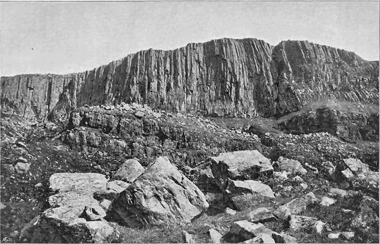
- 303 -
The rock composing this magnificent sheet is a coarsely crystalline, ophitic, olivine-dolerite.[314] The same diminution of the component crystals, which is so marked along the margins of the eruptive masses at Portrush, is strikingly exhibited at the borders of the Fair Head sill. For about 18 or 20 inches upward from the bottom, where the bed rests on the black, Carboniferous shales, the dolerite is dark and finely crystalline, weathering spheroidally in the usual manner. But immediately above that bottom layer of closer grain, the normal coarsely crystalline texture rapidly supervenes. A similar closeness of grain is observable at the surfaces of contact where the sheet splits up on its western border.
[314] Professor Judd has described what he calls a "glomero-porphyritic structure" in this rock (Quart. Journ. Geol. Soc. xlii. (1886), p. 71).
Nowhere, so far as I know, can the phenomena of "segregation-veins" be so instructively studied as along the abundant exposures of this great sheet. The veins are most conspicuous where the rock occurs in thickest mass. They vary up to three or four feet in thickness, and, as at Portrush and elsewhere, lie on the whole parallel to the upper and under surfaces of the sheet. An erroneous impression may be conveyed by the term "veins" applied to them. They are quite as much layers, parallel on the whole with the bedding of the sheet, yet not adhering rigidly to one plane, but passing across here and there from one horizon to another. That they are not due to any long subsequent protrusion of younger material through the main sheet is made manifest by the thorough interlocking of their component crystals with those of the body of the rock in which they lie. The material that fills these veins has obviously been introduced into them while there was still some freedom of movement among the crystals of the surrounding rock, which must thus have been still not quite consolidated and therefore intensely hot. Both crystallized slowly, and in so doing their component minerals dovetailed with each other. The constituents of the veins consist of an exceedingly coarse aggregate of crystals, or rather of crystalline lumps of the same minerals that constitute the general mass of the rock, the felspar and augite showing the ophitic intergrowth of the main rock, but on a far larger scale. Some of the pieces of augite measure two inches or more in diameter. The conditions under which these veins were produced must have differed in some essential respects from those that prevailed during the formation of the fine-grained, highly siliceous veins already described as occurring in some dykes and sills.
This great Fair Head sill lies upon Carboniferous strata, but that it is to be classed with the Tertiary volcanic series is, I think, demonstrated by its relations to the Chalk at its eastern end. It has there broken through that rock, and converted it for a short distance into a white, granular marble. But it is at the western side that the most interesting sections occur to show the truly intrusive nature of the mass. The rock there splits up into about a dozen sheets, which, keeping generally parallel with each - 304 - other, have forced their way between and partly across the bedding planes of the Carboniferous shales (Fig. 317). In this way the huge, unbroken mass, 250 feet thick, subdivides itself and disappears in a few hundred yards, though it continues a little further inland, and approaches the shore again half a mile to the south-west. Further evidence of the intrusive nature of this rock may be observed along the base of the precipice, where at least one sheet 70 feet thick diverges from the main mass and runs eastwards between the Carboniferous shales (Fig. 315). At the contact with the eruptive rock the shales are everywhere much indurated.
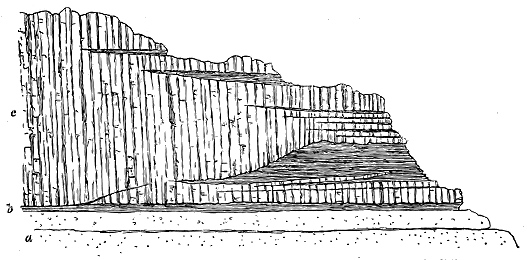
All through the Inner Hebrides the base of the basalt-plateaux presents abundant examples of sills. The general parallelism of these intrusive sheets to the bedding of the Jurassic strata among which they lie has been above referred to as having given rise to the erroneous conclusion that in Skye and elsewhere the basalts are interstratified with Jurassic rocks, and are consequently of Jurassic age. It was Macculloch who first described and figured in detail the proofs of their intrusive nature. His well-known sections in plate xvii. of the illustrations to his work on the Western Islands have been repeatedly copied, and have served as typical figures of intrusive igneous rocks.
Nowhere in North-Western Europe can the phenomena of sills be studied so fully and with such exuberance and variety of detail as in the island of Skye and its surrounding islets. On the western coast the greater subsidence of the basaltic plateau has for the most part submerged the platform of intrusive sheets, though wherever the base of the bedded lavas is brought up - 305 - to the surface the accompanying sills are exposed to view. The east coast of the island has been classic ground for this part of volcanic geology since it supplied the materials for Macculloch's descriptions and diagrams. From the mouth of Loch Sligachan to Rudha Hunish, at the north end of Skye, a series of sills may be traced, sometimes crowning the cliffs as a columnar mural escarpment, sometimes burrowing in endless veins and threads through the Jurassic rocks. The horizontal distance to which this continuous band of sills extends in Skye is not far short of 30 miles. But it stretches beyond the limits of the island. It forms the group of islets which prolongs the geological structure and topographical features of Trotternish for 4 miles further to the north-west. It reappears 10 miles still further on in the Shiant Isles. Thus its total visible length is fully 40 miles, or if we include some outlying sills near the Point of Sleat, to be afterwards described, it extends over a distance of not less than 60 miles. From the last outlier in Skye to the sills of the Isle of Eigg is a distance of only 8 miles, thence to those of Ardnamurchan 17 miles, and to those of the south coast of Mull 25 miles. Thus this platform of intrusive sheets of the Inner Hebrides can be interruptedly followed for a space of not less than 110 miles.
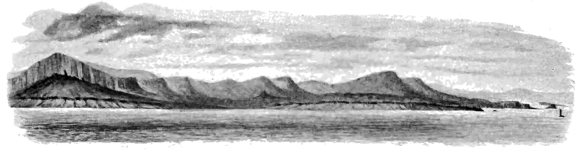
Though none of the sills in Skye itself attain the dimensions - 306 - of the Fair Head sheet, they present a greater variety of rock and of geological structure than is to be found in Antrim. They are specially developed at the base of the thick, overlying, basalt-plateau—a platform on which such a prodigious quantity of eruptive material has been injected. Part of this material consists of basic rocks in the form of dykes, veins, or sills; part of it is included in the intermediate and acid groups, and comprises veins, sheets, and bosses of granitoid, felsitic, rhyolitic, trachytic, and pitchstone rocks. One of the peculiarities of the Skye sills is the occurrence among them of compound examples, where sheets of basic and acid material have been injected along the same general platform. These will be more specially referred to in Chapter xlviii. With regard to the basic sills (dolerites, basalts, etc.), I would remark that while in Western Scotland the Antrim type of short, thick intrusions, or laccolites, is also found, the vast majority of the sheets are much thinner, more persistent, and less easily distinguishable from the bedded basalts.
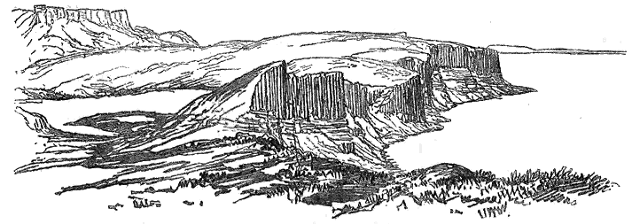
In describing the sills of Skye I shall take first those of the eastern and then those of the western side of the island. Along the east coast, from Loch Sligachan to the most northerly headlands and islets the sills play a notable part in the scenery, inasmuch as they cap the great sea-cliff of Trotternish and run as a line of ridges parallel to the trend of the coast, - 307 - while the plateau-basalts rise above them further inland as a lofty escarpment, which includes the picturesque landslips of the Storr Rock and Quiraing (Figs. 318, 319). Beneath the thick sills, the Jurassic sandstones form a range of pale yellow precipices, along which many thinner sheets of eruptive material have been intruded. As Macculloch well showed, many of these sheets, if seen only at one point, might readily be taken for regularly interstratified beds, but perhaps only a few yards distant they may be found to break across the strata and to resume their course on a different level.
The sills of this Trotternish coast may be distinguished even at some distance from the bedded basalts by the regular prismatic jointing, already referred to, and by their frequently greater thickness, while on closer inspection they are characterized by their much coarser texture. They are generally somewhat largely crystalline ophitic dolerites, gabbros or diabases, and exhibit the persistent uniformity of composition and structure so characteristic of intrusive sheets and dykes. These characters are well exhibited in the Kilt Rock, a columnar sill capping the cliffs to the south of Loch Staffin (Fig. 319).
These massive sills are prolonged in a series of picturesque flat tabular islets beyond the most northerly headlands of Skye. They probably continue northwards under the sea at least 12 miles further, for sills of the same type rise there in the singularly striking group of the Shiant Isles (Fig. 320). These lonely islets, extending in an east and west direction for about three miles, display in great perfection most of the chief characters of the Skye sills. They are especially noteworthy for including the thickest intrusive sheet and the noblest columnar cliff in the whole of the Tertiary volcanic series of Britain. The larger of the two chief islands consists of two masses of rock connected by a strip of shingle-beach, and having a united length from north to south of about two miles. The northern half, or Garbh Eilean, presents towards the north a sheer precipice 500 feet high. This magnificent face of rock consists of one single sill, but as its original upper limit has been removed by denudation and its base, where it is thickest, is concealed under the sea, the sill may exceed 500 feet in thickness. The rock has the usual prismatic structure, which imparts to it an impressive appearance of regularity. The columns retain their individuality to a great height, and though none of them perhaps can be followed from base to crest of the cliff, many of them are evidently at least 300 or 400 feet long.
Macculloch, who gave the first geological description of the Shiant Isles, showed the intrusive nature of the igneous rocks, and described the remarkable globular or botryoidal structure of the Jurassic shales between which they have been injected.[315] Professor Heddle has published a brief account of the geology of the islands.[316] Professor Judd visited the group and brought away a series of specimens of their eruptive rocks, which he found to include basic and ultra-basic varieties.[317]
[315] Western Islands, vol. i. p. 441.
[316] Trans. Norfolk Nat. Hist. Soc. vol. iii. (1880) p. 61.
[317] Quart. Journ. Geol. Soc. vol. xxxiv. (1878) p. 677, and xli. (1885) p. 393. My description in the text is the result of three successive visits to the islands.
- 308 -
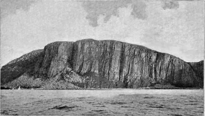
In Garbh Eilean, where the thickest mass of erupted material presents itself, at least three sills may be observed. Some low reefs that run parallel with the northern coast of the island consist of coarse ophitic gabbro in two or more sheets which have been intruded between the Jurassic shales. - 309 - Above these strata comes the great columnar sill, its base gradually sinking towards the west until it passes under the sea, and the vertical columns then plunge abruptly into the water. The rock of which this massive sill consists is another large-grained gabbro or dolerite, with an ophitic structure. Owing to the form of the ground it cannot be so satisfactorily examined as the neighbouring island of Eilean Mhuire, which, though less lofty and rather smaller than Garbh Eilean, affords a succession of admirable and easily examined sections along its precipitous shores.
Professor Judd found that while the rocks are mainly ophitic gabbros and dolerites, they include such highly basic compounds as dunite. An examination of the Eilean Mhuire cliffs enables the observer to ascertain that the sills display considerable variety in texture and in the character and arrangement of their component minerals. They are marked by a persistent, more or less distinct disposition in rude beds, and these again often display a banding of their constituents in lines parallel with the general bedding. Some of these bands are largely felspathic, and are thus paler in colour. Others, where the ferro-magnesian minerals and ores are more specially aggregated, are dark in colour. In some layers the long black prisms of augite are ranged in a general parallelism with the banding.
A specimen selected as typical of the ordinary coarse-grained amorphous rock was sliced and placed in Mr. Harker's for microscopic examination, and he has supplied the following observations regarding it: "The gabbro from Eilean Mhuire [7110] is a crystalline rock showing to the eye lustrous black augites, half an inch long, and (predominating) felspar. The microscope reveals, in addition, irregular grains of black iron-ore and little hexagonal prisms of apatite. No olivine is to be detected. As regards structure, the augite has tended to crystallise out in advance of the felspar, but this relation is not constant.
"The augite is of a light-brown tint in slices, and has an unusual kind of pleochroism. The colour for vibrations parallel to the β-axis is of the purplish-brown tone seen in some soda-bearing augites; parallel to γ and α it has a yellow or citron tint. The colour and pleochroism are more marked in the interior of a crystal than towards the margin, but some crystals pass at the margin into a slightly pleochroic, pale-green, recalling ægerine-augite. The felspar tends to build elongated crystals. It is a rather finely lamellated labradorite, sometimes showing pericline- as well as albite-lamellae."
Another specimen from one of the black bands in the same island, with a linear arrangement of its component minerals, is thus described by the same petrographer: "This rock [7111] is of darker appearance than the preceding, and contains abundant black iron-ore, besides some pyrites. It also differs in having a marked parallel disposition of its crystals.
"Except for the greater prominence of large irregular grains of iron-ore, this rock under the microscope closely resembles the last described, the parallel structure not being conspicuous in the slice. The augite has the - 310 - peculiar colour and pleochroism already noted, and the felspar is of the same kind as before."
I did not succeed in finding in place any bands of dunite, but this basic material probably occurs at the base of some of the sills where it has segregated from the rest of the mass, like the picrite at the bottom of the Bathgate diabase.
The amount of contact-metamorphism effected even by such thick sills as those of Trotternish and Shiant is much less than might be expected. It seldom goes beyond a mere induration of the strata for a few yards, often only for a few inches from the surface of junction. In the Shiant Isles, however, the shales between the sills have undergone a more remarkable alteration. They have not only been greatly indurated, but have acquired the globular or botryoidal structure so fully described by Macculloch. The spheroidal aggregates vary from not more than a line to more than half an inch in diameter, and appear on the surface as dark, irregularly grouped, pea-like aggregates. This structure is perhaps best developed immediately under the thick sill on the west side of Eilean Mhuire.
The massive sills are not the only evidence of the injection of igneous material on the Shiant Isles. The sill, or more probably group of sills, forming Eilean Mhuire is traversed by a number of sheets of basalt varying from only two or three inches to 20 feet in thickness. These black fine-grained rocks invariably present chilled selvages next the coarse gabbro, and though they have been on the whole injected parallel to the general bedding or banding, they here and there break across it as veins. The most important of these later intrusions forms a columnar sill on the eastern side of the island, and can be followed for several hundred yards. It consists of a dark finely crystalline olivine-basalt, which towards the margin assumes a dense black texture. Under the microscope Mr. Harker found a thin slice of this rock to be "an olivine-basalt of semi-ophitic, semi-granulitic structure [7112]. The olivine is mostly fresh, but part of it is converted into a yellowish-brown pseudomorph like iddingsite. Magnetite occurs chiefly in imperfect octohedra. The felspar is in little lath-shaped sections, many of which are finely striated, and give extinction-angles indicating a labradorite. The augite, light brown in the slice, never has crystal-boundaries, and often enwraps the felspars."
The narrow veins are composed of a much closer-grained basalt in which a few scattered felspars are visible. Mr. Harker remarks, with regard to a thin slice of one of these rocks [7113], that "the microscope shows this, too, to be an olivine-basalt. The porphyritic felspars are twinned on the Carlsbad and albite laws. Olivine and pseudomorphs after it are well represented. Magnetite is only sparingly present. The general mass of the rock consists of very small striated prisms of labradorite, granules of augite, and interstitial matter which must be partly glassy."
This is perhaps the most striking of all the examples known to me where an older sill has been split open to receive a subsequent injection of molten material. The Eilean Mhuire gabbro must be at least 200 feet - 311 - thick, and it not impossibly passes under the still thicker pile of Garbh Eilean. Yet it has been horizontally ruptured near its base, and into the rent thus produced another mass of molten matter has been thrust. This subject will be again referred to in connection with another remarkable example on the west coast of Skye.
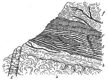
In contrast to such enormous thicknesses of intrusive material as those of Trotternish and the Shiant Isles, instances may be culled from the same belt of sills where the molten rock has been injected in thin leaves and mere threads into the Jurassic sandstones and shales, or into the shales and coals intercalated among the plateau-basalts. Thus, on the cliff immediately to the north of Ach na Hannait, between Loch Sligachan and Portree Bay, the section may be seen which is represented in Fig. 321. At the base lies a vesicular dolerite with a slaggy upper surface (a). Next comes a zone of sedimentary material about five or six feet thick, the lower portion consisting of an impure coal, which passes towards the right hand into brown and grey carbonaceous shale with plant-remains (b). This coaly layer has been already alluded to as probably lying on the same horizon with the coal of Portree (p. 288). Traced northward, it is found to have a bed of fine tuff beneath it, and sometimes a volcanic breccia or conglomerate. It fills up rents in the underlying slaggy lava, and was undoubtedly deposited upon the cooled surface of that rock. Immediately above this lower band the black carbonaceous shale which follows has been invaded by an extraordinary number of thin cakes or sills and also by veins or threads of basalt. For a thickness of two or three feet the band (d) consists mainly of these intrusions, which, in the form of a fine grey basalt, vary from less than an inch to three or four inches in thickness. They are separated by thin partings of coaly shale, and as they tend to break up into detached nodule-like portions, - 312 - especially towards the right hand of the section, they might, on casual inspection, be easily mistaken for nodules in the dark shales. Somewhat later in the time of intrusion are veins of basalt which, as at c, break across the nodular sills, and sometimes expand into thicker beds (c′).
I have never seen such a congeries of minute sills among the Tertiary basalt-plateaux as that here exhibited. In a space of about three feet of vertical height there must be more than a dozen of roughly parallel leaves of intrusive rock. Veins (e) run up from the chief band of eruptive material into the overlying finely vesicular basalt (f). The dyke (g) is probably the youngest rock in the section.
The more general and extensive submergence of the base of the basalt-plateau on the west side of Skye has for the most part carried the platform of sills below sea-level, so that it is only exceptionally where, owing to local irregularities, that base has been brought up to the air, that the intrusive sheets show themselves. Yet the persistence of the platform on that side is indicated by its extension even as far as the southern promontory of the island.
The Trotternish type of sill extends down the west coast under the headlands of Duirinish. Thus at the mouth of Dunvegan Loch, where the underlying Jurassic platform has been ridged up above the surface of the sea, it has carried with it the marked sill which forms the islets of Mingay and Clett that lie as a protecting breakwater across the entrance of the inlet. The intrusive rock rests on shell-limestones full of oysters (Ostrea hebridica), and referable to the Loch Staffin group of the Great Oolite Series. This sill, when observed from a little distance, presents the usual regularly prismatic or columnar structure so well developed among the Trotternish examples, but on a closer view shows this structure less distinctly. It is an olivine-dolerite of medium and fine texture, which in thin slices displays under the microscope a distinctly ophitic structure, the abundant light-brown augite enclosing the striated felspars. Its lowest portion, from three to seven or eight inches upward from the bottom, is much closer-textured than the rest of the rock and is finely amygdaloidal. Its vesicles are in many cases drawn out to a length of three or four inches, and the zeolites which now fill them look like parallel annelid tubes or stems of Lithostrotion. It is noteworthy also that the elongation of the vesicles has sometimes taken place at a right angle to the surface of contact with the underlying strata. But the most remarkable feature in this sill is the surface which it presents to the oyster-beds on which it rests. The fine-grained dark dolerite has there assumed the aspect of a sheet of iron-slag, with a smooth or wrinkled, twisted, ropy surface, which displays fine curving flow-lines. No one looking at a detached specimen of this surface would be ready to admit that it could possibly have come from anything but a true lava-stream that flowed out at the surface. The contours of a viscous lava are here precisely reproduced on the under surface of a massive sill.
A little further south, the promontory of Eist, forming the western breakwater of Moonen Bay, consists of an important sill or group of sills - 313 - which has insinuated itself among shales, shell-limestones, and shaly sandstones, full of Ostrea hebridica, Cyrena aurata, etc., and belonging to the Loch Staffin group of the Great Oolite Series. The shore-cliff below the waterfall affords the section given in Fig. 322, illustrating the manner in which a thick intrusive sheet may sometimes give off thin veins from its mass. The rock attains on the Eist promontory a thickness of probably at least 100 feet, where it is thickest and undivided. But the two main sheets, or branches of one great sheet, on this peninsula have probably a united depth of more than 300 feet. Landwards the rock splits up and encloses cakes of the Jurassic strata. It possesses the usual prismatic structure and doleritic composition. In Moonen Bay, as shown in Fig. 322, it presents a banded structure, marked especially by an alternation of lines of amygdales and layers of more compact and solid dolerite, with occasional enclosed cakes of baked shale or sandstone. Its upper surface is somewhat uneven, and from it are given off narrow, wavy, ribbon-like veins (d), from less than an inch to three inches or more in width, which keep in a general sense parallel to the top of the sill, but at a distance of a few inches or feet from it. The sill becomes as usual fine-grained towards the contact, the shales and sandstones being indurated and the limestone marmorized.
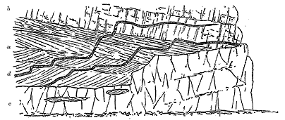
The next uprise of the base of the basalt-plateau on the west side of Skye lies about 25 miles to the south-east, where it emerges from the sea in the Sound of Soa (Fig. 323). A vast volcanic pile has there been heaped up on the Torridon sandstone, the whole of the thick Jurassic series, which is found in force only three miles distant in Strathaird, having been removed by denudation from this area before the beginning of the Tertiary volcanic period. The plateau-basalts rests on the upturned edges of the Torridonian sandstones and shales, and are accompanied as usual by their underlying network of intrusive rocks. It is hardly possible to exaggerate the wild confusion of sills, dykes and veins which have been injected among the rocks, at and on both sides of the unconformability. Endless sheets of basalt and dolerite have forced their way between the bedded basalts and the sandstones, while across the whole rise vast numbers of dykes and veins. Narrow, black, - 314 - wavy ribbons of basic material cross many of these veins, while the later north-west dykes cut sharply through everything older than themselves. As a natural section for the study of the phenomena of intrusion in many of their most characteristic phases, I know no locality equal to the northern coast-line of the Sound of Soa, unless it be the cliffs of Ardnamurchan. But the Skye cliffs, though less imposing than those of the great Argyllshire headland, have this advantage, that instead of being exposed to the full roll of the open Atlantic, they form the margin of a comparatively sheltered strait, and can thus be conveniently examined.
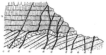
Following still the western seaboard of Skye, we meet with other striking examples of sills at a distance of some eight miles in a straight line eastward where, between Lochs Slapin and Eishort, the prominent headland of Suisnish juts out into the sea. This promontory has long been known to geologists from the section of it given by Macculloch as an instance of the connection between overlying rocks and dykes. I have already alluded to it in that relation, and refer to it again as an example of one of the thicker intrusive sheets of the Inner Hebrides. Denudation has here also proceeded so far that the whole of the volcanic plateau has been stripped off, only some of the underlying sills being left, together with the platform of older rocks between which and the vanished basalts they were injected. Most of these sills consist of granophyres belonging to the acid group of rocks to be afterwards described. But basic sheets occur not infrequently interposed between the granophyres and the subjacent Lias, and sometimes even intercalated in the former rock. Though at first sight it might be thought that these sills had insinuated themselves after the eruption of the granophyre, and there are instances where this cannot be shown not to be the case, I have obtained so many proofs of the invasion of the basic by the acid rock that I have no doubt the former is, as a general rule, the older of the two.
The Suisnish headland exhibits the structure represented in Fig. 249. For about 300 feet above the sea-level the steep grassy slope shows outcrops of the dark, sandy shales and yellowish brown, shaly sandstones of the Lias which form the range of cliffs to the eastward. These gently - 315 - inclined strata are cut through by many vertical basalt-dykes, some of which intersect each other, but among which by far the largest is the mass shown in the figure. This broad dyke consists of a dolerite or gabbro the largely crystalline texture of which marks it off at once from the others, which are of the usual dark, heavy, fine-grained type, with an occasional less basic and porphyritic variety. Traced up from the sea-margin, the dyke loses itself in a talus of blocks from the cliff above, so that its actual junction with the mural front of the sill cannot be seen. But that it joins that mass, with which it agrees in petrographical characters, hardly admits of question. The cliff consists of a thick sheet of coarsely crystalline dolerite or gabbro (d in Fig. 249), which in its general aspect at once recalls the rock of Fair Head. It varies considerably in texture, some parts of the mass are exceedingly coarse, like the Skye gabbros, and present a fibrous structure in their augite resembling that of the diallage in these rocks; other portions assume the compactness of basalt. A specimen of medium grain under the microscope shows the typical ophitic structure so generally found among the dolerites both of the plateaux and of the intrusive sheets. This sill must be about 200 feet thick, and like the rock at Fair Head is traversed from top to bottom by joints that divide it into prisms. It appears to bifurcate eastward, one portion running with a tolerably uniform thickness of a few feet as a prominent band at the top of the shales and sandstones, the other slanting upwards and gradually thinning away in the granophyre.
Towards its base, near the contact with the underlying shales, the rock as usual becomes finer grained, and the thin band just referred to resembles in texture one of the wider basalt-dykes. Westwards the rock can be followed round the top of the grassy slopes formed by the decay of the shales. Though concealed by intervals of moorland and peat, it is visible in the stream sections, and I think must be continuous, as a band only a few yards thick, round the northern side of the hills as far as Beinn Bhuidhe, where a similar sill makes a prominent crag. Its total area measures a mile and a quarter in length by half a mile in breadth. The granophyre which overlies it forms part of an interesting series of sheets which I have traced all the way from Suisnish to the braes above Skulamus.
Whether or not the whole sheet of basic rock is continuous, and whether it all proceeded from the great Suisnish dyke, cannot be confidently decided until the ground is mapped in detail, though from the great thickness of the sill at the dyke, its attenuation outwards from that centre and its uniformity of petrographical character, I am disposed to answer affirmatively. There is no other probable vent to be seen in the neighbourhood, unless a massive dyke that runs from Loch Fada north-westwards into Glen Boreraig can be so regarded.
Not far from the extreme southern point of Skye a singularly interesting example of a sill remains as a detached survival of the basaltic plateau and its accompaniments. In his map of Skye, Macculloch showed the position of this outlier, which he classed with the general "trap" formation of the island. The locality was visited by Professor Judd, who regarded the intrusive - 316 - rock as a "phonolite"[318] In 1894, during an excursion with my colleague Mr. C. T. Clough, I had an opportunity of examining the rocks and collecting notes for the following account of them.
[318] Quart. Jour. Geol. Soc. vol. xxxiv. (1878) p. 692.
At Rudh' an Iasgaich, about two miles from the Point of Sleat, a small outlier of conglomerate lies on the edges of the Torridon Sandstone. This deposit has been correctly identified by Professor Judd with the similar strata which, in Skye and elsewhere on the west coast of Scotland, underlie the Liassic series. It is here about 10 or 12 feet thick, reddish and yellowish in colour, and distinctly calcareous. Its component pebbles consist largely of Cambrian (Durness) limestone, quartzite, and Torridon Sandstone—rocks which all occur in situ in Sleat. It may be compared with the limestone conglomerates of Strath and those which underlie the Lias at Heast on Loch Eishort.[319] That here, as elsewhere in this region, the basement conglomerate was followed by the rest of the Lias and Oolites may be inferred with some confidence from the copious development of the Jurassic series a few miles off, both to north and south. But the whole of this overlying succession of formations has here been swept away, and, but for the protection afforded by the eruptive rocks of Rudh' an Iasgaich, the conglomerate would likewise have disappeared.
[319] Op. cit. vol. xiv. (1857), p. 9; vol. xliv. (1888), p. 71.
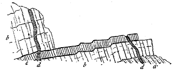
Above the conglomeratic band lies a sheet of intrusive rock, which in one place has apparently cut it out, so as to rest directly upon the Torridon Sandstone (a, Fig. 324). The decay of the softer detrital rock underneath has caused the sill to break off in slices, which have left behind them a bold mural escarpment (b b).
The rock of this sill is a rather coarsely crystalline porphyritic olivine-dolerite, which towards the north attains a thickness of about 70 feet. It exhibits the usual prismatic jointing, but less perfectly than some of the Trotternish sills already referred to. Besides these vertical joints, it is also traversed by a system of horizontal divisional planes which, though somewhat irregular in their course, run, in a general sense, parallel to the upper and under surfaces of the sill.
It seems to have been along this transverse series of joints that a second sill (c), five or six feet thick, has been injected. The material of this - 317 - younger intrusion is a black, finely crystalline dolerite or basalt, with rudely prismatic jointing. Its most striking feature, besides its regularity of position and persistency for several hundred yards as a platform along the shore, is the basalt-glass which marks both its under and upper surfaces of contact, and which is here developed upon a scale to which I have not met with an equal among the Tertiary sills of this country.
The selvage of glass appears as a black tar-like layer, varying from a mere film to two or three inches in thickness. It is found not only on the upper and under surfaces, but descends along abrupt step-like interruptions of the upper surface, a foot or more in height, as if the sill had been broken by a series of subsidences. The apparent fracture, however, is probably due to the irregularities of the passage forced for itself by the molten rock as it passed from one line of horizontal joint to another through the heart of the older sheet.
The exposed surface of black glass on the top of the younger sill exhibits long parallel lines, probably marking flow-structure, which are made conspicuous by a pale yellow ferruginous weathered crust. Portions of the larger intrusive sheet have been broken off and involved in the later rock. The younger sill disappears to the north, and is not found in the cliff of Rudha Chàrn nan Cearc, where the thick sill, lying once more on the band of conglomerate, forms a fine escarpment above the shore. Dykes of fine-grained basalt (d d) with compact chilled margins rise through both sills, together with veins which pursue a wavy upward path like strips of black ribbon.
This example, and that of the Shiant Isles already described, cannot but impress the observer with the prodigious force with which the material of the sills was injected. In these instances solid sheets of intrusive rock have subsequently been rent open, doubtless under a superincumbent pressure of many hundreds of feet of the terrestrial crust, and a new injection of molten magma has made its way into the rents thus caused. In each case, the position of the rents was obviously determined by structural lines in the older sills, but we are lost in astonishment at the energy required to split open, even along these lines, such solid crystalline masses as the thick sills, and to overcome the superincumbent pressure of so deep a pile of rock.
The isolation of a relic of the Tertiary sills on the west side of the promontory of Sleat presents some interesting problems to the mind of the geologist. The locality lies about midway between the basalt-plateau of Strathaird and that of Eigg, and some eight or nine miles in a direct line from either. The basalts cannot be proved to have once stretched continuously between Eigg and Strathaird, and to have covered this part of Sleat; but the position of the Sleat sills makes it probable that this continuation did formerly exist. The denudation of the West of Scotland since early Tertiary time has been so stupendous that I am prepared for almost any seemingly incredible evidence of its effects. There can hardly be any doubt, however, that the sills here described belong to the great platform of intrusive sheets, and that they were injected under a pile of Secondary strata, if not also of Tertiary basalts, which has here been entirely removed.
- 318 -
Reference may be made, in conclusion, to a not infrequent feature of the Skye sills. Like the dykes, they are often double or multiple, molten material having been successively injected along the same plane. The example just cited from the west side of Sleat illustrates one type of such compound sills. More frequently, however, the subsequent injections have been made along the floor or roof of the first sheet. Mr. Harker has found numerous cases of this structure in the Strath district. They are recognizable even from a distance by their terraced contours when seen in profile. They often vary considerably in thickness owing to the dying out or coming-in of their separate bands; while, on the other hand, single sills tend to maintain a uniform thickness for long distances, or taper away gradually. The compound arrangement of the basic sills is well brought out where acid material has been injected between the sheets, as will be more fully described in Chapter xlviii.
The phenomena of the coasts of Skye are repeated on the east side of Raasay, in Eigg, and still more magnificently along the south coast of Mull. A single example is here given (Fig. 325) from the east side of Eigg. Over the Jurassic sandstones (a a) a sill of basalt (1) four to six feet thick has been injected between the stratification, and another (2) two to four feet thick has forced its way across the middle of one of the bedded basalts (b b) in which it bifurcates, and above which comes the thick series of lavas of the plateau (c, d). In one of the streamlets, which exposes a section of the Jurassic strata below the volcanic escarpment, more than twenty intrusive sheets may be counted among the shales and limestones. They are sometimes not six inches thick, and seldom exceed six or eight feet.
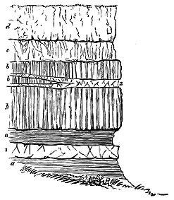
I will conclude this account of the Tertiary basic sills of Britain by referring to one further district in the West of Scotland, where they are well displayed on bare hillslopes and also along a picturesque sea-coast. In the promontory of Ardnamurchan in the west of Argyleshire, one of the most conspicuous eminences, known as Ben Hiant, affords a striking mass of intrusive material, which, extending along a rugged shore for three-quarters of a mile, mounts thence inland in a series of rocky knolls, and in rather less than a - 319 - mile culminates in a summit, 1729 feet above sea-level.[320] The rocks which cover this large space are disposed in numerous rude beds, which have a seaward dip of perhaps 15° to 20°, and are sometimes distinctly prismatic, the prisms being not infrequently grouped in fan-shape. They are evidently due to successive intrusions. Although generally coarsely crystalline in texture, they include also intermediate and fine-grained sheets. They are never, so far as I have been able to discover, amygdaloidal,[321] nor do they present the ordinary external characters of the beds of the plateaux, though here and there they appear to have caught up portions of the plateau-series. They distinctly overlie the bedded basalts on their eastern and southern margins; but westwards they appear to lie transgressively across the edges of these rocks, while to the north-west and north they rest on quartzites and schists and on Jurassic limestones. An outlier from the main mass forms the prominent hill of Sròn Mhor, and can be seen distinctly overlying the bedded basalts as well as the neck of agglomerate already described (Fig. 302).
[320] This locality has been described by Professor Judd (Quart. Jour. Geol. Soc. xxx. (1874), p. 261; and xlvi. (1890), p. 373).
[321] As amygdaloidal structure is occasionally to be found among both dykes and sills its presence in the Ben Hiant rocks would not be inconsistent with their intrusive origin.
The prevalent rocks of Ben Hiant are well crystallized, ophitic olivine-dolerites and gabbros. A specimen taken from the shore on the west side of the mass was found by Dr. Hatch to present under the microscope its augite in large plates, which enclose narrow laths and needles of plagioclase felspar as well as grains of olivine. All the felspars are in lath-shapes, sometimes extremely long and narrow. The iron-ore likewise assumes an ophitic character, enclosing rectangular portions of felspar. Dr. Hatch observed in another specimen, taken from the south-east side of the hill, "a curious intermixture of two different structures. Scattered portions which show the usual ophitic structure, their felspar and augite occurring in large crystals, are, so to speak, imbedded in a groundmass which presents rather a basaltic type, its felspar, augite, and magnetite, in long thin needles, microlites, and other skeleton forms, being enclosed in a dark devitrified base." A third specimen, selected from one of the columnar sheets near the top of Ben Hiant, is "a fine-grained dolerite (or gabbro) showing little ophitic structure, the augite occurring in roundish grains, and only slightly intergrown with the felspars, which are more or less lath-shaped. The rock contains a considerable quantity of black iron-ore in irregular grains and some dirty-green viridite." Still another variety of structure occurs in a specimen which I broke from one of the shore crags on the south-west side of the hill. Under the microscope, Dr. Hatch found in it a beautiful aggregate of "skeleton crystals and microlites of plagioclase, with here and there a rectangular crystal, long slender microlites of augite, and short serrated microlites of magnetite, the whole being confusedly imbedded in a dark glassy base powdered over with a fine magnetite dust."[322] A sill - 320 - of pitchstone lies among the bedded basalts on the east side of the hill.
[322] Professor Judd has called the rocks of Beinn Hiant augite-andesites, and has given descriptions and figures of their structure, and analyses of their chemical composition (op. cit.).
From a number of specimens collected by me during a second visit to this district in the summer of 1896, I selected some for microscopic examination and submitted them to Mr. Harker, who has furnished me with the following descriptions of them: "The sill at the north end of Camas na Cloiche, Ben Hiant [7114] is an olivine-gabbro of medium grain and fresh appearance. Olivine, fresh or partly serpentinized, is plentiful. The felspar is a labradorite with Carlsbad- and albite- (rarely pericline-) twinning, and some of it has zonary banding. It is for the most part in crystals giving rectangular sections, but there are some of allotriomorphic form. Magnetite occurs chiefly in shapeless grains of later crystallization than the felspar, but sometimes presenting crystal-faces to the augite. The augite is light-brown in the slice, without any true diallage-structure, and tends to enwrap the earlier minerals in ophitic patches.
"The sill south of Uamh na Creadha, on the west side of Ben Hiant [7115], is a rock of different type, having porphyritic crystals of felspar, up to an inch or more in length, in a rather finely-crystalline groundmass. The microscope shows it to be a dolerite of granulitic structure, the main mass of the rock consisting of little striated labradorite-crystals, grains of pyroxene, and rather abundant crystal-grains of magnetite. The pyroxene seems to be chiefly augite, but hypersthene is also present, and builds rather larger and more idiomorphic crystals with characteristic pleochroism."
In rambling over this Ardnamurchan district I have often been reminded of the great intrusive sheets of Fair Head. One of the features in which the rocks of the two localities resemble each other is their tendency to assume a coarsely crystalline texture. In some parts of Ben Hiant the individual crystals reach an inch or more in length. These more largely crystalline portions, however, do not form distinct bands so much as patches in the midst of the general mass; at least I have not noticed any examples of such veins of segregation as are so prominent in Antrim.
No one familiar with the well-marked distinctions between the lavas of the plateaux and the sills which traverse them can hesitate in which series to place the rocks of Ben Hiant. Since, however, these rocks have been claimed by Professor Judd as the superficial lava-currents of a volcano which broke out after the time of the plateau-basalts, like the Scuir of Eigg, some further details in regard to the geological structure of the district, which would otherwise be superfluous, may here be given.
The number of sills and dykes in Ardnamurchan is astonishingly great. There must be hundreds of them visible, and perhaps as many more concealed under superficial coverings. They are well exposed on the shore traversing the Jurassic strata and the schists. The sills become especially large and abundant in the direction of Ben Hiant, which has evidently been the principal centre from which their materials were injected. The rocks composing these sills are quite similar to those of Ben Hiant, save that, as they occur in thinner sheets than in that mountain, - 321 - they do not attain the same coarseness of texture which the more massive beds there display. They generally possess fine-grained chilled selvages along their upper and under surfaces.
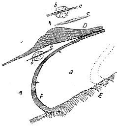
These abundant sills may be traced up into the mass of Ben Hiant from which they have issued, and of the individual sheets of which they are a continuation. One of the most striking and easily-followed examples of this connection is to be seen on the north side of the mountain. A thick sheet in the middle of Ben Hiant descends from among its contiguous sheets and, as a prominent rib, runs down the scree-slope into the valley below, where it forms a prominent feature. Crossing the streamlet in the middle of the valley, where a section has been cut through its upper surface, it gradually bends round towards the north-east, mounts the side of Beinn na h-Urchrach until it reaches the crest of the ridge and joins the other sills of which this eminence is built up. The route of this band of rock will be understood from the annexed ground-plan (Fig. 326).
That this prolongation of one of the thick beds of Ben Hiant is in no respect a superficial lava-stream but a true sill, is proved not only by its escarpment and dip-slope, but by its actually passing under and indurating the schistose grits, as may be seen in the stream-section. Again Beinn na h-Urchrach, which is mapped by Professor Judd as a northern expansion of Ben Hiant, is likewise not a lava but a true sill. Not only does it dip northwards at an angle of about 20°, having the schists immediately below its crest on the one side and descending with a long dip-slope on the other, but dwindling down rapidly from a thickness of 100 or 200 feet in the centre to no more than a few feet in a south-westerly direction, it there passes under schistose grits like those on which it lies. The strata that adhere to its upper surface are as usual indurated.
A section drawn across this attenuated development of the Beinn na h-Urchrach sill and that from Ben Hiant shows the structure represented in the accompanying diagram (Fig. 327), which simply gives the facts as exposed on the ground. The lower sill is that which issues from the main body of Ben Hiant, massive at first but diminishing in thickness as it recedes from its source.
Again, among the sheets which descend from the northern face of the - 322 - summit of Ben Hiant and strike into the Jurassic outlier below, intensely indurated shale may be seen lying between two of the dolerites, which are unquestionably sills that have been injected into the Jurassic series.
The ridge of Ben Hiant is thus found to consist of a thick and complex series of sills, some of which are not traceable beyond the side of the mountain, while others can be followed outwards among the surrounding rocks. The specially marked dyke-like sills diverge from the main mass and run for some distance north-eastward, one of them, fully a mile long, descending among the schists into the valley and ascending into the basalt-plateau on the opposite side.[323]
[323] The sills of Ben Hiant descend on the south-west side into the sea, and can be examined along the slopes and the beach, where Professor Judd has mapped a continuous platform of agglomerate. The broad hollow between that mountain and Beinn na h-Urchrach, over which he has spread his "augite-andesite lavas," appears to be underlain mainly by the crystalline schists through which sills from Ben Hiant have been injected. The northern eminence, which he has united with Ben Hiant, is entirely separate and, as above shown, is an obvious sill.
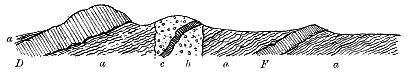
On the south-east side of the mountain where the bedded basalts can be traced close up to the intrusive dolerites, they are found to present the usual dull indurated aspect so characteristic of contact alteration among these rocks. There cannot therefore be any doubt that Ben Hiant never was itself a volcano. Its rocks are characteristically those of subterranean intrusions. They seem to have been injected from a line of fissure or from several such lines, running in a general north-easterly direction, at some late part of the volcanic period. The group of agglomerate necks of older date shows that already the ground underneath had been drilled by a number of distinct volcanic funnels, and discloses a weak part in the terrestrial crust.
In the Faroe Islands the actual base of the volcanic series is nowhere visible. Hence, the great lower platform of intrusive sheets being there concealed, this feature of the basalt-plateaux is less conspicuous than it is in the Inner Hebrides. A number of sills, however, have been noticed by previous observers,[324] and I have observed others on the sides of Stromö, Kalsö, Kunö and other islands. In the lofty precipices of the Haraldsfjord, many of the massive light-coloured prismatic sheets are intrusive, for though they preserve their parallelism with the bedded sheets for considerable - 323 - distances, they may be seen sometimes to break across these, as is strikingly shown in one of the great corries on the east side of Kunö.
[324] See in particular Prof. James Geikie and Mr. Lomas, in the papers already cited on p. 191.
One of the most remarkable sills in the Faroe Islands is probably that which forms so prominent an object on the western cliffs of Stromö, at the entrance into the Vaagöfjord (Figs. 328, 329). It is prismatic in structure, and where it runs along the face of the cliffs, parallel to the bedded basalts among which it has been intruded, presents the familiar characters of such sheets. The precipice of which it forms a part is that which rises above the row of volcanic vents already described. But it there begins to ascend the cliffs obliquely across the basalts until it reaches the crest of the great wall of volcanic rock at a height of probably about 1000 feet above the waves. From the crest of the precipice the upward course of the sill is continued into the interior of the island. It pursues its way as a line of bold crag along the ridges of the plateau, gradually ascending till it forms the summit of one of the most prominent hills in the district (Fig. 329).
Some further idea of the enormous energy with which the sills were injected may be formed from this example, where the eruptive materials followed neither the line of bedding nor a vertical fissure, but took an oblique course through the plateau-basalts for a vertical distance of probably more than 1500 feet.
If we consider the facts which have now been adduced regarding the position and structure of the sills, we are led, I think, to regard these masses as certainly belonging to the history of the basalt-plateaux, but, on the whole, to a comparatively late part of it. They consist of essentially the same materials as the lavas that form these plateaux, though with the differences of structure which the conditions of their production would lead us naturally to expect. Where they occur in thick masses, which must obviously have cooled much more slowly at some depth beneath the surface than the comparatively thin sheets could do that were poured out above ground, they have assumed a far more largely crystalline texture than that of the superficial lavas. As a rule, we may say that the thicker the sill the coarser is its texture, while the thinnest sheets are the most close-grained. Sills are especially abundant about the base of the basaltic-plateaux. We may examine miles of the central and higher parts of the escarpments without - 324 - detecting a single example of them, but if the escarpment is cut down to the base we seldom need to search far to find them.
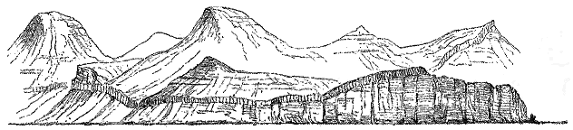
That the efforts of the internal magma to establish an outlet towards the surface were accompanied by powerful disturbances of the terrestrial crust is shown by the abundant dykes which traverse all the volcanic districts from Antrim to Iceland, and some of which ascend even to the very highest remaining lavas of the basalt-plateaux. The parallel fissures filled by these dykes prove that even after the accumulation of more than 3000 feet of basalt-sheets, the movements continued to be so powerful as to disrupt these vast piles of volcanic material. But undoubtedly the highest parts of the plateau-basalts are less cut by dykes than the lower parts. There would no doubt come a time when the dislocations would more seldom reach the surface, when dykes would not be formed so abundantly or up to such a high level, and when the volcanic energies would more and more sparingly result in the opening of new vents or in the discharge of fresh eruptions from old ones.
It appears to me most probable that the injection of the sills was connected with the same terrestrial disturbances that produced the dykes which traverse the plateaux. Besides being dislocated by parallel fissures, the earth's crust in North-Western Europe seems to have been ruptured internally along lines more or less at right angles to the vertical fissures. The deep accumulation of bedded basalts presented an increasing obstacle to the ascent of the magma to the surface. Unable to gain ample enough egress through such vertical fissures as might be formed in the volcanic pile, the molten rock would find its lines of least resistance along the planes of the strata and the lower basalt-beds, either by the aid of terrestrial ruptures there, or in virtue of its own energy. On these horizons, accordingly, the sills occur in extraordinary profusion throughout the volcanic regions. They are no doubt of all ages in the progress of the building up of the volcanic plateaux, but I am disposed to believe that a large number of them may belong to the very latest period of the uprise of basalt within the area of Britain.
One of the most suggestive features of the abundant Tertiary sills lies in - 325 - the evidence they furnish of the enormous energy concerned in the ascent and intrusion of volcanic material. The infilling of dykes or the outpouring of successive streams of lava at the surface hardly appeals to our imagination so strikingly as the proof that the sills have been impelled into their places with a vigour which, even when guided and aided by gigantic terrestrial ruptures, was capable of overcoming the vertical pressure of hundreds, or even thousands of feet of overlying rock. Had these intrusive sheets been mere thin layers, their horizontal extent and persistence would still have excited our astonishment, but when we find them sometimes several hundred feet thick, and to extend in a continuous series for horizontal distances of 50 miles or more, we are lost in wonder at the prodigious expansive strength of the volcanic forces. Again, the intrusions have not always taken place between the bedding-planes of the stratified or igneous rocks, but, as we have seen, solid sheets of already deeply buried lavas have sometimes been split open and the intrusive material has forced itself between the disrupted portions. Such subterranean proofs of the vigour of volcanic energy teach some of the most impressive lessons in the chronicles of volcanic action in the British Isles.
In closing this history of the accumulation of the great Tertiary volcanic plateaux of North-Western Europe, I would remark that as the result of prolonged eruptions from innumerable vents, the depression that extended from the south of Antrim to the Minch was gradually filled up with successive sheets of basalt to a depth of more than 3000 feet. A succession of lava-fields stretched from the North of Ireland across the West of Scotland, and perhaps even to the Faroe Islands, Iceland and Greenland. That the lava spread round the base of the Highland mountains and ran up the Highland glens, much as the sea now does, is made clear from the position of the outliers of it which have been left perched on the ridges of Morven and Ardnamurchan. So far as can now be surmised, these wide Phlegræan fields were only varied by occasional volcanic cones scattered over their surface, marking some of the last vents from which streams of basalt had flowed. But the volcanic energy was still far from exhaustion. After the accumulation of such a deep and far-extended sheet of lava, those underground movements which produced the fissures that served as channels for the uprise of the earliest dykes continued to show their vigour. The pile of bedded lavas was rent open by innumerable long parallel fissures in the prevalent north-westerly direction, up which basic lavas rose to form dykes, while vast numbers of sills were injected underneath. Whether the outflow of basalt at the surface had wholly ceased when the last of these dykes were injected into the plateaux cannot be told. Nor is there any evidence whether it had ended before the next great episode of the volcanic history—the extravasation of the gabbro bosses. All that we can affirm with certainty is, that the formation of north-west fissures and the uprise of basalt in them were again repeated, for we find north-west dykes traversing even the crests of the later eruptive masses of basic and acid - 326 - rocks. It is difficult to suppose that none of these latest dykes communicated with the surface, and gave rise to cones with the outpouring of basalt and the ejection of dust and stones. But of such later outflows of basic material over the surface of the plateaux no undoubted trace has yet been recognised.
- 327 -
Petrography of the Rocks—Relations of the Gabbros to the other members of the Volcanic series—Description of the Gabbro districts—Skye
In singular contrast to the nearly flat basalts of the plateaux, another series of rocks rises high and abruptly above these tablelands into groups of dome-shaped, conical, spiry, and rugged hills. It is these heights which, more than any other feature, relieve the monotony of the wide areas of almost horizontal stratification so characteristic of the volcanic region of the north-west. Their geological structure and history are much less obvious than those of the bedded basalts. Their mountainous forms at once suggest a wholly different origin. Some portions of them have even been compared with the oldest or Archæan rocks.[325] That they are really portions of the Tertiary volcanic series, and that they reveal a wholly distinct phase in the history of volcanic action, is now frankly admitted. Whether we regard them from the petrographical or structural point of view, they naturally arrange themselves into two well-defined groups. Of these one consists of highly basic compounds, of which olivine-gabbro is the most prominent. The other comprises numerous varieties—granite, granophyre, felsite, quartz-porphyry, pitchstone and others—all of them being more or less decidedly acid, and some of them markedly so. For reasons which will appear in the sequel, the former group must be considered as the older of the two, and it will therefore be described first.
[325] This was my own first impression, when I began, as a boy, to ramble among them. The remarkable resemblance of some parts of them to ancient gneisses will be afterwards dwelt upon. Macculloch had correctly grouped them with the other overlying rocks, and this conclusion was afterwards confirmed by Prof. Zirkel.
Since the publications of Macculloch, the occurrence of beautiful varieties of highly basic rocks among the igneous masses of the Western Isles has been familiar to geologists. They were named by him "hypersthene rock" and "augite rock,"[326] names which continued in use until 1871, - 328 - when my friend Professor Zirkel published the results of his tour through the West of Scotland, and showed that the rocks in question were mostly true gabbros.[327] Since his observations were published some of these rocks have formed the subject of important papers by Professor Judd.[328]
[326] Western Islands, vol. i. pp. 385, 484.
[327] Zeitschrift. Deutsch. Geol. Gesellsch. xxiii. (1871), p. 1.
[328] Quart. Jour. Geol. Soc. xli. (1885), p. 354; xlii. (1886), p. 49.
The general petrographical characters of the gabbro areas of Western Scotland may be summarized as follows:—A very considerable variety of petrological structure and chemical composition is observable among the rocks. At the one end of the series are compounds of plagioclase and augite, which, though wanting in olivine, have the general structure and habit of dolerites. At the other end are mixtures wherein felspar is scarce or absent, and where olivine becomes the chief constituent. Between these two extremes are many intermediate grades, of which the most important are those containing the variety of augite known as diallage and also olivine. These are the olivine-gabbros, which form so marked a feature in the central parts of the great basic bosses. That some of these varieties of rock pass into each other cannot be doubted. Their distinctive composition and structure appear to have been largely determined by their position in the eruptive mass. The outer and thinner sheets are in great measure dolerites, with little or no olivine. Coarse gabbros are abundant in the inner portions. Rocks rich in olivine, however, occur at the outer and especially the lower part of the gabbro masses of Rum and in some parts of Skye. The following leading varieties may be enumerated:—
Dolerite.—This rock varies from an exceedingly close grain (when it approaches and graduates into basalt) up to a coarse granular crystalline texture, in which the component minerals are distinctly visible to the naked eye. An average sample is found to consist of plagioclase, usually lath-shaped, and crystals or grains of augite with or without olivine. Under the microscope, the different varieties are distinguished by the presence of more or less distinct ophitic structure, the felspar being enveloped in the augite. For the most part they are holocrystalline, but occasionally show traces of a glassy base. Ilmenite is not infrequent, with its characteristic turbid decomposition product (leucoxene). In other cases, the iron-ore is probably magnetite. Between the dolerites and gabbros no line of demarcation can be drawn in the field, nor can a much more satisfactory limitation be made even with the aid of the microscope. As a rule, the thickest and largest intrusive masses or bosses are gabbro, those of less size are dolerite, while the smallest (and sometimes the edges of the others) assume externally the aspect of basalts.
Gabbro.—Under this term I arrange, as proposed by Professor Judd, all the coarse-grained granitoid basic rocks of the region without reference to the variety of augite present in them. Under the microscope, they are found to be holocrystalline, but with a granitic or granulitic rather than an ophitic structure, though traces of the latter are by no means rare. To the naked eye their component minerals are usually recognizable. Professor - 329 - Zirkel, from his examination of the Mull gabbros, believed them to consist of three parts of plagioclase, two parts of olivine, and one part of diallage.[329] Olivine, however, is not invariably present.[330] The pyroxene also does not always show the peculiar fibrous structure of diallage. Professor Judd, indeed, maintains that the diallagic form is due to a deep-seated process of alteration (schillerization), and that the same crystal may consist partly of ordinary augite and partly of diallage.[331] Ilmenite (with leucoxene), magnetite, apatite, biotite, and epidote are not infrequent constituents.
[329] Zeitschr. Deutsch. Geol. Gesellsch. xxiii. (1871), p. 59.
[330] Professor Judd (Quart. Jour. Geol. Soc. xlii. p. 62) believes that originally all the gabbros contained olivine, and that where it is now absent, it has been altered into magnetite or serpentine. But in some coarse massive gabbros this mineral does not appear to have been an essential constituent. See op. cit. vol. l. p. 654.
[331] Op. cit. xli. In a later paper he insists on the gradation of the coarse granitoid varieties (gabbros) into holocrystalline compounds, where the felspar appears in lath-shapes with crystals or rounded grains of augite and olivine (dolerites), and thence into true basalts, magma-basalts, and tachylytes (op. cit. xlii. p. 62).
In a recent study of the gabbros of the Cuillin Hills of Skye by Mr. J. J. H. Teall and myself, four characteristic types have been recognized.[332]
[332] Quart. Journ. Geol. Soc. vol. 1. (1894), pp. 645-659, and Plates xiii. xxvi.-xxviii. See also Prof. Judd's paper, op. cit. (1886), p. 49.
(1) Granulitic Gabbros.—These are dark, fine-grained rocks which externally resemble some of the altered basalts of the plateau-series. They occur in bands or sheets which, so far as can be made out, are the oldest portions of the whole gabbro mass. Under the microscope they are found to possess a finely granulitic structure, and to consist of grains of pyroxene (augite, but more usually with the inclusions characteristic of diallage and pseudo-hypersthene), and of felspar allied to labradorite, with green pseudomorphs agreeing in form and size with the pyroxene-grains, but made of minute prisms and fibres of green hornblende and a little chlorite.
(2) Banded Gabbros.—These are characterized by a remarkable arrangement in parallel bands of different mineral composition like the banding of ancient gneisses. This structure will be more particularly described in later pages. They are coarse-grained rocks composed of pyroxene, plagioclase, olivine and magnetite. But these minerals are not distributed equally through the mass. The pale bands contain much felspar; the dark bands are largely composed of the ferro-magnesian minerals and magnetite. The pyroxene, occurring as ordinary augite, not uncommonly shows a tendency to ophitic structure. The felspar, a variety closely allied to labradorite, occurs as grains, as irregular ophitic patches, and also in forms that give broad rectangular sections. Olivine in an unaltered condition has been detected by Mr. Teall in only one specimen, and he thinks that this mineral probably never played an important part in the original constitution of these rocks. Its rounded grains may be observed to have the other minerals moulded round them, whence it may be inferred to be of older consolidation. Magnetite is generally present, either in rounded grains or in large irregular masses. Though it occurs also in strings traversing the other minerals as a secondary product, it must undoubtedly have entered largely into the original composition - 330 - of these rocks. It is found enclosing the augite grains and behaving like a groundmass between the felspars. Among the dark bands there occur narrow lenticular black layers ('schlieren') composed entirely of augite and iron-ore.
The extraordinary differences between the composition of the pale felspathic and the dark ultra-basic bands are well brought out in the following analyses by Mr. J. Hort Player, No. 1 being from a light-coloured band consisting mainly of labradorite with some augite, uralitic hornblende and magnetite; No. 2 from a dark band composed of augite, magnetite and labradorite; and No. 3 from a thin ultra-basic layer mainly formed of augite and magnetite. All these specimens were taken from the ridge of Druim an Eidhne, on the eastern side of the Cuillin Hills, Skye.[333]
| I. | II. | III. | |||
| Silica | 52·8 | 40·2 | 29·5 | ||
| Titanic acid | ·5 | 4·7 | 9·2 | ||
| Alumina | 17·8 | 9·5 | 3·8 | ||
| Ferric oxide | 1·2 | 9·7 | 17·8 | ||
| Ferrous oxide | 4·8 | 12·2 | 18·2 | ||
| Ferric sulphide | ··· | ·4 | ·4 | ||
| Oxide of manganese | ··· | ·4 | ·3 | ||
| Lime | 12·9 | 13·1 | 10·0 | ||
| Magnesia | 4·8 | 8·0 | 8·7 | ||
| Soda | 3·0 | ·8 | ·2 | ||
| Potash | ·5 | ·2 | ·1 | ||
| Loss by ignition | 1·2 | ·5 | 1·0 | ||
| 99·5 | 99·7 | 99·2 | |||
| Spec. grav. | 2·91 | 3·36 | 3·87 |
[333] Quart. Journ. Geol. Soc. vol. 1. (1894), p. 653. Banded structures have been recognized in many gabbros of different ages. See the references in this paper; also Mr. W. S. Bayley, Journ. Geol. Chicago, ii. (1895), p. 814, and vol. iii. p. 1.
(3) Coarse-grained massive Gabbros.—These rocks, so abundant among the great basic bosses of the Inner Hebrides, are characterized by their coarse granitic structure, their component crystals being sometimes more than an inch long. They occur as sheets, veins and irregular masses traversing the varieties of gabbro already mentioned. They consist of the same minerals as the banded forms, and indeed are themselves sometimes banded. They are more uniform in composition than the typical banded gabbros, though showing also some variation in the relative proportions of their constituents. The specific gravity of three specimens was found to be 2·82, 2·97, and 3·06.
- 331 -
- 332 -
(4) Pale Gabbros of the Veins.—These occur abundantly as irregular branching veins, from less than an inch to several yards in width, and cross all the other varieties (Fig. 330[334]). Their whiteness on weathered surfaces makes them conspicuous by contrast with the dark brown or black hue of the rocks which they traverse, and shows at once that they must be poorer in bases than these. They are found on microscopic examination to consist of the same minerals as the more coarsely crystalline gabbros, but with a much greater abundance of the felspar. They contain also apatite, and hornblende appears to predominate in them over augite. They are to be distinguished from the pale veins that form apophyses from the intrusive granophyres.
Troctolite (Forellenstein).—This beautiful variety of plagioclase-olivine rock occurs as a conspicuous feature on the east side of the gabbro-area of the island of Rum. It forms a sill on the side of the mountain Allival, in which the component minerals are drawn out parallel with the upper and under surfaces of the bed (Fig. 341). So marked is this flow-structure that hand-specimens might readily be taken at the first glance for ancient schistose limestone. "The felspathic ingredient (probably labradorite or anorthite) is white, and its lath-shaped crystals have ranged themselves with their long axes parallel to the line of flow. The olivine occurs in perfectly fresh grains, which in hand-specimens have a delicate green tint. Under the microscope they appear colourless, and are penetrated by the felspar prisms in ophitic intergrowth. There is a small quantity of a pale brownish augite, which not only occurs in wedge-shaped portions between the felspars, but also as a narrow zone round the olivines."[335] Considerable differences are visible in the development of the flow-structure, and with these there appear to be accompanying variations in the microscopic structure. Dr. Hatch, to whom I submitted my specimens, informed me that in one of them, where the flow-structure is so marked as to give a finely schistose aspect to the rock, "there is a larger proportion of augite, some of which exhibits a distinct diallagic striping; the olivine grains show no ophitic structure, but are sometimes completely embedded in the augite." To this remarkable flow-structure I shall again refer in connection with the light it throws on the bedded character of much of the gabbro bosses.
[335] MS. of Dr. Hatch.
Between the different basic intrusive igneous rocks of the Inner Hebrides, as Professor Judd has shown, there are many gradations according to the varying proportions of the chief component minerals. Thus from the olivine-gabbros, by the diminution or disappearance of the augite we get such rocks as troctolite; where the plagioclase diminishes or vanishes, we have different forms of picrite; where the olivine is left out, we come to compounds, like eucrite; while by the lessening or disappearance of the felspar and augite, we are led to ultra basic compounds, consisting in greatest part of olivine, like lherzolite, dunite and serpentine. To some of the features and probable origin of these chemical and mineralogical diversities in the same great eruptive mass further reference will be made in later pages.
- 333 -
Various opinions have been expressed regarding the connection between the amorphous eruptive rocks of the hill-groups and the level basalt-sheets of the plateaux. Jameson, though he landed at Rudh' an Dunain, in Skye, where this connection can readily be found, does not seem to have made any attempt to ascertain it. He noticed that the lower grounds were formed of basalt, and that the mountains "appeared to be wholly composed of syenite and hornblende rock, traversed by basalt veins."[336] Macculloch, in many passages of his Western Islands, alludes to the subject as one which he knew would interest geologists, but about which he felt that he could give no satisfactory information, and with characteristic verbiage he refers to the impossibility of determining boundaries, to the transition from one rock into another, to the inaccessible nature of the ground, to the almost insuperable obstacles that impede examination, to the distance from human habitation, and to the stormy climate,—a formidable list of barriers, in presence of which he leaves the relative position and age of the rocks unsettled.[337]
[336] Mineralogical Travels (1813), vol. ii. p. 72.
[337] See his Western Islands, vol. i. pp. 368, 374, 385, 386. With much admiration for the insight and zeal, amounting almost to genius, which Macculloch displayed in his work among the Western Islands, at a time when, with poor maps and inadequate means of locomotion, geological surveying was a more difficult task than it is now, I have found it impossible to follow in his footsteps with his descriptions in hand, and not to wish that for his own fame he had been content to claim credit only for what he had seen. His actual achievements were enough to make the reputation of half a dozen good geologists. It was unfortunate that he did not realize how inexhaustible nature is, how impossible it is for one man to see and understand every fact even in the little corner of nature which he may claim to have explored. He seems to have had a morbid fear lest any one should afterwards discover something he had missed; he writes as if with the object of dissuading men from travelling over his ground, and he indeed tacitly lays claim to anything they may ascertain by averring that those who may follow him "will find a great deal that is not here described, although little that has not been examined" (p. 373). Principal Forbes long ago exposed this weak side of Macculloch and his work (Edin. New Phil. Journ. xl. 1846, p. 82).
Von Oyenhausen and Von Dechen, who wrote so excellent an account of their visit to Skye, and who traced much of the boundary-line between the gabbros and the other mountainous eruptive masses ("syenite"), seem to have made no attempt to work out the connection between the former and the rest of the volcanic rocks.[338]
[338] Karsten's Archiv, i. p. 99. They frankly admit that "the relation of the hypersthene rock to the other trap rocks was not ascertained."
J. D. Forbes, in his able sketch of the Topography and Geology of the Cuchullin Hills, was the first to recognize the superposition of the "hypersthene rock" upon the "common trap rocks"—that is, the plateau-basalts. He was disposed to consider the "hypersthene mass as a vast bed, thinning out both ways, and inclined at a moderate angle towards the S.E."[339]
[339] Edin. New Phil. Journ. xl. (1846), pp. 85, 86.
Professor Judd regarded the bosses of basic and acid rocks that rise out of the bedded basalts as the basal cores of enormously denuded volcanic cones. He believed the granitoid rocks to have been first erupted, and - 334 - that after a long interval the basic masses were forced through them, partly consolidating underneath and partly appearing at the surface as the plateau-basalts.[340] That the order of appearance of the several rocks has been exactly the reverse of this supposed sequence was fully established by me in the year 1888, and has since been amply confirmed.[341] Professor Zirkel recognized that the gabbros are a dependence of the basalts, that they overlie them, and that on the naked flanks of the mountains they are regularly bedded with them.[342]
[340] Quart. Journ. Geol. Soc. xxx. (1874), p. 249.
[341] Trans. Roy. Soc. Edin. xxxv. (1888), pp. 122 et seq.; Quart. Journ. Geol. Soc. vol. 1. (1894), pp. 216, 645; vol. lii. (1896), p. 384, and Mr. Harker, ibid. p. 320.
[342] Zeitschrift. Deutsch. Geol. Gesellsch. xxiii. (1871), pp. 58, 92.
Up to the time of the publication of my memoir in 1888 no one had traced out in more detail the actual boundaries of the several rocks on the ground, so as to obtain evidence of their true relations to each other as regards structure and age. Some of the numerous impediments recorded by Macculloch no doubt retarded the investigation. But, as Forbes so well pointed out, there is really no serious difficulty in determining the true structural connection of the amorphous rocks with each other and with the bedded basalts of the plateaux. I have ascertained them in each of the districts,[343] and have found that there cannot be the least doubt that the amorphous bosses, both basic and acid, are younger than the surrounding bedded basalts, and that the acid protrusions are on the whole younger than the basic, I shall now proceed to show how these conclusions are established by the evidence of each of the areas where the several kinds of rock occur.
[343] In two of my excursions in Mull, and once in Skye, I was accompanied by my former colleague Mr. H. M. Cadell, who rendered me great assistance in mapping those regions.
The largest, most picturesque, and to the geologist most important area of Tertiary gabbro in Britain, is that of Skye (Map. VI.). Though, like every other portion of the Tertiary volcanic districts, it has suffered enormous denudation, and has thereby been trenched to the very core, it reveals, more conspicuously and clearly than can be seen anywhere else, the relation of the gabbro to the bedded basalts on the one hand, and to the acid protrusions on the other. Its chief portion is that which rises into the group of the Cuillin Hills, which for blackness of hue, ruggedness of surface, jaggedness of crest, and general grimness of aspect, have certainly no rivals within the limits of the British Isles (Fig. 331). It has long been known to extend eastwards into Blath Bheinn (Blaven) and its immediate northern neighbours. There is, indeed, no break whatever between the rock of the Cuillins and that of the hills on the east side of Strath na Creitheach. In Strath More the gabbro is interrupted by the granitoid mass of the Red Hills. Patches of it, however, occur further to the east, even as far as the Sound of Scalpa.
- 335 -
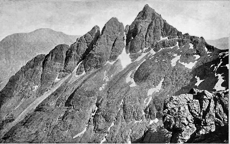
- 336 -
If we throw out of account the invading granitoid rocks, and look upon the whole tract within which the gabbro occurs as originally one connected area, we find that it covered an elliptical space measuring about nine miles from south-west to north-east and six miles from north-west to south-east, and embracing at least 40 square miles.[344] But that its original size was greater is strikingly shown more particularly on the western margin, which like that of the basalt-escarpments, has obviously been determined by denudation, for its separate beds present their truncated ends to the horizon all along the flanks of the Cuillins, from the head of Glen Brittle round to Loch Scavaig (Fig. 332), and from Strath na Creitheach round the southern flanks of Blath Bheinn to Loch Slapin and Strath More.
[344] Though this and the other bosses are here spoken of as consisting of gabbro, it will be understood that this rock only constitutes the larger portion of their mass, which includes also dolerites and other more basic compounds, together with involved portions of the plateau-basalts and masses of agglomerate which probably mark the position of older vents.
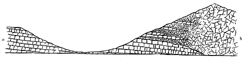
The first point to be ascertained in regard to the gabbro and associated basic rocks of the mountainous tract is their connection in geological structure and age with the bedded basalts of the plateau. This initial and fundamental relation, as Forbes long ago said, can be examined along the whole western and southern flank of the Cuillin Hills, from the foot of Glen Sligachan round to the mouth of Loch Scavaig. Even from a distance, the observer, who is favoured with clear weather, can readily trace the almost level sheets of basalt till they dip gently under the darker, more massive rock of the hills. Tourists, who approach Skye by way of Loch Coruisk, have an opportunity, as the steamer nears the island of Soay, of following with the eye the basalt-terraces of the promontory of Rudh' an Dunain until they disappear under the gabbro of the last spur of the Cuillins that guards the western entrance to Loch Scavaig.
What is so evident at a distance becomes still more striking when viewed from nearer ground. Nowhere can it be more impressively seen than at the head of Glen Brittle. Looking westwards, the traveller sees in front of him only the familiar level terraces and green slopes of the basalt-plateau, rising platform above platform to a height of nearly 1500 feet above the sea. But turning to the east, he beholds the dark, gloomy, cauldron-like Corry na Creiche, from which rise some of the ruggedest and loftiest crests of the Cuillins. On the hills that project from either side of this recess and half - 337 - enclose it, the bedded basalts mount from the bottom of the valley, with their lines of parallel terrace dipping gently inward below the black rugged gabbro that crowns them and sweeps round to form the back or head of the corry. Down the whole length of Glen Brittle the same structure conspicuously governs the topographical features. On the right hand, the ordinary terraced basalts form the slopes; and they rise for some 500 or 600 feet up the eastern side, until they pass under the darker, more rugged, and less distinctly bedded rocks of the mountains (Fig. 332). The dip of the whole series is here at a gentle angle towards south-east, that is, into or under the main mass of the Cuillin group.
When, however, we proceed to examine the junction between the two rocks we find it to be less simple than it appears. It is not an instance of mere superposition. The gabbro unquestionably overlies the basalts, and is therefore of younger date. But it overlies them, not as they rest on each other, in regular conformable sequence of eruption, but intrusively, as a sill does upon the rocks on which it appears to follow in the unbroken order of accumulation. This important structure may be ascertained in almost any of the many sections cut by the torrents which have so deeply trenched with gullies the flanks of the hills. Starting from the ordinary bedded basalts, we observe, in mounting the slopes and approaching the gabbro, that the rocks insensibly assume that indurated shattery character, which has been referred to as characteristic of them round the margins of vents, and which will be shown to be not less so in contact with large eruptive masses of basic or acid rock.[345] Beds of dolerite make their appearance among the basalts, so distinctly crystalline, and so similar in character to the rocks of the sills, that there can be little hesitation in regarding them as intrusive. These sills increase in size and number as we ascend, though hardened amygdaloidal basalts may still be observed. True gabbros then supervene in massive beds, and at last we find ourselves entirely within the gabbro area, where, however, thin bands of highly altered basalt may still for some distance appear. One further fact will generally be noticed, viz. that before reaching the main mass of gabbro, veins and sills of basalt, as well as of various felsitic and porphyritic members of the acid group, come in abundantly, crossing and recrossing each other in the most intricate network. The base of the thick gabbro-sheets is thus another horizon on which, as on that below the plateau-basalts, intrusive masses have been especially developed. Through all these rocks numerous parallel basalt-dykes, running in a general persistent N.N.W. direction, with a later N.E. series, rise from below the sea-level up even to the very crests of the Cuillins (Fig. 333).
[345] This indurated, altered character of the bedded basalts near the intrusive bosses and sills will be more particularly described in a later chapter in connection with the granophyre intrusions (see p. 386). The metamorphism induced by the basic rocks has generally been less pronounced than that effected by the acid masses.
The sections on the western side of the gabbro area of Skye thus prove that this rock inosculates with the bedded basalts by sending into them, between their bedding planes, sheets which vary in texture from fine dolerites at the outside into coarse gabbros further towards the central mass, and that this intrusion has been accompanied by a certain amount of induration of the older rocks.
- 338 -
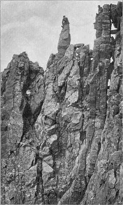
- 339 -
On the eastern side, the same structure can be even more distinctly seen, for it is not only exposed in gullies and steep declivities, but can be traced outward into the basalt-plateau. In the promontory of Strathaird, Jurassic sandstones and shales, which form the coast-line and lower grounds, are surmounted by the bedded basalts. Denudation has cut the plateau into two parts. The smaller of these makes the outlier that rises into Ben Meabost (1128 feet). The larger stretches continuously from Glen Scaladal and Strathaird House northward into Blath Bheinn. Hence from the ordinary terraced basalts, with their amygdaloids, thin tuffs, red partings, and seams of lignite, every step can be followed into the huge gabbro mountain. Starting from the black Jurassic shales on which the lowest basalt lies, we walk over the successive terraces up into the projecting ridge of An da Bheinn. But as we ascend, sheets of dolerite and gabbro make their appearance between the basalts, which gradually assume the altered aspect already noticed. The dip of the whole series is at a low angle northwards, and the beds can be followed round the head of the Glen nan Leac into the southern slopes of Blath Bheinn. Seen from the eastern side of this valley, the bedded character of that mountain is remarkably distinct, but it becomes less marked towards the upper part of the ridge where the gabbros preponderate. One of the most striking features of the locality is the number and persistence of the dykes, which strike across from the ordinary unaltered basalts of the plateau up into the highest gabbros of the range. Where less durable than the intractable gabbro, they have weathered out on the face of the precipices, thereby causing the vertical rifts and gashes and the deep notches on the crest that form so marked a feature in the scenery. On the other hand, they are often less destructible than the plateau-basalts, and hence in the Glen nan Leac they may be seen projecting as low dams across the stream which throws itself over them in picturesque waterfalls. The youngest dykes in the Blath Bheinn group of hills, have been found by Mr. Harker to have a north-easterly trend, and a north-westerly hade of about 40°, and to give a stratified appearance to the gabbro when viewed from a distance.
The deep dark hollow of the Coire Uaigneich has been cut out of the very core of Blath Bheinn, and lays bare the structure of the east part of the mountain in the most impressive as well as instructive way (Fig. 334). By ascending into this recess from Loch Slapin, we pass over the whole series of rocks, and can examine them in an almost continuous section in the bed of the stream and on the bare rocky slopes on either side. Sandstones and shales of the Jurassic series extend up the Allt na Dunaiche for nearly a mile, much veined with basalt and quartz-porphyry, by which the sandstones are locally indurated into quartzite. At last these strata are overlapped by the basalts of the Strathaird plateau, which with a marked inclination to N.N.W., here dip towards the mountains. But by the time - 340 - these rocks have reached the valley, they have already lost their usual brown colour and crumbling surfaces, and have assumed the indurated splintery character, though still showing their amygdaloidal structure. They are much traversed by felsitic veins and strings which proceed from a broad band of fine-grained hornblende-granite that runs up the bottom of the Coire Uaigneich and, ascending the col, crosses it south-westwards into the Glen nan Leac. On the left or south-eastern side of this intrusive mass, a portion of Lias shales and limestone (here and there altered into white marble) is traceable for several hundred yards up the stream.[346]
[346] This limestone was formerly identified by me with the Cambrian strata of the district. It was noticed by Von Oyenhausen and Von Dechen, who, as Mr. Harker has recently ascertained, correctly believed it to be a portion of the Lias torn off and carried upward by the eruptive rocks (Karsten's Archiv, i. p. 79).
The bedded basalts of Strathaird, after dipping down towards the N.N.W., bend up where they are interbanded with dolerites and gabbros, and form the prominence called An Stac, which rises as the eastern boundary of the Coire Uaigneich. Their steep dip away from the mountain is well seen from the east side, and their outward inclination is continued into the ridge to the southward. Similar rocks appear on the other flank of the band of granite, and form the base of Blath Bheinn. They are likewise continued in the mountains further north called Sgurr nan Each and Belig, where they dip in a northerly direction away from Blath Bheinn, which seems to be the centre of uprise, with the gabbro-sheets dipping away from it. The bedded basalts have been traced by Mr. Harker up to a height of well over 2000 feet on the Blath Bheinn range. They are of the usual altered, indurated, and splintery character. The intrusive sheets interposed between them become thicker and more abundant higher up, until they constitute the main mass of the mountain. But that they are in separate sheets, and not in one amorphous mass, can be recognized by the parallel lines that mark their boundaries. The junction of the gabbro sills and the lavas is a very irregular one, portions of the latter rocks being enveloped in the intrusive sills.
The granite which sends out veins into the surrounding rocks is obviously the youngest protrusion of the locality, except of course the basalt-dykes which cross it, and which are nowhere seen in a more imposing display than round the flanks of Blath Bheinn. A section across the corry shows the structure represented in Fig. 334.
It is thus demonstrable that when its line of junction with the surrounding plateau-basalts is traced in some detail, the gabbro is found to overlie them as a whole, but also to be intercalated with them in innumerable beds, bands, or veins which rapidly die out as they recede outwards from the main central mass; that these interposed beds are intrusive sheets or sills from that mass which have cut off and enveloped portions of the basalts, and that the contiguous bedded basalts show more or less marked metamorphism.
We have now to consider the structure of the interior of the gabbro - 341 - area of the Cuillin Hills. The first impression of the geologist who visits that wild district is that the main mass of rock is as thoroughly amorphous as a core of granite. Yet a little further examination will reveal to him many varieties of texture, sometimes graduating into, sometimes sharply marked off from, each other, and suggesting that the rock is not the product of one single protrusion. He will notice further indications of successive discharges or extravasations of crystalline material during probably a protracted period of time, and in the intricate network of veins crossing each other and the general body of the rock in every direction, as well as in the system of basalt-dykes that traverse all the other rocks, he will recognize the completion of the evidence of repeated renewals of subterranean energy.

But the observer will be struck with the absence of the more usual proofs of volcanic activity in such forms as vesicular lavas and abundant masses of slag, bombs and tuffs, which are commonly associated with the idea of the centre of a volcanic orifice, though he will meet with isolated masses of coarse volcanic agglomerate within the gabbro area and along some parts of its junction with the granophyre. The general characters of the rocks around him suggest that he stands, as it were, far beneath that upper part of the earth's crust which is familiar to us in the phenomena of modern volcanoes; that he has been admitted into the heart of one of the deeper layers, where he can study the operations that go on at the very roots of an active vent.
When the geologist begins a more leisurely and systematic examination of the interior of the gabbro area of Skye he soon sees reason to modify the impression he may at first have received that this rugged region presents the characters of one single eruptive mass. The more he climbs among the hills the more will he meet with evidence of long-continued and oft-repeated extravasation, one portion having solidified before another broke - 342 - through it, and both having been subsequently disrupted by still later protrusions.
But if by chance he should begin his examination of the ground upon some of the more typically banded varieties of rock, he may for a time almost refuse to admit that these can be either of volcanic origin or of Tertiary age.[347] He will find among them such startling counterparts of the structure of the ancient Lewisian gneiss of the North-West of Scotland that he may well be pardoned if for a time he seeks for evidence that they really do belong to that primeval formation, and have only been accidentally involved among the Tertiary volcanic rocks. If, for instance, he should land in Loch Scavaig, and first set foot upon the gabbros as they appear around Loch Coruisk, he would find himself upon masses of grey coarsely crystalline, rudely banded rock, like much of the old gneiss of Sutherland and Ross. Ascending over the ice-worn domes, he would notice that the banding becomes here and there more definitely marked by strong differences in texture and colour, while elsewhere it disappears and is replaced by a granitoid arrangement of the crystals, which are often as large as walnuts.
[347] See Quart. Journ. Geol. Soc. vol. l. pp. 217, 657, and a paper by the author, "Sur la Structure rubannée des plus anciens Gneiss et des Gabbros Tertiaires," Compt. rend. Cong. Géol. Internat. 1894, p. 139.
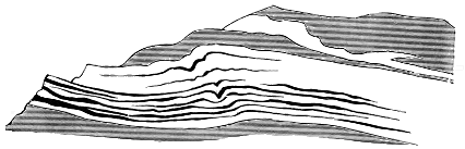
Nowhere is the gneissoid banding more beautifully developed than on the east side of the Cuillin group near the head of Glen Sligachan along the ridge of Druim an Eidhne. It was at this locality that the four typical structures were observed which have already been referred to (p. 329). The varieties of colour and composition depend upon the exceedingly irregular distribution of the component minerals. The paler bands, rich in felspar, lie parallel with dark brown bands full of pyroxene, olivine and magnetite, in which, moreover, thin ribs of glistening black consist in large part of the iron ore. These layers vary in thickness from mere pasteboard-like laminæ to beds a yard or more in thickness. Within a space of a few square yards their parallelism reminds one of stratified deposits (Fig. 336), but traced over a wider space they are found to be more or less irregular in thickness and lenticular in form.
- 343 -
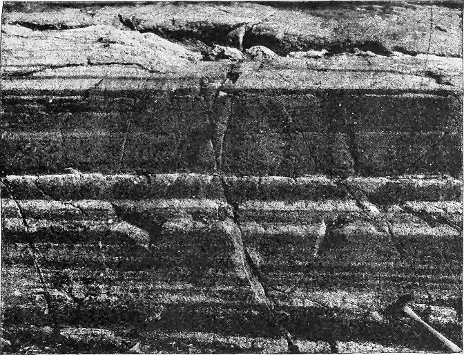
- 344 -
The resemblance to gneisses, and sometimes to the flow-structure of coarse rhyolites, is still further sustained by occasional undulations or minute puckerings (Fig. 335). Still more extraordinary are the examples of the actual plication of a group of successive bands, as shown in Fig. 337, wherein such a group about ten feet thick is shown to have been doubly folded between parallel bands above and below. This structure is not due to any deformation of the gabbro long subsequent to the consolidation of the mass. It belongs to the phenomena of protrusion and solidification. An examination of thin slices of these rocks under the microscope reveals no evidence of crushing. On the contrary, the minerals of one band interlock with those of the band adjoining, in such a manner as to prove that the differences of composition cannot be due to crushing and shearing or to successive intrusion, but must have been present before the final consolidation of the whole rock.[348]
[348] Mr. J. J. H. Teall and A. G., Quart. Journ. Geol. Soc. vol. 1. (1894), p. 652.
The conclusion which seems most consonant with the facts is that the magma which supplied the visible masses of gabbro in Skye existed below in a heterogeneous condition, that portions of it, differing considerably from each other in composition, were simultaneously intruded, and that by the deformation of these portions during their intrusion their present plicated structures were produced. A careful study of these banded gabbros offers many suggestive points of comparison with the gneisses and anorthosite (Norian) rocks of pre-Cambrian age. It seems in the highest degree probable that the banded structures and peculiar mineral aggregation in these ancient rocks arose under conditions closely analogous to, if not identical with, those in which the Tertiary gabbros of Skye originated.[349]
[349] Consult the Memoirs cited in the footnote on p. 342.
Similar structures are found to be widely developed through the gabbros of the Cuillin Hills. Not only are these rocks disposed in distinct beds, but many of the beds display the most perfect banding. Thus the mountains that surround the head of Loch Scavaig and sweep round Loch Coruisk up to the great splintered crests of Sgurr na Banachdich display on their bare black crags a distinct bedded structure. On the east side of Loch Scavaig the rock presents a rudely-banded character, the bands or beds being piled over each other from the sea-level up to the summits of the rugged precipices, and dipping into the hill at angles of 25° to 35°. Abundant dykes and veins of various basic, intermediate and acid rocks cut this structure. The individual layers here show sometimes the wavy and puckered condition already referred to.
Even from a distance the alternating lighter and darker bands can readily be seen, so that this structure, with the variations in its inclination, can be followed from hill to hill (Fig. 338). The regularity of the arrangement, however, is often less pronounced on closer inspection. While the gabbro is rudely disposed in thick beds, indicative of different intrusive sheets or sills, with which the banding is generally parallel, considerable irregularities may be observed in the arrangement of the structure of individual sheets. These sheets may be parallel to each other, and yet, while in some the banding is tolerably regular in the direction of the planes of the sheets, in others it is much twisted or inclined at various angles.
- 345 -
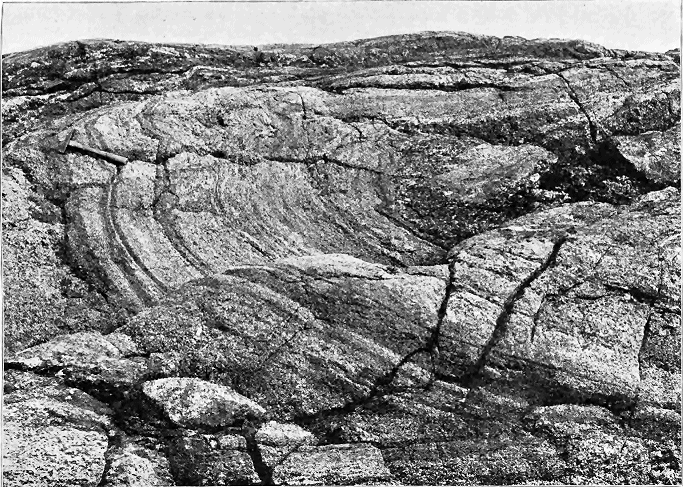
- 346 -
On the west side of the Coruisk river the banding is vertical; southward from that stream it inclines slightly towards the south, but soon again becomes vertical, and continues conspicuously so at the junction of the gabbro with the Torridon sandstones and plateau-basalts on the west side of Loch Scavaig.
Thus, instead of being one great eruptive boss, the gabbro of this district is in reality an exceedingly complicated network of sills, veins and dykes. While the general inclination of the bedding sometimes continues uniform in direction and amount from one ridge to another, it is apt to change rapidly, as if the complex assemblage of intruded masses had been disrupted and had subsided in different directions. For example, after overlying the bedded basalts of the plateau all the way from Glen Brittle to the west side of Loch Scavaig, the gabbro descends abruptly across these basalts and also across the Torridon sandstones, on which they unconformably rest. These two groups of rocks are not only truncated by the gabbro, but are traversed by the intricate system of sills, dykes and veins already referred to. Where it abuts against the sandstones and basalts in Loch Scavaig, the gabbro is arranged in vertical bands of different mineral composition and texture. Much of it is remarkably coarse, some bands displaying pyroxene crystals more than an inch in length. There is no fine-grained selvage here, indicative of more rapid cooling. So coarse, indeed, is the rock close up against the sandstone, that the junction-line can hardly be supposed to be the normal contact of the intrusive rock. This inference is confirmed by the existence of a singular kind of breccia between the gabbro and the sandstones. It is a tumultuous mass of fragments of coarse and fine gabbro, Torridon sandstone and shale, and plateau-basalts, embedded in a pale crystalline matrix of fine granular granophyre; veins from this acid intrusion run off into the gabbro on the one side as well as into the Torridon sandstones on the other. It would seem that this junction-line has been one of great movement, that the gabbro-sheets have subsided against a fault-wall of plateau-basalt and Torridon sandstone, and that subsequently an intrusion of finely granular granophyre has come up the fissure, involving in its ascent fragments of all the materials around.
The rocks for a considerable distance to the south of the gabbro are intensely altered. The Torridon sandstone has been so indurated as to pass into a bleached white quartzite, while the shales interstratified with it have been converted into a kind of porcellanite. But the most interesting alterations are those to be observed in the plateau-basalts, which at a height of about 300 feet above the sea, are to be seen in nearly horizontal sheets that lie immediately on the upturned edges of the Torridon sandstones. These lavas have suffered great metamorphism, to which more particular reference will be made in Chapter xlvi. in connection with the action of the granophyre. Whether this alteration has been produced by the intrusion of the gabbro or of some concealed mass of granophyre underneath, of which only projecting dykes and veins reach the surface, must remain a matter of doubt. On the whole, as the gabbro is here undoubtedly thrown against the basalts and - 347 - Torridon sandstone by a fault, it seems most probable that the change has been mainly due to the influence of the acid rock.
In the Blath Bheinn group of hills the relations of the gabbro to the bedded basalts have recently been mapped in detail by Mr. Harker during the progress of the Geological Survey of Skye. He has observed that, allowing for irregularities of form, the mass of gabbro obliquely overlies the basalts as a great sheet, not necessarily due to a single intrusion, which dips towards the west. He has found the rock to vary from a coarse gabbro to a diabasic type, and to vary also in mineralogical constitution, becoming in places very rich in olivine, though the banded structure is here only exceptionally developed. North of Garbh Bheinn the gabbro is much crushed and the outlying patch to the north of Belig is in part a crush-breccia. Mr. Harker remarks that similar brecciated structures are common among the granophyres of the Red Hills, and that it is sometimes difficult to distinguish their structure from that of the true volcanic agglomerates.
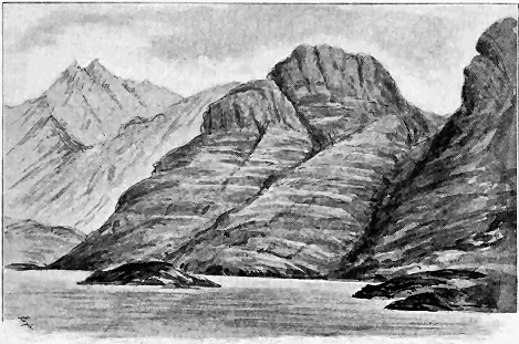
Besides the main area of gabbro in Skye, a great many small detached bosses, sills and dykes lie further east on the flanks of the Red Hills. One of the best marked of these detached areas forms a conspicuous crag on the east side of Strath More, immediately to the north of Beinn na Cro. It consists of beds of coarse gabbro, with others of dolerite intercalated in an outlier of the plateau-basalts, and is traversed by veins from the granophyre of the glen, as well as by the usual north-west basalt dykes (Fig. 349). It appears to be a marginal portion of the main gabbro area separated by the intrusion of the great granitoid boss of the Red Hills. On the north-eastern side of - 348 - Beinn na Caillich numerous intrusive sheets of gabbro and dolerite traverse the quartzite and limestone, and extend down to the sea-margin in the Sound of Scalpa.
There is an important feature in the main gabbro area of Skye not yet clearly understood, and which only a minute and patient survey can elucidate. Though I have found among the Cuillin Hills no distinct proof that the mass of gabbro ever gave rise to discharges of material, either lava-form or fragmentary, which reached the surface, the gabbro area, as already remarked, contains unquestionable evidence of explosions and the production of pyroclastic masses. Among the moraine-mounds of Harta Corry, blocks of basalt-agglomerate are strewn about, full of angular fragments of altered basalt, sometimes highly amygdaloidal, and also boulders in which lumps of coarse gabbro are enveloped in a matrix of finer material. I did not find the parent rocks from which these glacier-borne masses had been derived, but there can be no doubt that they exist among the gabbro crags that surround that deep glen. Reference has already been made to the similar rock found in situ on the opposite side of the Cuillin ridge at the head of the great cauldron of Corry na Creich; likewise to the mass of coarse agglomerate which forms a group of knolls and crags on the east side of Druim an Eidhne above the head of Glen Sligachan. This rock contains abundant blocks of various slaggy lavas like those of the basalt-plateau, and runs for some distance along the eastern limit of the gabbro, between that rock and the granophyre. It is intersected by numerous basalt-veins. Mr. Harker, as above mentioned, has recently found some considerable strips of agglomerate which, like that which I traced round the west side of Beinn Dearg, are interposed between the gabbro and the bosses of granophyre, or lie at the base of the volcanic series (p. 284).
There does not, however, appear to be any evidence to connect these isolated masses of agglomerate with the phenomena attending the uprise of the gabbro. They seem to be more probably related to the plateau eruptions, and may be compared with those of Strath, Ardnamurchan and Mull (pp. 278, 280, 384). That the huge gabbro mass of Skye, besides invading and altering the bedded basalts, may have communicated eventually with the surface, and have given rise to superficial discharges, is not at all improbable, but of any such outflows not a vestige appears now to remain. We must remember, however, that the gabbro no doubt in many places found its readiest upward ascent in vents belonging to the plateau-period, and that portions of the agglomerates of these earlier vents may be expected to be found involved in it, as the agglomerate of the great vent of Strath has been invaded by the granophyre.
- 349 -
THE BOSSES AND SHEETS OF GABBRO IN THE DISTRICTS OF RUM, ARDNAMURCHAN, MULL, ST. KILDA AND NORTH-EAST IRELAND. HISTORY OF THE GABBRO INTRUSIONS
The mountains of the island of Rum, rising as they do from a wide expanse of open sea, present one of the most prominent and picturesque outlines in the West Highlands (Map VI.). More inaccessible than most of the other parts of the volcanic region, they have been less visited by geologists. They were described by Macculloch as composed of varieties of "augite rock." He noticed in this rock "a tendency to the same obscurely bedded disposition as is observed in other rocks of the trap family," and found at one place that it assumed "a regularly bedded form, being disposed in thin horizontal strata, among which are interposed equally thin beds of a rock resembling basalt in its general characters."[350] Professor Judd repeats Macculloch's observation, that "the great masses of gabbro in Rum often exhibit that pseudo-stratification so often observed in igneous rocks." He regards these masses, like those of Skye and Mull, as representing the core of a volcano from which the superficial discharges have been entirely removed, and he gives a section of the island in which the gabbro is represented as an amorphous boss sending veins into a surrounding mass of granite.[351] In a subsequent paper he gave an excellent detailed account of the mineralogical composition of some of the remarkably varied and beautiful basic rocks constituting the hills of Rum, but added no further information regarding the geological structure of the island.[352]
[350] Western Islands, i. p. 486.
[351] Quart. Journ. Geol. Soc. xxx. p. 253.
[352] Op. cit. xli. (1885) p. 354. See also his paper in vol. xlii. of the same Journal.
Even from a distance of eight or ten miles, the hills of Rum are seen to be obviously built up of successive nearly horizontal tiers of rock. As the summer tourist is carried past the island, in that wonderful moving panorama revealed to him by the "swift steamer" of modern days, these great dark cones remind him of colossal pyramids, and as the ever-varying lights and shadows reveal more prominently the alternate nearly level bars of crag and stripes of slope, the resemblance to architectural forms stamps these hills with an individuality which strikes his imagination and fixes itself in his memory. If choice or chance should give him a nearer view of the scene, he - 350 - would not fail to notice that it is among the northern hills of the island that the bedded character is so conspicuous, and that it ceases to be prominent in the southern heights, though here and there, as in the upper part of Scuir na Gillean, it may in certain lights be detected even from a distance. Crossing over from Eigg, he would recognize each of the features represented in the sketch reproduced in Fig. 339. Along the shore, red sandstones rise in naked cliffs, from the top of which the ground slopes upward in brown moors to the bare rocky declivities. A deep valley (Glen Dibidil) is seen to run into the heart of the hills, between the bedded group to the north and the structureless group to the south. If the weather is favourable, some eight or more prominent parallel bars of rock may be counted on the two higher cones to the right. These bars are not quite level, but slope gently from right to left. They remind one of the terraced basalts of the plateaux, but present a massiveness and a breadth of intervening bare talus-slope such as are not usual among those rocks.
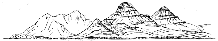
Nor is this impression of regularity and bedded arrangement lessened when we actually climb the slopes of the hills. I had for years been familiar with the outlines of Rum as seen from a distance, and had sketched them from every side, but I shall never forget the surprise and pleasure when my first ascent of the cones revealed to me the meaning of these parallel tiers of rock. I found it to be the structure of the Cuillin Hills repeated, but with some minor differences which are of interest, inasmuch as they enlarge our conceptions of the process by which the gabbro-bosses were formed.
The northern half of the island of Rum consists almost entirely of red sandstone, which, as already stated, is a continuation of the same formation (Torridonian) so well developed in the south-east of Skye, Applecross and Loch Torridon, and traceable between the Archæan gneiss and the Cambrian strata up as far as Cape Wrath. The sandstones, though full of false bedding, show quite distinctly their true stratification, which is inclined with singular persistence towards W.N.W., at angles averaging from 15° to 20°. If they are not repeated by folds or faults, they must reach in this - 351 - island a thickness of some 10,000 feet. Their red or rather pinkish tint seems mainly to arise from the pink felspar so abundant in them, for in many places they really consist of a kind of arkose. Pebbly bands with rounded pieces of quartz are of common occurrence throughout the whole formation. Dykes and veins of basalt are profusely abundant. Sometimes these run with the bedding, and might at a distance be taken for dark layers among the pink sandstones. They often also strike obliquely up the face of the cliffs like ribbons.
But, notwithstanding their apparent continuity, there can be no doubt that these sandstones have suffered from those powerful terrestrial disturbances which have affected all the older rocks of the North-West Highlands. On the west side, where they plunge steeply into the sea, they have undergone a change into fine laminated rocks, which might at first be mistaken for shales, but which owe their fissility to shearing movements. Along their southern border, from a point on the east coast near Bagh-na-h-Uamha, south of Loch Scresort, to the head of Kilmory Glen, they are abruptly truncated against a group of dark, flaggy and fissile schists and fine quartzites or grits, which in some places are black and massive like basalt, and in others are associated with coarse grey gneiss. That some of these rocks are portions of the Lewisian series can hardly be doubted, and their structure and relations are probably repetitions of those between the Lewisian gneiss and Torridon sandstone of Sleat in Skye. I found also on the northern slopes of Glen Dibidil a patch of much altered grey and white limestone or marble, which reminded me of the Cambrian limestone of Skye. The red sandstones in a more or less altered condition are prolonged to the south-east promontory of the island.
In passing over the zone of these more ancient rocks, we find them to present increasing signs of alteration as they are traced up the slopes towards the great central mass of erupted material. The pink sandstones gradually lose their characteristic tint, and grow much harder and more compact, while the veins and dykes of basalt and sheets of dolerite intersecting them increase in number. The zone of black compact quartzite, which lies to the south of the sandstones, and which at one point reminds us of basalt, at another of the flinty slate of the schistose series, likewise displays increasing induration. Its bedding, not always to be detected, is often vertical and crumpled. But the most remarkable point in its structure is the intercalation in it of bands of breccia. These vary from less than an inch to several yards in diameter; they run mostly with the bedding, but occasionally across it. The stones in them are fragments of the surrounding rock embedded in a matrix of the same material, but also with pieces of a somewhat coarser grit or quartzite. A band of coarse breccia forms the southern limit of this zone along the northern base of Barkeval and Allival. In general character it resembles the thinner seams of the same material just referred to. The matrix so closely agrees with the black flinty quartzite, that but for the included stones it could hardly be distinguished; so greatly has the mass been indurated that the stones seem to shade off into the rest of the rock. But here and - 352 - there its true brecciated nature is conspicuously revealed by prominent blocks of hardened sandstone. This band of breccia must in some places be 150 or 200 feet broad. It has no distinct bedding, but seems to lie as a highly inclined bed dipping into the hill. It may possibly be a crush-breccia belonging to a period earlier than the volcanic eruptions. It is at once succeeded by a black flinty felsite like that of Mull. The groundmass of this rock, so thickly powdered with magnetite grains as to be almost opaque under the microscope, displays good flow-structure round the turbid crystals of orthoclase and the clear granules of quartz. Further up the hill, the rock becomes lighter in colour and less flinty in texture—a change which is found to arise from more complete devitrification, the groundmass having become a crystalline granular aggregate of quartz and felspar with scattered porphyritic crystals of these minerals (microgranite). In some places, the felsite incloses fragments of other rocks. A specimen of this kind, taken from the head of Coire Dubh, shows under the microscope a brown micro-felsitic groundmass, with crystals of felspar and augite, inclosing a piece of basalt, composed of fine laths of plagioclase, abundant magnetite and a smaller proportion of granules of augite.
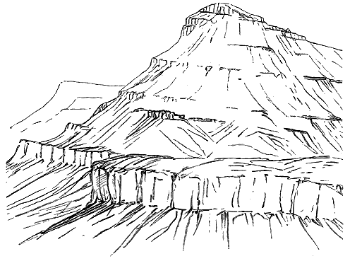
This band of felsite and microgranite may be traced continuously from Loch Gainmich along the base of Barkeval and Allival, and similar rocks appear at intervals on the same line round the eastern base of the hills. - 353 - Immediately above this belt of felsitic protrusions comes the great body of gabbro. It will be observed that here, as in Skye, the base of the gabbro mass presents a horizon on which injections of acid rocks have been particularly abundant. Whether the breccias be regarded as the result of earlier rock-crushings, or as due to volcanic explosions during the Tertiary period, they are evidently older than the eruption of the gabbros. In that respect they may be compared with the agglomerates through which the youngest eruptive bosses of Skye have made their way; but their component materials have been derived from the surrounding platform of ancient rocks, and not from subterranean lavas.
For my present purpose, however, the chief point of importance is the structure of the gabbro mass that springs from that platform into the great conical hills of Rum. The accompanying sketch (Fig. 340) will convey a better idea of this structure than a mere description. At the base, immediately above the felsite just referred to, bedded dolerites make their appearance, much intersected with veins from the siliceous rock. Veins and dykes of basalt also cut all the rocks here, the newest being those which run in a north-west direction. The lowest sheets of dolerite are succeeded by overlying sills of coarser dolerites, gabbros, troctolites, etc., which are as regular in their thickness and continuity as the ordinary basalts of the plateaux. The band of light-coloured troctolite, in particular (Fig. 341), about 20 to 30 feet thick, which has been already referred to for its remarkable laminar structure, can be followed for some distance along the base of the hill as a marked projecting escarpment. This rock at once arrests attention by its platy or fissile structure, parallel to the bedding-surfaces of the sheet. Indeed hand-specimens of it, as I have said, might readily pass for pieces of schistose limestone, especially if taken from the upper part. It consists of successive layers, which on the weathered surface divide it into beds almost as regular as those of a flagstone, each bed being further separated into laminæ marked off by the darker and lighter tints of their mineral constituents. The darker layers consist of olivine, and the lighter of plagioclase. This segregation here and there takes the form of rounded masses, where the minerals are more indefinitely gathered together. The affinity of the rock with intrusive sheets is further displayed by the occurrence of abundant - 354 - nut-like aggregates of pale green olivine. Examined under the microscope, flow-structure is admirably seen, the lath-shaped felspars being drawn out parallel to the planes of movement, and giving thereby the peculiarly schistose structure which is so deceptive.
The massive and coarsely crystalline gabbros below and above this troctolite are all more or less affected by the same laminar structure. Some of those in higher parts of the mountain are quite massive in part, but also include bands of lamination. Banding like that of the Skye gabbros is generally developed among them, the individual bands varying from less than an inch to a foot or more in thickness. This structure, like the lamination, is parallel to the general bedding of the sheets. As in the Cuillin Hills, the bands differ from each other in the relative proportions of the constituent minerals, especially the predominant pyroxene and olivine. The crystals or crystalline aggregates are often from a quarter of an inch to an inch in diameter, and in these large forms are crowded together in certain bands. Magnetite, on the whole, is rather less conspicuous than in the Cuillin gabbro: at least, it is not so prominently aggregated in special layers. In one or two instances I have observed curvature of the banding, but no example so striking as that cited from the Cuillin area (Fig. 337).
On weathered surfaces, where the felspars decay into a creamy white and the ferro-magnesian minerals assume tints of green, brown and red, the resemblance of the rocks to schists is striking. This external likeness is combined with a tendency to split into thin plates parallel to the lamination, which still further increases their schistose appearance. Though less developed than in Skye, the banding appears to be of the same kind and origin; but in Rum it is combined with the remarkable lamination above mentioned, produced by the arrangement of the component minerals with their longer axes parallel to the planes of bedding, as in flow-structure—a combination which I have not yet observed in Skye.
The bedded arrangement of the gabbros of Rum, so conspicuous in the great eastern cones (Figs. 339 and 340), is emphasized by the fact that some sheets, of a more durable kind, stand out boldly as prominent ribs, while the softer crumble into a kind of sand, which forms talus-slopes between the others. Alternations of this nature are continued up to the very top of the mountains. The beds are nearly flat, but dip slightly into the interior or towards the south-west. On the west side of the island also, beyond Loch Sgathaig, a distinct bedding may be traced, the inclination being here once more inwards or to the east. But from Glen Harris and the base of Askival this structure becomes less marked, and gradually disappears. There is thus a central or southern more amorphous region, while round the margin towards the north and east the rock appears in frequent alternating beds.
It is clear that in the broad features of their architecture the hills of Rum follow closely the plan shown in the Cuillin Hills of Skye. But, unfortunately, in the former island denudation has gone so far that no connection can be traced on the ground between the gabbros and the plateau-basalts. As already stated, the latter rocks have been almost entirely - 355 - stripped off from the platform of sandstones and schists which they undoubtedly at one time covered, and the few outliers of them that remain lie at some little distance from the margin of the gabbro area (ante, p. 216). Nevertheless, we are not without some indications of them underneath the gabbros. I have alluded to the basalts that lie at the base of the eastern cones. As we follow the bottom of the gabbro southward round the flanks of the hills, dull compact black shattery basalts, with a white crust, appear from under the more crystalline sheets. These at once remind one of the altered basalts of Skye and Mull. On the west side also, beds of basalt emerge from under the gabbro, but they have been so veined and indurated by the granophyre of that district, that their relations to the gabbro are somewhat obscured. If we could restore the lost portions of the plateau, I believe we should find the gabbros of Rum resting on part of the volcanic plateau, and some of the gabbro-beds prolonged as sills between the sheets of basalt.
The promontory of Ardnamurchan reveals as clearly as the flanks of the Cuillin Hills, though in a less imposing way, the relations of the gabbros to the plateau-basalts (Map VI.). From the southern shore at Kilchoan to the northern shore at Kilmory, bedded basalts, of the usual type, amygdaloidal and compact, weathering into brown soil, may be followed along the eastern slopes of the hills, resting upon the schists and Jurassic series of western Argyleshire. These rocks are a continuation of those that cap the ridges further to the south-east and cross Loch Sunart into Morven. They dip westwards, and followed upwards in that direction, they soon present the usual marks of alteration. They weather with a white crust and become indurated and splintery. Sheets of dolerite with many veins and dykes of basalt run between and across them. Bands of gabbro make their appearance, and these, as we advance westwards, increase in number and in coarseness of grain until this rock, in its rudely bedded form, constitutes practically the whole of the promontory from Meall nan Con to the light-house. Many admirable sections may be seen on the coast-cliffs and in the rugged interior, showing the irregular bedding of the gabbro, and how prone this rock is to develop its component minerals in bands or ribbons, sometimes made up of large crystals, as in Skye, Rum and Mull.
In the island of Mull, the conclusions to which the geology of the other volcanic districts leads us as to the position of the gabbros in the series of volcanic phenomena, are further confirmed. The first geologist who appears to have observed the relation of these rocks in that island was Jameson, who classed them under the old name of "greenstone," including in the same designation rocks now termed dolerites and gabbros. He ascended one of the - 356 - hills above Loch Don, probably Mainnir nam Fiadh (2483 feet), which he found to consist of "strata of basalt and greenstone," with some basalt-breccia or tuff and a capping of basalt. He speaks of the "singular scorified-like aspect" of the weathered greenstone—a description which applies to some of the coarser gabbro bands of that locality. But he appears to have recognized the general bedded arrangement of the rocks up even to the summit of the hill.[353]
[353] Mineralogy of the Scottish Isles i. p. 205.
It was not, however, until the visit of Professor Zirkel in 1868, that the true petrographical characters of the gabbro of Mull were recognized. This observer remarked that the rock is regularly interstratified with the basalt.[354] Professor Judd, as already stated, has supposed the gabbros to be the deep-seated portion of the masses which when poured out at the surface became the plateau-basalts, and he represents them in his map and sections of Mull as ramifying through the granitic rocks.[355]
[354] Zeitsch. Deutsch. Geol. Gesellsch. xxiii. (1871) p. 58.
[355] Quart. Jour. Geol. Soc. xxx. (1874).
In Mull the disposition of the gabbro in beds, sheets or sills is well displayed, for there is here no great central complicated mass of interlacing banded and amorphous sheets. We have seen that a higher group of plateau-basalts has survived in this island better than in the other plateaux, and it would seem that denudation has not yet succeeded here in cutting down so deeply into the gabbro core as in Skye, Rum and Ardnamurchan. Only the upper or outer fringe of intrusive sheets among the bedded basalts has been laid bare. The district within which this fringe may be observed is tolerably well-defined by the difference of contour between the long terraced uplands of the ordinary basalts and the more conical forms of the southern group of gabbro hills between Loch na Keal and Loch Spelve. The number and thickness of the gabbro-sheets increase as we proceed inwards from the basalt-plateau. These sheets are specially prominent along the higher parts of the ridge that runs northwards from the northern end of Loch Spelve, and along the west side of Glen Forsa. But they swell out into the thickest mass in the south-western part of the hilly ground, where, from above Craig, in Glenmore, they cross that valley, and form the rugged ridge that rises into Ben Buy (2354 feet), and stretches eastward to near Ardara (Map VI.). It is in this southern mass that the Mull gabbro approaches nearest in general characters to that of Skye. But even here its true intercalation above a great mass of bedded basalt may readily be ascertained in any of the numerous ravines and rocky declivities.
One of the best lines of section for exhibiting the relations of the rocks is the declivity to the west of Ben Buy and Loch Fhuaran. Ascending from the west side, we walk over successive low escarpments and terraces of the plateau-basalts with a gentle inclination towards north-east or east. These rocks weather in the usual way, some into a brown loam, others into spheroidal exfoliating masses. But as we advance uphill they gradually assume the peculiar indurated shattery character already referred to. The soft earthy amygdaloids become dull splintery rocks, in which the amygdales are no longer sharply - 357 - defined from the matrix, but rather seem to shade off into it, sometimes with a border of interlacing fibres of epidote. The compact basalts have undergone less change, but they too have become indurated, and generally assume a white or grey crust, and none of them weather out into columnar forms. Strings and threads full of epidote run through much of these altered rocks. Abundant granophyric and felsitic veins traverse them. Sheets of dolerite likewise make their appearance between the basalts, followed further up the slope by sheets of gabbro until the latter form the main body of the hill.
On the north side of the same ridge similar evidence is obtainable, though somewhat complicated by the injections of granophyric and felsitic veins and bosses, to which more detailed reference will afterwards be made. But the altered basalts with their amygdaloidal bands and their intercalated basalt-tuffs and breccias, can be followed from the bottom of the glen up to a height of some 1700 feet, above which the main gabbro mass of Ben Buy sets in. Many minor sheets of dolerite and gabbro make their appearance along the side of the hill before the chief overlying body of the rock is reached. Some of these can be distinctly seen breaking across or ending off between the bedded basalts which here dip gently into the hill (Fig. 342). A conspicuous band of coarse basalt-agglomerate, containing blocks of compact and amygdaloidal basalt a yard or more in diameter, shows by the excessive induration of its dull-green matrix the general alteration which the rocks of the basalt-plateau have here undergone. An almost incredible number of veins of fine basalt, porphyry and felsite has been injected into these rocks—a structure which is precisely a counterpart of what occurs under the main body of gabbro in Skye, Ardnamurchan and Rum.
The gabbro mass of the Ben Buy ridge is thus undoubtedly a huge overlying sheet, which probably reaches a thickness of at least 800 feet. It seems to descend rather across the bedding into the hollow of Glen More, and possibly its main pipe of supply lay in that direction. Being enormously thicker than any other sheet in the island, it exhibits the crystalline peculiarities which are so well developed in the central portions of the larger bosses of gabbro. It presents more coarsely crystalline varieties than appear in the thinner sheets, some portions showing crystals of diallage and felspar upwards of an inch in length. It likewise contains admirable examples of banded structure, which, as in Skye and elsewhere, is best developed where the texture becomes especially coarse. Veins or bands, in which the constituent - 358 - minerals have crystallized out in more definite and conspicuous forms, here and there succeed each other so quickly as to impart a bedded or foliated look to the body of rock, recalling, as in Skye, the aspect of some coarsely crystalline granitoid gneiss. In these respects the Mull gabbro closely resembles that of the Cuillin Hills. Occasionally, on the exposed faces of crags, portions of such bands or veins are seen to be detached and enveloped in a finer surrounding matrix. The thick belts or bands of coarser and finer texture alternate, and give an appearance of bedding to the mass. Nevertheless they are really intrusive sills, which run generally parallel with beds of finer gabbro or with sheets of highly indurated basalt, that may be detached portions of the ordinary rocks of the plateau. The thick sheet of Ben Buy, like the mass of the Cuillin Hills, is thus the result not of one but of many uprises of gabbro.
Of the thinner sheets of dolerite and gabbro in Mull little need here be said. I have referred to their great abundance in the range of eastern hills that rise from the Sound of Mull between Loch Spelve and Fishnish Bay. Though obviously intrusive, they lie on the whole parallel to the bedding of the basalts. The latter rocks exhibit the usual dull indurated shattery character which they assume where large bosses of gabbro have invaded them, and which gradually disappears as we follow them down hill away from the intrusive sheets to the shores of the Sound. They dip towards the centre of the hill group, that is, to south-west in the ridge of Mainnir nam Fiadh, Dùn da Ghaoithe, and Beinn Meadhon, the angle increasing southwards to 15°-20°, and at the south end reaching as much as 35°-40°. Some fine crags of gabbro and dolerite form a prominent spur on the east side of the ridge of Ben Talaidh, in the upper part of Glen Forsa. These consist of successive sheets bedded with the basalts, and dipping south-west. A large sheet stands out conspicuously on the north front of Ben More, lying at the base of the "pale lavas," and immediately above the ordinary basalts. It circles round the fine corry between Ben More and A'Chioch, some of its domes being there beautifully ice-worn. This is the highest platform to which I have satisfactorily traced any of the intrusive sheets of Mull. Another dyke-like mass emerges from beneath the talus slopes of A'Chioch, on the southern side, and runs eastward across the col between the Clachaig Glen and Loch Scridain.
Sixty miles to the westward of the Outer Hebrides lies the lonely group of islets of which St. Kilda is the chief. As the main feature of geological interest in this group is the relation of the acid protrusions to the other rocks, the account of the geology will be more appropriately given as a whole in Chapter xlvii. I need only remark here that the predominant rocks of these islands are dark basic masses, chiefly varieties of gabbro, but including also dolerites and basalts. Reasons will be afterwards brought forward for regarding these rocks as parts of the Tertiary volcanic series. They present - 359 - a close parallel to the gabbros and associated rocks of Skye. But in one important respect they stand alone. No certain trace remains of any basalt-plateau at St. Kilda such as those through which the gabbros of Skye, Mull and Ardnamurchan have been injected. In regard to their mode of production they have doubtless been intruded at some considerable depth beneath the surface. But no relic appears to have survived of the overlying cover of rock under which they consolidated, and into which they were injected.
In the remarkable volcanic district of the north-east of Ireland a series of basic rocks appears, which in its mode of occurrence and its relation to the other members of the series presents many points of resemblance to the gabbros of the Inner Hebrides. The Irish gabbros are well developed in the Carlingford district, where they form intrusive bosses and sheets which have been erupted through the Palæozoic rocks (Map VII.). They are themselves pierced by later masses of granophyre and other acid rocks. Further reference will be made to these gabbros in later pages, where an account will be given of the granite masses of Mourne, Barnavave and Slieve Gullion.
It is interesting to observe that, while in St. Kilda no relic of any basaltic plateau has been preserved, in the Faroe Islands, on the other hand, no sign has been revealed by denudation that the volcanic plateau of that region is pierced by any eruptive core of gabbro or of granophyre. During my cruises round these islands and through their channels, I was ever on the outlook for any difference in topography that might indicate the presence of some eruptive boss like the gabbro and granophyre masses of the Inner Hebrides. But nothing of that nature could be discerned. Everywhere the long level lines of the bedded basalts were seen mounting up to the crests of the ridges and the tops of the highest peaks. Though I cannot assert that no intrusions of gabbro or of granophyre exist among the Faroe Islands, I feel confident that any such masses which may appear at the surface must be of quite insignificant dimensions, and do not make the important feature in geology and topography which they do among the Inner Hebrides. It is, of course, possible that, vast as the denudation of these islands has undoubtedly been, it has not yet trenched the plateau deeply enough to expose any great intrusive bosses and sills which may underlie and invade the basalts.
We are now in a position to draw, from the observations which have been given in this and the preceding chapter regarding the different areas of gabbro in the Tertiary volcanic region of Britain, some general conclusions with respect to the type of geological structure and the phases of volcanic energy which they illustrate.
1. No evidence exists to show that the masses of gabbro ever communicated directly with the surface. They never exhibit the cellular, slaggy and other structures so characteristic of surface-flows. They are, on the whole, free from included pyroclastic material, though masses of agglomerate - 360 - are enclosed in, and have probably been invaded by, the gabbro of the Cuillin Hills. If the gabbro-bosses ever were continuous with sheets of rock emitted above ground, all such upward continuations have been entirely removed. In any case, we may be quite certain that in an outburst at the surface, the rock would not have appeared in the form of a coarsely crystalline or granitoid gabbro.
2. The crystalline structures of the gabbros point unmistakably to slow cooling and consolidation at some depth beneath the surface. The most coarsely-crystalline varieties, and those with the best developed banded structure, occur in the largest bodies of rock, where the cooling and consolidation would be most prolonged.[356]
[356] On this subject, see the papers by Professor Judd already cited.
3. The remarkable differences in composition between the dark and pale layers in the banded gabbros cannot be accounted for by segregation or successive intrusion, but seem to point to the existence of a heterogeneous magma from which these distinct varieties of material were simultaneously intruded.
4. From the prevalence of a bedded structure and the occurrence of bands and more irregular portions of considerably different texture and even mineralogical composition which intersect each other, it may be confidently inferred that even what appears now as one continuous mass was produced by more than one intrusion.
5. In every case there would necessarily be one or more pipes up which the igneous material rose. These channels might sometimes be wider parts of fissures, such as those filled by the dykes. In other places, they may have been determined by older vents, which had served for the emission of the plateau-basalts and their pyroclastic accompaniments. There can be no doubt that some of these vents afforded egress for the subsequent eruption of granitoid rocks, as will be pointed out in the following chapters. In the case of the gabbros, however, the position of the vents seems to have been generally concealed by the tendency of these rocks to spread out laterally. Denudation has cut deeply into the gabbro-masses, but apparently not deep enough to isolate any of the pipes from the larger bodies of material which issued from them, and thus to leave solitary necks like those in and around the basalt-plateaux. In Skye, where the central core of gabbro is largest and most completely encircled, we cannot tell how much of it lies above the true pipe or pipes, and has spread out on all sides from the centre of eruption. The prevalence of rude bedding and a banded structure indicate that most of the visible rock occurs in the form of sills, successively injected not only into the plateau-basalts, but between and across each other. Round the margin of the gabbro we undoubtedly reach horizons below that rock, and see that it lies as a cake or series of cakes upon the plateau-basalts. The actual pipe or fissure of supply must in each case lie further inward, away from the margin, and may be of comparatively small diameter.
6. From the central pipe or group of pipes or fissures which rose from the - 361 - platform of older rocks into the thick mass of the basalt-plateaux, successive sheets of dolerite and gabbro were forced outward between the layers of basalt. This took place all round the orifices of supply, on many different horizons, and doubtless at many different times. In some cases, the intrusive sheets were injected into the very bottom of the basalts, and even between these rocks and the older surface on which they rested. This is particularly the case in Rum, where the gabbro-cones spring almost directly from the ancient grits, schists and sandstones on which they rest. The intrusive sheets have likewise found egress at every higher platform in the basalt-series, up at least to the base of the "pale group" in Mull—that is, through a continuous pile of more than 2000 feet of bedded basalt. But the intrusion did not proceed equally all round an orifice. At all events, the progress of denudation has revealed that on one side of a gabbro area the injected portions may occur on a lower stratigraphical level than they do on the opposite side. At the Cuillin Hills, for example, the visible sheets of dolerite and gabbro to the north of Coire na Creiche begin about 1600 feet above the sea, which must be much more than that distance above the bottom of the basalts. On the south-east side, however, they come down to near the base of the basalts at Loch Scavaig; that is to say, their lowest members lie at least 1600 feet below those on the opposite margin.
7. The uprise of so much igneous material in one or more funnels, and its injection between the beds of plateau-basalt, would necessarily elevate the surface of the ground immediately above, even if we believe that surface to have been eventually disrupted and superficial discharges to have been established. If no disruption took place, then the ground would probably be upraised into a smooth dome, the older lavas being bent up over the cone of injected gabbro until the portion of the plateau so pushed upward had risen some hundreds of feet above the surrounding country. The amount of elevation, which would of course be greatest at the centre of the dome, might be far from equable all round, one side being pushed up further or with a steeper slope than another side. But even in the case of the Cuillin Hill area, it is conceivable that the total uplift produced at the surface a gentle inclination of no more than 8° or 10°.
It is along the periphery of a gabbro area that we may most hopefully search for traces of this uplift. But unfortunately it is just there that the work of denudation has been most destructive. There appears also to have been a general tendency to sagging subsequent to the gabbro protrusions, and the inward dip thereby produced has probably been instrumental in effacing at least the more gentle outward inclinations caused by the uprise of the eruptive rock. In one striking locality, however, to which I have already referred, the effects of both movements are, I think, preserved. The basalt-plateau of Strathaird, which in its southern portion exhibits the ordinary nearly level bedding, dips in its northern part at an unusually steep angle to the north-west, towards the gabbro mass of Blath Bheinn. But before reaching that mountain the basalts, much interbanded with sheets of dolerite and gabbro, suddenly bend up to form the prominent eminence of An - 362 - Stac, where they dip rapidly towards south-east and south (Fig. 334). This steep dip away from the central mass of gabbro, is repeated in the hills to the north, where the beds are inclined to north-east, the angle gradually lessening northwards till they are truncated by the granophyre of Strathmore. The mass of Blath Bheinn thus occupies the centre of the dome or anticline. The theoretical structure of one of the gabbro bosses is represented in Fig. 343. It will be understood, however, that what for the sake of clearness is here represented in one uniform tint of black in reality consists of an exceedingly complex network of sheets and dykes differing from each other in texture and structure, as well as in the relative dates of their intrusion.
8. The injection of so much igneous material among the bedded basalts has induced in these rocks a certain amount of contact metamorphism. I have referred to it as showing itself in the field as a marked induration, the rocks becoming closer grained, dull, splintery, and weathering, with a grey or white crust, while their amygdales lose their definite outlines, and epidote and calcite run in strings, veins and patches through many parts of the rocks. As already remarked, it is difficult to determine how much of this change should be referred to the influence of the gabbro, and how much to that of the numerous intrusions of granophyre which may be apophyses of much larger bodies of that rock lying not far underneath. On account of this difficulty, the more detailed description of the metamorphism of the plateau-basalts is reserved for Chapter xlvi., where it will find a place in connection with the effects produced by the intruded granophyres, which have undoubtedly been more extensive than those effected by the gabbros.
The structure and history of the gabbro bosses of the Inner Hebrides find a close parallel in those of the Henry Mountains of Southern Utah, so well described by Mr. G. K. Gilbert of the United States Geological Survey.[357] In that fine group of mountains, rising to an extreme height of 5000 feet above the surrounding plateau, and 11,000 feet above the level of the sea, - 363 - masses of trachyte have been injected between sedimentary strata belonging to the Jura-Triassic and Cretaceous systems. These masses, thirty-six in number, have consolidated in dome-shaped bodies, termed by Mr. Gilbert "laccolites," which have arched up the overlying strata, sending sheets, veins and dykes into them, and producing in them the phenomena of contact metamorphism. There is no proof that any of these protrusions communicated with the surface, and there is positive evidence that most if not all of them did not. The progress of denudation has laid bare the inner structure of this remarkable type of hill, and yet has left records of every stage in its sculpture. In one place are seen only arching strata, the process of erosion not having yet cut down through the dome of stratified rocks into the trachyte that was the cause of their uprise. In another place, a few dykes pierce the arch; in a third, where a greater depth has been bared away, a network of dykes and sheets is revealed; in a fourth, the surface of the underlying "laccolite" is exposed; in a fifth, the laccolite, long uncovered, has been carved into picturesque contours by the weather, and its original form is more or less destroyed.[358]
[357] See the remarks and diagram, ante, p. 86.
[358] "Geology of the Henry Mountains," by Mr. G. K. Gilbert, U.S. Geographical and Geological Survey of the Rocky Mountain Region, 1877.
The gabbro "laccolites" of the West of Scotland belong to an older geological period than those of Utah, and have, therefore, been longer subject to the processes of denudation. They have been enormously eroded. The overlying cover of basalt has been stripped off from them, though from the escarpments beyond them it is not difficult in imagination to restore it. In Rum it has been so completely removed, that only a few fragments remain at some distance from the core of gabbro, which now stands isolated. In Ardnamurchan, and still more in Skye, the surrounding plateau of basalt remains in contact with the gabbro bosses. But in Mull, where the plateau-basalts reach now, and perhaps attained originally a greater thickness than anywhere else, they have protected the intrusive sheets, which are therefore less deeply cut away than in any of the other districts, and no great central core of gabbro has yet been uncovered.
- 364 -
Their Petrography—Their Stratigraphical Position and its Analogies in Central France
We now come to the examination of another distinct phase of volcanic action during Tertiary time in Britain. The igneous rocks that have been under consideration in the foregoing chapters, whether poured out at the surface or injected below ground, have been chiefly of basic, partly indeed, like the peridotites, of ultra-basic character. Some, however, have shown an andesitic or intermediate composition. Reference has also been made to the probable eruption of acid rhyolites in the long interval between the outflow of the lower and the upper basalts in Antrim. But we now encounter a great series, decidedly acid in composition, in the more largely crystalline members of which the excess of silica is visible to the eye in the form of free quartz. While there is a strong contrast in chemical composition between this series and the rocks hitherto under discussion, there are also marked differences in structure and mode of occurrence. Like the gabbros, all the masses of acid rock now visible appear to be intrusive. They have been injected beneath the surface, and therefore record for us subterranean rather than superficial manifestations of volcanic action.
The existence of rocks of this class in the midst of the basic masses has long been recognized. They were noticed by Jameson, who described the hills between Loch Sligachan and Broadford as composed of "a compound of felspar and quartz, or what may be called a granitel, with occasional veins of pitchstone."[359] Macculloch gave a fuller account of the same region, and classed the rocks as chiefly "syenite" and "porphyry."[360] In Antrim, also, even in the midst of the basalt-tableland, masses of "pitchstone-porphyry "pearlstone-porphyry," "clay-porphyry," and "greystone" were observed and described.[361] In more recent years Professor Zirkel has given a brief account of the so-called "syenite and porphyry" of Mull and Skye,[362] and the late - 365 - Professor Von Lasaulx fully described the "trachyte" or rhyolite of Antrim.[363]
[359] Mineralogical Travels, ii. 90.
[360] Western Isles, see the descriptions of Skye, Mull and Rum.
[361] Berger, Trans. Geol Soc. iii. (1816), p. 190; Portlock, Journ. Geol. Soc. Ireland, vol. i. (1834), p. 9.
[362] Zeitsch. Deutsch. Geol. Gesellsch. xxiii. (1871), pp. 54, 77, 84, 88.
[363] Tschermak's Min. und Petrog. Mittheilungen, 1878, p. 412. The chemical composition of this rock and its place among the rhyolites had already been determined by E. T. Hardman from analysis, Journ. Geol. Soc. Ireland, vol. iii. (1871), p. 32.
This interesting series of rocks embraces a greater variety of petrographical characters than any other portion of the British Tertiary volcanic rocks. On the one hand, it presents thoroughly vitreous masses, some of which in their colour, lustre and microscopic structure remind us of recent obsidians. On the other hand, it affords coarsely crystalline compounds, to which no other name than granite can be assigned, and which, did we not know their geological position, might almost be classed with some of the most ancient eruptive rocks. Between these two extremes abundant gradations may be found, including beautiful spherulitic rocks, felsites and rhyolites.
In dealing with such a series of intrusive rocks, we again encounter the difficulty of reaching certainty as to their relative dates of eruption, since in each case all that can usually be affirmed is that the intrusive mass is younger than that into which it is injected. It is quite possible that protrusions of acid rocks occurred at intervals during the accumulation of the basic masses, as may perhaps be inferred from the rhyolite-tuffs and conglomerates of Antrim and from the occurrence of fragments of siliceous lavas in the gravels near the base of the basalt-plateau of Mull, and in the agglomerates of that island as well as of other districts.[364] It is probable, therefore, that at the time when the basalts of the plateaux were emitted, there existed, within reach of volcanic explosions, masses of granophyric, felsitic or rhyolitic rocks, fragments from which were shot up the funnels of discharge. That portions of these rocks were actually intruded into the basalt-sheets before the building up of the plateaux was completed appears to be proved in Antrim. Elsewhere, however, no evidence has yet been obtained of any such intrusion until after the close of the plateau-period. On the contrary, in every case where the relative ages of the rocks can be fixed, the acid are younger than the basic protrusions.
[364] Reference may also again be made to the agglomerates of Strath, Skye, which contain in some parts abundant fragments of acid rocks that closely resemble some of the masses of granophyre which disrupt these agglomerates.
The only known exceptions to this rule are the latest basalt-dykes. Hence, while amid the large and varied series of acid rocks, which no doubt represents a wide interval of time, some may belong to comparatively early epochs in the protracted volcanic period, the actual available evidence places the emission of these rocks, as a whole, towards the end of the volcanic history. This evidence I shall bring, forward in full detail, since it necessitates an abandonment of what has been the general belief in regard to the relative ages of the rocks.
- 366 -
The classification of the rocks which best harmonizes the field-evidence and the detailed study of their mineralogical composition, is one that arranges these volcanic protrusions into two series. In the one, the orthoclase is sanidine, and the rocks range from the most vitreous pitchstone through perlitic and spherulitic varieties to rhyolite ("quartz-trachyte"). In the other series, which embraces by far the largest proportion of the whole, the orthoclase is always turbid, and in this respect as well as in many others the rocks remind us rather of ancient eruptive masses than of those which have appeared in Tertiary time. They range from flinty felsitic varieties, which are obviously devitrified glasses, through different textures of quartz-porphyry into granophyre, and finally into granite. As I have been unable to recognize any essential difference of structure and composition between these acid Tertiary rocks and those of far earlier geological time, I give them the names which no petrographer would hesitate to apply to them if they were of Palæozoic age. It has long appeared to me that these rocks furnish conclusive evidence of the misleading artificiality of any petrographical nomenclature in which relative antiquity is made an essential element of discrimination.
Granite.—That true granites form part of the Tertiary volcanic series of the British Isles has now been completely established. They occur as bosses and sills which have been intruded into the gabbros and all older rocks. They are thus proved not only to belong to the Tertiary period, but to one of the latest phases of its volcanic history. But besides these granites, the relative age of which can be definitely fixed, there occur others which, standing alone and at some distance from the basaltic plateaux, can only be inferentially classed in the Tertiary series. To this group belong the granite masses of the Isle of Arran and the Mourne Mountains in north-eastern Ireland.
Taking first the unquestionably Tertiary granites which occur as bosses and intrusive sheets, we have to note that the more coarsely crystalline granophyres are hardly to be distinguished externally from granite. As the dark ferro-magnesian constituent of these rocks was generally believed to be hornblende, they were called by the older petrographers "syenite"; that is, granite with hornblende instead of mica. The peculiar micropegmatitic groundmass, which constitutes the distinguishing feature of the granophyres, may occasionally be observed so reduced in amount as only to appear here and there between the other minerals, which are grouped in a granitic structure. From this condition, one step further carries us into a true granite, from which all trace of the granophyric character has disappeared. Such gradations may be traced even within short distances in the same boss of rock. Thus, in the hornblende-biotite-granite boss of Beinn-an-Dubhaich, Skye, a thoroughly granitic arrangement of the component minerals is observable in the centre, while a specimen taken from near the edge on the shore of Camas Malag shows the development of a granophyric - 367 - groundmass. But, though the large bosses are usually somewhat coarsely crystalline in the centre, and tend to assume finer felsitic textures around their borders, as was observed long ago by Oeynhausen and Von Dechen,[365] the granitic structure is sometimes exhibited even at the very edge, and not only so, but in the dykes that protrude from the bosses into the surrounding rocks. Thus the Beinn-an-Dubhaich mass, at its margin in Camas Malag, sends a vein into the surrounding limestone, but though more close-grained than the main body of the rock, this vein is neither felsitic nor granophyric, but truly granitic in structure.
[365] Karsten's Archiv, i. p. 89.
So far as I have observed, the true granites contain a brown mica and also a little hornblende, both visible to the naked eye, but generally somewhat decomposed. These rocks are thus hornblende-biotite-granites (amphibole-granitites of Rosenbusch). They may be defined as medium-grained aggregates of quartz, orthoclase (also plagioclase), biotite and hornblende, with sometimes magnetite, apatite, epidote and zircon. Dr. Hatch found that in some instances (Beinn-an-Dubhaich) the quartz contains minute inclusions (glass?), bearing immovable bubbles with strongly-marked contours; while in others (Beinn-na-Chro, Skye) this mineral is full of liquid inclusions with bubbles, sometimes vibratile, sometimes fixed. He remarked that the quartz and felspar have consolidated almost simultaneously, but that in some instances (Marsco, Glen Sligachan) there are isolated roughly idiomorphic crystals, of a white, less turbid orthoclase, which belong to a slightly earlier consolidation than that of the more kaolinized felspar of the rest of the rock.
The granite of the island of Arran, in the Birth of Clyde, which is here included in the Tertiary volcanic series, has long been recognized as consisting of two distinct portions, an eastern or coarse-grained, and a western or fine-grained variety. The latter sends veins into the former. These granites contain orthoclase, plagioclase, quartz and dark mica, the quartz being often idiomorphic with respect to the felspar, and a tendency towards a micropegmatitic structure being sometimes observable. A distinguishing characteristic of the Arran granite is the cavernous or drusy structure which it presents, the cavities being often lined with well-crystallized orthoclase and smoky quartz.[366] The granite of the Mourne Mountains in Ireland closely resembles that of Arran. Its druses, with their beautifully terminated minerals, have long been well known.
[366] See Mr. Teall's British Petrography, p. 328.
Microgranite.—This term is applied to certain intrusive masses, which megascopically may be classed with the quartz-porphyries and felsites, but which microscopically are found to possess a holocrystalline granitic groundmass of quartz and orthoclase, through which are scattered porphyritic crystals of the same two minerals, sometimes also with plagioclase, augite, magnetite or apatite. Rocks of this type do not appear to be abundant. They occur as dykes and bosses, but occasionally also as sheets. I have collected them from Skye, Rum and Ardnamurchan.
- 368 -
Granophyre.—Under this name may be grouped the large majority of the acid rocks which play an important part in the geology of the West of Scotland. They are typically developed in the islands of Mull and Skye. Generally pale grey or buff in colour, they range in texture from the true granites, into which, as above stated, they graduate, to exceedingly close-grained varieties like the felsites of Palæozoic formations. In the great majority of them the micrographic intergrowth of quartz and felspar, known as micropegmatite, is their conspicuous structure, and even constitutes most of their substance. They may thus be classed generally as granophyres, in the sense in which this term is employed by Rosenbusch, but without his limitation of it to pre-Tertiary rocks.
The specific gravity of these rocks has been determined from a series of specimens by Mr. A. Harker to range from about 2·3 among the felsites to 2·7 among the granites. No chemical analyses of these rocks have yet been made, but they have been subjected to microscopical examination, and their general structure and composition are now known.
The typical granophyre of the Inner Hebrides outwardly closely resembles an ordinary granite of medium grain, in which the component dull felspar and clear quartz can be readily distinguished by the naked eye. Throughout all the varieties of texture there is a strong tendency to the development of minute irregularly-shaped drusy (miarolitic) cavities, which here and there give a carious aspect to the rock. That these cavities, however, are part of the original structure of the rock, and are not due to mere weathering, is shown by the well-terminated crystals of quartz and felspar which project into them. On a small scale, it is the same structure so characteristic of the granite of the Mourne Mountains and of parts of that of Arran.
Examined under the microscope, a normal specimen of the granophyre of the Western Isles presents a holocrystalline groundmass, which fills all the interspaces between the crystals of earlier consolidation. This groundmass consists of an aggregate of clear quartz and turbid orthoclase, arranged as micropegmatite, but also in more or less idiomorphic crystals. In some parts, the two dominant minerals are grouped in alternate parallel fibres, diverging from the surface of the enclosed crystals, which are thus more or less completely surrounded by a radially fibrous mass. The felspathic portion of the micropegmatite which usually surrounds the orthoclase crystals, when viewed between crossed Nicols, is found to extinguish simultaneously with the central crystal.[367] In other parts, the felspar forms a kind of network, the meshes of which are filled up with quartz. Through the groundmass, besides the clear quartz and dull orthoclase, some ferro-magnesian or other additional constituent is generally distributed, but usually somewhat decomposed. In certain varieties Dr. Hatch found an abundant brown mica, as in the rock at Camas Malag, Skye. In others, a pyroxene occurs, which he observed in minute greenish grains, sometimes completely enclosed in the quartz. In a third variety, the dark constituent - 369 - is hornblende, the most remarkable example of which is one to be seen at Ishriff, in the Glen More of Mull, where the ferro-magnesian mineral takes the form of long dirty-green needles, conspicuous on a weathered surface of the rock. A fourth variety is distinguished by containing plagioclase in addition to or instead of orthoclase. In the rock of the sheet forming Cnoc Carnach, near Heast, in Skye, Dr. Hatch observed both orthoclase and plagioclase scattered through a fine micropegmatitic groundmass, and in a part of the boss at Ishriff he found the rock to be composed mainly of plagioclase, in a micropegmatitic groundmass of quartz and felspar, with a few scattered grains of a pale brown augite and grains of magnetite. A fifth variety is marked by the prominence of the crystals of quartz and felspar of earlier consolidation, and by the fineness of grain in the surrounding micropegmatitic groundmass, whereby a distinct porphyritic structure is developed. Rocks of this kind are megascopically like ordinary quartz-porphyries. Still another variety has been detected by Mr. Teall in the rock of Meall Dearg, at the head of Glen Sligachan, Skye, in which, besides irregular patches which may represent decayed biotite, and others which are possibly ilmenite, the rare mineral riebeckite is present.[368]
[367] Mr. Teall, Quart. Journ. Geol. Soc. vol. 1. (1894) p. 219. See also his British Petrography, p. 327.
[368] Quart. Journ. Geol. Soc. vol. 1. (1894), p. 219.
Felsite.—The close-grained rocks into which the ordinary granophyres frequently graduate may be conveniently grouped under the general name of Felsite. They differ in no essential feature from the felsites of the Palæozoic formations. They are more particularly developed, as might be expected, in those places where the conditions have been most favourable for rapid cooling, while the more coarsely crystalline granophyres occur where the material may be supposed to have consolidated most slowly. Where the acid magma has been injected into chinks and fissures so as to take the form of veins or dykes, it is sometimes felsitic, sometimes granophyric, in texture. Along the margin of large bosses, like those of Mull and Skye, it frequently though not invariably has assumed a fine texture, with even spherulitic and flow-structures. But in the centre of large bosses it usually appears as coarse granophyre or as granite.
The felsites vary in texture from flinty or horny to dull finely-granular, and in colour from white through shades of grey, buff and lilac, to black, generally with porphyritic felspars and blebs of quartz. Where these porphyritic enclosures increase in size and number, the rocks cannot be distinguished externally from ancient quartz-porphyries. In general the groundmass of these rocks has been completely devitrified. But in some dykes enough of the glassy base remains to show their original vitreous condition. A gradation can thus be traced from thoroughly glassy pitchstone into completely lithoid felsites and crystalline granophyres.
A characteristic feature of the felsitic varieties of acid rock is their flow-structure, which they often display in great perfection. Sometimes, indeed, this structure has been so strongly developed as to cause the rock to weather along the planes of flow and to break up into thin slabs.
Many of these rocks also present admirably developed spherulitic structures, - 370 - varying from microscopic minuteness up to large round or egg-shaped balls nearly two inches in diameter, and often distributed in lines along those of flow-structure. They likewise exhibit a frequent development of micropegmatite. No line indeed can be drawn between these felsites and the granitoid varieties, for the same characteristic granophyric intergrowth of felspar and quartz runs through them all.
Pitchstone.—This name is applied to the glassy varieties apart from their chemical composition, and specially denotes the possession of a vitreous structure. Some of the rocks to which it has been applied are probably glassy varieties of andesite, others are dacites, while some may be as acid as the most acid felsites and granophyres. The pitchstones are found in veins or dykes which traverse different geological formations up to and including the great granophyre bosses of the Inner Hebrides. They vary in colour from a deep jet-black or raven-black to a pale bottle-green, and in lustre from an almost glassy obsidian-like to a dull resinous aspect. Occasionally they assume a felsitic texture, owing to devitrification, and also a finely spherulitic structure. Some varieties appear to the naked eye to be perfectly homogeneous, others become porphyritic by the appearance of abundant sanidine crystals.
The microscopic structure of the British pitchstones has not yet been fully worked out. The beautiful feathery microlites of the Arran dykes, first made known by David Forbes, and subsequently described by Zirkel, Allport and others, are well known objects to geological collectors. Dr. Hatch, in whose hands I placed my tolerably large collection of specimens and their thin slides, furnished me with some preliminary notes on the slides, from which the following generalized summary is compiled.
At the one end of the pitchstone group we have a nearly pure glass, with no microlites, and only a few scattered crystals of sanidine, quartz, augite or magetite. The glass in thin slices is almost colourless, but generally inclines to yellow, sometimes to dark-grey. Some varieties of the rock are crowded with microlites, in others these bodies are gathered into groups, the glass between which is nearly free from them. Among the minerals that have been observed in this microlitic form are sanidine, augite, hornblende (forming the beautiful green feathery or fern-like aggregates in the Arran pitchstones, Fig. 3) and magnetite. Sometimes the rudimentary forms appear as globulites, or as belonites, but more commonly as dark trichites. Among the more definite mineral forms are grains of sanidine, quartz and augite. The porphyritic crystals are chiefly sanidine, augite and magnetite, but plagioclase occasionally occurs. The development of spherulites is well seen in a few of the slides, and occasionally perlitic structure makes its appearance.
The interesting rhyolitic areas of Antrim include several varieties of pitchstone. One of these is described by Professor Cole as "a glassy pyroxene-rhyolite, on the verge of the rhyolitic andesites." Another is a blue-black porphyritic obsidian.[369]
[369] Scientif. Trans. Roy. Dublin Soc. vol. vi. (ser. ii.) 1896, p. 77.
- 371 -
Rhyolite (Quartz-Trachyte).—This rock has been abundantly erupted in north-east Ireland, where it rises in occasional bosses among the plateau-basalts.[370] It is best exposed at the Tardree and Carnearny Hills, where it has long been quarried. Its petrographical characters at that locality were described by Von Lasaulx as those of a typical quartz-trachyte rich in tridymite, and containing large crystals of glassy sanidine, isolated narrow laths of plagioclase (probably andesine), grains of smoky-grey quartz, partly bounded by dihexahedral faces, and a few scattered flakes of a dark-coloured mica. The groundmass is microgranitic, and under a high power is resolvable into a confused aggregate of minute microlites of felspar, with interstitial quartz-granules.[371] More recently a detailed investigation of the petrography of the Antrim rhyolites has been conducted by Professor Cole, who has called attention to their remarkable varieties of structure, ranging from perfect volcanic glass to a thoroughly lithoidal texture, and exhibiting flow, perlitic and spherulitic structures.[372]
[370] Fragments of acid rock were detected by Prof. Cole in the gravel among the Ardtun basalt of Mull, as already noticed on p. 212.
[371] Tschermak's Min. und Pet. Mittheil. 1878, p. 412.
[372] Scientif. Trans. Roy. Dublin Soc. vol. vi. (ser. ii.) 1896, p. 77. This paper gives an excellent account of the microscopical character and mineralogical and chemical compositions of these rocks.
Intrusive masses of rhyolite are also found in the Carlingford region. One of these, seen at Forkhill, is a velvet-black almost resinous rock with abundant quartz and felspar, and sometimes displaying beautiful flow-structure. It will be more particularly described in Chapter xlvii. Some of the acid dykes and sills of the Inner Hebrides are varieties of rhyolite. No undoubted example has yet been observed of a superficial rhyolite-lava, though such not improbably appeared in the interval between the lower and upper basalts of Antrim.
In the history of opinion regarding the relative position of the Tertiary eruptive rocks, no feature is so remarkable as the universal acceptance of the misconception regarding the place of the acid protrusions. In tracing this mistake to its source, we find that it probably arose from the fact that along their line of junction the granitoid masses generally underlie the basic. This order of superposition, which would usually suffice to fix the age of two groups of stratified rocks, is obviously not of itself enough to settle the relative epochs of two groups of intrusive rocks. Yet it has been assumed as adequate for this purpose, and hence what can be proved to be really the youngest has been placed as the oldest part of the Tertiary volcanic series.
Macculloch, who showed that his "syenites" and "porphyries" had invaded the Secondary strata of the Inner Hebrides, and must therefore be of younger date than these, left their relations to the other igneous rocks of the region in a curiously indefinite position. He was disposed to regard them all as merely parts of one great series; and seems to have thought that - 372 - they graduate into each other, and that any attempt to discriminate between them as to relative age is superfluous. Yet he evidently felt that the contrasts of topography which he described could hardly fail to raise the question of whether rocks so distinct in outward form did not differ also in relative antiquity. But he dismissed the question without answering it, remarking that if there is any difference of age between the two kinds of rock, "there appears no great prospect of discovering it."[373] He records an instance of a vein of "syenite" traversing the "hypersthene rock" in the valley of Coruisk. "If this vein," he says, "could be traced to the mass of syenite, it might be held a sufficient ground of judgment, but under the present circumstances it is incapable of affording any assistance in solving the difficulty."[374] Instead, however, of being a solitary instance, it is only one of hundreds of similar intrusions which can be connected with the general body of granitic and granophyric masses, and which put the relative ages of the several groups of rock beyond any further doubt.
Boué, who knew the geology of some of the extinct volcanic regions of Europe, recognized the similarity of the Scottish masses to those of the Continent, and classed the acid rocks as "trachytes." He saw in each of the volcanic areas of the West of Scotland a trachytic centre, and supposed that the more granitoid parts might represent the centres in the European trachytic masses. He traced in imagination the flow of the lava-streams from these foci of volcanic activity, distinguishing them as products of different epochs of eruption, among the last of which he thought that the trachytic porphyries might have been discharged. He admitted, however, that his restoration could not be based on the few available data without recourse to theoretical notions drawn from the analogy of other regions.[375]
[375] Essai Géologique sur l'Écosse, pp. 291, 322, 327.
In the careful exploration of the central region of Skye made by Von Oeynhausen and Von Dechen, these able observers traced the boundary between the "syenite" and the "hypersthene rock"; and as they found the former lying underneath the latter, they seem naturally to have considered it to be the older protrusion of the two.[376] Principal Forbes came to a similar conclusion from the fact that he found the dark gabbro always overlying the light-coloured felspathic masses.[377] Professor Zirkel also observed the same relative position, and adopted the same inference as to the relative age of the rocks.[378] Professor Judd followed these writers in placing the acid rocks before the basic. He supposed the granitoid masses to form the cores of volcanic piles probably of Eocene age, through and over which the protrusions of gabbro and the eruptions of the plateau-basalts took place.[379]
[376] Karsten's Archiv, i. p. 82. It will be shown in later pages that the apparent infraposition of the granophyre is often deceptive, the real junction being vertical.
[377] Edin. New Phil. Jour. xl. (1846) p. 84.
[378] Zeitsch. Deutsch. Geol. Gesellsch. xxiii. (1871) pp. 90, 95. He says that the gabbro seems to be the younger rock, so far as their relations to each other can be seen.
[379] Quart. Jour. Geol. Soc. xxx. (1874) p. 255.
- 373 -
The evidence for the posteriority of the acid rocks will be fully detailed in later pages. Before entering upon its consideration, however, I would remark that the uprise of the British granophyres presents so many points of resemblance to that of the trachytes and phonolites among the basalt-plateaux of Auvergne and the Velay in Central France, that a brief account of the acid protrusions of these regions may be suitably given here as an introduction to the account of those of the Inner Hebrides. A succession of stages in the progress of denudation allows us to follow the gradual isolation and dissection of the French volcanic groups. The youngest examples occur in the chain of cones and craters, in the region of the Puy de Dôme. These may be of Pleistocene, or even of more recent date. Older and more deeply eroded than these are the numerous domes and cones in the territory of Haute Loire. Yet more ancient and still more stupendously denuded come the bosses, sills and dykes of Britain. Nevertheless, the geologist, by the methods so admirably devised by Desmarest, may follow the chain of relationship through these different regions and trace a remarkable continuity of structure. The younger rocks serve to illustrate the original condition of the more ancient, while the latter, by their extensive denudation, permit points of structure to be seen which in the former are still concealed.
No feature in the interesting volcanic district of Auvergne has attracted more attention than the trachytic protrusions.[380] Rising conspicuously along the chain of puys, they claim notice even from a distance owing to the topographical contrast which their pale rounded domes offer to the truncated, crater-bearing cones of dark cinders around them. They consist of masses of a pale variety of trachyte (domite), which in ground-plan present a circular or somewhat elliptical outline. They vary in size from the nearly circular dome of the Grand Sarcoui, which measures about 400 yards in diameter, to the largest mass of all—that of the Puy de Dôme, which extends for some 1500 yards from north to south with a breadth varying from 500 to 800 yards. They are likewise prominent from their height; in the Puy de Dôme they form the highest elevation of the whole region (1465 metres), and even in the less conspicuous hills they rise from 500 to 600 feet above the surrounding plateau.
[380] The admirable Map and Memoirs of Desmarest on Auvergne are classics in geology. Scrope's work, vol. i. p. 45, gives still the best published account of this district. See also the work of Lecoq (ibid.). The results of more detailed petrographical research regarding the rocks will be found in the essays of M. Michel Lévy (Bull. Soc. Géol. France, 1890, p. 688) and in the Clermont sheet of the Geological Survey Map of France (Feuille, 166). A bibliography of the district up to the year 1890 is given in the volume of the Bull. Soc. Géol. France just cited, p. 674.
Five such dome-shaped protrusions of trachyte have made their appearance among the cinder-cones in a space of about five English miles in length by about two miles in extreme breadth. Though opinions have varied as to the mode of formation of these domes, there has been a general agreement that their present topographic contours cannot be far from the original outlines assumed by the masses at the time of their production. The position of the trachyte bosses among the puys serves to show that they were not deep-seated masses which have been entirely uncovered by denudation, - 374 - but were essentially superficial, and were protruded to the surface at various points along the plateau in the midst of already existing cinder-cones. In some cases, they have risen on or near the position of the vents of these cones. Thus the Puy de Chopine is half encircled by the crater of the Puy de la Goutte, and the Grand Sarcoui stands in a similar relation to the fragmentary crater-wall of the Petit Sarcoui.
M. Michel Lévy, in pointing out the superficial character of the domitic protrusions, has forcibly dwelt on the evidence that these rocks have undergone a comparatively trifling denudation, and that they could never have extended much beyond their present limits.[381] As Scrope pointed out, they were obviously protruded in a pasty condition, not flowing out in streams like the other lavas of the district, but consolidating within their chimneys and rising from these in rounded domes.
[381] Op. cit. p. 711.
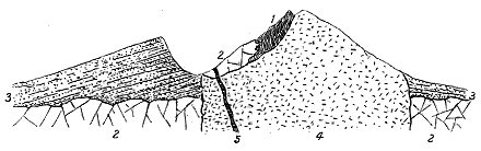
Undoubtedly denudation, cannot have left them altogether unaffected, but must have removed some amount of material from their surface. There is reason to believe that the material so removed may have been in large part of a fragmental character, and that it was under a covering of loose pyroclastic debris that the upward termination of the trachyte column assumed its typical dome-form. Thus in the crater-wall of the Puy de la Goutte, layers of buff-coloured trachytic tuff dip gently away from the central domite mass of the Puy de Chopine. That this material was thrown out from the vent previous to the uprise of the domite may be inferred from the way in which the latter rock has obliterated the northern half of the crater. The relations of the rocks are somewhat obscured by talus and herbage, but when I last visited the locality in the spring of 1895 the structure seemed to me to be as expressed in the accompanying diagram (Fig. 344).[382]
[382] Compare M. Michel Lévy, ibid.
The relative date of the protrusion of the trachytic domes cannot be very precisely defined. There can, indeed, be no doubt that it belongs to a late phase of the volcanic history. It came long after the outpouring of the older basaltic plateaux, of which large fragments emerge from beyond the limits of the younger lavas on both sides of the great ridge of the puys, and not only long after that outpouring, but even after the widespread sheets of basalt had been deeply trenched by valleys and isolated into outliers capping the hill-tops. Yet there is good evidence also that the uprise of the comparatively - 375 - acid trachytes was not the last volcanic episode of the district. The abundance of dark slags and fragments of basalt lying on the domite hills shows that discharges of more basic detritus occurred after these hills had taken their place in the landscape.
Since the latest eruptions, a gradual alteration of the topographical features by denudation has been slowly but continuously going on. The Grand Sarcoui, possibly from having originally had a considerable covering of fragmentary material, shows least the effects of this waste. Its remarkably regular form, like that of an inverted cauldron (the "Chaudron," as it is called in the district), presents, in a distant view, a smooth grassy surface which slopes steeply down into the great volcanic plain. But on a nearer examination these declivities are found to be seamed with trenches which the rain-storms of centuries have dug out. The covering of loose debris has been largely washed away, though many fragments of dark slag are still strewn over the slopes, and the scars are now being cut into the domite below. A more advanced stage of decay may be seen on the Puy de Dôme, where, from greater elevation and exposure, the domite is already deeply gashed by gullies and ravines, while the slopes below are strewn with its detritus.
The region of the Velay displays on a far more extensive scale the protrusion of trachytic and phonolitic bosses, but as its volcanic history goes back beyond the time of the Puys of Auvergne, its volcanic monuments have consequently been more extensively affected by denudation.[383] A series of basaltic eruptions forming extensive sheets can there be traced, the oldest dating from Miocene time, the youngest coming down to the age of the mammoth, cave-bear and early man. During this prolonged outpouring of basic lavas there were several intervals during which materials of a more acid nature—trachytes and phonolites—were erupted. These rocks occur partly as extensive tracts, covering five or six square miles, like those of the Mezenc, the Megal, the Pic de Lizieux, and the Rand, and partly in isolated conical or dome-shaped prominences, sometimes only a few hundred feet in diameter. Upwards of one hundred distinct eruptions of phonolite have been observed in the Velay. Even in the tracts where they cover the largest space, several prominent eminences may usually be observed, not unlike in general shape the isolated cones and domes of Auvergne. In these wider areas there appears to be evidence of the outcome of the lava from one or more vents, either as superficial streams or as underground intrusive sheets. M. Boule has expressed his opinion that most of the masses of trachyte and phonolite have been the result of local and limited eruptions, the pasty rock having risen in and accumulated around its pipe, without flowing far in any direction. A section across one of these masses would present a somewhat mushroom-shaped form.[384]
[383] In addition to the work of Scrope, the student of this important volcanic district will find an invaluable guide in the Le Puy Sheet (No. 186) of the Geological Survey Map of France, and in the Bulletins of the Survey, particularly those by MM. Termier and Boule, No. 13 (1890) and No. 28 (1892).
[384] Bull. Carte. Géol. France, No. 28 (tome iv.) p. 125.
- 376 -
That fragmentary ejections accompanied the protrusion of these rocks, though probably on a very limited scale, is shown by the occasional survival of portions of trachyte tuff around them. One of the most notable of these deposits occurs in the hollow between the Suc du Pertuis and the next dome to the south. It consists of fine and coarse, trachytic detritus, which in one place is rudely bedded and appears to dip away from the phonolite dome behind it at an angle of 30°. This material and its inclination are what might be expected to occur round an eruptive vent, and may be compared with those of the crater-wall of the Puy de la Goutte in relation to the domite boss of the Puy de Chopine.
The denudation of Velay has undoubtedly advanced considerably further than that of the Puys of Auvergne. The pyroclastic material which may have originally covered the domes of trachyte and phonolite has been in great part swept away. The surrounding rocks, too, both aqueous and igneous, have been extensively removed from around the necks of more enduring material. Hence the trachyte and phonolite bosses stand out with so striking a prominence as to arrest the eye even for a distance of many miles.
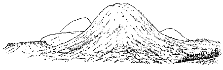
There cannot be any doubt that these necks have pierced the older basalts, and therefore belong to a later epoch in the volcanic history. The approximately horizontal sheets of basalt have been deeply eroded and reduced to mere fragments, and in some instances their existing portions owe their survival to the protection afforded to them by the immense protrusions of more acid material. But there is here, as well as in Auvergne, evidence of the uprise of a later more basic magma, for sheets of basalt are found overlying some parts of the trachytes and phonolites.
While the external forms of these Velay necks recall with singular vividness the features of many more ancient necks in Britain, an examination of the internal structure of some of them affords some further interesting points of resemblance. The slabs into which, by means of weathering along the joints, the rock is apt to split up are sometimes arranged with a general dip outwards from the centre of the hill, so that their flat surfaces roughly coincide with the hillslopes. In other cases the peculiar platy structure, so characteristic of phonolite, is disposed vertically or dips at a steep angle into the hill, so that the edges of the slabs are presented to the declivities, which consequently become more abrupt and rugged.
- 377 -
Though none of the volcanic series in Auvergne or the Velay is so acid in composition as the more acid members of the Tertiary volcanic series of Britain, the manner in which the trachytes and phonolites of the French region make their appearance presents some suggestive analogies to that of the corresponding rocks in this country. We see that they were erupted long after the outpouring of extensive basaltic plateaux, that they belonged to successive epochs of volcanic activity, that they were protruded in a pasty condition to the surface, where, more or less covered with fragmentary ejections, they terminated in dome-shaped hills or spread out to a limited distance around the vents, and lastly, that they were succeeded by a still later series of more basic eruptions, which completed the long volcanic history. We shall see in the following pages how closely the various stages in this complex record of volcanic activity may be paralleled in the geological records of Tertiary time in Britain.[385]
[385] The phonolite necks of Bohemia, which form so prominent a feature in the Tertiary geology of that country, might likewise be cited here in illustration of the acid domes and bosses of the British Isles.
- 378 -
Returning now to the consideration of the acid rocks as these manifest themselves in the volcanic areas of Britain, I would remark that three distinct types of structure may be noted among them, viz. (1) bosses, (2) sills or intrusive sheets, (3) veins and dykes. These types, as above remarked, belong entirely to the underground operations of volcanism, for though the rhyolitic fragments in the tuffs and agglomerates of the plateaux prove that acid lavas existed near the surface, no undoubted case of superficial lava belonging to the acid series has yet been observed.[386]
[386] The rhyolites of Tardree in Antrim have recently been claimed by Professor Cole as true lavas grouped round an eruptive vent. For reasons to be given in the next chapter I regard them as intrusive masses, though they may not improbably have been connected with streams of lava now entirely removed.
The bosses of acid material in the British Tertiary volcanic series are irregular protrusions, varying in size from knobs only a few square yards in area up to huge masses many square miles in extent, and comprising groups of lofty hills. As a rule, their outlines are markedly irregular. Beneath the surface they plunge down almost vertically through the rocks which they traverse, but in not a few instances their boundaries are inclined to the horizon, so that the contiguous rocks seem to rest against them, and sometimes lie in outliers on their sides and summits. From the margins of these bosses apophyses are given off into the surrounding rocks, sometimes only rarely and at wide intervals, in other places in prodigious numbers. Sometimes the acid material has been injected in thousands of veins and minute threads, which completely enclose fragments of the surrounding rock.
The rock of which the bosses consist is generally granophyric in texture, passing on the one hand, particularly in the central parts, into granite, and on the other, and especially towards the margin, into various more compact felsitic varieties, and sometimes exhibiting along the outer edge more or less developed spherulitic and flow-structures.
Decided contact metamorphism is traceable round the bosses, but is by no means uniform even in the same rock, some parts being highly altered, while others, exposed apparently to the same influences, have undergone - 379 - little change. The most marked examples of this metamorphism are those in which the Cambrian limestone of Skye has been converted into a pure white saccharoid marble. But the most interesting to the student of volcanic action are those where the altered rocks are older parts of the volcanic series. As the bosses of each volcanic area offer distinctive peculiarities they will here be described geographically.
It is in the island of Skye that the granophyre and granite bosses attain their largest dimensions and afford, on the whole, the most complete evidence of their structures and their relations to the other parts of the volcanic series (Map VI.). They cover there a total area of about 25 square miles, and form characteristic groups of hills from 2000 to 2500 feet in height. On the south-east side, three conspicuous cones (the Red Hills) rise from the valley of Strath (Beinn Dearg Mhor, Beinn Dearg Bheag and Beinn na Caillich). A solitary graceful pointed cone (Beinn na Cro) stands between Strathmore and Strathbeg, while to the north-west a continuous chain of connected cones runs from Loch Sligachan up into the heart of the Cuillin Hills. Their conical outlines, their smooth declivities, marked with long diverging lines of screes, and their pale reddish or reddish-yellow hue, that deepens after a shower into glowing orange, mark off these hills from all the surrounding eminences, and form in especial a singular contrast to the black, spiry, and rugged contours of the gabbro heights to the west of them.
Besides this large continuous mass, a number of minor bosses are scattered over the district. Of these the largest forms the ridge of Beinn an Dubhaich, south of Loch Kilchrist. Several minor protrusions lie between that ridge and the flank of Beinn Dearg. Others protrude through the moory ground above Corry; several occur on the side of the Sound of Scalpa, about Strollamus; and one, already referred to, lies at the eastern base of Blath Bheinn. In the neighbouring island of Raasay, a large area of granophyre likewise occurs, which will be described with the Sills in later pages.
In so extensive a district there is room for considerable diversity of composition and texture among the rocks. As already stated, in some places, more particularly in the central parts of the hills, the acid material assumes the character of a granite, being made up of a holocrystalline aggregate of quartz, orthoclase, plagioclase, hornblende and biotite, without granophyric structure, and thus becomes a hornblende-biotite-granite (quartz-syenite, granite-syenite of Zirkel, or amphibole-granitite of Rosenbusch). By the development of the micropegmatitic structure and radiated spherical concretions, it passes into granophyre. By the appearance of a felsitic groundmass, it shades off into different varieties of quartz-porphyry or rhyolite, sometimes with distinct bi-pyramidal crystals of quartz.[387] This change, which here and there is observable along the edge of a boss, is sometimes accompanied with an ample development of spherulitic and flow-structures. - 380 - As it is convenient to adopt some general term to express the whole series of varieties, I have used the word granophyre for this purpose.
[387] The best account yet published of these varieties in Skye is that by Prof. Zirkel, Zeitsch. Deutsch. Geol. Gesellsch. xxiii. (1871) p. 88.
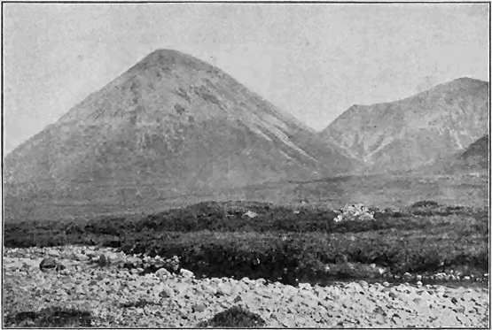
That the large area of these rocks in Skye was the result of many separate protrusions from distinct centres of emission may be inferred, I think, not only from the varieties of petrographical character in the material, but also from the peculiar topography of the ground, and perhaps from the curious relation which seems, in some instances at least, to be traceable between the external features and apparent internal structure of the hills. It will be seen from the Map (No. VI.) that in the area lying to the east of Strath More the granophyre is broken up into nearly detached portions by intervening patches of older rocks. There can be little doubt that the - 381 - mass of Beinn na Caillich and the two Beinn Deargs is the product of a distinct orifice, if not of more than one. Beinn na Cro, lying between its two deep bounding glens, is another protrusion. The western cones stand so closely together that their screes meet at the bottoms of the intervening valleys. Yet each group is not improbably the result of emission from an independent funnel, like the separate domite puys of Auvergne.
But, though I believe this large area of granitoid rock to have proceeded not from one but from many orifices, I have only here and there obtained, from the individual hills themselves, indications of an internal structure suggestive of distinct and successive protrusions of material from the same vent of discharge. On the outer declivities of some of the cones we may detect a rudely bedded structure, which will be subsequently referred to as well displayed in Rum (p. 403). This structure is specially observable along the east side of Glen Sligachan. Down the northern slopes of Marsco the granophyre (here in part a hornblende-biotite-granite) is disposed in massive sheets or beds that plunge outwards from the centre of the hill at angles of 30° to 40°. On the southern front of the same graceful cone, as well as on the flanks of its neighbour, Ruadh Stac, still plainer indications of a definite arrangement of the mass of the rock in irregular lenticular beds may be noticed. These beds, folding over the axis of the hill, dip steeply down as concentric coats of rock. The external resemblance of the red conical mountains of Skye to the trachyte puys of Auvergne was long ago remarked by J. D. Forbes,[388] and in this internal arrangement of their materials, indefinite though it may be, there is a further resemblance to the onion-like coatings which Von Buch and Scrope remarked in the structure of the interior of the Grand Sarcoui.[389]
[388] Edin. New Phil. Jour. xl. p. 78.
[389] Von Buch, Geognostische Beobachtungen auf Reisen durch Deutschland und Italien, vol. ii. (1809) p. 245; Scrope, Geology and Extinct Volcanoes of Central France, 2nd edit. p. 68. Von Buch regarded the external form of this Puy as having been determined by its internal structure.
Where the contour of the cones is regular, and the declivities are not marked by prominent scars and ribs of rock, this monotony of feature betokens a corresponding uniformity of petrographical character. But where, on the other hand, the slopes are diversified by projecting crags and other varieties of outline, a greater range of texture and composition in the material of the hills is indicated. This relation is well brought out on the western front of Marsco, where numerous alternations of granitoid and felsitic textures occur. On many declivities also, which at a distance look quite smooth, but which are really rough with angular blocks detached from the parent mass underneath, an occasional basalt-dyke will be observed to rise as a prominent dark rib. A good example of this structure is to be seen on the south front of Beinn na Caillich. Where a group of dark parallel dykes runs along the sides of one of these pale cones, it sometimes produces a curiously deceptive appearance of bedding. A conspicuous illustration may be noticed on the southern front of Beinn Dearg Meadhonach, north from Marsco. When I first saw that hillside I could not realize that the parallel - 382 - bars were actually dykes until I had crossed the valley and climbed the slopes of the hill.[390]
[390] The difference of contour and colour between the ordinary reddish smooth-sloped "syenite" and the black craggy "hypersthene rock" and "greenstone" in the Glamaig group of hills caught the eyes of Von Oeynhausen and Von Dechen (Karsten's Archiv, i. p. 83).
Good evidence of successive protrusions of the acid rock within the great area of the Red Hills may be found on the south side of Meall Dearg at the head of Glen Sligachan, where the granophyre is traversed by a younger band or dyke of fine-grained spherulitic material about ten feet broad. The rock exhibits there the same beautiful flow-structure with rows of spherulites as is to be seen along the contact of the main granophyre mass with the gabbro on the same hill, which will be afterwards described. This dyke, vein or band, though possibly belonging to the same epoch of protrusion as the surrounding granophyre, must obviously be later than the consolidation of the rock which it traverses.
Occasionally round the margin of the granophyre a singular brecciated structure is to be seen. I have found it well marked on weathered faces, along the flanks of Glamaig and of Marsco, and Mr. Harker has observed many examples of it on the north side of the granophyre mass of the Red Hills. When the rock is broken open, it is less easy to detect the angular and subangular fragments from the surrounding matrix, which is finely crystalline or felsitic.
The actual junction of the eruptive mass with the surrounding rocks through which it has ascended is generally a nearly vertical boundary, but the granophyre sometimes plunges at a greater or less angle under the rocks that lie against or upon it. On the north side of Glamaig, for instance, the prophyritic and felsitic margin of the great body of eruptive rock descends as a steeply inclined wall, against which the red sandstones and marls at the base of the Secondary formations are sharply tilted. On the south side of the area a similar steep face of fine-grained rock forms the edge of the granophyre of the great southern cones, and plunges down behind Lias limestone and shale, Cambrian limestone and quartzite, or portions of the Tertiary volcanic series. Where the granophyre cuts vertically through the gabbro, the latter rock being more durable is apt to rise above the more decomposable granophyre as a crag or wall, and thus the deceptive appearance arises of the basic overlying the acid rock. As above mentioned, there seems every reason to believe that this peculiarity of weathering has given rise to or confirmed the mistaken impression that the granophyre is older than the gabbro.
There can be no doubt, however, that along many parts of the boundary-line the acid eruptive mass extends underneath the surface far beyond the actual base of the cones, for projecting knobs as well as veins and dykes of it rise up among the surrounding rocks. This is well seen along the northern foot of Beinn na Caillich. But of all the Skye bosses none exhibits its line of junction with the surrounding rocks so well and continuously as Beinn an Dubhaich. This isolated tract of eruptive material lies entirely within the area of the Cambrian limestone, and its actual contact - 383 - with that rock, and with the basalt-dykes that traverse it, can be examined almost everywhere. The junction is usually vertical or nearly so, sometimes inclining outwards, sometimes inwards. It is notched and wavy, the granite sending out projecting spurs or veins, and retiring into little bays, which are occupied by the limestone. The subdivisions of the latter rock have recently been traced by Mr. Harker up to one side of the granite and recognized again on the other side, with no apparent displacement, as if so much limestone had been punched out to make way for the uprise of the acid boss. The older dykes, too, are continuous on either side of the ridge. The granite is massive and jointed, splitting up into great quadrangular blocks like an ancient granite, and weathering into rounded boulders. Its granitic composition and texture are best seen where the mass is broadest, south of Kilbride. Towards its margin, on the shore of Camas Malag, the granophyric structure appears, especially in narrow ribbons or veins that run through the more granitic parts of the rock. These may be compared with the much larger dyke of spherulitic rock above noticed as traversing the granophyre of Meall Dearg.
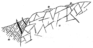
Immediately to the south of Camas Malag the junction with the limestone is well displayed, and the eruptive rock, which is there granitic in character, sends out into the limestone a vein or dyke about two feet broad, of closer grain than the main body of the boss, but still distinctly granitic in structure. The junction on the north side is equally well seen below the crofts of Torran. Here the rock of the boss, for a few yards from its margin, assumes a fine-grained felsitic aspect, and under the microscope presents a curious brecciated appearance, suggestive of its having broken up at the margin before final consolidation. Portions of the already crystallized granite seem to be involved in a microgranitic base. The rock has here truncated a number of basalt-dykes which intersect the Cambrian limestone. To one of these further reference will be made in the sequel.
On the surface of the mass of Beinn an Dubhaich, a few little patches of limestone occur to the south of Kilchrist Loch. Considering the nearly vertical wall which the granophyre presents to the adjacent rock all round - 384 - its margin, we may perhaps reasonably infer that these outliers of limestone are remnants of a once continuous limestone sheet that overlay the eruptive rock, and hence that, with due allowance for considerable denudation, the present surface of the boss represents approximately the upper limit to which the granophyre ascended through the limestone. The actual facts are shown in Fig. 347.
All round the margin of this boss, the limestone has been converted for a variable distance of a few feet or many yards into a granular crystalline marble. The lighter portions of the limestone have become snowy white; but some of the darker carbonaceous beds retain their dark tint. The nodules of chert, abundant in many of the limestones, project from the weathered faces of the marble. The dolomitic portions of the series have likewise undergone alteration into a thoroughly crystalline-granular or saccharoid rock. The most thorough metamorphism is exhibited by portions of the limestone which are completely surrounded by and rest upon the granite. The largest of these overlying patches was many years ago quarried for white marble above the old Manse of Kilchrist. I have shown by lithological, stratigraphical and palæontological evidence that this limestone, instead of belonging to the Lias, as was formerly believed, forms a part of the Cambrian or possibly the very lowest Silurian series, being a continuation of the fossiliferous limestone of western Sutherland and Ross-shire.[391] Mr. Clough and Mr. Harker, in the progress of the Geological Survey in Skye, have ascertained that the distinctive characters of the three groups of strata into which the limestone can be divided may be recognized even through the midst of the metamorphism.[392]
[391] Quart. Journ. Geol. Soc. vol. xliv. (1888) p. 62.
[392] Annual Report of Director-General of the Geological Survey for 1895.
The generally vertical line of separation between the rock of Beinn an Dubhaich and the contiguous limestone has been taken advantage of for the segregation of mineral veins. On the southern boundary at Camas Malag, a greenish flinty layer, from less than an inch to two or three inches in width, consisting of a finely-granular aggregate of some nearly colourless mineral, which polarizes brilliantly, coats the wall of the granophyre, and also both sides of the vein which proceeds from that rock into the limestone. But the most abundant and interesting deposits are metalliferous. Fragments of a kind of "gossan" may be noticed all along the boundary-line of the boss, and among these are pieces of magnetic iron-ore and sulphides of iron and copper. The magnetite may be seen in place immediately to the south of Kilbride. A mass of this ore several feet in diameter sends strings and disseminated particles through the surrounding granophyre, and is partially coated along its joints with green carbonate of copper.
From the Skye area important evidence is obtainable in regard to the relation of the acid eruptions to (1) earlier eruptive vents filled with agglomerate; (2) the bedded basalts of the plateaux; (3) the bosses, sills and dykes of gabbro and dolerite; and (4) the great system of basic dykes.
(1) Relation of the Granophyre to older Eruptive Vents.—The granophyre - 385 - of Beinn na Caillich and the two Beinn Deargs has invaded on its north-eastern side the Cambrian limestone and quartzite, and has truncated the sheets of intrusive dolerite and gabbro that have there been injected into them. But to the south-west it rises through the great Strath agglomerate already described, and continues in that rock round to the entrance into Strath Beg. The eruptive mass is in great part surrounded with a ring of agglomerate, as if it had risen up a huge volcanic chimney and solidified there, though probably there were more than one vent in this agglomerate area. Again the thick mass of agglomerate north of Belig is interposed between the bedded lavas and the great granophyre mass which extends northwards to Loch Sligachan. On the west side of the Blaven ridge, a number of masses of agglomerate are found on both sides of Glen Sligachan, along the border of the same great tract of acid rock.
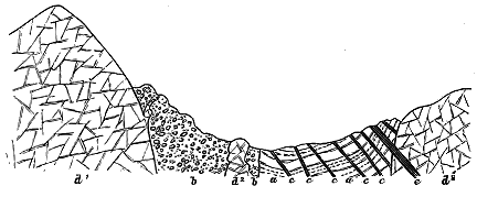
With regard to the relation of the granophyre of the Red Hills to the great agglomerate of Strath, we may infer that the granophyre has not risen exactly in the centre of the old funnel, but rather to the north of it, unless we suppose, as already suggested, that some of the agglomerate belongs to the cone that gathered round the eruptive orifice. It is interesting to observe, however, that granophyre, from the same or from another centre of protrusion, has likewise risen along the outer or southern margin of the agglomerate, generally between that rock and the limestone, but sometimes entirely within the agglomerate. The distance between the nearest part of this ring of eruptive rock and the edge of the boss of Beinn an Dubhaich is under 400 yards, the intervening space being occupied by limestone (or marble), much traversed by north-west basalt-dykes. Most of these dykes do not enter the rocks of the vent, and are abruptly truncated by the mass of Beinn an Dubhaich. The probable structure of this locality is shown in Fig 348.
The masses of agglomerate which further westward so curiously follow the margin of the great granophyre bosses, and those which are entangled in that rock and in the gabbro, probably indicate, as already suggested, the - 386 - position of a group of older volcanic funnels which provided facilities for the uprise of the basic and acid magmas. The group of vents which, as we have seen, probably rose out of the plateau-basalts, and first served for the rise of the masses of gabbro, has by the subsequent protrusion of the granophyres been still further destroyed and concealed.
The granophyre intrusions in the great Strath agglomerate have lately been mapped and described by Mr. Harker. As regards their internal structure and composition, this observer remarks that compared with the normal granophyres of the Red Hills and other bosses of the district, these smaller intrusive masses are darker and manifestly richer in the iron-bearing minerals, and have a slightly higher specific gravity. But in their general characters they agree with the other granophyres. The most interesting feature in them is the evidence they afford that they have enclosed and partially dissolved fragments of basic rocks. To this evidence further reference will be made on a later page (see p. 392).
(2) Relation of the Granophyre to the Bedded Basalts of the Plateaux. Metamorphism of the Basalts.—On the north-west side, the granophyre of Glamaig and Glen Sligachan mounts directly out of the bedded basalts. These latter rocks, which rise into characteristic terraced slopes on the north side of Loch Sligachan, appear on the south side immediately to the west of Sconser, and stretch westwards round the roots of Glamaig into the Coire na Sgairde. As they approach that hill they assume the usual dull, indurated, splintery, veined character of their contact metamorphism, and weather with a pale crust. Some of them are highly amygdaloidal, and between their successive beds thin bands of basalt-breccia, also much hardened, occasionally appear. Veins of granophyre become more numerous nearer the main mass of that rock. The actual line of junction runs into the Coire na Sgairde and slants up the Druim na Ruaige, ascending to within a few feet of the top of that ridge. A dark basic rock lies on the granophyre, the latter being here finer grained and greenish in colour, and projecting up into the former.[393] There is so much detritus along the sides and floor of Glen Sligachan that the relations of the two groups of rock cannot be well examined there. But the basalts, which present their ordinary characters to the north of the Inn, are observed to become more and more indurated, close-grained, dull and splintery, as they draw nearer to the granophyre of Marsco. This part of the district furnishes the clearest evidence of the posteriority of the great cones of Glamaig and its neighbours to the plateau-basalts which come up to the very base of these hills.[394]
[393] I think it probable that some of the greenish portions of the granophyre along this part of the junction-line will be found to have had their structure and composition altered by having incorporated into their substance a proportion of the bedded basalts through which they have been disrupted.
[394] The dykes of granophyre in these basalts are referred to at p. 444.
Round the eastern group of cones some interesting fragments of the once continuous sheet of plateau-basalts remain, and show the same relation of the acid protrusions on that side. One of these lies on the granophyre of the flanks of Beinn na Caillich, a little to the west of the loch at the northern - 387 - base of that hill. Another of larger size forms a prominent knob about three-quarters of a mile further west, and is prolonged into the huge dark excrescence of Creagan Dubha, which rises in such striking contrast to the smooth red declivities of the granophyre cones around it. This prominence at its eastern and northern parts consists of highly indurated splintery basalt in distinct beds, some of which are strongly amygdaloidal. The bedding is nearly vertical, but with an inclination inwards to the hill. Towards the south-west end a thin band of basalt-breccia makes its appearance between two beds of basalt. Its thickness rapidly increases southward until it is the only rock adhering to the granophyre. Beyond the foot of the hill, limestone and quartzite occupy for some distance the bottom of Strath Beg, much invaded by masses of quartz-porphyry. At the summit of Creagan Dubha abundant veins run into the basic rocks from the granophyre, which is here finer grained towards the margin; and there are likewise veins of quartz-porphyry which, though their actual connection with the main mass of granophyre cannot be seen, are no doubt apophyses from it.
This outlier of altered basalt and breccia appears to me to be a fragment of the plateau-basalts which once overlay the Cambrian and Jurassic rocks of Strath Beg, and were disrupted by the uprise of the granophyre. It continues to adhere to the wall of the eruptive mass that broke up and baked its rocks. Its breccia, passing southward into a coarse agglomerate, may be a product of the same vent or group of vents that discharged the great agglomerate mass above Kilbride and Kilchrist. I have already (p. 282) referred to what appears to be another outlier of the basalts on the south side of Beinn Dearg.
On the northern and southern flanks of Beinn na Cro, similar evidence may be observed of the posteriority of the granophyre to the basic rocks. Round the northern base of the hill a continuous tract of plateau-basalts, dolerites and gabbros forms the ridge between Strathmore and Strathbeg. There is an admirable section of the relation of the two groups of rock on the eastern side of the western glen. Along the lower part of the declivity, coarsely-crystalline gabbros, like some of those in the Cuillin Hills, are succeeded by sheets of dolerite and basalt, the whole forming an ascending succession of beds to the summit of the ridge. The edges of these beds are obliquely truncated by the body of granophyre, which slants up the hill across them and sends veins into them. They are further traversed by basalt dykes, which here, as almost everywhere, abound (Fig. 349). On the south side of Beinn na Cro, highly indurated black and grey Lias shales and sandstones have been tilted up steeply and indurated by the eruptive rock of the hill; and at one place some 800 feet above the sea, a little patch of altered basalt, lying on the shale, but close up against the steep declivity of granophyre, forms a conspicuous prominence on the otherwise featureless slope.
Reference has already been made to the mass of fine-grained hornblende-granite which runs for several miles at the base of the volcanic series on - 388 - the eastern side of the Blaven group of hills. Mr. Harker has traced a great development of granophyre on the west side of these hills, where the acid rock sends apophyses both into the bedded basalts and into the gabbros.
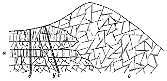
Combining the results of observations made not only in Skye but in Mull, Rum and Ardnamurchan, I shall here give a fuller account of the metamorphism of the basalts, to which frequent allusion has been made as one of the evidences of the posteriority of the eruptive bosses of rock round which it occurs.[395] The field-geologist observes that the basalts, as they are traced towards these bosses, lose their usual external characters. They no longer weather into spheroidal blocks with a rich brown loam, but project in much jointed crags, and their hard rugged surface shows when broken a thin white crust, beneath which the rock appears black or dark bluish-grey, dull and splintery. They are generally veined with minute threads or strings of calcite, epidote and quartz, which form a yellowish-brown network that projects above the rest of the weathered surface. Where they are amygdaloidal, the kernels no longer decay away or drop out, leaving the empty smooth-surfaced cells, but remain as if they graduated into the surrounding rock by an interlacing of their crystalline constituents. They then look at a distance more like spots of decoloration, and even when seen close at hand would hardly at first betray their real nature.
[395] Many years ago I was much struck with the evidence of alteration in the igneous rocks of Mull, and referred to it in several papers, Proc. Roy. Soc. Edin. (1866-67) vol. vi. p. 73; Quart. Journ. Geol. Soc. xxvii. (1871) p. 282, note. The subject was more fully discussed in my memoir in the Trans. Roy. Soc. Edin. vol. xxxv. (1888) p. 167, from which the account in the text is taken. Prof. Judd has more recently referred the alteration to solfataric action (Quart. Journ. Geol. Soc. xlvi. 1890, p. 341). As already mentioned, I have been unable to detect evidence of such action. The alteration is always intimately connected with the presence of intrusive masses, and it affects indifferently any part of the basalt-plateaux which may chance to lie next to these masses. The bedded lavas can be traced step by step from their usual unaltered condition in the plateaux to their metamorphosed state next to the eruptive rocks. The nature or degree of the metamorphism has doubtless somewhat varied with the composition and structure of the rocks affected, and with the character and mass of the eruptive material; but it is certainly not confined to the older parts of the plateaux, nor to any supposed pre-basaltic group of andesites. I have found no evidence that such a group anywhere preceded the plateau-basalts. The andesites, so far at least as my observations go, were erupted at intervals during the plateau period, and alternate with the true basalts. The greatest accumulation of them lies not below but above the general body of the basalts, in the "pale group" of Mull. Nor even if the term "propylite" be adopted for these altered rocks, can it be applied to any special horizon in the volcanic series. The alteration of the basic rocks by the granophyre of St. Kilda will be described in the account of that island in Chapter xlvii.
- 389 -
From the specimens collected by me among the Inner Hebrides up to the year 1888, I selected two dozen which seemed to be fairly typical of these altered rocks, and placed thin slices of them for microscopic examination in Dr. Hatch's hands. His notes may be condensed into the following summary. One of the most frequent features in the slides is the tendency in the component minerals to assume granular forms. In one specimen from Loch Spelve, Mull, the rock, probably originally a dolerite, shows only a few isolated recognizable crystals of plagioclase and augite, the whole of the rest of the rock consisting of roundish granules embedded in a felspathic matrix. The felspar crystals are sometimes broken up into a mosaic, though retaining their external contours. Besides the granules, which are no doubt augite, a few grains of magnetite are scattered through the rock, aggregated here and there into little groups. In another specimen, taken from the junction with the granophyre in Glenmore in the same island, parts of the augite crystals are converted into granular aggregates associated with large grains and patches of magnetite. The latter mineral also assumes in some of the rocks granular and even globular shapes suggestive of fusion.
The felspars, which in most of the basic rocks are usually remarkably clear and fresh, show marked kaolinization in some of these altered masses. Minute dusky scales of kaolin are developed, sometimes also with the separation of minute grains of quartz. The augite shows frequent alteration to hornblende, proceeding as usual from the exterior inward. In some cases only an envelope of uralite appears round the augite, while in others only a kernel of the original mineral is left, or the whole crystal has been changed. In many cases the altered substance appears as minute needles, blades and fibres of actinolite. Occasionally, besides the green hornblende, shred-like pieces of a strongly pleochroic brown hornblende make their appearance. Serpentinous and chloritic substances are not infrequent. Epidote is sometimes abundant. The titaniferous iron has commonly passed more or less completely into leucoxene. Here and there a dark mica may be detected.
Since the year 1888 I have continued the investigation of this subject, and have especially studied the metamorphism of the bedded basalts on the western shores of Loch Scavaig, where, as already described, they are truncated by vertical beds of gabbro, and are traversed by basalt-dykes and by abundant veins of fine-grained granophyre. The alteration here effected affords excellent materials for study, as the very same sheets of basalt can be followed from the normal conditions outside to the altered state within the influence of the metamorphic agent. The alternations of amygdaloidal and more compact sheets can still be recognized, although their enclosed amygdales have in places been almost effaced. They show the dull, indurated, splintery character, with the white weathered crust, so distinctive of this type of contact-metamorphism. They are traversed by numerous sills and veins of gabbro. As has been already suggested, although no large mass of - 390 - granophyre appears here at the surface, the alteration of the basalts is probably to be attributed not so much to the influence of the gabbro, as to the abundant acid sills, dykes and veins, for there may be a considerable body of granophyre underneath the locality, the dykes and veins being indications of its vicinity.
In the summer of 1895 I examined the locality with much care, and collected some typical specimens illustrative of the conditions of metamorphism presented by different varieties of the bedded basalts. Thin slices cut from these specimens were placed in Mr. Harker's hands for microscopical examination, and he furnished me with the following notes regarding them.
"In hand-specimens the bedded basalts from the neighbourhood of the gabbro of Loch Scavaig [6613-6618] do not appear very different from the normal basalts of this region. The most conspicuous secondary mineral is yellowish-green epidote in patches, and especially in the amygdales.
"The texture of the rocks varies, and the slices show that the micro-structure also varies, the augite occurring sometimes in small ophitic plates, sometimes in small rounded granules. The chief secondary change in the body of the rock is shown by the augite, which is seen in various stages of conversion to greenish fibrous hornblende. Some round patches seem also to consist mainly of the latter mineral, and are probably pseudomorphs after olivine. Here the little fibres are confusedly matted together, without the parallelism proper to uralite derived from augite. No fresh olivine has been observed. The felspar and magnetite of the basalts show little or no sign of metamorphic processes, unless a rather unusual degree of clearness in the felspar crystals is to be regarded in that light.
"The contents of the metamorphosed amygdales are not always the same. Epidote is usually present in some abundance, and in well-shaped crystals. It has a pale citron tint in the slices, with marked pleochroism; but a given crystal is not always uniform in its optical characters. Frequently the interior is pale, and has a quite low birefringence. This is probably to be regarded as an intergrowth of zoisite in the epidote, and there are a few distinct crystals of zoisite seen in some places.
"In the slide which best exhibits these features [6613] the crystals of epidote are in part enwrapped and enclosed by what are doubtless zeolitic minerals. At least two of these are to be distinguished. One, very nearly isotropic, and with a pale-brownish tint, is probably analcime. Associated with this is a colourless mineral with partial radiate arrangement and with twin lamellation; the birefringence is somewhat higher than that of quartz, and the γ-axis of optic elasticity makes a small angle with the twin-line. These characters agree with those of epistilbite. In other parts of the same large amygdale, the epidote crystals are embedded in what seems to be a felspar. This latter mineral is rather obscure, and twin-lamellation is rarely to be detected; but it seems highly probable that felspar has here been developed by metamorphic agency at the expense of zeolites which once occupied the amygdale. I have observed undoubted examples of this in - 391 - metamorphosed basalts from other parts of Skye, e.g. from Creagan Dubha, near the granophyre mass of Beinn Dearg.[396] The felspar occurs there in the same fashion, and in the same relation to epidote [2700, 2701]. In the specimens now described the chief minerals in the metamorphosed amygdales are those already named: others occur more sparingly, associated with them. In some cases there is a grass-green, strongly pleochroic, actinolitic hornblende, accompanied by a little iron pyrites [6615].
[396] Compare Trans. Roy. Soc. Edin. vol. xxxv. p. 166.
"Epidote and various hornblendic and augitic minerals are characteristic products in the metamorphism of amygdaloidal basalts in other regions: felspar with this mode of occurrence I have not seen except in Skye, where it seems to connect itself naturally with the abundance of zeolites in the amygdales of the non-metamorphosed lavas. It is to be observed that in these basalts from Loch Scavaig the alteration is shown especially in the amygdales, the body of the rock not being greatly affected: this indicates a not very advanced stage of metamorphism. The production of uralitic hornblende, rather than brown mica, from the augite and its decomposition-products, seems to be characteristic of the metamorphism of basaltic as distinguished from andesitic rocks, and is well illustrated by a comparison of the two sets of lavas near the Shap granite."[397]
[397] Quart. Journ. Geol. Soc. vol. xlix. (1893) p. 361.
Mr. Harker, who is at present engaged in mapping the central region of Skye, has had occasion to go over a number of the localities (Creagan Dubha, etc.) originally cited by me, and, while corroborating my general conclusions regarding them, has been able to obtain much fresh evidence regarding the nature and extent of the metamorphism which the bedded basalts have undergone. The results of his investigations will be published when the Geological Survey of Skye is further advanced.
(3) Relation of the Granophyre to the Gabbros.—That the granophyres invade the gabbros has been incidentally illustrated in the foregoing pages. But as the mutual relations of the two rocks in the island of Skye have been the subject of frequent reference in previous writings of geologists, it is desirable to adduce some detailed evidence from a region which has been regarded as the typical one for this feature in the geological structure of the Inner Hebrides. No geological boundary is more easily traced than that between the pale reddish granophyre and the dark gabbro. It can be followed with the eye up a whole mountain side, and can be examined so closely that again and again the observer can walk or climb for some distance with one foot on each rock. That there should ever have been any doubt about the relations of the two eruptive masses is possibly explicable by the very facility with which their junction can be observed. Their contrasts of form and colour make their boundary over crag and ridge so clear that geologists do not seem to have taken the trouble to follow it out in detail. And as the pale rock undoubtedly often underlies the dark, they have assumed this infraposition to mark its earlier appearance.
I will only cite one part of the junction line, which is easily accessible, - 392 - for it lies in Glen Sligachan immediately to the south of the mouth of Harta Corry. The rounded eminence of Meall Dearg, which rises to the south of the two Black Lochs, belongs to the granophyre, while the rugged ground to the west of it lies in the gabbro. The actual contact between the two rocks can be followed from the side of Harta Corry over the ridge and down into Strath na Creitheach, whence it sweeps northward between the red cone of Ruadh Stac and the black rugged declivities of Garbh Beinn. There is no more singular scene in Skye than the lonely tract on the south side of Meall Dearg. The ground for some way is nearly level, and strewn with red shingle from the decomposing granophyre underneath. It reminds one of some parts of the desert "Bad lands" of Western America. Grim dark crags of gabbro, with veins from the granophyre, rise along its western border, beyond which tower the black precipices of the Cuillins, while the flaming reddish-yellow cones of Glen Sligachan stand out against the northern sky.
Having recently described in some detail the relations of the boss of granophyre at this interesting locality, I will only here offer a brief summary of the chief features.[398] The granophyre of Meall Dearg forms a marginal portion of the great mass of the Red Hills. It has broken across the banded gabbros, and also cuts an isolated boss of agglomerate in the ridge of Druim an Eidhne. Its line of junction is nearly vertical, but along part of its course the wall of gabbro rises higher than that of the more decomposable granophyre. Hence the origin of the black crags that crown the red slopes of granophyre debris. Seen from a distance the basic rock seems to rest as a great bed upon the acid mass.
[398] See Quart. Journ. Geol. Soc. vol. 1. (1894) p. 212.
The younger date and intrusive nature of the granophyre are well shown by the change in the texture of the mass as it approaches the rocks against which it has cooled. The ordinary granophyric characters rapidly pass into a fine-grained felsitic texture, and this change is accompanied with the development of a remarkably well-defined flow-structure and of rows of spherulites which run parallel to the boundary wall. In a ravine on the west side of Meall Dearg, the lines of flow-structure and rows of large spherulites are seen to be arranged vertically against the face of gabbro.
Further proof of the later date of the protrusion of the granophyre is supplied by abundant felsitic dykes and veins which traverse the gabbro, and some of which can be seen to proceed from the main body of granophyre. These intrusions will be described in the next chapter, in connection with the dykes and veins of the acid rocks.
Additional evidence as to the posteriority of the granophyre to the gabbro has recently been obtained by Mr. Harker from a study of the internal structure and composition of the masses of these rocks which have been intruded into the agglomerate above Loch Kilchrist in Strath. He has found that the granophyre has there caught up from some subterranean depth portions of gabbro, and has partially dissolved them, thereby undergoing a modification of its own composition. - 393 - "The gabbro-debris," he remarks, "has been for the most part completely disintegrated by the caustic or solvent action of the acid magma on some of its minerals. Those constituents which resisted such action have been set free and now figure as xenocrysts [foreign crystals], either intact or more or less perfectly transformed into other substances. At the same time the material absorbed has modified the composition of the magma, in the general sense of rendering it less acid." Mr. Harker has traced the fate of each of the minerals of the gabbro in the process of solution and isolation in the acid magma, which, where this process has been most developed, is believed by him to have taken up foreign material amounting to fully one-fourth of its own bulk, derived not from the rocks immediately around, but from a gabbro probably at a considerable depth beneath.[399]
[399] Quart. Journ. Geol. Soc. vol. lii. (1896) p. 320.
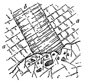
(4) Relation of the Granophyre to the Basic Dykes and Veins.—Reference has already been made to the fact that the "syenite" bosses of Skye cut off most of the basalt-dykes, but are themselves traversed by a few others.[400] The locality that furnished me with the evidence on which this statement was originally made nearly forty years ago affords in small compass a clearer presentation of the facts than I have elsewhere met with. The sections described by me are visible at the eastern end of the boss of Beinn an Dubhaich, Strath; but similar and even better examples may be cited from the whole northern and southern margins of that eruptive mass. On the north side an extraordinary number of dykes may be traced in the Cambrian limestone from the shores of Loch Slapin eastwards. They have a general north-westerly trend, but one after another, as I have already remarked, is abruptly cut off by the granophyre. As an example of the way in which this truncation takes place, I may site a single illustration from the northern margin of the eruptive mass, near Torrin. It might perhaps be contended that the numerous dykes which traverse the limestone and stop short at the edge of the acid rock, are not necessarily older than the granophyre, but may actually be younger, their sudden termination at the edge of the acid boss being due to their inability to traverse that rock. That this explanation is untenable is readily proved by such sections as that given in Fig. 350, where a basic dyke (b) 9 or 10 feet broad running through the Cambrian Limestone (a a) is abruptly cut off by the edge of the great granophyre boss. Not only is the dyke sharply truncated, but numerous pieces of it, from an inch to more than a foot in length, are enclosed in the granophyre. The latter is well exposed along the shore of Loch Slapin in an almost continuous section of nearly a mile in length. The contrast therefore between the development of dykes within and beyond - 394 - its area cannot but arrest the attention of the observer. Though I was on the outlook for dykes in the granophyre, I found only one. Yet immediately beyond the eruptive boss they at once appear on either side up to its very edge, where they suddenly cease. The conclusion cannot be resisted that the protrusion of the acid rock took place after most of the dykes of the district had been formed, but before the emission of the very latest dykes, which pursue a north-west course across the boss (Fig. 348).
[400] Ante, p. 173, and Quart. Journ. Geol. Soc. vol. xiv. (1857) p. 16.
Some sections on the southern margin of Beinn an Dubhaich complete the demonstration that such has been the order of appearance of the rocks. Near the head of the Allt Lèth Slighe (or Half-way Burn), where the granite has pushed a long tongue into the limestone, a north-west basalt-dyke is abruptly cut off by the main body of the boss and by the protruded vein (Fig. 351). Besides this truncation, the acid rock sends out strings and threads of its own substance into and across the dyke, these injected portions being as usual of an exceedingly fine felsitic texture.
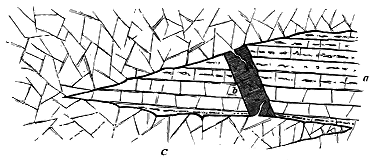
Similar evidence may be gathered from the area of the great granophyre cones further north. The profusion of basalt-dykes in the surrounding rocks stops short at the margin of that area. The comparatively few dykes which cross the boundary pursue a general north-west course through the granophyre, and, as already remarked, from their dark colour, greater durability and straightness of direction, stand out as prominent ribs on the flanks of the pale cones which they traverse.
- 395 -
Though of comparatively small extent, the granophyre bosses of the island of Mull afford to the geologist a large amount of instruction in regard to the relations of the different members of the volcanic series to each other. Especially important is the evidence which they contain of the connection between the acid and basic groups of rocks. They have been laid bare in many natural sections, some of which, forming entire hillsides, are among the most astonishing in the whole wonderful series which, dissected by denudation, reveal to us the structure of these volcanic regions. They lie in two chief areas. One of these extends along the northern flanks of the mountainous tract from the western side of Beinn Fhada across Loch Ba' to the west side of Glen Forsa. The other occupies for over three miles the bottom of Glen More, the deep valley which, skirting the southern side of the chief group of hills, connects the east side of the island by road with the head of the great western inlet of Loch Scridain. There are other minor areas. One of these extends for about a mile along the declivities to the south of Salen, across the valley of the Allt na Searmoin; another occurs at Salen; a third runs along the shore at Craignure. In the interior also, many isolated areas of similar rocks, besides thousands of veins, occur in the central group of hills and valleys which form the basins of the Glencannel and Forsa rivers (Map VI.).
The chief northern boss, which for the sake of convenience of reference may be called that of Loch Ba', has a length of nearly six miles, with a breadth varying from a quarter of a mile to about a mile and a quarter. It descends to within 50 feet of the sea-level, and is exposed along the crest of Beinn Fhada at a height of more than 1800 feet. It chiefly consists of a grey crystalline rock which might readily be identified as a granite, but which when examined microscopically is found to possess the granophyric structure. With this distinctly granular-crystalline rock are associated various porphyritic and felsitic masses, which pass into it, and are more specially observable along its border. An exceedingly compact black - 396 - quartz-felsite or rhyolite forms its southern boundary, runs as a broad dyke-like ridge from the head of the Scarrisdale Water north-eastward across Loch Ba' (Fig. 352), and spreads out eastward into a mass more than a mile broad on the heights above Kilbeg in Glen Forsa. The sharp line of demarcation of this felsite, and its mass and extent, point to a different period of extravasation.
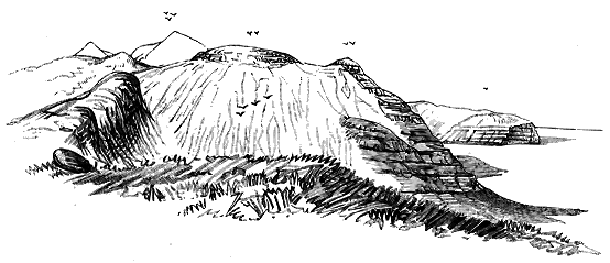
The geologist, who approaches this district from the north-east, has his attention arrested, even at a distance of several miles, by the contrast between the outer and inner parts of the hills that lie to the south-west of Loch Ba'. He can readily trace from afar the dark bedded basic rocks rising terrace above terrace, from the shores of Loch na Keal, to form the seaward faces of the hills along the southern side of that fjord. But he observes that immediately behind these terraces the mass of the rising ground obviously consists of some amorphous rock, which weathers into white debris. Nothing can be sharper than the contrast of colour and form between the two parts of the hills. The bedded plateau-rocks lie as a kind of wall or veneer against a steep face of the structureless interior (Fig. 352). Seen from the other or hilly side, the contrast is perhaps even more striking. But the astonishment with which it is beheld at a distance becomes intensified when one climbs the slopes, and finds that the sheets of dolerite and basalt (which from some points of view look quite level, yet dip towards the north-east at a gentle angle) are immediately behind the declivity abruptly truncated by a mass of granophyre. Of all the junction-lines between the acid bosses and the lavas of the plateaux, those exposed on these Mull hillsides are - 397 - certainly the most extraordinary. So little disturbed are the lavas, that one's first impulse is to search for pebbles of the granophyre between the basalts, for it seems incredible that the inner rock should be anything but a central core of older eruptive material, against and round which the younger basic rocks have flowed. But, though the granophyre is so decomposing and covers its slopes with such "screes" of debris, that had the basalts been poured round it, they must infallibly have had some of its fragments washed down between their successive flows, not a single pebble of it is there to be found. This might not be considered decisive evidence, but it is extended and confirmed by the fact that the acid rock gives off veins which ramify through the basalts.
Before examining the actual contact of the two rocks, however, the geologist will not fail to observe here an admirable example of the gradual change which was described in the foregoing chapter as coming over the bedded basalts near the acid bosses. As he approaches the nucleus of white rock, the basalts assume the usual hard indurated character, not decaying into brown sand as on the plateaux, but often standing out as massive crags with vertical clean-cut joint-faces. This metamorphosed condition extends in some cases to a considerable distance from the main body of acid rock, especially where knobs of that material, protruding through the more basic lavas, show that it must extend in some mass underneath. Thus along the shore at Saline the bedded basalts succeed each other in well-defined sheets, some being solid, massive and non-amygdaloidal, others quite vesicular, and recalling the black scoriform surfaces of recent Vesuvian lavas; yet they are all more indurated than in the normal plateau-country, and they break with a hard splintery fracture. Immense numbers of dykes cut these rocks, and they are likewise pierced by occasional felsitic intrusions.
If we cross to the other side of the island and trace the bedded basalts away from the central masses of acid rock we meet with so gradual a diminution of the induration that no definite boundary-line for the metamorphism can be drawn. As we recede from the centre of alteration, the rocks insensibly begin to show brown weathered crusts, with spheroidal exfoliation, the reticulations of epidote and calcite become much less abundant, the amygdaloids gradually assume their normal earthy character, and eventually we find ourselves on the familiar types of the plateau. This transition is well seen along the shores of Loch na Keal.[401]
[401] Some of the thick massive sheets of basic rock along the south side of this inlet may possibly be altered sills.
These proofs of the alteration of the plateau-basalts are accompanied in Mull as in Skye by further abundant evidence that the acid rocks are of younger date than the basic. In particular, dykes and veins may be traced proceeding from the former and intersecting the latter. Thus, in the bed of the south fork of the Scarrisdale stream, a separate mass of granophyre (which under the microscope exhibits in perfection the characteristic structure of this rock) protrudes through the basalts in advance of the main mass, and a little higher up on the outskirts of that mass narrow ribbons - 398 - of the granophyre run through the basic rocks. The contrast of colour between the pale veins of the intrusive rock and the dark tint of the basalts is well shown in the channel of the water. Similar sections may be seen on the flanks of Beinn Fhada, especially in the great corry north of Ben More, where the granophyre sends a tongue of finer grain between the beds of basalt. On the east side of Loch Ba' numerous proofs of similar intrusion may be observed. Thus at the east end of Loch na Dàiridh, where the granophyre has been intruded into the basalts, hand-specimens may be obtained showing the two rocks welded together. On the slopes of Cruach Tòrr an Lochain, where the granophyre has a felsitic selvage, the bedded basalts are traversed by veins of the latter material (Fig. 353). A little further east, at the head of the Allt na Searmoin, the bedded basalts, some of which are separated by slaggy scoriaceous surfaces, are intersected by another protrusion from the compact felsitic porphyry (Fig. 354).[402] A mile lower down the same valley a separate mass of granophyre sends out veins into the basalt, which as usual is dark bluish-grey in colour, indurated and splintery.
[402] This rock appears to the eye as a black finely crystalline-granular felsite. Under the microscope, it was found by Dr. Hatch to "present a markedly granulitic structure, consisting mainly of small rounded grains of dirty brown turbid felspar, with isolated granules of colourless quartz. Scattered through the rock, or accumulated in patches, are small spherical or drop-like granules of a bright green augite (coccolite)."
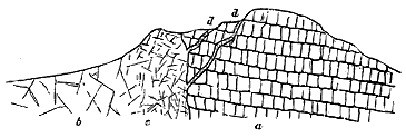
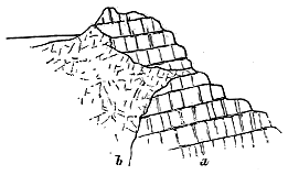
As the posteriority of the Mull granophyre and felsites to the basalts is thus proved, the further question remains as to their manner of intrusion. Here and there, especially on the south-eastern side, between the head of the Scarrisdale river and Loch Ba', the line of junction between the two rocks is nearly vertical, but a body of black felsite intervenes as a huge wall between the ordinary granophyre and the basalt. On Beinn Fhada and Beinn a' Chraig the line of separation, as I have above remarked, is inclined - 399 - outwards, and plunges under the basalts at an angle of 30° to 40°. The terraced basalts and dolerites are not sensibly disturbed, but end off abruptly against the steep face of intrusive rock. We might suppose that in this case the younger rock had merely carried upward the continuation of the beds that are truncated by it, as if an orifice had been punched out for its ascent. But on the top of the ridge of Beinn a' Chraig we find that the outliers which there remain are not portions of the lower basalts, but of the upper "pale group" of Ben More. The same rocks are prolonged on the other side of the Scarrisdale Glen, sweep over the summit of Beinn Fhada, and run on continuously into the crest of A'Chioch and the upper part of Ben More. The granophyre has usurped the place of the lower dolerites and basalts, but has left the more felspathic lavas of the "pale group" in their proper position. And to make this remarkable structure still more clear, sections may be seen on the southern flanks of Beinn Fhada, where the upper surface of the granophyre comes down obliquely across the edges of the lavas, and allows the junction of the basalts and the "pale group" to be seen above it (Fig. 355). As in the case of Beinn an Dubhaich, it is as if the granophyre had eaten its way upward and dissolved the rocks which it has replaced.
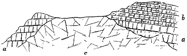
The usual kind of contact-metamorphism has been produced around this intrusive boss. It is most marked in the outliers that cap Beinn a' Chraig and on the two ridges to the south-west, where it is seen to consist in a high degree of induration, the production of a shattery, irregularly-jointed structure, and the effacement of the obvious bedding which characterizes the unaltered rocks.
The position of this eruptive mass, quite a mile broad, breaking through, without violently tilting, more than 1800 feet of the bedded basalts, and then stopping short about the base of the "pale group," presents a curious problem to the student of geological physics. It at once reminds him of many sections among Palæozoic granites where an eruptive boss has ascended and taken the place of an equivalent volume of the surrounding rocks, which, though more or less metamorphosed, are not made to dip away from it as from a solid wedge driven upwards through them. In this Mull case, however, there are some peculiar features that deserve consideration, for they seem to show that here, as elsewhere, passages for the uprise of the intrusive rock were already provided by the presence of volcanic pipes, which, - 400 - even if filled up with fragmentary materials, would no doubt continue to be points of weakness. Round the flanks of the Loch Ba' boss, and here and there on its surface, patches of intensely indurated volcanic agglomerate may be detected. A little to the south of the tarn called Loch na Dàiridh, the granophyre is succeeded by the black, flinty felsite or rhyolite already referred to. This rock in some places exhibits a beautiful flow-structure, with large porphyritic felspars, and encloses a great many fragments of dolerite and gabbro, varying from the size of a pea up to blocks several inches in diameter. Lying on its surface are detached knolls of much altered dolerite, basalt, and coarse breccia or agglomerate. On its southern margin one of these patches of agglomerate contains abundant fragments of various felsitic rocks, among which are pieces of a compact rock with flow-structure like that found in place immediately to the north; also rounded pieces of quartzite, and of compact and amygdaloidal basalt wrapped up in a very hard matrix which seems to consist largely of basalt-dust. No bedding can be made out in this rock, and the mass looks like part of a true neck. Further down the slope the bedded basalts appear. The actual junctions of the different rocks cannot be satisfactorily traced, but the structure of the ground appears to me to be as shown in Fig. 356. A patch of similar agglomerate appears a little to the south-west of the last section in front of a cliff of the felsite, and seems to be enclosed in the latter rock, and other exposures of agglomerate, underlain and intensely indurated by the felsite, may be noticed on the ground that slopes towards Loch Ba'.
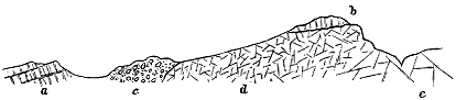
That these agglomerates do not belong to the period of the eruption of the granophyre and felsite, but to that of the bedded basalts, may be inferred from their intense induration next the acid rocks, and also from the fact that similar breccias are actually found here interposed between the bedded basalts. This is well shown on the hill above the Coille na Sròine, where the accompanying section can be seen (Fig. 357). The broad dyke-like mass of black flinty felsite already referred to runs as a prominent rib over the southern end of Beinn a' Chraig into the head of the Scarrisdale glen (see Fig. 352). It cuts across the bedded basalts, and immediately to the south of where these appear, a thin intercalated bed of breccia crops out, of the usual dull-green colour, with abundant fragments of basalt and many of yellow and grey felsite.
From these various facts we may, I think, conclude that along the strip of ground now occupied by the Loch Ba' boss of granophyre and felsite, there once stood a line or group of vents, from which, besides the usual - 401 - basalt-debris, there were ejected many pieces of different felsitic or rhyolitic rocks, and that these eruptions of fragmentary material took place during the accumulation of the plateau-basalts. These volcanic funnels occasioned a series of points or a line of weakness of which, in a long subsequent episode of the protracted volcanic period, the acid rocks took advantage, forcing themselves upwards therein, and leaving only slight traces of the vents which assisted their ascent. The mingling of acid and basic fragments in the material ejected from these vents is another proof of the existence of acid rocks in the volcanic reservoirs before the advent of the great granophyre intrusions. The evidence thus entirely confirms the conclusions deduced from the Skye area.
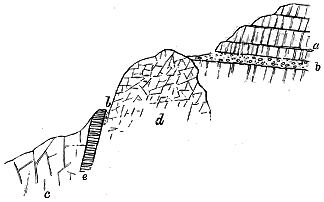
The second or Glen More boss, instead of rising into hilly ground, is confined to the bottom of the main and tributary valleys, and has only been revealed by the extensive denudation to which these hollows owe their origin. It begins nearly a mile below Torness and extends up to Loch Airdeglais—a distance of almost four miles. Though singularly devoid of topographical feature, it exhibits with admirable clearness the relation of the granophyres to the gabbros, and thus deserves an important place among the tracts of acid rocks in the Western Islands. Its petrographical characters change considerably from one part of its body to another. For the most part, it is a true granophyre, sometimes with orthoclase, sometimes with plagioclase as its predominant felspar. At Ishriff, as already stated, it is sprinkled with long acicular decayed crystals of hornblende; but at the watershed the ferro-magnesian mineral is augite. The surrounding rocks are mainly the plateau-basalts, with their sills of dolerite and gabbro.
- 402 -
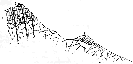
This strip of granophyre sends abundant apophyses from its mass into the dark basic rocks around it. Some of the best sections to show the nature of these offshoots are to be found on the steep hillslope which mounts from the watershed in Glen More southward into the Creag na h-Iolaire (Eagle's Crag), and thence up into the great gabbro ridge of Ben Buy. From the main body of granophyre a multitude of veins ascends through the basalts and gabbros from two feet or more in breadth down to mere filaments (Fig. 358). Even at a height of 300 feet up the hill some of these veins are still three inches broad, and present the usual granophyric structure, though rather finer in grain than the general mass of the boss, and sometimes assuming a compact felsitic and spherulitic texture at the immediate contact with the surrounding rock. One of the most striking proofs of the posteriority of these veins is furnished by the perfect flow-structure they not infrequently exhibit along their margins, their long felspar crystals being arranged parallel to the walls in lines that follow the sinuosities of the boundary between the two rocks. Patches of gabbro and of the indurated basalts may be seen lying on the granophyre, from which veins and strings ramify through them (Fig. 359). Similar veins - 403 - can be traced upward into the main body of coarse gabbro, forming the ridge of Ben Buy. Some of them are of the usual granular granophyric texture, others are dull and fine-grained (claystones of the older authors).
Hence it is evident that the granophyres of Mull have been protruded not only after the accumulation of the plateau-basalts, but after these were traversed by the sheets and veins of gabbro. The amount of acid rock injected into these older rocks over the mountainous part of the island is enormous; but I reserve further reference to it for the section on acid Dykes and Veins, for these are the forms in which it chiefly occurs in that region. It should be added, that in the localities here referred to basalt-veins and dykes are generally abundant, cutting through all the other rocks (Fig. 359). So numerous are they that the geologist ceases to take note of them when his thoughts are engaged upon the problems presented by the masses through which they rise.
In the island of Eigg three small bosses or sheets of acid rock occur. That at the northern end rises through the Jurassic sedimentary rocks, and forms a bold cliff from 150 to 200 feet high. It is a light grey granophyric porphyry, with rounded blebs of quartz in a micropegmatic base of quartz and felspar. The other two masses, of smaller size, cut through the bedded basalts[403] (Map VI.).
[403] Quart. Journ. Geol. Soc. xxvii. (1871) p. 294.
In the opposite island of Rum, the acid protrusions play a much more important part. On the east side of the hills, they occur in sheets at the base of the gabbros; on the west side, they form a large tract of hilly ground, which, stretching along the coast-line for about three and a half miles from the headland of A' Bhrideanach to Harris, forms there a range of shattered sea-cliffs, that tower for 1000 feet above the Atlantic breakers that beat about their base. The area extends inland to the slopes on the west side of Loch Sgathaig, a distance of about three and a half miles, descending in a range of precipices along its northern front, and reaching in its culminating summit, Orval, a height of 1868 feet above the sea. The rocks of which this triangular area consists resemble those of the Mull bosses. They are chiefly quartz-porphyries, becoming felsitic in texture towards their contact with adjacent rocks. In some places, as was noticed by Macculloch on the sea-cliffs,[404] they have a rudely bedded structure. Thus on the north-west front of Orval, this structure is shown by parallel planes that dip outwards or north-west at 30° to 40°, and which are made still more distinct by an occasional intrusive dyke or sheet of basalt between their surfaces. I have already alluded to indications of an internal arrangement in the granitoid bosses of Skye (p. 381).
[404] Western Islands, vol. i. p. 487.
- 404 -
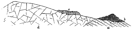
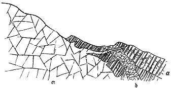
As in the other islands, the granophyres, porphyries and felsites of Rum have been intruded at the base of the volcanic series. Over much, if not all, of their area they lie directly on the red Torridon sandstone. That the bedded basalts once covered them is indicated by the position of the three outliers of the basalt-plateau already noticed. But a fourth outlier still lies upon the porphyry of Orval as a cake that dips gently northward. It consists of a bedded, dark, finely-crystalline, ophitic dolerite, porphyritic in places, with a rudely prismatic or columnar structure (Fig. 360). It has undergone contact-metamorphism, and tongues from the underlying rock project up into it. On the south-eastern side of the same hill, still more striking evidence is presented of the posteriority of the acid to the basic rocks. The porphyry shows here the same tendency to assume a bedded structure, the parallel "beds" again dipping outward or south-east at 40°. They plunge under the body of gabbro, dolerite and other intrusive masses which from this point stretch eastward into the great cones of Allival and its neighbours. The rock at the junction is a fine microgranite with traces of micropegmatite. It is composed of a holocrystalline base of quartz and orthoclase, with porphyritic crystals of microcline, blebs of quartz and scattered granules of augite. The rocks that rest immediately next it are basalt and dolerite, into which it has sent an intricate network of veins (Fig. 361).[405] It has also pushed long tongues down the slope into them, which may be seen traversing the dolerite and gabbro veins that cut the basalts. The basic rocks next the porphyry have been intensely - 405 - altered. They seem in places as if they have been shattered by some explosive force, and had then been invaded by the mass that rushed into all the rents thus caused. This remarkable structure is still better displayed on St. Kilda, and is more fully described in the following account of the geology of that island.
[405] In a thin slice cut from a specimen showing the junction, there is a minute vein of the porphyry penetrating the basalt which is much altered, while the porphyry becomes much finer in grain than at a distance from the contact.
Brief allusions to St. Kilda and its rocks have already been made (pp. 173, 358). We may now enter more fully upon the consideration of its geological structure and history.
When the weather is clear there may be seen from the western headlands of the Outer Hebrides a small blue cone rising above the Atlantic horizon at a distance of about 60 miles. As the voyager approaches this distant land it gradually shapes itself into a group of islets of which St. Kilda, the largest and only inhabited, has an extreme length of about four miles, a breadth of less than two miles, and a height of 1262 feet above the sea. Four miles to the north-east Borrera, about one square mile in extent, rises with precipitous sides to a height of 1000 feet. Off the north-western promontory of St. Kilda the huge rock of Soay, half a square mile in area, towers from 600 to 800 feet above the waves. Borrera has two attendant rocks—Stack Li and Stack an Armin—huge pyramidal masses several hundred feet high, and the home of thousands of gannets. St. Kilda possesses two less imposing islets between its north-western headland and Soay, and a third to the south-east known as Levenish.
The scenery of this picturesque group affords a good indication of its geological structure. It displays two distinct types of topographical form. In Borrera the marvellous combination of spiry ridges, deep gullies and clefts, notched crests and splintered pinnacles, at once reminds the visitor of the outlines of the Cuillin Hills of Skye. The same features are repeated on a less magnificent scale in Soay and along the whole of the south-western precipitous coast-line of St. Kilda.
In marked contrast to these varied outlines, the eastern half of St. Kilda rises with a smooth green surface, varied with sheets of grey screes, up to the rounded summit of Conagher, the highest point in the island. If the dark crags of the rest of the island group remind one of the Cuillins, this eastern tract recalls at once the form and colour of the Red Hills of Skye. A closer examination shows that in each case the topography arises from the influence of the very same rocks and geological structure as in that island.
There is, however, one aspect in which St. Kilda has no rival throughout the Western Isles. Its russet-coloured cone, though rising on the west side with gentle green slopes from the central valley, plunges on the eastern side in one vast precipice from a height of 1000 feet or more into the surge at its base. Nowhere among the Inner Hebrides, not even on the south-western side of Rum, is there any such display of the capacity of the youngest granite to assume the most rugged and picturesque forms. It is hardly possible to exaggerate the variety of outline assumed by the rock as - 406 - it yields along its system of joints to the influence of a tempestuous climate. It has been carved into huge projecting buttresses and deep alcoves, the naked stone glowing with tints of orange and fawn colour, veiled here and there with patches of bright green slope, or edged with fringes of sea-pink and camomile. Every outstanding bastion is rent with chasms and split into blocks, which accumulate on the ledges like piles of ruined walls. To one who boats underneath these cliffs the scene of ceaseless destruction which they present is vividly impressive.
The geology of St. Kilda was sketched by Macculloch, who recognized the close resemblance of its two groups of rock to the "augite-rock" (gabbro) and "syenite" (granophyre) of Skye and other islands of the Inner Hebrides. But he left the relations of the two groups to each other undetermined.[406] Professor Heddle has published a brief reference to the rocks of St. Kilda, without, however, offering any definite opinion as to the geological structure of the islands.[407] The best account of the geology has been given by Mr. Alexander Ross, who obtained evidence that the acid sends veins into the basic rock. He brought away specimens clearly showing this relation, but in his description left the question open for further inquiry.[408] To some of the observations in these papers reference will be made in the sequel. The following account is based on the results of two visits paid by me to St. Kilda in the summers of 1895 and 1896, during which I was enabled to examine the rocks on land, and to sail several times round the islands, boating along those parts of the cliffs which presented features of special geological importance.
[406] Description of the Western Isles, vol. ii. p. 54.
[407] In an article on the general geological features of the Outer Hebrides contributed to A Vertebrate Fauna of the Outer Hebrides, by J. A. Harvie-Brown and T. E. Buckley, 1888.
[408] British Association Report, 1885, p. 1040, and a much fuller paper in the Proceedings of the Inverness Field Club, vol. iii. (1884), p. 72.
In the St. Kilda islets three groups of rock differing from each other in age may be recognized. 1st, A series of gabbros, dolerites and basalts which have been intruded through and between each other as sills; 2nd, a mass of granophyre which invades these sills; and 3rd, abundant dykes and veins of basalt which occur both in the basic and acid masses.
From the extension of the basalt-dykes across the Outer Hebrides it is clear that the Tertiary volcanic region reached at least to within 60 miles of St. Kilda. Whether or not it stretched over the intervening space now overflowed by the Atlantic must be matter for conjecture. There can be no doubt that the intrusive rocks of St. Kilda are in age and origin the equivalents of those of the Inner Hebrides. The remnants left of them were assuredly not superficial extrusions, but are characteristic examples of the more deep-seated intrusions of the Tertiary volcanic period. Down to the most minute details of structure they reproduce the features so well displayed by the gabbros and granophyres of Skye, Rum and Mull. If it is demonstrable in the case of these islands that the intrusions have taken place under a deep cover of basalt-sheets, now in large part removed, the inference may legitimately be - 407 - drawn that at St. Kilda a basalt-plateau once existed which has been more completely destroyed than in the other regions. Not a fragment of such a plateau has survived, unless we may perhaps be allowed to recognize it in some of the basalts enclosed among the gabbro-sills. Placed far amid the melancholy main and exposed to the full fury of the Atlantic gales, these islets must be regarded as the mere fragmentary cores of a once much more extensive volcanic area. The geologist who visits them is deeply impressed at every turn by the evidence of the active and unceasing destruction which their cliffs are undergoing. Nothing now remains save the deep-seated nucleus of intrusive sills, bosses and dykes.
1. The Gabbro Sills.—The rudely-bedded arrangement of these rocks is conspicuous along the west side of St. Kilda, in Soay and in Borrera. They consist of coarse and fine varieties disposed in successive sheets which dip at angles varying from as little as 15° up to as much as 60° or even more. In St. Kilda they form the picturesque promontory of the Dune, and extend thence along the western side of the island to its extreme northern end. Their escarpments face the ocean, and their dip-slopes descend towards the north-east in grassy declivities to the south bay and the long verdant glen which runs thence across to the north bay. The same strike is prolonged into Soay, but further east in Borrera the direction curves so as to present vast escarpments towards the west and shelving sheets of rock towards the east.
None of the gabbros seen by me are as coarse as the large-grained varieties of Skye, nor does there appear ever to be such a marked banded structure among them as that displayed by the Cuillin rocks. Faint banding, however, may be noticed. A series of specimens which I collected from the west side of the island has been sliced for microscopic examination, and Mr. Harker has furnished me with the following notes regarding them.
"An olivine-gabbro from the west side of St. Kilda [7107] is a dark, heavy, medium-grained rock, in which augite and felspar are conspicuous. The microscope shows, in addition, plentiful grains of olivine, with but little original iron-ore, and some apatite-needles. The structure is ophitic, the plates of pale-brown augite enveloping both olivine and felspar. A little brown hornblende and red-brown mica are probably original, the rock showing little sign of alteration. The felspar is labradorite, with albite- and Carlsbad-twinning, and forms elongated rectangular crystals.
"Another specimen [7108] is a rock of similar appearance but somewhat coarser texture, and structurally is a more typical gabbro than the preceding, the felspar having little of the 'lath' shape, while the augite, though still moulded on the felspar, scarcely assumes an ophitic habit. A striking feature in this rock is the way in which the augite is crowded with 'schiller'-inclusions, in places so closely as to be almost opaque. A high magnification shows that these inclusions are dark, linear in form, and disposed along two directions intersecting at a high angle. The labradorite has unusually close twin-lamellation on both albite and pericline laws, and it is possible that this is a strain-effect.
"A third specimen [7109] is from a rock in every respect identical - 408 - with the preceding, except that the olivine is rather more plentiful, and in some grains is partially serpentinized."
While the gabbros of St. Kilda are not a mere uniform boss, but a series of sills and irregular masses which have been successively injected into each other, they have subsequently been cut through by many basalt-dykes and veins. These, which are sometimes as abundant as in the gabbro of the Cuillin Hills, traverse the rocks both in the line of bedding and also at many different angles across it. As they generally weather faster than the gabbros, they give rise to deep narrow clefts which may be traced up the whole height of the precipices, occasioning sea-caves below and sharp notches on the crests above.
These scenic features, so indicative of the geological structure that causes them, are specially well seen on the western face of the Dune or south-western promontory of the island, and likewise in the strangely rifted precipices further north and in Soay. They are, however, most impressively displayed around the naked walls of Borrera, which in their marvellous combination of spiry ridges, deep straight gullies, and splintered crests, remind one at every turn of the scenery of Blaven and the Cuillin Hills.
2. The Granophyre Boss and its Apophyses.—The eastern half of the island of St. Kilda consists of a pale rock which Macculloch long ago identified with the granophyre of Skye, and which, as he pointed out, has much resemblance to parts of the granite of Arran.[409] Not only does it give rise to topographical forms like those of the Red Hills, but it weathers, like the Skye granophyre and the Arran granite, into thick bed-like sheets divided by transverse joints into large quadrangular blocks. On closer inspection it is found to resemble still more precisely the acid rocks of the Inner Hebrides. It possesses the same drusy micropegmatitic structure as the granophyres of Skye, Rum and Mull. The ferro-magnesian constituents are present in small quantity, hence the pale hue of the stone. The quartz and felspar project in well-terminated crystals into the drusy cavities, which are sometimes further adorned with delicate tufts of clear crystallized epidote. In these and other respects the rock displays the familiar external forms of the younger or Tertiary granites of Britain.
[409] Description, vol. ii. p. 54.
Mr. Harker's notes on the microscopic structure of this granophyre are as follows:—"The prevailing felspar is orthoclase, often very turbid from secondary products. Even what appear to be distinct crystals are sometimes seen in the slices to be invaded on the margin by quartz in rough micrographic intergrowths, and much of the finer intergrowth occurs as a fringe to the crystals. In this case the felspar of the micropegmatite can often be verified to be in crystalline continuity with the crystal which has served as a nucleus [6624]. Quartz occurs in distinct crystals and grains as well as in the micropegmatite. There is a more granitoid variety of the rock, in which only a very rude approach to micrographic intergrowths is seen [6623]. In both varieties there is but little trace of any ferro-magnesian mineral; the more typical granophyre has what seems to be destroyed - 409 - augite, while the granitoid rock contains a little deep-brown biotite. Scattered crystal-grains of magnetite occur in both."
Narrow ribbon-like veins of a finer material, sometimes only an inch in breadth, traverse the ordinary granophyre. Similar veins run through the rock of the Red Hills in Skye; they are sharply defined from the enclosing rock, as if the latter had already solidified before their intrusion. With regard to the microscopic structure of some thin slices prepared from these veins, Mr. Harker remarks that "the material of the veins is of a type intermediate between granophyre and microgranite [6622, 6623]. The chief bulk is a finely-granular aggregate of quartz and felspar, the latter very turbid; but in this aggregate are imbedded numerous patches of micropegmatite, often of perfect and delicate structure. These areas of micropegmatite show some approach to a radiate or rudely spherulitic structure, and, in some cases, are clustered round a crystal of felspar or quartz. Some granules of magnetite and rare flakes of brown biotite are the only other constituents of the rock. Although they must be of somewhat later date, there is evidently nothing in the petrographical characters of these fine-textured veins to separate them widely from the ordinary granophyres of the region."
These veins may be compared with the spherulitic dyke that traverses the granophyre of Meall Dearg at the head of Glen Sligachan (described at p. 381), which, though undoubtedly somewhat younger than the rock that contains it, yet presents the very same structures as are visible at the margin of that rock.[410] The material of this dyke and of the finer veins of St. Kilda and the Red Hills probably belongs to a later period of protrusion from a deeper unconsolidated portion of the same acid magma as at first supplied the general body of granophyre.
[410] Quart. Journ. Geol. Soc. vol. 1. (1894), p. 220.
Undoubtedly the most interesting feature in the granophyre of St. Kilda is its junction with the mass of basic rock to the west of it. This junction-line runs from about the middle of the chief or south bay (where, however, its precise position is concealed under detritus) across the island to the north shore, where it descends the face of the precipice and plunges under the sea. Important as the actual contact of the two rocks obviously is in regard to their relative date, it has not hitherto been observed or described. Macculloch noticed "numerous fragments of trap penetrated by veins of syenite," but he did not see these rocks in place, and, in spite of their apparent testimony to the posteriority of the acid intrusions, he was inclined to believe that the veins were not real veins, but that the "trap" and "syenite" had a common origin and would be found to pass into each other, as he thought also occurred in Mull and Rum. In recent years Mr. Alexander Ross, during his visit to St. Kilda, collected specimens illustrating the varieties of gabbro, dolerite and basalt, and showing the intrusion of the acid into the basic rocks. As already stated, he was disposed to regard the "granite" as of younger date than the gabbros, but left the question undecided.[411]
[411] In his paper, Proceed. Inverness Field Club, vol. iii. (1884), p. 78, Mr. Ross quotes a letter - 410 - from Prof. Judd, who there states that the rock supposed to be granite "is seen under the microscope to be a quite different rock—a quartz-diorite." Some of the specimens from St. Kilda collected by Mr. Ross were exhibited at a meeting of the Geological Society on 25th January 1893. With regard to these Prof. Judd, in the course of the discussion on his paper on "Inclusions of Tertiary Granite in the Gabbro of the Cuillin Hills," remarked:—"They show a dark rock traversed by veins of a light one, but the dark rock is not a gabbro and the light one is not a granite" (Quart. Journ. Geol. Soc. vol. xlix. (1893), p. 198).
The best locality for the examination of the junction of the main granophyre mass with the gabbros is inaccessible save by boat, and only in the calmest weather. It occurs in the great cliff on the northern side of the island between the north bay and the sea-stack known as the Bragstack. The line of contact emerges from below the sea-level, and ascends the cliff with a westward inclination of from 60° to 80°. Here, as in Skye, the acid rock underlies the basic masses, which are rudely bedded and much jointed. About 150 feet above the sea-level, the nearly vertical cliff breaks up into an exceedingly rocky and rugged acclivity, across which the junction seems to slope at a lower angle. But the place is hardly reachable, save perhaps by the intrepid, barefooted cragsmen of St. Kilda.
Along the sharply defined line of contact the granophyre is close-grained, and sends a network of veins into the dark sheets of gabbro. The general features of the junction are represented in Fig. 362. The veins are narrow, those nearest the main body of granophyre diverging from it at a still more acute angle than those from the mass of Meall Dearg (Fig. 376), and then branching so as to enclose masses of the gabbro and to run across them in long parallel veins. A characteristic feature of many of these veins, besides their narrowness, is their tendency to split up at the ends into mere fingers and threads as represented in Fig. 363.
Owing to the depth of soil on the cultivated land, and of boulders and sand on the beach, the actual junction of the main body of granophyre with the gabbro is not seen on the southern shore. But a few yards to the - 411 -westward of where it must lie, the beach is cumbered with large blocks of rock broken up from the mass, which can be seen in situ a little further south forming a line of low cliff with a rugged foreshore. These rocks consist of various gabbros and basalts of rather fine grain, profusely traversed with veins of white granophyre. Some of these veins are two feet or more in breadth, and, when of that size, show the distinctive granular texture and drusy structure of the main part of the acid rock. But from these dimensions they can be traced through every stage of diminution until they become mere threads. When they are only an inch or two broad, they assume a finely granular texture like that of the veins that run through the body of the granophyre.
The amount of injected material in the dark basic rocks is here and there so great as to form a kind of breccia (Fig. 364), which, from the contrast of tone between its two constituents, makes a conspicuous object on the shore. Here, as in the example already cited from Rum, the basic rocks seem to have been shattered into fragments, and the acid material to have been injected into the minutest interstices between them. The enclosed fragments are of all sizes from mere grains up to blocks a foot or more in length. They are generally angular, like rock-chips from a quarry. Moreover, they are not all of the same kind of material. While at this locality most of them consist of basalt, they include also a few large and small pieces of rather coarse gabbro. There has evidently been a certain amount of transport of material, as well as an extensive disruption of the rocks in situ. The granophyre here and there assumes a darker or greener tint, as if it had dissolved and absorbed some portion of the older rock.
Still more astonishing are the sections to be seen on the western cliffs and rocky declivities of the ridge to the north of the Dune, at a distance of perhaps 500 or 600 yards westwards from those of the South Bay. Here the gabbro-sheets are traversed by a number of conspicuous white bands, which on examination prove to be veins or dykes of granophyre. As viewed from the sea, the general disposition of the two groups of rocks is represented in Fig. 366. The broadest mass of granophyre breaks out towards the bottom of the precipice, and slants upward as a sheet intercalated between the gabbro sills, with a breadth of about 40 or 50 feet, but rapidly thinning away in its ascent. One of the bands below it has a breadth of about 15 feet. The material of these intrusions is a - 412 - pale fine-grained granophyre like that of the South Bay, I did not detect, either here or anywhere else in St. Kilda, a definite spherulitic structure such as is so common in the granophyre dykes of Skye.
Though the acid intrusions are somewhat irregular both in thickness and direction, they lie generally parallel to each other in the line of strike of the bedding of the gabbros. They are no doubt apophyses from the main - 413 - body of granophyre, which emerges to the surface about a third of a mile to the eastward, but may of course be at no great depth underneath.
Besides the broader bands of acid rock, and diverging from them, a complicated network of veins ramifies in all directions through the gabbros, as at the South Bay. The extraordinary degree to which the basic rocks have been shattered into fragments is strikingly displayed here, likewise the extreme liquidity of the acid magma, whereby it was able to insinuate itself into every chink and cranny. But the observer notices that this condition of excessive disruption is not shared by all the basic sills, and is not attendant upon all the acid dykes. As an example of this irregular distribution of the structure, I give the accompanying sketch (Fig. 365), where a fine-grained gabbro has been completely broken up and intersected with granophyre veins, while the coarser sheet overlying it has almost entirely escaped. The dark basalt-like sheets appear generally to have been much more disrupted than the more largely-crystalline varieties. It is noticeable here, also, that the fragments entangled in the network of granophyre veinings do not entirely belong to the rock that has been shattered, but sometimes include large and small lumps of different gabbros, showing some transference of material with the inrush of the acid magma.
Though closer in grain where it comes in contact with the gabbro, the granophyre never assumes any vitreous texture along its margin. A series of thin slices, prepared from specimens collected by me in the South Bay in the summer of 1895, was examined by Mr. Harker, who furnished the following notes regarding them:—"The basalt traversed by the granophyre is a fine-textured variety with small porphyritic felspars. These latter seem to be usually unaltered, retaining the glass cavities which in some of the crystals are abundant. The groundmass, however, shows minerals of metamorphic origin which must be derived mainly from the original augite. A brown mica is the most conspicuous; but with it are associated some brownish-green hornblende and certain chloritic and perhaps serpentinous substances. It is chiefly near the margin of a fragment of basalt that the mica gives place to these minerals. The basalt still retains plenty of unaltered granules of augite in the central parts of a fragment. It is not certain that the secondary minerals named come exclusively from the augite of the basalt; from their form and mode of occurrence they may in part have replaced olivine or even rhombic pyroxene.
- 414 -
- 415 -
"The acid rock, though styled granophyre above, belongs to a granitoid variety of that group of rocks, and has but little indication of micrographic structures. Compared with the other granophyres from St. Kilda, sliced and examined, these examples show a less acid composition. This is expressed mineralogically in the presence of a somewhat larger proportion of ferro-magnesian minerals and of soda-lime felspar. These features might indeed be matched in many normal granophyres among the Western Isles, but in the present case it can hardly be doubted that they are to be explained, at least in some degree, by the acid magma having taken up a certain amount of material from the basalt. Many of these Tertiary granophyres have undoubtedly been modified by the incorporation of pieces of basalt and gabbro, and a collection made in the Strath district of Skye will furnish examples for future study. Professor Sollas's description of similar phenomena in the Carlingford district has already proved the importance of this kind of action.[412] In the present instance, both brown mica and hornblende occur plentifully in the granophyre, and especially round the basalt fragments. This latter point is conclusive as to the derivation of the basic material, and further proves a certain degree of viscosity in the acid magma at the time of its intrusion."
[412] Trans. Roy. Irish Acad. vol. xxx. (1894), pp. 477-572.
Another series of specimens which I collected in the following year was submitted to Mr. Harker for petrographical determination, and his observations on two of the microscopic slices are as follow: "A breccia from the South Bay, St. Kilda [7105], consists of angular fragments up to two inches in diameter set in a matrix of grey granophyre of medium texture. The fragments belong to two types—one of very close texture (basalt), the other more evidently crystalline (diabase). Both are cut by the slice.
"The basalt shows very evident metamorphism, its augite being wholly transformed into greenish-brown hornblende. The little felspar-laths and granules of iron-ore seem to be unaltered, though the latter may perhaps have contributed to the formation of the hornblende. Another fragment of basalt has some larger crystal-grains of augite, and these are not converted into hornblende.
"The diabase shows a less marked boundary under the microscope, but otherwise has similar characters to the preceding. The striated felspar-crystals and grains of iron-ore have not been re-crystallized. A considerable amount of pale augite remains, but there is also plenty of deeply-coloured hornblende, both fibrous and compact. This diabase is certainly an intrusive rock, but the basalt, from its petrographic character, might be from a lava-flow or from a dyke.
"The granophyre is of somewhat coarse texture, the micrographic structure being only of a rude type. It is notably richer in the darker constituents than is usual in such rocks. Further, the hornblende and magnetite tend to cluster in little patches which suggest destroyed fragments of basic rocks. A grain or two of sphene occur, a mineral foreign to the normal granophyres.
"Another similar specimen [7106] from the same locality shows a basic rock of coarser texture, approaching some of the gabbros in appearance and with boundaries in places not very sharply defined. The grey matrix is again relatively rich in the dark elements, and the manner in which they - 416 - occur in little patches, like nearly obliterated 'xenoliths,' points unmistakably to a certain amount of absorption of basic material by the acid magma, with consequent enrichment in the ferro-magnesian minerals.
"The slice cuts only the acid rock, which is seen to be of granitoid rather than granophyric structure, though the tendency of the felspar to enclose quartz-grains is unlike a typical granite. Oligoclase, with combined albite- and Carlsbad-twinning, is well represented in addition to orthoclase, and some zoned crystals seem to be of albite with a border of oligoclase. Brown hornblende and a little brown mica are the coloured constituents. Magnetite and apatite are also observed."
The testimony of the rocks of St. Kilda to the posteriority of the granophyre to the gabbros and basalts is thus clear and emphatic. It entirely confirms my previous observations regarding the order of sequence of these rocks in Mull, Rum and Skye. But the St. Kilda sections display, even more strikingly than can be usually seen in these islands, the intricate network of veins which proceed from the granophyre, the shattered condition of the basic rocks which these veins penetrate, the remarkable liquidity of the acid magma at the time of its intrusion, and the solvent action of this magma on the basic fragments which it enveloped.
3. The Basic Dykes.—Reference has already been made to the numerous dykes by which the gabbros of the St. Kilda group of islets is traversed. Similar dykes occur also, though less plentifully, in the granophyre. It remains for future observation to determine whether there is one series older and another later than the intrusion of the acid rock. In any case, it is quite certain that the dykes in the gabbro do not all belong to one period of injection, for frequent examples of intersection may be noticed, especially on the cliffs of Borrera, and also cases of double and even treble dykes which have been formed by successive infillings within the same fissure. The remarkably varied precipices of that island are marked by the long narrow rifts left by the weathering of vertical dykes, which, as above remarked, may be followed with the eye from the sea-level to the sky-line, ascending obliquely across the bedding of the gabbro sheets. Another group of dykes may be traced sloping upward at low angles along the face of the cliffs and affording admirable ledges with overarching roofs for innumerable gannets, kittywakes and guillemots. Other dykes and ribbon-like veins may be seen traversing the gabbro in many different directions, precisely as among the Cuillin Hills. As no similar network of dykes and veins is to be observed in the granophyre, I am disposed to regard a large number of these intrusions as older than that rock. But I did not observe any actual example of a basic dyke truncated by the granophyre.
There can be no doubt, however, that an injection of similar dykes and veins took place after the invasion of the granophyre. These later intrusions are conspicuously displayed along the cliffs that extend from the gabbro junction on the north side of St. Kilda round the eastern coast into the South Bay. They maintain a general parallelism and ascend from the sea-level at varying angles of inclination, running up the pale sea-wall as dark - 417 - bands. They consist of basalt-rocks, and may often be seen to branch and to die out. Like those in the gabbro, they are not infrequently compound, being made up of two or three or even more distinct dykes. This is well seen on the great precipice below Conacher, where the section given in Fig. 367 is displayed. Here in a vertical height of about 800 or 900 feet, there must be at least seven dykes, simple and compound. A little further south a triple dyke may be seen to be composed of a thick central zone and two thinner marginal bands, of which the lower strikes off from the others and maintains an independent course through the granophyre (Fig. 368).
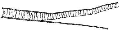
- 418 -
The northern half of the island of Arran is mainly occupied by one of the most compact and picturesque groups of granite mountains in Scotland.[413] These heights, rising out of the Firth of Clyde to a height of 2866 feet, present, in their spiry and serrated crests, a contrast to the smoother contours of the older granitic elevations of this country. The granite is surrounded by a ring of schistose rocks, belonging to the metamorphic series of the Southern Highlands, save for a short distance on the eastern margin, where it comes in contact with and indurates the Lower Old Red Sandstone. Macculloch long ago pointed out that no pebbles of the granite are to be found in the surrounding conglomerates and red sandstones of Carboniferous and younger age.[414] Geologists accordingly came to the conclusion that the protrusion of the granite took place after Carboniferous time, and hence that it had no connection with the appearance of the far older granites of the Highlands. In the year 1873 I gave reasons for believing the granite to be not only younger than the Carboniferous formations, but to be referable with most probability to the Tertiary volcanic series.[415] The progress of inquiry has tended to confirm this inference, though no direct proof of its correctness has been obtained. Two lines of investigation may be pursued, and each leads to the conclusion of the probability of the Tertiary age of the granite. One of these proceeds on a comparison of the petrographical characters of the Arran rocks with those of undoubted members of the Tertiary series among the Western Isles. The other inquiry deals with the relation of the rocks to each other in the general geological structure of Arran itself.
[413] The rocks of Arran have often been described. Besides the work of Macculloch above quoted, reference may be made to the paper by Sedgwick and Murchison, Trans. Geol. Soc. 2nd Ser. vol. iii. p. 21; A. C. Ramsay's Geology of the Island of Arran, 1841, the paper of Necker de Saussure quoted on p. 412; J. Bryce's Geology of Clydesdale and Arran, 3rd edit. 1865. The island is at present being surveyed for the Geological Survey by Mr. W. Gunn.
[414] Description of the Western Islands of Scotland, vol. ii. p. 388.
[415] Trans. Edin. Geol. Soc. vol. ii. part iii.
Macculloch first remarked the strong lithological resemblance of the Arran granite to the "syenite," or granophyre, of Skye and St. Kilda.[416] More recent petrographical investigation, as already stated, has furnished additional proofs of the connection between the acid rocks of these islands. So closely indeed are these rocks linked by megascopic and microscopic characters, that the petrologist has no hesitation in placing them together as probably products of the same period of igneous activity.
[416] Description, vol. ii. p. 352.
From the general geological structure of Arran, a further strong argument may be deduced in favour of the late date of the eruptions of granite. Good reasons have been given for classing as Permian the bright red sandstones which occupy much of the central and southern parts of this island, and include the little volcanic group already referred to. These sandstones have been invaded by a complex series of eruptive rocks which would thus be later than the Permian period. No igneous masses posterior to this - 419 - period are certainly known in Britain save those of Tertiary age. The larger body of granite in the northern half of the island nowhere comes into direct contact with the newer red sandstones, but these strata are pierced by smaller bodies of granite. Hence, both by the evidence of their internal structure and by the stratigraphy of the ground, the later igneous rocks of Arran may be reasonably grouped together as one important and consecutive series, comparable in age and general characters with those of Tertiary date in the Inner Hebrides.
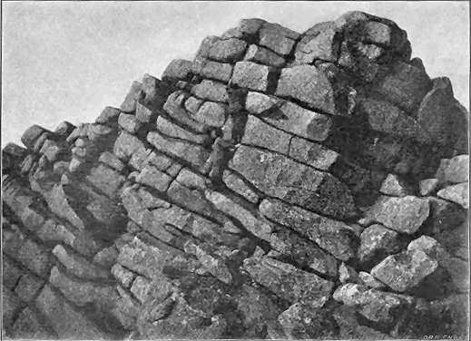
The igneous rocks of Arran, later than the probably Permian sandstones, range from acid to basic in composition. Besides the northern granite, there are in the southern part of the island acid rocks that include granite, coarse-grained quartz-porphyry and fine-grained felsite. Where the relations of these rocks to each other can be seen, the felsite - 420 - is found by Mr. Gunn to be newer than the porphyry, into which it sends sills and dykes.
A feature observed by the same geologist in Arran offers a further point of resemblance to the acid sills and dykes of Skye. He has noticed that accompanying the quartz-porphyry of Drumadoon and Bennan, a mass of basic rock forms a kind of fringe or selvage round it, sometimes with what appears to be a rock of intermediate character between them. Basic sills are abundant south of Glen Ashdale, though to the west of Whiting Bay most of the intrusive sheets are of acid material.
Some of the quartz-porphyry sheets are markedly columnar. One of them, near Corriegills, displays a divergent grouping of the prisms, not unlike parts of the pitchstone sheets of Eigg and Hysgeir, and suggestive of the rock having flowed along a hollow like that of a valley. No certain trace, however, has been found of any Tertiary lava-stream in Arran, nor has evidence of tuffs been detected in any part of the younger igneous series. All the rocks appear to be intrusive, though so abundant and varied are they as to indicate that they belong to a vigorous eruptive centre, which may have poured out at the surface lavas and ashes, since entirely removed by denudation.
The numerous basic dykes for which the south end of Arran has long been celebrated have a general northerly trend, and appear to be all of the same or nearly the same age. They undoubtedly cut through the quartz-porphyries and the coarse-grained basic sills, but are less numerously visible in the finer-grained basic sills, while in the felsitic sheets they are seldom to be seen. In several places dykes running in an E.N.E. direction cut the others, and are therefore of later date.[417] The compound dykes of Tormore on the west side of the island have been already noticed (p. 161).
[417] Ann. Rep. of Geol. Surv. for 1894, p. 286.
In the north-eastern counties of Ireland there are two regions which afford ample material for discussion in connection with the protrusion of acid rocks during the Tertiary volcanic period. One of these, which for distinction may be called the Carlingford region, embraces the tract of country which includes the Mourne Mountains on the north-east side of Carlingford Lough and the ranges of Slieve Foye and Slieve Gullion on the south-west side. The other lies mainly within the basaltic plateau, the largest of its scattered portions forming parts of the hills of Carnearny and Tardree in the county of Antrim (Map VII.).
a. The Mourne Mountains.—This compact and picturesque group of hills, about twelve miles long and six miles broad, and reaching a height of 2798 feet in Slieve Donard, presents a comparatively simple geological structure, since it consists almost entirely of granitic rocks which pierce, overlie and - 421 - underlie Upper Silurian grits and shales. So far as regards the contact of these rocks with the disrupted sedimentary formations, all that can be asserted is that the granite must be later than at least the older part of the Upper Silurian period. But for at least two reasons, the eruptive rocks may be regarded with some confidence as part of the Tertiary series. In the first place, there is a strong petrographical resemblance between the Mourne Mountain granite and that of the Island of Arran and the granitic parts of the granophyre of the Western Isles. And this resemblance is so close as to furnish a cogent argument in favour of grouping all these rocks together as parts of one geologically contemporaneous series. In the second place, the Mourne Mountain granite abruptly cuts off a large number of basic dykes which, running in a general N.N.W. direction, may be looked upon as almost certainly members of the Tertiary system of protrusions.
The manner in which the granite of the district behaves towards certain detached areas of Silurian strata with their accompanying dykes is one of the most astonishing features in the whole assemblage of intrusive rocks in Britain. As has been excellently shown in the Geological Survey Map and sections by Mr. W. A. Traill, the granite has carried up on its surface broad cakes of vertical Silurian strata, together with all their network of dykes.[418] A cake of this kind, from 50 to about 200 feet thick and nearly two miles broad, has been bodily uplifted from the rest of the mass and carried upward by the granite, so that the truncated ends of the beds of grit and shale with their system of dykes stand upon a platform of granite, from which also numerous veins penetrate them. There can be little doubt that the basic dykes thus broken through are parts of the great Tertiary system, and if so, the granite which disrupts them cannot be older than Tertiary time.
[418] See Sheets 60, 61 and 71 of the one-inch map of the Geological Survey of Ireland, and Sheets 22, 23 and 24 of the Horizontal Sections. The Explanation to these Sheets of the map was written by Professor Hull, Mr. Traill having previously retired from the service. The Mourne Mountain area is now undergoing critical revision by Prof. Sollas for the Geological Survey, and important additional material for the elucidation of this district may be expected from him.
Besides the older basic dykes disrupted by the granite, a younger but much less abundant series traverses that rock, and also follows a general north-westerly direction. These later dykes in some cases cross more acid dykes which have risen through the granite. There is no trace of any superficial discharge from the Mourne Mountain area. But from the analogy of other districts we may easily conceive that the granite represents the underground parts of volcanic material which has now been entirely removed.
b. Slieve Foye and Barnavave District.—This area embraces the mountainous ground lying between Carlingford Lough and Dundalk Bay, and culminating in Slieve Foye (1935 feet). It measures roughly about six miles in extreme length and four miles in breadth.
The remarkable assemblage of basic and acid materials in this area has received considerable attention from geologists. The relative order of the - 422 - two groups of rocks was first clearly recognized by Griffith, who showed that the granite (granophyre) is intruded into the gabbro.[419] Professor Haughton subsequently confirmed this observation, and proved the post-Carboniferous date of the intrusive materials, which he compared with those of Skye.[420] The general distribution of the rocks was traced out in some detail by the Geological Survey, and described in the official Memoirs.[421] More recently the district has been examined by Professor Sollas, who, bringing the photographic camera and the microscope to the aid of field-geology, has elucidated the structure and relations of the rocks, and has obtained abundant evidence that the acid and basic rocks maintain there the same relative order as among the Inner Hebrides.[422]
[419] Journ. Geol. Soc. Ireland (1843), p. 113.
[420] Quart. Journ. Geol. Soc. vol. xii. (1856), p. 171; xiv. p. 300; and Journ. Geol. Soc. Ireland (1876), p. 91.
[421] Sheet 71 of the Geol. Surv. Ireland, and accompanying Explanation. These were the work of Mr. W. A. Traill.
[422] Trans. Roy. Irish Acad. vol. xxx. (1894), p. 477. This is part i. of what is intended to be a series of papers.
One of the first features in this tract of country to arrest the eye of the geologist is the situation of this centre of protrusion and that of Slieve Gullion along a north-west line, coincident with the general direction of the numerous basic dykes of the region. Whether or not the successive intrusions took place contemporaneously in the two areas, they have followed each other in the same order. In the Barnavave district the igneous rocks occupy an area of about 20 square miles. They consist of a central and chief mass composed of acid materials, which have risen through the basic rocks now found as an interrupted ring round them.
In his more recent examination, Prof. Sollas has devoted special attention to the influence of the solvent action of the acid magma upon the basic rocks and upon its own composition and structure. Besides confirming the work of previous observers as to the order of appearance of the two kinds of material, he has obtained evidence that the gabbro had not only completely solidified, but was traversed by contraction-joints, possibly even fractured by earth-movements, before the injection of the granophyric material. He found that this material, like that of the Inner Hebrides and St. Kilda, must have been in a state of great fluidity at the time of its intrusion, and made its way into the minutest cracks and crevices. In observing the solvent action of the granophyre, he ascertained that this action took place even in comparatively narrow dykes, which probably consolidated at no great depth beneath the surface.[423]
[423] Op. cit.
c. The Slieve Gullion District.—This area is separated from that just described by a narrow strip of Silurian strata, so that its isolation as a separate igneous district is complete. It will be observed from the map to continue the same north-westerly line as the Slieve Foye tract, the two together running in that direction for a distance of some 16 miles. It is interesting to note the adoption of this predominant north-westerly trend even by eruptive masses which were mainly of acid material.
- 423 -
This district measures about ten miles in length by from one to five miles in breadth. The rocks are, on the whole, similar to those in the area south of Carlingford Lough, and bear the same relation to each other, the acid being intrusive in the basic series. It is worthy of remark that the Tertiary eruptive rocks have made their appearance in the midst of the older granite of Newry. This granite has been already alluded to as disrupting Upper Silurian strata, and being probably of the age of the Lower Old Red Sandstone (vol. i. p. 290). In long subsequent ages, after protracted denudation, during which its cover of Silurian and Carboniferous formations was stripped off and it was laid bare, it was broken through by the whole series of basic and acid protrusions of Slieve Gullion.
This district is portrayed on Sheets 59, 60, 70 and 71 of the Geological Survey of Ireland, which show a central core of basic and acid material piercing the Newry granite.[424] Round this core and touching it at its north-western and south-eastern end, but elsewhere separated from it by a space of several miles, runs a curiously continuous band of igneous material which is marked as "quartziferous porphyry" and "felstone-porphyry" on the Survey maps.
[424] The ground was chiefly mapped and described by Mr. Joseph Nolan and Mr. F. W. Egan.
The south-western portion of this elliptical ring possesses a peculiar interest from its including certain remarkable masses of breccia or agglomerate. These rocks have been mapped by Mr. Nolan, and are described by him in the official Explanation, but in more detail in two separate papers.[425] Having had an opportunity of paying a brief visit to the ground, I can confirm the general accuracy of his mapping and description, and am able to add a few further particulars to the facts enumerated by him.
[425] Sheet 70 of the Geol. Surv. Map of Ireland and Explanation thereto; also Journ. Roy. Geol. Soc. Ireland, vol. iv. (1877), p. 233; Geol. Mag. 1878.
The tract of ground where these agglomerates appear forms a prominent ridge which rises several hundred feet above the lower country on either side, and extends in a W.N.W. direction for about seven miles, nearly along the line of junction between the Newry granite and the Silurian strata. The ridge has a breadth varying from a few hundred yards to upwards of a mile. It is separated from the main igneous mass of the Slieve Gullion area by an intervening strip of lower ground from three-quarters of a mile to about a mile and a half in width, which is occupied by the Newry granite. At the north-west end of the ridge the newer eruptive rocks lie within the area of that granite, while at the south-east end they rise entirely amongst the Silurian strata.
Beginning at the south-eastern extremity, we find the agglomerate occupying several detached eminences and surrounded by altered Silurian grits and shales. Further west the rock occurs in larger and more continuous masses, appearing at intervals, especially along the southern borders of the quartz-porphyry which forms by much the greater part of the ridge. Actual junctions of the agglomerate with the older rocks around seem to be seldom visible. I found one, however, above the gamekeeper's house on the southern - 424 - flanks of the hill called Tievecrom. The Upper Silurian grits and shales, in a much indurated and shattered condition, are there traceable for several hundred feet up the slope, until they are abruptly cut off by the agglomerate. The line of separation appears to be nearly vertical, the truncated ends of the strata being wrapped round by the mass of fragmental material.
The most remarkable features of this agglomerate, which has been well described by Mr. Nolan, are the notable absence of truly volcanic stones in it, and the derivation of its materials from the rocks around it. I found only one piece of amygdaloid, but not a single lump of slag, no bombs, no broken fragments of lava-crusts, and no fine volcanic dust or enclosed lapilli. The rock may be said to consist entirely of fragments of Silurian grits and shales where it lies among these strata, and of granite where it comes through that rock. Blocks of these materials, of all sizes up to two feet in breadth, are confusedly piled together in a matrix made of comminuted debris of the same ingredients.
The agglomerate on the ridge of Carrickbroad has no definite boundary, but seems to graduate into an andesitic rock, and then into a quartz-felsite or rhyolite. This apparent gradation is one of the most singular features of the ridge. The andesite resembles some of the "porphyrites" of the Old Red Sandstone. It is close-grained, with abundant minute felspar-laths, and numerous large porphyritic felspars, which latter are sometimes aggregated in patches, as in the old porphyries of Portraine, Lambay Island and the Chair of Kildare. This rock has undoubtedly been erupted at the time of the formation of the agglomerate, or at least before the loose materials were compacted together; for it is full of separate stones of the same materials, and becomes so charged with them as to become itself a kind of agglomerate, with a small proportion of andesitic matrix cementing the blocks.
A thin slice prepared from one of the specimens obtained by me from this hill has been studied by Mr. Watts, who reports that the fine-grained andesitic matrix in which the stones are imbedded has often been injected into their minute fissures, and that the minute fragments enclosed in this matrix consist here of a trachyte-like porphyry, felsite, andesites, basalts of various degrees of fineness and olivine-basalt, together with isolated grains of felspar, such as might have been derived from the breaking up of some of these fragments.
Westward from Carrickbroad, the chief eruptive rock is a dark, sometimes nearly velvet-black, flinty, occasionally almost resinous, quartz-porphyry or rhyolite, with abundant quartz and large felspars and occasional well-marked flow-structure. This material, near the much smaller protrusion of andesite, is curiously mixed up with that rock, as if the two had come up together. Sometimes they seem to pass into each other, at least the separation between them cannot be sharply drawn. There can be little doubt, however, that the acid magma continued to ascend after the other, for it sends veins and strings into the more basic material, and encloses blocks of it. This thoroughly acid porphyry plays the same part as the andesite in regard to the stones of the agglomerate. - 425 - Throughout its whole extent, it is found to enclose these stones, which here and there become so numerous as to form the main bulk of the mass, leaving only a limited amount of quartz-porphyry (rhyolite) matrix to bind the whole into an exceedingly compact variety of breccia. Occasionally the acid rock cuts through the ordinary clastic agglomerate, as may be well seen on the southern face of Tievecrom.
A specimen of this porphyry with its enclosed fragments, which was collected by me from above the old tower at Glendovey, Carrickbroad, has been sliced and examined by Mr. Watts under the microscope, and is thus described by him: "The large fragment in this slide consists of ophitic olivine-dolerite full of large phenocrysts of olivine. It is broken up and penetrated by veins of quartz-porphyry, rich in quartz, which exhibits a beautiful flow-structure. The felspars and augite of the dolerite do not appear to have suffered much alteration at the margin of the fragment, but the olivines are much serpentinized, the serpentine passing into a border of actinolite which runs in veins into the neighbouring rock and even passes out into the quartz-porphyry at the junction, impregnating it with actinolite and chlorite for some distance. A few particles of basalt also occur and a portion of a granite-fragment comes into the slide, from the edge of which a piece of biotite has floated off into the quartz-porphyry."
The essentially non-volcanic material of the agglomerate shows, as Mr. Nolan pointed out, that it was produced by æriform explosions, which blew out the Silurian strata and granite in fragments and dust. These discharges probably took place either from a series of vents placed along a line of fissure running in a north-westerly line, or directly from the open fissure itself. Possibly both of these channels of escape were in use; detached vents appearing at the east end and a more continuous discharge from the fissure further west.
After the earliest explosions had thrown out a large amount of granitic and Silurian detritus, andesitic lava rose in the fissure, and solidifying there enclosed a great deal of the loose fragmentary material that fell back into the chasm. Subsequently, and on a more extensive scale, a much more acid magma ascended from below, likewise involving and carrying up a vast quantity of loose stones, among which are pieces of basalt and dolerite.
No evidence remains as to the extent of the material discharged over the surface from this fissure. Denudation has removed all the surrounding fragmental sheets as well as any lava that may have flowed out upon or become intercalated among them. There remains now only the cores of the little necks at the east end, and the indurated agglomerate and lava that consolidated along the mouth of the fissure or vents.
This is the only example of such a line of fissure-eruption which has yet been met with in the British Isles. Its connection with the eruptive masses of Slieve Gullion and Carlingford links it with the Tertiary volcanic series. But no evidence appears to remain regarding the epoch in the long volcanic period when the eruptions from it took place. They may possibly date back to the time of the plateau-basalts; but the abundant acid magma, - 426 - which constitutes one of their distinguishing characteristics, suggests that they more probably belong to the later time when the main protrusions of acid material took place. They suggest that coeval with the uprise of the great domes of Slieve Gullion, Carlingford and the Mourne Mountains there may have been many superficial eruptions of which, after prolonged denudation, all trace has now been effaced.
Reference was made in Chapter xxxvii. to the occurrence of rhyolitic conglomerate and tuff between the lower and upper series of basalts in the Antrim plateau, and to the evidence furnished by these detrital deposits either that masses of rhyolite appeared at the surface, or that rhyolitic ashes were discharged from volcanic vents in the long interval that elapsed between the two groups of basalt. The further consideration of this question, and an account of the rhyolite bosses, were reserved for the present chapter, that they might be taken in connection with the other acid eruptions of Tertiary time in Britain.[426]
[426] For an early account of the Antrim trachytic rocks, see Berger, Trans. Geol. Soc. iii. (1816), p. 190. Professor Hull has described the Tardree rock in the Explanation to Sheets 21, 28 and 29, Geol. Survey of Ireland (1876), p. 17, and has supposed it to be older than the basalts, referring it to the Eocene period (Physical Geology and Geography of Ireland, 2nd edit. (1891), pp. 87, 95). Duffin (quoted by Mr. Kinahan) believed that "the trachytes occur at the centre of eruption, and were probably poured out at the end of the outburst." Du Noyer also (quoted by the same writer) thought them to be newer than the plateau-basalts, and to have lifted up masses of these rocks. Mr. Kinahan himself (Geology of Ireland, p. 172) has pointed to the absence of any rhyolitic fragments between the basalts as an argument against the supposed antiquity of the acid protrusions. A petrographical account of the Tardree rock is given by Von Lasaulx in the paper already cited, Tschermak's Min. Pet. Mittheil. (1878), p. 412. A more elaborate discussion of the petrography by Prof. Cole will be found in the Memoir above referred to (Scientif. Trans. Roy. Dublin Soc. vol. vi. 1896), and the geological relations of the rocks are discussed by him in another shorter paper, Geol. Mag. (1895), p. 303. See also Mr. M'Henry on the trachytic rocks of Antrim, Geol. Mag. (1895), p. 260, and Proc. Geol. Assoc. vol. xiv. (1895), p. 140.
With one exception, all the known protrusions of acid material in the Antrim area lie within the limits of the basalt-plateau (see Map. No. VII.). They occur along a line at intervals for a distance of about 17 miles, from Templepatrick to a point four miles north of Ballymena. It is worthy of remark that here again the line of protrusion has a north-west trend. It not improbably indicates the position of a fissure up which the acid material rose at various points.
The petrography of the rocks has been frequently discussed. They include several varieties of rhyolite, generally rather coarsely crystalline, but sometimes becoming compact, and even passing into dark obsidian. No undoubted tuff occurs associated with them in any of the exposures, nor do the rhyolites anywhere display structures that point to their having flowed out at the surface.[427] That the masses now visible may have communicated - 427 - with the surface is quite conceivable, but what we now see appears in every case to be a subterranean and not a superficial part of the protrusion.
[427] At Sandy Braes an exposure is visible of what at first might be thought to be a volcanic conglomerate, but closer examination shows the rock to consist of obsidian, which decomposes into a clay, leaving round sharply-defined glassy cores enclosed in the decayed material. The "banded rhyolites" do not exhibit any kind of flow-structure that may not be met with in dykes and bosses. Nor have any satisfactory traces been found of vesicular or pumiceous bands such as might mark the upper surfaces of true lava-streams. Professor Cole has described what he calls "The Volcanoe of Tardree" (Geol. Mag. July 1895). If the Tardree mass ever was a volcano, which is far from improbable, its superficial ejections have long ago disappeared. At least, after the most diligent search, I have been unable to discover any trace of them, all that now remains appearing to me to be the neck or core of protruded material.
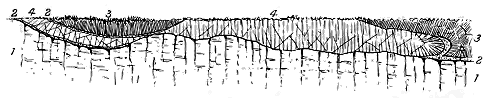
Most of the rhyolitic exposures are extremely limited in area—mere little knobs, sometimes rising in the middle of a bog, and never forming conspicuous features in the landscape. The relation of these rocks to the basalts are generally concealed, but the isolation of the small rhyolitic patches leaves no doubt that they are intrusive as regards the surrounding basalts. This relation is well seen at Templepatrick, where it was first observed by Mr. M'Henry of the Geological Survey (Fig. 370). The rhyolite there forms a sill which has been thrust between the basalts and the gravel that underlies them, the basalts being bent back and underlain by the acid rock.[428]
[428] The progress of quarrying operations during the last eight years has somewhat destroyed the section as exposed in 1888. But we now see that the basalt has not only been bent back but is underlain by the acid rock.
The largest and most interesting of the Antrim rhyolite tracts covers a space of about ten square miles in the heart of the basalt-plateau to the north-east of the town of Antrim. It rises to about 1000 feet above the sea, and forms a few featureless hills, some of which are capped with basalt. The best known localities in this tract are Tardree and Carnearny. The rock is chiefly a somewhat coarse-textured lithoidal rhyolite, but includes also vitreous portions.
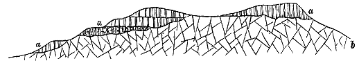
Owing to the cover of soil and turf, the junction of this mass with the surrounding basalts cannot be so clearly seen as in the sections of the Inner - 428 - Hebrides, and hence the stratigraphical relations of the two groups are apt to be misunderstood. What is actually seen is represented in Fig. 371. The lithoidal rhyolite emerges from underneath the basalts which abut against its sloping surface, forming on the north side of Carnearny Hill a steep bank about 150 feet above the more gently inclined slope below. The basalts consist of successive nearly level sheets of compact and amygdaloidal rock.
It is obvious that only two explanations of this section are possible. Either the rhyolite was in existence before the basalts which flowed round it and gradually covered it, or it has been erupted through these rocks, and is therefore of later date.
The former supposition has been the more usually received. The rhyolite has been supposed to form the summit of an ancient volcanic dome, perhaps of Eocene age, which had been worn down before the outflow of the plateau-basalts under which it was eventually entombed. Had this been the true history of the locality, it is inconceivable that of a rock which decays so rapidly as this rhyolite, and strews its slopes with such abundance of detritus, not a single fragment should occur between the successive beds of basalt which are supposed to have surrounded and buried it. Though the several beds of basalt are well exposed all round, I could not, on my first visit, find a trace of any rhyolitic fragments between them, nor had Mr. Symes, who mapped the ground in detail for the Geological Survey, been more successful. I have since made a second search with Mr. M'Henry, but without detecting a single pebble of the acid rock among the basalts. Yet it is clear from the upper surfaces of some of these lavas that a considerable interval of time separated their successive outflows, so that there was opportunity enough for the scattering of rhyolite-debris had any hill of that rock existed in the vicinity.
Again, little more than a mile to the east of Carnearny Hill, an outlier of the basalts forming the prominent height of the Brown Dod lies upon and is completely surrounded by the rhyolite, which along the east side of the hill can be traced as it passes under the level sheets of basalt. The line of junction ascends and descends on that flank of the outlier, so that successive flows of basalt are truncated by the acid rock. But I could find no rhyolitic debris between them.
It appears to me, therefore, that the relations between the two groups of rock in this area are similar to those between the granophyres and bedded basalts on the south side of Loch na Keal in Mull (p. 396). In other words, the rhyolites have risen through the basalts, and are therefore younger than these lavas. This conclusion is corroborated by the actual proofs of the intrusion of rhyolite into the basalts at Templepatrick.
All the known rhyolitic masses in Antrim are confined to the Lower group of basalts.[429] And as they traverse some of its highest members, - 429 - they may be regarded as certainly younger than that group. Mr. M'Henry, who first indicated this relation, suggested that the rhyolites were erupted in the interval between the two basaltic series, and he connected with their eruption the rhyolitic detritus found in association with the iron-ore at so many places in Antrim. It appears to me that this suggestion carries with it much probability. The rhyolitic conglomerate of Glenarm proves that, in the long period represented by the iron-ore and its associated group of sedimentary deposits, there were masses of rhyolite at the surface, the waste of which could supply such detritus. The resemblance between the material of that conglomerate and the rhyolites now visible at Tardree and elsewhere is so close that we cannot doubt that, if not derived from some of the known rhyolitic protrusions, this material certainly came from exposed masses that had the same general petrographic characters.
[429] The only exception to this rule was believed to be that of the mass at Eslerstown, four miles east of Ballymena, which, as originally mapped, was shown as crossing from the Lower into the Upper basalts. Mr. M'Henry, however, has recently ascertained that the acid rock is entirely restricted to the area of the older group.
While the rhyolite pebbles in the Glenarm conglomerate are distinctly rounded and water-worn, showing that some prominences of acid rock were undergoing active denudation at the time when this conglomerate was laid down, the finer rhyolitic detritus in the tuffs of Ballypallidy rather suggests the actual discharge of rhyolitic ashes during the same period. But it would appear that the superficial outbursts of rhyolitic material, whether in the form of lava or of tuff, were only of trifling extent, or else that the interval between the eruption of the two basalt-groups was so prolonged that any such superficial material was then removed by denudation. The varieties of lithological character to be met with among the acid protrusions of Antrim suggests a succession of uprises of rhyolites differing from each other more or less in composition and structure. Unfortunately the ground is generally so covered with superficial accumulations, and the exposures of rock are so poor and limited, that no sequence has yet been determined among the several kinds of acid rock. The only locality where I have observed clear evidence of such a sequence is on the old quarries half a mile west of Shankerburn Bridge, and three miles north-west of Dromore, County Down. A small boss of rhyolite there rises through the Silurian strata. It consists partly of a coarse-grained lithoidal rhyolite, with large smoky quartzes and felspars, and partly of a much finer textured variety. The latter, on the south side of the small brook which separates the quarries, can be seen to ascend vertically through the coarse-grained rock into which it sends a projecting vein. Its margin shows a streaky flow-structure parallel with its vertical wall and is in places spherulitic. Here the closer-grained rock is certainly later than the rest of the mass.
- 430 -
Not only have the acid rocks been protruded in small and large bosses, they have also been injected as sills between the bedding-planes of stratified rocks, between the surfaces of the basalt-beds, and between the bottom of the plateau-basalts or of the gabbros and the platform of older rock on which the volcanic series has been piled up. Every gradation of size may be observed, from mere partings not more than an inch or two in thickness, up to massive sheets, which now, owing to the removal of their original covering of rock by denudation, form minor groups and ranges of hills. Where the sheets are numerous, they are usually small in size; where, on the other hand, they are few in number, they reach their greatest dimensions.
It is not always possible to discriminate between bosses and large irregular sills. A good illustration of the connection between these two forms of intrusion will be cited from the island of Raasay, where a widespread intrusive sheet is in part connected with a true boss.
In Mull, sills of acid eruptive rocks are profusely abundant throughout the central mountainous tract between Loch na Keal and Loch Spelve. If we ascend the slopes from the Sound of Mull, for instance, we have not gone far before some of these sheets make their appearance. They are usually dull granular quartz-porphyries, or granophyres, often only two or three feet in thickness, and interposed between the beds of basalt that form the mass of the hills. Along the crest of the ridge that stretches through Beinn Chreagach Mhor to Mainnir nam Fiadh they take a prominent place among the ledges of basalt, basalt-conglomerate and dolerite. The largest sheet in Mull is probably that which has thrust itself between the base of the basalts and the underlying Jurassic strata and crystalline-schists on the shore of the Sound of Mull at Craignure. The porphyry of this sheet is referred to by Professor Zirkel as only a finer-grained variety of the same quartziferous rock, with hornblende and orthoclase crystals, which in Skye breaks through the Lias.[430] On the south coast also, at the base of the thick basalt series, similar porphyries have been injected into the underlying strata; and under - 431 - the great gabbro mass of Ben Buy similar protrusions occur. But as we retire from the mountainous tract into the undisturbed basalts of the plateau, these acid intercalations gradually disappear.
[430] Zeitsch. Deutsch. Geol. Gesellsch. xxiii. p. 54.
In the islands of Eigg and Rum, excellent examples occur of the tendency which the sheets of porphyry or granophyre manifest to appear at or about the base of the bedded basalts. I have already alluded to the boss or sheet at the north end of the former island. A still more striking illustration occurs in Rum. All along the base of the great mass of gabbro, protrusions of various kinds of acid rock have taken place. The great mass of Orval, already described, is one of these. Below Barkeval and round the foot of the hills to the south-east of that eminence an interrupted band of quartz-porphyry may be traced, from which veins proceed into the gabbros and dolerites.
But it is in Skye and Raasay that the intrusive sheets of the acid group of rocks reach their chief development. They have been most abundantly injected underneath the bedded basalts, particularly among the Jurassic strata. A band or belt of them, though not continuous, can be traced round the east side of the main body of granophyre, at a distance of from a mile and a half to about three miles. Beginning near the point of Suisnish, this belt curves through the hilly ground for some five miles, until it dies out on the slopes above Skulamus. It may be found again on the west side of the ridge of Beinn Suardal, and on the moors above Corry, till it reaches the shore at the Rudh' an Eireannich (Irishman's Point). It skirts the west side of Scalpa Island, and runs for some miles through Raasay. Another series of sills occurs below the basalts and gabbros in the Blaven group of hills.
Over a large part of their course, the rocks of the eastern belt rest in great overlying sheets upon the Jurassic strata, which may almost everywhere be seen dipping under them. From the analogy of other districts, we may, I think, infer that the position of these sills here points to their having been intruded at the base of the plateau-basalts which have since been removed from almost the whole tract. Fortunately, a portion of the basalts remains in Raasay, and enables us to connect that island with the great plateau of Skye of which it once formed a part. There can be no doubt that the basalts of the Dùn Caan ridge once extended westwards across the tract of granophyre which now forms most of the surface between that ridge and the Sound of Raasay. A thin sheet of quartz-porphyry, interposed among the Oolitic strata, may be seen a little inland from the top of the great eastern cliff and below the position of the bedded basalts.
The great sheet, or rather series of sheets, which stretches north-eastwards from Suisnish at the mouth of Loch Eishort in Skye, consists of a rock which for the most part may readily be distinguished in the field from the granitoid material of the bosses. It appears to the naked eye to be a rather close-grained or finely crystalline-granular quartz-porphyry, with scattered blebs or bi-pyramidal crystals of quartz and crystals of orthoclase. At the contact with adjacent rocks, the texture becomes more felsitic, sometimes - 432 - distinctly spherulitic (west side of Carn Nathragh, next Lias shale). Under the microscope the rock is seen to be a fine-grained granophyric porphyry or porphyritic granophyre. It caps Carn Dearg (636 feet) above Suisnish, where it covers a space of nearly a square mile, and reaches at its eastern extremity (Beinn Bhuidhe), a height of 908 feet above the sea (Fig. 249). This rock rests upon a sill of dolerite, and is apparently split up by it. But, as I have already stated, the basic rock is probably the older of the two, and the granophyre seems to have wedged itself between two earlier doleritic sheets. To the north-west of Carn Dearg, above the northern end of the crofts of Suisnish, the same sill, or one occupying a similar position, crops out between masses of granophyre, and is intersected by narrow veins from that rock.
Though severed by denudation, the large sheets of granophyre to the east of Beinn Bhuidhe are no doubt continuations of the Carn Dearg mass, or at least occupy a similar position. That they are completely unconformable to the Jurassic strata is shown by the fact, that while at Suisnish they lie on sandstones which must be fully 1000 feet above the bottom of the Lias, only two miles to the east they are found resting on the very basement limestones, within a few yards from the underlying quartzite and Torridon sandstone. I do not think that this transgression can be accounted for by intrusion obliquely across the stratification. I regard it as arising from the eruptive rock having forced its way between the bottom of the now vanished basalt-plateau and the denuded surface of Jurassic rocks, over which the basalts were poured. The platform underneath these granophyre sills thus represents, in my opinion, the terrestrial surface before the beginning of the volcanic period.
But there is abundant proof that though the intruded granophyre sills followed generally this plane of separation, they did not rigidly adhere to it, but burrowed, as it were, along lower horizons. Thus on the south-east front of Beinn a' Chàirn, which forms so fine an escarpment above the valley of Heast, the base of the granophyre, after creeping upward across successive beds of limestone, sends out a narrow tongue into these strata, and continues its course a little higher up in the Lias. The same rock, after spreading out into the broad flat tableland of Beinn a' Chàirn (983 feet), rapidly contracts north-eastwards into a narrow strip which forms the crest of the ridge, and at once suggests a much-weathered lava-stream. The resemblance to a coulée is heightened by the curious thinning off of the rocks where the two streams emerge from the Heast lochs; it looks as if the igneous mass were a mere superficial ridge which had been cut down by erosion, so as to expose the shales beneath it. But that the granophyre is really a sill becomes abundantly clear at its eastern end, where we find that it consists of two separate sheets with intervening Liassic shales. The structure of this interesting locality is shown in Fig. 372. In this instance also, there is evidence that the acid sills are younger than the basic, for the upper sheet of granophyre sends up into the overlying dark basaltic rock narrow vertical felsitic veins, a quarter of an inch to an inch in width, which being more - 433 - durable, stand out above the decomposable surface of the containing rock, and show their quartz-blebs and felspar crystals on the weathered surface.
Perhaps the most striking feature of the granophyre sills of Skye is their general association with thinner basic intrusive sheets between which they have insinuated themselves. This characteristic structure, pointed out by me in 1888, has recently been more minutely mapped in the progress of the Geological Survey. Mr. Harker has found the typical arrangement to be the occurrence of a thick sill of granophyre interposed between two sills of basalt, each of which is usually not more than six or eight feet thick. Where the granophyre has been intruded independently among the Lias formations, it does not assume the regularity and persistence which mark it where it has followed the course of basic sills.
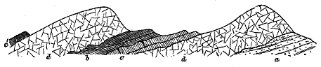
"The acid rock," Mr. Harker observes, "is invariably the later intrusion, for it sends narrow veins into the basalts, metamorphosing them to some extent and frequently enclosing fragments of them. These fragments are always rounded by corrosion, and show various stages of dissolution down to mere darker patches as seen by the naked eye. Such inclusions and patches are found in the marginal part of a granophyre, where no continuous basalt occurs, but where the acid magma has evidently in places completely destroyed the earlier basic sheets between which it was forced. It seems probable that in all cases a certain amount of solution of the basalt by the granophyre magma took place at their contact, facilitating the injection of the later intrusion and accounting for its persistent choice of the contact-plane of two basalt-sills as the surface offering least resistance to its injection."
These observations throw fresh light on the remarkable original regularity and persistence of the basic sills. Where one of these sills disappears above or below a granophyre sheet its probable former presence is often indicated by corroded fragments of the basic in the acid rock. Mr. Harker remarks that the acid magma seems to have been "in itself less adapted than the basic to follow accurately a definite horizon and to maintain a uniform thickness in its intruded sheets, but could do both when guided by a pre-existing basalt-sill, or especially when insinuated between contiguous basalt-sills." The corrosive action of the acid magma on the surface of the basalt, which enabled it to force its way more readily between the basic sills, might proceed so far as partially or wholly to destroy these sills.
- 434 -
This solvent action may serve to explain some of the irregularities of the granophyre intrusions. According to the same observer, such irregularities are found "where the granophyre sheet and its encasing basalt-sills are not co-extensive, or again where the two basalt-sills separate, owing to one of them cutting obliquely across the bedding. In the latter case, which is not common, the granophyre follows one of the basalt-sills, necessarily parting from the other. When one of the two guiding basalt-sills dies out, the granophyre may still continue, following the sill which persists. If the latter also dies out, while the granophyre is still in some force, the acid magma seems to have been reluctant to travel beyond the limit of the basalt, but has drawn towards it, and the granophyre presents a blunt laccolitic form, which contrasts with the acutely tapering edge of a granophyre which dies out before reaching the limit of its basalt-sills. If, on the other hand, on reaching the limit of the basalt, the acid magma has been in such force as to be driven further, it is usually found to lose something of its regularity and to depart from the exact horizon which it has hitherto followed. This seems to happen, for instance, in the Beinn a' Chàirn sheet, which, when traced westward, is found to behave as a 'boss' and is obviously transgressive, having cut across the bedding of the strata so as to enter the limestones, where it no longer behaves in any degree as a sill. The district affords many examples of the tendency of intrusive masses in general to cut sharply across the beds when they enter a group of limestones."
More complex examples of acid sills are to be found where there have been three or more basic sheets together. The great granophyre sheet already referred to at Suisnish affords the best illustration of this structure. Mr. Harker has noticed that "round most of its circumference there is seen merely a single basalt-sill passing under the granophyre. Probably there has been another similar sheet over the acid rock, but if so, it has been removed by erosion, the granophyre itself forming everywhere the surface of the plateau. On the southern side, however, we see that the original basalt must have been at least triple, or counting the uppermost member, now removed, quadruple. The granophyre has forced its way in between the several members of the multiple basalt-sill, the intermediate ones being thus completely enveloped. They are evidently metamorphosed as well as veined by the granophyre, and when traced onward they give place to detached portions which, floating as it were in the acid rock, are soon lost."
It is seldom easy to determine where lay the vent or vents from which the granophyre sills proceeded. Those of the Skye platform just described may be chiefly concealed under some of the larger areas of the rock, such as the sheets of Carn Dearg or Beinn a' Chàirn. But in several places, in close association with the compound sills of granophyre and basalt, Mr. Harker has found large dyke-like bodies of the acid rock, which may with considerable probability be regarded as marking the position of the channels by which the material of the sills ascended. "These bodies," he remarks, "either occur isolated by erosion, the sills or the parts of the sills presumed - 435 - to have been in connection with the dykes having been removed, or are only very partially exhibited in direct connection with sills still remaining. Where they can be examined in detail they are seen to be dykes varying up to about 100 feet in width, but of no great longitudinal extent. Between Suisnish and Cnoc Carnach they bear E.N.E., that is, at right angles to the ordinary basic dykes of the district and parallel to the general direction of the axes of folding, though further north they change this trend, but still remain parallel to the strike of the Lias.
"These dykes are composed essentially of granophyre, identical with that of the sills. In some cases, they are flanked with basalt-dykes on one or both sides, or the former existence of such lateral dykes is indicated by partly-destroyed inclusions of the basic rock in the granophyre. The basalt found in these cases is identical with that of the basic sills, and shows the same relation to the granophyre. Discontinuity and failure of the basalt are commoner, however, in the dykes than in the sills—a difference presumably attributable to more energetic destructive action of the acid magma when it was hotter and fresher. These supposed feeders of the granophyre sills are certainly in some cases, and have possibly been in all, double or triple dykes. The acid magma thus appears not only to have spread laterally along the same platforms as the earlier basalts, but to have reached these levels by rising through the same fissures which had already given passage to the basic magma."[431]
[431] MS. notes supplied by Mr. Harker.
The granophyre sills which, as already stated, can be followed as an interrupted band from Suisnish Point to the Sound of Scalpa, emerge again beyond Loch Sligachan and also in the island of Raasay, where a great sheet of the acid rock covers an area of about five square miles. This tract has recently been mapped for the Geological Survey by Mr. H. B. Woodward, who has found it to have been intruded across the Jurassic series, a large part of its mass coming in irregularly about the top of the thick white sandstones of the Inferior Oolite. But it descends beneath the Secondary rocks altogether, and in some places intervenes between the base of the Infra-liassic conglomerates and the Torridon sandstone. Its irregular course transgressively across the Mesozoic formations is probably to be regarded as another example of the intrusion of the acid material preferentially along the line of unconformability between the older rocks and the Tertiary basalts, now nearly all removed from Raasay by denudation, though the intrusion does not rigidly follow that line of division, but sometimes descends below it.
The central portions of this Raasay granophyre possess the ordinary structures of the corresponding rocks in Skye. They show a finely crystalline-granular, micropegmatitic base, through which large felspars and quartzes are dispersed. But at the upper and under junction with the sedimentary rocks, beautiful spherulitic structures are developed. This is well seen on the shore near the Point of Suisnish (Raasay), where, below the Lias Limestones, the top of the granophyre appears, and where its bottom is seen to lie on the Torridon sandstone.
- 436 -
This granophyre sheet presents a further point of interest inasmuch as it appears to have preserved one of the dyke-like masses which may mark channels of escape from the general body of the acid magma below. Near the Manse the section represented in Fig. 373 may be observed. Owing to great denudation, the massive sheet of granophyre has been cut into isolated outliers which cap the low hills, and the rock may be seen descending through the Jurassic sandstones, which in places are much indurated. It is observable that the amount of contact-metamorphism induced by the granophyre sills upon the rocks between which they have been injected is, in general, comparatively trifling. It is for the most part a mere induration, sometimes accompanied with distortion and fracture.
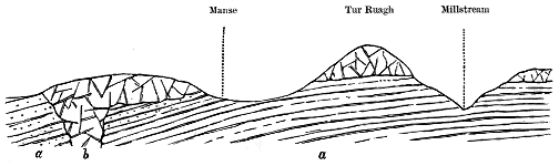
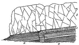
Although the intrusion of the granophyre sills has been subsequent to that of the basalt-sheets with which they are so generally associated, we may expect that as there is a series of post-granophyre basic dykes, so there may be some basic sills later than the injections of the acid sheets. The Raasay granophyre appears to furnish an example of such a later basic intrusion. At the Point of Suisnish on that island I have observed the relations shown in Fig. 374. There the dark shales of the Lower Lias (a a) are immediately overlain by the granophyre sill (b), and are cut by a basalt-dyke which, when it rises to the base of the granophyre, turns abruptly to one side, and then pursues its course as a sill (c) between the granophyre and the shales. There can be little doubt that this intrusion is later than the granophyre. Here a basic sill is interposed at the bottom of the acid sheet; and is - 437 - visibly connected with the actual fissure up which its molten material was impelled.
Besides bosses and sills, the acid rocks of the Inner Hebrides take the form of Dykes and Veins which have invaded the other members of the volcanic series. Some of these have already been referred to; but a more particular description of the venous development of the acid rocks as a whole is now required.
As regards their occurrence and distribution, they present two phases, which, however, cannot always be distinguished from each other. On the one hand, they are found abundantly either directly proceeding from the bosses (more rarely from the sills), or in such immediate proximity and close relationship to these as to indicate that they must be regarded as apophyses from the larger bodies of eruptive material. On the other hand, they present themselves as solitary individuals, or in groups at a distance of sometimes several miles from any visible boss of granophyre. In such cases, it is of course obvious that though not exposed at the surface, there may be a large mass of the acid magma at no great distance beneath, and that these isolated dykes and veins do not essentially differ in origin from those of which the relations to eruptive bosses can be satisfactorily observed or inferred.
Considered as a petrographical group, these Dykes and Veins are marked by the following characters. At the one extreme, we have thoroughly vitreous rocks in the pitchstones. From these, through various degrees of devitrification, we are led to completely lithoid felsites, quartz-porphyries or rhyolites. Micropegmatitic structure is commonly present, and as it increases in development, the rocks assume the ordinary characters of granophyre. Occasionally the structure becomes microgranitic in the immediate periphery of a boss wherein a granitic character has been assumed. Viewed as a whole, however, it may be said that the dull lithoid rocks of the dykes and veins can generally be resolved under the microscope into some variety of granophyric porphyry or granophyre.
A characteristic feature in the granophyric, felsitic or rhyolitic dykes and veins is the presence of spherulitic structure (Figs. 375, 377). In some cases this structure is hardly traceable save with the aid of the microscope, but from these minute proportions it may be followed up to such a strong development that the individual spherulites may be an inch or two in diameter, and lie crowded together, like the round pebbles of a conglomerate. The structure is a contact phenomenon, being specially marked along the margin of the dykes, as it is on the edge of sills and bosses. In the Strath district of Skye, Mr. Clough and Mr. Harker have observed that the spherulites are apt to be grouped in parallel lines so as to form rod-like aggregates along the walls, and that where the rock is fairly fresh the centre of the dyke sometimes consists of glassy pitchstone, so that the spherulitic felsite or granophyre is probably devitrified pitchstone. Frequently flow-structure is admirably developed in these dykes, the streaky layers of devitrification flowing round the spherulites and any enclosed fragments as perfectly as in any rhyolitic lava (Fig. 378).
- 438 -
- 439 -
In regard to their modes of occurrence, the dykes of acid material differ in some important respects from those of basic composition. More especially they are apt to assume the irregular venous form, rather than the vertical wall-like character of ordinary dykes. They take the form of dykes, particularly where their material has been guided in its uprise by one or more already existent basic or intermediate dykes, as in the compound dykes, already described. The conditions for their production must thus have been essentially different from those of the great body of the basic dykes. Their intrusion was not marked by any general and widespread fissuring of the earth's crust, such as prepared rents for the reception of the basalt and andesite dykes. They were rather accompaniments of the protrusion of large masses of acid magma into the terrestrial crust. This magma, as we have seen, was often markedly liquid, and was impelled, sometimes with what might be called explosive violence, into the irregular cracks of the shattered surrounding rocks or into pre-existing dyke-fissures. Hence long straight dykes of the acid rocks are much less common than short irregular tortuous veins and strings.
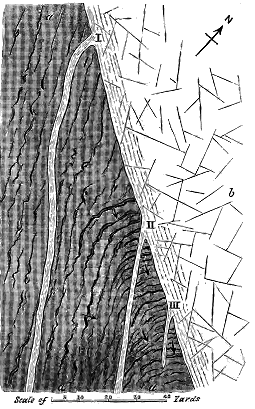
Much difference may be noticed among the granophyre bosses in regard to their giving off a fringe of apophyses. Thus, along the well-exposed boundary of Beinn-an-Dubhaich in Skye, though the edge of the boss is remarkably notched, hardly any veins deserving the name diverge from it. On the other hand, the ridge of Meall Dearg at the head of Glen Sligachan, already referred to, is distinguished by the number and variety of the dykes and veins which proceed from the granophyre and traverse the banded gabbros. As this locality has been elsewhere fully described, I will give here only the leading structural features which it presents.[432]
[432] Professor Judd (Quart. Journ. Geol. Soc. vol. xlix. (1893), p. 175) described the granophyre dykes of this locality as inclusions of Tertiary granite in the gabbro, and cited them in proof of his contention that the acid eruptions of the Western Isles are older than the basic. Their true character was shown by me in a paper published in the Quart. Journ. Geol. Soc. vol. 1. (1894), p. 212.
- 440 -
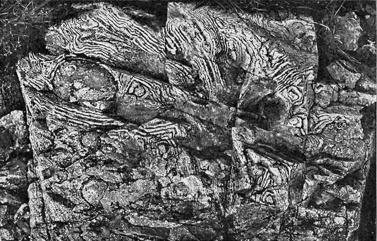
- 441 -
Within a horizontal distance of less than 100 yards three well-marked dykes issue from the spherulitic edge of the Meall Dearg granophyre, and run in a south-easterly direction in the handed gabbros (Fig. 376). The most northerly of these is traceable in a nearly straight line for 800 feet. The central dyke, which can be followed for 200 feet or more, rises as a band six to ten feet broad between the dark walls of gabbro as represented in Fig. 379.
These dykes are marked by the most perfectly developed spherulitic and flow-structures (Figs. 375, 377). Numerous detached portions of other dykes and also irregular veins are to be observed cutting the banded gabbros all over the ridge of Druim an Eidhne for a distance of a mile or more. Many of these exhibit the same exquisitely beautiful spherulitic and flow-structure displayed by the dykes which can actually be traced into the main body of granophyre. The lines of flow conform to every sinuosity in the boundary-walls of gabbro, and sometimes sweep round and enclose blocks of that rock. The example of this structure, given in Fig. 378, shows how these lines, curving round projections and bending into eddy-like swirls, exhibit the motion of a viscous lava flowing in a cleft between two walls of solid rock. Sometimes the laminæ of flow have been disrupted, and broken portions of them have been carried onward and enveloped in the yet unconsolidated material. Certain portions of this dyke are richly spherulitic, the spherulites varying from the size of small peas up to that of tennis-balls. Occasionally two large spherulites have coalesced into an 8-shaped concretion, and it may be observed in some cases that the spherulites are hollow shells.
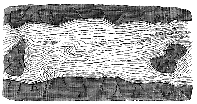
- 442 -
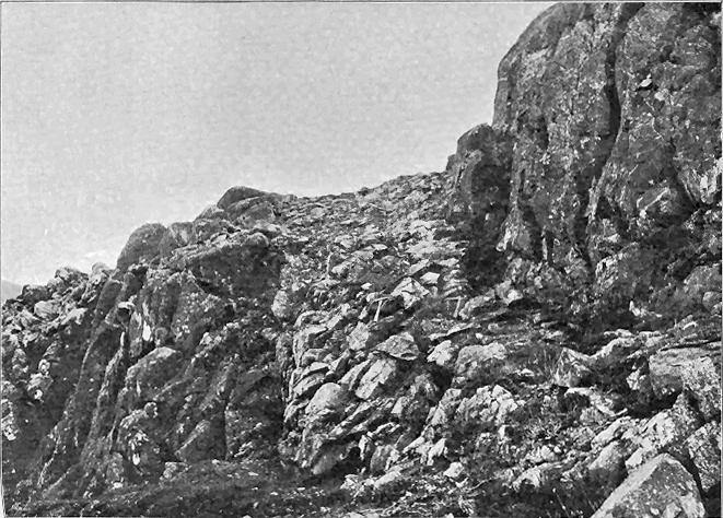
- 443 -
A remarkable feature has been recently observed by Mr. Harker among the abundant granophyre dykes and veins which intersect the gabbros and older rocks, along the eastern flanks of the Red Hills of Skye between Broadford and the Sound of Scalpa. Broad dykes of granophyre which traverse the Cambrian limestone of that district might be supposed at first sight to be cut off by the intrusions of gabbro. But closer examination proves that their apparent truncation arises from their suddenly breaking up into a network of small veins where they abut against the basic rock. This structure evidently belongs to the same type as that of the St. Kilda granophyre.
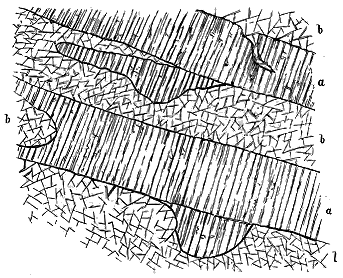
Compound dykes and sills, where one or more of the injections has consisted of acid material, have been already noticed as intimately associated together in Skye (p. 162). Dykes of this nature are more particularly abundant in Strath, especially along its eastern side. In addition to the examples cited already from that district, I may refer to other two which intersect the Middle Lias shales and limestones in the island of Scalpa. They are both compound dykes, but the more basic marginal bands are not always continuous, having possibly been here and there dissolved by the acid invasion. Though they do not show any distinct spherulitic forms, the presence of flow-structure is indicated by the thin slabs into which the rocks weather parallel to the dyke-walls. The rock in each case is a fine-grained felsitic mass, with bi-pyramidal crystals of quartz. It is observable that where these dykes come directly against the Liassic strata, the latter are more seriously indurated than where they are traversed by the ordinary basic dykes.
In the central mountainous tract of the island of Mull veins of acid material are extraordinarily abundant. They probably proceed from a much larger subterranean body of granophyre than any of the comparatively small bosses of this rock which appear at the present surface of the ground. They - 444 - show themselves partly at the margins of the visible bosses, but much more profusely in that tract of altered basalt, with intrusive sheets and dykes of basalt, dolerite and gabbro, which lies within the great ring of heights between Loch na Keal and Loch Spelve. In some areas, the amount of injected material appears to equal the mass of more basic rock into which it has been thrust. Pale grey and yellowish porphyries and granophyres, varying from thick dykes down to the merest threads, ramify in an intricate network through the dark rocks of the hills, as shown in the accompanying illustration (Fig. 380), which represents a portion of the hillside between Beinn Fhada and the Clachaig River. Such a profusion of veins probably indicates the existence here of some large mass of granophyre or granite, at no great depth beneath the surface.
In Mull, as in the other islands of the Inner Hebrides, two horizons on which protrusions of acid materials have been specially abundant, are the base of the bedded basalts of the plateau and the bottom of the thick sheets of gabbro. Dykes and veins of granophyre, quartz-porphyry, felsite and other allied rocks are sometimes crowded together along these two horizons, though they may be infrequent above or below them.
Illustrations of solitary veins in the midst of unaltered plateau-basalts or in older rocks may be gathered from many parts of the Western Isles. Some remarkable instances are to be seen among the basalts that form the terraced slopes on the north side of Loch Sligachan. Several thick dykes of granophyre run up the declivity, cutting across hundreds of feet of the nearly level basalt-beds. Some of them can be seen on the shore passing under the sea. They trend in a S.S.E. direction towards Glamaig, and they are not improbably apophyses from that huge boss, the nearest edge of which is three-quarters of a mile distant. Another example may be cited from the basalt-outlier of Strathaird, where two veins of felsite, one of them a pale flinty rock showing flow-structure parallel to the walls, may be seen on the west front of Ben Meabost. In this case, the veins are three miles and a half from the granophyre mass of Strath na Creitheach to the north, four miles from that of Beinn an Dubhaich to the north-east, and nearly three miles from that of Coire Uaigneich at the foot of Blath Bheinn.
A special place must be reserved for the pitchstone-veins. Ever since the early explorations of Jameson and Macculloch, the West of Scotland has been noted as one of the chief European districts for these vitreous rocks. From Skye to Arran, and thence to Antrim, many localities have furnished examples of them, but always within the limits of the Tertiary volcanic region. That all of the pitchstones are of Tertiary age cannot, of course, be proved, for some of them are found traversing only Palæozoic rocks, and of these all that can be absolutely affirmed is that they must be younger than the Carboniferous or even the Permian system. But, as most of them are unquestionably parts of the Tertiary volcanic series, they are probably all referable to that series. Not only so, but there is, I think, good reason to place them among its very youngest members. It is a significant fact that - 445 - they almost always occur either in or close to granophyre or granite bosses, the comparatively late origin of which has now been proved.
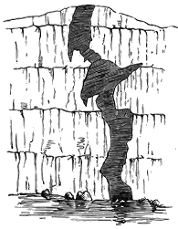
The first pitchstone observed in Skye was found by Jameson on the flanks of the great granophyre cone of Glamaig. Another rises on the side of the porphyry mass of Glas Bheinn Bheag, in Strath Beg. Several occur at the foot of Beinn na Callich. In Rum, I found a pitchstone vein traversing the western slopes of the wide granophyre boss of Orval. In Eigg, the well-known veins of this rock intersect the plateau-basalts (Fig. 381), but they are accompanied, even within the same fissure, with granophyre, and in their near neighbourhood lie the masses of this rock already alluded to.[433] In Antrim, pitchstone and obsidian occur in the midst of the rhyolite. The only marked exceptions to the general rule, with which I am acquainted, are those of the island of Arran. Most of the pitchstone-veins in that district traverse the red sandstones which may be Permian. But none of them are far removed from the great granite boss of the northern half of the island, while large masses of quartz-porphyry, which strikingly resemble some of those of Skye and Mull, lie still nearer to them. It is also worthy of notice that pitchstone-veins rise through the Arran granite boss itself, the probably Tertiary date of which has been already discussed.
[433] For an account of the pitchstone veins of Eigg, see Quart. Journ. Geol. Soc. xxvii. p. 299.
This common association of pitchstone-veins with the Tertiary eruptive bosses of acid rocks can hardly be a mere accidental coincidence. It seems to prove a renewed extravasation of acid material, now in vitreous form, from the same vents that had supplied the granitoid, granophyric, porphyritic and felsitic varieties of earlier protrusions. We must remember that the pitchstone-veins are not mere local glassy parts of the larger bodies of granophyre or granite in which they lie. Their margins are sharply defined; they are indeed in all respects as manifestly intruded, and therefore later masses, as are the basalt-dykes. Their occurrence, therefore, within the acid bosses proves them to be younger than these members of the Tertiary volcanic series. Whether they are also later than the latest basalt-dykes cannot yet be decided, for I have never succeeded in finding an example of the intersection of these two groups of veins and dykes. But, with this possible exception, the pitchstones are the most recent of all the eruptive rocks of Britain.
As a rule, the intrusive pitchstones occur as veins which cannot be traced far, and which vary from a few yards to less than an inch in width. - 446 - They generally show considerable irregularity in breadth and direction, sometimes sending out strings into the surrounding rock (Fig. 381). The outer portions are not infrequently more glassy and obsidian-like than the interior. Occasionally the vitreous character disappears by devitrification, and the rock assumes the texture of a compact felsite or of a spherulitic rock.
Among the later movements of the acid magma account must be taken here of the pale fine-grained veins which have already been referred to as traversing the granophyre bosses. These intrusions, so well seen in the bosses of Skye and St. Kilda, are often so close in texture that they may be called quartz-felsites. Their sharply-defined edges and felsitic character suffice to separate them from what are termed "veins of segregation." In at least one instance, that of Meall Dearg, already cited, a mass of typical granophyre which has developed spherulitic and flow-structures along its margin, and which sends out dykes having the very same structures for a distance of several hundred feet across the banded gabbros, is itself traversed by a dyke of precisely similar character. Here we see that after the intrusion of its apophyses, and after its own consolidation in the upper parts, the granophyric magma that rose into rents in the solidified portion retained the same tendency to produce large spherulites as it had shown at first.
The fine felsitic veins that traverse the granophyre of the Red Hills are now being mapped by Mr. Harker during the progress of the Geological Survey. He has not yet obtained evidence of the age of these veins in relation to the latest basic dykes. He has observed that they appear to be on the whole rather less acid than the material of the surrounding bosses, though they were probably all connected with the same underlying acid magma from which the bosses were protruded. A somewhat similar relation has been noticed between older granites and their surrounding dykes, as in Cornwall and Galloway.
- 447 -
There can be no doubt that considerable alterations of level have taken place over the volcanic areas of North-Western Europe since the eruptions that produced the basalt-plateaux, These alterations embrace general and local subsidences, and also dislocations by which considerable displacements of the crust either in a downward or upward direction have been effected.
The mere fact that in many places the lower members of the series of terrestrial lavas have been submerged under the sea may be taken to prove a subsidence since older Tertiary time. Along the west coast of Skye this depression is well shown by the almost entire concealment of the bottom of the plateau under the Atlantic. In the Faroe Isles the subsidence has advanced still further, for not a trace of the underlying platform on which the basalts rest remains above water. In Iceland, too, the complete submergence of the base of the Tertiary volcanic sheets points to a widespread subsidence of that region.
Another strong argument in favour of considerable depression may be derived from a comparison of the submarine topography with that of the tracts above sea-level. It is obvious that the same forms of contour which are conspicuous on the land are prolonged under the Atlantic. If we are correct in regarding the valleys as great lines of subærial erosion, their prolongations as fjords and submarine troughs must be considered as having had a similar origin. We can thus carry down the surface of erosion several hundred feet lower than the line along which it disappears under the waves.
I know no locality where this kind of reasoning is so impressively enforced upon the mind as the west end of the Scuir of Eigg. The old river-bed and its pitchstone terminate abruptly at the top of a great precipice. Assuredly they must once have continued much further westward, as well as the sheets of basalt that form the main part of the cliff. Yet the sea in front of this truncated face of rock rapidly deepens to fully 500 feet in some places. Had any such hollow existed in the volcanic period it - 448 - would have been filled up by the long-continued outflowings of basalt. Making every allowance for concealed faults and local subsidences, we can only account for this submarine topography by regarding it as having been carved out, together with the topography of the land, at a time when the level of the latter was at least 500 feet higher than it is now.
The subsidence which is thus indicated along the whole of the North-West of Europe probably varied in amount from one region to another. We seem to have traces of such inequalities in the varying inclinations of different segments of the basalt-plateaux. The angles of inclination are almost always gentle, but they differ so much in direction from island to island, and even among the several districts of the same island, as to indicate that certain portions of the volcanic plain have sunk rather more than other portions.
Thus in the Faroe Islands, where the bare cliffs allow the varying angles of inclination to be easily determined, a general gentle dip of the basalts in a south-easterly direction has been noted among the central and northern islands by previous observers. This inclination, however, is replaced among the southern islands by an equally gentle dip towards the north-east. The centre of depression would thus seem to lie somewhere about Sandö and Skuö. The highest angle of inclination which I noticed anywhere was at Myggenaes, where the basalts dip E.S.E. at about 15°.
Among the Western Isles, also, where similar variations in the inclination of the basalt-sheets are observable, it might be possible by careful survey to ascertain the probable position of the areas of maximum depression, and to show to what extent differential movements have affected the originally nearly level volcanic floor. It would doubtless be found that everywhere the dominant movement has been one of subsidence. The vast outpourings of lava would tend to leave the overlying crust unsupported, and to cause it to sink into the cavities thus produced.
Perhaps the most extensive subsidence of this kind, at least that which admits of most satisfactory investigation, because it still remains above sea-level, is displayed by the vast hollow in the Antrim plateau, which embraces the basin of Lough Neagh and the valley of the Lower Bann. This depression measures about 60 miles in length by about 20 in breadth. Its axis follows the N.N.W. trend so characteristic of the volcanic features of Tertiary time. The depression may be said to involve the entire basaltic plateau of Antrim, for with the exception of a few insignificant areas along the borders, especially on the east side between Larne and Cushendall, the whole region slopes inward from its marginal line of escarpments, which reach heights of 1800 feet and upwards, towards the great hollow in its centre (see Map VII.).
Lough Neagh, which occupies the deepest part of this hollow, and covers about one-eighth of the whole area of subsidence, is the largest sheet of fresh water in the British Isles, for it exceeds 150 square miles in extent of surface. Yet, for its size, it is one of the shallowest of our lakes, its average depth being less than 40 feet. Its shallowness, compared with its wide - 449 - area, marks it out in strong contrast to most of the larger British lakes. Its surface is only 48 feet above the level of the sea.
The origin of Lough Neagh, the theme of various legends, has been seriously discussed by different writers, but most exhaustively by the late E. T. Hardman of the Geological Survey.[434] This author connected the formation of the lake-basin with a series of large faults which are found intersecting the rocks around the basin, and passing under the water in a general north-easterly direction. He showed that these faults have produced serious displacements of the strata, amounting sometimes to as much as 2000 feet, and he believed that it was by the concurrent effect of such dislocations that the depression of Lough Neagh had been caused.
[434] "On the Age and Formation of Lough Neagh," Journ. Roy. Geol. Soc. Ireland, vol. iv. (1875-76), p. 170; also Explanation of Sheet 35 of the Geol. Surv. Ireland (1877), p. 72.
It is possible that these displacements may have contributed to at least the earlier stages in the history of the Antrim subsidence. They have undoubtedly taken place after the outpouring of the basalts, for these rocks are involved in their effects. But in the hollow of the Bann valley north of Lough Neagh the faults which have been detected in the basaltic plateau are few and trifling. The bold and bare escarpments, that so clearly display the relations of the rocks, reveal few traces of any important transverse dislocations. Nor has any proof of large longitudinal faults parallel with the axis of depression been obtained within the area of the Bann valley.
The earliest evidence for the existence of a lake on the site of the present Lough Neagh has been supposed to be furnished by certain fine clays, sands, seams of lignite and clay-ironstone, which have been referred to the Pliocene period. These deposits have been regarded as indicating the accumulation of fine sediment with drift vegetation brought down into a quiet lake by streams entering from the south. Their fresh-water origin was believed to be further corroborated by the occurrence of shells belonging to the lacustrine or fluviatile genus, Unio.[435]
[435] These shells were regarded as forms of Unio by the late W. H. Baily; but Dr. Henry Woodward assigned them to Mytilus. See Prof. Hull's Physical Geology and Geography of Ireland, 2nd edit. p. 101. The shells have been more recently dug out by Mr. Clement Reid, who has found them to be the common Mytilus edulis.
The thickness of this series of strata, their position above sea-level, and their distribution are important parts of the evidence for the geological history of the locality. At one place the deposits are said to have been bored through to a depth of 294 feet, and Mr. Hardman believed them to be not less than 500 feet deep. The same observer found that they certainly reach a height of 120 feet above the sea, and he was of opinion that in some places their height was not less than 140 feet. The deposition of strata to the depth of 300 feet below a level of 120 feet above the sea would, of course, entirely fill up Lough Neagh, and spread over a large tract of low ground around it. The pottery-clays and lignites, however, appear to be confined to the southern half of the lake, from which they rise gently into the low country around.
The distribution of these deposits and their extraordinary variations in - 450 - altitude, as described by Mr. Hardman, present great difficulties in the attempt to regard them as the sediments of a Pliocene lake. A more recent examination of the ground by Mr. Clement Reid of the Geological Survey has led that able observer to believe that two totally different groups of strata at Lough Neagh have been confounded. He noticed the Mytilus-clay to be a dark blue mass full of derived boulder-clay stones, and yielding Mytilus edulis and seeds of a sedge. This deposit cannot be Pliocene, but must be of Glacial or post-Glacial age, possibly contemporary with the Clyde beds. The junction of this clay with the pipe-clays is not at present seen, but the lithological contrast between the two groups of strata is so strong as to indicate their independence of each other. Mr. Reid found the white, red and mottled pipe-clays with their masses of lignite to present a strong resemblance to the Bagshot group in the Tertiary series. It is possible, as already suggested, that the pipe-clays and lignites may belong to the sedimentary zone that separates the lower and upper basalts of Antrim. At all events they furnish no proof of any Pliocene lake, and may not indicate more than a deeper part of the depression in which the tuffs, lignites and iron-ore were laid down.
The existence of the Mytilus-clay shows that in Glacial or post-Glacial times the valley of the Bann was a strait or fjord into which the sea entered. Thick masses of drift have been laid down all round and over the depression now occupied by Lough Neagh, insomuch that had any older lake existed here in Glacial times, it could hardly have escaped being filled up.
The observer, who from one of the basalt-heights looks down upon the expanse of Lough Neagh and the broad peat-covered plain that continues the level platform of the lake-surface down the valley of the Bann, cannot but be impressed with the size of this wide hollow in the heart of the Antrim plateau, and with the evident continuity of the whole depression from the lake to the sea. If he be a geologist, he will be further struck by the fact that while the Chalk and other older rocks appear from under the basalt-escarpments all round the plateau, at heights of many hundred feet above the sea, the floor of this wide hollow is entirely covered with basalt. Had the depression been merely due to denudation, the rocks that underlie the volcanic series would have been exposed to view. The base of the basalts which, on either side of the depression, is often more than 1000 feet above the sea-level, sinks below that level in the hollow of the Bann and Lough Neagh.
This inequality of position may have been partially brought about by faults like those around Lough Neagh, and may thus have been begun long before the Glacial period. But it appears to me to be mainly due to a wide subsidence, of which the axis ran in a N.N.W. and S.S.E. direction from the present coast up the valley of the Bann and the basin of Lough Neagh to beyond Portadown.
We may conceive that after the cessation of the outflows of basalt, the territory overlying the lava-reservoir that had been emptied would tend to - 451 - subside, partly by ruptures of the crust producing faults and partly by a downward movement of a more general kind. In course of time, these disturbances turned the drainage into the hollow now traversed by the Bann. Denudation would necessarily accompany them, and the surface of the country would be continually eroded and lowered.
Lough Neagh has been carefully sounded by the Admiralty, and its chart affords much suggestive material for the consideration of the geologist.[436] From the soundings there given it has long been known that the lake deepens towards its northern end, and attains a maximum depth of 102 feet. But it is not until we trace on the chart a series of contour-lines for successive depths, as shown by the soundings, that we realize the remarkable form of the lake bottom. We then discover that below a depth of 50 feet a well-defined channel extends for rather more than half the length of the lake. This channel begins to be distinctly perceptible between Kiltagh Point and Langford Lodge. It first runs in a northerly course on the west side of the centre of the Lough, but when it comes into a line with Saltera Castle on the western shore, it wheels round so as to conform to the curve of the Antrim coast-line, which it follows northward until, about two miles from the exit of the lake, its outline ceases to be traceable on the gently shelving bottom. Its total length is thus about 12 miles.
[436] Lough Neagh surveyed and sounded by Lieut. Thomas Graves, R.N.
There can hardly be any doubt that this channel is a former bed of the River Bann. It occupies exactly the position which that stream would take if the lake were drained, and its depth and breadth correspond to those of the valley-bottom of the present river. If this conclusion be accepted, some important conclusions may be further deduced from it.
1. The presence of a former course of the Bann on the bottom of Lough Neagh proves the lake to be much younger than the Ice Age. The thick boulder-clays and Glacial gravels which so encumber the country around and descend under the lake, would assuredly have filled up the river-channel had it existed at the time of their deposition. The channel has obviously been cut out of these drifts since the Glacial period. When the erosion took place, the present Lough Neagh could not have existed, but the Bann followed a continuous course across the plain which the lake now covers. The river probably maintained its place for a long period, so as to be able to excavate so wide and deep a bed in the drifts, if, indeed, it did not to some extent slowly carve its bed out of the underlying basalts. It must be remembered that sediment is being continually poured into Lough Neagh, and that some of the silt must have accumulated in the submerged river-course, thus lessening its depth and width. That the channel should still be so marked may be used as an argument for the comparatively late date of the subsidence.
2. The submerged river-course is a clear proof of subsidence. The present Lough Neagh cannot be looked upon as a glacial lake formed by rock-erosion or by irregular deposition of drift. Its floor must have been a land surface when the Bann cut out its bed upon it. The whole area has - 452 - sunk down, the drainage has been arrested, and some 20 miles of the course of the Bann are now under a sheet of shallow water. This subsidence was not brought about by faults. It seems rather to have resulted from a general sinking of the ground. The movement was probably comparatively rapid, otherwise the river-course would hardly have survived so well.
3. These inferences, based upon purely geological considerations, have an interesting bearing upon the allusions to the origin of Lough Neagh contained in some ancient historical documents. Various legends have from an early period been handed down as to the first appearance of this sheet of water. These myths, though differing in details, agree in describing such a sudden or rapid accumulation of water as destroyed human life, in a district which had previously been inhabited by man. The earliest records indicate that the alleged catastrophe took place in the first century of the Christian era.[437] It appears to me not improbable that the tradition,thus preserved in these legends, may have had its basis in the actual disturbance which, on geological grounds, can be shown to have determined the existence of Lough Neagh. Though the event may go back far beyond the first century, there can be no doubt that, in a geological sense, it was one of the most recent topographical changes which the British Isles have undergone.
[437] For versions of the legends, see Dr. Todd's "Irish Version of the Historia Britonum of Nennius," Roy. Hist, and Archæol. Assoc. Ireland; Dr. Reeves' "Ecclesiastical Antiquities of Down," etc., p. 370; Mr. J. O'Beirne Crowe's "Ancient Lake Legends of Ireland," No. 1 in Journ. Roy. Hist. and Archæol. Assoc. Ireland, vol. i. (1870-71), p. 94; Giraldus Cambrensis, vol. v. cap. ix. p. 91—"de lacu magno miram originem habente." Moore's well-known lines embody the popular belief that round towers and other buildings were submerged by the inundation.
Thus the Antrim basalt-plateau, in addition to the high interest of its volcanic history, has the additional claim to our attention that it has preserved, more fully and clearly than any other of the plateaux, the evidence for the latest subterranean movements that followed the long series of volcanic eruptions during Tertiary time. It contains the record of a post-Glacial subsidence that gave birth to the largest lake in Britain.
Though I have not observed any features among the Tertiary basalt-plateaux of the British Isles that can be compared to the remarkable rifts and subsidences of Iceland, it can be shown that these piles of volcanic material have undoubtedly been fractured, and that portions of them have subsided along the lines of dislocation.
Careful examination of the basalt-escarpments of the Inner Hebrides discloses the existence of numerous faults which, though generally of small displacement, nevertheless completely break the continuity of all the rocks in a precipice of 700 or 1000 feet in height. Not infrequently such dislocations give rise to clefts in the cliffs. Some good illustrations of this feature may be noticed on the north side of the island of Canna, where the precipice has been fissured by a series of dislocations, having a hade towards - 453 - the west and a throw which may in some cases amount to about 20 or 25 feet. The cumulative effect of this system of faulting, combined with a gentle westerly dip, is to bring down to the sea-level the upper band of conglomerate which further to the east lies at the top of the cliff. Again, the basalt-escarpment on the west side of Skye, from Dunvegan Head to Loch Eynort, is traversed by a series of small faults. On the east side of Skye and in Raasay, a number of faults, some of them having perhaps a throw of several hundred feet, has been mapped by Mr. H. B. Woodward.
The largest dislocation observed by me among the basalt-plateaux of the Inner Hebrides is that already referred to (p. 209), which runs at the back of the Morven outlier, in the west of Argyllshire, from the Sound of Mull by the head of Loch Aline to the mouth of Loch Sunart, along the line of valley that contains the salt-water fjord Loch Teacus and the fresh-water lakes Loch Durinemast and Loch Arienas. While the Cretaceous deposits and the bottom of their overlying basalts rise but little above the sea-level on the south-west side of this line, they are perched as outliers on hill-tops on the north-east side, where they rise to 1300 feet above the sea. The amount of vertical displacement here probably exceeds 1000 feet. The fault runs in a north-westerly direction, and has obviously been the guiding influence in the erosion of the broad and deep valley which marks its course at the surface.
This dislocation is only the largest of a number by which the basalt-plateau has been broken in the district of Morven. Their effects are well shown in the outlier of basalt which caps Ben Iadain, where two parallel faults bring down the lavas against the platform of schists on which they lie (see Fig. 266).
Many faults have been traced in the Antrim plateau, and are represented on the Geological Survey Maps. In general they are of comparatively trifling displacement. Occasionally, however, they amount to several hundred feet, as in those already referred to as occurring near Ballycastle and around the southern part of the basin of Lough Neagh.
To what extent the dislocations that traverse the British Tertiary basalts are to be regarded as comparable to those which in Iceland have been referred to subsidence caused by the tapping and outflow of the lower still liquid parts of lava-sheets must be matter for further inquiry. So far as my own observations have yet gone, the faults do not seem explicable by any mere superficial action of the kind supposed. Where they descend through many hundreds of feet of successive sheets of basalt, and dislocate the Secondary formations underneath, they must obviously have been produced by much more general and deep-seated causes.
It is conceivable that, if these dislocations took place during the volcanic period, they broke up the lava-plains into sections, some of which sank down so as to leave a vertical wall at the surface on one side of the rent, or even to form open "gjás," like those of Iceland. But it is noteworthy that the fissures, which have been filled with basalt and now appear as dykes, comparatively seldom show any displacement in the relative levels - 454 - of their two sides. In Iceland, also, the great lava-emitting fissures seem to be in general free from marked displacements of that kind.
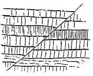
The faults in the Inner Hebrides, so far as I have observed, are all normal, and indicate nothing more than gentle subsidence. But among the Faroe Islands I have come upon several instances of reversed faults, which, in spite of the usually gentle inclinations of the basalts, probably point to more vigorous displacement within the terrestrial crust.
On the east side of Svinö a fault with a low hade runs from sea-level up to the top of the cliff, a height of several hundred feet. It has a down-throw of a few yards, but is a reversed fault, as will be seen from Fig. 382. Another similar instance may be noticed on the north-east headland of Sandö, where, however, on the upcast side, the basalts appear as if they had been driven upward, a portion of them having been pushed up into a low arch (Fig. 383).
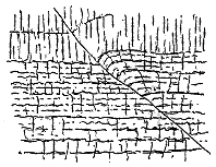
When the Tertiary basalt-plateaux of the Hebrides and the Faroe Isles come to be worked out in detail, many examples of dislocation will doubtless be discovered. We shall then learn more of the amount and effects of the terrestrial disturbances which have affected North-Western Europe since older Tertiary time. In the meantime evidence enough has been adduced to prepare us for proofs of very considerable recent displacements even among regions of crystalline schists, like that which has been disrupted by the Morven faults above alluded to. While the study of the Tertiary volcanic rocks demonstrates the vast general denudation of the country since older Tertiary time, the proofs that these rocks have been faulted acquire a special interest in relation to the origin and evolution of the topography of the region.
- 455 -
Among the more impressive lessons which the basalt-plateaux of North-Western Europe teach the geologist, the enormous erosion of the surface of this part of the continental area since older Tertiary time takes a foremost place. He may be ready almost without question to accept the evidence adduced in favour of a vast amount of denudation among such soft and incoherent strata as those of the older Tertiary formations of the south-east of England or the north-west of France. But he is hardly prepared for the proofs which meet him among the north-western isles that such thick masses of solid volcanic rocks have been removed during the same geological interval.
To gain some idea of the amount of this waste we must, in the first place, picture to our minds the extent of ground over which the lavas were poured, and the depth to which they were piled upon it. Though we may never be able to ascertain whether the now isolated basalt-plateaux of Britain were once united into a continuous plain of lava, we can be quite certain that every one of these plateaux was formerly more extensive than it is now, for each of them presents, as its terminal edge, a line of wall formed by the truncated ends of horizontal basalt-sheets. And there seems no improbability in the assumption that the whole of the great hollow from the centre of Antrim up to the Minch was flooded with lavas which flowed from many vents between the hills of ancient crystalline rocks forming the line of the Outer Hebrides on the west, and those of the mainland of Scotland on the east.
It is certain that the depth to which some parts of this long hollow were overflowed with lava exceeded 3000 feet, for more than that depth of rock can be shown to have been in some places removed. The original inequalities of surface were buried under the volcanic materials which were spread out in a vast plain or series of plains, like those that have been deluged by modern eruptions in Iceland. Owing, however, to a general but unequal movement of subsidence, the lava-fields sank down here and there to, perhaps, an extent of several hundred feet, so that the old land-surface on which they began to be poured out now lies in those places below the level of the sea.
I have shown that even during the volcanic period, while the lavas were - 456 - still flowing from time to time, erosion was in active progress over the surface of the volcanic plain. The records of river-action in Canna and Sanday, and the buried river-channel of the Scuir of Eigg, prove that, while eruptions still continued, rivers descending from the mountains of the Western Highlands carried the detritus of these uplands for many miles across the lava-fields, swept away the loose material of volcanic cones, and cut channels for themselves out of the black rugged floor of basalt.
The erosion thus early begun has probably been carried on continuously ever since. The present streams may be looked upon as practically the same as those which were flowing in the Tertiary period. There may have been slight changes of level, oscillations both upward and downward in the relative positions of land and sea, and shiftings of the water-courses to one side or other; but there seems no reason to doubt that the existing basalt-plateaux, which were built up as terrestrial areas, have remained land-surfaces with little intermission ever since, although their lower portions may have been in large measure submerged.
In the existing valleys, fjords and sea-straits by which these plateaux have been so deeply and abundantly trenched, we may recognize some of the drainage-lines traced out by the rivers which flowed across the volcanic plains. The results achieved by this prolonged denudation are of the most stupendous kind. The original lava-floor has been cut down into a fragmentary tableland. Hundreds of feet of solid rock have been removed from its general surface. Outliers of it may be seen scattered over the mountains of Morven, whence they look into the heart of the Highlands. Others cap the hills of Rum, where they face the open Atlantic. Several miles from the main body of the plateau in Skye, a solitary remnant, perched on the highest summit of Raasay, bears eloquent witness that the basaltic tableland once stretched far to the east of its present limits.
Two lines of observation and of argument may be followed in the effort to demonstrate how great the denudation has been since older Tertiary time. In the first place, there is the evidence of the level or nearly level sheets of basalt that form the plateaux, and, in the second place, there is the testimony of the dykes, sills and bosses by which these lavas have been disrupted.
1. The study of the denudation of the Tertiary volcanic rocks of North-Western Europe is most satisfactorily begun by an attempt to measure the minimum amount of waste which in certain places the basalt-plateaux can be proved to have undergone. For the purposes of this study, the stratification of the lavas and their nearly horizontal, or at least very slightly disturbed, position afford exceptional facilities. Amorphous rocks, such as granites and gabbros, or even foliated masses like the old gneisses and schists, may have been enormously denuded. Their mere presence at the existing surface may be taken as proof of such waste, yet they furnish in themselves no criterion by which the amount of removed material may be estimated.
But in the case of the basalt-plateaux, as in that of horizontal sedimentary formations, the successive lines of superposition of the component beds of the whole stratigraphical series supply admirable datum-lines which, - 457 - on the one hand, vividly impress the imagination by the demonstration which they afford of the reality and magnitude of the denudation, and, on the other hand, furnish a measure by which the minimum amount of this denudation may be actually computed.
Availing ourselves of this kind of evidence it is easy to show that valleys many miles long, several miles broad, and from crest to bottom several thousand feet deep, have been excavated out of the basalt-plateaux since the close of the volcanic period. And if this conclusion can be demonstrated for these plateaux, it must obviously apply equally to the rest of the country. We thus obtain a most important contribution to the investigation of the origin and relative age of the present topographical features of the surface of the land.
Let me give a few illustrations of the nature of the investigation and of the results to which it leads. Throughout the Western and Faroe Islands the level bars of basalt present their truncated ends in the great escarpment-cliffs which wind mile after mile along their picturesque coasts. Where they front the open sea, it is obviously impossible to say how much further seaward they once extended. But where they retire in fjords or sea-lochs, and sweep inland into glens, it is easy to measure the distance from the bottom of the eroded hollow to its bounding watersheds, and to estimate the amount of material that has been worn out of it. The only uncertainty in this computation arises from our inability to determine to what extent movements of subsidence may have come into play to aid in the disappearance of the basalts. Where the bottom of the lavas can be seen at the same level on either side of an inlet, with no evidence of faulting, or where a definite horizon in the volcanic series can be traced round the head of a glen or sea-loch, the influence of underground movements may be eliminated. The evidence of vast denudation is always visible, the proofs of subsidence are much less frequently observable.
The island of Mull supplies many striking examples of the enormous waste of the basalt-plateau. The Sound of Mull, for instance, has been eroded out of the volcanic series for a distance of 20 miles, with a mean breadth of about two miles. From the deepest part of this fjord to the summit of the Mull plateau is a vertical height of 3600 feet. The whole of this vast excavation has taken place since older Tertiary time. On the opposite side of Mull the hollow of Loch Scridain has been eroded to a mean depth of at least 1200 feet below the average level of the surrounding plateau, with a breadth of rather more than a mile.
The scattered islands which lie to the west of Mull tell the same tale. They are all outliers of the same basalt-plateau, and have not only been greatly lowered by the removal of their upper lavas, but have been separated by the erosion of long and deep hollows between them. Thus from the summit of the Gribon cliffs in Mull to the deepest part of the sea-floor between that precipice and the Treshnish Isles a vertical depth of at least 2000 feet of rock has been removed since the basalts ceased to be erupted.
- 458 -
I have referred to the impressive evidence of denudation displayed on the west side of the island of Eigg. The vertical distance from the summit of the Eigg plateau to the bottom of the submarine valley between this island and Rum is about 1500 feet, but as that summit lies below the original surface of the lava-field, the depth of rock which has been removed must exceed 1500 feet. We thus learn that since the close of the volcanic period the hollow between the islands of Eigg and Rum has been eroded to this great depth.
Still more striking is the evidence of enormous waste presented by the Faroe Islands. The cliffs there are loftier and barer, and the fjords have been cut more deeply and precipitously out of the basalt-plateau. I shall never forget the first impression made on my mind when the dense curtain of mist within which I had approached the southern end of the archipelago rapidly cleared away, and the sunlit slopes and precipices of Suderö, the two Dimons, Skuö and Sandö, rose out of a deep blue sea. Each island showed its prolongation of the same long level lines of rock-terrace. The eye at once seized on these features as the dominant element in the geology and the topography, for they revealed at a glance the true structure of the islands, and gave a measure of the amount and irregularity of the erosion of the original basalt-plateau. And this first impression of stupendous degradation only deepened as one advanced further north into the more mountainous group of islands. Probably nowhere else in Europe is the potency of denudation as a factor in the evolution of topographical features so marvellously and instructively displayed as among the north-eastern members of the Faroe group.
Availing ourselves of the datum-lines supplied by the nearly level bars of basalt, we easily perceive that in many parts of the Faroe Isles the amount of volcanic material left behind, stupendous though it be, is less than the amount which has been removed. Thus the island of Kalsö is merely a long narrow ridge separating two broad valleys which are now occupied by fjords. The material carved out of these valleys would make several islands as large as Kalsö. Again, the lofty precipice of Myling Head, 2260 feet high, built up of bedded basalts from the summit to below sea-level, faces the north-western Atlantic, and the sea rapidly deepens in front of it to the surface of the submarine ridge 200 to 300 feet below. The truncated ends of the vast pile of basalt-sheets which form that loftiest sea-wall of Europe bears testimony to the colossal denudation which has swept away all of the volcanic plateau that once extended further towards the west.
Nevertheless, enormous as has been the waste of this plateau of the Faroe Islands, we may still trace some of its terrestrial features that date back probably to the volcanic period. Even more distinctly, perhaps, than among the Western Isles of Scotland, we may recognize the position of the original valleys, and trace some of the main drainage lines of the area when it formed a wide and continuous tract of land.
A line of watershed can be followed in a south-westerly direction from - 459 - the east side of Viderö, across Borö to the centre of Osterö, and thence by the Sund across Stromö and Vaagö. From this line the fjords and valleys diverge towards the north-west and south-east. There can hardly be any doubt that on the whole this line corresponds with the general trend of the water-parting at the time when the Tertiary streams were flowing over the still continuous volcanic plain. Considerable depression of the whole region has since then sent the sea up the lower and wider valleys, converting them into fjords, and isolating their intervening ridges into islands.
The topography of the Faroe Islands seems to me eminently deserving of careful study in the light of its geological origin. There is assuredly no other region in Europe where the interesting problems presented by this subject could be studied so easily, where the geological structure is throughout so simple, where the combined influences of the atmosphere and of the sea could be so admirably worked out and distinguished, and where the imagination, kindled to enthusiasm by the contemplation of noble scenery, could be so constantly and imperiously controlled by the accurate observation of ascertainable fact.
2. Impressive and easily comprehended as are the proofs of denudation supplied by the basalts of the plateaux, they are perhaps to a geological eye less overwhelming than those furnished by the eruptive rocks which have been injected into these plateaux. In the case of at least the basic intrusions, we may reasonably infer that they assumed their present position under a greater or less depth of overlying rock which has since been removed. When, therefore, they are found at or above the summits of the plateaux, they demonstrate that a vast amount of material has been removed from these summits.
The argument from the position of the dykes has already been enforced. It is absolutely certain that valleys several thousand feet deep must have been excavated since these dykes were erupted, for had such valleys existed at the time when the dykes were injected across their site, the molten rock, instead of ascending to the tops of the surrounding mountains, would obviously have rushed forth over the valley-bottoms. I have shown that this reasoning applies not merely to the volcanic districts, but to the whole surface of the country within the region of dykes. Thus the uplands of Southern Scotland, and wide areas in the Southern and Western Highlands, can be proved to have had glens cut out of their mass to a depth of hundreds of feet since the Tertiary volcanic period.
Not less convincing is the evidence afforded by the great eruptive masses of gabbro. We have seen that these complex accumulations of sills, dykes, and bosses include rocks so coarse in grain as to show that they must have consolidated at some considerable depth, but that they now appear in hill-groups 2000 to 3000 feet in height, the whole of the original basaltic cover having been stripped off from them. But these gabbro hills have been in turn traversed up to the very crests by later basalt-dykes, which thus supply additional proof that the erosion here has been stupendous.
The granophyre bosses tell the same tale. Though, like the domite - 460 - Puys of Auvergne, they may still retain, in their conical forms, indications of the original shapes which their component material assumed at the time of its protrusion, we may be confident that their existing surfaces have been reached after the removal of much rock which once lay above them. This inference is confirmed by the fact that these eruptive bosses have been invaded by a younger system of dykes. The black ribs of basalt which may be traced along their pale declivities, which cross the glens that have been eroded in them and which mount up to their very crests, prove that since the latest manifestations of volcanic energy in the West of Scotland, extensive changes in the topography of the land have been effected by the operation of the subærial agents of degradation.
So much for what can be demonstrated. But how much more may, with the highest probability, be inferred! The original limits of the plateaux are unknown. The waves of the wide Atlantic now roll over many a square league of the old lava-plains, and wide tracts of the islands and the mainland from which the basalt has been entirely stripped, or where it remains only in scattered outliers, were once deeply buried under piles of lava-sheets. It would probably be no exaggeration to affirm that over the British area, as well as over the Faroe Isles, the amount of Tertiary volcanic rock that now remains, large as it is, falls short in amount of what has been removed. The geologist who has made himself familiar with the effects of denudation in other Tertiary volcanic districts, such as Central France, Saxony and Bohemia, will be prepared for almost any conceivable amount of erosion among the far older volcanic series of the north-west of Europe.
To the student of the origin of the existing topography of the land there is a profound interest in the demonstration which these volcanic rocks supply of the vast changes which the terrestrial surface has undergone within a period geologically so recent as older Tertiary time. When, on the one hand, he finds himself more and more restricted in his demands for time by the confident assertions of the physicist that all the phenomena of geological history must have been comprised within a few millions of years, and when, on the other hand, he watches the seemingly feeble and tardy operations of the forces of denudation and sedimentation which have played the chief parts in that history, he may well be excused if sometimes he is apt to despair of ever reconciling the facts which he observes with the physical deductions that are somewhat dogmatically brought forward in opposition to his interpretation of them. He may feel sure that his facts cannot be gainsaid, and he may be unable to find any other way of comprehending them save by the admission that they necessitate a liberal allowance of time. Yet he may not feel himself to be in a position to offer any valid objections to the arguments from physical considerations that would so seriously abridge the length of time which geology requires.
In these circumstances it is some satisfaction to be provided with definite measurements of the amount of geological change which has been - 461 - effected within a limited and relatively recent period of time. This change has resulted from the operation of the same agents by which it is still being carried on. No break in the history can be detected. There is not the least reason to suppose that the agents of denudation and sedimentation have, during the period in question, differed in their rate of working. Their activity at the present time is probably neither greater nor less than it was then. If, therefore, during so recent an interval such a stupendous amount of material has been worn away from the surface of the land and deposited on the sea-floor as the Tertiary volcanic rocks demonstrate, the geologist may surely contemplate without misgiving the lapse of time required for the completion of older geological revolutions. He may oppose to the arguments of the physicist the measurements and computations which he himself makes from data which are at least as reliable as the postulates whereon these arguments are based. The rate at which denudation and sedimentation are now taking place has been measured with tolerable accuracy, and a fair average for it has been obtained. Whatever may be maintained as to this rate in early geological ages, there can be no serious opposition to its being taken as fairly constant since older Tertiary time. We are thus provided with data for estimating the minimum amount of time that can have elapsed since the volcanic plateaux began to be denuded. But as no relic remains of the original upper surface of those plateaux, and as we are consequently ignorant of how much rock has been removed from their highest surviving outliers, it is obvious that such estimates are more likely to err in understating than overstating the amount of time required.
It would be beyond the scope of the present volume to enter fully into the measurements and calculations required for the adequate treatment of this subject. I will merely illustrate my argument by again taking a few data from the plateau of Mull. The original height of this plateau is shown by the outlier of Ben More to have been at least 3200 feet. If to this figure we add the portion of the basalt-group submerged under the sea the height will probably be increased by several hundred feet. But let us take 3000 feet as a moderate computation for the average thickness of the volcanic series here at the close of the plateau-period. Until a number of sections have been carefully plotted from the Ordnance Maps, in order to ascertain with approximate accuracy the average height of the present surface of the Mull basaltic plateau, making due allowance for the vast erosion of the Sound of Mull and the numerous glens and sea-lochs that traverse the island, any estimate which may be offered as to this average must be merely provisional. If, in the meantime, we suppose the present mean level of the plateau to be 1000 feet above the sea, the difference between this amount and the assumed original height will be 2000 feet. If, further, we take the present average rate of degradation of the Mull plateau to be 1/6000 of a foot in a year, which has been shown to be probably a fair estimate, then the time required for the lowering of the Mull plateau from its original to its present average level amounts to twelve millions of years. Yet this - 462 - period, vast though it be, does not carry us back even as far as the beginning of Tertiary time.
In concluding this lengthened discussion of the Tertiary volcanic history of Britain, I may, perhaps, usefully add a brief summary of the leading features of the long record.
The region within which volcanic activity displayed itself during older Tertiary time in the British Isles, if our estimate of its area is restricted to those parts of the country where igneous rocks, probably of that age, now appear at the surface, embraces the North of England and of Ireland, the southern half and the west coast of Scotland—a total area of more than 40,000 square miles. Over that extensive region volcanic phenomena were displayed during an enormously protracted interval of geological time. The earliest beginnings of disturbance may possibly have started in the Eocene, and the final manifestations may not have ceased until the Miocene period. So prolonged was the duration of the eruptions, that enormous topographical changes from denudation, and probably also considerable variation in the fauna and flora, alike of land and sea, may have been effected.
Owing to some cause which has not yet in this relation been investigated, but which is probably referable to secular terrestrial contraction, the volcanic region underwent elevation, while, at the same time, a vast subterranean lake or sea of molten rock existed underneath it. Enormous horizontal tension thus arose, and at last the stretched terrestrial crust gave way. A system of approximately parallel fissures opened in it, having a general direction towards north-west. The rapid and simultaneous production of such a gigantic series of rents must have given rise to earthquakes of enormous magnitude and destructive force. The great majority of the fractures, doubtless, did not reach to the surface of the ground, though probably not a few did so. Such was the potency of this development of terrestrial energy, that the fissures ran through the most varied kinds of rocks and the most complicated geological structures, crossing even earlier lines of powerful dislocation, and yet retaining their direction and parallelism for sometimes 50 or 100 miles.
Into the fissures thus formed the molten magma from underneath was forced for many hundreds or even thousands of feet above the surface of the subterranean lava-reservoir. Solidifying between the fissure walls, it formed the crowd of basic dykes that stand out as the most widespread and distinctive feature of the volcanic region.
Where the fissures reached the surface or near to it, the molten rock would seek relief by egress in streams of lava. This probably occurred in many places from which subsequent denudation has removed all vestige of superficial volcanic manifestations. But, in the great range of basalt-plateaux, from Antrim northwards through the chain of the Inner Hebrides, there are still left abundant remains of the surface-outflows. Like the modern lavas of Iceland, the molten material probably flowed out sometimes from the - 463 - open fissures, sometimes from vents formed along the chasms. After the convulsions ceased which produced the earliest dykes, the communication that had been established between the magma-reservoir underneath and the air above would be maintained, and repeated eruptions might take place, either from the original fissures and vents or from others afterwards opened by the volcanic energy.
As in the modern eruptions of Iceland, new fissures are successively opened through the older lava-sheets, so in the Tertiary volcanic areas, renewed ruptures of the earth's crust allowed later dykes to be formed. The basalt-plateaux are traversed by such dykes, even up to their highest sheets. It is impossible to say how often the process of dyke-making may have been repeated. Not improbably it recurred again and again during the building of the basalt-plateaux, and we know that it was renewed even after the protrusion of the granophyre bosses which mark one of the latest phases of volcanism in the region.
For a protracted geological period, with long intervals of quiescence, various basic lavas (basalts, dolerites, etc.), with occasionally some of intermediate composition (andesites, trachytes), and perhaps in Antrim acid rhyolites, flowed out from fissures and vents until they had filled up the hollows of the great valley, which then stretched from the south of Antrim northwards between the west coast of Scotland and the chain of the Outer Hebrides. In some places the accumulated pile of these ejections even now exceeds 3000 feet in thickness, but we cannot tell how much material has been bared away from its top by denudation. The volcanic discharges consisted mostly of lava, fragmentary materials being comparatively insignificant in amount and local in origin, though layers of fine tuff and basalt-breccias occur in all the plateaux. None of the erupted materials thicken towards any centres that might be taken to mark volcanoes of the type of Vesuvius or Etna. On the contrary, the persistent flatness and uniformity of the volcanic series, and the thinning out of the separate beds in different directions, show that the lavas issued from many points all over the region. The positions of some of the actual vents can still be ascertained. They are now filled sometimes with dolerite, sometimes with coarse agglomerate.
The surface over which the lava flowed seems to have been mainly terrestrial. Here and there, between the successive sheets of basalt, the leaves, stems, and fruit of land-plants, sometimes in most perfect preservation, may be observed, together with the remains of insects and fresh-water fish. Distinct relics of old river-channels can be recognized which have been buried under streams of lava. Among the deposits left by these streams the uppermost layers are commonly dark with decayed vegetation, while layers of coal are found here and there between the basalts.
As the pile of erupted materials gradually thickened, and the subterranean energy possibly grew feebler, the ascending magma was forced between the layers of sedimentary strata underneath the basalts, or between - 464 - these strata and the overlying volcanic series, or along any other plane of weakness in the terrestrial crust. In this way arose the multitudinous sills or intrusive sheets.
When the great volcanic plateaux had been built up to a thickness of several thousand feet, another remarkable episode in the history occurred. At certain points large bodies of coarsely crystalline basic rocks were pushed into and through the plateaux-basalts, upraising them in dome-shaped elevations, and ultimately solidifying as dolerites, gabbros, troctolites, picrites, etc. There is reason to believe that the points of extravasation of these materials were mainly determined by the positions of the larger or more closely clustered vents of the plateau-period, where points of weakness consequently existed in the terrestrial crust. Rising as huge bosses through such weak places, the gabbros and associated rocks raised up the overlying bedded basalts, and forced themselves between them, forming thus a fringe of finer-grained intrusive sills and veins around the central banded and amorphous masses of more coarsely crystalline material. Whether, in any of these vast domes of upheaval, the summit was disrupted, so as to allow the basic intrusion to flow out as lava at the surface, cannot now be told, owing to enormous subsequent denudation.
The next chapter in the chronicle shows us that probably long after the eruption of the gabbros, when possibly all outward symptom of volcanic action had ceased, a renewed outbreak of subterranean activity gave rise to the protrusion of another and wholly different class of materials. This time the rocks were of a markedly acid type. They included varieties that range from obsidians, pitchstones, flinty felsites and rhyolites, through porphyries and granophyres, into compounds which cannot be classed under any other name than granite. These masses likewise availed themselves of older vents in the plateaux, and broke through them. They now form huge conical hills, which, in their outer aspect, and even to some extent in their inner structure, recall the trachytic puys of Auvergne. But the granophyres not only ascended through the basalt-plateaux and the gabbro-bosses; they sent into these rocks a network of veins, pushed their way in huge sheets or sills between the strata below, and actually incorporated a considerable proportion of the basic materials into their own substance. Around the bosses of gabbro and granophyre, the bedded basalts have undergone considerable contact-metamorphism.
The gabbro and granophyre bosses of the Inner Hebrides demonstrate with singular force how unreliable petrographical characters are as a test of the relative age of rocks. No one, looking at hand-specimens of these rocks, or even studying them in the field, would at first suspect them to be of Tertiary date. They closely resemble rocks of similar kinds in Palæozoic and even Archæan formations. Yet, of their late appearance in geological time, there cannot be any possibility of doubt.
After the uprise of the granophyre, and the injection of the network of felsitic veins, there came once more a period of terrestrial convulsion, like that of the earliest basic dykes, but of less intensity. Again, the crust of - 465 - the earth over the volcanic region was pushed upward and rent open by another system of parallel fissures. Again, from a reservoir or basin of basic lava underneath, molten rock was forced upwards into the rents, and thus another system of basic dykes was formed. These dykes are found crossing those of earlier date, and rising through the other volcanic rocks. They traverse the plateau-basalts from bottom to top; they climb to the summits of the gabbro mountains, and they even pursue their undeviating course over the huge domes of granophyre. No proof has yet been found that from any of these dykes there was a superficial outflow of lava. But so great has been the subsequent denudation of the areas, that such outflows might quite well have taken place, and have subsequently been destroyed.
Whether these basic dykes were the last manifestation of volcanic energy in our region cannot yet be decidedly affirmed. So far as the evidence at present goes, they are possibly older than another series of acid veins and dykes (pitchstone, felsite, and granophyre), which are found at many points from Antrim to the far end of the Inner Hebrides. These protrusions traverse every other member of the volcanic series, except some of the youngest basic dykes, and do not appear to be themselves cut by any.
Since the close of the volcanic period considerable disturbance of the basalt-plateaux has taken place. The whole volcanic region has subsided, some districts having sunk more than others. In Britain the most striking evidence of such depression is supplied by the basin of Lough Neagh. But throughout the Inner Hebrides much of the lower portion of the terrestrial lava-plateaux is now below sea-level. In the Faroe Islands and in Iceland the subsidence has been still more marked. Dislocations, also, sometimes amounting to more than a thousand feet of displacement, have occurred among the volcanic masses. The bedded basalts, originally on the whole nearly flat, have thus been broken up into large blocks of country wherein the sheets are now inclined in various directions.
One of the most important lessons taught by the Tertiary volcanic series of the north-west of Europe is the extent of the denudation of the land since the close of the volcanic period. The horizontal or gently inclined layers of bedding among the basalts afford datum-lines from which the minimum amount of material removed may be measured. As a reasonable estimate it may be inferred that in the case of the Mull plateau, for example, the average amount by which its surface has been lowered since the close of the volcanic period cannot be less than 2000 feet. If the rate of lowering of the land-surface in western Europe by subærial denudation be taken as 1/6000 of a foot in a year, then the lapse of time required for the degradation of the Mull plateau must amount to about twelve millions of years. Some such interval has therefore elapsed since the last Tertiary volcanoes became extinct.
- 466 -
The foregoing chapters comprise a connected narrative of the history of volcanic action in the area of the British Isles during the vast succession of ages from the early Archæan dawn down to the latest eruptions of Tertiary time. In this final chapter I propose to present a brief summary of the facts of largest import and widest interest which this protracted history has placed before us, together with a statement of deductions which may be drawn from them regarding the nature and progress of volcanism in the evolution of the globe.
1. Among the broad features which soonest arrest attention in such a survey is the geographical position of the theatre of this volcanic activity. In the distribution of volcanoes at the present time we are familiar with their tendency to range themselves along continental borders or in oceanic islands. The volcanic energy so conspicuous in the geological history of Britain has shown itself along the western or Atlantic margin of the European continent. When the eruptions have not been actually on the land itself, they have taken place within the shallow tracts near the land, where the lavas and tuffs have been interstratified with sediments derived from the adjacent coasts.
Moreover the volcanic rocks in Britain are ranged along the greatest length of the group of islands, in a general north and south line, from the south of Devonshire to the far Shetlands. It is on the western side of the country that they occur. East of a line drawn from Berwick by Leicester to Exeter, although the geological formations, ranging from the Carboniferous Limestone to the latest Pleistocene deposits, are there abundantly exposed to view, they include no contemporaneous volcanic rocks.
2. A second and still more remarkable feature in the geological history of Western Europe is the persistence of volcanic activity along the site of the British Isles. Evidence has been brought forward in these volumes that from the primeval time vaguely termed Archæan, onward to that of the older Tertiary clays and sands of the south-east of England—that is to say, through by far the largest part of geological history, as chronicled in the stratified crust of the globe—this long strip of territory continued to be intermittently a theatre of volcanic action. Every great division of Palæozoic - 467 - time was marked by volcanic eruptions, sometimes over tracts hundreds of square miles in area and on a colossal scale. After a long period of quiescence during the Mesozoic ages, the renewed outbreak of volcanic energy in older Tertiary time, so marked over the western half of Europe, reached its maximum of development along the Atlantic border, from the north of England and Ireland through the chain of the Inner Hebrides to the Faroe Islands, Iceland and Greenland.
3. Not only has there been a remarkable persistence of volcanic activity over the comparatively limited area of the British Isles, viewed as a whole, but if we examine the different parts of this area we perceive that many of them, of relatively restricted extent, have been the sites of a recrudescence of volcanic action, again and again, through a vast succession of geological periods. While the whole region has been in different quarters and at different times affected, there have been districts where the volcanic fires have been rekindled after long intervals of quiescence, the new vents being opened among or near to the sites of earlier volcanoes. In the south-west of England, for example, the Middle Devonian tuffs and diabases were succeeded in the Carboniferous period by the eruptions of the Culm-measures, and in the very same tracts came last of all the lavas and tuffs of the Permian conglomerates. Still more astonishing is the record of volcanic energy in the south of Scotland, where, within a space of not many hundred square miles, there are the chronicles of the Arenig, Llandeilo and Bala eruptions of the Southern Uplands, the huge piles of lavas and tuffs of the Lower Old Red Sandstone, the long succession of the plateaux and then of the puys of the Carboniferous period, the groups of tuff-cones of the Permian period, and, lastly, the numerous dykes connected with the Tertiary volcanoes.
While some portions of the region have been specially liable to exhibitions of volcanic action, others have continuously escaped. Some of these "horsts," or stationary and unaffected blocks of country, have been surrounded by or have risen close to the borders of this volcanic district, yet have maintained their immunity through a long series of ages. Thus the Central Highlands of Scotland, though they were flanked on the south and south-west by the active volcanoes of the Old Red Sandstone, and again on the south by those of Carboniferous time, had no vents opened on their surface after the metamorphism of their schists. Still more striking perhaps is the immunity of the Southern Uplands. Though they were in large measure surrounded by the volcanoes of the Lower Old Red Sandstone, then by those of the Calciferous Sandstones and Carboniferous Limestone, and though they looked down on the Permian eruptions of Ayrshire and Nithsdale, which spread streams of lava and showers of ash along their flanks, these hills formed a solid block that seems to have resisted perforation by the volcanic funnels. Again, the tracts covered with Carboniferous Limestone in England and Ireland almost entirely escaped from invasion by volcanic eruptions.
We thus learn that even within comparatively restricted regions some portions of the terrestrial crust have been areas of weakness, liable to serve - 468 - again and again as lines of escape for volcanic energy, while close to them other portions of greater solidity have been persistently left intact.
4. The sites of volcanic vents in all the geological systems wherein they occur in Britain have not usually been determined by any obvious structure in the rocks now visible. They comparatively seldom depend on ascertainable lines of fault, even when faults, probably already existent, occur in their near neighbourhood. This independence, to which, however, there are occasional marked exceptions, comes out more particularly in the coal-fields pierced by vents, for mining operations have there revealed the positions of many more faults than can be traced at the surface. If the sites of the vents have been fixed by dislocations or lines of weakness in the terrestrial crust, these must generally lie below the formations now visible at the surface.
There is one striking connection between the sites of the vents and ancient topographical features to which frequent reference has been made in the foregoing chapters. All through the long volcanic history, as far back as such features can be traced, we see that orifices of discharge for the erupted materials have been opened along low grounds and valleys rather than on ridges and hills. The great central hollow of the Scottish midlands was a depression even as long ago as the time of the Lower Old Red Sandstone, and though it has probably been several times since then filled up, and more or less completely effaced, its ancient features have been partially revealed by extensive denudation. This vast depression, 40 miles broad, between the Highland mountains on the one side and the Southern Uplands on the other, was the chief centre of volcanic activity in western Europe during the latter half of Palæozoic time. The vents of the Old Red Sandstone, Carboniferous and Permian series are scattered all over it, but few or none of them are to be found on the high grounds that bound it. Again, in Tertiary time, the great outpouring of lava took place in the hollow that lay between the ridge of the Outer Hebrides and the mainland of Scotland. This wide and long tract of low ground was buried under upwards of 3000 feet of lava and tuff, but these materials were erupted from fissures and vents within its own border and not from the mountains on either side.
But perhaps the most conspicuous example of any in which the vents keep to the valleys is that supplied by the Permian necks of Nithsdale and the neighbouring glens. These depressions are as old as Permian, and even as Carboniferous time, but they appear to be entirely hollows of erosion; at least they have yielded no evidence that their direction has been determined by lines of fault. The chain of vents can be followed from the lowlands of Ayrshire up to the base of the Southern Uplands, down the wide valley cut by the Nith in these hills and up some of the tributary valleys, and though the volcanoes continued for some time in vigorous eruption, not a trace of any contemporary vent has yet been met with on the surrounding hills.
While the position of volcanic vents in lines of valley may be generally due to guiding lines of fissure in the crust underneath, either within or below the rocks visible at the surface, there may sometimes be conditions in which other dominant causes come into play. The curious coincidence between - 469 - variations in the upper limit of dykes and inequalities in the configuration of the overlying ground, suggest that where the subterranean magma has ascended to within a comparatively short distance from the surface, a difference of a few hundreds or thousands of feet in the depth of overlying rock, such as the difference of height between the bottom of a valley and the tops of the adjacent hills, may determine the path of escape for the magma through the least thickness of overarching roof.
5. Volcanic phenomena cannot be regarded as a mere isolated and incidental feature in the physics of the globe. During the short time within which man has been observing the operations of existing volcanoes, he has hardly yet had sufficient opportunity of watching how far they can be correlated with other terrestrial movements. Nor, when he endeavours to trace some such connection among the records of the geological past, has he yet collected materials enough to furnish a sufficiently broad and firm basis of comparison. One formidable obstacle is presented by the difficulty in determining chronological equivalents in separated groups of rock. Geologists have tried to discover whether the volcanoes of some particular period or region were in any way connected with such geological changes as extensive plication, dislocations of the crust, or elevation of mountain-chains. In regard to the volcanic history of Britain, various possible relations of this kind obviously suggest themselves. Thus the division of geological time comprised within the Lower Silurian period was undoubtedly an interval of considerable terrestrial disturbance in western Europe. The unconformabilities and overlaps in the series of formations belonging to that period, the frequent conglomerates, the great and often rapid changes in the thickness and lithological characters of the strata, all point to instability of land-surface and sea-floor. During these oscillations a prolonged and widespread series of volcanic eruptions took place. The volcanic manifestations began in Cambrian time and continued in intermittent activity till towards the close of the deposition of the Lower Silurian formations. It is certainly a significant fact that the Upper Silurian deposits, in their lithological characters, present a strong contrast to those that preceded them. They point, on the whole, to quiet sedimentation, during an interval of comparative calm in the terrestrial crust. With this evidence of tranquillity there is, over almost the whole of the British Isles, an entire absence of any trace of renewed volcanic activity. With the exception of the Dingle lavas and tuffs, in the extreme west of Ireland, not a single undoubted instance is yet known of an Upper Silurian volcano.
After the deposition of the Upper Silurian rocks an interval of great terrestrial disturbance ensued, and these rocks over a large part of Britain were intensely plicated and crushed. The movements, continued into the period of the Lower Old Red Sandstone, were, in their later stages, accompanied or, at least, followed by the vast outpourings of lava which now cover so much of the tracts of Old Red Sandstone in Scotland and Ireland.[438]
[438] Trans. Geol. Soc. Edin. vol. ii. part iii. (1874).
In proportion as the volcanic energy was vigorous, widespread and long-continued, - 470 - we may expect it to have been connected with important terrestrial movements affecting extensive regions of the earth. The Tertiary volcanic history seems to afford a remarkable instance of this connection. A wide area of the European continent is dotted over with old centres of volcanic activity which were in eruption at successive epochs throughout the Tertiary period. Of all these centres the most important was that of the north-western basalt-plateaux, where floods of lava were discharged over many thousand square miles from Ireland to Greenland. The geological date of these outpourings probably coincides with the last great orographic movements that gave to the mountain-chains of Europe their latest elevation and dimensions.
But without entering into what must be for the present a field of speculation, we can be assured of one important fact in the connection of ancient volcanoes with movements of the terrestrial crust. A study of the records of volcanic action in Britain proves beyond dispute that the volcanoes of past time have been active on areas of the earth's surface that were sinking and not rising. We usually associate volcanic action with elevation rather than subsidence, and there are certainly abundant proofs of such elevation around active or recently extinct volcanoes. Many of the active vents of the present time, like Vesuvius and Etna, began with submarine eruptions and have been gradually upraised into land. It may be, however, that such uprise is merely a temporary incident, and that if we could survey the whole geological period of which human history chronicles so small a part, we might find that subsidence, and not upheaval, is ultimately the rule over volcanic areas.
Be this as it may, there can be no question that with the one solitary exception of the Tertiary volcanoes, which were terrestrial and not submarine, all the British vents were carried down and eventually buried under aqueous sediments. Even the Tertiary lava-fields have in many places sunk down below sea-level since their eruptions ceased.
That there are any Palæozoic volcanic rocks now visible at the surface is obviously due to subsequent movements not immediately connected with their original conditions of eruption, and to gigantic denudation. The amount of subsidence which followed on a volcanic episode was sometimes enormous, even within the same geological period, as one may see by observing the prodigious piles of sedimentary material heaped over the lavas and tuffs of Arenig time, or over those of the Lower Old Red Sandstone. I do not wish to maintain that the downward movement was necessarily a consequence of volcanic ejections, for we know that it took place over tracts remote from centres of eruption. But I have sometimes asked myself whether it was not possibly increased as a sequel to vigorous volcanic action; whether, for instance, the great depth of the Palæozoic sedimentary rocks in some regions, as compared with their feeble development in others, may not have been due to an acceleration of subsidence consequent upon volcanic action.
6. A review of the geological history of Britain cannot but impress the geologist with a conviction of the essential uniformity of volcanism in its - 471 - manifestations since the early beginnings of geological time. The composition and structure of the materials erupted from the interior have remained with but little change. The manner in which these materials have been discharged has likewise persisted from the remotest periods. The three modern types of Vesuvian cones, puys and fissure-eruptions can be seen to have played their parts in the past as they do to-day.
Among the earliest igneous masses of which the relative geological date can be fixed are the dykes which form so striking a system among the Archæan rocks of the north-west, and show how far back the modern type of volcanic fissures and dykes can be traced. No relic, indeed, has survived of any lavas that may have flowed out from these ancient fissures, but so far as regards underground structure, the type is essentially the same as that of the Tertiary and modern Icelandic lava-fields.
The early Palæozoic volcanoes formed cones of lava and tuff comparable to those of such vents as Vesuvius and Etna. In the Lake District the pile of material ejected during Lower Silurian time was at least 8000 or 9000 feet thick. In the Old Red Sandstone basins of Central Scotland there were more than one mass of lavas and tuffs thicker than those of Vesuvius.
The puys of the later half of Palæozoic time closely resembled their Tertiary successors in Central France, the Eifel, and the Phlegræan Fields.
Nor, as regards extent and vigour, did the eruptions of the geological past differ in any important respect from those of the present time. There is assuredly no evidence that volcanic energy has gradually waned since the dawn of geological history. The latest eruptions of North-Western Europe, forming the Tertiary basalt-plateaux, far exceeded in area, and possibly also in bulk of material discharged, all the eruptions that had preceded them in the geological record.
7. Nevertheless, while the Tertiary eruptions showed no diminution of vigour, it is undoubtedly true that the volcanic energy has not manifested itself in a uniform way since the beginning of geological time. There have been periods of maximum activity followed by others of lessened force. Thus if we take a broad view of the general features of volcanic action during the Palæozoic ages in Britain, we see clear evidence of a gradual diminution in its vigour. The widespread outpourings of lava and tuff in the Silurian period in England, Wales, Scotland and Ireland were succeeded by the somewhat diminished, though still important, eruptions of the Lower Old Red Sandstone basins. The latter were followed by the still lessened outflows of the Carboniferous plateaux, which in turn were succeeded by the yet feebler and more localized eruptions of the Carboniferous puys, the whole prolonged volcanic succession ending in the small scattered vents of the Permian period. There were of course oscillations of relative energy during this history, some of the maxima and minima being of considerable moment. But though progress towards extinction was not regular and uniform, it was a dominant feature of the phenomena.
8. The Permian volcanoes were the last of the long Palæozoic series, - 472 - and, so far as we yet know, the whole of the Mesozoic periods within the area of Britain were absolutely unbroken by a single volcanic eruption. The chronological value of this enormous interval of quiescence may, perhaps, never be ascertainable, but the interval must assuredly cover a large part of geological time. It was an era of geological calm, during which the Triassic, Jurassic and Cretaceous formations were slowly accumulated over the larger part of Europe. The stratigraphical quietude was not indeed unbroken. The widespread subsidence of the sea-bottom was interrupted here and there by important upheavals, and considerable geographical changes were in process of time accomplished. But, save in one or two widely separated areas of Europe, there were no active volcanoes over the whole continent.[439] Here again the scarcity or absence of intercalated volcanic rocks is in harmony with the general stratigraphy of the formations.
[439] The Triassic eruptions of Predazzo and Monzoni were important, and traces of others are said to occur in the Cretaceous system in Portugal and Silesia.
9. After the prodigious interval represented by the whole of the Mesozoic and the earlier part of the Tertiary formations, a time of disturbance arose once more, and the great basalt-floods of the north-west were poured forth. Evidence has been adduced in the foregoing chapters that this latest volcanic period was one of vast duration; that it was marked by long intervals of quiescence, and by repeated renewals of volcanic energy. Yet over the area of Britain the whole of its manifestations were probably comprised within the earlier (Oligocene and perhaps early Miocene) part of older Tertiary time. Since its eruptions ceased, another interval of profound quiescence has succeeded, which still continues. But this interval is almost certainly of less duration than that which elapsed between the Palæozoic and Tertiary outbursts. In other words, remote as the date of these Tertiary volcanoes appears to be from our own day, it comes much nearer to us than did the era of the last Permian eruptions to the earliest of the Tertiary series.
10. By the dissection which prolonged denudation has effected among the old volcanic centres of Britain, materials are supplied for studying the sequence of events from the beginning to the end of a volcanic period. These events have generally followed the same tolerably well-defined order.
In the case of fissure-eruptions, rents formed in the crust of the earth and communicating with the surface have allowed lava to rise and flow out above ground, either from the lips of the fissures or from vents opened along the lines of chasm. The thousands of parallel dykes in Britain remain as evidence of this mode of the ascent of the molten magma. Lines of large cones of the Vesuvian type may be presumed to have risen along guiding fissures in the terrestrial crust.
But it is evident from a study of the British examples that the existence of a fissure in the visible part of the crust is not always necessary for the production of a volcanic vent. In hundreds of instances, communication - 473 - from the internal magma to the surface was effected by successive explosions, which finally blew out an orifice at the surface with no visible relation to any fissures or dykes. Of course, beneath the formations that now form the surface, and through which the necks rise, there may be lines of fault or weakness in older rocks which we cannot see. But, in what can be actually examined, vents have commonly been drilled through rocks independently of faults.
The discharge of explosive vapours was sometimes the first and only effort of volcanic energy. Generally, however, fragmentary volcanic materials were ejected, or, if the eruption was more vigorous, lava was poured out. In a vast number of cases, especially in the later ages of Palæozoic time, only ashes were projected, and cones of tuff were formed. In the earlier ages, on the other hand, there was a much larger proportion of lava expelled. Towards the close of a volcanic period, the vents were gradually choked up with the fragmentary materials that were ejected from and fell back into them. Occasionally, during the process of extinction, an explosion might still occur and clear the chimney, so as to allow of the uprise of a column of molten rock which solidified there; or the sides of the crater, as well as of the cavernous funnel underneath, fell in and filled up the passage. Heated vapours sometimes continued to ascend through the debris in the vent, and to produce on it a marked metamorphism.
There seems to have been commonly a contraction and subsidence of the materials in the vents, with a consequent dragging down or sagging of the rocks immediately outside, which are thus made to plunge steeply towards the necks.
When the vents were plugged up by the consolidation of fragmentary matter or the uprise of lava in them, the final efforts of the volcanoes led to the intrusion of sills and dykes, not only into the rocks beneath the volcanic sheets, but also, in many instances, into at least the older parts of the sheets themselves. These subterranean manifestations of volcanic action may be recognized in almost every district. They vary greatly in the degree to which they are developed. Sometimes, as in the Cader Idris, Arenig and Snowdon regions, they attain considerable importance, alike as regards the number and thickness of the sheets. In other cases, they are exhibited on so small a scale that they might be overlooked, as in the tract of Carboniferous puy-eruptions in the north of Ayrshire. But they are so generally present as to form a remarkably characteristic feature of the volcanic activity of each geological period from the earliest time to the latest. The basic sheets in the Dalradian series of Scotland display early and colossal examples. All through the successive eruptive periods of Palæozoic time, sills are found as accompaniments of superficial ejections.
The Tertiary basalt-plateaux supply numerous and gigantic examples of intruded sheets. Tertiary cones of Vesuvian type are not found in Britain, but where on the continent they have been sufficiently laid open by denudation, they present sometimes an astonishing series of sills. As a striking illustration of this structure reference may be made to the sheets of trachyte that - 474 - have been injected between and have marmorized the Cretaceous strata on which Monte Venda stands, among the Euganean Hills.[440]
[440] G. vom Rath, Zeitsch. Deutsch. Geol. Gesellsch., xvi. (1864), p. 461. E. Suess, Sitzungsber. k. Akad. Wien., lxxi. (1875), p. 7; Antlitz der Erde, vol. i. p. 193. E. Reyer, Die Euganeen, 1877. This volcano is further referred to, postea, p. 477.
It is obvious that the time of intrusion of the sills cannot be precisely determined. They were not likely to be injected at an epoch when the volcanic magma could find ready egress to the surface. That they did not arise before such egress was obtained may be inferred from their petrographical characters, which are usually those of the later and not of the earlier outflows of the magma; and from the fact that they not only lie among the rocks below the volcanic series, but intersect the lower parts of that series, sometimes even the higher parts. We may therefore, with every probability, regard the sills as among the closing phases of a volcanic period.
As the lavas and tuffs of each volcanic period are intercalated among the successive geological formations, a definite beginning and end to the period are stratigraphically fixed. We see exactly where in the sedimentary series the first showers of ashes fell, and where the last mingled with the ordinary sand and mud of the sea-door. The same record shows that the volcanic accumulations were finally washed down, that they subsided with the rest of the ground around them, and that usually they were buried under overlying conformable sedimentary deposits. Thus cones of ashes and lava which may have been several thousand feet high completely disappeared.
10. A consideration of the distribution of the volcanic rocks in time shows not only how singularly uniform the course of volcanic activity has been, but that there is no evidence of the cessation of any of the broader petrographical types during geological history. Quite as much variety may be observed among the erupted materials of Tertiary time in Britain as among those of the early ages, when the earth was younger and its volcanic vigour might be supposed to have been greater and more varied than it is now. The table on the following page will make these features at once apparent. From this table it will be seen that while some of the acid rocks have not always been extruded, the basic masses have played their part in every volcanic period.
11. A study of the volcanic products of a long series of eruptions within the same geographical region may be expected to throw light on the changes that take place during the course of ages in the character of the internal molten magma. In a former chapter (vol. i. p. 27) reference was made to the subject of volcanic cycles and to the sequence, observed in various widely separated parts of the world, among the materials erupted from below. Allusion was likewise made in a later chapter (vol. i. p. 90) to the remarkable differences in texture and composition noticeable within some large bodies of eruptive material, and to the evidence which these differences furnish of a segregation or differentiation among the constituents of - 475 - an eruptive mass after it has been injected into its position within the crust of the earth.
Table of the Periods of Volcanic Action in the British Isles and
of the Chronological Distribution of the Volcanic Products.
| Granites, Granophyres, etc. |
Felsites, Rhyolites, etc. |
Dacite, "Pitchstone" of Eigg. |
Trachytes. | Andesites (Porphyrites). |
Gabbros. | Dolerites, Basalts (Diabases). |
Picrites and highly basic lavas. |
Tuffs, acid or basic. |
||
| Older Tertiary | ||||||||||
| (Plateaux, dykes, necks, bosses, sills) |
* | * | * | * | * | * | * | * | * | |
| Mesozoic | ||||||||||
| No volcanic rocks. | ||||||||||
| Permian | ... | * | ... | ... | * | ... | * | * | * | |
| Carboniferous | ? | |||||||||
| Puy type | ... | * | ... | ... | * | ... | * | * | * | |
| Plateau type | ... | * | ... | * | * | ... | * | * | * | |
| { | Devonian | ... | ... | ... | ... | ... | ... | * | ... | * |
| Old Red Sandstone |
||||||||||
| Upper | ... | ... | ... | ... | ... | ... | * | ... | * | |
| Lower | * | * | ... | * | * | ... | * | ... | * | |
| Silurian | ||||||||||
| Upper | ... | * | ... | ... | ... | ... | ... | ... | * | |
| Lower, Bala | * | * | ... | * | * | * | * | * | * | |
| " Arenig | * | * | ... | * | * | * | * | ... | * | |
| Cambrian | ... | * | ... | ... | * | ... | * | ... | * | |
| Uriconian | ... | * | ... | ... | ... | ... | * | ... | * | |
| Dalradian | ... | ... | ... | ... | ... | ... | * | ... | ? | |
| Torridonian | ||||||||||
| Lewisian | * | ... | ... | ... | ... | ... | * | * | ... | |
From the history of volcanic action in the British Isles it is clear that differentiation is effected under three distinct conditions.
In the first place, a notable difference may be occasionally observed between two adjacent parts of the same mass of lava which has flowed out at the surface. Thus, in the Carboniferous picrite of Blackburn, there has been a separation of the heavy basic constituents, which have in great part settled down into the lower part of the sheet, while the lighter felspar has mainly come to the top. In this case the gradual transition from top to bottom suggests that the separation occurred after the lava had reached the surface and taken the form of a stream or sheet.
In the second place, segregation has taken place in the magma within the terrestrial crust after intrusion, for it is frequently observable in large bosses - 476 - and sometimes in sills, the basic elements having tended to mass themselves towards the margins of the rock, leaving more acid material in the centre. The cases of Garabol Hill among the Dalradian schists of Scotland, of Carrock Fell among the Silurian strata of the Lake District, and of the Cramond picrite among the Carboniferous formations of Midlothian, with others that might be cited from various other regions and geological formations in Britain, prove to what a considerable extent a separation of ingredients may take place in a boss, and even sometimes in a comparatively thin sill before the molten mass consolidates.
In the third place, there is good evidence that already before the magma is either intruded or extruded, and while it still lies within the internal reservoir, it may not possess a general uniformity of composition, but may have become more or less heterogeneous. In regard to intrusive rocks, the extraordinarily banded gabbros of the Tertiary series of Skye obviously proceeded from a magma in which the molten material consisted in some parts mainly of felspar, and in others mainly of the ferro-magnesian minerals and iron-ores. Streams from these differently constituted parts of the magma were simultaneously or successively injected as sills into the older portions of the volcanic series, while, as the process of differentiation within the magma proceeded, still more felspathic liquid was left behind, to be thrust into cracks in the sills previously consolidated.
Moreover, the banded basalts of the Tertiary plateaux show that this heterogeneity was not confined to internal intrusions, but maintained its place even when the molten material was ejected to the surface. The differentiation indeed is not so striking there as among the sills of gabbro; but its presence, even in a less degree, proves that the separation of constituent minerals was not due to any general cooling of an erupted body of igneous rock, but was already developed in the reservoir from which the molten material was propelled to the surface.
Attention has been called to the remarkable similarity of structure between these banded intrusive rocks and some of the ancient gneisses. The resemblance is so close that we may with every probability infer that the gneisses acquired their characteristic banding as intrusive masses of igneous rocks, discharged from heterogeneous magmas, like that which supplied the gabbros of the Cuillin Hills. And as these gneisses belong to pre-Cambrian formations, we are thus led to the interesting result that the tendency to develop heterogeneity was already as characteristic of the magma-basins of the earliest geological time as it has been of those of later periods.
The evidence of differentiation presented by superficial lavas, and by intrusive sills and bosses, acquires great interest when considered in connection with the changes which are seen to have occurred in the character of the materials erupted during the course of a definite volcanic period. An attentive examination of the volcanic products of the various ages, so fully recorded in the geological structure of the British Isles, shows that a recognizable sequence in the nature of the materials erupted during a single volcanic period can be traced from the earliest to the latest times, and - 477 - that, in spite of occasional departures, the normal order remains broadly uniform.
With the important exception of the Snowdonian region and possibly others, we find that the earlier eruptions of each period were generally most basic, and that the later intrusions were most acid. Thus the diabase-lavas and tuffs at the base of the Cambrian series of St. David's are pierced by quartz-porphyry veins. The andesites of the Lower Old Red Sandstone were succeeded by bosses, sills, and dykes of granite, felsite, and lamprophyre. The eruptions of the Carboniferous plateaux began with extremely basic lavas, and ended with trachytes, felsites, and quartz-porphyries. The basalts of the great lava-fields of the Tertiary period are pierced by masses of granophyre and even granite.
There has evidently been, on the whole, a progressive diminution in the quantity of bases and a corresponding increase in the proportion of acid in the lavas erupted during the lapse of one volcanic period. This sequence is so well marked and so common that it cannot be merely accidental. The acid and basic rocks, occurring as they do at each volcanic centre in the same relation to each other, are obviously parts of one connected series of eruptions. We seem to see in this sequence an indication of what was taking place within the subterranean magma. There was first an extensive separation of the more basic constituents, such as the ferro-magnesian minerals and ores, and the lavas which came off at that time were heavy and basic basalts, and even picrites. The removal of these elements left the magma more acid, and such rocks as andesites were poured out, until at last the deeper intrusive sills, dykes and bosses became thoroughly acid rocks, such as felsite, quartz-porphyry and granite, while if any superficial outflow took place it was such a rock as dacite.
In the case of the Tertiary volcanic series there is evidence that after the acid protrusions a final uprise of basic material occurred. No satisfactory proof of any similar return to basic eruptions has been detected among the Palæozoic formations. But it is possible that some of the basic sills and dykes, the precise age of which cannot be fixed, may really mark such a reversion, even in the earlier volcanic periods.
Some illustrative examples of volcanic cycles from other countries were cited in Chapter iii. To these I may add another instance which presents a close analogy to some of the phenomena characteristic of the British examples of Palæozoic as well as of Tertiary age. Monte Venda in the Euganean Hills, already alluded to (p. 474), may be cited as an interesting specimen of an older Tertiary volcano, which has been so dissected by denudation as to show not only the succession of its superficial discharges, but the position and order of its subterranean intrusions. The volcanic eruptions of this neighbourhood, judging from the area which they still cover and the height they reach, may have piled up a mountain rivalling or surpassing Etna in dimensions. In Monte Venda the lowest visible igneous rocks are sills of oligoclase-trachyte that have been thrust between and have highly altered Cretaceous (Tithonian) limestones. Other intrusive sheets - 478 - of trachyte follow in the overlying Cretaceous strata (Neocomian and Scaglia). It is not until the older Tertiary formations are reached that undoubted tuffs and lavas occur, indicative of truly interstratified volcanic materials. These formations, consisting of nummulitic limestones and other strata together with fossiliferous tuffs, show that the volcano began as a submarine vent. It discharged dark basic dolerites and tuffs. The highest lava, however, crowning the summit of the mountain is a trachyte. There appears to have been a rapid decrease of the bases in the magma, for the later lavas were rhyolites, accompanied with rhyolitic tuffs of Oligocene age, and followed in the end by the black vitreous trachyte of Monte Sieva.
12. From the evidence detailed in these volumes, it appears that the sequence from basic to acid discharges was on the whole characteristic of each eruptive period. It is obvious, however, that as the protrusions of successive periods took place within the same limited geographical area, the internal magma during the interval between two such periods must in some way have been renewed as regards its constitution, for when, after long quiescence, eruptions began once more, basic lavas appeared first and were eventually followed by acid kinds. This cycle of transformation is admirably exhibited in Central Scotland, where the andesites of the Old Red Sandstone with their felsite sills are followed by the limburgites, picrites and other highly basic lavas at the bottom of the Carboniferous plateaux, succeeded in turn by the andesites, trachytes and acid sills of that series. When the puy eruptions ensued, the magma had once more become decidedly basic.
That the true explanation of these alterations is of a complex order may be inferred from the exceptions which occur to the general rule. I have alluded to the Snowdon region, where the acid rhyolites are followed by more basic andesites, and where the sills are also more basic than the superficial lavas. In the Arenig and Cader Idris country the sills are likewise more basic than the bedded lavas. Among the Carboniferous puys of the basin of the Firth of Forth, the sills are not sensibly more acid than many of the superficial basalts, and they even include such rocks as picrite. Possibly in this last-named region we see an arrested sequence, the volcanic protrusions having from some cause ceased before the general uprise of the more acid magma.
- 479 -
AA form of lava in the Sandwich Islands, ii. 187
Abereiddy Bay, i. 206
Abich, H., i. 32
Acid igneous rocks, silica percentage of, i. 14;
devitrification of, 19;
flow-structure of, 21;
occur in thicker sheets than basic, 24;
alternations of, with basic, 28, 61, 152, 157, 165, 207, 213, 233, 284, 318;
ii. 236, 266, 278;
metamorphic action of, i. 95, 96;
connection with mountains, ii. 98;
scenery of, 102.
Acids, mineral, at volcanoes, i. 72
Acland, Mr. H. D., i. 133
Aegean Sea, volcanoes of, i. 1
Agglomerates, i. 31, 57, 58;
in dykes, 70;
Archæan, 120, 130, 135;
Cambrian, 148, 149, 167;
Silurian, 178, 180, 181, 184, 185, 194, 199, 206, 214, 237, 241, 244, 247, 253, 255;
Old Red Sandstone, 279, 285, 289, 300, 313, 325, 338, 349, 352;
Carboniferous, 381, 399, 402, 404, 427, 429, 439, 440;
ii. 13, 24, 28, 29;
Permian, 62, 64, 99;
Tertiary, 194, 277, 278, 281, 289, 292, 293, 384, 400, 423
Allan, T., i. 363
Allotriomorphic minerals, i. 21
Allport, Mr., i. 95, 130, 131, 260, 451; ii. 11, 42, 102, 103, 104, 106, 370
Amber in Tertiary volcanic series, ii. 198
America, Western North, volcanic rocks of, i. 10, 100;
ii, 267
Amygdales, origin of, i. 15;
ii. 189, 221, 285, 290
Amygdaloidal structure, i. 15, 16, 17, 59, 274, 385; ii. 3, 31, 57, 129, 188
Analyses of Cambrian tuffs, i. 148, 149;
of Cambrian diabases, 153;
of Old Red Sandstone diabases, 274;
of Old Red Sandstone andesites, 275;
of Old Red Sandstone trachytes, 276;
of Old Red Sandstone felsites, 278;
of Carboniferous limburgite, 377;
of Carboniferous basalts, 379;
of Carboniferous trachytes, 380;
of Carboniferous phonolite, 381;
of Tertiary trachyte, ii. 139;
of Tertiary dacite, 244
Anderson, Dr. Tempest, ii 261, 262, 263
Andesite, i. 24, 131, 136, 164, 165, 167, 178, 180, 184, 189, 190, 204, 212, 213, 214, 215, 229, 230, 245, 246, 247, 252, 274, 275, (analyses), 277, 292, 300, 306, 309, 315, 318, 325, 330, 333, 345, 377, 379, 386, 403, 421; ii. 45, 57, 96, 125, 137, 184, 236, 424
Anglesey, gneisses and schists of, i. 126;
volcanic rocks of, 189, 219
Anhydrite deposits, ii. 54
Annandale, Permian volcanic rocks of, ii. 56, 58, 60, 61, 66
Antrim, Old Red Sandstone volcanic rocks of, i. 314;
Tertiary volcanic rocks of, 47, 52; ii. 109, 110, 113, 139, 140, 199;
basalts of, 192, 193, 199, 202, 206;
clays and iron-ore of, 204;
rhyolites of, 185, 364, 370, 371, 426, 445;
deceptive agglomerate of, 188;
rhyolitic conglomerate of, 195, 206;
plateau of, 199;
tuffs of, 202, 204;
vents of, 271, 277;
sills of, 298;
central subsidence of basalt-plateau of, 448
Apatite, ii. 135
Apjohn, J., ii. 42
Applecross, volcanic vents in, ii. 292
Arans, the, i. 175, 176, 179, 184, 186, 207
Archæan period, i. 110, 111;
volcanic rocks of, 120
Ardnamurchan, dykes and veins of, ii. 154, 320;
basalt-plateau of, 208;
vents of, 287;
sills of, 318;
gabbro of, 355
Arenig group, i. 175;
lower limit of, 177, 185;
top of, 178, 228, 246
—— volcano of, i. 42, 175, 176, 179, 186, 207
—— rocks in Scottish Highlands, i. 123, 126;
in Merionethshire, 176, 179;
of Shropshire, 189;
of Ayrshire, 196;
of Scottish Highlands, 201;
of Anglesey, 221;
of Lake district, 229;
of Ireland, 239
Argyll, Duke of, ii. 113, 114, 198
Argyllshire, dykes of, ii. 127, 128, 138, 142, 146, 171, 172;
vents of, 278
Arizona, explosion crater in, i. 58;
laccolites in, 86
Arran, Old Red Sandstone volcanic rocks of, i. 298, 311;
Carboniferous volcanic rocks of, 386, 392;
possible Permian volcanic rocks of, ii. 58;
granite of, i. 93; ii. 366, 367, 418;
pitchstone of, i. 19; ii. 445;
dykes of, 123, 139, 140, 142, 146, 154, 161
Arthur Seat, i. 364, 373, 378, 385, 386; ii. 67
"Arvonian," i. 145, 156
Asbestos in volcanic breccia, ii. 51
Ascension Island, cellular lava of, i. 15
Ashes, volcanic (see Tuffs)
Ashprington volcanic series, i. 262
Asphalt, ii. 79
Atherstone, i. 170
Augite, loose crystals of, in volcanic vents, i. 62, 178, 181; ii. 58, 79;
lumps of, in volcanic vents, i. 352
Augite-aphanites, i. 178
Auvergne, old volcanoes of, i. 29, 32, 66, 70, 100; ii. 373
- 480 -
Aveline, Mr. W. T., i. 227, 230; ii. 32
Ayrshire, example of volcanic neck in, i. 56;
Silurian volcanic rocks of, 192;
Old Red Sandstone volcanic rocks of, 275, 282, 283, 285, 291, 331;
Carboniferous volcanic plateau of, 102, 368, 388, 393, 398, 410;
Carboniferous Puys of, 415, 416, 434, 440, 474;
Permian volcanic rocks of, ii. 55, 58, 62
Azoic period, i. 109
Bäckström, Mr., ii. 266
Baily, W. H., i. 251, 252; ii. 198, 449
Bala group, i. 175, 190, 196, 201, 206, 207, 223, 242;
limestone of, 47, 175, 229, 245, 251;
volcanic rocks of, 186, 190, 207, 213, 221, 241, 248
Balbriggan, igneous rocks of, i. 244
Ballagan beds (Lower Carboniferous), i. 384, 387, 392, 393, 412, 447
Ballantrae, volcanic rocks at, i. 192, 199
Ballypallidy, tuffs and leaf-beds of, ii. 204, 429
Bamborough, Whin Sill at, ii. 2, 3, 5
Banding of igneous rocks, i. 84, 207; ii. 189, 294, 329, 354, 357, 476
—— of gneiss, i. 116
Bangor group, i. 166
Banks, Sir Joseph, ii. 109
Barnavave, eruptive rocks of, ii. 421
Barrow, Mr. G., i. 201, 226, 272, 279, 380; ii. 147, 148
Basalt, columnar structure of, i. 24, 25;
relation to gabbro, 78;
altered by carbonaceous strata, 95;
shells supposed to occur in, ii. 110;
banded, 189;
thickness of sheets of, 192;
meaning of red layer between sheets of, 197, 203, 206, 254;
metamorphism of, 272, 276, 337, 339, 340, 347, 355, 356, 357, 358, 362, 378, 383, 386, 397, 399, 400, 404, 413
—— pre-Cambrian, i. 119, 131;
Silurian, 206, 207, 230, 245;
Carboniferous, 378, 403, 407, 417; ii. 11, 45, 46;
Permian, 57, 96;
Tertiary, 125, 136, 183, 199, 208, 291
Basalt-conglomerate, ii. 195
Basic volcanic rocks, silica-percentage of, i. 14;
devitrification of, 20;
flow-structure of, 21;
occur in thinner sheets than the acid, 24;
metamorphic action of, 94;
erupted at low levels, 98;
scenery of, 102;
converted into schists by deformation, 75, 114, 118, 119, 124, 129;
alternation with acid, 28, 61, 131, 157, 165, 207, 213, 233, 284, 318; ii. 236, 266, 278
Bass Rock, i. 372, 373, 403
Bassenthwaite Lake, i. 335
Bathgate, puy eruptions of, i. 440, 442, 445, 456, 461
Bauer, Dr. M., i. 62
Bauxite, ii. 197, 204
Bayley, Mr. W. S., ii. 330
Bedding in lavas, i. 24
Bell, Sir I. Lowthian, ii. 1, 113, 137, 165
Bemrose, Mr. H. A., ii. 10, 11, 13, 16, 17, 18, 20, 21
Ben Cruachan, alteration of granite at, i. 343
—— Hiant, basic sills of, ii. 318
Benaun More, felsite of, i. 347
Berger, J. F., ii. 22, 95, 110, 113, 139, 140, 141, 145, 199, 364, 426
Bertrand, Prof. M., i. 28
Berwickshire, i. 272, 290, 338, 375, 385, 401, 413
Berwyn Hills, i. 176, 186, 208, 218
Biggar, volcanic area, i. 287, 325
Binney, E., ii. 56
Binny Craig type of basalt, i. 419, 421 (444)
Biotite (see Mica)
Bitumen in intrusive rocks, i. 421
Blackstone (Derbyshire), ii. 18, 21
Blair-Atholl Limestone, i. 122
Blake, Rev. J. F., i. 126, 130, 144, 160, 161, 162, 163, 165, 166, 168, 220, 221, 222
Blocks, ejected, i. 36, 423, 438; ii. 197, 221
Bole between lavas, i. 442; ii. 197, 203, 206, 254
Bombay, volcanic plateau of, ii. 180
Bombs, volcanic, i. 60; ii. 39
Bonney, Prof., i. 95, 126, 130, 136, 144, 160, 162, 163, 164, 165, 166, 167, 168, 192, 210, 227
Borrowdale Volcanic Series, i. 227
Bosses, volcanic, i. 56, 78, 88;
petrography of, 89;
differentiation in, 90; ii. 476;
granitic, i. 93;
metamorphism around, 94, 95;
conditions of their intrusion, 97, 98;
weathering of, 102
—— Silurian, i. 215, 235;
Old Red Sandstone, 277, 288;
Carboniferous, 403, 458
—— Tertiary, ii. 271, 284, 327, 366, 378, 395, 403;
boundaries of, 382;
relation to older eruptive vents, 280, 384, 399;
relation to plateau basalts, 386, 396, 402, 404;
relation to gabbro intrusions, 391, 402, 404;
relation to the basic dykes, 395
Bostonite, ii. 47
Boué, Ami, i. 268, 363; ii. 112, 372
Boule, M., i. 27, 29, 44, 45, 46, 61; ii. 375
Boutan, M., i. 62
Bowden Hill, type of doleritic basalt, i. 418, 421
Braid Hills, great vent of, i. 289, 293, 311, 318, 323
Branco, Prof. W., i. 46, 417
Breccias, volcanic, i. 31, 32, 120, 131, 135, 147, 165, 189, 190, 197, 213, 224, 225, 233, 234, 246, 252, 255, 289, 347; ii. 39, 41, 49, 195
—— of non-volcanic materials, ii. 196, 423
Brecciated structure, i. 162, 211
Breidden Hills, i. 176, 190, 208
Brent Tor, ii. 33, 35, 36
Bréon, M. R., ii. 191
Britain, advantageous position of, for the study of ancient volcanic action, i. 6;
completeness of the Geological Record in, 6;
direction of folds and fractures in, 11;
chief lavas found in, 31;
Vesuvian cones of, 42;
volcanic plateaux of, 43;
puys of, 46;
lacustrine volcanoes of, 49;
fissure eruptions of, 52;
scenery of volcanic rocks of, 100, 101;
pre-Cambrian rocks of, 111;
in Cambrian time, 141;
in Silurian time, 173;
in Devonian time, 258;
in Old Red Sandstone time, 263;
in Carboniferous time, 355;
in Permian time, ii. 53;
in older Tertiary time, 108
Brögger, Prof., i. 28, 88, 90, 91, 92
Bryce, J., i. 314, 369
Buch, L. von, i. 27; ii. 381
Buckland, W., ii. 95, 110, 113
Buddle, J., ii. 113
Builth, i. 176, 203
Burdiehouse Limestone, i. 361, 374, 388, 415, 463
Burnt Country of Asia Minor, i. 2
- 481 -
Burntisland, Binn of, i. 428, 429, 433, 435, 457, 459
Burntisland Sill type of dolerite, i. 418, 421
Busz, Mr. K., i. 261
Bute, Isle of, i. 369, 378, 407
Cadell, Mr. H. M., i. 114, 423; ii. 334
Cader Idris, volcanic rocks of, i. 42, 175, 176, 177, 178, 179, 180, 181, 182, 188, 207
Caer Caradoc, i. 131, 132, 170
Caerfai group (Cambrian), i. 155
Caernarvonshire, volcanic rocks of, i. 159, 207
Caithness Flags, i. 343, 352
—— volcanic vents in, i. 352
Calciferous Sandstones, i. 361, 366, 415
Calcite as a matrix of tuffs, ii. 27, 39, 41
Caldecote volcanic rocks, i. 170
Callaway, Dr. C., i. 126, 130, 132, 134, 220, 221
Calton Hill, lavas and tuffs of, i. 373, 378, 385, 386, 389
Cambrian system, i. 112, 123, 133, 139, 143, 144;
volcanoes of, 145, 159
Campbeltown, volcanic rocks of, i. 312, 386
Campsie Fells, i. 102, 368, 369, 384, 386, 389, 393, 397, 398, 400, 403, 410, 412, 447
Canary Islands, i. 27
Canna, basalts of, ii. 184, 187, 190, 215, 216;
vent in, 288
Cantyre, volcanic rocks of, i. 311, 369, 370, 386
Caradoc group, i. 175, 196
Carbonaceous rocks, influence of, on igneous masses, i. 95, 426, 449, 456; ii. 65, 87, 104, 165
Carboniferous Limestone, origin of, i. 357
—— system, subdivisions of, in Britain, i. 358, 360, 366;
ancient geography of, 355, 361, 362, 432, 462;
flora and fauna of, 356
—— volcanic plateaux, distribution of, i. 364, 367;
nature of materials constituting, 377;
structure of, 383;
bedded lavas and tuffs of, 383;
vents of, 54, 394, 399
—— Puys, i. 46, 47, 308, 364;
of Scotland, 414;
nature of the materials erupted by, 416;
necks of, 424;
bedded lavas and tuffs of, 417, 436, 440;
sills of, 446, 472;
bosses of, 458, 465;
dykes of, 460;
of Derbyshire, ii. 8;
Isle of Man, 22;
of Somerset, 32;
of Devonshire, 32;
of King's County, 37;
of Limerick, 41
Carlingford, igneous rocks of, i. 96; ii. 175, 371, 420
Carnedd Dafydd, i. 209
Carnmony Hill, ii. 272
Carrock Fell, differentiation in rocks of, i. 91;
metamorphism at, 94, 96;
as a volcanic boss, 235, 236
Cement-stone group, i. 362, 366, 387, 418, 462
Cellular structure of volcanic rocks, i. 15, 33
Chalk, metamorphism of, by a dyke, ii. 164
Champernowne, A., i. 260, 262
Charnwood Forest, i. 134; ii. 53
Cherts associated with volcanic rocks, i. 123, 167, 169, 173, 174, 184, 196, 197, 240, 254; ii. 25, 36
Cheviot Hills, i. 102, 271, 272, 274, 275, 277, 278, 290, 293, 336
Chilled margin in intrusive rocks, i. 81, 83; ii. 126, 158, 160, 172, 299, 303, 310, 317, 321, 392, 402
Christiania, eruptive rocks of, i. 28
Chronology, volcanic, how determined, i. 46
Clark, Mr. G. T., ii. 180
Claystone, i. 277, 279, 318, 324, 327; ii. 403
Cleavage, effects of, on igneous rocks, i. 162, 165, 224, 231, 232, 234, 237, 260, 261; ii. 36
Clee Hills, ii. 101, 102
Cleveland Dyke, ii. 1, 122, 139, 140, 142, 144, 146, 147, 150, 153, 167, 168, 169
Clough, Mr. C. T., i. 114, 201, 236, 274, 290, 337; ii. 123, 124, 127, 128, 132, 137, 138, 142, 145, 146, 152, 162, 171, 172, 316, 384, 437
Clyde, Carboniferous volcanic plateau of, i. 368, 384, 385, 393, 400, 407, 411
Coal interbedded among volcanic rocks, i. 392, 423; ii. 198, 213, 251, 287
—— alteration of, at volcanic vents, i. 72; ii. 64
—— alteration of intrusive rocks by, i. 95, 451
—— alteration of by sills, dykes, etc., ii. 67, 164, 166
Coal-measures, i. 358, 360, 366
Coalbrookdale Coal-field, ii. 103
Cole, Prof. G. A., i. 176, 177, 178, 179, 180, 181, 184, 187, 188, 210, 211; ii. 134, 205, 212, 245, 370, 371, 378, 426
Colorado, Grand Cañon of, i. 30;
laccolites of, 86
Columnar structure, i. 25, 27, 343, 378, 385, 459; ii. 164, 186, 206, 301
Comley Sandstone, i. 144
Cones, volcanic, connection of, with necks, i. 70;
contemporaneous denudation of, 73; ii. 202, 218, 230;
entombment of, i. 433, 463; ii. 66
Conglomerates, volcanic, i. 31, 37, 183, 190, 286, 300, 307, 309, 310, 314, 315, 330, 341; ii. 195, 198, 218, 284
Coniston Limestone, i. 229, 231
Contemporaneity in Geology, 201
Continents, origin of, i. 11
Contraction, effects of terrestrial, i. 12, 97, 98
Conybeare, J. J., ii. 95
—— W., i. 171; ii. 9, 95, 110, 113, 199
Cooling, effects of, in inducing varieties of texture in igneous rocks, i. 78, 79, 81; ii. 274, 275, 299, 303, 310, 317, 392, 402
Coon Butte, Arizona, i. 58
Cork, County, volcanic breccias of, ii. 49
Corndon, sill of, i. 176, 189, 190
Corston Hill, i. 373, 386, 387
Craiglockhart type of dolerite and basalt, i. 418
Crater, consolidation of tuff within a, i. 429
Crater-lakes, i. 58; ii. 266, 275
Cretaceous period, geography of the, ii. 108, 182
Cross Fell, i. 228, 229, 238
Cross, Mr. Whitman, i. 86
Crush-conglomerates or breccias, i. 32, 220, 223, 225, 244; ii. 281, 347, 352
Crushing, mechanical effects of, i. 315 (see Schist)
Crust, contraction of the terrestrial, i. 12, 97, 98;
oldest rocks of, 110;
deformation of, 117, 121, 264, 295, 297
Cryptocrystalline type of basalt, i. 419
Crystallites of volcanic rocks, i. 18
Crystals, different periods of formation of, in volcanic rocks, i. 19, 20, 21, 421; ii. 128, 131, 134, 135;
ejected by volcanic vents, i. 62, 178, 180, 181, 195, 213, 234, 245; ii. 27, 49, 58, 79
- 482 -
Cuillin Hills, scenery of, i. 106;
gabbro of, ii. 329, 361;
acid rocks of, 391
Culots, i. 78, 88
Culm-measures, ii. 33
Cumbrae Islands, i. 368, 369, 378, 407
Cumming, J. G., ii. 22
Cycles, volcanic, i. 27, 92; ii. 116
Dacite, i. 230; ii. 185
Dakyns, Mr. J. R., i. 90, 229, 272; ii. 10
Dalmellington, volcanic rocks at, i. 333; ii. 62
Dalmeny type of dolerite and basalt, i. 418, 420
Dalradian rocks, probable crushed necks of, i. 75, 125;
lavas and sills of, 121;
green schists of, 124
Dalry, Ayrshire, buried volcanoes of, i. 434
Dana, J. D., ii. 189
Darwin, C., i. 27
Daubrée, A., i. 72, 404
Davies, J., i. 156, 157
Dechen, H. von, i. 46; ii. 112, 280, 333, 340, 367, 372, 381
Deformation, effects of, on volcanic rocks, i. 75, 115, 117, 119, 121, 127, 129, 162
De la Beche, H., i. 142, 143, 170, 175, 204, 205, 207, 259; ii. 9, 10, 19, 33, 95, 96, 97
Delessite, ii. 79
Denudation, influence of, on volcanoes, i. 3, 4, 8, 40, 43, 45, 46, 54, 58, 71, 73, 75, 79, 87, 100-107, 370, 433, 434, 436, 476; ii. 55, 61, 62, 179, 181, 182, 241, 245, 248, 249, 255, 257, 282, 283, 292, 316, 317, 363, 373, 407, 455
Derbyshire, toadstones of, i. 359; ii. 8
Desmarest, ii. 373
Devitrification of volcanic rocks, i. 18, 19, 78; ii. 437, 446
Devonian system, i. 257;
volcanoes of, 259
Devonshire, volcanic scenery of, i. 103;
Devonian volcanic rocks of, 259;
Carboniferous volcanic rocks of, ii. 32;
Permian volcanic rocks of, 94
Diabase, i. 151, 153 (analyses), 156, 192, 194, 204, 206, 214, 217, 235, 240, 247, 249, 273 (analyses), 278, 292, 318, 320, 330, 335, 344, 345, 351, 403; ii. 5, 136, 415
Diabase-porphyrite, i. 192, 204
Diamond found in volcanic vents, i. 62
Dick, Mr. A., jun., i. 380
Dickson, Mr. E., ii. 23
Differentiation in igneous rocks, i. 22, 27, 84, 85, 90, 91, 449; ii. 300, 475
"Dimetian," i. 145
Dingle-beds, i. 346
Dingle, Upper Silurian nodular lavas of, i. 20, 254
Diorite, i. 78, 247, 249, 277, 278, 288; ii. 36
Dirrington Law, i. 290
Dittmar, Prof., ii. 137
Dolerite, i. 119, 134, 178, 190, 206, 230, 247, 261, 378, 403, 407, 417, 448; ii. 5, 11, 35, 49, 102, 103, 104, 125, 136, 157, 183, 271, 299, 303, 307, 319, 328
Dolgelli, i. 169, 178, 188
Donegal, Dalradian rocks of, i. 122;
dykes in, ii. 124
Drogheda, volcanic rocks near, i. 244
Duffin, W. le S., ii. 426
Dumbarton, rocks near, i. 402, 404
Dumfoyn, a volcanic neck, i. 395, 398, 400
Dumgoyn, a volcanic neck, i. 395, 397, 398, 400
Dundee, sills and bosses near, i. 292, 306
Duneaton Water, volcanic rocks of, i. 329
Dunite, ii. 309
Du Noyer, G. V., i. 245, 250, 254; ii. 272, 426
Durham, Mr., i. 275
Durness Limestone, i. 112, 121, 123, 141
Dust, volcanic, i. 13
Dutton, Capt. C. E., i. 68; ii. 267
Dykes, vitreous margins of, i. 18;
formation of, 54, 98;
in necks, 66;
filled with agglomerate, 70;
grouping of, among intrusive rocks, 77;
character of, 79;
extent of, in Britain, 80;
age of, 81;
compound, 81; ii. 59;
expulsion of lava from, i. 82; ii. 128;
connected with the surface, i. 82;
pre-Cambrian, 118;
flow-structure in, 161;
Cambrian, 156;
Silurian, 187, 216, 235, 237, 248, 249;
Old Red Sandstone, 277, 291, 338, 345;
Carboniferous, 406, 429, 460; ii. 1, 30;
Permian, 83;
amygdaloidal structure of, 85
—— Tertiary, ii. 114;
arguments for their geological age, 118, 125, 171;
geographical distribution, 121;
two types of protrusion of, 122;
nature of component rocks of, 125;
external character of, 126;
classification of basic, 129;
enclosed fragments in, 129, 131, 144;
porphyritic and amygdaloidal structures of, 128, 129, 130;
veins in, 130;
joints in, 132, 166;
microscopic characters of, 134;
chemical characters of, 137, 139;
hade of, 139;
breadth of, 139;
interruptions of, 142;
length of, 142;
persistence of mineral characters of, 144;
direction of, 145, 159;
upward termination of, 147;
known vertical extension of, 150;
evidence of movement of molten rock of, 151;
branches and veins from, 152;
connection with sills, 155;
intersecting, 158;
compound or of more than one infilling, 159;
double, treble, and multiple, 160, 318, 417, 439;
compound, with basic and acid bands, 161, 435;
contact metamorphism of, 163;
relation of, to geological structure, 166;
origin and history of, 175;
Icelandic example of, 261;
example communicating with cinder cone in Utah, 268;
connection of, with surface, 179, 269, 280;
latest protrusions of, 381, 408, 416;
of granophyre, 435, 436, 437, 439
Earth, condition of the interior of the, i. 10;
fractures in crust of the, 11
Earthquakes, influence of, on early man, i. 1;
transient effects of, 3, 8
East Lothian, trachyte lavas of, i. 24;
Carboniferous volcanic plateau of, 370, 389, 403, 409
Edinburgh, volcanic rocks near, i. 24, 102, 104, 269, 273, 276, 279, 281, 285, 287, 289, 291, 293, 311, 317, 318, 323, 364, 370, 373, 385, 386, 387, 389, 410, 420, 436, 449
Egan, Mr. F. W., i. 242; ii. 201, 423
Eifel, i. 4, 46, 58, 100
Eigg, Isle of, ii. 115;
pitchstone of, 185, 217, 242, 445;
brecciated basalt in, 189, 192;
basalt plateau of, 215, 234;
Scuir of, 217, 234, 447;
sills of, 318;
acid bosses of, 403;
acid sills of, 431;
proofs of subsidence at, 447;
enormous denudation of, 239, 447, 458
- 483 -
Eildon Hills, i. 375
Electric Peak, i. 79, 82, 84
Elvans, i. 249, 281
Engulphment craters, i. 58
Ennerdale, granite of, i. 236
Enniscorthy, volcanic rocks near, i. 245
Environment, influence of, on early man, i. 1
Eozoic period, i. 110
Epidiorite, i. 118, 124, 129, 184, 247, 249
Erosion, laws of, i. 101
Eruptions, transient effects of, i. 3;
old submarine, how ascertained, 48;
lacustrine, 49;
fluviatile, 49;
terrestrial, 50;
evidence of intervals between, 283, 287, 300, 442; ii. 42, 59, 203, 205, 221, 251, 254, 287
Erzeroum, old volcanoes near, i. 32
Eskdale Dyke, ii. 127, 133, 136, 137, 140, 143, 145, 146, 153
—— (Lake District), granite of, i. 236
Etheridge, Mr. R, jun., ii. 24
Etna, i. 2, 4, 10, 55; ii. 261
Eurite, i. 188
Europe, basalt plateaux of north-western, i. 51, 52; ii. 181;
pre-Cambrian disturbances of north-western, i. 117
Explosion-craters, i. 58; ii. 266
Explosions, volcanic, i. 246; ii. 196, 266, 425, 472
Extrusive rocks, defined, i. 14;
textures of, 78
Fair Head, sills of, ii. 301
Farey, J., ii. 9
Farne Islands, ii. 2
Faroe Isles, basalt plateaux of, i. 52, 102; ii. 191, 192, 194, 256;
vents in, i. 63; ii. 293;
dykes of, 122, 133;
tuffs and lignites of, 258;
sills of, 322;
absence of gabbro bosses in, 355;
subsidence of, 447;
dip of basalts in, 448;
proofs of denudation in, 458
Faujas St. Fond, ii. 109, 112
Faults, connexion of volcanic vents with, i. 69; ii. 65;
boundary, i. 294, 303, 305, 369; ii. 169;
effects of, i. 446; ii. 200;
connection with, dykes, 168
—— of Tertiary basalt-plateau, ii. 452
Felsite (Felstone), Torridonian, i. 120;
Uriconian, 130, 133;
of Malverns, 134;
Cambrian, 151, 160, 161, 164, 165, 167, 168;
Silurian, 184, 199, 205, 206, 207, 210, 212, 218, 231, 232, 246, 247, 252, 255;
Old Red Sandstone, 276, 277, 291, 293, 321, 327, 335, 346;
Carboniferous, ii. 36, 49;
Permian, 85;
Tertiary, 174, 369, 424, 446
Felsitic breccia, ii. 195
—— type of devitrification, i. 19
Felspar, ejected crystals of, i. 181; ii. 58, 79;
large porphyritic crystals of, in dykes, 129, 135
Fife, Old Red Sandstone volcanic rocks of, i. 307;
Carboniferous volcanic rocks of, 428, 429, 430, 433, 437, 448;
Permian volcanic rocks of, ii. 56, 69
Fingal's Cave, i. 25; ii. 210
Fisher, Rev. O., i. 98
Fishguard, volcanic rocks at, i. 205
Fissure type of volcanoes, i. 42, 52; ii. 108, 115, 267
Fissures, volcanic, i. 42, 52, 53, 54, 425; ii. 141, 145, 159, 176;
filled with agglomerate, i. 70;
filled with dykes, 81, 118;
compound, 82, ii. 159;
pre-Cambrian, i. 118, 119;
Carboniferous, 425;
Tertiary, ii. 141, 159, 176, 425;
modern of Iceland, 262;
cause of, 177
Fleming, John, i. 268
Flow-structure, i. 21, 157, 160, 161, 162, 184, 210, 232, 246, 248, 255, 315, 321, 327, 346; ii. 129, 152, 190, 191, 332, 369, 392, 402, 424, 437, 441
Foot, F. J., i. 316
Forbes, D., ii. 370
—— Edward, ii. 66, 113, 114, 198
—— J. D., ii. 112, 333, 372, 381
Forellenstein, ii. 332
Forest of Wyre coal-field, ii. 102
Forfarshire, volcanic rocks of, i. 285, 299;
flagstones of, 299
Forster, M., ii. 113
Forth-basin, Carboniferous system of, i. 361;
Carboniferous plateaux of, 370;
Carboniferous puys of, 416, 427, 429, 430, 432, 434, 437, 440, 446, 462;
Permian volcanoes of, ii. 55, 67
Foster, Mr. C. le Neve, ii. 10
Fouqué, Prof., i. 18, 21; ii. 134
Fox, Mr. Howard, ii. 36
Fox Strangways, Mr. C., i, 135
Fragmental volcanic rocks, i. 14;
only arise from explosions which reach the surface, 57 (see Agglomerates, Conglomerates, Tuffs)
France, Tertiary volcanoes of Central, i. 4, 10, 29, 41, 45, 49, 58, 60, 70; ii. 31, 271, 281, 373;
Carboniferous volcanic action in, i. 357
Frankland, Prof. E., i. 273, 278
Fundamental complex of oldest gneiss, i. 114, 115
—— gneiss, i. 115
Gabbro, granulitic, ii. 329;
banded structure of, i. 116; ii. 329, 354, 357, 476;
coarse-grained massive, 330;
pale varieties in veins, 330;
gneiss-like aspect of, 342, 254, 358
—— of Carrock Fell, i. 91;
Silurian, 195, 206, 247;
Devonian, 262;
Tertiary, 84, 90, 116; ii. 307, 308, 309, 319, 327, 334, 349, 355, 358, 391, 406, 407
Gairloch, peculiar pre-Cambrian rocks of, i. 115, 117
Galapagos Islands, i. 27
Gallaston type of dolerite and basalt, i. 418
Galloway, granites of, i. 93, 95, 272, 277, 290, 331
Garabol Hill, differentiation at, i. 90
Gardiner, Miss, i. 95
Gardiner, Mr. C. J., i. 256
Gardner, Mr. Starkie, ii. 196, 198, 212
Garlton Hills, i. 102, 370, 377, 378, 379, 380, 386, 390, 405, 412
Garnet found in volcanic vents, i. 62
Garth Grit, i. 177, 185, 208
Gases dissolved in the volcanic magma, i. 13, 15, 72, 97, 99
Geikie, Prof. J., i. 277, 306, 308, 331, 336, 339, 340, 369, 375, 426; ii. 57, 191, 259, 322
Genèvre, Mont, i. 194
Geological action, supposed former greater intensity of, i, 139
—— contrasts, i. 103
—— history, i. 109, 113
—— Survey of Great Britain, i. 113, 115, 118, 119, 121, 122, 123, 124, 125, 126, 129, 130, 133, 135, 142, 143, 144, 145, 159, 160, 166, 170, 171, 175, 176, 179, 181, 182, 183, 186, 187, 188, 190, 196, 198, 201, 204, 205, 207, 208, 212, 214, 215, 216, 217, 218, 219, 220, 221, 225, 227, 228, 232, 233, 238, 239, 240, 242, 243, 244, 245, 250, 251, 254, 259, 270, 275, 278, 294, 299, 306, 307, 308, 314, 315, 317, 318, 325, 329, 331, 336, 339, 340, 344, 346, 349, 350, 352, 364, 369, 372, 373, 375, 397, 403, 404, 406, 407, 411, 423, 425, 434, 449, 462, 475, 476; ii. 3, 4, 9, 10, 12, 13, 16, 17, 20, 23, 33, 36, 37, 42, 43, 46, 48, 49, 56, 58, 65, 66, 68, 94, 95, 102, 103, 118, 121, 125, 127, 144, 145, 148, 162, 164, 170, 174, 175, 190, 192, 199, 201, 203, 253, 272, 277, 292, 347, 384, 391, 420, 422, 423, 426, 428, 433, 435, 446, 449
- 484 -
Giant's Causeway, ii. 80, 109, 186, 188, 192, 206
Gilbert, Mr. G. K., i. 87; ii. 362, 363
Girvan, i. 192, 200
Glaciation, absence of, in Devonshire, i. 261
Glass in volcanic rocks, i. 18, 33, 60, 78, 180, 211, 216, 230, 232, 235, 316; ii. 85, 120, 126, 133, 135, 137, 184, 204, 247, 272, 285, 316, 317
Globulites, ii. 135
Gloucestershire, Silurian volcanoes of, i. 238
Gneiss, analogies of, with igneous rocks, i. 93; ii. 476;
oldest, i. 110, 115
Godwin-Austen, A. C., i. 259, 262
Goodchild, Mr. J. G., i. 229, 449; ii. 150
Grainger, Rev. Dr., ii. 198
Grand Sarcoui, ii. 373, 374, 381
Granite, bosses of, i. 88, 90, 93;
plutonic and volcanic, 89;
metamorphism by, 95;
altered by dykes, ii. 164;
pre-Cambrian, i. 119;
post-Arenig in Highlands, 126, 310;
in Cambrian rocks, 155;
in Silurian rocks, 200, 229, 236, 238, 249;
of probably Old Red Sandstone age, 272, 277, 290, 331, 337;
Tertiary, ii. 366, 418, 420
Granitite, i. 188, 277, 290, 337; ii. 367
Granophyre, alteration of rocks by, i. 95, 96;
scenery of, 105;
solvent action of, 82, 84, 85, 96, 99; ii. 163, 392, 415, 422, 433;
brecciated, 382;
spherulitic, 381;
bedded structure of, 381, 403, 404;
apt to be intruded at the base of a volcanic series, 403;
shattering of rocks invaded by, 405, 411, 413, 416, 439;
veins of, 409, 410, 432, 437;
Silurian, i. 214, 215
—— Tertiary, i. 339; ii. 368, 395, 408, 430;
boundaries of, 382, 409;
relation to older vents, 280, 384, 399;
relation to plateau-basalts, 386, 396, 402, 404;
relation to gabbro, 391, 402, 404, 410;
relation to basic dykes, 395;
proof of liquidity of, 413;
sills of, 430, 436, 437;
dykes of, 435
Granophyric structure, i. 20; ii. 366
Graphite in Tertiary volcanic series, ii. 198
Graptolites, i. 174, 196, 197
Granwacke or Devonian rocks, De la Beche on, i. 259, ii. 33
Graves, Lieut. T., ii. 451
Great Glen of Scotland, i. 121
Greeks, influence of volcanoes on, i. 1
Green, A. H., i. 133, 134, 163; ii. 10, 12
Greenland, Tertiary basalts of, ii. 182
Greenly, Mr. E., i. 129, 214
Greenock, Lord, i. 363
Green schists of the Scottish Highlands, i. 122;
of Anglesey, 129
Greenstone, i. 183, 187, 206, 217, 219, 249, 259, 261; ii. 34, 35, 37, 103, 104, 355
Greenstone-ash, i. 219
Griffith, Sir R., ii. 299, 422
Gunn, Mr. W., i. 114, 298, 311, 336, 369, 407, 410; ii. 58, 172, 420
Gypsum deposits, ii. 54
Hade of dykes, ii. 139
Hæmatitic iron-ore, ii. 197
Hall, Sir James, i. 72, 363
Hälleflinta, i. 131, 167
Hardman, E. T., ii. 365, 449
Harker, Mr. A., i. 90, 91, 93, 95, 96, 99, 188, 209, 210, 211, 212, 213, 214, 217, 218, 222, 227, 228, 230, 231, 232, 235, 236, 237, 238, 290; ii. 124, 125, 126, 129, 130, 139, 144, 146, 160, 162, 163, 164, 174, 185, 189, 190, 223, 224, 247, 269, 281, 284, 285, 309, 310, 318, 320, 334, 339, 347, 348, 368, 382, 384, 385, 387, 389, 392, 407, 408, 409, 413, 415, 433, 434, 437, 441, 446
Harkness, R., i. 228; ii. 56
Harlech anticline, i. 159, 179, 187;
group, 176
Hatch, Dr. F. H., i. 183, 184, 187, 188, 229, 230, 246, 247, 248, 249, 261, 277, 278, 306, 377, 380, 381, 417, 419, 420; ii. 57, 96, 184, 274, 276, 299, 319, 332, 367, 368, 369, 370, 388, 398
Haughton, Prof. S., i. 346; ii. 422
Hawaii, lava-fountains of, i. 12;
differentiation in lavas of, 27;
lava-cauldron of, 58
Haworth, Mr. E., ii. 96
Hay Cunningham, R. I., i. 269, 317, 363, 372, 373, 449, 451; ii. 237, 238, 244
Heaphy, Mr. C., i. 432
Hebrides, basalt-sheets of, i. 24, 47, 52, 102;
acid rocks of, 95, 102;
gabbros of, 84, 90, 102;
scenery of, 105;
pre-Cambrian rocks of, 112, 114, 117, 121;
Cambrian land of, 141;
early observations on the Tertiary volcanic rocks of, ii. 109, 110, 111;
dykes of, 118, 146, 158, 174;
basalts of, 181, 186, 215;
pitchstone lava of, 238, 246;
plateau-scenery of, 249;
Tertiary rivers and lakes of, 217, 228, 231, 234, 252;
vents of, 274;
basic sills of, 304;
gabbro intrusions of, 327;
acid intrusions of, 364, 379, 430, 437;
dislocations of, 452;
denudation of, 455
Heddle, Dr., i. 274, 302; ii. 78, 79, 246, 307, 406
Helland, Prof. A., ii. 191, 261, 263, 264
Henderson, Mr. J., i. 449
Henry Mountains, laccolites of, i. 86; ii. 362
Henslow, J. S., ii. 22, 224
Heterogeneity in volcanic magmas, i. 85, 90; ii, 190, 334
Hett Dyke, ii. 1, 7, 147
Hibbert, S., i. 46
Hicks, Dr. H., i. 126, 145, 154, 158, 159, 166, 206
Hill, Mr. J. B., ii. 140
Hill, Rev. E., i. 135
Hinde, Dr. G. J., i. 198; ii. 35
Hinxman, Mr. L., i. 114, 344; ii. 121
Hobson, Mr. B., i. 260; ii. 23, 27, 96, 99
Holden, Mr. J. S., ii. 204
Holl, H. B., i. 133, 134, 170
Holland, Mr. P., i. 177, 178, 179; ii. 23
Hollybush Sandstone, i. 133, 170
Holocrystalline structure, i. 78; ii. 136, 184
Hopkins, W., ii. 177, 179, 268
- 485 -
Hornblende, ejected crystals of, i. 178, 181; ii. 49, 51, 58, 79
Hornblende-schists formed from basic igneous rocks, i. 75, 114, 118, 119, 124, 129
Horne, Mr. John, i. 114, 196, 199, 200, 344, 345, 375; ii. 23, 144, 292
Hornito of a lava-stream, i. 55; ii. 264
Hornstone, i. 131, 136, 277, 278 (analyses), 324
Houston Marls, i. 423, 436, 440, 444, 466
Howard, Mr. H. T., i. 207
Howell, Mr. H. H., i. 294, 307, 364
Hoy, Island of, i. 350
Hughes, Prof. T. M'K., i. 126, 144, 160, 161, 166, 168, 220, 222, 223, 227
Hull, Mr. E., ii. 42, 95, 103, 272, 421, 426, 449
Hurlet Limestone, i. 360, 366, 394, 410, 415, 444, 452, 456, 467, 470, 474
Huronian rocks, i. 111
Hutchings, Mr. W. M., i. 227, 230, 233
Hutton, James, i. 363; ii. 9, 110
Hutton, W., ii. 3
Hyperite, i. 279
Hysgeir, pitchstone of, ii. 246
Iceland, Tertiary basalts of, ii. 182, 260;
Tertiary gabbros and liparites or granophyres of, 261;
continuity of volcanic phenomenon of, 261;
lava-fields of, i. 24, 42, 53, 100; ii. 260;
lava-domes of, i. 10; ii. 265;
fissures of, i. 70; ii. 262, 271, 454;
dykes of, 122, 261;
cinder cones of, 264, 271;
subsidence of, 447
Idahoe, lava-fields of, ii. 267
Iddings, Prof., i. 28, 29, 30, 78, 79, 82, 84, 90; ii. 128, 178
Idiomorphic crystals, i. 21, 417, 420; ii. 40
Index Limestone of the Scottish coal-fields, i. 360, 444, 452
India, fissure-eruptions of, i. 10;
volcanic plateau of, ii. 180
Intermediate volcanic rocks, silica-percentage of, i. 14
Intersertal structure, i. 417; ii. 136
Intrusive rooks, defined, i. 14;
occasional cellular character of, 16;
flow-structure in, 22, 161;
varieties of, 77;
textures of, 78, 449; ii. 274, 360, 392;
in sheets, sills, and laccolites, i. 83;
melting of rocks by, 82, 84; ii. 129, 163, 392;
consolidation of, i. 84;
banding of, 84, 450; ii. 329, 342;
heterogeneity of, i. 85; ii. 344;
metamorphism by, i. 94, 451;
influence of surrounding rocks on, 95;
conditions of their intrusion, 97;
columnar structure in, ii. 187, 291, 301
—— Pre-Cambrian, i. 116;
Cambrian, 156;
Silurian, 187, 195, 206, 216, 235, 237, 248, 249;
Devonian, 261;
Old Red Sandstone, 277, 291, 321, 335, 338, 343, 345;
Carboniferous, 406, 408, 420, 446; ii. 1, 21, 30, 33, 40, 48;
Permian, 58, 64;
Tertiary, 270, 298
Ireland, submarine eruptions of, i. 48;
Dalradian rocks of, 122, 123, 126;
Arenig rocks in, 123;
Silurian volcanic rocks of, 239, 251;
granites of, 290;
Old Red Sandstone volcanic rocks of, 346, 348;
Carboniferous volcanic rocks of, 359; ii. 37;
early observers among the Tertiary volcanic rooks of, 109;
Tertiary basalt plateau of, 364, 370, 371;
gabbros of, 359;
acid rocks of, 420
Iron-ore, pisolitic (Arenig), i. 181, 208;
Tertiary, of Antrim, ii. 204
Irvine, Mr. D. R., i. 294, 299
Irving, Rev. A., ii. 95
Isogeotherms, shifting of, i. 98
Italy, old volcanoes of, i. 4; ii. 474, 477
Jack, Mr. R. L., i. 294, 308, 369, 375, 396, 404; ii. 57, 145
Jameson, Robert, i. 268, 269, 317, 363; ii. 109, 161, 244, 333, 355, 364
Jan Mayen, ii. 182
Jedburgh type of dolerite and basalt, i. 418
Jennings, Mr. C. V., i. 176, 177, 179, 180, 181, 184, 185, 186, 187, 188
Johnston-Lavis, Dr., ii. 261
Joints in dykes, ii. 132
Judd, Prof. J. W., i. 157, 275; ii. 115, 116, 134, 137, 162, 185, 209, 211, 245, 247, 267, 274, 278, 280, 303, 307, 309, 315, 316, 319, 322, 328, 329, 332, 333, 349, 356, 360, 372, 388, 410, 439
Jukes, J. B., i. 143, 171, 175, 208, 218, 219, 245, 246, 250, 254, 316; ii. 10, 20, 42, 47, 49, 101, 103, 105
Jurassic period, physical conditions of the, ii. 108, 182
Kelly, J., i. 314
Kenmare, Old Red Sandstone volcanic rocks of, i. 350
Keratophyre, i. 247
Kerrera, Isle of, i. 342
Kersantite, i. 261
Keswick, i. 229
Kildare, Chair of, Bala volcanic rocks at, i. 245, 256
Killarney, nodular lavas of, i. 20, 272, 346
Kilpatrick Hills, i. 385, 388, 403, 410
Kilroe, Mr. J. R., i. 251, 253, 315
Kilsyth type of dolerite and basalt, i. 418
Kinahan, Mr. G. H., i. 349; ii. 45, 49, 426
Kincardineshire, volcanic necks of, i. 281, 286, 293, 299;
Old Red Sandstone of, 301
King, Mr. Clarence, i. 27
King's County, volcanic necks of, ii. 37
Kippie Law type of basalt, i. 418
Kirkby, Mr. J., ii. 106
Kirwan, R., ii. 110
Knockfeerina, Old Red Sandstone volcanic rocks of, i. 349
Knocklayd, ii. 200
Kynaston, Mr. H., i. 343
Labyrinthodonts, i. 356
Laccolites, i. 77, 83, 86, 88, 98, 99, 190; ii. 363
Lacroix, Prof., i. 96
Lacustrine volcanic eruptions, i. 49
Lagorio, Dr. A., ii. 137
Lake, Mr. P., i. 177, 179
Lake-District, i. 227, 290;
Vesuvian cone of, i. 42, 45
"Lake Caledonia," i. 272, 294, 296
"Lake of Lorne," i. 341
"Lake Orcadie," i. 266, 271, 343, 350
Lakes, eruptions in, i. 49;
crater, 58;
of Old Red Sandstone, 264
Lambay Island, conglomerates of, i. 244
Lammermuir, granites of, i. 290, 340
Lamplugh, Mr. G. W., i. 32, 220; ii. 23, 28
- 486 -
Lamprophyre, i. 291, 293
Lanarkshire, i. 291, 368, 416
Land, sculpture of the, i. 101, 102
Landslips, ii. 200, 287
Lankester, Prof. E. Ray, i. 310
Lapilli, volcanic, i. 33, 34, 61, 151
Lapworth, Prof. C., i. 130, 132, 137, 171, 172, 189, 190, 196
Largs, volcanic vent near, i. 56, 396, 397, 401
Lasaulx, Prof. von, ii. 365, 371, 426
Laurentian gneiss, i. 110
Lavas, classification of, i. 14;
flow-structure of, 16, 21;
vesicular structure of, 17;
glass in, 18;
devitrification of, 19;
bedding of, 24;
effect of water on molten, 25, 334;
sack-like or pillow-structure of, 26, 184, 193, 201, 240, 244, 252;
seldom occur in solitary sheets, 26;
variations in structure in, 27;
sequence of, in eruptions, 28, 92, 377, 386;
crusts of, disrupted in volcanic explosions, 58, 59, 60; ii. 189;
alternations of acid and basic, i. 28, 61, 152, 157, 165, 207, 213, 284, 318; ii. 236, 266;
contrasted with intrusive rocks, i. 78;
sandstone veins in, 283, 300, 303, 320, 327, 333, 337; ii. 59, 98;
shattered or agglomerate structure of, 99;
metamorphism of, i. 231, 240, 338; ii. 272, 276, 337, 339, 340, 347, 355, 379, 386, 397, 399, 400, 404, 413
—— Cambrian, i. 152, 168
—— Silurian of Merionethshire, i. 183;
Scotland, 191;
Builth, 203;
Pembrokeshire, 205;
Caernarvonshire, 207;
Berwyn Hills, 218;
Anglesey, 219;
Lake District, 227;
Gloucestershire, 238;
Ireland, 239, 254
—— Lower Old Red Sandstone, i. 273, 281, 294, 317
—— Carboniferous, i. 377, 384, 417, 436, 440, 443; ii. 8, 18, 34, 45
—— Permian, ii. 68, 96
—— Tertiary, ii. 183;
types of, 186;
banding of, 189;
thickness of, 192;
lenticular character of, 193;
of Antrim, 199;
irregular bedding of the vitreous, 243
—— modern Icelandic eruptions of, ii. 261
Lava-domes, ii. 265
Lava-plug of volcanic funnels, permanence of, i. 40, 41, 55, 73, 76, 430
Lawson, Prof. A. C., i. 82
Leaf-beds, ii. 198
Lebour, Prof., i. 336; ii. 2, 3, 5, 7
Leckstone, i. 419, 442, 443
Lecoq, H., i. 45; ii. 373
Leinster granite, ii. 245, 249, 290
Lewisian Gneiss, i. 81, 110, 111, 113, 118
Liddesdale, Carboniferous volcanic vents of, i. 55, 416, 425, 440, 475
Life, earliest traces of, i. 140
Lignite in Tertiary volcanic series, ii. 198
Limburgite, i. 377, 408, 417, 420, 448; ii. 40, 46
—— type, i. 418
Limerick, Carboniferous volcanic rocks of, i. 421, 430; ii. 41;
Old Red Sandstone volcanic rocks of, i. 348
Limestone, metamorphism of, i. 72, 451; ii. 14, 22, 164, 280, 383
Lindley and Hutton on Eigg conifer, ii. 238
Lingula Flags, i. 144, 177
Linlithgowshire (see West Lothian)
Lintrathen, porphyry of, i. 277, 292, 311
Lion's haunch type of dolerite and basalt, i. 418
Lithomarge, ii. 197, 204
Lizard, rocks at the, i. 194
Llanberis, Pass of, i. 159, 163
—— group, i. 144
Llandeilo group, i. 175, 196, 242;
volcanic rocks of, 186, 202, 221, 227, 241
Llandeiniolen, i. 160
Llandovery group, i. 175, 196;
possible volcanic rocks of, 238
Llangadock, i. 205
Llangefni, i. 220
Llanllyfni, i. 161
Llanwrtyd, i. 204
Lleyn Peninsula, i. 208, 209, 213, 215
Lloyd Morgan, Prof., i. 145, 147, 154
Llyn Padarn, i. 157, 159, 160
Loch Carron, pre-Cambrian rocks of, i. 115, 117
Loch Lomond, dykes at, ii. 180
Loch Tay Limestone, i. 122, 124, 125
Lomas, Mr. J., ii. 191, 322
Longulites, ii. 135
Lonsdale, W., i. 257
Longmyndian rocks, i. 111, 129, 132
Lorne, volcanic rocks of, i. 102, 271, 281, 341
Lough Mask, Silurian volcanic rocks of, i. 251
—— Nafooey, Silurian volcanic rocks of, i. 251
—— Neagh, subsidence of site of, ii. 201, 205;
history of, 448
Ludlow group, i. 175
Lycopods, fossil, i. 174
Maare, volcanic, i. 58; ii. 287, 288, 296
Macconochie, Mr. A., ii. 58
Macculloch, John, i. 95, 269, 270; ii. 22, 111, 113, 123, 140, 154, 156, 159, 172, 174, 175, 213, 217, 231, 237, 244, 251, 280, 293, 304-307, 310, 314, 315, 327, 349, 364, 371, 403, 406, 408, 409, 418
Macknight, Dr., i. 268, 317
Maclaren, Charles, i. 269, 317, 325, 363, 372, 373, 451, 462; ii. 67
M'Henry, Mr. A., i. 32, 240, 242, 244, 314, 347; ii. 201, 204, 272, 293, 426, 427, 428, 429
M'Mahon, General, i. 260; ii. 35, 36
Magma, volcanic, explosive energy of, i. 13;
gases and vapours dissolved in, 13, 72, 97, 99;
differentiation of, 22, 84, 91;
solvent action of, 82, 84, 85, 99; ii. 392, 415, 422, 433;
heterogeneity of, i. 85, 90, 91; ii. 344, 360, 476;
metamorphic action of, i. 94;
alteration of, by incorporation of foreign material, 96; ii. 386, 390, 392;
conditions for the injection of, i. 97, 99
Magnesian Limestone, ii. 54
Malvern, pre-Cambrian volcanic rocks of, i. 133;
Cambrian volcanic rocks of, 169
Man, Isle of, Carboniferous volcanic rocks of, ii. 22
Manod, i. 184
Marl Slate, ii. 54
Marl, volcanic, i. 423, 436, 440, 444, 466
Marr, Mr. J. E., i. 227, 228, 230, 231, 232, 236, 237, 238, 290; ii. 189
Matlock Bath, ii. 13, 22
Mediterranean, earthquakes and volcanoes of, i. 1
Melaphyre, i. 131
Mello, Mr. J. M., ii. 22
Melrose, rocks near, i. 397, 398, 400, 425
- 487 -
Melting of rocks by igneous intrusions, i. 82, 84, 85, 96, 99; ii. 163, 392, 415, 422, 433
Menai Strait, i. 159
Menevian group, i. 114
Merse, volcanic plateau of the, i. 375
Metamorphism of tuffs, i. 157;
of lavas (see under Lavas)
—— by lavas, i. 27;
by sills and bosses, 87, 94, 95, 216, 236, 331, 338, 431; ii. 7, 22, 36, 131, 148, 163, 299, 300, 310, 337, 339, 340, 347, 355, 356, 357, 358, 362, 378, 383, 386, 397, 399, 400, 404, 413
—— in vents, i. 67, 71, 82, 93, 399, 404; ii. 39, 78, 292
—— around vents, i. 72, 349, 350, 352, 399, 404, 432; ii. 76, 272, 273, 276, 280, 292
—— regional, i. 121, 123; ii. 35
Mica, ejected crystals of, in volcanic breccias, ii. 49, 58, 79, 80
Mica-porphyrite, i. 277, 338
Michel Lévy, M., i. 18, 21, 46, 88; ii. 373, 374
Microgranite, i. 131, 215, 235, 249; ii. 367, 437
Microlites of igneous rocks, i. 18, 21, 33; ii. 135, 275
Micropegmatitic structure, i. 20, 418, 449; ii. 5, 368, 437
Microscopic examination of rocks, i. 18, 21
Midlands, eruptive rocks of English, ii. 100
Midlothian, Carboniferous volcanic plateau of, i. 373, 385, 387;
sills of, 446
Miller, Hugh, ii. 237
—— Mr. H., i. 336
Mills, Abraham, ii. 109
Millstone grit, i. 358, 360, 366
Minette, i. 277, 278, 291, 293
Minto Crags, i. 375, 397
Mitchell, Rev. Hugh, i. 301
Moel Siabod, i. 175
—— Wyn, i. 175, 176, 184, 185
Monckton, Mr. H. W., i. 449; ii. 224
Montana, lava-fields of, ii. 115, 267
Montrose, volcanoes of, i. 299
Moray Firth, basin of, i. 271, 343
Morton, Mr. G. H., i. 189
Morven, basalt-plateau of, ii. 208
Mountain-chains, origin of, i. 11, 12, 98
Mourne mountains, granite of, i. 93; ii. 124, 366, 367, 420
Muck, Isle of, ii. 215
Mud-lava, ii. 85
Mudstone, volcanic, i. 423, 436, 440, 444, 466; ii. 86, 222, 258
Mull, branching amygdales of, i. 17;
perlitic glass from, 19;
pale lavas of, ii. 184, 213;
basalt of, 188, 192, 193;
breccias of, 196;
plateau of, i. 24, ii. 208;
non-volcanic breccias in, 196, 211;
flint gravel in, 211;
leaf-beds of, 212;
vents in, 274, 278;
gabbro of, 355;
acid bosses of, i. 20; ii. 395;
acid sills of, 430;
acid dykes and veins of, 443;
enormous denudation of, 457, 461
Murchison, R. I., i. 113, 121, 129, 142, 173, 175, 189, 204, 205, 207, 238, 257; ii. 56, 95
Mynydd-mawr, i. 209, 211, 216
Mythology, influence of earthquakes and volcanoes on, i. 2
Nant Francon, i. 161
Naples, puys of, i. 100, 429
Napoleonite, i. 22
Necker, L. A., ii. 112, 123, 139, 140, 146
Necks, volcanic, i. 56;
of fragmentary materials, 56;
of non-volcanic detritus, 57, 289, 343, 426;
of agglomerate, 58; ii. 276;
internal stratification in, i. 63; ii. 80, 294;
with central lava-plug, i. 64, 430;
with dykes and veins, 66, 430; ii, 291;
of lava-form material, i. 67, 430; ii. 271;
parasitic, i. 69;
connection of, with cones, 70, 435; ii, 70, 89, 277, 281, 290;
metamorphism of, i. 67, 71, 82, 93, 399; ii. 39, 78;
metamorphism of rocks around, i. 72, 349, 350, 352, 399, 404, 432; ii. 76, 272, 273, 274, 276, 280, 292;
inward dip of rocks towards, i. 73, 352; ii. 80;
connection of, with bosses, i. 93; ii. 276, 284;
entombment and exposure of, i. 434;
connection of with valleys, 272, 366, 375; ii. 61, 65;
relation between their size and the character of the agglomerate, 76;
connection of, with sheets of tuff or lava, 70, 89, 277, 284
—— Silurian, i. 215, 235;
Old Red Sandstone, 277, 288, 293, 311, 318, 323, 328;
Carboniferous, 394, 399, 400, 404, 406, 424, 465; ii. 13, 28, 47;
Permian, ii. 62, 67;
Tertiary, ii. 202, 270, 276
Neptunist and Plutonist controversy, i. 363; ii. 67, 95, 110, 112
New Mexico, necks in, i. 68
Newry granite, i. 290
Nicholson, Prof. Alleyne, i. 228, 229
Nicol, James, i. 311, 369
—— W., ii. 238
Nigrine, ii. 79
Nithsdale, Permian volcanic rocks of, ii. 58, 60, 62, 65
Nodular structure of lavas, i. 20, 162, 204, 206, 207, 211, 232, 247, 255, 274, 346
Nolan, Mr. J., i. 240, 251, 315; ii. 423, 424, 425
Non-volcanic debris, among volcanic rocks, i. 31, 57, 289, 313, 345, 381, 399, 402, 422, 426, 437; ii. 18, 27, 28, 58, 64, 76, 78, 99, 195, 196, 281, 423;
indicates comparatively feeble eruptions, i. 57, 289, 345, 426, 438; ii. 293;
points to earliest eruptions of a vent, ii. 76
Nordenskjöld, Mr. O., i. 120
North Berwick Law, i. 371, 373, 403
North, Mr. Barker, ii. 244
Norway, eruptive rocks of, i. 28
Nuneaton, i. 171
Obsidian, i. 18, 19; ii. 370
Ochil Hills, i. 274, 276, 277, 279, 281, 286, 287, 288, 293, 303, 308, 311
Oil-shales of the Lothians, i. 361, 362, 462
O'Kelly, J., i. 349; ii. 49
Oldham, T., ii. 299
Old Red Sandstone, lines of vents in, i. 69;
granite protrusions of, 236, 272, 277, 290, 337;
of County Waterford, 251;
distribution in Britain, 257;
an exceptional stratigraphical type, 258;
conditions of its deposit, 259, 263, 297;
original scenery of, 265;
vegetation of, 265;
isolation of the water-basins of, shown by fossil evidence, 265;
classification of, 260;
history of the investigation of, 268;
volcanic centres in, 271;
nature of volcanic products in, 273;
structure of lavas and tuffs of, 281;
volcanoes of, 259, 263, 294, 303, 323, 325, 337, 341, 343, 346, 348, 352;
- 488 -
subdivisions of, 297;
thickest conglomerates of, 301;
composition of conglomerates of, 302, 315, 341;
unconformabilities in, 267, 328, 333;
Upper division of, 348, 375, 383; ii. 42
Olenellus-zone, i. 112, 130, 132, 140, 144
Olenus-zone, i. 144
Olivine, i. 154, 418, 420; ii. 58, 135
Omagh, i. 315
Ophitic structure, i. 21, 417; ii. 136, 184, 274
—— type of dolerite, i. 418, 421
Oregon, crater lake in, i. 58
Orkney Isles, i. 271, 344, 350; ii. 121
Orthoclase, ejected crystals of, ii. 79
Orthophyre, i. 273, 276, 277, 308
Osann, A., ii. 191
Oyenhausen, C. von, ii. 112, 280, 333, 340, 367, 372, 381
Palæopicrite, i. 261
Palæozoic systems, i. 139;
volcanic rocks resemble modern, i. 30
Palagonite, i. 33, 61, 151, 180, 246, 422, 423; ii. 44, 46, 57, 223
Paradoxides-zone, i. 144
Paramorphism, i. 249
Peach, Mr. B. N., i. 114, 128, 147, 168, 191, 192, 195, 196, 197, 198, 199, 200, 216, 240, 277-294, 307, 308, 329, 331, 344, 345, 369, 375, 425, 426, 476; ii. 133, 145
Pebidian, i. 145
Pegmatite, i. 20, 119, 127, 418, 449; ii. 5, 368, 437
Pembrokeshire, volcanic rocks of, i. 145, 159, 205
Penmaen-mawr, i. 209, 215
Pennant, T., ii. 109
Pennine chain, ii. 8
Pentland Hills, volcanic series of the, i. 102, 269, 273, 276, 279, 281, 285, 287, 289, 291, 311, 317
Perlite, i. 130
Perlitic structure, i. 19, 196, 199, 206, 211, 216, 232, 274
Permian system, geographical conditions accompanying the deposition of, ii. 53, 97;
subdivisions of, in S. W. England, 94;
volcanic phenomena of, i. 46; ii. 55;
lavas and tuffs of, 57, 58;
vents of, 62, 67, 70, 96;
sills of, 91, 100
Permo-carboniferous strata, ii. 54
Petersen, Dr., i. 275, 336
Phillips, J., i. 133, 170, 205, 238; ii. 3
—— J. A., i. 260, 261
—— W., i. 171; ii. 95
Phonolite, i. 380 (analysis); ii. 375
Phyllite, i. 162, 222
Picrite, i. 377, 417, 420, 448, 450; ii. 57
—— type, i. 418
Pillow-structure in lavas, i. 26, 184, 193, 201, 240, 244, 252; ii. 189, 259
Pitchstone, i. 18, 19, 130; ii. 134, 174, 204, 238, 242, 246, 370, 437, 444
Plagioclase, ejected crystals of, ii. 79
Plants fossil, in tuffs, i. 392; ii. 113, 198, 212, 222
Platania, G., i. 26
Plateau-type of volcanoes, i. 42, 100, 308, 341, 364
Plateaux, Carboniferous, of Scotland, i. 364;
distribution of, 367;
composition of, 377;
structure of, 383;
lavas and tuffs of, 383;
vents of, 394;
dykes and sills of, 406;
close of eruption of, 410;
Tertiary, ii. 181;
formation of modern Icelandic, 265
Player, Mr. J. H., analyses by, i. 377, 381; ii. 138, 330
Playfair, John, i. 363; ii. 110
Plinthite, ii. 197
Pliocene (supposed) of Lough Neagh, ii. 449
Plutonic operations of volcanoes, i. 77;
granite, 88
Plutonists and Neptunists, i. 363; ii. 67, 95, 110, 112
Pomeroy, volcanic series near, i. 315
Porphyrite, i. 190, 193, 207, 229, 240, 252, 273, 274, 377, 379
Porphyritic structure, i. 19, 274; ii. 128
Portlock, J. E., ii. 110, 111, 113, 199, 201, 299, 364
Portraine, conglomerates at, i. 244
Portrush, shells in supposed basalt at, ii. 110, 299
Potstone, i. 125
Pre-Cambrian rocks, i. 111, 121, 126
Pressure, experimental proof of effects of, i. 24
Prestwich, Sir J., ii. 103
Propylites, ii. 185, 388
Proterobase, i. 247
Pterygotus, i. 265
Pumice in tuffs, i. 244, 422; ii. 17, 27, 28, 32, 44, 46, 286, 288;
in volcanic necks, i. 60, 180; ii. 17, 39, 195
Pumiceous structure, i. 15, 33, 34, 60
Puys, as a type of volcano, i. 10, 44, 100, 414;
probable subærial nature of some, 432;
Carboniferous, 308, 364, 414, 424, 463; ii. 13, 28, 34, 47;
Permian, ii. 62;
Tertiary, 271, 276
Puy de Chopine, i. 32; ii. 374
—— Dôme, ii. 373
—— Montchar, i. 32
—— Pariou, i. 66, 70; ii. 31, 281
Pyroclastic detritus, i. 31, 58, 61
Pyromeride, i. 211
Pyrope, ii. 58, 79
Pyroxene, ii. 135
Quartz-porphyry, i. 19, 156, 159, 160, 161, 165, 277, 291, 314; ii. 96, 369, 420, 423, 430, 431
Quartz-trachyte, ii. 371
Quartzite, i. 112, 170
Raasay, basalt of, ii. 192;
neck-like breccias in, 293;
acid sill of, 430
Raddling or red-staining of rocks, i. 250, 261
Radiolarian cherts, i. 123, 167, 169, 173, 174, 184, 196, 201, 244
Rain-pittings in strata, i. 342
Raisin, Miss, i. 161, 163, 164, 165, 210
Ramsay, A. C., i. 126, 142, 143, 144, 145, 158, 159, 168, 175, 176, 177, 178, 179, 180, 182, 183, 204, 205, 208, 210, 212, 214, 223, 237, 364
Ratho type of dolerite, i. 418, 421
Red Head, section at, i. 300
Red Hills, Skye, scenery of, i. 105; ii. 379
Reed, Mr. Cowper, i. 205
Reid, Mr. Clement, ii. 449, 450
Renard, Prof. A., i. 148, 149
Renfrewshire, Carboniferous volcanic rocks of, i. 368, 385, 397, 400, 404, 408, 416, 430, 447
- 489 -
Reyer, Prof. E., ii. 474
Reynolds, Mr. S. H., i. 177, 179, 256
Rhobel Fawr, i. 177, 178, 186
Rhyolite, i. 19, 22, 24, 131, 161, 165, 167, 168, 178, 204, 210, 231, 232, 255, 276, 278; ii. 185, 205, 371, 424, 437
Rhyolitic conglomerate, ii. 195, 206, 429
Richardson, Rev. W., ii. 110
Richthofen, F. von, i. 28; ii. 115, 116
Rivers made to shift their channels by volcanic eruptions, i. 42, 49;
of the Tertiary volcanic period, ii. 217, 228, 231, 234, 456
Rocks, oldest known, i. 110
Roscommon, volcanic rocks of, i. 316
Rosenbusch, Prof. H., ii. 136, 137
Ross, Mr. Alexander, ii. 406, 409
Rothliegende, ii. 95
Roxburghshire, Carboniferous vents of, i. 55, 403, 404
Rubers Law, i. 375, 380, 404
Rum, i. 112;
basalt-plateau of, ii. 215;
gabbros of, 332, 349;
acid bosses of, 403;
acid sills of, 431;
pitchstone of, 445
Rutley, Mr. F., i. 131, 133, 170, 207, 210, 227, 231, 232, 238, 260; ii. 23, 35
Sahlite found in volcanic vents, i. 62
Saline Hill, volcanic vents of, i. 433, 435, 440
Sanday, basalts of, ii. 215;
conglomerates of, 226
Sandstone altered into quartzite, i. 72, 349, 350, 404, 432, 451; ii. 76, 164;
veinings of, in lava, i. 283, 300, 303, 320, 327, 333, 337; ii. 59, 98
Sandwich Islands, lava-cones of, i. 10
Sanidine ejected from volcanic vents, ii. 58, 79
Sanquhar, Silurian volcanic rocks at, i. 192, 195, 199;
Permian volcanic rocks at, ii. 62
Santorin, ii. 134
Saponite, ii. 79
Scenery, origin of, i. 8, 100
Schalstein, i. 262; ii. 36
Schists, primeval, i. 110, 114, 118, 119;
produced by deformation of igneous rocks, 75, 114, 118, 119, 121, 162, 240, 249, 252, 261
Schmidt, Dr. C. W., ii. 266
Scoriaceous structure, i. 15, 16, 282, 327, 339
Scorpions, fossil, i. 174, 356, 466
Scotland, lines of fault in, i. 11;
Vesuvian cones of, 42;
plateaux of, 43;
puys of, 46;
submarine lavas of, 48;
Carboniferous vents of, 55;
volcanic scenery of, 104;
pre-Cambrian rocks of, 111;
Cambrian rocks of, 112;
Lewisian gneiss of, 114;
Dalradian rocks of, 121;
Arenig rocks of, 123, 191;
Old Red Sandstone of, 266, 273, 281, 291;
Carboniferous geography of, 356;
Carboniferous volcanoes of, 359;
Carboniferous plateaux of, 367;
Carboniferous puys of, 414;
Permian volcanoes of, ii. 55;
Tertiary dykes of, 122;
Tertiary basalt-plateaux of, 208, 274, 304;
Tertiary gabbros of, 327;
Tertiary acid rocks of, 379
Scrope, G. P., i. 27, 82, 45, 116; ii. 373, 374, 381
Sedgwick, A., i. 142, 166, 175, 218, 227, 257; ii. 1, 2, 3, 5, 113, 139, 153, 157
Segregation (see Differentiation)
Segregation-veins, i. 84, 92; ii. 66, 130, 300, 303
Selwyn, Mr. A. C. R., i. 143, 175, 208, 221
Semi-opal, ii. 79
Sepulchre Mountain, i. 79
Serpentine, i. 195, 293
Shale, alteration of, i. 72, 451; ii. 164
Shap, granite of, i. 236, 238, 271, 290
Sheets, intrusive (see Sills)
Shelve, i. 176, 190
Shetland, i. 271, 289, 292, 293, 345
Shiant Isles, ii. 307
Shineton Shales, i. 144
Shore-lines, traces of ancient, i. 295, 305
Shropshire, ancient volcanic rocks of, i. 129, 189;
latest eruptive rocks of, ii. 101
Sicily, i. 26
Sidlaw Hills, i. 286, 294, 303
Sills, vitreous margins of, i. 18;
tectonic relations of, 77, 83, 451;
origin of name, 83;
differentiation (segregation) in, 81, 450; ii. 476;
ordinary stratigraphical position of, i. 85;
considered as parts of incompleted volcanoes, 86;
metamorphism by, 87, 94, 451; ii. 299, 303, 310;
conditions for injection of, i. 97, 98, 99, 458;
columnar structure of, ii. 187, 291, 301, 306, 308, 319;
amygdaloidal structure in, 299, 312;
banding of, 309;
split by later sills, 310, 316;
extreme subdivision of, 311;
slaggy surface in some, 312;
give off veins, 313;
double and multiple, 318, 434;
connection with vents, 322
—— pre-Cambrian, i. 118, 124;
Cambrian, 155, 170, 171;
Silurian, 187, 195, 206, 216, 237, 249;
Devonian, 261;
Old Red Sandstone, 277, 291, 321, 335, 343, 345;
Carboniferous, 408, 446, 472; ii. 2, 21, 30, 48;
Permian, 64, 66;
of Midlands, 102, 103;
Tertiary, (1) Basic, 298;
(2) Acid, 366, 430
Silurian system, i. 173;
vegetation of, 174;
geography of, 263;
volcanoes of, 175;
classification of, 175;
two volcanic series of, 177
—— volcanoes in Shropshire, i. 189;
in Scotland, 191;
at Builth, 203;
in Pembrokeshire, 205;
in Caernarvonshire, 207;
in the Berwyn Hills, 218;
in Anglesey, 219;
in the Lake District, 227;
in Gloucestershire, 238;
in Ireland, 239, 254
Skae, H. M., i. 294, 299, 306, 375; ii. 57
Skiddaw, i. 228;
granite of, 236
—— Slate, i. 229
Skomer Island, i. 207
Skye, spherulitic dykes and sills of, i. 20;
ophitic structure from, 20;
basalt-terraces of, 24;
metamorphism by granophyre of, 95, 96;
volcanic scenery of, 103, 105;
dykes of, ii. 123, 124, 129, 139, 140, 146, 150, 152, 154, 160, 162, 164, 165, 173, 269;
bedded basalts of, 192, 249, 269;
tuffs of, 251;
connection of dykes and superficial lavas in, 269;
vents in, 280;
sills of, 304;
gabbro bosses of, i. 116; ii. 334;
acid bosses of, 379;
acid sills of, 431;
acid dykes of, 437;
pitchstone veins of, 445;
subsidence of, 447
Slaggy structure, i. 16, 33, 59, 282, 327, 339; ii. 98, 187
Slane, volcanic rocks near, i. 244
Slate-tuffs, i. 180, 213, 234
Slemish a volcanic neck, ii. 271
Slieve Foye, ii. 421
—— Gallion, ii. 200
—— Gullion, ii. 422
- 490 -
Small Isles, basalt-plateau of, ii. 215;
vents of, 288;
sills of, 318;
acid bosses of, 403;
acid sills of, 431
Small, Mr. E. W., i. 207
Smaragdite found in volcanic vents, i. 62
Snowdon, volcanic rocks of, i. 20, 42, 47, 102, 175, 208, 209, 210, 211, 212, 213, 218, 226
Soda-felsites, i. 183, 196, 247
Solfataric action, i. 71; ii. 185, 205, 388
Sollas, Prof., i. 96; ii. 175, 293, 415, 421, 422
Solway, Carboniferous volcanic plateau of, i. 375, 385, 413
Somerset, volcanic rocks of, ii. 32
Somma, denudation of, i. 3, 100
Spheroidal structure of dolerite, i. 456
Spherulitic structure, i. 19, 20, 95, 120, 130, 155, 162, 184, 211, 232, 235, 346; ii. 369, 381, 392, 432, 435, 437, 441, 446
Spilosite, i. 262
Springs, mineral, connected with volcanic action, i. 390, 445
St. Abb's Head, i. 338
Staffa, i. 25;
first notice of, ii. 109;
columnar basalts of, 186, 188, 210;
basalt conglomerate of, 195
Staffordshire, latest eruptive rocks of, ii. 101, 103
St. Andrews, old volcanoes near, ii. 71, 73, 87
St. David's, Cambrian volcanic rocks of, i. 145
—— Head, i. 205
Steam in volcanic action, i. 13, 15, 16, 71
Stecher, Dr., i. 421, 451; ii. 165
St. Kilda, dykes of, ii. 173, 416;
gabbro of, 358;
general account of geology of, 405;
granophyre of, 408
Stocks, or bosses, i. 78, 88
Strahan, Mr. A., i. 171; ii. 10, 12, 23, 28, 32
Strathaird, ii. 123, 140, 164, 269
Strathbogie, i. 344; ii. 121
Strathmore, i. 304
Stromboli, i. 4
Sublimations, traces of ancient, i. 445
Submarine eruptions, i. 48
Sub-ophitic structure, i. 417
Subsidence and volcanic action, i. 295, 297, 444, 463; ii. 42, 205, 447, 470
Subterranean igneous injections, i. 77 (see Bosses, Dykes, Sills)
Suess, Prof. E., ii. 474
Sun-cracks, i. 342
Sweden, Archæan volcanic rocks of, i. 120
Syenite, ii. 366
Symes, Mr. R. G., i. 311, 343, 369; ii. 201, 428
Tate, G., ii. 3, 113
—— R., ii. 204
Tatlock, Mr. R. R., i. 273, 278
Tawney, E. B., i. 157
Teall, Mr. J. J. H., i. 90, 114, 116, 117, 118, 119, 120, 156, 192, 194, 200, 207, 210, 275, 277, 290, 311, 336, 338, 346, 407, 449; ii. 2, 3, 5, 7, 11, 32, 44, 113, 131, 134, 135, 137, 138, 140, 144, 149, 292, 293, 329, 367, 368, 369
Teesdale, i. 228
Termier, M. P., ii. 375
Terrestrial volcanic eruptions, i. 50
Tertiary Volcanic Series, ii. 181
Subaerial character of eruptions, ii. 103, 198
Scenery of, ii. 255, 256, 349, 391, 405, 408
The Plateaux, ii. 183, 249;
lavas of, 183, 218, 236, 256;
thickness of individual sheets, 192, 206, 254, 257;
lenticular character of lavas of, 193, 257;
greatest depth of, 210, 211, 213, 260;
tuffs and clays of, 194, 202, 204, 211, 222, 225, 251, 258, 277, 284, 287;
non-volcanic fragments in, 196, 211, 213, 219;
lignites of, 198, 203, 208, 213, 251;
gravels and conglomerates of, 198, 212, 238, 256;
coal of, 213, 251, 256, 287;
leaf-beds of, 204, 212, 222, 225, 288;
carbonaceous nature of the upper parts of intercalated sediments in, 223, 226, 227, 229, 232, 251, 288;
evidence for intervals between the eruptions in, 203, 205, 208, 221, 228, 240, 245, 251, 254, 288;
no evidence of great central vents in, 208, 214, 255, 258, 260, 267;
faulted condition of, 200, 208, 209, 452;
subsidences of, 205, 208, 209, 214, 447;
ancient river channels of, 217, 228, 231, 234, 456;
volcanic cones of, 202, 218, 230, 277, 281, 285;
paralleled by the modern Icelandic eruptions, 260;
vents of, 202, 218, 230, 270, 276
The Basic sills, ii. 298, 304
The Gabbro bosses, ii. 327, 349, 355, 358;
history of the gabbro intrusions, 359
The Acid rocks, ii. 364;
petrography of, 366;
history of their investigation, 371;
analogies with trachytes of Central France, 373;
intruded at base of the gabbros or of the bedded basalts, 337, 353, 357, 431, 432, 444;
bosses of Skye, 378;
of Mull, 395;
of Small Isles, 405;
of St. Kilda, 405;
of Arran, 418;
of Carlingford, 420;
of Slieve Foye, and Barnavave, 421;
of Slieve Gullion, 422;
of Antrim, 426;
acid sills, 430;
acid dykes and veins, 437
Metamorphism of the basalts, ii. 272, 276, 337, 339, 340, 347, 355, 356, 357, 358, 362, 378, 383, 386, 397, 399, 400, 404, 413
Texture, varieties of, in igneous rocks, i. 78, 449; ii. 5, 299, 360
Tholeiites, ii. 137, 158
Tholeiite type of basalt, i. 419, 421
Thornhill, volcanic rocks of, ii. 60
Thoroddsen, Th., ii. 261, 262, 263, 264, 265, 266, 278
Thrust-planes, i. 229
Time in geological history, ii. 107, 461, 465
Timmins, J. H., i. 133
Tinto, i. 278, 288, 329
Titterstone Clee Hill, ii. 101
Toadstones of Derbyshire, i. 359; ii. 8
Topley, W., i. 147; ii. 3, 5, 7
Torridonian rocks, i. 111, 112, 113, 120; ii. 350
Tortworth, volcanic rocks at, i. 238
Tourmakeady, volcanic rocks of Bala age at, i. 251
Townson, R., i. 363
Trachyte, i. 183, 230, 246, 273, 276 (analysis), 379 (analysis), 386, 403, 407, 421; ii. 36, 47, 96, 138, 152, 184, 236
Traill, Mr. W., ii. 175, 421, 422
Traprain Law, i. 372, 380, 403, 405
Traquair, Dr. R. H., i. 266
Tremadoc group, i. 144, 177
Trevelyan, W. C., ii. 3
Triassic eruptive rocks, i. 29;
geography, ii. 108
Trichites, i. 19; ii. 136
- 491 -
Troctolite, ii. 332
Tuffs, i. 31;
association of, 33;
composition of, 34;
alternations of, 34, 61;
blending of, with non-volcanic sediment, 35, 437;
fossiliferous, 36;
without lava, 36;
necks of, 58;
relation of, to lavas, 61;
metamorphism of, ii. 224
—— pre-Cambrian, i, 125, 135;
Cambrian, 147, 151, 155, 163, 165, 167;
Silurian, 178, 189, 190, 195, 205, 209, 212, 213, 222, 224, 229, 232, 241, 245, 246, 254, 255;
Devonian, 262;
Old Red Sandstone, 279, 281, 289, 337, 339, 351;
Carboniferous, 381, 384, 387, 399, 422, 427, 429, 432, 436, 466; ii. 11, 18, 24, 36;
Permian, 57, 58;
Tertiary, 194, 197, 202, 204, 211, 222
Tyrol, Triassic eruptive rocks of, i. 29
Tyrone, Old Red Sandstone of, i. 314
Ulster, Old Red Sandstone volcanic rocks of, i. 314
Ultra-basic rocks, i. 14, 118, 377, 417
Unconformability, deceptive case of, i. 163
Urgneiss, i. 110
Uriconian volcanic rocks, i. 129
Ussher, Mr. W. A. E., i. 260, 262; ii. 35, 95
Utah, laccolites of, i. 86;
volcanic regions of, ii. 115, 267
Valleys, tendency of vents to appear in, i. 272, 368, 376; ii. 61, 65, 96
Vapours, action of volcanic, i. 13, 15, 16, 17, 31, 57, 72, 78, 97, 99, 180, 289, 426
Variolitic structure, i. 21, 206, 235
Veins, intrusive, i. 66, 77, 79, 98, 426, 429; ii. 311, 313, 400, 410, 432, 437
Velay, volcanic rocks of, i. 26, 27, 29, 60; ii. 271, 373, 375
Vents, volcanic, i. 53;
ground-plans of, 54;
size of, 55;
filled with non-volcanic detritus, 57;
ejected crystals found in, 62;
agglomerates of, 62; ii. 13, 28, 47, 61, 69, 276, 280, 284, 288, 289;
stratification in, i. 63; ii. 80;
metamorphism in, i. 67, 71;
metamorphism of rocks around, 72, 349, 350, 352, 399, 404, 432; ii. 76, 272, 280;
connection of, with geological structure-lines, i. 68;
occurrence of, in lines and in groups, 69;
double and multiple, 69;
possible indications of length of activity of, 72;
inward dip of strata around, 73, 352; ii. 76, 295;
stages in history of, i. 74;
tendency of, to rise in lines of valley, 272, 368, 376; ii. 61, 65, 96, 468;
criteria for the relative ages of, 270;
connection of, with later eruptive bosses, 280, 384, 399, 400
—— Silurian, i. 209, 214, 234;
Old Red Sandstone, 272, 287, 298, 305, 323, 328, 337;
Carboniferous, 394, 399, 400, 404, 406, 424, 465; ii. 13, 28, 47;
Permian, 61, 69;
Tertiary, 202, 270, 294, 400
Vesicular structure of lavas, i. 15; ii. 187
Vesuvius, denudation of, i. 3;
as an active volcano, 4;
as a type of volcano, 10, 39, 53, 100; ii. 108, 115, 261, 266
Vicary, Mr. W., ii. 95
Vogesite, i. 277, 293
Volcanello Island, i. 70
Volcanic action, permanent traces of, i. 4;
of present time elucidates that of the past, 5;
submarine, 5;
transient effects of, 8;
chief factors in, 10;
explosive energy of, 13, 99;
uniformity of, in geological time, 13, ii. 470;
metamorphism by, i. 67, 71;
underground phases of, 77;
proofs of gradual quiescence of, 155, 157, 166;
connected with subsidence, 295, 297; ii. 205, 444, 463, 470;
repetition of, in the same region, i. 368, 375, 377; ii. 42, 69, 94, 467;
developed along continental borders, 466;
persistence of, in Britain, i. 7; ii. 466;
connection of, with lines of geological structure, 468;
connection of, with terrestrial disturbance, 469;
gradual decline of, during Palæozoic time, 471;
quiescence of, during Mesozoic time, 472
Volcanic cycles, i. 27, 92
—— products, general characters of, i. 14;
persistent uniformity of, 30, 46;
thickest mass of, in Britain, 229 (see Agglomerate, Lava, Tuff)
Volcano, Island of, i. 4, 24
Volcanoes, their influence on mythology, i. 1, 2;
denudation of, 3;
number of extinct, 4;
ancient, of Britain, 6;
influence on scenery, 8, 100, 102;
defined, 10;
types of, 10, 39; ii. 471;
determination of relative dates of, i. 46;
their geographical condition in old times, how ascertained, 48;
parasitic, 69;
contemporaneous denudation of, 73, 100;
connected with granite, 89;
incompleted, 86, 93, 99
Vom Rath, G., ii. 474
Wacke, i. 157
Walcott, Mr., i. 30
Wales, pre-Cambrian rocks of, i. 126, 142;
early geological work in, 142;
Cambrian volcanoes of, 145, 159;
volcanic scenery of, 176;
Silurian volcanoes of, 176, 202, 205, 207, 218, 219;
Old Red Sandstone of, 257, 259
Waller, Mr. T. H., i. 171, 278
Ward, J. C., i. 227, 228, 229, 230, 231, 233, 234, 235, 236, 237; ii. 23
Warwickshire, Cambrian rocks of, i. 137, 171
Waterford, volcanic region of, i. 247
Watts, Mr. W. W., i. 131, 132, 135, 137, 189, 190, 191, 243, 276, 278, 336, 347, 417, 421, 423; ii. 40, 42, 43, 45, 57, 96, 184, 204, 224, 272, 424, 425
Weaver, T., i. 238
Wenlock group, i. 175;
volcanic rocks of, 552
Wernerian School, ii. 109
West Lothian, volcanic rocks of, i. 47, 55, 415, 433, 437
Whin Sill of England, i. 83, 85, 97, 449; ii. 2
Whitehurst, J., ii. 9, 109
White trap, i. 96, 426, 449, 456; ii. 65, 87, 103, 165, 252
Williams, Mr. G. J., i. 179, 185, 186, 188
Williamson, W. C., i. 392
Wilson, Mr. J. S. Grant, i. 148, 149, 153, 276, 344, 375, 379, 380; ii. 137, 164
Wilson, Mr. A., ii. 49
Winch, N. T., ii. 113, 147
Witham, H. T. M., ii. 113, 238
Wood, N., ii. 113
Woods, Mr. H., i. 204
Woodward, Dr. Henry, ii. 449
Woodward, Mr. H. B., ii. 32, 435, 453
Worcestershire, latest eruptive rocks of, ii. 101
Worth, Mr. R. N., ii. 99
Wrekin, i. 130
Wright, J. R., ii. 102
- 492 -
Wunsch, E., i. 369, 392
Würtemberg, puys of, i. 46
Wyoming, lava-fields of, ii. 115
Yates, J., i. 171
Yellowstone Park, volcanic phenomena of, i. 29, 31
Y-foel-frâs, i. 209, 214
Y Glyder-Fach, i. 209
Yoredale group, ii. 9, 13, 17
Young, Mr. John, i. 369, 392
Young, Prof. John, i. 294, 308
Zircon, found in volcanic vents, i. 62
Zirkel, Prof., ii. 327, 329, 334, 356, 364, 370, 372, 379, 430
THE END
Printed by R. & R. Clark, Limited, Edinburgh.
THE CAMBRIDGE NATURAL HISTORY.
Edited by S. F. Harmer, M.A, Fellow of King's College, Cambridge, Superintendent of the University Museum of Zoology; and A. E. Shipley, M.A., Fellow of Christ's College, Cambridge, University Lecturer on the Morphology of Invertebrates.
To be completed in Ten Volumes. 8vo. price 17s. net each.
Intended in all respects to be a Standard Natural History accurate enough to be of use to the Student, and at the same time popular enough for the general reader who desires trustworthy information as to the structure and habits of all members of the Animal Kingdom, from the Protozoa to the Mammals. The Volumes are fully illustrated by original figures drawn where possible from nature. When complete, the Series is one which should be indispensable in all libraries, whether public or private.
NOW READY.
WORMS, LEECHES, etc.,
VOLUME II.
FLATWORMS. By F. W. Gamble, M.Sc., Vict., Owens College.
NEMERTINES. By Miss L. Sheldon, Newnham College, Cambridge.
THREAD-WORMS, Etc. By A. E. Shipley, M.A., Fellow of Christ's College, Cambridge.
ROTIFERS. By Marcus Hartog, M.A., Trinity College, Cambridge, D.Sc. Lond., Professor of Natural History in the Queen's College, Cork.
POLYCHAET WORMS. By W. Blaxland Benham, D.Sc. Lond., Hon. M.A. Oxon., Aldrichian Demonstrator of Comparative Anatomy in the University of Oxford.
EARTHWORMS AND LEECHES. By F. E. Beddard, M.A. Oxon., F.R.S., Prosector to the Zoological Society, London.
GEPHYREA, Etc. By A. E. Shipley, M.A., Fellow of Christ's College, Cambridge.
POLYZOA. By S. F. Harmer, M.A., Fellow of King's College, Cambridge.
NATURAL SCIENCE.—"This second volume of the Cambridge Natural History is certain to prove a most welcome addition to English Zoological literature. It deals with a series of animal groups, all deeply interesting to the specialist in Morphology; some important from their economic relations to other living things, others in their life-histories rivalling the marvels of fairy-tales. And the style in which they are here treated is also interesting: history and the early observations of the older writers lend their charm; accounts of habits, and mode of occurrence, of life, in a word, from the cradle to the grave, are given in ample detail, accompanied by full references to modern and current literature. The whole is admirably illustrated."
SHELLS.
VOLUME III.
MOLLUSCS AND BRACHIOPODS. By the Rev. A. H. Cooke, M.A., A. E. Shipley, M.A., and F. R. C. Reed, M.A.
FIELD.—"We know of no book available to the general reader which affords such a vast fund of information on the structure and habits of molluscs."
DAILY NEWS.—"Promises to be, in its own department of science, the most important work of the day.... This large and exhaustive work is written especially for general readers. No special training in science is needed for the easy comprehension of this first volume at any rate. But while the writers treat their respective subjects in what is called a popular way, they are careful to give due importance to the latest results of scientific research.... The volume is liberally and admirably illustrated."
KNOWLEDGE.—"If succeeding volumes are like this one, the Cambridge Natural History will rank as one of the finest works on natural history ever published."
WESTMINSTER REVIEW.—"Should find a place in the library of every naturalist."
INSECTS and CENTIPEDES.
VOLUME V.
PERIPATUS. By Adam Sedgwick, M.A., F.R.S. MYRIAPODS. By F. G. Sinclair, M.A. INSECTS. Part I. By David Sharp, M.A. Cantab., M.B. Edin., F.R.S.
FIELD.—"Although written for the student and the specialist, the book is not the less adapted to all intelligent readers who wish to make themselves thoroughly acquainted with the habits, structure, and the modern classification of the animals of which it treats. To such it cannot be recommended too strongly."
ATHENÆUM.—"This book will find a place in the library of most entomologists, prove a welcome boon to weak brethren who are compelled to lecture—docenda discimus—and occupy by the side of Westwood's 'Modern Classification' and Burmester's 'Manual' a niche that has long-been empty."
NATURE NOTES.—"When the following volume is completed, Mr. Sharp's work will, we think, last for many years as the standard text-book on Entomology in England."
SCIENCE PROGRESS.—"The work is excellently illustrated, and besides being full of interest for the general reader will prove extremely useful to the student."
⁂ The next Volumes to appear will be Vol. IX. on BIRDS, by Mr. A. H. Evans, and Vol. VII. on FISHES and Kindred Forms, by Professor Bridge, and other contributors. These will be published in the course of 1897, and the remaining Volumes are all in active progress.
MACMILLAN AND CO., Ltd., LONDON.
NATURE SERIES.
Crown 8vo.
POPULAR LECTURES AND ADDRESSES. By Lord Kelvin, F.R.S. In Three Vols.
| Vol. | I. | The Constitution of Matter. Second Edition. 7s. 6d. |
| Vol. | II. | Geology and General Physics. 7s. 6d. |
| Vol. | III. | Papers on Navigation. 7s. 6d. |
HOW TO DRAW A STRAIGHT LINE: a Lecture on Linkages. By A. B. Kempe, F.R.S. Illustrated. 1s. 6d.
ON LIGHT. The Burnett Lectures. By Sir George Gabriel Stokes, F.R.S. Three Courses. I. On the Nature of Light. II. On Light as a means of Investigation. III. On Beneficial Effects of Light. 7s. 6d.
LIGHT: a Series of Simple, Entertaining, and Useful Experiments. By A. M. Mayer and C. Barnard. Illustrated. 2s. 6d.
POLARISATION OF LIGHT. By W. Spottiswoode, F.R.S. Illustrated. 3s. 6d.
SOUND: a Series of Simple, Entertaining, and Inexpensive Experiments. By A. M. Mayer. 3s. 6d.
MODERN VIEWS OF ELECTRICITY. By Prof. O. J. Lodge, F.R.S. Illustrated. 6s. 6d.
THE CHEMISTRY OF THE SECONDARY BATTERIES OF PLANTE AND FAURE. By J. H. Gladstone, F.R.S., and A. Tribe. 2s. 6d.
THE CHEMISTRY OF PHOTOGRAPHY. By Prof. R. Meldola, F.R.S. Illustrated. 6s.
CHARLES DARWIN. Memorial Notices reprinted from Nature. By Thomas H. Huxley, F.R.S.; G. J. Romanes, F.R.S.; Sir Archibald Geikie, F.R.S.; and W. T. Dyer, F.R.S. 2s. 6d.
THE SCIENTIFIC EVIDENCES OF ORGANIC EVOLUTION. By George J. Romanes, F.R.S. 2s. 6d.
TIMBER AND SOME OF ITS DISEASES. By Prof. H. M. Ward, F.R.S. Illustrated. 6s.
ON THE COLOURS OF FLOWERS. By Grant Allen. Illustrated. 3s. 6d.
FLOWERS, FRUITS, AND LEAVES. By Sir John Lubbock, M.P., F.R.S. Illustrated. 4s. 6d.
ON BRITISH WILD FLOWERS CONSIDERED IN RELATION TO INSECTS. By Sir John Lubbock, M.P., F.R.S. Illustrated. 4s. 6d.
THE ORIGIN AND METAMORPHOSES OF INSECTS. By Sir John Lubbock, M.P., F.R.S. With Illustrations. 3s. 6d.
SEEING AND THINKING. By Prof. W. K. Clifford, F.R.S. Diagrams. 3s. 6d.
MACMILLAN AND CO., Ltd., LONDON.
BY THE SAME AUTHOR.
TEXT-BOOK OF GEOLOGY. With Illustrations. Third Edition. Revised and Enlarged. Medium 8vo. 28s.
CLASS-BOOK OF GEOLOGY. Illustrated with woodcuts. Second Edition. Crown 8vo. 4s. 6d.
ELEMENTARY LESSONS IN PHYSICAL GEOGRAPHY. Illustrated with woodcuts and ten plates. Fcap. 8vo. 4s. 6d. Questions for the use of Schools. Fcap. 8vo. 1s. 6d.
PHYSICAL GEOGRAPHY. Illustrated. Pott 8vo. 1s.
THE SCENERY OF SCOTLAND VIEWED IN CONNEXION WITH ITS PHYSICAL GEOLOGY. With a Geological Map and Illustrations. Second Edition. Crown 8vo. 12s. 6d.
GEOLOGY. With Illustrations. Pott 8vo. 1s.
OUTLINES OF FIELD GEOLOGY. New and revised Edition. Extra Fcap. 8vo. 3s. 6d.
GEOLOGICAL SKETCHES AT HOME AND ABROAD. With Illustrations. 8vo. 10s. 6d.
THE TEACHING OF GEOGRAPHY. Suggestions regarding principles and methods for the use of teachers. Globe 8vo. 2s.
GEOGRAPHY OF THE BRITISH ISLES. Pott 8vo. 1s.
Box of Geological Specimens to illustrate Geikie's Primer of Geology. 10s. 6d.
MACMILLAN AND CO., Ltd., LONDON.
MACMILLAN AND CO.'S BOOKS FOR STUDENTS
OF
PHYSICAL GEOGRAPHY, GEOLOGY, AND MINERALOGY.
PHYSICS OF THE EARTH'S CRUST. By Rev. Osmond Fisher, M.A., F.G.S., Hon. Fellow of King's College, London. 2nd Ed., enlarged. 8vo. 12s.
TABLES FOR THE DETERMINATION OF THE ROCK-FORMING MINERALS. Compiled by F. L. Loewinson-Lessing. Trans. by J. W. Gregory, B.Sc., F.G.S. Glossary by Prof. G. A. J. Cole, F.G.S. 8vo. 4s. 6d. net.
MICROSCOPICAL PHYSIOGRAPHY OF THE ROCK-MAKING MINERALS. By H. Rosenbusch. Trans. by J. P. Iddings. 8vo. 24s.
METEOROLOGY. By T. Russell. 8vo. 16s. net.
PHYSIOGRAPHY FOR BEGINNERS. By A. T. Simmons, B.Sc. Globe 8vo. 2s. 6d.
A POPULAR TREATISE ON THE WINDS. By W. Ferrel, M.A., Member of the American National Academy of Sciences. 8vo. 17s. net.
ECONOMIC GEOLOGY OF THE U.S. By R. S. Tarr, B.S. 8vo. 16s. net.
ELEMENTARY PHYSICAL GEOGRAPHY. By R. S. Tarr, B.S. Crown 8vo. 7s. 6d. net.
ELEMENTS OF CRYSTALLOGRAPHY, for Students of Chemistry, Physics, and Mineralogy. By G. H. Williams, Ph.D. Crown 8vo. 6s.
POPULAR LECTURES AND ADDRESSES. By Lord Kelvin, P.R.S. Vol. II. Geology and General Physics. Crown 8vo. 7s. 6d.
THE PLANET EARTH. By R. A. Gregory, F.R.A.S. Crown 8vo. 2s.
PHYSIOGRAPHY. An Introduction to the Study of Nature. By the Eight Hon. T. H. Huxley, F.R.S. Illustrated. Crown 8vo. 6s.
SHORT STUDIES IN EARTH KNOWLEDGE. Introduction to Physiography. By William Gee. Illustrated. Globe 8vo. 3s. 6d.
OUTLINES OF PHYSIOGRAPHY—THE MOVEMENTS OF THE EARTH. By J. Norman Lockyer, F.R.S. Illustrated. Crown 8vo. Sewed, 1s. 6d.
MACMILLAN AND CO., Ltd., LONDON.