![[Cover]](images/cover.jpg)
Title: The Anglo-Egyptian Sudan: a compendium prepared by officers of the Sudan government, Vol. 1 (of 2)
Editor: Edward Gleichen
Release date: October 15, 2024 [eBook #74584]
Language: English
Original publication: London: His Majesty's Stationery Office
Credits: Galo Flordelis (This file was produced from images generously made available by The Internet Archive/University of Pretoria)
Large-size versions of illustrations are available by clicking on them.
| By kind permission of] | [F. Lundt, Berlin. |
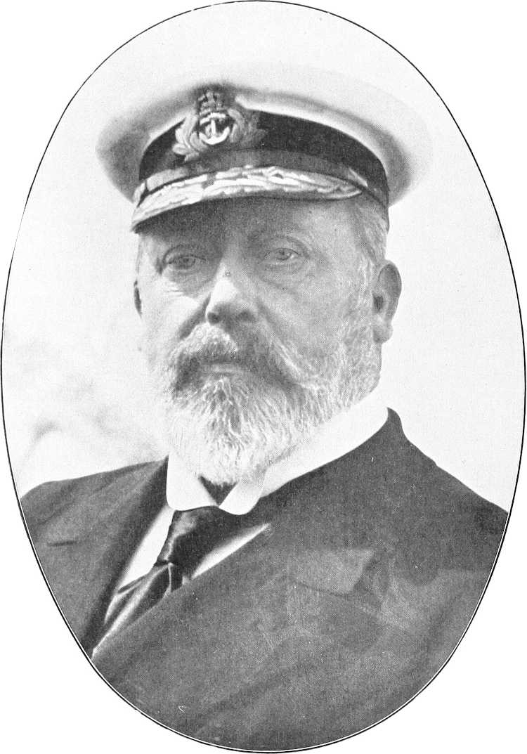
H.M. KING EDWARD VII.
| By kind permission of] | [Dittrich, Cairo. |
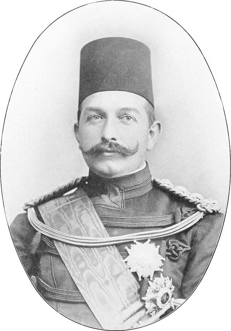
H.H. THE KHEDIVE ABBAS HILMI PASHA.
(To face p. 1.)
[All rights reserved.
A COMPENDIUM
PREPARED BY OFFICERS OF THE
SUDAN GOVERNMENT.
EDITED
BY
LIEUT.-COLONEL COUNT GLEICHEN, C.V.O., C.M.G.,
D.S.O.
(Late Director of Intelligence, Sudan
Government and Egyptian Army, and Sudan Agent, Cairo.)
IN TWO VOLUMES.
Volume I.
(GEOGRAPHICAL, DESCRIPTIVE, AND HISTORICAL.)
(With eighty-two illustrations.)
LONDON:
PRINTED FOR HIS MAJESTY’S STATIONERY OFFICE,
BY HARRISON AND SONS, ST. MARTIN’S
LANE,
PRINTERS IN ORDINARY TO HIS MAJESTY.
And to be purchased, either
directly or through any Bookseller, from
WYMAN AND SONS, Ltd., Fetter Lane E.C.;
or
OLIVER & BOYD, Edinburgh; or
E. PONSONBY, 116, Grafton Street,
Dublin.
1905.
Price Ten Shillings.
(Wt. 8207 1500 9 | 05—H & S 3874)
![[Decoration]](images/decor.png)
The following pages contain a comprehensive description of the Anglo-Egyptian Sudan in 1905. This includes revision and amplification of the “Handbook of the Sudan” (1898) and of the “Supplement to the Handbook of the Sudan” (1899), besides a great deal of additional information as to the resources, development, administration, commerce, etc., of the country, shewing its progress since 1899. It may, however, be well understood that the description of many parts of the country is still far from complete.
The chapters have been compiled by various officers in the Sudan Administration; but the main work of editing and revision has fallen on Lieut.-Colonel Count Gleichen (the Editor), who, from the somewhat indiscriminate mass of reports, documents and books at his disposal, has evolved a compendium which cannot fail to be of great use and value to the officers and officials of the Sudan Government. I even venture to hope that such of the general public as may be interested in this vast country, its history, and its future, will find in the following pages a useful work of reference until a more complete and comprehensive work is forthcoming.
[The loss to the Sudan Government of the services of Count Gleichen, who, since he undertook this work, has been transferred to the Military Attachéship at Berlin, is much to be regretted, and that he should have been able to continue the compilation in his new position speaks volumes for his industry and capacity.]
The Editor’s thanks are particularly due to Sir William Garstin, G.C.M.G., and Captain Lyons (Director of Egyptian Government Surveys) for a mass of valuable information about the White Nile, and to Captain H. H. S. Morant (Assistant Director of Intelligence), for assistance rendered in compiling and editing.
The work has been divided into three Parts (Geographical and Descriptive, Historical, and Routes); the last Part, for convenience of practical reference, being bound separately (by chapters) as the second volume.
[For practical purposes of travel, sport, etc., the books noted on p. 213 will be found indispensable.]
REGINALD WINGATE, Major-General,
Sirdar and Governor-General of the Sudan.
Khartoum, 9th January, 1905.
Editorial Note.—The indulgence of readers is requested in the matter of possible small errors in cross references, Index, etc., for, during the progress of the work through the press in London, the majority of the compilers and proof-correctors have been in the Sudan and the Editor in Germany.—G.
Berlin, 23rd March, 1905.
“THE ANGLO-EGYPTIAN SUDAN”
| I.D.W.O. No 1793 | Lithd. at the Intell. Div., War Office, Oct. 1903 |
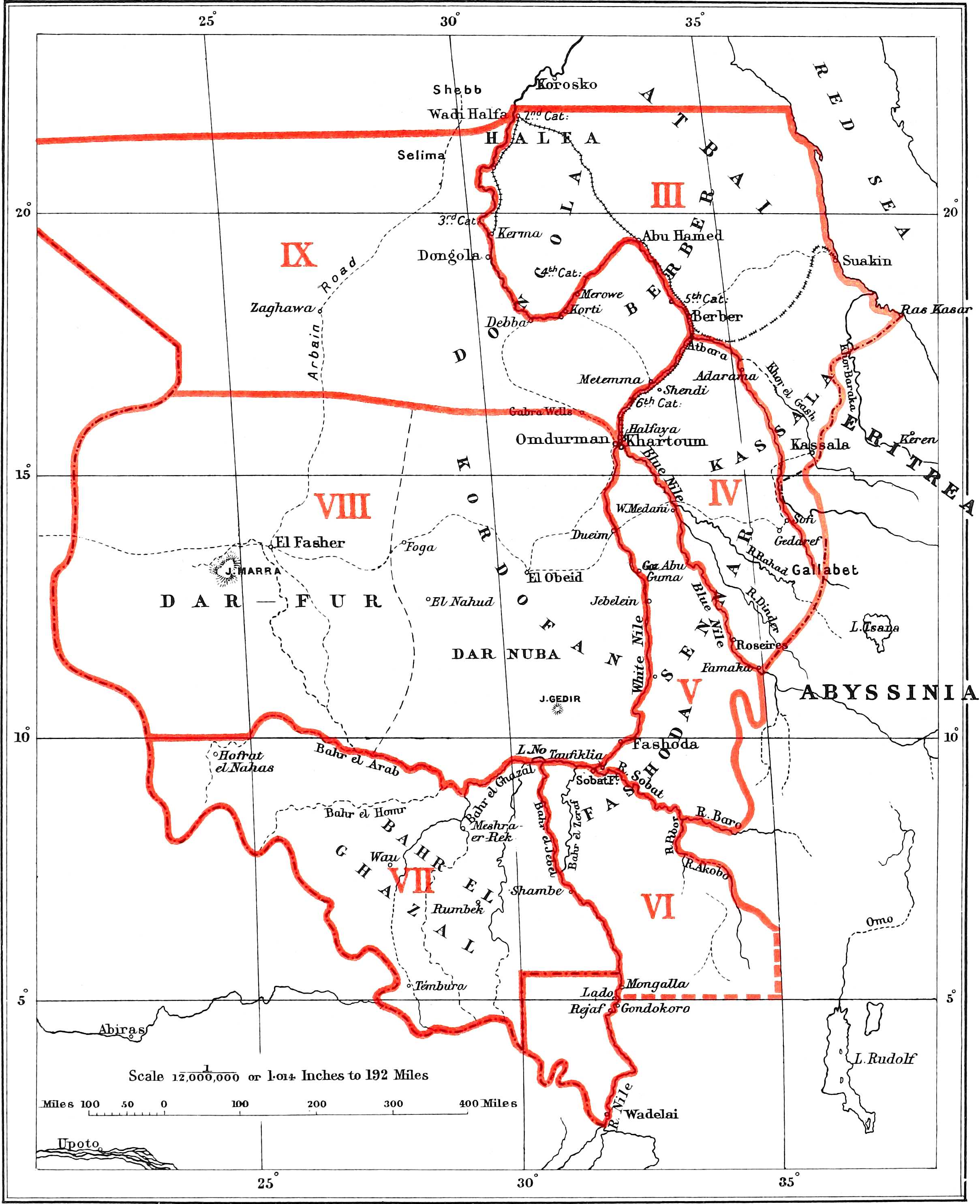
Diagram of
Chapters
in Vol. I, Part I, &
in Vol. II.
PART I.
(GEOGRAPHICAL AND DESCRIPTIVE.)
| CHAPTER I. | |
| GENERAL DESCRIPTION. | |
| (The Editor.) | |
| PAGE | |
| Boundaries; Population; Towns; Administration | 1 |
| Army | 3 |
| Revenue and Expenditure. (Bernard) | 4 |
| Communications | 7 |
| Resources and Commerce | 7 |
| Justice. (Bonham-Carter) | 9 |
| Religion | 10 |
| Education; Climate | 11 |
| Game; Slavery; Forests. (Broun) | 12 |
| CHAPTER II. | |||
| THE WHITE NILE. | |||
| (The Editor.) | |||
| (i) | Introductory — General — Flood — Historical | 15 | |
| (ii) | General Description (down stream); Albert Nyanza to Mediterranean | 16 | |
| (iii) | River Discharges | 17 | |
| (iv) | Navigability: Boats and Steamers; Landing Places | 19 | |
| (v) | Climate: Winds; Temperature | 21 | |
| (vi) | Detailed Description (up stream); | ||
| Section (1). — | Halfa to Merowe | 22 | |
| (2). — | Merowe to Khartoum | 35 | |
| Description of Khartoum and Omdurman | 47 | ||
| (3). — | Khartoum to Lake No | 52 | |
| (4). — | Lake No to Gondokoro. (Garstin and Lyons) | 73 | |
| [vi]CHAPTER III. | ||||
| NORTH-EASTERN SUDAN. | ||||
| (Morant.) | ||||
| (Country bounded on the north by the Sudan-Egyptian frontier, on the west by the Nile from that frontier to the mouth of the Atbara, on the south by the Atbara and Abyssinian and Eritrean frontiers, and on the east by the Red Sea.) | ||||
| Section | 1. — | Country between Halfa and the Atbara mouth, along the Nile banks. (Jackson, Hayes-Sadler, etc.) | 83 | |
| „ | 2. — | Country between Halfa, Berber, Suakin, and the intersection of the 22nd parallel with the Red Sea:— | ||
| (a) | Between the Railway and the Nile. (Talbot) | 85 | ||
| (b) | East of the Railway (or “the Atbai”). (Talbot, Bramly, Longfield) | 86 | ||
| (c) | The Bisharin. (Bramly) | 91 | ||
| (d) | The Ababda. (Hopkinson and Bramly) | 93 | ||
| „ | 3. — | Suakin and District (Playfair, Kerr, etc.) | 94 | |
| „ | 4. — | Country between the Berber-Suakin road, the Atbara, and the Abyssinian and Eritrean frontiers:— | ||
| (a) | Country between the Berber-Suakin road and latitude of Kassala. (Parker) | 96 | ||
| (b) | Kassala | 97 | ||
| (c) | The Khor Gash | 99 | ||
| (d) | Country south of Kassala to the Setit | 99 | ||
| (e) | „ „ the Setit | 99 | ||
| (f) | The Atbara and Tributaries | 100 | ||
| CHAPTER IV. | |||
| CENTRAL EASTERN SUDAN. | |||
| (Morant.) | |||
| (Country between the Nile and Abyssinia, bounded by the Atbara and the Blue Nile.) | |||
| Section | 1. — | Country between the Atbara and the Niles, from El Damer southwards to the Abu Haraz-Sofi line | 103 |
| „ | 2. — | Gedaref and District | 106 |
| „ | 3. — | Gallabat and District | 107 |
| „ | 4. — | Country between Blue Nile, Dinder, and Rahad, with description of these rivers | 109 |
| Table of distances on the Blue Nile | 115 | ||
| CHAPTER V. | ||||
| CENTRAL SUDAN. | ||||
| (Morant.) | ||||
| (Country between the White Nile and Abyssinia, bounded by the Blue Nile and Sobat.) | ||||
| Section | 1. — | The Gezira (Khartoum to the Sennar-Goz Abu Guma line) | 117 | |
| „ | 2. — | Country south of Sennar-Goz Abu Guma line:— | ||
| (a) | General Description | 119 | ||
| (b) | Dar Fung (including Burun and Keili). (Gwynn and Gorringe) | 122 | ||
| (c) | Fazogli. (Smyth) | 123 | ||
| (d) | The Dinkas on White Nile. (Wilson) | 126 | ||
| (e) | Selim Baggara | 130 | ||
| CHAPTER VI. | ||||
| SOUTH-EASTERN SUDAN. | ||||
| (Morant.) | ||||
| (The Sobat and tributaries, and country south of the Sobat and north of N. lat. 5° between the Abyssinian frontier and the Bahr El Jebel, including description of the Bahr El Zeraf, R. Atem, etc.) | ||||
| Section | 1. — | Sobat and tributaries | 131 | |
| „ | 2. — | The country south of the Sobat and north of N. lat. 5°, between Bahr El Jebel and Abyssinian frontier:— | ||
| (a) | General description | 141 | ||
| (b) | Bahr El Zeraf. (Wilson) | 142 | ||
| (c) | R. Awai or Atem. (Liddell) | 144 | ||
| (d) | Bor and south. (Türstig and Borton) | 144 | ||
| (e) | The Beri tribe. (Borton) | 147 | ||
| (f) | Country south of the Akobo. (Austin) | 148 | ||
| (g) | The Upper Pibor. (Comyn) | 151 | ||
| Table of distances on the Sobat | 152 | |||
| [vii]CHAPTER VII. | ||
| SOUTH-WESTERN SUDAN. | ||
| (Boulnois.) | ||
| (The Bahr El Ghazal.) | ||
| 1. | Introductory | 153 |
| 2. | General Description | 153 |
| 3. | Rivers and Water Supply | 154 |
| 4. | Administration | 154 |
| 5. | Resources. (Boulnois and Broun) | 154 |
| 6. | Climate and Hygiene. (Haymes) | 156 |
| 7. | Forestry. (Broun) | 157 |
| 8. | Communications and Transport | 159 |
| 9. | Tribes | 159 |
| 10. | Game | 161 |
| 11. | Religious Beliefs. (Cummins) | 162 |
| 12. | Dinka and Bongo Vocabulary. (Cummins and Türstig) | 163 |
| 13. | Itinerary of Bahr el Ghazal River:—Lake No to Meshra el Rek. (Garstin, Peake, Editor, etc.) | 165 |
| CHAPTER VIII. | |||
| WESTERN SUDAN. | |||
| (The Editor.) | |||
| (Kordofan, Darfur, and Shilluk Country.) | |||
| Section | 1. — | Kordofan. (Lloyd):— | |
| 1. General Description | 173 | ||
| 2. Inhabitants | 178 | ||
| 3. Towns | 181 | ||
| 4. Animals | 182 | ||
| 5. Climate and Health. (Stallard) | 183 | ||
| „ | 2. — | Darfur. (Morant) | 184 |
| „ | 3. — | The Shilluks and their Country. (Editor, etc.) | 192 |
| Appendix: History and Religion of Shilluks. (Banholzer, Giffen, etc.) | 197 | ||
| CHAPTER IX. | |||
| NORTH-WESTERN SUDAN. | |||
| (Morant.) | |||
| (Country west of the Nile, south of latitude 22° and north of Kordofan.) | |||
| Section | 1. — | Desert west of the Nile and north and west of Wadi El Gab). (Hodgson, Currie, etc.) | 201 |
| „ | 2. — | Wadi El Gab. (Turner, Colvile, Hunter, Garstin) | 204 |
| „ | 3. — | “Bayuda Desert.” (Fowler, etc.) | 207 |
| Report on El Ein. (Carey) | 210 | ||
| CHAPTER X. | |||
| COMMUNICATIONS | |||
| (The Editor.) | |||
| Section | 1. — | Railways. (Macauley) | 213 |
| „ | 2. — | River Communications. (Bond) | 215 |
| „ | 3. — | Roads | 217 |
| „ | 4. — | Riding and Transport Animals | 217 |
| „ | 5. — | Posts and Telegraphs. (Liddell) | 218 |
[viii]PART II.
(HISTORICAL.)
(The Editor.[1])
| CHAPTER I. | |
| From the earliest times to the Arab Invasion (A.D. 640) | 221 |
| CHAPTER II. | |
| From the Arab Invasion to the time of Mohammed Ali | 227 |
| CHAPTER III. | |
| From Mohammed Ali’s conquest (1819) to the end of 1882 | 231 |
| CHAPTER IV. | |
| Events on the Nile from 1882 to May, 1898 | 247 |
| CHAPTER V. | |
| The remainder of the Sudan from 1882 to May, 1898:— | |
| (a) Darfur, Kordofan and Dar Fertit | 255 |
| (b) The Eastern Sudan | 257 |
| (c) Bahr el Ghazal and Equatoria | 259 |
| CHAPTER VI. | |
| From May, 1898, to the final destruction of the Dervish power (end of 1899) | 265 |
| CHAPTER VII. | |
| From 1900 onwards | 273 |
| Governors-General of the Sudan | 280 |
[ix]APPENDICES TO VOL. I.
| A. — TEXTS OF TREATIES AND AGREEMENTS REGARDING THE ANGLO-EGYPTIAN SUDAN. | ||
| 1. | Sudan Agreement, 19.1.99 (Great Britain and Egypt) | 283 |
| 2. | Suakin Annex to above, 10.7.99 (Great Britain and Egypt) | 285 |
| 3. | Declaration re Spheres of Influence, 21.3.99 (Great Britain and France) | 285 |
| 4. | Agreement re Bahr El Ghazal, 12.5.94 (Great Britain and Congo Free State) | 286 |
| 4a. | Withdrawal of clause of above, 22.6.94 „ „ „ | 288 |
| 5. | Agreement re Tribes between Khor Baraka and Red Sea (Kitchener—Baratieri), 25.6.95/7.7 (Egypt and Eritrea) | 288 |
| 6. | Agreement re Frontier between Red Sea and Khor Baraka (Parsons—Martini), 7.12.98 (Egypt and Eritrea) | 289 |
| 7. | Delimitation of Frontier between Khor Baraka and Sabderat (Walter—Bongiovanni), 1.6.99 (Sudan and Eritrea) | 289 |
| 8. | Description of Frontier between Sabderat and Todluk (Talbot—Colli), 16.4.01 (Sudan and Eritrea) | 290 |
| 9. | Description of Frontier between Abu Gamal and Setit (Talbot—Martinelli), 18.2.03 (Sudan and Eritrea) | 290 |
| 10. | Declaration re Sudan—Eritrean—Abyssinian Frontier, Rome, 22.11.01 (Sudan and Eritrea) | 291 |
| 11. | Grazing Agreement (Collinson—Martini), 28.2.01 (Sudan and Eritrea) | 291 |
| 12. | Customs Convention, Rome, 26.11.01 (Sudan and Eritrea). (Martini—Gleichen) | 292 |
| 13. | Postal „ „ „ „ „ „ „ | 294 |
| 14. | Telegraph „ „ „ „ „ „ „ | 294 |
| 15. | Treaty re Frontier, etc., 15.5.02 (Great Britain and Abyssinia) | 295 |
| 16. | „ „ „ (Great Britain, Eritrea, and Abyssinia) | 296 |
| 17. | Duties on Uganda goods, 21.4.02 (Sudan and Uganda) | 297 |
| TREATIES INDIRECTLY AFFECTING THE SUDAN. | ||
| 18. | Agreement re Bahr El Ghazal, etc., 14.8.94 (France and Congo Free State) | 297 |
| 19. | „ Frontier, 10.7.00 (Eritrea and Abyssinia) | 298 |
| 20. | [2]Berlin Act, 26.2.85: Free Trade in Congo Basin, etc. | — |
| 21. | [2]Brussels Act, 2.7.90 (in force since 2.4.94): Slave Trade, Firearms, Ammunition, etc. Amongst others, Great Britain, France, Italy, Russia, Turkey and Abyssinia are Signatories | — |
| B. — | THE SUDD. (Garstin, Broun, the Editor, etc.) | 299 |
| C. — | ZOOLOGY OF THE SUDAN. (Butler) | 307 |
| D. — | ANTIQUITIES OF THE SUDAN. (Crowfoot and Editor) | 311 |
| E. — | ETHNOLOGY OF THE SUDAN. (Crowfoot) | 317 |
| F. — | LIST OF TRIBES AND SHEIKHS. (Slatin, Morant, etc.) | 322 |
| G. — | BOUNDARIES OF PROVINCES | 335 |
| H. — | BIBLIOGRAPHY AND CARTOGRAPHY. (The Editor) | 339 |
| INDEX | 351 | |
| General Map of Sudan (1:4,000,000) | at end. | |
PART
III.
(Bound as Vol. 2.)
(ROUTES.)
(Arranged in Chapters corresponding to Chapters III to IX (inclusive) of Part I., besides an Appendix, describing routes partly outside the Sudan. For detail, see “Contents” in Vol. 2.)
| PAGE | ||
| The Sovereigns of the Anglo-Egyptian Sudan (frontispiece) | to face | 1 |
| Khartoum Palace, from the river. (D. J.) | 1 | |
| Market scene, Gezira. (D. J.) | 8 | |
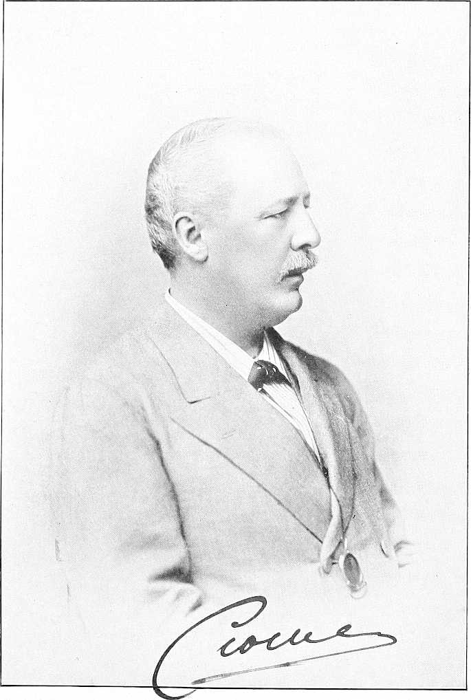
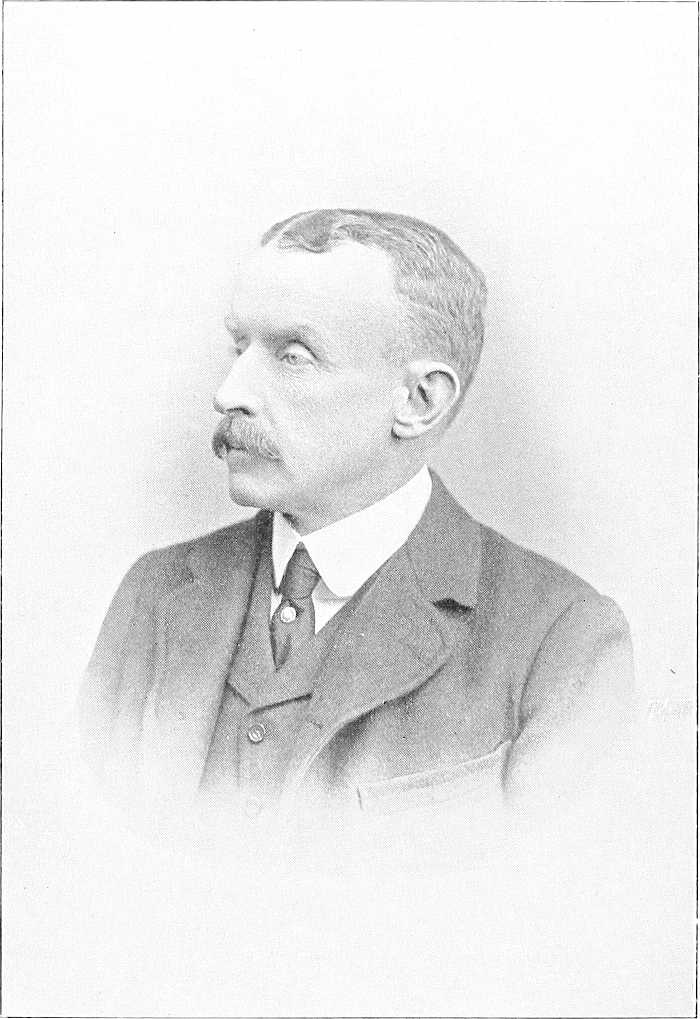
| The Earl of Cromer and Sir W. Garstin | to face | 15 |
| The Eastern Nile bank, south of Halfa. (K.) | 22 | |
| Jaalin Shepherd scene; corn-grinding stones, Omdurman. (T.) | 46 | |
| The Governor-General and Sirdar | 48 | |
| Khartoum, looking north from the War Office roof over Tuti Island. (K.) | 51 | |
| „ Palace, and garden, from the south-west. (K.) | 51 | |
| Jebelein (G.); Wooding station near Goz Abu Guma; Jebel Ahmed Agha. (G.) | 61 | |
| Akunere, Shilluk village (T.); Shilluk maiden with household utensils. (T.) | 65 | |
| Kodok: Roman Catholic Mission Station, Lul. (T.) | 69 | |
| Taufikia. (G.) | 71 | |
| Lake No; Shambe | 72 | |
| Kiro. (P.); Lado. (P.) | 78 | |
| Gondokoro | 81 | |
| Mongalla. (G.) | 82 | |
| On the Blue Nile. (T.) | 110 | |
| Forest scenery, west bank, Upper Blue Nile. (D. J.) | 112 | |
| On the Blue Nile. (D. J.) | 112 | |
| Scenes in the Southern Gezira. (D. J.) | 116 | |
| In the Dar el Fung; village scene, Burun country. (D. J.) | 121 | |
| Ingássana village; hill scenery, Dar el Fung (D. J.) | 124 | |
| Dinka: man and girl. (T.) | 127 | |
| American Protestant Mission, Sobat. (M.) | 133 | |
| The Bahr el Zeraf. (G.) | 141 | |
| Anuak women at Itang. (M.) | 150 | |
| Woman of Dar Fertit. (T.) | 164 | |
| Bahr el Ghazal. (G.); River Rohl. (G.) | 171 | |
| Kordofan Arabs with Chief. (S. D.) | 174 | |
| Taaisha (Baggara) girl. (T.) | 178 | |
| Nuba woman, daughter, and baby. (T.) | 180 | |
| Darfur girl. (T.) | 186 | |
| Old woman, Darfur. (T.) | 187 | |
| The Darfur Mahmal passing through Omdurman | 188 | |
| Shilluk. (T.) | 192 | |
| „ warriors. (T.) | 195 | |
| Mek Kur wad Nedok. (T.); Shilluks on a visit. (T.) | 198 | |
| Shilluk village scene. (T.) | 200 | |
| Dongolawi merchant. (T.) | 203 | |
| Bayuda Desert Arabs. (S. D.) | 207 | |
| Colossal ram of Amenhotep III., Jebel Barkal. (W.) | 223 | |
| Ethiopian King from Meroe. (W.) | 224 | |
| One of the animals at Nagaa. (W.) | 226 | |
| Stone lamb from Soba. (W.) | 228 | |
| Sudanese women. (T.) | 233 | |
| „ maiden. (T.) | 244 | |
| Sir R. von Slatin Pasha | 245 | |
| General Gordon | to face | 247 |
| F.-M. Viscount Wolseley | 249 | |
| Types of Sudanese soldiers.—The raw material. (T.) | 250 | |
| „ „ „ —The finished article. (T.) | 251 | |
| Khalifa’s house, Omdurman. (S. D.) | 252 | |
| Captured Dervish Emirs. (J. K. W.) | 254 | |
| Old woman of Dar Nuba. (T.) | 264 | |
| General Viscount Kitchener | to face | 265 |
| The Mahdi’s tomb, 3rd September, 1898. (S. D.) | 266 | |
| The late Emir Ahmed Fedil. (J. K. W.) | 267 | |
| After Um Debreikat; body of the Khalifa in foreground. (J. K. W.). | 269 | |
| The end of the Mahdist dominion. (J. K. W.) | 272 | |
| Sons of the Mahdi and Khalifa | 275 | |
| Lord Kitchener at the Gordon College, Khartoum. (K.) | 281 | |
| Sudd-scape | 299 | |
| Ambach | 302 | |
| Papyrus. (G.) | 305 | |
| Balaeniceps Rex at Khartoum. (W.) | 309 | |
| Nagaa: Egypto-Roman buildings in the desert. (L.) | 314 |
The above are from photographs by the following gentlemen, to all of whom, especially to the three first named, the warm thanks of the Editor are due for the kind permission granted to him to use the photographs, and in many cases the blocks themselves. Those not initialled above are acknowledged on the illustrations themselves.
| T. | Mr. B. Türstig, Omdurman. |
| G. | Sir Wm. Garstin. |
| D. J. | Mr. Digby Jones. |
| K. | Mr. Hallil Kemeid, Editor “Standard Guide to Egypt and Sudan.” |
| L. | Captain Longfield, Egyptian Army. |
| M. | Captain H. H. S. Morant, Egyptian Army. |
| P. | Major Phipps, Egyptian Army. |
| S. D. | Lt.-Col. Stanton, Egyptian Anny, per Mr. Dennis, Scarborough. |
| W. | Mr. John Ward, F.S.A., Belfast. |
| J. K. W. | Lt.-Col. Watson, Egyptian Army. |
Those entirely unacknowledged are by the Editor and his sister.
| H. S. C. | History of Sudan Campaign. (Colvile.) |
| O. G. H. | The Nile above the 2nd Cataract. (O’Grady Haly.) |
| N. O. | Report on the Nile and Country between Dongola, Suakin, Kassala and Omdurman (Gleichen). |
| H. S. | Handbook of the Sudan (Gleichen). |
| S. H. S. | Supplement to Handbook of the Sudan. (Gleichen.) |
| A. | Arabic. |
| D. | Dinka. |
| S. | Shilluk. |
N.B.—According to the latest system of transliteration, many words formerly spelt with a “k” (Kâf ق are now spelt with a “g,” e.g., Wadi el Gab, Yagub, etc. The word for hill is always spelt Jebel, whether pronounced hard or soft.
E.A. = Egyptian Army; S.G. = Sudan Government.
[1]Except part of Chapter II and most of Chapter III (taken from “Report on Egyptian Provinces of Sudan,” I.D.W.O., 1884).
[2]Not printed here, but text may be found in Hertslet’s “Map of Africa by Treaty,” 1896 Edition, pp. 20 to 47, and pp. 48 to 106 respectively.
[3]Including those whose works or reports have been utilised.
[1]
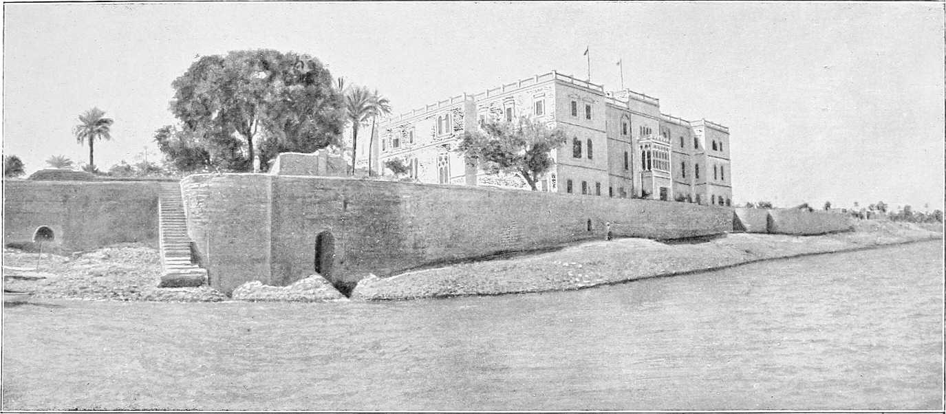
THE PALACE, KHARTOUM (LOW NILE).
Part I.
GENERAL DESCRIPTION.
Boundaries.The Anglo-Egyptian Sudan comprises that country which is bounded on the north by the 22nd parallel of north latitude; on the east by the Red Sea, Eritrea, and Abyssinia; on the west and south-west by a line running through the Libyan Desert (defined by the Anglo-French Agreement of March, 1899), by the Sultanate of Wadai, and by the line of rising ground forming the watershed between the Congo and Shari on one side, and the Nile on the other; and on the south by the Lado Enclave[4] and east of the Nile, the 5th parallel of north latitude.
The greatest length from north to south is about 1,250 miles, and from east to west about 1,080 miles. (Vide Appendix A for text of Frontier treaties.)
Area and population.The estimated area of the territory is about 1,006,000 square miles, and the population about 2,000,000. For distribution of population vide Appendix F., p. 322.
Capital and main towns.The capital and seat of Government of the country is Khartoum, situated at the junction of the White and Blue Niles (lat. 15° 36′, long. 32° 32′), and distant, as the crow flies, about 1,250 miles from the Mediterranean Sea. (For description see Chap. II, p. 49.)
The other chief towns of the country are Khartoum North (formerly termed Halfaya) and Omdurman (close to Khartoum), Halfa, Merowe, Berber, Wad Medani, Kassala, Suakin, Dueim, and El Obeid. (Detailed descriptions will be found in the various chapters dealing with them.)
The Sudan is administered by a Governor-General (who is at present also Sirdar of the Egyptian Army) and under him by Mudirs (governors of provinces), assisted by inspectors and deputy inspectors[5] (British: military and civilian), and by Mamurs (Egyptian or Native officers).
[2]The text of the agreement of 1899, on which the administration is based, provides for the administration of the territory south of the 22nd parallel of latitude by a Governor-General, appointed by Egypt with the assent of Great Britain, and declares the general principles in accordance with which the administration shall be carried on. The British and Egyptian flags shall be used together; laws shall be made by proclamation; no duties shall be levied on imports from Egypt, and duties on imports from other countries shall not exceed those levied in Egypt; the import and export of slaves is prohibited, and special attention shall be paid to the Brussels Act of 1890 respecting the import and export of arms, ammunition, and spirits.
The “Capitulations” are not in force in the Sudan, nor are there any foreign Consuls.
The Sudan is divided into eight first class and four second class Provinces, as follows:—
| Province. | Chief Town. |
|---|---|
| First Class. | |
| Bahr El Ghazal | Wau |
| Berber | El Damer |
| Dongola | Merowe |
| Kassala | Kassala |
| Khartoum | Khartoum |
| Kordofan | El Obeid |
| Sennar | Senga |
| Upper Nile | Kodok |
| Second Class. | |
| Halfa | Halfa |
| Suakin | Suakin |
| Gezira (Blue Nile) | Wad Medaui |
| White Nile | Dueim |
Each Province is divided into a varying number of Districts, each of which is under an Egyptian or native Mamur, as follows:—
| Province. | District | |
|---|---|---|
| First Class. | ||
| Bahr El Ghazal | ⎧ ⎨ ⎩ |
Deim Zubeir |
| Wau | ||
| Rumbek | ||
| Berber | ⎧ ⎪ ⎨ ⎪ ⎩ |
Robatab |
| Berber Town | ||
| „ District | ||
| El Damer | ||
| Shendi | ||
| Dongola | ⎧ ⎪ ⎪ ⎨ ⎪ ⎪ ⎩ |
Argo |
| Dongola | ||
| Khandak | ||
| Debba | ||
| Korti | ||
| Merowe | ||
| Kassala | ⎧ ⎨ ⎩ |
Kassala |
| Gedaref | ||
| Gallabat | ||
| Khartoum | ⎧ ⎨ ⎩ |
Khartoum |
| Omdurman | ||
| Wad Ramla | ||
| Kordofan | ⎧ ⎪ ⎪ ⎪ ⎨ ⎪ ⎪ ⎪ ⎩ |
El Obeid |
| Bara | ||
| Khursi (Um Dam) | ||
| Taiara | ||
| Nahud | ||
| Dilling | ||
| Tendik | ||
| Nuba Mountains (Talodi) | ||
| Sennar | ⎧ ⎪ ⎪ ⎨ ⎪ ⎪ ⎩ |
Sennar |
| Senga | ||
| Abu Naama | ||
| Dinder (Abu Hashim) | ||
| Roseires | ||
| Dar Fung (Soda) | ||
| Upper Nile | ⎧ ⎪ ⎨ ⎪ ⎩ |
Renk |
| Kodok | ||
| Taufikia | ||
| Sobat | ||
| Mongalla | ||
| Second Class. | ||
| Gezira (Blue Nile) | ⎧ ⎪ ⎪ ⎨ ⎪ ⎪ ⎩ |
Abu Deleig |
| Kamlin | ||
| Rufaa | ||
| Mesellemia | ||
| Wad Medani | ||
| Managil | ||
| Halfa | ⎧ ⎨ ⎩ |
Halfa |
| Mahas (Dalgo) | ||
| Sukkot (Kosha) | ||
| Suakin | ⎰ ⎱ |
Suakin |
| Tokar | ||
| White Nile | ⎧ ⎪ ⎨ ⎪ ⎩ |
Geteina |
| Dueim | ||
| Kawa | ||
| Gedid | ||
[3]The chief Government officials, besides the Governor-General, are the Secretary-General, the Director of Intelligence and Agent-General (Cairo), the Inspector-General, the Legal Secretary, Financial Secretary, Director of Surveys, Director of Works, Director of Education, Director-General of Irrigation,[6] Principal Medical Officer, Director of Woods and Forests, Director of Agriculture and Lands, Director of Railways, Director of Steamers and Boats, Director of Telegraphs and Posts, Director of Customs, Principal Veterinary Officer, Director of Slavery Repression Department[6], and Superintendent of Game Preservation Department.
The duties of these officials sufficiently explain themselves by their titles.
The following are the names, at present (1904), of the chief officials:—
| Governor-General | Major-General Sir F. Reginald Wingate, K.C.B., K.C.M.G., D.S.O. |
| Secretary-General | Colonel F. J. Nason, D.S.O. |
| Inspector-General | El Lewa Sir Rudolf von Slatin Pasha, K.C.M.G, C.V.O., C.B. |
| Legal Secretary | E. Bonham-Carter, Esq. |
| Agent-General, Cairo | Lieut.-Colonel Lord E. Cecil, D.S.O. |
| Financial Secretary | „ „ E. E. Bernard. |
All the above (with the exception of the Legal Secretary, the Directors of Education, Woods and Forests, Superintendent of Game Preservation, and Director of Agriculture and Lands, who are civilians) are at present British[7] officers attached to the Egyptian Army.
In addition to one British battalion, at present furnished by the British Army of Occupation in Egypt and The Army quartered at Khartoum, nearly the whole of the Egyptian Army may be said to be in the Sudan. The normal garrisons of the Sudan are as follows:—
| Province. | Battalions. | Squadrons. | Artillery. | Miscellaneous Additional Troops.[8] | |||||
|---|---|---|---|---|---|---|---|---|---|
| British. | Egyptian. | Sudanese. | Egyptian. | Sudanese. | Horse Battery. | Field Battery. | Garrison Company. | ||
| Bahr El Ghazal | — | — | 1 | — | — | — | — | — | 276 men, Gehadia. |
| Berber | — | ½ | — | 3 | 1 | — | 1 | — | — |
| Dongola | — | 1 | — | — | — | — | — | — | — |
| Halfa | — | — | — | — | — | — | — | — | 1 Railway Battalion. |
| Kassala | — | — | 1 | — | — | — | — | — | 1 Battalion Arab Camel Corps. |
| Khartoum | 1 | 4 | 1 | — | — | 1 (Max.) | 2 | 2 | Hd.-Qrs. A.G.’s Dept. and Works Dept. |
| Kordofan | — | — | 1 | — | — | — | — | — | 4 Companies Camel Corps (3 Arab, 1 Sudanese). |
| Sennar | — | — | 1 | — | — | — | — | — | — |
| Suakin | — | ½ | — | — | — | — | — | — | — |
| Upper Nile | — | — | 1 | — | — | — | — | — | — |
| Totals | 1 | 6 | 6 | 3 | 1 | 1 | 3 | 2 | |
As a rule, the Governor of the Province, being the senior British officer, is in Military command of the troops in his Province.
The following gives a table of revenue and expenditure since 1899:—
| Year. | Revenue. | Expenditure. | Deficit. |
|---|---|---|---|
| £E. | £E. | £E. | |
| 1899 | 126,596 | 511,693 | 385,097 |
| 1900 | 156,888 | 614,780 | 457,892 |
| 1901 | 242,309 | 629,969 | 387,660 |
| 1902 | 270,226 | 639,493 | 369,267 |
| 1903 | 462,605 | 810,019 | 347,414 |
| 1904 | 531,000 | 815,500 | 284,500 |
| 1905[9] | 535,883 | 915,646 | 379,763 |
| 1 £E. = 100 piastres = £1 0s. 6d. | |||
The deficit is made up by the Egyptian Government, which now contributes annually to the cost of Civil and Military Administration in the Sudan the nominal sum of about £E.380,000. The actual sum contributed is, however, not really so large as this, for about £E.60,000 is paid in Customs dues in Egypt on goods going to the Sudan, which sum is absorbed by the Egyptian Government; and the Sudan Government pays the Egyptian Government an annual amount of between £E.122,000 and £E.282,000 (£E.186,757 in 1905) for the maintenance of that portion of the army which is in the Sudan.
Some changes were introduced into the system of accounts in 1903 which caused a considerable increase in the figures on both sides of the Budget of that year as compared with those for previous years, but this increase was apparent only and did not affect the amount of the contribution by the Egyptian Government towards the Civil and Military expenditure of the Sudan Government.
Besides the above budgetary expenditure, additional credits to the extent of £E.1,060,114 have been authorised since 1899, principally for completing and improving the railway between Halfa and Khartoum, for telegraph extensions, public works and for other purposes. Moreover, the entire cost of the railway now in course of construction between Suakin on the Red Sea and the Nile at a point near the Atbara River in the Berber Province, and expenditure connected with the new harbour works at Sheikh Barghout to the North of Suakin, will be borne by the Egyptian Government.
The revenue is derived at present from the following taxes, etc., which are imposed according to the circumstances of the Province:—
| Land Tax. | Royalties. |
| Date Tax. | Customs. |
| Animal Tax. | Sales (of Government properties, etc.). |
| Road Tax. | Woods and Forests. |
| House Tax. | Miscellaneous, including rents, ferries, licences, stamped paper, market and court fees, slaughtering dues, etc., etc. |
| Boat Tax. | |
| Tribute from Tribes. |
Land Tax.—A proportion of this tax is derived in certain Provinces from the “Ushur,” or tenth part, tax. This is assessed on the value of the products of the land, and is paid sometimes in kind, but generally in cash.
The land tax is assessed on the extent and value of the irrigated land, and varies from 10 piastres to 60 piastres a feddan (acre). Rain lands pay less than irrigated lands, whilst those only recently coming under cultivation pay less than those already long cultivated, etc., etc.
The Date Tax is levied on date palms, at the rate of 2 piastres per tree, whether male or female.
Animal Tax is levied on camels, mules, sheep, horses, etc., etc., at the following rates:—
| Piastres. | Piastres. | ||
|---|---|---|---|
| Camel | 20 | Sheep | 1 |
| Horse | 3 | Head of Cattle | 5 |
| Mule or donkey | 3 | Goat | ½ |
[5]The Road Tax is a light tax levied in certain places with the object of keeping the roads open and safe, and the wells dug and in good order.
The Boat Tax amounts to 2 piastres per ardeb capacity.
The House Tax amounts to one-twelfth of the annual rental value of the building.
The Tribute from Tribes is levied on those nomad tribes who own no lands or are not agriculturists. It is assessed by the Governor broadly on the value of their possessions in herds and other property.
Gum, ivory, ostrich feathers and india-rubber[10] are the articles at present which pay a Royalty of 20 per cent. ad valorem to Government. The Royalty on ivory has been recently reduced to 15 per cent. as a temporary and tentative measure.
Sales and Miscellaneous explain themselves.
Budget.The following are the special services and estimated receipts and expenditure for 1904-5:—
SPECIAL SERVICES.
| 1905. | 1904. | |||
|---|---|---|---|---|
| I.—Loans not yet wholly expended. | ||||
| £E. | £E. | £E. | £E. | |
| Loan for the development of the Sudan Railway | 55,000 | |||
| Loan for the purchase of iron bases for Telegraph poles | 18,500 | |||
| Loan for improving the Sudan Railway and purchasing Rolling Stock | 528,000 | 528,000 | ||
| Advance for special survey, Suakin-Berber projected Railway | 10,000 | 10,000 | ||
| Advance for the construction of the Suakin Port | 30,985 | 30,985 | ||
| Advance for the construction of Light-houses at Suakin | 15,800 | 15,800 | ||
| Advance for the excavation of a cutting and for improving and digging wells on the Suakin-Atbara line | 16,000 | 16,000 | ||
| 600,785 | 674,285 | |||
| II.—Credits not yet wholly expended. | ||||
| Credit from Wakfs Administration for building mosques | 5,000 | 10,000 | ||
| Credits from the Egyptian Government:— | ||||
| 1. Relief of poor Refugees | 4,000 | 4,000 | ||
| 2. Extension of Telegraph line to the Bahr-el Ghazal Province | 12,150 | |||
| 3. Partial cost of a steamer for development of trade on the Upper Nile (total cost being £E.4,000) | 2,850 | |||
| Credits sanctioned against the surpluses of the years 1902 and 1903 | 68,200 | |||
| 92,200 | 14,000 | |||
| III.—Services outside the Budget. | ||||
| Gordon Memorial College | 3,590 | 3,590 | ||
| 3,590 | 3,590 | |||
| Grand Total | 696,575 | 691,875 | ||
[6]TABLE SHOWING THE SUDAN GOVERNMENT BUDGET FOR THE YEARS 1904-5.
| RECEIPTS | EXPENDITURE | ||||||||
|---|---|---|---|---|---|---|---|---|---|
| 1905. | 1904. | 1905. | 1904. | ||||||
| £E. | £E. | £E. | £E. | £E. | £E. | £E. | £E. | ||
| Khartoum | 10,657 | 9,660 | Khartoum | 16,952 | 14,862 | ||||
| Gezira (Blue Nile) | 18,049 | 25,000 | Gezira (Blue Nile) | 16,796 | 18,220 | ||||
| Sennar | 22,489 | 22,126 | Sennar | 28,383 | 21,647 | ||||
| White Nile | 27,833 | White Nile | 13,495 | ||||||
| Kordofan | 43,122 | 55,390 | Kordofan | 25,352 | 24,557 | ||||
| Upper Nile | 7,700 | 8,300 | Upper Nile | 18,853 | 12,617 | ||||
| Bahr-el-Ghazal | 5,990 | 5,500 | Bahr-el-Ghazal | 25,503 | 19,117 | ||||
| Kassala | 10,425 | 8,310 | Kassala | 16,937 | 14,615 | ||||
| Berber | 18,820 | 18,000 | Berber | 20,180 | 17,909 | ||||
| Dongola | 32,900 | 30,900 | Dongola | 19,350 | 18,045 | ||||
| Halfa | 12,730 | 11,300 | Halfa | 9,210 | 6,279 | ||||
| Suakin | 10,845 | 16,000 | Suakin | 16,092 | 14,364 | ||||
| 221,560 | 210,486 | 227,103 | 182,232 | ||||||
| Central Administration | 47,187 | ||||||||
| Governor General’s Office | 5,808 | ||||||||
| Secretary General’s Department (Stores Section) | 800 | Inspector General’s Office | 2,723 | ||||||
| Secretary General’s Department | 33,358 | ||||||||
| Finance Department | 17,681 | ||||||||
| Legal Department | 4,000 | 3,000 | Legal Department | 18,630 | 15,760 | ||||
| Controller of Stores’ Department | 1,000 | Controller of Stores’ Department | 16,680 | ||||||
| Education Department | 250 | Education Department | 12,806 | 8,552 | |||||
| Forestry Department | 15,602 | 14,289 | |||||||
| Agriculture and Lands Department | 1,550 | Agriculture and Lands Department | 4,639 | ||||||
| Game Preservation Department | 1,200 | Game Preservation Department | 1,051 | 840 | |||||
| Prisons Department | 12,568 | ||||||||
| Customs | 12,000 | Customs | 6,237 | ||||||
| Hospitals | 795 | 600 | Hospitals | 13,584 | 10,523 | ||||
| Cattle Plague | 1,670 | 1,622 | |||||||
| Survey Department | 7,909 | 5,045 | |||||||
| Khartoum Town | 8,055 | 6,000 | Khartoum Town | 16,002 | 10,385 | ||||
| General Central Receipts | 8,700 | 9,090 | General Central Expenditure | 38,259 | 29,407 | ||||
| Public Works | 47,314 | 47,245 | |||||||
| Steamers and Boats | 97,031 | 75,554 | Steamers and Boats | 92,975 | 90,864 | ||||
| Posts and Telegraphs | 25,771 | 22,155 | Posts and Telegraphs | 32,260 | 31,508 | ||||
| Railways | 154,171 | 141,237 | Railways | 133,278 | 140,478 | ||||
| 314,323 | 258,636 | 501,786 | 482,953 | ||||||
| 535,883 | 469,122 | 728,889 | 665,185 | ||||||
| Contribution by Egyptian Government | 379,763 | 379,763 | Egyptian War Department for maintenance of Army in the Sudan | 186,757 | 183,700 | ||||
| Total | 915,646 | 848,885 | Total | 915,646 | 848,885 | ||||
(See Chapter X for details.)
Communication in the Sudan is maintained by:—(I) Railways; (II) River; (III) Roads.
(I) The Railway.—The Sudan Government Railway, a single line completed on the last day of 1899, runs from Halfa, crossing the Nubian desert, to Abu Hamed along the Nile bank to Khartoum North on the right bank of the Blue Nile opposite Khartoum (575 miles).
Another branch, also single, 203 miles, runs from Halfa to Kerma (35 miles north of Dongola) following the Nile. This is to be abandoned after the 31st December, 1904.
A line of railway joining Suakin on the Red Sea to the Nile near the mouth of the Atbara is now under construction; it will be of the greatest benefit to the trade and development of the Sudan. Other railway projects at present under consideration are:—Abu Hamed to Merowe, Thamiam (near Suakin) to Kassala, and Omdurman to El Obeid.
The distance between Halfa and Aswan forms the only break in the railway communication between Khartoum and the Mediterranean Sea; a service of Sudan steamers plies on this reach.
(II) River.—North of Khartoum the river is navigable throughout except at the five cataracts; at certain times of the year most of these are navigable, with difficulty. South of Khartoum communication is maintained along the White and Blue Niles and their affluents. During low Nile—January to June—the Blue Nile is not navigable. The White Nile is navigable up to Gondokoro in Uganda, though there are some difficulties in the way of navigation (vide p. 73). The Sobat and Baro are not navigable from January to beginning of May.
(III) Roads.—Roads are, and must be for some time to come, the principal means of communication in the Sudan. Transport is chiefly performed by camels, mules and donkeys. The greater part of the Sudan, being level, lends itself without much difficulty to the making of roads suitable for carriages, though draught transport has not been in use hitherto to any extent. Bullock wagons are in use in the Bahr El Ghazal.
Some automobile carriages are now being tried in the different parts of the Sudan, and have so far given fairly good results.
The chief natural resources of the Sudan at present lie in the forests of Kordofan and the Blue Nile, which produce gum (Hashab and Talh), ebony, furniture woods and fibre; and in those of the Bahr El Ghazal, which produce india-rubber, gutta-percha, etc.; also in the products of animals, such as ivory, ostrich feathers, rhinoceros horns, skins, etc.
There are large quantities of fine cattle in the country, especially on the Upper White Nile, but export of these is for the present forbidden.
As regards agricultural products, only the country lying close to the Nile and its tributaries is, as a rule, cultivated, and the people do not, so far, grow more than is necessary for their own use. The principal crops are dura (a kind of millet), beans, lentils, dukhn, sesame, onions, melons, and a little wheat and barley. In the Gezira, however, between the White and Blue Niles, and in the Gedaref district, large tracts are cultivated.
The Dongola Province is rich in date palms, and exports large quantities of dates.
There is a large opening for the growth and export of cotton. Little is grown at present, but the soil is favourable and the quality is good. Inducements, therefore, in the way of seed and promises to purchase what is grown, are being offered to the natives to cultivate this invaluable plant, and it is expected that the opening of the Nile-Red Sea Railway will considerably increase its production.
Sugar could also be grown: there was formerly a sugar factory at Kamlin.
Land and settlement.The fertility of the land in the Sudan varies enormously, from the sterile desert wastes of Northern Kordofan and the Eastern Sudan to the rich soil bordering the river banks. There are also large tracts of fertile soil round Gedaref, Kassala and Tokar, where rich crops are grown with little effort.
Inducements are, according to circumstances, held out by the Government to would-be settlers in the shape of free or easy grants of lands, remission of taxes for a time, low rates of transport, etc., and purchasers and cultivators are slowly trickling in. The settlement, especially in view of the dearth of native population and labour, must necessarily be a slow one. As larger tracts are brought into cultivation, as canals are dug, and as irrigation and communications are improved, so will the export of cereals and produce of all sorts increase. The Nile-Red Sea Railway is expected to give Sudan trade a great impetus, and the population is rapidly increasing. But although those best qualified to judge are convinced of a great economic future before the country, it can hardly be expected that the Sudan will pay its own way for some years to come.
[8]
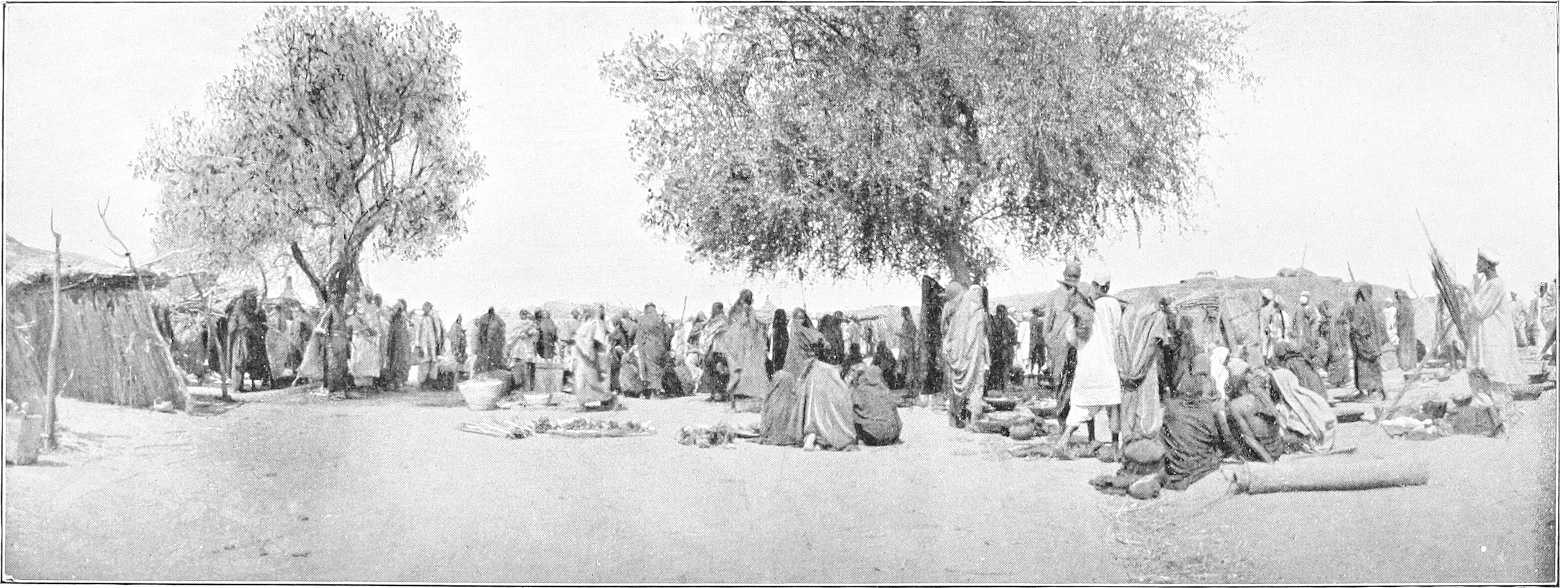
MARKET SCENE—GEZIRA.
[9]Produce and Industries.The following is a list of the chief articles of produce of the Sudan, with the districts where such are mostly found:—
| Cotton | Throughout the Sudan in small quantities, but increasing in Dongola, Berber, and Gezira Provinces. |
| Hides | Kordofan and Eastern Desert. |
| Gum | Kordofan, Blue Nile, and Gedaref District. |
| Ivory | Bahr El Ghazal, Kordofan, and Upper Nile Provinces. |
| India-rubber | Bahr El Ghazal and Kordofan. |
| Feathers | Kordofan. |
| Woods | Chiefly up the White and Blue Niles and in the Bahr El Ghazal. |
| Grain and Cereals | Chiefly Dongola, Tokar, Gedaref, the Gezira, Sennar, and Upper Nile Provinces. |
| Sugar | Small quantities in Berber. Increasing. |
| Dates | Dongola. Best quality at Sukkot. |
| Gold | Indications in Northern Sudan and Upper Blue Nile. |
| Copper | Hofrat Nahas—Bahr El Ghazal. |
| Iron | Bahr El Ghazal and Kordofan. |
| Other Minerals | Kordofan, Upper Blue Nile and Abyssinian border, Eastern and Northern Sudan. |
| Mother of Pearl | Suakin. |
The native industries are, so far, limited in number. Cultivation is the usual occupation of the people. Cotton-cloth weaving, boat-building on the Niles, camel breeding in the northern and western deserts, and iron-smelting in the Bahr El Ghazal practically exhaust the list. Agricultural and industrial shows at the chief towns have, however, been started, and receive considerable support. Minor industries, such as pottery, leather work, improved carpentry, etc., are quickly coming to the fore.
For the purpose of Customs duties, the Sudan is, in the main, considered as forming a part of Egypt. The Government has, however, concluded a Customs Convention with Eritrea,[11] and applies practically the same principles to the co-terminous countries of Uganda, the Congo Free State, the French Congo and Abyssinia.
Broadly, goods exported to these countries from the Sudan pay 1 per cent. ad valorem, and imports from those countries 5 to 8 per cent.; whilst goods in transit thence receive a drawback equal in amount to the duty paid on entering the country, i.e., they can pass free of duty through the Sudan.[11]
The main lines of judicial organisation in the Sudan date from 1899, at which time the whole country was under Egyptian Martial Law.
Under the code of Criminal Procedure of that year the criminal courts are directly under the Governor-General, who, however, has the benefit of the advice of a Legal Secretary. Under “The Civil Justice Ordinance, 1900,” the civil courts are subordinated to the Legal Secretary, in his capacity as Acting Judicial Commissioner.
Criminal justice in each province is administered by the Mudir’s Court (composed of the Mudir or Governor, or his representative, and two other magistrates), which has general competence; minor District Courts of three officers, with limited competence; and magistrates with powers similar to, but more limited than, those of Indian Magistrates. These magistrates are the members of the Provincial Administrative Staff, who are either picked officers of the army or civilian inspectors, who, unless they have had a legal training, are required to pass an examination in the Codes.
The procedure at the inquiry, and as to arrest, etc., is borrowed from the Indian Code of Criminal Procedure; that at the hearing is that of an Egyptian (or substantially, of a British) court-martial, with which the military officers are familiar.
Sentences passed by the Mudir’s Court are submitted to the Governor-General for confirmation. Those of the subordinate courts are either submitted to the Mudir for confirmation, or are open to appeal before him.
The Governor-General has, in all cases, revising powers similar to those of an Indian High Court.
The substantive criminal law is contained in the Sudan Penal Code, which is a copy of the Indian Penal Code, with such modifications as the circumstances of the country appeared to demand.
[10]The civil courts in each province are those of the Mudir and of the subordinate magistrates. The procedure is borrowed in part from that in Indian provinces which do not possess a High Court, and in part from the Ottoman and African Orders in Council.
The parties appear before the judge, who settles the issues to be tried before trying the case. Every court has power to sit with assessors, who, in commercial cases, are frequently of considerable assistance. Appeals lie to the Mudir, or from the court of the Mudir to that of the Judicial Commissioner.
This system has been somewhat modified by the appointment of four civil judges who are trained lawyers. Wherever there is a civil judge, he has all the powers, civil and criminal, of the Mudir, and ordinarily takes all the civil and the more responsible criminal work of that officer. A civil judge has now sat continuously for the last three years at Khartoum, where all the principal merchants reside. A system of circuits will probably be shortly instituted in the outlying provinces; in the meantime provision is made for civil disputes of special importance or complexity in those provinces by a section which authorises their transfer, by consent of the parties, to the court of the Judicial Commissioner. It is very possible that the latter court may shortly be replaced by a bench of civil judges.
It was not thought advisable to create a body of substantive civil law at a time when all that was known of the customs of the people was that they probably differed from those of any country whose legislation could have been taken as a precedent. Section 3 of the Civil Justice Ordinance provides for the recognition of customary law, so far as applicable and not repugnant to good conscience, in matters of succession, etc.; and Section 4 provides for the administration of “justice, equity, and good conscience,” a phrase which has stereotyped custom in large parts of the east, and filled up the interstices with the principles of English Law.
In commercial matters in the Sudan the judges have inclined to interpret it as implying the obligation to recognise the principles of Egyptian Commercial Law in cases in which the law of civilised countries is not in agreement.
The above-mentioned Codes are applied wherever they may be put in force by the Governor-General, and they have been gradually extended to all parts of the Sudan, except the Bahr El Ghazal. In the more backward provinces in the south, where officers are scattered, advantage has to be taken of a provision that they shall be applied with such modifications, not affecting the substance, as the circumstances may require.[12]
Mehkema Sharia.There are special courts, Mehkema Sharia, for the trial in accordance with Mohammedan Law, of cases between Mohammedans, involving questions of personal status, such as succession, wills, gifts, marriage, divorce, family relations, and also the constitution of charitable endowments (wakf).
The judges of these courts are Mohammedan Sheikhs, either natives of the Sudan or Egyptians; of whom the latter have obtained their training in the Azhar Mosque at Cairo.
The Mehkema Sharia comprise District Courts, which have jurisdiction over one or more Districts, according to the extent and population of the Districts, Province Courts, which act as courts of appeal from the District Courts and have also an original jurisdiction over the district in which they are situated, and a Supreme Court of Appeal situated at Khartoum, consisting of the Grand Kadi of the Sudan, who acts as President, the Mufti, and two judges of appeal.
Though the majority of the inhabitants of the Sudan are followers of the Maliki School of Mohammedan Law, the courts generally, as in Egypt, adopt the jurisprudence of the Hanafi School.
Legislation takes the form of Ordinances, issued by proclamation of the Governor-General. In accordance with Article IV of the Agreement of the 19th January, 1899, between the British and Egyptian Government as to the administration of the Sudan, all such ordinances must be forthwith notified to the British Agent-General in Cairo and the President of the Council of Ministers of His Highness the Khedive. All Ordinances are published in the “Sudan Gazette.”
Except for the negroid tribes the religion of the native population is that of Islam. The black tribes in their own country are all heathen; outside it a good many of their members have embraced Islam.
[11]The Arab population is inclined to be fanatical; and to enable the Government to keep itself informed of the religious feelings of the people, a consultory board of Ulema (learned men) has been established at Omdurman.
There are two Christian missionary stations amongst the black tribes: one (American Protestant) on the Sobat River, and the other (Austrian Roman Catholic) near Kodok. The latter mission is now establishing another branch in the Bahr El Ghazal.
There are also several missionary schools at Khartoum and Omdurman. A British Protestant Church is about to be built at Khartoum, and there are Roman Catholic, Greek, and Coptic churches in course of construction.
In the Sudan a higher primary school system is gradually being developed. There are four of these schools (Khartoum, Omdurman, Halfa, and Suakin), besides a few Kuttab or village schools, where instruction is given in reading, writing, and arithmetic. Every day shows a greater necessity for a Sudanese class able to read, write, and cipher sufficiently to fill the minor appointments under Government. This class is gradually being constructed, but it takes time, especially as competent teachers are scarce.
All school subjects are taught in Arabic, not English. The latter language is not encouraged, but it can be taught, as a foreign language.
The Gordon College, with an endowment of over £E.100,000, was finished and opened in October, 1903.
At present it contains a Higher Primary School, attended by 150 boys, and a Training College for Schoolmasters and Kadis. Competent Sudanese teachers of the vernacular are now the chief requirement, but this want will be remedied as time goes on.
A separate wing of the building affords room for an institute for bacteriological work,[13] and research into the products and diseases of the country.
Another invaluable adjunct to the College is found in some technical workshops generously and completely fitted up by a private benefactor.[14]
The climate of the Sudan naturally varies over such a huge territory. Roughly speaking, it may be said that from the latitude of about Shendi northwards the climate is dry throughout the year. South of this, the rains in the summer, increasing in intensity towards the south, towards the sea, and towards the Abyssinian hills, cause a damp climate for two or three months, the remaining months being quite dry.
Between Halfa and Dongola there are a few rainy days in the winter, and, very exceptionally, some torrential rains in the summer. At Suakin heavy rains occur at intervals from August to January, with occasional rainfalls during the spring. The Khor Baraka flood may be expected at Tokar about the 15th August, and the Gash flood at Kassala during the first week of July.
The rainy season proper, on the Upper Blue Nile, Atbara, and in Abyssinia commences about the middle or end of May, the rains lasting till the middle of September; light rains in January and February; heavy rains sometimes in October and November.
The rainy season at Khartoum and in the “Bayuda desert” lasts nominally from the middle of June to the end of September, but during this period rain rarely falls on more than 15 days. In the Bahr El Ghazal the rains last from April till October, and in Southern Kordofan and Darfur from June to October.
Heavy rains occur in addition in the valley of the Upper White Nile from September to November; also numerous thunderstorms, especially in the hilly region round Rejaf and the Sudd district to the north of it.
On the Sobat, rains last from May to end of October.
The more unhealthy parts, in each case only during the period immediately succeeding the rains or the Nile flood, are, in the order of the evil, the Bahr El Ghazal, the Upper White Nile, the Upper Blue Nile, Kordofan, Kassala, and Suakin. During the rest of the year the climate is dry and healthy throughout. The temperature is, in the summer, undoubtedly hot, the thermometer having on rare occasions risen to as much as 126°; but on the other hand, except in the rainy season, the nights are always cool and refreshing.
During the rest of the year, the temperature naturally varies considerably; but it may be said that the winter is bright and invigorating throughout, and not too hot. There are even unpleasantly cold winds at times.
[12]Except during the rainy season, the prevailing winds are, in the valley of the Nile, always from a northerly direction. In other parts, the wind varies according to season, but all get their share of the north wind.
METEOROLOGICAL NOTES (KHARTOUM), 1902 and 1903.
| Month. | Temperature, Fahrenheit. | Prevailing wind. | Rain, inches.[15] | |||||||||||
|---|---|---|---|---|---|---|---|---|---|---|---|---|---|---|
| Maximum. | Minimum. | Mean. | ||||||||||||
| Highest. | Lowest. | Highest. | Lowest. | |||||||||||
| 1902. | 1903. | 1902. | 1903. | 1902. | 1903. | 1902. | 1903. | 1902. | 1903. | 1902. | 1903. | 1902. | 1903. | |
| January | 97·7 | 91·4 | 70·7 | 68·9 | 68·9 | 62·6 | 48·2 | 42·8 | 61·2 | 65·5 | N. | N. | — | — |
| February | 105·8 | 100·4 | 88·7 | 71·6 | 74·3 | 64·4 | 59·0 | 48·2 | 70·8 | 67·1 | N.E. | N. | — | — |
| March | 107·6 | 104·0 | 88·7 | 81·5 | 79·7 | 68·9 | 57·2 | 55·4 | 84·2 | 74·3 | N. | N. | — | — |
| April | 110·3 | 113·0 | 98·6 | 96·8 | 82·4 | 79·7 | 65·3 | 61·7 | 78·8 | 86·4 | N. | N. | — | — |
| May | 113·9 | 109·4 | 102·2 | 104·0 | 85·1 | 82·4 | 73·4 | 65·3 | 93·0 | 90·0 | N.W. | S. | — | 1·0 |
| June | 113·0 | 112·1 | 99·5 | 103·1 | 86·0 | 82·4 | 72·5 | 68·9 | 96·5 | 91·4 | W. | S. | — | ·7 |
| July | 106·7 | 105·8 | 86·0 | 87·8 | 80·6 | 81·5 | 66·2 | 71·6 | 83·0 | 77·9 | S. | S. | 4·962 | ·5 |
| August | 108·5 | 104·9 | 92·3 | 90·5 | 81·5 | 83·3 | 69·8 | 64·4 | 87·5 | 87·8 | S. | S.S.W. | ·197 | ·6 |
| September | 108·5 | 105·8 | 96·8 | 96·8 | 80·6 | 78·8 | 69·8 | 60·8 | 85·0 | 86·1 | S. | S.S.W. | ·070 | — |
| October | 106·7 | 106·7 | 97·7 | 95·0 | 83·3 | 78·8 | 61·7 | 67·1 | 88·9 | 86·9 | N. | N. | ·320 | — |
| November | 104·9 | 105·8 | 89·6 | 93·2 | 80·6 | 78·8 | 54·5 | 64·4 | 81·7 | 85·5 | N.E. | N.N.E. | — | — |
| December | 91·4 | 101·3 | 77·0 | 86·9 | 69·8 | 69·8 | 49·1 | 56·3 | 74·7 | 78·6 | N. | N.N.E. | — | — |
The efforts of the Government are directed towards preserving the numerous species of game of all sorts which abound in the Sudan, and to preventing them being exploited wholesale for commercial purposes.
Thus the Government, in the matter of ivory and feathers, has laid down stringent regulations which control the killing of elephants and ostriches. By imposing heavy duties and strictly limiting the numbers it is keeping within reasonable limits the export of live animals for menageries, etc., in Europe; and traffic in skins, trophies, etc., of wild animals is strictly prohibited.
As regards the shooting of game for sport, a sanctuary and game reserve have been instituted, and the licence with which a sportsman has to provide himself is expensive and only covers the shooting of a limited number of each species, some species being tabooed altogether. (For full details of the Game Laws, vide Ordinance for Preservation of Wild Animals, etc., 1903, and for practical hints, etc., re shooting, see books mentioned on p. 213.)
Slave-running is practically dead, save perhaps in the remotest parts of the Sudan. The Egyptian Repression of Slavery Department is well represented by a number of posts dotted about in the regions most likely to be favourable to this traffic.
In the Sudan, north of Khartoum, forests are scarce and of little extent. Scattered trees of “Samr” (Acacia tortilis) reach right into the desert, while on the occasionally flooded “Karu” land, between the desert and cultivation, is an open growth of the above with “Selem” (Acacia Ehrenbergii), “Sayal” (Acacia spirocarpa), “Hashab” (Acacia Verek), “Tundub” (Capparis aphylla), “Marakh” (Leptadenia Spartium), etc.
[13]South of Khartoum till about parallel 12° N. the forests consist mostly of belts, usually not of very great width, lining the banks of the rivers and khors. In these belts the most valuable tree is the “Sant” or “Sunt” (Acacia arabica), known not only for the strength of its wood, but for the tanning properties of its bark and seed pod, and also for its excellence as fuel, as well as for its value for boat building.
Inland, there are open woods of “Heglig” (Balanites ægyptiaca), “Talh,” and “Hashab,” or dense thickets of “Kittr” (Acacia mellifera) and “Laot” (Acacia nubica).
It is in this zone that the open woods of “Hashab” (Acacia verek), in Kordofan, are carefully tended and preserved against fire for the sake of their gum which is exported as “Hashab Geneina”; the gum from the unprotected forests fetching a lower price as “Hashab Gezira,” or “Gezira,” while that from other acacias is known as “Talh,” as the Talh tree is the chief producer.
South of 12° N., where the rainfall is more abundant, the forest on the White Nile is, as far as the northern limits of the Sudd, of similar character, only large tracts have been cleared near the river by the Shilluks, and Sant has completely disappeared and is not replaced by trees of equivalent value.
On the Blue Nile the forest changes in character. Not far from the river are numerous gigantic Baobabs (“Tebeldi,” Adansonia digitata) and “Tarfa” (Sterculia cinerea), while the most abundant trees are the graceful “Silag” (Anogeissus leiocarpus) and the Sudan ebony (“Babanus,” Dalbergia melanoxylon).
In these two species, as well as in some others, these forests are like those on the higher lands of the Bahr El Ghazal province and parts of Southern Kordofan. The Bahr El Ghazal forests cover the larger portion of the ironstone deposits in that province, and, as far as quality goes, are probably the finest found in the Sudan, many trees of great height and girth being found there, one of them, the African mahogany (“Homraya,” Khaya senegalensis), having a beautiful timber, already known to commerce. It is in these forests that rubber-producing lianas are most abundant, the best of them being “Ndala” or “Odilo” (Landolphia owariensis), vide Chapter VII.
The forests on the Bahr El Jebel and the woodlands of the Bahr El Ghazal province are more like those on the Upper White Nile, but some other trees appear, and the forests are not only in belts, but cover large areas. Near Mongalla the ironstone appears, and the forests partake of the same character as those of the Upper Bahr El Ghazal.
The forests on the Abyssinian and Eritrean frontiers have not yet been explored by an expert.
All over the Sudan the forests suffer greatly from fires which are set alight by the natives either for purposes of sport, or to clear the paths, or for grazing after the rains. Owing to these fires numbers of trees get killed or mutilated, and it is hopeless to think of developing fine forests until they can be kept under control.
Fuel.One of the great economic questions of the Sudan, which gives rise to a certain anxiety, is the future supply of fuel. Although the felling of trees is under control, those alongside the river necessarily suffer greatly from the demand for steamer fuel, and there is not an unlimited supply. So far, no coal or petroleum has been found in the Sudan; it is believed that there are beds of lignite in the Dongola Province, but up till now they have not been thoroughly explored. Imported coal now costs from £E.4 to £E.6, and petroleum £E.6, a ton at Khartoum. (Vide also p. 20.)
Concessions.A certain part of the Sudan—chiefly to the north and north-east and south-east—has been leased to concessionaires for the purpose of prospecting for minerals and exploiting them when found. There are traces of gold and other minerals in most of these areas.
Survey.The Sudan is being surveyed (commenced in 1898) on a scale of 1250000. So far, over 50 sheets out of 139 projected have been published, and the work of surveying is proceeding steadily. Vide p. 349.
Sanitary.The population is very gradually being trained in sanitary methods, but it is a slow process. Efforts are also being made to stamp out malaria,[16] etc., by the latest scientific methods, but the size of most of the malarial districts is vastly in excess of the means so far available to deal with them. At Khartoum and at some of the other chief towns the steps taken have proved most effectual.
[4]Temporarily occupied by the Congo Free State.
[5]Full particulars of Conditions of Service, etc., of Government Civil Officials in the Sudan may be obtained from the Secretary to Selection Board, Finance Ministry, Cairo.
[6]This Department is under the Egyptian Government.
[7]Except the Inspector-General.
[8]Detachments of Medical Corps, Supply, Transport, Stores, Works, and Veterinary Departments are at all stations where necessary.
[9]Estimate only.
[10]Trade in india-rubber is at present prohibited (December, 1904).
[11]See Appendix A.
[12]The above observations on Justice are extracted from Lord Cromer’s Report, Egypt No. 1. (1904), p. 88.
[13]The Laboratory is the generous gift of Mr. Wellcome.
[14]Sir W. Mather, M.P.
[15]The figures for 1904 are:—
| July | 1·338 |
| August | 2·592 |
| September | ·787 |
only. Vide “The Rains of the Nile Basin, 1904,” by Capt. H. Lyons, Survey Dept., Egypt, just published.
[16]Vide Report on the Wellcome Research Laboratories—Gordon College—1904.
| By kind permission of] | [Dittrich, Cairo. |
THE EARL OF CROMER.
| By kind permission of] | [Maull & Fox, London. |
SIR WM. GARSTIN.
(To face page 15.)
THE WHITE NILE.
[The reader who wishes to study in detail the whole question of the Nile Basin, its floods, discharges of rivers, schemes of irrigation, etc., etc., is referred to Sir William Garstin’s invaluable “Report on the Basin of the Upper Nile,” F.O. Bluebook, Egypt No. 2 (1904). Price 17s.]
General.The White Nile and its tributaries form the life blood of the Sudan. The great river traverses it for 2,029 miles from south to north, receiving on its course through the country the Bahr El Ghazal, the Sobat, the Blue Nile, and the Atbara.
Of these four tributaries the Bahr El Ghazal joins the Nile out of the swamps from the west, whilst the other three join it from the east, bringing down the fertilizing matter from the Abyssinian hills.
Flood.The rise of the Nile takes place during the summer, but the dates naturally vary largely at different points.
The causes of the flood are, briefly, as follows:—The rains in southern Abyssinia cause the Sobat to rise about the middle or end of April. The yellowish-white water caused by this flood reaches Kodok the last week in April. The equatorial rains cause the Bahr El Zeraf and White Nile, above the Sobat, to rise about the end of May. The effect of the first rise is felt at Halfa about the 20th May. The Blue Nile begins to rise about this time, and brings the red fertilizing flood down to Khartoum about the 20th June, and to Halfa about the middle of July. The muddy Atbara flood (June to August) rises very rapidly after the Blue Nile, and causes the flood to attain its maximum about the end of August; at this period the river is muddiest. The White Nile continues to rise slowly, and its effects (clear white water) are felt at Halfa till October, when it falls very slowly. The Blue Nile falls rapidly after the middle of September, and the Atbara has generally disappeared by October. The Sobat begins to fall at Nasser early in December.
The Bahr El Ghazal rivers rise slightly in May. These soon subside, and the main floods take place in July and August.
The above is a description of an average year. An early maximum (i.e., about the middle of August) generally means a low summer flood, and vice versâ. The flood at its height moves at about 100 miles a day (below the Atbara).[17]
The above dates vary largely in accordance with the time and amount of rainfall in the upper valleys of the rivers.
Of the flood water annually brought down by the rivers, about half now runs to waste into the Mediterranean sea. The Aswan dam regulates and utilizes this to a certain extent, but a large proportion remains over. This it is proposed to utilize in the future for irrigating the Sudan by means of flood and catchment basins; but the time is still distant when this surplus will be entirely devoted to this purpose.
Historical.Up to comparatively recent times the sources of the Nile were involved in mystery.[18] In ancient days many guesses were hazarded at their origin, some geographers maintaining that the Nile rose in the Atlas Mountains of Marocco; others were positive that the Niger formed the upper portion of the great river. During the 17th and 18th centuries it was held that the sources were to be found in the “Mountains of the Moon.” These have since been speculatively identified with the Ruwenzori Mountains between Lakes Albert and Albert Edward, and, if this theory is correct, the ancient geographers were not so far out.
It was left for Speke and Grant, in 1862, on a journey from the east coast, to discover that the great lake, now known as the Victoria Nyanza, was the main source of the White Nile. Sir Samuel Baker, in March, 1863, working up stream, discovered the Albert Nyanza; but it was not till some time afterwards that the actual course of that portion of the river, now known as the Bahr El Jebel, was mapped and traversed, Lieutenants Watson and Chippendall, R.E., being the first, under Gordon in 1874, to lay down the actual course. During the ensuing years, this, the upper portion of the river, was several times blocked with sudd, and at the re-conquest of the Sudan from the Dervishes in 1898, it was permanently blocked. An expedition under Major Peake, however, succeeded in clearing a channel in 1899-1900, and there is no likelihood of the clear channel now existing being, except quite temporarily, blocked again.
[16]The sources of the Blue Nile, which for long was considered as the main river, were, as early as 1770, discovered by Bruce to be near Lake Tsana (Abyssinia), but to this day the actual course of the Blue Nile between Lake Tsana and Famaka (Abyssinian-Sudan border) has never been accurately laid down.
The course of the Atbara, as far up as the junction with it of the Setit, was roughly known before 1864, when Sir S. Baker made a more thorough exploration of these rivers, but the courses of the Atbara and Setit lying within the Sudan have only recently been fairly accurately laid down. The Atbara rises in the Abyssinian hills, near Chelga, where it is known as the Goang.
The Sobat was explored by Marno and Junker in the “Seventies” as far as Nasser, where there was then an Egyptian post. It was left for British officers, after 1898, headed by Captain Gamble, to explore the various narrow rivers such as the Baro, Pibor, Akobo, etc., which join the main stream from South-West Abyssinia, east of Nasser. The course of the Upper Pibor was explored by Lieut. Comyn in September, 1904, vide p. 151.
The course of the comparatively short Bahr El Ghazal river, known to the slave-traders of old times, was laid down by Petherick, Gessi, etc., in 1864-78; but the courses of the western rivers which flow into it, such as the Bahr El Arab[19] or El Homr, have not yet been even roughly determined. Those of the more southerly affluents, such as the Suei or Jur, etc., though not yet accurately fixed, have been sketched in by Junker, Marchand, etc., and the British officers in the Bahr El Ghazal since 1900.
Albert Nyanza to Khartoum, Bahr el Jebel.After leaving the Albert Nyanza, the White Nile (or as it is there called the Bahr El Jebel) flows for 110 miles in a deep broad arm, with scarcely any velocity or slope, past Wadelai and Dufile to Nimule, and then, after a short and troubled course, between high mountain ranges, tosses over the Fola Rapids in a channel only 50 yards broad. From here it continues in a torrent to about Rejaf. Here the river is 7 feet deep at low Nile and 15 feet at flood time, discharging between 18,000 to 60,000 cubic feet per second. The regulating effects of the great lakes are well felt here. It is here at its lowest in winter; begins to rise about 15th April, with a minimum about the end of August.
From Rejaf to Bor, 112 miles, the river is mainly in one channel with a rapid fall. From Bor to the junction with Lake No, 384 miles, the river meanders along in numerous marshy channels with a very gentle slope. The main channel always used is known as the Bahr El Jebel. In this reach are the dams of living vegetation, known as the “Sudd” (for description see Appendix B). On one stretch the true channel is still blocked with sudd, and a “false” channel, a little to the westwards, has to be used for about 20 miles.
Lake No.At the junction of the Bahr El Ghazal and the Nile in north lat. 9° 29′ is Lake No, or Moghren El Buhur,[20] a shallow expanse of water surrounded on all sides by reedy marsh and varying in size according to season, but in summer probably about 60 square miles. It forms a reservoir for the sluggish streams that drain the extensive plateau forming the water-shed between the Nile and Congo. In summer the lake and its swampy surroundings act as an evaporating basin, and the loss of water is consequently considerable. The waters here also become polluted with decaying green vegetable matter.
The Bahr El Ghazal enters Lake No at its western extremity, and the Bahr El Jebel passes through its eastern end. The Bahr El Ghazal has a feeble discharge and has no effect at any time on the volume of the White Nile.
In the stretch between Lake No and the Sobat, 81 miles, the current is slow and the channel occasionally blocked by sudd.
Sobat.During flood, the Sobat has a discharge nearly equal to that of the Bahr El Jebel above the junction. In the spring the discharge from the Sobat is feeble, and the river is then unnavigable. The soil brought down by the Sobat is light and friable.
White Nile.At the Sobat confluence the river changes its name[21] and now becomes the Bahr El Abiad or White Nile.
From this point down to Omdurman, 530 miles, it receives no more perennial affluents, but several large khors join it on the east bank between Kodok and Renk—chief of which are Khor Adar and Khor Rau.
The White Nile flows sluggishly along with a low velocity and gentle slope; its course is generally straight and its section wide and shallow, banks low, supply very constant; the colour and limpidity of its water show very little change throughout the year, and the variations between the level of high and low supply are very small, being not more than 2 to 6 feet. The depth of the river in this stretch ranges from 15 feet at low Nile to 21 feet in flood. In parts, the channel in flood time is often of immense width.
The result of 94 measurements made in June, 1862, show the mean width of the river in flood to be 1,870 yards. In many places, however, the channel is more than 2 miles wide, and in its general appearance it resembles a lake rather[17] than a river. Its banks, more particularly the western shore, are very low, and its waters in flood spread for several miles over them. Their average height is not more than 8 to 10 feet above low water level, and the maximum difference between high and low supply is not more than 6 feet.
The river is at its lowest by the beginning or middle of April; the rainfall in the south then causes a constant and gradual rise, but the flood does not reach its maximum before the beginning of September.
The velocity of the current when in full flood is not more than 2½ to 3 miles an hour, whilst in winter this is reduced to 1½ miles an hour. The water is of an olive green or yellowish brown tinge. It owes most of its colour to the creamy-white waters of the Sobat River, called by the Arabs the Bahr El Asfar, or Yellow River.
Green water.An odd phenomenon, the source of which has not been satisfactorily explained, is the “green water,” which makes its appearance at Dueim about the middle of May. The colour is owing to the mass of minute algæ in the water, which subsequently putrify and stink, but the origin of the water has not been definitely traced. It is believed to come from the upper Sobat, or Bahr El Ghazal, and not from the Bahr El Jebel. This green water reaches Cairo towards the end of June.
Junction of the Niles at Khartoum.At Omdurman, half Nile usually occurs about the middle of July, high Nile at end of August or beginning of September, lasting about a month; half Nile end of November, lowest Nile end of April. The Blue Nile is at its lowest in May, and highest about the end of August. The result of careful measurements during the last 3 years has been to prove that when the Blue Nile is in flood, and generally when its discharge exceeds 5,000 metres cube per second, its waters hold back those of the White Nile and, owing to the increased depth in this river, due to the rise in the water levels, the volume coming from the south floods the Sudd marshes right and left of the channel and thus reduces the discharge of the White Nile by about 50 per cent.
The average difference between low and high Nile here is 22 feet (17½ to 26 feet).
Below Khartoum.The river below Khartoum flows steadily along till it reaches the 6th or Shabluka cataract (see p. 47). Below this it is not disturbed, except for the rapids of the so-called 5th or El Homar and Bagara cataracts, till it passes Abu Hamed and enters the 4th or Belal cataract some way below this point. This cataract, forming the most complicated and dangerous rapids on the Nile, is for ordinary purposes unnavigable (see p. 36). Below it there is an open stretch past Dongola to the 3rd or Hannek cataract, shortly followed by the Kajbar rapids (see p. 26). A rocky channel full of small islands and small rapids, increasing in size and importance as the river proceeds, is entered some 80 miles below Kajbar, and through the Batn El Hagar the river rumbles along till, after passing the 2nd or Amka cataract, it emerges past Halfa in a broad and steady stream which lasts till it arrives at the dam and 1st cataract (Shellal) of Aswan. From here onwards there are no further obstacles (except sand-banks and canals) till, viâ the Delta of Egypt, the Mediterranean Sea is gained.
The following, taken from Sir W. Garstin’s Report above mentioned, gives a summary of results respecting discharges in the basin of the Upper Nile:—
The discharge at the Ripon Falls varies between 500 and 650 metres cube per second with a range of 1·1 metres. Downstream of the Murchison Falls the range is probably 1 metre, and the maximum and minimum discharges 1,000 and 400 metres cube per second respectively. The increase in flood is due to the rainfall throughout the catchment area of the river between these two points, while the decrease during the low season is due to the Choga Lake, which undoubtedly has a regulating effect upon the supply issuing from Lake Victoria. Lastly, the volume which enters Lake Albert by this river is generally, in flood, greater than that which leaves it by the Bahr El Jebel.
At Wadelai, the first discharge site, the range of the river is about 1·11 metres while the discharge varies from 550 to 950 metres cube per second. The increase brought in by the streams which feed this river between Lake Albert and Wadelai is compensated by the loss of water due to a portion of the discharge of the Victoria Nile passing south up the lake during the flood season.
At Lado, 381 kilometres, the range is 2·30 metres, and the discharge in summer averages from 600 to 700 metres cube per second. The maximum (generally attained in September) varies between 1,000 metres cube per second in a low flood, and 2,000 metres cube per second in a high one. This increase in the flood supply is due to the rainfall throughout the river valley, and to the volume added by the many important tributaries, such as the Asua, the Kit, etc., which feed the Bahr El Jebel between Wadelai and Lado.
[18]At Bor, 559 kilometres, the loss of water in flood is some 50 per cent. of the amount passing Lado, and the discharge here can rarely, if ever, exceed 1,000 metres cube per second. This loss is due to the filling up of the entire river valley, which thus forms an immense basin or reservoir, and reduces the discharge passing to the north. This reservoir extends from Lado to the head of the Bahr El Zeraf, a distance of some 378 kilometres. As the river falls the water of this basin, with the exception of the large amount lost by evaporation, slowly filters back through the marshes into the river during the winter months, and thus maintains the constancy of supply.
Throughout the “Sudd” region the loss of water in the Bahr El Jebel, both in summer and in flood, is very considerable. By the time that Lake No (1,156 kilometres from Lake Albert, and 749 kilometres from Lado) is reached, 85 per cent. of the discharge at Lado has been lost in a high flood, and 70 per cent. in a low one. During the summer months the loss at this point varies between 50 and 60 per cent. Lastly, the discharge which enters the White Nile from the Bahr El Jebel is nearly constant at all seasons of the year, and never even in the highest flood exceeds 300 or 320 metres cube per second. The regulating effect of the great marshes is thus very apparent.
The discharge of this river, as a feeder of the White Nile, may be neglected entirely. Its summer volume entering Lake No varies from 20 to 30 metres cube per second, while its flood discharge is even less, equalling from 12 to 20 metres cube per second. None of this water enters the White Nile, merely increasing the flooded area of Lake No. It, however, helps to augment the reservoir area of the main stream.
This branch of the Bahr El Jebel adds to the volume of the White Nile by an amount varying from 30 to 60 metres cube per second in summer, and from 80 to 160 metres cube per second when in flood. If, however, the Bahr El Jebel is closed by “Sudd” then the discharge of the Bahr El Zaraf increases, possibly to from 300 to 400 metres cube per second during the flood season.
This river is the main supply of the White Nile during the period of flood. The first effects of its waters are felt in May and June, while, as it does not reach its maximum until October and November, the volume of the Blue Nile having then been largely reduced, it maintains the discharge passing Khartoum to a very considerable figure. In years of good flood the discharge of the Sobat varies from 900 to 1,000 metres cube per second. In the early months of the year its discharge shrinks to very low limits, its waters being held back by those of the White Nile. When in flood the reverse is the case. The volume of the Sobat being at that time more than double that of the White Nile causes a rise in the levels of the latter upstream of the junction and holds back its water as far as Lake No.
The discharge of this river below the Bahr El Zeraf junction varies from 300 to 500 metres cube per second according to the season of the year and the nature of the flood. It is probable that the last figure is a maximum and is never surpassed.[22] At El Dueim, 637 kilometres below the Sobat junction, the summer supply varies between 350 and 500 metres cube per second. The minimum levels are generally attained in the month of April and the first half of May. The discharge, owing to the Sobat water, gradually increases until the Blue Nile flood exceeds the volume of 5,000 metres cube per second at Khartoum. As soon as this figure is passed the discharge of the White Nile is reduced by an amount varying from 30 to 60 per cent., and this holding back continues until the Blue Nile falls again below the figure above given. This reduction of the White Nile discharge takes place in the months of August and September. As soon as the Blue Nile discharge has fallen below 5,000 metres cube per second that of the White Nile rises very rapidly, attaining its maximum in the months of November and December, when as much as from 1,500 to 1,700 metres cube per second have been recorded. This increased discharge is, of course, partly due to the Sobat, but also to the draining off of the water which has been ponded up for so long a period. It seems safe to assume that the White Nile discharge at Khartoum never under any circumstances exceeds 1,800 cubic metres per second.
To sum up:—The White Nile is at its lowest from March to May. It rises in June, is checked again in August and September, and attains its maximum during the months of November and December. Its limits in a low year[19] are from 300 to 1,500 metres cube per second, and in one of high flood from 400 or 500 to 1,700 metres cube per second.[23]
The supply of this river is chiefly derived from the drainage of the basin through which it runs and from the large tributaries which enter it downstream of the point where it issues from the Abyssinian hills. The Tsana lake has but a small influence upon its supply at any period of the year. It is at its lowest in May, when its discharge at times shrinks to nothing. It begins to rise in June and attains its maximum about the end of August. Its discharge in a year of good flood is as much as 10,000 metres cube per second, and it seems probable that in a year of exceptional flood 12,000 metres cube may pass Khartoum. In September it falls very rapidly, and during the winter months rarely discharges more than from 200 to 400 metres cube per second. The Khartoum gauges prove that a higher reading is recorded for a given flood discharge when the river is falling than is the case when the river is rising. This is probably due to the filling of the valley between Khartoum and the Shabluka Pass.
The first water from this river reaches the Nile in the last week of June, and the maximum is usually reached in the last days of August, or in the first week of September. The Atbara generally attains its maximum before the full flood from Khartoum has arrived at the junction of the two rivers. After the maximum has been reached, the fall of the Atbara is rapid, and by the end of the year the river reverts to its summer state of a series of pools. The maximum discharge of the Atbara, measured in 1903, was 3,088 metres cube per second, but this is probably surpassed in a year of very high flood.
The discharges of 1903 record a maximum of 10,500 metres cube per second in an average year. If to this be added the volume of the Atbara, a total of nearly 14,000 cubic metres per second is reached. As in 1903 the levels at both Halfa and at Cairo did not pass those of a very ordinary flood supply, it would seem probable that in very high flood a volume of quite 16,000 metres cube per second must pass Berber.
In conclusion it may be stated with confidence that the White Nile contributes practically nothing to the flood which reaches Egypt. This is entirely derived from the Blue Nile and from the Atbara. On the other hand, the supply passing Aswan during the spring and early summer is due, almost entirely, to the water of the great lakes brought down by the White Nile.
The following are the water-slopes of the two rivers, as worked out from the discharges:—
| Bahr El Jebel— | ||
| At Wadelai | 127000 | dry season. |
| At Bor | 112100 | flood season. |
| At 830 kilometres from Lake Albert | 122500 | flood season. |
| At Hellet-el-Nuer | 140000 | flood season. |
| At „ „ | 116500 | dry season. |
| At Lake No | 187500 | flood season. |
| At „ | 154000 | dry season. |
| White Nile— | ||
| Above Sobat | 120000 | dry season. |
| At Dueim | 1100000 | when Blue Nile has fallen and the While Nile is at its maximum. |
| At Dueim | 150000 | dry season. |
| Blue Nile | ||
| At Khartoum | 111200 | flood season. |
| (See also footnote on p. 111, giving a short table of comparative discharges.) | ||
Between Halfa and Khartoum (880 miles) the river may be said to be navigable throughout at high Nile.
Details are given below as to the various cataracts to be encountered, but it may be broadly said that, although difficult, it is not impossible to get boats and steamers through in the time of the flood. At low Nile most, if not all, of the cataracts are unnavigable.
[20]Before the Nile Expedition of 1884-85 steamers and boats were taken over the 2nd cataract. During the expedition both were taken over the 3rd cataract and intervening rapids, and boats (whalers) successfully surmounted the 4th cataract. In 1897 gunboats and other steamers were hauled over the latter place, and the rocks of the 5th and 6th cataracts have never, when there was enough water, offered serious resistance to the passage of boats or steamers.
From Khartoum to Gondokoro, practically 1,100 miles, the only obstacles to navigation at any time of the year are:—
2. Fuel.—One of the great economic questions of the Sudan which would give rise to anxiety were not the Nile-Red Sea Railway already in course of construction is the future supply of fuel. Imported coal now costs £E.4 to £E.6 per ton, and petroleum £6 to £E.11·500 per ton at Khartoum. Though a bed of lignitic coal has been discovered at Dongola, no other coal, nor even lignite, has so far been located within our boundaries. Wood therefore, is and will for some time remain the chief source of fuel supply. The large demand which arose with the development of Khartoum has caused the destruction of forest belts along the White and Blue Niles to a considerable distance from Khartoum, and although the Forest Department has now control of the fellings, the enormous demand is making inroads into the forests from which subsequent fires preclude recovery.
Wood stations for steamers are established at different points along the banks, at distances usually sufficiently near to obviate steamers taking too heavy a load, but there is a long gap between Khor Attar wood station and Kanisa (about 380 miles), which necessitates steamers carrying a large amount of firewood to enable them to cross the sudd region. As there is a heavy tax on the forests at these wood stations, the fellings are getting farther and farther away from the bank, and tramways are necessary to work the more remote portions of the forest.
3. The Sudd.—A full description of the formation of and methods of dealing with the sudd are given in Appendix B. The Nile was blocked by the sudd from 1870-4, 1878-81, in 1884, and from 1895 to 1900.
The Nile, before it flows into Lake No, appears to be a channel varying from 100 yards to a mile in width, but, from the masthead of a steamer, it would be seen that there is a sea of papyrus grass, bulrushes, and reeds on either side of this water channel, and that the real banks of the river are 4, 8, or even 12 miles distant on either side. Under all this vegetation is water, which is slowly making its way down to fill up the void caused by the absorption of the water by plants and sun. The matted vegetation which floats on the top of the water is so thick that it is possible to walk on it; and, were it not for this covering, the evaporation over such a vast area would greatly diminish the supply of water to Lower Egypt.
A considerable part of the Nuer tribe actually live on the floating mass of vegetation, fish and the stalks of a water-lily forming their only food. The surface of the water is covered by a dense tangled mass of papyrus, ambach, and other water plants, which in places grow to a height of from 15 to 30 feet.
At the rise and fall of the Nile, quantities of the grass get torn away and float down stream. If the season is unusually wet, the stream increases in bulk and rapidity, and innumerable large masses of the grass, hurried and packed by the wind, are sent floating down; these jamb in the channels and form the sudd blocks.
The channel of the river is very tortuous; at Lake No, for instance, where the Bahr El Ghazal flows into the Nile, there is a sharp turn to the east. If the water contributed simultaneously by the Bahr El Ghazal happens to be insignificant and incapable of sweeping away the floating masses, a block is the result at this point.
4. Sandbanks.—They are not as a rule any considerable obstacle, but are, of course, more troublesome at low than at high Nile, and shift about every year.
Steamers with no encumbrances, and with fuel ready cut for them to pick up, take about 12 days up stream from Khartoum to Gondokoro, and about 8 days down stream. (Record journey in 1903: 11 days up and 7 down).
The navigation up to the mouth of the Sobat is at all times easy, the Abu Zeid Ford and occasional rocks and sandbanks forming the only difficulties. The deepest channels lie usually towards the east bank. From the Sobat to Gondokoro a perfect and recent knowledge of the route is required, in order not to deviate into any of the lateral branches which are frequently met with, and which, varying from year to year, are chiefly in evidence during and after the rainy season.
There are also many sandbanks on this stretch. Between Gondokoro and Rejaf the river is rather difficult when low on account of shifting sandbanks and islands. There are a few rocks, but not dangerous, except at one point.
Between Rejaf and Bedden there is the same difficulty of shifting sandbanks and sunken rocks, which are, however, isolated and few in number, and might be blasted away. The current here is about 1½ miles an hour. At Bedden there is a bad rapid necessitating a transhipment; but from there boats can go to Kiri.
From Kiri to Labore there are awkward rapids, but the river might be utilised to a great extent. The river continues[21] of much the same character till the junction of the Asua, when the rapids become more serious, terminating in the Fola Rapids.
The last 15 miles before reaching Nimule are quite impassable to any steamers or boats.
From here on, the river is free of any obstacles up to Lake Albert.
Between Dufile and Lake Albert the Nile is very sluggish, and papyrus islands abound in it. Breadth of channel varies.
The usual Nile boats are the “Nugger” and “Gayassa,” varying in capacity from 5 to 400 ardebs. The latter solidly built, with high bows, and free board, and lateen-rigged, is the Egyptian boat, whilst the former, which is found from the 2nd cataract southward, is flat, with low free board, and is roughly though solidly built without ribs. Rafts, canoes, inflated waterskins and water-tight pots are also used for individual navigation. Further up stream “dugouts” and ambach canoes are seen. Of steamers there are 10 gunboats, 21 other steamers, and 6 launches on the river, mostly stern-wheel; a few are screw, and one or two paddle. (Vide Chap. X, Part I.)
From Halfa to Khartoum and from Khartoum up to Goz Abu Guma it is possible to land almost anywhere on either bank. From there up to Kodok, owing to the broad reed fringe on either bank, landing is difficult except at the following places, viz.:—Jebelein, Um Ashrin, Karshawal, Renk, Meshra Leungtom or Domaia, Meshra Zeraf, Meshra Rom, Kaka, Kaka Wood Station, Melut and Demtemma. All these, except Kaka and Um Ashrin, are on the right bank.
As Gordon states, in the stretch between Kodok and 100 miles north of it, “People do land, but it is over your knees in the rainy season,” and even if a landing is effected, progress inland is always liable to be arrested by wide and deep khors which are really branches or overspills from the main stream: these obstacles are encountered even in the dry season.
There are easy landing places in many spots between Kodok and Lake No, then nothing except Hellet Nuer, Shambe, Abu Kuka, and Kanisa for 360 miles till Bor; south of Bor the best known ones are at Kiro, Lado, Mongalla, Gondokoro and Rejaf, though elsewhere a landing can generally be effected, especially on the left bank of the western channel, which leaves the main river near N. Lat. 5° 30′. Above Rejaf one can land anywhere up to the Fola Rapids. Between Dufile and Magunga (on Lake Albert) there are five landing places.
The rains on the Upper Nile in the equatorial regions from the Albert Nyanza to the Bahr El Ghazal last from February or March to October or the middle of November.
As one proceeds northwards the heavy rains come later; the “Kherif,” or rainy season, in the neighbourhood of Kodok, lasts, as a rule, from the middle of May to the end of October, whilst at Khartoum it may be said to be during July, August, and September. At Halfa there is no rainy season.
At Gondokoro the hot weather commences middle of November and lasts till the end of March.
Colonel Stewart states (1883):—“The rains are very heavy, lasting 10 to 12 hours at a time. From Gondokoro south to the Equator, rainy seasons increase in length, till on the Equator it may be said that rain and sunshine succeed each other in rapid succession all the year round.”
Heavy thunderstorms and rains occur at intervals during the rest of the year, especially from October to January in the hilly regions round Rejaf and the Sudd district to the north of it.
During late autumn winds are very variable, blowing from all points of the compass. East and south-east winds at this period predominate, especially in the upper reaches. During the rest of the year the north wind, varying from north-west to north-east, is fairly constant, except during the summer rains, when the wind shifts to the south and south-east.
The average maximum and minimum shade temperatures on the Upper Nile during the hot months are 99° and 85° respectively, and during the rest of the year 88° and 74°. Between Khartoum and Halfa the maximum average is a good deal higher, and the minimum rather lower.
In the Sudd region and south the maximum averages about 85°, but, owing to the dampness of the district, from April to December fevers are rife, and the heat and mosquitos are difficult to bear with equanimity.
The northern boundary of the Sudan (and of the Halfa Province), though nominally the 22nd parallel of north latitude, begins for administrative purposes on the Nile at Faras Island, 12 miles north of the point where that parallel crosses the river and 20 miles north of Halfa. Opposite Halfa the river is some 900 yards broad, and is navigable up to the foot of the 2nd cataract, 26½ miles up stream.
Beyond the 2nd cataract the river runs through the broken rocky country of Batn El Hagar, and is full of rocks and rapids which require careful steering, even for small boats at high Nile, up to the Amara rapid. Beyond this the river is fairly easy till the 3rd or Kajbar Cataract is approached. At this point the Nile again works its way through broken hilly ground covered with boulders, and from thence it is plain boating, except for sandbanks, till Merowe.
A road, or rather a fair camel track—total 228 miles from Halfa to opposite Dongola—runs along the right bank of the river, taking short cuts across bends (notably for 35 miles across the desert between Kosha and Abu Sari) all the way, but has naturally been considerably superseded by the railway. On the left bank there is also a through camel track, but it keeps further from the river and is less used than that on the other bank. (For detail, vide I.D.W.O. map No. 1489, sheets Wadi Halfa, Kosha, Dongola, Debba, and Merowe.)
The railway (3 feet 6 inches gauge) extending from Halfa to Kerma (203 miles) was started in Ismail Pasha’s time (1877), carried on nearly to Akasha in 1884-5, almost entirely destroyed by the Dervishes (1885-96) and rebuilt to provide means of transport for the Dongola Expedition in 1896. Of necessity it was rapidly and lightly laid, and it is now (1904) in a bad state of repair. Owing to the great cost which would be involved in its complete repair, it is to be abandoned (see Chapter X, Section 1).
(For administrative and economical details of the Halfa and Dongola Provinces, vide Chapters III and IX.)
N.B.—In the river table, in order to avoid fractions, as a rule only the nearest mile or kilometre is given. Kilometres, where given, are in italics: 5 miles = 8 kilometres.
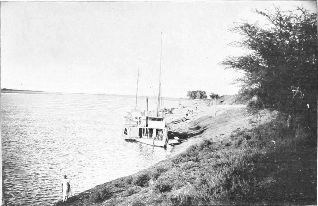
| From Photo by] | [M. Venieris. |
THE EASTERN NILE BANK, SOUTH OF HALFA.
[23]
| Place. | Miles. Kilometres. |
Left (West) Bank. | River and General. | Right (East) Bank. | |
|---|---|---|---|---|---|
| Inter-mediate. | From Halfa Camp. | ||||
| Faras Island | 20 32 |
Bare, except for a few huts and patches of cultivation. Sandy and rocky, sloping to the river | Northern point of the Sudan Administration on river. River some 800 yards in width, current 1½ miles per hour at low Nile to 3 miles per hour at high Nile | Cultivated in general. Palm trees. Sandy. Banks 20 feet at low Nile, 4 feet at high. | |
| Jebel Sahaba | 12 | 8 | The 22nd parallel crosses the river at this point | Jebel Sahaba, hill on R. bank. | |
| Dabarosa | 5 | 3 | Fertile island. | ||
| Halfa | 1½ | 1½ | Difficult approach to right bank at low Nile. Numerous sandbanks appear, varying from year to year on this stretch | A commercial town of about 2,500 inhabitants, of which about 200 are Greeks. (See Chapter III, page 85.) Landing place for goods and passengers. Headquarters of Halfa Province. Terminus of S.G.R. | |
| Halfa Camp (802 miles by river from Cairo) | 1½ | 0 | Nearly opposite Halfa is the Quarantine Camp, on a sandy slope | The best description of the river between the 2nd and 3rd cataracts (including both) is by Commander Hammill, R.N., whose report (1884) is to be found in H.S.C., Vol. I., Appendix O | Headquarters of the Sudan Railway. Landing place close to officers’ mess. Bank 10 to 30 feet above river (226 miles from Shellal). |
| Khor Musa | 5 | 5 | The bank generally gets more rocky and broken | Some additional matter, with large-scale (but inaccurate) map of the different rapids, is given in O.G.H., pp. 9-25 | Fort now in ruins. Action v. Dervishes 1888. Bank broken and rocky. Huge boulders. |
| Foot of 2nd cataract (Shellal el Amka) | 1½ | 6½ 10½ |
The cataract, 8½ miles in length, is impassable for steamers and nearly so for any but small boats at low Nile, and only navigable with difficulty at high Nile. At high Nile it is a rumbling mass of rapids, whilst at low Nile it is a broken expanse of black rock, with shallow channels finding their way between. The Batn El Hagar (Belly of rocks) is now entered. See Hammill’s report for detail. | ||
| Abu Sir | ½ | 7 | High cliff. Fine view of cataract | The banks of the river between this point and Ginnis, where the Batn El Hagar is quitted, differ remarkably in their characteristics. The left or western bank usually presents a steep slope of loose golden sand, driven by the prevailing winds from the great Libyan Desert, varied by black crags jutting out of it and low rocky hills, while the right or eastern bank is generally rocky, free from sand, and in some places almost precipitous. | |
| Matuka | 3 | 10 16 |
Ancient Egyptian fortress of Matuka (XIIth Dynasty). Small temple to S.E. (see Murray, page 982). | ||
| [24]Head of 2nd cataract | 3 | 13 21 |
Between the head of the 2nd cataract and the foot of the Semna Rapid the Nile runs through a sterile and uninviting country, the eastern side covered with masses of black rocks, the western with mountains of yellow sand. The navigation is described as “difficult, dangerous, and tedious.” | ||
| Gemai | 2 | 15 | Used in 1884-5 as head of railway, portage for boats, &c. | ||
| Murshid | 10 | 25 | |||
| Sarras | 8 | 33 53 |
Advanced post and fort of the Frontier force 1886 to 1896. | ||
| Ruin | 1 | 34 | Ancient Egyptian fort | Railway here leaves the river bank and enters the rocky desert to the East. | |
| Melik | 6 | 40 64 |
Melik Island; ancient temple of Sikator I. | ||
| Semna Rapid | 3 | 43 | Semna Temple on height about 300 feet above river. Jebel Barga just behind | Here a narrow ridge of gneiss forms an awkward barrier. At high Nile the river sweeps over it without perceptible diminution of width (430 yards), but at low Nile the rocks are bare save for a narrow channel, 45 yards broad and 65 feet deep, formed by erosion. (Gregory.) | Kumna Temple on height about 400 feet above river. |
| Atiri Rapid | 7 | 50 80 |
The obstructions to navigation consist of 2 “gates” about 1½ miles apart; of these the lower gate presents no difficulty. It is about 300 yards long, and steamers are able to steam up through it at “half Nile” without unloading. The upper “gate” is more troublesome to pass, the channel being obstructed by a great barrier of rocks which stretch quite 200 yards across the river, leaving at “low Nile” only a narrow gap towards the western bank. At “high Nile” another channel exists near the opposite bank. Not serious. | ||
| Ambugol Rapid | 7 | 57 | One mile long; channel near right bank. Fall 3 feet. Not difficult. | ||
| Tanjur Rapid | 15 | 72 116 |
Bank low and even, desert sand up to river | Extends for about 3 miles. Awkward cross currents at foot. Western channel best. “Gates” at either end straight and clear, but considerable rush of water. Difficult rapid altogether | Bank high and precipitous, much broken up. |
| Jebel Alimula | 2 | 74 | Road passes to west of J. Alimula and by a precipitous track cutting off bend to Sonki. | ||
| Sonki | 3 | 77 | |||
| Omka | 2 | 79 | Bank low and fairly level | Slight rapid, not serious | Range of hills recedes from river bank low and even. |
| Hammam | 5 | 84 135 |
Hot spring (sulphur) for rheumatism, etc. | ||
| [25]Akasha | 1 | 85 137 |
Easy rapid. Ridge of rocks extends across river. Western channel best | At the village of this name the railway touches the river for the first time since Sarras. Macdonald’s advanced brigade occupied this, April, 1896. Headquarters of District and residence of Mamur. | |
| Kulba | 8 | 93 150 |
Late boundary (1903) between Halfa District and Dongola Province | River begins to open out. | |
| Dal Cataract | 5 | 98 158 |
Bank low and even. Village here and on adjoining islands. On one island is a Mameluke fort, whence good view obtainable | Broken water about 4 miles, numerous islands with high cliffs, difficult rapid, careful pilotage required—low ridges and rocks well covered at high Nile. Channel by right bank till half-way up, and then cross to left. Total width of river about 1,500 yards. Fall of 5 feet | Bank higher than opposite one, evenly undulating. Becomes gradually cultivated. Jebel Dal, 4 miles to the east, tall conical hill, 1,973 feet. |
| Sarkamatto | 6 | 104 167 |
Desert road here leaves river for a short cut of 19 miles S.W., to Sakiet El Abd | The river from here to Amara, 16 miles on, is in parts full of small islands, but offers no difficulty | Cultivated tract, dominated in its upper portion by Jebel Firket, 1,880 feet. The action of 6.7.1896 took place to the south of this hill, and a mile north of Firket village. The railway, after short cut from Akasha, here comes close to the river, and follows it through Mograka to Kosha, where it turns sharp to the south, following for the first 12 miles the desert road to Abu Sari. Seven miles to the east lies Jebel Idris, 1,720 feet, and 6 miles E.S.E. of the latter rises the mass of Jebel Hamra, 2,368 feet. |
| Jebel Firket | 1 | 105 | |||
| Firket Village | 2 | 107 172 |
3 miles inland is a hill, 1,490 feet, name doubtful | Action here between E.A. and Dervishes: 7.6.96. | |
| Sarghun | 4 | 111 | Island near east bank. | ||
| Kosha | 2 | 113 182 |
Road leaves river here for Selima Oasis | The channel here turns in a wide curve to the west. Native boats take 8-10 days from here to Dulgo at high Nile with fair wind. | Headquarters of District and residence of Mamur. |
From Kosha onwards both the river banks become more and more cultivated, and are divided into districts varying from 1 to 4 or 5 miles in length, each containing one or more villages: gaps between districts in uncultivated parts.
All these districts consist of a greater or lesser amount of cultivated or uncultivated ground, together with a varying number of palm trees and huts. Each district is under a headman, and groups of them form the various sub-Districts, each under a Police Officer, a varying number of which go to make up a District; and out of these is formed the Province.
Only the more important sub-Districts will be mentioned in the River Itinerary.
[26]
| Place. | Miles. Kilometres. |
Left Bank. | River and General. | Right Bank. | |
|---|---|---|---|---|---|
| Inter-mediate. | From Halfa Camp. | ||||
| Ginnis | 2 | 115 185 |
At actual high Nile the river is navigable without difficulty from Kosha to Dongola and above; but a fortnight later it will be impossible to pass the Kaibar and Hannek cataracts, except in small boats | The action of Ginnis of 30.12.1885 was fought on the slopes to the west of the village. Bank mostly low and even. Palm trees; more cultivation. | |
| Amara Rapid | 3 | 118 | Desert sand comes right down to river | Insignificant except at low Nile; caused by ridge of broken rocks crossing river bed. | |
| Arneti | 5 | 123 | Island 3 miles long, lying in curve, which river here makes to the south. | ||
| Sagiet El Abd | 4 | 127 | Desert road arrives from N.E. across curve. Here a desert road strikes west to Selima (75 miles) and the Arbain road. | ||
| Yabri and Sai Island | 3 | 130 | North end of Sai Island. West channel unsurveyed, keep in east channel. | ||
| Koyeka | 5 | 135 217 |
Open desert, almost flat for many miles | Koyeka district; tomb of Sheikh Idris. Ground gradually rises to E. | |
| Jebel Abud | 5 | 140 | South end of Sai Island | Abud district. Jebel Abud 1,598 feet, 4 miles inland. | |
| Suarda | 2 | 142 228 |
Capture here of Dervish stores by Cavalry after Firket. Rich district. | ||
| Gurjan Tau | 14 | 156 | Ancient temple. | ||
| Koya | 8 | 164 264 |
Desert road leads due south 28 miles (no water) to rejoin the Nile at Fakir Benti. Proposed route for railway, 1871 | Channel here turns sharp to the east and after 10 miles curves S.E. | |
| Abu Sari | 15 | 179 288 |
Islands become more frequent, and the channel turns again definitely to the south | Desert road from Kosha (36 miles without water, excellent going), reaches river here. | |
| Dalgo | 12 | 191 307 |
Large and important district. Railway here rejoins river from Kosha. Hd. Qrs. of the Mahas District | ||
| Kaibar Cataract (Kajbar, Kagbar) | 12 | 203 325 |
Banks even and low, but rocky | Thick (450 yards) low ridge of black granite here crosses the river, 1,200 yards wide here. Difficult even for small boats at low Nile; it presents practically no difficulty at high Nile | Banks low. Palm trees. The railway here crosses the river and takes a short cut to Kerma. |
| 4 | 207 | Channel bends sharp to west | Desert road cuts across S.W. to Abu Fatma (18 miles). | ||
| Arduan | 5 | 212 | Arduan Island. Rocky. 9 miles by 4. South channel narrow and unnavigable. Keep to left bank. | ||
| Fakr Benti | 10 | 222 | Fakr Benti | River winds through broken, rocky country. | |
| Jebel Alibersi and Jebel Sadek | 6 | 228 | Jebel Alibersi, overlooking river | Jebel Sadek, 1,220 feet, 3 miles inland. | |
| Shaban Rapids and 3rd or Hannek Cataract | 1 | 229 368 |
Banks low and generally even and cultivated | Four miles of broken water; keep to east channel except during highest Nile. 7 to 9 different rapids, the one at the foot being the worst. Not serious at high Nile. Fall, 18 feet altogether. The numerous islands are fertile. | Bank broken by low ridges of boulder granite. |
| [27]Hannek | 2 | 231 | Village. | ||
| Simit Island | 2 | 233 | Large island, 3 by 1½ miles. Keep to west channel. | ||
| Badin Island | 8 | 241 | Country becomes much flatter | Island 6 miles by 1. Keep to east channel. | |
| Abu Fatma | 2 | 243 391 |
Rocky and enclosed. The desert road which left the river at mile 207 here rejoins it. British Garrison here 1885. Boundary between Halfa and Dongola Provinces. | ||
| Kerma (Rest house) | 3 | 246 396 |
The Nile between here and Dongola becomes unnavigable for steamers from March to June. There is at other times a fortnightly postal steamer between Kerma and Merowe; this runs all the year round from Dongola to Merowe | Terminus of the railway. Transport to Dongola is continued by land at low Nile, and by steamer at high Nile. P.T.O. Chief market day Weds. | |
| Hafir (Rest house) | 2 | 248 | British camp here Summer, 1885. Action here 20.9.1896. Egyptian Army crossed from right to left bank. Market on Saturdays | Village of Kerma. | |
| Argo Island (Rest house) | 4 | 252 405 |
North end of Argo Island, perhaps the richest soil in the Sudan. Thickly populated and highly cultivated. The head man is called the Melik (King) of Argo. The east channel is narrow and navigable for 3 months only. Numerous fertile islands in west channel. Hd. Qrs. of a District | There are 8 or 10 small villages on E. bank behind Argo Island; cultivation carried on chiefly for the “Demera” crop. | |
| Zawerat | 19 | 271 | Highly cultivated | South end of Argo. | |
| Chief ferry between W. Bank and S. end of Island, where boats can always be found | |||||
| Dongola (Rest house) | 9 | 280 450 |
Better known to the natives as El Ordi. Lies 2 miles to the north of the older pre-mahdist town. Former capital of the Province. British garrison there Mar.-July, 1885. 1,000 inhabitants. Post and telegraph office, residence of a British inspector, and Headquarters of District and residence of Mamur. The old forts and earthworks built by Mustafa Pasha Yawar are still to be seen stretching round the town | Numerous sandbanks, sometimes causing difficulty in landing. A large island now lies opposite the town. | |
| Between Dongola and the foot of the 4th cataract the river runs through a plain. Banks low almost throughout; no obstacles to navigation except sand banks at low and half Nile. From Dongola to Ambugol there is a broad strip of cultivation on one or other bank, rarely on both at the same time. From Ambugol the cultivated land gradually increases in extent; both banks are cultivated, and the Dar Shaigia is richer and better cultivated than any district south of the Fayum; the vegetation here is quite tropical in character, and all the islands are cultivated. Between Belal and Abu Hamed there is little cultivation, except in the Monasir (El Salamat) country. There are numerous villages on either bank, and the mud houses are all whitewashed and of a better class than those below Dongola, generally a short distance behind the cultivated strip. The weather is variable in October; before reaching Debba the north wind is sometimes lost. Debba to Abu Hamed is a warmer district than the country below and above these places. Prevailing winds from the north; native boats have to be towed between the two places named. The banks themselves are good for towing, but difficulties arise as the river falls. The most serious obstacles are the Sagias, which in some cases are only 50 to 100 yards apart. | |||||
| Govt. Mosque, about 60 permanent shops and 3 or 4 flour mills | |||||
| Irtidi | 1 | 281 | Village. Good road alongside river and telegraph line | From Dongola to Debba the river is shallow, but clear of any serious obstructions all the year round. A few isolated rocks appear at low Nile. | |
| [28]Khannag | 2 | 283 | Village. | ||
| Sheikh Sherif | 1 | 284 | Small village, ¾ of a mile from river. Intervening space highly cultivated. The road from Dongola runs over alluvial soil at some distance from the river, on the outskirts of the cultivation | The east bank is desert sand, and almost entirely uncultivated. | |
| Kajatti | 5 | 289 | Name disappearing. Large tomb east of road. Few scattered huts. | ||
| Ordi El Monfok | 1 | 290 | Ruined village; good grazing | Name disappearing. | |
| Kasr Wad Nimiri | 1 | 291 | A stone ruin on a mound overlooking the river. The gravel ridge, which has skirted the road all the way, here comes down to the river. From the last station the river banks are lined with palms and the ground covered with coarse grass | Islands of Lebab, Ab Turki, and Derer. Lebab Island is also spoken of as “Geziret Ashraf,” and was the birthplace of the Mahdi. | |
| Sahaba | 5 | 296 | Rocky ridge widens out; good camping ground; gradually coming under cultivation. | ||
| Akri | 4 | 300 | Stone village. | ||
| Teit, Taetti | 1 | 301 483 |
A stone village over a mile in length, situated a ¼ of a mile from the river. Between it and the river is a narrow strip of cultivation. The best camping ground is to the south of the village. | ||
| Saati Beshir | 3 | 304 | Domed tomb. Hills within 500 yards of river. | ||
| Urbi | 5 | 309 | A large village built where the hills leave the river, leaving a good open space for camping | Island of same name opposite village very highly cultivated. | |
| Sori | 4 | 313 | A long scattered village on the river bank. A strip of cultivation runs along the river; there is, however, a break in it just north of the large tomb. This is a suitable place for a camp. | ||
| Sali | 4 | 317 | The hills, which had widened out opposite Sori, here come nearly down to the river, leaving room for a shallow camp. A small scattered[29] village with strip of cultivation. The road from Urbi to this place runs over a sandy plain with scattered mimosa | Malwad opposite south end of Sali. | |
| Khandak (Rest house) | 3 | 320 | Headquarters of District, and residence of Mamur. Built on a stony mound overlooking the river. Eight and a half hours’ steaming from Dongola (October). The town could be easily defended against a force coming down river or across the desert from the west. Broken mud wall on west and north sides. Old sun-dried brick fort in middle of town on the bank; good storage, accommodation for 200 men (British); commands town and approaches. Also 4 well-built brick houses in the town, capable of housing 300 men. Town of mud huts clean and well built. Market day on Saturday. Four hundred and forty sagias in the district, each representing 4 families. Much wood in the district. Road west into desert to Marghum, etc. Remains of many churches | ||
| Shebatut, or Shabadud | 1 | 321 | About 20 houses, 400 yards from river, at foot of low hills. Cultivation on banks 200 yards wide. Good space between cultivation and village. Best camping ground at south end of village. This spot was extensively used as a camping ground during the Nile Expedition. Light Camel Regiment here, Spring of 1885 | ||
| Dambo | 2 | 323 | Fifteen houses ½ mile from the river; no cultivation. Good camping ground east of village; mimosa scrub. Banks shelving; compact village, 40 houses; good landing; numerous palms and acacias | ||
| Goled Bahri and Gibli | 6 2 |
329 331 |
Three groups of huts extending over 1 mile, ¾ mile from river. Situated in broad alluvial plain, running down to river. Monday market; mass of cultivation; 2¾ hours’ steam from Khandak; considerable supply of wood, the mimosa trees growing to a great height. On leaving El Goled,[30] the road runs at some distance from the river across a rich alluvial plain (cultivated) | Komi Island (cultivated) | East bank gradually becomes more inhabited and cultivated. |
| Wad Abbas | 3 | 334 | Nani Island | Desert road leads east from Wad Abbas to near Merowe. (76 miles.) | |
| Rumi | 2 | 336 | Villages Bahri and Gibli | Rumi Island 2 miles on | Stone ruins 2 miles inland to north-east. |
| Bakri | 4 | 340 | On nearing this place the ground becomes more sandy and covered with mimosa scrub. It extends for over 1 mile, amidst palms and cultivation. All supplies plentiful. Good camping ground to south. Saturday market. | ||
| El Khelaiun, or Kheleiwa | 4 | 344 | From Bakri to this spot (which consists only of a poor hut or two) the river banks have been lined with coarse grass, outside of which is a strip of sand dunes and mimosa, with the road outside this. Cultivation here takes the place of the grass. Sand dunes still continue. Site of old Christian church. Stones with Greek inscriptions found | Commencement of highly cultivated Latti district, 3 to 4 miles broad, with numerous villages, e.g., Amentogo, Arab Hag, Kodokol, and Megabda. Quantities of date palms and wood. | |
| Kankalab | 1 | 345 | Village of 30 tukls, on a high bank overlooking a broad strip of cultivation, which intervenes between it and the river. Good camping ground 1 mile south | River shallow. Former site of Ghaddar Island | District narrows down as hills approach river from north-east to Ghaddar, etc. |
| Old Dongola, locally pronounced “Tóngălo” | 6 | 351 564 |
Dongola Gharbi. Well cultivated, many trees; shelving banks and good landing. A long, scattered village, separated from the river by a broad strip of cultivation. Between the village and the desert is a tract covered with mimosa and “dead sea fruit.” Fairly well wooded. Wednesday market | Baja Island | Old Dongola, on the right bank, is a deserted town of ruined mud houses, containing not more than 30 able-bodied men. The people live in the island of Hamur, a little higher up stream, and in the cultivated districts on the west bank; much wood in surrounding country; 422 sagias. It is built on a rocky height, overlooking the river and the desert to the east. It is capable of easy defence, and might be held by a very small force. In rear of the town[31] are the ruins of a once strong fort. Severe sand storms are frequent. There is one mosque built over an old Christian church commanding the river, village, and surrounding country. Cliffs, old sandstone, 30-70 feet high. |
| El Ghaba | 4 | 355 | A small village with a clump of trees. There is a break in the cultivation here, and space on the river for good camping ground. Markets Tuesdays and Fridays | Tangussi Island, very fertile; 8 miles long. Narrow east channel | Fertile stretch opposite Tangussi. |
| Abu Gussi | 1 | 356 | Was an important village, with road striking south-west to Omdurman and El Fasher. British Garrison, 1885. Now deserted; river eating away banks and cultivation | Good landing west bank. On leaving Abu Gussi, the river changes its course to nearly east and west. The left bank to Debba is highly cultivated, and a little vegetation is visible on the right bank. | |
| Giref | 4 | 360 | The country between Abu Gussi and Debba is hard, sandy going, with low hills on the right hand, and broad patches of cultivation on the left. A desert road to Mahtul, 40 miles, here leaves the river. | ||
| Karad or Kurot | 9 | 369 | Just north of Debba; 45 sagias; steep banks. Good landing for all boats. General Brackenbury’s brigade was quartered here during the spring of 1885 | Argi Island | Argi district, cultivated. |
| Debba (Rest house) | 2 | 371 596 |
Consists of old field works of 430 yards perimeter, enclosing a few huts. Was garrisoned in 1884 by 250 Bashi Buzuks. Headquarters of the District, and residence of Mamur. Wheat, barley, dura and wood procurable from neighbouring cultivated districts. A direct road to Omdurman starts from here viâ Abu Gerad. The position is excellent, the fort being surrounded on the south by an open sandy plain, covered by slight bush, and abutting on the river on the north, where there is a good landing place, steamers and heavily laden boats being able to come close alongside. Cultivation along the banks of the river recommences about a mile distant, east and west of the fort. The Wadi Melh, a dry shallow valley, debouches on to the plain,[32] where its course is lost in the sand. By following up the course of this valley, the old and now little used Kordofan caravan road is joined, leading to Bir Mahtul and El Obeid. A commercial centre (formerly) for ivory and gum from, and for European merchandise for Kordofan and Darfur. Geological formation, Nubian sandstone, acted on by heat, and metamorphosed on the surface. Petrified wood is found in great quantities | River here 750 yards wide; course south-east and north-west. Various cultivated islands such as Gira (373), Tambanarti (382), Ganeti (391, keep to north bank), Jigarnarti (397), and Husseinarti (404), dot the river hereabouts | Right bank bare as a rule, with cultivated patches at intervals. Ruined castle at Abkor (380). |
| Abu Dom | 16 | 387 623 |
The road passes over sand and some slight sandhills while passing Abu Dom. An important village of about 300 men; the houses are scattered along the edge of the sand; there are 30 water-wheels and a few palms. Cultivation: dura, wheat, Indian corn. Market on Wednesdays. The most southerly point on the river before reaching Berber. A more northerly course is then taken. The left bank continues most rich in cultivation; wood abounds. Next districts in order: Abu Kleiwat, Jura (with ruins of Coptic church, road makes short cut to east), Artimoga, Fakrin Koti, Mansur Koti | River channel now curves, and runs south-west and north-east. Easy navigation to foot of 4th Cataract. | East bank becomes more cultivated. Districts of Affat, Abseit, Nizezi, Neriko and Difar. Rest house at Affat. |
| Hetani or Tani | 16 | 403 | Rocky Hill Jebel Taraka 1 mile to south; outlying spurs from J. El Nob 5 miles to south. Old castle (Galat Hatani) 1 mile on, in ruins, with rock well. Narrow road, camels single file, was held by Emir Heddai against Mudir of Dongola, in 1884 | ||
| — | 6 | 409 | Camp of General Dormer’s Brigade, 1885. Bush gets thinner, road descends to— | Kori and Takar districts. Bank fairly cultivated. Districts El Bar, El Barsa, Karafab (420). | |
| [33]Ambugol | 4 | 413 665 |
Large village, standing ½ mile back. Open country around. Branch road to Korti. Metemma road starts from here. Friday market. The river bank from here to Merowe is well wooded throughout, and the road during the whole distance runs over a sandy plain sparsely covered with mimosa scrub | El Arag, Hajeir, Magal, Bakhit, with hill and ruins (431). Low rocky hills in distance. | |
| Gowari | 2 | 415 | A compact village of many houses. The road from Ambugol runs over an alluvial plain sparsely covered with mimosa scrub. No cultivation along the river banks, and the ground is everywhere favourable for camping. A few palms to the south of the village. | ||
| Korti[24] (Rest house) | 1 | 416 670 |
Two villages: one on the river, and one 1 mile inland. Palms, mimosa, and cultivation along the river. A low sand ridge runs parallel to the river, at a distance of 1 mile from it. Sunday market. Steep banks, 15 feet high. Advanced base of Nile Expedition, 1884-5. River banks now mostly cultivated, including thick mimosa scrub in parts. Road to Jakdul and Metemma starts from here. The W. Mogaddam joins the Nile here. Headquarters of Mamuria. | ||
| Ghoreiba | 3 | 419 | Fifty well-built houses. No cultivation between here and El Basa, 3 miles on. Passing Usli (426) arrive at— | ||
| Gureir | 12 | 431 | Scattered village, extending for nearly 8 miles. River banks deeply cultivated almost its entire length. Good camping grounds are to be found on the water’s edge just before the village is entered from the south, and at its northern extremity, and at a point 6 miles from its southern end. The cultivation lies on the low ground formed by mud deposits at the salient angles of the river, the village being situated on the original bank; the water is consequently only accessible at the re-entrant angles. Saturday market. | ||
| [34]Hannek or Korti district | 1 | 432 | Districts of Korei, Arak, and Tangassi | Abu Rannat Island (436) 3 miles long | Large village of mud huts. Much wood of considerable size. Then come Magashi, El Zoma, Tulbenab, and Kajabi. |
| Tangassi | 9 | 441 710 |
A large scattered village with deep cultivation in a salient angle of the river. Tuesday market, the most important in province and well known throughout the Sudan. Police post. | ||
| El Debeiba | 2 | 443 | Small village with wide strip cultivation | Desert sandstone rock comes down to the right bank, forming cliffs 40 to 60 feet high, extending for about 2½ miles along the bank. | |
| Abu Dom Sanam (site of ancient town of Napata) | 3 | 446 | A scattered village at the confluence of the Khor Abu Dom with the Nile. The cultivation runs a considerable distance inland along the Khor, which delivers a considerable stream during the rainy season. Surrounded by dense vegetation and trees. A road from here joins the Dugiyet-Berber road. Supplies of all kinds plentiful. | ||
| Merowe (capital) | 1 | 447 719 |
Merowe. Headquarters of province and residence of the Governor. It is practically on the site of the 1896 camp of Abu Dom Sanam. The town has yet to be built. At present it only consists of about 30 houses, including offices, telegraph, etc. | Old village of Merowe. Advanced post during summer of 1885, under Commander Julian Baker, R.N. | |
| Will be terminus of the branch line from Abu Hamed. From Affat to Merowe boats will have to be towed by tugs, as they are unable to navigate this bit of river against wind and stream. | |||||
| Desert road to S.E. to Jakdul | |||||
[35]RECAPITULATORY TABLE OF DISTANCES.
| Intermediate. | From Halfa. | |||
|---|---|---|---|---|
| Miles. | Kilometres. | Miles. | Kilometres. | |
| Faras Island | — | — | 20 | 32 |
| Halfa Camp | 20 | 32 | — | — |
| Foot of 2nd Cataract | 6½ | 10½ | 6½ | 10½ |
| Head of „ „ | 6½ | 10½ | 13 | 21 |
| Akasha | 72 | 116 | 85 | 137 |
| Kosha | 28 | 45 | 113 | 182 |
| Dalgo | 78 | 125 | 191 | 307 |
| Kaibar Cataract | 12 | 19 | 203 | 325 |
| Third (Hannek) Cataract | 26 | 42 | 229 | 368 |
| Dongola | 51 | 82 | 280 | 450 |
| Debba | 91 | 146 | 371 | 596 |
| Korti | 45 | 72 | 416 | 668 |
| Merowe | 31 | 50 | 447 | 719 |
The distinguishing feature of the river between Merowe and Abu Hamed is the difficulty of navigation, and also of communications along either bank. A variety of rapids, mostly impassable except at high Nile, form the 4th Cataract, which extends practically from Belal to Shirri, a distance of about 67 miles, whilst there are little or no cultivation or supplies, except in patches on either bank. This (Rapids) portion of the river was ascended in whale boats by most of the River Column in 1885, and the right bank was traversed by General Hunter’s flying column in 1897, when proceeding to attack Abu Hamed. Otherwise it is not now generally in use for communications,[25] owing to these obvious difficulties. A telegraph line now connects Merowe with Abu Hamed.
[The reader who may wish for further detail than that given below is referred to “N.O.” 1st and 2nd editions (1897 and 1898), which give some additional reports by slightly different routes.]
(Lieut. Poore, R.N., October, 1884.)
The prevailing winds are north-easterly and boats can rarely use their sails, excepting occasionally at high Nile when a southerly wind may blow for a few days.
Boats leaving Ambugol for Abu Hamed invariably have to tow the whole way.
The pilots state the average passage of a nugger[26] from Merowe to Abu Hamed as being from 35 to 40 days, but they appear to perform the journey in parties of about 10 boats, in order to supply their own hauling labour, thus considerably increasing the time of passage.
Nuggers generally leave Debba on the trip to Abu Hamed 20 days before high Nile and try to time their arrival at Abu Hamed as soon as possible after the river begins to fall.
Steamers should not leave Merowe for Abu Hamed later than 10 days after high Nile.
Nuggers should not leave Merowe for Abu Hamed later than 15 days after high Nile.
There are men in the village of Bela at the foot of the Gerendid Cataract and in a few of the villages near Merowe who are acquainted with the different cataracts, but would seem to be more useful as guides to point out the different channels than as pilots, their knowledge of boats or nuggers seeming very limited.
It would be advisable to take pilots for the cataracts from the rais of nuggers.
Supplies between the cataract of Gerendid and Abu Hamed are very scanty, a few scattered patches of date palms, wheat and dura constituting all cultivation.
Between the different cataracts the banks appear to be rocky and badly adapted for towing. The stream is swift with frequent sharp bends and the river studded with rocks and small islands.
[36]Confusion may arise from the custom of the pilots and natives in continuing the terms east and west as regards the river banks after the river has turned to the northward at Ambugol; the right bank being invariably termed the east and vice versâ without reference to the direction of the river. Thus, between Ambugol and Abu Hamed, a wind which is termed by the pilots south-westerly is in reality north-easterly.
(Captain W. Doran, August, 1897.)
The following is a report on the river between Kassingar and Amari, together with remarks on points that have come under my observation:—
Nuggers with a strong favourable wind can get up to Meshra El Abiad, but there is a strong current below Meshra El Abiad for about 3 or 4 miles, and the track (on the right bank) is rocky, or much obstructed by sunt trees.
Meshra El Abiad presents no great difficulty. About 50 men will pull a nugger of 200 ardebs through in half an hour.
For about 3 miles after leaving Meshra El Abiad, the channel on the right bank presents no difficulty, though the stream is strong, and the banks steep and covered with sunt bushes, which at high Nile will impede towing.
About 5 miles from Meshra El Abiad the banks become rocky, and rapids are met with; the water being very bad, and rocks numerous. I crossed this rapid, which is about a mile in length, and extends to just below the village of Shebabik, in half a gale. Otherwise, I should think the passage would be difficult, as the rocks on the right bank are very steep, and without a strong wind portage would probably be necessary. From Shebabik village, by following a channel on the right bank past the village of Abu Haraz, good water is met with for about 6 miles, till the cataract of Halfaya is reached.
From Halfaya to the village of Amari, a distance of about 2 miles, the river is very difficult, tortuous, and rocky, towing being necessary throughout.
From Amari, I am informed, the river is not difficult.
It must be understood that these remarks refer to the river as I found it. Any rise or fall may make difficult places easy, and vice versâ.
I would venture to make the following suggestions for future river convoys:—
1. That only boats of 150 ardebs should be sent up at present. Large boats are unwieldy, cause great delay, break ropes, and run the risk of losing stores. For example, one of my boats of 300 ardebs took 4 hours to get up a place which boats of 150 ardebs crossed in an hour. It broke two ropes, and was nearly wrecked on several occasions, besides being always a source of delay to the rest of the convoy. The exertion caused to the men in hauling these heavy boats is very great, much greater than that of hauling two boats of half the capacity.
2. Each convoy should consist of not more than 20 boats under a British officer, and should have with it two companies (200 men) of an Egyptian battalion to haul the boats over the cataracts, and in the ordinary stream when the wind is unfavourable. If the water proves easy beyond this place, Amari, these men might return to Merowe from here by return convoy. Men who are good swimmers should be selected, if possible, and, as the work entails great exertion on the men—most of them having to stand work in the water all day—the companies should be relieved after one or two trips.
Unless considered necessary for safety, these men should not bring arms or ammunition with them, except just sufficient for a small guard, as these have to be portaged across bad places, causing delay.
The large cooking pot, “kazan,” is not suitable for these occasions, as men are often separated on islands from the rest of the convoy at night time, and are unable to get their proper food after a hard day’s work. Something of the Flanders kettle type would be better.
3. Each convoy should be provided with four strong hemp ropes of at least 200 fathoms each, in addition to the smaller ropes carried by each boat. These latter should be inspected before the convoy starts.
A small boat of about 50 ardebs would also be most useful to enable the officer in charge of the convoy to go up and down his convoy, and also to assist in the portage of stores from the nearer boats when they get stuck in shallow places or rocks.
(Commander Colin Keppel, R.N.)
To Kasinjar on right bank, river broad, navigation simple. No obstacles. Thence to Kenisha, navigation easy.
[37]At Meshra El Abiad there is a difficult, narrow passage between two rocky islands, with a very sharp turn. Water very rapid, which continues until Um Deras Island is reached.
N.B.—The cataract marked on the official map as El Dermi was not recognisable at this time of the year.
Um Deras Island is practically at the foot of what is termed the Gab El Abd, or 4th Cataract, it was from thence that a course by the left bank was followed by the river column in 1884-85. This channel was found to be so difficult and dangerous at high Nile, it was decided to examine the channel by the right bank. This was found to be more easily navigable for steamers at this time of the year. It should, however, be noted that this channel, though navigable for steamers at high Nile, and undoubtedly the only channel to be followed with safety at that time, would be impassable at any other time of the year. As at low Nile, many parts of it are dry.
From Um Deras Island to the point marked Khor Abu Herejil (north bank) (A),[27] no great difficulties are encountered.
At this point all guns, ammunition stores, and heavy gear of every description were taken out of the steamers and portaged to the camp of El Bana, a distance of about 2 miles.
The following arrangements were then made for passing the steamers over this cataract:—
A wire hawser was fastened round the ship. Two hawsers were then led out of the steamer, one for hauling, and other to serve as a guy to steady her, and to prevent her bow from being taken round by the force of water.
About 600 yards up-stream, at the junction of a smaller channel (B), these hawsers were slipped, and the steamer reached the southernmost point of the next bend (C).
From this point to a point 1,100 yards up-stream (D) the greatest difficulties were met with, owing to the necessity of passing ropes on to the island 300 yards up-stream (E). As many men as could swim had to cross over to this island. The steamer was then hauled up to the southern end of the island.
The rope had now to be passed from the island (E) to point (D).
At point (D) the haulage became very difficult, as the river thence, for 600 yards, to point (G), in mid-stream, is intersected by isolated rocks, upon which it was necessary to have groups of men in order to pass the rope from one rock to another. From point (G) the hawser was then led to the mainland. Guy ropes were used throughout.
After passing the rock marked (G) powerful steamers, of the “Zafir” class, were able to steam, without further haulage, to El Bana, but otherwise it was necessary to use ropes for hauling up to El Bana.
On leaving El Bana, the channel on the right bank was followed, and though the water was rapid in places, rushing between numerous small islands, no great difficulty was encountered until arrival at the foot of the Geridu (Geriddo) Rapids (3¼ miles up). Here it was necessary to tie up to the bank in order that each steamer might pass over the rapid separately.
It will be seen that the channel takes a very sharp turn here (between points A and B); a large volume of water rushes with considerable force between an island (440 yards long, with a rock at the west end) and the south bank (a promontory on the south bank), where a rope was attached to a rock, and then gradually eased off to let the bow go round.
From Geridu to Hosh El Geruf the channel is devoid of obstacles.
The channel taken was by the right, until El Shwadiyat was reached, whence it crosses to the left bank and continues thus as far as Rakabat El Gamal; here the river becomes a maze of small islands. The channel continues by the left (?) bank of Dulka Island (known by the natives as Dirbi), smaller islands being left on the starboard side.
The current thence became very strong, and continued so until Kirbekan Rapids was reached.
At the bottom of these rapids the steamers were stopped, but the cataract, after examination, having been considered passable without haulage, each steamer went over it separately, in order to prevent any risk of one hampering another.
The main stream was then followed as far as Uss Rapids; here the volume of water was very great. From the top of Uss Rapids the channel followed was by the left bank as far as Sherari Island, whence it passes by the right bank of that island, and thence between it and Shirri Island to the right bank of the river.
The river now becomes very broad, and navigation is practicable on either bank from Salamat to Hebi. From Hebi to Abu Selem the channel is by the left bank. In Huella Rapids there was a strong rush of water.
The river now becomes much intersected by small islands, and, though navigation is not very difficult, skilful pilotage is necessary.
Wood was found in the following places:—
| El Bana. | Salamat. |
| Hosh El Geruf. | Abu Selem. |
| Uss village. | Left bank, just below Mograt Island. |
(Major Slade, R.A., February, 1885.)
| Names of Places. | Distances in miles. | Description. | |
|---|---|---|---|
| Inter-mediate. | Total from Merowe. | ||
| El Dueim | 3 | 3 | A small scattered village; a large white-domed tomb makes it visible for some distance. |
| Sagag | 1 | 4 | A compact hamlet, mostly of straw huts, ¼ mile from the river. The banks, which for the last 4 miles have been bare, here become studded with palms. |
| Gereif | 1 | 5 | A collection of wells and sagias from which the ground is cultivated. The uncultivated ground is covered with coarse grass. A low range of hills here touches the south of the road. |
| Nurri | 2 | 7 | This village extends a considerable distance inland. Near it, to the south of the road are 11 pyramids. Soon after leaving them the alluvial ground over which the road has hitherto passed gives place to sand. |
| Belal | 1 | 8 | A large well-built village. The road here runs close to the river between small patches of cultivation and a track of very broken rocky ground, which comes to within ¼ mile of the river. This stony tract is about 50 feet above the alluvial ground. At the east end of the village a break in the cultivation leaves room for a small camp on the river bank. |
| Khor-el-Sorawi | 3 | 11 | A dry watercourse, 20 yards wide. It shows signs of out-pouring a considerable stream in the rainy season. 1 mile further to the east the river makes a sharp bend to the north-east, the edge of broken ground continuing to run in an easterly direction. The road takes an intermediate course across a plain of firm gravel which lies between the rocks and the river. |
| Kanisa | 1 | 12 | A small village ½ mile to the north of the road, at the foot of a small rocky hill, in an angle of the river. |
| El Dugaiyet | 1 | 13 | A scattered village. The broken ground here again comes to within ½ mile of the river. There is a good camping ground on the river bank near the village. The road to Bir Sani and Berber here branches off. It runs at first over very rocky ground. There are said to be 90 islands in the river between this place and Belal. The cultivation of the district is for the most part on these islands. |
| Hamdab | 5 | 18 | A very long village with a fair amount of cultivation. The road from Dugaiyet runs between the broken ground and thick bush. Just before reaching Hamdab the rocky ground opens out considerably at the mouth of the Khor El Shungui. A good camping ground on the river bank. The road described from Hamdab onwards was followed by part of River Column, 1885. |
| Dates, dura, cotton, dukhn, and barley grown. The road to Berber leaves the river about 2 miles below Hamdab, crossing the rocky ground at a point marked by two solitary dom palms. | |||
| Good camping ground for a large force, commanded by rocky ridge, 400 yards from river. | |||
| Jebel Kulgeili | 4 | 22 | The road as far as Jebel Kulgeili skirts the belt of cultivation, which is interspersed with a few native houses. It is commanded the whole way by a low ridge of rocks, at a distance from the river varying from 50 to 500 yards. |
| Jebel Kulgeili, 400 feet high, commands the surrounding country for a distance of several miles. The direct desert road to Berti (19 miles) leaves the river at the foot of this hill. | |||
| The road, after leaving Kulgeili, becomes rocky and much cut up by ravines and sandy khors, gradually becoming more difficult as the islands of Auli are approached. The river between Hamdab and Auli is quite open, and free from broken water. | |||
| Auli | 8 | 30 | At Auli the cataract of Terai commences; but it is not difficult. There are several houses and much cultivation on the islands and on the left bank. Good camping grounds are to be found. |
| El Kabur | 3 | 33 | Cultivation extends along the road, broken at times by rocky and barren ground. At El Kabur, which is situated at the end of the nest of islands which forms the 4th or Edermi Cataract, there is scanty cultivation and a few houses. |
| From Auli to El Kabur by water the boat channel follows the right bank. There is one difficult gate, about two-thirds of the way up, at which heavy stores have to be portaged. The country to the east of the road along the left bank is very rocky and broken, and nearly impracticable for cavalry. | |||
| [39]Kabeinat (ruined forts) | 1 | 34 | The road leaves the river at El Kabur and follows the bed of a sandy khor until an old ruined fort built upon a rocky prominence commanding the river is reached. The rocky and broken ground skirts the river between El Kabur and Kabeinat, and is impracticable for cavalry. Opposite this ruined fort there is another of a similar kind. The river between these two forts is very narrow, and forms the commencement of the Kabeinat Cataract. |
| Mushani ridge | 5 | 39 | The road skirts the river bank; but although the country is more open than that previously travelled it is broken at parts by rocky ridges and deep ravines. Much acacia and many dom palms are found. |
| Kabeinat Cataract presents no difficulty to navigation, and although the current is rapid, no broken water offering serious impediments to the passage of boats, is met with until the Gab El Abd Gate, 2 miles above the ruined forts, is reached. Here there is a direct fall of water which, however, can be avoided by going over to the right bank. From this point to Mushani ridge, which may be called the upper end of Gab El Abd Cataract, the river presents most serious difficulties. Tracking from rocks and islands has invariably to be resorted to, and at low Nile it is doubtful whether even light boats could be taken up this part of the river. | |||
| Mushani Ridge commands the country to the north-east as far as the distant hills overlooking Berti. The ridge runs at right angles to the river, and the rocks and boulders in which it terminates come down close to the left bank of the river. There is but little cultivation along this part of the river, except on the islands of Umderas and Amri, the former of which is passed just after leaving Kabeinat, and at the village of Shebabik on the right bank opposite the lower end of Umderas Island. | |||
| Warrak | 1 | 40 | There is a large tomb and a few detached huts at this point, with a certain amount of cultivation, very good camping grounds, much mimosa, and many dom-palm trees. |
| The cataract of Um Hababoa is here met with, lying between Kandi Island and the left bank. It is very difficult, and it is supposed, from the remains of wreckage found lying about, it was near this point that Ismail Pacha abandoned his boats in 1820. | |||
| This cataract can be avoided at high Nile by going between the islands of Amri and Kandi, the passage between which islands was nearly dry in February, 1885. | |||
| A track leads from Warrak to Berti, across rocky and broken ground; but it is not much shorter than that generally followed. | |||
| Gamra | 2 | 42 | The road skirts the river through considerable cultivation, mostly dukhn. At Gamra, which is opposite the upper end of Kandi Island, there are several native huts, and good camping grounds can everywhere be found. |
| The river between Warrak and Gamra is not difficult; but there is a very swift current, and tracking is necessary at certain points from the left bank. | |||
| One mile beyond Gamra the road leaves the river to avoid the rocky kopjes which command the foot and mark the commencement of the Rahami Cataract. It strikes the river again 2 miles below Berti. It is very rocky, and much cut up by deep khors and ravines. | |||
| A broad, sandy khor leaves the river 1½ miles above Gamra, and runs away to the east until lost in the desert. | |||
| By following this khor until it strikes the Kulgeili-Berti road, the mountains and rocky country overlooking Berti can be avoided, and Berti entered at its upper end. | |||
| The river between the foot of Rahami Cataract and Berti offers most serious obstacles to navigation. The boat channel lies along the right bank. | |||
| Berti | 6 | 48 | Berti is a scattered village extending over a length of 2 miles. It is situated mostly on an island which, however, forms part of the mainland at low Nile. The cultivation is very rich and plentiful, and barley, dura, cotton, wheat, beans, dates, and dukhn grow in great abundance. This is the boundary between Dongola and Berber Provinces. |
| The lower end of the village is situated in rocky ground, but the larger portion lies in the open. | |||
| The direct road from Jebel Kulgeili enters near the house of Suleiman Wad Gamr, about half-way up the village. | |||
| Berti is the head-quarters of the Monasir tribe, and is on the boundary between Berber and Dongola Provinces. | |||
| The island of Ishashi is passed just before reaching Berti, and is very richly cultivated. | |||
| Jebel Kirbekan | 8 | 56 | Between Berti and El Kirbekan there are several pieces of broken water, but nothing worthy of the term “cataract” is to be met with until opposite Dulka Island, where the cataract of Ragabat El Gamal obstructs the river; it is not difficult. Boni Island lies on the right side of the river, abreast of and overlapping Dulka Island, and between it and the right bank the cataract of Abu Sayal is situated. It is impassable at low Nile. In the centre of Boni Island, and in prolongation of the Kirbekan[40] ridge, is a remarkable round-topped mountain, which can be seen for several miles before Boni Island is reached. |
| On leaving the belt of cultivation at Berti, the track leaves the river and winds through a mass of rocks and boulders until it again strikes the river opposite a small island, on which are the remains of a ruined castle (Castle Camp of River Column); distance from Berti, 6 miles. Scant cultivation and a good camping ground for a small force are here to be found. | |||
| After leaving the bank opposite the ruined castle, the track again quits the river and follows the bed of a sandy khor, interrupted in parts by belts of rocks and boulders until the river is again struck opposite Dulka Island (6½ miles from Castle Camp), where there is a good camping ground amidst patches of cultivation. One and a half miles beyond this point the long razor-backed hill, running at right angles to the course of the Nile, and known as Jebel Kirbekan (300 feet), is situated. It completely blocks the road, but can be easily turned by marching round its south-west extremity. | |||
| The action of 10.2.85 took place here. | |||
| El Kirbekan (village) | 4 | 60 | On leaving Jebel Kirbekan, the track follows the bed of a sandy khor, much broken in places by rocks, &c., for 4 miles, when the village of El Kirbekan, at the lower entrance of the Shukuk Pass, is reached. Here there are a few mud houses, palm trees, and some scant vegetation; barley, dura, and dukhn. |
| The Wadi El Arku, which breaks up into several outlets on nearing the river, comes out at this point, and it is here that the direct road to Abu Egli (78 miles), viâ the Jura Wells (48 miles), leaves the river. | |||
| Shukuk Pass (south end) | ½ | 60½ | The Shukuk Pass is entered immediately after leaving El Kirbekan. The track leaves the river, and follows the bed of a sandy khor, completely commanded by rocky heights varying from 20 feet to 100 feet, until Jebel Shukuk (350 feet) is reached. This mountain, with its conspicuous marble tops, marks the half-way through the Pass. |
| Leaving Jebel Shukuk on the left-hand side, the track inclines towards the river, the Pass becomes narrower and more difficult, and at places it is impossible for more than one loaded camel to pass at a time. The track at this point is nearly impracticable, and it is with the greatest difficulty that even horses can keep their footing. | |||
| Shukuk Pass (north end) | 7½ | 68 | The Shukuk Pass terminates suddenly opposite the upper end of Uss Island, and at the commencement of Shoar Island, on which latter island there are many small villages, and much cultivation. |
| The Shukuk Pass can be turned by leaving the river at El Kirbekan, striking into the desert and skirting the whole block of mountains through which the pass runs. This is an easy half-day’s camel ride, but there is no water along the road. | |||
| Capt. Maxse says (1897) the pass is 7 miles long; there is water at each end, and the going is good, with the exception of ½ mile at the south-west entrance, and ¾ mile at the north-east exit. | |||
| During that first ½ mile at the entrance the roadway is narrow and intricate, the path being strewn with quantities of small loose locks and boulders. These could be cleared away. The labour thus expended would greatly facilitate all subsequent movements of troops and transport. | |||
| The ¾ mile of exit could similarly be much improved by manual labour. A little blasting would help still more here. | |||
| There is, however, 100 yards of pathway at the bottom of a deep cutting, which would defy ordinary appliances. Still there is room for a loaded camel, and the removal of loose stones would make even this bit easy. | |||
| The interior of the pass is mostly a broad, level, sandy khor, varying in width from 5 yards to 200 yards. | |||
| Should the pass be held by a stubborn foe, it can be turned without difficulty from the east. | |||
| The river between El Kirbekan and the end of the Shukuk Pass is clear and free from obstacles, though it flows at times between steep and rocky banks. | |||
| Just as the upper end of Uss Island is reached, a small rapid has to be passed which is not, however, very difficult. | |||
| Both north and south of the Shukuk Pass there are numerous drawings of a rough description representing cattle, monkeys, and dogs, probably the same period as those at Murrat—2nd and 3rd century A.D. (Major Sir H. Hill, Bart.). | |||
| Salamat | 12 | 80 | On debouching from the Shukuk Pass, the country commences to open out, and the hills to recede further from the river. The track follows the bank, which now commences to become more generally cultivated. Just before coming abreast of Shoar Island, the[41] track ascends a rocky plateau, from the summit of which the first view of Jebel Osma is obtained. |
| The Island of Sherrai follows Shoar Island, but it is very barren and rocky. One mile up this island the cataract of Tuari is passed. It is very difficult, and the river is here much broken by rocks and shallows. | |||
| After passing Tuari Cataract the cultivation increases still more, and sagias and groups of date palms occur at frequent intervals along the bank. The fertile and densely populated Island of Sherri succeeds that of Sherrari. | |||
| The track continues along the bank of the river, deviating occasionally to avoid clusters of rocks on a khor, until Salamat, opposite the upper end of Sherri Island, is reached. | |||
| It is at this point that the cataract of Um Deras is placed on the official maps, but no impediment to navigation exists. | |||
| Salamat, the principal village in the Monasir country, is a long straggling village of fairly-built mud huts, the principal of which belong to Suleiman Wad Gamr and his uncles, Omar and Abu Bakr. The country is very rich and there are several large groups of palm trees. | |||
| The desert comes down to the bank of the river on the right bank, just above Salamat. | |||
| The track, after leaving Salamat, follows the bank of the river until Jebel Osma is reached, 3 miles | |||
| Opposite Hebi, or Hebba | 8 | 88 | Leaving this solitary mountain on the left, a detour of 1 mile is made, where the river is again struck. A broad sandy khor runs at the foot of Jebel Osma. The bank is now followed until abreast of the village of Hebi, situated on the right bank. The road is good throughout. Patches of rich cultivation are constantly met with, near groups of huts built in the rocks and boulders, which are left on the right-hand side. |
| There are two broad khors running into the desert between Salamat and Jebel Osma. Mimosa or sûnt trees, of an unusually large size, are met with along the road. The river is free from obstruction. | |||
| If going to Abu Hamed, it is advisable to cross the Nile opposite Hebi, where the river affords great facilities for crossing and swimming animals. The island of Kan and smaller islands on the right bank may be utilized in the crossing. Lieut.-Colonel Stewart’s steamer, on its way from Khartoum, was wrecked on the island of Kan on the 18th September, 1884, and he and his party were treacherously murdered in the house of one named Othman Fakri, commonly known as Othman Amian, in the village of Hebi. | |||
| Hebi is a straggling village, composed of small mud huts, built in the rocks. There are some conspicuous palm trees on the bank of the river. The village was completely destroyed by the British troops in February, 1885. There is much cultivation in and near Hebi: dura, dukhn, barley, beans, etc., growing in luxuriance. | |||
(Major Hon. M. G. Talbot, R.E., October, 1897.)
General Notes.
| (i.) | The grazing for camels is moderate. |
| (ii.) | The places where water can be obtained depend on the time of the year. The bed of the river is the only source of supply. |
| (iii.) | No considerable elevation is crossed anywhere. Probably the road is never more than 100 to 150 feet above high Nile level. |
| (iv.) | Telegraph line follows road where not otherwise mentioned. |
| (v.) | No supplies obtainable on right bank. |
| Names of Places. | Distances in miles. | Description. | |
|---|---|---|---|
| Inter-mediate. | Total from Merowe. | ||
| Old Merowe | Village. | ||
| J. Barkal | 4 | 4 | Two miles inland. Ancient ruined pyramids at base. Desert road from Dongola joins river here. |
| Kasinjar | 4 | 8 | Telegraph line crosses from left to right bank here. |
| Small fort. | |||
| Amrao | 19 | 17 | On leaving Kasinjar fort the road curves round with the river, but gradually recedes from it. After 2 miles of good firm sand, with thin thorny scrub, the road turns away from the river to the north-east, passing to the right of Jebel Wad El Duga, beyond which it turns N.N.E., over undulating, stony ground, draining to right. The going is good to 11 miles. At about 13 miles road passes into a shallow basin draining east, from which it emerges at 14½ miles, and begins to descend to river by a bad path down and across small khors. Reaches river at Meshra El Abiad, a good watering place, at 15¾ miles. From 11 to 14½ miles the road, though generally good, is less so than before, and passes over bits of stony ground, which would be very troublesome at night or even for a considerable body marching by day. From Meshra El Abiad road runs along river bank; good going for camels, and some grass and thorn grazing. A few huts at Amrao, where there is plenty of room to camp and some shade. |
| There is also a road by the river, which was used by General Hunter’s column. It is said to be bad and to take baggage camels 5 hours. | |||
| Abu Haraz | 9½ | 36½ | Desert road leaves river at once and follows telegraph wire for 3½ miles, when latter strikes off to right to river, and continues along it to Abu Haraz. To 3½ miles road is good, in flat khor, few bushes on left, and gigantic boulders on right. Keeps on straight to 8 miles, crossing plain strewn with scattered ridges of granite boulders, and then turns slightly to right down to river at Abu Haraz, 9 miles, where there are a few ruined mud houses, and a clump of palms at 9½ miles, with camp and shade for a battalion. No water along road. |
| Hosh El Geruf | 12 | 48½ | For 4½ miles road winds in and out of low slaty and granitic ridges, with strip of good sand between, keeping generally near the river. It then leaves the river near Khor Abu Herejil and strikes across low slatey ridges to about 7½ miles, when it again strikes an arm of the river, dry at this season, along which it keeps for 1 mile, and then across broad, low open plateau to Hosh El Geruf. Like all the names in this part, Hosh El Geruf is applied to a strip along the river, rather than to any one spot or village. The spot referred to here is a clump of palms, at the foot of a low hill, near a little cultivation. |
| Salmia | 14 | 62½ | Road generally bad, quite unsuitable for wheels. It follows river at starting for 1 mile, and then, leaving it, winds up and down khors and over low rocky ridges almost the whole way. From about 8½ to 10 miles is the worst bit. Here horses should be led in single file, after that road enters sandy plain and is good to 13 miles, when it commences to cross low ridges again. At 13½ miles the river is seen for the first time and the road descends to Salmia, which consists of two or three groves of palms, with a field or two of dura and three or four houses of Monasir. Room to camp three or four battalions, with a little shade. |
| Dakhfili, south end | 12½ | 75 | [43]Road leaves river at once, and for 1¾ miles crosses stony ground strewn with boulders. It then gets on to sandy and more open ground, and is good to 3 miles when it drops down to valley of river by a bad path. Then very good sand to 4 miles, where it strikes river bank at Kamasab, just opposite Jebel Us. From here road is bad nearly to 6 miles, when a strip of good going takes it as far as Shukoka, 9 miles, where there is a little cultivation on the bank of the river and on a backwater. Southern end of Dakhfili is reached at 12½ miles, road being partly along river and never very far from it, and passing several small groups of huts. Dakhfili is a large camping ground ¾ mile long, opposite Shirri Island. It has a few palms and some large sunt trees. No cultivation to speak of. |
| There is another route to Dakhfili from Hosh El Geruf, which leaves the river at much the same place, and keeps straight across the desert to Dakhfili. It was much used by convoys, even at night, and is undoubtedly much better going than the Salmia route, and probably a couple of miles shorter, but there is no water along it. | |||
| El Gab, viâ Um Duema | 19 | 94 | At the north-east end of Dakhfili, road leaves the river, and after 1 mile over heavy sand and sand-covered rock, emerges into the open Khor Haweili, 500 to 600 yards wide, and bounded by low sand-covered slopes. (From this point a track leads to the river and round by it to Um Duema, distance 14 to 15 miles, bad going.) Road continues up khor to 7 miles over sand and gravel, generally very good for camels, but a little soft for men and horses. Room to march in any formation. (From here desert road continues almost straight on to El Gab, 17 miles, mostly good going, but some heavy sand for the last 3 or 4 miles.) At 7½ miles the Um Duema road strikes off to right by an easy but unfrequented path over low hills partly covered with sand, and descends by a baddish path between Ab Rumeila and Hebi at 11 miles. Road continues easy but narrow along the bank, passing Hebi, 12 miles, where there are a few houses, with some palms and a little cultivation, and Um Duema at 13 miles, which is similar to Hebi. At 14 miles, road enters sand which lasts to El Gab. It is heavy in places and bad for men and horses. El Gab is an ancient ruined post on a low rock overlooking the river. There is a small patch of cultivation and a few palms. Plenty of room to camp. |
| Sand continues heavy to 2½ miles, where direct road by desert leaves river and strikes it again at about 10 miles. (I did not follow this, but believe it is fairly good going.) It is possible to march along the river bank, a little longer, but the sand is heavier. | |||
| Khulla, north end direct road | 16 | 110 | Khulla is a strip of the bank some 4 miles long; no houses nor cultivation, only a few shepherds’ huts; many sunt trees and dom palms. Much room to camp and plenty of shade. The sand is piled with hillocks along the bank, and the road runs on lower ground from 100 to 600 yards from river. Northern boundary of Khulla is Khor Hamadein. This was the furthest point attained by the River Column, 1885. |
| Ab Tin, by river road | 20 | 130 | After crossing Khor Hamadein, road keeps due east for about 4 miles and passes through Gemmeiza, a district similar to Khulla, but not so well wooded. Low gravelly hills approach on right bank, and at several points tracks branch off to the left forming short cuts over these hills towards Ab Tin. (I did not travel by any of these, but I understand they are easy going.) The telegraph line follows one of these. At 4 miles road turns north by baddish track, heavy and stony, following river bank, and passes small village of Tibna at 6 miles. Fair but heavyish going to 10 miles, where short cuts from Khulla and telegraph line join in. Bad going to 11 miles over low, rocky ridges covered with sand; then excellent going to Ginefab, 14 miles. Then ½ mile of bad going, and 5 miles good going to Shellal Gurgurib over open ground with many sunt trees; ¾ mile more of good going to Ab Tin at 20 miles. This, though quite a small place, is the largest village that has been passed. It has a small area of cultivation and some palms. |
| Abu Hamed | 10 | 140 | Road good and open, though heavy in places, for 5 miles, till it strikes railway; then heavy sand with small hillocks and many dom palms and other trees to 9 miles, where road and river turn south and track gets harder. The railway station is about 1 mile north of Abu Hamed village. Residence of Mamur and headquarters of the district. |
Abu Hamed.Abu Hamed used to be chiefly notable as being the point of arrival and departure of the various caravan routes which traverse the Korosko Desert, and takes its name from a highly venerated sheikh, whose tomb is here situated.[44] The merchants were in the habit of depositing here any articles with which they did not wish to encumber themselves during their journey through the desert, and the environs of the tomb used to be surrounded by every sort of superfluous impedimenta, left by their owners to await their return, with no other protection than that afforded by the sanctity of the defunct sheikh.
Considerable plantations of acacias and doms are found in the neighbourhood of the village, which is also remarkable for the numerous “dunes” or sand hills collected by the winds from the surrounding desert.
It is a small village, utterly destitute of supplies. The sterile desert extends to the very margin of the Nile. Altitude 1,040 feet above sea level. Desert perfectly flat. Deep sand. Major-General Hunter attacked and took the place from the Dervishes on the 7th August, 1897. (Vide p. 254.) The railway reached this point from Wadi Halfa on 31st October, 1897. It is now a watering station for trains, with modern bathrooms for tourists, etc. It is the residence of the Mamur and inspector of the Monasir and Robatab Districts. It is also proposed as the junction of a branch line to Merowe.
Little has been recorded of the actual navigation of the river and the description of its banks between Abu Hamed and Khartoum, and especially of the stretch between Abu Hamed and Berber.
Between these two latter places the desert is broken by numerous ravines and studded with acacias and “dom” palms; the river channel is full of reefs and rapids, and navigation is at all times difficult and somewhat dangerous; cultivation only exists in scanty patches, and the inhabitants are poor and few in number. The inhabitants and cultivation are, however, increasing on both banks.
Mograt Rapid.A couple of miles above Abu Hamed is the Mograt Rapid, consisting of a few miles of bad passages (at low Nile). After clearing the Mograt Rapid, the navigation of the river is unimpeded for about 32 miles, until Mero Island, opposite Abu Hashim, is reached.
Bagara Rapid.As an obstacle to navigation the Abu Hashim Rapid is unimportant, and from the Mograt Rapid there exists a reach of about 50 miles of practically open water to the rapid of Bagara.
The Nile here takes a bend to the west, and for the space of 2 or 3 miles the bed of the river is filled with masses of black rocks, in some places forming dams, over which the river roars in its swift descent (December). This rapid is passable at high Nile, but impracticable at low or even mean Nile.
The cataract of Bagara is not long, but during low or even medium water it is rather rapid.
The banks of the river present no features of interest, and the country on the eastern shore is an almost uninhabited desert, the usual “doms,” which fringe the shore being the only vegetation to be seen, with here and there a scanty patch of cultivation; but, as the Bagara Rapid is approached, an improvement takes place on the western shore.
5th Cataract.The 5th Cataract, or Shellal el Homar, 24 miles from El Bagara, is a system of tortuous rapids running through irregular dangerous rocks. It is formed by a ridge of black rocks, broken up into islands, of which the main one is termed Draka. Here there are really two distinct cataracts—one to the north, which has two rather dangerous and difficult passages, in consequence of the banks being covered with brushwood rocks and mimosa trees, which prevent the tow rope being employed; the other to the south, called Shellal el Homar. These cataracts, like those that precede them, are dangerous and impracticable during low water.
They were successfully surmounted by the gunboats of the Nile Expedition in September, 1897 (high Nile).
From the 5th Cataract, where the Dar Robatab is quitted and the Dar Berber commences, a path exists on both banks for 30 miles to the town of Berber. About half-way the nature of the soil changes from the primitive desert to sandstone, and ranges of hills formed of the latter begin to show themselves on both banks, but more prominently on the western shore, where, opposite El Hasa, the edge of a stony plateau, about 100 feet high, known as Jebel Nakam, advances to within 200 yards of the water’s edge; thence the road follows the western shore at a distance of about ¾ of a mile, the intervening land being well cultivated and acacias and “dom” palms fairly abundant.
On the right bank, although a fringe of acacias borders the Nile, cultivation is almost entirely absent except in the immediate neighbourhood of the villages, which are met at frequent intervals; and the country, after entering the sandstone formation, consists of nothing but one vast desert plain extending as far as the eye can reach.
In view of the railway running the whole way along the river bank from Abu Hamed to Khartoum the description of the itineraries along the banks is omitted. The reader who desires such is referred to N.O. (pp. 63-70).
Berber.Berber, 131 miles from Abu Hamed (for description, vide Chap. III, p. 85).
Between Berber and the Atbara (20 miles) the cultivation improves, and a fairly broad band runs parallel to the east bank of the river; the inhabitants in this reach are fairly numerous.
[45]The current here runs at the rate of from 2 to 3½ miles per hour; but above it, where the river increases in width, a proportional decrease in the rate of the stream takes place, and it does not exceed 2 miles.
Atbara confluence.The Atbara River, at its point of junction with the Nile, has a deep, well-defined section, and a bed-width of some 400 yards; the banks are steep and high. Although the channel is dry in summer, the flood marks register a height of 25 feet above the bed. The velocity of the Atbara current in flood is so great that it forces the water of the Nile across on to the western bank. The sandbank thus formed causes considerable difficulty to navigation, and in the early spring of 1898 caused the division of the fleet of gunboats into two isolated halves, neither of which could have moved if required to the assistance of the other.
El Damer.South of the junction lies the town of El Damer, formerly celebrated for its learning and university. It is now again a town of growing importance, and is to supersede Berber as the headquarters of the Province. Railway bridge over the Atbara here. The Nile-Red Sea Railway branches off up the right bank of the Atbara, north of the bridge.
From the Atbara to Khartoum the distance, by water, is about 200 miles. On this reach the slope of the river is separated by the Shabluka Cataract into three portions. This cataract begins at some 35 miles from Khartoum, and continues as far as Wad Habashi, 55 miles further north.
The average bed-slopes are:—
| From Khartoum to head of Cataract | 111000 |
| Cataract and Rapids | 15500 |
| From Wad Habashi to Atbara | 112500 |
Between the Atbara and Shendi (86 miles) there is little variety in the river scenery.[28] The average height of the banks over the river is from 25-28 feet; the channel is broad and interspersed with many sandbanks and islands. The eastern bank is flat, and covered with a thick growth of scrub and thorn bushes; the soil is good, but the halfa grass, owing to years of neglect, has got such a hold that very considerable labour is necessary in order to remove it and render the land fit for cultivation. The western bank is lower, and the strip of cultivable land much narrower than on the eastern shore. In places, ravines or “khors” run back from the river, and these in flood must be full of water. The whole tract has a most desolate appearance; villages are few and poor; inhabitants and cattle are wanting, although a few small flocks of sheep and goats are occasionally met with; here and there a sagia is at work; but the cultivation is confined chiefly to the foreshore of the river and to the islands. At certain points low ranges of hills, such as Jebel Egerdan and Jebel Umali approach the river on either side. Fuel is fairly plentiful, and everywhere the thorn jungle has encroached and swallowed up the areas which were once under cultivation. The depopulation of this district must date from a period anterior to the Dervish rule. Sir Samuel Baker, on visiting the country in 1869, noted the deterioration and desolation which had ensued since his visit of a few years previous. He attributed this ruin to the misgovernment of the Turkish Governor-General.
The “Pyramids of Meroe” are passed about the 17th parallel; they lie close to villages named Maruga and Sur. The district here between the Atbara and the Nile was in ancient times termed the “Island” of Meroe. (See Chap. IV and Appendix D.)
Shendi.Shendi, 86 miles from Atbara mouth, situated on the right bank of the river and on rocky ground, which extends for half a mile above and below the town, was once the capital of the ancient kingdom of Meroe, and is said to have been the residence of the famous Queen of Sheba. Ismail Pasha, son of Mohammed Ali, was here burnt in his hut by the Jaalin in 1822, in revenge for his barbarities. The town and inhabitants were destroyed in 1823 by Mohammed Ali. It is now reviving considerably, and is the headquarters of the Cavalry in the Sudan; it owes its selection chiefly to the fine grazing, the gravel soil, and the level country around it.
Metemma.Four miles beyond Shendi, on the left bank, lies Metemma, the terminus of the trans-Bayuda route from Korti (vide Vol. II), used by the Desert Column in 1885. The town was not assaulted or taken by our troops on that occasion, but was the object of a reconnaissance in force, 21st January, 1885; it lay dormant until 1897, when it became the headquarters of a projected rising against the Dervishes by the Jaalin tribe. Mahmud, however, was warned in time, and exterminated the conspirators and all their belongings. Over 2,000 Jaalin were killed and the town was destroyed. It is still a deserted ruin, lying over a mile from the river, but is easily recognisable by the solitary grove of date palms which stands out as a landmark in the flat and treeless plain. Here the western desert approaches the water’s edge, but a little cultivation is carried on upon the foreshore and the large island in front of the town. The remains of five Dervish earthworks still exist upon the bank up-stream of the town, and another (masked) upon the island. One-and a half miles up-stream lies the former village of Gubat, the furthest point reached by the Desert Column in 1885.
Between Metemma and Wad Habashi the whole country appears to be deserted, and there is a complete absence of life. At one point a series of honey-combed cliffs approaches the river, and runs parallel with it for some 5 miles.
Wad Habashi.Wad Habashi (left bank), 42 miles from Shendi, was the starting point of the 1898 Omdurman Expedition. The[47] soil here is excellent, and the land must once have been cultivated, as traces of the old water-courses are still visible. It is now covered with a dense growth of acacia jungle and halfa grass, which stretches in a thick belt for some 2 miles from the Nile.
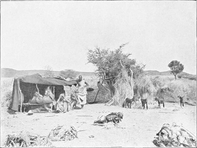
JAALIN SHEPHERD SCENE.
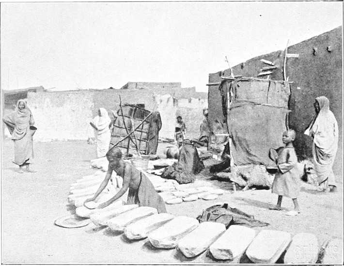
CORN GRINDING STONES, OMDURMAN.
About ½ mile inland a large and deep canal runs parallel to the river. This whole tract is entirely deserted, and, from its appearance, it seems probable that it was thrown out of cultivation prior to the rebellion of 1884. Four miles south of Wad Habashi is the boundary between the provinces of Berber and Khartoum, the limits being marked by the isolated granite hill on the east bank, known by the name of “Hagar El Asal.” From this point, the reefs forming Sixth Cataract.the tail of the Shabluka Cataract begin, and navigation at low water becomes impossible for steamers.[29] Although the actual cataract, or rapid, is only some 12 miles in length, the bad water, above and below the pass, extends for a length of some 55 miles, i.e., to Wad Ramla, or to within 35 miles of Khartoum.
In summer, i.e., if the railway is not used, this portion of the journey has either to be made in native boats, or by camel portage round the cataract. The land route is shorter than that by the river, being not more than 26 miles in length.
Wad Hamed.Five miles above Wad Habashi the former cavalry station of Wad Hamed is passed on the west bank. This place was selected as the headquarters of the Egyptian cavalry on account of the good fodder to be found in the vicinity. From here the difficulties of navigation increase; the river is split into numerous channels, and winds between picturesque islands, covered with a luxuriant growth of vegetation. Rocks and reefs appear above the water, and the swirls and eddies indicate the existence of many more below the surface. It was in this part of the rapid, on Mernat Island, that the “Bordein” steamer went aground on returning from Khartoum in 1885. Low serrated granite ridges confine the river on either side.
At the entrance of the Shabluka gorge, the channel takes a very sharp turn to the east, and the section is both deep and narrow—not being more than 200 yards in width anywhere, and in some places even less than this. The river runs between high granite hills for some 4 or 5 miles, with a very high velocity. The marks upon the rocks show that the highest flood level is not more than 7 feet above the water level of the river in March.
The northern entrance to the pass was guarded by five Dervish forts, now in ruins; four on the western and one on the eastern bank. These completely command the channel. On emerging from this gorge the river widens out, and the difficulties of navigation recommence. Reefs, rocks, and islands appear in all directions; the solitary peaks of Jebel Royan and Jebel Tyem stand out, one on either bank. At some 20 miles up-stream of the pass Wad Ramla is reached; from this point to Khartoum navigation, with care, is possible for steamers, even at lowest Nile. The country on both sides becomes more open, and many large islands are passed, most of which, notably that of Tamaniat, bear fine crops of dura. Large quantities of hay are also grown upon these islands and transported to Omdurman. The land on the east bank is good, and the cultivable strip extends for a considerable width, though covered as usual with scrub and rank grass. On the west bank the desert approaches the river closely.
Omdurman.At 198 miles from the Atbara, the town of Omdurman is reached—the long low ridge of the Kereri hills to the north marking the scene of the battle in 1898. This town covers a large area, being some 5½ miles in length by 1 to 1½ miles in breadth. Its eastern frontage follows the river bank throughout. Two or three broad streets traverse it, but, with these exceptions, the houses are separated one from another by a network of twisting lanes. Some of the principal remaining Dervish houses, notably those of the Khalifa and Yagub, are spacious and well built. Ebony is much used in the roofs, and where the span is great, iron girders are inserted to support the roofing.
The “Beit El Amana,” or Dervish storehouse, covers a large area. Here are the old powder magazines and stores of a most miscellaneous description. The open-air mosque is simply a large inclosure, and within the “Sur,” or great wall, is packed a rabbit-warren of buildings, with narrow and winding streets. The entire town was, during the Dervish occupation, full of old cess-pits; these being merely deep holes sunk in the desert, and open to the air. These pits were probably largely responsible for the disease for which Omdurman attained such an evil reputation (Cerebrospinal meningitis), but which has now practically disappeared. The Mahdi’s tomb and Khalifa’s house, the latter still in good repair, are objects of interest for the tourist (vide pp. 266 and 252 respectively).
The town lies in a direct line 3 miles from Khartoum—but by water another mile, some 40 minutes by steamer. Very many of the houses are now deserted, but the population still numbers some 46,000. It lies on good gravel soil, and comprises, besides the old Dervish buildings above-mentioned, barracks for the garrison, which consists of 2 battalions infantry and 2 maxims. There is a large market (Suk), where a considerable trade in gum and other produce is carried on. On the sloping banks a large boat traffic is at work. Steamers and ferry boats connect the[49] town with Khartoum. It is the residence of the sub-Governor of Khartoum Province who resides in a house built in the late Khalifa’s enclosure.
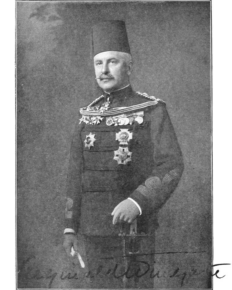
| By kind permission of] | [W. Crooke, Edinburgh. |
MAJ.-GEN. SIR REGINALD WINGATE.
Governor-General and Sirdar.
Khartoum North (Halfaya).Khartoum North (lately Halfaya) is the terminus of the railway from Halfa, and lies opposite to Khartoum, on the right bank of the Blue Nile. It includes storehouses, workshops, the headquarters and the dockyard of the Steamers and Boats Department, barracks for an Egyptian garrison, consisting of infantry and artillery, Custom-house, etc., etc. Population about 2,000. A steam chain ferry, running every half-hour, connects it with Khartoum.
Khartoum. Principal towns.Khartoum, including the towns of Khartoum North (late Halfaya) and Omdurman, together with a little hinterland (vide App. G.), forms a Province by itself. It is once again the capital of the Sudan and the seat of Government, though Omdurman still is, and Khartoum North will probably become in a few years, the principal trade centre.
Khartoum (meaning elephant’s trunk—with reference to the point of land jutting out between the two Niles) is a rapidly growing town, on the left bank of the Blue Nile, just before it joins the White Nile, and is built on the site of the old town of the same name, which was so gallantly held by Gordon and destroyed by the Dervishes in 1885. Its population is now 8,500 souls, and is gradually increasing. The soil is alluvial; bank of Blue Nile about 30 feet above the river at low Nile. In 1898 the old town was found entirely deserted and in ruins.
The main buildings are the Palace (built in 1899), the seat of the Governor-General; the Government Buildings (including the local War Office and the Offices of the Sudan Government); the Nuzl or Government store, the Post and Telegraph buildings, the Mosque, the Department of Works, the Mudiria (Governor’s office), branches of the National Bank and the Bank of Egypt, the Gordon College, the British barracks (holding one battalion of British troops), houses of the chief officials, and a small town of well-built mud-brick and stone houses (including a market square, landing place, a good European hotel, club, brick kilns, Zoological Gardens, etc., etc.), which is daily increasing in size.
Barracks.At intervals along the line of the old entrenchments from east to west are the barracks occupied by the Egyptian Army which are named after Ismail, Tewfik, and Abbas Pashas.
Outside these lines are villages of mud-built and grass-roofed houses of various Sudanese tribes, whose members are employed mostly in building and in other pursuits. (Vide also Chap. V.)
Higher up the Blue Nile at Buri are the Gordon College and British barracks.
Town, etc.The town is symmetrically laid out with wide avenues planted with shady trees, and the class of buildings erected must be in strict conformity with the standard fixed for each particular quarter.
The public gardens and “Zoo” are situated at the west end of the town; these, especially the latter, have only as yet reached an embryo stage.
Garrison.The normal garrison of Khartoum consists of one battalion of British Infantry, relieved annually in October, and three battalions of Infantry of the Egyptian Army, as well as Cavalry and Artillery. (Vide p. 3.)
Market.The market at Khartoum is poor and more expensive than that at Omdurman, which is much larger and better. Meat is usually PT.3 per oke (2¾ lbs.) and dura varies from PT.25 to PT.90 per ardeb (300 lbs.) according to the season and the year.
Building and fire-wood have to be brought long distances from up the Blue and White Niles, and are consequently both expensive.
Labour is scarce and difficult to obtain owing to the many buildings, etc., at present under construction.
Rainfall.The rainfall is very variable but that of an average year is very slight;[30] rain seldom falls on more than 10 to 15 days in the year, but when it does it is generally in heavy thunderstorms, which occur at intervals from June to October, and are usually preceded by duststorms, very similar to those at Kassala. In some years heavy storms occur as early as May.
Climate.The climate is comparatively good all the year round, though in August, September, and October, and occasionally at other seasons, a certain amount of fever is prevalent.[31] Khartoum is 1,253 feet above the Mediterranean.
The hottest month, according to the monthly average maximum temperatures recorded for 1901, is April (110·66° Fahr.), and the coolest January (88·34° Fahr.). April, May and June are here, as elsewhere, as a rule, throughout the Sudan, usually the three hottest months of the year. Vide also p. 12.
The highest temperature recorded in 1901 was in July (116·6° Fahr.), and the lowest (51·8°) in December.
The wind blows from the north almost continuously from November to April, after which it varies considerably, and finally settles down in May or June to blow pretty consistently from the south until the end of October or beginning of November.
[50]Posts and telegraphs.There is a bi-weekly mail to and from the north, weekly to and from El Obeid, Wad Medani, Goz Abu Guma, and intermediate stations on the White Nile, fortnightly to Kodok, and monthly to stations on the Upper Nile and Bahr El Ghazal.
Telegraphic communication with the following and intermediate stations: Cairo, Dongola, Merowe, Suakin, Massaua viâ Kassala, Gedaref, Gallabat, Roseires, Renk, Kodok, Taufikia and El Obeid. Telegrams to Addis Abbaba can be sent viâ Kassala and Asmara. Vide also p. 219.
Ferries, etc.A Government ferry keeps up communication with Omdurman, and a steamer runs twice daily to and from Omdurman and Khartoum North, calling at Khartoum. There is also, as before mentioned, a steam ferry from Khartoum to Khartoum North and several of the native boat ferries.
The suburbs of these three towns include an additional population of 11,000 souls.
Recapitulatory table of distances by river in section:—
Merowe to Khartoum.
| Intermediate. | From Merowe. | |||
|---|---|---|---|---|
| Miles. | Kilometres. | Miles. | Kilometres. | |
| Merowe | 0 | 0 | 0 | 0 |
| Foot of 4th Cataract | 9 | 14 | 9 | 14 |
| Head „ „ | 77 | 124 | 86 | 138 |
| Abu Hamed | 62 | 100 | 148 | 238 |
| El Bagara Rapid | 55 | 88 | 203 | 327 |
| Foot of 5th Cataract | 24 | 38 | 227 | 364 |
| Head „ „ | 2 | 3 | 229 | 367 |
| Berber | 30 | 48 | 259 | 416 |
| Mouth of Atbara | 20 | 32 | 279 | 447 |
| Shendi | 86 | 138 | 365 | 585 |
| Metemma | 4 | 6 | 369 | 592 |
| Foot of 6th Cataract | 54 | 87 | 423 | 678 |
| Head „ „ | 12 | 19 | 435 | 697 |
| Omdurman | 41 | 66 | 476 | 764 |
| Khartoum junction of Niles | 3 | 5 | 479 | 771 |
INSIDE OF OLD PALACE, KHARTOUM.
[51]
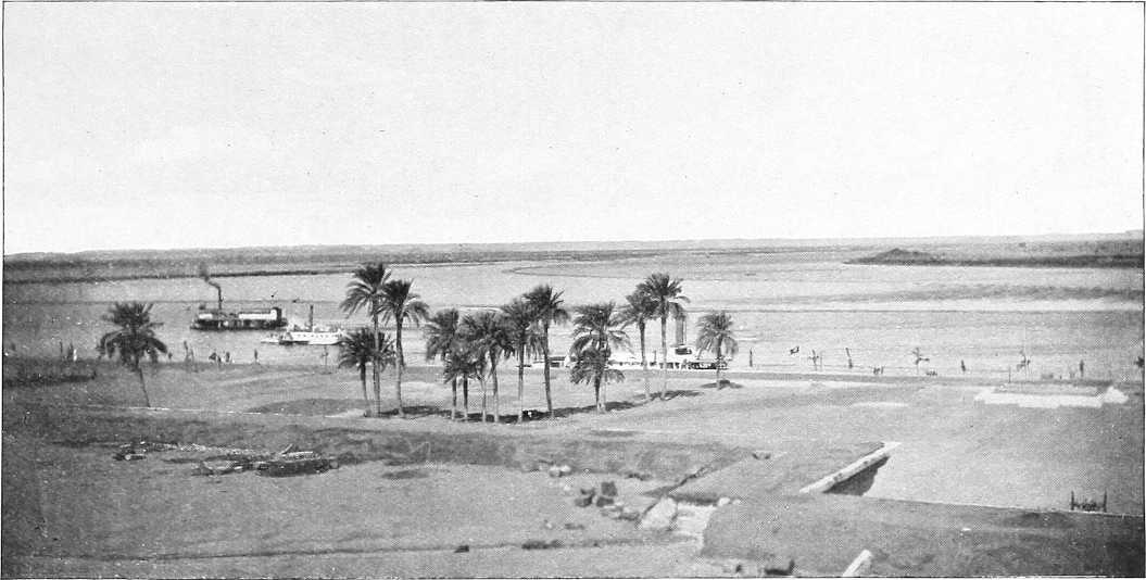
| By kind permission of] | [M. Venieris. |
KHARTOUM: LOOKING NORTH FROM THE WAR OFFICE ROOF OVER TUTI ISLAND.
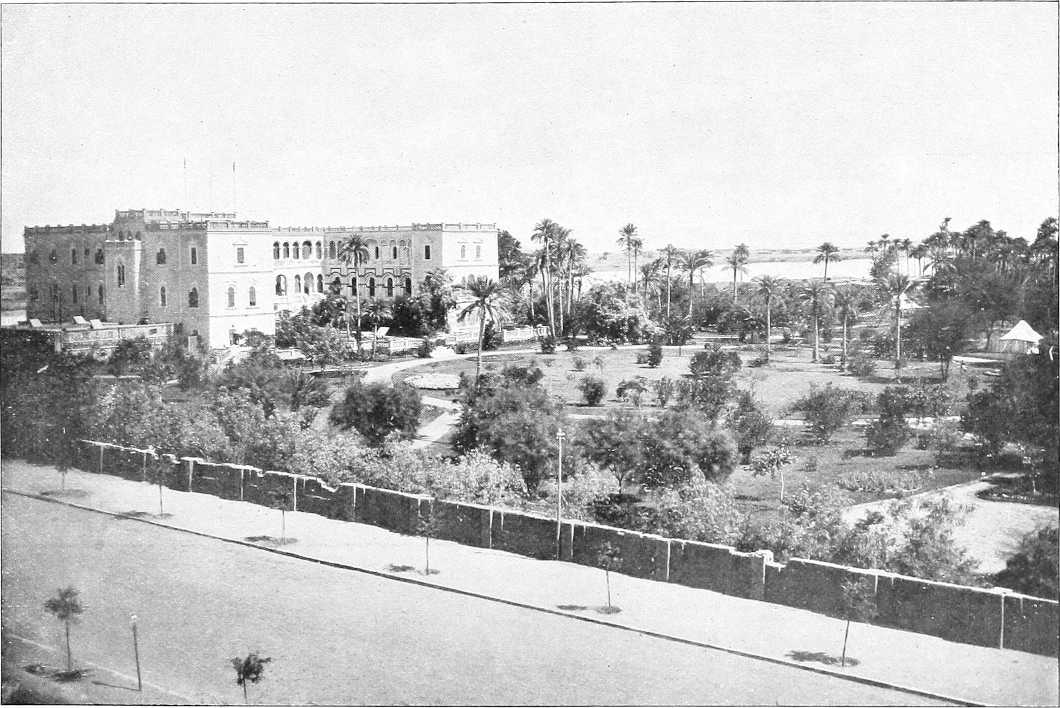
| By kind permission of] | [M. Venieris. |
THE PALACE AND GARDEN, KHARTOUM, FROM THE SOUTH-WEST.
| Place. | Miles. Kilometres. |
Left Bank. | River and General. | Right Bank. | |
|---|---|---|---|---|---|
| Inter-mediate. | From Omdurman. | ||||
| Omdurman | On the W. bank, after getting clear of the houses of Omdurman, a hard, sandy track is followed skirting the edge of the cultivation | In the first 15 miles up stream of Khartoum the country on either side is low, flat, and treeless; cultivation is carried out on the mud flats, and on the islands, which appear as the water falls. The water channel is fully 2 miles wide in this reach. It is very shallow, and landing is almost impossible on account of the shelving banks. On these last, as the water falls, a crop of grass springs up, which affords grazing to large flocks of cattle and sheep. Further up stream the channel gets narrower, but it is still over a mile in width. Both banks are low and fringed with thin and low thorny jungle, and except for the isolated hills of Jebel Auli and Jebel Gurun the country is a dead flat. On leaving Omdurman the water channel at once opens out, at high Nile, to 2 or 3 miles, course for steamer close to R. bank | |||
| Left bank low, sandy, some scrub, and further on mimosa woods extending to river | Right bank; several villages, low, sandy, or swampy bank. | ||||
| Kalakla | 8 | 8 | Road from Khartoum passes through village Kalakla in large clump of trees and then continues on open desert sand about 2 miles from river; very good going. | ||
| Sheikh Salim | 3 | 11 | Sheikh Salim or Wad Um Meriam. | ||
| Village with high tomb in it. Road about 2 miles from river. After this it enters some low sandhills with large clump of trees on river side about ½ mile off. The first open scrub begins, which thickens as it approaches the river. | |||||
| Gemmueiya district | 6 | 17 | Gemmueiya district.—A long, straggling village of that name and tribe; track passes on desert side of it some 3 miles from river; bank of river difficult of access for watering owing to mud; some bush and trees; low volcanic range to W. Well passed on right just before reaching village 30 feet deep, 7 feet diameter water good. A small tukl village just E. of hill and same name. Track as before. | ||
| [53]Um Arda | 3 | 20 | Scrub gets thicker on R. bank. | ||
| Low flat island. About 9 miles long, trees S. end. Island banks inhabited by Jaalin and Hassania. | |||||
| Haneik | 7 | 27 | S. end of El Arda island. | ||
| Jebel Auli | 1 | 28 45 |
Track unchanged, sparse bush on either flank; good camping ground (at low Nile) and watering place | Road runs round E. of Jebel Auli, a steep bare volcanic rock about 100 feet high. Good camping ground for a brigade or less under the mountain. Another track leads S.E. from here. | |
| Gar El Nabi | 2 | 30 | Road runs ½ to ¾ mile from river through open bush to Gar El Nabi; village mostly destroyed. | ||
| Jebel Mandara | 2 | 32 | Jebel Mendera or Mandara. Well defined table hill 2 miles from L. bank, road passes spur of it. Bank swampy | Bank sandy. | |
| Wad El Kereil | 2 | 34 | Village to west of track | Water channel 3 miles broad at high Nile; keep to right bank | Road crossed by small khors and in places by cultivation in zeribas. River invisible from it. |
| Mohammedia | 1 | 35 | Many small islands | Village; also called Wad El Kereil. | |
| Jebel Barima or Breima (Wad Belal) | 5 | 40 | Low hill. Watering place 1½ miles from track. Latter crosses khors at intervals along route; good, some bush and trees, and sand dunes | Sand and swamp alternate on both banks with trees growing into the water. Rocks appear at low Nile to W. of channel just before reaching the Jebel | Road runs through sand hills ½ mile from river and then closes to river at Wad Belal; good watering place and wood station for steamers. |
| Abu Hagar | 12 | 52 82 |
Dense scrub just before reaching El Hagar or Abu Hagar. Good camping ground ¼ mile to W. in desert. Watering place somewhat difficult of access at river; pools near desert after high Nile. For 2 miles track continues good, then becomes a single camel track, necessitating marching in file through very thick bush. The track to Homra (80 miles) and El Obeid gradually branches off S.W. from the river track | Water channel 1¾ miles. | |
| El Geteina | 3 | 55 88 |
Large village divided into 2 parts, clean, good market, some “Shaduf” cultivation. Headquarters of the Geteina district.[54] P.T.O. Country flat; Danagla Arabs. Road runs through village here about 200 yards from river. Good going, chiefly through sand dunes and scattered bush. | ||
| Salahia | 4 | 59 | El Salahia district. Swamp or cracked mud near river bank. Much dura in Wadi Sadik | South of this thick thorn bush commences. From here to El Dueim (66 miles) the same scenery continues. Cultivation is limited to the islands and foreshores. As the water falls, large mud flats in the centre of the river appear. To these the people transfer their cattle and belongings, build “tukls” and set up shadufs. The soil on these flats is good, and rich crops are produced. As the majority of these islands are not exposed before the month of February, artificial irrigation for the crops is necessary. These quickly ripen under the hot sun, and are, as a rule, harvested in May. The river varies in width from 700 to 2,000 yards. The west bank throughout this reach is fringed with acacias, and, at high Nile, is flooded for a long distance as the left bank is very low and shelving | E. bank open, high, and sandy. Sand hills come down to the water’s edge. |
| Dazira and El Debeiker | 4 | 63 | Old salt works, a mile E. of track. | ||
| El Alaga | 7 | 70 | Good camping ground and watering place. For 3 miles track leads through dura cultivation, then good road near river bank | El Alaga district both banks. | |
| El Gerazi or Garrasa | 6 | 76 | Water channel 2 to 3 miles broad for next 40 miles. Vast quantities of water birds of all sorts inhabit the Nile almost from Khartoum upwards, and large numbers of crocodiles are visible, one or more on nearly every mud bank | Low sand hills with Danagla village of Gerazi to S. of them. People poor, no market. Good meshra. Road runs from here through 3 or 4 miles of dura land ½ to ¼ mile from river, then along sand hills near river to Wad Shalai. | |
| Wad Shalai | 6 | 82 132 |
Village of conical thatched houses; banks become drier; series of villages from here along right bank at 2 to 5 miles interval. Road runs for about 3½ miles through sand dunes close to river, then gradually leaves river, and passes through dura ground about 1½ miles from it. | ||
| [55]Wad Nimr | 2 | 84 | A long straggling village and name of the district. Good watering place 5 miles S., the desert road joins the river road. Track runs some way from the river skirting the edge of the cultivation. | ||
| Wad El Zaki | 5 | 89 | Large village on top of some sand hills, pop. 400 to 500. From here 3 miles takes one to a few houses about 2 miles from the river on some sand hills called Sayif, one of three villages of that name. Road goes on over cotton soil for 4 miles, then crosses sand hill ridge for about 1 mile and descends to a plain close to river where another village, also called Sayif, is seen 2 miles inland. | ||
| El Rahawat | 1 | 90 | On left bank nearly opposite Wad El Zaki is El Rahawat watering place, good camping ground. Leaving this village the track on desert side of the cultivation should be followed. Three miles on sand dunes are passed on R., and behind them is the canal, some 20 miles long, 500 yards broad and 6 feet deep. (Feb’y.) | Commencement of Tura El Khadra (Green Canal) district. | |
| Sayif | 5 | 95 | Good meshra and ferry to other bank; good building and cultivation. The road from here to Dabasi Meshra is over cotton soil with low scrub on river side. | ||
| Tura El Suk and Zif | 5 | 100 | Four miles from river | Zif village. Hashaba a mile to the E. | |
| Dabasi Meshra, or Dobasi | 6 | 106 | Khalifa had big grain depôt here, ruins of which can still be seen. Ferry. Road runs through sand hills ½ mile from river to Dabasi. | ||
| Dabasi | 1½ | 107½ 173 |
Telegraph line to El Obeid branches off here from Dueim line at Minedrib | Fair-sized village, 400 to 500 inhabitants on road. From Dabasi to Shabasha road remains close to bank, thence for next 10 miles 1 to 1½ miles distant. | |
| Amara and Jebel Arashkol | 1½ | 109 175 |
About 10 miles west of left bank is the high rugged mass of Jebel Arashkol, with several distinct peaks. Volcanic. Chief peak named J. Abd el Daim | Island Manir Long, flat, well-wooded island opposite Amara. |
Amara village (or Um Arda). |
| [56]Shabasha | 3 | 112 | Good camping ground and excellent watering place. Village under spur from main mass of Jebel Arashkol. Track continues through cultivation. Good going | A ferry connects Shabasha El Gharb with Shabasha El Sharg (on the east of the river). | |
| Ghobeisha | 9 | 121 | The road closes to river at Meshra. Ghobeisha village. Good place for camp and watering. Road crosses open plain with high grass; cotton soil; probably under water at high Nile (?) | ||
| El Dueim | 4 | 125 201 |
Town of fluctuating population of about 7,000 inhabitants; disembarking place for El Obeid. Head Quarters of the White Nile Province and residence of the Governor. El Dueim is developing into an important trade centre; large market; principal mart for export Kordofan gum. Substantial Government offices. Starting point of Sudan transport service for El Obeid. The plain all round is open and the locality is fairly healthy. Up-stream from El Dueim some fine strips of cultivation occur along the foreshore. Behind this belt grows a fringe of acacias, and beyond lies a rolling steppe. Action here 23.8.83; small Egyptian garrison repulsed Mahdists. | Channel narrows to 1 mile or less | Road opposite Dueim leads to Maatuk, Managil, and Wad Medani. |
| The east bank is covered with low bush and a little cultivation. Track leads N.E. (20 miles) to Maatuk. | |||||
| Hassania Island (N. end) | 5 | 130 | Island (sometimes under water) | Half a mile on Meshra Ghayafa. Good camping ground and watering place; sandhill near Meshra. Sand fairly thick; cotton soil. | |
| [57]Denegila | 5 | 135 | Village west of road opposite island of same name, chief village of which is Mahbale. 1½ miles further is village of Abu Gurun, north of road where it crosses track to Um Saneita. Dura crops in this district. | ||
| Um Gar | 3 | 138 | Um Gar village. Good watering place and camping ground. Track leads 5 miles to opposite Kawa, through bush and trees | Um Gar Island. | |
| Meshra El Hella | 5 | 143 | Small floating pieces of sudd begin to appear | Thick bush close to river to Meshra El Hella. Road runs close to river to Kawa. | |
| Kawa | 3 | 146 236 |
Wad Abu Rul, opposite Kawa. Thick bush and trees on banks. Gum depôt belonging to Kordofan province. | Large village, 500
inhabitants. Residence of British Inspector and Mamur. Wooding station for steamers. Post and Telegraph Office. Road hence to Sennar. Kawa is built on high land and bush is open all round it. Inhabitants mixture Jaalin, Hassania, and Danagla. The houses are mostly round with thatched conical roofs. Large market, neat Government offices. Boat building has been started; ferry. Track from here northwards (31 miles) to Ma’atuk. |
|
| Lakadawia | — | — | Wooded island close by, with north end opposite, Kawa; about 4 miles long; richly cultivated with a variety of crops, comprising wheat, barley, onions, lubia, bamia, and dukhn. Above this the forest belt covers both banks of the river, and is often flooded for a great distance on either side | ||
| The road runs ½ mile from river through dura cultivation, and then over grassy plains past villages of Abu Hindi and Fum Omer to Shaggara. | |||||
| Meshra Shaggara, Kenuz | 8 | 154 | Meshra and village close to river, thence past Kenuz with island opposite. The road runs ¼ to ½ mile from river. Hassan Allob on banks with village called Dabus opposite, still through dura country to Nur El Daim. | ||
| Hassan Alob and Dabus | 2 | 156 | Village. | ||
| Nur El Daeim | 3 | 159 | Large village and police station; 1 mile distant from river. | ||
| Khor Gusab (?) | 1 | 160 | Watering place. Road now leads through dense bush; river unapproachable till Um Turan. | ||
| Sheikh’s Tomb | 2 | 162 | Tomb of Sheikh Nur El Taib; three large trees, ruined mud and brick buildings and some flags mark it. Road bends due south to Shawal. | ||
| [58]Shawal, Abu Lahm, and Aba Island (N. end) | 1 | 163 262 |
Abu Lahm at point of curve | North end of Aba Island. Take western channel. Island cultivated in places, some 27 miles in length, belt of trees along river’s edge, but interior only thinly wooded. Higher at south than at north end. Inhabited by a few Shilluks. From this point the character of both banks changes. The sand dunes seen lower down the river have been gradually disappearing, and black cotton soil now comes down to the water’s edge, which is fringed at low Nile by reeds, and by bunches of sudd which have floated down from the Bahr El Jebel. Beyond the fringe of are what are at high Nile grassy swamps, but at low Nile are dry and excellent grazing grounds. Behind this swampy ground is a belt of fine sant and other acacias. From here to Jebelein at low Nile thousands of sheep and goats and herds of cattle are seen grazing on either bank. These belong to the tribes living inland, where at this time of year water and grazing is scarce. | Village right. Three conspicuous single hills (Jebel Tuema?) about 20 miles south-east and a fourth peaked hill rather south of these (Jebel Buyut?). Country on right open bush, slightly undulating, good sandy watering places on river. |
| Um Turan (?) | 2 | 165 | Watering place. Road improves; good going along bank till Fachi Shoya. | ||
| Malaha | 1 | 166 | Meshra Malaha and village Malaha; salt works. Road enters scrub; bush country to Marabia. | ||
| Marabia | 8 | 174 | Action 29.4.83; Hicks Pasha defeated Dervishes. Good camping place on high ground, where there are ruins of an old fort and brick buildings. Road leaves river, crosses a grassy plain, probably under water at high Nile, past village Torba (186) east of road, and turns towards river. | ||
| Mahdi’s Place | 1 | 175 | Large tree on river bank; ruins of mud houses. | ||
| Fachi Shoya | 1 | 176 283 |
Starting point for Sherkeila and South Kordofan. Country open. Good camping and watering place. Village deserted. Base of two expeditions in 1899. | The banks on both sides now begin to be fringed with reeds, the strip extending gradually in width from a few yards to 400 or 500 yards. Behind this are fine sant trees, etc. | |
| Hesai Island | 2 | 178 | Thick trees and bush, up to 1½ miles in width, commence | Between Aba Island and right bank. Mangara village on Aba Island. | |
| El Alob | 7 | 185 | Village; track leads S.W. to Gedid (33 miles). | ||
| Zeinuba and Aba Island (S. end) | 6 | 191 | El Khema district both banks. Shilluk village at south end of Aba Island. | “Manjera” (boat yard) of Zeinuba under clump of large trees. | |
| [59]Goz Abu Guma and Wurelat Island | 1 | 192 309 |
Track leads S.W. (32 miles) to Gedid | Wurelat Island, opposite Goz Abu Guma. Large grass islands make their appearance in the river (January). The eastern channel opposite Goz Abu Guma is shallow, and dries up at low Nile, when a landing has to be effected either 2 miles above the town or on the west bank of the island opposite the town. | Headquarters of district of that name. Telegraph and Post Office. The telegraph line from Sennar (Blue Nile) across the Gezira reaches the White Nile here and continues southwards. East bank heavy grass with a few acacias. The east channel here is some 500 yards wide. The north and south road runs ½ to 1 mile from river. Line of villages on high ground 4½ miles from river. Good grazing; 400 inhabitants; Tukls. Little trade. Greek merchants have collecting station during the gum season on the left bank, which belongs to Kordofan. |
| Gum collecting station on L.B. | |||||
| El Khema | 7 | 199 | Road joins river at El Khema Police Post. Many birds and monkeys. | ||
| Abbassia Gedida (Black Colony) | 1 | 200 322 |
Colony of old Sudanese soldiers. East bank reed strip thinner than west. | ||
| Abu Zeid | 8 | 208 333 |
Abu Zeid village. Bank continues fringed by several hundred yards of reeds. Baggara Selim country begins; sparsely inhabited, with thick bush and trees behind. Good game country begins | Passage only practicable at low water. The Abu Zeid ford is a most serious obstacle to navigation. At this point, for a length of some 4 miles, the river spreads out in a broad and extremely shallow sheet, at low Nile about 1,200 yards in width. Upon the bed, masses of what are called “fresh-water oysters” collect. The broken shells form, with a shingle, a kind of “conglomerate,” almost as hard as rock, and which nothing but a specially adapted dredger could remove. In March and April, in very low years, the depth of water here is in places not more than 1 foot 5 inches to 1 foot 8 inches. The forest is very thick on both shores, and on the west a wide belt of swamp and grass renders landing very difficult. The papyrus reed is first seen at this place, and occasional ambach. Floating patches of sudd are met with in the channel, as well as many permanent large grass islands, the largest being those of Nuago and Musran. Hippopotami begin to appear in considerable numbers | Police Post, east bank. Scattered trees and bush, 1 to 1½ miles in width, commence again. |
| Masran Island (N. end) | 1 | 209 | North end of island. East channel often much blocked with sudd; only a narrow passage of 50 yards being visible at times. Island thickly wooded | Road keeps close to river bank. | |
| Danko Shush | 4 | 213 | Shilluk village. | ||
| Azalet Rocks | 9 | 221 | Rocks across main western channel. Dangerous at low Nile. | ||
| Danko Selim | 6 | 227 | Shilluk village on Masran Island. Rocks in middle of stream; dangerous to navigation, especially at night. Here the reef runs right across the river channel, and the only method of passing safely at low water is to steer a course like the letter S. Many of the rocks are below the water surface, and their presence is only indicated by the ripples which they cause. | ||
| [60]Meshra Zubeid | 4 | 231 | Meshra to Masran Island. Hence road winds through thick scrub, with patches of open country, to the ford at Jebelein. | ||
| Masran Island (S. end) | 5 | 236 | Shilluk village at southern point. Careful navigation necessary | ||
| Jebelein | 2 | 238 383 |
Two roads lead north-westwards from opposite Jebelein to Gedid, etc. Baggara Selim live on left bank | River about 500 yards wide; rocks showing in places. Up-stream of Jebelein, for many miles, the country is most dreary and monotonous. A fringe of forest on either bank marks the higher land. Between this the river winds through reedy islands, masses of swamp grass and floating weed. A series of islands now begins. Dinka country right. | The boundary between the White Nile and Upper Nile Provinces belonging itself to the Upper Nile (Kodok) Province. Jebelein is easily recognisable by the five peculiarly-shaped granite peaks which rise abruptly from the plain on the eastern shore. The highest of these peaks is perhaps 600 feet. The nearest is 1 mile from the river, and the farthest 3 miles. They form an amphitheatre of rocky hills; two distinct masses, with a third hill to the east of the northern mass. Grassy plain between north and south ridges. Village on east of south ridge. The forest on the east bank is about a quarter of a mile in width, and extremely thick. Behind it stretches an endless expanse of prickly grass, some 3 feet high, interspersed with clumps of mimosas. Lions and Tiang fairly plentiful. The soil is light and friable, and much of it must be flooded during the rainy season. One or two ravines serve as drains to this area. The ruins of Ahmed Fedil’s “Deim” are still visible here. This tract once formed part of the Dinka country, but is now quite uninhabited, most of the Dinkas having migrated to the south to escape the raids of the slave-traders. At this point the “serut” fly makes its first appearance, and remains an unwelcome guest[62] throughout the journey to Kodok. This brown fly, which is about the size of a small wasp, has a sharp stab, and if allowed to settle speedily draws blood. Not poisonous. Road 200 to 400 yards from river. Massacre of Egyptian troops by Mahdists in 1882. |
| (Illustrations) | |||||
| Meshra Sherif | 3 | 241 | Meshra and camping ground good; name applies to country for next 2 miles. Road runs through thickish thorn jungle; path good. | ||
| Bulli Island | 6 | 247 | North end of Bulli Island. Western channel 100 yards broad; eastern one bad. Narrow island 100 to 200 yards wide, covered with grass and rushes | Path keeps close to east channel, which is nearly dry in April and May. | |
| Debba[33] El Goda | 12 | 259 | Western channel bad | Sheikh’s tomb. Large range of hills west. Pointed peak about 30 miles east. Perhaps Abu Gurud (?). | |
| Gamus | 17 | 276 | South end of Bulli Island. Western channel about 80 yards broad. | ||
| Karshawal | 2 | 278 | Small Selim village, with old camp inland 2 miles to south-east. Selim and Dinka Meshra. | ||
| Agang | 18 | 296 | Selim and Dinka villages about 3 miles inland. | ||
| Renk | 2 | 298 479 |
Thick forest on both banks. From Renk to Ahmed Agha there is no change in the monotony of the scenery. The west bank is very flat and low, and the east bank is covered with thorn jungle, plenty of trees and heavy grass | Road closes to river. Headquarters of Renk District. Government offices and residence of British Inspector. Good sandy meshra, open ground for camping large force. Telegraph and Post Office. Inhabitants, Dinkas and Selim Arabs, who own sheep, goats, and the former cattle. Thick forest. Mosquitoes very troublesome here after sunset. Action here 15.9.98. Dervish “deim” bombarded and taken, and a steamer captured. Track to Gule and Roseires branches off here (vide Vol. 2). | |
| Khor Deleib | 2 | 300 | The river is fringed with a belt of reeds on either bank, varying from 10 to 200 yards broad. Thick forest[63] both sides. Much bird life. There is a ford across both channels here (Ahmed Fedil crossed in 1898), but it is rarely practicable except at low Nile, and not always even then. Northern end of Wad Dakona Island; take western channel. A few Shilluk villages on this island formed by White Nile and Khor Gaza El Abiad. This khor at high Nile is probably 300 to 600 yards wide, but at low Nile nowhere more than 300 yards; fordable nearly everywhere. Many wildfowl on it | Road leads south-east to Khor Deleib and runs along an eastern branch of the Nile named Gaza El Abiad. Village of Sheikh Bakhit Niok (released slave from Cairo). South of here people mostly Selim Baggara, living in temporary encampments: about 1 mile inland for grazing. | |
| Warrit, or Loingwin, and Dabba Dungit | 10 | 310 | |||
| Um Hedeida | 10 | 320 | Khor decreases till at Um Hedeida water stagnant and in small quantity (February). Elephants drink here regularly, but only at night. They pass the day about 20 miles inland in a forest of dense kittr bush which the Arabs call their “beit” or house. | Track follows eastern bank of khor. Country covered with 3 feet high grass where not burnt. Scattered bush “Heglig” and “Hashab”; no cultivation. | |
| Water reappears in khor. Selim encampments east of track. | |||||
| Leungtom (D), or Domaia (or El Wat (A)) | 6 | 326 | South of Wad Dakona Island | Meshra. Road approaches Nile for first time since Renk. About 1½ miles inland are villages of Kolang El Wat under Sheikh Salem Banga (also released slave from Cairo). Country fairly open. Track follows east bank of a khor. On west of track is a fringe of thick “talh.” To the east country is fairly open. | |
| Debba El Zawia or Zawa | 5 | 331 | Dom Palms on left bank as well as on right | Two islands, western channel 80 yards; shallow at low Nile | Commencement of Nabagaia District. Island. Swamp grass and trees. First “dom” palms are met here. |
| Anok | 4 | 335 | Village of Agweim Dinkas passed about ¾ mile to east on slight elevation. Thick “talh” bush on either side of track. Village depends on river for water. | ||
| Tereiba or Allal (D) district commences. | |||||
| Debba Ibrahim Sharak | 9 | 344 | Shade and good water in khor. Good midday camping ground. Jebel Ahmed Agha visible. From here on bush unpleasantly thick. Elephants and much game. | ||
| El Ragal (A) | 1 | 345 | Track branches off east to Dinka village or district of Kash Kash (10 to 20 miles from river?). Bush ceases to annoy. Elephants drink here. | ||
| Senagul (D) | 4 | 349 | |||
| Debba Abu Teiba | 1 | 350 | Two main khors, Sangeir (or Ran (D)) and Mesangeir (or Balantega (D)), from the Abyssinian hills near Kirin (?), join the river here. Difficult to cross July to November. | ||
| [64]Meshra Meteima (Selim) | 2 | 352 | Meshra on left bank. | ||
| Jebel Ahmed Agha (or Biba (D)) | 1 | 353 568 |
Western channel best; 70 yards. Matmar district commences; then Mohadan Zeraf | A solitary hill, 250 feet high and 250 yards from east to west along its crest; great landmark; volcanic; a few small trees to summit; stands 2 miles from the bank. From its summit is seen a vast tract of trees and grass broken by khors and swamps. J. Ulu and Gerauit visible 60-70 miles to the east. No break in the level. Much game. Several Dinka and Selim villages in neighbourhood, but in rains the Dinkas retire inland, and the Arabs to districts north of fly limit. Dinka Sheikh Jok. Many “dom” palms around the Jebel. Water is obtainable from Khor Biba. It is 1 mile east of river, which here bends south-west. About 22 miles south-south-east of the Jebel, on the Khor Mesangeir, lies the village of Akorwen in a large grassy plain. There is a track up K. Rau to Awitong and several other Dinka rain villages. Thence track goes to J. Ulu and Gerauit, thence to Kirin or J. Jerok. | |
| Edor Gamoia. | 4 | 357 | Much game: buffalo, etc. | Shilluk village on north end of Gezira Wad Beiker | Opposite this island, for about 6 miles, extends the district of Heglig or Tau. |
| Gamus | 6 | 363 | Shilluk village on the island. The sheikh, after whom the village is named, is a refugee from Cairo. | ||
| Dabba Marbeit or Shakab | 1 | 364 | Opposite south end of Wad Beiker. A grand game country. | ||
| Kwe | 2 | 366 | A Dinka Farik. | ||
| Alumbal | 1 | 367 | Sheikh Ajak’s village. Country round is fairly open, scattered “kittr” and “naal” grass. Both these villages are under Sheikh Salem Banga of El Wat. Track south-east to Akorwen, 22 miles. | ||
| (Illustrations) | |||||
| [66]Meshra Zeraf | 1 | 368 | Meshra on left bank also | The meshra extends for about 2 miles, the road skirts the river and crosses a wide shallow khor called a “farlegh” or “rigl” by the Arabs. It is said to come from near Aturuk. | |
| Rom or Um Gursan | 4 | 372 | Dinka village named Rom, under Sheikh Jok. The district for the next 8 miles is known by the Arabs as Um Gursan. The track from Renk to here is, as a rule, excellent, but from here to Kaka bad; passing over hard-baked, badly cracked cotton soil. Splendid game district on both banks. | ||
| Ardeib El Miriam | 6 | 378 | Ardeib El Miriam district on west bank | District of Tereiti begins. | |
| Meshra Rom or Tereiti | 2 | 380 | Telegraph line passes here. Ageir district. | ||
| Fil and Ajak Kwa El Mango. | 3 | 383 | Ageir Dinka villages. Track about 1 mile from river. Country open with patches of bush here and there. Track goes further from river; at knoll called Debba Shagerab road bends westwards and crosses a marshy (in rains) plain to Debeik, Sheikh Akol’s village, about 1 mile from river opposite Kaka. | ||
| Kaka and Debeik | 11 | 391 634 |
Kaka is one of a collection of Shilluk villages spread along several miles on the left bank, 400 yards from the river. From this point southward, the villages on the western bank of the river are continuous. They cluster along the ridge and behind the forest. In front of them extends a broad belt of swamp, mostly dry at low Nile, varying in width from a few hundred yards to over a mile. Landing at any point along this reach is impossible except at low Nile. The marsh[67] is very deep, and covered with thick grass and reeds, through which nothing but hippopotami can force their way | Many grass islands block the river channel, which averages from 300 to 400 yards in width. Near Kodok these grass islands occur in constant succession, and on the west bank a double line of Shilluk villages is to be seen—the one on the edge of the swamp, and the other further inland. Landing can only occasionally be effected on either bank of the river | On the eastern bank the swamp is perhaps 500 yards wide behind it the eternal belt of forest. Outside of this again stretches an endless plain of high grass dotted with clumps of trees. This side of the river is quite uninhabited, except by a few Shilluks who cross the river for the purpose of hunting or fishing. Occasional big khors run into the Nile on the eastern bank. These depressions run for many miles inland, and their banks are covered with a thick growth of thorny trees. |
| Ajok | 8 | 397 | Skirting an open marshy (in rains) plain on right and following line of trees on left Ajok (Dinka village) is reached. Tracks now become numerous and ill-defined; the one followed led across an open marshy (in rains) plain to the Nile, 2 miles north of Kaka Wood station. | ||
| Kurwa district | 5 | 402 | Road starts from here to Fungor (Mek Bosh-Nubawi) (41), and J. Gedir (71 miles). No landing place. | ||
| Kaka Old Wood Station (1902) | 2 | 404 | The river now curves to the west and then to the east | Known as Hellet El Nyam-Nyam, close to river bank; wood station. Much game here—waterbuck, lion, cobus leucotis, &c. | |
| El Gerab | 7 | 411 | Village. Marshy banks; a few trees | The country in the bend the river forms is called Gerab El Aish (bread-bag?). | |
| Melut | 2 | 413 | Telegraph station, Government buildings, and residence of police officer. Line crosses river to west bank. Track leads from here to Kirin, on the Abyssinian frontier. | ||
| Demtemma | 3 | 416 | Shilluk village left. Sheikhs Kodak and Tak | Demtemma. Small village 700 yards from bank. Headquarters of district officer. | |
| Sheikh Delal | 2 | 418 | Unapproachable by steamers at high Nile; a string of villages now extends, 1 to 2 miles inland, along the west bank for many miles. | Sheikh Lowir (D) village two hours inland east. | |
| Sheikh Nyekeia | 31 | 449 | His villages extend for the next 10 miles. | Floating islands frequent. Western channel 200 yards | Dinka villages right bank; but not so numerous as Shilluks on left bank. |
| Kodok[34] | 10 | 669 459 738 |
Up narrow backwater on left bank. Position 9° 53′ longitude, 32° 8′ latitude. Height, according to Austin, 1,360 feet. Date palms. At low Nile a steamer cannot get up the backwater, and has to discharge on the east bank of the peninsula forming the backwater. The latter has then to be crossed in boats. Headquarters of the Province. Telegraph station and post office. Government buildings, brick stores, zinc roofed.[68] Native village 600 yards to west, with a few shops, where small requirements, such as sardines, cigarettes, etc., can be purchased. Trade goods popular in these parts can be procured here. Garrison of two companies. Marchand’s garden, etc., kept up. His expedition arrived here June, 1898; attacked twice by Dervishes. Anglo- Egyptian expedition arrived 10.9.98. French evacuated December, 1898. Was in the old days a considerable trading station. Climate unhealthy July to October. Millions of mosquitos. | Country on each bank open grassy plain, with bunches of big trees, resembling a park | A track leads south from opposite Kodok to Uryong on the Sobat, about 40 miles. Three wells at Dunjol, 13 miles south. Open grassy country most of the way, up to within 7 miles of Uryong, when thick thorn bush continues to the river. |
| Scattered Dinka villages at intervals. | |||||
| Lul | 18 | 477 | Austrian Roman Catholic Mission Station. Flourishing garden on bank. Station 600 yards inland. Staff of about five fathers and three sisters. | ||
| Taufikia | 34 | 511 822 |
Station second in importance in U.N. Province. Headquarters of a Sudanese battalion; 300 inhabitants; Mamur; deleib and dom palms, also acacias; Old Government post under Ismail. Sir S. Baker’s headquarters in 1865, etc.; “Baker’s Tree” still remains. Fairly healthy site, but little trade. Country in rear marshy, but never flooded. White ants bad. Good landing place. Proposed site for a dockyard (1904). | ||
| Sobat River [The river between the Sobat mouth and Lake No has not yet been accurately surveyed. The figures given in this portion must, therefore, be accepted with caution.] |
5 | 516 830 |
Village left opposite junction. Sheikh Luong | River channel bends gradually due west. Average breadth at Low Nile 150 to 300 yards. Numerous islands and backwaters in places | Mouth of River Sobat or Bahr El Asfar. Yellow river, 80 to 150 yards wide; well defined banks; current of cream-coloured water three miles per hour. Almost at the junction, on the left bank of the Sobat, is the (deserted) fort built in 1898. This point was reached[70] from Abyssinia by Colonel Artomonoff and Messrs. Faivre and Potter ten days before the Marchand mission passed (vide p. 141). Seven miles up the Sobat on its north bank, and six miles across southwards from Taufikia, is the American Protestant Mission Station of Tatûg or Deleib (amid a grove of deleib palms “tuga”). Flourishing. Shilluk neighbourhood. |
| Finidawi | — | — | The left bank is still studded with a chain of Shilluk villages standing about a mile from the river. The intervening space is covered with long grass, but open in places, with stunted solitary trees. Much game. | ||
| (Illustrations) | |||||
| Khor Attar | 1 | 517 | Wooding station; good landing place; swampy inland. Khor running in from due south. Trees and grass, ambach, &c. | ||
| Tonga | 4 | 521 | East end of Tonga Island begins. Very low; annually covered by the flood. Width from one to two and a-half miles. At low Nile the channel separating it from the mainland is dry at the western end. The eastern part of this channel is termed the River Lolle or Fanakama. At its eastern end it is 80 yards broad and about three feet deep (in April); it is doubtful whether it is a river at all; but it has been reported to come from the Nuba hills. It was explored by Marno in 1880 for about 32 miles, and by Colonel Sparkes in 1899 for about 28 miles (stopped by sudd). A branch from the Lolle forms the western part of the channel referred to. | ||
| Gabt El Megahid | 5 | 526 | Formerly a base camp for sudd cutting parties. | ||
| Shakwa El Shilkawi | 5 | 531 | Shilluk villages—group. | ||
| Bahr El Zeraf | 16 | 547 880 |
Western end of Tonga Island | Mouth of the Bahr El Zeraf; 38 yards broad; little or no current; 19 feet deep (low Nile). | |
| Maya Signora | 53 | 600 | A large lagoon (explored by M’lle. Tinné (Dutch) in 1863), over 500 yards wide, extending for some distance alongside the river. Likely place for sudd to collect. Connects with Bahr El Jebel, 13 miles up stream of Lake No. | ||
| Lake No | 12 | 612 985 |
Entrance to Lake No. Mouth of the Bahr El Jebel. For description of Lake No vide p. 165. | ||
[71]RECAPITULATORY TABLE OF DISTANCES.
| Intermediate. | From Omdurman. | |||
|---|---|---|---|---|
| Miles. | Kilometres. | Miles. | Kilometres. | |
| J. Auli | 28 | 45 | 28 | 45 |
| Geteina | 55 | 88 | 55 | 88 |
| J. Arashkol | 54 | 86 | 109 | 175 |
| Dueim | 16 | 26 | 125 | 201 |
| Aba Island | 38 | 61 | 163 | 262 |
| Fachi Shoya | 13 | 21 | 176 | 283 |
| Goz Abu Guma | 16 | 26 | 192 | 309 |
| Abu Zeid | 16 | 26 | 208 | 333 |
| Jebelein | 30 | 48 | 238 | 383 |
| Renk | 60 | 96 | 298 | 479 |
| J. Ahmed Agha | 55 | 89 | 353 | 568 |
| Kaka | 41 | 66 | 394 | 634 |
| Demtemma | 22 | 35 | 416 | 669 |
| Kodok | 43 | 69 | 459 | 738 |
| Taufikia | 52 | 84 | 511 | 822 |
| Sobat River | 5 | 8 | 516 | 830 |
| Bahr El Zeraf | 31 | 50 | 547 | 880 |
| Lake No | 65 | 105 | 612 | 985 |
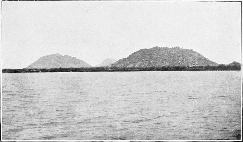
JEBELEIN.
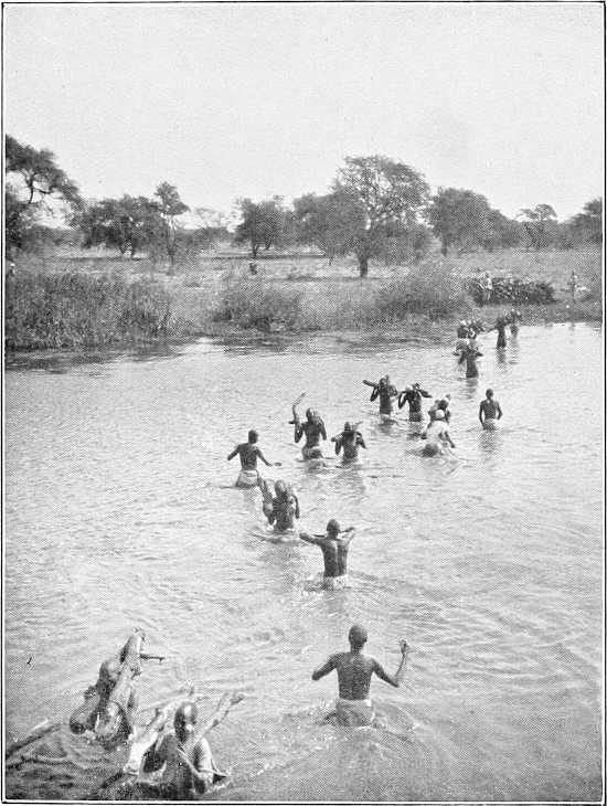
WOODING STATION NEAR GOZ ABU GUMA.
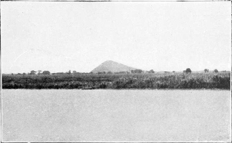
JEBEL AHMED AGHA.
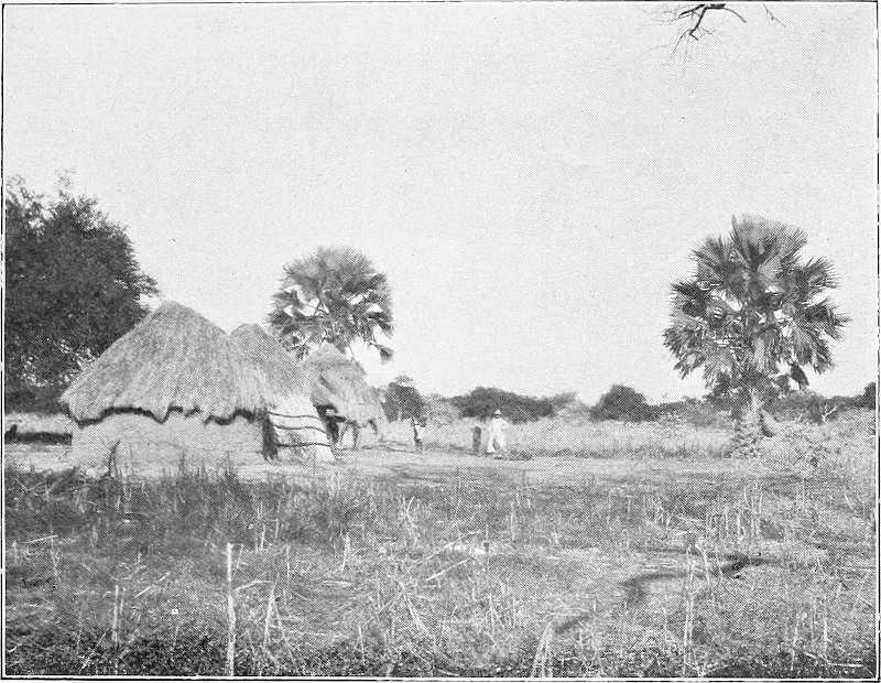
AKUNERE, SHILLUK VILLAGE.
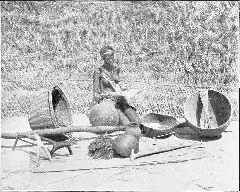
SHILLUK MAIDEN WITH HOUSEHOLD UTENSILS.
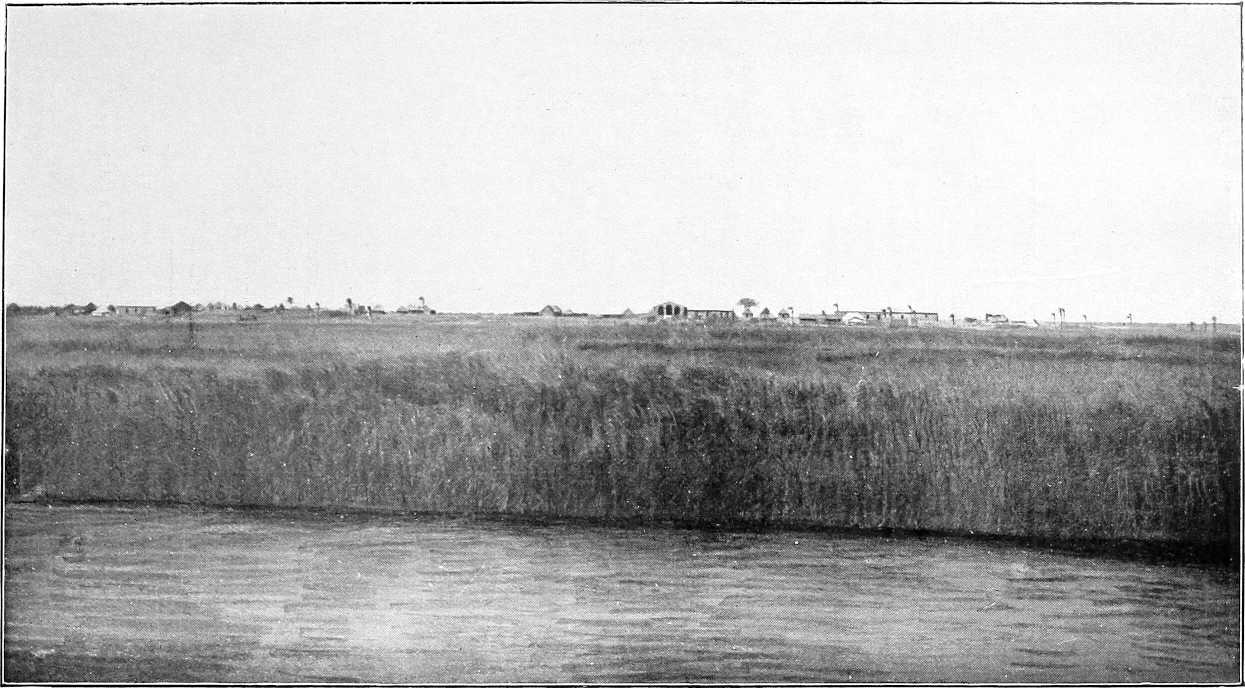
KODOK.
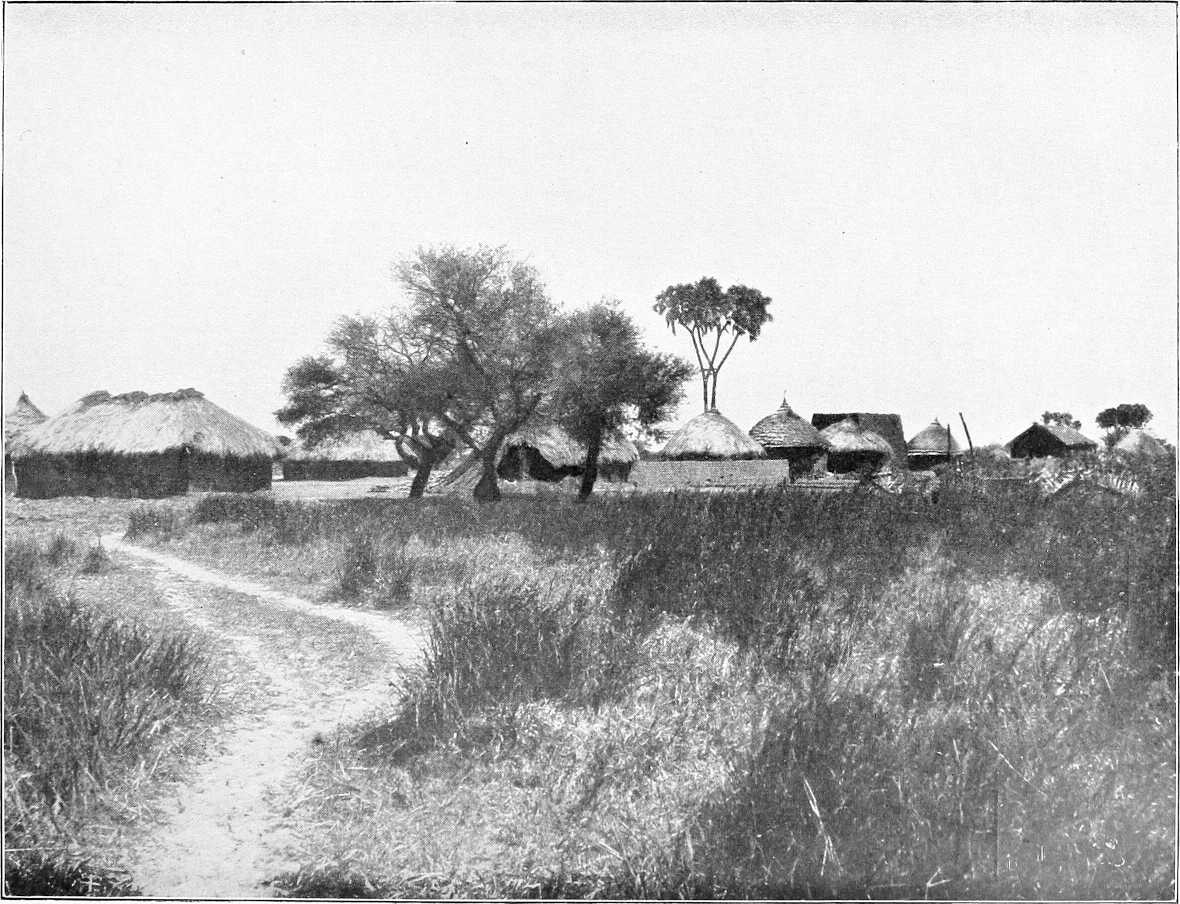
ROMAN CATHOLIC MISSION STATION, LUL.

TAUFIKIA.
[72]
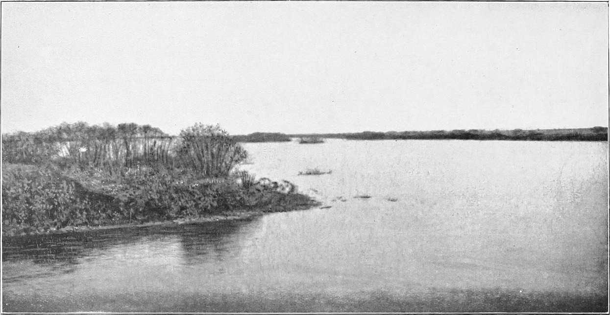
LAKE NO.
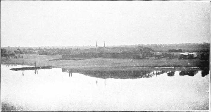
SHAMBE.
| Place. | Miles. Kilometres. |
Description. | |
|---|---|---|---|
| Inter-mediate. | From Lake No.[32] | ||
| For description of Lake No, see page 165. For the Sudd, see Appendix B. | |||
| Bahr El Jebel | — | — | For detailed description and maps of the Bahr El Jebel between Lake No and Gondokoro, see Sir W. Garstin’s Report (Blue Book, Egypt, No. 2, 1901, price 3s. 6d.), from which much of the following is taken; also see his Report of 1904 (price 17s.). |
| Ex block[35] No. 1 | 1 | 1 | The entrance to the Bahr El Jebel is about 150 yards broad at the extreme east end of Lake No. The channel, turning suddenly to the south, is bounded on either side by a dense perpendicular growth of rich green papyrus swamp, in which ambach trees, and um suf and convolvulus occasionally appear. The papyrus reaches from 10 feet to 15 feet above the surface of the water (Jan.). As the steamer proceeds in its winding course, the channel varies from 70 to 100 yards, whilst the breadth of the papyrus strip varies from a few hundred yards to several miles. The solid ground (at its best only a few feet above the level of the water) on the far side of the papyrus gradually recedes, and the trees in the distance become more and more sparse, till at last they vanish altogether. Except in occasional instances, no dry land is to be seen throughout these swamps. Their extent is unknown, but, more especially to the west of the river, it must be enormous. In all probability the greater portion of the region lying between the Bahr El Jebel and Bahr El Ghazal and its tributaries is, in the rainy season, a vast marsh. To the east their area is more limited, as the country beyond the Bahr El Zeraf gradually rises into alluvial plains, covered with dense grass, and intersected by numerous swamp lines. These plains, as a whole, are above the level of the Nile when in flood. In the long island, lying within the loop formed by the Bahr El Zeraf with the main stream, there undoubtedly exists a ridge of comparatively high land. Upon this a Nuer population has settled. Except by occasional glimpses of trees, and, more rarely, of a village, it is impossible to trace this ridge. Its limits are undetermined. It is surrounded on every side by a belt of almost impassable morass. The only evidence of human beings are the grass fires on the horizon, and, except for an occasional elephant, buck, or giraffe, visible in the far distance from the top of the steamer, and a few water-birds, bee-eaters, wagtails, &c., animal life appears to have suddenly become extinct. At sunset, however, thousands of insects make their appearance, but, with the exception of the mosquito, who is always en évidence to a greater or lesser extent (worst from April to November (during the rains) and least from December to March—dry season—grass fires), they vanish after an hour or two. |
| „ „ 2 | 8 | 9 14 |
|
| Discharge (14.4.00) 218·95 c.m. per sec. | 1 | 10 16 |
|
| Ex block No. 3 | 6 | 16 26 |
|
| „ „ 4 | 21 | 37 59 |
|
| „ „ 5 | 14 | 51 82 |
|
| „ „ 6 | 4 | 55 88 |
|
| „ „ 7 | 3 | 58 93 |
|
| „ „ 8 | 6 | 63 101 |
|
| „ „ 9 | 3 | 66 106 |
|
| „ „ 10 | 1 | 67 108 |
|
| Ex block No. 11 | 5 | 72 116 |
The water of the Bahr El Jebel is dark-coloured, but contains little or no sediment. The depth of the main channel varies from 20 to 24 feet at low Nile. As far as mile 40, the ridge lying between the Zeraf and the Jebel is visible on the eastern bank, at a distance varying from 500 to 3,000 yards. Trees and a few palms appear to indicate the presence of villages. From this point the ridge disappears and the swamps stretch to the horizon upon both sides of the river. The first four of the sudd blocks, cleared by Major Peake’s party, occurred within this distance. The fifth, sixth, seventh, and eighth blocks were met with between miles 50 and 63. Upstream of mile 63, the character of the marsh changes. North of this point comparatively few open lagoons are to be seen, but from here, until Hellet-el-Nuer (mile 139) is reached, these shallow lakes border the Bahr El Jebel in continuous lines. Some of them are of considerable area, as a reference to the map will show. They form nurseries for the growth of water plants, and are the chief cause of the blocks which form in the channel. Their depth rarely exceeds 3 feet. As the river is ascended, these lagoons increase in number and size. The channel often passes between two of these lakes, only separated from them by a belt of papyrus. In winter these lagoons are open spaces of water, but, with the advent of the rainy season (in the month of April), their surfaces become covered with detached masses of floating vegetation. Many of them are connected by a series of openings with the river, and their water level rises and falls with that of the latter. The loss of water, by evaporation, upon these shallow ponds, must be extremely great. It is difficult to say whether these lagoons are old courses of the Bahr El Jebel and long since filled up, or whether they are traces of the vast lake which, it is imagined, once covered this area. The latter supposition appears to be the more probable, as the channel of the river is so deep and so sharply defined that it appears hardly possible that it should have utterly disappeared. On the other hand, there is at least one instance where the river is actually in process of vanishing, i.e., between miles 143 and 165. In this reach the channel is filled with decomposed sudd to such an extent that it is difficult to trace[74] it. It is reasonable to suppose that, unless cleared, it will, in course of time, disappear and be transformed into a series of “mayas” or lagoons. These “mayas” are constantly changing their shape. New channels burst into the river and others fill up and disappear. |
| „ „ 12 | 3 | 75 120 |
|
| „ „ 13 | 4 | 79 127 |
|
| „ „ 14 | 3 | 82 132 |
|
| Discharge (1.4.01) 362 c.m. per sec. | 10 | 92 148 |
The average level of the marshes, in March and April, 1901, was from 7 inches to 1 foot above the river water surface. Between mile 65 and Hellet-el-Nuer, the width of the river is very variable; in many places it is only 60 yards and in others as much as 150 yards. The general average may be taken as from 75 to 80 yards, and the mean velocity of the stream at 2 miles an hour, at low water. The depth ranges from 15 to 22 feet, but in places is as much as 28 feet. The sudd blocks 9 to 14 were met with between miles 65 and 82. At block 14, what may be termed the first series of sudd obstruction ended, and with its removal, in April, 1900, through navigation between Khartoum and Gondokoro was restored. The worst place in the river, in the way of giving trouble, was block No. 10, at mile 67. |
| 2 deleib palms. (W.) | 16 | 108 | From this point land approaches the river on both banks, that to the east being less extensive. |
| 3 deleib palms. (E.) | 5 | 113 | |
| Trees | 12 | 125 | Trees 5 miles to east. |
| Hellet El Nuer | 14 | 139 223 |
At mile 139 from Lake No, Hellet El Nuer (or Aliab Dok) is reached. It is rather a pretty landing-place with stretches of short turf; no huts or inhabitants. The latitude at this place is 8° 4′ 36″ North, and at this point the high land touches the west bank of the Jebel and stretches in a broad expanse to the horizon. The bank here is 3 feet above the water, but the land rises at a short distance from the river. This plain is evidently never swamped, even in flood. It is covered with a growth of deleib palms, Euphorbia, and bush. It commences at mile 131, and continues along the river as far as mile 144, with swampy intervals at the loops. |
| Captain Gage’s channel | — | — | At Hellet El Nuer itself, a branch of some size takes off the Bahr El Jebel. This channel is not shown upon any existing maps, and was first mentioned by Captain Gage, of the 7th Dragoon Guards, in his report upon his journey through the sudd in the winter of 1899-1900. It has a width of 70 yards, of which 10 yards on either side are filled by the swamp grasses. Its average depth, at low water, is 3 feet, and its mean velocity is 2 feet per second. Its discharge, as measured in March, 1901, was 21·74 cubic metres per second. Captain Gage’s channel leaves the Bahr El Jebel at a right angle, but some 500 yards down-stream it turns in a north-westerly direction. Captain Gage followed its course for some 40 miles, but was then stopped by sudd. It seems not improbable that this channel forms a junction between the waters of the Bahr El Jebel and those of the River Naam, which discharges into the Bahr El Ghazal, through the Khor Deleib. A few miles down-stream its banks are lined by a succession of Nuer villages, and its width increases to 200 yards. It must carry a large quantity of water when in flood. At other periods of the year (January) it appears to flow into, not out of, the Bahr El Jebel. |
| North end[36] of false and true channels and block 15 | 4 | 143 230 |
Four miles further on the channel widens into a small lake, and from here[36] the true river is blocked by sudd for some 20 miles. This is termed block 15, and repeated efforts to clear it out (1901-02), owing to the total absence of current, resulted in failure. The expedition under Lieutenant Drury, 1903-04, very nearly succeeded in clearing the whole of the true channel. Both Lieutenant Drury and Sir W. Garstin later passed right through this block in 1904, the only remaining piece near the southern end of the block being fairly easily navigable. The true channel is from 16 to 20 feet deep, whilst the false channel to the west is only 4 feet to 6 feet in depth. One of the Dervish steamers, with boats containing ivory, was sunk in this part of the river, and was discovered by the 1903-04 expedition. At present navigation of the false channel is attended with considerable difficulty, and the services of a competent pilot are indispensable. The river is separated into many branches, and these cross and recross one another, forming a bewildering labyrinth of islands. At the south end of the small lake before mentioned, channels converge from all points of the compass. These are separated by low flats, covered with dense growth of papyrus. |
| Series of lakes | 7 | 150 | After steaming for some 7 or 8 miles through a wilderness of papyrus, a series of lakes is reached, at mile 150 from Lake No. Stiff current here. These lakes have a depth of about 4 feet at the deepest point, but shoal rapidly towards the shore. A feeble but distinct current passes through them to the north. Their breadth varies largely. Their shores are surrounded by high papyrus and their surfaces are dotted by countless small sudd islands. There are, however, indications on both sides that the high land is not very far distant. It has already been explained that the true channel, which lies to the east of these lakes, is[75] said to skirt the dry land. On the west a line of fair-sized trees at a distance of, perhaps, 2 miles, shows that the swamps in that direction also have a limit. A very noticeable feature of these expanses of water is their lifelessness. No birds are to be seen, and hippopotami appear to avoid them altogether. At mile 163 the lakes end, and a fresh network of branching streams confront the navigator. Here, again, very careful steering and knowledge of the passage to be followed is required. Each year these channels change. What is, in one season, the deepest channel, is, perhaps, the next year impassable. For some 5 miles the river is split up into many different branches, all winding through papyrus swamp. At mile 165 the true channel of the river is reached. The change is startlingly sudden, as the depth suddenly increases from 4 to 21 feet. Instead of a twisting stream, the Bahr El Jebel again becomes a fine open river, some 80 to 90 yards in width, bounded by a high fringe of papyrus on either side. The false channel leaves the river at an angle of nearly 90 degrees. In April, 1900, the junction was blocked by sudd, but this was light and easily removed. Large shallow lagoons extend on either bank, separated from the river by a belt of papyrus. The high land to the west ends about a mile from the river, and the swamp recommences. To the east a line of palms, perhaps, 6 or 7 miles distant, not improbably indicates the banks of the Bahr El Zeraf. Above this point the Bahr El Jebel widens out for some distance. In places its breadth is as much as 200 yards, and its depth from 15 to 18 feet. The swamps continue as before. At mile 166 the high land approaches the river on the east, and runs parallel to it for some 2 miles. It is covered with bush and an occasional Euphorbia. At this point a khor joins the Nile on the west bank, bringing in a strong stream of water. Two villages (Nuer) are to be seen in the distance; these are probably Favor and Fatooah of the German map (Julius Perthes). The mean velocity now averages 1½ miles per hour. Between miles 175 and 200 the high land and bush before mentioned touches the eastern bank at intervals. At mile 187 there is a break in this ridge, and two or three channels leave the Nile to the east. These are said by the natives to be the most northerly outlets of the Bahr El Zeraf. In 1900 a fine deleib palm stood on the water’s edge at this point. This formed a landmark that could be seen for miles. It has now, unfortunately, fallen into the river. At mile 220, and again at mile 223, channels come in from the west bringing water to the Jebel. These streams may possibly be the mouths of the River Rodi, or Yei, which is supposed to join the Nile somewhere in this locality. At mile 225 the false channel, which, previous to the clearance of blocks 16 to 19, was the only navigable line, joins the river. This was the route followed by Major Peake and Lieut. Drury in 1900, in making the journey to the upper Nile. They found the passage very difficult. During the transit they bent their rudder twice, and went aground four times. From this point numerous channels join the Bahr El Jebel on both sides. Many islands, covered with ambach and papyrus, separate the stream into numerous branches, and the whole country is once more a waste of swamp. The Bahr El Jebel here is extremely narrow (25 to 30 yards), but is from 18 to 22 feet deep. The false channel in appearance far more resembles the main river than does the true one. |
| South end of true and false channels and of block 15 | 15 | 165 265 |
|
| Land approaches east edge of channel | 1 | 166 | |
| North channel to Bahr El Zeraf | 21 | 187 301 |
|
| Mouth of Yei (?) | 33 | 220 | |
| North end old false channel | 5 | 225 362 |
|
| Ex block No. 16 | 18 | 243 391 |
|
| „ „ 17 | 2 | 245 394 |
|
| „ „ 18 | ½ | 245½ 395 |
|
| South end of block No. 18 | 3½ | 249 401 |
It is hard to imagine that this narrow, twisting stream can be the Nile. Its windings are worse than ever. A tree or a boat may be visible at a comparatively short distance ahead, and yet many miles of channel must be traversed before it is reached. The river here runs nearly due west, while the false channel follows an easterly course, passing through numerous shallow lakes, until it joins the main river again at mile 249. At mile 240 the Jebel widens out again, and more resembles a river in appearance than it did. Its average breadth is from 50 to 60 yards, and its depth is some 15 feet. Between this point and mile 248 occurred the four sudd obstructions, removed in February, 1901, by Lieut. Drury, R.N., and which were known as blocks Nos. 16, 17, 18, and 19. At mile 249 the Bahr El Zeraf takes off from the Nile, following the false channel for some distance, before branching off to the east. The width of this river at the head is about 30 yards, and the outlet is surrounded by a sea of marsh. Just up-stream of this point there is a severe bend in the Nile, which might one day give trouble. As the steamer passes, decomposed sudd rises to the surface. |
| Bahr El Zeraf | — | 249 401 |
|
| Shambe | 7 | 256 412 |
The general character of the landscape now changes, as land and forest are visible to the west, and at mile 253 from Lake No, the Shambe lagoon or khor is reached. This is a large lake, some 3 to 5 miles in length, and more than 1½ miles in breadth. Its depth averages 4½ feet. The post of Ghaba Shambe is situated in north latitude 7° 6′ 30″, on the west bank of its lagoon, at a distance of 1½ miles from the river. The land here is about 2 feet over the water, but rises as the forest is reached. It is a dreary-looking spot, consisting of a mud-brick house inside a mud parapet, and a nuzl, and a few “tukls” erected on the flat shore of the lake; garrison of 25 men; a Dinka village lies not far off. Shambe[76] is now the chief Nile post of the Bahr El Ghazal province, and from here proceeds the road inland to Rumbek (116 miles), &c. The river winds round the lake for some 8 miles, separated from it by a band of marsh, about 600 yards broad. Large quantities of hippopotami. To the east the swamp stretches for a long way; at miles 255 and 256 are two other outlets of the Zeraf River. The aspect of the landscape is extremely desolate, with papyrus-covered marshes stretching in all directions. The river itself alternates between long straight reaches or easy curves, and a series of sharp twists and bends, which form a regular maze through the swamps. The water surface is covered with masses of detached plants of the Pistia (or sword grass) stratiotes. The mean velocity is 2 miles per hour; the average depth is 15 feet; and the average width from 50 to 60 yards. For many miles the same dreary scenery prevails. The river recedes a long way from the western forest, and on both sides an expanse of reeds and water extends. The width of the swamped area here cannot be less than 30 miles. |
| Abu Kuka | 37 | 293 471 |
At mile 293 Abu Kuka, north latitude 6° 54′, is reached. The papyrus swamp ceases just north of this point. Here the forest approaches the river, and the bank is dry. The thick bush comes down to the water edge, the trees being about 1,500 yards away. The village of this name is inland, and is not visible from the river. |
| Kanisa | 11 | 304 489 |
At miles 300 and 304, the old and new wooding stations of Kanisa are respectively situated on the west bank. Kanisa or “Heiligen Kreuz,” north latitude 6° 46′, is the site of the Austrian Mission which was located here for many years. The church and buildings were situated on the eastern bank, only a foot or two above the water, but their traces are no longer visible. A large fruit garden formerly existed on the west bank, but only two large shady trees are still alive. This Mission was abandoned in 1864 or 1865, on account of the deadly effects of the climate. The only inhabitants now are a few Dinka. The forest is very thick and consists of Sidr, other acacias, and a few Euphorbia. This forest is continuous as far as the banks of the Rohl, some 60 miles to the west. |
| Immediately up-stream of Kanisa, the river wanders away into the swamps as before. From this point, to mile 343, there is little to describe. The banks on both sides are very flat and rarely more than 2 feet above low water level. The papyrus now practically ends. Occasional clumps are to be seen, but nowhere in continuous masses. Tamarisk is common. The spills from the river into the marshes are very numerous, more particularly on the east bank. A line of trees on the eastern horizon, some 7 to 10 miles away, appears to mark the limits of the swamp. It is easy to see how the Bahr El Zeraf marshes are formed. At every few hundred yards the river spills into them. These spill channels are deeply cut, with vertical sides, as if dug by hand, and the amount of water discharged by them in flood must be very great. In size they vary considerably. Their average breadth is from 3 to 5 yards, but some are as much as 16 yards wide. Between miles 303 and 379, 129 spills were counted, of which 97 were on the east bank. Probably many more escaped observation.[37] | |||
| Lake Powendael | 40 | 344 553 |
At mile 344 the large lagoon, known as Lake Powendael, commences on the west. The river circuits this lake for 4 or 5 miles, separated from it by a belt of swamp, varying in width from a few hundred to 2,000 yards. Lake Powendael is in many places as much as 3,000 yards in breadth, but is very shallow. Its surface is dotted with many small islands, and it is connected with the river by several inlets. Hippopotami are abundant in these parts. Both banks are now very low and flat, about 10 inches over the water. The reach of the river between Bor and Kanisa is unendurably desolate and monotonous, wandering through continual swamp for some 100 miles. At mile 360 another large lake is met with, also on the west. This sheet of water must be quite 4 miles in breadth, and the river winds round it for a long distance in a series of very sharp curves. Many natives are to be seen fishing here. |
| At mile 374 a welcome change appears, as a limit is at last visible to the eastern swamps, which are practically continuous from Lake No to this point. A line of villages (Dinka) stands 2 miles from the river, and behind them lies the forest. A little further up-stream these villages approach nearer, until at last, at mile 380 from Lake No, the high land on the east comes down to the river. | |||
| Bor[38] | 40 | 384 617 |
Bor, north latitude 6° 12′ 46″, is a collection of Dinka villages which stretch northwards (outside the swamp) almost to the Bahr El Zeraf. The forest here stands back from the river on the east bank, but the high bank comes close to the water, except where a large backwater or lagoon passes through it for some 2,000 yards. Gordon mentioned this place as an inconvenient wooding station, but it is very handy now. A few tall deleib palms stand out as land marks. The houses of Bor are neither large nor important, but like in all Dinka villages they are well-kept, neat, and clean. The huts are circular in shape. They are plastered with mud and have conical thatched roofs. Each has a small door[77] through which the inmates crawl. The people show no signs of shyness and appear comfortable and contented. They possess large herds of cattle. At mile 384 the river runs close under the high bank, hugging it for some distance. The land here is from 6 to 8 feet over the water, and is, of course, never flooded. The forest consists of thick bush, with a few large trees; a distinctive feature is the thicket of small deleib palms which cover the ground. Not one in 500 of these young palms appears to develop into a tree, but they form an extremely dense undergrowth. The Bahr El Jebel is now a fine stream, 80 to 90 yards wide, with a strong current. On the west the marshes stretch into space. The valley here must be quite 20 miles across. |
| Dervish Deim | 6 | 390 626 |
South of Bor, the sudd, properly so-called, disappears. The marshes are formed of a deeper layer of sand, covered with a thin surface of clay, and with streaks of clay running through them. These swamps, except in the centre of the valley, are, as a rule, well over summer water-level, and the loss of water can be as nothing compared with that north of Bor. The vegetation, too, is of a different kind, being chiefly grass, and though dense enough, is not composed of those reeds which require to have their roots under water for a great portion of the year. At mile 390 the Dervish “Deim” is visible, situated on the east bank. This is the place held for so long by the Emir Arabi Dafaalla. The spot is well chosen for defence, as the river sweeps round it on two sides. The bank all round has been cleared of bush for a long way. The “Deim” is surrounded by a mud wall forming a rectangle, of which the river forms one side. The inclosure is some 400 yards deep by 700 yards in length. The mud bank, fast disappearing, is about 4 feet 6 inches high, with an outer ditch 3 feet deep by 4 feet wide. At the corners are small watch towers, and in other places remains of loopholed houses. The Bahr El Jebel now, for many miles runs close to the east bank. It winds continually, and there are occasional loops of swamp, but as a whole it follows the high land closely. |
| Bor (military post) | 8 | 398 | Small military post, furnished from Mongalla. Formerly a wood station, now much cut up. Large numbers of elephants. This is to be the site of the Headquarters of the new Administrative District of Bor. |
| In places the bank is perpendicular down to the water’s edge, and from 6 to 8 feet high. At such points there is always great erosion. The scenery more resembles that of the Blue Nile than the White. The forest close to the river, the high banks, the profusion of creepers and undergrowth, the boils and eddies of the river along these curves, combine to form a picturesque scene, utterly different from that usually met with on the White Nile. About 22 miles south of the Deim the Dinka inhabitants are replaced by those of the Bari tribe. The difference is at once apparent. The “tukls” are untidy, crowded together, and badly built. The people seem poor and possess few cattle. They live chiefly by fishing; in April the whole population is engaged in preparing the land for cultivation, if the river allows, chiefly on the west bank. At mile 404 the river bifurcates, one channel branching off to the west, while the other, and the deeper, follows the eastern bank. These two channels reunite at mile 422. The width of the island between them is not very great, being rarely more than 800 to 1,000 yards. The west bank is now a flat grass plain, marked by swampy depressions. The river must top this in flood, but not to any depth, as the marks show that the total rise cannot exceed 4 feet. The west bank is inhabited by the Aliab tribe, a sort of cross between Baris and Dinkas, but they consider themselves quite distinct. The solitary mass known as Jebel Lado is now first visible on the south-west horizon. The river above the junction of the two channels averages 80 yards in width and 11 feet in depth. The bends and twists are never-ending, and there is hardly a straight reach in its whole length. The banks are very sandy, as are the flats which show up above the water. Occasional small islands separate the channel into two or more branches. | |||
| Tree disappeared[39] | 33 | 431 694 |
There is now a decided ridge on either side of the main channel resembling that described in the White Nile. East and west of this ridge the level of the flats is lower, and in the depressions lagoons are formed and winding channels wander. The average width of the valley here cannot be more than from 5 to 7 miles. On either bank the forest line marks the high ground. On the narrow ridges above described are located a few groups of Bari huts surrounded by fields of dura. The high ground does not average more than 100 to 200 yards in width. At mile 431 a magnificent tree used to be situated on the eastern shore. It made a striking landmark, but disappeared in 1902.[39] The forest rises rapidly from the water, and at its highest point is quite 20 feet above summer level. One-and-a-half miles up stream, the river, which has followed the eastern bank for so long, now winds[79] across in a westerly direction. In thus crossing the swamps, an excellent idea of the general section of the valley is obtained. In the centre the flats are, perhaps, 2 feet above the water; towards the sides they rise to a height of 4 feet and sometimes 4 feet 6 inches. The lower portions are marked by a series of lagoons. These marshes are only, however, swamped when the river is in flood, and even then not to any great depth, as the total flood rise is not more than 4 to 5 feet over summer level. The valley averages 8 to 10 miles in width. The forest and thick bush extend to a long distance away from the river. Progress through this forest is only possible by means of the elephant tracks, which are very numerous. At mile 438 the channel again bifurcates, the two branches reuniting 5 miles up-stream. There are so many islands and so many side channels, that it is almost, if not quite, impossible to find the whole stream contained in one single channel, and this is the case the whole way between Bor and Gondokoro. The river varies immensely in width. In places it is from 200 to 300 yards broad, and in others only 80 to 90 yards. As the Bahr El Jebel is ascended the average depth decreases, and throughout the reach between Kiro and Lado is rarely more than from 6 to 9 feet. At mile 451 the river touches the western forest edge, having traversed the marshes. The trees on this side are, as a rule, finer than those in the eastern forest. The bank, at the water’s edge, is from 3 to 4 feet high, but rises rapidly to a height of 12 to 16 feet above the water. At mile 456 used to be an Anglo-Egyptian station, 1901 (west bank), now abandoned. The scenery here is very fine, and luxuriant tropical vegetation abounds. Giant Euphorbia are a marked feature of the landscape. The whole of the banks and most of the trees are covered with a velvety-looking mass of creepers. A bluff, 10 to 12 feet high, juts out into the stream, but the action of the current is so strong that the friable soil is being rapidly eaten away. The face of this cliff is perforated by myriads of holes, made by a very beautiful and tiny species of bee-eater. These birds have rose-coloured wings with bronze-coloured bodies. They add much to the beauty of a lovely scene. |
| Pole west bank (April, 1903) to mark 5° 30′. | 17 | 448 721 |
|
| Western forest | 3 | 451 726 |
|
| Old Anglo-Egyptian station of Kiro. | 5 | 456 734 |
|
| (Illustrations) | |||
| Kiro (Congo F.S.) | 4 | 460 740 |
At mile 400 from Lake No, the station of Kiro, the most northerly in the Lado Enclave, is situated on the western bank. The latitude of Kiro is apparently between 5° 12′ and 5° 13′ north. The erosion caused by the river here is very great, large masses of the sheer cliff, which is 15 to 20 feet over the summer water-level, are constantly falling into the Nile. It seems probable that unless they take protective measures the Belgians will be forced to retire their houses some distance back from the water. Kiro is a picturesque-looking place. The huts are well laid out and neatly built. The cantonment is surrounded by a brick wall, with places for guns, parapet, and ditch. The Commandant’s house is a comfortable-looking structure, with a good thatched roof and a deep verandah. The forest surrounds the station. The garrison consisted in January, 1903, of some sixty-five men. It possessed a small steamer (the “Van Kerckhoven,” called after the leader of the first Congo Expedition to the Nile, 1889; the boat is clumsy and draws 4 feet of water; but having been brought in sections overland from the west coast she is entitled to respect), and several steel sailing boats. The negro soldiers differ largely in type from the inhabitants of the Nile valley. In figure they are short and squat, and some of them are much tattooed. They are recruited from the West Coast, and from the tribes in the Congo valley generally, and make excellent and very mobile soldiers. Upon an island opposite the station vegetables and paw-paw trees are grown. Beyond this there appears to be little cultivation. Kiro is extremely unhealthy in the rainy season. In two years the Belgians lost 9 Europeans and 300 natives from fever. Black-water fever is not uncommon here, and guinea-worm is a prevalent complaint. One-and-a-half miles up-stream of Kiro two fair-sized lakes are enclosed by the western forest. These evidently receive the drainage of the high land from a considerable distance. On the east bank a khor, passable for small steamers, runs north-north-east, rejoining the river just north of Kiro. From here to mile 467 the river skirts the western bank. Everywhere severe action is taking place, and many trees have fallen into the water. Three miles on another large lake opens out in the forest. At one end of it the Lado mountain forms a background, making an imposing picture. At mile 468 another bifurcation occurs. The western branch follows the forest as far as Lado, but navigation in summer by this channel is difficult. The eastern branch crosses the marshes. There are several connections between the two channels. The river now averages from 250 to 300 yards in breadth. At mile 472 the eastern forest is again reached. Here there is a good wooding station, as the trees and high land come down close to the water’s edge. |
| Mongalla[40] | 14 | 474 763 |
Most southerly post on the Nile of Sudan Government (occupied 1901), situated on east bank. Garrison two companies. A gunboat is always stationed here, in addition to which there is usually a steamer at the disposal of the Commandant for administrative purposes.[80] About 200 tukls. Open grassy, sandy spot; fairly healthy; 5 to 8 feet above water. Plenty of trees and bush. The Bari are the inhabitants of the district, but are few in number; few supplies. Brick houses. Proceeding up-stream, the river divides, the main channel running through swamps, and the east channel skirting the villages of Sheikh Lado, Lowala, and Yemba. The depth is rarely more than 9 feet, though there are occasional pools of 12 to 16 feet in depth. Hippopotami used to be extremely numerous and particularly obtrusive, but seem lately to have disappeared. A few huts are to be seen, chiefly on the eastern shore. Most of these have been recently constructed, as many of the Bari have migrated from the west to the east bank of the river, and have settled on Sudan territory. At mile 477 the river again leaves the east bank and crosses the swamps. The width of the valley now contracts to some 4 miles. Such a labyrinth of streams winds through these grassy flats that, without an experienced pilot, navigation would be extremely difficult, more especially as the depth of water rapidly decreases. As it is, there are so many sand banks that it is difficult to proceed at night. At mile 494 the west channel, mentioned as branching off at mile 468, rejoins the east branch, and half a mile up-stream the station of Lado is reached. At this point, with the exception of a moderate-sized inlet some 3 miles down-stream of Lado, the river is confined in one single channel. |
| Sheikh Lado’s village, east bank | 2 | 476 766 |
|
| Lado | 19 | 495 796 |
Capital of the Lado Enclave, taken on and rebuilt in 1898. Formerly an Egyptian post, and at one time head-quarters of Emin Pasha. Situated on the bank 10 to 14 feet above river. Very well selected position, protected on the north by a broad swift running khor and 2 forts, and on the south by an impassable morass; only land approach from the west commanded by a fort. Surrounded on three sides by a rectangular parapetted enclosure, about 400 by 200 yards, one long face being open to the river. Garrison, about 15 white officers and 500 men (1904). Enclosure contains about 20 good brick straw-thatched houses, and good tukls for the men. Road leads to Rejaf (broad) and thence to Yei, Ibembo and Mbima. Native track also to Kiro. Good bamboo and some gum about Jebel Lado. Forest close by. Few or no supplies. The neighbourhood of Lado is a desolate-looking spot, not nearly so picturesque as Kiro, but, on the other hand, healthier. A flat plain with bushes stretches from the river for about 2 miles. From here the forest commences, and gradually rises to the spurs of Jebel Lado, which is some 12 miles from the station. The food for the troops has to be brought from a very long distance. In front of Lado is a low island, upon which vegetables, bananas, and castor-oil plants are grown. This island is 4 feet over low-water level at the south end, and was topped by the 1903 flood. According to the Belgian officers, the flood water contains but little sediment beyond sand, and this statement is borne out by the deposit on the flats and banks. They further state that in flood the colour of the water scarcely changes at all. There appears to be no trade whatever, but a good deal of cultivation. The ivory collected here is small. India-rubber is apparently not found within any reasonable distance of the Nile. Owing to the two years’ drought and one year’s flood, the natives on the west bank of the river had no supplies. Lado possesses a fine herd of long-horned cattle for the use of the garrison. Fever is very prevalent during the rainy months, but does not appear to be of such a deadly type as at Kiro. In April, 1901, the rains had already commenced. According to M. Renier, the month of May in this region is one of abundant daily rainfall, but this is not always the case. |
| Proceeding up-stream from Lado, the scenery improves. Eleven ranges of irregularly-shaped peaks are visible to the east and south-east. Most of them are covered with scrub, and round the bases the bamboo is said to grow in luxuriance. From the river bank up to these ranges extends a broad expanse of reeds and grass, bounded by a dark forest line. To the west the country rises rapidly in a series of ridges clothed with forest. The Bahr El Jebel now averages from 250 to 300 yards in width, and the depth ranges from 6 to 8 feet. Islands and side channels abound, and in flood time it must be difficult to say which is the main stream. The loss of water is comparatively small, as the grass flats are high. Numerous Bari villages on the east bank and on the islands, but few on the west bank. Further south, range upon range of hills show up in the distance, one beyond the other. These are not very high, but are of striking outline and form an agreeable change to the eye, after days passed in the dreary flatness of the Jebel marshes. The width of the valley is here about 5 miles from bank to bank. The Bari villages increase in number on the east bank as the river is ascended. Jebel Lado still dominates the western landscape, and Jebel Rejaf, a pyramidal and solitary peak, marks the point where the reefs and rapids begin. On approaching Gondokoro, navigation becomes more and more difficult as the water shoals rapidly, and the maze of channels and islands are perplexing and intricate; half a mile from Gondokoro are some bad shallows. | |||
| [81]Gondokoro | 9 | 504 810 |
At mile 504 from Lake No, the station of Gondokoro is reached. This place, on the east bank of the Bahr El Jebel, is the north frontier post of the Uganda Protectorate. Gordon gives the latitude of Gondokoro as 4° 54′ 29″ north, and the longitude as 31° 43′ 46″ east. The altitudes given by different authorities vary so much that they are not worth recording. Gondokoro, although a healthy-looking station, has a deserted and scattered appearance. The buildings, mostly of bamboo and straw with brick houses for the European staff, contrast but poorly with those of the Belgians at Lado and Kiro; the station was occupied in 1899. The Collector’s house, or Residency, is situated about 300 yards to the north of the garrison lines, and 130 yards from the river. It is built of burnt bricks, with a high thatched roof, on ground 16 feet, or more, above the river, and surrounded by a thorn zeriba. This and the M.O.’s house are raised on brick arches from the ground and surrounded by gardens and cultivation. The thorn scrub approaches to within 1000 yards of the houses. The station is situated on a high cliff, from 18 to 39 feet above the water. Much of this cliff has fallen in, and the foundations of the Austrian Mission Buildings, abandoned in 1858, are now on the extreme edge of the high bank. A few deleib palms and lime trees mark this bluff. The station extends over an area of about 1 by ½ mile. The new lines are built some 400 yards back from the river. The present huts which accommodate the small garrison are circular huts of mud and grass. There is also a police barracks containing about 25 men. The remains of Baker’s old lines are still existing. He had here a garrison of 1,500 men, but in his time the Bari was a powerful and warlike tribe. Gondokoro was, moreover, an important centre for the slave trade. Baker’s old lines consist of three rectangles, one within the other. The inner one is about 300 by 400 yards; the second, 500 by 800 yards; while the outer is, perhaps, 1,000 to 1,200 yards square. Each of these rectangles is surrounded by a mud bank about 4 feet high, with an outer ditch 4 feet deep by 6 feet broad at the top. There used to be plenty of trees, bananas, paw-paws, etc., and the station was, on the whole, a pretty one, but floods and white ants have now destroyed many of the trees. To the south and north of the station, and also 1¼ miles to the east, are large marshes, which must tend to make the place unhealthy. At times wild elephants come close to the lines. Many Bari villages are located on the river near Gondokoro. All these are on the east side. The Bari appear to be better agriculturists than are either the Dinka, Nuer, or Shilluk. They cultivate dura, ground nuts, beans, and a little tobacco; also sweet potatoes, and manioc. A small market for local produce has been established, and Bari and Luluba keep it fairly well supplied; time, it is hoped, will bring an increase in population and cultivation. The castor-oil plant grows like a weed in this locality. The average maximum flood rise of the river here over summer level is not more than 4 feet. In the flood of 1878 it rose to a height of 7·2 feet on the gauge (Chelu). The general direction of the river here is north and south, so that Gondokoro is well situated with regard to the prevailing winds. The main channel, opposite the station, is about 400 yards across, but is separated from the main land by a large island. |
| (For description of the river to the Albert Nyanza, vide Appendix, Vol. II.) | |||
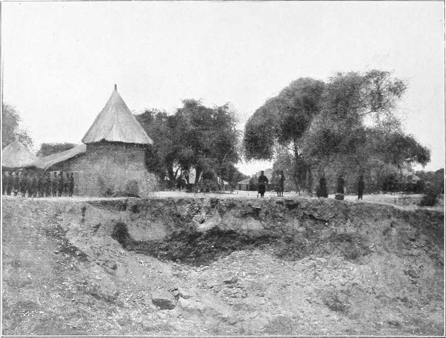
KIRO.
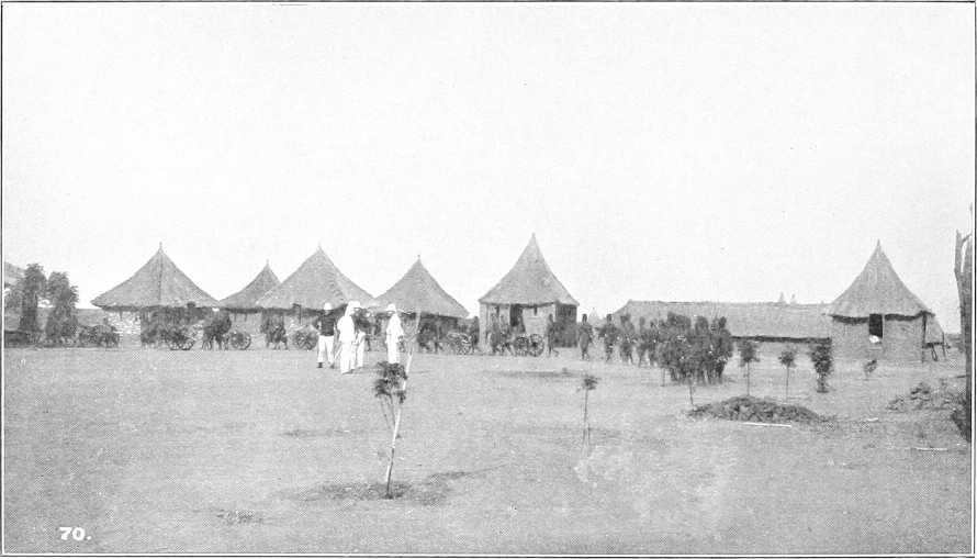
LADO.
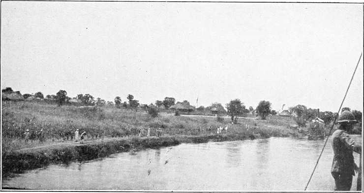
GONDOKORO.
[82]RECAPITULATORY TABLE OF DISTANCES.
| Intermediate. | From Lake No. | |||
|---|---|---|---|---|
| Miles. | Kilometres. | Miles. | Kilometres. | |
| Hellet el Nuer | 139 | 223 | 139 | 223 |
| False channel (22 miles) | 4 | 6 | 143 | 230 |
| Bahr el Zeraf (south end) | 106 | 170 | 249 | 401 |
| Shambe | 7 | 11 | 256 | 412 |
| Abu Kuka | 37 | 59 | 293 | 471 |
| Kanisa | 11 | 18 | 304 | 489 |
| Bor | 80 | 129 | 384 | 617 |
| Latitude 5° 30′ | 64 | 103 | 448 | 721 |
| Kiro | 12 | 19 | 460 | 740 |
| Mongalla | 14 | 22 | 474 | 763 |
| Lado | 21 | 34 | 495 | 796 |
| Gondokoro | 9 | 14 | 504 | 810 |
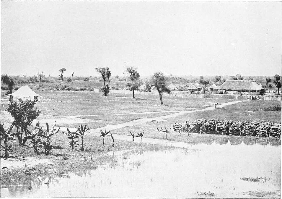
MONGALLA.
[17]The flood discharge at Berber is 14,000 metres cube per second.
[18]For full record of the history of the exploration of the Nile vide “The Nile Quest” by Sir H. Johnston.
[19]An endeavour is to be made during the winter of 1904-5 to explore the Bahr El Arab from its mouth.
[20]I.e., Meeting of the Rivers.
[21]According to some the change takes place at Lake No.
[22]The dates of its maximum levels upstream of the Sobat coincide with those of the Bahr El Jebel.
[23]The maximum is never reached until the late autumn, when the Blue Nile flood has passed away.
[24]Korti is 825 ft. above the level of the Mediterranean.
[25]A reconnaissance for a railway connecting Merowe with Abu Hamed was carried out in April and May, 1904, by Lieut. Newcombe, R.E. The amount of rock cutting necessary to lay the line near the river on the R.B. is said to be prohibitive, and the most feasible scheme seems to be to lay the line some distance inland and approach the river perhaps twice only between Abu Hamed and Merowe. The length of line would be roughly about 150 miles. It has been definitely decided to commence the construction of this line at an early date.
[26]Nowadays (1904) nuggers never make this journey.
[27]For practical purposes reference should be made to Capt. E. A. Stanton’s large scale sketches (I.D. Nubia District, 132) of 23rd August, 1897 (El Bana and Halfia), and 25th August, 1897 (Geridu Rapid). Letters refer to points thus marked on these sketches.
[28]A broad road or clearing has been made along both banks from Shendi to Berber. This is to be extended to Abu Hamed.
[29]For further details of this cataract see N.O. (1st edition, pp. 74-80; 2nd edition, pp. 78-83).
[30]The rainfall in 1903 was 67·9 mm. or 2·7 inches, of which 24·1 mm. fell in May and the remainder in July, August, and September. In 1904 the rainfall amounted to 21·4 mm. or about ¾ of an inch. Vide also p. 12.
[31]The steps taken to exterminate mosquitoes here have proved so effectual that they are now practically extinct. The few stray ones imported by the steamers from the Upper Nile are soon marked down and their larvæ destroyed. For methods of destruction vide “Report of Wellcome Research Laboratories—Gordon College—1904.”
[32]i.e., the point of junction of the Blue and White Niles opposite the South part of Omdurman. The distances are measured up the centre of the navigable channel, so they are not absolutely correct for the tracks on either bank. The (banks) itinerary given here does not always correspond accurately with the latest map, being sometimes based on road reports of previous dates.
[33]A Debba is a low mound, generally the site of an old or existing village.
[34]The native name for the late Fashoda.
[35]I.e., where the block formerly existed.
[36]At this point was the “Box” or “Sanduk,” on a pole, erected as a landmark and for letters.
[39]There is a large Gemmeiza tree, sheltering a rest house, with a wooding station, in this neighbourhood. Opinions are divided as to whether it is the original tree.
NORTH-EASTERN SUDAN.
(Country bounded on the north by the Sudan-Egyptian frontier, on the west by the Nile from that frontier to the mouth of the Atbara, on the south by the Atbara and Abyssinian and Eritrean frontiers, and on the east by the Red Sea.)
General.Along the Nile from Faras to Halfa the east bank is fairly well cultivated. From Halfa to near Kosha, with the exception of Sarras, there is little cultivation and practically no inhabitants. Most of this stretch is rocky and desert-like, and is known as “Batn El Hagar.” South of Kosha cultivation and villages become more general, and continue almost uninterruptedly to Abu Hamed (see Chap. II, Sections 1 and 2. For the left bank, Dongola town, etc., see Chap. IX.)
Between Abu Hamed and the Atbara junction there is little cultivation on the east bank, except south of Genenetti. From here to the Atbara there are about 500 sagias. The cultivated land, as a rule, extends about 500 yards back from the river, and in a few places as much as 3 miles.
The country enclosed by the river and the mainline Sudan Government Railways between Halfa and Abu Hamed is waterless, sandy, or gravelly desert, broken here and there by rocky hills and ridges. It is practically uninhabited, but is believed to contain minerals and workings of old mines near Kuror, etc. These are now being explored.
The soil on the banks of the river in the Dongola Province is rich and alluvial almost throughout, and well adapted for cotton cultivation. This province is in fact the richest and most prosperous in the Sudan.
Climate.Health is excellent all the year round. Very little fever, only simple cases. Little rain; showers may be expected in September. The wind is almost constantly from the north. Ophthalmia, common in Egypt, is rare in Dongola Province. During months June to end of September, the weather is very hot and enervating, but air dry.
Communications. Roads.Good roads, 5 metres in width, have been made on both banks of the Nile throughout the Province; bends can be cut off frequently, notably between Kosha and Abu Sari, a distance of 35 miles across the desert with no water (see Chap. II). There is a desert track on the right bank from Dongola (Naui) to Merowe, a distance of about 100 miles without water, and there are other desert tracks which have never been traversed by a white man; of these latter little or nothing is known.
Boats.Heavy goods, such as merchandise, grain, dates, etc., are mostly carried by boat, and there is no lack of transport for the needs of the natives in this respect; boats are constantly being built, and every encouragement is given them to do so.
A fortnightly post boat runs between Kerma and Merowe. From February to June, however, the low state of the river renders navigation for steamers dangerous through the rapids between Kerma and Dongola; during these months, therefore, the mail is carried by camels over this reach of 40 miles, transport requirements being conveyed by Government gayasas, of which there are 9 in the Province. There are two steamers (1903).
Population, riverain, and desert.From Halfa to Debba the inhabitants are Berabra.[41] The Mahasi dialect is spoken from Halfa to Kerma. Here the Gararish[42] and then the Danagla (Berabra), commence and continue to Debba; from there on to Berti are the Shaigia. From Berti to Khulla the Monasir are found, and then come the Robatab, who extend as far as Kerraba. From here on to the Atbara junction are the Angariab, Hagab, Merifab, and Fadlab. The few inhabitants of the desert are mostly wandering Bisharin.
The total riverain population of Dongola Province numbered (December, 1902) 105,026, and is rapidly increasing.
This is exclusive of nomad Arabs, whose numbers may be put down at 2,000 Gararish (along the river), besides Bisharin, and other Nomads (vide Appendix F.) on the left bank.
The occupation of the people is that of cultivating the ground, which they do very imperfectly except in Dar Shaigia; it could be made to produce double the amount.
[84]The natives of Mahas and Sukkot lag behind, the fault being entirely their own; they are of an extremely indolent nature, perpetually quarrelling amongst themselves over questions as to ownership of land and date trees, and do little or nothing towards bettering themselves.
There is naturally a certain proportion of poor in the province, but agricultural labour being in demand, employment is always to be obtained by persons not too lazy to work.
Cultivation.The cereals mostly cultivated on the river bank are dura, barley and wheat. Cotton has hitherto been grown to a limited extent for local use only. On the completion of the Nile-Red Sea Railway a great increase in cotton culture is expected. A large amount of land, admirably suited to the cultivation of this valuable commodity, is available, and very large issues of Egyptian cotton seed have this year (1904) been made by the Government.
In the Berber Province the wheat and barley grown are of good quality, but both are expensive to cultivate.
| Average yield per feddan (Berber), | barley | 5 | ardebs, | average price per ardeb, | PT.45 to PT.55. |
| „ „ | wheat, | 3 | „ | „ „ | PT.75. |
| „ „ | dura, | 5 | „ | „ „ | PT.35 to PT.80. |
In the Dongola Province the crops are as follows:
| Crop. | Months when planted. | Months when cut. | No. of crops yearly. | Average yield per crop per feddan of PT. 40 land. | |
|---|---|---|---|---|---|
| Dura | June and September | August and December | 2 | ⎱ ⎰ |
3 to 4 ardebs. |
| Dura Shami | June | August | 1 | ||
| Wheat | December | March | 1 | ⎱ ⎰ |
2½ to 3 ardebs. |
| Barley | December | February, end of | 1 | ||
| Simsim | September | October, end of, or November, beginning of | 1 | ||
N.B.—The majority of the land will give three crops yearly, viz., twice dura and once wheat or barley.
The number of sagias in the Dongola Province in December, 1902, was 3,462, besides 77 shadufs and two pumps. There are now (1904), nearly 4,000.
Iron sagias, though tried, have been pronounced unsuitable as they are difficult to repair. Iron fittings for the old wooden sagias have, however, proved a decided success. European ploughs are not popular on account of their weight.
The chief requirement of all the riverain Provinces is agricultural labour, men of the fellahin type, who would teach the inhabitants how to till and tend the soil, and thus produce crops in proportion to the value of the land.
The local breed of cattle is fair, and moderately numerous, but might be improved in both respects.
Dates.The date tax (PT.2 per tree) is one of the principal items of revenue in Dongola. There are also a considerable number of trees in the Berber Province. It is hoped that the new railway will enable dates to be much more largely exported,[43] and thus materially increase the revenue of these Provinces. At present the freights are almost prohibitive. Date harvest, October and November. Quality in Dongola excellent, and ripen before those from Egypt, Tunis or Tripoli. In Berber the dates are not so good.
Dom palms.The dom palm furnishes a means of livelihood to many of the riverain inhabitants in the Berber Province. The leaf is made into mats, sandals, and baskets. Coir (lif) is largely exported to Omdurman, where it is made into rope.
Other trees.Besides the above, there are sunt trees mostly used for sagia building, and selem, talh, samr, and heglig mostly on the back lands, with haraz and the dwarf tarfa on the river bank. Tamarind trees are being introduced and are doing well.
Senna.A certain amount of senna grows wild in the Berber and Dongola Provinces. It is gathered by the Arabs, who transport it to Kordofan, and Aswan, where it fetches about £E.2½ per camel load.
Fruit.Melons and lemons are plentiful in the spring and autumn. People are commencing to cultivate the vine.
Trade.The import trade of the Dongola Province consists chiefly of cotton goods and such luxuries as sugar, tea, coffee, perfumery, etc., and of the export of cereals and dates. Business, however, is not brisk. The chief obstacle to the development of the import trade is the want of enterprise on the part of traders. There are excellent openings for merchants. The people are well off and willing to buy, especially such goods as cutlery, crockery, soap, agricultural implements, hardware, and such sundry merchandise, but at present (1904) there is not a single well-to-do trader in the Province.
[85]Native cotton cloth, called “damur,” is worked throughout the Province, and forms the chief clothing of the men, who dress in shirt and drawers, with ferda (or toga) of this material.
Administrative.Crime is small in proportion to number of population. Inhabitants most peaceably inclined, and all (men, women, and children) work at their crops.
Housing.Villages are mostly composed of well-built houses straggling along the borders of cultivation. The houses are built of galus (mud and stones), with good court yards, whitewashed and clean. Very superior to those of fellahin in Egypt.
Miscellaneous insects.The “Nimetta” fly, a small midge, appears in countless myriads from November to April, both months inclusive, between Dalgo and Korti. The bite causes slight fever through irritation. At times they are absolutely unbearable, and cause temporary migrations of both white men and natives. Natives wear bunches of smouldering grass twisted round the head to keep off the fly.
White ants also are both numerous and most destructive between Dalgo and Korti.
Chief towns. Halfa.Halfa (Wadi Halfa), comprising “The Camp” and “Halfa town” is the capital of the Province of Halfa,[44] which extends along the Nile from Faras Island (N. lat. 22° 10′ approximately) to Abu Fatma. It is also the present headquarters and terminus of the main line (Sudan Government Railways) to Khartoum, as well as of the branch to Kerma. There are extensive railway workshops at the Camp. The latter includes barracks, prison, officers’ mess, native quarter, and the old fortifications. Also post and telegraph office. Population about 400, of which one-quarter are white. No garrison at present. Halfa was for years (1885-96) the headquarters of the Frontier Field Force which defended the southern frontier of Egypt against the Dervish invasion.
The civil quarter of Halfa lies 1½ miles to the north of the Camp. Here there is an excellent hotel, also railway station, post and telegraph offices, some good stores, and native bazaar. The population, which is composed chiefly of Egyptians and Sudanese, with a large sprinkling of Greeks, is about 2,900.
Berber.Berber is a long straggling mud-built town containing about 5,000 inhabitants. It was captured by the Mahdists after a certain resistance on the 26th May, 1884, and was re-occupied by the Anglo-Egyptian forces under Lord Kitchener on 6th September, 1897. It is now the capital of the Berber Province, but this will be moved to El Damer in 1905 (vide Chapter IV). There are at present two railway stations, Berber Camp and Town. Post and telegraph office. There are no good stores in the town, and there is little trade here at present. The present town lies 2 miles to the north of old Berber, and is the headquarters of an Egyptian battalion.
The desert road to Suakin starts from here (242 miles). Behind the town an immense flat plain stretches to the horizon. This is fertile soil, and only awaits proper irrigation to be reproductive. Berber is 1,140 feet above the Mediterranean or 95 feet below the level of Khartoum.
General.For purposes of description this area is conveniently divided into two portions by the Halfa-Abu Hamed Railway. The portion west of the railway comprises some of the most arid country in the Sudan. The general formation is that of a plain covered with sand or gravel, dotted here and there with steep and even precipitous hills of from 100 to 800 feet elevation above the plain, which falls gently and uniformly to within a few miles of the Nile. In places these detached hills are so numerous and so close together as to resemble connected ranges. As a rule the sand is coarse and heavy enough to afford excellent going for camels; but strips of soft deep sand are occasionally met with, especially where the wind has banked it up against or between the hills.
The crest of this gently sloping spur projecting into the bend of the Nile, is some 2,000 feet above sea level, where the railway crosses it, that is some 1,550 feet above Halfa and 1,080 feet above Abu Hamed.
The country midway between the river and the railway has been little visited, and the only known place of any importance is J. Kuror, the highest hill west of the railway and some 4,070 feet above the sea. After heavy rains its “Makhzans,” or rocky reservoirs, hold water for many months, and are occasionally visited by nomad Arabs.
Immediately south of Halfa the plain terminates in a belt of low hummocky hills, some 8 to 10 miles wide. After Sarras, the belt becomes wider and the hills bolder, till they culminate in J. Ago, east of Akasha, at the southern end of the Batn El Hagar.
Between Akasha and the latitude of Kosha the country becomes less confined, but contains several high and precipitous hills. South of Kosha it becomes more and more open, and the hills lower and more scattered until they appear to die away south of Kerma.
[86]From Kerma, as far as Old Dongola, practically no hills are visible from the river, and the sand hills are piled up on the very edge of the water. At Old Dongola the ground rises, and from there, as far as J. Barkal, near Merowe, rocky elevations approach the river here and there, or are seen in the distance, without, however, always encroaching on the fertile belt on the right bank.
From J. Barkal to Abu Hamed there is a rough and rocky belt of hills a few miles from the river, though the elevations are inconsiderable.
Drainage.Rain falls at long intervals in very heavy and local showers. From the upper part of the country it is carried off by a number of wide shallow wadis, whose beds are hardly distinguishable when crossed, though the slight remains of grass they sometimes contain show them up clearly when looked down on from the top of a hill.
As these wadis reach the rocky belt along the river, their beds contract so much that after heavy rain regular torrents descend them, sweeping away anything they find in their path. Much damage occurred in this way to the camp at Akasha in 1896, though no rain fell in the vicinity.
South of the crest of the spur the chief drainage lines are the two Wadis Keheli, one of which rises near J. Kuror and joins the Nile, about 40 miles below Abu Hamed; the other rises near No. 5 Station and is followed by the railway under the name of Wadi Gaud, and eventually reaches the Nile a little west of Mograt Island.
Vegetation.Some of the wadis contain a little grass and a few stunted selem bushes, but there is no grazing for flocks except within a few miles of the Nile. Firewood also is very rarely met with.
Inhabitants.The riverain inhabitants graze their flocks a few miles into the desert. Besides these shepherds there are no inhabitants.
Cultivation.There is none.
Roads.Except in the hilly belt along the river, camels can go anywhere.
The only track at all well-known is that from Dongola (Naui) to Merowe, cutting off the great bend of the Nile to the south.
Limits.The Atbai is roughly the name applied to the country bounded on the north by the Kena-Kosseir road, on the south by the Berber-Suakin road, on the east by the Red Sea, and on the west by the Nile from Kena to Halfa, and thence by the Sudan Government Railway to Berber. It lies, therefore, approximately, between N. lat. 26° and 20°.
The northern half, which is inhabited by the Ababda, belongs to Egypt; the southern portion, inhabited by the Bisharin and the Amarar, etc., near Suakin, belongs to the Sudan. Although on many maps this country is generally labelled “Nubian Desert,” much of it is by no means desert in the true sense of the word. Comparatively little is known even now of the more southern districts[45] of the Atbai, and the following descriptive notes must be taken to apply chiefly to the country between north lat. 21° and 22° 30′.
Bisharin country.The country of the Bisharin, which is bounded on the north by an irregular line rather north of lat. 22°, and to the south extends as far as Mitateb on the Atbara, contains wide stretches of gravelly, sandy, or stony desert, intersected by frequent bare sandstone and granite ranges, but, at the same time, on the eastern side especially, it contains many more or less fertile and quite luxuriantly wooded wadis, in which water is sometimes found within 2 or 3 feet of the surface.
Drainage.East of the railway the hills become more frequent and larger, and the drainage lines more conspicuous.
Generally speaking, the watershed between the Nile and the Red Sea, which lies between 35° and 35° 30′ E. long., consists of a mass of hills from 30 to 40 miles in width. These hills, which consist of agglomerations of rather small features, out of which a bolder peak, such as J. Eigat, occasionally rises, are intersected by very numerous rocky khors, which feed a few large and well-wooded wadis. West of the watershed, from as far south as 20° 30′, all the drainage escapes north by the wadis Alagi and Gabgaba, which unite to the east of Korosko and join the Nile near Sayala.
Of these the Gabgaba has the longest course, as its head waters rise much further south than those of the Alagi. Much of its basin is still unexplored, in fact, the only well known portion is the plain south-east of Murrat wells, which is painfully arid and deficient in vegetation.
Many of the wadis, however, that descend to it on the east are well wooded as long as they are in the hills, and even for a few miles after they have emerged from them.
The scheme of drainage here is exactly the reverse of that west of the railway.
Instead of water-courses beginning broad and ending narrow and deep, here they commence with narrow defined rocky channels, gradually becoming broader, sandier, of more gentle slope, and in many places with fine trees and much “tabas” grass. When the hills are left, however, the trees die away, the grass disappears, and the bed becomes ill-defined or completely lost. South of the parallel of Murrat the country appears to become more open, and probably very wide plains exist with little to offer to even a desert Arab.
[87]South of the Gabgaba Basin, the drainage from the watershed descends nearly due west by several large wadis, which have at various times given trouble to the railway. Owing to the outcrop of rocks near the river between Abu Hamed and Berber, the beds of these wadis become restricted as they approach the river, with the usual result as regards spates and floods.
Drainage east of watershed.On the east of the watershed the wadis, after leaving the hills on which they rise, traverse a range of granite hills, and thence flow, generally in a north-east direction, to the maritime plain of the Red Sea.
The principal wadis, from north to south, are Hasium, Di-ib, and Haieit.
The Wadi Hasium, after emerging from the hills of Abu Hodeid, skirts the Kajoj and Musa ranges, which it leaves some distance to the south, and flows through open country to the sea. It contains the wells of Kajoj and Shalatein.
The Wadi Di-ib, perhaps the most important wadi of the Eastern Atbai, rises in the Amarar country, probably as far south as the 20th parallel, and flows generally northwards. About 20 miles before it turns eastwards to traverse the open maritime plain, it opens out into a wide basin, a mile in breadth and 8 to 10 miles in length, containing a bed of rich alluvial soil. This basin forms the principal cultivable land in the Um Ali Bisharin country. It is the property of the Shantirab, but portions are allotted both to the Amrab and Belgab in good years. An important tributary on the left bank of the Di-ib is the Wadi Hufra, which, rising in the Amrab country in the hills to the north-east of Onib, joins it at the north end of the J. Elba range. It receives all the drainage from the hills of the southern Belgab country by the Wadis Is and Legia. At several places in its bed, the Arabs cultivate and obtain good crops of dura.
Wadi Haieit, in the southern Atbai, is also said to be cultivated.
The ranges of Elba and Asotriba are composed of red granite, whilst at the foot of the latter are small hills of very beautiful hornblende porphyrite.
Climate.The climate of the Atbai is probably the best in the Sudan. The air is of absolute purity, and the elevation, 1,500 to 3,000 feet above sea level, very considerably mitigates the shade temperature. The heat of the sun, however, is intensely fierce in warm weather, owing to the glare from the sand and rocks. During the summer, waves of superheated air are occasionally known, such as that which destroyed a convoy on the march from Korosko to Abu Hamed in 1897.
In winter, the cold is quite severe, and anyone proposing to travel there in December or January should make sure he has plenty of bedding and warm clothes.
Though it is essentially a very dry climate, dew falls at Deraheib on the west of the watershed in December, and a misty haze, which seems to be connected with moisture in the air, frequently covers the whole country. The climate of the littoral is, as may be supposed, much warmer than that of the interior.
Rainfall.The rain falls in violent local showers during the months of July and August, called the “Shuti” rains. In exceptional years, showers occur in May and June.
Many places go without rain for several years in succession, but during the above-mentioned months it is always risky to camp in the bed of a wadi, as a spate may come down, though no rain nor clouds have been visible to the traveller.
The dew is very heavy on the littoral, and suffices to keep the bush grazing in good condition, though it is insufficient to raise the short grass, which sprouts after rain, and which forms the principal pasture for sheep.
Towns or Villages.There are nowadays no towns or villages in the Atbai. The Arabs live by families in groups of tents made of dom-palm matting. These, of course, move according as it suits them.
Deraheib.There are, however, throughout this district, the remains of quite large stone-built villages, formerly inhabited by the miners of the ancients. Those at Deraheib are particularly striking. Deraheib (Der — castle, aheib — beautiful) was evidently at one time the seat of a colony of miners. On the right bank of the wadi are the broken walls of 500 or more houses, arranged in streets. The castle, a large square building, stands under the hills on the left bank. The pointed arches of the castle and portions of some of the houses are set in lime. The majority of buildings, however, are constructed of stone and mud.
Vegetation.The vegetation, generally, is rare and scanty, though in some of the large wadis, even west of the watershed, it is surprisingly luxuriant. Perhaps the Wadi Alagi, with its fine sayal and heglig and abundant marakh, arak and other green trees, is the most striking instance. West of the Gabgaba, and immediately east of it, selem is chiefly met with, but as one ascends the wadis one comes on sayal and the rare palm, “Medemia argun.”
The latter is especially numerous in the Wadis Abaraga and Terfaui, and is found in many other khors in the neighbourhood, especially in those descending from J. Rafit to the Gabgaba.
No adult specimens were noticed east of the Wadi Abaraga, though there are many young plants trying to sprout at Abu Tabag.
This palm is largely used for mat-making, and the Arabs are fully alive to the advantage of preserving it, as well as other trees.
The grazing is not confined to the actual beds of the wadis. There are many flat or depressed places where, for some months after good rain, excellent grazing is found for camels, sheep, and goats.
[88]The rainfall, however, is so uncertain that it is impossible to rely on finding grazing at any particular place even if it has been found there in previous years.
Vegetation east of watershed.The vegetation along the wadis flowing towards the sea varies considerably from that found along those emptying into the Nile. Large trees, such as sayal, selem, heglig and tundub are found along the former, as well as a bush called “adlib,” which camels are extremely fond of, “arad,” an acacia, growing on the tops of the granite hills that border the littoral, is used by the Arabs to produce the red dye for the leather of sword scabbards, etc. The medicinal qualities of the small undergrowth and grasses of the eastern Atbai are considered by the Arabs far more efficacious than those of the west. A species of gum tree, similar to the “Ficus elastica,” but with a smaller leaf, exists on the hills of the eastern Atbai; it is known by the Arabs as “gemmeiza.”
Water supply.Water is scarce throughout the whole district and, where found, is in many places more or less brackish.
The only wells that have been sunk by the present Government are at Nos. 4 and 6 stations, at both of which a plentiful supply is obtained at less than 100 feet depth.
The ordinary water supply consists of regular wells, stone lined for part or all of their depth, rough excavations in the beds of wadis, and accumulations of rain water in cracks or hollows in the rocks. These latter, which are called “makhzans,” if large, and “gammam,” if small, contain the best water. Those on J. Rafit are particularly well known, and were drawn on for the supply of the garrison of Murrat before the re-conquest of the Sudan.
The largest supply of water is perhaps found in the Wadi Murrat close under the old fort. This, in the pre-Dervish days, was the midway halting place of caravans proceeding from Korosko to Abu Hamed, and very large numbers of camels used to be supplied from the wells at this place. The water is brackish and disagreeable, but drinkable.
Like the Murrat Wells, most of the wells in the Atbai are situated in the beds of wadis and khors, and are consequently filled in every time a flood descends, entailing great labour on the inhabitants, who have to clear them out. This is especially the case with those which are not stone lined. (A list of wells is given on page 92.)
Cultivation.As may be supposed, the Atbai is not a great agricultural district. In years of good rainfall, however, there is a considerable amount of dura cultivated in the Wadis Alagi, Gabgaba, and Di-ib, etc., but the Arabs rely chiefly on Aswan, and to a lesser extent on Halaib and Suakin for their grain supply. At the former town they find a ready sale for their sheep, which command good prices. The price of a sheep at Aswan is about PT.75, at Suakin PT.25, whilst dura at Aswan only costs from PT.40 to PT.70 per ardeb, whereas at Suakin it is oftener nearer PT.150. Aswan is, therefore, the most popular market with the Arabs of the Atbai.
Roads.The one main road through this country, that from Korosko to Abu Hamed viâ Murrat, which used to be the artery through which the commerce of the Sudan flowed to Egypt, has fallen into disuse since the construction of the railway, and there are now no other tracks except those made by the Nomad Arabs.
The nature of the country, consisting as it does of masses of very small features intersected by numerous khors, and often separated by plains of considerable extent, lends itself to great freedom of movement in almost all directions. The absence of regular trade, too, has militated against the formation of stereotyped routes, and the result is, that between any two places you can find at least one and very often several more or less different routes, none of which, unless lately passed over by a large party, would appear to the traveller more frequented than the others.
The hilly mass forming the watershed is so far an exception that camel transport from one side to the other is restricted to a few passes.
The tracks, as a rule, are bad and stony; camels, even those bred in the country, soon suffer from sore feet. The tracks usually follow the wadis.
Minerals.That this country was once, to a certain extent at any rate, rich in gold, is evident from the numerous shafts and traces of former workings that are seen.
Game.The following species of game are found in the Atbai:—
Drainage.From the northern portion of the Atbai the general line of the watershed between the Nile and the Red Sea is south-eastward as far as the hills enclosing the upper part of the Wadi Amur.
The hills lying to the north of the Wadi Amur in its upper part form a portion of the watershed.
North of these hills are a series of large khors which drain first north and north-east. Lower down these khors are practically unknown, but are said to curve eastward and reach the sea north of Cape Elba. The largest of these khors are Mahaleit, Dirab, and Haieit. In their upper portions they are broad level valleys covered with a considerable amount of coarse grass. The scrub in them is low and scattered.
South of Wadi Amur the watershed lies north and south in about E. long. 37° 20′, until the great Khor Arab basin is reached.
Of the wadis draining westward, south of lat. 20°, Khor Arab has by far the largest drainage area. It includes in its lower portion not only Khor Arab proper, but also Khors Erheib and Thamiam and Barameyu. It may be said to drain the whole triangle of country, whose angular points are Kokreb, Erkowit, and Oi.
Between Khor Arab and Wadi Amur the drainage is taken by Khors Habob and Laiameb, while Khors Misrar and Aderot drain the country between Khor Arab and the Tobrar range.
On the east side of the hills the valleys are narrower and have a steeper fall, and possess well-defined and clean-swept watercourses, which, in the narrower valleys, cover the whole bed of the valley.
The most important of the khors draining west are Khors Garar, Arbat, Okwat, and Adit.
The general course of Khors Garar and Okwat is at right angles to the watershed, and the upper parts of these khors are therefore steep and stony. Khors Arbat and Adit lie parallel to the watershed for a considerable part of their length.
Khor Arbat is the largest of these khors, and, from its watershed, opens out almost immediately into the broad Odrus plain, which the Berber-Suakin caravan road crosses.
Entering the Akareirirba hills, it narrows in, and in the lower part of its course it becomes a defile shut in by steep hills, which rise directly from the sandy and stony bed of the watercourse.
Khor Adit also has its maximum width in its upper part between Sinkat and Jebel Erba, and, narrowing as it descends, joins Khor Okwat through Khor Totali, a winding defile shut in by steep hills, and in places only 200 yards wide.
The minor khors which drain eastward from the hills bounding Khors Adit and Arbat, are steep stony valleys, ending in agabas, strewn with boulders and difficult of passage by loaded camels.
Such are Khors Adaia and Bengar, leading from Khors Arbat and Khors Teiutelri and Abent from Khor Adit.
The khors become ill-defined on leaving the hills, and what vegetation they possess gives place to the low scrub and coarse grass of the maritime plain.
Climate.The higher parts of the watershed on the eastern side have a perfect winter climate, and the extreme ranges of the temperature are less than those of the higher plains of the northern Atbai.
On clear nights in the late autumn and winter a very heavy dew falls, quite sufficient to saturate any bedding or kit left exposed to it.
On the west side of the watershed little or no dew falls.
To the west of the hills the rainy season coincides with that in the Nile Valley, while in the east rain may be expected between November and March, although local thunderstorms may occur at other times of the year.
The winter rain in the western hills is sometimes heavy thunder rain, and at other times a heavy downpour or thick mist, unaccompanied by electrical disturbances.
Vegetation.In the lower parts of the khors, where they merge into open desert, the vegetation is very scanty. It is confined to a thin line of scattered scrub which marks the lowest part of the valley.
As the valleys become narrower and more marked the trees are larger.
Selem, samr, and tundub, form the chief part of the vegetation, with gamob in Wadi Amur and a thick belt of “eitil” in Khor Arab, near its junction with Khor Oi.
In the valleys east of the watershed the trees are larger and more numerous. Khor Adit is especially noticeable in this respect, with its large gemmeiza trees near Sinkat well, its thick covering of arak bush along the bed of the valley, and sunt and other trees of considerable size near the watercourse. The steep and stony khors, however, such as Khor Garar and the upper part of Khor Okwat, are in most places swept too bare of earth to allow of the growth of trees of any size.
[90]The grazing on both sides of the watershed is confined to the actual valleys.
The watersheds dividing the westward-flowing khors are low rough ridges of black rock and gravel, and are practically destitute of vegetation.
After rain, there is frequently grazing in the depressions in the atmurs, such as El Gura, near Tendera.
In the khors on the east of the watersheds there is little or no grass until the lower levels are reached, except in the Odrus plain and in the upper part of Khor Adit, near Sinkat.
Water supply.Throughout the whole stretch of desert, between the hills and the railway, water is scarce.
Besides those at the well-known halting places on the Berber-Suakin caravan road—Obak and Ariab—the following wells may be noted:—
Garafab.—50 miles N.N.E. of Abidia, has several shallow wells among sand dunes.
Sararat Well.—In Wadi Amur, is 96 miles from Garafab. The well is 50 feet deep, and is lined with stone, but only gives a small supply. This well is probably the same as that marked on the older maps as the “Oasis of Amur.” South of the Suakin-Berber road the chief wells are as follows:—
Tendera, Mib, and Oi.—There are several good wells at each of these places.
The Mib wells are specially good, and lie in a hollow of the hills, reached by a narrow defile about ¾ of a mile long. The water supply at Thamiam is very good, but the wells are dug in the bed of the khor and are liable to fill up. There is sometimes water in the rocks at Rauai, but it was stated not to be sufficient to water a hamla of 80 camels in November, 1902.
Talgwarab is only a water hole 18 feet deep, and cannot be counted on as a supply at present. The natives state that attempts to dig down deeper are prevented by the light soil falling in.
Near the watershed the wells are more numerous. There are four wells in the upper part of Khor Haieit, and several others in the deep valleys through which the larger khors drain into the Haieit, Amur, and Arab basins. In the upper part of Wadi Amur, above Sararat, wells are reported to be about 11 miles apart. On the eastern side, besides the existing wells, water could probably be found at a depth of a few feet anywhere in Khor Arbat. The wells in the lower parts of the khors are frequently brackish. Hoshiri at the foot of Khor Okwat is an example of this.
Cultivation.In years when the rainfall is good there is a considerable area under dura cultivation in Khor Arab near Talgwarab and between there and Thamiam wells. The natives build numbers of horse-shoe shaped dams to retain the water and keep it standing on the ground. There are also signs of the main khor channel having been dammed to divert the water over the flat earthy soil of the valley.
The upper stretches of Khors Barameyu and Erheib and Hareitri are also used for dura growing.
There is also cultivation near Abu Goloda, on the eastern side in the head of Khor Haieit, in Khor Adit above Sinkat, and especially in the Odrus Plain, dura is grown.
Near the Atbara River there is a considerable area under cultivation in Khor Abadar.
Roads.Besides the main Berber-Suakin caravan road there are well-marked roads leading to Rauai well.
The Tendera-Mib-Oi road is also a good track and the surface is fairly smooth, except at the approaches to Mib and Oi wells.
The going on the main Suakin-Berber road is distinctly bad in several places, notably at the head of the Kokreb valley, in Wadi Hareitri and in Khor Hadasana.
Near the hills, communications parallel to the watershed are difficult, as for instance between Haieit and Kokreb. Such a line is very hard on camels, as there is a continued succession of deep-cut khors of varying size divided by hills or ridges of loose shale and black rock, steep and difficult to surmount.
The road leading from Khor Haieit to Khor Garar is a fairly easy one for camels, but Khor Garar itself is very rough.
The chief routes across the watershed are:—
From Khor Barameyu to Sinkat—here the gradients are very easy and the surface smooth.
A route westward from Sinkat towards Abu Goloda and Rauai has steep stony “agabas.”
From Abu Goloda into the Odrus plain—easy slopes but rough underfoot in the upper part of the Abu Goloda khor.
Wadi Hareitri on the Berber-Suakin road—very rough underfoot.
From Wadi Amur into Khor Yudib—many low rough watersheds have to be crossed, and there is no beaten track.
From Khor Arbat the maritime plain can be reached either:—
(1) By the Tamabaf watershed into Khor Okwat.
(2) By Khor Dimm.
(3) By Khor Adaia or Khor Bengar.
Of these the Tamabaf and Khor Dimm routes are easy for camels, but Khors Adaia and Bengar have steep and rough “agabas.”
Boundaries of Bisharin.The Bisharin inhabit the desert bounded on the north, roughly, by the Alagi and its tributaries, on the south by the Atbara, on the east by the Red Sea from Shalatein to J. Asotriba, and thence by a line joining Mitateb or Umbeiba on the Atbara, and on the west by the Nile from the mouth of the Atbara to Abu Hamed, and thence by the old trade route from Abu Hamed to Korosko.
The Ababda and Bisharin formerly lived a good deal further south in the districts now occupied by the Hadendoas; both tribes moved northwards probably about 100 years ago.
The Ababda by their move north, came into a more civilised country. Their Sheikhs, through the transport needed on the Korosko—Abu Hamed road, came into touch with the Government and acquired at this time great wealth, and with wealth, their numbers increased, whilst the Bisharin of the hills, left far behind as regards progressiveness, soon came to be despised by them.
The Bisharin claim descent from Bishar, the son of Kahl, who was also the father of Abad and Amar, from whom the Ababda and Amarar are said to have sprung.
Origin.Kahl is said to have been descended from Zubeir Ibn El Awam,[46] whose wife was a sister of Abbas, uncle of the Prophet. They maintain, therefore, that they are descended from the noble Koreish Tribe. In the genealogy of the tribe, the three principal ancestors are Kahl, Bishar, and Ali Jalan; on this all accounts seem to agree. The present generation of Sheikhs is generally said to be the ninth or tenth from Ali Jalan.
The descendants of Kahl most likely originally inhabited part of the district now occupied by the Hadendoas, the Bisharin, and Ababda, as stated above, having latterly moved northwards.
Sub-division.The Bisharin are divided into two great families, the Um Ali and Um Naji. The former live in the north, the latter in the south, of their country. Both sections are named after the wives of Ali Jalan, the great grandson of Bishar, who had the following sons:—
| By Um Ali. | Tribe. | By Um Naji. | Tribe. |
|---|---|---|---|
| Ali | Aliab. | Hanr | Hanr. |
| Shanatir | Shantirab. | Eira | Eireiab. |
| Amer | Amrab. | Nafi | Nafab. |
| Hamedor | Hamedorab. | Mansur | Mansurab. |
Aliab.—The Aliab, who are far more numerous and wealthy than any of the Um Ali or Um Naji tribes, are divided into the following sub-tribes: Koatil, Mallak, Hamedomerab, Kurbeilab, and Balgab.
The first three named are sometimes classed together and known as the Sararab, on account of their near common ancestry.
The Sheikh of the Koatil has for two generations been the representative Sheikh of these three families; before this the Sheikhship was with the Hamedomerab.
Koatil.—The Koatil, under Sheikh Isa Abdalla, are a small tribe, and poor. They live at Meshushenai and Terfaui.
Hamedomerab.—Sheikh Mohammed Wad Kurab. This, again, is a small tribe, owning few camels, but good flocks of sheep and goats.
Wadi Meisa, at the head of which is Bir Meisa, is where most of the tribe are to be found during the summer. Their two wells are Meisa and Didaut, close together in the small hills north of the Elba red granite range.
Mallak.—Sheikh Isa Shingeirab. The Mallak, the third Sararab tribe, is by far the richest, and own many camels, and of a breed which is famous among all the neighbouring tribes. The Mallak own many wells.[47]
Balgab.—The next of the Aliab tribes is the Balgab (Isa Abdalla), who live in the hills about Is. They have never, since the time of Abdalla, the father of Isa, had a representative Sheikh, but have always been represented by the Sheikh of the Sararab.
They have good herds of camels, sheep, and goats. They do not frequent the Aswan market as much as the other Aliab sub-tribes, but they sell a great deal to merchants who come from there, and buy much of their corn in good[92] years from the Di-ib. They are a wilder people than the other tribes and very rarely leave their hills. They are shy and difficult of approach. Their wells are Is and Legia.
Kurbeilab.—Sheikh Mohammed Katul. This is a large tribe. They have many wells, generally in the small tributaries of the upper Alagi.
Katul, Sheikh of the tribe, is by far the ablest man of the Aliab Sheikhs, or, in fact, of any other of the Bisharin Sheikhs.
Compensation for murder or wounds.The traditional “diia” or compensation for loss of life among these Arabs is: for a man, 50 male and 50 female camels; for women or children, or loss of legs, arms, eyes, 25 male and 25 female camels.
Wounds are assessed according to their gravity. The cause in which murders are committed, or a wound is received, is always taken into consideration.
The above amounts are the limit of compensation.
The following is a list of Bisharin wells in the northern Atbai, showing the sub-tribe to which they belong:—
| Sub-tribe. | Name of Well. | Remarks. |
|---|---|---|
| (i) Um Ali. | ||
| Koatil | Terfaui | Water good—shared by Eireiab. |
| J. Mashushanai | Water in open basin, 12 feet deep—sweet but scarce (December, 1902). | |
| Umrasin | Not much water, and then only after rain. | |
| Hamedomerab | Meisa | Not open 1903. |
| Didaut | — | |
| Mallak | Eigat | Water never more than a few feet below surface—sometimes flowing. |
| Heilaigabeir | Well 10 feet deep—not much water, rather salt. | |
| Butna | Good water and plentiful. | |
| El Eifein | Good water, but supply does not last. | |
| Abu Dom | Slightly brackish—10 to 15 feet down, according to season. | |
| Um Gabrit | Good water—not visited. | |
| Abu Tabag | Stone lined well, 24 feet deep—water plentiful, but slightly brackish. | |
| Balgab | Legia | Good water and plentiful. |
| Is | Good water, 4 feet down. | |
| Kurbeilab | Neshd | Water good—camels cannot approach owing to rocks. |
| Kamotit | Water good. | |
| Homeitra | Water in tanks in mountain; also obtainable by digging at base. | |
| J. Abu Hodeid | Water plentiful—in spring and tanks. | |
| Um Beshtit | Not always water. | |
| Jugub | Rarely open, and not much water. | |
| Derbieib | Hole in side of hill—much water on surface. | |
| Nasari | 1 well, belongs to Amrab—good water, not visited. | |
| Feireida | Very small supply of good water. | |
| Miaus | Small supply of good water. | |
| Shinai | Much water, about 10 feet down. | |
| El Faui | Good water, and plentiful supply. | |
| Kajoj | Much water, near surface—salt. | |
| Gidimib | ? | |
| Madi | ? | |
| Adoloiab | Murrat | Best well is used by the Mining Co.—water very brackish and very aperient. If long stay to be made, water should be obtained from J. Rafit (10 miles). |
| Telat Abda | 2 wells of 15 feet deep—one brackish. In westerly well, water sweet but scarce. | |
| Abu Tabag | Stone lined well, 24 feet deep—water plentiful but slightly brackish. | |
| Naba | Also belongs to Eireiab—much water, 4 to 5 feet down, very salt. 3 wells about 8 miles apart in bed of wadi. | |
| Abaraga | Much water—slightly brackish, 10 feet down. | |
| Maietib | Much water, 15 feet down—brackish. | |
| Gogaieb | Not much water—very brackish, 8 feet down. | |
| Girid | Brackish water—rarely open. | |
| Shantirab | Selala | Well, 35 feet deep—stone lined, 9 feet of water, brackish (December, 1902). |
| [93]Gunnub | Well, 25 feet deep—water sweet, but much polluted by animals (December, 1902). | |
| Murio | ? | |
| Hora | Well, 12 feet deep—good water and plentiful. | |
| Amrab | Labasoi | Bad water—only fit for camels and goats. |
| Sania | Bad water, but plentiful. | |
| Sohanit | Bad water, but drinkable. Better water from the tanks in neighbouring hills. | |
| Oni | Water plentiful and good from well, if open. Also from natural tank in rock. | |
| Beshbesh | Not always open—water good, 10 feet below the surface. | |
| Eiweb | Good water, and plentiful—8 feet down. | |
| Dilko | Rain water only—little. | |
| Nufrium | Good water, and plentiful—6 to 8 feet down. | |
| Nasari | Good water? | |
| Hamedorab | Oyia | Water near the surface, but not always in the same place (1903). |
| Meheiriga | Spring—water rather salt. | |
| J. Elba | Water plentiful, in springs or wells round its base. | |
| Halaib | Well, 15 feet deep, near Government Post—water brackish. | |
| Shellal | Well, 14 ft. deep—very brackish, better from natural tanks 300 feet? deep. | |
| (ii) Um Nagi. | ||
| Eireiab | Naba | Much water, 4 to 5 feet down—very salt. 3 wells about 8 miles apart in bottom of the wadi. |
| Nafab | El Dueim | Good water and plentiful—about 10 feet down. |
| Kamotit | Much water—brackish, 10 to 12 feet down. | |
| Kamoreib | Good water—plentiful, about 10 feet down. |
The following brief account of the Ababda Arabs, whose country adjoins the Bisharin, is given here, as, although with the exception of the Meleikab section, they are under the Egyptian Administration, they are generally said to have sprung from the common ancestor Kahl (vide origin of Bisharin). Feuds, too, between these tribes, though now less frequent, were, until recently, of constant occurrence.
Limits. Three main-sub-tribes.The Ababda, who inhabit the Atbai from roughly north lat. 22° 30′, where they adjoin the Bisharin, to as far north as the Kena-Kosseir road, are divided into three main sections or sub-tribes, viz., Eshabab, Fogara, and Shanatir.
(1) Eshabab.—The Eshabab, which is by far the largest and most powerful section of the Ababda, range practically the whole way from Kena to Ongwat, and share the Kosseir route with the Shanatir. The Sheikhship of this sub-tribe rests with the Gubran family, of which Beshir Bey is the representative. Beshir Bey’s residence is at Aswan; he claims to be Nazir of the Ababda, and does not admit any common ancestry with the Bisharin. This sub-tribe is divided into many minor sub-tribes.
(2) Fogara.—The most important sub-tribe of the Fogara is the Meleikab, part of which sub-tribe belongs to Egypt and part to the Sudan. The Meleikab in the Sudan, who are practically a colony of those in Egypt, range from Korosko to Abu Hamed, but considerable movement goes on between the two sections. The head Sheikh of the Fogara is Abdul Azim Bey of the Khalifa family; his headquarters are at Derau, in Egypt, on the Nile, north of Aswan.
(3) Shanatir.—The Shanatir share the Kosseir route with the Eshabab, and also live on the river between Aswan and Korosko. Their headquarters are at Sayala. Their hereditary Sheikh is Bashari Bey, who belongs to the Shanatir family. Their largest sub-tribe is the Abudiin.
Feuds with Bisharin.The feuds before-mentioned are, as a rule, in connection with the wells. The Ababda having gradually moved north, base their claims to wells, now occupied by Bisharin, on the fact that they originally belonged to them, despite the fact that they themselves left them perhaps half a century ago.
Suakin.The town of Suakin is built partly on an island and partly on the mainland, connected by a causeway, called after the famous General himself: “Gordon’s Gate and Causeway.” The portion of the town on the mainland is called El Kaf.
The Government offices, official, and most of the larger civilian residences are situated on the island. Many of them are imposing-looking buildings of coral, several stories high.
Harbour.The khor or inlet of Suakin is bordered by a reef of rocks on either side, its length being 2 miles, and its breadth at the narrowest part, 180 yards. At the entrance of the khor there is a depth of 25 fathoms, which gradually decreases towards Quarantine Island to a depth of from 6 to 8 fathoms. The bottom throughout the channel is mud.
The harbour will accommodate about 20 vessels without blocking the channel, though as many as 34 vessels, men-of-war and transports, were berthed at one time during the expedition in 1884.
Owing to the numerous coral reefs Suakin is a most difficult harbour to enter and to beacon adequately, and would probably never be safe to navigate at night.[48] For further details, vide “The Red Sea Pilot.”
Population.The population at the present time may roughly be estimated at about 10,500 inhabitants.
Water Supply.The water supply is from two sources, firstly, from Shaata Wells, distant about ¾ mile from the walls of the town, and, secondly, from the pulsometer, which pumps water at the rate of 12½ tons per hour, from wells ½ mile beyond those of Shaata.
This latter water is brackish and is only used as a rule for cooking and washing: it is sold in the town at 1 millieme per can of about 3½ gallons.
Shaata water, on the other hand, is fairly good: it is brought into the town in skins and is sold at 1 PT. per skin in the summer months and rather cheaper during the winter.
New condensers to take the place of the old sets which have not been used since 1900 are now (1904) on their way to Suakin.
Rains.In the neighbourhood of Suakin heavy rains occur at intervals from October to February, with occasional rare storms up to the end of March. In the desert, between Suakin and Berber, torrential rains sometimes fall about July to September. No year passes without rain unless in the extreme north of the Province, where very occasionally there is a wholly dry season. In July, 1896, and in 1903, exceptionally heavy rains took place, filling all the wells, including Obak, almost to overflowing. The total rainfall for the 12 months March (1903)—February (1904) was 114·5 m.m.,[49] of which 12·4 m.m. fell in May.
Defences.The part of the town built on the mainland, is entirely surrounded by a high coral wall, built in the old days to resist the attacks of the Dervishes. There is also a line of outer forts about a mile beyond, but since the suppression of Mahdism these have not been garrisoned, and there is now only half a battalion stationed at Suakin.
Time.Time at Suakin is Cairo time, not local time.
Telegraph cables.Suakin is connected by Eastern telegraph cable with Aden, Suez, Perim and Obokh, and by Ottoman cable with Jedda. Communication by land is by land lines to Berber and Kassala.
Climate.The heat at Suakin is very great during June, July, August and September, and the climate is much damper than is usually the case in most parts of the Sudan. The difference between the wet and dry bulb thermometer is often 21°. Sand storms are experienced during summer, when sand fills the air for 40 or 50 miles seaward, rendering objects invisible at a distance of more than ½ mile.
In January the average daily temperature is about 77° and at night about 73°.
Erkowit.Erkowit, the summer headquarters of the Suakin district, is an undulating plateau with low granite hills and easy khors, about 3,000 feet above sea level, and 35 miles from Suakin. The headquarters have now (1904) moved to Erkowit for the third year in succession. The station consists at present of seven houses, built of stone and mud-brick, white washed, which are used as offices and quarters for certain of the employés. A mess-house has been built on the slope of a hill not far from these offices, also quarters or rest-houses, four in number, for the Governor or inspectors or other officers. These are all built of wood with corrugated iron roofing over felt and raised about 1 foot from the ground on iron piping as a protection against the white ant. This precaution has proved to be wholly successful. There is Water supply.an abundant supply of excellent water from two wells situated in a khor in close proximity to the Government offices.
Erkowit is in telegraphic communication with Suakin during the summer months.
Climate.The climate of Erkowit in the summer is dry and healthy, a striking contrast to Suakin. In the winter, the hills are wrapped in clouds, and a drizzling mist nearly always hangs over them. In March, the plateau and the eastern[95] hill slopes are still clothed with green, the hill sides are covered with bush, ferns, flowers of various kinds, and grass, and the plateau affords excellent grazing.
Communications with Suakin.With regard to the road communications, there are four tracks in use from Suakin:—
(1) Viâ the Sinkat Agaba and Khor Gebet; three days for loaded camels.
(2) Tamaneb and Khor Arab route, at present easier for lightly loaded camels than the following, but longer, and crossing two agabas, 39 miles.
(3) The Masilli route, on which the very bad portion is fairly short, but the route involves an unnecessary detour and is only practicable for very lightly-loaded camels. Length, 36 miles.
(4) Kolkilai Route: A new road or track has been made this year (1904) up this hillside, which rises over 2,000 feet above the plain below, and it is now possible for hill camels carrying average loads to reach Erkowit without difficulty by this route—length 33 miles. A heavy hamla would still require to come by routes (1) or (2).
Tokar.Tokar, the next town of importance in the district, 56 miles by road south of Suakin, consists of a fort (built after the defeat of the Dervishes and capture of Tokar in 1891) in which are the Government offices, Mamur’s house, post and telegraph offices, etc. There is also a small market place, with a few merchants’ houses. It is situated at the mouth of the Khor Baraka, between Jebel Shabba and Jebel Heina, two prominent landmarks. Population. Cultivation.The population is about 3,000. The soil of Tokar is rich, and there are very extensive fields for cultivation—cotton,[50] dura, dukhn, etc.—but owing to the uncertainty of the Baraka flood, and also to the fact that the country yearly runs a great risk of being devastated by locusts, it is impossible to foretell events or to form an estimate of what the produce of the district will be. One year the harvest may be an extraordinary rich one, the next may prove to be a blank. The Baraka is in flood from the middle of July to the end of September, reaching its maximum about the middle of August.
Dust storms.During the months of June and July, i.e., prior to the Baraka flood, blinding dust storms prevail daily from 9 in the morning till 4 or 5 in the afternoon, and it is impossible to see more than a few yards in front of one. Travellers constantly lose their way and occasionally die on the road between Tokar and Suakin. Formerly convoys and troops moving at that time of year often suffered severe privations.
In the summer of 1891, a party of cavalry were caught in one of these storms and had terrible experiences, losing many men and horses.
Climate.In the winter the climate of Tokar is dry and healthy.
Water supply.There are many wells, but the water is not of very good quality.
Trinkitat.Ras Magdam forms the northern entrance point of the inlet forming the harbour of Trinkitat, about 10 miles inland from which is the town of Tokar. The entrance to Trinkitat is not easily distinguishable, as the coast is low and sandy. Off the entrance lie extensive reefs and shoals. There is good anchorage outside the harbour in about 6 fathoms, under shelter of the reef named Katat Kennasha. The harbour opens to the north-east, is about ½ mile wide, extends ¾ mile to the southward, has a depth of 4 fathoms, and is capable of accommodating 20 vessels drawing from 18 to 21 feet; the holding ground is good. The shores of the harbour are sandy, with low bushes.
Sheikh Barghut (Barud).About 14 miles south and ¾ miles west from Mersa Durur, and 36 miles north of Suakin, is the entrance to Mersa Barghut, useful as a temporary anchorage, and which is to supersede Suakin as a harbour, and the outlet for the trade of the Sudan. This Mersa is named after a chief,[51] the ruins of whose tomb on the northern point of the entrance is a good sea-mark. The khor is formed by a gap in the coast reef, by which it is also bordered; its north-western arm extends inland 2½ miles, with depths of from 14 to 18 fathoms, mud for 1½ miles, and then irregular soundings. A small vessel can go up in mid-channel, but could not turn without using warps.
The western arm extends about ½ mile, and shoals gradually; there is a donga at its head trending more than a mile in a south-westerly direction, in which, during the wet season, there is fresh water, but, in the summer, only a shallow tidal drain.
Directions.The tomb on the northern entrance point is more in the shape of a cottage than of the ordinary Arab tombs, and its summit, being about 25 feet above the sea, can be seen from the masthead of a vessel from a considerable distance.
There is good anchorage in 14 fathoms near the entrance of the north-western arm with the tomb, bearing about south-east by east. Here there is room for three vessels of moderate size at single anchor.
Supplies.No supplies of any kind can be procured, but there are some springs of good water on the southern side of the khor, about a mile from the beach. Fish may be obtained by the score in the western arm. Game is plentiful, but somewhat wild.
Police posts, &c.The remaining stations of importance in the district are merely police posts, consisting of a fort, garrisoned by police, with a small Arab community living in grass tukls close by. These are: Halaib, Mohammed Gul, and Agik,[96] all on the Red Sea, and Karora, inland. Halaib is the most northern, and is near the frontier of Egypt. Karora is the post on the Sudan-Eritrean frontier, about 28 miles from the Red Sea. There are about 1,000 feddans of cultivable land between Karora and the sea on the northern side of the Sudan boundary of which the natives take advantage, though not to any great extent.
Game.In different parts of the Suakin district the following species may be found: Kudu, oryx (beisa), ibex, wild sheep, klipspringer, ariel, gazelle (Dorcas and Isabella), dig-dig, hare, bustard. Lion, leopard and cheetah are rare. There is good sea fishing at Suakin, which is famous for its so-called lobsters, which are really large crayfish.
It is quite impossible to arrive at anything like an accurate number of the population of the Arabs in this district, but 50,000 is a fair estimate. Vide Appendix F.
The majority of them live right in the interior of the hills and are constantly on the move, here, there, and anywhere, wherever rain happens to have fallen or grazing is plentiful.
A journey, no matter how far, is nothing to them; their houses, consisting simply of straw mats stretched over curved sticks, can be put up or pulled down in a very short time. Their families, wives, children, and belongings, are put on what camels and donkeys they possess; cattle, sheep, goats, etc., are driven on ahead, and so the caravan proceeds, sometimes for a whole month and more, sometimes for only a few days.
The chief tribes are the Amarar and the Hadendoa, both of which have many sub-tribes. There are also the Beni Amer, Bisharin, Ashraf, Shaiab, Habab, Komilab, Arteiga, and Rasheida, who came originally from Arabia and now live partly on the Atbara in Berber Province and partly near Agik. They were until recently much addicted to slave running.
For detailed list of Nomads, vide Appendix F.
The coast of the Suakin Province extends from Suakin to N. Parallel 22° on the north, and from Suakin to Ras Kasar on the south, i.e., roughly about 500 miles in all. The coast from Sheikh Barghut to Suakin is quite low, being composed entirely of raised coral reef, furrowed by khors which contain water only in the rainy season.
There are several small inlets and creeks where dhows can anchor all along the coast, but the chief harbours, in addition to those already described, are as follows:—
| On the North. | On the South. |
|---|---|
| Halaib. | Heidob. |
| Rowaya. | Ras Magdam. |
| Mohammed Gul. | Agik. |
| Darur. | Adobana. |
| Gezira Abdalla. | Ras Kasar. |
At all of the above harbours, except Gezira, Abdalla, Heidob, and Ras Magdam, fresh water can be found a short way inland.
Most of the entrances to the harbours are narrow, and require careful navigation; moreover, they are in every case guarded by coral reefs, and as they are not at present (1904) lighted, they cannot be entered at night.
General description.Kassala and Adarama are, with the exception of a few small outlying hamlets near the former and the one diminutive Hamran village on the Setit, the only permanent towns or villages in Sudan territory east of the Atbara. Nearly the whole of this country, except that near Kassala and south of it, belongs to the Hadendoas, who range from the Atbara to Suakin.
Country north of Kassala.Adarama, on the Atbara, about 78 miles above its junction with the Nile, once the headquarters of the redoubtable Osman Digna, but now almost deserted, consists of little more than a few tukls, and the walls of the mud houses of the Dervish town.
[97]The following general description of the country between Adarama and Kassala is taken from a report by Captain A. C. Parker, who traversed this country in April and May, 1901.
“Lying to the north of Kassala, and bounded on the east by the range of hills along which the frontier is delimited, and on the west by the river Atbara, stretches a vast plain of almost unbroken continuity.
“From Goz Regeb to a point on the river west of Kassala the country inland consists of, first, a broad strip of cotton soil, sparsely sprinkled with small trees and bushes. To the east of this there occurs a stretch of more or less sandy soil, supporting a coarse grass and a few stunted isolated trees until the fertile soil adjoining the Khor El Gash is reached.
“This khor, after passing the town of Kassala and receiving numerous small khors from the east, conveys its flood water in a more or less defined channel, or in some places channels, as far as Filik. Along its banks, north of Kassala, dom palms are replaced by thick tamarisk or tarfa trees, which continue most of the way to Filik, on nearing which they in turn are replaced by talh and other thick thorn scrub.
“A short distance north of Filik, owing to the extreme flatness of the country, the eastern channel disappears, and the water dissipates itself through the soil to a distance varying according to the volume of the flood water, its direction being roughly N.N.W.
“The opinion, still held by some, that the Gash water flows towards the Langeb seems untenable.
“The Odi plain which receives numerous small khors from the eastern hills is probably about the same level as the Gash plain, but there certainly appears to be sufficiently rising ground between, though hardly noticeable, to preclude the Gash reaching Odi.
“From Filik, following the direction of the Gash, the bushes which define its course gradually decrease until they become as scattered as in the rest of the plain, and all trace of its direction is lost.
“The plain still extends northwards, until at a point, said to be not far from Jebel Safra, it receives the waters from the Angwatiri and Godamaieb khors, which join here, and probably that of other khors flowing in a south-westerly direction from the rocky hills to the north-east. From these hills also many khors start in an easterly and south-easterly direction, which finally reach the Odi or the Langeb.
“From J. Sanai northwards, for some distance the country consists of large ranges of hills, separated by wide valleys, containing very often stretches of cotton soil in the wider parts, but close to the hills the ground becomes rocky and stony.
“From these valleys, the khors, some of which are lined with dom palms, trend in a south-westerly direction, but in nearly every case are hemmed in by sand hills, and are thus prevented from reaching the Atbara. The valleys, or rather basins, where the final exit is stopped, being usually selected by the Arabs to cultivate.
“Of these valleys the principal are Hegerib, Todabanob, and Hambokeb.
“Wells, the locality of which depend largely on the rainy season or local thunderstorms, are fairly plentiful throughout the whole of the country traversed by these khors, and supply water for numerous sheep and goats, and in some places a few cattle, grazed by Hadendoas of the Gemilab, Haikolab, Amerab, Shebodinab, and other tribes.
“A small party mounted on camels may travel through this country at any time of the year without fear of inconvenience from lack of water. After the rains, pools of standing water will be met with in many places.
“The Gash itself, according to native tradition, has an exit to the Atbara near Adarama, and it is very possible that the waters of the northern Gash plain, called by the Arabs Gash Dai, may have a channel meandering through the hills formed by the rush of water in exceptional years.”
Kassala is situated on the right bank of the Khor Gash, 1,735 feet above the sea, and lies 15 miles west of the nearest point on the Italian frontier, which is near Sabderat. The twin Jebels, Mokram and Kassala, rise abruptly from the plain 3 miles to the east and south-east. The highest of the peculiar dome-shaped protuberances of the latter is 2,600 feet above the town, and is usually visible at a distance of 60 or 70 miles. There are several perennial springs in the mountain.
Town.Beyond the fort built by the Italians, the barracks, and the various other Government buildings, etc., there are few brick buildings in Kassala, as the native part of the town is constructed chiefly of grass tukls. There are two or three fair stores kept by Greeks, where most tinned provisions and other small requirements are obtainable, and at least one of these is licensed to sell liquor.
Garrison.The normal garrison consists of one regular battalion, six (late Italian) 9 cm. Krupp guns, four Nordenfeldt, and four Gardner machine guns. In addition, there is a battalion of Arab irregulars, recruited locally, chiefly from Beni Amers,[98] Hadendoas, and Abyssinians. In consists of 200 men, all of whom are mounted on either camels or mules. This battalion rendered good service during the late campaign, and, in peace time at any rate, are by far the most suitable troops for this part of the country. They are natural scouts and exceedingly mobile. A considerable number of irregulars could be raised here at any time.
Sheikh El Morghani.Said Ali El Morghani, the youthful head of the Morghani sect whose home is the Khatmia under the north-west end of J. Kassala, has now taken up his abode at Omdurman, where, however, he is by no means so generally revered as in the Eastern Sudan. Said Ahmed, an elder brother, who was a prisoner during the Mahdia, now acts as his representative at Kassala. Said Ali’s ancestors were Ashraf at Mecca, and settled at Kassala at the beginning of the last century.
Population.The population of Kassala town in 1900 was 12,000; and the whole of the Nomad Arabs in the district were then estimated to number 6,000. In 1904, the total population of the town and the Nomads was computed to be 46,000. The townspeople are chiefly Halenga Arabs, who are excellent cultivators, also a mixture of Beni Amer, Shukria, Takruris, etc.
Water supply. Cultivation.The water supply, which is from wells varying from 15 to 30 feet deep, is good and plentiful.
The principal cultivation is the dura crop, raised on the land flooded[52] by the Gash. This dura is a large white species called “Taulib,” and is harvested about January; it ranks in quality with the best “Mugad” dura of the Nile. At present the system of irrigation on the Gash is very primitive and wasteful. An improved scheme in accordance with modern ideas is under consideration.[53] A subsidiary rain crop (Naggad), harvested at the end of October, is also raised, but is not of much account. Crops are very liable to the attacks of extraordinary flights of very voracious small birds and also locusts. A very destructive species of “blight” occasionally devastates the crops. It is known as “El Asal” (Aphis Sorghi, vide “Report of Wellcome Research Laboratories—Gordon College—1904”). The rains are often barely sufficient to raise those crops dependent on them. Gardens irrigated by sagias and wells are numerous.
Rains.The rainfall of an average year is very meagre.[54] During the Kharif, the period from June to October, rain of any kind rarely falls on more than 20 to 30 days. On perhaps half a dozen of these there may be very heavy thunderstorms. Rain, which almost invariably comes from the east, generally falls between 6 and 8 p.m., and is preceded by a wind of hurricane force, which usually brings with it a phenomenal wall of dust several thousand feet high and many miles in extent, which often takes an hour or more to blow past, during which time the obscurity and colour of the atmosphere reminds one strangely of the thickest of London fogs.
Climate.The climate for eight months of the year, though hot in March, April, and May, when the thermometer not infrequently registers over 112° Fahr., is healthy. From July to October there is a good deal of malaria, especially during a favourable rainy season. This has been reduced a good deal recently by draining, and precautions against mosquitoes.
Trade.The trade at present is not to be compared with that before the Mahdia, but is increasing; what export trade there is, comes from Gedaref. The imports viâ Suakin and Massawa are not of much importance at present; they are sugar and Manchester goods principally. By far the largest proportion of imports now comes viâ Suakin.
Transport animals.The camel is the best animal for this district, both for riding and transport purposes. A good camel costs from £E.7 to £E.10. They are nearly always available for sale or hire, though in the rains they are not to be found in the immediate vicinity of Kassala.
Horses or mules, which are imported in small numbers from Eritrea or Abyssinia, cannot usually be hired or purchased. Horses are liable to be attacked by a species of horse sickness, which often ends fatally. The Abyssinian and Dongolawi breeds do best. A good riding mule costs from £E.6 to £E.8.
Posts and telegraphs.There is a weekly camel post for both letters and parcels to and from Berber, also a weekly mail to and from Keren and Massawa, also a fortnightly mail to and from Suakin, and a weekly mail to Gedaref and Gallabat. Telegraph lines connect with Suakin, Gedaref, Gallabat, Massaua, and Addis Ababa. Communication is liable to occasional interruptions during the rains.
Serut fly.During the “Kharif” the whole country south of the line Kassala-Asubri swarms with a wasp-like “Serut” fly, which bursts into life as soon as the young grass has sprouted and dies as the vegetation dries up at the end of the rains. This fly is most vehement in its attacks on all animals, including game, but camels suffer the most, and if exposed for any length of time to their bites, they rapidly lose condition, and will probably die from the effects.
Game.In various parts of the districts, described in Section 4, the following varieties are found:—Elephant, rhinoceros, buffalo, giraffe, roan-antelope, kudu, waterbuck, tora hartebeeste, ibex, wild sheep (?), bushbuck (two (?) varieties), reedbuck (scarce); Abyssinian duiker, oribi, dig-dig, and the following gazelles:—Sommering’s, Dorcas, Heuglin’s,[99] Isabella, and possibly Rufifrons; also hippopotamus, crocodile, turtle, warthog, pig, wild ass, lion, leopard, hyena (two varieties), cheetah, serval; also various civet and wild cats, hares, wild dogs, baboons, and monkeys; ostrich, bustard, guinea fowl, francolin, sand grouse, geese, snipe, wild fowl, and quail.
Both rhinoceros and buffalo are rare.
For at least 70 miles above Kassala the Gash has a sandy bed, which averages 100 to 300 yards in width, with strips of higher ground, covered with grass, and liable to be flooded in a good year, bordering it at intervals, especially at the bends. Outside these again, on what may be called the real banks, is an almost continuous fringe of dom palms and high grass, varying from 100 to 500 yards, and occasionally nearly a mile, in width. There is no definite track parallel to the khor on either bank, but the going on both banks outside the belt of dom palms is good. If desired, the bed of the Gash may be followed, though rather heavy-going, and corners may be cut off occasionally.
Year after year, in the dry season, water is found in certain well-known localities, usually 2 or 3 miles apart. The depth of the wells, which are revetted with brushwood, varies, according to the season and the flood, from 5 to 20 feet. The cattle and sheep are watered usually every alternate day from large mud basins (duruk), two or three of which are constructed near each well. There are nowadays no places between Kassala and Todluk where water stands in pools for any considerable time after the flood has subsided, as it is said to have done formerly at Saneit,[56] where, however, water is still found very close to the surface.
The Gash flood usually reaches Kassala during the first week in July, and brings down with it numerous fish, which are eagerly caught by the natives. It ceases to flow about the end of September or beginning of October. During the period when it is in flood it is occasionally unfordable for several days together. The Gash, like the Atbara, brings down a large amount of fertilising matter from Abyssinia. The discharge of the Gash in flood is estimated at about 100 metres cube per sec.
There are no permanent inhabitants living on the Gash, but in the dry season, thousands of Beni Amer cattle and sheep, and nearer Todluk, those of the Baria, are brought to it south of Kassala for pasture and water.
Many of the Beni Amer, Baria, and Baza in Italian territory, all of whom are bitter enemies of the Abyssinians, may be met openly carrying Remington rifles.
North of Kassala the people, watering from the Gash, are principally Hadendoas. For description of Gash, north of Kassala, vide p. 97.
South of Kassala a flat and, except for the Gash, waterless plain, bounded on the east and south-east by the Eritrean hills from Sabderat to Sogada, extends to the river Setit. The whole of this plain is more or less covered with kittr and other thorn bush, which becomes particularly dense towards its southern and western extremities. With the exception of the Nomads living during the dry season on the banks of the Gash and Atbara and the few Hamrans on the Setit, the entire country is uninhabited.
Though a good deal of the country south of Abu Gamal is drained by several khors, chief of which are Gersat and Gullui which, having their origin in the Sogada hills, or even further east, join the Atbara at Khashm El Girba, nevertheless, the ground, being cotton soil, becomes at intervals in the rainy season boggy, and practically impassable, and water stands in ponds at several places, notably Umsiteiba and Mellawiya, on the roads from Kassala to Asubri and Fasher. At this season, too, most of the country is covered with tall rank grass, and travelling even along the roads is a thing to be avoided.
There is a perennial spring on Jebel Abu Gamal, 18 miles south of Kassala, from where there used to be a road, now overgrown with bush, viâ this Jebel to Um Hagar on the Setit.[57] A scanty water supply is sometimes obtainable from holes in the rock of Koraitib, 47 miles south of Abu Gamal.
Inhabitants.Sudan territory, south of the Setit, bounded on the west by the Atbara, and on the east and south by the Abyssinian frontier, running from the mouth of the Khor Royan (a tributary of the Setit) to a point opposite the Khor Abnakheir (a tributary of the Atbara), near Gallabat, is uninhabited, save for the one village of Gadabi, about 25 miles north of[100] Gallabat. The people living at this village are Takruris. The village of Nogara, which lies 10 miles S.S.E. from J. Lukdi, belongs to Abyssinia, and is under Dejaj Gasessa (1904). Many of its inhabitants were formerly under Mek Nimr, and are a mixture Jaalin, Takruris, and Sudanese, the majority of whom are said to be robbers and runaway slaves.
The country bordering the Setit to as far south as J. Lukdi belongs to the Hamrans, south of them the country, including the Bahr El Salam, belongs to the Debania, and further south again the country, including Gadabi, belongs to the Takruris, of Gallabat.
Description of country.Between the Setit and the Bahr El Salam rivers the country is flat and waterless, and its surface is badly cracked, cotton soil, overgrown with high grass, and generally wooded, but with here and there wide open spaces. South of the Bahr El Salam, though the trees, grass, and soil continue much the same, the Abyssinian foot hills approach nearer to the Atbara and the ground becomes more undulating and intersected by khors, in some of which, though chiefly in the extreme south, water stands throughout the year.
Roads.As the inhabitants are few, roads are proportionately little used, and consequently bad and overgrown. Off the track, the going is execrable, and grass, bush, and cotton soil make the following of game paths a necessity.
All roads lead to Nogara, the asylum for illegitimate hunters and renegade blacks from the Sudan. They are: (1) Gedaref to Nogara (70 miles, approximate), viâ Sofi, Geif El Hamam (on Setit), and J. Lukdi. About 25 miles without water between the two latter places. At Lukdi, a large well, filled with sand, requires cleaning out; now (1904) only contains rain water for a few months.
(2) Um Hagar (on Setit) to Nogara (38 miles). Water comparatively plentiful up to December, after that only obtainable by digging in bed of Khor Royan and Khor Bowal (17 miles interval). The Italians hope this road will be a trade route from Abyssinia into Eritrea. With this object in view a road has been cut by them from the Khor Gash to Um Hagar.
(3) Abu Gulud to Nogara, viâ Abu Siteib (50 miles). Water at Tabarakalla (17 miles), also Atbara, Abu Siteib, Bahr El Salam.
(4) Nogara to Gallabat (83 miles), viâ Abu Siteib, Khor El Dom, Gadabi, and Um Sai. Water plentiful in December, probably scarce between Abu Siteib and Gadabi (37 miles) later. Very little used and much overgrown.
Natural products.Honey and gum are practically the only products of this country. A good deal of game still exists, but it has suffered both from the depredations of cattle plague, as well as from professional game dealers with their parties of armed natives who have hunted this district for years: these are now rigidly excluded by the Sudan Government. The inhabitants of Nogara are also mostly armed with modern breechloading rifles.
Abyssinian outlaws.Two Abyssinian outlaws have haunted this region both during and since the Mahdia. One, whose name is Hakos,[58] reputed to have some 150 rifles, has lately (1902) been actively raiding villages along our frontier. Kidana Miriam, the other brigand chief, has remained comparatively inactive, and is now (March, 1903), reported to be on the Upper Bahr El Salam or Angareb with 50 to 200 rifles.
The Atbara.—The Atbara rises near Chelga in Abyssinia, where it is known as the R. Goang. Coal is found in the valley of the Goang near its source. Both the Atbara and Setit in their course through the Sudan flow for the most part through a flat alluvial plain, and have cut for themselves a deep channel, which is, in the upper reaches of the Atbara at any rate, over 150 feet below the level of the plain. The banks, too, have been washed away by the drainage from either side and are cut up into numerous ravines and khors for several miles on either side of the actual bed.
Thus it is that the banks of the Atbara from Gallabat, to a point 15 miles north of Goz Regeb, are so intersected with ravines and watercourses, that it is seldom possible to march within 2 or 3 miles of the river, which is only approached at intervals. At Gallabat the width of the bed, which is generally shingle, and in which during the dry season the water stands in pools as it does throughout its course from here to the Nile, varies from a minimum of twenty yards at a spot where the river passes through perpendicular cliffs of rock to an average width of 100 to 150 yards.
At Asubri the width between the banks, which are some 15 to 30 feet high, is about 350 yards.
At Gallabat (1899) the spate commenced to come down on 17th May, and the river was still just fordable at Fasher in the same year on the 15th June; after about that date it does not again become fordable until the beginning or middle of November. The flood water reaches the Nile about the end of June.
There are usually ferries at Sofi, Fasher, Suweihil (near Asubri), and Goz Regeb during the flood season.
South of Sofi a road leads up the left bank to Gallabat.
[101]North of Sofi, which is on the left bank near the junction of the Setit, roads run parallel with the river on both banks, that most generally used being from Sofi to Asubri by the left bank, thence to the Nile by the right bank. The country from the Setit to Fasher (right bank) belonged formerly to the Hamrans; it is now practically uninhabited except by Nomads during the dry season. Fasher to Mitateb (right bank) belongs to the Hadendoas, who go there in large numbers for grazing during the dry season. Their country practically extends from the Atbara to Suakin. From Mitateb (right bank) and Goz Regeb (left bank) to the Nile the country belongs to the Bisharin. From a point about 50 miles south of Adarama northwards to the Nile the banks are fringed with dom palms. Few people live along the river during the rains, and though the alluvial soil brought down by this river is one of the chief fertilizing agents of Egypt, there is at no season any system of irrigation in use along it. Here and there where nature causes the river to overflow its banks a certain amount of cultivation may be met.
Tributaries of the Atbara.—These nearly all emanate from the hilly country of Abyssinia or Eritrea. There are none of importance on the left bank in the Sudan.
(1) The Bahr El Salam and Angareb.—The Bahr El Salam is a flowing stream during most of the year. Its bed is very rocky, and in places the bends are extremely sharp as it cuts its way through high cliffs of rock. It has many deep pools with hippopotamus and crocodiles, and appears to often overflow its banks in flood time in places where it passes through these narrow gorges. It has generally a north-westerly direction. The River Angareb appears to be only another name for the upper Bahr El Salam. The Bahr El Salam joins the Atbara on the R.B. about 28 miles south of Sofi.
(2) The Setit[60] and Royan.—The lower Setit, i.e., that portion of it which flows through Sudan territory, much resembles the upper Atbara in general character. Its banks are similarly intersected by ravines and small khors which carry the drainage from the plateau along which on either bank there is a track at some distance from the river, and which only descends to it occasionally. The river is generally about 300 yards wide, and during the dry season it is fordable at frequent intervals, and here and there almost ceases to flow.[61]
The only inhabitants of the Setit, west of the junction of K. Royan are the survivors of the once famous Hamran sword-hunters, who live in a small village on the right bank about 15 miles from its junction with the Atbara. Although now very poor and with their hunting to a certain extent restricted by the Game Laws, they have nearly all acquired horses and are as bold and keen Nimrods as ever. Latterly, many of the Beni Amer Arabs from Eritrea have brought their flocks for pasturage to the banks of the Setit during the dry season.
Above Umbrega there was no track on the right bank in March 1900, as the Abyssinian Baza, living east of Maietib, were said to terrorise the country. There is now (1904) a fairly good track made by the Italians who have a small post at Um Hagar.
In Abyssinia the Setit is known as the Takazze.
The junction of the Royan and Setit is about 4 miles east of Khor Umbrega. The Royan appears to be merely a khor which is dry, except for occasional pools, a few months after the cessation of the rains. Its junction marks the boundary on the Setit between the Sudan and Eritrea on the north bank, and Abyssinia on the south bank.
[41]There are 4 Berberine dialects, viz.:—
[42]The Gararish are Nomad Arabs and their northern limit may be said to be Halfa.
[43]In 1904 about 30,000 kantars of dates were exported from Dongola, the average price per kantar being about 22 P.T. The cost of freight per kantar from, say, Merowe to Omdurman is about 75 P.T.
[44]The population of Halfa Province in 1904 was 30,800.
[46]In spite of their claim to be of Semitic origin, the Bisharin are not true Arabs and are of Hamitic descent.
[48]Chiefly on this account it has been decided to abandon Suakin and construct a harbour and town, etc., at Sheikh Barghut, vide p. 95.
[49]About 4·5 inches.
[50]In 1903-04, 7,425 feddans were under cotton cultivation and yielded 29,039 kantars which realised £E.25,873, or an average of 89·1 P.T. per kantar.
[51]Barghut = fleas. The new name for Sheikh Barghut is “New Suakin.”
[52]In 1903, under 2,000 feddans of cultivation were irrigated by the Gash flood.
[53]Vide Sir W. Garstin’s “Report on the Basin of the Upper Nile.” Foreign Office Blue Book, Egypt No. 2, 1904.
[54]12·4 inches (1904).
[55]Vide Sir W. Garstin’s “Report on the Basin of the Upper Nile.” Foreign Office Blue Book, Egypt No 2, 1904.
[56]Vide “Wild Tribes of the Sudan”—James.
[57]A road is now (1904) being cut from Kassala viâ Abu Gamal to Umbrega on the R. Setit.
[58]Hakos is reported to have been killed on the Abyssinian side of the frontier, December, 1903, whilst Kidana Miriam appears to have settled down in Abyssinian territory.
[59]Vide Sir W. Garstin’s “Report on the Basin of the Upper Nile.” Foreign Office Blue Book, Egypt No. 2, 1904.
[60]Vide “Nile Tributaries of Abyssinia” (Baker), and “Wild Tribes of the Sudan” (James).
[61]Mr. P. C. Waite (Scottish Geographical Magazine) gives the length of the Setit as 800 miles, and its flood discharge (at mouth?) as more than 4,500 metres cube per second. Sir W. Garstin estimates the maximum discharge of the Atbara at its mouth to be about 3,000-4,000 metres cube per second. The discharge of the Setit is, therefore, evidently considerably over-estimated.
CENTRAL EASTERN SUDAN.
(Country between the Nile and Abyssinia, bounded by the Atbara and the Blue Nile.)
General description.The vast tract of country from the junction of the Atbara with the Nile southwards to about the line Abu Haraz-Sofi, bounded on the east and west by these rivers, and on the south-west by the Blue Nile, has been generally called by cartographers “the Island of Meroe”; this name in reality, however, has long ceased to be applied to it locally, and is quite unknown to the Arabs of the present day. By the latter it is divided into four districts. The northern one, forming the triangle El Damer, Adarama, Shendi, is called El Daheira (the high stony ground). The western district, including Shendi, Halfaya, Geili, and Abu Deleig, is known as El Karaba; south and south-east of this the country north of the Blue Nile from Khartoum North to Abu Haraz is called Sharg El Adeik; whilst the whole of the eastern portion from Adarama southwards, bounded on the west by Um Hatab, El Hawad, Geili, and Galaat Arang, forms the well-known El Butana grazing district.
El Daheira.The northern or El Daheira district is, as its name denotes, a sandstone plateau generally bare, level, and desert-like. On the west, there are considerable ranges of sandstone hills. The soil, which is more sandy than further south, is, as a rule, poor and unfertile, except in the wadis, a few of which are usually cultivated in favourable years, and are generally marked by stunted selem and kittr bush. El Karaba and Sharg El Adeik.Further south, in the El Karaba and Sharg El Adeik districts, there is much more land suitable for cultivation, though even here it is generally seen in the wadis only, notwithstanding that the rainfall is markedly heavier. Selem, kittr, samr, sayal, and tundub trees grow plentifully, though they are rarely thick enough to obstruct free passage through them, and homra and maheirib grass are everywhere to be met. In the two last-named districts wells are comparatively numerous, though often excessively deep, occasionally as much as 250 feet, and the water rather salt.
In El Karaba, saltworks are frequently seen. Hafirs or tanks for holding up rain water, many of which are said to have been made by the ancients, are here particularly numerous compared to other parts of the Sudan, and are quite a distinctive characteristic of this part of the country.
El Butana.The region known as “El Butana” is wonderfully open and flat, indeed, so much so, that, as a rule, not a single tree or bush is visible for miles, except along an occasional wadi. These, as a rule, drain northwards, and, as elsewhere in this part of the country, are usually the localities selected for cultivation, though the soil, generally speaking, is here richer than in the other districts.
The great product of El Butana is, however, Hantut grass and Siha plant, both particularly good for camels, and thus during the rains it was, and is still to a lesser extent, customary for camel-owning Arabs from all parts of the Sudan to visit this district for grazing. Water at this time of year, being comparatively plentiful, the Arabs are not tied down to the very limited number of wells existing in the dry season, and are thus free to wander far and wide wherever it suits them. A month or two after the cessation of the rains the grass becomes dry, weather-beaten, and broken, and the greater part of this region is then bare and desolate.
Though the Shukria are probably the rightful owners of this district, yet the Debania (Gedaref), Abu Rof, Kenana, Kawahla (Blue Nile), and other tribes were always accustomed to graze here gratuitously, though without, it seems, the permission of the owners, who apparently were not strong enough to effectively resist this invasion. An arrangement has now been made by the Government assigning specified areas to the various tribes for grazing purposes.
Wells.The principal localities, and, in fact, the only known wells where the Nomad Arabs congregate during the dry season, are given below. At all these places the Arabs live by families in small groups of dom-mat tents.
I. Um Hatab.—About 30 miles east of Kabushia, 10 wells, 36 feet deep, less in the rains. Arabs here are Fadnia, Kawahla, and Jaalin, under Sheikh Mohammed Suleiman. Belongs to Shendi District of Berber Province. Last wells on road from Gedaref to El Damer. It is just outside the north-west limits of El Butana.
[104]II. Um Shedida.—Some 30 miles east of Um Hatab. 30 wells, 36 feet deep. Arabs and Sheikh same as Um Hatab, belong to Berber province. Situate in north of El Butana.
III. Bir Ambasa.—Between Abu Deleig and Um Hatab, is said to be 300 feet deep, water plentiful. However, no Arabs live here, presumably on account of the great depth of well and consequent labour in drawing water. It is said to have been dug by the Ancients (infidels), and to have inscriptions on it, though this appears open to doubt.
Bir Geheid about 20 miles east of Ambasa and on the eastern side of El Hawad—a very large well, 30 feet in diameter and 330 feet deep. No water at present and well partially filled in. Said also to have been built by the Ancients.
IV. Debbaghat.—16 wells, 60 feet deep, in Khor Jegjegi. Lies about 6 miles E.N.E. from Abu Deleig. Arabs, Jaalin, Ahamda, Batahin, under Hassan Nimr, a sub-Sheikh under Mohammed Suleiman. It belongs to Berber Province.
V. Isnabir.—23 miles east of Abu Deleig, on road from Goz Regeb to that place. Arabs, Batahin, under Sheikh Mohammed Talha, belonging to Gezira Province. Wells contained little water in April, 1900.
VI. Abu Deleig.—84 miles by road E.N.E. from Khartoum. 50 wells, 30 to 70 feet deep, extending for some miles in the Wadi Jegjegi. Headquarters of the Batahin and residence of Sheikh Mohammed Talha. Other tribes here are Mogharba, Hassania, Jaalin, etc.
Abu Deleig belongs to Gezira Province, and there is a Mamur, Police Officer, and Police Post here.
Up to February, 1898, Abu Deleig was always held by a Dervish force, latterly under the command of Abd El Rahim Wad Abu Dugal. This post was surprised by Irregulars from Kassala in February, 1898, who in turn, however, were themselves surprised on their way back to Kassala and suffered severely.
VII. Geili.—About 25 miles due south of Abu Deleig. About 30 wells, 100 to 150 feet deep, situated around a flat topped granite hill about 250 feet high, on the summit of which is the tomb of Bint El Mek, a daughter of one of the Fung kings and wife of one of the early Shukria sheikhs. Arabs, Batahin and Mogharba, belonging to Gezira Province. There are ancient carvings here on the south side of the hill. (Vide also “Route Report Khartoum North to Kassala” Vol. II, Chap. IV).
VIII. Um Rueishid.—50 miles south-east of Abu Deleig on the road from Kassala to Khartoum, three wells, 100 feet deep in the dry season. They are the westernmost wells in the Kassala Province. Arabs Shukria, Mogharba, and Awaida, under Shiekh Ali Wad El Had.
IX. El Geleita.—12 miles north of Um Rueishid, on Goz Regeb-Abu Deleig road. Eight wells, 70 feet deep, water plentiful, Arabs mostly Shukria. Belongs to Kassala Province.
X. Shag (El Walia).—12 miles east of El Geleita, first water after leaving Goz Regeb, on Abu Deleig road. Four wells, 70 to 100 feet deep. Inhabitants chiefly Shukria, few Mogharba, etc. Belongs to Kassala Province.
XI. El Sofeiya.—72 miles rather north of west from Asubri. 20 wells, 100 feet deep, water plentiful. Arabs same as at Um Rueishid. Residence of Ahmed Mohammed Abu Sin, wakil of Head Sheikh of Shukria in the Kassala Province.
XII. Rera.—About 10 miles south of El Sofeiya, 10 wells, 100 feet deep. In the eastern and highest ridge, of which there are several close by, there are two or three rock tanks containing water. Arabs, Shukria, Mogharba, Awaida, etc., under Ali Wad El Had, of Kassala Province. 48 miles south of Rera is the well of El Adeid a few miles south of J. Tawal. Water is scarce in the dry season, and only a few Shukria are found here.
XIII. El Sadda.—22 miles south-east of Rera, 20 wells, 90 feet deep, ¼ mile west of south end of J. El Sadda, a low ridge running north and south; Arabs and sheikh same as at Rera. From here a road leads to Gedaref, which lies about 90 miles S.S.E. No water on the road except during rains at Hafir El Igl.
Cultivation.The Arabs cultivate considerably in favourable years, when dura can be purchased at PT.25, or even less per ardeb. As before stated, the wadis known locally as “Atmurs” are the localities selected for cultivation; the chief of these being El Hawad (12 miles east of Abu Deleig), which extends probably some distance to the south, and northwards it trends towards the Nile at Kabushia. It receives the water of Khor Jegjegi. “Hemeisi” and “Feterita” dura are the crops most generally grown.
Herds, etc.All these Arabs own large numbers of sheep and goats, but cattle and camels are now comparatively scarce, owing to the depredations of the Dervishes. The Shukria camels are remarkable for their size and carrying capacity, but are not, as a rule, suitable for fast work.
Riverain population.Along the left bank of the Atbara, from El Damer to Goz Regeb, the Arabs are chiefly Nomad Bisharin and Jaalin. There are few permanent villages south of Adarama.
Atbara.Amid the ruins of Goz Regeb live the few survivors of the former inhabitants under Sheikh Gaffa Ageil. South of Goz Regeb are Shukria, under Amara Abu Sin, who has a permanent village at Gandaua, a few miles north of Asubri.
In the neighbourhood of Fasher are the Lahawin, a tribe which formerly belonged to the White Nile.
Nile.Along the Nile (right bank), from El Damer to Khartoum North, there is a considerable and much mixed[105] riverain population, for the most part living in mud-built villages, and cultivating with both sagias and shadufs. The chief tribes are Jaalin, Ababda, Shaigia, Hassania, Mogharba, Aonia, etc.
Villages on the Nile. (R.B.)El Damer.—Population about 700; Jaalin, etc. This town was formerly famous for its University and learning. It suffered much during the Mahdia, but its population and prosperity is now rapidly increasing, and there is quite a good market; principal trade, dom-mats, baskets, etc., and salt. A few caravans come here direct from Gedaref. There is a railway station here. It will be the capital of the Berber Province in 1905.
Kabushia.—26 miles down the river from Shendi. Population about 250, Shaigia and Jaalin; Awaida, Aliab, and Fadnia Nomads come here for grazing and cultivation. There is a comparatively large market.
The ruins of the ancient Meroe are situated about 4 miles to the north, and there are traces of an old temple at El Bagarawia. There are 25 pyramids (Tarabil) about 5 miles north-east. Some of these pyramids were examined in 1903, but little of interest was discovered. (Vide Appendix D.)
Shendi.—Population about 500, majority Shaigia and a few Jaalin also Nafiab, Awaida, and Ababda. Headquarters of the Egyptian Cavalry: four squadrons, also one field artillery battery. Railway workshops and good railway station. Headquarters of Shendi District and residence of a British Inspector, Mamur, etc. Post and telegraph offices. Excellent climate. Houses of mud. There is a good market, but not to be compared with that of former days, when Shendi was an important place and had 7,000 inhabitants. The town was once the capital of the ancient kingdom of Meroe, and is said by some to have been the residence of the Queen of Sheba. Bruce says the women of Shendi were noted as being the most beautiful in the Sudan. It was here that Ismail Pasha, son of Mohammed Ali, Khedive of Egypt, was burnt in his hut by Mek Nimr, in 1822, in revenge for his barbarities. To avenge Ismail’s death the town and inhabitants were destroyed in 1823 by order of Mohammed Ali. The Nimr family are now in poor circumstances.
There is excellent grazing along the banks of the river at almost all seasons of the year.
Shendi was occupied by Major T. Hickman with the 15th Egyptian Battalion on 26th March, 1898, after a short fight.
Government steam engines have been erected here with a view to cultivation by the Supply Department of the Army. The natives here have learnt to appreciate such agricultural implements as iron sagias and ploughs of English pattern, and are anxious to acquire them.
Wad Ban Naga.—There is a railway station here about 24 miles from Shendi. Sauarab and Aonia Arabs, and others, such as Deshiab Batahin, Ababda, and Hassania, come here for grazing. It belongs to the Shendi District, of the Berber Province. For the antiquities in the neighbourhood vide Appendix D.
Geili.—Situated on right bank of Nile, 28 miles north of Khartoum North, is the residence of Zubeir Pasha and his following, who belong mostly to the Gemaab tribe, a branch of the Jaalin. There are also Batahin and Hassania here. There is a railway station at Wad Ramla, 1½ miles to the north.
Villages on the Blue Nile. (R.B.)Khartoum North.—On the right bank of the Blue Nile immediately opposite Khartoum. The name applies to several small detached villages, such as Gubbat Khojali, Hellet Hamad, etc. The inhabitants consists of Jaalin, Shaigia, Mahas, Mogharba, Khojalab, etc., under Omda Mohammed Osman Ibrahim. (For description see Chap. II, p. 49.)
Eilafun.—On right bank Blue Nile, 19½ miles by road from Khartoum. A very neatly-kept village of Mahas and Shaigia, under Omda Mohammed Abd El Kader. It belongs to Kamlin district of Gezira Province. There is a mosque here, as to the Khalifaship of which there are frequent squabbles.
About 7 miles east of Eilafun is the village of Um Dibban, the abode of the three brothers, sons of the famous religious Sheikh El Obeid, the powerful and fanatical Mahdist leader who defeated Mohammed Ali Pasha at Um Dibban in September, 1884, and who was the first Dervish Commander to besiege Khartoum. They have a private mosque here, and though primarily a religious family, they aspire to considerable temporal power.
Rufaa.—Situated on the right bank of Blue Nile, 95 miles by land, by river 104 miles, from Khartoum. The population of the town and surrounding district numbers 30,000, and is mainly composed of Shukria Arabs. Others are Batahin, Sherafa, Jaalin, Mogharba, etc. There is one Greek trader here who carried on business here throughout the Mahdia. The houses are mostly grass tukls. No post or telegraph office. Nearest is at Kamlin.
Routes.
Route reports referring to the principal caravan routes are given in Vol. II, Chap. IV. There is also a caravan route from Gedaref, viâ El Sadda, Rera, Abu Deleig, and Um Hatab to El Damer. Caravans, however, usually strike the Nile at Kabushia after leaving Um Hatab. From Kabushia a track leads due east to Adarama.
Practically the whole of the region enclosed between the Rivers Rahad and Atbara from a point some miles north of the town of Gedaref, southwards to Khor Seraf Said on the Gallabat road, an area containing more than 11,000 square miles, is comprised in the Gedaref District. This large tract of country, like other parts of the Sudan, is now greatly under populated. The inhabitants of the district are estimated at about 25,000 (1904).
The whole of the northern portion of this area is generally flat and open and devoid of bush, but here and there, particularly to north-east and south of the town of Gedaref, it is undulating and rather hilly. As these hills extend further south, the whole country becomes gradually enveloped in forest, which, though it yields a good deal of gum, is practically uninhabited, waterless, and for the most part unexplored, and bears few signs of former inhabitants.
In the rains, the surface of the ground, whether open or forest, is covered with grass 3 to 5 feet, and in places 15 feet, in height, which, until burnt, is exceedingly annoying to the traveller, should he be on foot or riding a mule or a donkey.
Generally speaking, the whole country is fertile, and only needs inhabitants and a minimum of labour to render it reproductive; water, though now scarce, would probably not prove to be an insuperable difficulty.
Historical.In pre-Mahdist days, Gedaref and district, including the old Gedaref or Suk Abu Sin, was a fertile and populous spot. Its cornfields supplied a large portion of the Sudan, both to the north and west, and it was, in short, prosperous. It was devastated by the Dervishes in 1885, and the garrison captured. Abu Anga and later Ahmed Fedil were appointed Emir of the district. In 1898, it was seized by a small column from Kassala under Colonel Parsons, after a hazardous and successful fight, a few miles outside the town, and though subsequently twice attacked by Ahmed Fedil, held its own until relieved by a force from the Nile. (Vide p. 267.)
Gedaref Town.
The town of Gedaref is situated partly on an under-feature emanating from some low hills, rather more than 100 feet high, half-a-mile to the east, and partly on the plain which lies below the general level of the surrounding country on three sides, and on the fourth, slopes away very gradually westwards.
This plain, which extends for some miles in all directions, especially to the west and north-west, is devoid of trees of any description, and being practically all rich black cotton soil, there is really an almost unlimited extent of land available for cultivation during the rains.
The quasi-European quarter of the town consists of one street of shops, built of brick, about 200 yards long, and, with the exception of a few other brick houses and the Government buildings, the whole of the remainder of the town consists of grass tukls.
Trade.The principal traders are Greeks, but these are few, and so far trade has not reached the expectations formed of it, owing chiefly to want of railway communication with this part of the Sudan.
There is a fair gum trade, but the quality of Hashab is hardly equal to that of Kordofan. Otherwise, besides the usual imports, consisting of cotton goods, sugar, etc., and the export of a certain amount of dura, dukhn, and simsim, and coffee from Gallabat, into other districts of the Sudan, trade at present has not reached large proportions, but is improving.
It is a notable fact that in the Eastern Sudan a well-to-do native never travels without his coffee, after imbibing which he professes to be ready for anything; in the Gezira and Kordofan, coffee does not seem to be nearly so generally drunk.
There is a little trade with Walkait, viâ the Setit, but this at present is insignificant.
Population.The inhabitants of Gedaref, estimated in 1904 at 5,500 souls, are a heterogeneous collection of Shukria, Debania, Takruris, and every kind of black. The Baggaras sent here to colonise after their defeat at Omdurman have now mostly been disseminated in the district, and what Abyssinians were originally found here have for the most part returned to their homes.
The old name of the town, “Suk Abu Sin,” is now inapplicable, as the Shukria have so decreased in numbers and wealth during the Mahdia as to be comparatively insignificant. Abu Sin is the family name of the leading Shukria family.
Water supply.The water supply is from wells partly cut through rock; it is good but not plentiful. Efforts are being made to improve the supply.
Garrison.The garrison usually consists of one company of the Sudanese battalion at Kassala, which also furnishes a[107] detachment at Gallabat. There is always an Egyptian Mamur present, and usually a British Inspector for at least six months in the year. In addition, there is generally a small detachment of the Arab battalion here.
Cultivation.There are many excellent gardens, growing the usual Sudan vegetables, and in addition, figs, limes, custard apples, and dates; the latter are remarkable in that the trees bear two separate crops during the year.
As above-mentioned, a rain-crop of dura, dukhn, simsim, etc., is very extensively cultivated on the surrounding fertile plain; a certain amount of cotton is also grown for local use; this, and the cereals, are capable of considerable development; but this must await the advent of a railway. It should, however, be borne in mind that rain-watered cotton does not produce so fine a staple as that grown on irrigated land. All cotton grown here finds a ready sale at Gallabat to the Abyssinians.
The characteristic dura of Gedaref is a red species called “Kurgi,” which produces a very white flour. There is very little “Naggad” or early dura sown; its place is taken by dukhn, which, with simsim, is harvested at the end of October, whereas the “Kurgi” is not ripe until February. Simsim, or Sesame, as a rule does particularly well in this district. As all crops are dependent on the rainfall, they naturally vary considerably and in direct accordance with it. In 1899 they were almost a complete failure. The crops were attacked in 1902-03 by a disease called “Asal,” a species of blight, so called as it produces a formation strongly resembling honey (Arabic “Asal”).[62]
Rains.The rains begin in June and last on till October.[63] As the surrounding country is cotton soil, dust does not precede the storms as at Kassala, but judging from the dilapidated appearance of the town, when revisited on their cessation, the rainfall must be considerable in a favourable year.
Unless actually seen, it is difficult to picture the difference between Gedaref before and Gedaref immediately after the rains. By May, the surface of the ground surrounding the houses and environs of the town has become clean and bare, and many of the grass tukls have been rebuilt and appear almost toy-like, so spick and span are they. However, in October the whole place has the appearance of a wreck, houses are tumbling down, the neat new tukls are discoloured and distorted, and every square foot of ground, right up to the houses, not already planted with dura, at this time fully 12 feet high, is overgrown with the rankest of tall Aada grass, which is even higher, and through which the by-streets of the town are mere tunnels little more than 2 feet wide, and along which it is difficult to find one’s way about without a guide.[64]
Climate.At this season (September and early October) there is a good deal of malarial fever in a year of good rainfall. The natives of the place seem to some extent inoculated with it, though those from the more northern districts are readily affected.
From December to May the climate is perfectly healthy.
Wood.There is no building wood, and little fire wood within 15 to 20 miles.
Posts and telegraphs.There is a post and telegraph office, and a weekly camel post to Kassala, Gallabat, and Wad Medani. Telegraph also connects with these places.
Serut fly.As the serut fly is present at Gedaref during the rains, all camels are removed about the end of May, and other animals are kept in tukls as far as possible.
Transport animals.In the dry weather camels are the best transport, both for travelling along the roads or going across country over the cotton soil, should it be necessary, but, in the latter case, they will sooner or later suffer from sore feet.
Limited numbers of camels are obtainable for hire or purchase during the winter months. Mules are only occasionally brought here. As many as 50 donkeys can usually be bought without much difficulty, price £E.2 to £E.3. The little Abyssinian donkey, price about £E.2, which is the best for that country, is also generally procurable.
Game.Ariel, gazelle, bustard, quail, and a few snipe and teal are to be found in the neighbourhood at certain seasons. For game in other parts of this district, vide under Gallabat.
Villages.Beyond Gedaref itself and the villages in its neighbourhood there are few others worth mentioning. Sofi, on the Atbara, is a largish Jaalin village under Sheikh Taib El Nimr. It was here that Sir Samuel and Lady Baker spent the rains of 1869 (vide “Nile Tributaries of Abyssinia”).
At Abu Gulud, between Sofi and Doka, and other villages in this neighbourhood a large quantity of grain is usually grown. Asar is the headquarters of the Debania tribe, now much reduced in numbers, and the residence of their Nazir Sheikh Wad Zaid.
On the Rahad the principal villages are Mafasa and Hawata. The former is the headquarters of the Mamur of this (Radah) district. Upstream of Hawata there are few inhabitants at present.
General.The comparatively small area (about 1,200 square miles) bounded on the west by the River Rahad, on the north by Khor Seraf Said, the southern boundary of Gedaref Province, and on the east and south by the Abyssinian[108] frontier, comprises the district of Gallabat. Practically the whole of this region is thickly wooded with talh, soffar, ebony, silag, ardeib, hashab, baobab, bamboo, and other trees, of which some attain considerable size; the central and south eastern portions are hilly, as is Gadabi and some of the country to the east of the Atbara.[65] In the vicinity of the town of Gallabat there are perennial streams of running water, but the greater part of the province is dependent on wells for its water supply.
Town.Gallabat town, called by the Abyssinians Matemma, is situated at the foot of a steep slope on the left bank of the Khor Abnaheir, which here constitutes the boundary with Abyssinia, and is about 5 miles from the Atbara which flows to the north and north-east.
Historical.The town has for a very long time been considered as forming an important trade centre on the Sudan-Abyssinian frontier, and the latter people used to lay claim to it. It was in consequence an almost constant source of feuds and fighting during the greater part of the last century between the Abyssinians and the Turks, and later with the Dervishes. It was formerly celebrated for its slave mart, and drove a prosperous trade. (Vide “Cradle of the Blue Nile,” vol. 2, p. 168.)
It was attacked by the Dervishes under Zeki Tumal in 1886, and sacked. Three years later King John of Abyssinia, burning with fury at the sack of Gondar by the Mahdists, collected his warriors and fought a tremendous battle here, with, it is asserted, 80,000 to 100,000 on either side, on 9th March, 1889. The Abyssinians, who outnumbered the Dervishes, at first were successful, but just as the Dervishes, on the following day, were giving way on all sides a stray shot wounded and subsequently killed King John. This completely reversed the situation, and the Abyssinians turned and fled (vide p. 258.)
Its occupation by the Dervishes naturally resulted in the ruin of its trade, and this is only now beginning to revive. Robbers are, however, rife inside the Abyssinian frontier, and owing to that and other reasons, the revival is slow. The Anglo-Egyptian flags were hoisted at Gallabat on 7th December, 1898, by Colonel Collinson, C.B. The Abyssinian flag was then already flying on the fort.
Gallabat is said, before the Mahdia, to have been a comparatively large and busy trade centre. Looking at it now, it is difficult to believe that it can ever regain its pristine wealth and importance. The town, such as it is, with the exception of the Zabtia, etc., is built entirely of grass tukls. On the top of the slope overlooking the town there still remains the old Dervish fort built by Zeki Tumal. From here a very fine view is obtained away to the hills beyond the Atbara, and on a clear day one can see the mountains surrounding Lake Tsana. The hill pointed out as that on which King John was wounded lies 3 miles south-east, and that near which his body was captured is visible 10 miles further off.
Inhabitants. Takruri.The inhabitants are almost entirely Takruris,[66] originally from Darfur. The ancestors of these people, on arrival at Gallabat on their way back to Darfur after visiting Mecca in the 18th century, realised they had found a better land and settled here, where they have remained ever since. They possess curious jagged throwing-knives, which their ancestors are said to have brought from the Upper Congo.
In 1899 the population of the province, which was carefully assessed, numbered 2,200 souls, of which about 700 were living in the town itself. In 1901, it was estimated to be 2,670, and it has since increased to 3,800 in 1904.
These Takruris are as a rule poor, but industrious and fairly good cultivators. They also collect a good deal of honey. This they find with great dexterity by means of a bird, whose note they are exceedingly quick at detecting. Honey and water is always proffered to the thirsty traveller, though a liquor called “Asalia,” a kind of “Um Bilbil” or “Merissa,” is the drink they prefer themselves.
Trade.Neither the import nor export trade with Abyssinia has as yet attained much importance. Coffee is one of the chief imports; this is about PT.70 per 100 lbs., and is of very good quality. The remainder are mostly unimportant native requirements, such as bees-wax, shatta (red pepper), tobacco, etc., which are brought in in small quantities; also a good many cattle, horses, mules and donkeys. This import of live-stock constitutes the bulk of the trade.
There is a growing export trade both in raw locally-grown cotton as well as in Manchester goods.
Half the customs receipts go to Abyssinia. In 1902 the total amounted to £E.720 and in 1903 to £E.805.
Cultivation.Most of this district is fertile, but there is little land cultivated around the town of Gallabat, as the natives have discovered other spots in the forest where, owing to the particular kind of grass that grows, less labour is necessary to prepare the land for sowing.
Most of the cultivation lies about 15 miles north-west of Gallabat, where there are a good many villages, chief of which are Wallak and Basunda. Though, as a rule, the grass is almost everywhere burnt as soon as dry (November and December), yet the grass on a piece of land which it is intended to cultivate is most carefully preserved until the arrival of the ensuing rains. Then, and not till then, when the young grass has sprouted, the dry grass is[109] fired, and the old and new are destroyed together; the ground is now clear and ready for sowing without further trouble, and thus cultivation is carried on with a minimum of labour. As the country is mostly forest, of course clearings have occasionally to be made. Two crops of dura are raised—“Naggad” and “Kurgi”—also a good deal of dukhn, which is ready for harvesting by the middle of October. Cotton is said to grow well, and in 1901 there were 800 acres of it under cultivation; this was four times as much as in the preceding year. It is expected that several thousand acres will be under cotton cultivation in 1905-6.
A few lime trees are now all that remain of the beautiful gardens which existed formerly on the banks of the Khor Abnaheir. The Dervishes are said to have ruthlessly cut down the fruit trees for building wood.
Garrison.The garrison is usually a detachment furnished by the company of the Sudanese or Arab Battalion at Kassala. There are also the usual civil police.
Rains.The rains begin here earlier and are much heavier[67] than at either Gedaref or Kassala. After the end of April heavy rain storms become pretty frequent and last till September or October. During this season the roads are very bad for travelling. The serut fly appears when the new vegetation has sprung up.
Climate.The same as Gedaref. Healthy, December to June; unhealthy, during the remainder of the year.
Water supply.The main water supply is from the Khor Abnaheir, which averages 5 yards wide and 2 feet deep, but varies considerably according to the time of year, and becomes stagnant and foul towards the end of the dry season. There are also some small springs near the fort, the water from which, at this season, is more wholesome.
Trade routesRoads lead from here to Chelga and Gondar, Kwara, Dunkur, Roseires, Rahad, and Gadabi. (Vide Vol. 2).
Telegraph offices.There is a telegraph and post office at Gallabat.
Transport animals.Camels are the most suitable transport animals, unless the Abyssinian frontier is crossed, when mules or donkeys become desirable; for the journey to either Gondar or Kwara they are indeed indispensable.
When the Dervishes sacked Gondar, their transport consisted chiefly of camels, but very few are said to have survived or even to have reached there.
Camels are hardly ever procurable at Gallabat. No number of mules, donkeys and horses can be relied on unless plenty of notice is given, when the Abyssinians would probably readily supply a limited number.
Currency.British, Egyptian, or Turkish money is not as a rule accepted by the Abyssinians, who require to be paid in Maria Theresa dollars, which they value at PT.10½, but the Sudan Government at not more than PT.9½.
Game.From El Damer to the line Roseires-Gallabat all the game mentioned under “Kassala” is found, with the exception of ibex, oryx, wild sheep, and klipspringer, and in addition rhinoceros and tiang (Damaliscus Senegalensis); bohor, or reedbuck, and Gazella rufifrons are common in places.
General description.The country between the Blue Nile and the Rahad and Dinder Rivers is at present (1904) practically uninhabited south of the village of Durraba on the Dinder, which is about the same latitude as Karkoj on the Blue Nile.
Before the Mahdia, villages extended along both the Rahad and Dinder to nearly as far south as the Abyssinian frontier. Now, however, though inhabitants are slowly returning, there are but few villages even north of the Karkoj-Durraba line.
Tribes.The country lying south of the latitude of Sennar being infested with the serut fly during the rainy season, the inhabitants, who are principally Kenana, Kawahla, Rufaa El Sharg, and Agaliin, are semi-nomadic; that is to say shortly before the commencement of the rains many of them trek with their camels, cattle, horses, etc., northwards across the Rahad to the well-known El Butana grazing district (see p. 103), in order to escape the fly, whilst only a few remain behind to cultivate their dura, simsim, and cotton.
The whole of this country as far south as the Abyssinian frontier, in the vicinity of which the hills commence, is perfectly flat and covered with bush or forest of varying density, with here and there open spaces, often many miles in extent. The bush is thickest in the vicinity of the river banks and thickest of all along the Rahad.
The trees and bush most usually seen are talh, hashab, kittr, sayal, kurmut, heglig, laot, sunt, sidr, etc.
El Agab Abu Gin.El Agab Abu Gin, Nazir of the Rufaa El Sharg Arabs, is in charge of all the country bordering the Dinder and Rahad (left bank) from the latitude of Sennar southwards. His residence is at Abu Hashim on the Dinder (left bank). Of the other villages occupied by his people the principal are Durraba, Bandana, Gileidat, and Lueisa.
Communications.From the villages of Wad El Abbas and Sheikh Talha, both on the Blue Nile, roads lead to Gileidat and thence southwards along the Dinder to Durraba, beyond which point there is no regular road. From Senga and Karkoj, roads lead, viâ Abu Hashim and Deberki on the Dinder, to Hawata on the Rahad. South of this, as far as the Roseires-Abu Ramla track, the country may be said to be roadless and, owing to the cotton soil and bush, travelling across country is a trying operation for man or beast. There is a good road up the right bank of the Blue Nile from Wad Medani to Famaka.
[110]Khor Um Degul, or Agaliin, or Mehara, which lies between the Blue Nile and Dinder, and joins the latter near Deberki, was formerly thickly populated and cultivated by the Agaliin; it was, however, until 1902, quite deserted. A few villages are now said to be springing up along it, and wells are being opened. There are many talh and hashab gum trees in its vicinity.
North of Sennar-Gileidat villages are more numerous along the Rahad, Dinder and Blue Nile, though there is no great extent of cultivation.
Game.In this district, or rather in the southern portion of it, the following species are found:—Elephant (Abyssinian variety, with small tusks), buffalo, rhinoceros, giraffe, roan, kudu, waterbuck, tora hartebeeste, tiang, reedbuck, ariel, gazelle, oribi, bushbuck, warthog, bush pig, lion, leopard, hippopotamus, crocodile, etc.
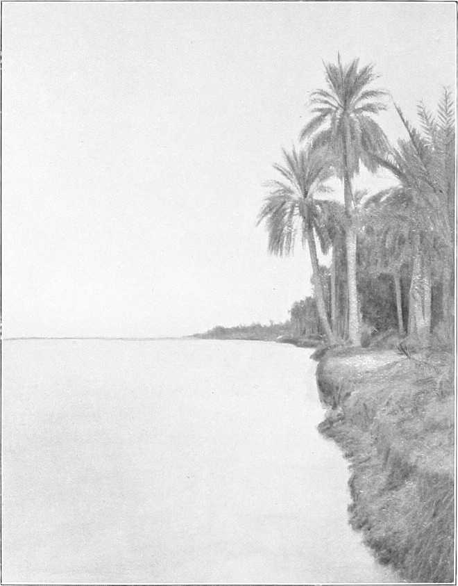
ON THE BLUE NILE.
General description.The Blue Nile rises in the Abyssinian mountains about 60 miles south of Lake Tsana (altitude of Lake Tsana, 4,800 feet). Its source was discovered by Bruce in the year 1760. After flowing northwards into the lake at its south-west corner, it finds an exit[69] again to the south-east, and, after making a big bend to the east, it curls round[111] to the south and flows in a north-westerly direction towards the Sudan, which it enters near Famaka, after a course of some 500 miles. Altitude at Famaka, 1,700 feet (approx.).
Throughout the whole of this upper portion of its course, which has never been explored, it is believed to flow in a series of rapids over a rocky bed and often between high cliffs, and for the most part through the most precipitous and rugged country. Here it is known as the Abai, whereas, as soon as it reaches the plains of the Sudan, its name at once becomes “Bahr Azrak” or Blue Nile.
Until comparatively recently the Blue Nile was considered by the Abyssinians to be the main stream of the Nile, and they, several centuries ago, fully realised the value of attempting, or threatening, to deprive Egypt of her water supply by the construction of a dam at the outlet of lake Tsana or possibly elsewhere. A mission to study the possibilities of this lake was recently sent from Egypt, and the investigation showed that it is by far the most suitable site on the Blue Nile for the construction of a storage reservoir which, though its benefit to Egypt would be slight, would be of the greatest value to the Sudan.[70]
Length, width, &c.The length of the Blue Nile, from the point near Famaka, where it enters the Sudan, to its junction with the White Nile at Khartoum, is estimated at approximately 460 miles, which makes its total length about 1,000 miles.
The average width of channel throughout its course in the Sudan is 550 yards.
Although in the northern reaches the width increases, it is rarely more than 800 yards wide at any point.
Banks.The average height of the banks over low-water level is from 26 to 30 feet for the first 150 miles up-stream from Khartoum. Further south they are higher, and average over 33 to 39 feet above low-water level. The difference in level between flood and low-water is 20 to 23 feet. In the first quarter of the year, the river is reduced to a succession of deep pools, connected by very shallow reaches. Even native boats can with difficulty navigate the distance between Sennar and Khartoum during this season. The Blue Nile is at its lowest in April, but during the latter half of May the first or false rise begins. The real rise begins in June, and the maximum height is attained in August. In the latter half of September it begins to fall rapidly.
Navigability. Cataract.Navigation is simple enough at high Nile. As far up-stream as Roseires, 405 miles above Khartoum, the river is navigable by the ordinary Nile steamers from the middle of June till the end of November. Just above Roseires, however, there is a cataract about 6 miles long. This cataract has never been navigated by steamer, but it is said that previous to 1881, sailing boats passed regularly up and down it. Rafts occasionally navigate it successfully on their way down stream. During the last two years a small launch and a few sailing boats have been passed up and down, but there is a dangerous reach for sailing boats above the cataract.
During November and December the water falls rapidly, and sandbanks appear in quantities, the rush of water through the narrow channels being very great. The worst part of the river is near Abdin and Sennar, but there is little rock anywhere. The water for 5 miles below Roseires is bad, and in places dangerous from rock. Steamers with barges lashed alongside, at the end of December in most years, can get through, except at one point some 20 miles south of Sennar, near Abdin, where a reef of rocks extends almost entirely across the river. Steamers have to be steadied over this place by ropes in December, and the barges passed up and down by ropes.
Discharges.[71]Sir W. Garstin calculates the average discharge of the river at Khartoum to be:—
| At low-water (May) | 200 | metres cube per second. |
| In flood (August) | 11,000 | „ „ „ |
Velocity.The velocity of the stream is very great: even in February it is not less than 3 miles an hour, while in full flood it must be considerably over 6 miles an hour. In winter the water is very clear, and of a beautiful limpid blue. In[113] flood, being charged with the scourings of the Abyssinian mountains and forests, it is heavily charged with deposit, and the water is of a deep chocolate colour. The Blue Nile is considered the chief fertilizing agent of Egypt.
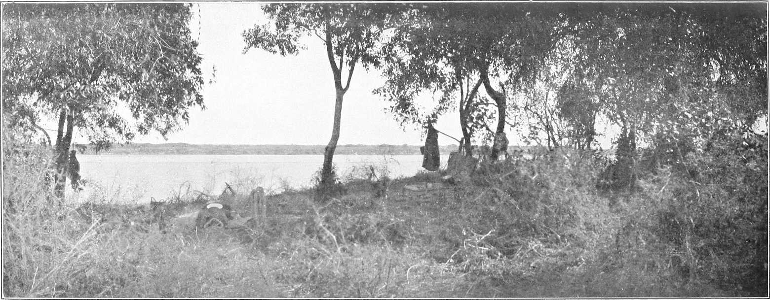
ON THE BLUE NILE.
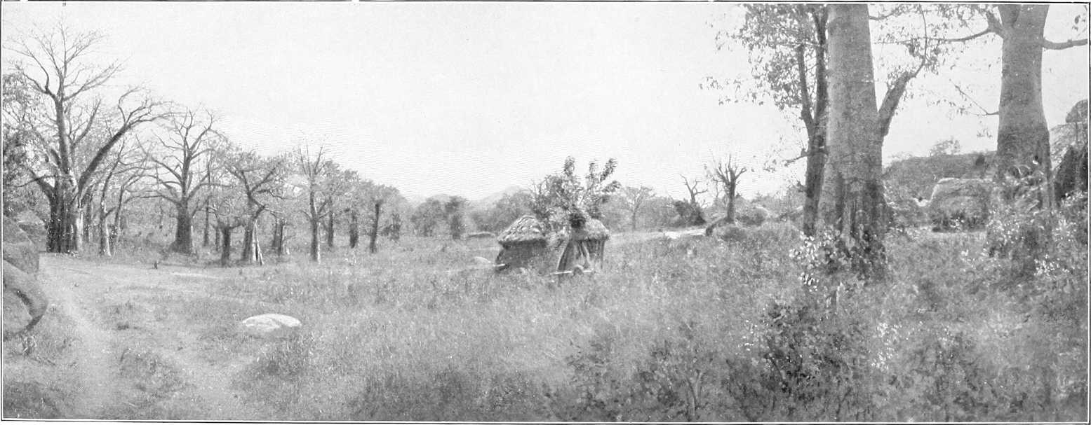
FOREST SCENERY, WEST BANK, UPPER BLUE NILE.
Country along the banks.From Khartoum to Sennar the country is uninteresting; banks flat, vegetation and population considerable, here and there cultivation by sagias, crops mostly dura.
South of Sennar the thorn jungle along the banks becomes very dense, and at high Nile dips into the water; often the only way to get through it is by hippopotamus paths, though the roads on both banks have been cleared and there are meshras at frequent intervals.
Speaking generally, the further south one goes the steeper and higher the banks become, the channel of the river being worn away by the rush of water. The country on the right bank is mostly jungle, with little cultivation and few villages.
Between Wad Medani and Sennar the jungle on the left bank runs in a strip of one or two miles in breadth; west of this strip are the cultivation and villages, which extend right across to the White Nile. Near Wad Medani the cultivation is continuous, and one marches for miles through dura fields.
As one proceeds south, the cultivation becomes less general, until south of Senga, where it is mostly confined to strips along the river bank, and a certain amount round villages a few miles inland. South of Senga the jungle is replaced by forest, large tamarind trees, etc., with thick undergrowth, and open marshes extend along the banks, which, in the dry season, afford excellent grazing. The grass, which grows to a height of 8 to 10 feet in the rains, dies rapidly as the rain ceases, and throughout November and December the natives burn enormous tracts of the dry grass. These grass fires, intended to improve the grazing as well as to enable people to get about the country, are, as may be imagined, exceedingly detrimental to the forest trees, which become distorted and stunted. The forest on both banks of the Blue Nile south of Senga is chiefly composed of acacias of several varieties, laot, tamarisk, kittr, hashab, talh, soffar, and sidr. A few kakamut, tebeldi, dom palms, and sycamores are also to be seen in these forests.
Climate.The months of December, January, and February are cool and healthy. March, April and May are hot. The rainy season begins in May and lasts till the end of October.[72] August, September, and October are very hot and damp. The drenching rains cool the air temporarily, but the subsequent heat is moist and enervating. On the upper reaches at Sennar, Karkoj, and further south, as the vegetation and foliage increase in density, so does malarial fever abound in proportion for at least a month after the rains have ceased. September and October are probably the worst months.
In October, frequent heavy thunderstorms occur with torrential rain; they are, however, very local. Heavy dew at night. The storms get less frequent as the month goes on, and are over before November, after which the climate gradually improves. The north wind blows fitfully during November and December, and the nights are cold, but the temperature by day is very high until late in December, particularly south of Karkoj. Serut fly.The “serut fly” practically appears and disappears with the rains, and is scarce in October, except in certain places. Its northern limit is Sennar. Mosquitoes are bad at all stations at night during August, September, and October.
Cotton.Cotton is cultivated by the natives on the Blue Nile either on the foreshore of the river or inland on ground found by experience to be suitable in a good rainy season.
On the Dinder the only crop raised is the rain crop. This is sown in July after the heavy rains have commenced at the same time as dura, etc. The foreshore sowing takes place simultaneously with that of other foreshore crops, i.e., about December, after the river has fallen, according to the state of the Nile and the height of the submerged banks thus cultivated.
Both rain and foreshore crops begin to be ready for picking 4 months after sowing. There are usually three pickings, the last being the worst, as by that time the plants, which during winter are neglected, are invariably suffering from drought.
In a good year one feddan (acre) of rain-watered land will produce 400 to 1,000 lbs. of unginned cotton. The species of cotton generally sown on the Blue Nile and Dinder are “Abu Hareira,” “Belwa,” and “Mumtaz.” The two former, usually sown on the foreshore, are the old native kinds, whilst the latter, sown as raincrop, was introduced by Mumtaz Pasha from Egypt in the days of the Old Government. The “Abu Hareira” and “Belwa” kinds last 3 years, but the “Mumtaz” only one.
On the Blue Nile, the most favourable land for cotton cultivation is said to be from Sennar southwards to Abu Naama; on the Dinder, the land above Deberki and Abu Rakhis is considered best. Good cotton (irrigated), however, was grown at Wad Medani last year (1903-1904) on the Government experimental farm; 6¾ kantars[73] being actually grown on 1,000 square metres, or a ¼ feddan, giving an average yield of 27 kantars (2,700 lbs.) per feddan.
Principal towns.Roseires.—On the right bank; residence of a British Inspector and Egyptian Mamur. Post and telegraph office; communication by ferry with left bank. There is usually a garrison of one company, under a British officer,[114] furnished by the battalion at Wad Medani. A gunboat is also stationed here. The population is increasing, chiefly Hameg and Sudanese tribes. The market is kept open all the year round, and most ordinary requirements can be obtained here. For rainfall, vide footnote on preceding page.
Karkoj.—On the right bank is an unimportant village, formerly residence of a British Inspector and Mamur, and the headquarters of the District, which has, however, now been moved to Senga. Population about 1,000, mostly Jaalin. The market, which is a poor one, is held on Wednesdays and Saturdays. There is no post or telegraph office here. Senga is the telegraph office.
Senga.—Left bank. (Vide Chap. V, p. 119.)
Sennar.—Left bank. (Vide Chap. V, p. 119.)
Wad El Abbas.—On the right bank; was founded about 50 years ago. The population numbers about 1,200, and consists chiefly of Jaalin, with a mixed lot of Gezira Arabs, as well as about 300 Sudanese.
There is a weekly market on Wednesdays.
Wad Medani.—Left bank. (Vide Chap. V, p. 119.)
For principal towns between Wad Medani and Khartoum (vide Chaps. IV and V).
Game.See under “Country between Blue Nile and Rahad,” p. 109.
Tributaries of Blue Nile.With the exception of the Dinder and the Rahad, there are in the Sudan no other important affluents of the Blue Nile, with the exception of perhaps the Khor Tomat, which joins the main stream near Famaka. This is dry, except during and shortly after the rainy season. Water, however, is easily obtained by digging in its bed.
Dinder. General.The River Dinder rises in the Abyssinian mountains to the south-west of Dunkur, and after flowing for about 50 miles through very mountainous country it enters the plains of the Sudan and flows for about 200 miles in a north-westerly direction until it joins the Blue Nile (right bank) about 40 miles above the town of Wad Medani.
Bed.Its bed near Dunkur, where it leaves the mountains, is rocky and stony, and about 100 yards wide. It was here found (June, 1901) to be 3 feet deep, with a rapid current, and for several months in the rainy season it must be difficult to ford.
Throughout its course in the Sudan its bed, which is sandy and free from rocks a few miles below where it crosses the frontier, is much less winding than that of the Rahad and rarely exceeds 200 yards in width. Its tendency is to become narrower in its lower reaches, and at its mouth it is not more than 120 yards wide.
Upstream of the old site of El Haj the river is wider and shallower and banks lower than in the inhabited area. Even in the old days there were few or no permanent villages above El Haj, but only temporary grazing encampments.
Banks.Its banks are steep and generally about 15 feet high. They are, as a rule, rather higher than the adjacent country, which, when the river is full, becomes flooded and marshy. These marshes were formerly extensively planted with cotton, which is said to have been of good quality; its cultivation is now being encouraged as far as the limited population admits.
Forests.The forests along the banks of the Dinder are of better quality and less dense than those of the Rahad; sunt, kakamut, haraz, sidr, hashab, talh, babanus, etc., are plentiful.
Navigability.The Dinder has been navigated by steamer as far up-stream as Deberki, about 120 miles from its mouth. Large sailing boats ascend it as far as El Safra. Of course, this is only possible whilst the river is in flood during, perhaps, three months in the year, and owing to the wooded banks and southerly wind it is very difficult for sailing boats. In the dry season water stands in pools. There is little doubt, however, that like the Rahad it is navigable in flood to the Abyssinian border.
Flood.The flood arrives at the junction with the Blue Nile about the last week in June. This is rather earlier than the Rahad flood, owing to the later commencement of the rains in Northern Abyssinia, and possibly partly due to the Dinder not being so excessively tortuous as the Rahad. Both Dinder and Rahad bring down large quantities of fertilising matter.
Tributaries.None of much importance.
Rahad. General.The Rahad rises in Abyssinia in the mountainous region between Lake Tsana on the East and Kwara to the west. It takes, at first, a northerly direction, but after entering the Sudan it flows generally north-west in an extraordinarily winding bed to its junction with the Blue Nile, almost opposite the town of Wad Medani.
Width.Its width probably nowhere exceeds 100 yards, and is frequently not more than 60; in places it is only 30 yards wide. It loses much of its water by “spills” known as “Maya,” and is a much more imposing-looking river above than below Hawata.
Banks.The banks, especially the right, are steep and high, sometimes as much as 40 feet above the bed at low water. They differ from those of the Dinder in that only the left bank is liable to be flooded, and that only at a few places, and consequently do not lend themselves to cultivation to the same extent.
Forest.Belts of dense kittr bush and other jungle grow along its banks. In the lower reaches there are many fine sunt[115] trees, and further inland talh, heglig, etc. Bordering its upper reaches are heglig, silag, khashkhash, ardeib, tebeldis, gemmeiz, etc.
Villages.There are few villages at present above Hawata (right bank), and consequently there is no regular path, though the bush has been to a certain extent cleared. Travelling along the river above Shammam, though practicable, is a difficult operation, more especially before the grass is burnt.
Flood.The flood reaches the Blue Nile about the first week in July, and water ceases to flow at the mouth by the end of November. High water is said to last 90 days from about mid-July.
Navigability.The river, when in flood, is navigable for small steamers throughout, but its comparatively narrow bed, combined with very sharp and frequent bends, militate against successful navigation by sailing boats.
Mr. Armbruster navigated the river in the stern-wheeler Amara from its mouth to Meshra Abid (420 miles) in August, 1904. On the way down stream navigation was only effected with considerable difficulty and serious damage to the steamer, owing to the rate of the current—6 miles per hour at Abid and 3 miles per hour at Sherif Yagub—as well as to the extreme sharpness of the bends, at which there were often rocks and large overhanging trees.
Table of Distances on the Blue Nile.
| Place. | Intermediate. | Total from Khartoum. | ||
|---|---|---|---|---|
| Miles. | Kilometres. | Miles. | Kilometres. | |
| Khartoum (Palace) | 0 | 0 | 0 | 0 |
| Soba | 14 | 22½ | 14 | 22½ |
| Eilafun | 4 | 6½ | 18 | 29 |
| El Masid | 20 | 32 | 38 | 61 |
| Kamlin | 23 | 37 | 61 | 98 |
| Rufaa | 33½ | 53 | 94½ | 151 |
| Abu Haraz | 23 | 37 | 117½ | 188½ |
| Mouth of Rahad | 5 | 8 | 122½ | 197 |
| Wad Medani | ½ | 1 | 123 | 198 |
| Mouth of Dinder | 40 | 64 | 163 | 262 |
| Wad El Abbas | 30 | 48 | 193 | 310½ |
| Sennar | 20 | 32 | 213 | 342½ |
| Senga | 53 | 85 | 266 | 428 |
| Karkoj | 21 | 34 | 287 | 462 |
| Abu Naama | 22 | 35½ | 309 | 497½ |
| Roseires | 73 | 117½ | 382 | 615 |
| Famaka | 52 | 83½ | 434 | 698½ |
[64]This description refers to the state of Gedaref up to the end of 1899. Conditions have now improved.
[65]For description of country east of Atbara, vide pp. 99-101.
[66]The Takruris speak of the Abyssinians as “Makada”—this is a name generally used for them throughout the Sudan and means “slaves.” The Abyssinians naturally resent the appellation and have complained officially about it. They retaliate by calling the Takruris, who originally came from Darfur, “Far,” i.e. Rats, the real name of people of Darfur being, of course, For.
[67]Total rainfall, January to October, 1904, 34·6 inches.
[68]Vide also p. 19, and “Itinerary of the Blue Nile,” Vol. II.; also Sir W. Garstin’s “Report on the Basin of the Upper Nile,” Foreign Office Blue Book, Egypt No. 2, 1904
[69]Its course through the lake is said to be plainly discernible.
[70]Vide Foreign Office Blue Book, Egypt No. 2, 1904.
[71]The following table of discharges (Sir W. Garstin’s) shows to a certain degree the relative importance of other rivers in the Sudan:—
| Discharge per second. | ||||
|---|---|---|---|---|
| Maximum. | Minimum. | |||
| Bahr El Jebel (Mouth) | 300 | m.c. | 300 | m.c. |
| Bahr El Zeraf (Mouth) | 140 | m.c. | 50 | m.c. |
| Bahr El Ghazal (Mouth) | 30 | m.c. | 15 | m.c. |
| Sobat (Mouth) | 900 | m.c. | 50 | m.c. |
| White Nile (Khartoum) | 1,600 | m.c. | 300 | m.c. |
| Atbara (Mouth) | 3,000 | m.c. | nil. | |
| Gash (Kassala) | 100 | m.c. (?) | nil. | |
| Nile (Berber) | 14,000 | m.c. | (?) | |
[72]Total rainfall at Roseires, April to October, 1904, 27·8 inches.
[73]1 Kantar = 100 lbs.
[116]
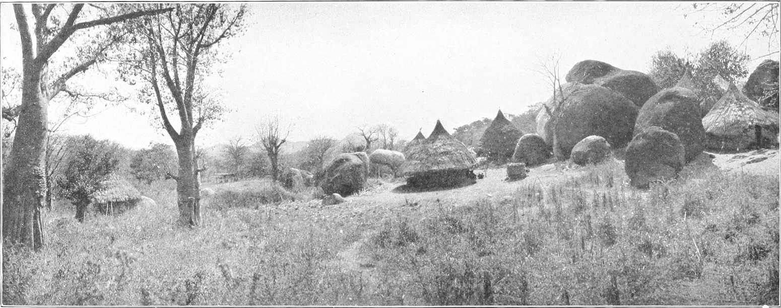
VILLAGE IN THE SOUTHERN GEZIRA.
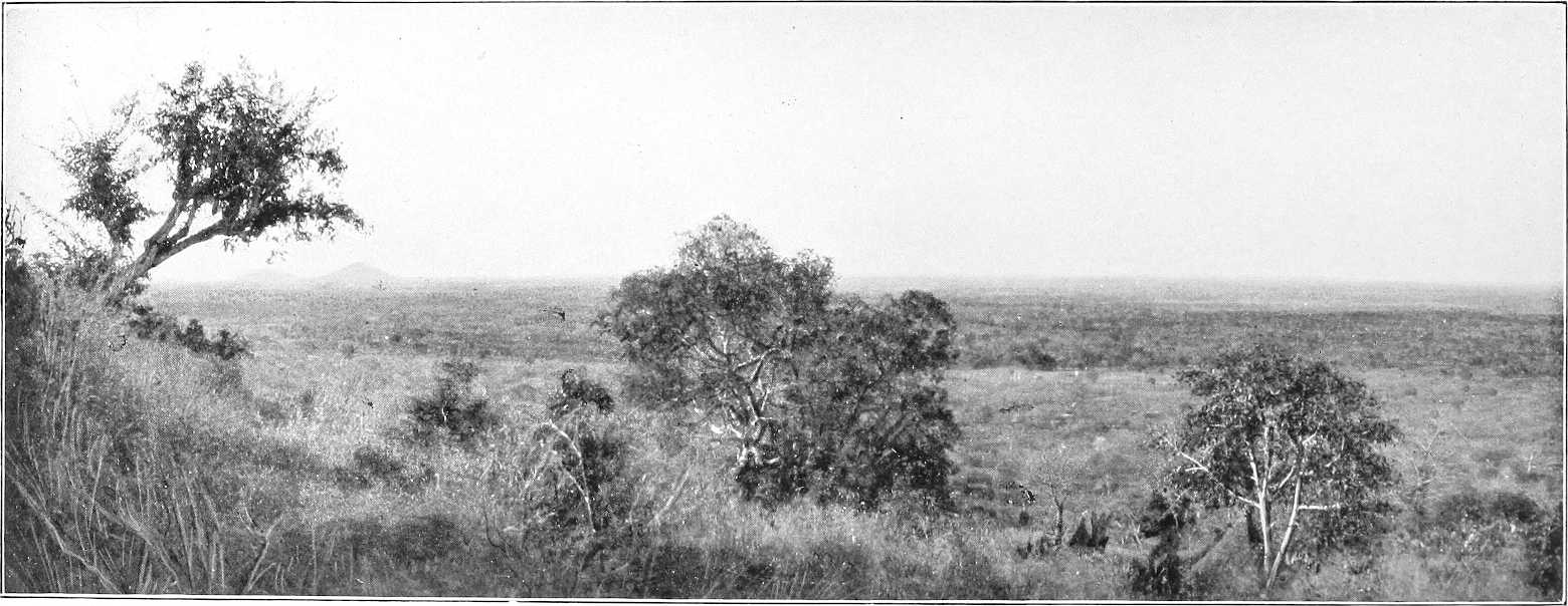
LANDSCAPE, SOUTHERN GEZIRA.
CENTRAL SUDAN.
(Country between the White Nile and Abyssinia, bounded by the Blue Nile and Sobat.)
General description (topographical).The area of about 7,500 square miles enclosed by the Blue and White Niles, from their junction at Khartoum to as far south as the line Sennar-Goz Abu Guma, forms the northern portion of that generally known as the “Gezira” or “El Hoi,” and contains some of the most fertile and most thickly populated districts in the Sudan. Though rather sandy in the neighbourhood of Khartoum, the soil of this flat alluvial plain gradually becomes richer and richer as one proceeds southwards, until between Mesellemia and Managil or Abud the acme of fertility is attained. The eastern half of this district is much more fertile and cultivated than the western half, a fact perhaps attributable to the fertilizing properties of the Blue compared to the White Nile. The whole of this region is so flat and free from khors, or other indications as to the direction of the drainage, that, except perhaps just south of Managil, it is impossible, without careful levelling, to define the watershed between the two rivers.
Bush of any extent and the granite hills, so common in most parts of the Sudan, are only found along its more southern, eastern, and western limits, whilst where not cultivated, the surface of the ground is usually covered with maheirib, homra, hantut, or naal grass. The entire area is definitely owned by tribes, families, or individuals, and strangers desiring to cultivate any portion can only do so on payment of rent, which is usually taken in kind.
Inhabitants.Many of the tribes, and their name is legion[74], inhabiting the interior of this district are of a semi-nomadic nature, that is to say, they cultivate and graze in the interior during the rains, and in the dry weather repair to the rivers, where not only is the watering of their flocks an easier matter and the grazing better than inland, but much ground is left by the receding Niles available for cultivation.
On both the Blue and White Niles, however, there is, in addition, a large and heterogeneous sedentary population.
Cultivation (dura).The principal cereal cultivated is, of course, dura, and a species known as “feterita” is sown as soon as sufficient rain has fallen, after which it merely requires to be kept weeded, and in two months’ time is ready for harvesting. The only drawback is that this crop is entirely dependent on the rainfall, which is often insufficient, and small banks, 1 to 2 feet high, called “taras,” are generally necessary to hold up the water in order to thoroughly flood any particular piece of land which it is desired to cultivate.
Three ardebs[75] per feddan (acre approximately) is an exceptionally good crop, but one ardeb per feddan is the ordinary yield of rain-watered land. The natives reckon a yield of 15 ardebs per ruba[75] of seed sown a very good crop for very good land in a favourable year, but 4 ardebs per ruba is about the average.
Dura shami.Shaduf or sagia-watered land on the Blue Nile yields 5 ardebs of dura shami (Indian corn) per feddan, whilst on the White Nile 3½ to 4 is an average crop. Irrigation on the former is usually by sagia, and on the latter by shaduf.
Wheat.Wheat is cultivated to a limited extent on shaduf or sagia lands, but it is too expensive to be popular with the natives. An average crop is 5 ardebs per feddan. It is sown late in November, and harvested three months later.
Cotton.Much has yet to be learnt as to the suitability of the Gezira for growing cotton. Cotton sown on the foreshore of the White Nile near Khartoum in July is irrigated by the flood, and three pickings can be made before the river becomes too low in February. Experiments so far show “Mit Afifi” to be the species best adapted to the country, but the paucity of the rainfall has so far precluded the possibility of obtaining reliable results from the experiments made. Sufficient cotton, of a quality suitable for local requirements, has, however, been grown for many years.
Water supply.The water supply during the dry season of other than the riverain population is from wells. In the rains these are supplemented by hafirs or tanks. The depth of the wells varies from 60 feet on the east of the watershed near the Blue Nile to 100 feet in the centre, where they gradually become deeper the further south one travels, until a few miles south of Managil they are as much as 200 feet deep, whilst in the pans or hollows of the west of the watershed[118] they are often not more than 15 feet. These latter wells are peculiar, in that if used for long they become salt and thus new wells have to be constantly dug.
Many of the wells also in the north of the Gezira are salt. Nearly all villages have their own well, though occasionally water is carried for a distance of several miles.
Grazing.There is often very little grazing a few months after the rains have terminated; during the dry season, therefore, the flocks are pastured along the banks of the Niles, and in bad seasons they even cross the river into Kordofan.
During the Kharif, as the serut fly is not present north of Sennar-Shawal, many camels and flocks are brought from the south to graze north of this line.
Chief towns.El Geteina.—54½ miles by road south of Khartoum on right bank White Nile. Headquarters of Geteina District and residence of Mamur, police officer, etc. The inhabitants are chiefly Danagla and Jaalin. The Omda’s name is Sheikh Mohammed Osman Abd El Rahman, a Dongolaui. Most of the houses are built of mud. Post and Telegraph office. (Vide p. 53.)
Kawa.—132 miles by road south of Khartoum on White Nile (right bank). It is the same as El Eis of the old travellers. It has rather a large population of Danagla, Jaalin, Shaigia, and various blacks. The Omda’s name is Ismail Musa. The houses are both mud and flat-roofed, and grass “tukls.” It is the headquarters of Kawa District and residence of Mamur. Post and Telegraph office. (Vide p. 57.)
Goz Abu Guma (or Zeinoba).—Quite a newly built town of grass tukls on the White Nile, about 180 miles by road south of Khartoum. A steamer from Khartoum runs up as far as this with mails weekly. There is a post office and telegraph office. Residence of a Mamur and police officer. Inhabitants, Danagla, Jaalin, Gowama, and blacks. Omda Ahmed Mohammed El Zein, a Jaali. Practically no transport animals obtainable here. A good deal of gum is collected here from the interior of Kordofan. (Vide p. 59.)
Maatuk.—A collection of tukl villages, 22 miles north-east of Dueim and 29 miles west of Managil. The population, a large one, consists chiefly of Arakin, also Hassania and Tawal. The Omda’s name is Ibrahim Wad El Netef, an Araki.
The water supply is plentiful and good from many wells 15 to 30 feet deep. In the rains the inhabitants, to a great extent, leave the wells and live on their cultivation, drinking from hafirs or rain-water tanks. There is much rain cultivation about here in good years. Where not cultivated, the land is usually covered with scattered laot and kittr bush. Maatuk belongs to Kawa District of the Gezira Province.
Managil.—A collection of some half-dozen or more tukl villages in the centre of the most fertile part of the Gezira. It is 38 miles from Wad Medani, 50 from Dueim and 107 from Khartoum. Residence of Mamur and police officer of Managil District belonging to Gezira Province. Fair “Suk”: market days, Sundays and Wednesdays. The wells, three in number, are about 150 feet deep. There is a large mixed population here and throughout the District, which contains 43,000 inhabitants. The land just south of Managil is the most suitable in the Gezira for the cultivation of cotton. This district was handed over to his fellow Taaisha by the Khalifa Abdalla, and some of the Tagale blacks imported by them to cultivate have settled in the neighbourhood.
Segadi.—A large tukl village situated at the foot of the southern slopes of two low granite hills 50 miles south of Managil. It belongs to the Sennar Province. The Omda’s name is Torin Ahmed, of the Rufaa tribe. The population, numbering about 1,500 (?), is composed of many different tribes. Water supply is fairly good. It is about 40 miles from Goz Abu Guma and 36 from Shawal, on the White Nile.
Moya.—Another large village belonging to and 21 miles west from Sennar and about 14 miles south-east of Segadi. There are several hills in the neighbourhood, chief of which is J. Moya, about 500 feet high, from the summit of which Jebel Dali, on the road to Gule, is visible bearing 177° mag. There is a road from here to Gule and another to Wad Medani. Water supply is very bad, and, in fact, almost nil towards the end of the dry season, when the inhabitants disperse in different directions. The Omda’s name is El Imam Hadibai, and the population, which, however, varies, numbers about 1,200, chiefly Amarna, also Hameg and Gowama.
Kamlin.—58½ miles by road and 64½ miles by river from Khartoum, on left bank of Blue Nile. Present (1904) Headquarters[76] of Gezira Province and residence of Mudir. There is a large population, consisting of Danagla (several sections, but chiefly El Jeberked), Mawalads (Mogharba and Egyptian), Jaalin, and Shaigia. Houses mostly built of mud. Post and Telegraph office. The Omda’s name is Abbas Musa.
Hellet Amara (or Arbagi).—On left bank, Blue Nile, 84½ miles by road and 95 by river from Khartoum. Opposite Rufaa. There are several villages in the angle of the river which, however, are so close to one another that they may be considered as one. Houses mostly built of mud. Population chiefly Jaalin, Danagla and Batahin, under Omda El Sheikh Ali El Haj Taha, a Jaali. Amara is the headquarters of the Mesellemia District of Gezira Province and residence of a British inspector, Mamur, police officer, etc. Population of District 32,300, chiefly Halawin, who are the best cultivators in the Sudan.
[119]Arbagi.—Arbagi, which is close to Amara, is one of the oldest sites in the Sudan, and is mentioned by the learned Ludolphus in his history of Abyssinia. It was destroyed by the Shukria early in the 19th or at the end of 18th century.
Mesellemia.—Mesellemia, from which an administrative district takes its name, is about 11 miles nearly due south of Arbagi, and about 6 miles inland from the Blue Nile (L.B.). Prior to the Mahdia it was a very large town and a great centre of trade. People are now returning and are rebuilding it. Surrounding it is some of the most fertile land in the Sudan. Residence of a Mamur and headquarters of the district.
Wad Medani.—Population about 14,000; on left bank Blue Nile, just above its junction with Rahad; about 1 mile long by ½ mile broad; large market daily, also bi-weekly, Monday and Thursday, the largest in the Sudan next to Omdurman. Founded by El Fiki Medani about 1800 A.D. Post and telegraph office. Inhabitants: Gezira sedentary tribes, principally Khawalda, Arakin, Kawahla, Jaalin, Bussalia, and Medaniim. Headquarters of Gezira Province (1905). Garrison, one battalion. Rainfall here for 12 months—March 1903 to February 1904—was 313·5 m.m. or about 12½ inches.
Senga.—Headquarters of Senga District: will probably be headquarters of Sennar Province in 1905. A large and increasing village, and next in importance to Wad Medani; left bank Blue Nile about half mile long and some distance inland; all built of straw huts except the Government buildings, which are of brick. Soil fertile, and district much wooded. Population about 1,600. Yearly increasing trade and daily market. Founded by Abdalla Wad El Hassan about 19 years ago. Inhabitants mostly Jaalin and Kenana. Post and telegraph offices.
Sennar.—Almost in ruins owing to Dervish occupation. Has lost all its former importance. Extends about ¾ mile along the river, surrounded by an old trench and embankments. There is a large mosque of red burnt bricks, in a very bad state of repair. At the time of its re-occupation in 1898, Sennar town was in ruins and uninhabited; it was made headquarters of the province till, in April, 1900, it was superseded by Wad Medani, Sennar remaining headquarters of a District. In March, 1903, the headquarters of the District were removed about 3 miles south of Sennar to Kabush on the river bank, where new buildings have been erected; people are now moving and settling between old Sennar and Kabush. Bi-weekly market Monday and Thursday. In surrounding district soil very fertile, all land cultivated by rains, except in Sennar town, which is irrigated by five sagias. Near Kabush there is thick forest along the river, known as the forest of Kabush, extending nearly up to Ereidiba. Population 350. Inhabitants: Kenana, Gawazma, Rufaa, Jaalin, Kawahla, etc.
Wad El Abbas.—Population about 1,200; right bank Blue Nile; founded about 50 years ago. Inhabitants, Jaalin and Gezira tribes, with some 300 blacks. Weekly market on Wednesdays.
Topography.The country between the Niles south of north lat. 13° 30′ (approximately) forms the southern portion of that known as “the Gezira” or “El Hoi,” and is, save for the riverain population of the Blue Nile and the few villages on the White Nile between Goz Abu Guma and Jebelein, practically uninhabited as far south as north parallel 12°, which is the northern limit of Dar Fung.
With the exception of the water in natural tanks at Jebels Mazmum[77] and Gerebin (which are however apt to run dry) this level plain is waterless in the driest season, though the soil is of the richest description, and beyond here and there a few isolated granite hills, the highest of which is Abu Gurud, its surface is devoid of all inequalities and undulations. Not a single khor or wadi is discernible, and except for fairly wide belts of kittr bush, especially near the two rivers and round the bases of the hills, the country is on the whole fairly open until nearing Dar Fung.Dar Fung, when dense forest commences and stretches, apparently continuously, east and west from Nile to Nile.
Owing to the scanty water supply during the dry season and the spongy nature of the soil, it is almost impossible for caravans to travel otherwise than on the few existing tracks.
South of Gule this forest of talh, hashab, soffar, etc., extends uninterruptedly to the hills of Tabi on the south-east, and to Surkum and Keili to the south. About 30 miles south of Gule khors draining the Tabi hills become frequent, and the surface of the ground becomes stony, making the going along the already narrow and much overgrown paths exceedingly bad.
Fazogli and Keili.The districts of Fazogli, Keili, and the greater part of Dul and Kirin are undulating and much cut up by watercourses, and boast far more hills than the country further west towards the White Nile. The hills in these districts[120] are scattered promiscuously, and rise steeply from the surrounding country. They are generally covered with detached boulders and stunted trees. The plain itself is for the most part gravelly or stony, and is intersected with dry rocky khors. It is covered near the foot of the hills with a thick low growing forest, but away from the hills the bush is generally thinner. Before it has dried up, the grass among the bush would make it very difficult to leave the paths, but in the dry season there is generally no difficulty in getting through the bush, excepting at the khors. The whole of this country suffers greatly from want of water, and even where there is water in the streams near their sources, it soon disappears into the ground. Water can, however, often be found in many of the stream beds by digging.
South and south-west of Gule.South and south-west of Gule stretches an almost uninterrupted plain to the Baro and Sobat, bounded on the west by the White Nile and on the east by the hills on the Abyssinian frontier. In the central and eastern portions of this district there are a few scattered hills, such as Abuldugu, Melkan, Ulu, etc., belonging to the Burun, at each of which there is water, but in the Dinka country from Jebelein southwards along the Nile, these are conspicuous by their absence. Between north parallels 12° 30′ and 10° 30′ forest is almost continuous, however, south of 10° 30′ the country becomes gradually more open and grassy and continues so, as far as is known, up to the fringe of forest bordering the Baro and Sobat. Water, south of 10° 30′, seems comparatively plentiful, both in hafirs made by the Burun or standing in pools in khors.
The width of marsh bordering the Baro and Sobat is often much exaggerated; it seems generally not to exceed 4 to 5 miles in width along the former, and is more often much less along the latter. Fringing the marsh is a narrow belt of forest, and behind that steppe-like country, which becomes practically treeless in the region of the lower Sobat (vide Chap. VI).
Drainage.Khor Tomat, draining Beni Shangul and Fazogli is the principal khor emptying into the Blue Nile.
The more important ones emptying into the White Nile are:—
Khor Deleib, source in Jebel Tabi and mouth at Renk; Khors Rau and Balantega, mouths at Jebel Ahmed Agha, but source conjectural, and Khor Adar or Yal, which empties into the White Nile about 30 miles north of Fashoda, and possibly forms the mouth of both the Yabus and Sonka. Another theory is that the Sonka and Yabus drain into a marsh, from which a certain amount of water is believed to find its way into the Sobat near Nasser. Khor Garre drains into the Baro.
Rainfall.The rainfall over the whole of this area is heavy, especially in the more southern districts, where the rainy season may be said to extend from the end of April till the beginning of November.
Transport animals.Camels, mules, or donkeys do well throughout the whole of this district, except during the rains, when mules are probably the best. At this season the serut fly is present everywhere, and in the dry season along the Nile there is a small black fly, similar in general appearance to the common house-fly, which is excessively annoying and somewhat injurious to camels. Abyssinian horses are useful, and the ordinary Arab does well, though more delicate.
Roads.The only roads[78] known to exist, with the exception of those from Senga to Moya, and Senga to Jebelein, viâ Teigo and Jebel Dali, are described in the route reports in Vol. 2, Chap. V.
Currency.In the more northern parts of this region the ordinary Sudan currency is de rigueur, but in dealings with natives along the Abyssinian frontier Maria Theresa dollars or gold rings, obtainable at Abu Shaneina (36 Maria Theresa dollars = 1 oz. gold, approximately), are generally required, though in Fazogli, Keili, or in fact in any Arabic-speaking district, Egyptian money is as a rule readily accepted.[79] Menelek’s dollar is only very rarely seen, and his smaller coins never. The Maria Theresa dollar is not, as a rule, accepted unless the brooch on the shoulder is pretty clearly distinguishable. Amongst the Gallas salt bars form the small change (3½ bars = 1 Maria Theresa dollar).
In the Dinka country on the White Nile, giraffe or buffalo hides are the best trade goods; “gianotta”[80] and other large beads, as well as Egyptian money are also acceptable. Along the Sobat, beads (large amber, opaque white, small white, “gianotta,”[80] etc.), spear heads, axes, and fasses are all much in request. Money is becoming daily more readily taken.
Mosquitos.Mosquitos, or “Ba-uda” as they are called by the Dinkas and by many Sudanese Arabs, are very numerous in places even in the dry season along the White Nile, though here and there there are none even quite close to the water. The natives themselves, though not professing belief in the Anopheles theory, say that if one is bitten much by them they cause fever. The fact of there being a village at any spot may be accepted as sufficient guarantee that there are no, or at any rate, very few, mosquitos there. Most of the villages even in the dry season are a mile or more from the river.
Game.The following species are represented:—Elephant, buffalo, giraffe, hippopotamus, hartebeeste (Jacksonii and tora), tiang, roan-antelope, kudu, waterbuck, reedbuck, bushbuck, cobus leucotis, gazelle, oribi, lion, leopard, cheetah, etc. Specimens of Neumann’s hartebeeste are also believed to have been shot near Ahmed Agha.
[121]
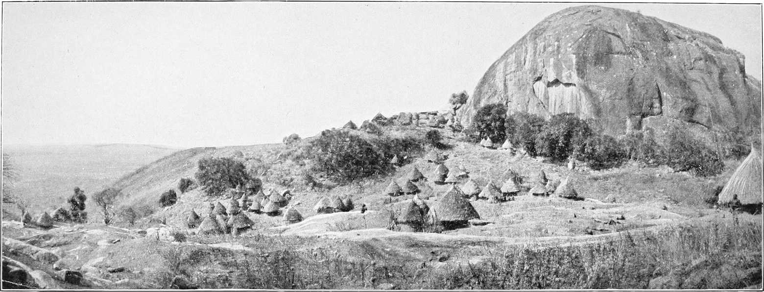
IN THE DAR EL FUNG.
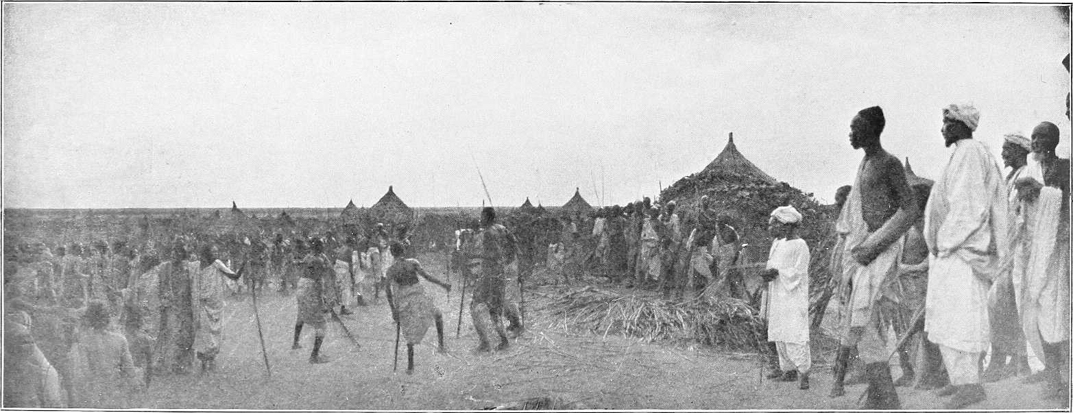
VILLAGE SCENE—BURUN COUNTRY.
Boundaries.Dar Fung is now, compared to its palmy days, an unimportant district. Its boundaries are: on the north, Jebels Gereiwa and Rera; on the east, Jebel Agadi and the Fazogli district. Southwards, it extends to the Abyssinian frontier, and, including the district of Keili and the northern Burun country, extends westwards towards the Dinkas of the White Nile.
In the days when the Fung were at their best, it included Dul and Assosa etc., which now belong to Abyssinia.
J. Tabi and Ingassana.Jebel Tabi and district is included in Dar Fung. The Ingassana, now under Mek Agoda, who inhabit it, remained independent and refused to pay tribute to Idris Wad Regab or the Government until February, 1903, when the Mudir visited this district and established the headquarters of the Dar Fung District at Soda instead of Gule, without opposition. The Ingassana are seldom met without their peculiar sickle-shaped swords. They also possess curious boomerang-like throwing-sticks. They keep apparently a good deal to themselves, as complaints against them are rare. They expressed delight at coming under the ægis of the Government, and at the assurance of their future immunity from slave raids. The district of Tabi is hilly and well watered, and appears to be much more healthy than the surrounding plains. It is said to much resemble Erkowit in the Suakin district. Pigs are not uncommon in this district, and the menu of the chiefs is a varied one, dogs, horses, camels, leopards, etc., are all eaten, especially the former, with great relish. The skulls of all animals consumed are arranged in order round the enclosures of the houses.
Idris Wad Regab.Idris Wad Regab, a direct descendant of the old Fung dynasty, is now Mek or head Sheikh of Dar Fung. He is a loyal man, and is now very badly off, having suffered greatly at the hands of the Dervishes, by whom he was not recognised. Sheikh Abd El Kader is his Wakil. Adlan Wad Surur was Mek during the Mahdia; he now lives near Karkoj.
Gule used to be the chief town of Dar Fung, it is now only second in importance to Keili. It consists of three small villages situated at the foot of Jebel Idris or Gule, a granite mass about 1,000 feet high, and contains but a few hundred inhabitants, mostly Hameg, or a mixture of Hameg and the aboriginal Fung. There are generally some encampments of Dar Ageil or Selim Arabs in the vicinity.
Trade.There is a little trade with Abyssinia, but practically nothing in the shape of supplies, animals etc., are procurable here. Most of the merchants trading with Abyssinia pass through Keili.
Cultivation.There is the usual dura and simsim cultivation, but little more is grown than is required for the wants of the inhabitants.
Raids.As, prior to the demarcation of the Abyssinian frontier, the Burun were so decimated by raiding parties from Abyssinian territory, Idris Wad Regab was, in March, 1902, given rifles by the Government to protect his people. In addition to these he had a good many of his own, with which he inflicted some loss on Ahmed Fedil’s force when it marched from Dakhila to the White Nile after the battle of Roseires, December, 1898. These raids have ceased for the present owing to the capture of the principal raider, Ibrahim Wad Mahmud, in February, 1904. Vide Chap. VII, Part II, page 278.
Water supply.Water, which is obtained from several holes at the foot of the Jebel, is fairly plentiful but bad. It is said to be impregnated with lime.
Boundaries, etc.The Burun inhabit the country between the Dinkas of the White Nile and the Abyssinian frontier from about 11° 30′ north latitude southwards to the Dinkas and Nuers of the Sobat and Baro. Those among the hills north of K. Yabus are under Mek Idris Wad Regab, of Gule, and appear to have acknowledged the suzerainty of his predecessors for probably a century before the advent of the Turks. On the K. Yabus and south of it nothing can be definitely stated as to their organisation, but they appear to be divided into a number of independent communities.
The Burun are said to be related to the Berta, but they are lighter in colour than the Berta generally are and speak a different language.
Burun near K. Yabus.Major Gwynn gives the following description of the Burun near Khor Yabus: The men, who are physically very finely built, are stark naked, and smear their heads with wet and clammy red mud.[81] They all carry long bows, wooden pointed featherless arrows, and in addition, generally a spear. Arrows are poisoned by being stuck into a certain species of tree,[82] and are pointed with notched charred wood or ebony. They have a range of 150 yards.[123] The women are also naked, save for a small loin cloth of skin. They are good looking and attractive. The Burun dialect spoken by Idris Wad Regab’s men, but no Arabic, is understood by the Burun of the Yabus. Their word of greeting is “Moka.”
The Burun north of K. Yabus live as a rule on the scattered hills during the rains, and drink from the rainwater which collects in natural rock tanks. During the dry season, when this water is exhausted, they either descend to the plain and live on the khors, in many of which water stands in pools, or else have to carry their water for a considerable distance. Some of the hills inhabited by them are Abuldugu, Surkum, Melkan, Gum Gum, and Wadaga. K. Gemmeiza, flowing from near J. Abuldugu towards Melut, furnishes their principal water supply. They also obtain water from “Hafirs,” or ponds, which are roofed with thatch to lessen evaporation. Wells seem to be very rarely sunk. These northern Burun are now very poor, and women and children are very scarce.
The Burun, in the Garre Valley, seem more prosperous, having plenty of water and grain in their country, but both sections, especially the northern, have been most deplorably reduced by slave raids from the east. The principal raider, however, Ibrahim Wad Mahmud, as before stated, was captured by Lieutenant-Colonel Gorringe in February, 1904. The southern Burun country is still almost entirely unexplored.
Communications.The Burun seem to have little intercourse with the tribes living on the White Nile, and no regular roads to it, except perhaps from J. Gerawid to J. Ahmed Agha, seem to exist. It is intended, however, to open up roads between the western frontier of Abyssinia and the Nile, and to improve the present primitive system of water supply in this district. For report on routes, vide Chapter V. and Appendix, Vol. II.
Boundaries.Keili, which is part of Dar Fung, is bounded on the east and south-east by the Abyssinian frontier, which divides it from Beni Shangul, Gomasha, and Dul, and on the north-east by Fazogli. Keili claims to share with Fazogli the mountains of Agaru, Kashangaru, and Ragreig, though practically the whole of Agaru belongs to the latter, and the whole of Ragreig to the former, as also does Jebel Gainshur. Jebels Kurmuk and Maiak are within the southern limits of this district, and Jebels Surkum and Abuldugu to the west also belong to it. On the north the boundary is Jebel Tabi.
Inhabitants.The Jebelawin inhabit the eastern portions of the district, and the Burun the western. For administrative purposes, this district is in the Dar Fung District.
The acting Mek of Keili is a youth of about 15 years of age. His father, Beshir Hamdan, who was much addicted to slave dealing, was arrested and deposed by Government, February, 1903.
The valley between Ragreig and Jebel Keili forms as it were an oasis, and must have a population of several thousand. It is a very pleasant spot in the dry season, but in the rains becomes more or less swampy.
Sheikh Bilburka, of the Fung inhabitants of Dul, now lives at Keili in order to avoid the exactions of the Watawit, under Abyssinian rule, similarly Sheikh Jela Abdalla, a Jaali refugee, fled from Beshir and Shanji villages in 1897, and now lives in the Arab settlement at Keili.
Language.The Jebelawin language is used at Jebel Keili. The Burun use a dialect of the Burun language similar to that of Jebel Maiak.
Cultivation, etc.In the valley between Jebels Kurmuk and Keili a great deal of dura is grown, both for local consumption and for the supply of the mountaineers in the hills near Dul. There are plenty of cattle, sheep and pigs.
Gold.Some alluvial gold is found in the khor east of Jebel Ragreig.
Water supply.Water is obtained from wells and from pools in khors, whilst on the face of Jebel Keili itself there are several springs. At Jebel Surkum there is a perennial supply of muddy water from four holes on the south side of the Jebel.
At Jebel Abuldugu there is water in the pass through which the road from Gule leads. This, however, does not last all the year round. Natives then water in the Khor Ganna, about 2 miles to the east.
Keili is the chief town of Dar Fung and is rapidly growing. It is situated at the foot and to the south of J. Keili, and is the residence of the Mek. There is also a small garrison of Sudanese regulars here from Wad Medani, as well as some mounted irregulars.
Boundaries.Fazogli is not included in Dar Fung, but belongs to the Roseires District; it is bounded for administrative purposes as follows:—On the north-west and west by the Hameg (Abu Gemai to Jebel El Geri), on the north by the Jebel Geri-Abu Ramla line, and from Abu Ramla its boundary runs southwards along the Abyssinian frontier to Jebel Kashangaru, thence northwards towards Jebel Agadi, Dar Fung being to the west of this line.
[124]
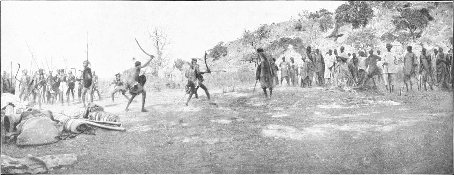
INGASSANA VILLAGE.
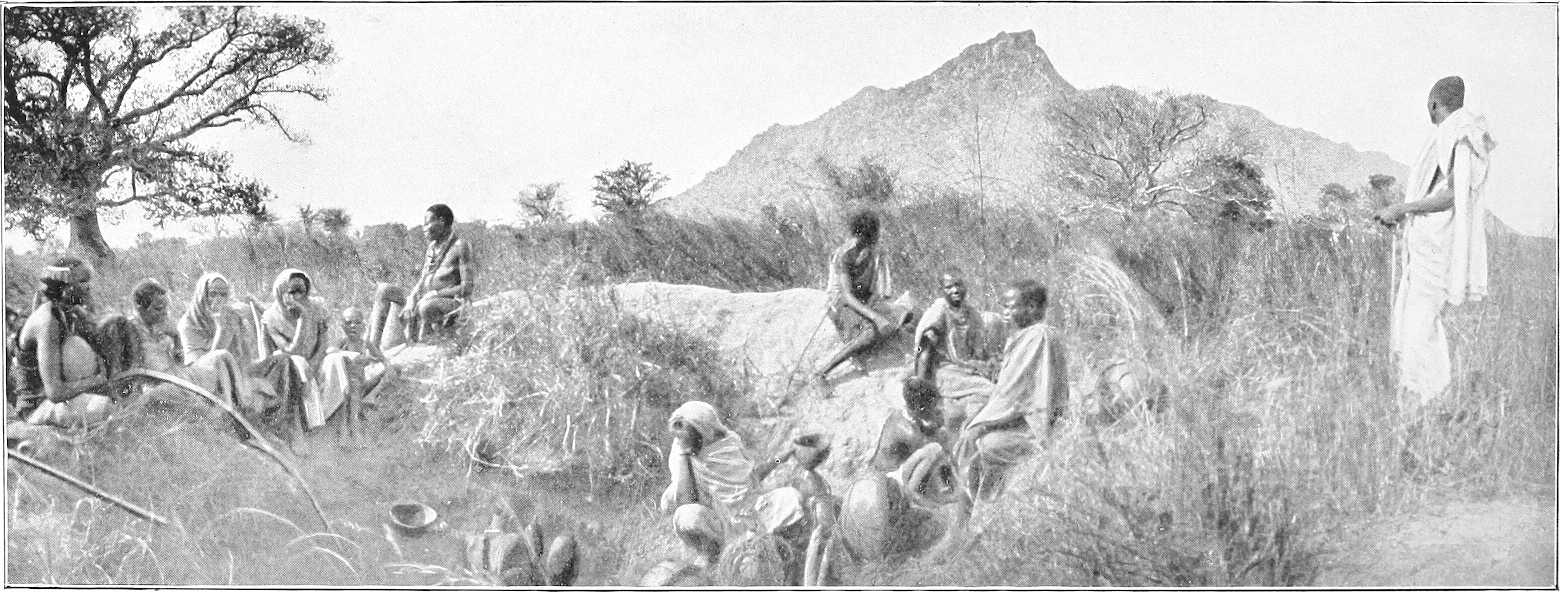
HILL SCENERY IN DAR EL FUNG.
[125]Mek.The Mek’s name is Regab Hassan, who is surnamed Abadaro, and is a middle-aged man who appears to have a good deal of influence, but is said to be addicted to drink. He claims descent from Jaber, the first Fung conqueror of Fazogli.
Inhabitants. Jebelawin.The principal inhabitants are Jebelawin, an aboriginal race merged into the ruling Fung living at Fazogli, Kuturu, Kiri, Abu Shaneina on both banks, and Adarsi. Their villages on the Tumat and at Abu Shaneina are under Mek Khamis, a Jebelawi, but the Arabs at the latter place are under an Arab named Ali Wad Rowaa.
Elias Khamis, the former Fung ruler of the Jebelawin of Beni Shangul lives on the Tomat with a following of Sudanese refugees from Beni Shangul. Sheikh Fakir is similarly in charge of Arab refugees from the south.
Language.Arabic is understood by the Sheikhs of the district, but the rotana in use on the left bank of the Nile is that used by the Hameg of the Blue Nile, and by the Jebelawin and Berta. On the right bank, in the Fazogli district, the Gumz language is totally different.
Religion.The Sheikhs alone profess Mohammedanism; the majority of the Jebelawin are heathen.
Berta.In the hills the inhabitants are nearly all Berta; very few can talk Arabic. They are as a rule finely developed and healthy looking, but are dull and lazy to a degree. Their villages are built in the most inaccessible places; the tukls being wedged amongst great boulders. They only grow small patches of dura, and depend entirely on the rains to irrigate it. During the dry season, even for drinking, water has to be carried immense distances. A great many fowls are kept in the villages. The men in some places wash for gold in the khors.
The Berta of Jebel Falabut are under Mek Abadalla, those of Jebel Faronge are under Mek Amaka. On the latter mountain are separate villages for the Faronge sub-tribe, part of the Fadoko sub-tribe, and the Goamili, who were driven from Jebel Abdanab of late years by the rulers of Beni Shangul. The head-quarters of the Fadoko sub-tribe remain at Sarankchau, near Abdanab on the Yabus river, subject to the Sultan of Beni Shangul. Falabut and Faronge are in charge of Mek Abu Ras of Kiri.
The Berta extend westwards from the Blue Nile through Gezan to Mudeli village (Sheikh El Nur) to Jebel Sude sub-district (Sheikh Hambalha), and Khor Gasa (Mek Jibara), south and west of which the Berta have lost their independence.
Religion.The Berta, though heathen, are not averse to Mohammedanism.
Gezan.Bakurig Bugul, the successor of Gormaz, the last aboriginal Mek of Gezan sub-district, lives at Fazogli. Hassan Wad El Gharbi is the Sheikh of the Watawit at Gezan and Amora, Mek Abulang being resident chief of the Berta.
Gumz.The word “Gumz” signifies “people” in the aboriginal language, of which the various sub-tribes use distinct dialects. The Gumz, of which the Bazaroda and Kadalo are sub-tribes, are heathen, God and sun being synonymous.
Bazaroda.The Bazaroda sub-tribe is under Mek Ya Karda, grandson of Ab Zaroda. The boundaries are the Blue Nile on the south and Khor Bombode on the east. Headquarters, Hoburra. Other villages are Kambal, Yagor, Agabar, and Yarada. Though subject to Abadaro, the Mek of Gubba demanded as tribute, in 1900 and 1901, 50 ardebs of dura and 30l. worth of gold dust. Products include cotton, dura, simsim, “zaf” or dom fibre, and Adansonia bark rope, honey, gungeleis or Adansonia fruit, and gold dust from the Nile, near the mouth of the Khor Zuar.
Kadalo.El Kadalo sub-tribe, formerly peopled Jebel Dimr and Jebel Mulki, but Mek Adam, owing to a blood feud with the Fung ruler of Gubba, is now living on the Nile with his following from those hills. The rest of the Kadalo are under him, and subject to Abadaro of Fazogli. In the Samina Hills there are Kadalo at Beletamaru and Masambaga, under Mek Ahmed Wad Mohammed, surnamed El Wishari, also at Jabranza under his son Beshir Ahmed.
At Jebel Metongwe the local Mek is Mansur, and at Jebel Menze, Mek Idris.
Principal villages. Fazogli.Fazogli the residence of the Mek, is a straggling village of tukls, extending about 2 miles along a ridge of high ground running parallel to the river. This ridge is about 800 yards from the river, and the low intervening ground is given over entirely to cultivation. The ground behind Fazogli rises to the height of 1,750 feet at a distance of 2 miles, and is covered with trees.
The water supply is from the river.
Famaka.The old mudiria of Famaka is an enclosure about 120 yards square, surrounded by a stone wall, which is still in good condition. It is situated on the river bank on a solid rock, which stands in a bend of the river facing E.S.E., and about 60 feet above it, and holds a commanding view of the country to the south for miles.
It is itself, however, commanded at a distance of 800 yards by the very high ground rising behind Fazogli.
Abu Shaneina.Abu Shaneina is the most important village or town in Fazogli. It is here that the trade route from Beni Shangul strikes the Blue Nile, and it is chiefly from that quarter that any considerable increase of trade with Abyssinia can be expected. It is the headquarters of a small frontier force furnishing outlying detachments north and south of the Blue Nile. Mek Khamis is Sheikh of the Jebelawin here and Ali Wad Rowaa of the Arabs.
Kiri.Kiri is the most prosperous (1900) looking village in Fazogli, and is built on what should be a very healthy site near the river. The Sheikh’s name is Abu Ras Wad Sogheir.
[126]Masurkum.Masurkum is on the Beni Shangul Abu Shaneina road. The Sheikh, named Bikori, is an old and infirm man, but has evidently been a strong man in his time. He suffered considerably from Dervish raids, and has lost all his cattle.
Cultivation.Dura, simsim, lubia, and tobacco are the principal crops cultivated, the former is of good quality, both Naggad and Kurgi being sown. In Gezan there is a considerable area under cultivation, but with this exception there is practically none south of a line drawn from Kiri through Jebel Kukura to Masurkum and thence up Khor Masurkum.
In the Tomat villages, west of Jebel Fazogli, the dura crop is very fine, but simsim is chiefly grown between Kiri and Fazogli.
Ground close to Tomat would undoubtedly repay cultivation, but at present the more easily cleared areas near the Nile are amply sufficient for the population.
Cattle, etc.There are comparatively few cattle and sheep in the district, the people having suffered so much from raids.
Trade.A good deal of trade is carried on with Beni Shangul and this is bound to develop.
Fazogli produces a little gold, which is found in all the khors coming from Jebel Faronge: Khor El Dahab, near Gezan, being the richest.
A good deal of coffee is imported from Abyssinia, as well as horses, mules, cattle, donkeys, and sheep.
The idea of ever tapping the trade of the Abyssinian province of Gojjam is said to be out of the question owing to the apparent impossibility of finding a trade route free from physical difficulties of an insuperable kind.
Transport.Donkeys or mules are the best transport animals all round, though camels do very well as long as their feet do not get sore. All the transport animals available for purchase, or otherwise, are those that come in from Abyssinia, and the supply is a very fluctuating one.
The Dinka country on the White Nile, extends from Jebelein southwards to about 10 miles south of Kodok, along the right bank; it is uninhabited, however, except by Nomad Selim, north of Karshawal.
The Dinkas, or Jange, as they are called by the Arabs, have no Mek like the Shilluks, but each section is separate and independent under its own sheikh, consequently, they were never able to unite to defend themselves against the depredations of slave traders and the Dervishes, who found them an easy prey. Many of their sheikhs at the present time are men who have been slaves in Cairo, and who have been repatriated either by Gordon or the present Sudan Government. Thus it is that, whilst the majority of the men are stark naked, one here and there meets a respectably dressed old man carrying a sunshade.
The women ordinarily wear a goatskin apron in front and another behind, but the unmarried girls are usually content with a string of beads.
The men mould their hair, mixed with red mud, into fantastic shapes, and sleep on a bed of cow-dung ash, with which their bodies are covered. The women do not usually thus disfigure themselves, and sleep on hide mats.
The Dinkas are remarkable for their height and slender limbs and figures. They are not, however, of such fine physique as their neighbours the Shilluks.
They are unenterprising and ignorant to a degree, and so unprogressive and rigidly conservative that any such up-to-date innovation as the introduction of donkeys[83] for transport purposes, an innovation admitted by themselves to be most desirable, is not adopted simply on the pretext that it was not the custom of their fathers and forefathers.
They consequently always walk, the men carrying long narrow bladed spears and a knob-kerry, and the women a large basket on their heads containing their food, etc.
During the dry season the Dinkas desert the hinterland of the river, and descend with their flocks and herds to live near its banks, where the now dry marshes afford excellent grazing.
The localities which they frequent mostly are Renk, El Wat, Jebel Ahmed Agha, Meshra Zeraf, Kaka (right bank), Khor Adar. There are police posts at Renk and Melut; Renk being the headquarters of the District and residence of a British Inspector.
Cultivation.On the arrival of the rains they, for the most part, retire inland, sometimes 20 or 30 miles, to their cultivation, which however, is little more than sufficient for their own requirements. The grain is stored in these cultivation villages, and is only brought to the river in the dry season in small quantities from time to time on the women’s heads.
Donkeys, and indeed any means of transport but their women’s heads are unknown. If, therefore, it is desired[128] to purchase any dura from the Dinkas in the dry season, the would-be purchaser must be prepared to provide transport and to send it a day or so inland.
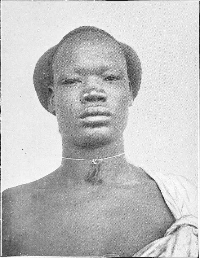
DINKA.
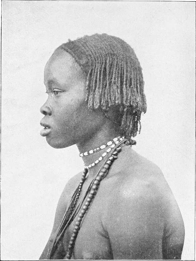
DINKA GIRL.
Herds, etc.The Dinkas of the White Nile, who number about 8,000, own a good many cattle and sheep, and pay tribute on them to the Government partly in kind and partly in money (1904). According to a census made in 1903, the following were the estimated numbers of their herds and flocks: cattle, 8,000; sheep, 16,000; goats, 13,000.
Though living in a grand game country they have no sporting instincts whatever, and rely on the Baggara Arabs to provide them with skins in exchange for dura. They fish to a certain extent, but are not nearly so expert as their neighbours the Shilluks, unlike whom they have no aquatic proclivities.
Religion.A certain number, owing to their having travelled to Khartoum and even Cairo as slaves, profess the Mohammedan faith, but their number is few. The remainder believe in the existence of a being who rules their destiny, and whom they call Deng. He has many forms and shapes, from the spirit of a great departed Sheikh to the more familiar personality of a favourite cow. They also believe in the possibility of transferring their spirits to a particular animal for a particular purpose and for a stated time; for instance, if an unwelcome individual is present, they annoy him in the guise of hyænas at night until he departs. (Vide also Chap. VI, Section 2 (d), and Chap. VII.)
Marriage customs.(a) Arranging Marriage.—The intending bridegroom must obtain the consent of the girl’s father or guardian, as the case may be, and settle the “maal” (purchase price). He does not necessarily pay the whole at the time, but later, if he finds the girl suits him, and does not have any dealings with other men, he pays the difference; also sometimes after paying the full “maal” he may be ordered by a village council to pay an additional “maal” if he is a rich man.
As a rule the “maal” is paid to the girl’s father or guardians a year or so before the man marries her; she remaining meanwhile in her father’s house. If during this period of “engagement” the man comes to the conclusion that the girl is not suited to him, he can terminate the engagement, and receives back his cattle. No inter-marriage of blood relations is allowed under any circumstances, on the other hand, a man may marry all or any of his late father’s widows (except of course his own mother). In this connection it is interesting to note that, if a girl is tampered with and subsequently becomes ill, it is held to be conclusive proof that she was tampered with by a blood relation, and the blood relations who could possibly have been responsible for the offence are ordered to pay a heavy fine to the girl’s father.
(b) Misconduct of a Fiancée.—If a fiancée misconducts herself, the bridegroom elect receives back all the cattle that he may have paid to the girl’s relations, but, if, on the other hand, he still chooses to marry her, he will not receive his cattle back, but will exact a “fine maal” from the man with whom the girl misconducted herself. If he does not choose to marry the girl he receives back his cattle, and the father of the girl receives the “fine maal” from the delinquent. If the man still marries the girl under these circumstances, he slaughters one of the cattle paid as “fine maal” and invites the whole village to dinner; but if he does not marry her, the girl’s father does not follow this custom of slaying the bull.
The father or guardian who receives the marriage portion of the girl does not retain the whole to himself, but it is divided according to certain rules among the relations. A man having received a marriage portion on behalf of his daughter or ward, and the girl being still only “engaged,” may not dispose of any of it, until the girl is actually married, and has entered her husband’s house.
(c) Misconduct after Marriage.—If a man has dealings with a married woman, her husband shall take a “fine maal” from the adulterer, two or three head of cattle according to the adulterer’s wealth. If the wife go wrong, the husband may cast her off, and send her back to her people, and receive back from them the “maal” he originally paid, plus the issue of the said cattle since they left his hands. If the husband go wrong, the father or guardian of the girl he has wronged will take a fine “maal” from him; his wife cannot divorce him.
(d) Divorce.—If a man maltreats his wife she may complain to her father, who may free her by paying the husband back the original “maal,” plus its issue. If the father has no cattle, he will receive his daughter into his house, and when she marries, recompense the late husband.
If a man wishes to divorce his wife, and has good grounds for wishing to do so, he will return her to her father or guardian and receive back his original “maal,” plus the issue or not, according to the circumstances of the case.
If a man divorce his wife for misconduct, and there are children of the marriage, they will remain with him.
Misconduct.(a) If a man misconduct himself with a girl he will pay to her father or relations a “maal” such as he would have paid had he wished to marry the girl in the usual way, and he must marry her. If, however, the father of the girl is not willing to marry his daughter to the man, he will not exact a full “maal” from him, but only a “fine maal” according to the man’s wealth. If a girl misconduct herself, and dies from the effects, the man responsible will pay her father eight head of cattle.
If a man misconduct himself with an engaged girl, and marries her in the place of the original fiancée he shall pay to her father the same “maal” as was paid in the first instance by the other man, and if the girl die in his house,[129] he shall have no claim to receive back all or any of his “maal” from her father or whoever received his “maal,” but in most cases the father will pay him a proportion as a favour.
(b) Misconduct with a Blood Relation.—The man who is convicted of misconducting himself with a blood relation will pay to the girl’s father one bull and one cow-calf. The bull will be cut into two halves, and afterwards devoured at a village feast; the couple will not, of course, be allowed to marry.
Blood maal.If a man has an adopted daughter, who has been paid to him as “blood maal,” she is not allowed to marry out of her adopted father’s family, except in rare cases in which she happens to be a blood relation of her adopted family. A man thus possessing an adopted daughter, paid originally as a “blood maal,” can terminate the blood feud by paying to her father or relations a small “maal” of cattle.
Violating a “blood maal girl.”—If a man has dealings with a girl who has been paid as a “blood maal,” he shall be ordered to pay one head of cattle, which, however, can never be returned. If a man has connection with a girl who does not come under this category, he pays, as stated before, a certain “maal,” which, however, is returned to him when the girl eventually marries, together with the issue of the “maal.”
Death of a wife.If a wife die before she has been received into her husband’s house, he receives back the “maal” he has paid in advance for her. If she die after being received into her husband’s house, he does not, as a matter of course, receive his “maal” back, but the father will almost invariably pay him back half as a favour. If there are children of the marriage, the widower will not receive any cattle back.
Death of a husband.If a husband die his widow will remain with her late husband’s relations unless her own relations choose to pay back the “maal” originally received for her, in which latter case the custody of the children is generally given to her late husband’s people.
Disposal of property.If a man die and leave property, it goes to his sons, failing a son, if he leave a married daughter who has a son it goes to him. Failing any issue, his property goes to his male relations. The widow of a man will never receive his property.
This section of the Dinkas migrated from the Bahr-el-Ghazal about 130 or 150 years ago, as nearly as can be judged from various sources of information, and most of their customs, their character, and habits of daily life, are identical with the corresponding traits of the Bahr-el-Ghazal Dinkas as recorded by Schweinfurth. Some of the older Dinkas of the “Ibrahim” section, especially those whose wits have been sharpened by a visit to Cairo or Khartoum, appear to take a considerable interest in tracing back their history.
At the time of the migration, the head of the Bahr-el-Ghazal Dinkas was one Akwai Chakab. He descended into the country on the right bank of the White Nile north of the Sobat, and drove out the Arab inhabitants; these were chiefly Fung, Abu Rof, and Jaalin, the latter being also partly on the left (west) bank. No mention is made of the presence of any Baggara Arabs on the west bank. Akwai Chakab was accompanied by one Kur Deng Achuk wad Agweir, and by his own son, Deng Karuma wad Akwai. Having seized the country and installed his own people, Akwai Chakab returned to his own country in the Bahr-el-Ghazal, and left the Government of his new country in the hands of his son, Deng Karuma and Kur Deng Achuk wad Agweir. Another son of Akwai Chakab accompanied his father in the seizure of the new territories; this was Kolong wad Akwai, and to him was entrusted the command of the advance guard of the army. His orders were to push on ahead, spy out the country, and eventually attack Sennar and the El Ahamda, etc., and reinforcements would be supplied from the rear if necessary.
On the conquest of the Sudan by Mohammed Ali Pasha, the invading “Turks” did not penetrate the east bank beyond Jebel Ahmed Agha; how far south they went on the west bank is not stated. On the east bank, however, they had to fight the powerful Dinka forces from Muli (now called Renk) and did not always come off victors (Muli was at that time called by the Arabs “Hasoia”). The Dinkas, however, being forced to fall back, retreated up Khor Rau, east of Ahmed Agha, followed by the “Turks,” who came up with them, and fell on them at the Debba Mabiu. The “Turks” completely routed them, and seized and carried off their cattle, but none of their women or children. Mention is made of the “Turks” fighting with the Shilluks near Kaka. The invading army then appears to have retired from the country, leaving the Dinkas to their own devices; and they do not seem to have been troubled again for a considerable time. They were, however making mischief, and they admit that the evil days that befel them at a later date was the inevitable consequence of their own misdeeds. Strong enough to hold their own against other neighbouring tribes, they appear to have turned their attention to annoying the Government, and amongst other exploits, penetrated to Karkoj, killed Sheikh Abdallahi and some of his people, and robbed the remainder. The Governor-General of the Sudan at, or about the time of these occurrences, 1863, was Musa Pasha Hamdi, and he detailed an army under the command of Mohammed Kheir, to go into the Dinka country and wipe out the Dinkas. This was the commencement of their troubles which did not end till 1898. The first descent upon the Dinkas was in the Abialang district, otherwise known as the Dinka[130] Ibrahim. The inhabitants fled to Jebel Gule and threw themselves under the protection of Sheikh Regab wad Idris, and paid him heavy tribute on the understanding that he would arrange matters between themselves and the Government. Regab wad Idris appears to have accepted the tribute, and then to have sent word to Sennar that the fugitive Dinkas were in his power. Thereupon a force of Egyptian soldiery was despatched from Sennar, and captured the fugitive Dinkas, whom they led off as slaves. The men were enrolled in the Nubian regiments, and the women and children sold. Orders subsequently came to release them, but a considerable number of the men were, nevertheless, kidnapped, and many remained in the regiments; of the latter, there are now several still serving in the army as more or less senior officers. On those occasions when the Dinka forces defeated the Government troops, the locality of the battle has generally been called by the Dinkas by the name of the commander of the Government troops, such as the Island of Wad Ab Kona, of which the original Dinka name, also still used, was Gasa-el-Abiad. Other instances are Wad Ab Sheiba and (Jebel) Ahmed Agha.
The result of these depredations was that the Dinkas were practically driven to exist as outlaws, living in the woods or in the inaccessible Nuer country. They never, however, lost their hold over their own country, and whenever the Government forces withdrew, they would return to the vicinity of their villages, ready to fly at a moment’s notice.
In later days, in the time of the Dervish regime, those Dinka districts which, on demand, paid up the whole of their cattle, were not further molested; on the other hand, the people south of Jebel Ahmed Agha declined to fall in with this proposal, and were consequently perpetually harried and raided, and had many of their women and children carried off, the Dinka’s first care being always to drive his cattle off to a place of safety. Since the establishment of a settled Government, the Dinkas have been returning in increasing numbers to their country, but the general complaint now is, that at the present time, hundreds, and even thousands of Dinkas are still in the service of those who seized them, or bought them in the old days, and who would, if they had an opportunity, return to their country.
The Selim Baggara, though really belonging to the left bank from opposite to Jebelein southwards nearly to Kaka, cross over to the right bank in considerable numbers during the dry season. They prefer to live amongst the Dinkas, as they rely on them principally for their grain supply, not being cultivators to any extent themselves. A good many of them are mounted on Abyssinian ponies (price 30 to 40 sheep, i.e., 3l. to 4l.) on which they hunt elephant, buffalo, and giraffe in the most fearless manner, armed only with their long broad-headed Baggara spears. The skins of these animals are readily accepted by the Dinkas in exchange for dura. The Selim are divided into two sections, Um Tarif and Walad Mahbub; the Sheikh of the former is Amin Musa,[84] and of the latter El Hag Suleiman, both live on the left bank opposite Jebelein. The tribe owns a considerable number of sheep, but little or no cattle. They cultivate to a small extent on the borders of the Gimma country, about 20 miles north-west from Jebelein.
The Arab names for places are, as a rule, quite unknown to the Dinkas, and vice versâ.
From Kodok south, on the right bank, to the Sobat the inhabitants are mostly Shilluks (for description of whom vide Chap. VIII.)
[74]Vide list, Appendix F.
[75]1 ardeb = 300 lbs. = 24 ruba.
[76]Wad Medani is to become the headquarters of Gezira (Blue Nile) Province in 1905.
[77]There is now a well at J. Soga, a few hundred yards west of the village at the northern end of J. Mazmum; there is also a well at J. Dali, which cannot, however, be relied on.
[78]A new road is being cut (1904) from Senga to Goz Abu Guma, and from Roseires direct to Gule and Renk.
[79]Egyptian money is accepted in Beni Shangul except by the Abyssinians.
[80]Black bead with white spots.
[81]Their appearance is said to be rendered still more grotesque by the wearing of a cow-hide belt about 3 inches wide to which is affixed, at the back, the tail of some animal; this gives the wearer the strange appearance of possessing a tail.
[82]Euphorbia candelabrum.
[83]Since writing this, Bakhit Niok, a more progressive sheikh than his fellows, has provided himself with both a horse and donkey, other sheikhs are following his lead, and donkeys are becoming comparatively common in Northern Dinkaland.
[84]El Hag Suleiman is now (1904) Head-Sheikh of all Selim.
SOUTH-EASTERN SUDAN.
(The Sobat and tributaries, and country south of the Sobat and north of N. Lat. 5° between the Bahr El Jebel and Abyssinian frontier.)
River Sobat.The Sobat rises on the Abyssinian plateau somewhere about east long. 36° and north lat. 7° 15′, though its source has probably never been accurately determined, and flows generally from east to west.
For the first 260 miles (approximately), as far west as the junction of the Pibor[85], it is known by the Abyssinians as the Baro, by the Nuers as the Kir, and by the Anuaks as the Upeno; from this point to its junction with the White Nile, at a point some 55 miles by river south of Kodok and 460 miles (approximately) from its source, it is called the Sobat.
In its descent from the plateau to Gambela, for the first 150 miles, it flows in a series of rapids through wooded, mountainous, and hilly country, in a rocky bed often not more than 40 yards wide. From Gambela to Finkio (15 miles) it increases in width to about 200 yards, but in the dry season is full of rocks, especially at the bends. Throughout the remainder of its journey to the Nile it meanders across an immense dead-flat alluvial grassy plain, varied here and there by extensive woods reaching down to the water’s edge, but often nothing is visible for miles save swamp and grass with numerous termite hills, and but an occasional tree. During this part of its course its width varies as a rule from 150 to 300 yards, though occasionally it narrows to 30 or 40 yards in the marshy region between Balamkun and the Pibor.
Banks.[86]Working up stream,[87] the banks are, as a rule, firm and dry for the first 150 miles from Sobat mouth, and numerous villages are seen built actually on them. The left bank is usually higher than the right, and both banks are higher than the country in their immediate vicinity, and thus narrow swamps running parallel to the river exist well on into the dry season. These marshes are often drained by the natives through cuts in the banks in order to capture the fish in them. Above the village of Shwai the banks are alternately marshy and firm.
Navigability.Both the Sobat and Baro, probably as far up-stream as Finkio, are navigable for steamers drawing 4½ feet of water, from the middle of May till the end of December. About the middle of the latter month the appearance of sandbanks makes navigation difficult, though it is probable a channel for small boats exists throughout the year.
Fords.Both the Sobat and Baro are fordable at fairly frequent intervals in the dry season eastwards of the Dinka country.
Current.The current is generally estimated at from 2½ to 3 miles per hour in flood; in the dry season (February to May) it is not more than 1 mile per hour.
The current of the Baro in flood combined with the sharp bends and occasional narrowness of the river render navigation difficult in places.
Water.The water of the Sobat in flood is of a reddish-yellow colour, whilst that of the Baro is similar to the colour of the Blue Nile or Atbara, being like them derived from the Abyssinian hills.
The sources of supply of the Sobat are:—
(i) The southern Abyssinian hills and the rains which drain westward from them.
(ii) The vast marshes which lie between the White Nile and the Abyssinian hills, which keep the Pibor bank-full till the middle or end of January.
Rise.The Sobat reaches its lowest level about the end of January and commences to rise about the end of April or beginning of May.
Discharge.Petherick in April (low water), 1862, estimated the discharge of the Sobat at 120 cubic metres per second. The same authority on 5th June (after the rise had begun), 1863, reckoned the discharge at 233 cubic metres per second. For later calculations, vide footnote p. 111.
[132]Adura (loop of the Baro).A large loop of the Baro takes off from the main stream near the village of Gadjak[88] on the south bank, and enters the Baro again some 14 miles to the east of the Sobat-Pibor junction. This river is known by the natives as the Adura. Although seemingly a large and important loop, it was found to be quite unnavigable in July, when the river was nearly full, owing to the existence of a large number of sand-banks and islands. Another loop south of the Adura is said to be formed by a stream known as the Mokwai. This has a very insignificant exit from the Baro, only some 5 or 6 miles to the east of the Adura exit, but is reported in its lower reaches to be an important stream in flood time, possibly after it is joined (as it is said to be) by the Bela river. The combined stream enters the Pibor, by native report, and, in that case, the river, followed by Major Capper for some 20 miles of its course, is probably this one.
Tribes — Shilluks.From the junction of the river Sobat with the White Nile, for the first 30 or 40 miles up-stream, both banks of the Sobat are occupied by the Shilluks. For full description of this tribe, see Chap. VIII.
Dinkas.The Dinka tribe thence occupy both banks of the river Sobat to about 32° 16′ east, villages of first Shilluks and then Dinkas being very numerous from the Sobat mouth up to this point, which is near the village of Lajak. They are shy and suspicious, but amenable to kindness and trade.
The Dinkas of the Sobat have been worsted in the frequent forays of the more powerful Nuers into their district. They complain bitterly of the spoliation of their herds by the Nuers, and state that many of their children, now growing into manhood as Nuers, were torn from them in the constant raids of the Nuer tribe. The Dinkas, in spite of this alleged oppression, own large numbers of sheep, goats, and cattle (vide details Appendix F, p. 330). The Dinkas on the Sobat are far more intelligent and energetic than their kinsmen on the White Nile, and cultivate sufficient grain and tobacco for their own needs.
For the most part the Dinka territory along the Sobat consists of open, treeless, grass plains. Fifteen to 20 miles east of Lajak the river banks are uninhabited until the small village of Ashel is reached, which is the commencement of a small tract of Anuak country, sandwiched in between the Dinkas in the west and the large and powerful Nuer tribe to the east.
Anuaks (west of Nasser).The small section of Anuaks referred to here only occupy some 25 to 30 miles of the river bank as far as the village of Wegin, which is the boundary between them and the Nuer tribe. The different tribes hereabouts are considerably intermingled, as they appear to intermarry[89] to a large extent, and Anuaks may be found living amongst the Nuers even as far east as Nasser. Their position would not, however, appear to be a very enviable one, as the men are more or less slaves of the Nuers, and are called upon to perform many household and menial duties for their more powerful neighbours; at the same time the Anuaks appear to have no fear of entering Nuer territory.
The chief villages of the Anuaks, between Ashel and Wegin on the left bank of the river, are Yakwoik, Fatiwanyang and Shwai. A friendly Sheikh, Aiwel Wad Agwot, lives at Fatiwanyang. He is constantly to be seen at Nasser Post, and also occasionally even at Kodok.
This section of the Anuaks is a small and unimportant one; in general appearance they closely resemble the Nuers. They appear to grow very little food, barely more than sufficient for their own requirements, but at the same time have flocks of sheep and goats and a few herds of cattle.
Their country is well wooded for the most part, and, from native accounts, numerous herds of elephants constitute a very real source of danger to travelling, more especially at night time. Game is plentiful on both banks of the river in December, 1899. Very little trade has been carried on with these natives, but a few goats and sheep can be purchased for brass wire; the price being about a 6-foot length of wire for a sheep. Latterly, however, since more intimate communication with Nasser Post has been established, the demand for cloth has increased.
Nuers (Sobat and baro).The Nuers are by far the most powerful and numerous tribe living along the Sobat river. Originally they appear, from native accounts, to have occupied tracts of country south of the Sobat in the neighbourhood of Bor and the Bahr El Ghazal, but these sections trekked north, and ousted the more weakly tribes living on the Sobat, and occupied their country. The Falangs and Bonjaks no longer exist, their territory being occupied by the Nuers. There appear to be three separate factions of Nuers at the present day occupying the Sobat valley, who, if native accounts are to be believed, are more or less at enmity with each other, owing to family disagreements. It is often difficult in consequence to get guides from one part of the country to enter that occupied by a rival section. For instance, Sheikh Jok’s people will not readily enter the territory of the Nuers in the neighbourhood of Nasser Post; whilst these again will refuse to proceed further east along the Baro than the village of Barrakwik.
The Nuer territory along the Sobat and Baro rivers extends from about east 32° 33′ to about 34° 10′. Their territory on the right bank of the Baro as far east as the Khor Garre[90] (33° 48′ approximately) belongs to the Sudan, whilst east of this khor and the whole of the left bank of the Baro belongs to Abyssinia. From Wegin village to[133] Nasser Post the country is probably the finest occupied by the Nuers, as it is for the most part well wooded, and in places one passes through really beautiful park-like country. Villages are numerous, and several of the districts, such as Fauwel and Jurwel, are well cultivated. East of the Pibor their country bordering the Baro is a desolate marsh.
Although the huts and villages of the Nuers hereabouts are well and substantially built, the natives themselves are shy, suspicious, indolent and altogether a very low type of humanity. They appear to cultivate only such small plots of ground in the immediate vicinity of their villages as will suffice for their own requirements for perhaps six months in the year, whilst during the remainder of the year they live chiefly on fish, which, existing in great quantities, are easily speared during the dry season of the year. They do not appear to hunt at all.
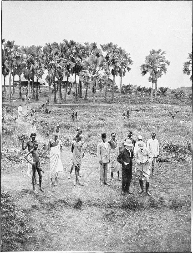
TATUG OR DELEIB—AMERICAN PROTESTANT MISSION STATION ON THE SOBAT.
Physically, the men are tall and well-built, but show little signs of muscular development, being generally long-limbed and wiry. They are all stark naked, and cover themselves from head to foot with cow dung ash, which gives them a particularly filthy appearance and renders their skin extremely rough and coarse. They make no attempt to adorn themselves, but are extremely anxious to procure brass wire with which to make for themselves bracelets extending from the wrist to near the elbow. This seems to be about their only vanity. They are all armed[134] with spears, of which every man carries two or three. Their weapon of defence consists of an oval-shaped buffalo-hide shield. Bows and arrows they do not appear to possess.
The elder married women are as filthy as the men in appearance. They all, however, wear a leather apron or skin fastened round their waists. The younger girls and unmarried women wear no such covering, and, like the men, are quite naked.
The right bank of the Sobat near Nasser Post is densely populated as far as the junction of the Sobat and Pibor rivers, there being several large and important villages such as Kwoinlualtong, Taufot, and Ajungmir in addition to smaller ones. The left bank of the Sobat is not inhabited, as from Nasser to the Pibor a considerable portion of the country is inundated when the rivers are full.
East of the Sobat-Pibor junction, the country through which the Baro flows may be described, until Anuak territory is reached, as worthless. For the most part it consists of open treeless grass plains, which, in the vicinity of the river, are inundated for months at a time. The population is small, and confined to villages some distance apart, and absolutely no signs of cultivation are seen, except on a large island near the border of Anuak territory.
This perhaps may be explained by the fact that the Nuers in the dry season of the year occupy villages near the river banks, which are merely used as large fishing villages during the time the rivers are low; they subsist almost entirely then on the fish speared in the many pools which are formed by the receding waters of the rivers. When the rivers become full again, and the country is inundated, they withdraw to their permanent quarters further inland, where they probably merely cultivate during the rainy season of the year, between the months of May and November.
Several of the large villages to the east of the Pibor-Sobat junction, such as Taiyau, Gunjang, Gadjak and others which were teeming with life in the month of January, were deserted in July when a visit was paid by steamer to Itang.
With the Nuers of the Sobat and Baro rivers very little trade can be done, as they possess little or no grain, living chiefly on fish. They possess, however, numerous flocks of goats and sheep in the vicinity of Nasser Post, and also some magnificent herds of cattle at Ajungmir. Thirty-five goats and sheep were obtained in exchange for a cow. Large opaque white beads, about the size of a pea, are in request as articles of barter, but brass wire “No. 8” is most in demand, and a desire for cloth is beginning to rise.
Anuaks or Yambos (E. of Nasser).The eastern Anuaks of the Baro (or Ufeno, as they call it) inhabit that portion of the river bank extending east of 34° 10′ to the mouth of the Baro river gorge at the foot of the Abyssinian hills, and the whole of their territory, with the exception of a small enclave round Itang,[91] which is leased to the Sudan Government, belongs to Abyssinia.
This tract of country is probably the most fertile anywhere along the river after it enters the plains. It is well wooded, and to a great extent free of those large expanses of swamp found lower down the river in Nuer territory. The numerous huts and hamlets, with which the river banks are dotted, are generally built close to the edge of the bank overlooking the river, usually on mounds slightly raised above the normal level of the bank. These huts are neatly built of mud and wattle with grass roofs, and are scrupulously clean and well kept. They are, as a rule, surrounded by a fence of tall reeds and grass, giving absolute privacy to the occupants. Within the enclosure so formed, in addition to several huts for the family, are the granaries, and also other enclosures for the herding of goats and sheep at night time. The interior is most carefully plastered over with mud and free of dust and dirt. The natives of this region are more advanced in ideas of civilisation than any others living along the Sobat and Baro in the plains. This is possibly due to their being in closer touch with the Gallas, with whom they trade considerably, than any of the more western tribes are.
They are a most peaceful, friendly and industrious race, and are great agriculturists. Miles and miles along the river banks are diligently cultivated by them twice a year, and splendid crops spring up from the generous soil.
Physically the Anuaks are not such a tall race as the Nuers, but their muscular development is perhaps finer. This is probably due to their more nourishing grain food all the year round, but they also supplement their grain largely with fish during the dry seasons of the year. Although they rarely seem to kill their goats and sheep for food, like the Nuers, they are extremely fond of meat, and will constantly beg a white man to come and shoot a hippopotamus for them, so that they may indulge in a real gorge.
As a rule the men are more decently clad than the Nuers, as many of them wear beautifully cured skins, as soft as chamois leather, round the loins. They are far cleaner, better groomed, and smarter looking in every way than the Nuers. A large number of the Anuaks, especially in the neighbourhood of Pokum and Finkio, wear splendid ivory bracelets on the arms. Some of these are as much as 4 to 5 inches in depth, and it is by no means uncommon to see a man with one such bracelet on the upper arm, and two somewhat smaller ones on the fore-arm.
One very curious weapon, to be seen nowhere else, is found among the Anuaks. This consists of a spear, the head of which is manufactured from a legbone of a giraffe, polished down to about 1 inch or ¾ inch in diameter, and sharpened to a fine point. These curios are obtainable for about five ½-piastre pieces.
[135]The Anuaks would not appear to be either a courageous or warlike race like the Nuers, and seem content to merely cultivate their fields and remain at peace with their neighbours. Their spears are generally small headed, with long handles, and it is by no means unusual to see some men armed with nothing but sharp-pointed sticks hardened at the ends. Knobkerries are carried by most men. The older married women all wear skins, cured or otherwise, round the loins. Some of these are daintily picked out with a border of vari-coloured small beads. A large quantity of beads are also very commonly worn both round the waist and neck. The attire of the younger women and girls is really most attractive. In addition to a numerous accumulation of beads round the neck, they wear a large number of strings of beads round the waist of many different colours, whilst a small fringe, as it were, of generally white opaque or light blue and white beads depends in front and behind, some 2 to 3 inches in length round the body. As the girls are often very beautifully formed, and possess pleasant, laughing and occasionally really pretty faces, a group of them together forms a most charming picture of modest maidenhood.
The upper reaches of the Baro are not well cultivated, and beyond the point where the Faidherb was abandoned, the population is very scanty, and little or no food is obtainable from the natives; the river banks become very stony and thickly wooded, and what little cultivation there is to be seen hereabouts is generally on the islands.
Principal villages. Nasser.Nasser, situated on the left bank of the Sobat, 160 miles above its junction with the White Nile, is the residence of a police officer and detachment of police. It is also garrisoned by half a company of a Sudanese battalion under a British officer (January, 1904). Little trade is as yet carried on as the Nuers who live in the vicinity have not yet got over their aversion to dealings with a civilized Government.
Itang (Finkio).By the treaty of May, 1902, the Emperor Menelek agreed to lease to the Anglo-Egyptian Government an area of about 1,000 acres in the neighbourhood of Itang, for the purpose of forming a trading station there. Itang is on the right bank of the Baro, roughly 100 miles above Nasser, and is in the Anuak country; a station was established here in January, 1904. As, however, the site is not a very suitable one a more convenient one at Finkio further east has been adopted. The Sheikh of Finkio is named Ojilo.
Although it is not practicable for probably five or six months in the year to maintain direct steamer communication with Nasser, the post should be absolutely self supporting. Shallow draught steamers drawing say 15 inches could, however, probably reach Finkio during 10 months of the year.
In addition to grain of various kinds, cotton is also grown by the natives in small quantities, and tobacco is very commonly to be obtained. Flocks of goats and sheep are numerous; but the natives will not readily part with their live stock. Cattle are only to be seen very rarely, as the natives fear to possess these lest they should attract the cupidity of the Abyssinians.
The Anuaks are very ready to sell flour and grain in exchange for beads, more especially in the Finkio district, which is very largely populated. They also hire themselves readily as carriers.
The most popular bead is a small light blue opaque one, the only opaque species of small bead obtainable in Cairo. A string of this bead, sufficiently large to pass over the head on to the neck, will purchase from 1 to 1½ pounds of flour, and perhaps 2 pounds of grain. A fowl can also be obtained for about the same quantity of beads. Possibly white or small green opaque beads would be equally sought after, but a blue and white bead, known in East Africa as the “punda malia” (zebra), would, everywhere in these regions, be eagerly sought after by the natives. Many of the Anuaks wear these beads, though how this species has got into the country, except, perhaps, gradually from the north of Lake Rudolf, where they may have been bartered in 1898, is difficult to understand.
The best trade goods would be white, green, pale blue (all must be opaque and not glass) and “punda malia.” Beads would be the main purchasing medium for grain, and perhaps brass wire and cloth for goats and sheep.
In a short time money may be introduced—as at Kodok amongst the Shilluks—as the Gallas, being neighbours of the Anuaks, and familiar with the Maria Theresa dollar, would readily bring down goats and sheep for sale, and the Anuaks would probably soon follow suit.
Besides tapping the fertile food-producing districts of the Anuaks, trade in ivory, coffee, live stock, donkeys, and mules, and in addition, perhaps gold and iron, in smaller quantities, will spring up with the Gallas when they find a ready market for their goods.
Tributaries of Sobat and Baro.Several more or less important streams and khors join the Baro in its upper stony region on both banks. Chief of these are the Sako on the right bank and the Bonga on left bank.
Lower down on the right bank, Khor Jokau or Garre joins the Baro by, some say, two mouths, one at Jokau about 40 miles west of Itang, the other at Machar[92] 15 miles further west, where the post to mark the Sudan-Abyssinia frontier has been erected.
[136]The Khor Garre, which forms the boundary between the Sudan and Abyssinia in these regions, brings down a large quantity of water in flood time from the Galla hills. In the dry season water stands in pools in its bed.
For the first 20 miles from its mouth this khor is inhabited by or belongs to the Nuers, then for a few miles by the Anuaks or Yambos, whose district is called Chai, and higher up by Burun.
Khor Makeir.About 8 miles east of the Pibor junction, Khor Makeir comes in on the right bank. This, near its mouth, is deep, with a sandy bed 30 yards wide. It has not been explored, but is believed by some to be the mouth of the Sonka, in which case it has its origin near Jebel Sonka in the Galla hills south of Kirin. Others say it is only a spill from the Baro.
Tributaries on left bank. Nigol or Aluro.The River Nigol (Nuer) or Aluro (Anuak) enters the Baro about 17 miles below Itang. It appears to have its origin on the Abyssinian plateau, and for some 25 miles before its junction with the Baro it flows parallel to that river, at a distance often of little more than a mile. In flood time it is a most formidable obstacle, as it forms large areas of swamp. Its entry into the Baro, near the border between Anuak and Nuer territory, is a very insignificant one, and barely discernible, as it spills out into a large swamp, near the village of Methok, before it reaches the actual river, and apparently the water gradually finds its way into the river through a thick forest-growth of trees by two small channels only a few feet wide. From the point where the Adura takes off from the Baro, the banks of the latter river are thickly wooded with sycamore and other trees as far as the eastern boundary of Nuer territory.
Pibor.The Pibor flows generally from south to north, and enters the Sobat river at a point about 25 miles above Nasser and about 200 miles from its (Sobat) mouth. It is by far the most important tributary of the Sobat. The Pibor was found (June, 1903) to be blocked by sudd immediately above the Akobo junction, and so its upper waters remained unexplored until September, 1904.[93] The greenish colour of its water would lead one to suppose that it receives its supply from vast marshes in the plain between the Akobo and the Nile, rather than from the Abyssinian plateau.[94]
The banks of the lower Pibor are, as a rule, swampy, especially at the season when the river is fullest. The adjoining country is flat and covered with grass, with but few trees, though, south of Koratong, the banks are firm and dry, and trees become general, especially on the right bank.
Width.The waterway of the Pibor in its lower reaches is exceedingly narrow, a steamer frequently touches the reeds of either bank simultaneously. About 40 miles from its mouth, however, it widens to from 40 to 100 yards.
Navigability.The Pibor river has not (1903) been navigated by steamer in the months of February, March, and April, during which period it appears probable navigation would be difficult, if not impossible. During the rest of the year the average depth of water is at least 10 feet.
Discharge.The discharge at the mouth of the Pibor, calculated by Captain H. H. Wilson in October, 1901, worked out at roughly 13,500 gallons per second. The width of the river here being about 80 yards, of which about 30 yards was blocked by sudd. The maximum depth was nearly 30 feet, and the current rather more than 1 mile an hour.
Route.There is a route over comparatively dry country from Nasser to Waratong (45 miles approximately).
Inhabitants.The inhabitants of the lower Pibor are Nuers, whose principal villages are a group at Koratong and another at Kur, both situated on the left bank. These appear to be the permanent homes of this section (Sheikh Jok’s) of Nuers, but in the dry season they occupy other villages both north and south along the Pibor, the most important of which is Bil (right bank) near the junction of the Gelo River; during this season Nuers from other districts visit the Pibor for fishing.
The Nuers of the Pibor do not differ in any essential degree from those of the Sobat and Baro, and are just as disinclined as their kinsmen to recognise the advantages of civilisation.
Trade goods.Dura was purchased from the late Sheikh Yowe’s (now Jok’s) people for small white and dark blue beads, not much larger than a pin’s head. A string sufficiently large to pass over the head on to the neck purchased from 1 pound to 1½ pounds of unground grain. A spear length of brass wire, about 9 feet in length, purchased a goat of average size. Coloured fancy cloth will soon be in much request.
Anuaks.A few Anuaks are found on the right bank, these are more or less subject to the Nuers. Their Sheikh is Okwai.
Tributaries of Pibor. The Agwei (Gwynn), or Neubari (Austin), or Ruzi II (Wellby), or Adjouaro (Faivre).The “Agwei” River joins the Pibor about 17 miles south of the Akobo junction. It was found by the Faivre Expedition (1898), by whom it was named the Adjouaro, to rise in the Southern Boma hills and to flow northwards to within a few miles of the left bank of the Akobo, and then bending westwards to flow parallel with that river to the Pibor, or, as they called it, the Adjouba (Agibba?). The Agwei was also heard of by Major Austin when marching through Boma; it was described as a big river and was named by him the Neubari. It is also probably the same as Wellby’s Ruzi II.
In September, 1904, Major Gwynn explored this branch of the Pibor in a steam-launch for 55 miles from its mouth, when further progress was arrested by heavy sudd. He describes it as a fine stream flowing between well-defined banks, averaging 3 feet above the level of the river in flood and 60 to 80 yards apart. In places, however, it had overflown its banks and flooded the adjoining country to a considerable depth. The average width of[137] waterway, which was frequently obstructed by light sudd blocks, was 30 yards, depth 20 feet, and current 2 to 2½ miles per hour. The banks of the Agwei were stated by Anuaks to be inhabited partly by people of their own tribe and partly by Agibbas. Their description of its upper course appears to agree with the theory that it is the Neubari, and that it is connected with the Akobo, as Major Austin surmised, by the Oboth.
The Akobo or Juba.The River Akobo or Juba, which rises in the Domme Hills (Abyssinia) forming part of the watershed between the River Omo and the Nile, about north lat. 6° 30′ east, long. 35° 45′, flows generally in a north-easterly direction, and for the first 100 miles through more or less hilly country; it then enters the plains and eventually joins the Pibor about 70 miles from its mouth.
The ill-fated Bóttego struck this river (January, 1897) about 40 miles from its source, and found it to be about 25 yards wide and about 18 inches deep, its banks being much overgrown with very high grass which impeded travelling considerably. It was found to be uninhabited for about 45 miles further west, when the first Anuak village was reached. This was the most eastern point on this river reached by Major Austin’s Expedition (1901).
The Akobo river forms the boundary between the Sudan and Abyssinia in these regions. The following interesting account of the Akobo and its inhabitants is taken from Major Austin’s Report:—
“On our journey south from Nasser, we retraced our footsteps of the previous year along the River Pibor through Nuer territory until we reached the junction of that river with the Akobo. Here we found a small colony of Anuaks settled down for the coming dry season with a view to carrying out fishing operations, and without difficulty obtained the services of two guides. For our first two marches we proceeded east along the river, the banks of which are somewhat thickly wooded with thorn bush, amidst which, here and there, we came upon small families of Anuaks enjoying a precarious kind of existence on fish and the frugal products of the woods. These natives were all without exception very timid, and generally had cleared out of their cosy little arbours before the head of the caravan had reached them. They are very poor and wretched in appearance, the men being quite naked and possessing very few adornments.
“The elderly women merely content themselves with a small goatskin worn round the waist, whilst the younger women, like the men, are devoid of covering. They lack the prosperous and smart bearing of the Ufeno (or Baro River Anuaks), and in general characteristics closely resemble those of the Gelo.
“Some 30 miles to the east of its junction with the Pibor the banks of the Akobo become generally very swampy, and the river was unapproachable at the time we were travelling along it (February). No villages were seen until we reached long. 33° 40′, where there was a small one, Bor by name, situated at the base of a single tree, surrounded on all sides by swamp. From near here a track runs in a southerly direction to Bonjak, reported to be 30 to 40 miles distant, and no water on the road.
“Settled villages become somewhat more frequent from that point until the Tedo district is reached. This is fairly thickly populated on both banks of the river, and for the first time we came across a considerable amount of cultivation. A large khor enters the Akobo from the east hereabouts, which probably has its origin in the Abyssinian highlands, whilst, from the village of Neum, a broad loop takes off from the Akobo and re-enters that river again some 5 or 6 miles further north. Up to this point the country had been chiefly open grass land, very sparsely wooded with trees, and occasional small groves of lalob, but it now became well wooded, and the swampy areas less frequent. Small villages were established at closer intervals, but the natives remained very timid and suspicious, and it was difficult in consequence to obtain the services of guides, as the larger number of the inhabitants concealed themselves on the approach of the caravan.
“The Anuak territory terminates at the junction of the Akobo and Ajibur streams, after which comes a long stretch of uninhabited country extending to the foot of the Boma hills. The district of Bula, some distance to the east, is reported by the Anuaks to be inhabited by men of a fair complexion—possibly Gallas. The Anuaks of the Akobo possess but few flocks of goats and sheep, and apparently no cattle. In addition to grain, they probably subsist to a large extent in the dry season on fish, as fish weirs and traps are occasionally met with in the river.
Width, depth, and current.“The average width of the Akobo in its lower reaches is 20 yards, and depth 7 feet, current 3 miles an hour (February); higher up above Neum its width increases to 40 to 60 yards, and its depth diminishes to 18 inches. Its banks are generally high and steep. In its upper portions it flows over a lava bed.
Navigability.“Small dug-out canoes are also used by the natives for travelling along the river. Navigation in a small launch would probably be quite possible as far as Neum for several months in the year. The larger Nile steamers would most likely be unable to navigate this stream owing to the extraordinary sharp curves and bends of the river, the stream when in flood being very swift. It is quite possible, however, that a powerful launch, drawing, say, 18 inches of water, might, at full flood time, be able to proceed, perhaps, as far as Melile, although extreme caution would have to be observed, for in parts the river flows over a lava bed, whilst in others, fallen trees in the river might prove dangerous.”
Discharge.The discharge of the Akobo near its mouth was calculated by Captain H. Wilson to be 2,185 gallons per second in October, 1901. There was then a clear waterway 15 yards wide and 14 feet deep, on each side of which were belts of sudd from 20 to 30 yards wide.
[138]Ajibur, or Ruzi I.The Ajibur (Austin) or Ruzi I (Wellby), a small stream rising on the Boma hills, flows northwards to the Akobo and joins it on the left bank about 80 miles from its (Akobo) source. Water was standing in pools in its bed in February, 1901.
Gelo River.The Gelo River rises in the Mocha hills (Abyssinian), situate about east long. 36°, north lat. 7° 30′, and flows generally in a westerly direction to the Pibor, which it enters on the right bank 26 miles above its junction with the Baro.
Mr. Oscar Neumann, who explored this river in 1901, considers it a very important source of supply of the Sobat, and far more so than the Akobo river, which he thinks comparatively insignificant. Mr. Neumann is strongly of opinion that after traversing Lake Tata the river divides, one branch flowing into the Pibor, as above stated, the other or others flowing northwards towards the Baro. Though Bottégo seems to have had the same opinion, Major Austin does not lend much credence to this theory.
Neumann gives the following description of the upper regions adjoining this river:—
“In Shekho I found a large river running westwards. I believed this river to be the Gelo, discovered near its junction with the Ajuba by the Italian Bóttego, an opinion which was confirmed afterwards. Travelling became very difficult here. The western slopes of the south Ethiopian plateau are cut by many deep ravines; the roads, therefore, were narrow and bad, and many of my mules became wounded and useless. As it flows westwards, the River Gelo is lined on both sides by the densest forest. I could march only about 2 or 3 miles each day, and to cover that distance the men had mostly to cut the way with axes and bush knives from morning to noon, after which the caravan was able to proceed. The inhabitants of this forest are the Mashango, who are very seldom seen, but we often found large traps made for hippopotami and waterbucks, and loops made of creepers for monkeys and other small animals going to the water. Already in Gimirra I had seen, far away to the west, a long mountain chain running from north to south, called by the Galla ‘Gurafarda’ that is to say, ‘horse’s ear,’ from a sharp double peak in the middle. It took more than three weeks from Gimirra to reach the point where the Gelo pierces the mountains, forming magnificent cascades. Some days after passing this gap, I saw from a bamboo-covered hill in the west a boundless bush and grass-covered dead flat plain, the plain of the Sobat and the beginning of the Sudan. Only a few granite hills are scattered over it. Ascending one of these I saw, far away, a large lake—Lake Tata—through which the River Gelo runs. Here we found the first villages of the Yambo or Anuak, who were the first true Nilotic people I met. They are a division of the great Shilluk tribe, which is spread over the whole Eastern Sudan, and extends southwards to the east short of Lake Victoria. The few samples I obtained of their language show that it is scarcely distinguishable from that of the Kavirondo people on the east shores of Lake Victoria, whose country I passed on my first African journey in 1894.
“The land now became more and more swampy. The Anuaks, poverty-stricken through many Abyssinian ‘razzias,’ live hidden away on small islands in these swamps. A large part of the people have migrated westward, and live in a state of semi-slavery under the protection of the more powerful Nuer, near the Egyptian fort of Nasser on the Sobat.
“Approaching Lake Tata the swamps became so numerous and deep that I turned south and marched to the village Neum, where I struck Bottégo’s route. The attempt to march along the northern bank of the Akobo failed, because we stuck fast in the swamps, where I lost many of my mules; so, after two days, I marched back to Neum and crossed the Akobo. The country on the left shore of the river, which had here a north-westerly direction, was drier.”
Major Austin, gives an interesting description of the river and country west of Lake Tata:—
“The Anuaks of the Gelo river district need very little description, and, as practically little was seen of them except when passing their villages, not much information was obtained regarding them. As compared with their compatriots on the Ufeno river, they appear to be a far less prosperous race, and, physically, might be described as an anæmic-looking tribe, probably due to the fact that the tract of country they inhabit is for months at a time one vast swamp, and unhealthy in consequence. They are more suspicious and shy than the northern section, but not really unfriendly in any way, as we had no difficulty in obtaining guides from them. They do not take the same pride in their personal appearance as those of the Upeno, and few of the men wear skins. The women are less particular also, and unhesitatingly entered the river at Patok devoid of all clothing, and washed themselves on the bank before our men. The unmarried women, like those of the Nuers, deem it unnecessary to provide themselves with any covering. Beads are worn, but not in the same quantities nor with the same taste as further north.
“The right bank of the Gelo, as far west as about east 33° 50′, is generally well-wooded some little distance from the river, but the left bank west of about east 33° 50′ is absolutely devoid of a tree or even almost of a shrub. An open treeless grass plain appears to extend south until the Akobo river is reached.
“Patok, the first village on the Gelo reached by the survey party, is one of very considerable size, skilfully concealed in a thick belt of wood, the interior of which has been cleared to a large extent. The village is enclosed by a stockade of tree trunks and branches for defensive purposes.
“Most of the large villages along the Gelo, such as the Otwol, Chiro, Oran group, Goin, and Ungela are similarly concealed inside belts of tall trees, and surrounded by stockades.
[139]“These villages are situated some distance from the river, as the expanse of swamp bordering the Gelo prevents villages being built nearer to its banks. At the height of the rainy season it appears probable that the whole country north of the Gelo and between that river and the Baro is one vast swamp, quite impracticable for transport animals.
Width and current.“The width of the Gelo west of Lake Tata varies as a rule from 60 to 100 yards. At its junction with the Pibor its width is not more than 30 to 40 yards, whilst its current is very swift.
“As the Gelo is followed along its banks, no other stream appears to flow into it, although several swampy khors issuing from the river are crossed, flowing in a northerly direction. These are reported to join the Bela river and to flow into the Mokwai.
Cultivation.“Along the Gelo, beyond a small patch of cultivation on the river bank near the village of Patok, no other signs of civilization are evident, except in a few diminutive cleared spaces in the woods; no food is obtainable from these natives. That they must subsist on grain to a large extent appears to stand to reason, so it is possible their fields, like their villages, are concealed in the midst of woods, with which the country abounds. Like the Nuers and Anuaks of the Baro these natives possess small dug-out canoes for crossing the Gelo, and employ them also in their fishing operations.
“To the west of Perbong two other villages, Ametha and Otwol, are reported to exist in Anuak territory hereabouts, and these two probably depend on wells for their water supply, as they must be quite 3 to 4 miles distant from the river, and no signs of tracks leading from or to the Gelo are visible. Goats and sheep are only seen in very small numbers.
Swampy nature of country.“In normal years it is doubtful if this tract of country can be traversed much later than the middle of April with transport animals,[95] as once the rains set in the whole country is rapidly converted into bog, through which laden animals, especially donkeys, are quite unable to travel. During the dry seasons of the year large herds of elephants roam over these grassy plains and find both food and shade in the forest growth on the north bank of the Gelo. It is to these regions the Abyssinians descend in large numbers yearly from the western edge of the plateau, on ivory hunting expeditions, and traces of recent Abyssinian encampments were on several occasions met with. Before the rains break, however, these parties return to their homes, and we were warned at Gore by Fitorari Hili that we would find the country impracticable for animals once the rains set in, and this we certainly found to be the case.”
River Mokwai.The River Mokwai or Bela appears to flow westwards to the Pibor from the Gurafarda range of hills (Abyssinia) traversing en route the marshy region between the Baro and Gelo; from the latter river it probably receives a considerable overflow. Its mouth is supposed to be about 8 miles south of the Pibor-Sobat junction, but owing to swamp it has not been accurately determined. It is said to be an important river in flood time.
Khor Filus.The Khor Filus enters the Sobat on the left bank about 10 miles from its junction with the White Nile, the following description of this khor, the adjoining country and its inhabitants, is taken from a report by Captain H. H. Wilson, Inspector, Upper Nile Province:—
“. . . Starting on April 15, 1902, the expedition marched from the village of Gokjak (some 20 miles from the mouth of the Sobat), and met the Khor Filus at Shol Ajik, some 8 miles inland, thus saving an unnecessary long march along the khor from its mouth, which is 10 miles from the Sobat mouth. The country here is flat and uninteresting, nothing but a vast grass plain, with hardly a tree to be seen. At Shol Ajik trees were met with, the banks of the khor being thinly wooded with a small growth of red ‘talh,’ with a sprinkling of the unwelcome ‘kittr’ thorn bush. The khor at this point is some 50 to 80 yards in width, mostly, however, filled up with weeds, the real water channel being clearly marked (though practically dry) by a deep narrow bed, some 15 feet lower than the adjacent banks. On to the village of M’Yolga the same country extends—grass, with a few trees; in one place there were traces of elephants which had been there in the rainy season. Other game seen was the bastard tiang hartebeeste, which was really all the game seen in any quantity in the country. M’Yolga is a long scattered village on the right bank of the khor, and marks the limit of the Dinka tribe inland. From here onwards for many miles is uninhabited country, from Bia to Nerol being thickly wooded, in places densely, but only occasionally with any undergrowth that makes travelling difficult. Tiang hartebeeste were seen in considerable numbers along the whole route, and also quantities of waterfowl, pelicans, duck, geese, teal, and many and various kinds of crane and heron. In the vicinity of Fanyanglwel, 46 miles south of Sobat, the first signs of Nuer habitation were met with in the shape of their cattle ‘feriks,’ which are the summer residences (i.e., dry season, from January to May), built close to water, and constructed lightly of grass only. No regular huts or tukls were met with until reaching Riul, 7 miles further south, where the banks became low and flat, and trees only at some distance on either side. The khor is here in the rains evidently broad and shallow, and, owing to mud, probably an impassable obstacle under such conditions.
“A noticeable feature in the Nuer tukls is the superiority of their construction compared with the tukls of the Dinkas, Anuaks, and other tribes of the Sobat, their cattle tukls being in many cases marvels of constructive art, given[140] only boughs of trees, grass, and native tools for their building. The regular solidly-built villages are placed at varying distances from the khor, probably dependent on high ground and on the nature of the soil, if suitable for the dura crops or otherwise, which are always grown in the vicinity of the rainy season tukls. Another noticeable feature, differing from the Shilluk and Dinka customs, was that the villages are not compactly built. The Shilluks and Dinkas generally build their tukls in close proximity, each village being a thick cluster of huts, the dura being sown anywhere close by. In the Nuer case, the tukls are built in twos and threes, at great intervals, probably each family being separate; the land around each homestead being sown and tilled by the dwellers therein. In the case of many Nuer villages, owing to the village being built in the woods, and the groups of tukls at intervals of 200 to 600 yards, it was impossible to estimate the size of the village without covering many square miles of country. Around the various large pools of water near Meinom, Fading, and Shit, were thick fringes of ‘Ambach’; these pools, being the chief source of supply for men and cattle in the dry season, it is only natural to have found the water so churned up and fouled by the cattle as to be nearly undrinkable. In places near these pools, where the adjacent soil was sandy, wells had been dug to obtain a cleaner supply of water. From Shit the khor continues in a southerly direction, being broad and shallow, and it is said, runs on to Bor. The expedition left the khor at Shit, and, relying on native assurances that water would be found in wells, pushed inland to the east, and marched through the main Nuer villages, which were in places very thickly dotted about, and well built. The country from Shit to the limit of the march was well wooded, chiefly with the heglig tree. The ground rose slightly, and as one got inland it became sandy and covered with fine grass, standing 2 to 4 feet high. The country also, here, struck one as being presumably fairly healthy in the rainy season, there being a complete absence of any rank vegetation. The dura crops in April were just appearing, the young shoots being about 6 inches high, and a very considerable extent of ground around each village was under cultivation.
“At Amwot-el-Sogheir, another fairly large khor was crossed; it was, however, quite dry, and the expedition camped on the further side, alongside some wells, which it was learned were the only ones to be found in this part of the district. These wells were worth noticing: dug on the sandy banks of the khor, their depth varied from 20 to 30 feet, with a diameter of about 2 feet 6 inches. Owing to the solidity of the ground, the walls of the well stood without need of revetting, and great labour must have been expended in their construction. Steps were cut in the wells on opposite sides, to enable a man to descend and ascend. In one of the wells a calf was seen, standing in the water at the bottom, having evidently fallen in. It was rescued by one of the Dinka guides, who descended the well without difficulty, and brought up the animal unhurt.
Denkur.“From the camp an expedition was made on the 22nd to the Nuer villages in this vicinity, which were stated to be the headquarters of the chief sheikh of the Nuers of the whole country under notice, by name of Denkur. Marching through a fairly thick forest of ‘Abu Homera’ trees for an hour, and afterwards over an open grass plain for another hour-and-a-half, brought us up to the village, Keik. Standing in the centre of the village, and seen for about 3 miles off, was a conical mound of earth, well and solidly constructed by Denkur’s people as a token that Denkur was a very big man in that part of the world. It was stated that the bones of innumerable oxen were buried in the body of the mound; the cattle being slaughtered for the occasion. This act was to give greater value to the cone in the eyes of the surrounding tribes, as cattle are the most valued possessions of the tribes of the White Nile, and are practically all they live for; in fact, what religion they possess is centred in the cow. The height of this conical mound was about 50 to 60 feet, many large elephant tusks being firmly planted round the base and on the summit. The largest tusk measured 7 feet 10 inches, but of poor quality, as long exposure to rain and sun had ruined the ivory.
“Having thus traversed as much of this country as was possible on account of water, the party returned to the Sobat by the same route, and arrived on the river bank on May 2. Owing to the extreme shyness of the Nuers, it was difficult to collect much information of their customs. Dress, hair, &c.Like all tribes of the Sobat, they are stark naked, and owing to their living in their own country, unmolested and out of all possibility of being in touch with civilization, it is only natural that they are sunk in barbarism and retain to the full all the inherited customs of their savage ancestors. Their hair is left to grow to a length of about 10 inches, and is stained red with the ammonia contained in the dung and water of their cattle. Their bodies (of the men) are covered with the white ash of burnt cow-dung, like the Dinka tribe. This results from the men always sleeping in separate tukls, the floor of which is several inches deep with this white ash, resulting from the perpetually burning or smouldering fire of cow-dung inside the tukl; the men actually make their bed in the ashes. The women do not thus cover themselves, but sleep on mats made of dressed cow-hide, and keep their own skins oiled and clean. The young unmarried girls, like the men, wear no covering, but the married women wear a loin cloth of whatever material is available, a leopard, gazelle, or sheep skin. Weapons.The arms of the men consist entirely of spears (throwing) and shields, with the universal knob-kerry; bows and arrows are possessed by a very few—rifles they have none. It was reported that one of the big sheikhs possessed himself of a few at one time, but broke them up and made bracelets for his ladies. As I have mentioned above, the main wealth of the Nuers lies in their cattle and flocks of sheep. As the importance or otherwise of a man is gauged entirely by the number of his cattle, it follows that the quickest way to become powerful is for an individual or a village to appropriate the[141] cattle of another individual or a village, or better still, of another tribe, and thus little raids of this kind are not infrequent.
“At Nerol another khor joins Khor Filus, by name Khor Nerol, or Chirol, which is said to connect with the village of Nyandeng, on the Sobat. Owing to lack of water, it was found impracticable to explore any distance up this khor.”
The country included in the above limits comprises an area 300 miles by 200, which, except along its eastern, northern, and western margins, still remains practically virgin soil untrodden by a white man.
Our only direct information regarding the interior of this region is furnished by the Faivre Expedition (1898) which followed the course of the Pibor for about 60 miles above the Akobo junction, by the expedition (1902) led by Major A. Blewitt, which marched nearly due south up the banks of the Khor Filus for about 70 miles, and by Lieutenant Comyn[96] who explored the so-called Pibor for 170 miles beyond the Akobo junction in September, 1904.
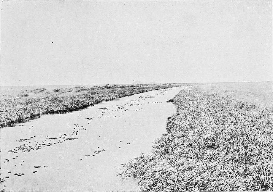
THE BAHR EL ZERAF.
Except perhaps in the extreme south the whole of this area seems to be a flat alluvial grassy plain, during the rains, marshy and liable to be inundated by the various canal-like watercourses traversing it generally from south to north, but during the dry season probably arid and waterless for considerable stretches. In the south the forest is perhaps finer and more generally distributed than further north, where thin belts of the ubiquitous heglig, kittr, and talh occasionally vary the monotony of this vast grass-covered plain.
Though a flat and somewhat unattractive country to the explorer, there is more than one interesting problem awaiting solution, chief of which is the Pibor question.[96]
The course of the mysterious Oquelokur which drains the northern slopes of the Latuka hills and the Kos, its supposed affluent after entering the Sudan, also awaits investigation. When Captain Borton visited the Beri at J. Lafol at the foot of which, according to existing maps, the Kos should flow, he could see or hear nothing of this stream. At Bor, too, nothing has been seen or heard of any large khor for at least 15 miles inland, though the[142] natives there say the Beir tribe live on a large khor three or four days to the east. It seems therefore probable that the so-called Oquelokur flows further east than is shown on maps, and that it and possibly the Kos drain into the Pibor and thence into the Sobat.
With regard to the source of the Khor Filus, the only information that has been obtained emanates from natives living near its mouth, who vaguely say it “comes from Bor,” the reputed starting point of the other large khors Nifar, Diar, and Gaweir (perhaps different names for the same khor), which are said to flow northwards between the Filus and Bahr El Zeraf. Mr. E. Grogan certainly crossed several wide lagoons or spills just north of Bor, so possibly what the natives say regarding the origin of these khors is correct. For description of the Khor Filus, vide p. 139.
As regards the inhabitants of the interior, all we know is that the Nuers live on the Khor Filus as far south as 8° north latitude, that the Beri or Beir tribe live some 50 to 80 miles east of the Nile between Bor and Uganda, and that the Agibba tribe live on the so-called Upper Pibor, apparently only some 60 miles east of Bor.
General.Bahr El Zeraf is the name given to the eastern branch of the Bahr El Jebel, which leaves that river somewhere in the neighbourhood of Shambe, and flows into the Bahr El Abiad or White Nile near Tonga, about 100 miles up-stream of Kodok. It has not been navigated in recent years above a point about 180 miles from its junction with the White Nile. Here it opens out into several channels and lagoons, which are for the most part blocked with sudd, and it is difficult to determine which is the main channel. According to native report a through channel to the Bahr El Jebel, navigable for steamers at high Nile, does exist. Whether such is the case has not yet been ascertained.
The general direction of the river is from S.S.W. to N.N.E. The current is much stronger at the head waters of the river than in its lower reaches, except where it flows into the White Nile, which it does through a narrow channel.
Width. Depth.The river averages about 60 yards in width, and nowhere does navigation present any difficulty until nearing the sudd region. Its depth is generally 5 to 10 feet or more, even at low Nile.
Banks.The rise and fall of the Bahr El Zeraf is considerable. In May the banks, which are then hard and steep, are from 5 to 10 feet above the level of the river, which at high Nile, in spite of the opening of the Bahr El Jebel channel, appears still to overflow its banks almost everywhere. This has, no doubt, killed the trees close to the old channel, masses of dead stumps being a feature of the river.
Roads.The country inland in May is dry and level, affording good going, but the only path near the river and parallel to it passable at all seasons of the year is said to be on the left bank. This runs from opposite Tonga on the White Nile up the left bank and crosses to the right bank near Ajiung thence up the right bank to the neighbourhood of Bor. During the dry season water along this route is said to be scarce. The right bank is said to be impassable owing to swamps and elephants. Mr. Grogan, however, followed the right bank from Ajiung to the White Nile, and in April, 1904, Captain J. S. Liddell marched without difficulty with camels from Khor Attar to Twi, leaving the Zeraf about 20 to 30 miles to the west. Much of the country traversed, but at this season dry, had been flooded to a depth of 18 inches by the overflow of a large khor to the east named Gaweir. The road followed is chiefly used by the Dinkas in the rains, as in the dry season water, which is stored in fulas, is scarce.
The banks of the Zeraf are almost invariably fringed with Um Suf, a few yards wide.
Sudd.Most of the sudd in the lakes at the head of the river appears to be growing, though on the edges it is floating and liable to become detached at any time; this is specially noticeable on the western lake or head of the river. The water is strongly discoloured after the 100th mile, and gets more so as the end of the navigable water is reached. Hippopotami, though scarce on the lower reaches, are very numerous on the higher ones, and in the many lagoons through which the channel flows.
The sudd is of three kinds:—
(1) Sudd growing up from bottom and immovable.
(2) Small low floating sudd in large patches, but loosely hanging together, and easily broken up or pushed away.
(3) Patches of high sudd floating and connected by very fibrous roots, and very difficult to separate or clear; very liable to entangle in the stern wheel of steamer.
The first and second can be steamed through with difficulty. The latter has to be cut to pieces by hand and disintegrated.
Wood.Between 30th and 148th miles there is no place where wood can be cut, except by cutting it in water (October, 1898). Beyond that, there is no wood at all.
Inhabitants.The inhabitants of the island formed by the Zeraf, Jebel, and White Nile are Nuers, who also occupy the right bank of the Zeraf from its mouth to about opposite Shambe. The right bank appears to have been originally[143] inhabited by Dinkas, of whom a few are still to be found living among the Nuers, whilst the hinterland of the right bank of the Zeraf is still occupied by them. They, however, live in dread of the Nuers, and many of them have left their villages and have sought safety on the river Sobat.
The Nuers are very shy, but having got over their first timidity on meeting strangers they are cheery and open-hearted, evincing none of that suspicion and churlishness which is such an ever-present characteristic of the Dinkas, even in the more northern districts, nor that inexpressible laziness, a trait of both Dinkas and Shilluks.
The men, boys, and unmarried women are, of course, naked. The married women wear loin cloths of skin, and a few of the men leopard skins. They all affect the long red-dyed hair, the universal custom of the Nuer tribes.
The following is a detailed description of the various Nuer districts on both banks of the Bahr El Zeraf as far as is at present known (taken from a report by Captain H. H. Wilson, 1903):—
Lak.The first district on entering the Zeraf is Lak, of which the head Sheikh is Fador Wad Koing (1903). His country is of great extent, and split up into various sub-districts. This district extends between the Zeraf, Bahr El Jebel, and White Nile, near Tonga, the majority of the villages and people being nearer the Bahr El Jebel than the Zeraf. Only a very small proportion of them winter on the latter river, the majority do so on the White Nile, up-stream of the mouth of the Zeraf. The chief village of Lak, and in which Fador himself resides, is called Fulwal, and is close to the Bahr El Jebel.
The only sub-district of Lak which is on or near the Zeraf, is Warao, of which the Sheikh is one Warao Wad Koing. This sub-district is entirely on the right bank of the Zeraf, at about 50 miles from its mouth, the winter hunting village being situated about 1 mile inland, on the right bank of a big khor known as Bahn, which runs into the Zeraf at this point. The inland village where the people reside during the rains and grow their crops, is about two hours’ march inland, and is called Fulfam; the sheikh himself resides in this village.
Thiang.The district of Thiang is also a large one, being situated on both the right and left banks of the Zeraf, at or about 80 miles from the mouth. The head Sheikh is Toi Wad Thief[98], who has two big villages, both on the left bank, called respectively, Fakoi and Fai-at. The people living on the right bank spread themselves between the Zeraf and Jebel rivers, and in the winter descend to the banks of either or both of these rivers to graze their cattle. The people on the right bank have their “rain” village at a place called Khandak, about three hours inland on the right bank at 80 miles. The Sheikh of this section is called Deng. These people are great hunters of the elephant.
Gaweir.The villages of this district are seen from the river at about 120 miles, standing about 1 to 2 miles back, with a thick belt of trees behind them; just north of these trees are seen several clumps of deleib palms, and a few solitary dom palms. This district is on the left bank entirely, as far as could be ascertained. The Sheikh of the district is one Nyal Wad Jek[98], a young man well disposed to the Government, and who has only recently succeeded his father as sheikh. He is very well supported by his uncle, Niar Wad Koing, an elderly man. These people remain in the same place all the year round; the ground being sufficiently high to admit of their building their rain villages in proximity to the river. This was the furthest point visited by Captain Wilson (1903). The information regarding the remaining district is from hearsay.
Fasheikh.This is the district ruled over by Sheikh Diu, who, being an influential man in these parts, is known by this name only. He rules his own district only, and has nothing to do with the other Nuer districts above mentioned, each of which is independent, under its own sheikh. This district lies in the upper region of the Zeraf on the east bank, and the name Fasheikh applies to the inland district, where Diu and his people reside in the rains, as opposed to the village of Ajiung, which is the winter village.
The history of Diu’s occupation of this district is interesting, and was supplied by several men, who may be quoted as local authorities. In the days of the old Government it was a large Dinka district, the chief sheikhs of which were two men well known to the present Government, i.e., Aiung Yor and Agweir Owae, who are, at the present time, settled on the left bank of the Sobat, at M’Yolga, vide p. 139. At that time, Diu was somewhere on the Bahr El Jebel, and the Nuer sheikh on the Zeraf was one Bil Wad Teng, who lived at the spot that is pointed out as the zeriba of Kuchuk Ali, the Khartoum trader. The two lived together, the trader probably working the country under the guidance of the sheikh. On the retirement of the Government from these parts and the disappearance of Kuchuk Ali, Diu came down and seized the Dinka country to the south of this spot, turning out the Dinkas under the above-mentioned sheikhs, and establishing himself as the paramount power in the district. He is stated to consider himself a “fakir” in the same way as Denkur; but that he is not hostile to the Government is clear from the fact that he sent his representatives to Kodok last year.
Fasheikh is stated to be about three hours’ march inland from Ajiung, but inaccessible owing to the intervening swampy ground.
River Atem.An important branch of the Bahr El Jebel appears to leave the main stream through the swamp and sudd to the north of Bor, and to flow north-west parallel to it and at a distance of perhaps 5 or 6 miles to the east. For about 30 miles below Bor, this branch, known by the Dinkas of Pabek as the river Atem, and by those at Tau as the Awai—the “Gertrude Nile” of Grogan—is said to be blocked by sudd. The Dinkas, however, say that Arabi Dafaalla sent a steamer down it from Bor to the junction of the Mading. In May, 1904, Sir William Garstin, G.C.M.G., and Captain J. S. Liddell explored this river by steamer as far up-stream as the village of Tau within 40 miles of Bor. At Tau the natives said it was blocked by sudd 10 miles further south. Up to this point the river was never less than 4 feet deep, though its breadth varied considerably, and to enable a steamer with barges to pass through it would require a certain amount of clearing.
River Mading.About 55 miles below Bor the Atem or Awai bifurcates. One branch known as the R. Mading, flowing north, is at first a fine river 80 yards wide and 5 or 6 feet deep but quickly narrows and looses its water in the marshes, and after 7 miles becomes an insignificant stream. It is said to be completely blocked by sudd a little lower down.
River Awai.The main branch known only as the Awai bends westwards and flows as an easily navigable stream, though difficult for a steamer with two barges, through the usual reedy swamp to the lakes a little north of Shambe. Between the Mading and Shambe the Awai has two main outlets into the Bahr El Jebel. One from Fajak, navigable only for dugouts, spills into the main river near Abu Kuka, but the principal channel, only a few hundred yards long connecting with the Jebel, is about 8 miles up-stream of Shambe. This is easily navigable by steamers.
Banks.The banks of the Awai and Mading are generally swamp, papyrus or grass, but from the former, about 7 miles from the Mading junction, ant hills on more or less dry ground are visible. On the eastern bank of the Atem forest approaches the river and for 10 miles north of Tau the right bank is high and firm, though liable to be flooded. The western bank is everywhere swampy.
Inhabitants.The Nuers do not appear to extend south of the latitude of Shambe. Here the banks of the rivers are thinly populated by Dinkas. From a few miles north of the Mading junction to Tau is the Dinka district of Twi—it was with the people of this district that Mr. Grogan had some trouble in 1900. Sheikh Gurung of Pabek in the north of Twi seems, however, very friendly. South of Tau, Bor district commences, the Dinkas of which are said to be not on friendly terms with Twi.
Bor.There are three sites on the right bank of the Bahr El Jebel known as Bor—the most northern is the site of the Old Government Mudiria, 4 miles further south is Arabi Dafaalla’s deim, and about the same distance still further south is the site of the present Military Post and the proposed site of the Headquarters of the new administrative district of Bor, vide pp. 76, 77.
The bank at all three places is high and firm, but the most roomy landing place is at the most southern site. Wood is everywhere plentiful, as the forest comes down to the water’s edge.
Inhabitants.The inhabitants in the neighbourhood of Bor are Dinkas who live mostly 10 to 15 miles inland. The principal sheikh (Being-Dit) is named Bor, whose village is about 10 miles east of the Dervish deim. Sheikh Kur living about 7 miles north-north-east of Bor is also an important man.
Being Dit.The office of head sheikh (Being Dit) is said to have been from time immemorial in the family of sheikh Bor. It is customary for the Being Dit to nominate his successor from among his near relatives, his selection depending on their individual ability. In the present case, though the eldest son of the Being Dit usually succeeds, sheikh Bor has disregarded the claim of his own two sons, and has nominated Majam, son of his deceased brother, Matj.
If the Being Dit dies suddenly without nominating his successor, an assembly is held to appoint one, a curious fact being that the women, especially the wives of the late Being Dit, have a good deal to say in the selection.
Justice.Owing perhaps to the weakness of the central authority, sheikh Bor, there seem to be practically no penalties for offences. The fine of one cow appears to be considered sufficient for any crime from murder downwards. Capital punishment is never awarded. In the case of theft, the misdemeanant, if traced, is merely ordered to restore the stolen property. This he sometimes does and sometimes does not.
Villages.The houses of the villages are much scattered, which renders the occupants very defenceless in case of raids by the dreaded Beir or Beri tribe under sheikh Lom, who lives several days further inland in a south-easterly or easterly direction.
The tukls are well and neatly built, the walls being made of mud or dura stalks covered with daub. The doorway usually leads into a sort of hall or porch about 3 to 4 feet high; this again has an inner door. This is said to be for protection against hyenas.
[145]The usual buildings of a family consist of one tukl (Ud) per wife, one extra large tukl (Luak as cow stable, and the “Gu” or granary, a kind of miniature tukl raised off the ground on wooden legs.
Water supply.In the rains water is stored in fulas, as the water in these gets low, a series of circular holes, 2 or 3 feet deeper than the fula, are dug round its circumference, and the remainder of the water is drained into them. These holes are then thatched with dura stalks, and water is economised by thus diminishing the loss by evaporation, as well as by draining the wet mud at the bottom of the fula.
When these holes run dry water has to be carried by the women often 10 miles or more from the river.
Communications.From Bor a dry road, though not yet explored, undoubtedly leads north to Twi or Twich. A good path with rest-houses at frequent intervals leads south up the right bank to Mongalla and Gondokoro.
Communication with the Aliab, a tribe rich in cattle and grain, living on the west bank opposite to and south of Bor, is maintained by dugouts to Uternau, thence by road to Sheikh Anok, Mek of the Aliab, who lives about 25 miles west of Bor Military Post.
Cultivation.A good deal of dura is grown by sheikhs Bor and Kur. It is of the white variety and of excellent quality. The Dinkas are great smokers, and cultivate sufficient tobacco for their requirements.
Cattle and sheep.Large numbers of cattle (Wong) and a good many sheep (Amal) and goats (Biu) are owned by these Dinkas. The grazing stables or cattle zeribas are called “Mura.” The price (Tiek) of a wife used to be five cows or forty goats. Cattle being now scarce, owing to Arabi Dafaalla’s prolonged residence at Bor, the price of a wife has been reduced to one cow.
Arms.Bows (Danga) and arrows (Juet) are in general use, and are looked upon as the principal weapon for fighting, as their lances are indifferently manufactured.
Some of the wood from which the bows are made is said to come from Dar Fertit; the arrows are made of cane with iron or hard-wood points, and are poisoned by soaking them in the milky juice (Byol) of the Euphorbia candelabrum, which grows hereabouts.
The Dinkas are very inexpert smiths, and so generally have their lances made by the Jurs and Aliab of the west bank in exchange for sheep or goats.
In addition to their bows and spears they usually carry an ebony club.
Ornaments.Iron bracelets (Lung Kok) are made locally. These are about the only things a Dinka smith can make. A Dinka receives his bracelets on coming of age and is then not allowed to part with them.
Ivory bracelets (Gong) are only occasionally seen, as these people are not great hunters, though elephants are very numerous in their country.
The Jenotor[100] (Guainakwach) are the favourite beads, but they are very particular as to the kind. The most popular are black with red and white spots. Forty of these beads make a necklace and will purchase a sheep or goat; five is the price of a hen and three will buy five eggs.
Brass wire is not nearly so much appreciated as iron or the right sort of beads. It is hammered into bracelets by the smiths, but they prefer to buy these ready made.
Goat skin bracelets are also worn by the men as well as by the women who wear, in addition, brass bracelets round the wrists and ankles, and strings of small blue or white beads round the waist. The men as a rule are naked, whilst the women wear the usual skin apron in front and occasionally behind. At present cotton cloth is considered a prohibitive luxury and is not of much use as barter, though acceptable as a present.
Word of greeting and language. Habits.The word of greeting is “Akingedo” and the reply to this is the same word repeated.
The dialect of these southern Dinkas varies considerably from that spoken in the northern districts.
The Dinka is so abnormally lazy that he has no desire whatever to hire himself for work of any description. Carriers are most difficult to obtain from them even when applied for through the medium of their most influential sheikhs.
At certain seasons they are busily occupied with their cultivation, but for the remainder of the year, with the exception of the few engaged in superintending the grazing of the cattle, they live in absolute idleness, varied only by an occasional and generally futile hunting or fishing expedition.
The women on the other hand are very industrious. On them falls the heavy work of pounding the dura into flour and preparing food and other household duties, as well as carrying water which has often to be brought from a great distance. Salt is not eaten by the Dinkas, nor is it sought after like sugar, and they do not appear to have any substitute for it. The women usually drink milk flavoured with cow’s urine, but the men as a rule drink it unadulterated.
Religion.As is stated on p. 128, the Dinka believes in a Creator of the world and mankind known as Deng-Dit. It was only after man had learnt to sacrifice cattle and sheep to Deng-Dit that woman became fruitful and man was able to propagate his species.
The Dinkas have regular priests (Tieit) who are not, however, professional men, but live and work like the[146] ordinary individual. These priests are believed to have supernatural powers of conversing with those who are dead and have become the children of Deng-Dit.
This communion with the dead is held on the occasion of a ceremony to commemorate the deceased or sometimes in cases of serious illness.
Mr. R. Türstig gives the following interesting description of these ceremonies:—
“It was the memorial day for a deceased wife of sheikh Bor. At about 7 a.m. he and some of his people went to the tukl, which had belonged to her, and sat down in front of the doorway; on the other side near the ‘Gu’ or granary sat the deceased wife’s ‘locum tenens’ as well as other wives. In the open space between them the Tieit or priest sat on his cow-hide mat. Close by was a tree from which the branches had been shorn, and to which a large number of cow-horns had been affixed—said by sheikh Bor to be a very old erection—and to the bottom of the tree a live goat was fastened.
“Sheikh Bor and his people then commenced to question the priest on many points with regard to which they desired the opinion of the deceased wife; the priest meanwhile sat with legs crossed supporting his head with one hand, whilst with the other he continued to rattle a bottle-shaped-gourd half-full of lubia beans. After much shaking and rattling he proceeded, having first directly addressed the deceased and having made a suitable pause to enable her to reply, to give a detailed answer on each question in a deep guttural tone, his eyes meanwhile being rigidly fixed on the ground, his voice (similar to a ventriloquist) sounding as though it were not his own.
“Though I was unable to understand much that was being said, one, at least, of the questions and answers referred to the approaching visit of the Mudir.
“Having obtained all the information required, sheikh Bor rose, the priest remaining seated, seized the sheep, threw it down, and then slowly and solemnly cut the throat of the animal with a lance, remaining himself the while in an upright position. The blood having spurted out, the ceremony was over, and the old sheikh said ‘Now let us go to your house.’
“On another occasion a somewhat similar ceremony took place in connection with a sick man. The same priest officiated, but there were more people, and it lasted from 5 p.m. to 10 p.m. A good deal of dancing was performed by women who were decked in fantastic fashion with ostrich feathers, etc. One woman carried a gourd full of liquid butter, with which she anointed in most liberal fashion the necks of those present as well as the entire body of the bull which was subsequently sacrificed. The priest invariably receives the ribs of the animal as his portion, but in this case no one partook of any of the flesh until 5 a.m. the following morning. On the whole, the Dinkas did not strike me as a particularly superstitious race.”
Vide also Chap. VII, p. 162, and compare with Shilluk religion, Chap. VIII.
Baris.On the right bank, 20 miles south of Bor, the Baris begin and extend to Gondokoro and south. The Sudan Baris appear to be a poor race both materially and mentally. At present they are neither willing to work to increase their cultivation, nor to act as porters. In the days of Baker they were a warlike race, rich in cattle—this spirit and property seem to have vanished under Dervish rule. They appear physically stronger and better built than the Dinkas. Like them they do not appear to inhabit the country more than 20 miles inland. Their inland villages have no wells, but each house has usually five pits dug round it for collecting rainwater. The Baris cultivate dura, simsim, telabun and tobacco. During the last few years their crops have suffered much from drought and floods alternately.
Beads are of little use as trade goods. Brass wire, hoes, iron, and tarbushes, as well as native cotton-cloth (damur) are all acceptable.
The men as a rule carry a long narrow-bladed spear, and go about stark naked. The women wear a leather fringe round the loins, with a tanned skin hanging down behind. The unmarried girls are content with the fringe only.
The women carry their babies on their backs, in skin bags, which can be detached and hung on a cross stick to form a cradle.
The principal Sheikhs of the Bari living on the right bank and working south are Kula, Wungo, Lefo Abu Kuka, Legi Lefo, Lado, and Lowala, and on the left bank Mudi, Wani, and Lado Kanga. They have apparently no tribal organization, and the Sheikhs have very little authority.
Mongalla.Mongalla is the southernmost post of the Sudan Government on the White Nile. It was moved here from Kiro, on the left bank, in April, 1901. It is the residence of a British Inspector and Police Officer; there is also a detachment of two companies under a British officer furnished from the Sudanese battalion at Taufikia. There are here Government offices, barracks, hospital, and residences of officials built of brick. A gunboat is always stationed here. Mongalla is on the right bank, 23 miles north of Gondokoro, and 13 and 12 miles from the Belgian stations, Lado and Kiro respectively.
Rains.The rainy season in this district is spread over the period from the end of February to November, but during[147] this season rain is by no means constant. At first there are intervals of a week or even a fortnight between the rainstorms, but after the middle of June, when the heavy rains commence, there is, as a rule, one storm during every 24 hours.
Temperature.The temperature in these regions is comparatively cool, and the thermometer very seldom rises to 100° Fahr.
Health.The natives appear healthy, and there seems no reason why, with ordinary precautions, white races should not enjoy equally good health, though the more southern portions, at any rate, of this district are certainly within the “Blackwater” fever zone.
Description.The following information is taken from a report by Captain N. T. Borton, who visited these people in April, 1904.
The Beri tribe appear to be a mixture of the Bari and Latuka. They live on a hill about 2,000 feet high called Jebel Lafol which is composed of granite with several fair sized trees growing on it. It lies about 50 miles south-east by east from Mongalla.
Houses.The hill is artificially terraced with granite slabs throughout and on these terraces, practically right up to the top of the hill, are built the tukls of the people, exactly similar to Bari Tukls except that the sides are made of strips of wood instead of reeds. The fighting men live round the foot of the hill and the older people higher up.
Water.There is no water on the hill itself—all has to be carried from rain pools of which there are at this time of year about a dozen round and fairly close to the hill.
Cattle.All cattle were driven off during our visit and were only beginning to return when I left—there did not appear to be many really large cattle zeribas, though these too may have been removed at our approach which had been watched for by day and night for the last three days.
Chief.Alikori[101] is the chief of the tribe and holds absolute sway. He is an oldish man of about 65 years of age, about 5 feet 8 inches in height, and like nearly all his tribe, wears a feather quill piercing his lower lip to allow the saliva to run off, when smoking, with a minimum of trouble to the smoker.
Succession.The rule of succession is that brothers succeed each other according to seniority; after the youngest brother’s death, the succession passes to the eldest son of the eldest brother and so on through the family.
Alikori succeeded his father Aseri who had no brothers, the present heir apparent is named Waller Mari.
Beris.All Beris stated they have no connection whatever with the Beir tribe opposite Bor[102] and say they have no other district but Jebel Lafol. From the top of it one can see 50 miles or more in the Bor direction; there did not seem to be any roads and no hills were visible. All tribes in these parts live on hills.
Cultivation.The cultivation on the vast plain lying round the hill consists of dura, tobacco, and a few ground nuts only. The dura was about a foot high and appeared to be well looked after and the ground cleaned.
Trade.The only trade is the purchase of dura for sheep, carried on principally with the Lokova on Mount Illyria and a little with our Bari Sheikhs Lado, Lowala, etc., on the Nile.
Enemies.The present fashionable enemy is the Latuka tribe belonging to Queen Topein—relations with other powers are reported as satisfactory.
Population.The population probably amounts to about 3,000 men all told.
Health.People seem very healthy, quite the opposite of the Baris; no disgusting sights like one sees in their villages; malformed children are destroyed at birth. Sleeping sickness is unknown.
Legal.All disciplinary powers are vested in the chief. For premeditated murder punishment is death. For killing in quarrel, etc., the offender must pay a boy to the family of the deceased. Thefts of cattle must be repaid or the offender is exiled. Thefts of food are not looked upon as offences but as occasional necessities. For adultery the co-respondent must pay 1 cow, 5 sheep and 5 iron malotes (hoes); the wife is dealt with by her husband in the seclusion of the home, but must not be killed.
Customs.The birth of a child does not give an excuse for a festival of any sort.
Marriages are arranged when the girls are very young. The bridegroom interviews his proposed father-in-law, as in other countries, and arranges to pay so many sheep a year until the lady reaches a marriageable age. The ceremony is then celebrated amid much merissa drinking. Divorce is allowed to husbands only; if granted they receive back their marriage settlement. A widow marries her deceased husband’s brother; if she has no brother-in-law she may marry someone else, but she usually becomes the property of the head chief.
Death is believed to be the end of all things. No after state is believed in. A sheep is always killed over a dead man’s grave.
Language.The language is peculiar to the tribe.
[148]Clothing.The men go naked or wear a short mantle of skin over the shoulders. Women wear a broad skin covering from the waist in front and behind.
Arms.The same practically as the Baris.
Visitors.Alikori states no white man has ever been to him before (April, 1904). Emin Pasha once passed with a concourse of people going towards Bor but did not stop.
Siege.Arabi Dafaalla besieged the hill for 13 days in 1897; he then drew off having suffered considerable loss. The natives used to rush the water holes every night at a different point and thus bring in enough to last for the next day.
Supplies.Flour and sheep could only be obtained on payment by repeatedly demanding them and were then only forthcoming in very small quantities. It is probable that when the Beri are again visited supplies of grain and meat will be more readily produced.
Transport.Mules, donkeys, and in the dry season camels could all be advantageously employed for transport.
Game.Giraffe, hartebeest, topé and oribi practically comprised all the game seen, but there were many fresh tracks of elephant and rhino. One herd of giraffe numbered over eighty animals.
Road.The best route from Mongalla to J. Lafol is up the right bank of the branch of the Bahr El Jebel, south of Mongalla to Sheikh Lado’s or Lowala’s (9 miles, thence south-east up the Felluru river viâ Nierchuk to junction (18 miles) of track from Ali Bey and Gondokoro, water in dry season all along this river. Thence general direction east, passing two pools, liable to be nearly dry in dry season, to Khor Wandida (15 miles), dry in April. Thence still east to Wallada lake, 12 miles, thence 11 miles north-east to J. Lafol, passing a marsh half-way where water should be always obtainable. Total distance about 65 miles. Between the Felluru River and J. Lafol there is no track.
Boma.South of the junction of the Ajibur and Akobo rivers, an undulating tract of country is traversed before the foot of the Boma hills is reached. The soil is generally of a gravelly nature, but the district is often most charmingly wooded, whilst striking cocked-hat shaped peaks to the west enclose the valley of the Ajibur and add variety to the scene. Until the Boma hills are entered the country appears to be quite uninhabited, for it was not until we reached the lower slopes that we observed natives for the first time gathering the fruit of the many palms that grow, as well as bamboo, hereabouts. The hilly district of Boma[104] is then entered, and many streams, valleys, and ridges have to be crossed. The soil is seemingly very fertile and capable of producing all kinds of cereals. Proceeding as we did in a south-westerly direction through these hills, we, of course, only traversed quite a small corner, so to speak, of the country, but were much impressed by the possibilities of the place as the site of a future post along the frontier. The natives appeared quite friendly; the scenery at times was really grand; and plenty of food and water could doubtless be always procurable once the natives saw that they would be protected from outside raiding parties. The average altitude of this region is generally from 3,000 to 4,000 feet above the sea level, but other ridges and heights attain an altitude of close on 6,000 feet. The natives were exceedingly shy, but eventually we persuaded them to approach us, though unfortunately we were unable to converse with them except by that most unsatisfactory of means—signs. Physically, the men—we saw no women at all at close quarters—are finely built and appear a higher type than the Nuers or Anuaks. Many of them wore ostrich feathers in their head-dress, and several had large circular knives—like those of the Turkana, but much broader—round their wrists. Beads were very generally worn, and many of the young bloods had broad bands of red beads, picked out with patches of blue and white ones, fastened across the forehead. Small skin aprons, not unlike those of the Turkana, were also worn by some of the men. Most of the men’s spears were sheathed and not carried like those of the Nuers and Anuaks uncovered. The huts we saw were wretched little grass erections with no appearance of stability, and gave one the impression of being little more than mere rough shelters. We gathered from these natives that they had recently been raided by the Magois, whom they hate and fear, and had in consequence no goats or sheep left. We certainly did not see any, but at the same time the men looked so sturdy and well-filled that they probably had plenty of grain food. Moreover, the wild fig grows fairly abundantly along the banks of some of the streams. The loftier heights of the country are well wooded, and though, perhaps, they were somewhat distant to judge accurately, I think probably these trees would provide excellent timber for building purposes. The climate appeared most bracing, and, judging by the few days experience we had, the rainfall must be very heavy.
Grand solid rock peaks in places spring out from the ridges in a curious manner, and by their precipitous appearance would probably tax the resource of the most skilled Alpine climbers to reach their summits. We were able to learn nothing regarding the customs or habits of these natives, and, in fact, from the time we left Anuak country until we[149] reached the Uganda Protectorate had to carry out all conversation by signs. Judging by the great display of beads made, for trading purposes I have little doubt but that red, blue and white beads would be readily taken in exchange for food. The small bead known as “pound” beads would, I think, be far less popular than a slightly larger variety about the size of a pea. The beads should be opaque, and the ordinary glass beads procurable in Cairo, I fancy, would be little sought after.
Karuno.To the south of Boma and some short distance away from the foot of the hills, a pleasantly wooded tract of country is traversed, consisting of alternate plains of open bush and grass land, whilst water is obtained from khors running in a westerly direction across this plain, before turning north. Further south, again, however, a most uninviting dried up plain, which, after rains, would probably be converted into heavy bog, is met with, and water now becomes a most-serious consideration as far as about lat. 5° 30′ north, where a broad sandy-bedded khor winds its way across the plain in a westerly direction. Along this river bed we found the Karuno tribe settled in considerable numbers. They appeared to be a somewhat powerful tribe, and were certainly the most elaborately bedecked and prosperous looking set of men we saw during our journey. They possessed large numbers of cattle, goats and sheep, and donkeys, and also grow grain along the banks of the Karuno. Like all the natives of these regions, they are extremely suspicious of strangers, and though not unfriendly, are by no means anxious, it seemed to us, to have anything to do with Europeans. I do not remember these people having ever before been mentioned by any traveller; but on comparing my map with Mr. Donaldson Smith’s we seemed most obviously to be at the place shown by him as inhabited by the Magois tribe. On enquiring of these natives where the Magois were, they pointed away across the plain to the west, and gave us to understand they had been driven away in that direction by the Turkana, who had come up in force from the south. Although we tried to induce the Karuno people to bring grain or goats and sheep into camp for sale, they would not do so, nor would they even provide us with guides. This is probably more due to the fear these natives entertain of travelling into their neighbour’s country than from any unfriendly motives. Here, where raids and counter-raids are frequently being indulged in, considerable hostility naturally exists between the several tribes living next each other. The Karuno in some respects are not unlike the Turkana, except that their head-dress is not a long pendant bag-shaped one, but more like a squat chignon, which is stuck full of fine vari-coloured ostrich feathers. Beads are worn by them in great quantities, chiefly red, white, and a variegated one known in East Africa as “Punda malia” (zebra). Many of the young warriors in addition to numerous strings round the neck, had solid bands of beads—similar to those we saw in Boma—fastened across the forehead. The elders have most handsome head-dresses made of cowrie shells, whilst others again wore skull caps made of small white and red beads worked into a neat design of many circles. Physically, the men are well set up and sturdy, though they do not run to height much and are probably little above the average stature.
The women are not unlike the Turkana, and weave their hair into straight ringlets which fall round the head. They also wear beads in great numbers round the neck, whilst the lower part of the body is covered with a skin apron, cut away at the side with a flap in front and a long trailing tail arrangement behind.
In addition to long handled spears, the men carry short stabbing spears, and oblong-shaped hide shields.
Exactly what extent of country the Karuno occupy I can hardly say, but I should imagine they do not exist further east than the foot of the escarpment, where the country becomes thickly wooded with thorn bush. In a westerly direction they probably do not extend more than 2 or 3 miles beyond where we first struck the Karuno river bed, leaving an uninhabited area of country between themselves and the Magois. After leaving the Karuno, and striking at first in a south-easterly, and later in an easterly direction, we reached and travelled along the foot of a rocky escarpment through an irregular bay, as it were, in the hills. The valley, between our line of march and broken hills to the south, was thickly wooded with thorn bush, and water was difficult to find. We saw a few old grass huts of natives, which had been deserted for some months previously, but saw no signs of human life. It is probable that this tract of country can only be occupied during the rainy season of the year, owing to the extreme scarcity of water.
Musha.After we had worked our way through these hills, finally crossing the eastern ridge by an easy pass, we found ourselves in a broad plain, thickly covered with thorn bush. Some 30 miles east more hills seemed to bar progress in that direction, whilst to the south the thorny plain appeared to extend for some 40 miles to the foot of the high mountain masses to the west of Lake Rudolf. We were now in the tract of country called by Dr. Donaldson Smith, Musha. The thorn-bush plain terminated to the north at the foot of two lofty mountains, the more westerly one of which attains a height of close on 6,000 feet, whilst the loftier mass to the south-east of it (previously known to me as Mount Naita.Mount Naita, and called by Dr. Donaldson Smith, Etua; whilst in Bottégo’s map it is named Aguzzo) reaches a height of about 7,300 feet. We passed numerous kraals whilst journeying in an easterly direction across this plain, which had all been temporarily abandoned by the natives, with whom we could get no intercourse, as they refused to approach us. On several occasions, when we saw two or three natives watching us from a distance, men were sent out to try and induce them to come into camp, but they fled before our men could get within even shouting distance of them. We were most anxious to obtain the service of guides, as the country before us was unknown, and the anxieties regarding water had become very great. It would appear, judging by the tracks we saw, that the Musha[150] possess much livestock, consisting of camels, cattle, donkeys, goats, and sheep. In the thick bush, however, these people had little difficulty in driving them away and concealing their animals until we had passed, when presumably they returned again to their kraals. On one occasion, however, our advent was unexpected, as near our camping ground some of our party surprised two or three Musha, who were tending a flock of over 200 goats and sheep, and perhaps a dozen donkeys. The natives fled, leaving everything behind in their little enclosures. Strict orders were issued that these animals were not to be touched, as we hoped by so doing we might induce the natives to understand that we were not a marauding expedition, and were desirous of opening friendly intercourse with them. The animals were left alone all that day and night, but the Musha evidently feared to return, and when we marched off next morning the donkeys gave us a parting bray, which was the nearest approach to friendly intercourse we experienced in this neighbourhood, as we never saw another Musha man during the rest of our journey. In due course we crossed another low range of hills to the south of that grand mountain, Naita, and entered another wooded valley, which ultimately joined that of the River Sacchi, where we arrived on the 1st April, and our difficulties regarding water for the present[151] were at an end. I would here remark that perhaps for nine months in the year, for a large party to cross this bit of country from Boma to the Sacchi, by the route followed by us, would be a most risky undertaking owing to the extreme scarcity of water. The many watercourses shown on the map were found to be almost without exception merely dry stony beds in which no water was procurable by digging. Fortunately, about the 20th March, rain had fallen to the east of where we then were, and by extraordinary good luck we subsequently found pools at intervals, after long continued search. One point worthy of note is that, in spite of previous rain, we seldom found water in the actual nullah beds, as, owing to their stony nature, the water runs off at once. What water was found was nearly always in depressions some distance away from the banks of these nullahs, where the clayey soil prevented percolation, and retained water in pools until it became evaporated in due course by the hot sun.
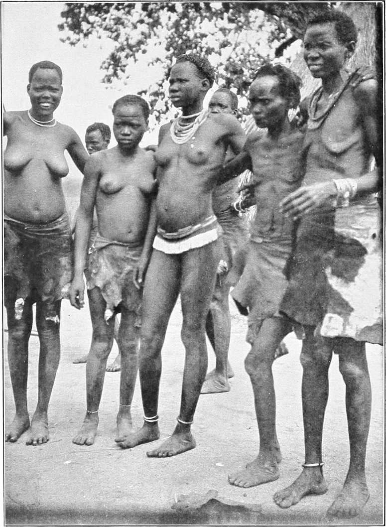
ANUAK WOMEN.
On our previous visit to Lake Rudolf from the south, our old Suk guide, Nyanga by name, had on several occasions pointed out to me the striking Naita peak away to the north-west, and told me that the country thereabouts was the most dreadful one he knew for scarcity of water. I believed him, as he was about the most knowledgable and intelligent native of his class regarding the geography of the country that I have ever met. His information had now been verified by us, and it was with a sigh of relief we found the Sacchi river.Sacchi a running stream. To the Swahilis the tract of country we had traversed was always known as Donyiro, which name appears on the map prepared by the Macdonald expedition.
From very imperfect data I am inclined to think that between our southerly route from Boma and the valley of the Sacchi the escarpment we skirted is the edge of a fine hilly plateau,[105] varying in height probably from 3,000 to 5,000 feet above sea level. I imagine all that tract of country to be a fertile and probably well-watered region, very much like Boma itself. Whether it is thickly populated it is difficult to say, as the country is absolutely unknown to Europeans, but to traverse it from north to south and east to west with mule transport would probably be most interesting. It would probably be almost too difficult for any pack animals except mules and perhaps donkeys. The much talked of gold, which is discussed by our Swahilis as existing in those parts, might also be found, although I must admit we never saw any gold ornaments worn by natives in the plains bordering that country.
Game.In Sudan territory south of the Sobat the following species are known to exist: Elephant, buffalo, giraffe, rhinoceros, zebra roan-antelope, waterbuck, Mrs. Grey’s waterbuck (cobus maria), white-eared cob (cobus leucotis), Uganda cob, bushbuck, reedbuck, Jackson’s hartebeeste, tiang, lion, leopard, etc.
General.In August, 1904, the head waters of the so-called Pibor were explored by Lieutenant D. C. Comyn, Black Watch. It was found that 17 miles above the Akobo junction the river bifurcated, one branch known as the Agwei[106] apparently coming from the E. and S.E., the other, known by the Anuaks as Nyanabek, by the Nuers as Kang, and by the Agibbas as Natila, from the S. and S.W.
Following the latter branch, without encountering any serious sudd obstructions, Lieutenant Comyn succeeded, with the aid of a steam launch, in reaching a point which appeared to him to be very near the source of this important feeder of the Pibor.
Source.The flooded plain in which the river seemingly has its origin, is according to Lieutenant Comyn’s sketch, about 60 miles due E. of Bor, and 170 miles by river above the Akobo junction.
Banks.The banks of the Natila are as a rule ill-defined, swampy and sudd-fringed; in places they appear to be as much as 200 to 250 yards apart.
Almost throughout its course the banks were more or less inundated, the left bank being usually the higher, and in its upper reaches the plain was flooded to a depth of a foot or more for many miles round.
Water-way.The water-way varied from 20 to 70 yards in width, and about 20 miles above the Akobo junction, what appeared to be a sudd-covered lake, some 800 yards broad and 6 miles in length, was traversed by a deep and tortuous channel 20 to 30 yards wide.
Depth.The average depth for the first 130 miles was found to be about 20 feet, but in the next 40 miles the river gradually shoaled to about 15 inches, and the direction of its course was then only faintly distinguishable by the band of light-green grass which blocked its bed and precluded further progress.
Current.The current varied from ¾ to 2 miles per hour, the rise and fall of the river apparently depending largely on the local rainfall. In the dry season the plain, and, according to the Agibbas, the river itself dries up.
Fuel.Fuel is plentiful everywhere, the river being fringed with a belt of talh and heglig trees for the greater part of its course.
[152]J. Atin.J. Atin, standing on the left bank, about 1½ miles from the river and about 100 miles from the Akobo junction, forms a conspicuous landmark. It is a solid rocky mass about 2 miles in circumference, and has twin peaks some 400 feet above the plain.
Gordon is said to have marched up the right bank in 1878 (?) and to have crossed to J. Atin, and to have marched thence westwards to the Nile through the Beir or Beri country.
Inhabitants.As is stated on p. 136 the inhabitants of the Lower Pibor are Nuers and a few of the less powerful Anuaks. On the Upper Pibor or Natila a tribe known as the Agibba were found, their first village being Nyanabek, about 70 miles S. of the Akobo. For the next 60 miles villages were frequently seen.
Agibba tribe.Lieutenant Comyn gives the following account of the Agibba tribe, who appear to strongly resemble the Nuers, and also in some respects the Turkana:—
“The Agibbas are a warlike tribe, feared by and fearing the Nuers. Their other neighbours, the Anuaks and Dinkas, they look on with contempt, and buy their suksuk from them. The Abyssinians do not harry this part of the tribe. A few men know the Nuer, Dinka and Anuak dialect. Their physique is good, but their stature is not uniform. Many seem to suffer from hydrocele, and I saw one man with elephantiasis in the leg. They are armed with roughly-made spears of various shapes, wrist knives, and an oblong shield of giraffe hide, and invariably carry their head-rest to sit upon. Their huts are rudely built, of a bee-hive shape, and about the same size as an ordinary tukl.”
“They appear to have no canoes, and I saw no fishing-spears, though plenty of fish baskets. Their ivory ornaments are old and small. The principal men wear over the right elbow a bunch of giraffe tails, the band ornamented with cowrie shells. Their clothing consists of a belt round the waist, and, in front and behind (if a man is well off), a skin often embroidered and edged with beads—most wear a 3½-inch band of red beads with a 1-inch line down the centre across their foreheads. Some of the older men had a bead-covered bowl on their heads instead. The hair of the younger men was dressed very neatly, like an inverted soup plate with the part over the forehead cut oft. They have all sorts of suksuk. What they asked for were (in order of preference) cowrie shells, beads (janitor), brass wire, red, white and other beads. The head sheikh, whose name I think is Nadgweir (they were very averse to telling it) seems a man of character. All seem afraid of him, and said if they took up spears without his permission he would cut their throats. I saw but half-a-dozen of women and no children.”
Table of Distances along the Sobat.
| Place. | Intermediate. | From Sobat Mouth. | From Khartoum. | |||
|---|---|---|---|---|---|---|
| Miles. | Kilometres. | Miles. | Kilometres. | Miles. | Kilometres. | |
| American Mission (Tatug or Deleib) | 5½ | 9 | 5½ | 9 | 524 | 843 |
| Khor Filus | 4 | 6½ | 9½ | 15½ | 528 | 849½ |
| Gokjak | 10 | 16 | 19½ | 32 | 538 | 865½ |
| Abwong | 63 | 101 | 82½ | 133 | 601 | 966 |
| Nasser | 107 | 172 | 189½ | 306 | 708 | 1138 |
| Pibor Mouth | 27½ | 44 | 217 | 349 | 735½ | 1182 |
| Machar | 36½ | 58½ | 253½ | 406½ | 772 | 1240½ |
| Jokau | 16 | 26 | 269½ | 434 | 788 | 1267 |
| Balankun | 9 | 14½ | 278½ | 448½ | 797 | 1282 |
| Itang | 36 | 58 | 314½ | 507 | 833 | 1340 |
| Fenkio | 23 | 37 | 337½ | 544 | 856 | 1377 |
| Gambela | 18 | 29 | 355½ | 572½ | 874 | 1406 |
| Baro Ford | 26 | 42 | 381½ | 614 | 900 | 1448 |
[85]Abyssinian boundary.
[86]During the driest season of the year there is no difficulty in marching along either bank. Between Itang and Nasser the best road is along the right bank.
[88]Between the Pibor and this point is a dreary, treeless, uninhabitated region of marsh. Above Gadjak the banks are finely timbered, and the river scenery is quite beautiful.
[89]Many Anuaks are to be seen marked with the Nuer tribal mark, i.e., 6 parallel horizontal lines across the forehead.
[91]Now moved to Finkio.
[92]Though the supposed mouth at Machar is deep and 30 yards wide, whilst that at Jokau is only 5 yards wide, there seems good reason to doubt if the former is in any way connected with the Khor Garre. Capt. Wilson was informed by the natives in February, 1904, when the Machar was entirely dried up, whilst the Jokau was a strong flowing stream 3 feet deep, that the former is not a mouth of the Garre. In June, 1904, the discharge of the Jokau was very marked, being of a muddy-white colour similar to the Pibor. At Machar, on the other hand, though the khor did contain water, perhaps an overflow from the Baro, no discharge was noticeable.
[94]In June, 1904, the discharge at its mouth was observed to be a dirty-white colour.
[95]This country was traversed from March to June, 1904, by Mr. McMillan and his expedition. Out of 150 mules and the same number of donkeys only 16 animals survived. Anuak carriers were, however, readily obtainable, from 150 to 380 being constantly employed.
[96]For précis of Lieut. Comyn’s report on his exploration of this river south of the Akobo junction, vide p. 151.
[97]Vide also p. 18, and the itinerary of this river in Vol. II.
[98]Visited Khartoum, 1904.
[99]Most of this information was supplied by Mr. R. Türstig.
[100]Or “Gianotta;” vide p. 120, footnote.
[101]There is another branch of this tribe living further north under a chief named Lom (vide p. 144).
[102]This statement appears to be untrue.
[103]Extract from a report by Major Austin, R.E., 1901.
[104]Boma was visited by Messrs. Bulpett and Jessen in June, 1904. The inhabitants were found to be very friendly, and a certain amount of grain was obtainable from them. Iron wire—not brass—was what they asked for in payment. Crops in Boma are harvested in June. The maximum temperature registered on the Boma-Musha plateau was 85° F.
[105]Messrs. Bulpett and Jessen reached a point about 30 miles N.N.E. of Mount Naita in June, 1904, and report that this plateau appeared very rocky and cut up by water courses, which contained water in pools in June. The land seemed uninhabitable and unsuited to cultivation.
SOUTH-WESTERN SUDAN.
THE BAHR EL GHAZAL.
Introduction.The Bahr El Ghazal was re-occupied by the troops of the Sudan Government during the winter of 1900-1901. Before their advent the most recent detailed descriptions of the country (not counting the necessarily superficial writings of the Marchand Expedition in 1898) date from pre-Dervish days (e.g., Junker, Schweinfurth, etc.). Although there has not been time or opportunity for the whole of the country to be subjected to a searching examination since 1901, still, sufficient is known to prove that great changes have taken place in the province since 1881. Roads and places have disappeared, the face of the country has in many parts completely changed, and tribes have disappeared, have been thinned out, or have emigrated to other territories.
Thus it will be found that in many particulars the detail given in the following pages will not at all bear out the descriptions by Schweinfurth and Junker of 20 years or more ago.
(For an abstract of the descriptions by these celebrated travellers, vide H.B.S. pp. 110-138.)
Boundaries.The Bahr El Ghazal province is bounded on the south and west by the Congo-Nile watershed, on the north by the Bahr El Arab and Bahr El Ghazal, and on the east by the Bahr El Jebel. Its previous history and that of the occupation of this province in 1900-01 by the Sudan Government is narrated elsewhere (vide Part II, Chaps. V and VII).
The various areas.The northern boundary of the ferruginous tableland through which the western tributaries of the Nile pass from the watershed through the Bahr El Ghazal country may roughly be said to coincide with a line drawn through Rumbek and Chamamui (Chak Chak). North of this and until the sudd is reached, the country is flat, and the soil is clay, with great plains of long grass and many swamps intervening—“The Steppes” of Schweinfurth. North-west of this the country is dry and covered with bush, cut up by small khors, which are full in the rainy season. The sudd extends from Lake No to Meshra El Rek (where a base post has been established), and stretches westwards towards Chamamui, to receive the contents of the Wau, Bongo, and Bahr El Arab rivers.
The table-land.The tableland rises gradually towards the south and west to the watershed, the undulations of the surface becoming more pronounced in this direction, and the khors more defined and frequent. Granitic outcrops, rising to 400 feet in some cases, are numerous along the higher slopes of the watershed. Everywhere ironstone and crystalline rock appear above the thin layer of soil that covers them. Nevertheless, on the lower slopes and in the basins of the various khors the soil is profitable and fertile, generally of a rich copper colour with a certain amount of sandstone soil. In Telgona district and the country round, especially to the north and west, are several granitic outcrops, the seven-peaked Telgona and the conical hill of Lutu being the most remarkable. Great forests cover the country almost throughout from east to west. In the steppes of the lower level there are many grass plains, which become vast swamps in the rains. In the table-land the open plains are of no great area.
Soil and geological formation.The soil, both in the swamps and in the land liable to annual inundation, is a rich black clayey loam. In the portions further away from the rivers there is often a large mixture of sand washed down from the higher lands. Most of it is, however, very suitable for cultivation. Alluvial plains border one or both banks of all the more important rivers for a considerable distance up their courses. It is only in the upper reaches that the alluvial deposits almost disappear and that the rocky tree-clad slopes descend abruptly to the river. The soil on the higher lands is usually sandy, and clayey in depressions or near streams. It overlies a pitted, ferruginous stone or laterite, which, in its turn, rests on granite, which in places degenerates into gneiss, schists, or quartzite. These granitic rocks are, as a rule, not visible in the lower portion of the highlands, which only show abundance of ironstone, but further inland outcrops of granite become more frequent, and the country becomes more undulating, forming long, low hill ranges, or throwing up solitary granitic hills, usually rounded in outline, but occasionally more rugged in appearance.
Rivers.The surface of the Bahr El Ghazal country is intersected by many rivers threading their way from the watershed towards the Nile. Passing through the lower plateaux of the tableland, they are mostly fine broad rivers, with high banks and sandy bottoms, and are generally similar in formation. The Boro, Sopo, Chel, Sueh or Jur, and Rodi vary from 80 to 130 yards in breadth, and should be navigable for small craft, when in flood, for considerable distances. The current in flood is not more than 2 knots per hour. The Jur River is navigable for steamers from its mouth as far as the “Poste des Rapides” at Rafili, and probably above this point by light draught steamers to Khojali, from August till November. In the tableland and higher plateaux of the watershed, these rivers are fed by many streams running down from the slopes and hills. On the other hand, in the lower steppes to the north, the water runs up into many khors and swamps, which break away from the banks. Lower down, the banks disappear altogether, and the waters are discharged into the sudd.
Drainage of the country.The western portion of the Bahr El Ghazal is drained, at least in its more elevated portions, by several rivers running in a more or less northerly direction. These are, beginning from the east: The Rohl (Naam) River, the Jau, the Tonj River, the Jur River, with its more important branch the Wau River, the Bongo River, and the Chel River, which, not far from Deim Zubeir, unites two branches, the Kuru and the Biri Rivers. There are also less important rivers, such as the Mulmul and the Getti, which do not flow during the dry weather. The most important of all, on account of its volume of water, is the River Jur or Sueh, which, flowing from Tembura’s country past Wau, joins the Bahr El Ghazal some 20 miles below Meshra el Rek. The courses of the other rivers, whether ultimately falling into the Bahr El Ghazal itself, or first joining the Bahr Telgona or Bahr El Arab, have not yet been properly explored, and the exploration is rendered difficult by the fact that, owing to the flatness of the country in their lower courses, the water spreads all over the land and forms enormous swamps which stretch to those which join the Bahr El Ghazal itself. The Jur itself, powerful a stream as it is, does not break the rule, and the parties occupied in cutting its sudd had great difficulty in tracing the channel when crossing the swamps. According to its drainage, then, the country can be divided into three zones, viz., (a) the perennial swamps near the mouths of the rivers, (b) the somewhat raised alluvial flats further up, which are liable to inundation during the rains, and (c) the undulating plateaux or hilly country in the upper reaches.
Water supply.In the dry season water is scarce in the plains and plateaux. It is generally obtained from shallow pits and wells, seldom more than 20 feet below the surface, though it cannot always be found at that level.
The Bahr El Ghazal now forms a Province under a Mudir or Governor (and Commandant) assisted by three or four British officers and inspectors. The headquarters are at Wau.
At present a line of Government posts has been established from east to west as follows:—Shambe on the Nile, Rumbek, Tonj, Wau (the headquarters), Chamamui (Chak Chak), Deim Zubeir and Telgona. A post has also recently been established at Kossinga and another at Kafi Kingi to the north-west of the province. Each of these posts consists of a small garrison, a few huts, and store-houses.
For administrative purposes the Province is divided into three Districts—“Eastern,” Headquarters at Rumbek; “Central,” Headquarters at Wau; and “Western,” Headquarters at Deim Zubeir.
Ivory.The resources of the country are yet to be developed.
There is a good deal of ivory, and elephants are still very numerous in many parts, especially towards the north, where they feed on the gum tree. The natives hunt them, but do not apparently reduce the numbers to any extent.
Ivory now forms one of the chief products of the Province.
The following information regarding the forests of the Bahr El Ghazal is taken from a report by Mr. A. F. Broun, Director of Forests to the Sudan Government.
India-rubber.As regards the india-rubber, the rubber-yielding species is found to be a fairly large apocynaceous creeper, a landolphia, called “Odilo” by the Jurs, and “Ndala” by the Golos and Dinkas. Of three other similar plants, one is an apocynaceous climber (also a landolphia) called “Apwamah” by the Jurs and Dinkas and “Bi” by the Golos, nearly allied to the first; another is a large (originally epiphytic) ficus, known as “Kwel”; while the third, known generally by its Arabic name “Lulu,” is a bassia (Parkii), and the only one which belongs to the natural order, the sapotaceæ, which yields the best gutta-percha.
“Odilo” or “Ndala.”“Odilo” or “Ndala” (landolphia owariensis) is found almost entirely on the ironstone, and only in very rocky[155] situations, such as the edges of the ironstone plateau. In such places, although by no means rare, it is by no means so well represented as its cousin the “Apwama” (or “Bi”), from which it can be recognised by its young and slightly hairy shoots, and by its fruit, which is smaller and with a sweet pulp, while that of the “Apwama” is acidulated. It is also a smaller climber than the latter. There is, apparently, no “Odilo” on the route from Wau to Deim Zubeir viâ Chak Chak, nor between the Bongo and the Chel near Deim Zubeir, but in the old days it used to be obtained in abundance from places far or near, and was purchased by Government. It is, in fact, fairly well distributed all over the Province.
The usual native method of collecting is as follows:—
A tangential slice is taken out of the bark, no special care being taken not to reach the wood, and, as the milk oozes out of the various milk vessels which have been cut through, it is taken up by the finger and spread out on the collector’s bare skin, either on the arm or over the stomach. It dries very quickly and is collected into a ball by being rolled with the hand, or into a spindle-shaped mass round a piece of twig. The rapidity with which the milk coagulates is very striking, for, five minutes after the cut is made, all that has been collected is made up into a ball and is ready for the market. This peculiarity, although in many ways it shows the excellence of the rubber, renders the clean collection a matter of great difficulty, for the wounds get covered by a film very quickly, and collection in vessels seems to be almost impossible. During the rainy season the outflow of milk is more copious.
“Apwama” or “Bi.”The other landolphia (florida), “Apwama” or “Bi,” grows under similar conditions as “Odilo.” It is however, more abundant, and grows to a larger size. It is a gigantic climber which reaches the crowns of the tallest trees. Its milky juice is much more copious than that of its cousin, but, on the other hand, it coagulates with much more difficulty. The difficulty with the collection of this latex is to obtain it pure. The bark of the creeper is coarse, and as the stems are not upright but bent in all directions, it is difficult to hang collecting bottles in such a way as to make a clean collection. The indiarubber obtained from the “Apwama” is far inferior to that which the “Odilo” produces, and has but little elasticity.
“Kwel.”The “Kwel” (Ficus platyphylla) is a large fig-tree which is found all over the province, but is most abundant in the lowlands, especially between Wau and Meshra El Rek. In appearance it is a good deal like the “Banyan” (Ficus bengalensis). Like the “Banyan,” it usually germinates on another tree, generally in a place where moisture is retained for some time, such as the fork of the stem, the axil of a palm leaf, etc. After some time it begins sending down roots, which, following the stem, ultimately reach the ground. Once this is effected the young tree grows apace, sends down fresh roots, which ultimately surround the stem of the host and finally kill it. Many such figs germinate in the axils of dead leaves on the “Deleib” which they finally fold in their embrace. The palms, being endogenous, are hard to kill, hence the not uncommon spectacle of a “Deleib” growing out of a tree. Many “Kwel” trees in the Dinka districts have become mutilated by badly done tapping. This latex, when dry, forms a resinous brittle gum, apparently of little value, as it is used by the natives to clean brass ornaments. When the tree is tapped the latex flows in abundance, pulsating somewhat like blood from a cut artery.
“Lulu.”The “Lulu” (Butyrospermum Parkii) belongs to the family of Sapotaceæ. It is common all over the ironstone country, and grows abundantly on the borders of the alluvial flats and the plateaux, especially between the Tonj and Naam rivers. The fruit of the “Lulu,” called the “Sudan date,” forms a staple food. Edible oil, greatly used in cooking, is extracted from the kernel, which resembles the horse chestnut.
Tanning products.The forests of the Bahr El Ghazal will probably some day be of great value on account of the number of trees which yield tannin. The two great families from which tannin is obtained, viz., Combretaceæ and Mimosæ, are abundantly represented, and some trees have already a reputation for their richness in tannin, viz., “Abu Surug” (Prosopis oblonga) and “Mudus” (Parkia filicoidea), the bark of which fetches a good price at Omdurman.
Timber.With some notable exceptions, the forests have suffered from fire; the trees are stunted, crooked, hollow, or generally misshapen, and fire-protection will be required to obtain better grown timber. There are, however, a few gigantic trees which have risen above the fires and would yield timber of large dimensions. The most common is perhaps Khaya Senegalensis (“Homra” Arabic name), a tree of the family of the Meliaceæ, to which mahogany and satin wood belong, and which generally gives handsome or useful timber. The bark is, not unlikely, a febrifuge, and the seed yields an oil which keeps away flies, etc., from wounds; it is used against the “serut” flies. There are also two enormous trees of the family of the Leguminosæ, viz., the “Mudus” (mentioned above), which is found abundantly near Tonj and sporadically to Wau, and the “Shande” (Jur name) (Daniellia Thurifera) which grows on the banks of the Wau River, not far from old Wau. There are several others of varying dimensions and also Bamboos, but these are not in sufficient quantities to be considered as an article of export. “Rattan” is also found near Tembura.
For further timber, etc., resources, see under Forestry, p. 157.
Wax and honey.Bees are abundant in the Bahr El Ghazal, and large quantities of honey are collected every year.
Salt.Salt is found only in the west, in the Faroge district, but is in demand everywhere.
[156]Crops.Generally speaking, the ground is cleared in April. Crops are sown in May, and reaped in November-December. One crop a year.
Indian corn is grown extensively in the plateaux. Sown in April, it ripens in August. Sorghum dura is grown universally. The Dinkas, living near the marshes, sow this at the end of March, it ripens in October, and has a short stalk 4 feet high. Everywhere else it grows 12 feet high and ripens in December. Ground nuts and pumpkins are also universally grown, especially by the Dinkas. Simsim, telabun, dukhn, and various vegetables are met with in the habitations of other tribes. Locusts play great havoc with the crops, and the natives, especially the Dinkas, are too lazy to combat them. The crops are increasing in extent, especially in the western portion; each military post cultivates a certain amount, but it is expected that the natives will soon produce enough (bar accidents and drought) to supply the troops and any demand that may be made on them.
Minerals.Iron is very plentiful almost throughout the province, and is extensively worked (vide p. 160). A recent analysis of the iron ore gives a percentage of 47 per cent. of pure iron.
Copper is only found at the rich mines of Hofrat El Nahas, near the southern borders of Darfur. It lies in the midst of a deserted country, and has not been worked for a long time. It had not been visited by Europeans (until Colonel Sparkes’s recent journey, February, 1903), since 1876 (Purdy).[107] According to recent analysis of a specimen the ore is a silicate and carbonate, not a sulphate, of copper, containing 14 per cent. of pure metal. Although there is an immense quantity of this ore, its distance from civilisation and the obstacles to transport will render its development a matter of considerable difficulty for some time to come. In places, it sticks up in ridges above the surface.
Currency.Different tribes and districts have a fancy for various articles of barter. “Genotor” (Gianotta) beads (round, black beads with white and coloured spots) are useful anywhere. With the Dinkas, small white and red beads (“Suk-suk”) and brass wire, especially in the form of bracelets, are acceptable; but cloth only holds a steady demand on the direct routes to Government posts, where the inhabitants are thrown into contact with civilisation; it is, however, rapidly becoming more popular, and in some parts of the country is preferred to beads. Jurs like beads, brass and cloth. Golos and Bongos prefer cloth, which also obtains the best value from the Nyam Nyams. The Dinkas in the north have been in the habit of exchanging ivory for cattle with the Baggara Arabs.
The rainy season[108] begins in April and ends in November; December, January, February, and March are the dry months, when the humidity is slight, though there is always a certain amount of dew. From the end of April till the middle of November rain falls, on the average, one day out of three, generally in very heavy showers lasting for two or three hours at a time. In the early months terrific thunderstorms accompany the showers. The shade temperature in the dry season shows an average maximum of 98° and a minimum of 59°. In the rainy season the maximum in April, May, and June averages 89°, and from July to December 85°. The minimum average during these months is 70°. During the rains the humidity is excessive, and the dews exceedingly heavy.
Sickness. Malaria.About 80 per cent. of the sickness in the Bahr El Ghazal is due to malaria. It attacks Europeans and Egyptians more severely than blacks.
The frequency and severity of this disease varies with the season and also with the locality. June and July have proved the most unhealthy months; the rainy season being then at its height. From December to March there is very little sickness. The natives state that some years are far more unhealthy than others, but this does not seem to depend upon the amount of rainfall. The most unhealthy stations are Wau, Meshra El Rek, and Tonj, all of which are built close to the river banks, whilst Rumbek and Deim Zubeir, which are some miles from a river, and watered from wells, are comparatively healthy. It is a noticeable fact that the natives never build villages near the river bank, but generally at least a mile inland; they also usually drink from wells. This is probably done to avoid mosquitoes, and therefore is a possible reason for the small amount of fever amongst them. Mosquitos cannot breed in shallow wells from which all the water is drawn several times daily. By selecting these positions for their villages they are also removed from the marsh, which is usually found on one or other bank of the river. Egyptians are more susceptible than Europeans, and the Sudanese from Khartoum more so than natives.
Varieties of fever.Although the ordinary periodic types of fever are met with, and easily combated by quinine, a malignant type is far from uncommon, and is a very serious trouble. The patient may have two or three distinct attacks of fever in one day, and often on two or three consecutive days, leaving him weak and unfit for duty. Vomiting is a common accompaniment, and sometimes continues for two days. The stomach refuses food or medicine, and quinine has to be injected subcutaneously. Drugs, however, seem to have little effect on the course of the fever. The after effects[157] met with are anæmia, rheumatism, neuralgia, and dyspepsia. The most serious complication, however, is “blackwater fever,” which is a hæmoglobinuria, occurring in a patient saturated with malaria. The red-blood corpuscles are destroyed by the action of the malarial parasite, and the hæmoglobin thus set free is passed in the urine, giving it its characteristic port wine colour. The patient becomes terribly weak, has acute pain over the stomach, vomits frequently, and cannot retain any nourishment, the heart becomes very feeble, and death only too often follows. At present there have been as far as is known, since 1900, about eight cases, with only two recoveries; it does not appear to attack natives at all.
Guinea worm.Guinea worm is common amongst the natives and Sudanese. It has been met with all over the country, from Meshra El Rek to the Nyam Nyam country. It appears in June and July, and is often the cause of ankylosis of the joints. From observations made in 1901-02 the period of incubation would appear to be a long one—probably 10 or 12 months. At least one European has developed it.
Boils.Boils are common and appear in epidemic form, chiefly attacking the hands.
Dysentery.Dysentery in its true form has not been met with. The water supply at all stations is good.
Small-pox.Small-pox occurs occasionally amongst the natives and carries off hundreds. An outbreak occurred amongst Tembura’s Nyam Nyams in the winter of 1903-04.
Phthisis.Phthisis in all its forms is common, and is believed to be responsible for a large percentage of the mortality amongst natives. September, October and November are the months in which it is most prevalent.
Night blindness is common.
Beyond mention of the great frequency of hydrocele and hernia amongst the natives, there is nothing else that calls for special remark.
Mosquitos.Mosquitos are not very numerous on the dry plateaux of the table-land and the lower steppes during the dry season, but abound during the rainy season near the rivers. Near the sudd, and on it, they are always to be met with, but not in any quantities away from the rivers. At least two out of six specimens sent home were found to belong to malaria-bearing species.
Tsetse fly. Sleeping sickness.A species of the tsetse fly, identified as Glossina morsitans, was discovered in 1903 (April) by Major G. R. Griffith, D.S.O. Beyond its often fatal attacks on animals, it seems otherwise harmless. Sleeping sickness is unknown in the Bahr El Ghazal, though fatal cases have occurred in the Lado enclave, which adjoins it.
Fires.The Bahr El Ghazal province is, unfortunately, no exception to the general rule which prevails in the Sudan. Traces of fires are clear everywhere, from the grass lands near the rivers to the innermost portions of the uninhabited forest tracts to the north-east and east of Deim Zubeir. The largest fires are started in the grass lands near the rivers in order to provide tender herbage for the cattle. These, as they sweep inland, are fed by others, which are made to clear the country near the villages, and they are then carried on until they rush on and penetrate into the forest themselves. In the forests, where the paths get overgrown with grass, travellers fire the grass, not only to clear the way, but to provide against coming unexpectedly on wild animals. Further, fires are lighted for hunting purposes. The reed rat, which lives in long grass near water, and which is generally relished for its meat, is hunted by setting fire to the grass, and the hunting of other animals, including the elephant, is accomplished in a similar manner. It is evident that before such fierce fires seedling growth is killed out; that saplings and young trees are killed or mutilated, and that larger trees themselves must suffer, especially on the outskirts of the forests. So heavy is the toll taken that more wood is destroyed each year than is produced by the increase in girth and by the birth of new trees in places respected by the fires once in a way. In other words, the capital is being eaten into, the forests are deteriorating, and, unless protected, will ultimately disappear. Apart from purely economic reasons this is a prospect which is not good to contemplate if the effect of such a denudation is considered.
Forest zones.As before mentioned, the country can be divided into three divisions, according to the amount of drainage. Each of these divisions has its own characteristic vegetation:—
Swamp vegetation.The ambach (Herminiera elaphroxylon), which in places forms dense covers, and on the upper Bahr El Ghazal almost supplants papyrus, is the only plant which may claim to form forest vegetation. It may in future be of use, owing to its lightness, in floating timber down the river.
Lands not always submerged.On the land, which is under water annually at flood time, forest vegetation is scanty, and such trees as there are are usually perched on the top of termite hills. Such are the Sarcocephalus esculentus and Mitragyne Africana (Rubiaceae), the ardeib, dabka, gughan, the small-leaved inderab, and, where the soil is poor, Euphorbia candelabrum. Large expanses of country are treeless, owing to fires and heavy felling.
[158]Highland forests.On the higher ground the chief ones are tamarind and gughan, with sidr bushes, talh (acacia), and talh-beida forests, um shutur, zeitun (edible fruit), abu khamera and heglig, and occasionally habil.
The above trees are also found on the higher land, but generally near water or in clay soil and in smaller quantities. The highland forests, however, differ largely from those on the lower lands, there being little acacia or thorny growth. Among the largest trees are the nwana (tanning bark “mudus”) and abu surug (tanning bark), kuru, riang or bei, shanda and koba (in best parts of forest), digdig (sweet yellow flowers), homra (large tree, allied to mahogany, also called homraya or murraya), and lulu (blackish scaly bark and tufted leaves, gutta-percha tree, above described).
The quality of the forests is at present not high. The best forests are those found in the broad, uninhabited stretch between Deim Zubeir and the Bongo, but even here the frequency of fires has prevented the stock from being at all uniform. In other places, where fires are still more frequent, and where there are traces of former cultivation, the stock is of a much more patchy character, and degenerates into curtains of forest surrounding blanks, or into mere scrub composed of contorted shoots of habil, dorut, kalto, akan, grewia, etc. It is, however, satisfactory to note that, even in such fireworn areas, there are still to be seen scattered here and there enormous trees such as shande, homra, bei, nwana, etc. But at the same time it is also a fact that, except in the case of koba, which reproduces itself fairly freely, the other large trees are not at all largely represented among those of younger generations, notwithstanding the fact that most of them seed abundantly. The most that can be said of these forests is that the larger trees are very fairly represented and that with proper treatment and protection some magnificent reserves could be evolved.
Principal timber trees.Homra: enormous size, would make a fine cabinet wood. Pinkish inside, but soon turns mahogany brown; found on ironstone.
Heglig: not very tall, but 6 to 8 feet in girth. Timber durable and not liable to attack by white ants; lowlands, clayey soil.
Koba: graceful, rounded crown, flat pods, abundant, good brown building timber, much used by Jurs; highland.
Digdig: large tree, straight bole, sweet yellow flowers, leafless during the cold season, strong yellowish timber; highland.
Ardeib: grows large, timber of very old trees is beautiful, mottled black and white, much valued in cabinet trade and also for its fruit; clayey soil.
Abu surug: large, fine dark red wood, capable of good polish, used chiefly by iron smelters for charcoal, bark rich in tannin; common in highlands.
Nwana: very large and abundant, white timber, not strong, but useful for planking, seed pulp sweet and edible, bark (“mudus”) good for tanning; ironstone.
Silag: common, tall, graceful, birchlike, white timber fairly durable, much used for building, leaves probably rich in tannin; highland tree.
Gughan: ebony family, sometimes very large, fine dark brown timber which turns black on exposure, much used for gun stocks; clay soil.
Abnus: Sudan ebony (not true ebony), crooked and thinnish; scattered on rocky soil in highlands.
Zeitun: teak family, large size, white wood, not strong; lowlands or clayey soil in highlands.
Bamboo: apparently strong and good, used for rafts and roofing; line banks of khors in highlands.
Fibres.The mottled-leaved Sanseviera guineensis is found all over the portion of the province visited. It yields a strong and durable fibre. Strong jungle ropes for building are made with a species of vitis growing in the highland forests, while grewias and sterculias yield strong best fibre. In the Nyam Nyam country the bark of a fig is used as cloth.
Edible fruits.Many trees in these forests yield edible fruits, but most of them are poor and insipid, with the exception of lulu, which has a fruit, the pulp of which is not only eaten, but the kernel yields an edible oil which is said to be a good substitute for “ghee.” Klato has a not unpleasant acidulated fruit, and the fruits of both apwama and odilo are also eaten. The pods of the nwana contain a sweet farinaceous pulp; and a gardenia has a large ovoid fruit, which is not unlike a very inferior apple. The fruit of zeitun is also eaten, and when roasted and ground it makes an excellent substitute for tea.
Iron smelting.It is impossible to omit mention of a very important industry which is connected with, but would be impossible in this province without an adequate supply of fuel. Iron smelting is carried on with a certain activity by Jurs and Bongos. The ironstone and laterite, which form the upper layer of rocks over a great portion of the province, are very rich in iron[110]; and, with proper working, all the needs of the Sudan, and possibly also of Upper Egypt, could be supplied from this province. For this, however, it will be necessary to work the forest in a systematic manner in order to make sure of a continuous supply.
Transport.The chief difficulty to contend with in the Bahr El Ghazal is that of transport. During the rainy season (May or June to November) since a large portion of the country is flooded, it is almost impossible to get about. Stores have, therefore, to be laid in beforehand during the dry season.
Between Meshra El Rek and Wau the direct road is practically closed from the middle of June to the middle of November, though communication by single individuals is possible by a roundabout route during this period.
Between Wau and Rumbek the road is difficult, though never entirely closed, from August to November. The same applies to the Wau-Deim Zubeir road.
Between Rumbek and Shambe (on the Nile) the road is impassable for animals from the end of April or May till early December. In October, 1903, nearly the whole of this route was actually under water.
On all the above-mentioned roads, however, carriers with light loads can get about, though with difficulty, all the year round.
As thick bush and forest prevail almost throughout, the routes everywhere are merely narrow tracks with tortuous windings, which can only be traversed in single file. When the grass grows long, high overhead in the autumn, the tracks are not easy to find. The main Government routes, however, have been much improved.
Carrier transport is the most suitable, but carriers in great numbers are not easily procurable and are never obtained from the Dinkas. The Golos, Bongos, Ndoggos and Nyam Nyams are willing to carry. The ordinary load for a man is 40 to 50 lbs. besides his own food.
Mules. Donkeys. Camels.Mules and donkeys can be used along most of the routes. Mules, especially the Abyssinian breed, answer best. Donkeys are useful but die in great numbers. Camels have been successfully employed from Shambe to Rumbek and from Meshra El Rek to Wau and Tonj river post during the dry season; but the rainy season does not agree with them, and nearly all have died. In the rainy season camels cannot move, and mules and donkeys only with difficulty. The chief causes of mortality amongst all transport animals are overwork, fly, bad roads and poisonous grasses. It is doubtful how far the climate shares in causing these losses. Practically all transport animals have to be brought into the country. Generally speaking, mules and donkeys thrive better than camels.
Oxen.Rough carts drawn by oxen are being tried, and have given good results so far. Each cart carries a load of 600 lbs. Pack oxen are slow, and require much time for grazing.
Fly.In the rainy season a fly, resembling the common horse-fly, attacks horses, donkeys, and mules, and cattle in certain rocky districts. At Wau this pest is particularly prevalent. The animals generally sicken and die in a fortnight. This fly is well known to the natives. As before stated a species of Tsetse fly has been identified on the Bongo River, vide p. 157.
River transport.Below Meshra El Rek steamers ply on the Bahr El Ghazal, but from the end of April till the end of August they are stopped at the mouth of the Jur, or even to the north of it. Light craft can generally get through to Meshra El Rek during that period, but with much difficulty.
The Jur river is now open to navigation for small steamers and light craft from August till the end of November, as far as Wau, and even to Rafili, the sudd having been cleared to a great extent from its mouth to Wau. During the rest of the year it is only navigable for about half this latter distance from the mouth. In June, in spite of rains, it is almost dry (see p. 154).
General.The Dinkas occupy the lowlands in the north of the province, their southern limit being the edge of the table-land, where the good grazing and pasture land terminates.
On the lower slopes of the ironstone plateaux, between Rumbek and the Bongo river, there are many Jur settlements. Between the Tonj and Bongo rivers are a few villages of the Bongo tribe, which have survived the raids of the Nyam Nyams from the south. Golos, Ndoggos, and Kreich, who formerly held the country west of Wau to Deim Zubeir, have been driven further north by the same powerful tribe, and have taken refuge in the district between Wau and Chamamui, where they are now more or less under the protection of the Dinkas. South of these tribes, and separated from them by a broad belt of uninhabited forest about 100 miles wide, are the Nyam Nyams.
In the west the Mandalla tribe live in Telgona district, but the ruling classes in that district, including Sultan Nasser Andel, have Arab blood in them, introduced through their relations with the tribes of Darfur. The same may be said of the Faroge tribe, ruled by Sultan Musa, who reads and writes Arabic. To the east, on the lower slopes of the plateaux, are the Mittu, Wira, and Madi tribes.
[160]Dinkas.The Dinkas.—There is no ruling chief, but every little district has its own head man or sheikh, and fighting frequently occurs between neighbouring districts. A man is powerful in proportion to the number of cattle he owns and the size of his family. Head men may own up to 30 or even 40 wives, but six is a fair average. The great object of the Dinka is to acquire cattle, to which they pay a kind of reverence. Owing to in-breeding the produce of cattle is not numerous. The yield of milk is insignificant. The price of a wife[111] varies from 25 to 40 head of cattle. A head man is generally succeeded by his eldest son; and in this respect the Dinkas are generally loyal. In character they are savage, deceitful, and treacherous, but their domestic ties are strong. Tending flocks and herds is the occupation of the Dinka. They are very lazy, and cultivate only small crops; but they levy taxes of corn and produce on the neighbouring Jurs and Golos.
The Dinkas are poor sportsmen. They do some fishing, chiefly with spears in the pools of rivers during the dry season, but are bad trackers and hunters of big game. Spears, long in shaft and blade, made by the Jurs, and wooden clubs of hard wood or ebony are their weapons. Tobacco is grown, chiefly for chewing, and occasionally for smoking. Most of the men carry a plug of tobacco behind the ear.
Dura crops ripen in September in the low-lying areas, being sown in May. Lubia (beans), pumpkins, and monkey nuts are also cultivated. Cow dung is used for fires. The ashes of charcoal and cow dung are rubbed in the hair, and all over the body by the cattle owners and young warriors.
The Dinkas are a tall, slim race of men, 5 feet 9 inches being a fair average height, and the women about 5 feet 7 inches. The men wear no clothing, but fantastic head-dresses decked with ostrich feathers; they are fond of beads as ornaments. The women wear numerous earrings of brass and a leather apron fore and aft. Brass bracelets are worn by both men and women; ivory bracelets by the men only. Compare also pp. 126 to 130 and pp. 132 and 144.
Jurs.The Jurs.—The Jurs are very like the Dinkas in appearance, the skin being perhaps a shade lighter, but in habits they are more civilised and peaceful. They are said to have originally been a branch of the Shilluk tribe. Their language is quite different from the Dinkas, but most of them speak and understand the language of the latter, to whom they are subservient.
Living on the northern slope of the ferruginous table-land, where ore is easily obtained from the surface, the Jurs practise iron-smelting, with small furnaces about 4 feet high from the ground. “Malots” (small hand-trowels used for turning the soil), spears, cowbells, and axes are made in this way.
Dura is cultivated extensively, but is later than the Dinka crops, ripening in November. This may be said of all the dura grown in the plateaux and higher ground away from the marshes.
The Jurs understand tracking, and are accustomed to setting rough traps for lion, leopard, and hyena.
The women, like the Dinkas, wear leather aprons, bracelets and anklets of brass or iron. A wife costs from 40 to 50 malots, or 20 or 30 sheep and goats. The men are fond of clothing.
Golos.The Golos.—The Golos are an intelligent, active race, willing to learn and to work.
The cultivation of crops is their chief occupation. Besides dura and Indian corn they grow telabun, dukhn, lubia, simsim, onions, sweet potatoes, water melons, pumpkins and “bedingan.” They keep a few sheep and many fowls, but no cattle.
The huts are well built, with ventilation between the wall and roof, and are clean both inside and outside.
“Malots” (iron hoes) are bought from the Jurs for honey, skins, labour, etc. A wife costs 40 malots.
The men are fond of clothes, and are generally clad like the Sudanese over the rest of the Sudan. They are fairly skilful weavers, using the cotton of the country, which, however, is not extensively cultivated. The women, on the contrary, are content with a bunch of leaves fore and aft, but are fond of beads.
The Golos are good sportsmen and trackers. They possess a fair number of guns, chiefly old traders and Remington rifles, but have very little ammunition. Bows and arrows and elbow knives are other weapons used.
Bongos.The Bongos.—The Bongos have the same occupations and appearance as the Golos, but are rather shorter and more thick-set.
The women wear a large circular stone on the upper lip or a wooden plug pierced through the lower.
Decimated by the Nyam Nyams and slave-traders, very few of them practise the crafts that they were formerly skilled in. Like the Jurs, they are accustomed to smelting ore and working in iron. Their dexterity in wood carving is shown in the various utensils, stools, spoons, etc., which they still make. Great attention and trouble is devoted to basket work and weaving grass mats.
The Bongos are fond of music, and play with string and wind instruments.
Ndoggos and Kreich.The Ndoggos and Kreich.—The Ndoggos and Kreich are similar to the Golos and Bongos in appearance, but not so comely as the former and not so short as the Bongos. They are slightly fairer in skin. Having formerly lived prosperously in the districts where the old Government posts were established (Deim Zubeir, Deim Bekir, Deim Idris,[161] Wau, and Jur Ghattas), these tribes, Dinkas excepted, clearly realise the protection and other benefits accorded by a civilised Government.
Nyam Nyams.The Nyam Nyams.—The Nyam Nyams or Azande are the most intelligent, keen and well-ordered tribe in the Bahr El Ghazal province.
The tribe—covering, roughly, the south-west third of the province and a portion of the Congo Free State and Haut Ubangi to the south and west of the Nile-Congo watershed—is split up into five districts, each governed by a chief, holding absolute power, and these chiefs form two factions, which constantly quarrel.
Tembura, Zemio and Sasa make the western faction; Ndoruma and Yambio the eastern.
Colonel Sparkes, says in the account of his patrol to Tembura’s country:—
“Tembura is a shrewd, intelligent man, anxious for progress and development, and the Nyam Nyams generally are far superior to any other people I have met up here.
“Tembura’s standing army, which is quartered round him, consists of about 4,000 men, of whom 1,000 have rifles or guns of sorts, and the rest spears, bows and arrows. They look after and handle their guns exceedingly well, and have been taught a certain amount of drill by the French.
“Besides quantities of dura, the Nyam Nyams grow bananas, limes, tomatoes, sweet potatoes, sugar cane, manioc, onions, and many other sorts of vegetables. Excepting a few of the head men, they have no cattle, sheep or goats, though quantities of fowls are kept everywhere.
“Yambio has the largest number of people under him, but is the least civilised, never having been brought into direct contact with Europeans, as have the others.”
The Nyam Nyams are great hunters, and all the chiefs possess a considerable quantity of ivory. The men wear well-woven straw hats, with cock’s feathers, and loose breeches made of “Roko” bark.
The women are clad like the Golos and Bongos, but are more reserved and retiring than the latter. Both men and women dress their hair, grown long, in various styles. Beards are cultivated and are greatly admired if long.
Of cannibalism amongst the Nyam Nyams there is not much heard, but it is a fact that they eat their enemies who have fallen in battle and those who die. They eat dogs when they can get them. Schweinfurth considers this custom as allied to cannibalism.
Lighter coloured than the other tribes, they consider themselves “white men.”
Country, etc.Both Tembura and Yambio have a fine country, perhaps the cream of the Bahr El Ghazal, well watered by flowing streams, undulating, and growing many lulu, banana, and other fine trees. The country teems with many kinds of game: elephant, eland, rhinoceros, and buffalo all being numerous, the former especially so. The Nyam Nyams manufacture a white cotton cloth, similar to fine sacking. They are practically all clothed, and would probably readily purchase cloth.
Their arms are bows, arrows and spears, but both these sultans now possess a considerable number of rifles.
They were formerly, in the old Government days, converts to Islam, but they (Tembura at any rate) both now merely believe in the existence of a God, without participating in any form of religion.
Mittu, Madi and Wira.The Mittu, Madi, and Wira Tribes.—These tribes, living on the eastern border of the Nyam Nyams, resemble the Bongos, but are physically inferior to the latter. They have suffered too, in the same way as the Bongos, from the raids of the Nyam Nyams.
The Madi and Wira tribes are really sub-tribes of the Mittu, and they all speak the same Mittu dialect.
Teeth.Regarding the teeth of the different tribes:—
Jurs and Dinkas extract the lower incisors; the Nyam Nyams file the upper incisors to a point; Golos, Ndoggos, Bongos, and Belandas file the upper incisor only on the inner aspect. But many of the latter, who have been brought up in the Nyam Nyam country, have the tooth-marks of that tribe. In fact, the tooth distinction is becoming less characteristic, owing to interchanging of tribes.
The following is a list of the game which is to be found in the Bahr El Ghazal province:—
In making enquiries as to religious beliefs among the people here, one is met at the outset by two difficulties. The first and greater is the reticence displayed on such subjects by the natives, and the second is that the interpreter, being invariably an Arabic-speaking native who has with his Arabic acquired the Moslem faith, is liable to colour his translations with ideas of his own; partly out of shame for the beliefs he has discarded, and partly from his anxiety to tell you what he thinks you expect. Perseverance in this line of enquiry is, however, well repaid, as the primitive religions of the tribes in the Bahr El Ghazal are most interesting and suggestive.
The Dinkas, though the most difficult of all to approach on such subjects, appear to have a most elaborate list of gods and demi-gods. At the head of the Divine community are Deng-dit (Rain Giver) and Abok, his wife. They have two sons, Kûr Konga, the elder, and Gurung-dit, the younger, and a daughter called Ai-Yak.
Their devil is called L’wâl Burrajôk, and is the father of Abôk, the wife of Deng-dit. There are also other relatives.
Their story of the origin of mankind (or it may be of the Dinka tribe) is curious and poetical. Deng-dit gave to his wife, Abôk, a bowl of fat, and she and her children, softening the fat over the fire, proceeded to mould from it men and women, in the image of gods. Deng-dit warned her against L’wâl (the Shaitan), who was suspected to have ill-intentions towards Deng-dit. But Abôk forgot, and with her children went to gather wood in the forest. There L’wâl found the bowl, drank the greater part of the fat, and from the remainder proceeded to mould caricatures of men and women, with distorted limbs, mouths, and eyes. Then, fearing the vengeance of Deng-dit, he descended to earth by the path that then connected it with heaven. On discovering the result of her neglect, Abôk hastened to her husband, who, greatly incensed, started in pursuit of L’wâl. The latter, however, had persuaded the bird Atoitoish to bite asunder with its bill the path from heaven to earth, and thus escaped from the Divine wrath.
In spite of this complicated mythology, the Dinkas appear to be very indifferent to religion as an active principle in life. They are without any plan of prayer, and though they assert that their forefathers made great sacrifices to God, the present generation thinks twice about parting with a goat—to say nothing of a cow—for sacrificial purposes. Sacrifices constitute, however, their only attempts at intercourse with God. In fact, they seem to regard him not as a being likely to confer benefits, but as a destructive power to be propitiated, if possible.
The Golos also believe in male and female deities, called Umvili and Barachi, respectively. This couple is said to have originated the human race, and to be the parents of mankind. This belief is, I think, common to the Golo, N’Doggo, Shere, and Belanda tribes, and possibly also to the A-Zande or Nyam Nyams.
They have vague ideas as to future bliss for worthy, and punishment for evil, doers; the execution of the latter is entrusted to a spirit called Ma-ah, who corresponds to Shaitan, but is the servant rather than the enemy of God; some of the Golo songs in common use are of the nature of moral exhortations, directing the people to hear the voice of God.
Like the Dinkas, they do not pray to God, but attempt to appease him with sacrifices of chickens. These sacrifices are rather one-sided, as the procedure is to kill 20 chickens, cook and eat 19, and throw out the twentieth for Umvili.
Golos and Dinkas both associate the ideas of reverence and divinity with the sky, and of malignity and punishment with the bowels of the earth; pointing upwards to their gods and downwards to their devils. This association is, I[163] believe, universal, and has probably its origin in Sun worship. The natural human instinct for religion is probably as deeply rooted in the Bahr El Ghazal as elsewhere, and manifests itself perhaps in the readiness with which these tribes embrace Islam, when they learn about it in Sudanese regiments or as servants to Moslem masters.
They would seem to offer a hopeful and legitimate field for judicious missionary work,[114] as they are far from being the savages, destitute of ideas and beliefs, that they appear on a superficial view.
| English. | Dinka. | Bongo. | |
|---|---|---|---|
| Bad | Aragj. | ||
| Beads | Gwet | Kira. | |
| Boat | Aryan | Kobbu. | |
| Bracelets | Melang | Tilu. | |
| Bread | Râb | Mun. | |
| Bring | Bei | Gimma. | |
| Brother | Wakmat | Guma. | |
| Buffalo | Anyar | Kobi. | |
| Bull | Tono Wong. | ||
| Butter | Miuk-chak | Dibusha. | |
| Cloth | Alad | Mabiu. | |
| Clothes | ⎧ ⎨ ⎩ |
Bwam. | |
| Bium. | |||
| Bum. | |||
| Come | Baa | Aiba. | |
| Cow | Wong. | ||
| Crocodile | Anyang | Hyango. | |
| Day | Akol. | ||
| Donkey | Akajaa. | ||
| Dura (bread) | Râb | Mun. | |
| Elephant | Akôn | Kiddi. | |
| Evening | Aten. | ||
| Egg | Tong. | ||
| Far | Amet. | ||
| Father | Wadet | Bukàbbada. | |
| Fire | Mach | Fudda. | |
| Giraffe | Mir. | ||
| Girl | Nia. | ||
| Give me | Bidègin | Wadi gimma. | |
| Goat | Kaiou. | ||
| Go, go on | Lok | Indeba. | |
| Grass | Ual Totj. | ||
| Gun | Akol | Kuddah. | |
| Hippo | Rau. | ||
| Horse | Dunkur. | ||
| Iron | Lung. | ||
| Is there? | Ata-ta. | ||
| Little | Akur. | ||
| Man | Mutj. | ||
| Many | Adjokje. | ||
| Meat (flesh) | Rînk | Mihi. | |
| Milk | Kyap or Tia. | ||
| Morning | Miak. | ||
| Moon | Paï. | ||
| Much | Ajwid. | ||
| Near | Atiok. | ||
| Night | Akān. | ||
| Nile | Warr. | ||
| Oil | Miuk yum. | Yabumulla. | |
| Path | Kwĕrr. | ||
| Pool | Auŏl. | ||
| Porter | Munkinashiel (a). | Budu tukba. | |
| Raid | Kito tora. | ||
| River | Kjir. | ||
| Salt | Awai. | Taddu. | |
| Sheep | Tup or Amāl. | Minya. | |
| Sheikh (headman) | Baindit. | ||
| Star | Kwel. | ||
| Spear | Tong. | ||
| Start | Gerùd. | Tubba terch. | |
| Stone | Kur. | Landa. | |
| Stop | Kâja. | ||
| Station (post) | Lobai. | Indebba kor. | |
| Take | Muk. | Tobba. | |
| Tobacco | Tâb. | Tâb. | |
| To-day | Akoli. | ||
| To-morrow | Miăk. | ||
| Track | Dulik. | Kunga. | |
| Tree | Amat. | ||
| Village | Pâuda. | ||
| I want | Bei. | Gimma. | |
| Water | Piu. | Muni. | |
| Wind | Jur. | ||
| Wilderness | Ror. | ||
| Well | Jīt. | ||
| Woman | Tīk. | ||
| Wood | Tim. | Kagga. | |
| Where? | Aiyu. | Nabba. | |
| Yesterday | Koluai. |
Dar Fertit.
For brief description of Dar Fertit, now partly in the Bahr El Ghazal and partly in French territory, vide p. 256. Very little is known about it definitely.
[164]
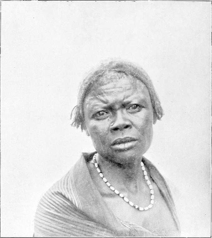
WOMAN OF DAR FERTIT.
Lake No—Meshra El Rek.
| Place. | Miles. | Description. | |
|---|---|---|---|
| Inter-mediate. | From W. end Lake No. | ||
| Lake No | — | — | Proceeding up-stream westwards from the junction of the Bahr El Jebel and the White Nile, Lake No is immediately entered. Lake No is known to the Arabs as the “Moghren-el-Buhur,” or the “Meeting of the Rivers.” It is situated in north latitude 9° 29′. It is a shallow expanse of water covering a good many square miles of area, and surrounded on all sides by reedy marsh. It is probably a portion of the great lake which once covered this country. Through its eastern end the Bahr El Jebel passes, and the Bahr El Ghazal enters it at its western extremity. Lake No acts as a reservoir for the waters of the sluggish streams which drain the extensive plateaux forming the watershed between the Congo and the Nile. These streams find their rise in an area lying between latitude 5° and 8° north, and longitude 24° and 30° east. The channel by which their united waters are delivered to the Nile is the Bahr El Ghazal, and from it the province through which it passes receives its name. Its chief affluents are the Rohl, the Jau, and the Tonj on the right, and the Bahr El Arab, the Bahr El Homr, and the Jur on the left. The water thus brought down fills up the depression known as Lake No, over which area the water of the Bahr El Jebel spreads. The consequence is that this lake is an expanse of water through which little or no current passes, but whose levels rise and fall with that of the Nile. The flooded area changes according to the season of the year. It forms an important reservoir for the White Nile. The actual extent of Lake No is difficult to ascertain. It has been variously estimated at from 20 to 40 square miles. These differences are probably due to the fact that the area was estimated at different periods of the year. During maximum flood the extent cannot be much less than the larger estimate, but at the period of low supply the area is much reduced, and in 1900 and 1901 could hardly have exceeded 8 square miles. In the early months of these years the surface had shrunk to very small dimensions, and more resembled a large river than a lake. The width, during the period of low Nile, is extremely variable. Thus in April, 1901, in the first mile from the White Nile, the open water surface was at times under 200 yards, and then suddenly widened out to, perhaps, 2 miles; a little further on it again contracted, and for 4 or 5 miles more varied from 300 to 600 yards. The depth, at that time, was nowhere more than 7 feet, and, in places, only 4 feet. No current at all was visible through any portion of the lake. Beyond the open water stretched a broad belt of flooded reeds. This belt was chiefly composed of “Um Suf,” with clumps of ambach. The open water itself was full of reedy islands. Lake No abounds with hippopotami and waterfowl. The former cause a good deal of trouble to the Nuer population, as they are unusually savage in this locality, and are said to make a practice of attacking any canoe or raft crossing the lake. The bank to the north of the eastern end swarms with lion and antelope of every description (January, 1903). |
| After passing the entrance to the Bahr El Jebel, keep to the northern channel. Open water right and a few low bushes; ant-heaps (termites), and dry ground left. Some wood. Landing possible. At 6 miles from the White Nile a continuous line of Nuer villages runs parallel to the left bank of the channel for several miles, and marks the ridge beyond which the swamping does not extend. Their average distance is some 2 miles from the river. The villages appear to be thickly populated, and the inhabitants possess large herds of cattle, sheep, and goats; they now barter their fowls, &c., with readiness. | |||
| From 7 miles above the White Nile—Bahr El Jebel junction (whilst still within Lake No) and westwards the channel is, in dry weather, reduced to 80 or 90 yards wide. In flood-time the line of the channel is not visible. This channel is by some termed the Khor El Deleb, in continuation of a khor of that name which flows into it at the western end of Lake No; but as the Bahr El Ghazal is obviously the main stream, the latter name has been applied to it here from the Bahr El Jebel junction westwards. About 10 miles west of the Bahr El Jebel mouth take southern channel, which comes in west-south-west, leave northern channel, as it closes up and comes to a dead end 5 miles on. Large village, Nuer tribe, 2 miles away left. Scrub on horizon left. Reeds, sudd, &c., both sides, and all part of Lake No. | |||
| Bahr El Ghazal | 0 | 0 | The true Bahr El Ghazal comes in close here left. Narrow mouth, 40 yards; 8 feet deep in March. Sudd seen floating down stream, 1½ miles an hour. Leave broad open channel, which bifurcates 2 miles farther on, and becomes the Deleb and Signorina backwaters, ending 18 miles up. Take northern channel, which is now the Bahr El Ghazal. The Khor Deleb, which enters the river from the south at the western point of the lake, is a wide expanse of[166] channel 150 to 200 yards in breadth. It forms the outlet for the waters of the River Rohl, coming from the south. In summer no current at all is apparent. The Ghazal River at this point, with a width of some 40 yards, is in appearance a more insignificant stream than the other. Its depth, however, is greater, averaging 13 feet, as against 6 or 7 feet in the Deleb. The Khor Deleb was explored by Major Peake for some 18 miles above this junction. At this point it was blocked by sudd and reeds, with trees on both banks, so that further progress was impossible. It had, however, a decided stream coming through the reeds, which left the Ghazal 33 miles higher up. The transparency of the waters differs in the two channels; that of the Khor Deleb being opaque and of a whitey-grey colour, while that of the Bahr El Ghazal is clear and limpid, like that of the White Nile itself. Between the two rivers, which run parallel for some distance, is an expanse of low marsh, a foot above low- water level. This whole area must resemble a large lake when the rivers are in flood, and the aspect of the country is desolate and monotonous to an extreme degree. It is absolutely treeless; the atmosphere is damp and warm even in the winter months, and the mosquitoes are of a peculiarly venomous variety. |
| River Rohl or Khor Deleb | 2 | 2 | |
| Mayyet Eléri | 16 | 18 | Proceeding up the Bahr El Ghazal, for a long way there is little change in the landscape. The low banks continue, and the stream winds about through the marshes with a very feeble velocity. At 18 miles a large khor joins the Bahr El Ghazal on the left bank. This is known as the Mayyet Eléri, and appears to come from a north-westerly direction. It is this khor which has been supposed to be the junction between the Bahr El Ghazal and the Lollé. From the slope of the country, however, it would seem that water flows from the higher land into the Bahr El Ghazal. It is possible that in flood there may be a spill in the opposite direction. This khor, although 200 yards in width, is very shallow. At 21 miles the Khor Deleb approaches to within 1,200 yards of the Bahr El Ghazal. A solitary deleb palm (mentioned by Junker) forms a fine landmark on the right bank. The Khor Deleb derives its name from this palm. The left bank of the river beyond the fringe of swamp is an extensive grass plain covered with ant-hills. These are so close together that they somewhat resemble a gigantic grave-yard. The Nuer villages are now a long way from the bank. As the river is ascended the country becomes more and more hopeless-looking. Flat grass plains extend to the horizon, and a wide band of swamp borders either side of the waterway. The channel narrows, and in places is not more than 25 yards. The depth is from 12 to 16 feet, and the turns and bends, though not as sharp as on the Bahr El Zeraf, are endless. The difference between the Bahr El Zeraf and the Bahr El Ghazal is very striking. The water of the former during the period of low supply is considerably below its banks; in the latter it is almost level with them. The rise of the former, even in ordinary flood, is not less than 6 to 6½ feet. That of the Bahr El Ghazal, on the contrary, must be very small. It is difficult to imagine that even in flood the water can rise more than 3, or at most, 4 feet over its lowest level. Even with such a rise, the area of the country under water would be enormous, and the flooding would extend for a very long distance. A few miles further up the depth of water increases to 19 feet, and in places to 25 feet. For the first time forest appears in the distance on the left, but several thousand yards away from the river. The right bank is now covered with low bush and scrub beyond the flooded line. The country bordering the Bahr El Ghazal does not have the appearance of being under water for any length of time, even in flood. In this respect, again, it differs from that traversed by the Bahr El Zeraf. It must, however, be saturated and resemble a sponge in the rainy season. There cannot be more than a very shallow film of water over these plains, or the bush and scrub would not flourish as it does; neither would ant-hills be found in such quantities. The general slope of the country is so low that the water must drain off extremely slowly. |
| Deleb palm | 3 | 21 | |
| Mayyeh Nur | 10 | 31 | At mile 31 the width is 60 yards, and the reed-belt gets narrower; a very large “mayyeh,” or khor, comes in on the left bank here. This is known as the Mayyeh Nur, or the Mayyeh Mahmud Effendi. Its width near the junction is from 150 to 200 yards, and its general direction appears to be west. It is very shallow. This mayyeh is said to receive the waters of the Keilak River (Mayyeh b’ta Komandari (?)), a stream about which little is known, but which is supposed to rise in the hills of Dar Nuba. There is a wooding-station on right bank opposite the Nur. Up-stream of this junction the Bahr El Ghazal takes a more southerly direction. The two streams run for some miles parallel to one another, from 600 to 700 yards apart. The country between the two is, perhaps, 2 feet over the water. At mile 35, the first papyrus seen since leaving the White Nile is met with. From this point on, for many miles, a band of this reed fringes both edges of the water. It is never so high as on the Bahr El Jebel, nor does it grow here in such dense luxuriance as on that stream. The water surface is very narrow, often not more than 20 yards, but the depth is considerable, averaging from 15 to 19 feet. The reed-birds here are an extraordinary sight. They are to[167] be seen in myriads and resemble a flight of locusts. The Serût fly is very bad on the Bahr El Ghazal. The ant-hills certainly form a distinctive feature of the Ghazal scenery. Nowhere else are they so large or so numerous. They are generally from 20 to 50 yards apart. At mile 49 good halting or camping ground, fairly dry; bushes and trees right. Large clump of big trees ½ mile away south. This clump is close to the stream running into Mayyeh Deleb. From here on, channel very narrow; papyrus both sides; liable to be blocked with sudd at any time; large islands of sudd are met, often taking up whole width of stream up to the junction with the Bahr El Arab, where river is much wider again. Mayyeh right: river bends sharply, channel only width of steamer, 17 feet; current very fast; numbers of owls and Balæniceps Rex seen about, also hippopotami; some wood left, 500 yards away. Large trees left, close to water, good for fuel; village on horizon right, and two Dom palms; channel opens up. At mile 53 wooding-station left. The papyrus belt gets wider as the river is ascended, and at 57 miles the forest on the left bank comes down close to the water’s edge and the river skirts it for some 2 miles. The trees are large, but the belt is only a few hundred yards wide. |
| Papyrus | 4 | 35 | |
| Camping ground | 14 | 49 | |
| Wood-station | 4 | 53 | |
| Large tree | 8 | 61 | The scenery here is beautiful, as the ground is high and glades of fine trees are scattered about the grassy plain. Many elephants are to be seen. On the right bank is a wide marsh through which the river channel has evidently wandered at times. This is the beginning of the reach in which the Bahr El Ghazal is occasionally closed by sudd. At 61 miles, in 1880, Marno found his first block here, and in November, 1898, and April, 1899, it was blocked. Large solitary tree right bank. The channel is very narrow, deep, and winding. At present it runs under the high bank, but it is clear that it could easily be blocked at one of the many bends, and in such a case it would doubtless form a series of lagoons and mayyehs in the adjacent papyrus marsh. After leaving the left bank forest for a time the river at mile 62 again returns to it. The depth of the channel suddenly decreases to 5 feet, but soon deepens again to 10 and 13 feet. This shoal is doubtless caused by decomposed sudd which has sunk to the bottom. Such a bar is one of the frequent causes of a block. The sudd raises the bed level, and other masses floating down ground upon the obstruction and the channel is speedily closed. The Bahr El Ghazal has evidently changed its course here very recently. It is now much closer to the left bank than it was in 1899. The change has probably been caused by a block of sudd. It was near here, i.e., at mile 63, that Gessi Pasha had such a disastrous experience in January, 1880. His steamers, on descending this river, were imprisoned in the sudd for some 6 weeks, and he lost over 100 men. Had it not been for the opportune arrival of Marno in the “Bordein” none of the party could have escaped. They were on the verge of starvation and it was impossible to obtain fuel for the steamers, being cut off from the shore by an impassable swamp. These 6 or 7 miles of the Bahr El Ghazal must always be more or less dangerous, as regards possible closure by sudd, at certain seasons of the year. In 1900 and 1901 the channel was open, but in the spring of 1899 it was closed not far up-stream of this point. The channel is extremely contracted, having a width of only 12 yards and a depth of 13 feet. The course is so tortuous that it is difficult to follow all the turns. The whole of this area must, in the rainy seasons, be a reedy lake. At mile 64 the river emerges from this dreadful marsh and the width increases to 30 yards. The banks average 2½ feet above water level. The country on either side is generally higher. On the right, bush is dotted about, and the ant-hills reappear to the left in a large grassy plain. At mile 65 the river widens into a lagoon, some 400 yards broad, and a mile in length. At the up-stream end of this lagoon a large mayyeh is said by the Arabs to form the outlet of the Jau River, which is another of the tributary streams that feed the Bahr El Ghazal from the south. This channel, which is known as the Mayyeh Ahmed Arabi, runs more or less parallel to the Bahr El Ghazal for some 40 miles, taking off it at Lake Ambadi, or 88 miles from the point where the Ghazal and the Deleb join. It is often at a considerable distance from the main stream, but glimpses are to be seen of it at times. A fine tamarind-tree close to the edge of the mayyeh assists recognition of this spot. In 1899 the Bahr El Ghazal was blocked by sudd near this junction. The right bank continues to be fairly high, but the left is low and must be flooded for a long distance. The stream is now more rapid. The air in the mornings here is cool and damp, but a strong marshy smell prevails. At mile 74 wood-station left bank. Elephants, and the Euphorbia first, appear. This shrub is fairly plentiful from this point up-stream. For several miles there is little change in the conditions, but at mile 79 trees are visible on the right bank, about 1,500 yards from the river. The intermediate country is flooded. A few Dinka are occasionally met with, but no villages. The absence of human habitations on this river is very striking. Since the Nuer villages were left behind at mile 43, not a sign of life has been visible. A small but deep khor joins the river on the left bank here. |
| Gessi’s place | 2 | 63 | |
| Jau River or Mayyeh Ahmed Arabi | 3 | 66 | |
| Wood-station | 8 | 74 | |
| 8 | 82 | ||
| [168]False Bahr El Arab | 8 | 90 | From here for the next 20 miles good wood left. At mile 90 a large and important khor comes in, also on the left bank. This channel, which was asserted by the boatmen to be the Bahr El Arab, and which was ascended under this supposition, flows from a north-westerly direction and evidently brings water from a long distance. Later experience has proved that the Bahr El Arab is several miles further up-stream, but this khor must, nevertheless, bring down a large volume of water during the flood. It is quite possible that it forms a second mouth of the Bahr El Arab. It joins the Bahr El Ghazal through two small lakes or lagoons, the largest being about 1,000 yards long by 800 yards wide, with an island in the centre. These lakes are swarming with hippopotami. The width of this khor is much greater that than that of the Ghazal, being from 100 to 120 yards. It has a perceptible though feeble current even in April, but its depth is shallow, averaging from 4 to 5 feet. It was ascended for some 8 miles above the junction, when shoal-water prevented further progress. Its general direction is north-west, but at the furthest point reached it turns sharply to the north, and its course can be traced for a long distance, winding through the country. Even here its width is 100 yards, with wide-stretching mud-flats on either side. It runs between flat plains covered with low grass and averaging 2½ feet over the water at the river’s edge. It differs remarkably from the Ghazal in its characteristics, particularly in the absence of the reed fringe which distinguishes the main river. Its rise must be small, as the banks show no trace of flooding. |
| Lau | 6 | 96 | From 5 miles above the junction a succession of Dinka villages line both banks. Some of these are large and appear to be thickly peopled. The principal village is called Lau. This consists of a large collection of scattered huts, grouped together, and covering a large area. It would be interesting to explore this khor during high water and ascertain whether it really is one of the outlets of the Arab River. |
| To return to the Bahr El Ghazal. From the point where this khor joins it, the general course is due west and fairly straight with occasional long curves. It is bordered by a narrow strip of papyrus on either bank, and traverses a country of flat grassy plains. This river is placid and sluggish throughout its entire length, and can never approach anything like a torrent, even when in flood. It meanders along, slowly and gradually sucking away the moisture of the vast, water-logged flats through which it passes. Its width averages from 60 to 70 yards, and its mean depth is 10 feet. | |||
| Forest | 4 | 100 | At mile 100 trees and bush are found on both sides and the banks are clear of reeds and continue until mile 103, where the Bahr El Arab joins the Ghazal. This forest is known as the “Ghaba b’ta el Arab,” and is one of the few wooding-stations to be found on the river. The trees upon both banks are different from those found elsewhere. There are a few mimosas, but the bulk are very thorny trees with bright green leaves. The belt of wood is about half a mile in width, back from the river. Behind it are open spaces of grass, through which broad and shallow lagoons wind. In this plain are many large clumps of trees. Except in the depressions, the country here is certainly not flooded, even in the rainy season. The marks on the banks show that the maximum rise of the river is not more than 3 feet. The Bahr El Arab is a broad well-defined channel, from 40 to 100 yards in width, and confined between well-marked, but swampy, banks. Its direction, at the junction, is due north, but about 3 miles further up it turns more to the west and runs apparently through forest. Next to nothing is known of this river. Felkin crossed it in December, 1879, and found it, 300 miles from its mouth, 120 yards wide, with banks 15 feet above low water. He noted that in the rainy season it flooded the surrounding country. It is impossible to investigate this river, as, at some 1,300 yards above the junction, it is closed by sudd and reeds. It has no current at the mouth, and its depth is from 10 to 11 feet at low water. The water of the Bahr El Arab is singularly clear and free from sediment. Reports received in the spring of 1901 show that this river is still blocked by sudd. Immediately up-stream of the Bahr El Arab junction the Lake Kit, or Ambadi, begins. The Bahr El Ghazal traverses this lake, but from this point its nomenclature changes, and the river is known as the “Kit,” or “Keit,” by the natives, and as such is entered on many maps. At mile 105, Lake Ambadi is divided into two parts by a large grassy island, about a mile in length, the right channel being 400 yards, and the left 150 yards wide. Half-way up the right channel, the large Mayyeh Ahmed Arabi, previously alluded to, rejoins the Bahr El Ghazal. It has a width of 500 to 600 yards here. The swamps surrounding this lake are of considerable breadth, especially on the left side. They are very low and reedy, and a very small rise in the water levels must increase the flooded area enormously. It is impossible to calculate the width of the swamps on the left bank. They appear to extend for many miles from the water’s edge. Lake Ambadi has an average depth of 10 feet, in the deepest parts of the channel, but shoals rapidly on either side. It is evidently the great reservoir of the Bahr[169] El Ghazal, receiving the waters of the swamps and the southern rivers, and slowly discharging them by means of the narrow but deep channel of the Ghazal itself. At low water it has a length of about 10 miles by an average breadth of 1 mile; in flood-time the area must be very much greater. It is a great nursery for certain of the sudd grasses, but chiefly those of the “swimming” variety. The Azolla, Utricularia, Aldrovandia, Otellia, and many other kinds are found upon its waters. The Pistia is conspicuous by its absence. Among the reeds in the swamps a certain amount of Vossia procera and Saccharum spontaneum is met with, but not in such proportion as on the Bahr El Jebel. The papyrus does not exist on this lake, nor does the ambach. Except between miles 35 and 82, the former is not found at all on the Bahr El Ghazal, and it only grows in real luxuriance between miles 65 and 77. After Lake No is passed, ambach is not found in the Bahr El Ghazal. The absence of papyrus and “um sûf” is probably the reason why the sudd in this river is so much less tenacious and is so much lighter in consistency than than that of the Bahr El Jebel. [Col. Peake, however, speaks of the sudd here as being of a “very tough and felt-like consistency.”] Lake Ambadi is the home of large numbers of the rare Balæniceps Rex. The evaporation upon the lake must be very great during the hottest months. With two large and shallow sheets of water like Lakes Ambadi and No, the amount of water discharged by the Bahr El Ghazal must be largely reduced before it reaches the White Nile. |
| Bahr El Arab | 3 | 103 | |
| Lake Ambadi | 1 | 104 | |
| Kit River | 10 | 114 | At mile 114 the lake stops and the river recommences. This is the Kit, properly so called. Its width here is from 100 to 120 yards and its depth 10 to 11 feet. The current is so feeble as to be almost imperceptible. The Bahr El Homr comes in near this point. On the 1st October, 1900, Captain Sanders found the Bahr El Homr navigable for 5 miles; after which it was blocked by sudd. Its width is 80 yards and depth, 9 feet; direction N.N.W. Col. Peake places its junction 9 miles further down-stream. It appears to have no discharge in March and April, and the water shoals so that it is impossible to explore it. For the next 3 miles the Kit has a mean width of 180 yards. The water surface suddenly narrows to a width of 20 yards, the remainder of the channel being filled by sudd. In this block are several reedy islands. The country is now a dead flat in every direction. Even on these African rivers it is rare to see an expanse giving a greater impression of flatness than does this. On all sides marshes extend, apparently to the horizon. It is quite impossible to arrive at an idea of their area. In these marshes are many large lagoons. A little further up-stream, the channel widens again from 35 to 40 yards, with a depth varying from 12 to 15 feet. Occasionally it shoals to 6 feet, or less, probably owing to sunken sudd upon the bed. Navigation at all seasons must be very difficult, as the river winds and twists through the marshes. There are no tall reeds here; nothing but floating plants, and the water is choked with masses of decayed weed. It is a hopeless morass. During stormy weather, this place is one of those where blocks are often formed. There are no signs of life anywhere, with the exception of the Balæniceps Rex, which are numerous. These horrible marshes continue for another 6 or 8 miles. Sudd islands separate the channel, in places, and the width varies greatly. At one point of this reach, viz., at mile 120, the main channel of the Kit was quite closed in March, 1900. The entire river was forced through a small opening, 10 or 12 yards wide, through which a strong stream was rushing, and in one place it was actually barred for 50 yards. The total length of the block was about 500 yards. A more loathsome-looking swamp it is difficult to imagine. The sudd in this river is very different from that of the Bahr El Jebel. It is impossible to walk on its surface, which resembles slime rather than sudd, but which is bound into a mass by vegetable matter. The chief ingredients appear to be the long trailing, swimming plants, described as found on Lake Ambadi. It is not difficult to force a way through it, but the stuff, when removed, does not float as does that on the Jebel, but sinks and decays. Three miles on, the two groups of trees called Matruk-el-Wabur (“the landing-place of steamers,” vide Junker) are passed on the left, about 2 miles from the main stream. A channel, at present blocked by sudd, leads to the landing-place. Matruk-el-Wabur is an island of dry land in a sea of swamp. When Col. Peake visited it in 1898 the remains of the former French occupation were visible. The Egyptian flag was hoisted here on the 28th September, 1898. Up-stream of this point, for another 5 miles, the Kit winds about; the width of the channel increases, averaging from 180 to 200 yards; its surface is covered by myriads of water fowl, the whistling duck being especially numerous; a few Dinka are to be seen, who have come down to the river for the purpose of fishing and hunting the hippopotamus. At mile 128 the channel bifurcates. The Kit itself runs due south, in the direction of Meshra-el-Rek. The other branch has a westerly direction, and receives the water of the Jur River, which, again, forms the outlet for the Sueh and Wau Rivers. The latitude of this junction, as observed in April, 1900, was[170] 8° 44′ 50″ north. The water at the time was so shallow that it was impossible for the steamer to ascend the channel, the width of which was from 600 to 700 yards, with a depth of 3 feet. The water coming down this stream was of a dark amber colour, and was evidently the drainage of the marshes. A slight current was visible. The general direction of the Kit is south or south-west. Captain Sanders, who visited this place in September, 1900, found the Kit completely blocked by sudd: but Lieutenant Fell, R.N., ascended it in November of the same year, and reports that the water near the Meshra was “foul, stagnant, and very shallow.” In March, 1900, the sudd was very light, mostly floating, and easily removed. Above this junction, the expanse of water into which the Jur discharges itself has a width of 400 yards, a depth of 10 feet, and a fair velocity, even in the month of March. The marshes here are bewildering in their extent. |
| Matruk-el-Wabur | 9 | 123 | |
| Mouth of Jur River | 5 | 128 | |
| Navigability | — | — | After 3 years’ experience, it is found to be impossible for a steamer to reach the mouth of the Jur River, and, therefore, of course, Meshra-el-Rek, from the middle of April till the middle of July. In May a steamer cannot get within 15, and in June within 35, miles of the Jur mouth. Even when free of sudd, the Jur is unnavigable, owing to its shallowness, from the first week of December to the end of July. After strenuous exertions during 2 years on the part of Lieutenant Fell and others, the Jur has has now been cleared of sudd and a channel made for steamers up to Wau, a distance of 160 miles. This enables stores, &c., to reach headquarters by water during 4 months of the year (August to November, inclusive). The sudd is, however, quick-growing and grows from the bottom. Sudd-cutting parties have, therefore, to be annually employed during the low river time to clear a channel for the flood-time. The average difference between high and low Jur is as much as 15 feet; in flood-time the current is swift and the river deep, whilst the reed beds on either side make towing impossible. Luckily a north wind helps boats along up-stream. |
| Meshra El Rek | 25 | 153 | (Junker made the total distance by river from Lake No to here, after 1,781 angular measurements, to be about 135 miles; but it is difficult to make out his exact point of starting.) |
| Meshra-el-Rek lies on a small island in a backwater—the river itself apparently starting in marsh land, and not yet having been defined. Island about a mile long and varies from 200 to 400 yards in breadth. On either side of the river marshes extend for 2 or 3 miles. Mosquitoes swarm, and, owing to the stagnant condition of the river, the water supply is very indifferent during the dry season. No natives live within about 7 or 8 miles. The station consists of straw tukls—the hospital standing on the one bit of high ground. Great difficulty in building huts, as there is no wood suitable within several miles; on the whole a most unhealthy place. High ground lies quite 5 miles beyond the marsh. The French had a fort near our present post in an even worse position. | |||
[171]
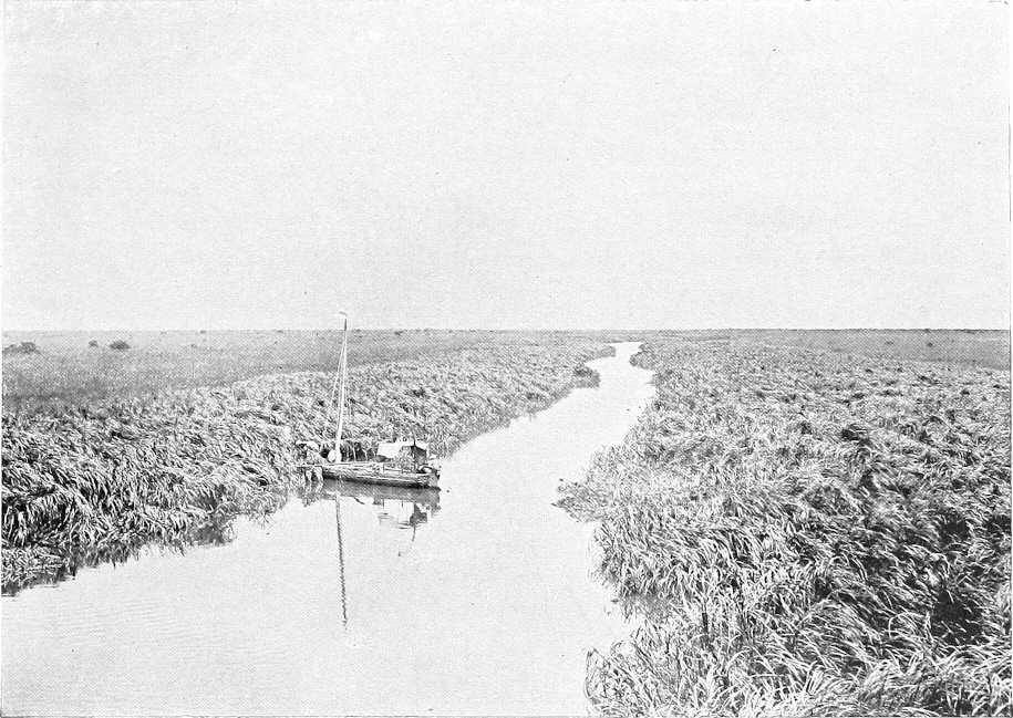
THE BAHR EL GHAZAL.
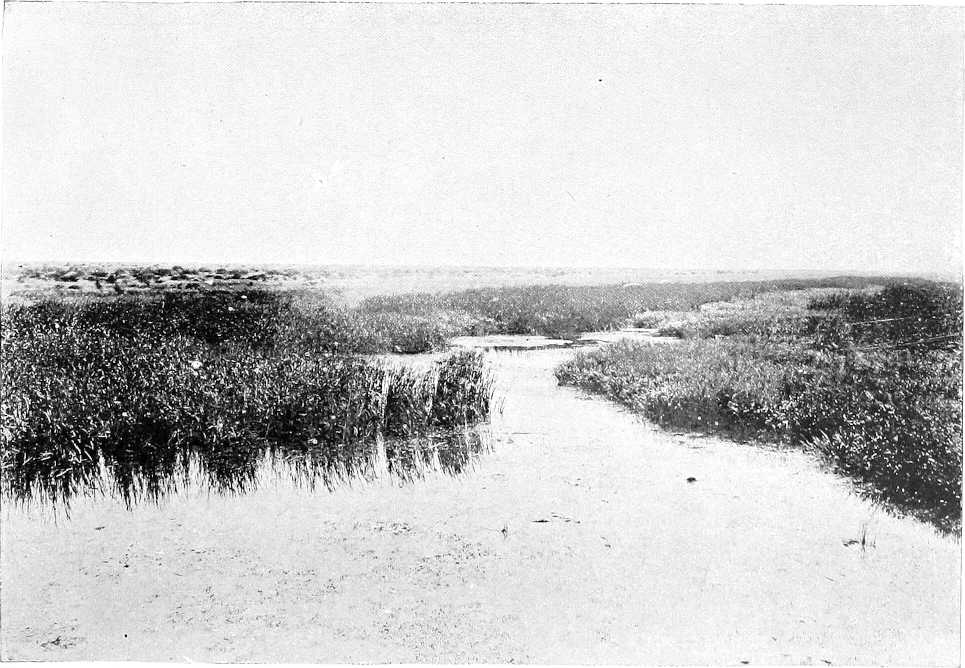
THE BAHR EL GHAZAL—MOUTH OF RIVER ROHL.
[107]Natives of the district deny that it was ever visited by Belgians from the Congo Free State between these years, or in 1894, as has been stated.
[108]Rainfall at Wau (1904) 25 to 30 inches.
[109]Taken from a report by Mr. A. F. Broun, Director of Forests to the Sudan Government.
[110]Analysis of ore—47 per cent. of pure iron.
[111]Compare pp. 128 and 145, price of wives amongst Dinkas at Bor, and amongst the Shilluks, p. 193.
[112]Very plentiful in east, and along banks of Jur and Bahr El Ghazal Rivers.
[114]The Roman Catholic Missionaries who visited the Golos and Bongos in the spring of 1904, and who now have stations in their country, west of Wau, express themselves as well satisfied with the outlook from their point of view.
[115]Compiled from information furnished by Captain S. L. Cummins (R.A.M.C.) and Mr. R. Türstig.
WESTERN SUDAN.
KORDOFAN AND DARFUR.
The country between the Nile and the eastern frontier of Darfur consists of vast plains broken in places by clusters of hills, which rarely exceed 600 feet in height above the plain. In the north, these plains are intersected by wadis which run down from the hills and gradually lose themselves in the sand. The country is thinly covered with low scrub, which becomes denser in the wadis. Towards the south the khors gradually become less and less, until about lat. 14° 30′ north they cease. Here the real bush country commences, and the surface of the ground becomes more undulating. There is no visible watershed, the rain sinking in where it falls.
The northern plains, occupied by camel-owning tribes, consist chiefly of reddish sand, which, if the rains are good, supports plenty of coarse grass and crops of dukhn. Should they fail, even the grass in the wadis does not afford grazing, and the wells give out (1902-03).
In the undulating country between El Obeid and the river the grey gum acacia (hashab) is the prevailing tree. The soil here contains more clay than further north. Between Id El Ud and Zereiga on the east, and Hashaba and Jebel Kon on the west, is a waterless district called El Agaba, in which grows little but marakh bush and coarse grass.
Between El Agaba and the river the ground falls, at first abruptly, and then very gently, to the river. The sandy soil gradually disappears, and along the bank is replaced by a strip of black soil, in places, 12 miles wide. This soil is rich and is generally overgrown with thick bush. On the river bank, and as far inland as the floods at high Nile reach, large red sunt trees are found. At high Nile these often stand in 3 or 4 feet of water. During the rains this soil becomes a swamp, impassable for camels in most places, the khors fill with water, and the roads near the river go out of use. As soon as the rains stop and the river falls, this soil dries up and cracks, and until the paths have been used for some time the going is very bad.
Dar Hamid.In Dar Hamid, a large district north-west of Bara, there is a series of basins running from north to south, divided by steep ridges of red sand. At the bottom of each basin, locally called a “khor,” the soil is white, sandy earth, containing much lime. Water is here found at a depth of from 4 to 10 feet. These khors were formerly all cultivated by Danagla, who used shadufs or saglias. The whole district, which extends from Ashaf in the south to Shershar in the north, is known as El Kheiran. Date, dom, and deleib palms, as well as limes grow, and in a few places gardens with onions, shatta (red pepper), rigl, etc., have been made.
Southern portion.Though the change is very gradual, south of lat. 13° 15′ the plains become more level. They are broken by deep khors with steep banks, and are covered with thick bush or tall trees up to the foot of the Nuba hills. Further south the bush becomes larger, until huge forest trees are met with. On the edge of the khors there are immense creepers and tangled undergrowth. The soil appears fertile, but is only cultivated near the hills. The rest of the country is covered with jungle, and becomes a swamp in the rains, but afterwards quickly dries up. The timber found is of little value, being chiefly acacia. Game is abundant. Elephant, giraffe, and antelope abound; monkeys and birds are found in great numbers in the woods. Snakes are also said to be common.
Dar Nuba.Dar Nuba is the only part of Kordofan where the scenery can be said to be pretty, and some of the views of the hills looking over masses of forest are really beautiful, whereas most of the rest of the country is wearisome from its sameness. The hills in the north are nearly bare of vegetation. On all the Nuba hills thorny bushes grow between the rocks, except on a few of the more isolated hills, whose summits consist of piled masses of rock devoid of vegetation. They are terraced for cultivation, by the people, to a height of 300 or 400 feet from their base.
Hills.The most important groups of hills are, in the north, Jebel Haraza and Jebel Kaja Katul, both inhabited by Nuba[174] Arabs, and Jebel Kaja Serrug in the west. In the south, Jebel Daier, Jebel Tagale, Jebel Kadero, Jebel Gedir, Jebel Moro, Jebel Talodi, Jebel Kari, Jebel Eliri-liri, and Jebel El Joghub, are all inhabited by Nubas.
Dar Hamar.Dar Hamar, the country west of Dar Hamid, and extending up to the Darfur frontier, consists of gently undulating steppes covered with bush. In places there are a few low rocky hills, and the horizon is broken by huge tebeldi trees. As there are few wells, almost the whole population depends on the water that is stored in these trees during the rains. Throughout the province, from November until June, the plains have a dried-up appearance, only broken by the few trees, such as the hashab and marakh, that remain green throughout the year, and in the southern districts by the trees in the khors, which can be traced as bands of dark green, winding through the black hills and dull brown plains.
Drainage system.The drainage system of Kordofan is complicated. It is doubtful if any rain that falls there ever reaches the Nile, unless it does so underground. In the north, the hard sand forms wide shallow wadis, which, after wandering for a greater or lesser distance, either lose themselves by spreading over a bare surface, or by striking an outcrop of rock form a “sink,” which enables shallow wells to be dug, and gives an excellent supply of water. In the south, the softer soil and more abundant rainfall, together with, in places, steeper gradients, cause the shallow wadis of the north to be replaced by narrow khors with steep sides. But the water eventually disappears from the surface in the same way as in the northern districts. For example, the wadi from Abu Tabr and those north of Jebel Derish end at Shageig, where a plentiful supply of water is to be found all the year round. Jebel Kajmar also is the natural dam to Wadi El Sigai, which flows from the south. Habisa is another similar place. In the south, the Khor Abu Habl loses itself west of Gedid, and further west, El Sinut, a large lake in the rains, and a swamp afterwards, is believed to have no outlet.
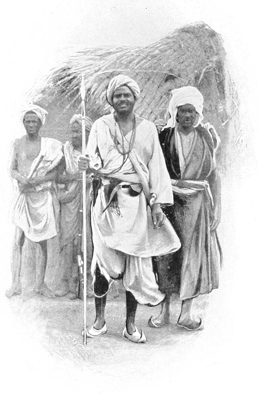
KORDOFAN ARABS WITH CHIEF.
Lakes.The chief lakes are Abu Serai, Sherkeila, El Rahad, and El Birka. In January, 1900, all were dry, but in 1901, El Rahad lasted for the whole year, though El Birka was dry by the end of December. Abu Serai always dries up a few weeks after the rains cease. Sherkeila is said generally to dry up, but was full in December, 1900, and was expected to last until the next rains. Rahad was also full.
These lakes are said to be all connected with the Khor Abu Habl, but native information points to El Rahad being the end of Khor Khashgil, only Sherkeila and Abu Serai joining the Khor Abu Habl. As a proof of this, in 1902, after the rains, Sherkeila was full and El Rahad nearly empty. When dry, wells are dug in the bottom of the lakes.
[175]In Western Kordofan there is a series of swamps—Abu Zabbat, El Sinut, El Seneita, Toto, Kutna, and Burdia—but though in the rains they are generally full of water, they dry up almost at once, and can hardly be dignified with the name of lakes. The Baggara Arabs, who frequent these swamps, dig wells in the middle of them as they dry up and build up the mouths with wood and earth to a height of 4 or 5 feet, to prevent the mud and grass washing in during the rains. In Southern Kordofan there are many such tracts of land under water during the rains; and Butler Bey (in March, 1902) found, about 50 miles north-west of Jebel Eliri, a lake called El Abiad, which although said never to dry up, was dry in January, 1903. It was (in March, 1902) about 6 miles by 4 miles, and contained excellent fish. As far as could be ascertained it had no outlet. The only really permanent lake, as far as is known, is Lake Keilak in the Dar Homr district, which is about 4½ miles by 2 miles.
Wadis, &c.In many districts the difference of level is so slight that it is very difficult, except during or just after the rains, to detect which way the water flows. As soon as the country dries up the wind and sand rapidly obliterates all signs of running water, and many wadis can only be recognised by their more abundant vegetation.
In the centre of the province, that is, south of the Helba-Bara road and parts of Dar Hamar and north of the Gedid-Um Ruaba-El Obeid road, there is no watershed, and hence no khors or wadis properly so called. This country is undulating, but the hills seldom have any general direction; where they have, it is north and south, but the valleys are seldom of any length and never contain streams. The rain sinks in where it falls. However, just as in Dar Hamid, every basin, though without an outlet, is called a khor, so in this part of the country every depression is called a wadi, and takes its name from the adjacent village.
Water supply.The water supply, which is entirely dependent on the local rains, is derived from (1) wells; (2) surface water in pools or fulas and the lakes; (3) tebeldi trees (Adansonia digitata), and melons.
The best watered portions of Kordofan, excluding the Nuba hills, are Dar Hamid, Bara, and El Eddaiya, where the wells can be worked with a shaduf, and there is enough water for irrigation, and the basins of El Obeid, Abu Haraz, and Sherkeila.
Elsewhere water is always liable to give out, and towards the end of the hot weather whole villages are frequently obliged to migrate to more favoured places until the rains once more fill the fulas.
Wells.North of 14° 13′, except actually during the rains, when pools form in the khors, the only water obtainable is from wells or holes in the hills. The former are numerous, but are liable to become choked by drift sand or to fall in when a sudden rush of water comes down the khor. They vary greatly from year to year, being entirely dependent on the local rainfall over a limited area. There are a few places, such as Gabra, Habisa and El Safia, where the water is said never to give out. The wells in the desert country are seldom more than 50 feet, and often only 5 or 6 feet deep, being dug in the bed of a khor, often at its termination, as at Kagmar.
On the Bara-El Dueim road some of the wells are, however, over 200 feet deep, and water is generally plentiful. Further south the wells become less deep, and give less water. In the valley of the Khor Abu Habl and in Dar El Ahamda the wells average 30 feet, but the amount of water they contain depends entirely on the local rains.
The deep wells in Eastern Kordofan are of two kinds: those in hard soil or rock, and those in sandy soil. The former are generally 5 to 8 feet in diameter and unlined, and with care will last for years. The latter are seldom more than 3 or 4 feet in diameter and require constant attention. As they are dug, a lining called “lawai,” has to be put in. This is made of grass rope in lengths of about 40 feet. Near the bottom the lining is made of the roots of trees, that of the “hashab” being considered the best for this purpose. This class of well requires constant repairing and cleaning, and seldom lasts more than two years, when the sand at the bottom “caves in,” and a new well has to be dug. Hence, where many old wells are found it does not imply that more than one or two were open at the same time. In these, as in all desert wells, a dilwa must be used for drawing water, as a bucket damages the sides. Men must not be allowed to go near the mouth of the well with boots on. In a few places stone-lined wells exist.
In the Nuba hills the wells are usually big holes, down the sides of which the women climb to draw water; the art of well-sinking is generally unknown. In some places, however, the wells are lined with trunks of trees. When watering cattle the men and women go down the well standing across it and pass kantushes up and down. This is a very quick way of drawing water, but, as a good deal is spilt, and as both men and women are naked and covered with oil and red clay, the effect on the water is unpleasant. When drawing water in this way the women protect their head-dress, which consists as a rule of a lump of clay on each tuft of hair, by putting half a gourd on their heads.
In the Nuba mountains running streams are occasionally found, notably at Jebel Eliri, Jebel Tira El Akhdar, and Jebel Kindirma, but their water almost immediately disappears into the soil on reaching the plains.
In other mountains water is found in large rock tanks often as much as 500 feet above the plain.
In the greater portion of Dar Hamar there are no wells, and as soon as the surface water dries up, generally about the end of October, the natives are dependent on water-melons and water stored in tebeldi trees.
Fulas.“Fulas,” or artificial ponds, exist near many villages. They are usually made by damming a khor, but the ground is so porous that the water seldom lasts after October. The lakes have already been described.
[176]Tebeldi trees (Adansonia digitata).The tebeldi trees (locally termed “Homr”), which are naturally hollow, and are besides often artificially scooped out, when used for storing water have a hole cut in the trunk, generally just above a big branch, on which a man can stand when drawing water. The hole is about 18 inches square. Round the bottom of the trunk a small pool is formed. This catches the water during a storm and it is then put into the tree by means of leathern buckets (dilwas) or girbas. Some trees, however, in consequence of being open at the top and having branches so formed that they act as gutters, fill themselves; these are called El Lagat, and are naturally very valuable. The trees vary in diameter outside from 10 to 25 feet, and the water-holding portion is often 20 feet high. The bark is frequently much cut about as it is used to make rope and nets. The largest trees are not used for water as the trunks are generally cracked. Water so stored remains sweet to the end of the hot weather, so that good trees are a valuable form of property, and are let or sold, either with or without the adjacent land. Near a town they are a source of many quarrels. On the main routes across Dar Hamar, i.e., from Obeid to Nahud, or Shidera to Nahud, the Hamar make a living by selling water to travellers. During the Dervish rule many of these trees were destroyed by raiding parties cutting holes at the bottom of the trunk.
Melons.The melons, on which whole villages, including horses, cattle, etc., depend, are small, almost tasteless, and full of black seeds. The natives grow them on the same ground as the dukhn, or else separately. When ripe, they are gathered and stored in heaps for future use. They are also found wild all over Dar Hamar. The skins are saved and given to the goats when the grass dries up. These water melons are not the same as the ordinary well-known water melon.
Produce. Dukhn.Dukhn or millet is the food of most of the Arabs. It is grown on the sandy ridges during the rains, and requires little water. It will not grow in the low ground as there is generally too much salt in the soil. It is also given to camels and horses, but is considered heating. It is easily grown. The ground is first cleared of grass. Before the rains, about May, holes are made with a crooked stick (mach-far) a few inches deep and 5 or 6 feet apart, and a few grains are dropped into each hole, which is then closed with the foot. As soon as the rains commence the grain sprouts, and the crop is gathered at the end of October or beginning of November. The heads of corn are piled to dry before threshing. When the young plant is a few inches high it is liable to attacks from a large millipede called surffa. The natives make no efforts to kill this, as they say it only eats at night. This is an error, but even when it is proved to the Arab that they feed by day he is too lazy to destroy it. Later on the dukhn is liable, like other crops, to attacks from locusts and voracious small birds. When required for food, it is ground between two stones, the lower one being fixed, the upper rubbed backwards and forwards. Mixed with water it is baked in flat wafers, called kisra, or boiled into asida. It is also made into a sweet beer called Merissa or Um Bilbil. The dukhn of Kordofan is famous for its good quality.
Dura.Dura is grown south of El Obeid, in the valley of the Khor Abu Habl and Nuba hills. It requires much more water than dukhn. It is cooked in the same way, and is considered much better food, but does not make such strong merissa. As forage, it is supposed to be less heating than dukhn, and being larger, animals are obliged to masticate it more; this is an advantage, especially in the case of camels.
Simsim.Simsim is grown in small quantities everywhere. The seed is crushed in primitive mills, made by hollowing out the stump of a sunt or haraz tree. The pestle has a long arm attached to it, and is turned round by a camel or a bullock. The oil is used for cooking and hair-dressing. The refuse is excellent food for animals out of condition.
Tobacco.Tobacco is grown in small quantities in the Nuba hills. It is wetted and made into hard cakes and smoked in large pipes by the blacks. It has a singularly unpleasant flavour.
Cotton.Cotton is grown in many parts of the Province and must have been formerly extensively cultivated, as the old plants are to be seen in the vicinity of most ruined villages. It is woven on hand looms into damur (coarse cotton cloth) of an inferior quality.
Salt.Salt is made in two ways. One method consists in mixing earth that contains salt with water, allowing the sediment to settle, and then evaporating or boiling away the water. The other method, which is followed at El Ghar, and other places where there are salt-water wells, is simply to boil the water until it has all evaporated. It is generally of a dark colour and somewhat bitter.
Iron.Iron is plentiful, but now seldom worked. Some is smelted at El Nahud and Um Semeina, and spear heads, hoes, and axes are made. The works at Jebel Haraza are not now used. The absence of fuel will always preclude its becoming an extensive industry. A clay full of iron is found some 60 miles to the north-west of El Obeid.
Other minerals.Some old workings of gold and other minerals in the Tagale country have recently been explored, but the result has been unsatisfactory, and the gold appears to have been worked out. There may be other minerals in the country, but no details are known regarding them.
Gum.The best gum comes from the grey acacia, called hashab. This is found between the parallels of 13° and 14°, but is little worked west of El Obeid, on account of the cost of carriage to Khartoum. The chief places where it is collected are El Obeid, Taiara, Bint Joda, Gedid, Um Dam, and Nahud, whence it is either taken by camel straight to Khartoum or to the river at El Dueim or Goz Abu Guma, and there put into boats. The cultivation is simple.[177] In January strips of bark are torn off the trees, dead branches cut away, and, in well managed gardens, the grass is cut as protection from fire. This should always be done, as fires, both accidental and incendiary, are by no means uncommon. As soon as the hot weather comes on, the sap runs up the tree and oozes out of the wound and the tree comes into leaf. This “garden” (geneina) gum is collected every few days and taken into the nearest market. As soon as the rains commence the flow of gum ceases. Wild gum (wadi) is also collected by people who do not own gardens, from the ownerless and, as it were, wild trees, but it is worth comparatively little.
The forests south of the Khor Abu Habl are full of red gum acacias (talh), but the trees are not worked, as the gum is of little value compared with the hashab which abounds. The latter is not yet worked to more than half its capacity, even in Eastern Kordofan.
The following table shows the amount of gum, in hundredweights, exported from the Sudan, most of which comes from Kordofan, but it is impossible to say exactly what proportion:—
| Year. | Cwts. |
|---|---|
| 1879 | 144,706 |
| 1880 | 135,646 |
| 1881 | 150,861 |
| 1899 | 41,963 |
| 1900 | 60,912 |
| 1901 | 170,781 |
| 1902 | 220,000 |
| 1903 | 191,214[116] |
Ostrich feathers.The chief market for ostrich feathers is at El Nahud, where considerable quantities are collected. The best come from Dar El Zeiah in Northern Darfur, but few of these come into the market. The Hamar Arabs keep a few birds in pens. Ostriches have been seen within a few miles of El Obeid. Ostrich farming on a large scale has been proposed, but would be difficult on account of the expense of obtaining food. Feathers from wild birds (Kitala) are longer and more valuable than those plucked from farm birds (Maata), which, though cleaner, are shorter and cheaper.
Ivory.The trade in ivory was never very large, and had in 1901 practically ceased. It is now, however, increasing rapidly, owing to Government restrictions being removed. Over 50,000 lbs. weight passed through Nahud in 1903.
India-rubber.Large quantities of india-rubber might be collected from the country south of El Eddaiya if the cost of transport to Khartoum admitted of a fair price being paid for its collection. At present it does not.
Cattle.There is a large export of cattle, mostly to Omdurman.
Imports.The imports consist chiefly of cotton goods, sugar, salt, soap, tobacco, beads and metal goods, such as axes, hoes, and fasses. Blue and white cottons and muslins, with open-work pattern, are chiefly in demand, but coloured goods are frequently asked for now that the sartorial regulations of the Khalifa are no longer in force. The blacks especially like striking colours, but the dyes must be fast to stand washing with mud and water when no soap is available.
Past and present conditions.It must be borne in mind in comparing the following account with former ones, that the Khalifa laid practically the whole of Kordofan waste at various times, and that when the province was re-occupied in December, 1899, all the large towns and most of the villages had ceased to exist. Thus, on the old road to El Obeid from Tura, viâ Abu Shok and Khursi not a single village or well remained, and the present road from El Dueim to Helba and Bara had to be taken. Bara was found almost deserted, all the old houses and gardens having been destroyed. Khursi, once a large place with a market, had no inhabitants, and has now only a few huts. At El Obeid there was not a single soul, and nothing was left of the old city but a portion of the mudiria buildings. Melbis is quite overgrown, and Abu Haraz is still in ruins. Between El Obeid and Taiara there are now six villages. In January, 1900, there was not one. At Foga, once the headquarters of troops and a telegraph station, the ruins can hardly be traced. At many places in Dar Hamid, hundreds of date palms had been cut down. Everywhere the destruction was wanton and complete.
The only people who successfully resisted the Dervish occupation were the Nubas; living in the hills, they closed the entrances to their villages with defensible walls. They were constantly raided by slave-traders in the old days and so knew how best to defend themselves. But although the Mahdi failed to force these hills, except in the case of a few small and detached ones, the inhabitants all suffered severely, especially from slave-raiding. Mek Geili said in 1900 that he had lost two-thirds of his people, and, judging by the number of deserted houses in his country, this statement is probably not much exaggerated.
Those Arabs who were not taken to Omdurman, and who rebelled against the Khalifa in 1896, fled after Mahmud’s[178] raids to the Nuba hills, the Gezira, or Nahud, a place which, though never mentioned by old travellers, had over 4,000 inhabitants in March, 1900, and a large market with traders from the Bahr El Ghazal, Darfur, and Wadai. Many of these people have now returned to their villages, but they are, of course, greatly impoverished and reduced in numbers.
General.The inhabitants consist of Arabs in the plains and Nubas (or blacks) in the hills. The Arabs are either villagers or nomads; the latter being divided into camel owners (Siat El Ilbil) and cattle owners (Baggara). There are no camel owners south and no Baggara north of El Obeid; in the south they are horse and cattle owners.
Nearly all the nomads grow a crop of dukhn, and in the west, where there are no wells, melons are grown for the cattle during the dry season. Portions of these nomad tribes have been obliged to become sedentary in consequence of the destruction of their herds.
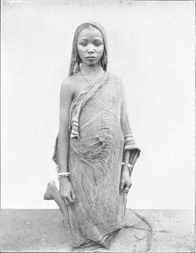
TAAISHA (BAGGARA) GIRL.
Villagers.The village Arabs own small herds of sheep and goats, a few donkeys, and some cattle, and sometimes a camel or two. Near the river they cultivate the islands and low ground, growing dura, beans, onions, etc. Inland, dukhn, simsim, and melons form the chief crops, with a little cotton in places. Throughout Eastern Kordofan gum is collected largely and exchanged for dura or cotton goods.
Very poor after the defeat of the Khalifa, in consequence of two good years, they are now becoming fairly prosperous. A large area round each hella (village) is under cultivation; in the gum country, the gardens show signs of attention, and both the men and women, instead of wearing the dirty waist-cloth seen when the province was first occupied, now wear Manchester cotton goods very largely. Silver ornaments are becoming common.
They have few firearms, and, as a rule, only carry a spear or small axe, even when travelling.
[179]The most important tribe is the Gowama, living between El Obeid and El Agaba, and owning most of the gum country. The Shankab and Mesellemia live on the river; the Dar Hamid tribes and the Bederia, near El Obeid, are large tribes, but are now poor. There are several villages of Danagla and Jaalin scattered about. Jebel Atshan and Jebel Royan are inhabited by Zaghawa Arabs, relations of the large tribe in Northern Darfur, and at Ushut, north-west of El Obeid, there are a few Nimr from Eastern Darfur. Between Hashaba and Jebel Kon the Baza Arabs have many gardens, and near Yasin, half-way between Jebel Kon and Taiara, the Massadab have a few villages.
Nomads. Baggara.The nomad tribes are far superior to the villagers, both physically and mentally. The various Baggara[117] tribes live chiefly in Southern Kordofan, and only move north during the rains. They occupy the plains between El Obeid and the Bahr El Arab, and, being constantly in touch with the Nubas in the hills, were the chief slave-raiders. Their occupations are hunting for meat and skins, and occasionally for ivory, and herding their cattle. They own a good many horses, but when on the move carry their baggage on their bulls. They always carry arms. These consist of a large stabbing spear and small throwing spears. They own a certain number of Remington rifles, but have little ammunition, and their rifles are generally in bad order, as they cut down the stock and fore-end to lighten them and frequently remove the backsight, as it makes the rifle more convenient to carry.
They also carry a broad-bladed straight sword, which, when mounted, is slung over the high pommel of the saddle, the blade resting against the side of the saddle under the left thigh. The large spear (Kibis) is carried in the hand and the small spears (Tabaiig) are hung on the off side in a kind of quiver (Turkash). Shields are not used. A few of the richer men wear chain armour. They are by far the most warlike people in Kordofan, and are inclined to resent being no longer allowed to raid the blacks. The most important tribes are the Hawazma, between Sungikai and Jebel Eliri; the Messeria, near Sinut; the Kenana, between Lake No and Tendik; the Selim, on the White Nile south of Dar El Ahamda (a branch of the tribe situated in the Gezira and Upper Nile Provinces), the Habbania, now a small tribe at Sherkeila. The Homr, south of El Eddaiya towards the Bahr El Arab, are a large and fairly rich tribe; and the Gimma, near Gedid, the majority of whom, however, have permanent villages.
Camel owners.The camel owners (Siat El Ilbil) are less numerous, and live entirely in Northern Kordofan, only moving as far south as El Obeid when the water and grazing further north is exhausted. This depends, of course, on the rains. In the winter of 1902-03 the Kordofan tribes were all south of the Shageig-Kagmar road by the beginning of December. They are by far the pleasantest-mannered Arabs to meet, being independent, but hospitable and polite, though perhaps no more honest than the rest.
They live chiefly on camel or goats’ milk (the former is excellent) and dukhn; the latter they grow as a rain crop or buy with money earned by carrying goods, or else in exchange for sheep and goats. During the rains they all go north and east towards Dongola and beyond the Wadi Melh. Though most of the tribes still own herds of camels, goats, and sheep, large portions of some tribes live in villages and cultivate.
Of the camel-owning tribes in the province, the Hamar, once a large and prosperous tribe owning thousands of camels, now reduced in numbers, own but a few hundred. They have a good many sheep and goats. Their country (Dar Hamar) lies between Dar Hamid and the Darfur frontier. A large proportion of this tribe have now settled down in their former villages and cultivate near Nahud, Um Bel, and all along the frontier between Foga and Taweisha.
The Kababish still own many camels. They claim the country north of Kaja Katul and eastwards to Gabra.[118] Their great watering-places are Gabra, El Safia, Habisa, and Kagmar. A great part of the tribe under Sheikh Ali Tom suffered very heavily from the Dervish rule, and for having supplied us with camels in 1884-85, they had to face the vengeance of the Mahdi when we abandoned the country. Their cultivation is west of Omdurman.
The Shenabla graze their flocks and herds in Dar Hamid, but keep many goats and sheep near Shat. The Beni Jerar, now a small tribe, generally water their camels at Kagmar, but have cultivation near Shat, Um Deisis, and in the Busata district. Both the Shenabla and Beni Jerar were formerly under the head sheikh of the Kababish, but separated in Dervish times.
The Kawahla live north-west of Shageig, where they water during the dry season. They own many camels and do a good deal of carrying trade.
Blacks.In the northern hills the inhabitants called Nuba Arabs speak Arabic and have copied the habits of the village Arabs. They are black and have woolly hair but their features are more prominent than is the case with the southern tribes: they are not negroes. They live chiefly in straw tukls at the foot of their hills, though at Jebel Haraza some still live on the hillside. At Jebel Um Durrug the ruins of a very large village can be seen on the north side of Jebel Kershungal (the highest peak), near the largest well (a crack in the rock). At Jebel Abu Hadid there is also a large[180] ruined village on the side of Jebel El Hella. At Jebel Atshan and Jebel Maganus, now entirely deserted by the Nubas, the ruins of small circular stone huts can be traced.
In the southern hills, as at Jebel Tagale, Jebel Daier, Jebel El Joghub, etc., the natives are pure, or nearly pure, Nubas, and speak Nuba, though most hills have different dialects. But there are also several hills occupied by escaped slaves. These consist of negroes of mixed origin, and call themselves after the tribe they escaped from. Thus at Jebel Eliri there are Hawazmas and Kawahlas; at Jebel Krondi, Hawazmas; and at Jebel Talodi, Homrs. They speak Arabic, and have little intercourse with the Nubas.
The Nubas are split up into innumerable tribes, each under a mek, who is generally on bad terms with his neighbours. Mek Geili, of Tagale, is one of the most powerful. He is a Jaalin by extraction; it is not uncommon for the mek to be of Arab descent. Each mek is assisted by a “kugur.” who acts as chief rain-maker and adviser to the tribe, his power being dependent chiefly on his astuteness. He is often the only man who can speak any Arabic.
Living in the zone of good rains they raise large crops of dura round the base of their hills. They make, in good years, large quantities of merissa (native beer), and drunkenness is very common. They own a good many cattle. The men, as a rule, wear no clothing, and the young women are usually contented with an elaborately plaited head of hair and a girdle of beads, from which a strip of cotton 3 or 4 inches wide depends, both in front and behind. But in places the latter garment is replaced by a strip of dom palm an inch wide. The married women generally wear either a cotton robe or a goat or sheep-skin. In many places the whole body is covered with a mixture of red clay and oil; and each tuft of hair, which is generally very short, is covered with a lump of red clay to make it stand out at right angles to the head. Cotton clothes, are, however, gradually coming into fashion in the less remote hills.
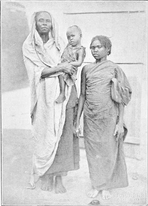
NUBA WOMAN, DAUGHTER AND BABY.
In most of the hills there are a good many rifles, but ammunition is scarce. The Remington rifle is the most common, but old Italian ones, magazine and single-loaders, are seen. Ammunition is manufactured locally, match-heads being often used as a substitute for caps.
A man who owns a rifle, even if his bandolier be empty, always carries it for appearance sake. In January, 1900, it was estimated that Mek Geili alone had 1,500 rifles. The other arms carried are knob-kerries and spears, but no shields. The blacks chiefly fear being raided by horsemen when they are cutting their crops on the plains at the foot of their hills. To disconcert the Arab horsemen they leave the trunks of the trees about 2 or 3 feet high when they clear the[181] ground, and also make pit-falls with spikes at the bottom. A horse running against one of these stumps hidden in the dura gives his rider a bad fall and enables the fleeing black to turn on his pursuer or escape to the hills. Their houses used to be always built high up on the hill, and any gullies or valleys closed by stone walls high enough and strong enough to be easily defended, but now they are beginning to build in the plains. They also take care, as a rule, to have water inside their defences; they were thus able to hold out successfully against the Dervish expeditions which were sent against them from time to time. It is also probable that having been constantly raided for slaves by the Government troops they had discovered the best means of escape and of defence even before the Mahdia.
It is difficult to say how they will develop now that they no longer live in fear of the Arab. They are lazy, but have had no inducements to work. Easily angered, their quarrels do not seem to last long; in fact, they are primitive children who require constant watching lest they become unmanageable, and constant protection lest other races abuse their ignorance, improvidence, or credulity.
Habitations.In a few places, such as El Dueim and El Obeid, there are mud houses with flat roofs. But the natives mostly live in conical-shaped straw huts (tukls) or in box-shaped shelters called “rakubas.” The house is generally surrounded by a thorn fence, inside which the sheep and goats are kept at night.
Tukls are cylindrical buildings with conical roofs. They are generally built by driving forked stakes (shab) into the ground in a circle from 10 to 20 feet in diameter. A circle (kara) of similar size is then made, apart from the other circle, of strong tough twigs tied together every few inches with strips of bark. To form the roof, four poles are tied together at their small ends and the butts pushed into the kara to form a cone. A small circle of twigs is then lashed on near the top and more poles placed with their butts in the kara and their tops lashed to the upper circle. As many more horizontal bands of twigs as the size of the huts demand are then made, and the whole frame is lifted on to the forks of the uprights. The roof is then thatched with dura, or dukhn stalks, and the walls are built of the same material.
“Rakubas” are box-shaped huts made of poles and covered with grass or straw. They are useless in the rains but excellent at other times, as the walls, while keeping out the sun, let the wind through.
The camel-owning Arabs make tents of woollen blankets. They are exactly the shape of gipsy tents in England. The Baggara tribes make similar tents, but cover them with mats made of grass or reeds and tanned ox-hides called “dilla.” The old frames can frequently be seen on deserted camping grounds.
The Nubas, though they vary very much in skill, generally build better tukls than the Arabs. The walls are made of either stone, mud, or wattle and daub, the latter being sometimes ornamented with a pattern in red clay. The roofs are much better thatched than those of the Arabs and are given a steeper pitch.
The furniture of an Arab tukl consists of a few bedsteads (angarib), very short and narrow, and sometimes a mat. The cooking utensils consist of a grindstone (generally outside the door), a stone to cook kisra on, a few wooden dishes for food, some flat baskets and earthenware pots (kantûsh), spherical in shape, for water. Pillows of wood to support the head are used by the blacks, who go in for extensive head dresses. Small and very light axes are used for cutting wood, they are seldom more than an inch wide and 5 inches long. A dilwa or bucket made of a piece of soft leather suspended from a circle of wood by strings a few inches long, so that it can open out nearly flat at the bottom of the well when water is scarce, is used for drawing water.
Rope.Rope is made from the bark of trees, such as the tebeldi (Adansonia digitata), sayal (Acacia spirocarpa), kittr, and usher, which makes the best.
Fire.Fire is made by twirling a stick of marakh (Leptadenia spartium) on a piece of usher (Calotropis procera), or if no usher is available, two pieces of marakh are used. Two pieces of hard wood are also used at times, sand being put in the hole to increase friction.
El Obeid.—El Obeid, the capital of Kordofan, is situated in lat. 13° 11′ north and long. 30° 14′ east. Its elevation has been given as between 1,700 and 2,000 feet. It is built on the side of a depression in the centre of which are the wells. These are from 60 to 80 feet deep, and give (except from March to June) a plentiful supply of water for the present population of about 10,000 people, but in former times, when the population was larger, there were frequently water famines.
The old mudiria is still standing and has been repaired. Barracks for a Sudanese battalion and details are being built, and the town laid out in squares. Most of the inhabitants, many of whom only come in for the dry season, live in tukls, but a good many mud-brick houses have been built by merchants. There is a large market, and a considerable trade is done in gum and cattle.
The old fortifications can still be traced in places, but most of the old buildings have disappeared.
The town was held by Mohammed Pasha Said against the Mahdi from 3rd September, 1882, till 17th January, 1883,[182] when it fell (see p. 247). It is 158 miles from Dueim on the W. Nile and, therefore, 268 miles from Khartoum. It is 388 miles from El Fasher.
Bara.—Bara is now a small place, but there are excellent gardens there and a small market.
El Dueim.—El Dueim, on the Nile, is the port of Kordofan. Most of the merchandise for the interior is landed there, and gum is shipped to Omdurman. There is a good market. (Vide p. 56 for description.)
Nahud.—Nahud, situated 165 miles west of El Obeid and 80 miles south of Foga, is a new town of some 7,000 inhabitants. It is not mentioned in any of the old accounts of Kordofan, as before the decline of the Dervish rule it was a small place populated by Hamar and people from the river, such as Jaalin, Danagla, etc., who had originally gone out to trade in slaves. Gradually people collected there, so that the inhabitants consist of every tribe in Kordofan, the Hamar predominating. All the trade with Darfur passes through here, and there is a large market where cotton and trade goods can be purchased. Cattle is the chief trade. Gum is not in any demand, owing to cost of transport. Feathers and ivory are obtainable in fairly large quantities. India-rubber is brought in in small quantities. There is little crime there now; the market has been built, and there are some 40 good mud-brick shops owned by Greeks, Syrians, Jaalin, Danagla, etc. Dukhn is plentiful. When the town was first occupied drunkenness was very common amongst both sexes. Dura, simsim, and cotton are also brought into the market. It is the second town in Kordofan, and is increasing.
Taiara.—Taiara, formerly the centre of the gum trade, was destroyed by the Dervishes, and in December, 1899, consisted of but six huts. It is now the headquarters of a district and has a good market. There are several gum merchants there, besides agents of Omdurman firms. The place is rapidly growing.
Cattle.The Baggara tribes have large herds of the hump variety, but they are seldom anxious to sell them. They are small, but their meat is of good quality. The bulls are used as pack-transport animals and are extremely docile. Cattle are generally watered every second day, but if grazing is scarce and they have to go far from the wells, it is not uncommon for them to go three or even four days without water. This applies especially to the cattle in Northern Kordofan. There is also a smaller humpless variety.
The Nubas own considerable herds but seldom sell them. Like the Dinkas and other blacks they regard cattle as a form of wealth which enables them to obtain wives.
Camels.These have also decreased to a terrible extent. The Kababish, Kawahla, Shanabla, Hamar, and Beni Jerar, who formerly had the whole of the carrying trade of Kordofan, are now hardly able to cope with it. All over the gum country Hawawir and other northern tribesmen are to be found with caravans of camels. The Hamar have almost ceased to be a camel-owning tribe, and it must be years before the supply of camels is at all large. The villagers own few camels, and the Baggara tribes none, as they cannot live south of lat. 13° 30′. In the Dinka country to the south it is not at all uncommon for people, especially children, to fly in dread at the sight of a camel.
Horses.The Baggara tribes own a good many horses. Some are ugly animals, all head and tail, and not up to much weight, but the larger proportion are small horses, up to weight, good looking and well bred. The Dongalawi horse is prized, but it is now scarce; horses, or rather ponies, are also imported from Abyssinia. These are far inferior, but ridden by Arabs they are more suited to the country, being very hardy. If trained they can do 60 miles without water and do not seem to suffer. Their price is generally £E.3 to £E.5, but a good one runs to £E.18.
Donkeys.There are a good many donkeys, chiefly among the villagers. Like the horses they can go for a couple of days without water. From Zereiga to Bint Joda (50 miles) or from Abu Zabbat to Nahud (65 miles) are quite common marches for donkeys.
Sheep and goats.Large numbers of sheep and goats are owned by all tribes. In the south there is a small and very active breed which seems to carry more meat in proportion to its size than the ordinary Arab breed.
Game.Elephants are found in Dar El Homr, Dar El Ahamda, Dar El Tagale, and Dar Jange. Elephants are very numerous in Dar El Homr from May until June, when they travel to Dar Fertit and towards Lake No.
Rhinoceros (both black and “white”) are found in Dar El Homr and Dar El Rizeigat.
Buffalo are found in Dar El Homr, Dar El Nuba and in Dar El Ahamda.
Lion, leopard, and cheetah are found all over Kordofan from south of Kaja Katul, and are very numerous in the south.
Giraffe are found south of El Eddaiya and are very plentiful all over Southern and South-Western Kordofan.
Roan-antelope are found in Southern Kordofan.
Kudu are found scattered all over Kordofan; most plentiful in Kaja and Talodi districts.
Hartebeeste (Jacksonii) are very plentiful in Southern Kordofan.
[183]Tiang are plentiful in S. and S.E. and in Kaja and Foga districts; there is a different species to that found on the White Nile, etc., which has been identified as the “Damaliscus korrigum” of West Africa, vide App. C.
Oryx (white) are found in Dar Hamid and Kaja districts.
Ril or Addra Gazelle are found all over Northern and North-Western Kordofan, but are local. They are not found elsewhere in the Sudan.
Addax are found north of Jebel Fas. Rare.
Ariel are found near Gabra and as far south as Fachi Shoya, but not very far west of White Nile.
White-eared cob (Cobus leucotis) are found on the White Nile and in Dar Jange.
Mrs. Gray’s waterbuck are found in Dar Jange.
Waterbuck (two kinds) are found on the White Nile and in Dar Homr.
Reedbuck are found in Southern Kordofan.
Oribi, duiker, dig-dig, bushbuck, gazelle (four kinds) and warthog are found in most places south and south-west of Keilak.
Gazelle (three kinds), viz., Rufifrons, Dorcas, and Isabella, are plentiful in various part of Kordofan.
The “harnessed antelope” and eland are said to exist in the south.
Small Game.Hares, quail, partridge, jungle-fowl, bustard (four kinds), and guinea-fowl are plentiful in the south up to January.
The year in Kordofan is divided into three seasons, viz.:—
The Kharif, or rainy season, which commences usually about 15th of June and lasts until the end of September.
The Shita, or cold weather, from the beginning of October to the end of February.
The Seif, or hot weather, from March to the middle of June.
The Rainy Season.[119]—Towards the middle of June the wind changes to the south, and heavy clouds begin to collect in that quarter. These, in a very few days, bring a storm of rain, usually heralded by strong wind, clouds of dust and sand, and thunder and lightning. These storms appear every two or three days. Although a steady rain falls, occasionally for 24 days, it usually comes in the form of stormy showers. As the result of these showers, by the end of July, the ground, even in the villages and around Government buildings, become covered with rank green vegetation, which defies all efforts to destroy it. The rank smell from this grass, the numerous frogs, toads, and other reptiles it harbours, and the general lassitude produced by these surroundings, render life anything but enjoyable during the day, whilst sleep inside one’s house is rendered well nigh impossible at night by the steamy moistures of the air and attacks of sand flies and mosquitos.
The Cold Weather.—Towards the end of September the wind begins to blow from the north and a great change takes place. The fever decreases, until by the end of November there are only a few cases in hospital. The weather is delightfully cool and the breezes bracing and refreshing.
The Hot Weather.—The heat in El Obeid and Western Kordofan is not as great as in other parts of the Sudan; the maximum temperature being rarely above 106° Fahr., whilst the nights remain delightfully cool until the rains appear.
Altitude above the sea level, compiled by Major Prout, 1876:—[120]
| Feet. | ||||
|---|---|---|---|---|
| Helba | 1,381 | |||
| Bara | 1,622 | Wells | 20 | feet deep. |
| El Obeid | 1,919 | „ | 80-130 | „ „ |
| Faki Don | 1,743 | „ | 120 | „ „ |
| Hamdaui | 1,734 | „ | 110 | „ „ |
| Magenis | 1,820 | „ | 80 | „ „ |
| Um Dobau | 1,704 | „ | 15 | „ „ |
| Gumburra | 1,853 | |||
| Tibri | 2,072 | |||
| Um Ratali | 1,994 | |||
| Shitangul | 1,998 | |||
| Aboir Tine | 1,789 | |||
| Abu Sinun Hella | 1,928 |
[184]Health.Most diseases in Kordofan may be included under one of two heads—malarial and venereal. Were it not for these classes of disease Kordofan might be considered a healthy country.
Malaria.—The fever is, perhaps, more often of the remittent type. Those attacked for the first time almost invariably have remittent fever; the subsequent attacks are either remittent or intermittent. During January and February, which are otherwise healthy months, a particularly sudden and severe type of remittent fever has been noticed. A patient, previously well, will lose consciousness in the course of an hour, and either die in a state of coma or only recover after weeks of convalescence. This apparently is the result of malaria contracted during the rains, as Egyptian and British officers who have spent a wet season here and afterwards left the district, have been attacked in this way whilst on leave in Cairo and England. The good effect of hypodermic injections of hydro-bromide of quinine in fever of this kind is worth recording.
Venereal Diseases of every kind rage, except in Dar Nuba, where the people make great efforts to prevent the spread of these diseases. Travellers should take precautions to prevent their guides and servants drinking out of their water-bottles.
Water-borne Diseases.—Of diseases traceable to an impure water supply there has been a remarkable freedom in El Obeid itself. In this garrison there have been only a few cases of dysentery and diarrhœa during the last three years. Amongst the inhabitants of the country further south, who derive their water supply from rain water collected in hollows during the rainy season or from shallow wells during the dry season, this is not always the case, as many cases of dysentery, tape worm, guinea worm (very prevalent), etc., coming from these parts testify.
Guinea Worm.—With regard to the guinea worm, there is not sufficient evidence to prove that it is contracted by washing or wading in water, as the natives state. It in all probability is taken into the system with drinking water. To avoid this pest all surface water or water that is likely to have been fouled by the natives wading in it (for the ova are introduced into the water in this way) should be boiled before being drunk.
Small-Pox is still common in the southern part of the district, and the faces of many of the inhabitants are scarred in consequence.
Pneumonia is common amongst the blacks during the cold weather, and a great many camels die from this disease.
Historical.[121]Darfur was formerly one of the line of ancient African Kingdoms stretching across the Continent from west to east, of which Wadai and Abyssinia are the only ones still surviving[122] as independent states. Up to the early part of the 18th century the Kings of Darfur had dominion over the country as far east as the Atbara; but the war-like Fungs, who at that time were one of the most powerful tribes of the Sudan, gradually drove the Darfurians back, and established their own authority on the banks of the White Nile. Vide p. 229.
In 1770 they wrested the Province of Kordofan from the Darfur kings, but five years later it was retaken by the latter, and remained under their control until conquered in 1822 by Mohammed Bey Dafterdar, the brother-in-law of Ismail Pasha, who was burnt at Shendi.
After the loss of Kordofan the Darfurians retired westwards and the kings then governed only a circumscribed area, of which Jebel Marra was the centre. This is the Darfur that was conquered and annexed to Egypt by Zubeir Pasha in 1874 and which is the Darfur of the present day.
Present boundaries.Modern Darfur in shape is a more or less regular parallelogram, 400 miles by 400 miles, and may be said to lie between N. Lat. 10° and 16° and E. Long. 22° and 27° 30′.
It is bounded on the north by Dar Bedaiat and the desert west of the Wadi Melh; on the east by Kordofan,[123] the frontier running from Kaja Serrug (Darfur) in a south-west direction to Dam Jamad (Kordofan) and thence in a southerly direction to the Bahr El Arab and Dar Fertit; Dar Habbania and Dar Taaisha belonging to Darfur. The western boundary leaves Dar Sula and Borgu or Wadai within the French sphere of influence and Dar Gimr and Dar Tama to Darfur.
Drainage.The watershed of Darfur, which forms part of that separating the basin of Lake Chad from that of the Nile, runs nearly north and south through the centre of the country. The chief features which define it are in the North Jebel Meidob (3,500 feet) connected with Jebel Tagabo further south by a plateau, the greatest altitude of which is about 1,200 feet, and further south Jebel Marra and its offshoots. To the south-west of these mountains, the main peaks of which rise to an altitude of some 6,000 feet, the plain is about 4,000 feet above the sea.
[185]As might be expected the general direction of the drainage is east and west. In the north the country is so arid and the rains so meagre that the water draining eastwards towards the Wadi Melh soon sinks into the sandy soil and disappears. Similarly, further south the Wadis, chief of which is Wadi Ko, draining the east and south-east of the Marra group and which flow generally in a south-easterly direction towards the Bahr El Arab, an affluent of the Bahr El Ghazal, seldom if ever discharge water into that river. The Wadis Bulbul, Gendi, and Ibra, however, which spring from the more southern slopes of the watershed and also trend south-east, are believed to convey a considerable quantity of water into the Bahr El Arab during the rainy season.
To the west of the watershed the general trend of the wadis is south-west, the Wadi Sonot and Kia in the north, with their affluents draining the hills of Dar Tama, and most important of all the Wadi Azum which carries the drainage from the western slopes of Jebel Marra are thought to unite near Dar Sula and to flow, under the name of Bahr El Salamat, towards Lake Iro, though it is doubtful if their waters ever reach this marshy swamp which, in turn, drains into the Shari.
The drainage of the south-west of Darfur flows towards the River Mamun, a perennial stream, also an affluent of the Shari, which, of course, empties into the southern end of Lake Chad.
Water supply.Broadly it may be said that the country to the north and east of the Marra range resembles that of Kordofan in its character and usual dearth of water, whilst to the west, south-west, and south it is much better watered and more fertile. During the rains water is here everywhere plentiful, whilst at this season much of Southern Darfur becomes marshy and difficult to travel over. In the rainy season too the principal wadis, especially those in the south and south-west, are perfect torrents, and, although their beds are dry soon after the cessation of the rains, water is generally to be found in abundance held up by the clayey strata at a few feet below the surface. In Eastern Darfur the wells are of considerable depth and at great distances from each other, especially south of Dara and Taweisha, and the people are dependent to a great extent on water melons (batikh) and to a less extent on Tebeldi trees (Adansonia digitata) which are such a feature of Dar Hamar, the adjoining district of Kordofan.
The deepest wells are at Karnak, where water is only obtained at 250 feet. At Burush on the Fasher-Obeid road and on the road to Taweisha, and at Taweisha itself, the wells, which pass through strata of chalk and marl, average from 100 to 130 feet in depth.
At El Fasher the wells are of no great depth and at the end of the dry season water is obtainable at 35 feet.
The nearer one approaches the central group of mountains the depth at which water is found diminishes. At 3,200 feet above the sea it is found by excavating in the sandy beds of khors, but at 4,000 feet there is running water which becomes more abundant still further to the west of Jebel Marra.
Geology.The geological formation is very varied; in the west the mountains show a volcanic origin; in the north and south granite and sandstone are the prevailing rocks; in the east the soil is sandy and contains a quantity of iron, which is worked to a small extent.
In the east and north-east, granite predominates, with the exception of a strip between Foga and El Fasher, where red and white sandstone crops out.
In the north, Wadi Melit and the hills in its neighbourhood are of gneiss. To the north-east of this, granite again predominates at Saya, whilst still further north, Jebel Tagabo is of sandstone.
Jebel Meidob contains both sandstone and granite; this group has been much distorted by volcanic agency, and beds of lava are to be seen in all directions. To its south-west lies Bir El Melh,[124] an extinct crater, which to outward appearance is an insignificant hill, but has a depth of about 150 feet. Here is a small lake strongly impregnated with alkaline matter, while sweet water springs issue from the sandstone and granite declivities.
The Jebel Marra group is also of volcanic origin; lava and granite are to be found everywhere, but there is no sandstone; small peaks of pink granite crop up here and there between these mountains and El Fasher.
Stretching from the main group in a westerly direction for a distance of 30 or 40 miles is a huge dyke of white quartz with a sandstone plateau raised some 300 feet above the plain which is itself about 3,200 feet above sea level.
The inhabitants report a large lake of brackish water, from which salt can be obtained, on the north-eastern part of the mountain; while, at a day’s journey to the west, salt is also found at Karunga, and the Wadi Burka is strongly impregnated with soda.
In all the depressions sand rich in iron is met with.
In a southerly direction from Jebel Marra, there stretches a broad alluvial plain which is dotted all over with peaks of granite, giving the impression of a range of mountains, buried all but its highest points.
Inhabitants.The original tribes of the country are the Fors and the Dago; the latter ruled for centuries over the entire district from their inaccessible strongholds in Jebel Marra. Tradition relates[125] that about the 14th century the Tungur Arabs, emigrating south from Tunis, scattered throughout Bornu and Wadai, and eventually readied Darfur,[186] the first arrivals being two brothers, Ali and Ahmed, who settled with their flocks on the western slopes of Jebel Marra. Of these brothers, Ahmed, nicknamed El Makur, was destined to become the founder of a new dynasty in Darfur. He became very popular with the then king Kor who not only gave him his favourite daughter as wife, but nominated him as his successor to the throne. Accordingly on Kor’s death Ahmed succeeded to the throne of Darfur, and on the news spreading to the Tungur of Wadai and Bornu, they flocked into the country in such numbers as to partially displace the Teigo. The only small settlements now left of the former rulers are near Dara, where there is a Dago sheikh, and also at Dar Sula, a long way to the west, where there is a semi-independent ruler called “Sultan Bekhit El Dagawi.”
A regular male succession was now established and a great grandson of Ahmed’s was the celebrated Sultan Dali, who wrote the Kitab-Dali or Penal Code. Another noted Sultan was Suleiman who took the name of Solon, who being the son of an Arab mother and himself married to an Arab woman, introduced Arab blood into the Royal Family. It was through him, some 400 years ago, that the country became Moslemised, and his descendants now proudly boast of their Arab descent and quite ignore the black element which is undoubtedly there, and which may account for the bitter enmity which exists between the ruling Darfur family and the Nomad Arabs of the country. At the end of the 18th century Sultan Abdel Rahman married a Beigo girl and her son, Mohammed El Fadl, became Sultan about the beginning of the next century. The Beigo tribe, originally slaves, were from that time declared free.
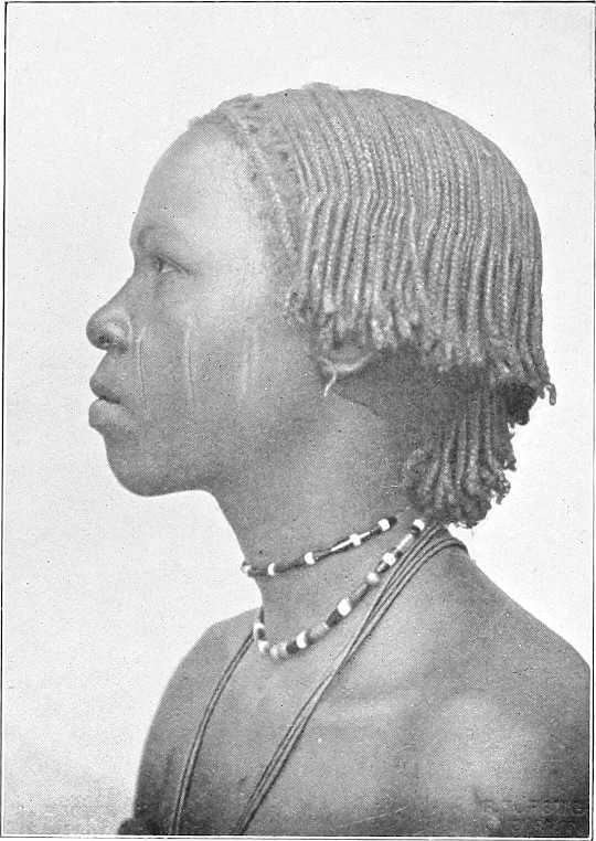
DARFUR GIRL.
To turn to more recent times, Darfur has during the last 20 years been so devastated and depopulated that many formerly important tribes such as the Maharia, Nawaiba, Mahamid, Ereigat, Beni, Hussein, etc., have become so disintegrated and scattered that they now practically cease to exist as tribes and are seldom heard of.
The population of Darfur, prior to the Mahdi’s revolt, was estimated at 1,500,000. It is now probably less than half that number.
Furs.The Masabat and Kunjara, the ruling class of Fors, have their centre at El Fasher.
[187]The Fors are clean and industrious. They may be found assembled under trees spinning, weaving cotton or plaiting mats, whilst the children will be herding the cattle. The men wear a jibba and drawers of coarse cotton stuff, whilst the women wear a piece of the same stuff made fast round the hips with the end thrown over the shoulder.
They live in tukls or conical huts, five or six of which arranged in a circle form a habitation.
Compared to other tribes, they are exceedingly clean feeders and very particular as to the manner in which their food is served, though corn and merissa are the main articles of consumption.
They are religious and fanatical, and study the Koran assiduously.
The mountainous stronghold of Jebel Marra is inhabited by the Jebelawin, the aboriginal inhabitants of Darfur.
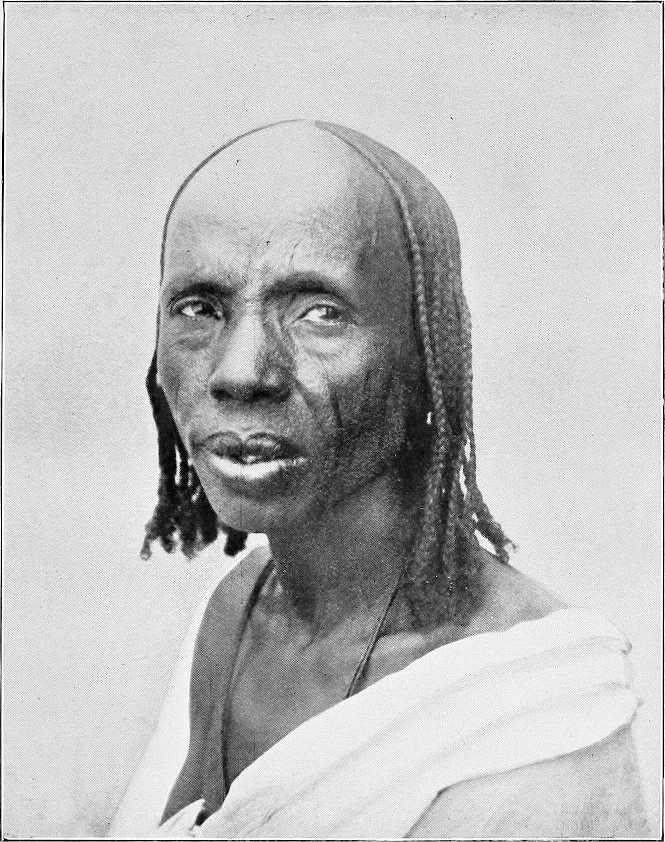
OLD WOMAN OF DARFUR.
Arabs, etc.Other important tribes are in the north the Zaghawa and Zeiadia, in the east the Berti and Kaja, in the south-east the Maalia and Rizeigat, and in the south the Beni Helba, Habbania and Taaisha. The four last-named tribes are Baggara.[126] In the west are the Masabat and Tama.
In addition to these Darfur has a large sedentary population amongst whom are found the following tribes: Mima, Birged, Beigo, and Gimr, etc.
The present ruler of Darfur is Sultan Ali Dinar, a grandson of Sultan Mohammed Fadl; he was kept a prisoner at Omdurman during the Mahdia. In September, 1898, immediately after the defeat of the Khalifa at Kereri, he escaped to his native country. He now pays an annual tribute to the Sudan Government by which he has been officially recognised as its Agent in Darfur.
[188]
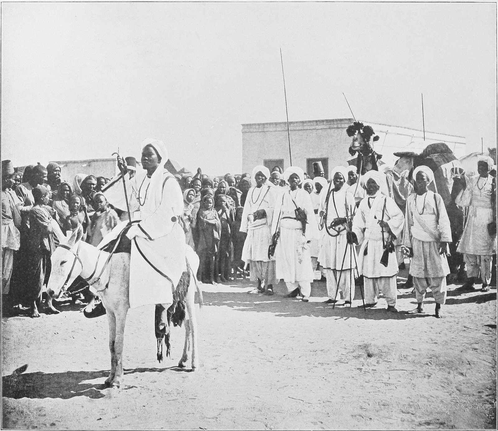
| By kind permission of | M. Venieris, Khartoum. |
THE DARFUR MAHMAL PASSING THROUGH OMDURMAN, 1904.
[189]Administration.The management of the internal affairs of the country is left almost entirely to the sultan, though the Sudan Government sends him instructions and advice on certain matters from time to time as occasion arises. His judgments on all administrative questions are based on a combination of the Sharia Mohammedia and common law.
Army.The sultan maintains an army, organised on Dervish lines, of some 6,000 rifles, mostly of a more or less antiquated description. In case of need he could probably mobilise upwards of 2,000 horsemen. His chief commanders are Mohammed Ali Dedingawi, Adam Rijal, and Kamar El Din. The greater part of the army is quartered at El Fasher: the principal outlying garrison (about 500 men) is at Jebel El Hella on the Fasher-Obeid road.
Communications.Though in 1874 it took Colonel Mason, with a large caravan, from 100 to 150 days to reach Fasher from Cairo, nowadays a letter from Cairo could reach Fasher in 30 days without any difficulty.
In the old days the telegraph extended to Foga, now the furthest point to which it is proposed at present to extend it is Nahud, which is on the western frontier of Kordofan, and about 10 days’ camel ride from El Fasher.
(1) With Omdurman.There are two routes from Omdurman to El Fasher. That most generally used is viâ El Obeid, Nahud, and Jebel El Hella. The other, which has hitherto been avoided by merchants owing to the number of robbers in the neighbourhood of Kaja Katul, and Serrug, lies to the north of El Obeid, and, after passing the two above-mentioned places, joins the El Obeid-Nahud route at Jebel El Hella. Both are described in the route reports in Vol. II.
(2) With Wadai.There are three routes from Fasher to Abesher, the capital of Wadai. The direct road known as Sikkat El Masalat passes viâ Kebkebia (Darfur) and Bir Tawil to Abesher. This is not much used, in fact Ali Dinar has forbidden merchants or pilgrims to use either this or the northern route, as at Kebkebia there is a Fiki named Senin who has defied all the sultan’s efforts to induce him to tender his submission, and this road is consequently unsafe.
The northern route runs through Kutum, Dar Zaghawa, Dar Gimr, and Dar Tama; this is known as Sikkat Zaghawa. Owing to recent disturbances in Dar Zaghawa, this road is temporarily closed.
The southern route leads viâ Keibe and the Wadi Azum to Dar Sula and thence northwards to Abesher; this is known as Sikkat Dar Sula, and is the longest of the three, but it is comparatively safe.
Trade.Trade between Darfur and other parts of the Sudan has increased a good deal of late. The principal imports from the Nile are cotton goods (gomash), sugar, and tea; the exports are feathers, ivory, pepper, rhinoceros horns, and tobacco. The ivory, as a rule, comes from Dar Jange and Dar Fertit in the south. Owing to the recent disturbances in Wadai, ivory that formerly was exported through that country has been finding its way viâ El Fasher to Omdurman. A good many camels and cattle are imported from Wadai and are exported again viâ Nahud to the Nile.
Customs.A royalty of about 20 per cent. is taken on all ivory and feathers leaving Fasher, where the price of ivory is from £15 to £16 per 100 lbs.
Every laden camel entering Darfur pays PT.150 to PT.180, and each laden donkey PT.30 to PT.60.
Taxes.The taxes are three in number, Oshur, Zika, and Fitra. Oshur tax is assessed at the rate of ⅒th of the harvest, whilst Zika is 2 per cent. on all property animals, goods, or money.
Currency.The sultan has ordered that the present Egyptian coinage shall be current in Darfur, but merchants, finding they lose by it, are not anxious to introduce it. At present the principal coins in use are “Girsh Kabashi,” 20 of which equal one rial Mejidi, the equivalent of PT.16.
There are also a few “Girsh Garagandi” in use, these are of the same value as the “Kabashi.”
Transport animals.Camels are the best transport animals, except in the mountainous and southern regions, where mules, donkeys, or bullocks would be preferable.
Climate.The climate, of course, varies considerably. Fasher is healthy. In the south, where the rains are heavier, there must be the usual malaria at certain seasons. The climate of Jebel Marra is said to be cool and healthy.
Religion.The people of Darfur, as a whole, are followers of Islam, but the negroes in Jebel Marra, the Jebelawin, and those in the south and south-west have no religion. The late Sheikh Senussi wrote three times to Sultan Ali Dinar asking him to prepare Zawias for him, and to otherwise further his doctrine. Ali Dinar, however, considered it best to politely hold aloof from him, and there are now no Senussiites in El Fasher.
The country may be divided into three sections with reference to the vegetation, i.e., the eastern zone of sandy steppes, the central mountains, and the western zone.
Corn.In the eastern zone, the cultivation of corn, in the shape of dukhn and a little dura, is the chief industry. A small quantity of simsim, cucumbers, pumpkins, and water melons are also grown. In certain depressions of the ground, where the presence of clay gives a stronger soil, cotton is produced, but in no great quantity.
[190]The northern part of the country is almost uncultivated; and in the west, agriculture is pretty much the same as described for the eastern portion, except that owing to the greater quantity of water, more vegetables are grown.
The central mountainous district is the best watered and richest, and accordingly the most thickly populated. Small terraces, upon which gardens are laid out, are constructed all over the slopes of the hills. Here barley, wheat, dukhn,[127] dura, simsim, pumpkins, and melons are grown. In the small water-courses, onions are planted during the dry season. Honey of very good quality is collected in Jebel Marra.
Cotton.The cotton grown formerly was excellent. Now very little is grown. Arabs manufacture from wool a coarse material, but the Fors are ignorant of the process of its manufacture.
Salt.The production of salt is carried on in many parts of Darfur.
Camels.Camel breeding is the principal pursuit of the Arabs in the north and east of Darfur. North of 14° lat. camels used to be very numerous; they are now comparatively scarce. The Zeiadia, Maharia, and Bedaiat are the principal breeders.
The Arabs who breed camels occupy themselves with no other industry, and have even to buy the corn used in their households, which, with camel’s milk, satisfies all their wants.
Cattle.In the south, among the sedentary inhabitants, cattle and sheep are to be found in abundance.
The cattle are of two kinds: the humped species and the so-called African species, with long horns. The former are compact, well-made animals, and become very fat; the others are not worth much.
Sheep.The sheep have but little wool, but their flesh is good; among the Zaghawa there is a species with long curly hair. Zaghawa is leased to the present sultan’s sister, Miriam Tajer.
Goats.Goats abound everywhere.
Horses.The Baggara Arabs confine themselves chiefly to breeding cattle and horses. The Messeria are large horse-owners.
Horse breeding is largely carried on by the Mahamid tribe. The horses are small in size but very strong, and are said to be able on an emergency to travel for 60 hours without water. They are chiefly of a local breed (Tama).
The sultan has a stud farm in the Zeiadia country, with the object of improving and reviving the breed of horses.
El Fasher.The old capital was Kobe, but at the end of the 17th century it was moved to El Fasher which is now the chief town. Colonel Gordon in 1877 described it as a most miserable place, though once a populous and thriving town under the sultans. It is 388 miles by road from El Obeid, or about 650 miles from Khartoum, and about 300 miles nearly due east from Abesher.
El Fasher or Tendelti stands mostly on the western bank of the Wadi Tendelti or Dindil in an angle formed by the junction of the latter with the Wadi El Ko.
The Tendelti has no current of its own, but is filled during the rains by the overflow from the Ko, and a dam, constructed near the junction, retains the water for some time. The wells supplying the town are all sunk in its bed.
The town now consists almost entirely of tukls and box-shaped straw sheds. There are about five or six mud houses, and the sultan intends to build himself a palace, the plans and material for which have been already sent to him from Khartoum.
On the town side, opposite the old palace, the old Government constructed a square fort with ditch and parapet. This is now demolished.
The population of the town was, in 1875, about 2,650. Of these—1,700 were natives, 300 Zeiadia Arabs, 250 Sâbah Arabs, 400 Melha Arabs. The population is now estimated at about 10,000.
Dara.There are now no other towns of importance. Dara, which used to be second in importance to Fasher, and the headquarters of a mudiria, is merely a small tukl village.
Melit.Melit is the name of rather a populous district in the north. Here there is a plentiful water supply from wells 9 to 12 feet deep in a khor, which also contains many date trees.
Tura.The ancient burial place of the sultans is at Tura in Jebel Marra.
[191]ROUGH GENEALOGICAL TABLE TO SHOW THE RELATIONSHIP OF THE MORE RECENT SULTANS OF DARFUR.
| Sultan Mohammed El Fadl (died 1839). | |||||||||||||||||||||||
| Sul. Hussein (died 1875). | Hasaballa[128] (died in Cairo). | Sul. Bosh (died 1878). | Abu Bakr. | Zakaria. | Seif El Din. | Nuerein. | Imam, &c. | ||||||||||||||||
| Sultan Ibrahim. | Abdel Rahman. | Dud Banga (surrendered 1898. Now lives at Gedaref, 1904.) | Ali Dinar (present Sultan). | Sul. Harun (died 1880). | |||||||||||||||||||
| Sul. Yusef (died 1888). | Sagha (died 1889). | Abu El Kheirat (died 1890). | Abdel Hamid (now in Cairo). | Hussein (executed by Ali Dinar, 1903.) | Osman Abdel Rahman, late O. C. J. Hella (executed by Ali Dinar, 1903). | Hamza (Heir Apparent). | Ibrahim. | Seif El Din, &c. | |||||||||||||||
| At present attached to the Staffs of the principal Commanders in Sultan Ali Dinar’s Army. | |||||||||||||||||||||||
[192]
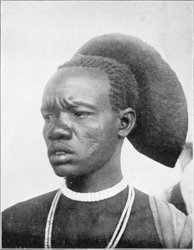
SHILLUK.
The Shilluk nation, the only people in the Sudan who acknowledge one head as immediate ruler or mek, extends along the west bank of the Nile from Kaka in the north to Lake No in the south. There is also a colony along the banks of the Sobat, near its mouth, extending 35 miles up this river to Nagdyeb, and chiefly living on the north bank.
The country is almost entirely a grass country, and as a result its wealth consists almost entirely of cattle.
A large and increasing amount of dura and other vegetables is grown, but it is often barely enough for the needs of the population, and with bad harvests famines are constantly occurring.
Description of the people. Appearance.Physically, the Shilluks, Shulla, or Ojallo (native names) are a fine race. In colour they are glossy blue-black. The average height of the men is quite 5 feet 10 inches, and that of the women is in proportion. According to European ideas they are narrow in the shoulders and thin in the calves in proportion to their height, but they are capable of sustaining considerable fatigue on short rations, and are courageous and moral in their sexual relations.
Every man carries and cherishes a long spear, with a laurel-leaf-shaped blade and a tuft of ostrich feathers near the butt; when prepared for war he carries also a knob-kerry, an extra throwing spear or two, and a light oblong shield of wickerwork or hide. The hair is twisted by means of a mixture of gum, mud, and cow-dung, into a series of extraordinary shapes, e.g., cockscombs, “tam o’shanter”-like halos, plumes a foot high, knobs, etc., etc. Few clothes are worn, occasionally a twist of cloth or a leopard’s skin, but as a rule the men go stark naked. The women[193] are more clothed. A large proportion of the Sudanese battalions are drawn from Shilluks, though no conscription is enforced.
History and religion.The legendary history and the religion of the Shilluks are related on page 197.
Character.In character they are haughty and independent, and hate foreigners, according to the lessons instilled by the older men who suffered under the “Turks,” the Danagla slave-dealers, and the Dervishes. Under the present regime it is hoped that this feeling will die out. They are also crafty, quarrelsome, and untrustworthy as a rule; at the same time they are thick-headed and obstinate; but, as aforesaid, their morals in relation to women are very good; they have a fine sense of discipline, and become very much attached to their leaders, whether black or white; they are exceedingly plucky, and they are the finest warriors in the Sudan.
Population.The country is thickly populated for its size. Right away from Kaka to Lake No is a continuous string of villages lying about a mile from the river. There are only two points in the whole of this distance at which the interval between villages exceeds two miles, and these are at the points where grazing is bad (between Akurwa and Nun, and between Nielwag and Nyagwado). There are, in addition, eight groups of villages which lie 12 to 22 miles inland, away from the river.
Villages.A careful census of the river villages in 1903 gave a result of 1,010 villages, 8,693 domiciles, and 39,312 souls.
Shilluk villages are invariably built in a circle, the open space in the centre containing nothing but a meeting-house for men only, and almost invariably a temple erected to a grandfather or great-grandfather of the reigning chief. Each domicile consists usually of three or four tukls, enclosed by a dura stalk fence. The houses are kept scrupulously clean by the women. A family occupies two or three huts; one is reserved for the householder with his wife, another as a cook-house, where merissa is also made, and the third is occupied by the retainers and children of the house. Dr. Schweinfurth records the existence of Shilluk villages of 200 huts. The largest village is Atwadoi, consisting of 120 domiciles, in a district of the same name north of Kodok. The constitutional laziness of the tribe does not prevent their erecting very well-built tukls, and many men are most proficient in thatching the roofs. The crest or peak of the tukl being completed, the workman descends, and a sheep is at once killed by the future occupant and eaten by the workmen, whose reward is completed by a further donation of two sheep.
Domestic life.A wife can be had for a milch cow and four to five oxen, but this is a high price to pay at present. This purchase money cannot be collected by many all their lives. The Shilluks keep one, two, or three wives; a very few exceed this number.
The Shilluk woman is fruitful; there are some with eight or nine children; three, four and five children seem to be the average issue. In former times, it is said, the number of children was much larger.
Having cost the man much money and trouble the woman is well looked after and treated. Aided by the girls she has she does her house work. She helps her husband honestly in the field. She is permitted to remain for weeks on a visit to her relatives. If disobedient the man gives her a thrashing on the back with a rope end, but this occurs very seldom.
The education of the children consists practically of the phrase, “Do just the same as you see me doing.”
The native at home knows of no science or profession, hence schools and house tasks are out of the question. Girls learn from their mothers house, field and plaiting work. The boys are all cattle-tenders. At the age of 13 to 15 years they start the cultivation of a small field, and grow up to manhood by degrees, acquiring the means for a house and a wife.
As long as they are young, children are obedient, but they take no notice of what the parents say as soon as they are able to carry out any work by themselves.
Cultivation.The cultivation carried on during the rainy season requires hard work, which the Shilluk is not inclined to give except for short periods at a time. The soil is, along the river, very rich and black, about 12 feet thick, and is named “do do”; inland it is poorer. Owing to the richness, weeds grow apace, and the land has to be weeded two or three times to avoid the young dura being choked. When gathered, thieves, mice, and elephants reduce the stock considerably, and even when he has produced, by dint of hard work, a fair pile of dura the native does not use it economically, for he eats a great deal at a time, gives generously to his poorer friends, and sells it badly.
Maize, beans, melons, ful (ground nuts), sesame, and cotton are also grown, but in only sufficient quantities for local wants. The cotton cultivation could probably be extended.
Cattle breeding.The chief occupation of the Shilluk is, however, cattle breeding. To him it represents property and wives. The amount of cattle in the country is unfortunately smaller than formerly, for it has been reduced largely by the depredations of the Danagla, the Dervishes, and even their own kings. In comparison with the Dinkas they are poor indeed, for a Dinka will willingly part with 20 or more oxen and cows for a wife, whereas the Shilluk can only pay one cow and three or four oxen with difficulty.
The cattle census of 1903 amounted to only 12,173 head of cattle and 63,473 sheep and goats in the whole country,[194] but they are increasing. The cattle are large and of a good stamp, and breed well, but the sheep and goats (the former of whom have hair, not wool) are small and stunted. Many cattle die every year of disease, in spite of every care being taken. One-sixth part of the sheep and goats, it is said, die during the rains, and these animals are especially exposed, not only to crocodiles, but to glanders and a sort of guinea worm which burrows between the hoofs.
During the dry season herds migrate to different parts of the country, the majority of those owned by the central district crossing over to the east bank of the Nile, to return when the new grass springs up. Similarly the cattle of the Sobat Shilluks descend to the lagoons south of the Sobat and graze with the herds of Obai and Fennikang. All the youths and boys over 10 years old accompany them, leaving their homes for several weeks.
The grass of Shilluk land generally gives little nourishment. Milk is therefore scanty. If one possesses even herds of cows the result in milk is small; curiously enough three or four out of every 10 are barren. A cow is never slaughtered; like man, it ought to expire by itself. Oxen are only killed on festal occasions, such as funeral dinners, etc. Mutton and goats’ meat are usually only eaten at festival dinners and ceremonies, or when the animal expires; or in cases of human sickness.
It is therefore very difficult to buy cattle from the Shilluks, for they cannot obtain wives for cash. It is simply impossible to buy a milch cow.
Old soldiers who have returned home to their native land, where they never get a piece of meat to eat, hanker after the flesh pots of Egypt, where they had meat nearly every day.
Crafts.The Shilluks have their own blacksmiths, potters, thatchers, pipemakers, surgeons, boat-builders, and basket and hair plaiters.
The blacksmiths are very skilful; they prepare spears, spades for building, small axes, fishing rods, big harpoons, picks, arm rings, bells and chains, etc. Their handicraft is a travelling one; they take their tools and go about from one place to another. The pay of a blacksmith is good. The employer has to support the man working for him, and makes him a present of sheep besides.
Pottery is the handicraft of the women. They make pots, pitchers, heads for smoking pipes in any form, and make them well. They are paid in food for their work.
The thatchers make not only watertight but also very neat roofs; a skilful European cannot make one better.
Snake stings and damage from blows or spear wounds are numerous. For the treatment of these evils the surgeons are called in. In their work they chop and cut most unmercifully, but although they inflict much pain they often save lives.
To make canoes out of crooked pieces of wood is the work of the ship-builders, and, with the poor tools they have, they make fairly satisfactory boats.
The plaiting of baskets and straw mats is done by both sexes. The species of grass here being not well adapted for plaiting, the production is not grand; however, the result meets the demand.
The nimbus-like and other head-dresses of hair worn by the Shilluks are masterly work.
Families carry on these respective trades for generations, and the father and mother impart their skill to their children and next relatives.
Building houses, carving and polishing clubs and spear sticks and other common work is understood by every Shilluk.
There are villages which are especially distinguished; some in fishing or hunting, some in cattle-breeding, others in cultivating dura, etc.
Occupation.During the rainy season, old and young, men and women, are busy; anyone who visits the country at this time of the year would believe them to be a hardworking people. At this time work is very fatiguing; no European could do it on such a meagre fare as that of the Shilluks. Diseases, fever, dysentery, colds, coughs, and pulmonary ailments are also rife at this season, both among the natives and their cattle.
During the dry season, however, there is not much to do; at most there are houses to be built and repaired, and this is done by young men. The old ones, viz., from 35 years onwards, do nothing but lie about or pay visits.
At this time of the year Shilluks begin to travel. Relatives pay mutual visits, and marriageable young men go to the Nuers and Dinkas with spears, wire, stuffs and dura, which they exchange for sheep and calves.
Industries. Fishing.Fishing is precariously carried out in shallow waters, either by spearing (horizontally, with bow-shaped fishing spears) or by pouncing on the fish with hemispherical wicker traps somewhat like lobster pots. Neither nets nor fishing lines appear to be used. Hippo hunting.Hippopotamus hunting is done by combined parties in canoes or dug-outs, harpooning the hippopotamus and despatching him with spears when he comes to the surface to breathe. These animals, it may be remarked in passing, are very savage, doing much harm on the land and gratuitously attacking canoes, etc., in the water.
Climate.From January to April the climate is not bad, though April is the warmest month of the year. June to September constitutes the rainy season,[130] and from October to December the country is flooded with water: but the marshes and[196] khors all dry up by April. From November to April the climate, though certainly not perfect, has little effect on a healthy constitution, provided good food, water, clothing, and a house are available. October is perhaps the worst month of the year.
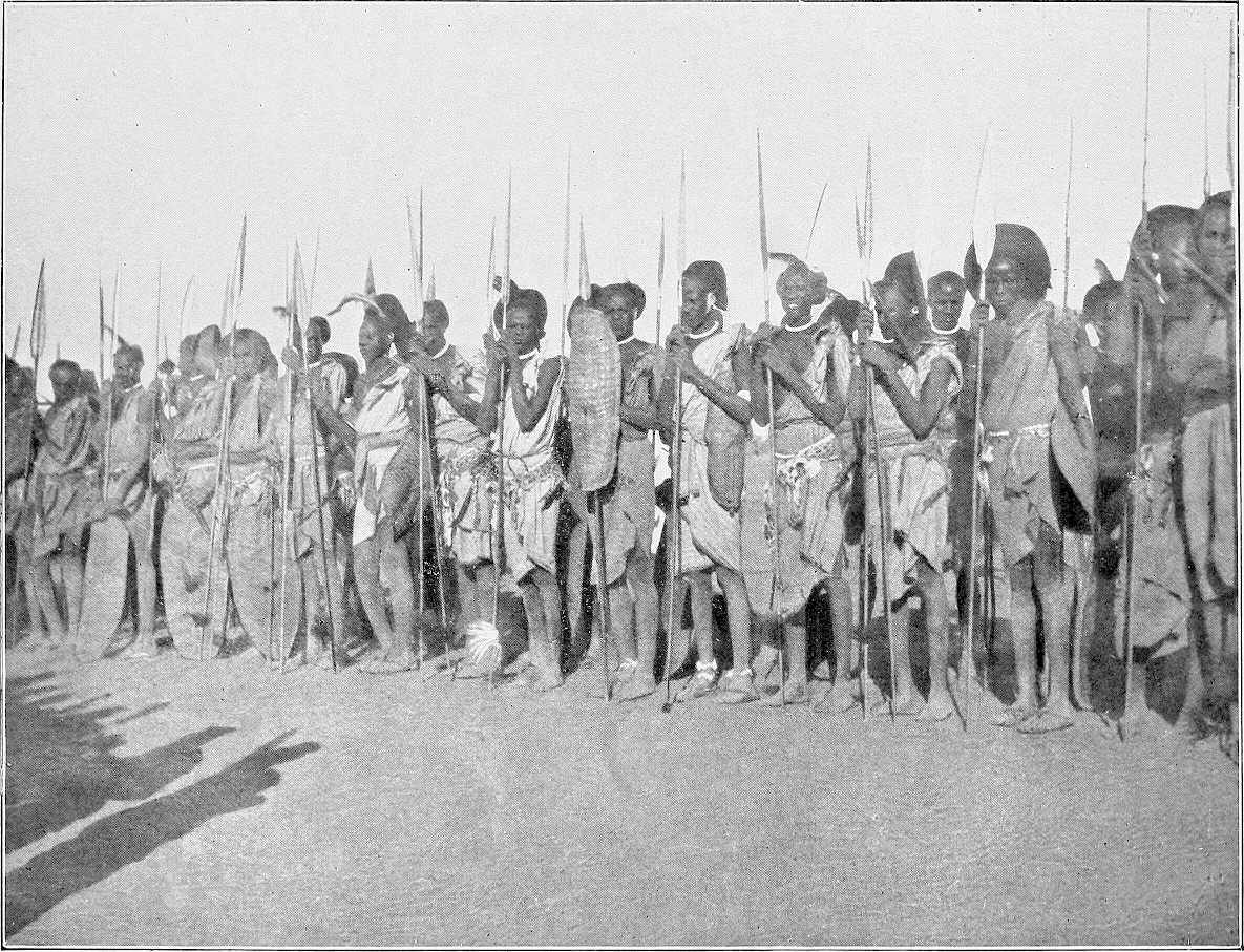
SHILLUK WARRIORS.
Relations with the Dinkas.The Shilluks do not, as a rule, agree well with the Dinkas, and there are big contrasts between the two races. The Dinka possesses many cattle and prepares his food with milk, whilst the Shilluk has only a few cattle and sprinkles his food with the dust obtained from drying and grinding dura stalks; for this he is despised by the Dinka.
Taken on the whole, the Dinkas are much more intelligent than the Shilluks. When Shilluk boys are unable to find a reply to the pointed remarks of a Dinka boy, they raise their sticks threateningly and say “The Dinka boy has a sharp tongue and must be flogged till he is quiet,” which generally stops the rather vulgar expressions used by Dinka boys.
The Dinkas are said to have formerly lived on the right bank of the lower Sobat, but were driven inland by the Shilluks.
Incited by a few Arabs, the Shilluks in former times used to raid the Dinkas and carry away their women and cattle. They however live peaceably now, thanks to the fear they have of the new Government. The two races now and then pay mutual visits, and also intermarry occasionally; a certain amount of trade is carried on between them.
Arab and other immigrants.There are a few Selim Baggara in the neighbourhood of Kaka, but these people appear to visit the district only after the harvest to purchase dura from the Shilluks, which they are too indolent to cultivate themselves.
The Kenana Arabs, under Sheikh Faki Hamed, occupy, though they are not allowed to monopolise, the wells at Atara. They are disliked by the Shilluks on account of their dirty habits.
Another branch of the Kenana Arabs occupy a village close to Fadiang. This branch of the tribe dwells in 60 domiciles. Fama (Sheikh Yogagieb Wad Awell), a sub-district of Nyagir, contains a mixed population of Nubawis and Shilluks; the former cultivate dura largely. They were originally driven into this district by the Khalifa’s people when the latter were at Fungor, and under the Sheikh Nail they inhabit five villages, consisting of 104 domiciles, and are subject to the Shilluk Sheikh Yogagieb Wad Awel. In Fama there is also a Gowama Arab village of 40 dwellings, under Sheikh Abu El Gasim, who collected these people at Taiara on the approach of the Khalifa, and permanently settled them in his present village. The list of immigrants to Fama district is completed by the mention of the Hawazma Arabs, under Sheikh Abu El Wahab Walad Handigai. From their own account they are fearless hunters of the elephant.
A sprinkling of Kenana Arabs is to be found temporarily living in villages as far south as Dusim, and a family or two of Felata hail from Jebel Eliri, but these are not permanent residents.
Administration.Since time immemorial the Shilluk nation has been governed by a Mek or King, and the list of reigning monarchs since the beginning is known to every well-educated Shilluk (vide p. 199). For administrative purposes the country has been divided for a long time into two provinces, that of Gerr (sub-divided into Kaka, or Moama, and Kodok). which extends to Bol (inclusive), and that of Loak, which extends from Fadiet (south of Bol) to Tonga and Lake No. Each of the three districts is under a head sheikh, residing in Oriang, Debalo, and Nyabanjo respectively, and the whole is subject to a mek or king, elected in a ceremonious manner by all the headmen of the sub-districts.
Up till the last representative, Kur Wad Nedok, the meks had supreme power, which appears to have been wielded in a somewhat arbitrary manner. Wad Nedok was deposed in the spring of 1903 for numerous malpractices, and his successor, Fadiet Wad Kwad Keir, is now limited in power, and is subservient in most things to the Governor of the Upper Nile Province, a British officer resident in the town of Kodok. (Vide Chap. I, p. 2).
For administration the country is still further divided into two provinces, the northern and southern, containing 29 districts altogether; the principal ones are:—
| Northern Province. | |
|---|---|
| Name of District. | Name of Head Sheikh. |
| Ashargo | Kudyit Wad Edor. |
| Golo | Deng Wad Aiwol. |
| Southern Province. | |
| Name of District. | Name of Head Sheikh. |
| Awarajok | Lual Wad Agok. |
| Dusim | Amailek Wad Amosh. |
| Fennikang | Akurwat. |
| Tonga | Yang Jok. |
Roads.A good track exists on either bank from Delal, south of Kaka, to Fennikang, south of Taufikia. South of this again many villages can be reached only by crossing deep khors which are filled with water all the year round. The[197] Lolle river, nearly 200 yards wide throughout, flows past the villages of the districts Tonga and Fennikang. South of the Sobat mouth, a branch of the White Nile flows close to the villages of Dusim, Tuara, Oashi, Awarajok, and Fannidwai, and emerges into the main stream at a village named Warajok, where the telegraph cable crosses the river. This stream is about 13 feet deep throughout. It is known to old native navigators as the Bahr El Harami; sailing boats with contraband used to take this course in preference to passing the Government station of Taufikia.
Game.There is little game in the thickly inhabited Shilluk country itself. A little way inland, however, elephant, lion, antelope, etc., are plentiful, and more especially is this the case near the river towards Lake No. The neighbourhood of Kaka and north of it is also a grand game country.
History and Religion of the Shilluks.
In the beginning was Jo-uk, the Great Creator, and he created a great white cow, who came up out of the Nile and was called Deung Adok. The white cow gave birth to a man-child whom she nursed and named Kola (Kollo); Kola begat Umak Ra or Omaro, who begat Makwa or Wad Maul, who begat Ukwa. These people lived in a far off country, nobody knows where. (Bahr El Ghazal (?), Jur tribe (?) according to linguistic links).
Ukwa was one day sitting near the river when he saw two lovely maidens with long hair rise out of the river and play about in the shallows. He saw them many times after that, but they would have nothing to do with him and merely laughed at him. It should be mentioned that their lower extremities were like those of a crocodile.
One day Ukwa found them sitting on the banks, so he came up behind and seized them. Their screams brought their father, Ud Diljil, out of the river, to see what was the matter. Ud Diljil, whose right side was green in colour and in form like a crocodile, whilst his left side was that of a man, protested mildly, but allowed Ukwa to take away his daughters and wed them, merely giving vent to a series of incorrect prophecies regarding them.
Nik-kieya, the elder sister, gave birth to two sons and three daughters, and Ung-wad, the younger, to one son only, named Ju, or Bworo. The eldest son of Nik-kieya was named Nyakang (Nik-kang or Nyakam) and inherited the pleasing crocodilian attributes of his mother and grandfather. Meanwhile Ukwa married a third wife, whose eldest child, a son, was named Duwat.
On Ukwa’s death there was a furious quarrel between Nyakang and Duwat as to who should succeed Ukwa. It ended by Nyakang, with his sisters Ad Dui, Ari Umker, and Bun Yung, his brother Umoi and his half-brother Ju, acquiring wings and flying away to the south of the Sobat. Here they found the Shilluk country inhabited by wicked Arabs, so they drove them out and founded a most successful kingdom. According to their genealogy this would have been about 1200 A.D., or later.
Nyakang had a creative power which he used greatly to the advantage of the kingdom. In order to people the vast territory more quickly, he proceeded to create a people from the animal life he found in the forests and rivers. From crocodiles and hippopotami, and from wild beasts and cattle, he created men and women. When these had brought forth many children, the parent stock was removed by death, so that the children might not know of their origin.
The new creation and their offspring form the Shulla race or common people, in distinction from the direct descendants of Nyakang’s family. The latter continue to bear authority and fill the priestly function to this day. All outside the royal and priestly line are accounted Shullas.
Nik-kieya still exists. She never died and never will. The western part of the Sobat and part of the White Nile near there is her favourite abode. She often appears, usually in the form of a crocodile, but at times in different forms and always in the river or on its banks. No sacrifices are ever offered to her. When she wishes, she takes what is required from among men and beasts; and when it is so, the people must not complain; indeed, it is an honour when Nik-kieya is pleased to take her sacrifice of man or beast from a family.
Nik-kieya becomes judge also in certain difficult cases, it is said, particularly in cases of illegitimate children. When the man accused denies fatherhood, the case is turned over to Nik-kieya. The disputants are taken to the river bank, and along with them a goat. They are then put into the river, and the one that Nik-kieya carries off is judged guilty, and he or she is left in the hands of Nik-kieya, to be punished. The beauty of this method is that a consciousness of guilt, added to a belief in and fear of Nik-kieya often causes confession, and thus the case is ended. It is not quite clear why the goat is taken to the river. It may be to give Nik-kieya a chance for a sacrifice without taking a human being, or it may be because a goat tied close to the river will attract crocodile from quite a distance. To Nik-kieya are ascribed many wonderful miracles, and it is feared also that in actual practice she becomes a cloak for sin.
Around this mythical being and her demi-god son are wrapped many superstitions, not the least of which is that sacrifices to and the worship of, the great deity Jo-uk, are carried out by the intermediary of Nyakang, the demi-god.
[198]
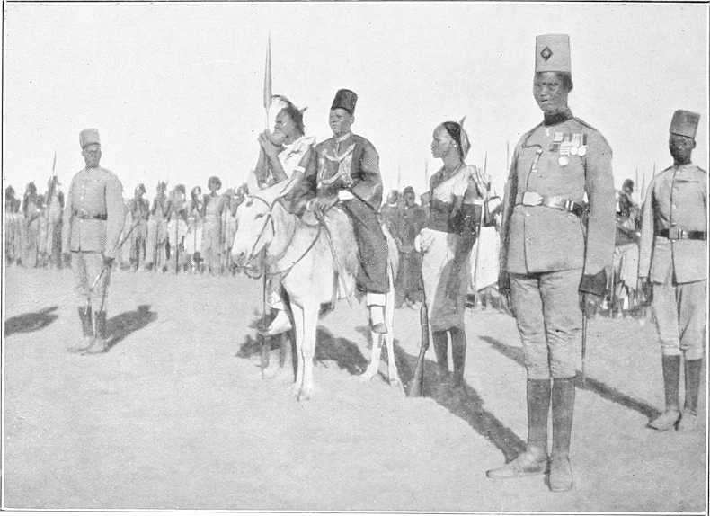
EX-MEK KUR WAD NEDOK—DEPOSED 1903.
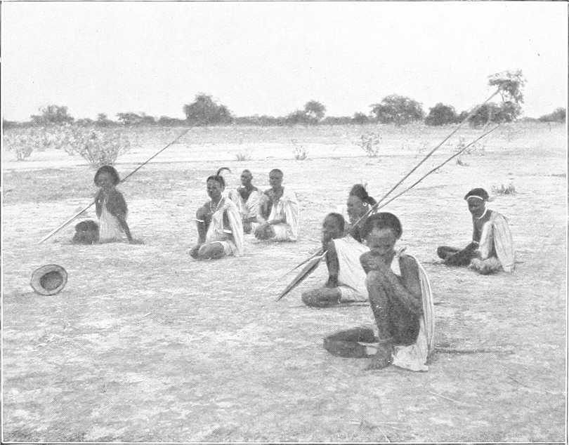
SHILLUKS ON A VISIT.
[199]Jo-uk is recognised as the father and source of all life, of evil as well as good. He is treated rather as a deity to be feared and propitiated, but he enters into the small relations of life all the same, and most incidents, such as death, sickness, going on a journey, etc., are referred to his action. The Shilluks believe that Jo-uk is everywhere, and that man when he dies goes to Jo-uk; but whether anything happens to him in consequence seems doubtful.
To Jo-uk sacrifices are made at least once a year, at the beginning of the rainy season, and much of good and evil are attributed to him. This sacrifice consists in the slaying of an animal by the priest of each village for the people of his village, assembled at the house of the “Nyakang.” The animal is slain with a holy spear, and the flesh divided among the people, cooked and eaten. Then follows a dance, with much drinking of merissa to make their hearts merry. For this sacrifice and dance, which is apparently the sum of their worship, there are especial houses. But in each village there is a small temple, similar in structure to the larger one. In this, or more correctly, around this, the elders of the people assemble for the transaction of all serious business, and call their gods to witness in all covenants. No village is without this small temple, and it is the only building on which any ornamentation is attempted. It is called the house of Nyakang, not the house of Jo-uk.
In cases of illness sacrifices are made to Nyakang. The Shilluks bury their dead inside the confines of their villages close to the house where the deceased had lived, killing a bullock at the wake, the horns of which are set up to mark the place of interment.
History.After Nyakang there have been, including the present one, 26 kings. The following is the list[131]:—
| 1. | Nyakang. | 15. | Nyadok. |
| 2. | Dag (Dok). | 16. | Akwot. |
| 3. | Odage. | 17. | Ababdo. |
| 4. | Kudit. | 18. | Awin. |
| 5. | Dokodo (Dakkode). | 19. | Akoj. |
| 6. | Boj (Boiwj). | 20. | Nedok (Nyadok). |
| 7. | Tugo (Tuka). | 21. | Kwad Keir (Kwat Ki). |
| 8. | Nya Dwai (Nya dwi). | 22. | Ajang (Ajung). |
| 9. | Nya Ababdo. | 23. | Gwin Kun (Kwoe Kon). |
| 10. | Muko (Mu Kao). | 24. | Yor Adodit (Yur). |
| 11. | Nya To (Nya Ta). | 25. | Akol. |
| 12. | Nyakong (Nik Kang). | 26. | Kur Wad Nedok. |
| 13. | Okun (Ukon). | 27. | Fadiet Wad Kwad Keir. |
| 14. | Nya Gwatse (Nkwaji). |
Kur Wad Nedok was appointed king by the Dervishes as a reward, it is said, for betraying Mek Yor Adodit to them. During Kur’s absence in Omdurman, Akol was appointed mek by the Shilluks. Ak Kwo Kwan, son of Akol, is a pretender to the throne, but has few adherents.
It is related that all kings from Dag to Nyadok were killed by the Shilluks. Kwad Keir, Ajang, and Gwin Kun fell by the hand of the “Turks.” Yor fell in fight with the Dervishes. Kur abdicated. Akol is dead; he is said to have been shot by the Dervishes. The descendants of the kings are called “Gwared,” in contrast with the ordinary Shilluks, who are called “Ororo.” The royal descendants form the upper class, while the Oroko are at the beck and call of the kings.
The idea of kingship is implanted wherever the Gwared exist, and the latter are numerous. It is, therefore, not easy to exterminate the idea of royalty.
Royalty in this country is royalty, both by selection and inheritance at the same time. It is so by selection because the leading men of the country select the king from a variety of claimants, and by right of inheritance, inasmuch as only sons of kings are entitled to ascend the throne.
The right of accession to the throne is acknowledged as belonging primarily to the sons of the late king.
[200]
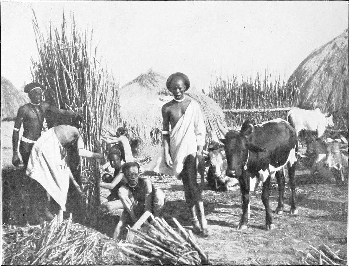
SHILLUK VILLAGE SCENE.
[116]In 1904 the amount of gum exported from Kordofan is expected to be 219,300 kantars. One kantar = 100 lbs.
[118]Gabra, north-west of Omdurman, must not be confused with Gabra El Sheikh, near Kagmar.
[119]The rainfall at El Obeid from March to October, 1904, amounted to 12·16 inches; the maximum temperatures registered in 1904 were 108° in April and 107° in May, the lowest being 45° in February.
[120]Some of these names are not now recognisable.
[121]Chiefly from “Fire and Sword in the Sudan.”
[122]It was rumoured at Omdurman (May, 1904) that Abesher, the capital of Wadai, was occupied by the French on the 20th December, 1903. This rumour, however, appears to be unfounded.
[124]Not to be confused with Bir El Melha on the Arbain road west of Debba.
[125]Taken from “Fire and Sword in the Sudan.”
[127]The dukhn is ready for harvesting 90 days after sowing.
[128]Mother was not real wife of Sultan.
[129]Compiled chiefly from Reports from Major Matthews, the Rev. Father Banholzer (R.C. Mission, Lul), and the Rev. J. K. Giffen (American Protestant Mission, Sobat). The Editor is under much obligation to Father Banholzer for his kindness in writing him a special description, and to Rev. J. K. Giffen for allowing him to make use of his MS. for part of the Appendix.
[130]Total rainfall at Kodok, January-October, 1904, was 19·4 inches.
[131]From Father Banholzer’s memo. The Rev. J. K. Giffen gives an almost identical list, and includes an extra king.
NORTH-WESTERN SUDAN.
COUNTRY WEST OF THE NILE, SOUTH OF LAT. 22° AND NORTH OF KORDOFAN.
This district readily lends itself to division for description into three sections, viz.:—
1.—Desert west of the Nile, north and west of Wadi El Gab, including Arbain road (for detailed report of which vide Appendix, Part III, Vol. II.).
2.—Wadi El Gab.
3.—Bayuda Desert.
The country west of the Nile from Halfa to Kerma merits little description. Desert of the most arid description comes down close to the banks of the river, west of which all is uninhabited and waterless, with the exception of the few oases, for as far as is known upwards of 300 to 400 miles. The desert itself varies from hard, often stony sand or gravel-covered plains, to undulating moving sand dunes and rocky hills of lime, granite, or basalt. Remains of petrified forests are occasionally met. The amount of mineral wealth discovered in this inhospitable region is not yet definitely known.
Here and there a very limited amount of vegetation is met, at some spot where the water of one of the rare rainstorms that pass over this district has chanced to collect, but more often one may travel for miles and miles over country devoid of any vestige of animal or vegetable life.
The whole of this desert region, including the wells and oases, is uninhabited. It is, however, visited occasionally by roving bands of Hawawir and Kababish in search of natron or wild dates, as also by raiding parties of the Bedaiat, a tribe living to the north of Darfur, who only recently drove off camels grazing within 80 miles of Dongola.
The following is an extract from a report by Captain H. Hodgson, February, 1903, descriptive of the country west of the Wadi El Gab.
“Beyond the limits of the Wadi El Gab, on the western side, there seems to be a belt of country in which water is easily found, but is undrinkable. Of the two water pans I have tried, namely Murrat and Butta, the one is very bitter and the other has a distinct smell of sulphuretted hydrogen—Arabs use these waters medicinally as purgatives.
Jebel Abiad.“I reached and ascended the plateau of Jebel Abiad at what I reckon, roughly, to be 100 miles west from the river at Khandak. In 1901 I found the northern extremity of this range to be 98 miles from the river at Dongola. It is, on the eastern side, a high steep bluff, exposing the white rock (gypsum) from which it gets its name. It extends continuously from where I stood, both north and south, as far as the horizon.
“The surface of the plateau is shingle and sand; it slopes gently down on the western side.
Wadi Natrun.“I reached the Natrun valley on the 31st January. It is not literally a valley, but an undulating plain stretching south and south-west as far as the horizon. From south-east to north-east it is bounded by a high range of steep hills of black rock; from north-east to north-west by high broken rocky ground with isolated conical hills; to the west, by low gravel hills. On the distant horizon, north-west, is a high range of hills. Close under the bluff on the eastern side of the plain are two thickets of selem bushes, growing luxuriantly and suffering in places from over supply of water. This is very plentiful and near the surface, the sand being brown and damp, but it is not the best water in the valley. The southern of these two thickets is called Melani. An isolated peak in the northern centre of the plain, called Jebel Kashaf, lies at a bearing of 315° mag. from Melani. The best water, called Bir Sultan, lies 3 miles from Melani at a bearing of 278° mag. and due south of Jebel Kashaf. On the ground called Bir Sultan (which includes an area of about ¼ square mile, covered with tussocks of Halfa grass, etc.), I found three or four pans of good water, the soil below the sand being white clay. There is a small clump of date seedlings near the biggest spring.
[202]There is plenty of evidence of natron in the valley, but the place, where most of the digging is done and where the thickest seam of natron is reported to be, is 2,400 yards from Jebel Kashaf and to the west of it, at a bearing of 310° (mag.). The diggings are in what looks like a dry salt pan left by the sea, except that the sand is very red. The method of collecting it is as follows: About 2 to 4 inches depth of sand is cleared away until the natron, a substance resembling a yellowish rock salt, is reached; the top part is usually bad, being half sand. Then there is a seam ½ to 2 inches thick, of good natron, and again below a little bad natron, and then below all sand again. Sometimes all the natron is spoilt by being mixed with sand. Near the natron diggings is a large thicket of selem bushes, and besides this and at Melani, there is a clump of date trees and selem north-east of Jebel Kashaf and another thicket of “littel” scrub, besides plenty of halfa, tamam, taklis, and halaf grass etc. A party of 400 or 500 camels could live some months in the valley on the grazing only. Good shelter can be obtained from the wind, and there are plenty of garids etc. to make tukls. Gazelle plentiful.
Arbain road.“The Arbain road lies along very high land, and anyone traversing the road during the winter months should, if possible, march with the wind, i.e., from north to south. The cold was intense, and the shelter from north wind nil, as all hills are steep on the north side and slope gradually away to the south.
“At Sultan, Lagia, and Selima this is reversed, and the hills are steep on the south side. This change in formation accounts probably for the presence of water.”
Game.This desert region is the haunt of the Addax, the rarest of Sudan antelopes. Specimens have been killed near Tundubi.
Sheb-Nakhla district.[132]Nakhla.—Situated about 80 miles north-west of Halfa. Named after the single date palm overhanging the wells. Surrounding the hill on which this date palm stands is a narrow valley about 80 yards wide. Throughout this depression water can be obtained at a depth of 3½ to 5 feet. The water is of better quality than that of any of the neighbouring wells and is abundant. There is practically no grazing or fuel here; the latter can be obtained, however, at a distance of 2 to 3 miles.
Hassab El Gabu.—About 10 miles west (?) of Nakhla. This well is situated on the top of a circular sandhill 30 yards in diameter. Good water is found at a depth of 2 feet, as it may be almost anywhere between Nakhla and Sheb. Good grass for camels.
Bir Suleimat.—11 miles (?) from Nakhla. Good grazing. Water bitter, but plentiful.
Bir Sederi.—28 miles from Nakhla. Water bitter. Little grazing. Dom palm covered sandhills 100 yards from well.
El Haad.—33 miles from Nakhla (direction uncertain). No well, but good grazing on “Haad” grass.
Sheb.—40 miles W.S.W. of Nakhla. Is the southernmost water in the Sheb district. Well 4 feet deep and same in diameter (October, 1902). Water plentiful, but brackish and aperient. Good grazing and plenty of firewood. This is a watering place on the Arbain road.
Terfaui (I).—About 6 miles north of Sheb, situate in a small oasis in a broad wadi said to lead from the oasis of Selima to the Nile by way of Kurkur. This valley is bounded on the west by precipitous sandstone cliffs. There is a group of trees here 250 by 300 yards. Good grazing for camels. The water is drinkable. Immediately to the west of Terfaui is a pass over which the usual road to the northern oases of Beris, etc., passes. This is usually a watering place on the Arbain road.
Abu Hussein.—About 35 miles north-west of Sheb. Consists of a clump of trees and bush-covered mounds about 30 feet high. There are three more places exactly similar to Abu Hussein, two being to the eastward and one to the west. They are all about 5 miles apart and lie in a general line from east to west. Water may be found at a depth of 1½ feet at any of them, and here and there between them. Good water and plentiful. Grazing also good.
Terfaui (II).—16 miles north-west of Abu Hussein or about 50 miles north-west of Sheb. It consists of small mounds of sand covered with long green grass. Water plentiful at depth of 4 to 5 feet, grazing good, consisting of tufts of long grass, over an area of about 1 mile by ¾ mile. There used to be three dom palms here, but these were burnt down by Captain Ross in 1894 on account of the snakes which infested them.
Kassaba.—The northernmost well in the Sheb district is at Naseib, 15 miles north of Kassaba. At Kassaba the water is not good, but many old wells point to its having been much used in former days. Situated in an open plain about 26 miles N.N.W. of Sheb. A watering place on the Arbain road.
Selima Oasis.—Selima lies on the Arbain road about 78 miles south of Sheb and 55 miles west of the river at Sagiet El Abd. Halfa is about 120 miles to the north-east. It is perhaps the most important oasis in the western[203] desert of the Sudan, as not only must caravans using the Arbain route almost necessarily stop here for water, but its dates and salt are probably of considerable value from a commercial point of view.
Mr. James Currie, who visited this oasis in October, 1901, thus describes it:—
“A most beautiful place. It would be most difficult to find without a guide, as it is really only a large hole in the desert. The descent to it is very steep indeed. There are three wells, a good many date trees, and good grass. One sees the remains of an old Christian convent, moderately well preserved, but the point of interest attaching to it is that it has apparently been built out of the ruins of something much older, to judge from the inscribed stones one notices. There are abundant salt deposits near, and a huge petrified forest, which extends further than I had time or inclination to go.”
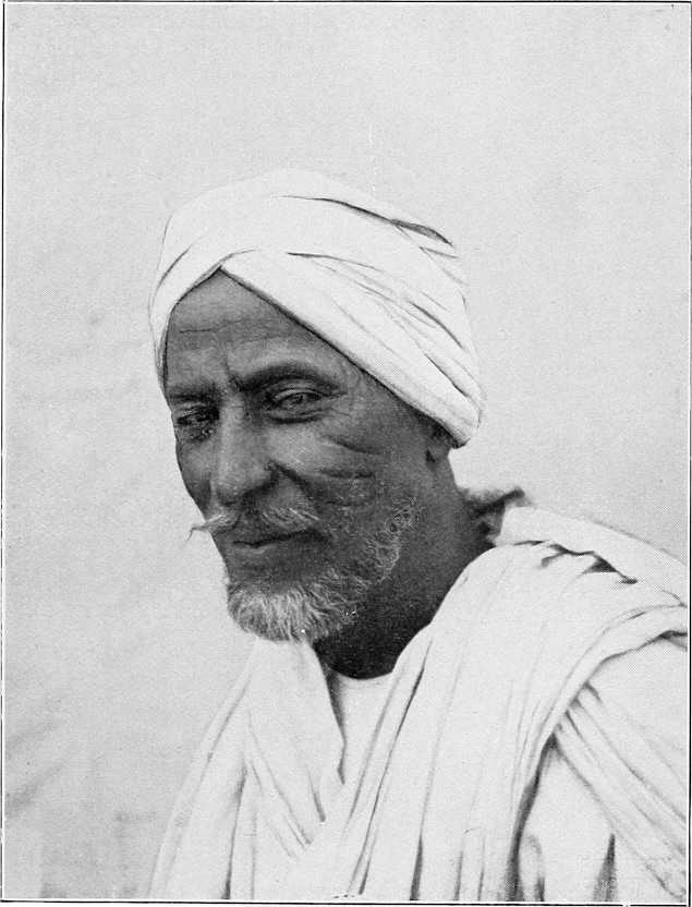
DONGOLAWI MERCHANT.
Captain H. Hodgson (February, 1903) writes with reference to this oasis:—
“Besides the old salt workings, which are capable of considerable development, there are some 2,000 fruit-bearing date trees. My estimate may not be very near, but I spent two hours with two other men counting in order to get this idea, and in this time counted 685 female trees, and covered only about one third of the ground. The trees are uncleaned with very thick undergrowth, and are being ruthlessly hacked in order to enable the Arabs (Hassanab from Kosha) to get at the fruit. Dates of the following species were collected: Kulma, Agwa, Barakawi, and Gawa. The first and second are both of considerable commercial value: the Agwa trees seem the most numerous.”
Tundubi.—For description of this oasis vide Route Report Dongola to Bir Sultan, Vol. 2. The addax is found near here.
Lagia.—Vide Route Report Dongola to Lagia, Vol. 2.
Bir Sultan.—Vide Route Report Dongola to Bir Sultan, Vol. 2.
Tura.—An oasis said to lie about 150 miles south-west of Lagia, which is approximately 160 miles north-west by[204] west from Dongola. Here there is said to be a sulphurous lake about ½ mile long, known as Tura El Bedai. Water, if obtained from holes dug on the margin of the lake, is said to be tolerably sweet and drinkable. There are many wild date trees here, for the fruit of which the Kababish and Bedaiat have been long accustomed to fight.
(By Major A. E. Turner, R.A., December, 1884.)
The northern branch of the Wadi El Gab extends from Hannek to the village of Sawāni, 20 miles due west of El Ordi, or Kasr Dongola.
It is a flat tract mostly sandy, but there are many stony plains and occasional rocky hills, as well as plains where salt and lime crop to the surface. The natives collect the salt, and carry it to the villages on the Nile, where they barter it for grain, etc. There are many wells, and round these wells the straw-built huts are congregated, forming villages; there are numerous, and some very fine, palms, both dom and date, near the wells, and these in some places mark the site of deserted villages, where the wells have dried up.
The people at the present time (1884) have very few camels,[133] except milch and young. They have sold a great many, and a good many are employed by contract between Dongola and Sarras on the west bank.
The villages are all built near the wells, and in deep reddish sand.
There is no ground for cultivation whatever, and hardly any grass (halfa or other); the trees are palms, acacias (the latter very fine and old).
Leaving Hafir and the Nile, the road leads S.S.W., crossing a plain covered with stones and shingle, with scanty mimosa shrubs; at 9 miles a low ridge is mounted, and the Wadi El Gab is visible with the village of Lagia.Lagia and its palms 5 miles distant. At 13½ miles, the ruins of three old buildings are met, one on the west, two on the south side of the road; one of the latter is a ruined convent or monastery, and its cells are visible. Many of the palms are burnt, having been destroyed by their owners who went to join the Mahdia. 4 miles S.S.W. is the village of Abu Naama.Abu Naama. Seven miles south-west the village of El Mungur.El Mungur, which has two good wells.
Two miles south-west of El Mungur is the well and village of Abu Baguga.Abu Baguga, and 1 mile south-west of it that of Abu Halfa.Abu Halfa.
After going 2 miles S.S.W., the road goes W.S.W., and a ¾ mile further lies, on the east of the road, the village of Sarari, Dukur, deserted.Sarari, now deserted, and that of Dukur on the west, also deserted. At 3 miles further, the deserted village of Ain El Bir, deserted.Ain El Bir, a mile from the road on our left (east), and just beyond it a solitary rocky hill called Mount El Kwais.El Kwais.
At 9 miles the road mounts a ridge, and then descends into a sort of circular basin about 1 mile in diameter, surrounded by low hills. On leaving this at 10 miles, I saw the village of Goz El Fugar.Goz El Fugar 1 mile to the left (east), and ¾ mile further I arrived at the village of Bayuda.Bayuda, on a sandy hill, with numerous palms; a considerable village.
After leaving Bayuda, the road goes south by east; at 1 mile on the right (west) lies the village of El Gumra.El Gumra, and 2 miles further, also on the west side, that of Zalia.Zalia; at 7½ miles a large expanse, covered with palms and acacias, with two good wells, is reached, called El Kurmotai.El Kurmotai. From this the road goes south-east for 1½ miles to the village of Sawāni, the sheikh’s own village and chief village of the Wadi Gab. Some of the huts are built of mud, but mostly of straw.
Sawāni.Sawāni is a very picturesque village with a large open space on the south side, bounded on three sides by trees, and on the fourth side lies the village.
The road to Dongola is due east; after 2 miles a low range of hills is crossed, at the east foot of which lies the small village of Um Hellal (1).Um Hellal, at ½ mile further, a flat plain with much lime; at 4½ miles (2 miles further), another village, called also Um Hellal (2).Um Hellal, on the north side, and 1 mile from the road is passed; a mile further, rocky ground is reached, which gradually rises, and 1 mile further the Wadi Gab ceases, and the road goes over bare, rocky, and broken ground to Dongola. The latter is 26 miles from Sawāni.
Wells.The wells are very good, the water is, as a rule, near the surface, and the wells are lined with stone; the depth of water did not appear to be more than a few feet.
The sheikh told me that there is no settlement of his branch of the Kababish tribe south of Khandak, and that all is desert between that end of his valley (wadi) near Khandak to within a day’s march of Debba.
[205]
| Names of places. | Distance in miles. | Description. |
|---|---|---|
| Intermediate. | ||
| Hafir | On the Nile. | |
| Lagia | 14 | The road is in a S.S.W. direction, and is over a plain mostly covered with shingle and a few mimosa shrubs. At 9 miles, a ridge is mounted, whence the Wadi El Gab is visible. At 12 miles, the valley is reached; and at 14, the village of Lagia. |
| El Mungur | 7 | The road is S.E. for 7 miles to El Mungur. |
| Bayuda | 10¾ | The road goes S.S.W. for 2 miles; the rest of the way W.S.W. |
| Sawāni | 9 | The road goes 7½ miles S. by E., then S.E. |
| Dongola | 26 | The road due E into Dongola. |
| Total | 66¾ |
(By Col. Colvile, Grenadier Guards, October, 1884.)
The Wadi El Gab is a sandy khor about 63 miles in length, running through the trough of a broader and rocky valley. Its general direction is north-west and south-west. It is inhabited by the Omatto section of the Kababish tribe, of which Sheikh Fadl Mula Wad Rekha is the chief. Its most southerly well is Marghum, 30 miles to the west of Khandak, and its most northerly is said to be 20 miles west of Hafir. Its only productions are wood and dates, both of which are plentiful. Its inhabitants do not appear to own any great number of camels; those to be seen at the various settlements being mostly milch nagas and their foals. Goats, which feed on the mimosa, are plentiful.
On leaving the Nile at Bakri the road at first crosses a flat sandy desert, destitute of vegetation; but after 7 miles a district is reached, thickly studded with low mimosa bushes. In the district are several Arab encampments, some of them as much as 4 hours’ journey from the nearest water. Fifteen miles from Bakri the country becomes more undulating, and the surface covered with firm gravel; and 10 miles further on, a range of hills running north and south is reached. Passing through a break in this range, the road follows for 3 miles a valley running nearly at right angles to the main one, and then strikes the track running down the Gab to the Abu Gussi-Kordofan road. Passing down a sandy valley, dotted with sand dunes, and sparsely studded with low mimosa scrub, the most southerly well, Bir Marghum, is reached, 7 miles north of the point where the valley first entered. The well is stone-lined, and the water is 20 feet below the surface and 4 feet deep. It is said that the well never runs dry; the water is good. For the next 6 miles the country continues to be scantily covered with low mimosa scrub; Bir El Ain is then reached, and the valley becomes more thickly and heavily wooded, and continues to be studded with fine acacia timber to El Sawani. Between El Ain and El Sawani are the following six wells:—
| Abu Haweid. | El Hudden. |
| El Bab. | Bayuda. |
| El Harma. | El Huffera. |
They are all lined with stone, and about 4 feet of good water is found in each of them at from 3 to 4 feet below the surface. Nine miles beyond El Huffera, El Sawani, the chief settlement of this section of the Kababish, is reached. It contains many native huts and four mud dwellings. This well, like all the others (with the exception of El Marghum) is marked by a clump of palms.
The road to El Ordi, after skirting the valley for a few miles in a north-east direction, turns to the east and crosses 10 miles of broken rocky ground and low ridges. A tract of undulating ground is then reached, which extends to El Ordi. With the exception of small patches of acacia in some of the valleys, this district is wholly devoid of vegetation; it is uninhabited.
(By Colonel A. Hunter, C.B., D.S.O., November, 1896.)
The Gab does not realise expectation, nor fulfil the descriptions given of it. The hand and sand of destruction is everywhere visible. The wind, blowing prevalently north or north-west, rolls the sand along, the sand catches in the[206] tamarisk bushes, in the roots and undergrowth of the palms, date and dom, till it piles over the bushes, and reaches towards the top of the palms or smothers them. The whole place has the appearance of a forest after a heavy storm: trees lying prone in all directions, but no effort is made at replanting or replacing. A few seedlings struggle into existence now and then. The sand moves on, leaving the palms crippled or dead. I have heard so much of the vegetation and grazing, and date trees, verdure, luxuriance, etc., of the Wadi El Gab—it never existed. Ruthless, and judging by events, not altogether unavoidable, neglect, has diminished the little there ever was. We know it carried a large head of camels, goats, and sheep, at least so it was supposed; but, barring goats and a few donkeys, the herds of the Kababish had to roam “for forty days in the wilderness” towards Darfur and Kordofan, and northwards to abreast Mahass and Sukkot, for their food. Water is found at from 12 to 20 feet below the surface; the Gab averages about 5 miles in breadth, patches of grass and thorn bush crop up at intervals, separated by rolling hills of rock and sand. Round the wells there are the miserable straw huts and mud houses of the tribesmen, with here and there groves of palms; no game to speak of. Gazelle exist in small numbers, and are very afraid of mankind. This is accounted for by the fact that the Arabs trap them, and hunt them with dogs, a breed of yellow greyhound. The trap is a round hoop, with thin strips of wood tied to the circumference, and the points of the strips meet at the centre, laid so that the strips make a slight cone, like the top of a basket. The gazelle browse on the thorn bushes; close to the bush the Arab puts the trap in a little hollow in the sand, cone downwards, places on the rim of the trap a running noose, to the other end of which is fastened a billet of wood. The whole is covered over with sand. The gazelle comes to feed off the sprouts of the bush; puts his foot into the noose; his foot slides through the apex of the spines of split wood; he kicks to free his foot, and so the noose tightens on his leg, and there he is, with a rope tied to his leg; he cannot kick off the rope, for the billet of wood drags the knot tight, and the trap prevents it slipping down, and the Arab then appears with his dogs, and chases the animal down.
Twelve miles west of Shemsi is Wadi El Butta, very much like the Gab in appearance. Addax and wild sheep are said occasionally to come here in summer. Water is near the surface, and is got by the animals by scraping. A curious feature is the occurrence over the whole face of the desert of patches of succulent plants and grasses which serve as food for camels and for goats.
Sawani to Bayuda, 9 miles. El Bab to Haweiya, 9½ miles.
At Haweiya, or Haweid, a number of wells, also at El Bab. They are part and parcel of one place.
Rode to El Marghum, the post occupied by the old Sheb post. I asked about these wells in the Gab, and got always the same answer. Those existing were dug by their ancestors, so long ago no one remembers, and ever since no one has been to the trouble to dig or explore for anything fresh. Well here deep, 18 or 20 feet, and stone faced.
(Sir W. Garstin G.C.M.G., April, 1897.)
No account of the Dongola province would be complete without some mention of this great depression which extends through the Western Desert from Hafir to Debba, a distance of some 125 miles. It is chiefly inhabited by the Kababish tribe of Arabs, who use it for grazing their flocks; and it contains numerous wells.
It has been thought that this depression might possibly be utilised as a storage reservoir or as a means for escaping the surplus water in an excessive flood. It is very doubtful whether it could thus be made use of. The wadi appears really to come to an end a few miles north of Hafir, and the nearest point to the river to be at a distance of some 10 miles.
The lowest portions of the Wadi El Gab must be considerably lower than the level of the river in flood, but by how much it is impossible, without levels, to say.
On leaving the Nile, in the direction of this valley, the country rises rapidly for some 4 miles. It then begins to fall away from the river, in a succession of terraces, until a total of about 10 miles have been traversed. The real edge of the wadi then commences. Its width at the northern end appears to be about 5 miles. The western edge is filled up with drift sand, which is gradually covering the palm trees. A well, measured at the Oasis of Lagia, showed the water level to be some 9 feet below the ground surface. The water was sweet and of good quality.
It would be useful to have the whole of this depression carefully levelled and surveyed. The area covered by it is very large, and supposing it were possible to fill it with water, the loss from evaporation would certainly be very great.
General.The tract of country north of Kordofan, i.e., north of N. lat. 16° (approximately), bounded on the north and east by the Nile and on the west by the Wadi Melh has been called the Bayuda Desert, though this name is not applied to it by the Arabs.
Inhabitants.It is inhabited by nomad Arabs, viz., on the east by the Kababish, chiefly the Omatto section under Sheikh Fadl Mula Wad Rekha; in the centre by the Hawawir, of which the Sauarab is the most important sub-tribe, under Sheikh Hassan Khalifa; and on the east by the Hassania, whose headquarters are at Jebel Gilif and Jakdul. In the extreme north, in the angle formed by the bend of the Nile, are the Monasir, who are, however, a sedentary tribe. These above-mentioned nomads wander a great deal according to the grazing, on the existence or absence of which, in many cases, depends the fact of wells being open or not.
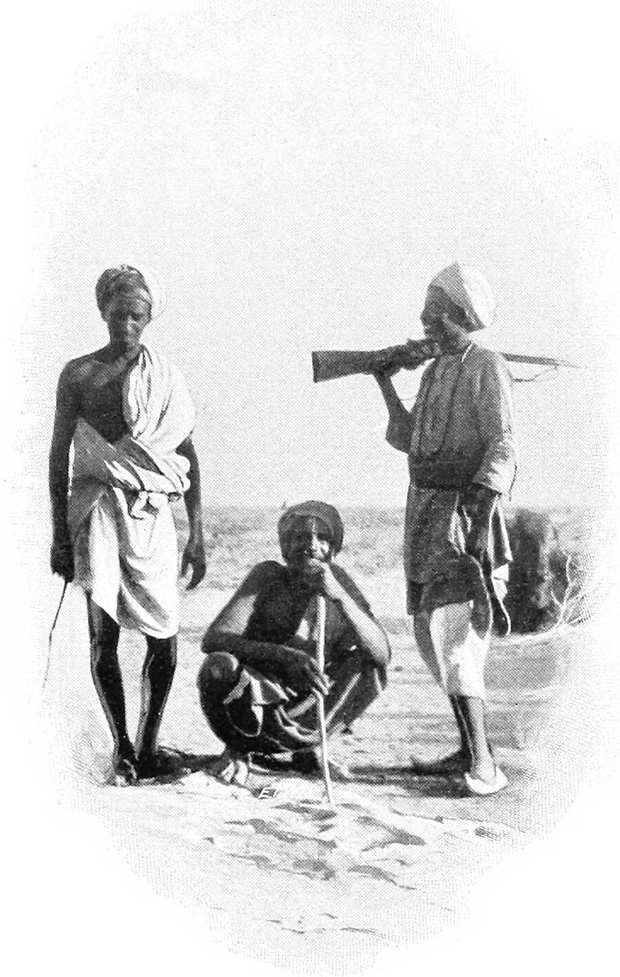
BAYUDA DESERT ARABS.
Cultivation.The Arabs cultivate their dura in certain well-known wadis, mostly in the more southern districts, according to the rainfall, which is, as a rule, not heavy, and very local, and varies considerably from year to year.
Wadi Melh.The W. El Melh is a broad shallow depression, frequently a mile or more in width, having its origin near Um Badr. It is inhabited here and there by the Kababish. It reaches the Nile at Debba, though it has long since ceased, if ever, to discharge water into that river. For further description of this wadi, vide Route Report Dongola to El Fasher, Part III. This route is now seldom, if ever, used. Vide also report on El Ein, p. 210.
Wadi Mogaddam.The next wadi of importance in this district is the Wadi Mogaddam which has its origin near Bagbag, about 60 miles south-west of Omdurman, and joins the Nile near Korti after a course of about 200 miles in length. For description of this wadi and the wells, etc., in it, vide Route Report Gabra to Korti, Part III.
Gabra.The wells of Gabra in the Wadi Mogaddam, nearly 60 miles north-west of Omdurman, are an important Arab centre, there being many wells and a good deal of cultivation in the neighbourhood. The Arabs are principally Kababish, but Geriat and Hassania also come here. Gabra is under the Governor of Khartoum, but the boundaries of Dongola, Berber, and Kordofan Provinces are all within a few miles of it.
[208]Communications.Communications throughout this district are bad owing to scarcity of water. The principal trade routes are:—
(1) Debba-Fasher viâ the Wadi Melh (little used).
(2) Debba-El Obeid viâ Amri, Hobagi, and Haraza (used a little during rainy season).
(3) Debba-El Obeid viâ Amri, Elai, and Habisa (longer than (2) but more water).
(4) Debba to Omdurman[134] viâ Inderab, Gumr and Gabra (a good deal used).
(5) Debba to Omdurman viâ Elai and Gabra (little used).
(6) Ambugol and Merowe to Shendi (Metemma) (little used).
(7) Merowe to Berber viâ Sani (a good deal used).
(8) Merowe to Omdurman[134] viâ Hamboti and Wadi Bishara.
(9) Gabra to Korti (little used).
All the above routes except No. 8 are described in the route reports in Vol. II, and from them some idea of the country may be obtained. The traffic along No. (7) will presumably increase considerably on the completion of the Nile-Red Sea Railway.
Northern Bayuda Desert.The track across the Bayuda Desert, from Ambugol to Shendi, is comparatively easy going, and is fairly well supplied with water; but not being a main trade route, it is little used by caravans.
There are no difficult defiles or passes.
The tract of country traversed consists of extensive plains divided by ranges of low hills. It is very unlike the sterile and rocky deserts further north, and in many places shows abundant signs of vegetation. Wadis, pastures of long coarse grass, and many clusters of trees are met with, whilst, during the rainy season, the ground is susceptible of profitable cultivation in some parts.
This route is just within the limits of the tropical rains. The wet season lasts from May to August, but rain never falls for more than 15 days in any year. Sometimes there is no rain for two consecutive years.
There are no streams, the water sinking into the sand and disappearing within 24 hours after rain has fallen.
During exceptionally hot days small whirlwinds pass in great numbers, and carry across the desert sand and fine debris in columns upwards of 150 feet in height. They have a formidable appearance, but are really almost harmless. A very large one might upset a tent, but this performance represents their maximum effect.
The Bayuda Desert is inhabited merely by wandering Arab tribes, of whom the principal are the Hawawir, Hassania, the Sauarab, the Fadnia, and the Aonia.
They subsist almost entirely by keeping flocks of sheep and goats, and by breeding camels, wandering from spot to spot to the best herbage, at such distance from the wells as enables them to water their animals. They also trap the gazelle—so plentiful in this desert; and after the rains a certain amount of ground is usually cultivated by them, and small crops are obtained.
About 4 miles above Ambugol the wadi (valley or stream course) Abu Gir debouches into the Nile; this wadi takes its rise in the Jebel Gilif about 70 miles from the Nile; water is obtainable from shallow wells along its entire course in its bed; like most of the lower portions of the Bayuda Desert, it is thickly covered with vegetation.
Vegetation.This consists principally of low “samr” bushes (spreading thorny acacia), occasional “sunt” trees (acacia arabica, 20 to 25 feet high), the milk plant (asclepia gigantea), the “marakh” (a green shrub), the “tundub” (a bush, some 15 feet high,), and “heglig” trees (20 to 25 feet high, and often with a diameter of trunk at 5 feet from the ground of 12 to 15 inches), the “mokert” (salvadora persica), and even occasionally the “dom” palm (hyphæne thebaica), of which the “dom” palm, the “usher,” and “marakh” are indicative of water close to the surface.
Firewood.Best suited for firewood are the “sunt,” the “samr,” the “tundub,” and the “heglig,” the wood of the latter, I may mention, being used as the base on which the natives twirl a dry piece of “samr” root with the object of producing fire.
Food for camels.Camels devour eagerly the younger branches of the “samr,” the succulent leaves of the marakh (camel thorn) and el gau (camel grass), both of the last-mentioned being plentiful in the Bayuda; indeed, this is a favourite district for breeding and rearing hagins (the lighter and faster class of camels).
Sheep.Sheep, of which large flocks are owned by the Hassania, Aonia, and other wandering Bedawi tribes of the Bayuda, find, during the dry season even, ample food in the grasses of the plains near Jebel Gilif; whilst the fresher shoots of the marakh and tundub, with the juicy leaves of the usher, provide sustenance for the goats.
Route from Ambugol.The readiest route from Ambugol is to strike for the desert close to the town, whence an easy slope, some 2 miles in length, rises to the desert plateau, here some 50 feet above the Nile bank. A shingly level plain is then traversed[209] for about 3 miles, when the Wadi Abu Gir is struck, leading right up to Jebel Gilif, with an ascent of about 10 feet per mile.
The route now skirts the hill Jebel Abu Shenkawi, near to the salt diggings, and passing another clump of hills, Debba El Kebir, joins another camel route from the Nile at a point some 300 miles from Ambugol, where the Wadi Mofokakart debouches into the Wadi Abu Gir.
This other camel track, after leaving Ambugol, follows the Nile to near Korti, a distance of some 4 miles, then, turning sharply to the right, passes by the Wadi Um Marra, and crossing the ridge of Nasaib El Ruchan, at a point some 300 feet above Ambugol, descends over rather broken ground to the Wadi Abu Gir, and from this point there is but one route. At about 37 miles from Ambugol the First wells.first wells are met; these are merely holes scooped in the sand, deepened as the subterranean waters fall, until either the sides fall in, or the whole of the excavations are obliterated by the rush of water down the wadi during the rainy season.
The water is drawn from these, and all similar wells in the Bayuda, by means of a rude skin bag; it is then poured into earth cisterns, on the surface, at which the camels, sheep etc., drink. It is so pure that a small quantity of salt, fairly plentiful in this desert, is mixed with it.
The wadi at this point, about 38 miles from Ambugol, which has hitherto been flat and sandy, with gently sloping sides, becomes much broken. Small metamorphic ridges, hills, and lava-like mounds close in, and petrified wood is strewn in all directions, showing that the belt of metamorphic rock that intervenes between the lower Nubian sandstone and the extensive granite rocks is being traversed.
El Haweiyat wells.About 55 miles from Ambugol are the wells of El Haweiyat, of similar character to those described above; the plain of El Rechewa is left on the right, and quitting the Wadi Abu Gir, which turns abruptly to the left, the route crosses a curious plain, about 3 to 4 miles wide, called El Mesalima.El Mesalima. This plain is surrounded by low hills, and without vegetation; it is intersected by veins of mountain limestone, much resembling marble, and I here found fossil remains of the Saurian type.
Leaving El Mesalima, the route now crosses the plain at the southern foot of the Jebel Gilif, passing across watercourses which, in the rainy season, carry off the drainage from the mountains. These streams issue from wild gorges, and are said to drain extensive plains, 20 or 30 miles distant; a statement corroborated by the fact that they bring with them much brushwood and small timber.
After issuing from the gorges these streams wander at will, cutting constant new channels over an irregular talus of boulders and debris they bring with them; at the foot of this talus, they collect and run down defined sandy channels from 1 to 3 miles long, whose permanent character is proved by their tree-covered banks; these large channels then break up into a number of smaller diverging channels, which lose themselves in a grass-covered plain to the south, fairly covered with trees and brushwood, and about 8 miles across; this plain is said to be covered with water during the rains to a depth of 3 or 4 feet.
Abu Halfa wells.Water may be procured in any of these sandy channels by digging holes as described above; and at Abu Halfa, about 90 miles from Ambugol, are large wells of this description, at which large numbers of camels and flocks are daily watered.
After passing numerous pools of water still standing in basins worn out of the granite bed, the gorge, at a distance of some 7 or 8 miles from the entrance, widened out into a valley about ½ mile across; here there was a small lake, the edges fringed with bulrushes and dom palms, whilst the native huts, flocks, and even birds and conies showed the permanent character of the lake. I heard that many similar lakes exist in the recess of the Jebel Gilif, but the Arabs are extremely reticent on this point.
Jebel Gilif range.At about 79 miles from Ambugol the Jebel Gilif range, with its uniform precipitous face, breaks up into outlying spurs with intermediate plains. In one of these spurs, about 2 miles to the north of the route and 100 miles from Ambugol, are situate the Jakdul wells.wells of Jakdul; these consist of water-worn basins in the bottom of a granite gorge of similar character to those mentioned above. The largest of the pools is some 60 yards long and 10 yards broad, and it is stated never to have run dry.
The water is sweet, but the lower pools are much contaminated by the flocks constantly using them, and the sight of thousands of beetles issuing from the water at dusk is not inviting.
The upper pools, however, are much cleaner, and with care an ample supply of excellent water might be ensured.
No doubt there are many other reservoirs up this gorge as at Abu Halfa.
El Faar wells.To the eastward of the wells of Jakdul, and about 8 miles from the camel track, are the wells of El Faar, consisting of holes dug in a sandy water-channel similar to those of the Wadi Abu Gir.
With Jebel Gilif the granite rocks are left, and the route traverses the upper Nubian sandstone, simple and metamorphic, to the river at Shendi, or rather Metemma.
115th to 125th mile.Between the 115th and 125th mile the route crosses a belt of drift-sand hills travelling from east to west, these are of the usual type, i.e., a crescent presenting its convex side and gentle slope to the wind; up this slope the sand[210] is driven to the apex, whence, falling over and remaining at its natural angle of repose on the concave side, the hill gradually but surely advances, the highest of the sand hills in this locality are about 13 feet high, their rate of progress depending entirely on the strength of the wind; to a camel they are no obstacle as it winds amongst them at will.
Abu Klea or Tleh wells.At 150 miles from Ambugol are the wells of Abu Klea, or strictly speaking Abu Tleh (Tleh equals a particular kind of grass), artificial pits of similar character to those already described; the water is good and rarely fails; they require of course frequent cleaning out.
Shebakat wells.At Shebakat, near the 168th mile, is a large well about 12 feet in diameter, sunk to a depth of 50 feet through the sandstone to a bed of water-bearing gravel; the water is brackish but the supply perennial.
Metemma.At 175 miles from Ambugol, Metemma is reached; the town is about 1 mile from the Nile, but the plain between is occasionally flooded. The water supply is from wells kept up by percolation from the river, and is therefore excellent.
Hence to Khartoum, as stated above, the river is navigable for nearly the entire year, vide Chap. X.
Rainy season.The rainy season in the Bayuda Desert is uncertain, as this is the extreme northern range of the tropical monsoon; there may be showers in May, but the true rains fall in June, July, or August. Some years may pass without any at all, and then a perfect deluge floods the country and refills the pools and wells.
Water.The conformation of the Jebel Gilif is such, that notwithstanding the large amount of water running off during the rains, a considerable quantity is stored at high levels, gradually finding its way into the sand-filled wadis, through permeable granite augites and diorites, of which Jebel Gilif is composed.
These wadis are crossed at intervals by spurs of trap rock, that serve the double purpose of keeping up the level of the wadi, which would otherwise rapidly degrade, and of affording, so to speak, “artesian” vents, up which the water, confined between the beds of the “Nubian” sandstone below, finds its way into the loose sand above. In Sinking wells.sinking wells, spots should be selected where the vegetation in the wadis is of a brighter hue, and where heglig and the dom palm exist. In December, 1871, water was found in many such places, never more than 15 feet below the surface. The trap dyke in the vicinity will provide any quantity of fairly bedded stone with which to line the sandy sides of the well; the way I should suggest, would be, in the first place, to dig through the sand until water be reached, and then to excavate the ground in a circle of say, 24 feet diameter, lining it with a dry stone wall 3 feet in thickness, in this should be built, at intervals, pieces of hard wood, of which there is a large quantity, in order to form a rude ladder; as soon as the water is reached, a Norton’s tube pump should be driven some 6 feet or more; this will prevent the accumulation of insect life, to be found in any open pools in the vicinity, and prevent other pollution; then, when this runs dry, the excavation should be again carried down to the lowering water level, and a well of internal diameter of 14 feet be built with a dry stone wall of say, 2 feet thick (the word in India for this form of well is “butcha”), the Norton tube driven down, and the process repeated as the waters lower. Were it possible to procure lime readily, the well might be sunk from the top, as is so habitually done in India, but the only limestone found in the Bayuda is at the plain of El Mesalima, as mentioned above.
The stone near these wells, and of which as described above, the supply will be practically unlimited, may be used in constructing defensive works, whilst there will be in their neighbourhood large quantities of fuel, and a considerable amount of bush that will serve as fodder for the camels.
A considerable quantity of sheep, milk, etc., may be procured from the neighbouring tribes.
Jebel Gilif.The Jebel Gilif presents a certain source of danger (during the expedition, 1884): this consists of, in places, an almost precipitous face of some hundreds of feet in height, at the foot is an irregular talus formed by the degradation of the face, and by the stones and boulders brought down the “khors” (ravines) with which it is intersected. These “khors” are, in many places, near their debouchure from the mountains, very narrow (in places only one camel can pass at a time), with steeply precipitous sides, the bottom being of granite rock, polished by the materials carried down in the torrents of the rainy season, and in many places half blocked up with boulders and débris. As these “khors” rise to the level of the range they widen out into valleys, well supplied with wood, water, forage, etc., where large numbers of men could be kept concealed for a considerable period.
Situation.El Ein is situated about 130 miles from Debba up the Wadi El Melh. The general trend up the wadi is S.S.W. At El Ein on the western bank, for some 60 miles northwards and a short distance southwards, is a precipitous escarpment of rugged outline, but extremely uniform in height, known as Jebel Makakush. El Ein is a gorge in this, the northern promontory of which is surmounted by a rock of curious shape and is called El Serg.
There are two places where water is obtainable along the route from Debba to El Ein, one called Mahtul about 30 miles from Debba has two wells, and the other is Soteir another 30 miles further on. The latter is the better[211] water, but the quantity is small. On the arrival of the writer the well had been emptied by watering a troop of camels, and his men stated there was not enough water to fill waterskins for from two to three hours. At El Ein there is good and abundant water, while grazing may be found almost anywhere along the Wadi El Melh, but from about 30 miles south of Soteir it lies only along the western side, and is much less abundant than further north.
Geology.The formation at El Ein is a series of undisturbed sedimentary beds lying horizontally, most of which are sandstones or grits. This overlies unconformably a much older series of gneisses and schists which are exposed in the lower parts of the Wadi El Melh along the foot of the Makakush escarpment a few miles north of El Ein.
The sandstone series is continuous all the way to Debba, and extends over very large tracts of the Sudan.
Mineral deposits.There are no indications of any mineral deposits of value at El Ein in any of the beds exposed.
Old workings.At several points, especially along the sides and just above the stream-bed, there are natural caves in the sandstone. For some little distance a very soft underlying bed has been weathered away undermining a harder upper one, the unsupported portions of which have broken off and fallen, or cracked and bent over, leaving open gashes. The general appearance of all this very much resembles that of an ancient shaft nearly filled up with débris, though a careful examination leaves no doubt that the phenomena are natural.
Ancient buildings.On either side of the gorge about opposite the well is a cluster of ancient houses, while on a hill some way up the gorge and on the south side are some five more.
The houses are all of similar design approximately round, and are well built, without mortar, of unhewn stone laid in courses; the walls are about 2 feet thick, and many of the stones are of great size. The doorways of most of them face down the valley, but a few are on the opposite side. Many have additional rooms built forming segments of circles.
These buildings are more substantial, and differ in other respects from those usually seen round ancient mines in the Sudan. The only implements noted were two crushing stones; these, however, have not been used for crushing quartz (the matrix in which gold usually lies), being of ordinary millstone and not hard enough for that purpose. They were in all probability only the usual stones for crushing grain.
Across the entrance to the gorge is a wall probably originally 6 to 8 feet high, but now in ruins. It is built of unhewn stones, fairly well coursed, without mortar. The sides are vertical. This runs across the flat space at the entrance to the gorge and a little way up the northern slope. The stream bed lies in a creek some 15 feet below the level of the ground on which the wall stands, and there is no evidence of this waterway ever having been blocked.
In view of this as well as of the general construction of the wall, it is impossible that the structure was a dam, but I should imagine it was probably built for defence, and the gorge was used as a place of refuge against marauding bands by a people whose flocks usually grazed in the valley below.
[132]This district is not actually in the Sudan, but owing to its proximity to Halfa, some description of the wells in it is given here.
[133]This remark applies equally now (1903).
[134]Cost of camel transport by this route varies from 55 P.T. to 75 P.T. per kantar.
COMMUNICATIONS.
Communications in the Sudan are carried on by:—
| A.—Railway. | D.—Riding and Transport animals |
| B.—River. | E.—Post and telegraph. |
| C.—Roads. |
There is no wheeled transport, except a few carts in the larger towns drawn by camels, mules, or oxen, and an experimental system of wheeled transport, rough carts drawn by oxen, in the Bahr El Ghazal.
Motor transport is in an experimental stage, and has only proved a partial success up till now, chiefly owing to the generally sandy nature of the ground and the present lack of roads.
There is a light railway at Khartoum which it is intended to run in conjunction with a tramway at Omdurman.
[For practical details and hints regarding Communications in the Sudan, see “Notes for Travellers and Sportsmen in the Sudan”[135] (price PT.5), “Sudan Almanac”[135] (price PT.5), and “Notes on Outfit for the Sudan” (price PT.2), all obtainable from the chief booksellers in Cairo or the Agent-General, Sudan Government, War Office, Cairo.
These are recommended as being indispensable for intending travellers.]
Historical.To Said Pasha (1860) is due the first idea of connecting the Sudan by railway with Lower Egypt. Mougel Bey reported on the subject, but, owing to the expense involved, the project was abandoned.
The first attempt at actually laying a railway in the Sudan dates from the time of the Khedive Ismail Pasha.
After a preliminary study in 1865-66, by Messrs. Walker and Bray, the Khedive sent up, in 1871, Mr. J. Fowler, C.E., to settle on the best routes for putting the Sudan into railway communication with civilisation. After some time spent in preliminary surveys, Mr. Fowler decided on a line which, starting from Halfa, would run up the eastern Nile bank, cross the river about Amara, and roughly follow the left bank to Ambugol. From here it would strike across the Bayuda desert, viâ Jakdul, to Metemma, cross the river again here, and continue along the right bank to Khartoum North.
From Debba a line was to be laid direct to El Fasher, capital of Darfur.
In the Eastern Sudan, meanwhile, a line was to be laid from Suakin, viâ Sinkat, to cross the Atbara and strike the Nile opposite to Khartoum.
These routes were accurately surveyed, and the railway from Halfa was actually begun and carried along the right bank to about Sarras. It was then abandoned, partly for financial reasons and partly at the desire of General Gordon, who considered that the country was not yet ripe for works involving such a considerable outlay.
During the 1884-85 expedition the railway was continued for some 40 miles, but in consequence of the evacuation of the Sudan it was dropped, and the portion beyond Sarras was destroyed by the Dervishes.
In 1896, when operations became imminent, the Sirdar began laying a line from Korosko southwards, but this was soon abandoned, and the original railway was continued in April, 1896, in the direction of Dongola. This line was completed after considerable difficulties, as far as its present terminus, Kerma, on 4th April, 1897.
The main line, striking from Halfa across the desert to Abu Hamed, was commenced on 1st January, 1897, and, after a stoppage of 22 days for want of material, reached Abu Hamed, 230 miles, on 31st October, 1897. It was laid at the great rate of about a mile a day, the maximum speed for one day being 5,200 yards. The record for 1 month was 48 miles; this was during October, 1897.
[214]It eventually reached Khartoum North (Halfaya) on the last day of 1899.
The Suakin-Berber railway was boldly taken in hand during the Suakin expedition in the spring of 1885, but only a few miles were laid, and it was then abandoned.
The route for the future Nile-Red Sea railway has now been decided on and surveyed (1902-03), and the laying has been commenced from both ends.
The present lines from Halfa to Khartoum North and Dongola (Kerma) were laid primarily to supply an army in the field; the route, method of laying, and materials, were all chosen with this object in view.
Partly as a consequence of this, nearly 50 per cent. of the line is in the desert.
The main line is 575 miles, and the Kerma line is 203 miles long.
The gauge of the lines is 3 feet 6 inches, the same as the Cape railways. Single line throughout (except at the crossing-places).
Goods trains on the Khartoum line have to carry 7,000 gallons of water to enable them to cross the waterless desert sections; this considerably reduces the useful carrying power of the line.
The Kerma line runs through very rocky country, and has sharp curves and steep gradients. It is liable to washouts, and, as its cost is prohibitive in proportion to the traffic receipts, it will be abandoned in December, 1904, and the Dongola Province will be later connected to the main line by a branch line to Abu Hamed.
Khartoum line, steepest gradient 1 in 125; sharpest curve 960 feet radius.
Kerma line, steepest gradient, 1 in 50; sharpest curve 500 feet radius.
The Nile-Red Sea line will leave the main line about the mouth of the Atbara, will run up this river to about Khor Hudi (15 miles), and then branch off north-eastwards over the desert to Suakin, viâ Sinkat Pass. It is now in course of construction, and should be finished by the summer of 1906. Besides this and the Abu Hamed-Merowe branch, which is to be shortly commenced, other projected railway extension is from Omdurman to El Obeid, Suakin to Kassala, and Khartoum (N.) to opposite Wad Medani.
KHARTOUM LINE.
| List of Stations. | Miles from Halfa. | Remarks. |
|---|---|---|
| Halfa[136] | 1 | See pp. 23 and 85 for description. |
| Halfa (Camp)[137] | 0 | „ p. 23 „ „ |
| Nos. 1 to 9 | In desert—these are only loops for crossing trains; wells at miles 77 (No. 4) and 126 (No. 6); telegraph station at latter, besides small shops and engine pit. | |
| Abu Hamed[137] | 230 | Battlefield is 1½ miles south of Station. Bath rooms in Station for use of passengers. |
| Dagash | 248 | Country between here and Berber little inhabited or cultivated. |
| Abu Dis | 267 | |
| Shereik | 291 | |
| Abu Sillem | 318 | In desert. |
| Abidia[137] | 343 | |
| Berber North[136] | 361 | Starting point for desert roads to Suakin and Kassala. |
| Berber South | 363 | |
| Suakin Junction | 384 | Line from Suakin will join in here. |
| Atbara | 385 | Girder bridge over the Atbara, 1,050 feet long. |
| El Damer[137] | 392 | Many villages from here onwards; much cultivation and cattle. Thick scrub in parts; fertile soil. Chief town of Berber Province. |
| Zeidab | 404 | |
| Aliab | 416 | |
| Mutmir | 429 | |
| Kabushia | 448 | Pyramids of Merowe about 3 miles north of Kabushia, about 2½ miles east of railway. |
| Taragma | 460 | |
| Shendi[137] | 471 | Headquarters of Cavalry. District Headquarters of railway—Southern Section—and office of District traffic manager. |
| El Goz | 483 | |
| Wad Ban Naga | 496 | Nagaa temples 23 miles to the S.E. (vide Appendix D). |
| El Meiga | 511 | |
| Jebel Gerri | 524 | |
| Royan | 538 | |
| Wad Ramla | 547 | Zubeir Pasha’s residence (Geili) close by. |
| Kubalab | 560 | |
| Khartoum North[137] | 575 | Terminus—on right bank of Blue Nile, opposite Khartoum. |
[215]From about 1st April to 15th December there are two expresses each way weekly between Halfa and Khartoum North; one of them has sleeping and dining cars attached with a restaurateur, but the other has only ordinary first, second, and third class carriages.
Passengers travelling by the latter must make their own arrangements for meals; the first and second class carriages have small kitchens in them for the use of passengers’ servants.
From about 15th December to 1st April there are two expresses weekly, each having sleeping and dining cars and restaurateur. There are also two local passenger trains each way weekly between Abidia and Khartoum North all the year round.
For fares and freights apply to Agent-General, Sudan Government, Cairo, or Traffic Manager, Halfa.
Time occupied on journey, Halfa to Khartoum, by passenger trains, 28 hours; by goods trains, 47 hours.
KERMA LINE.[138]
| List of Stations. | Miles from Halfa. | Remarks. |
|---|---|---|
| Halfa[139] | 1 | |
| Halfa (Camp)[139] | 0 | |
| Sarras | 33 | On river. |
| Ambugol | 64 | In desert; wells. |
| Akasha | 86 | On river. |
| Kosha[139] | 105 | On river; small shed and workshop; railway strikes south across desert. |
| Kuror | 137 | In desert. |
| Dalgo | 164 | Railway rejoins river. |
| Kerma[139] | 203 | On river; shed and workshops. |
Kerma is about 30 miles north of Dongola. Transport between these two either by steamer, donkey, or camel, according to state of river.
Passenger accommodation on the Kerma line is of a rough description. Rates according to class of vehicles.
General.Gross receipts of Sudan Government Railways during 1902, £E.194,000, of which £E.103,000 on Government account; in 1903 the receipts were £E.137,000.
Goods trains on both branches run according to the requirements of the traffic, usually one train each way daily. For rates, etc., apply Traffic Manager, Halfa.
Stations are open for receipt of goods from 7.0 A.M. to 4.30 P.M., and for delivery of goods from 7.0 A.M. to 5.0 P.M.
Light railways.There is a miniature railway in Khartoum used for passengers, etc., but beyond this no light railways have yet been constructed in the country. There seem to be openings for these towards Kassala, Gedaref, and El Obeid, but the time has not yet come.
The Sudan freight, passenger, and postal communications are carried out by river from Shellal to Halfa, Kerma to Merowe on the Dongola reach, and to stations south of Khartoum by steamers and sailing boats.
On the Shellal-Halfa reach for this purpose are five stern-wheel steamers, 2 screw tugs, 11 troop barges, 8 sailing barges (including one of 500 tons carrying capacity), and 44 sailing gayassas belonging to the Sudan Government; there are also about 110 gayassas on hire for carriage of supplies, stores, etc.
A fast steamer service twice a week for through mails and passengers runs in connection with the Egyptian and Sudan railway services. This service is carried out by two steamers.
A slow service for local mails and passengers and freight also runs twice weekly.
The steamer passenger service carries private passengers, but no private freight is taken either by Government steamers or sailing boats. This is taken by private companies, Messrs. Thos. Cook, etc.
Arrangements are made to load both ordinary passengers and cargo at North End, Aswan, and for steamers and boats to pass through the dam locks. The fast mail steamers start from above (i.e., south of) the dam.
On the Dongola reach there are two stern-wheel steamers, two troop barges, and 15 sailing gayassas belonging to the Government; some small nuggars are also being built for the use of districts.
One steamer is for the use of the Mudir, and the other runs a fortnightly service between Dongola and Merowe during low Nile, and from Kerma to Merowe when the river permits.
The river between Kerma and Dongola is always navigable for lightly-loaded steamers, but when the river is low there are one or two dangerous rocky places, and it is not considered advisable to run a regular service. This portion is therefore principally navigated by sailing boats during this period.
Steamers and sailing boats are available for the carriage of private passengers and goods.
The river is only navigable a short distance upstream of Merowe at certain times of the year.
There are three screw and seven stern-wheel armed gun-boats; the latter being frequently used for transport work. The screw boats are kept as station “guard ships” at the southernmost Blue and White Nile posts and at Khartoum. In addition to the gunboats there are five stern-wheel steamers and one new paddle steamer of about 100 to 120 feet long for post, passenger and freight service. For local work or special duty there are four very old paddle steamers of Gordon’s time, two screw tugs, and four launches, as well as 20 barges capable of carrying troops, animals, and freight.
Regular services.[140]A monthly service, 13 days, runs to Gondokoro, the most northerly Nile post of Uganda, leaving Khartoum on the 15th, and returning from Gondokoro for the north about the 29th of each month, arriving at Khartoum about the 10th.
This steamer calls at all intermediate stations south of Goz Abu Guma.
A monthly service (9 days) runs up the Bahr El Ghazal to Wau and Meshra El Rek, or as near as the state of the river will allow, leaving Khartoum on the 1st of each month; starting on the return journey on the 12th, and arriving at Khartoum about the 19th. These steamers also call at all intermediate stations south of Goz Abu Guma.
The weekly service from Khartoum every Tuesday to Goz Abu Guma and intermediate stations, returning on Sundays, is now carried out by the private company below-mentioned.
A steamer runs occasionally up the Sobat, as required, between the middle of May and end of December.
A steamer runs twice a day between Omdurman, Khartoum, and Khartoum North. A chain-steam-ferry also connects Khartoum and Khartoum North.
The Blue Nile is open for navigation by steamer only for about six months of the year (beginning of June to beginning of December), and a fortnightly service leaving Khartoum every alternate Wednesday then runs to Wad Medani and back. From there to Roseires a monthly service is maintained.
The stern-wheel post steamers have each 8 to 10 cabins, and are capable of towing two double-decked troop barges each. They can then take 300 or 400 troops each, or about 80 tons of freight.
A large proportion of the transport of supplies, stores, building materials, etc., is carried in sailing boats (nuggars and gayassas), of which the Government owns 125. They are generally of from 10 to 50 tons carrying capacity each.
Private passengers and freight are carried by the steamers; boats and occasionally steamers can be hired when available.
Non-Government steamers.Two steamers (stern-wheel) and seven steel barges have been put on the river at and south of Khartoum by a private company (The Sudan Development and Exploration Company), and carry passengers and freight.
Native boats.The native sailing boat, called nuggar, is found all along the Nile in considerable numbers. It varies in size, from a capacity of a few ardebs to that of about 200 ardebs (25 tons). These boats are very strongly built of thick hard timber, occasionally half-decked, and fitted with one mast and lateen sails, and very long oars, mostly crooked. They are not so high in the bows nor as graceful as the Lower Nile boats (gayassas). They are mostly employed in carrying grain or gum. The chief native boat-building yards are at Omdurman, Dueim, and Goz Abu Guma, and on the Blue Nile at Senga.
Small and cumbrous rafts, rowed by one or two men, are sometimes seen; these are mostly used for carrying timber.
The ambach canoe, composed of a thick bundle of that pith-like cane tied together, turned up at the bows, and propelled by a paddle, is seen up the White Nile, and in the higher reaches, dug-out canoes, holding from one to six men, are used, both for transport and for hunting purposes.
A still more primitive method of water transport is that of inflated skins, or empty jars with the mouth closed by a skin.
The Sudan Government owns a steamer of 420 tons, the “Mukhbir,” which plies between Suez and Suakin at irregular intervals as occasion requires.
The Sudan is almost entirely flat, except along its eastern frontier and in parts of Southern Kordofan, S. Bahr El Ghazal, and Darfur. Theoretically it should be possible to traverse it from end to end without difficulty, for it is almost everywhere good “going” for animals, though not for wheeled transport; but practically communication is everywhere limited by questions of wells and water supply, in many parts by the presence of thick and thorny bush, and in some parts by swamps.
The main cross-country roads (including some leading outside the Sudan) are:—
| 1. | The Darb El Arbain (40 days’ road), between El Fasher (Darfur) and Assiut (Egypt). (Vide Appendix, Part III., Vol. 2.) Little used except by occasional smugglers. |
| 2. | Korosko-Abu Hamed. Little used since the railway was built. |
| 3. | Debba-Khartoum. Date caravans, Dongola to Omdurman. |
| 4. | Korti-Metemma. Date caravans, Dongola to Shendi, etc. |
| 5. | Berber-Suakin. Will be superseded by railway. |
| 6. | Suakin-Tokar-Kassala. |
| 7. | Berber-Kassala. |
| 8. | Khartoum-Abu Haraz-Gedaref-Kassala. |
| 9. | Omdurman-El Obeid. |
| 10. | El Dueim-El Obeid. Gum caravans. |
| 11. | El Obeid-El Fasher. Road to Darfur. |
| 12. | Renk-Jebel Gule-Roseires. Lately opened. |
| 13. | Shambe-Rumbek-Tonj-Wau-Deim Zubeir. Bahr El Ghazal supply caravans’ road. |
| 14. | El Fasher-Shakka. In Darfur. |
| 15. | El Fasher-Abesher. Darfur-Wadai road. (Vide p. 189.) |
| 16. | Kassala-Massawa |
| 17. | Gedaref-Gallabat-Lake Tsana. Trade route from Northern Abyssinia. |
| 18. | Kirin to Melut. Trade route from Eastern Abyssinia (not yet opened). |
| 19. | Gore to Abwong. Ditto. |
| See Vol. II for detailed descriptions of roads throughout the Sudan. | |
The animal which is the most suitable for each district of the Sudan naturally varies according to the locality. Roughly, it may be said that north of the 12th parallel the camel is the most useful animal. On the hilly slopes of the Abyssinian plateau the mule and donkey are indispensable, and these are also employed in the Bahr El Ghazal (vide Chap. VII). In Southern Kordofan bulls are used for riding, and a certain amount of stuff is carried on pack-oxen; whilst in the low-lying, as well as in the hilly, districts of the Upper Nile human porterage is employed.
Horses.The horse is bred and used for riding purposes in Southern Kordofan, in parts of the Dongola province, and in the northern part of the Gezira between the White and Blue Niles, but, probably owing to his inability to travel long distances without water, is not thickly distributed any where, and a really good one is rarely to be purchased. Some Abyssinian ponies and country-breds are to be had near that border, price £E.4 to £E.5. The principal horse-owning tribes in the Sudan at present are the Homr and Messeria Baggara in south-west Kordofan.
Camels.The great breeding-grounds of the camel are to be found in the desert between the Nile (north of Berber) and the Red Sea; and in the Kababish and other country in Southern Dongola, in the Hadendoa country, and in Northern Kordofan. In these districts a very fine stamp of camel is produced, much lighter, faster, and better-bred-looking than the slow, heavy transport camel of Lower Egypt.
Thousands of camels are bred in these parts and owned by the various nomadic tribes; but it is not easy to obtain them in large numbers, for the owners are, as a rule, disinclined to sell.
The camels of the Kababish and neighbouring tribes are fully engaged in the transport of gum and dates, and in other parts constitute the sole wealth of their owners, who will not part except at comparatively high prices.
[218]The price varies from £E.9 in the Kassala and Suakin districts to £E.15 in the Dongola province, and fancy prices are sometimes paid for particularly good riding camels.
Average cost of camel hire PT.8 to PT.12 per diem, including baggage saddle, head rope, forage, and attendant.
Price of native riding saddle (maglufa) £E.2 to £E.5.
Sudan camels easily carry 350 lbs., and occasionally carry up to 500 lbs.
Mules.Mules are only obtainable from the Abyssinian borderland, chiefly at Gedaref, Gallabat, Roseires, and Itang, though, unless plenty of notice is given, not many are obtainable even at these markets. These mules are small, but good and hardy, suited to pack transport, though not suitable, owing to their small size and weight, to draught work. Price, £E.5 to £E.1O. Can carry 150 to 180 lbs.
Donkeys.Donkeys make excellent transport animals; they can go longer without water than mules. They are obtainable in most parts of the Sudan, price £E.3 to £E.10, or, to hire, PT.5 per diem. The Sudan donkey does for both riding or baggage work. The Abyssinian donkey is smaller and cheaper, £E.1½ to £E.3, and better for transport work, especially in hilly country, being less liable to sore backs, but he generally permits no one to ride him. Large quantities are to be had in Gedaref and Gallabat. Can carry 100 to 150 lbs.
Oxen.Pack oxen, occasionally used in Southern Kordofan and the Bahr El Ghazal, can only carry light weights up to 150 lbs., and are very slow movers. For draught work they have been so far successfully tried in the Bahr El Ghazal.
Carriers.Human carriers are only obtainable with difficulty on the Upper Nile and in the Bahr El Ghazal. They carry 50-lb. loads besides their rations.
Elephants are still a dream of the future as regards pack and transport work.
Posts.In March, 1897, a Sudan postal service was commenced. The first office opened was at Halfa camp, and following in the wake of the Army, offices were opened in the same year at Kerma, Dongola, Korti, and Merowe, and a regular bi-weekly mail was established.
In 1898 offices were opened at various places between Berber and Khartoum, and the postal service was rapidly further extended over a great part of the Sudan. In February, 1901, the postal and telegraph services were combined, and the head office was transferred from Cairo to Khartoum North, and subsequently in 1902 to Khartoum.
There are now 26 post offices in the Sudan open to the money order service, and a travelling postmaster issues and pays money orders at stations on the Halfa-Kerma Railway.
There are various other offices open dealing with correspondence, sale of stamps, and ordinary parcel service (vide below).
An increasing amount of money passes through the post in the shape of money orders. In 1902, a total of £E.355,000 was paid in at Sudan offices by the public for transmission, and a total of £E.145,000 was paid out. The figures in 1901 were £E.267,500 and £E.107,700 respectively.
Mails in the Sudan are carried by railway, steamers, camels, donkeys, or runners, according to the locality.
Mail services now extend to Gallabat, Roseires, Gondokoro, Meshra El Rek, and Nahud.
Mails are exchanged weekly with Eritrea at Sabderat.
(For details of post offices, vide Egyptian Postal Guide, 1904, p. 175.)
Telegraphs.The telegraph now, besides connecting with Suakin and Kassala, reaches to Gallabat, Taufikia (W. Nile), Roseires, and El Obeid. A line from Khartoum through Geteina and Kawa to Goz Abu Guma is now in course of construction, and when the Nile-Red Sea Railway is commenced, a telegraph line will be built along it.
At the beginning of 1905 a telegraph line will be laid from Meshra El Rek to Wau, and thence probably viâ Rumbek to the Bahr El Jebel. Communication between Meshra and Taufikia is to be maintained by oil launches.
Till 1902 white ants were a great source of annoyance, but since steel bases have been used for telegraph poles this has, to a great extent, ceased. Creosoted poles also do not appear to be attacked by them.
Elephant and giraffe in the more southern districts are, however, likely to continue a somewhat frequent course of interruption of communication.
A reconnaissance was made in April, 1904, south of Taufikia and another from El Obeid to Nahud and Foga with a view to further extensions of the wire. In the winter of 1904-05 the line will be laid from Meshra Rek to Wau, but there is a great difficulty in connecting with Taufikia.
There are now 3,074 miles of telegraph line (3,469 miles of wire), and 35 telegraph offices, in the Sudan (vide below).
Wireless telegraphy has not been lost sight of, but will not be adopted, at any rate, for the present.
79,500 private telegrams were forwarded from Sudan offices in 1903, as against 57,700 in 1901 and 66,000 in 1902.
Telephones.A telephone system was established between Khartoum, Omdurman, and Khartoum North, with an exchange in the Government buildings, Khartoum, in February, 1903. There are at present 45 offices connected to the exchange.
[219]Instruments and stores have been ordered to extend the system to enable private subscribers in the towns to be connected. A sub-exchange at Khartoum North was installed in January, 1904, and another has been ordered for Omdurman.
LIST OF SUDAN POST AND TELEGRAPH OFFICES.
| Abidia | — | t. | Kawa | 6 | — | ||
| Abu Hamed | 2 | t. | Kerma | 2 | t. | ||
| Bara | aaa | 6 | — | Khartoum | 1 | t. | |
| Berber | 1 | t. | Kodok | 2 | t. | ||
| Debba | 2 | t. | Korti | 6 | — | ||
| Dalgo | 5 | — | Kosha | 2 | t. | ||
| Dongola | 2 | t. | Melut | 6 | t. | ||
| Dueim | 2 | t. | Merowe | 2 | t. | ||
| El Damer | 2 | t. | Nahud | aaa | 6 | — | |
| El Obeid | aaa | 2 | t. | No. 6 Station | — | t. | |
| Erkowit | 6 | t. | Omdurman | 1 | t. | ||
| Gallabat | aaa | 2 | t. | Renk | 4 | t. | |
| Gedaref | aaa | 2 | t. | Roseires | 4 | t. | |
| Geteina | 6 | — | Sarras | 5 | — | ||
| Goz Abu Guma | 4 | t. | Sennar | 4 | t. | ||
| Goz Regeb | aaa | 6 | — | Shendi | 1 | t. | |
| Halfa | 1 | t. | Senga[141] | 2 | t. | ||
| Halfa (Camp) | 1 | t. | Suakin | 1 | t. | ||
| Khartoum North | 1 | t. | Taufikia (W. Nile) | 2 | t. | ||
| Kamlin | 2 | t. | Tokar | aaa | 2 | t. | |
| Kassala | aaa | 2 | t. | Wad Medani | 2 | t. |
Explanation of the Above Numbers.
| 1 | Office admitted to ordinary and registered correspondence, ordinary and insured parcels, inland ordinary and telegraphic money orders, and foreign ordinary money orders. |
| 2 | Office admitted to ordinary and registered correspondence, ordinary parcels, inland ordinary and telegraphic money orders, and foreign ordinary money orders. |
| 3 | Office admitted to ordinary and registered correspondence, and ordinary parcels. |
| 4 | Office admitted to ordinary and registered correspondence, and ordinary parcels in arrival. |
| 5 | Office served by travelling post for ordinary and registered correspondence, ordinary parcels, and inland and foreign ordinary money orders. |
| 6 | Rural service for delivery of ordinary and registered correspondence, and ordinary parcels. |
| aaa | Office admitted to the exchange of parcels not exceeding 3 kilogrammes. |
| t. | Telegraph office. |
Weekly between Halfa, Dongola, and Merowe.
Twice a week between Halfa, Berber, and Khartoum.
Weekly between Berber and Suakin.
Weekly between Berber, Kassala, and Gedaref.
Weekly between Suakin and Tokar.
Weekly between Gedaref and Gallabat.
Weekly between Khartoum, Dueim, Goz Abu Guma, and El Obeid.
Fortnightly between Khartoum, Kodok, Taufikia, Kanisa and Meshra El Rek.
Letters, etc., are taken at their owner’s or addressee’s risk by an occasional steamer to Gondokoro (Uganda).
Weekly between Khartoum and Wad Medani.
Weekly between Wad Medani and Gedaref, Sennar, Senga, and Roseires.
Weekly between El Obeid and Nahud.
Fortnightly in Suakin and Kassala.
All the above mails call at the intermediate postal stations and post offices.
Fortnightly between Suez and Suakin.
Fortnightly between Suakin and Aden.
Weekly between Kassala and Keren for Massaua.
Closed mails are now exchanged between London and the Sudan.
Mails for the Sudan are sorted on the mail steamers between Shellal and Halfa.
N.B.—No mails can be delivered at any other stations than those mentioned as postal stations or post offices above.
[135]Brought yearly up to date.
[136]Telegraph office in town.
[137] „ „ station.
[138]This line is to be abolished altogether in December, 1904.
[139]Telegraph office.
[140]Liable to alteration.
[141]For Karkoj.
[221]Part II.
HISTORICAL.[142]
FROM THE EARLIEST TIMES TO THE ARAB INVASION (A.D. 640).
The name of Ethiopia,[143] or Kush, was applied in ancient times vaguely to the East African interior south of Egypt, from about lat. 24° to about lat. 9°. (The name of Nubia, as representing the more northern portion of “Ethiopia,” say between the 3rd and the 1st Cataracts, does not appear till Roman times, but for convenience sake that portion will be so termed in the following account. It was termed Kenset by the Ancient Egyptians.)
The whole tract was, as we know, for the most part sandy or rocky desert, rich in minerals, interspersed with oases, but contained along the course of the Nile a valuable strip of territory; while, south and south-east of the point where the Nile receives the Atbara, it spreads out into a broad and fertile region, watered by many streams, diversified by hills and woodlands, and of considerable fertility; of this but little now remains. This ancient Ethiopia did not, in all probability, include the present Abyssinia.
At no time did the whole of this vast tract—1,000 miles long by 800 or 900 broad—form a single state or monarchy. Rather, for the most part, was it divided up among an indefinite number of states, or rather of tribes, some of them herdsmen, others hunters or fishermen, very jealous of their independence, and frequently at war one with another. Among the various tribes there was a certain community of race, a resemblance of physical type, and a similarity of language. Their neighbours, the Egyptians, included them all under a single ethnic name, speaking of their land as Ta Kes, Kesh, or Kush, and of the inhabitants as Kashi or Kushi—a term manifestly identical with the Kush of the Hebrews. They were a race cognate with the Egyptians, but darker in complexion, and coarser in feature, not by any means negroes, but still more clearly allied to the negro than the Egyptians were. Their best representatives in modern times are believed to be the Gallas and the like, who are probably their descendants.[144]
From the earliest times there appears to have been a constant infiltration from South Arabia into Abyssinia[144] and the Eastern Sudan; indeed, the dynastic Egyptians themselves are believed by some high authorities to have been a Semitic tribe which came over from Arabia, landed somewhere about Massaua (?), and proceeded northwards along the coast, leaving colonies as it went, till it struck the valley of the Nile viâ Kosseir, the Wadi Hammamat, and Kena (or Koptos). Here they found the Neolithic “New Race,” and exterminated or expelled them (?); but it is doubtful how far this New Race extended up the Nile valley.
B.C. 4000 (?).The earliest mention that we have of the land south of Egypt dates from the time of Snefru (? 3rd or 4th Dynasty), who conquered the land of the Negroes, and took captive 7,200 men and women, and 200,000 cattle.
B.C. 3400 (?).An inscription of the Fifth Dynasty informs us that King Assa sent one Ba Ur Tettu to the “Land of Ghosts, which is south of the land of the Negroes,” to fetch him some Pygmies. The quest was successful, and is confirmed (?) by some dwarfish skeletons found in the tombs of that period.
This would seem to show that there were communications, and possibly even a brisk commerce, between the countries at an even earlier date.
[222]B.C. 3230.In the time of the Sixth Dynasty Una, a high official under Pepi I, raised Sudanese levies, natives and negroes, to fight in Eastern Egypt and Sinai. He also cleared a canal in the 1st Cataract (of which there are now no traces), and Nubian chiefs, whom he had fought and conquered five times, brought wood for him. B.C. 3200.Mer-en-Ra (of Sixth Dynasty) sent one Her-Khuf three times to Nubia on trading expeditions, and he returned with ivory, ebony, etc., which would seem to show that he had penetrated some distance. He reached Amani, Arerthet, Meskher, Terres, etc., but the locality of these places is unknown. At this period the Nehes—negroids of the Sudan—occupied the country as far north as Aswan; some of their tribes were termed the Aam, Wauat, etc., the latter living probably near Korosko.
By the end of the Early Empire, B.C. 2530 (First to Tenth Dynasties), Egyptian armies had certainly advanced into the Eastern Sudan.
In the Eleventh Dynasty there was regular communication between Egypt and the debateable land of Punt, and B.C. 2500.we are told that one Hennu, in the reign of Seankhka, made a trading expedition thither by sea, viâ Kosseir, for unguents. This is not the place in which to discuss the position of the land of Punt, but it seems probable that it lay somewhere in the “horn” of Africa, and was not as far south as the Pungwe or Rhodesia, as some have recently tried to prove.
B.C. 2460.The next we hear of Nubia is that Amenemhat I (Twelfth Dynasty) conquered the Wauat and Machaiu Nubians, and then raided the Libyans to the west; B.C. 2430.and 30 years later his son, Usertsen I, sent an armed caravan under Ameni into Ethiopia and “enlarged the borders of Egypt between the 1st and 3rd Cataracts.”
B.C. 2366.The Nubians attacked the quarries at Aswan in the following reign (Usertsen II), but were repelled, and in the next generation B.C. 2325.a serious expedition on a large scale was undertaken by the great Usertsen III. This monarch worked through the canal in the 1st Cataract, conquered the “abominable Kash,” and at the 2nd Cataract he set a boundary stone. B.C. 2317.Eight years later he beat the Kash again, and built the great temples and forts of Semna and Kumna, 40 miles south of Halfa, to guard the defile of the Nile. He also issued edicts for the prevention of any natives from descending the Nile in boats or otherwise, except for the purpose of trade.
B.C. 2300.A few years later Amenemhat III cut a Nile gauge in the rock near Semna, and this is visible to this day. The height of the Nile flood is curiously enough, marked as being 26 feet higher than it is now. (This was the monarch who also built the Labyrinth in the Fayum.)
The statues of Sebek Hetep III on Argo Island probably prove that the kings of the Thirteenth Dynasty occupied and garrisoned the present province of Dongola; but for the following 600 years no further records are available (Hyksos period).
During the Eighteenth Dynasty (B.C. 1700 to 1400), Ethiopia was a good deal en évidence. B.C. 1700.Amâsis I invaded Nubia, slaughtered the “Anti of Kenset” somewhere south-east of Halfa, and returned; B.C. 1660.Amenophis I sent punitive expeditions to the Eastern Sudan and took many prisoners; B.C. 1630.Thothmes I had a river fight with the Nubians, killed their king, and fastened his “vile dead body” to the bows of his boat; he proceeded as far as Kerma (Tombos) and probably beyond, and set up a Viceroy as Prince of Kush; B.C. 1628.and two years later he proceeded again thither viâ the canal above-mentioned, clearing it out on his way. B.C. 1610.A few years afterwards, Thothmes II raided Nubia severely, killing all males except “one of the damned sons of the Chief of Kesh,” whom he used as a footstool. B.C. 1600.Under Queen Hatshepset[145] the Nubians paid tribute to Egypt, but revolted against her successor, the great Thothmes III. This monarch, however, seems to have crushed them in an expedition through the 1st Cataract, and to have consolidated the Egyptian conquests in Ethiopia.
B.C. 1590. B.C. 1560. B.C. 1500.Amenhotep II, son of Thothmes III, again overran Nubia on a large scale, and his successor, Amenhotep III, extended the Egyptian frontier to the 4th Cataract and possibly to the Atbara, building a large temple to Ammon at Napata, which lay close to Jebel Barkal (the present Merowe) near the foot of the 4th Cataract.
About this date there was formed a priestly colony at Napata,[146] in close touch with the Egyptian religion, and forming a strong link between the two countries. Civilization appears to have greatly increased in the Napata region, but the Nubians to the north seem to have remained in a barbaric condition, for we find B.C. 1400.Rameses I making an expedition against them, B.C. 1333.and the great Rameses II forcing them to pay tribute. B.C. 1360.The father of the latter, however, Seti I, as well as his son, devoted his chief energies in Nubia to erecting temples and works,[147] and more particularly to digging for gold, minerals, and precious stones in the Eastern Desert. Starting from Kubban, opposite Dakka, Rameses II dug wells in the Wadi Alagi and other regions and worked gold mines with considerable result. The warlike operations in these regions of himself and his successors, B.C. 1300. B.C. 1200.Manephtha and Rameses III, seem to have been chiefly confined to beating the Libyans in the Western Desert.
Meanwhile the hierarchy of Napata was growing in power. The Ethiopians of this region, a plastic race, adopted[223] to a considerable extent the Egyptian civilization, worshipped Egyptian gods in Egyptian shrines, and set up inscriptions in the hieroglyphic character and in the Egyptian, as well as the Nubian, tongue. Napata and the Nile valley both below it and above it, was already half Egyptianised when, on the establishment of the Sheshonk Libyan (Twenty-second) Dynasty in Egypt (B.C. 966), B.C. 966.the descendants of Herhor of Thebes resolved to quit their native country and remove themselves into Ethiopia, where they had reason to expect a welcome. They were probably already connected by marriage with some of the leading chiefs of Napata, and their sacerdotal character gave them a great hold on a peculiarly superstitious people. Retaining their priestly office, they became at once Ethiopian monarchs, and High Priests of the Temple of Ammon, which Amenhotep III had erected at Napata. Napata, under their government, flourished greatly, and acquired a considerable architectural magnificence. Fresh temples were built, in which the worship of Egyptian was combined with that of Ethiopian deities; avenues of sphinxes adorned the approaches to these new shrines; the practice of burying the members of the royal houses in pyramids was reverted to, and the necropolis of Napata recalled the glories of the old necropolis of Memphis.
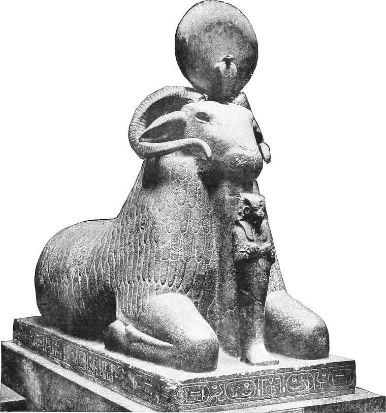
COLOSSAL RAM OF AMENHOTEP III. FROM JEBEL BARKAL, ORIGINALLY AT AMENHOTEP’S TEMPLE AT SOLIB—Berlin Museum.
Napata was also a place of much wealth. The kingdom whereof it was capital reached southward as far as the modern Khartoum, and south-eastwards stretched up to the Abyssinian highlands, including the valleys of the Atbara and its tributaries, together with most of the tract between the Atbara and the Blue Nile. This was a region of reputed great natural wealth, containing many mines of gold, iron, copper, and salt, abundant woods of date palm, almond trees, and ilex, some excellent pasture ground, and much rich meadow land suitable for the growth of dura and other sorts of grain. Fish of many kinds and excellent turtle abounded in the Atbara and the other streams, while the geographical position was favourable for commerce with the tribes of the interior, who were able to furnish an almost inexhaustible supply of ivory, skins, and ostrich feathers.
B.C 966-800.In course of time the Napata kingdom extended its sway to Aswan, and even to Thebes. The kings of the Twenty-second[224] (Libyan) Dynasty did not attempt to make Egyptian authority felt south of Aswan, and at last the Nubian opportunity came. B.C. 760-733.In about 734 B.C., Piankhi, King of Napata, seeing the weakened and divided sway of the Twenty-third Dynasty, chose a favourable moment in the revolt of Taf Nekht, Prince of Sais and Memphis, swooped down on Egypt, assaulted and occupied Memphis, and became master of the country. Bak-en-Renf, sole representative of the Twenty-fourth Dynasty, was killed; the whole of Egypt, with the exception of a portion of the Delta, became a province of Ethiopia, B.C. 730-667.and the Twenty-fifth Dynasty was composed of Ethiopian princes.
These Kings were named Shabaka (Sabaco), Shabataka, and Taharka (Tirhakah), the latter of which trio delivered B.C. 700.Hezekiah from Sennacherib. He was, however, heavily defeated by Esarheddon, son of the latter, somewhere near Tel-el-Kebir, B.C. 672.and Egypt was overrun by the Assyrians.
Fierce fighting continued for the next 20 years between Ethiopia and Assyria over the prostrate body of Egypt, and the latter was reduced to utter ruin. B.C. 652.Finally Mi-Ammon-Nut, Prince of Napata, and son (?) of Taharka, partly relieved the country from the Assyrians, but he had no successors, and died soon afterwards.
B.C. 650 (?).Psammetichus I (Twenty-sixth Dynasty), of Libyan descent, finally shook off the Assyrian yoke a few years later. His connection with Ethiopia is chiefly confined to the fact that a large number of his troops (200,000 to 240,000, according to ancient authorities—but this number must be grossly over-stated) quitted him as a protest against the favouritism shewn to his foreign (Greek and Lydian) mercenaries, and took service with Ethiopia. B.C. 648 (?).Several versions of this story exist, but no serious disturbance of the balance of power would seem to have resulted. Herodotus states that they[148] were given land to the south of Meroe, in the land of the Macrobii (Sennar?). B.C. 590 (?).His descendant Psammetichus II appears to have attacked Ethiopia, and it is stated that Nebuchadnezzar II, after beating Necho, the previous king, made a fruitless expedition into Nubia.
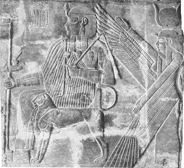
ETHIOPIAN KING FROM MEROË (BAGARAWIYA)—Berlin Museum.
B.C. 566.As far as can be gathered the following kings of Ethiopia succeeded Piankhi between about 730 and 525 B.C.; little is known about them except what is given below:—
Ra Usr Maat.
Mer-Ka-Ra.
Wach-Ka-Ra.
Aspelta, 625 B.C. Killed a colony of raw-meat-eaters at Barkal.
Pankhaluru, before 560 B.C.
Heru-Sa-Atef, Amen Sa Meri. A great warrior. 560-525 B.C.
Nastasenen, 525-517 B.C. Ruled over Kenset and the kingdom of Alut (Napata and Soba?); conquered many people.
[225]Between the years 625 and 560 the capital seems to have been shifted from Napata to Meroe. The kingdom ruled by these monarchs included Alwa, a place identified with the later Soba on the Blue Nile. The connection with Egypt was weakened; Heru-Sa-Atef found the royal palace at Napata in ruins and restored it; his successor Nastasenen re-visited it and went on a journey of inspection as far north probably as the 3rd Cataract, but Meroe was the principal seat of his kingdom. Nastasenen mentions on his inscription five campaigns, apparently against the rich pastoral peoples of the Eastern Desert, from whom he captured in all nearly 2,000,000 head of cattle, sheep, goats, etc. At Meroe, about 40 miles to the south of the Atbara, at a place now termed Bagarawiya, were built temples and pyramids copied from Napata.
It was in his reign that, according to Herodotus, Cambyses, first king of the Twenty-seventh Dynasty (Persian), sent an Embassy into Ethiopia, and on this being received by the natives with jeers, collected a large army and sent it south against them. B.C. 527He detached 50,000 men from the army when it arrived at Thebes against Siwa, or more probably Kharga, Oasis, but these were all overwhelmed by a sandstorm and were never heard of again. The remainder, ill-supplied with food or transport, marched into a desert on the way south, ate their transport animals, and finally began on each other; the greater part undoubtedly perished of hunger and thirst. It is impossible to trace where the disaster happened (Arbain road?), but it appears not to have been very far south, perhaps no further than the latitude of Aswan. The latest critic (Heinrich Schäfer) argues from Nastasenen’s inscription that Cambyses sent, in concert with the desert expedition, another one by river. This latter expedition seems to have reached the 3rd Cataract, where it was met and defeated by Nastasenen; this is, however, not yet universally accepted. Cambyses is reported to have himself reached the “Island” of Meroe, to have built a town there, and to have named it after his sister Meroe, who died there; but this is certainly a fable.
Between B.C. 525 and 260 came 11 more kings, but their chronology is more than doubtful, and little is known of them beyond their names, which are as follows:—
These names are here given for reference in case of future discoveries.
B.C. 300.About 300 B.C. (?), or perhaps earlier, the frontier of Egypt was then fixed at a point about 80 miles south of Aswan.
B.C. 260.Ark Amen, better known as Ergamenes, who was brought up at the court of Ptolemy II, was a man of some character, for besides building a temple at Dakka he set a new fashion in Priest-Kings by refusing to commit suicide at the request of the priests and by executing those who demanded it.
B.C. 210.In the days of Ptolemy V, Nubia caused trouble to Egypt, and the Egyptian king added the country between Aswan and Napata (?) to his possessions, dividing it into 13 districts.
In later Ptolemaic times the kings of Ethiopia evidently became more negroid, and owned barbaric names; and as time went on, the Kingdom of Meroe seems to have been governed by a series of queens or queen-mothers, bearing the title of Candace. Little is known of this period.
B.C. 30.When Egypt became a Roman province, an embassy from Ethiopia arrived at Philæ, and the king of the country near Khartoum was taken under Roman protection.
B.C. 22.Eight years after, a Queen Candace attacked Aswan and routed the Roman garrison there. She was, however, heavily defeated by the Prefect Petronius, who pursued her as far as Napata (?) and destroyed that town, leaving Roman garrisons there and near to Dongola.
A.D. 200.In the time of Strabo, who visited Egypt during the government of Ælius Gallus, Petronius’s successor, Aswan was again the frontier, the Romans having, as he observes, “confined the province of Egypt within its former limits.” Philæ then belonged “in common to the Egyptians and Ethiopians.” This did not, however, prevent the Cæsars from considering Lower Ethiopia as belonging to them or from adding to the temples already erected there.
The descendants of the priest-kings of Ethiopia seem to have died out about A.D. 200.
[226]Strabo says the Ethiopians above Aswan consisted of the Troglodytæ, Blemmyes, Nubæ, and Megabari. The Megabari and Blemmyes inhabited the Eastern Desert north of Meroe, towards the frontiers of Egypt, and were under the dominion of the Ethiopians.[149] The Ichthyophagi[150] lived on the shore of the Red Sea; the Troglodytæ, from Berenikê southwards, between it and the Nile; and the Nubæ, an “African” nation, were on the left bank, and independent of Ethiopia, which country, he states, did not extend north of Halfa.
A.D. 296.From Procopius we learn that in A.D. 296, in the reign of Diocletian, these Nubæ, or Nobatæ, were brought from the Oasis of El Kharga, and given the country above Aswan, on condition of their protecting Egypt against the incursion of the Blemmyes. This treaty was annually ratified by a religious sacrifice, according to the rites of the ancient Egyptian religion, on the Island of Philæ, in which the Roman garrison took part. There are still the remains of the wall which Diocletian built across the valley near here; and, according to some authorities, not venturing to trust entirely to the Nubians to defend the Egyptian frontier, he agreed to pay a yearly tribute both to the Nubians and the Blemmyes.
A.D. 330.A few years afterwards two young Christians of Tyre, Edesius and Frumentius, were, on their return journey by sea from India (?), kidnapped on the coast of Abyssinia. According to their story they became advisers to the widow of the king who had captured them, and used all their influence to promote Christianity in the land. They succeeded so well that Frumentius, on his return to Alexandria, was consecrated by Bishop Athanasius and returned to Abyssinia, where he spent the rest of his life in proselytizing, with excellent results.
Little or nothing is known of the history of internal or Upper Nubia during these centuries, but the Blemmyes continued to give trouble to the Roman rulers of Egypt. They gradually succeeded in occupying the five towns of the Commilitium Romanum, making Talmis or Kalabsha their capital, and even penetrated into the Thebaïd, A.D. 451.where in A.D. 451 Maximinus, the general of Marcian, was forced to make a treaty with them for 100 years. But it was soon broken by the barbarians.
A.D. 400-500.In the fifth century the Nubians, whose religion at that time was chiefly limited to star-worship, were gradually converted by monks and others of the Alexandrian Church. The first important convert was one Bahriya (?), nephew of the king, and he built many churches and monasteries.
A.D. 545.During the sixth century the entire nation adopted Christianity. In A.D. 545 their King Silko defeated the Blemmyes and took the already well-known town of (old) Dongola for his capital.
The Egypto-Roman-Christian remains at Nagaa[151], and those of the kingdom of Alwa, or Soba, then under the King of Nubia, may belong to this or even to an earlier period, for there are legends of Christianity having penetrated to the Blue Nile in the third century, and St. Mark is reported to have preached in the Sudan, or at all events, in “Ethiopia,” in the first century, A.D. 1.
A.D. 560.In the days of Justinian there seems to be no doubt that Christianity was the established religion of the whole of Ethiopia and Nubia.
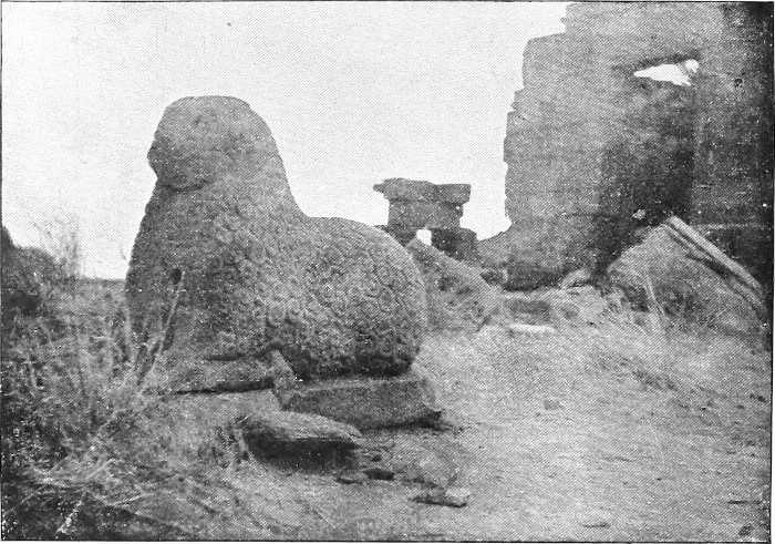
ONE OF THE ANIMALS AT NAGAA.
[142]Authorities:—Acknowledgments to the works of Dr. Budge, Prof. Rawlinson, Mrs. Butcher, etc., as mentioned in Appendix H, and to some notes of Mr. Crowfoot, for history up to a.d. 1493.
| A.D. | 1493 to 1837. | — | Col. Stewart, “Report on the Sudan, 1883,” and various other writers. |
| „ | 1837 to 1882. | — | From “Report on the Egyptian Provinces of the Sudan.” I.D., 1884. |
| „ | 1882 to date. | — | Compiled from various authorities, mainly Col. Wingate’s works, Intelligence Reports and Publications, &c. |
[143]Ethiopia is nowadays considered to mean Abyssinia, and is the word employed by the ruler of that country to denominate his dominions.
[144]Vide also Appendix E.
[145]This lady sent a large (five-ship) trading expedition to Punt, and did much business in gold, incense, and gum, in consequence.
[147]e.g., Abu Simbl, Gerf Husên, Derr, Wadi Sebûa, etc.
[148]Referred to by Herodotus (430 B.C.) as Automoloi; their descendants were later known as Sebridæ or Sembritæ, see p. 319 for an explanation of the story.
[149]Query—the ancestors of the present Bisharin and Ababda?
[150]The inhabitants of Elephantine Island, Aswan, were also thus termed in the 6th century B.C.
FROM THE ARAB INVASION TO THE TIME OF MOHAMMED ALI.
A.D. 640. A.D. 643.After the Arab invasion and conquest of Egypt, Abdalla ibn Said was sent by ’Amr, at the command of Omar, with 20,000 men (?) into Nubia. The natives, however, offered a most stubborn defence and fought to the death. Their bowmen showed particular skill, and although the Moslems were eventually victorious, they judged it expedient to retreat across the frontier. The Nubians now exhausted themselves in objectless raids northwards, and irritated the Arabs to such a pitch, A.D. 653.that ten years afterwards, the same general marched again into the country with the resolute purpose of subduing it.
The result was that Abdalla penetrated as far as (old) Dongola, bombarded the great church there and laid it in ruins. King Kalidurat thereupon concluded a friendly treaty with him, the chief clauses of which were that he should supply 400 slaves a year, and allow the Mohammedans to build a mosque at Dongola.
A.D. 700.As regards the rest of the Sudan, it is said that between the first and second century after the Mohammedan Era the Arabs of the tribe of Beni Ommia, being hard pressed by the Beni Abbas tribe, began to emigrate from Arabia in small numbers to the opposite shores of the Red Sea, and to settle in the districts about Sennar, on the Blue Nile. Whether the Beni Ommia led the van of the great Arab invasion it is impossible to say, nor is it known whether all the tribes chose the Red Sea road. Some authorities appear to think that several came into the Sudan from Egypt and Marocco.
Be this as it may, the fact remains that the Beni Ommia settled gradually in the districts round Sennar, the inhabitants of which were negroes belonging to the tribes of Fung, Hameg, etc.
The Beni Ommia, becoming gradually stronger, by degrees succeeded in becoming the masters of the whole of the Sennar districts, and converted the negroes to Islamism.
During the next two centuries the ever-increasing demands of the Arabs for slaves began to press on the country, and the Christian kingdoms, which had meanwhile been increasing in population, refused to pay tribute in this commodity.
Many Arabs began now to settle in the Sudan, and purchased lands from the inhabitants. In order to put a stop to this, Zacharias, King of Nubia, despatched his son, George, through Egypt to Baghdad, to see how the land lay. A.D. 831.He was graciously received by the Khalif Mutassim, who loaded him with presents, and gave him a house in Cairo. Eventually he returned after most successful negotiations, and all idea of open rebellion was dropped by the Nubians.
Nearly 50 years later Nubia was the scene of a filibustering expedition on a large scale. A.D. 878.One Abu Abdelrahman “el Omari,” hearing of the ancient gold mines in the Eastern Desert, equipped a party to work them. He found a great deal of gold, but being obstructed by the local Arabs, he gradually pushed his way to Shankir, south of Dongola, and with his increased following attacked the Nubians under King George and beat them. His subsequent adventures read like a romance, A.D. 880.but he was eventually driven out and murdered.
A.D. 950.In the following century the Christian kingdoms gradually became strong enough to resist the Arabs, and on occasions they even invaded Upper Egypt. A.D. 956.In A.D. 956 the Nubians seized Aswan, but were cut off by a flanking movement instituted from the Red Sea, by the Moslem General Kafur, and lost Deir Ibrahim, a stronghold 136 miles south of Aswan.
A.D. 967.Eleven years later, however, they again invaded Egypt and recovered their country as far as Akhmim.
A.D. 969.Two years afterwards Johar, a Greek renegade general of the Khalif Moiz, seeing the necessity of guarding his southern frontier, sent an embassy to the then King of Nubia (another George), inviting him to embrace Islam and pay his tribute as of old. The chief ambassador was one Ahmed ibn Solaim, and the account he writes of the Sudan in those days is exceedingly interesting.
He describes the province which extended from 6 miles south of Aswan to Halfa as well-watered, carefully cultivated and abounding in vineyards. Beyond this no Moslems were allowed inside Nubia on pain of death. Between the 2nd and 3rd Cataract was a terrible desert, from which, however, precious jewel-polishing stones were obtained (?). Beyond this lay the kingdom of Makorra, with capital at Dongola, and south of this was the Kingdom of Alwa, which was stronger and more fertile, but did not produce so many vines and palms as Makorra. Both kingdoms he describes as being amazingly fertile in herds and crops, far more so than Egypt (!).
[228]He arrived at Suia (Soba), capital of Alwa, which was situated at the confluence of the Blue and White Niles, and, besides noting the excellence of their camels, horses, meat and beer, states that the town was “adorned with magnificent buildings, great houses, churches enriched with gold, and gardens. The King also wears a crown of gold, for this metal is very abundant in his dominions.” Amongst other things he remarks that the Christians belonged to the Jacobite Church of Egypt, and that their books, originally written in Greek, had been translated into their own language. He also refers to a road leading from Shankir to Suakin.
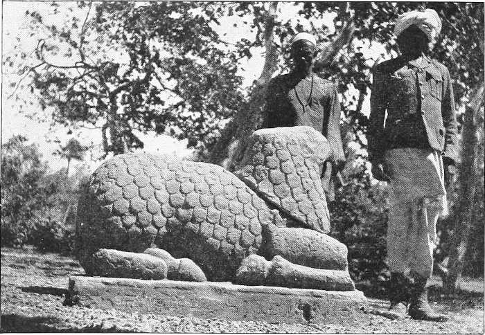
THE LAMB IN THE PALACE GARDEN AT KHARTOUM. (Brought from Soba.)
Ibn Solaim’s mission met with every courtesy but no success, and his report convinced Johar that he would act wisely in leaving Nubia severely alone.
A.D. 1092.In A.D. 1092 the Kings of Ethiopia and Nubia were so powerful that the Moslems of Egypt feared to persecute the Christians; A.D. 1172.but 80 years later the Nubians were conquered by the brother of Saladin and forcibly converted to Mohammedanism.
A.D. 1227.Fifty years afterwards the Nubians were again defeated and gave up to Egypt the Northern part of their Kingdom.
A.D. 1271.In A.D. 1271 King David of Nubia attacked Aswan, but was repulsed by the Khalif Bibars. The Mohammedans overran Nubia as far as Dongola, seized the northern province and imposed onerous conditions, one of which was the revival of the slave tribute.
A.D. 1287.Sixteen years later the Khalif Kalaun sent another expedition to Dongola, beat King Shemamun, left a garrison and retired. The Nubians promptly expelled the garrison, and the expedition was repeated, only to end in the same result. Thenceforward Shemamun was left in peace.
From this time onwards the Sudan apparently became the hunting ground of rival Arab slave-dealing tribes. The Christian kingdoms at last took to fighting among themselves, and their downfall became a mere question of time.
A.D. 1317.Thirty years later the great mosque was built at (old) Dongola, and kept up by the Christian inhabitants.
A.D. 1325.In A.D. 1325 the Moslems persecuted the Christians in Egypt to such an extent that the King of Abyssinia threatened to divert the Blue Nile unless they ceased.
A.D. 1375.Fifty years later we find civil wars and slave trade rife in the Sudan, whilst in the region of Aswan the Kenz, royal descendants of Ethiopia, pursued the trade of brigands, much to the detriment of all communications.
A.D. 1493.The rise of the kingdom of Sennar now commenced. By degrees the distinction between Arab and negro on the Blue Nile had diminished, whilst in 1493 the name of Beni Ommia is no longer heard of, and the old tribal names of Fung, Hameg, and others reappear.
In that year Amara Dunkas, the Sheikh of a sub-section of the Fung, either through the fortune of war or his superior capacity, succeeded in getting himself declared king of all the Fung tribes. He then allied himself with Abdulla Gemda el Kerinani, the powerful chief of the Keri district (east of the Blue Nile), and conquered all the country on both sides of the river between Fazogli and Khartoum.
These districts were inhabited by negroes belonging to the Nuba tribes, some of whom after the conquest remained[229] in the country, while others emigrated into the mountains of Fazogli and Kordofan. Those who remained embraced Islamism, intermarried with their conquerors, and, losing their language and nationality, were soon lost in the tribes known collectively under the name of Fung.
Of these tribes some settled in towns, while others retained their nomad habits, such as the (1) Khamir, (2) Rebia, (3) Kakhtan, (4) Kenana, (5) Kawahla, (6) Geheina, (7) Beni Shaker, (8) Beni Ziban, (9) Beni Abbas. From this last have descended the Kababish, Ferara, Beni Selim, and Ahamda. The latter two tribes are Baggara, or owners of cattle and horses. (Vide p. 179 and Appendix F.)
Some of these tribes are now to be found along the banks of the White and Blue Niles.
A.D. 1523.In 1523 Amara Dunkas was succeeded by his son Abdul Kader.
A.D. 1539.In 1539 Abdul Kader was succeeded by his son Nule.
A.D. 1545.In 1545 Nule was succeeded by his son Amara.
Amara was surnamed Abu Sakakin; during his reign Sheikh Abdalla Gemáa died, leaving the Province of Keri to his son.
A.D. 1553.In 1553 Amara died. Between that date and 1596 four kings, all of the family of Dunkas, succeeded each other.
A.D. 1596.In 1596, in the reign of Adlan, Sheikh Agib, a descendant of Gemáa and Governor of Keri, rebelled. Adlan defeated him near Alati. His children fled to Dongola, whither Adlan sent Sheikh Idris to offer them a free pardon and invite them to Sennar. They came, and Adlan invested the eldest with the Government of Keri.
This emissary of Adlan’s, Sheikh Idris, was celebrated for his ability. He is also said to have lived to the great age of 147. During this reign many learned men came from Cairo and Baghdad.
A.D. 1603.In 1603 Adlan was succeeded by his son Baadi.
A.D. 1606.In 1606 Baadi was succeeded by his son Rubat.
A.D. 1635.In 1635 Rubat was succeeded by his son Baadi Abu Dign (Father of the Beard).
This King attacked the Shilluk negroes and took a large number of slaves. The Shilluk inhabited the country on both sides of the White Nile south of Kawa. Thence he invaded the mountains of Tagale and destroyed Kordofan, where he again took a large number of slaves. On his return to Sennar he built a number of villages in that district for his prisoners.
The prisoners named these villages after those they had left, hence the number of villages now near Sennar with names similar to those in the Jebel Nuba, Tagale, and other districts about Kordofan.
In time these slaves supplied the Kings of Fung with recruits for their armies.
Besides his warlike enterprise, Baadi built the mosque now at Sennar, and furnished it with copper window bars.
A.D. 1671.In 1671 he died, and was succeeded by his son Ansu. During this reign there was a great famine and an outbreak of small-pox.
A.D. 1683.In 1683 Ansu was succeeded by his son Baadi el Ahmar. In this reign a number of the Fung tribes and the people of Keri under their prince, rebelled, but they were defeated with great slaughter, and the Prince of Keri was killed. Sheikh Hamed Walad el Terabi, a celebrated Sheikh, lived during this reign. His tomb is now at Sennar.
In 1699 Dr. Poncet, a French physician, on his way to Abyssinia visited Sennar, and found it a powerful kingdom in a flourishing condition.
A.D. 1710.In 1710 Baadi was succeeded by his son Ansu II. This monarch caused such great dissatisfaction by his extravagance and debauchery that the Southern Fungs revolted, deposed the King, and placed a noble called Nur on the throne. This happened in 1714.
A.D. 1719.In 1719 Nur was succeeded by his son Gaadi Abu Shilluk. In this reign the Abyssinian King Kedem Yasu invaded Sennar with a large army. He was, however, defeated with great slaughter by Sheikh Amin, near the village of Tekiya on the Dinder River. It is said that the reason for this invasion was that some presents sent by the King of France to Abyssinia had been seized by King Baadi.
After this great victory the renown of Sennar spread in all directions, and eventually reached Constantinople. Crowds of learned and celebrated men flocked into the country from Arabia, Egypt, and India. Notwithstanding this, in 1758 Baadi, owing to his bad administration was deposed and exiled. He was succeeded by his son Nasser.
A.D. 1758.1758.—Under his rule the Hameg tribe became very powerful, and the Fung lost a great deal of their influence and prestige. In 1765 Nasser was killed by a rebellious vassal, and was succeeded by his son Ismail.
A.D. 1774.In 1774 Ismail was deposed, exiled to Suakin, and succeeded by his son Adlan. During this reign many intertribal wars went on both in Sennar and Kordofan,[152] and the power and influence of the Hameg grew so great that they eventually became the masters of the King.
A.D. 1786.In 1786 Adlan was deposed by the Hameg, and the kingdom of the Fung totally disappeared. Anarchy prevailed throughout the country, and the kings succeeded each other in such rapid succession that in the year 1788 four kings successively reigned. During the succeeding 33 years of anarchy the Hameg continued supreme, and under Sheikh Nasser they devastated the northern and eastern part of the Sudan with fire and sword.
FROM MOHAMMED ALI’S CONQUEST TO THE END OF 1882.
1819. Invasion by Mohammed Ali.In 1819 Mohammed Ali, hearing of the anarchy prevailing in the Sudan, and wishing to introduce the benefits of a regular government of civilisation, and at the same time to occupy his troops, ordered his son Ismail, with a numerous army of regulars and irregulars, with many learned men and artisans, to invade the country.
Ismail reached Khartoum without meeting with any resistance, and thence marched on to Sennar. Here he found that of the two rivals to the throne of Baadi, Adlan had been murdered by Regab, and the latter had fled, leaving the kingdom to the Fung claimant, Baadi. The latter, however, had resigned his claims to Ismail.
At Sennar Ismail was joined by his brother, Ibrahim Pasha, and they together advanced to Fazogli. Shortly after, Ibrahim returned to Egypt, and the report spread that Ibrahim had been killed in the Fazogli Mountains. The Arab nomads immediately rose, but Ismail returned, defeated the rebels, and appointed new Sheikhs. He then went on to Shendi, on the Nile. The Mek (ruler) Nimr (tiger) of that place, wishing to be revenged of all the cruelties and barbarities Ismail had been guilty of, invited him and his followers to a great banquet at Shendi. Ismail burnt at Shendi. 1822.During the banquet and while the guests were all more or less intoxicated, forage was piled round the tent and set on fire, and Ismail and all his followers perished (1822).
When the news of this catastrophe reached Kordofan, Ahmed Bey, the Defterdar, who had wrested that province from the Darfur Sultan, put himself at the head of a large army and marched on Shendi. When he reached Metemma, opposite Shendi, the inhabitants sent to ask for pardon. This was granted. One of the people, however, happening to throw a lance at the Defterdar, the pardon was at once rescinded, and a general massacre took place. The Mek el Nimr, however, escaped, and fled towards Abyssinia.
After this the Defterdar marched to Tuti Island, opposite Khartoum, where he again defeated the rebels with great slaughter. He then marched to Wad Medani, near Mesellemia, and then returned to Kordofan.
It is said that when Kordofan was conquered it was found that the Governor of the Province had the title of Magdum, which is a title only given to Palace eunuchs. It would appear that it was the custom of the Darfur Sultans to send eunuchs to govern provinces and districts.
1822.In 1822 Osman Bey was named Governor of the Sudan, and the Defterdar, Ahmed Bey, returned to Egypt. This was a year of rebellions and famines.
1826.In 1826 Maho Bey was appointed Governor. Immediately afterwards Khurshid Pasha became Governor. He was renowned for his rectitude and honesty. He led several expeditions up the White Nile against the Dinka negro tribe, opposite Kodok, and also into the mountains of Tagale. 1834.In 1834 he went to Egypt for a few months. Towards the end of that year he marched to the Abyssinian frontier to repel the attack of the Abyssinians who were coming to the assistance of the Sennar rebels. The Abyssinians were defeated, and Adlan, their leader, was taken and impaled. During this year cholera and other diseases ravaged the country. In 1836 the Abyssinians, after attacking the Gallabat provinces, retreated into their mountains.
Khurshid Pasha was the first Governor who taught the people of Khartoum to build with bricks, and to give up their huts made of skins and reeds. 1839.In 1839 he was recalled to Egypt, and was succeeded by Ahmed Pasha Abu Udn (Father of Large Ears).[153]
The annexation of the Sudan provinces thus took place more than three-quarters of a century ago. Mohammed Ali having dispersed the Mamelukes, and made himself master of Nubia, turned his attention towards the districts bordering the White and the Blue branches of the Nile. Gold was doubtless his main object, for he had heard rumours of mines of vast wealth; but we must also give him credit for an honest intention to introduce commerce and civilisation into the midst of the Negro tribes.
[232]Expedition by Mohammed Ali, 1838.In the autumn of 1838 Mohammed Ali himself, at the age of 69, started to visit Fazogli, and in 1840 and following years three large expeditions were organised. Although gold was not found in any important quantities, the provinces were reduced under Egyptian sway, the navigation of the White Nile was declared free, military stations were established on both rivers, and many slaves were brought back to swell the ranks of Mohammed’s army. Whatever may have been his dreams of civilisation, the result of Mohammed’s expedition and consequent government was to establish at Khartoum, not only the capital of the Sudan provinces, but also a central mart for a huge slave trade.
The provinces thus annexed were Kordofan, Sennar, and Taka (Kassala).
Abbas Pasha, 1848-1854.Abbas Pasha, grandson of Mohammed, who ruled Egypt from 1848 to 1854, kept up his authority in the Sudan provinces by means of a large force, which was necessary for the purpose of collecting taxes from a discontented population. In 1853 the most southern Egyptian settlement was about 120 miles south of Khartoum, but in that year the first trading voyage to the Upper Nile was started by Mr. Petherick, the English Consul for the Sudan. He was soon followed by other traders, who established posts far up country, and organised armed bands under the command of Arabs. It was soon found that slave hunting paid even better than ivory, and raids were made on the surrounding tribes.
1854-1868.Said Pasha, the successor of Abbas, found the country in a deplorable condition; exhorbitant taxes, a depressed agriculture, and a disordered administration openly encouraging an open slave trade.
Said Pasha reorganises Government at Khartoum, 1857.With the resolution of organising a better state of things, Said, in the year 1857, made a rapid tour through the provinces in question. At Berber he proclaimed the abolition of slavery, and at Khartoum he organised a new government for the five provinces then comprised in the Sudan, i.e., Kordofan, Sennar, Taka, Berber and Dongola. He ordered that the excessive taxes on the lands and waterwheels of the people should be discontinued, and postal services on fast camels organised across the desert. About the year 1860 the European traders sold their stations to their Arab agents who paid rental to the Egyptian Government, and the misery and ruin were increased tenfold.
To Said Pasha is due the first idea for making a railway to unite the Sudan with Lower Egypt; Mougel Bey was ordered to report on the subject, but the probable expense caused the project to be abandoned.
Source of the Nile discovered.The sources of the Nile had long been the object of much speculation, but comparatively little had been done to solve the question. Towards the latter end of the eighteenth century, Bruce had tracked the Blue Nile to its origin in the Abyssinian mountains, but the White Nile remained unexplored till Speke and Grant, carrying out in 1860-62 an expedition organised by the English Government, proved that the Victoria Nyanza, discovered by Speke[154] in July, 1858.1858, was the source of the Nile.
Sir S. Baker’s expedition in 1861.In 1861 Sir Samuel Baker started on an expedition from Cairo viâ Khartoum, with hopes of meeting the travellers in question, and of making independent investigations on his own account. He was successful in both ways, and his explorations resulted in the discovery, in 1864, of Albert Nyanza Lake. State of the Sudan in 1864.His description of the Sudan at this period under the governorship of a certain Musa Pasha gives a melancholy picture of the results of Egyptian rule. He describes the provinces as utterly ruined and only governed by military force, the revenue unequal to the expenditure, and the country paralysed by excessive taxation; shut in by deserts, all communication with the outer world was most difficult; and the existing conditions rendered these countries so worthless to the State, that their annexation could only be accounted for by the fruits of the slave trade.
Ismail Pasha, 1863.On Ismail Pasha coming to the throne in 1863, orders for the suppression of the slave trade were issued, and on Baker’s return journey in 1865, he found an Egyptian camp of 1,000 men established at Kodok in the Shilluk country for the purpose.
Scheme for railway again brought forward, 1865-66.In 1865-6 the Khedive again brought forward the scheme for a Sudan Railway, and a study of the country from Aswan to Khartoum was made by Mr. Walker and Mr. Bray, but nothing came of it. About the same time Mr. Hawkshaw recommended the canalisation of the 1st Cataract, but this was strongly opposed by Mr. Fowler, who proposed as an alternative to construct a ship incline over land, using the mechanical force supplied by the descending water.
Ismail Pasha not only determined to extend his territories, but seemed in earnest to put down the slave trade.
The traders were chiefly Arab subjects of the Khedive, and the traffic was being carried out under the cloak of legitimate commerce. Khartoum was the headquarters for the trading companies, who leased from the Governor-General of the Sudan certain districts nominally for carrying on the ivory trade, for which they bought the monopoly. In these transactions the Government did not hesitate to lease territories over which they had not a vestige of right; in fact, any portion of Central Africa south of Khartoum was considered open to them for selling the monopoly. The result was that certain traders established themselves in, and claimed a sort of proprietary right to large districts, especially in that part which lies to the South of Darfur and Kordofan, and borders the course of the White Nile, now known as the Bahr El Ghazal. Traffic in slaves was the real business carried on, and for this purpose the traders organised armies of brigands, and formed chains of stations, of about 300 men each, throughout their districts. Raids[233] were made on native tribes, who were obliged to submit, fly the country, or ally themselves to the slave hunters, to be used against other tribes; and anarchy prevailed throughout the country.
In order to carry out the reforms it was necessary to annex the Nile Basin, to establish a sound government and commerce, and to open the Equatorial Lakes to steam navigation. The Khedive accordingly issued a firman to Sir S. Baker on 1st April, 1869.1869, whereby he gave him absolute and supreme power over all the country south of Gondokoro.
Baker left Suez for Suakin in December, 1869, and proceeded to Khartoum, where the expedition was fitted out.
He experienced much opposition from officials, who were all more or less implicated in the slave trade. He also made the discovery that the very provinces he was about to annex were already leased by the Governor-General of the Sudan to a notorious slave-trader, named Ahmed Sheikh Aga, whose son in-law and partner, Abu Saud, was a still more notorious character.
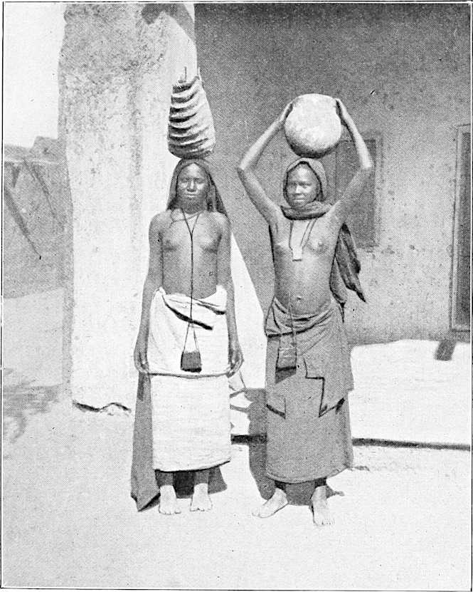
SUDANESE WOMEN.
Another expedition was being fitted out, at the same time, to the Bahr el Ghazal, for the purpose of establishing a settlement at some copper mines on the frontier of Darfur.
Annexation of Gondokoro, May 26th, 1871.In February 1870 Baker left Khartoum, and after several abortive attempts, with great difficulty succeeded in dragging his boats over the sudd in the Bahr El Zeraf and arrived at Gondokoro, and formally annexed this station, as “Ismailia,” on May 26th, 1871. In January, 1872, he left Gondokoro for the south, and on the 14th May of the same year, at Masindi, Unyoro annexed, 14th May, 1872.proclaimed Unyoro an Egyptian province. He organised military posts such at Masindi, Foweira, Fatiko, etc., and entered into friendly relations with M’tesa, the King of Uganda, thus establishing the Khedive’s rule to within 2° of the Equator. He dealt the slave trade a heavy blow by putting a stop to it in the annexed territory, as well as on the Nile, so that all exit for the traffic in the direction of Khartoum would have been closed if the officials could have been trusted.
[234]Baker returns to Cairo, August, 1873.In August, 1873, Baker returned to Cairo, and the Khedive put the Government of the Sudan on a fresh footing, by dividing it into provinces under responsible governors, more or less independent of the Governor of Khartoum. Thus Yusef Effendi was made Governor of Kodok, Ismail Yagub Pasha of Khartoum, and Hussein Khalifa of Berber.
1871. Railway scheme again taken up.In 1871 the railway scheme was again taken up; Mr. Fowler was employed by the Khedive to make careful surveys, and the result was an elaborately prepared project for making a line from Wadi Halfa, viâ Shendi, to Khartoum, with a plan for the passage of the 1st Cataract. Such a line would have been of vast importance in opening up the trade of Central Africa.
1874. Colonel Gordon appointed Governor of Equatorial Provinces.At the close of Sir Samuel Baker’s expedition, the Khedive, still anxious to consolidate his Empire, appointed Colonel Gordon, R.E., to carry on the work. Gordon arrived in Cairo early in 1874, and left for the scenes of his future operations on 21st February. His appointed task was to continue the reconnaissance of the Upper Nile, to establish a Government, and to destroy the slave trade. Accompanying him were Lieut.-Colonel Long, an American officer in the service of the Khedive, Lieut. Hassan Wassif, and a number of European civil employés. It was arranged that the territory over which the Governor-General of the Sudan now ruled was to be limited to the south by Kodok; Gordon to be Governor-General of the Equatorial provinces of the Nile, and the respective headquarters to be at Khartoum and Gondokoro.
Gordon left Khartoum in March, 1874, and reached Gondokoro the 15th of the following month, where he was cordially received by the Commandant, Rauf Bey. He found that the provinces in question were merely nominally under Egyptian control, there being but two garrisons, one at Gondokoro consisting of 450 men, 150 of whom were Egyptian soldiers, and a second at Fatiko of 200 Sudan soldiers. His first steps were to occupy Bor, an important position north of Gondokoro, and to send Colonel Long on an expedition to M’tesa, King of Uganda. Slave stations broken up, 1874.He then in June, 1874, proceeded to break up three large slave-trading stations on the Bahr el Zeraf, and established a strong post at the Sobat junction, so situated as to be able to arrest all illegal traffic on the river. The liberated slaves he, in accordance with their own option, planted at Sobat, and encouraged them to turn their attention to agriculture, it being one of his ideas that most of the wars between the tribes were caused by the great deficiency of food.
During the summer of 1874, Rauf Bey returned to Cairo, and was given the command of the Harrar country. Gordon sent Gessi about the same time to make an inspection along the Bahr el Ghazal.
Abu Saud, notorious in Baker’s time, had accompanied Gordon from Cairo. The latter, though aware of his character, knew him to be a man of great influence among the slave-dealing communities, and determined to turn him to account. On first taking over the government at Gondokoro, he made Abu Saud his lieutenant, and employed many of the other slave dealers under him. This, however, was of short duration; Abu Saud soon got beyond himself, and, showing his true character, was speedily dismissed by Gordon; while, towards the end of the year, a clean sweep was made of all the other slave-dealing Dongolese, whose intrigues had seriously hampered Long’s expedition.
September, 1874. Submission of chiefs round Gondokoro.On 11th September, 1874, 25 chiefs of the tribes round Gondokoro came in to pay homage to Gordon, a remarkable proof of the success of his rule, as up to this they had been at open enmity with the garrisons.
In October Yusef Bey, Governor of Kodok, intercepted a convoy of 1,600 slaves and 190 head of cattle from the stations of Ratatz and Kuchuk Ali on the Bahr El Zeraf.
About this time Gordon was making preparations for his expedition to the lakes. The sections of the steamers, which had been left at Gondokoro by Baker, were sent forward by carriers, to be put together at the Falls of Dufile, beyond which point there is a free passage to the lake Albert Nyanza.
It was decided to establish fortified posts at the following stations:—Labore, Dufile, Fatiko, and Foweira; this step was rendered necessary by the hostile attitude shown towards Colonel Long’s expedition by the King of Unyoro backed up by slave-traders.
1874. Representative sent to M’tesa.In consequence of the report of Colonel Long, who returned in October, Gordon arranged to send a trustworthy representative[155] to M’tesa, King of Uganda, who had shown himself to be friendly.
On the 21st November Gondokoro was abandoned as the headquarters in favour of Lado, a more healthy spot a few miles down the river, while another post was established at Rejaf, a short distance up the river.
At the close of the year 1874 Gordon reported the organisation of governmental districts along the whole line of his provinces, the chief stations being the following:—
1. Sobat, at the junction of the Sobat River with the Nile; garrison, 50 Sudan regulars.
2. Nasser, on the Sobat; garrison, 100 Dongolese irregulars.
3. Ghabatshambe (Shambe), 30 Sudan regulars, 150 Dongolese irregulars.
4. Makaraka, 20 Sudan regulars, 150 Dongolese irregulars.
5. Bor, 10 Sudan regulars, 150 Dongolese irregulars.
[235]6. Latuka, 10 Sudan regulars, 100 Dongolese irregulars.
7. Lado. Headquarters, 180 Sudan regulars, 50 Egyptian regulars.
8. Rejaf, 80 Sudan regulars.
9. Dufile (Ibrahimieh), 10 Sudan regulars.
10. Fatiko, 250 Sudan regulars, 100 Egyptian regulars.
11. Foweira, 100 Sudan regulars, 100 Egyptian regulars.
The results of the nine months’ work are summed up by the Egyptian General Staff[156] as follows:—
1st. The White Nile had been mapped with very considerable accuracy from Khartoum to Rejaf by Lieutenants C. M. Watson and Chippendall, R.E.
2nd. The slave trade on the White Nile had received a deadly blow.
3rd. Confidence and peace had been restored among the tribes round Gondokoro, who now freely brought in for sale their beef, corn, and ivory.
4th. The work of opening a water communication between Gondokoro and the lakes had been seriously commenced.
5th. Communications had been established with M’tesa, and the connection of Lake Victoria with Lake Albert, by the way of the Victoria Nile, demonstrated.
6th. Government districts had been formed and secure posts with intercommunication established.
7th. New expeditions were organised and ready to commence.
Conquest of Darfur, 1874.During the year 1874 an important addition was made to the Egyptian possessions in the shape of the Province of Darfur.
Gordon writes:—“Dar For and Dar Fertit mean the land of the Fors and the land of the Fertits. The Fors and the Fertits were the original negro inhabitants; then came in the Beduin tribes, who partially conquered the country and made the Fors Mussulmans, giving them a Sultan. The Fors and the Beduin tribes, the one stationary and the other nomadic, live in peace, for their habits are different.”
The country of Darfur had never been subjugated, but had been governed by its own Sultans in unbroken succession for more than 400 years.[157] The inhabitants were not of the true negro type, and the numerous wandering Arab tribes paid tribute to the Sultan and formed the bulk of his fighting men. Darfur enjoyed the celebrity not only as a centre of commerce, but also as a large slave depôt, a fact which appears from the following correspondence which passed between Bonaparte and Sultan Abd-el-Rahman, surnamed “the Just.” During the French expedition to Egypt, “the Just” wrote to Bonaparte “In the name of God the compassionate, the merciful,” saying he was glad to hear that he had conquered the Mamelukes. The reply was as follows:—“Au Sultan du Darfour, 12 Messidor, an VII, au nom de Dieu, clément et miséricordieux, il n’y a d’autre Dieu que Dieu! au Sultan du Dar-fur Abd-el-Rahmân.
“J’ai reçu votre lettre: j’en ai compris le contenu; lorsque votre caravane est arrivée j’étais absent ayant été en Syrie pour punir et détruire nos ennemis. Je vous prie de m’envoyer par la première caravane 2,000 esclaves noirs ayant plus de 16 ans, forts et vigoureux: je les achèterai pour mon compte. Ordonnez votre caravane de venir de suite, de ne pas s’arrêter en route: je donne les ordres pour qu’elle soit protégée partout.
Le Général-en-Chef Bonaparte.”
Bellal’s expedition to Bahr El Ghazal destroyed by Zubeir, 1869.Dating from the days of Mohammed Ali’s expeditions, Darfur was in constant dread of Egyptian aggression, and the country was practically closed to all Europeans, who were regarded as spies. For many generations Darfur had sent annually a caravan containing ivory, feathers, gum, slaves, etc., to Egypt, bringing back in exchange cloth, beads, firearms, etc. In 1874, the slave trade having been stopped in Egyptian territory, the Governor of the Sudan seized all the slaves belonging to the caravan of that year; this was one of the causes which led to a rupture with the Sultan of Darfur.
In 1869 the power of the slave dealers in the Bahr El Ghazal had become so great that they refused to pay their rentals to the Egyptian Government. Conspicuous among them was a certain Zubeir Rahama, who, according to Dr. Schweinfurth, lived in princely style and was regarded as a kind of king.
With the object of re-establishing his authority in the Bahr El Ghazal provinces, and also of conquering Darfur, the Khedive sent a small force under the command of Bellal. This force was destroyed by Zubeir, who became the chief power in the country. The Sultan of Darfur, in the meantime, to meet Bellal’s threatened attack, had placed[236] an embargo on corn along his southern frontier. This incensed the slave traders, who drew their supplies from Darfur, and a further cause of quarrel was the invasion of Bahr El Ghazal territory by Darfur troops in pursuit of slaves. Zubeir accordingly prepared for an invasion of the province. The Egyptian Government, seeing the danger of his acquiring fresh strength, determined upon taking the conquest into their own hands, giving out as a pretext that the repeated hostile expeditions of the Sultan had made it necessary to occupy Darfur. Two expeditions were accordingly organised—one from the north under the command of Ismail Yagub Pasha, and one from the south under Zubeir. In one of the ensuing battles the Sultan and two of his sons were killed, and Darfur fell into Egyptian hands. Zubeir was made a pasha, but he claimed a right to be made governor-general of the new province, and his acknowledged power was likely to make him formidable. His request, however, was refused, and though at first he intended to assert his independence, he, in the end, decided to push his claim at Cairo. Here he was, however, detained,[158] his son, Suleiman, of whom more hereafter, meanwhile taking his place in the provinces.
Exploration of Darfur and Kordofan, 1874.Darfur having thus become an Egyptian province, the Khedive sent out two scientific expeditions, composed of staff officers and attachés, to report on the capabilities of the country. These left Cairo on the 5th December, 1874: one, under Colonel Purdy, was to enter Darfur on its northern frontier; the other under Colonel Colston, by the east from Kordofan. The latter expedition was afterwards commanded by Major Prout, when Colston was incapacitated by sickness. Reports of these expeditions were compiled by the Egyptian General staff.
The relations between Egypt and Abyssinia have an important bearing on the history of the Sudan, and in future years are likely to exercise a still further influence on this portion of Africa.
The Turks and Arabs never succeeded in subjugating this country, although many attempts were made to that end. As far back as the sixteenth century the Turks had seized the port of Zula on the Red Sea, and in later times Suakin and Massaua; but, though based on these ports, they could make no headway into the Abyssinian hills, nor even occupy the coast provinces from Massaua to Suakin. During the aggressions of Ismail, son of Mohammed Ali, the Egyptians and Abyssinians came into collision from Kassala to Gallabat, and the Abyssinians were gradually pushed back to the mountains as their boundary, being hemmed in on all sides by Turks, Egyptians, and the tribes of the Galla country.
Massaua transferred to Egypt, 1866.In 1866 Turkey transferred her interest in Massaua to Egypt in consideration of an increased tribute, and in 1867 the Khedive claimed authority as far as Zula, which is situated in Annesley Bay. English expedition, 1868.Early in 1868 the English expedition to Abyssinia took place, and the Khedive, wishing for the countenance of England in his present and possible future encroachments on the Red Sea coast, did all in his power to assist the undertaking. Egyptian troops were offered to the British Government, though not accepted, and Kassala and Gallabat were spoken of as possible bases of operations. All this did not tend towards creating a good feeling between Egypt and Abyssinia.
When the Khedive, Ismail Pasha, was arranging his Sudan railway scheme, he proposed to make a branch line to Massawa, which would necessarily pass through the province of Bogos.
The Khedive claimed that Bogos had been conquered by Mohammed Ali, though as a matter of fact the borderland only had been held by the Egyptians, whilst the Abyssinians denied that they had ever relinquished their rights to the territory. Border war had been maintained till Said Pasha, the former Khedive, had withdrawn his troops, and Bogos for many years had remained neutral ground.
In the summer of 1874 there was a certain Swiss resident at Massaua named Munzinger, who acted as consul for both England and France. Keren, capital of Bogos, occupied, 1874.Seizing the opportunity of the King of Abyssinia being at war with the Gallas, the Egyptian Government employed Munzinger to occupy Keren, the capital of Bogos, with 1,500 men. About the same time, Egypt also acquired the territory of Ailet, a province lying between Hamasen and Massaua, by the treachery of the Governor, who sold it to the Khedive.
Against these acts the King appealed to Europe, and especially to England, sending as his envoy Colonel Kirkman, a Scotchman, then in the service of King Johannes, but who had formerly been with Gordon in China. This mission had no practical result, and the relations between Abyssinia and Egypt were more strained than ever.
Port of Zeila purchased by Egypt, 1875.In 1875 the Khedive purchased from the Sultan, for about £15,000 a year additional tribute, the port of Zeila, the base from which for many centuries Turk and Arab had unsuccessfully attacked Abyssinia; and in fact acquired at the same time all the Sultan’s nominal rights to the coast country from near Tajura to a point on the Indian Ocean, including Berbera, the transfer actually taking place in autumn, 1875.
Harrar annexed, 1874.The province of Harrar was annexed by an expedition under Rauf Pasha, whom, it may be remembered, Gordon had relieved at Gondokoro in 1874. After the death of Emir Ahmed, Sultan of Harrar, mentioned by the traveller Burton, the inhabitants made Khalifa Sitra Emir. He was deposed after a three days’ reign by Mohammed; the latter oppressed his subjects, favouring the Galla tribes, and bullying the Mussulmans. The people asked the Khedive to take possession, and in the year 1874, Rauf Pasha, being sent up for the purpose, met with little opposition. He began his government by the unnecessary act of causing the Sultan to be strangled. The Sultan’s son went to Cairo to complain, but nothing was done.
1875.Early in 1875 Gordon heard ill reports of Kabarega, King of Unyoro, who, with the old slave traders, was meditating treachery. He had already cleared his province of all those traders on whom he could lay hands, but 50 of them had escaped him, and taken themselves to the chief above mentioned. Rionga, Kabarega’s rival, now received Gordon’s support.
From the experience gained it became evident to Colonel Gordon that, in order to open up the Equatorial provinces, an outlet to the eastern coast must be made. The Nile was found to be impracticable as a waterway, owing to the numerous rapids, the obstruction formed by floating masses of vegetation (sudd), and the scarcity of wood. And as Gordon writes from Lado: “The only valuable parts of the country are the highlands near M’tesa, while all between this (Lado) and Khartoum is wretched marsh.”
1875.In January, 1875, Gordon proposed to the Khedive that he should establish a station at Mombasa Bay, 250 miles north of Zanzibar, and also take Formosa Bay, or rather a point, where the Tana and Ozi debouch, to the north of it. In making this proposition he was under the impression that the Tana was navigable as far as Mount Kenia, and that Lake Baringo was connected with the Victoria Nyanza, neither of which suppositions are true. The Khedive on his side proposed the mouth of the Juba as a base, and fitted out an expedition for the purpose of occupying it, of which more hereafter.
Gordon now set himself to transport a steamer from Lado to the lakes. The difficulties he had to contend with were very great, including the hostility of the border tribes, the obstacles to navigation, and above all, the useless material of which the Egyptian troops were composed. The heavy parts of the steamer had to be carried separately in large Nile boats (nuggars) to Dufile Falls, above which and up to the lakes the river is navigable. As he advanced, stations were established along the west bank of the river. This bank was more secure from attack by natives, as the mountains came within eight miles of it, and limited the sphere of their operations; while on the east bank the Bari tribe was very hostile. A party under Linant, one of Gordon’s officers, was here surprised and massacred.
As regards the finances of the expedition, Gordon writes from Muggi, in August, 1874:—“In a year he (the Khedive) has had £48,000 from the province, and I have spent, say, £20,000 at the outside, and have £60,000 worth of ivory here.” In September he says that he was entirely independent of the Sudan Government as regards supplies, and could raise them from his own resources. In this month parties were sent out to levy taxes in the shape of cattle on the hostile tribes, which had a salutary effect in keeping them quiet.
During Gordon’s absence, the Shilluk tribes in the neighbourhood of Kodok rose in rebellion against the oppression of the Government, and, had it not been for the presence of Gessi Pasha.Gessi there at the time, Kodok would probably have been lost. Gessi was an Italian adventurer of great force of character; he joined Gordon’s staff in the summer of 1874, having, during the Crimean war, acted as interpreter to British troops.
The steamer reached Labore in December, great difficulties having been met with in getting the boats conveying it up the rapids.
The Juba River Expedition, 1875.In the autumn of 1875 the Khedive, having long had under consideration the advantage of opening up a line of communication from the Indian Ocean to the central provinces, sent out what is known as the Juba River Expedition. The command was given to McKillop Pasha (an English naval officer who died in 1879, and he was accompanied by[238] Colonels Ward and Long, the former to survey the harbours along the coast and the latter to command an inland expedition. Colonel Gordon was to co-operate from the direction of Victoria Nyanza.
The anchorage at the mouth of the Juba River having been found inferior, the Expedition ran several miles further south to Port Durnford and the harbour of Kismayu; but here they encroached on the territory of the Sultan of Zanzibar. Several interests now clashed with the success of the enterprise. The British Government were bound more or less to the Sultan by treaties concerning the slave trade. The merchants of Zanzibar became alarmed for their equatorial trade, and the people of Aden for their supplies from the Somalis, who had been independent till Egypt had acquired a portion of their territory and levied taxes at their ports. The result was that, at the instance of Great Britain, the Egyptian Expedition was given up, but, on the other hand, the Khedive’s authority along the coast, as far as about 10° north lat. was tacitly acknowledged. Ismail Pasha was thus encouraged to think that he was entitled to the whole of the Red Sea coast, and could resist any pretensions of the Abyssinians to a port; while England believed that she had erected a safeguard against European settlement on the coast, and had opened the way to a Slavery Treaty with Egypt.
Abyssinia. Arendrup’s Expedition, 1875.During the same period other important events were passing in Abyssinia. Soon after the acquisition of the Port of Zeila by the Khedive, an Egyptian force was despatched to Massaua under Colonel Arendrup, a Danish officer in the Egyptian service. King Johannes had lately formed a new province (Ginda), which included the seaboard from the head of Annesley Bay to Amfila Bay and the Shoho, the Port of Zula, and the district of Ginda lying south of Ailet. This he had done to ensure the Port of Zula to Abyssinia, and he made Kirkman Governor of the new province, giving him the freehold for life. Kirkman accordingly had established his headquarters at Ginda, and ran up the British flag. In October, 1875, Arendrup’s force, having landed at Massaua, proceeded to Ginda, and took possession of it, and soon afterwards moved on Adua, the capital of Abyssinia. Destruction of Egyptian Army. 11.11.75.King John, however, having collected a large force, surprised and annihilated the Egyptian army at Gundet, killing 1,800 men and capturing 2,000 rifles, on the 11th of November. On the news reaching Cairo, Second expedition fitted out, December, 1875.another expedition on a larger scale was immediately organised, and the chief command given to Ratib Pasha, who was accompanied by Prince Hassan and several American officers in the service of the Khedive. The headquarters arrived at Massaua about the middle of December.
Owing however, to the disorganised state of the Staff and the difficulties of transport the army did not get under way till the middle of January, 1876. After tedious marches, it arrived at the Kaya Khor Pass, near which place, at Gura, Defeat of the Egyptians, 7th March, 1876.it was met and heavily defeated by King John on 7th March, losing nearly 4,000 men and 8,000 rifles.
The Egyptians retired into a fort they had constructed at Kaya Khor, where, during the next two days, they were assailed by the Abyssinians. On the 11th of March, however, King John withdrew his forces, and peace negotiations were entered upon. The Egyptian army commenced its return march for Massaua on the 19th April.
Ratib now returned to Cairo, leaving Osman Pasha in command at Massaua.
Walad Mikael.Walad (Wolda) Mikael, a former Governor of the Hamasen, and hereditary ruler of Hamasen and Bogos, who had joined the Egyptians during the campaign, now occupied himself in making a raid against the Hamasen territory of Abyssinia, which he laid waste in all directions. He then retired into Bogos and remained for some time at the Senhît Fort under protection of the Egyptians, who kept him as a menace to King John. The latter employed another chief, Shella Khan Alula, to watch him and to retaliate by ravaging the Bogos and Ailet countries. Menelik, King of Shoa, meanwhile had marched against King John, under the impression that he was worsted by the Egyptians, but he now returned to his own country.
The peace negotiations had come to an abrupt termination on account of the proceedings of Mikael, but in June, 1876, the King sent an envoy to Cairo to endeavour to have the boundary fixed, to secure certain privileges for Abyssinia at the Port of Massaua, and to obtain an Abuna (high priest) to fill the place of one who had died; offering at the same time the surrender of Hamasen if Walad Mikael were given up to him. The King’s representative was retained at Cairo, on one pretext or another, till December, when he was released through the influence of the British Consul.
1876.Gessi navigates Lake Albert Nyanza, 1876.Early in 1876 Gordon made preparations for Gessi to proceed to Lake Albert Nyanza with two lifeboats, while he himself proceeded towards Lake Victoria.
He had now surveyed the river from Khartoum to Dufile, and from Foweira to Mruli. Gessi started in March,[239] and succeeded in circumnavigating the lake in nine days, finding it to be only 140 miles long and 50 miles wide. The natives showed themselves hostile, and the west coast was inaccessible.
In January, Gordon had given up all idea of forming an expedition to meet that proposed from the Juba river; his reasons were that his troops were utterly untrustworthy and unfitted for such a task.
In July a steamer, brought up with much difficulty, was at length put together above the Dufile Falls, and the passage cleared to the Albert Lake.
A treaty was made with M’tesa recognising his independence, and Dr. Emin Effendi,[159] a German by birth, was sent to him as Gordon’s representative.
Gordon leaves for England, October, 1876.In October Gordon left for Khartoum and thence for England, having handed over the government of his province to Colonel Prout. He had during the three years successfully checked the slave trade in the Equatorial provinces, and established the basis of a sound government, if such could be found under Egyptian rule. That he could not entirely suppress the slave trade was due to its huge ramifications, the despicable quality of his troops, and the resistance offered to all his endeavours by the government of the Sudan under Ismail Yagub Pasha.
Gordon returns to Egypt, February, 1877.In February, 1877, Gordon, under pressure, returned to Egypt, and the Khedive made him Governor-General of the Sudan, uniting in one great province the Sudan, the Equatorial provinces, and the Red Sea provinces; thus giving him a district some 1,640 miles in length by an average of 660 in breadth, with three Wakils (deputy governors) for Sudan proper, Darfur, and the Red Sea provinces respectively. The Khedive drew his attention specially to the suppression of the slave trade and the improvement of the communications, and gave him powers to negotiate with Abyssinia in order to end the disputes with King John.
Gordon goes to Abyssinia, 1877.Gordon at once proceeded, viâ Massaua, to the Abyssinian frontier to make a treaty, if possible, with the King. He found that there was no hope of bringing the matter to a satisfactory result till a stop was put to the raids of Walad Mikael. Just now a large portion of Gordon’s troops were withdrawn for service in the Turco-Russian war, and it was useless for him to think of using force against Mikael, while the news of a serious revolt in Darfur required his presence elsewhere. He therefore agreed to supply Walad Mikael with money and provisions, on condition that he gave up his attacks on Abyssinia. King John, taking advantage of this temporary respite, proceeded to attack Menelik, King of Shoa.
Gordon having visited Bogos, Kassala, Gedaref, and Sennar, proceeded to Khartoum; here he spent some time in carrying out reforms, amongst others in giving back to the Ulema their ancient privileges of which they had been deprived by the late Governor, Ismail Yagub Pasha. In May, however, he found himself obliged to start for Darfur.
Harûn, a relative of the late Sultan of Darfur, and a claimant to the throne, took advantage of the discontent caused by the misgovernment of the province to raise a revolt in February, 1877.1877. He had a very large number of men with him as the nomad tribes, who had not helped the Sultan when Darfur was conquered in 1874, now joined his standard.
These tribes were semi-independent under their own Sheikhs, and each of them could put from 2,000 to 6,000 horse or camel-men into the field. They were largely engaged in the slave trade, making raids on the negro tribes to the south, or buying slaves from other nomad tribes who lived out of range to the west. Though the traffic of the large slave caravans had ceased, yet there was still an extensive trade carried on by small dealers, which it was impossible to put down.
The Governor of Darfur at this time was Hassan Hilmi Pasha, who showed no energy, as up to May he had failed to render assistance to the stations of El Fasher, Dara, Kolkol, and Kebkebia, where the followers of Harûn had hemmed in the Egyptian garrisons. A force had, it is true, been sent from Foga for the purpose, but seemed unable to accomplish the task.
Gordon arrives in Darfur, June, 1877.Gordon arrived himself at Foga on the 7th June, having dismissed, before his departure from Khartoum, Khaled Pasha, who had been sent to him as second in command.
In addition to the revolt in Darfur, Suleiman, son of Zubeir, was now at the head of the slave dealers to the south, and, having a large force at his command, was displaying a threatening attitude. Shakka was his headquarters, and the nest of the slave trade in that part. Gordon, considering the country was scarcely worth keeping, determined to call in all the outlying stations of Darfur, and merely maintain garrisons along the trunk road through El Fasher. Harûn was at Tine, and Gordon intended to move against him with the force at his disposal, reinforced by the garrisons of Taweisha, Dara, and Kagmar, in all about 3,000 men. In July he was at Dara, and Harûn retreated to Tura, whence he ravaged the country to the north, but, seeing Gordon was too strong for him, disappeared for the time.
Meeting with Suleiman, August, 1877.Gordon was at El Fasher in August, but soon after left for Dara, where he heard that the slave dealers were gathering in force. Here he met Suleiman and ordered him to lay down his arms; after some hesitation Suleiman left a large number of his men with Gordon and returned to Shakka; to this place Gordon followed him about the middle of[240] September, and sent him to the Bahr El Ghazal, while the other chiefs he dismissed to various places. The slave trade was thus broken up for the time being in this direction, and very large numbers of slaves were liberated. There were, however, upwards of 4,000 more slave hunters to be dealt with in the Bahr El Ghazal, but Idris, the chief of these, was friendly to Gordon.
Mikael again giving trouble, 1877.Gordon now returned to Khartoum, viâ El Obeid, and proceeded immediately to Bogos, where he heard that Mikael had resumed hostilities. In March, Gordon had proposed to King Johannes that Egypt should retain Bogos, but be answerable for the conduct of Mikael. Now, however, seeing that the latter was not to be trusted, he proposed to King Johannes to join him in seizing and sending him to Cairo. To this Gordon received no answer, and Mikael continued his aggressive action.
On December 26th Gordon writes:—“I am now waiting for a letter from Ras Barion, the frontier General . . . I want to get Johannes to give a pardon to Walad Mikael’s men, in order that, if I have to attack them, I may be able to give them the chance of getting away. If I attack them now, with Abyssinia closed to them, they would fight desperately.”
Visit of Gordon to Harrar, and dismissal of Rauf Pasha, the Governor, April, 1878.At the end of the year Gordon, getting no satisfaction, returned to Khartoum by Suakin and Berber, and, having paid a visit to Cairo, again started for the Red Sea provinces. Having touched at Zeila, he went on in April, 1878, to Harrar. Here he found Rauf, the Governor, had been guilty, not only of oppression, but also of illegal trading on his own account, and immediately dismissed him.
Fresh trouble now arose on the Abyssinian frontier. In March, Walad Mikael attacked, defeated, and killed Johannes’s general, Ras Barion, and got possession of Gordon’s letters, which revealed his real intentions. Mikael had been enabled to make this raid by the assistance rendered to him by Osman Pasha, Gordon’s Wakil, who supplied him with ammunition, and in addition received a congratulatory letter from the Khedive’s Minister of War, urging him to press on his conquest. However, he did not follow this advice; before long he came to terms with the King, and all seemed quiet for a time, though further troubles were soon to crop up.
In July, 1878, Gordon heard of the revolt of Suleiman, Zubeir’s son, and despatched an expedition under Gessi to put it down. The history of Gessi’s campaign will be narrated later on.
The railway scheme at this time occupied the Governor-General’s attention. He considered that the natural outlet for the Sudan trade was from Berber to Suakin, and that the Nile railway idea was visionary. Under Ismail Pasha the work had been commenced, but had come to a standstill in 1877, after an expenditure of some £450,000, and the completion of about 50 miles of line from Wadi Halfa southward. Gordon’s proposal was to use the river where navigable, for small steamers, and to lay tramways in the intervening spaces. The Controllers, however, did not take up his scheme, and the other affairs of his Government prevented him from giving further attention to the subject.
At this time the operations for stopping the slave trade were in active progress, as shown by the fact that within two months 14 caravans had been taken.
1878.Towards the end of 1878, the Khedive determined to take the Harrar and Zeila districts out of Gordon’s control.
In December, Walad Mikael started to make his submission to King Johannes, and the latter entered into further negotiations with Gordon about the frontier.
One of the King’s demands was for an Abuna, or Archbishop. An Abuna was and is always obtained from the Coptic Church at Alexandria, and was the only person in Abyssinia who could ordain priests.
Gordon had some difficulty just then as to the disposal of 1,300 slave soldiers (“Bazingers”) who had remained faithful to the Government, and finally decided on sending them under Nur Bey Angara,[160] their chief, accompanied by two Europeans, to a zone of country between Wadai and Darfur. These soldiers had been originally kidnapped by Zubeir and trained to arms.
Though Gordon had pointed out that the destruction of Zubeir’s force was the turning point in the slave trade question, he could get no assistance from Cairo.
The Slave Convention of August 4th, 1877.On August 4th, 1877, a Convention had been concluded between Great Britain and Egypt, by which all public traffic in slaves was at once prohibited, while the private trade in Egypt was to be suppressed in 1884, and in the Sudan in 1889. It is curious to note that although it was well known that Zubeir was mainly responsible for the slave trade of the past 10 years, yet he was now at Cairo being treated as an honoured guest, and Nubar Pasha even offered to send him to assist Gordon. The latter, however, declined the offer, and occupied himself by appointing European Wakils to all the frontier posts.
Gordon starts for Kordofan, March, 1879.In March, 1879, Gordon set out for Kordofan. Not only was the revolt in full vigour in Bahr El Ghazal, but there were also risings in Darfur and Kordofan. In the former, Harûn had once more appeared on the scene, and in the latter, the insurgents were led by Subahi, formerly one of Zubeir’s chiefs, who had taken to slave dealing on his own account, had murdered the governor whom Gordon left at Edowa (Eddaiya?), and gone to the hills, where the Egyptian troops under Hassan Hilmi Pasha were making no efforts to attack him.
[241]Gordon’s reasons for undertaking his present expedition were to help Gessi, to prevent partisans of Zubeir in Kordofan sending aid to the slave dealers, to cut off runaways, and to hinder Zubeir’s bands breaking into Darfur and joining Harûn. At the end of March he went to Edowa (Eddaiya), from which station Subahi with 400 men was only four days distant. Many captures of slave caravans now took place, the total number captured since June, 1878, being 63. Shakka was reached on 7th April, where a message was received from Gessi, asking for more troops and ammunition. Gordon now decided that it would be prudent to reinstate the Sultan’s family in Darfur, in the person of the son of Sultan Ibrahim, and telegraphed to the Khedive to send him down, as at that time he was kept at Cairo. In December, 1877, Gordon had found, imprisoned at Suakin, an ex-Vizier of Darfur; he had liberated him and sent him back to the province. Now he appointed him regent until the son of the deceased Sultan arrived from Cairo, and wrote to Harûn pointing out the uselessness of his further opposition, and inviting him to come in and assist to establish the new Sultan. In a letter written at this time he makes the following observation:—“If the liberation of slaves takes place in 1884 [in Egypt proper], and the present system of government goes on, there cannot fail to be a revolt of the whole country. . . . It is rather amusing to think that the people of Cairo are quite oblivious that in 1884 their revenue will fall to one-half, and that the country will need more troops to keep it quiet. Seven-eighths of the population of the Sudan are slaves, and the loss of revenue in 1889 (the date fixed for the liberation of the slaves in Egypt’s outlying territories) will be more than two-thirds, if it is ever carried out.”
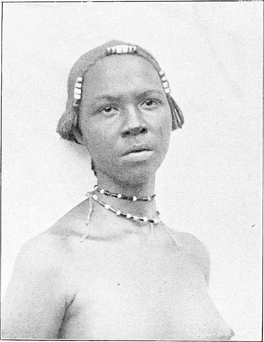
SUDANESE MAIDEN.
Gordon, leaving Shakka in April, went by Kalaka, Dara, El Fasher, to Kolkol, which he reached on 26th May; here he relieved the garrison, and returned to El Fasher. At the latter place he heard from Gessi of the capture of Suleiman’s stronghold, and was about to start for Khartoum, when learning that a force of Zubeir’s men was en route for Darfur, he returned to Taweisha, and, Gordon meets Gessi, June 25th, 1879.on June 25th, he met Gessi who informed him that the last of the rebel bands had been crushed. Leaving Gessi to follow up Suleiman, Gordon now left for Khartoum.
Revolt instigated by Zubeir, 1878.Before Zubeir had left for Cairo to push his claims to the Governorship of Darfur, he had made his officers swear that if, during his absence, he sent them word to conform to the arrangements he had made under a certain tree, then they[242] were to revolt.[161] He accordingly did send them orders on finding that his claims were not attended to. The extent of the insurrection was much larger than generally supposed; the chief slave dealers had in their plans apportioned out the provinces of the Sudan among themselves, and even gave out that they would not stop short of Cairo. They were backed up by numerous Arab tribes, and were powerful enough to tax the whole strength of Egypt. It was from the Arabs that most of the slave hunters were drawn, and they looked with scorn and hatred on the Egyptian rule.
Colonel Gordon wrote:—“There is no doubt that if the Governments of France and England do not pay more attention to the Sudan—if they do not establish at Khartoum a branch of the mixed tribunals, and see that justice is done, the disruption of the Sudan from Cairo is only a question of time. This disruption, moreover, will not end the troubles, for the Sudanese, through their allies in Lower Egypt—the black soldiers, I mean—will carry on their efforts in Cairo itself. Now, these black soldiers are the only troops in the Egyptian service worth anything.”
July, 1878, expedition organised by Gessi.In July, 1878, Gordon, hearing that the son of Zubeir (Suleiman) had seized the province of Bahr El Ghazal, at once sent up an expedition commanded by Gessi.
Gessi started up the river, and on his way met with many slave nuggars, and even Government steamers, plying the slave trade under the eyes and with the connivance of the Egyptian Wakils. He first went to Shambe to collect reinforcements, and then struck off in the direction of Rumbek on the river Rohl. His march was greatly impeded by floods, and it was not till the first week in September that he reached the above-named place. Here he heard of the open revolt of Suleiman, who had surprised and massacred the troops at Deim Idris, and was laying the country waste in all directions. The Arabs now began to join Suleiman in large numbers, and his army soon numbered about 6,000 men, Gessi in the meantime had but 300 regulars, 2 guns, and 700 irregular troops; his communication with Khartoum was almost closed by the sudd in the river, which, moreover, together with the rains, caused the whole surrounding country to be flooded and made marching impossible. He accordingly fortified himself at Rumbek till November. He occupied the time in regenerating the province which he found labouring under gross abuses and a staff of corrupt officials.
November, 1879.He was at length able to leave Rumbek on the 17th November, and, after having met with some hostility from the natives on the River Jur, arrived at the Wau on 5th December, where he established a station. He found Suleiman had carried off upwards of 10,000 women and children, and the inhabitants about Wau were greatly incensed against the slave dealers. Having received reinforcements and been joined by a friendly Sheikh, Gessi marched for Deim Idris, which he reached about the middle of December. Suleiman attacks Gessi, 28th December, 1879.Suleiman was on his way towards Shakka, thinking himself protected by the floods from an attack from the south, but hearing of Gessi’s arrival at Rumbek he at once turned to attack him with 10,000 men. The attack took place on the 28th December, but was repulsed with great loss after severe fighting. Second attack, 12th January, 1879.On 12th January, 1879, Suleiman, having been reinforced, again assaulted Gessi’s post, and after two days’ heavy fighting was again driven back. Third attack, 28th and 29th January, 1879.Gessi in the meantime was running very short of ammunition, but in spite of this repulsed a third attack on the 28th and 29th of January. On 11th March, having received some ammunition, he attacked the stronghold of Suleiman, which was constructed of wooden huts and barricades made of trunks of trees. Having set fire to the whole by means of rockets he met and utterly routed the brigands as they sallied out, but had not sufficient ammunition to pursue them. By the beginning of February, Gessi had cleared off many of the slave dealers, and had liberated more than 10,000 of their captives; the result being that confidence was being rapidly restored, and the headmen of tribes were giving their allegiance to the Government.
Deim Suleiman taken by Gessi, 4th May, 1880.On 1st May Gessi having received further reinforcements, marched on Deim Suleiman, which he took by assault three days later, capturing much booty. Suleiman himself escaped, and took refuge in a village some distance off. On the 9th May Gessi with 600 men started in pursuit, and after nine days’ absence returned to Deim Suleiman in triumph, having taken many of the slave dealers, although Suleiman, with Rabeh and Sultan Idris, two noted leaders, had escaped.
Though much had been done, the revolt was not, as Gessi thought, completely crushed, and in a few weeks, hearing that Suleiman was meditating a junction with Harûn, he at once went again in pursuit. On the night of the 15th July he surprised the enemy, and although he had only 290 men to their 700, he contrived to conceal the fact, and Suleiman captured, 15th July, 1880.induced Suleiman to lay down his arms. Fearing that, by plotting with the rebel Abdelgassin, who was at no great distance, the prisoners might escape, he shot the 11 ringleaders, including Suleiman, and dismissed their men to their new countries. Gessi had now broken the neck of the revolt, and aided by the tribes whose families he had freed from slavery, he hunted down the remaining bands. Abdelgassin was caught and shot, and only Rabeh escaped to the west, where he eventually carved a kingdom for himself near Lake Chad, and was killed by the French in 1901 (v. Baron Oppenheim’s Monograph).
In August, Gordon arrived at Cairo and conferred with the new Khedive, Tewfik, on affairs in Abyssinia. Walad Mikael and Johannes’s general, Alula, were now plotting a joint attack on Bogos, and Gordon’s proposal that he should at once go and endeavour to settle matters with the King was eagerly accepted by the Khedive.
[243]Gordon goes to Abyssinia, 1879.He landed at Massaua on 6th September, 1879, and finding that Bogos was practically in the hands of the Abyssinians, started on the 11th to meet Alula. The next day he heard that Alula, by the King’s orders, had made a prisoner of Walad el Mikael and all his officers, and that Mikael’s son had been killed. On the 16th Gordon reached Gura, the rendezvous, and, at an interview with Alula, requested him to state the complaints of Abyssinia against Egypt. Alula, on the 18th, replied that he had better see the King himself, and Gordon accordingly left the following day for Debra Tabor, near Gondar. He arrived there on the 27th October. On the 28th October, the King stated his claims as follows:—“You want peace; well, I want retrocession of Gallabat, Beni Shangul, and Bogos, cession of Zeila and Amfila (ports), an Abuna,[162] and a sum of money from one to two million pounds; or, if his Highness likes better than paying money, then I will take Bogos, Massaua, and the Abuna. I could claim Dongola, Berber, Nubia, and Sennar, but will not do so. Also I want certain territory near Harrar.” Gordon asked him to put these demands in writing, and give the Khedive six months for reply. But the King would give no satisfactory answer. On the 6th November there was another interview. The King had evidently been put up to his first demands by the Greek Consul at Suez, who was with him at the time, and now neither liked to withdraw his demands, nor to put them in writing. After some further delays, the King at length gave Gordon a letter and let him go, which he accordingly did, and started for Gallabat, intending to go to Khartoum. Before reaching Gallabat, however, the King had him arrested and brought back through Abyssinia. He reached Massaua, after much privation, on 8th December, and then ended his connection with the Sudan and Abyssinia.
Shortly before his departure he had given up the district Unyoro, and the stations of Mruli, Kodj, Foweira, Keroto, and Magunga were accordingly evacuated by Egyptian troops. Masindi and Kisima had been given up two years before. The Somerset Nile was now the boundary of the Khedive’s territory, and new stations were formed to defend it, whilst the province of Makaraka was also incorporated. Dr. Emin Bey had been made Governor of the Equatorial provinces, with his headquarters at Lado, and under him were the three Mudirs of Makaraka, Kiri, and Magunga. Many improvements had been made in these provinces, and Lado was greatly increased in size and importance.
Rauf Pasha was Gordon’s successor at Khartoum, while a second pasha was given the government of Massaua and the adjacent coast, and a third was appointed to Berbera, Zeila, and the Harrar district. As Gordon pointed out to the Khedive, King Johannes was too much occupied with internal affairs to be able to give further trouble on the border for the present; but in the summer of 1880 the Somalis revolted, and Egyptian troops had to be sent to aid the Governor of Harrar.
Gessi, as Governor of the Bahr El Ghazal, was most successful; he had completely stamped out the slave trade, done much to encourage agriculture, and revived to a great extent the ivory trade.
On the departure of Gordon, however, and in the absence of a strong central government, the slave dealers again showed themselves in other parts, and before long slave caravans were once more on their road to Lower Egypt and the ports of the Red Sea.
Railway scheme again entertained, 1880.Early in 1880 the railway scheme again seems to have occupied the attention of the Khedive, who then visited the Sudan, and expressed himself strongly in favour of a line from Berber to Suakin.
In September, 1880, Gessi, finding his position intolerable under Rauf Pasha, Governor-General of the Sudan, resigned his post, and, after having suffered great hardships on the way, on account of the steamers being stopped by the sudd, he at last reached Khartoum; meeting with a cold reception there, he managed to get to Suez, where he soon after Gessi’s death, 30th April, 1881.died, 30th April, 1881, from the effects of the suffering he had endured. Lupton Bey, an Englishman,[163] succeeded him in the governorship of the Bahr El Ghazal.
In April, 1882, the Sudan was reorganised on paper, and was to be again under one Governor-General with four subordinate governors for the West Sudan, Central Sudan, East Sudan, and province of Harrar. Schools and seats of justice were to be established, and special arrangements to be made for the suppression of the slave trade.
The Mahdi.The next great cause of disturbance in the Sudan was the appearance of the False Prophet.
For many years the creed of Mohammed had been making immense strides in Central Africa, where it seems to have a peculiar fascination for the native races; and high authorities estimate the number of converts to this religion at from eight to twelve millions. The idea of the regeneration of Islam by force of arms had gained a strong hold over the enthusiasm of these new converts, and on the appearance of the False Prophet in August, 1881, thousands flocked to his standard.
[244]The person in question was a Sheikh named Mohammed Ahmed, the son of a carpenter, and a native of Dongola. He was born about the year 1848, and educated in a village near Khartoum, where he studied religion. In 1870 he became a Sheikh, and after a short stay at Kaka, near Kodok, he finally took up his residence on the Island of Aba. Here his influence much increased, he gradually acquired a great reputation for sanctity, and in time assembled a considerable number of dervishes or holy men around him. He augmented his influence by marrying daughters of the leading Sheikhs of the Baggara, and by his power and tact succeeded in merging together the various tribes.
The principles of his teachings were universal equality, universal law and religion, with a community of goods. All who refused to credit his mission were to be destroyed, whether Christian, Mohammedan, or Pagan.
The causes of the rebellion were ascribed to—
1. The venality of the officials, and the oppressive and unjust manner of collecting the taxes.
2. The suppression of the slave trade. Most of the supporters of the Mahdi, more especially the Baggara tribes, owed all their wealth to their traffic in slaves.
3. The military weakness of Egypt. This was not, however, any real cause of rebellion, as the troops in the Sudan would have been sufficient, had they been properly handled.
1881. May.In May 1881 the Mahdi first advanced his claims to being the prophet foretold by Mohammed.
July.In July Rauf Pasha, then Governor of the Sudan, had his attention drawn to these pretensions. The Mahdi was then living at Marabia, near the Island of Aba.
August.In August he publicly proclaimed his mission during the Feast of Ramadan, and small parties of troops were sent to dispose of him, but failed to do so. He first showed himself in force in the neighbourhood of Sennar, and then took refuge in the Shilluk country, finally taking up his position at Jebel Gedir, about 90 miles west of Kaka on the White Nile.
9th December.A force of 350 regulars, under one Rashid Bey, attacked the Mahdi, but were defeated with loss.
The latter, having recruited his force, began early in spring to threaten the province of Kordofan.
1882. 4th March.Rauf Pasha was now recalled, and Abd el Gader appointed in his place. Pending the arrival of the latter, Giegler Pasha was temporarily appointed.
April.In April a concentration of troops was directed on Kaka, and 3,000 men collected there, whereby the garrisons throughout the country were much reduced.
The rebels, taking advantage of this concentration, attacked Sennar, and had many minor successes in that part of the country, until they were dispersed by Giegler Pasha, May.who arrived about the middle of May.
11th May.Abd el Kader reached Khartoum on the 11th May.
14th May.On the 14th the Egyptian troops were successful in an action near El Obeid, the result of which, however, was unimportant.
Towards the end of May Yusef Pasha, Governor of Kodok, was ordered to march with the force from Kaka against the Mahdi, who was in the hills at Gedir. After great delays, Yusef set out with a large disorganised force of several thousand men and swarms of camp-followers; but the rains had begun, and progress was slow.
7th June.On the 7th June, the Egyptian army came face to face with the rebels in a densely wooded country. A zeriba was commenced, and the troops were formed up in hollow square, but the rebels broke in upon them, defeated, and utterly destroyed the whole force.
This crushing defeat placed the Egyptian Government in a critical position, and gave great impetus to the insurrection.
The Mahdi now sent a portion of his army, under Wad el Makashif, across the White Nile by the ford of Abu Zeid, to threaten Sennar. He remained himself for some weeks at Gedir, though detachments of his following were raiding in Kordofan.
24th June.On the 24th June the rebels attacked Bara, but were repulsed with heavy loss.
17th June.On the 17th an attack was made on Um Shanga, in Darfur, but was likewise repulsed; but towards Shakka an Egyptian force of 1,000 men was almost annihilated on the 20th July.
Many minor engagements were fought upon the lines of communication between Kordofan and Dueim, which resulted in favour of the rebels.
August.At the beginning of August the Mahdi, with the bulk of his forces, was at Jebel Gedir; a second army was wasting Kordofan; a third stretched along the White Nile from Dueim to Geziret Aba on the north-east, and from Kaka to Marabia on the east bank.
19th August.The rebels were defeated at Bara, and El Obeid was revictualled.
23rd August.On the 23rd Dueim was attacked, but the rebels were here driven back with a loss of 4,500 men; and Makashif, who was advancing on Khartoum, was also defeated with heavy loss about the same time.
4th, 5th, 6th September.The Mahdi now took the field in person and advanced on El Obeid. On three successive days, he made desperate assaults on the garrison, but on each occasion he was repulsed with great slaughter. The rebels are said to have had[245] 10,000 men killed, while the Egyptian loss is put down at 288. These disasters caused great loss of prestige to the Mahdi, who had never heretofore been defeated when personally leading.
24th September.A relief column of about 2,000 men was now sent from Dueim under Ali Bey Satfi, and was directed on Bara. This column had two engagements with the enemy, in the first of which it was successful, but the second time was defeated with a loss of 1,130 men, the survivors making good their retreat to Bara.
| By kind permission of] | [Lekegian, Cairo. |
MAJOR-GENERAL SIR RUDOLF VON SLATIN PASHA.
9th, 10th October. 10th November.In October Bara was attacked with great determination on two successive days, but the rebels were driven off with great loss. The Mahdi then blockaded both El Obeid and Bara. About this time an expedition under a Sheikh, sent against Dueim, was defeated, and the leader captured and hung at Khartoum.
At the end of the year El Obeid had a garrison of 3,000 men, and Bara 2,000; both were reported to be well provisioned. Reinforcements were daily arriving at Khartoum.
[154]On a journey from the East Coast.
[155]Dr. Emin Bey.
[156]“Provinces of the Equator,” published by the Egyptian General Staff.
[158]Zubeir Pasha was permitted to return to the Sudan shortly after the fall of Omdurman (1898) and now resides at Geili on the Nile, about 30 miles north of Khartoum.
[159]Edward Schnitzer.
[160]Surrendered to Colonel Parsons at Gedaref (1898), and now living at Omdurman.
[161]This is altogether denied by Zubeir Pasha, and the Conference between him and Gordon in Cairo (1884) goes to show that there are two sides to this story. Slatin Pasha in “Fire and Sword” explains the other side. (F. R. W.)
[162]Archbishop.
[163]Captain of a Red Sea merchant steamer.
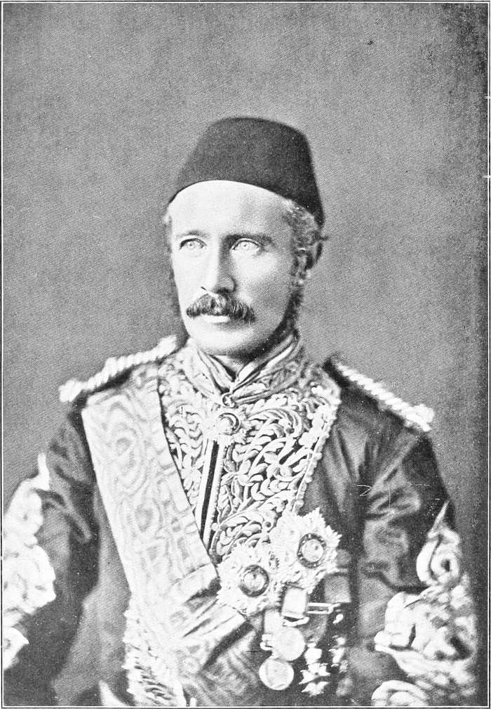
By London Stereoscopic Company.
GENERAL GORDON.
(To face page 247.)
EVENTS ON THE NILE FROM 1882 TO MAY, 1898.
In December, 1882, Colonel Stewart (11th Hussars) arrived at Khartoum with orders to report on the situation. 1883.His valuable report,[164] dated 9th February, 1883, went thoroughly into the question of finance and administration, and recommended drastic reforms, stating that the Egyptians by themselves were totally incapable of governing such a huge tract as the Sudan.
Fall of El Obeid, 17th January, 1883.Almost the first event of 1883 was the fall of El Obeid, on the 17th January. For six months Mohammed Pasha Said had held out, but was eventually obliged by famine to capitulate. The gallant commander was shortly afterwards killed by his captors, and the Mahdi transferred his headquarters to the town.
Meanwhile Abd el Gader Pasha, Governor of Khartoum, was doing his best to suppress the rebellion in the angle between the White and Blue Niles, and on the 24th February he beat the Emir Ahmed el Makashif at Meshra el Dai, and raised the siege of Sennar town for a time. In response to his former appeal to Cairo for reinforcements, troops were being collected, and Hicks Pasha was sent with a crowd of some 10,000, mostly undrilled, Egyptians to his support, arriving in Khartoum, viâ Suakin and Berber, on the 4th March.
Hicks arrives.Abd el Gader was, shortly before Hicks’s arrival, superseded by Ala el Din Pasha.
After a strong reconnaissance in force up the White Nile, during which Battle of Marabia.Makashif was heavily defeated and killed at Marabia on the 29th April, Hicks began preparations for an advance into Kordofan on a large scale. He started in September from Dueim with about 8,200 men, marching on El Obeid viâ Khor Abu Habl, this route having been recommended to him as holding much water. The Mahdi, informed of their approach, collected some 40,000 men and encamped in the forest of Shekan.
Annihilation of Hick’s Expedition, 5th November, 1883.Misled and betrayed by their guides, and suffering terribly from want of water, Hicks’s force advanced into the forest on the 5th November, was set upon by the enemy in overwhelming numbers and annihilated, some 300 only escaping death.
The news of this disaster naturally raised the Mahdi’s influence to the highest pitch, and produced a corresponding depression on the Egyptian side. At Khartoum, which had been virtually in a state of siege since July, there was a panic, but De Coetlogon (left by Hicks with the depot), Power, Herbin, and Hansal (British, French and Austrian Consuls respectively), collected food and outlying garrisons, and strengthened the defences by the end of the year. Sennar was meanwhile again besieged.
The effect of Hicks’s disaster on the Home Government was that it was decided that the Sudan should be abandoned and the garrisons evacuated. 1884. Gordon arrives.General Gordon was the man chosen to carry out this difficult task, and he, accompanied by Colonel Stewart, arrived in Khartoum on the 18th February, just a month after the proclamation in that town of the Government’s intentions.
Gordon was enthusiastically received at Khartoum, and proclaimed, in addition to the foregoing, that the suppression of the slave trade by Egyptian means was now abolished, and that the Sudan was now independent, with himself as Governor-General. A large exodus northward consequently took place.
Gordon quickly came to the conclusion that if the Sudan were evacuated, the only man capable of keeping it in order after the Egyptians had retired would be Zubeir Pasha. His request for him, however, was refused by the Government, so Gordon resolved to hold Khartoum at all costs and crush the enemy if possible.
Meanwhile the flood of Mahdism was spreading northwards, and after a fruitless attempt—owing to the rising of the Robatab tribe—on the part of Captain Kitchener and Lieutenant Rundle to communicate with and assist Hussein[248] Pasha Khalifa, Governor of Berber, Fall of Berber, 20th May, 1884.this town was attacked, and, after a certain amount of resistance, taken by the enemy on the 20th May. Captain Kitchener’s efforts, however, in negotiating with the Bisharin and Ababda in the Korosko-Abu Hamed desert with a view to stopping an advance through this desert were successful, and a reconnaissance on the left bank of the Nile along the Arbaîn route from Assiut to Sagiyet el Abd by Lieut.-Colonel Colvile and Lieut. Stuart-Wortley proved that the water supply along that route was absolutely insufficient for the advance of an enemy in this direction. It was therefore certain that if an advance northwards took place, it could only come by the Nile, and subsequent events have proved the correctness of this supposition.
Halfa and Korosko were fortified about this time, and English troops sent up to Aswan.
Action at Debba.In June Heddai, victor of Berber, advanced down-stream in the direction of the Dongola province, but was beaten at Debba (5th July, 1884) by a force of Bashi Bazuks, and again at Tani. Mustafa Pasha Yawer, Mudir of Dongola, gave rise to some anxiety by his doubtful and temporising action with regard to the enemy, but these successes appear to have decided his line of action.
Battle at Korti, 11th September, 1884.On 1st September he advanced with 400 men against Heddai, who had been reinforced by Mohammed Mahmud to the total number of 3,000, and in a smart action close to Korti totally defeated the Emirs, killing them both. Captain Kitchener, who had been sent to report on the Mudir, now pushed on, and entered into negotiations with the great Kababish tribe and their Sheikh Saleh for assistance in the forthcoming Nile expedition, which had just been decided on for the relief of Gordon.
Gordon relief expedition.This expedition was put in hand in the beginning of August, and the command of it given to Lord Wolseley. It was composed of nine battalions,[165] a camel corps of four “regiments,”[166] and the 19th Hussars, besides light Artillery and other details. The major portion was despatched up the Nile in whaleboats, and it concentrated eventually in December at Korti.
Fighting round Khartoum.During the advance of the expedition, Gordon employed every means to keep the enemy at a distance. On the 29th and 31st August his “fighting Pasha,” Mohammed Ali Pasha, defeated Emir Abd el Gader at Gereif and Sheikh el Obeid at Halfaya respectively, but five days afterwards was heavily defeated and killed by the latter at Um Dibban, whither he had followed him after a third victory at El Eilafun.
Murder of Colonel Stewart, &c.This defeat was a heavy blow to Khartoum, and on the 10th September Gordon sent Stewart, Power, Herbin, and some Greeks downstream on the “Abbas” steamer to give an account of the state of affairs to the authorities. These officers were decoyed ashore and murdered on the 18th near Hebba, at the head of the 4th Cataract.
On the 29th September Gordon sent three steamers down to Shendi to meet the British expedition, and these[167] remained on the river under the command of Nushi Pasha, fighting and reconnoitring, until the 21st January, when the British desert column met them near Metemma.
After the defeat near El Eilafun, the Mahdi summoned all the tribes to the attack of Khartoum, and this city was closely invested. Omdurman, held by Faragalla Pasha, was repeatedly attacked, and was obliged by famine, on the fifth day of the new year, to surrender.
The garrison of Khartoum was now getting weaker and weaker through famine, and though Gordon despatched cheery messages to say he “could hold out for years,” he knew it would be all over with Khartoum if the expedition did not arrive in time.
River column.On the 28th December a river column of four battalions,[168] one squadron, and details was sent upstream from Korti, under Major-General Earle, with the object of reaching Abu Hamed, communicating thence (for supplies) with Korosko (Major Rundle), and pushing on to seize Berber.
Desert column.On the 30th December a desert column, chiefly composed of Camel Corps, total about 1,100 fighting men, left Korti to occupy Jakdul Wells, over halfway to Metemma. This done, Sir Herbert Stewart (in command) sent back for more troops and supplies, and the column, increased to about 1,800 fighting men, 1885.left Jakdul on the 14th January, 1885. Battle of Abu Klea, 17th January, 1885.On the 17th a force of about 11,000 of the enemy, under Abu Safia (or Abd el Mejid?) was encountered and heavily defeated near Abu Klea (Tleh) Wells, and the column pushed on to the Nile, which it reached, after another stiff fight near Abu Kru (Khrug), on the evening of the 19th. On this day Sir H. Stewart was mortally wounded.
On the 21st a reconnaissance in force of Metemma was carried out. Gordon’s four steamers arrived during the action, and Colonel Sir C. Wilson being now in command, after proceeding next day on a reconnaissance towards Shendi, left Gubat on the morning of the 24th with two steamers for Khartoum.
Fall of Khartoum, and death of Gordon.On arriving there at noon on the 28th, Khartoum was found to have fallen two and a quarter days previously, the town having been taken by assault, and Gordon having been killed, just before dawn on the 26th. The two[249] steamers were both wrecked in the Sixth Cataract on the way back, and Sir C. Wilson and his party were only extricated by Lord C. Beresford (on a third steamer) after a hard fight with a shore battery[169] near the tail of the cataract.
The desert column, now under Sir R. Buller, short in transport and in numbers, retired to Abu Klea (Tleh), at which point they beat off the pursuing enemy (16th February), and eventually reached Korti during March.
The river column had meanwhile ascended the 4th Cataract with extreme difficulty, and met the enemy near Kirbekan. Battle of Kirbekan, 10th March.Here a decisive action was fought (10th March), in which the Mahdists were thoroughly beaten, but General Earle was killed. The command devolved on Brigadier-General H. Brackenbury, and the column reached Huella (or Khulla), within 30 miles of Abu Hamed, on the 23rd February, having destroyed the village of Stewart’s murderers on the way.
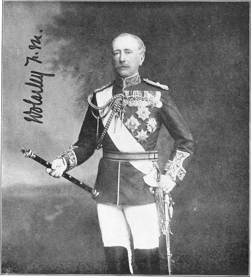
| By kind permission of] | [Werner, Dublin. |
FIELD MARSHAL VISCOUNT WOLSELEY.
Here orders were received to turn back, and the column retired, reaching Merowe on the 5th March.
When the news of the fall of Khartoum reached England, it was first determined to operate on the Sudan from the Suakin side, and a British expedition was sent there, together with a force of navvies, to construct a railway to Berber (v. p. 257). Preparations were also begun for another Nile campaign in the autumn, and the troops of the late expedition were encamped for the summer along the river.
Retirement of expedition, June, 1885.After some months the Government decided to proceed no further with the Sudan operations, and the whole force[250] was withdrawn, leaving the country unoccupied south of Kosha. A temporary native Government was established at Dongola, but it proved of no value, and fell to pieces on the advance of the enemy.
The Mahdists pushed gradually forward, and by the end of November came into touch with our frontier field force, now composed of 1,700 British and 1,500 Egyptian troops. A harassing month of skirmishes ensued, which was put an end to by the Battle of Ginnis, 30th December, 1885.decisive victory of our troops, under Sir F. Stephenson, at Ginnis, on the 30th December. Abdel Mejid was wounded, and the enemy’s losses amounted to 800 out of 6,000.
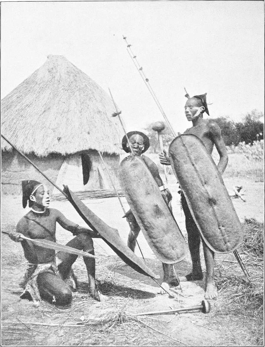
TYPES OE SUDANESE SOLDIERS—THE RAW MATERIAL.
[251]Death of the Mahdi.Meanwhile the Mahdi had died of typhus fever on the 22nd June. On proclaiming himself Mahdi he had nominated four Khalifas to succeed him in order, and had also sketched out a broad plan for the invasion of Egypt.
The Khalifas.The first of the Khalifas, Abdalla Ibn el Sayid Hamadalla el Taaishi, a Baggara of the Taaisha tribe (as his name implies), succeeded the Mahdi, and consolidated his position by tyranny, cunning, and crime.
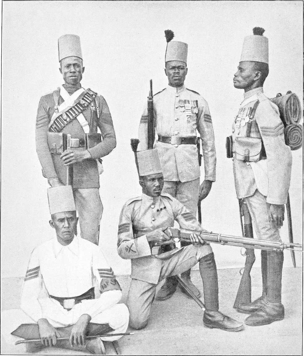
TYPES OF SUDANESE SOLDIERS—THE FINISHED ARTICLE.
The second Khalifa, Ali wad Helu, was a Sheikh of the Degheim and Kenana Arabs.[170] He was fanatical and religious, but his quarrels with Abdalla did not dispose him in his favour.
The third Khalifaship, which was offered to and refused by the Sheikh el Senussi, was filled[171] by one Adam wad el Wazir, but appears to have lapsed. The fourth Khalifa was Mohammed el Sherif, son-in-law of the Mahdi. His men[252] having been mostly killed under Wad el Nejumi, at Toski (1889), he was thereafter often imprisoned by Abdalla, and was of comparatively small account. He was, however, considered to be, strictly speaking, next in succession to Abdulla.
1886.During 1886 the frontier of Egypt was withdrawn to Wadi Halfa, and the enemy, checked but not daunted by the fight at Ginnis, worried and raided, and tore up the railway to their hearts’ content. Numerous small skirmishes occurred, but no serious fighting was destined to take place for another three years.
Although the Khalifa was anxious to carry out at once his plans for the invasion of Egypt, he was prevented by three causes: firstly, a revolt in Darfur and Kordofan (v. p. 255); secondly, attacks by the Abyssinians (v. p. 258); thirdly, attacks by the Kababish.
1887. Action at Sarras.During 1887 the only fighting of importance on the Nile was Colonel Chermside’s action of the 28th April, in which Nur el Kauzi and 200 Arabs were killed at Sarras. A misfortune, however, occurred in the defeat and death, at Matassi Wells, of Sheikh Saleh and many of his Kababish, who had repeatedly, by harassing their left flank, prevented Mahdist reinforcements from coming down the river. This great tribe was now split up and hunted down by the enemy until it had been greatly reduced in numbers.
About this time Charles Neufeld, a German merchant, was captured in the western desert and sent to Omdurman.
KHALIFA’S HOUSE, OMDURMAN.
1888.The small English force was now (1st April, 1888) withdrawn from the frontier, and the task of defending it devolved entirely on the Egyptian Army. A glance at the history and constitution of the latter will not be out of place here.
The Egyptian army.After the defeat of Arabi and his army in 1882, Sir Evelyn Wood, aided by a small but competent staff of officers, began the formation of a new Egyptian Army. By January, 1883, it consisted of 8 Egyptian battalions (forming 2 brigades, the first under British and the second under native officers), 1 regiment of cavalry, and 4 batteries of artillery.
The IXth Sudanese battalion was raised at Suakin in May, 1884, and in March, 1885, Sir Francis Grenfell became Sirdar.[172] The remaining battalions were raised as follows:—
[253]Besides the above, there were in 1898 10 squadrons of cavalry, 5 batteries artillery, 8 companies of camel corps, 3 companies garrison artillery, &c., besides 13 gunboats. The army has now been reduced.
Invasion by Wad el Nejumi.At the end of 1888 the Khalifa made great preparations for the invasion, and a large force was collected under Wad el Nejumi.
1889.By the end of May, 1889, Nejumi had reached Sagiet el Abd with some 4,000 fighting men and 7,000 camp followers, the Egyptian frontier force being then about 6,000 men.
Battle of Argîn, 2nd July, 1889.On the 2nd July, Colonel Wodehouse, O.C.F.F.F., engaged the enemy at Argîn,[173] and, although with much inferior numbers, advanced with determination to the attack, and inflicted a loss of 1,400.
Battle of Toski, 3rd August, 1889.A British brigade was now being sent upstream, but General Grenfell (the Sirdar), who had previously concentrated his Egyptian forces at Toski, found Nejumi on the 3rd August attempting to cross his front, and was therefore obliged to attack him without waiting for the British, whose advance parties had reached Korosko.[174] He stopped him at Toski,[175] on the 3rd August, and with 2 Egyptian and 4 Sudanese battalions (besides cavalry and artillery) routed him completely. Wad el Nejumi was killed, and his forces were practically destroyed. Thus ended the Mahdi’s dream of the conquest of the world.
1890.The victory of Toski had the effect of crushing for several years any important movement northwards on the part of the Dervishes, and the recapture of Tokar in February, 1891 (vide p. 258), caused the Khalifa still more to draw in his horns.
1891.The Shilluks were meanwhile giving the Dervishes considerable trouble in the neighbourhood of Kodok, and in 1891 Zeki Tumal was sent against them. Two steamers had stuck in the sudd in the winter of 1888, and had been taken by the Shilluks; desperate efforts were now made by the Dervishes to effect their recapture (vide p. 260).
In August, 1891, the Nuers were used as allies by the Dervishes, and succeeded in killing the Mek of the Shilluks. Soon afterwards, however, the Nuers turned against their allies and expelled them from the country south of Kodok, whilst the Shilluks inflicted a severe defeat on their enemy near Kodok, in December, 1891, and again in January, 1893. The war was waged with indecisive results till 1894, when the Dervishes finally crushed the Shilluks and murdered their King’s wife. After that the Dervishes merely kept a small tax-collecting outpost at Kodok, and the riverain tribes remained fairly quiet.
During 1891 the Khalifa, alarmed at a rumour of an Egyptian advance, pretended to be desirous for peace, but in December of that year he showed his true hand. He had long been aiming at making the Khalifate a hereditary succession, and finding an excuse for quarrelling with the Khalifa Sherif, he threw him into prison and loaded him with chains.[176] He would, no doubt, have liked to do the same with the remaining Khalifa, Ali Wad Helu, but the latter Sheikh had too powerful a following of Degheim and Kenana, and Abdalla desisted. At the same time, however, he effected a clean sweep of all disaffected Emirs, and by executing some and exiling the majority he succeeded in consolidating his own dominion. His nearest relations were his brother, Yagub, and his son, Osman Sheikh el Din; of these two he intended his son to succeed him.
1892.In 1892 raids recommenced on the frontier, and in December a serious raid was only stopped by a fierce fight at Ambugol, in which Captain Pyne was killed, together with 26 of his men.
1893.In July, 1893, another big raid was made by Osman Azrak on the oasis of Beris, and 11 natives were taken prisoners. As the Kharga, Beris, and Dakhla oases were thus threatened, posts were established at these places. In November the Dervishes raided Murrat Wells, and killed Saleh Bey, Sheikh of a section of the Ababda.
1894.In 1894 little occurred of importance on the Nile, though the year was memorable for the capture of Kassala by the Italians (vide p. 259).
1895.In the beginning of 1895 Sheb oasis was attacked, but the raiders were repulsed, and at the end of the year an attack was made on Adendan, a village north of Halfa. These raids, however, were soon to be avenged, for in March, 1896.1896, it was determined to retake Dongola, and the Egyptian Army was concentrated along the frontier by the end of that month. This decision was mainly taken with a view to assisting the Italians, who had been heavily defeated at Adua (1st March, 1896) by the Abyssinians, and whose right flank was threatened by the Dervishes.
Escapes from Omdurman.Reference must here be made to the successful escapes of three Europeans from Omdurman: Father Ohrwalder in December, 1891; Father Rossignoli in October, 1894; and Slatin Bey in February, 1895. These gave most valuable accounts of affairs at Omdurman, and besides corroborating information already gained, the latter, in particular, threw a vivid light on the state of the Dervish power.
[254]Egyptian advance.On 20th March (1896) an advanced Sudanese brigade occupied Akasha, and on the 1st May a cavalry skirmish with the enemy took place near this spot. The railway was quickly pushed on across the Batn el Hagar, Battle of Firket, 7th June, 1896.and on the 7th June the Sirdar surprised and almost annihilated the Dervish garrison at Firket, pushing his cavalry on to Suarda. Cholera.Cholera now travelled up the river from Cairo, and for 10 days caused considerable casualties. The railway meanwhile reached Kosha on the 4th August, and the Egyptian forces, reinforced by a British battalion,[177] Occupation of Dongola, 23rd September, 1896.pushed on to the Dongola Province. At Hafir the enemy were in force, but (19th September) were driven out by gunboats and artillery, and on the 23rd of the same month the army marched into Dongola, the enemy, under Wad Bishara, refusing to meet them in the open, and bolting southwards in a disorganised rabble. The retreat was quickly turned into a rout by the pursuing troops, and the river was occupied up to Merowe.
1897.The railway to Kerma was completed on the 4th May (1897), and prior to its completion the construction of a new railway from Halfa to Abu Hamed was commenced across the Korosko Desert. Capture of Abu Hamed, 7th August, 1897.Abu Hamed was taken after a sharp fight on the 7th August by a flying column[178] under Major General Hunter, and Berber was occupied by friendlies on the last day of that month, the Dervishes evacuating it at our approach. Occupation of Berber, 6th September, 1897.The occupation was quickly confirmed by the regular troops (6th September), and four gun-boats were dragged, under circumstances of exceptional difficulty, up the 4th Cataract (August).
CAPTURED DERVISH EMIRS.
The army was then placed in occupation of the river from the Atbara to Dongola, but, in consequence of the intention of the enemy to recapture Berber, it was concentrated about this place in 1898.January, 1898. The railway meanwhile reached Abu Hamed on the 4th November, 1897, and was pushed forward along the right bank towards Berber.
In March a British brigade[179] was despatched to reinforce the Egyptian troops, and the army moved up the Atbara to intercept Mahmud, who, with Osman Digna and a large force, was making for Berber.
Battle of the Atbara, 8th April, 1898.The resulting battle of the Atbara (8th April) caused the total destruction of Mahmud’s force[180] and the capture of its commander. During the spring and summer further preparations were made for the final destruction, with the help of two British Brigades, of the Khalifa’s power.
[164]Foreign Office Bluebook, Egypt, No. 11, 1883.
[165]1st battalions R.I., Sussex, S. Stafford, Black Watch, West Kent, Gordon Highlanders, Cameron Highlanders; 2nd battalions D.C.L.I. and Essex.
[166]Drawn from Heavy Cavalry, Light Cavalry, Brigade of Guards, and Mounted Infantry.
[167]The “Tel Howeiya,” “Bordein,” “Mansura,” and, subsequently, the “Safieh.”
[168]S. Stafford, Black Watch, D.C.L.I. Gordons.
[169]One of whose shots burst the boiler of the steamer.
[170]Originally from Sennar; horse-breeding tribes.
[171]The third Khalifa was never actually appointed and the Khalifaship always remained vacant (Slatin Pasha).
[172]Sir H. Kitchener succeeded as Sirdar in the spring of 1892.
[173]Three miles north of Wadi Halfa, on the left bank.
[174]One squadron of the 20th Hussars was the only British force present.
[175]Twenty miles north of Abu Simbel.
[177]North Staffords.
[178]No. 2 Battery Field Artillery, 3rd Egyptian battalion, IXth, Xth and XIth Sudanese battalions.
[179]1st battalions Warwickshire and Lincoln Regiments, and Seaforth and Cameron Highlanders.
[180]The Dervishes were estimated to have lost over 3,000 killed. Our losses were—British, 3 officers and 22 men killed, 10 officers and 82 men wounded; Egyptian—57 men killed, and 5 British officers, 16 Native officers, and 365 men wounded. Total, 560 casualties.
THE REMAINDER OF THE SUDAN FROM 1882 TO MAY, 1898.
The flame of the Mahdi’s rebellion quickly reached Darfur in 1882, and the prophet lost no time in attacking the Government posts, which were at that time, it will be remembered, under Slatin Bey. Madibbo, the insurgent Sheikh of the Rizeigat, attacked and occupied Shakka in July, but on following up his success was met by Slatin at Injeleila, near Dara, and was twice heavily beaten by him. Slatin then retired to El Fasher to concentrate, and succeeded in repulsing the enemy from Um Shanga.
Early in 1883 a message was sent to Slatin from Khartoum, ordering him to nominate a local Sultan as King of Darfur, and to retire on Dongola viâ Kaja. The tide of Mahdism gradually flooded Darfur, in spite of Slatin’s gallant efforts to stem it. He fought 27 battles in various parts of his province, but his own troops by degrees fell away from him, themselves infected with the new faith. After certain proof had been adduced of the disaster to Hicks’s expedition, the last remnant of loyalty flickered out from Slatin’s troops, Surrender of Slatin.and the Bey found himself obliged to surrender at Dara in December. He was sent to El Obeid, under the name of the Abd el Gader, and thence to Omdurman, where he remained a prisoner until his escape in 1895.
Zogal made Emir.Zogal,[181] formerly Mudir of Dara, was now appointed Dervish Emir of the province. His first act was to take El Fasher, a garrison of 1,000 men and 10 guns, still holding out under Said Bey Guma, and, this accomplished[182] (15th January, 1884), he devoted his time to reducing Jebel Marra, where the loyal hill population gave him considerable trouble.
On the death of the Mahdi in June, 1885, Madibbo and his Rizeigat revolted against the authority of the Khalifa. Karamalla, Emir of Bahr el Ghazal, thereupon advanced against him and defeated him. Madibbo fled to the Beni Helba Arabs, who protected him, but he was eventually caught, taken to El Obeid, and executed.
Zogal had several times been suspected of too great independence, and he was often summoned to Omdurman. At first he refused, but in the end he went, and was imprisoned on his arrival, being liberated shortly afterwards. He did not return to Darfur until after the defeat of the Khalifa at Omdurman.
Yusef, Emir of Darfur.Sultan Yusef succeeded him as Emir of Darfur, but on Karamalla and Katambura (Waterbuck), the latter being Karamalla’s trusted General, raiding from Bahr el Ghazal into Darfur territory, Yusef protested strongly, and the quarrel developed rapidly into war.
1887.In May, 1887, Zayid, the temporary ruler of Jebel Marra and former slave of Sultan Mohammed Fadl, came to Yusef’s assistance, and beat Katambura, with great slaughter, near El Taweisha. Karamalla then withdrew to Injeleila, entrenched himself there, and sent to Omdurman for reinforcements. Osman wad Adam (Ganu), sent to his assistance with a large force, reached Shakka, encountered the Darfurians near Dara, and forced them back (26th December). A second battle was even more disastrous, for Osman Ganu routed Zayid completely and entered El Fasher. Death of Yusef and Zayid.The two Sultans fled to the hills, but were shortly killed. Hereupon the brothers of Yusef appealed to the Sultan of Wadai for help against Osman. The Sultan applied to the Senussi for advice; but the Sheikh refused to interest himself in the matter unless he were attacked by the Mahdists, so the Sultan of Wadai declined. 1888. Abu Gemmeiza.The Darfur chiefs, however, found a ready ally in the shape of Abu Gemmeiza, Sheikh of the Masalat tribe, and the rising against the Mahdists began to swell in numbers. Wild rumours spread over the Sudan of the advent to power of a great Anti-Mahdi, but although the latter destroyed nearly half of Osman Adam’s force (October, 1888) at Kebkebia, his forces[256] were themselves destroyed in a fierce battle fought close to El Fasher on the 1889.22nd February, 1889. Abu Gemmeiza died next day, and the movement, which had at one time threatened to assume immense proportions expired by itself. Thus for some time to come the Dervish power was again supreme in Darfur.
During these years Kordofan had been, more from necessity than from choice, passively Mahdist, and submitted peacefully to the Dervish yoke.
1891.In 1891 Kordofan and Darfur became again disturbed, and various ineffectual risings took place. Sultan Abbas succeeded in turning the Dervishes out of the Jebel Marra district, and governed in his brother Yusef’s stead; but the Khalifa appears about this time to have considered Darfur as too far off for active interference, and seems to have acquiesced in this state of things.
1892.In April, 1892, some Degheim and Kenana Arabs in Kordofan became dissatisfied with Abdalla’s rule and deserted, but the Khalifa took no notice, finding probably that dealing with the men of a prospective successor, Ali wad Helu, was too delicate a matter in which to take a strong line.
1893.A year afterwards a certain western Saint of Sokoto, Abu Naal, Muzil el Muhan, collected many followers, and for a time was considered as directly threatening the Khalifa’s power. His advance, however, was chiefly confined to the despatch of abusive letters, and the movement died out by itself by the end of 1893.
After that date Kordofan and Darfur remained uneasy under the Khalifa’s hand, and Mahmud, later defeated and captured at the Atbara, was for several years engaged with much success in suppressing insurrections in Kordofan. By 1898, however, the only Dervish garrisons in Kordofan were at El Obeid and Bara, whilst Darfur had, with the exception of a small and hemmed-in garrison at El Fasher, been evacuated by the Mahdists. The people of both these provinces were heartily sick of Dervish misrule, and it was believed that they would welcome with joy a change of masters.
Dar Fertit is a large tract of country to the south of Darfur and separated from that country by a strip of desert; it formerly contained many sultans, sometimes one of these reigning over several others.
These sultans were independent, but paid tribute in slaves and ivory to the Darfur sultans; failing which the Darfurians used to make raids into the country. The Fertitawis sometimes repulsed these raids, and sometimes not.
Zubeir Pasha went to the Bahr El Ghazal as a trader about 1869, and gradually seized all the zeribas, and made himself absolute ruler of the country, including Dar Fertit and Hofrat El Nahas district, which ceased to pay tribute to Darfur.
The Government then sent Bellal to take over Dar Fertit from Zubeir. Zubeir, however, fought and repulsed him. Bellal himself was captured and died in Zubeir’s zeriba (see p. 235). Zubeir, by making valuable presents to those in authority, and by showing that Bellal was entirely to blame for what had occurred, succeeded in having the matter reported to Khartoum in its most favourable aspect, with the result that he obtained full pardon and was made Governor of Bahr El Ghazal.
After three years, Zubeir advanced against Shakka, and took it; this was one of the four divisions of Darfur (which were Fasher, Dara, Kebkebia, and Shakka).
After this Zubeir wrote to the Government, asking for someone to go to take over the country. They sent Bimbashi Mustafa Bey Abu Kheiran with troops, and on their arrival they, acting with Zubeir, conquered the other three provinces of Darfur. The Egyptian troops commanded by Ismail Pasha Ayub arrived shortly after, and with these was sent Hussein Pasha Hilmi as Governor-General of Darfur and Dar Fertit, the latter being garrisoned by irregulars under Suleiman Zubeir.
At the same time Bahr El Ghazal was put under Ibrahim Bey Fauzi.
Hussein Pasha Hilmi was succeeded by Messadaglia Bey, and he in turn by Slatin Bey.
Hofrat El Nahas was detached from Dar Fertit, and with Kebkebia, Kejma and Kulkul were put under El Nur Bey Angara,[183] subject to the Governor-General of Darfur (i.e., Slatin Bey), and the remainder of Dar Fertit, including Faroge, Telgona and Ringi, under Lupton Bey till the time of the Mahdi.
During the Mahdia Karamalla Kirkesawi was made Emir of the Bahr El Ghazal; he took Dar Fertit and brought Lupton Bey, who had succeeded Ibrahim Bey Fauzi, to Khartoum, the Emir Mohd. Zogal taking over Darfur.
After Karamalla’s visit to Dar Fertit, the country ceased to pay any tribute to the Mahdi. It was left unvisited till its re-occupation by the Anglo-Egyptian Government, when flags were sent to, and accepted by, some of the more important sultans.
1883.The Mahdist rising in the Eastern Sudan began towards the middle of 1883, when Osman Digna collected the powerful Hadendoa and other tribes and invested Suakin. The outlying Egyptian garrisons in these parts included Sinkat, Tokar, Kassala, Gira, Gedaref, Gallabat, and one or two smaller posts in Northern Abyssinia, and by the end of the year they were mostly besieged by the enemy.
Suakin reverses.In October, 1883, a reinforcing party for Sinkat was cut off by the enemy, and on the 4th November a party intended for Tokar met with the same fate, Commander L. Moncrieff, R.N., being among the killed. Reinforcements from Cairo—2,620 men, mostly constabulary—were despatched under Colonel Valentine Baker, but before he reached Suakin another disaster occurred on the 2nd December, by which nearly 700 men were cut to pieces near Tamanib. Baker started in January, 1884, to relieve Tokar, but on arriving at El Teb, 4th February, 1884.El Teb his force of 3,700 men was attacked by 1,200 Arabs. His troops behaved like sheep; they were seized with a panic, made no resistance, and were butchered to the number of 2,300, Baker and most of his English officers escaping with the utmost difficulty. 3,000 rifles and four Krupp guns fell into the enemy’s hands (4th February).
Fall of Sinkat.On the 8th February Tewfik, commander of Sinkat, spiked his guns and fought his way out, but he and the whole of his gallant garrison were cut to pieces.
British expedition, El Teb, 29th February, 1884.General Graham was thereupon sent with a small British expedition of 4,000 to relieve Tokar, and having gained a brilliant victory at El Teb (29th February), succeeded in his task, and sent 600 of the Suakin Egyptian garrison back to Cairo. Tamai, 13th March, 1884.On the 13th March Graham advanced again, and, beating the enemy thoroughly at Tamai, swept them back into the hills. The idea was then mooted of a dash across to Berber, but it was eventually dropped, and Graham’s troops retired, Major Chermside being appointed Governor-General at Suakin.
Fall of Gedaref.In April the garrison of Gedaref made terms with the enemy and surrendered.
Abyssinian Mission.In order to evacuate Kassala and Amadib, the help of King John of Abyssinia was now called in, and in June Admiral Sir W. Hewett, R.N., and Mason Bey, visited him and concluded a treaty to this effect, by which he was to have Bogos and Keren if he succeeded in his task. Later on he agreed also to relieve Gira and Gallabat.
Kassala had been besieged since November, 1883, and was beginning to feel hard pressed. Its garrison consisted of 1,600 regulars and 2,300 irregulars, including a force of Bashi-Bazuks, under the command of Ahmed Bey Iffat; the Beni Amer and Hamran tribes in the neighbourhood were also loyal.
In August Mason Bey, now Governor of Massaua, ordered Ahmed Bey Iffat to retire; but this was found to be impossible, as more than half the garrison was composed of natives of the district. John now proposed to relieve Kassala, but he was told that the case of Gallabat was more urgent; he therefore began his preparations, and Bogos was handed over to him on the 12th September.
Evacuation of Berbera, Zeila, and Harrar. 1885.During this latter month Great Britain took over Berbera and Zeila from Egypt, and in November Harrar was handed over to the natives and the evacuation began. 6,500 of the garrison were sent down to the coast without incident, and, under the auspices of Majors Hunter and Heath, a new government was established under the native Emir Abdullahi Mohammed Abd El Shakur.
[Harrar, it may be noted here, remained under its Emir till the beginning of 1887, when Abdullahi was decisively defeated at Chalanko by Menelik, and the town occupied by the Abyssinians.]
Second British expedition, 1885.On the fall of Khartoum becoming known another British expedition, assisted by Indian and Australian troops, was despatched to Suakin under the command of General Graham. Its objects were to crush Osman Digna, to occupy the Hadendoa country, to make a railway towards Berber (at all events as far as Ariab), and to prepare for the opening of the Suakin-Berber road when the Nile Column had captured Berber.
The expedition, numbering 13,000 men, arrived at Suakin on and about the 12th March, and remained for a couple of months. Tofrek, 22nd March, 1885.During this time it fought several actions, at Hashin (20th March), Tofrek (McNeill’s zeriba, 22nd March), and Tamai (3rd April), but none of these were decisive. The railway was carried as far as Otao, but on the retirement of the expedition (17th May) it was abandoned.
At the end of November, 1884, the garrison of Gallabat joined hands with the Abyssinians, and decisively beat the Mahdists. Relief of Gallabat, Amadib, Gira, and Senhit.They were definitely relieved in February, 1885, and retired to Massaua viâ Abyssinia. Amadib and Gira were also relieved, in April and July, 1885, respectively, and the garrison at Senhit[184] handed over their post to Abyssinia on the 19th April.
Colonel Chermside now wrote pressing letters to John, urging him to relieve Kassala at once, and promising 10,000 rifles in the event of his success; Ras Alula, John’s most valiant general, therefore began to move in September. Fall of Kassala, 30th July, 1885.Meanwhile, however, the gallant garrison had been starved into submission, and the town fell on the 30th July.
[258]Osman Digna came towards Kassala in August, but the Abyssinians and Beni Amer attacked him with great determination at Kufit, 23rd September, 1885.Kufit (23rd September) and utterly routed him, killing 3,000 of his men.
Egypt had on the 6th February handed over Massaua to the Italians, at which the Abyssinians, deeming it an infraction of the Hewett treaty, were seriously annoyed. In consequence Ras Alula refused, after the fight at Kufit, to resume operations against the Mahdists, and retired.
1886.In the beginning of 1886 Osman Digna once more tried to stir up strife in the neighbourhood of Suakin. The tribes, however, did not greet him cordially, and the attitude of the Amarar, Ashraf, and Habab was doubtful. As the year wore on, the Amarar fought against Digna, shut him up in Tamai, and beat him there (6th September). As the Beni Amer, Bisharin, etc., were showing signs of coming in, Osman Digna escaped, and took refuge in the rich delta of Tokar. Here he remained quiet for another year.
1887.In June, 1887, the Abyssinians under Ras Adal advanced into Gallabat, and beat the Dervishes under Wad Arbab, killing the latter. On reinforcements being sent by the Khalifa, under Yunes el Degheim, Ras Adal announced his intention of invading the Sudan with a large army. Abdalla responded by sending 87,000 men, under Abu Anga and Zeki Tumal, against Adal, Battle of Debra Sin.and a great battle was fought in August, 1887, at Debra Sin, 30 miles from Gondar. The Abyssinian army was completely routed, and the Dervishes entered and sacked Gondar. A slight side-issue arose for the moment in the shape of one Nebi Isa, a prophet, who arose at Gallabat in Abu Anga’s rear, but although many Dervishes, including Yunes, believed in him, as opposed to the Khalifa, Abu Anga quickly put a stop to the rising by capturing and hanging the prophet. Other risings occurred on the Blue Nile, among the Rufaa and other tribes, but they were soon suppressed.
1888.At the end of the year Osman Digna advanced again and besieged Suakin. He was, however, beaten in detail, Action of Handub.and fell back on Handub. The latter place was attacked by Colonel Kitchener with some irregulars on the 17th January, 1888, but the attack did not succeed, and Colonel Kitchener received a serious wound in the face.
Fighting continued at intervals during the whole year round Suakin. Abu Girga[185] arrived, but retired again. At last reinforcements were sent from Cairo, including a British contingent,[186] and Sir Francis Grenfell took command. Gemmeiza, 20th December, 1888.A decisive action ensued just outside the walls of Suakin (battle of Gemmeiza, 20th December, 1888), in which the enemy were completely defeated. In the following year a certain amount of local fighting went on near the town, but the tribes were becoming exhausted, and Osman was losing some of his influence.
King John of Abyssinia was meanwhile vowing vengeance for the defeat at Debra Sin, and in April of 1888 a sham Abyssinian deputation visited Omdurman, nominally to bring the submission of Ras Adal, but in reality to spy out the land. Abu Anga advanced again, and was at first successful, but in July Ras Adal smote him hip and thigh, and the Dervish general[187] died in the following January, whilst Ras Adal became King of Gojjam, under the name of Tekla Haimánot. King John was now determined to capture Gallabat and advance on Omdurman; he therefore left Gondar at the end of February, and advanced against Matemma, the capital of Gallabat. Zeki Tumal had fortified this town, and held it with 60,000 men; Battle of Matemma, 9th March, 1889.but the Abyssinians surrounded and overwhelmed them (9th March). During the last stage of the fight, however, Death of John.King John was killed by a stray bullet, whereupon his army retired at once. The Dervishes harassed their retreat and captured the body of their monarch, so to all intents the result amounted to a serious Abyssinian reverse. The Abyssinians are said to have numbered 87,000 men, and outnumbered the Dervishes, vide p. 108.
Accession of Menelik.On hearing of this, John’s rival, Menelik of Shoa, seized the throne and proclaimed himself Negus Nagasti, shortly afterwards making a treaty of friendship with the Italians.
1890. 1891.During 1890 Handub was still occupied by the enemy, but in the first days of 1891 Colonel Holled Smith, then Governor, attacked and occupied it during the absence of Osman Digna (27th January). He then followed up his advantage by seizing Trinkitat and Teb, and on the 19th February, after a sharp fight with the enemy at Tokar, Reoccupation of Tokar, 19th February, 1891.he occupied the ruins of that town and the village of Afafit, and drove Osman Digna back to Temerin.
This action and its results were a heavy and, as it proved, a final blow to the Dervish power in the direction of Suakin. Trade was reopened between Suakin and Berber in the summer of 1891, and although Osman Digna threatened reprisals, the tribes were getting tired of Mahdist rule, and refused to respond to his overtures. 1892.Raids occurred on a small scale near Tokar and Sinkat during 1892 and 1893, but led to no definite action.
Italians on the scene.Meanwhile the Italians had been steadily increasing their sphere of operations from Massaua, and by a protocol of the 15th April, 1891, had defined the northern frontier of their new colony of Eritrea as starting from Ras Kasar on the Red Sea coast, and thence proceeding in a south-westerly direction to the Atbara, passing east of Kassala. A further proviso enabled the Italians to take and occupy Kassala (if they could), with a small section of Egyptian territory, on condition that they were to hand it over to Egypt if required.
1893.During 1893 the Dervishes, alarmed at the growth of the Italian power, determined to invade Eritrea, and a strong[259] force proceeded eastwards from Kassala (then under the command of Musaid Keidom,[188] who had superseded Abu Girga in 1891) with that object. Battle of Agordat, 21st December, 1893.The Dervish force of about 12,000, under Ahmed Ali, arrived at Kassala in November, and pushed forward towards Agordat, an Italian post more than half-way to Massaua. Here Colonel Arimondi, with a native force of only a little over 2,000 men, with 42 officers, met them and inflicted a severe defeat on them (21st December, 1893), killing Ahmed Ali and routing the force completely.
1894. Capture of Kassala, 17th July, 1894. 1895. 1896.In the following July, Colonel Baratieri, with 2,510 men, made a fine forced march from Agordat, and surprised and took Kassala on the 17th of that month. He thereupon commenced fortifying it, and the town was successfully held by the Italians for nearly two and a half years. The Khalifa was furious, and ordered Ahmed Fedil and Osman Digna to retake it. Nothing, however, was done till the 18th March, 1896, when the Dervishes, in consequence of the severe defeat of the Italians by the Abyssinians at Adua on the 1st of that month, attacked Sabderat, and were repulsed. Subsequently, on the 2nd and 3rd April, Mokram and Tukruf, April, 1896.they fought two severely contested actions at Mokram and Tukruf, just outside Kassala, but on both occasions they were decisively beaten by the Italians under Colonel Stevani, and were forced to retreat.
Indian brigade, 1896.The only event of importance that took place at Suakin in 1896 was the arrival of an Indian brigade in May, to replace the Egyptian garrison called to the Nile, and to act as a menace to the Khalifa from the Eastern Sudan. No opportunity for fighting occurred, and the Indians left for home in December.
1897.In consequence of the occupation of Berber in September, 1897, the Suakin-Berber road was once more opened for trade and transport, and the 4th Egyptian Battalion passed over it in security in the last days of the year.
Kassala reoccupied by Egypt. 1898.On the 25th December, 1897, the town of Kassala was taken over by Egypt, and garrisoned by the 16th Battalion, &c., under Colonel Parsons. The Sheikh Said Ali El Morghani was brought from Suakin to the holy place of his ancestors, the Khatmia, just outside Kassala, and this act had the result of still further alienating Dervish influence from the neighbourhood. Successful actions were also fought by the friendlies at Asubri, Goz Regeb, El Fasher, and El Sofeiya. The garrison of Kassala rendered valuable assistance by capturing the Dervish outpost at Abu Deleig and in destroying the remnants of the fugitives from the battle of the Atbara in April, and Osman Digna himself only just escaped capture by a force of friendlies under the late Major Benson. Ahmed Fedil, at Gedaref, in order to cover the retreat of these fugitives, despatched a force to the Atbara which did not, however, proceed further north than Mogatta.
1882.In the Bahr El Ghazal the first outbreak in favour of Mahdism occurred at Liffi, on the 18th August, 1882. The people had been long suffering under the cruelty and injustice of their “Danagla” rulers sent from Khartoum, and part of the Dinka tribe rose steadily under Sheikh Jango to upset the Egyptian Government. Lupton Bey, however, was equal to the occasion, and, advancing from Deim Zubeir (Deim Suleiman), towards the end of 1882, Lupton defeats the Dinkas.he defeated Jango with considerable slaughter at Telgona.
1883.Jango returned with some of the Emir Madibbo’s men early in 1883, but was beaten again near Liffi. In September, however, he attacked Rufai Agha, Lupton’s captain, at Dembo, and massacred him and all his men. The Dinkas then revolted en masse, and blocked the road to Meshra El Rek and the north, and Lupton, short of ammunition, retired to Deim Zubeir. The last communication from Khartoum was brought by a steamer, which arrived thence at El Rek on the 15th August, and Lupton was thenceforth isolated.
Surrender of Lupton, 1884.On Karamalla’s[189] appointment as Emir of Bahr El Ghazal, he summoned Lupton to surrender, and this the latter, after gallantly fighting for 18 months, was obliged, by the defection of his troops, to do (21st April, 1884). He was christened Emir Abdalla, and sent to Omdurman, where he died on the 17th July, 1888.
Thus the last vestige of Egyptian authority disappeared in the Bahr El Ghazal.
Emin and his province.The Equatorial province, meanwhile, which extended from the Albert Nyanza to Lado (its capital), and included (since 1881) the provinces of Bor and Rohl and the northern part of Unyoro, was under the charge of Emin Bey (Edward Schnitzer, born 1840), who had been placed there by Gordon in 1879. His forces in 1882 consisted of two battalions (about 1,300) of Egyptian and Sudanese troops, and 3,000 irregulars, distributed amongst 40 to 50 stations. This province was, by the end of 1882, practically the only Egyptian territory south of Khartoum which was not in sympathy with the Mahdi.
Karamalla, in May (27th), 1884, summoned Emin to surrender. The latter, whose men were greatly scattered and, by this time, considerably disaffected, agreed to send a deputation to surrender, but meanwhile held out at Lado and Amadi, hoping for reinforcements. 1885.Amadi fell in March, 1885, and on the 18th April Karamalla arrived within three days of Lado, and informed Emin of the fall of Khartoum. Emin thereupon determined to retire south to Wadelai, giving up the more northerly posts.
[260]Karamalla shortly afterwards was obliged to fall back, owing to disturbances in the Bahr El Ghazal caused by several Emirs refusing to recognise the Khalifa Abdalla as successor of the Mahdi, and Emin retired to Wadelai to open friendly relations with Kabarega, King of Unyoro. Meanwhile Lado and Rejaf were attacked by negro tribes in the district, but held out.
1886.On the 26th February, 1886, Emin received, through the assistance of Kabarega, letters from Cairo, viâ Zanzibar, in which he was informed by Nubar Pasha (dated 2nd November, 1885) that the Sudan was abandoned, and he “might take any steps he liked should he decide to leave the country.” Dr. Junker, who had been, off and on, with Emin since January, 1884, started for Zanzibar, viâ Uganda, in January, 1886, and his representations in Europe had the effect of starting the Emin Relief Expedition.
1887.During 1886 and 1887 a mutinous spirit had been brewing amongst Emin’s troops, who wished to retire northwards instead of southwards. Stanley’s relief expedition.On the 15th December, 1887, the advanced guard of Stanley’s expedition arrived at the Albert Nyanza, but, not hearing any news of Emin, went back for their boat, which had been left at Kilonga Longa’s. Kabarega now, to whom Emin had sent Casati[190] to keep open communications with Zanzibar, on hearing that Stanley had fought and defeated the Mazamboni, his allies, changed his friendly attitude to Emin, thinking that the latter had sent for Stanley to invade his (Kabarega’s) country. He therefore treated Casati outrageously, and expelled him with the greatest ignominy.
1888.Stanley and Emin eventually met at Nsabé (Kavalli’s) on 29th April, 1888, and thereupon reports of a great invading White Pasha spread to Omdurman, with the result that the Khalifa in July sent up thence three steamers, six barges, and 4,000 troops to annihilate him. Stanley went back again on 24th May to pick up his rear guard, leaving Mounteney Jephson and a small escort with Emin, to escort him round his province, and settle whether he should retire or not. The Khedive’s “orders,” which Stanley brought with him, were to the effect that Emin and his men might come back with Stanley, or stay on at their own risk.
The garrisons in the south said they would go with Emin, but the troops at Labore mutinied, and a general revolt broke out, headed by Fadl el Mula, Governor of Fabbo; thus, on arriving at Dufile, Emin and Jephson were practically made prisoners (18th August, 1888). Arrival of Dervishes.On the 15th October news arrived that the above-mentioned Mahdists, in barges, were at hand, and two days afterwards three messengers arrived from Omar Saleh, the Mahdist commander, to summon Emin to surrender. The mutineers now released Emin, and decided to fight, and during November and December continuous fighting went on between Lado and Dufile. Fall of Rejaf.Rejaf was taken by the Dervishes on 15th November, and much loot, several prisoners and captured despatches, ammunition, tarbushes, and flags, were sent by Omar to Omdurman, whence a portion was forwarded through Osman Digna to General Grenfell at Suakin. This gave rise to all sorts of surmises in Egypt as to the fate of Emin and Stanley.
During December, Emin’s mutinous troops kept the Dervishes at bay between Wadelai and Rejaf, and eventually severely defeated them, driving them back to Rejaf. They did not, however, follow up their victory, and, under the leadership of Fadl el Mula Bey, remained in and about Wadelai, whilst the Dervishes strengthened their post at Rejaf.
1889.Meanwhile Emin and Jephson had retired to Tunguru on the Albert Nyanza, and on 18th January, 1889, Stanley arrived at the lake for the third time with the remains of the expedition, and was joined by Emin and Jephson in the beginning of February. Selim Bey, now commander of a portion of Emin’s rebel troops at Wadelai, on being summoned by Emin, left Wadelai with 14 Egyptian officers for Tunguru, and on arrival expressed his contrition for the mutiny. Emin returns to the coast.A council held on the 18th determined that the evacuation should take place on the 10th April, and although Selim Bey, who had returned to Wadelai, where Fadl el Mula Bey was in command, wrote to say all would return with Emin to Egypt, they did not arrive in time, and although every opportunity was given them of overtaking the expedition, no one appeared. The expedition, numbering about 600 men in all, and 900 women and children, eventually arrived in Zanzibar at the end of the year 1889.
The Emir Karamalla, after retiring from before Lado and Emin in 1885, to quash disaffections amongst his own Emirs against the Khalifa’s succession, appears to have become disaffected himself. So the Khalifa, seeing the danger of trying to hold a huge province with insufficient forces, and fearing that Karamalla, being a Dongolawi, might revolt altogether, Bahr el Ghazal evacuated by Dervishes.ordered the latter to evacuate the province and retire to Shakka, and eventually to Omdurman. Thus the land returned to the semi-barbarous state it was in before the Egyptian occupation, and had peace from the Dervishes for some years, for the Mahdist operations were chiefly confined to the neighbourhood of the Nile, and had little effect in the direction of the Bahr El Arab and interior of the Bahr El Ghazal country.
1890. Shilluk war.In 1890 a rebellion against the Mahdists sprang up among the Shilluks, in the neighbourhood of Kodok and the Emir of Gallabat, Zeki Tumal, was sent thither to quell it, with a force chiefly consisting of the Gallabat men who had fought so well against the Abyssinians in the spring of 1889. 1891.During the whole of 1891 the war continued with varying fortunes, the Dervishes on more than one occasion being heavily defeated, and the communications between[261] Omdurman and Bahr El Jebel being completely interrupted, much to the anxiety of the Khalifa. Alarmist reports continued to arrive in Omdurman during 1891 to the effect that Emin Pasha was at Dufile, advancing northwards with a large body of Germans, and reinforcements were sent to help Zeki and fight against the white invaders.[191]
1892.Eventually Zeki got the upper hand of the Shilluks in the beginning of 1892, but the Dervish supremacy did not last long. In the summer of that year it was reported at Omdurman that the Italians were advancing westwards from Massaua. Fate of Zeki Tumal.Zeki Tumal was therefore recalled with his army, and was thus obliged to evacuate Kodok, leaving only a very small guard for the purpose of collecting taxes.
He was then sent back to Gedaref and Gallabat, to make headway against the Italians, but on reporting that it was impossible to invade Eritrea, as the Khalifa wished him to do, he was again recalled to Omdurman, treacherously seized, thrown into prison, and ultimately starved to death.
During 1892 reports reached Omdurman from the south of an European advance on Equatoria from the Zanzibar direction. At this period there was a small Dervish garrison at Rejaf under Omar Saleh, and orders were sent to him to withdraw to Bor. This was effected, but the climate of Bor was so unhealthy, and the natives so difficult to manage, that Abu Girga October, 1892.Abu Girga,[192] a powerful Emir, whom the Khalifa was anxious to get rid of, was sent south in October with 250 men, with orders to send Omar Saleh to Omdurman. Abu Girga, who had got wind of the Khalifa’s intentions, took the first opportunity of fighting the other Baggara Emirs who were with him, and absconding at Kodok.
For several months he was supposed to have deserted the Khalifa and joined a serious movement in Kordofan which was led by a western saint, one Muzil el Muhan, and which aimed at the destruction of the Khalifa. The latter, by the way, had been much disturbed by this insurrection, and sent his cousin, Ibrahim Khalil, with 4,000, men to suppress it; but the movement died out by itself.
1893.Abu Girga eventually arrived at Rejaf in July, 1893. Probably fearing the Khalifa’s wrath, and finding the station in a flourishing condition, he sent the Khalifa a present of ivory as a peace offering; this arrived in August, 1893. Not even a rumour of any fighting having taken place at either Rejaf or Lado, least of all with any whites, seems to have reached Omdurman about this time.
On Omar Saleh arriving at Omdurman he assured the Khalifa that the district was not in danger, and that no Europeans had arrived there. The Khalifa thereupon despatched his relative Arabi Wad Dafaalla.Arabi Wad Dafaalla[193] to take command, to transfer the garrison from Bor back to Rejaf, and to place Abu Girga in chains (presumably for his misconduct at Kodok).
It is more than likely that the above-mentioned rumours at Omdurman of a large Christian force in Equatoria referred to Van Kerckhoven’s Congo expedition, which had at that time (November, 1892) barely crossed the great watershed; but rumour, especially in the Sudan, is not to be trusted implicitly.
Arabi Wad Dafaalla arrived in the autumn of 1893 from Omdurman, with 1,500 men, to supersede Abu Girga, the latter having another 1,500 at Rejaf. Arabi on his arrival wrote to Fadl el Mula Bey, now in command of some of Emin’s former men, Dervishes and Congolese.inviting him to seize Baert[194] and his officers and to bring them to him, but Fadl had had enough of the Dervishes, and declined; 400, however, of Baert’s 900 natives heard of this and deserted en masse to the Dervishes, and some of whom, under Abu Girga, were penetrating in a W.S.W. direction, and had arrived in the Makaraka country. Fadl el Mula then took service with Baert.
Baert does not appear to have actually come to blows with the Dervishes here, but with his thoughts intent on establishing Congolese posts on the Upper Nile, and even on the Albert Nyanza, at Kavalli’s, he despatched four companies of Sudanese (400 men) under Fadl el Mula, to proceed to the Nile and there establish posts in the interest of the Congo Free State. The exact route of this party is not known; they appear to have gone first towards the Nile, in the direction of Rejaf, but hearing the Dervishes had re-occupied that spot and were close at hand in force, they retreated to Makaraka and Wandi. Fight at Wandi.Here they were overtaken and had a severe fight with the Dervishes, losing Fadl el Mula (killed—some say taken prisoner and executed) and about half their number, together with a large quantity of material of all sorts. 1894.After this defeat, which took place in January, 1894, the remaining 200 struck out for the Nile, and reached it about Muggi and Labore, but finding little food, drifted towards Wadelai, and arrived there early in February.
To refer now to Uganda for a moment.
[262]Colonel Colvile was appointed Chief Commissioner in 1893, and arrived there on the 16th November of that year. Defeat of Kabarega.One of his first acts was to declare war against Kabarega, King of Unyoro, who had for some time been perpetually harassing Uganda, and on the second day of 1894 he occupied his capital. On the 2nd February Major “Roddy” Owen was despatched with a small party by boat to Wadelai, and on the 4th he arrived there, meeting at first with a hostile reception from the banks. He landed, however, hoisted the British flag, enlisted 50 natives (Luri) to protect it, Owen at Wadelai.and learnt from the natives that no white man had reached the place since Emin Pasha left it in 1888. The garrison had gone, he was informed, in April, 1893, to join the Dervishes. Hearing next day reports that a large body of “Dervishes” was approaching from the north, he retired, and arrived at Kibiro on the 11th.
From subsequent events it appears that these “Dervishes” were none other than the remaining 200 of Fadl el Mula Bey’s men, and had Owen remained another day he would have been able, no doubt, to bring them back with him into British territory.
As it was this event was only postponed for a short time, for Captain Thruston, who was sent to reconnoitre the western shores of the Albert Nyanza in March, found on the 23rd of that month the two Sudanese companies at Mahaji Soghair; to this spot they had drifted from Wadelai, not finding enough supplies at the latter place.
They were straightway enlisted by Thruston, and eventually brought back under the British flag to Uganda.
Events in the Bahr el Ghazal up to February, 1894.We must now take a glance at the Bahr el Ghazal, and endeavour to bring the history of that province, for the present, up to the beginning of 1894.
1886.The state of things in the Bahr el Ghazal since 1886 had been, on the whole, peaceable. On the death of Osman Ganu, Dervish commandant of Shakka, 1888. Abu Mariam.about 1888, the Emir Abu Mariam had succeeded him, and for three or four years little fighting had taken place. The country had relapsed into its original barbarous state of small native independent tribes, and Dervish influence, although nominally extending over the whole province, did not make itself felt in the direction of aggression.
Nothing worthy of record occurred until La Kéthulle appeared on the scene from the south. This officer had been ordered by Van Kerckhoven in 1891.1891 to proceed to Rafai’s, make friendly treaties with him, and obtain his assistance in furthering Van Kerckhoven’s expedition. He left Bomokandi in February, 1892.1892, and reached Rafai’s early in April. Here he was received in a most friendly manner, and made a treaty with Rafai on the 7th April. During the remainder of the year he established Congo posts up to the 7th parallel of north latitude, such as Alewali and Bandassi. Rafai assisted him to the best of his ability, and from December, 1892, to April, 1893.1893, accompanied him on an exploring tour viâ Yangu, Baraka, and the Upper Bali to Sango and back. La Kéthulle then returned to Yakoma, where a large expedition for the North was being organised by the Belgians, under Captain Nilis.
During this summer (1893), in consequence of some inter-tribal fighting, Abu Mariam advanced against the Dinka or Jangé tribe. Dinkas beat Dervishes.A battle took place, in which Abu Mariam was killed and his force destroyed, whereupon the fugitive Dervishes took refuge in Shakka, leaving many of their rifles in the hands of the Dinkas. On hearing of this the Belgian Governor of Zemio (Le Marinel) sent to Faki Ahmed and Ajerra, chiefs in Dar Fertit, and unwilling allies of the Dervishes, asking them to make common cause with the Dinkas against the Mahdists. At the same time he despatched an ally of Zemio’s, one Baudué, who appears to have been starting an expedition in the direction of Deim Bakr “to conquer the Bahr el Ghazal” on his own account, to help, and reinforced him by sending 2,000 men to Mbanga.
They were, however, not required. The Dervishes were too broken to renew the attack on the Dinkas, and no further action appears to have taken place in this direction. Mahmud.Mahmud, chief Emir of Kordofan and the Bahr El Ghazal, was much incensed at Abu Mariam’s defeat, and sent to Darfur for reinforcements; but the chiefs in Darfur refused to assist, or even to come and see him.
1894.By the beginning of 1894 the Congo Expedition for the North was ready, and in February Nilis, with La Kéthulle as second in command, five other whites (Lannoy, Gérard, Libois, Gonse Deschrymacker, and Sergeant Philippart) and a strong party, made a start for the North.
Recapitulating shortly, we see that by the end of February, 1894, the Dervishes based on Rejaf were pressing the remains of the Kerckhoven expedition under Baert on the Congo-Nile watershed, but that in the rest of the Bahr el Ghazal their influence was practically nil, their only post of any importance, and that weakly held, being Shakka, to the north of the Bahr el Arab. The Congo forces had not succeeded in establishing posts on the Nile, whilst between the north-west of the Bahr el Ghazal and Zemio’s country they were busy cementing relations with the natives, who seemed not ill-disposed to receive them. Since the British Government had taken over Uganda on 1st April, 1893, fears had been expressed that the Dervishes would attack the colony from the north; but for this there appears to have been no justification, for the Khalifa had no intention of enlarging his dominions in this direction, and was content to keep Rejaf as a penal settlement and as an outpost against the inroads of the whites.
[263]La Kéthulle.The expedition under La Kéthulle (for Nilis’e name disappears almost at once) penetrated, viâ Sandu, up the Chinko River, Sango, back to Sandu, Bakuma, Kreich, Bandassi country (7° 30′ north lat.), Upper Adda or Bahr el Arab (8° 40′ north lat.), to the important village of Hofrat el Nahas (where there are valuable copper mines), being well received all along the route. At Hofrat el Nahas the natives are said to have offered[195] to take La Kéthulle west along the caravan route to Lake Chad, but he declined, and himself returned along his own route to Rafai, where he arrived on 8th June, 1894, and at once proceeded to Europe.
Re-occupation by Dervishes.The Khalifa, on hearing of the presence of Europeans in the Bahr el Ghazal, and of their having communicated with the Emir of Shakka, sent orders to Mahmud to re-occupy the Bahr el Ghazal, and in consequence a force of 1,800 Sudanese riflemen and 2,000 spearmen, under the Emir Khatim Musa, was despatched from Shakka towards the Belgian posts in the summer of 1894; they were delayed some time by the rains, but eventually pushed forward. The Belgians, whose headquarters were at Liffi, with advanced post at Hofrat el Nahas (?), retired before Khatim Musa, who entered Faroge. Sheikh Hamed, finding himself deserted by the Belgians, sided with the Dervishes, and handed over the treaties; these, together with two letters written by Belgians at Liffi, dated September, 1894, arrived at Omdurman in January, 1895.
The result of the Dervish victory over Fadl el Mula manifested itself at Omdurman in May, 1894, by a steamer from Rejaf bringing back loot in the shape of many tarbushes, two guns, ivory, five red standards with white stripes, and many breech-loading rifles and Congo Free State buttons, together with a report that a great victory had been gained over the “Turks.” This produced at first considerable conjecture in Egypt as to the identity of those who had been defeated.
As regards Abu Girga, he was thrown into prison about the same time by Dafaalla.
The Dervishes had meanwhile been losing ground in the west, and only retained garrisons at El Fasher, El Obeid, Nahud, and Shakka, besides the penal settlement at Rejaf.
During 1894 there were various disturbances and rumours of invasion by white men in general from the south-west, and by Rabeh Zubeir in particular. Although little is known about these western movements in Wadai, etc., it is worth noticing that much information, curiously accurate on the whole, regarding movements of Europeans and their native troops on the Upper Nile, trickled down to Omdurman, and thence to the Egyptian Intelligence Department.
A rumour reached Omdurman in November, 1894, that Rejaf troops were being hard pressed (this must refer to the fights of the “Mahdists” with the Congolese), and eleven barges full of troops were sent as reinforcements. Numerous reports now reached Omdurman that the whites had beaten the Dervishes; this may refer to the victory by the Congolese at Egaru on the 23rd December, 1894. The Rejaf garrison was now estimated at 1,500 riflemen and 3,000 spearmen, with two steamers.
In consequence of the Franco-Congolese treaty of 1894, Major Cunningham and Lieut. Vandeleur were sent from Uganda in the beginning of 1895 to Dufile, where they planted the British flag on the 15th January. A hostile reception was given them at Wadelai in consequence, it is believed, of the alliance of the chief of that place with Kabarega.
1895.On the retreat of the Belgians in the Bahr el Ghazal, Khatim Musa retired towards Shakka, but famine and disease broke out in his camp, and most of his black Jehadia deserted to Zemio. Re-evacuation by Dervishes.The latter thereupon marched against Musa, who had but 800 left out of 4,000, and even these were mostly sick. Khatim Musa retreated towards Mahmud’s force in Kordofan, Abu Khawata, the recently-appointed Emir of Shakka, accompanying him. The Bahr el Ghazal was thus left open to any Europeans who chose to enter (April 1895).
In June a frantic message arrived at Omdurman from Wad Dafaalla, clamouring for reinforcements, as he was threatened by the speedy advance of an European force. He had therefore retired to Shambe.
This panic would seem to have been a false alarm, consequent perhaps on Congolese reinforcements having been sent to Dongu. However, numbers of men were collected and hastily sent upstream from Omdurman under one Hamadnalla, Emir of the Powder Factory at Khartoum. Strengthened by these (4,000 in all), Wad Dafaalla returned to Rejaf, and sent Hamadnalla in the autumn to suppress an attack by the riverain tribes.
1896.During 1896 Dafaalla and his men appear to have been paralysed by the news of the Dongola campaign, and remained quiet.
Nothing further of interest occurred, as far as we know, until the attack and occupation of Rejaf in 1897, by Chaltin.
Chaltin’s column—part of a large force of Congo troops under Baron Dhanis—composed of five white officers, four white non-commissioned officers, 806 trained riflemen, some guns, 250 porters, 50 Azande (Nyam-Nyam) riflemen, and 500 spearmen, under their chiefs Renzi and Bafuka, arrived at Surur at the end of the year, and left it on the 1st January. 1897.On the 14th February they reached the Nile at Beddên, and their scouts came into touch with the Dervishes. Capture of Rejaf by Chaltin.On the 17th they attacked the Dervish position near Rejaf, held by about 2,000 men, and routed them with great loss; later in the day they had another small action, and occupied Rejaf, the Dervishes bolting to the north. Chaltin lost[264] one white officer (Sarolea) killed and a few men, and the enemy lost nine Emirs,[196] 200 dead, three guns, 700 rifles, and a large stock of ammunition and provisions. Rejaf was found to possess a good landing place, and was strengthened by earthworks. Lado no longer existed.
A report from the Congo (June, 1897) stated that there were then 15,000 (!?) Dervishes at Bor, and that they had three European prisoners, of whose identity nothing was certain.[197] Chaltin himself had then about 1,300 men with him, and was mostly at a spot called Loka, on high ground, four days’ march south-west of Rejaf. He reported the soil to be poor, and that there was little prospect of trade. For subsequent events vide Chap. VII.
OLD WOMAN OF DAR NUBA.
Marchand expedition. As regards the French Expedition of over 400 men under Marchand and Liotard, which started from the French Congo in 1896, with a view to penetrating into the valley of the upper Nile, it reached the Sueh River, an affluent of the Bahr el Ghazal, in the autumn of 1897, and began launching two 5-ton gunboats. See next chapter for results.
1898.The Dervish supremacy in the Bahr el Ghazal and regions bordering on the Upper Nile had now been greatly diminished owing to their severe defeat at Rejaf, and also owing to the necessity of reinforcing their threatened centre about Omdurman.
[181]Killed at Fasher in 1902, in revenge for the way he had treated certain members of the Royal Family of Darfur, when Emir of that province.
[182]By filling up the wells whence the garrison drew water.
[183]Captured by the Dervishes at the taking of Bara, subsequently created an Emir, surrendered at capture of Gedaref, 1898, and now living at Omdurman.
[184]Keren.
[185]Now at El Fasher.
[186]The 20th Hussars; 2nd Battn. King’s Own Scottish Borderers; 1st Battn. Welsh Regiment.
[187]Buried at Gallabat.
[188]Now at Omdurman.
[189]Executed at Fasher by Ali Dinar in 1903.
[190]An Italian officer who had been sent out to assist Gessi Pasha, and remained on to explore.
[191]It is, perhaps, hardly necessary to say that these rumours were almost entirely devoid of foundation, for Emin, on his return to the interior, never went north of Kavalli’s, having a lively recollection of his troubles (in 1888) on the Upper Nile. He was murdered at Kinena’s, in the Congo Free State, on 26th October, 1892; this crime was owing to the petty jealousy of one Kibonge, who wished to show his rival, Munye Mohara, who had murdered several Belgians (Hodister, etc.), that he too could kill a white man!
[192]Now with Ali Dinar at El Fasher.
[193]Surrendered to Ali Dinar at El Fasher in 1902 and now residing there.
[194]Successor to Van Kerckhoven.
[195]Lt.-Col. Sparkes, who visited Hofrat el Nahas in 1903, states that the inhabitants absolutely deny this visit of La Kéthulle’s.
[196]Abu Girga surrendered and was given a letter of recommendation by Chaltin allowing him to return to his own country in the west. He recently forwarded this letter from Fasher to Khartoum, with a request that he might be permitted to settle in Omdurman.
[197]One was reported to be an Englishman, by name Hackiff, but their identity—if they existed—has never been disclosed.
| Photo by Duffus Bros., Johannesburg] | [per London Stereoscopic Company. |
GENERAL VISCOUNT KITCHENER OF KHARTOUM.
(To face p. 265.)
FROM MAY, 1898, TO THE FINAL DESTRUCTION OF THE DERVISH POWER (END OF 1899).
After the battle of the Atbara (8th April, 1898), the Khalifa concentrated his forces at Omdurman, and began making every preparation for resistance. The chief outlying force of Dervishes was one of between 5,000 and 6,000 men at and round Gedaref, under Ahmed Fedil, and these, after moving towards Mahmud, had returned to Gedaref. In addition to these, there were small Dervish garrisons at places up the river; at Bor (Upper White Nile, 1,200); and in Kordofan.
Meanwhile the Anglo-Egyptian preparations went on steadily, and by the 24th August the following troops were moving along the western bank of the 6th Cataract:—
British Troops (under Major-General Gatacre):—
Egyptian Troops (Major-General Hunter):—
Besides Camel Transport, Medical Corps, O.S.C., &c.
Grand Total, about 23,000 men.
The river force consisted of a flotilla of 10 armoured gunboats, including two 40-pounder guns, besides other steamers, boats and barges.
No resistance was encountered up to Kereri.
Battle of Omdurman.On the 2nd September the army, in zeriba at Egeiga, 8 miles from Omdurman, was attacked by the Khalifa in force, but repulsed him with heavy slaughter. The Anglo-Egyptian Army then proceeded towards Omdurman, but was fiercely attacked again, twice on the right rear (Macdonald’s brigade). By our troops wheeling to the right, this final attack was completely repulsed, chiefly through the steadiness of the 1st Egyptian Brigade, and the army continued its march, capturing Omdurman with little or no resistance. The Khalifa fled a few minutes before the Sirdar entered his house. The Anglo-Egyptian loss was as follows:—
| British Troops:— | ||||
| 3 | officers and | 24 | men killed. | |
| 8 | „ „ | 125 | „ wounded. | |
| Egyptian Troops:— | ||||
| 2 | „ „ | 27 | „ killed. | |
| 15 | „ „ | 286 | „ wounded. |
The dead bodies of 10,560 Dervishes were counted on the battlefield.
The result of the battle was the practical annihilation of the Khalifa’s army—estimated at over 40,000 men—the consequent extinction of Mahdism in the Sudan, and the submission of nearly the whole country formerly under Egyptian authority.
[266]The British troops were now quickly sent down-stream, and the Sirdar—shortly afterwards elevated to the Peerage under the name of Lord Kitchener of Khartoum—turned his attention to stamping out the remaining Dervishes, to reducing the country to some sort of order, and to exploring up-stream, with a view of meeting the French expedition under Major Marchand, which had been reported as having arrived at Kodok.
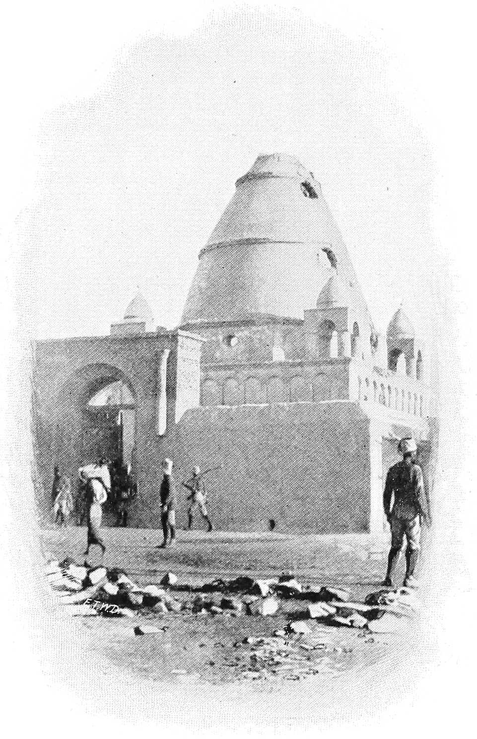
THE MAHDI’S TOMB, MORNING AFTER THE BATTLE OF 2ND SEPTEMBER, 1898.
Kodok.On the 10th September the Sirdar left Omdurman for the south with 5 gunboats, 2 Sudanese Battalions (XI and XIII), 100 Camerons, an Egyptian battery, etc., and having destroyed a Dervish force of 700 at Renk on the 15th, found, on the 19th, the French expedition entrenched at Kodok. This gallant little force of about 180 men had, after experiencing enormous difficulties in the swampy region of the Bahr el Ghazal, penetrated, with the help of its steam-launch, the “Faidherbe,” the country between the Nile-Congo watershed and Kodok, and had arrived at this latter point on the 10th July. On the 25th August they had been attacked by a Dervish force in 2 steamers, but had repulsed them, and were awaiting a second attack, when the Egyptian gunboats arrived and probably saved them from annihilation.[198]
The British and Egyptian flags were at once hoisted to the south of the French flag at Kodok, and the XIth Battalion, a gunboat and 4 guns were left at this point under Major Jackson. After much negotiation between France and England, which threatened at one time to lead to serious results between the two Powers, the French position was found to be untenable, and Kodok was eventually evacuated on the 11th December by Marchand and his companions, the latter proceeding to Jibuti, viâ the Sobat and Abyssinia, and eventually reached France in May 1899.
Sobat.The junction of the Sobat and Nile was reached on the 20th September, and a garrison (the XIIIth Battalion) left here under Captain Gamble. The Bahr el Jebel was found entirely closed by sudd, but a gunboat under Major Peake was sent up the Bahr el Ghazal, and hoisted the Egyptian flag a few miles north of Meshra el Rek.Meshra el Rek. Subsequently the Bahr el Zeraf was explored by Major Stanton for a distance of 175 miles, and the Sobat was explored by Majors Gamble, Maxse, Capper, etc., up to the 282nd mile, both these rivers and their tributaries being mapped and their courses laid down provisionally.
[267]Blue Nile.Immediately after the occupation of Omdurman gunboats were sent to patrol the Blue Nile, and a force of 600 men (Xth Battalion) and the R.I.F. Maxim detachment was despatched under Major-General Hunter, on the 19th September, to occupy Sennar, Karkoj, and Roseires, which was done on the 23rd September, 1st October, and 30th September respectively.
Battle of Gedaref. (22.9.98).On the 22nd September, Colonel Parsons, who had left Kassala on the 7th, and crossed the Atbara in flood with a force[199] of about 1,400 men, to occupy Gedaref, came into collision with its garrison of about 3,200 men, a few miles north of the town, and, beating off two desperate attacks, with a loss of 53 killed and 61 wounded out of 1,347, advanced and occupied the place.
Ahmed Fedil himself, who with about half the original garrison had previously left Gedaref in response to a summons from the Khalifa to reinforce him against the main advance on Omdurman, encountered General Hunter and the gunboats on the Blue Nile near Rufaa, and realising that Omdurman must have fallen, resolved to return at once and retake his headquarters at Gedaref, where he arrived at dawn on 28th September with some 4,000 to 5,000 men.
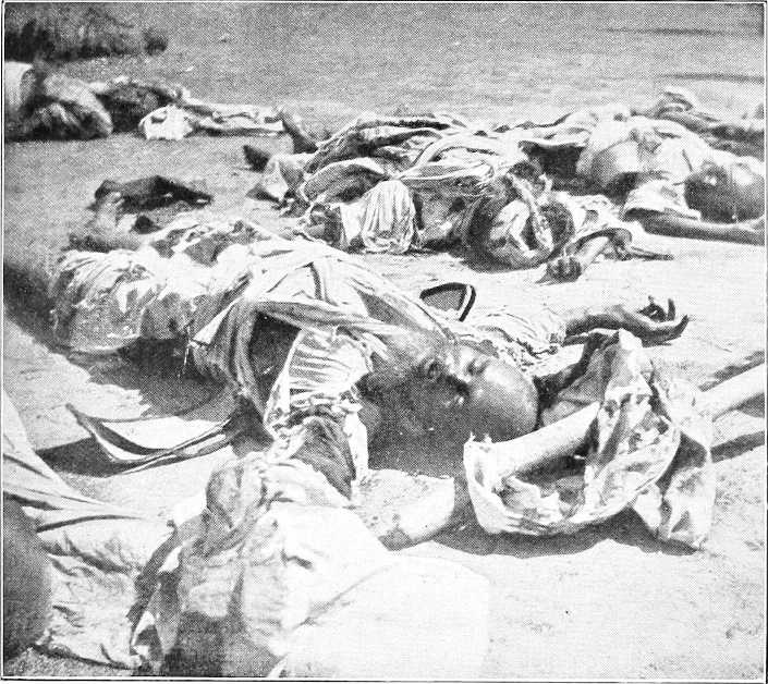
THE LATE EMIR AHMED FEDIL.
After two determined efforts to dislodge the Anglo-Egyptian troops, now safely ensconced in several walled enclosures, he withdrew after heavy loss to the village of Sofi on the Abu Haraz road, barely two miles from our forts. Here he remained for three days quietly collecting cattle and grain from the outskirts of the town and then moved to Asar, 10 miles south of Gedaref.
On receipt of the news at Omdurman of the state of affairs at Gedaref, Lieut.-Colonel Collinson was despatched to Abu Haraz with a force of about 1,100 Camel Corps and Sudanese Infantry with 2 Maxims, and arrived at Gedaref on the 21st October. Two days after the arrival of these reinforcements Ahmed Fedil began his move westwards viâ Beila and Hawata to Roseires, his march being dogged by friendlies under command of the recently surrendered Emir Abu Bakr Mustafa.
Efforts were then directed, through gunboats on the Blue Nile, to prevent him crossing that river with a view to joining the Khalifa, at that time near Sherkeila.
Action near Roseires (26.12.98).These were eventually successful, for Colonel Lewis, hearing from Roseires that the enemy were about to make the attempt to cross close by, marched with a small column (Xth Battalion and Friendlies), on the night of Christmas day, and in spite of the troops suffering much from fever, they, in a severe action on the following day, cut up most[268] of Fedil’s force as they were crossing the river near Dakhila, the leader and a few hundred men only escaping. About 500 Dervishes were killed,[200] whilst 1 British officer was wounded and 24 Egyptian Sudanese were killed and 118 wounded. Most of the remaining Dervishes subsequently surrendered on the White Nile.
Occupation of Gallabat.As the Abyssinians were becoming alarmed in consequence of our advance, and threatened trouble on their north-west frontier, a small body of troops was despatched from Gedaref to Gallabat, under Lieut.-Colonel Collinson, and hoisted the British and Egyptian flags alongside the Abyssinian one already flying on the old fort there (7th December).
Occupation of Fazogli.Fazogli and Famaka were also occupied by a small force under Lieut.-Colonel Nason, on the 22nd January, and friendly overtures were made to the Abyssinians in the neighbourhood, with completely successful results.
On 19th January, 1899, an agreement was signed between Great Britain and Egypt, defining the status of the Sudan, and laying down broad principles for its government (see p. 283).
Reconnaissance to Sherkeila.Meanwhile, it having been determined to dislodge the Khalifa if possible from his position near Sherkeila, Col. W. Kitchener started with a force of 2,007 regulars[201] and 1,650 irregulars from Fachi Shoya on the 25th January for that place. On reaching the neighbourhood of Sherkeila, 30th January, 1899, the Dervish force was found to be occupying a strong position, and was estimated at over 6,000 men. After consideration, no attack was made, and the force returned to the river.
Movements of Khalifa.During February reports were received that the Khalifa intended to attack Omdurman, but he made no forward movement, and remained in the neighbourhood of Sherkeila for some months. Many of his men deserted him owing to scarcity of food, and the neighbouring tribes harried him considerably.
Patrols.Several further river-patrols were undertaken during the spring towards the Bahr el Jebel, but the sudd still prevented progress up that river. Another patrol pushed up to the farthest navigable limit of the Baro.
1899. Operations against Khalifa.The Khalifa remained at Sherkeila till the beginning of May, when, finding himself short of food, he moved south, with about 3,000 men, in the direction of Jebel Gedir. During July and August he remained near Jebel Gurun, raiding for food in various directions, and being harassed by the Gowama and other Arab tribes. He reached Jebel Gerada, 6 miles north of Jebel Gedir, towards the end of August, and preparations were made in September for an expedition to capture or dislodge him.
Kaka expedition.Based on Kaka, the advanced guard of the force of 8,000 men reached Fungor, 50 miles inland, but the Khalifa had escaped north on the 16th October, and gave out his intention of marching on Omdurman, viâ Dueim. A flying column in gunboats under Colonel Lewis was quickly organised to follow and head him off from the river; but the enemy did not proceed much farther north than opposite Goz Abu Guma.
Gedid expedition.By the middle of November orders were given for an expedition to attack the Khalifa in the direction of Gedid, and a flying column[202] of 3,700 men, under Colonel Sir R. Wingate, left Fachi Shoya on the 21st November.
On the 22nd contact was established with Ahmed Fedil’s force at Abu Aadel. The column attacked and seized his camp, inflicting an estimated loss of over 400 in killed alone, and capturing all the grain which he was bringing to the Khalifa.
A night march followed to Gedid, and this place, containing water, was reached at 10 A.M. on the 23rd. The Khalifa’s position was located at Um Debreikat, 7 miles to the south-east, and another midnight march brought the column to within two miles of his camp. Battle of Um Debreikat and death of Khalifa, 24.11.99.After repelling a furious attack in the semi-darkness (5 A.M.), our troops drove the enemy back on to their camp, killing large numbers of them, including the Khalifa, Ali Wad Helu, Ahmed Fedil, and many other important Emirs, who, on seeing the day lost, had calmly seated themselves on their sheep-skins and awaited death. 3,000 prisoners, besides 6,000 women and children, were taken, and the Dervish loss by death was estimated at another 600.
The total loss of the Egyptian Column was 4 killed and 29 wounded men. This victory finally stamped out the Dervish dominion in the Sudan.
Khalifa Sherif.Meanwhile, in August, it was discovered that the Khalifa Sherif, who had been permitted to live on parole near Wad Medani, was again preaching Mahdism, and had collected a number of followers. Rebellion and death.The movement was promptly quashed by Captain N. M. Smyth, V.C., who surrounded his village on the 27th August and captured him. He was then tried by court-martial and shot.
Railway.During the year the railway had been steadily progressing; on the 26th August the Atbara bridge was opened, and on the last day of the year the railway reached Khartoum North.
Kordofan.El Obeid was occupied by Colonel Mahon, D.S.O., on the 17th December. It was found to be in ruins. Steps were at once taken for opening up Kordofan, the inhabitants evincing much pleasure at the re-occupation.
Darfur.Ali Dinar, with the sanction of the Government, took over the Sultanate of Darfur, and proceeded to consolidate[270] his position; in this he had a good deal of difficulty, owing to the tribes in the west and south refusing to recognise his authority.
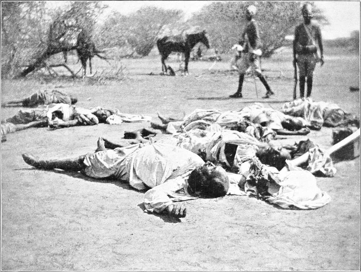
AFTER UM DEBREIKAT: BODY OF THE KHALIFA IN THE FOREGROUND.
Meanwhile Lieut.-Colonels Macdonald and Martyr, having quelled the mutiny of Sudanese troops in Uganda, pushed forward from that region in two small columns during the summer and autumn of 1898. Macdonald, starting from Mount Elgon, and marching across country, reached Latuka in September, and having made friends with the chiefs in this district, returned to Uganda in November. Martyr, proceeding down the Nile, reached Bedden and Rejaf in November, and, assisted by the Congo Free State troops, pushed on to Bor, where a Dervish garrison had been posted since March, 1897. On hearing of the advance of white troops, the Dervishes under Arabi Wad Dafaalla fled in a north-west direction. Martyr, hearing that the sudd extended from Shambe to Lake No, and recognising that no gunboat from down stream could join hands with him for many months to come, whilst the country around had been desolated by the enemy, retired again to Bedden, and formed posts at Fort Berkeley, Afuddo, and Wadelai (spring of 1899).
The Marchand column had, on its way to Kodok, proceeded down the Sueh river to Meshra el Rek, and had left small posts along its route at Tembura and many other places, even in the Rumbek country.[204] After the evacuation of Kodok, however, negotiations were entered into by the British and French Governments, and in consequence of an Agreement dated 21st March, 1899, all French territorial claim to the Bahr el Ghazal was relinquished, and the line separating the spheres of influence was drawn northwards along the Congo-Nile watershed, thence between the territories of Darfur and Wadai, and thence in a north-west direction up to the frontier of Tripoli.
Reference must here be made to affairs in Abyssinia, which have some bearing on Sudan matters.
After the Abyssinian victory over the Italians at Adua (1st March, 1896), the importance of the country began to attract much attention in Europe. Missions were sent from France and Russia to enter into friendly relations with the new Power, and in 1897, a British Mission under Mr. Rodd was despatched for the same purpose. A friendly treaty was concluded on the 14th May, but little progress in the way of commerce was made for some time. The French, whose merchants had been for many years established at the capital, Addis Abbaba, fitted out an expedition under Captain Clochette (late Marine Artillery) in the spring of 1897, which proceeded in the direction of the White Nile. Clochette died, and De Bonchamps, who succeeded him in the command, after many difficulties reached the Baro river, and eventually marched down it to the Sobat. It is difficult to say how far he penetrated, but the want of a boat and of supplies, the vast marshes, fever, and desertions of his followers, formed together such insurmountable obstacles that he was, after a gallant struggle, obliged to turn back (31st December, 1897) without reaching the Nile.
During 1897 an Abyssinian expedition was organised under Ras Makunnen, of Harrar, to subdue a rising in Beni Shangul. Without coming to a pitched battle, Wad Tur el Guri was defeated in detail, and most of this country was occupied in the spring of 1898.
In the early summer of 1898 another Abyssinian Expedition came down from the hills towards the Sobat and Nile. It was composed of 3,000 to 4,000 men, mostly armed with rifles, under Dejaj Tesemma. About half the men were mounted, and it is believed that some guns accompanied them. With the expedition were three Europeans—M. Faivre (French), Col. Artomonoff (Russian), and M. Potter (Swiss—subsequently killed).
Part of this force arrived at Waratong, on the Pibor, about June, and pushed on to the White Nile, viâ Nasser, and the left bank of the Sobat. It arrived at Sobat mouth at the end of June, only a few days before Marchand and his companions passed that point in their boats. Owing, it is reported, to the death of Tesemma,[205] the expedition returned almost immediately, apparently by the same way it had come, to the south of Waratong and the Kum Kum (or Kung Kung) country.
The victory of Omdurman and our subsequent successes appear to have impressed the Abyssinians, and a revolt by Mangasha, of Tigre, coupled perhaps with some uneasiness as to his possessions in the north-west of his kingdom, induced the Emperor Menelik to lead a large army into Tigre in the late autumn of 1898.
Mangasha was, however, quickly suppressed; the relations of the Negûs with England and Egypt continued to be of the most friendly character, and these were further accentuated by the news of the death of the Khalifa in November, 1899.
(Taken from French sources.)[206]
“When the Franco-Congolese agreement of 14th July, 1894, was concluded, the French had little difficulty in taking over the territory that had been occupied by the Belgians. Three companies of Senegalese tirailleurs—in effective force 175 men each—formed the regular military forces, and to these were joined, after a while, the native militia that had been recruited by the Belgians. Captains Vermot, Ditte, and Hossinger successively proceeded to take possession of the fortified posts still in the hands of the agents of the Congo State, and it was thus that M. Liotard was able, on his return to the Congo, at the beginning of 1895, after a seven months’ absence in France, to occupy as Commissioner of the Republic, and Lieutenant-Governor of Upper Ubangi, the important centre Zemio, on the 10th July, situated at 248 miles from the confluence of the M’Bomu with the Welle. Consequently, he was able to control the N’Sakarras and Azande tribes, whose chiefs, Bangassu, Rafaï, and Zemio, are now faithful allies of France.
“Once these territories were placed under direct French control, M. Liotard proceeded to carry out the initial programme of penetrating towards the Nile, and began to push forward the occupation of the Bahr El Ghazal Province, the rights over which, acquired by their treaty with England of 12th May, 1894, had been ceded to France by the Belgian Congolese.
“In February, 1896, M. Liotard, accompanied by Captain Hossinger, arrived at Tembura, where he was warmly received by the Azande Sultan. A post was established, and Captain Hossinger put in command. He was assassinated some months afterwards, 6th July, by a Senegalee belonging to the garrison. This did not modify in the least the political situation. M. Liotard had gained such an ascendency over the natives, that French authority was as firmly established as if it had been preceded by a vigorous military campaign.
“Moreover the personal influence of the Lieutenant-Governor impressed itself equally on his white fellow-workers.
In the Bahr El Ghazal Province—Marchand Mission.“It was thus that at the beginning of 1896, French political action had penetrated beyond the ridge of the Congo Basin, and had made itself felt in the Bahr El Ghazal Province, that is, in the Basin of the Nile. Captain Marchand therefore had had nothing to do with this, as it was only on the 25th June, 1896, practically four months after the occupation of Tembura, that this officer embarked at Marseilles. With him were Captains Baratier, Germain, Mangin, Lieutenant Largeau, Naval-Lieutenant Morin, Midshipman Dyé, Landerouin, interpreter Dr. Emily, 12 French non-commissioned officers, and 150 Senegalese tirailleurs. He had at his disposition two small steamers, the ‘Faidherbe’ and the ‘Duc d’Uzés,’ and three barges made of aluminium, the ‘Pleigneur,’ ‘Crampel,’ and the ‘Lauzière.’
“On the 23rd July, 1896, Marchand disembarked at Loango, and set to work to send forward the members of his staff and his material. The task was difficult, as the tribes between Loango and Brazzaville were in rebellion.
“On the 27th September, the head of the Mission arrived at Loudima, 155 miles from Brazzaville, in a dying condition. However, he pulled through, and on the 19th October he was on his feet again. The country had been pacified, and transports were able to get through, so that by the 1st March, 1897, Captain Marchand was able to leave Brazzaville and to reach the Upper Ubangi.
“Everything here was prepared for his forward march. M. Liotard having opened up on the east the road from Zemio to Tembura, had also freed the road to the north. To effect this, he had taken possession of Deim Zubeir, in June, 1897, formerly the residence of Lupton Bey when he commanded the Bahr El Ghazal. Thus Captain Marchand had the choice of two roads for reaching the Nile—the way by Zemio—Tembura, with the River Sueh for his flotilla, or the way of Zemio—Deim Zubeir, with the Bahr El Homr. Captain Marchand chose the first, and by tremendous exertions, lasting over eight months, all the material (boats, stores and ammunition) was concentrated near Tembura, in Fort Hossinger on the banks of the Sueh. This was in the last days of 1897.
“Marchand then chose Kojali as his point of embarkation. It is situated on the Sueh (about 50 miles N.N.E. from Fort Hossinger), and he connected it with Méré[207] by a road over 16 feet wide and 99 miles in length—a gigantic work. He built a dockyard at Kojali, with slips, for repairing his boats; then, 4 miles above the confluence of the Wau and the Sueh, he built Fort Desaix,[208] near the old Kuchuk Ali, and, in order to connect this with Kojali, he established the ‘Rapides’ station (Rafili), latitude N. 6° 52″.
“In the month of November, 1897, the whole mission was established on this solid base of operations, with the two gunboats ‘Faidherbe’ and ‘Nil,’ and ten barges built of steel and aluminium.
“Marchand, from his headquarters, Fort Desaix, set himself to convert the pronounced hostility of the Dinkas[272] (estimated at 5,000,000 (?)) into a more amicable attitude, by making them understand that he had not come to raid them in the name of the Sultan Tembura.
“In February, 1898, the announcement that a party of whites coming from the south had arrived at Ayak, on the Naam or Rohl River, determined Marchand to put his troops in motion, and this had an excellent moral effect on the population. Lieutenant Gouly was sent to occupy M’Bia, two days’ march from Ayak and Rumbek, but he unhappily died there of an attack of bilious hematuric fever; Captain Germain marched from the ‘Rapides’ post towards the Tonj, where the post of observation Diabéré was established; Captain Mangin went from Fort Desaix to Jur Ghattas; while a reinforcement of 100 tirailleurs, armed with ‘Gras’ carbines, arrived at Fort Desaix from Deim Zubeir. All the native chiefs then sent to Fort Desaix with offers of help.
“On the 26th March, Captain Baratier and the interpreter Landerouin returned from a reconnaissance which they had made as far as the confluence of the Bahr El Arab and up to Lake Nô, while Captain Largeau had explored the Bahr El Homr and made a survey of the course of the River Wau.
“At this time Captain Marchand occupied the following centres in the Basin of the Bahr El Ghazal:—Tembura, Kojali, les Rapides, Fort Desaix, Meshra El Rek, Bahr El Arab, Rumbek, Jur Ghattas, M’Bia, and Ayak. It was then that he wrote:—
“‘I hold now, in the Basin of the Bahr El Ghazal—that is, of the Nile—an all-powerful position. I have seven barges or steel boats, a steamer under way, fifteen canoes made by my tirailleurs, able to take me wherever I wish in the Basin of the Nile, where the first French steamer has now penetrated in spite of obstacles and every hostility.
“‘But do not think that our position is altogether an agreeable one. First of all, we are dying of hunger, and for a long time we have depended almost exclusively on what we shoot for food. You know that starvation was the cause of the disaster in this neighbourhood to the Dhanis[209] expedition. Locusts have ravaged the few plantations of the Bongo natives on which we were depending, and my own plantations are also destroyed. How are we going to reach the Nile? Shall we be forced to eat the ambach of the marshes? And then, if it were only the question of pushing quickly through with my boats, it would be little. But the problem is much more difficult. One must not pass through here only. The march through a country does not constitute a right to the country traversed. It must be an effective occupation, etc.’
“In spite of all these obstacles, Marchand and his companions arrived at Kodok on the 10th July, not without having had to do with the Dervishes. Three different times were they attacked by them in large numbers, but the rifles of the Senegalese tirailleurs soon caused great havoc in their ranks, and they fled, leaving their dead behind them. Thus the French Mission was able to establish itself at Kodok.”
THE END OF THE MAHDIST DOMINION.
[198]See end of Chapter for details of this expedition.
[199]Composed of:—16th Battalion, Arab Battalion, Camel Corps, Irregulars and details, the whole under 8 British officers.
[200]Among them the Emir Sadalla, who commanded the Dervish force at the first action at Gedaref.
[201]1 squadron Cavalry, 2 guns and 2 Maxims, 2nd and XIVth Battalions, &c.
[202]7th Squadron, 2nd Field Battery, 6 Maxims, 6 Companies Camel Corps, IXth and XIIIth Sudanese, 1 Company 2nd Battalion, 1 Battalion of Gehadia, etc., etc.
[204]See below (next page).
[205]False report.
[206]Translation from the “Bulletin de la Société de Géographie de Lyon.”
[207]The highest navigable point on the River Mboku.
[208]Now Wau.
[209]Congo Free State.
FROM 1900 ONWARDS.
1900.The new year opened auspiciously by the capture of Osman Digna on the 18th January by Captain F. Burges, Mamur Mohammed Bey, and a police patrol, in the Warriba Hills, some 90 miles south-west of Suakin. This notorious Emir was sent to Rosetta to join the other Dervish prisoners, and is now (1904) at Damietta.
Sudd and Survey expeditions.All the rivers were exceptionally low during the winter of 1899-1900, and the various expeditions and survey parties which were now started off had much difficulty in getting through to their posts.
Major Peake commenced clearing the sudd on the last day of December, and succeeded in opening a channel in the following April (vide p. 304). Sir W. Garstin also came up to study the Bahr el Jebel and Bahr el Ghazal rivers.
At the end of February parties of English (Uganda) (under Captain Gage), French (under Lieutenant Tanquedec), and Congolese (under Commandant Henry) troops arrived at Omdurman, having been found by Major Peake trying to cut their way through Block 3. The Uganda and Congolese parties were sent back, and the French (who were evacuating the Bahr el Ghazal) continued their journey to Europe.
Abyssinian Frontier.With the object of coming to an arrangement with Abyssinia regarding the frontier between that country and the Sudan, two surveying expeditions were sent out towards the end of 1899, under Major Austin, D.S.O., and Lieutenant Gwynn, D.S.O., respectively. The former, with Lieutenant Bright, surveyed up the Sobat and Baro Rivers to Gore, and thence in a southerly direction to the Gelo, returning viâ the Pibor River to Nasser. Owing to obstruction on the part of local Abyssinian chiefs Major Austin was unable to penetrate to Lake Rudolf, but the geographical results of his expedition were most useful. Lieutenants Gwynn and Jackson started up the Blue Nile to Famaka, thence south along the edge of the Abyssinian plateau, and across the Sonka to the Garre river, whence they returned viâ Nasser, after doing much valuable survey work.
On 22nd December, 1899, Sir R. Wingate was appointed Sirdar and Governor-General, vice Lord Kitchener, called to South Africa.
Millenniumists.In January, 1900, an increasing sect in Omdurman, which was dubbed “the Millenniumists,” and might have led to trouble, was suppressed.
Rabeh Zubeir.In April Rabeh Zubeir was attacked near Lake Chad by three converging French columns; he himself was killed, and his kingdom absolutely destroyed.
The rest of the year was mostly occupied in the Government settling down to its work, organising the exhausted country, etc.; no events of any importance took place till the end of the year.
Kiro.A Sudanese post was established in November at Kiro, on the left bank of the Upper Nile, a few miles north of the Belgian post, about 5° 30′ north lat. This post, finding in April, 1901, that it was just south of 5° 30′, crossed the river to Mongalla, where it established itself permanently.
Occupation of Bahr el Ghazal.On November 29th, 1900, an expedition under Lieut.-Colonel Sparkes left Omdurman in steamers in order to occupy the Bahr el Ghazal. It consisted of five British and 13 native officers, 82 regulars, and 266 irregulars, with necessary stores, transport, etc.
The party arrived at Meshra el Rek on 14th December, 1900, and patrols were sent out to reconnoitre. 1901.Tonj was quickly fixed on as temporary headquarters (1st January, 1901), and small expeditions were made by Colonel Sparkes to Wau, Fort Desaix, Rumbek, Amadi, Kiro, Shambe, and back to Tonj, whilst the remainder of the party consolidated its position and made friends with the natives. Lieutenant Fell, R.N., started cutting the sudd in the Jur river, with the object of opening up a waterway from the Bahr el Ghazal river, but his arduous labours, lasting for the next 15 months, were not crowned with success till June, 1902. Major W. Boulnois meanwhile conducted a patrol to Deim Zubeir, Telgona, Faroge (Forga), and Chamamui, meeting with a most friendly reception from the chiefs of these districts, and returned to Tonj on 10th April. Shortly afterwards the same officer proceded to Rumbek and chastised some raiding Nuers, with the effect of bringing the Agars and other Dinkas in at once to acknowledge Government authority.
[274]Colonel Sparkes now made an extensive patrol to the south, to visit Sultan Tembura of the Nyam Nyams. Here, after many difficulties of travel, he arrived on 25th June, 1901, and was most cordially received by the Sultan, whose people were of a comparatively highly civilised order. Sparkes returned to Wau on the 27th July, and proceeded north shortly afterwards, suffering severely from fever. In November, as Major Boulnois, besides many of the troops, was invalided owing to the same cause, Major Hunter assumed command of the Occupation Force.
Frontiers.In the spring of 1901 the question of the Sudan-Eritrea and Abyssinian Frontiers claimed the attention of the Sudan Government. Colonel Hon. M. G. Talbot concluded, with Lieutenant Colli, at Kassala, on 16th April, a treaty[210] regarding the frontier between Sabderat, the Atbara, Tomat, and Todluk, and a new grazing convention was also concluded between Colonel Collinson (Mudir of Kassala) and Signor Martini (Governor-General of Eritrea) on 28th February, 1901. Major Gwynn, D.S.O., with Captain Smyth, V.C., continued his surveys from Famaka northwards (he having arrived at this place from Addis Abbaba on the 14th April), and fixed a series of important points during his journeys, which extended altogether from Jebel Jerok to Gallabat.
Major Austin’s expedition.Meanwhile Major Austin and Lieutenant Bright had started from Nasser on a further expedition south-eastwards from Nasser on the 12th January. They were to find stores provided by the Abyssinians at Murle, on the north bank of Lake Rudolf, but on arriving at this point, after making a valuable survey from Nasser, they found no signs of Abyssinians or stores. They then struck south along the western shore of the lake, and after suffering severely from hunger and sickness, and losing 39 out of 53 of their men by starvation, they eventually arrived at Lake Baringo on the 6th August.
Darfur.Since 1898 Ali Dinar had been with some difficulty establishing himself on the throne of Darfur. He was appointed Government-Agent in that country, and in June, 1901, he began paying an annual tribute.
Raids in Darfur.In September Ali Dinar sent a strong force under Tirab Suleiman against the Maalia and Rizeigat Arabs in the south, whom he wished to bring under his sway. Tirab raided them heavily, and on their taking refuge in Kordofan threatened to pursue them thither. The consequent consternation in Kordofan was only allayed by the Mudir mobilising a force of camel corps, etc., near the frontier at Foga and Nahud. Matters quieted down, and Ali Dinar expressed his apologies.
Wadai.[211]To turn to affairs in Wadai:—
At the end of 1898 Sultan Yusef died and nominated his second son Ibrahim to succeed him, whilst Abdel Aziz his eldest son, who was a violent and war-like character, was blinded to preclude the possibility of disturbance. As Dud Murra the youngest of the three brothers got on well with Ibrahim he was left unmolested, and the late Sultan Yusef’s body was duly interred at Wara, the recognised burial place of Wadai Sultans. Ibrahim, on his accession, though his father Yusef was a strong Senussiist, refused to give up merissa drinking and declared himself an anti-Senussiist. It was at Sultan Yusef’s request that Senussi had sent Mohammed El Sunni as his representative at the Court of Abesher at the end of 1897.
Owing to widespread animosity against Ibrahim, caused partly by this friction with the Senussiists and partly by his execution of several of the Agids[212] he determined to leave Abesher on the pretext of going on pilgrimage to Wara, but in reality to seek refuge in the mountains of Abu Sinun. Sheraf El Din now took charge of affairs with the tacit consent of Jerma Othman the chief Agid, and sent an expedition to bring back the fugitive Ibrahim alive or dead. He was eventually betrayed by the ex-dervish Emir Zogal[213] and brought to Abesher, where after being, it is reported, blinded, he died of his wounds and was buried (1900). “Better,” he said, “to die as a Sultan in my Palace than to flee shamefully before slaves.” (The party sent to capture Ibrahim was under the command of the slave Gorani Gelma.) In 1902 his remains were transferred to Wara.
Thereupon Ahmed Abu Ghazali (so-called on account of his long neck), the son of the former Sultan Ali, was proclaimed Sultan through the influence of Sheraf El Din, who continued to have the chief hand in the government. This direction of affairs by a eunuch was, however, extremely unpopular and, as a protest, in September, 1901, Sultan Bekhit of Dar Sula refused to comply with orders from Abesher. Jerma, too, endeavoured to install Asil as Sultan in place of Ahmed Ghazali, but as the latter threatened to have Asil’s eyes put out, he fled to Fitri and surrendered near there to Lieut.-Colonel Destenave, in the French sphere. Ahmed now became annoyed with Jerma, as he considered him responsible for the flight of Asil, whilst the people, on the other hand, by whom Jerma was much liked, demanded the head of Ghazali’s chief adviser, Sheraf El Din. The Senussi agent, however, Mohammed El Sunni, now stepped in and effected a reconciliation between Jerma and Sheraf El Din, but the Sultan deeply incensed at the conduct of Jerma determined to kill him. Mohammed Sunni, hereupon, again intervened at the critical moment and obtained his reprieve.
[275]
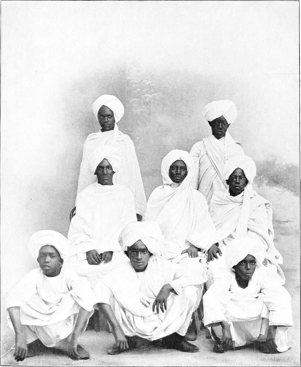
| By kind permission of] | [Capt. Amery. |
SONS OF THE MAHDI AND KHALIFA.
(Now being educated in Egypt.)
[276]With Jerma free again the Sultan and Sheraf El Din considered they were no longer safe at Abesher and both resolved to seek refuge in Dar Salamat. On the flight of the Sultan, Jerma at once assumed the direction of affairs at the capital and unsuccessfully attacked the fugitive Sultan’s rearguard soon after it had quitted Abesher. The pursuit was continued and a severe engagement took place about 40 miles further south. Another action was subsequently fought in Dar Salamat in November, 1901, and Ghazali continued his flight to El Batha.
Jerma now returned to Abeshe and in December 1901 proclaimed Dud Murra, a youth of barely 20 years of age and brother of Sultan Ibrahim, as Sultan.
Mohammed El Sunni.Mohammed El Sunni, the Senussi agent, is reported (1903) to be dead, and since the death of the Senussi, in May, 1902, the prestige of that doctrine is said to have materially decreased in Wadai.
Rome Conference.In November, in consequence of difficulties in the frontier negotiations between the Sudan, Eritrea and Abyssinia, a Conference was held in Rome, which resulted in agreements satisfactory to all, and included customs, postal and telegraph conventions between the Sudan and Eritrea (vide pp. 292-295).
Recapitulation to the end of 1901.Meanwhile the Sudan Government had been settling itself, exploring its vast territories, organising and administering the country, instituting legislation, extending communications, and in general laying the foundations of good government. Various small disturbances, not necessary to chronicle in detail, had occurred, chiefly in the neighbourhood of the frontiers, slave-raiding or refusal of sections of tribes to pay tribute being the chief causes; but on the whole, in spite of deficiency of population, limited numbers of officials, and rigid but necessary economy, the Sudan settled down into an era of peace and growing prosperity.
1902. Bahr el Ghazal.In January, 1902, Captain A. M. Pirie occupied Deim Zubeir and Chamamui, and was then recalled, owing to the murder of Lieutenant Scott-Barbour by the Agar Dinkas. This officer had been in charge of a camel convoy between Shambe and Rumbek, and was treacherously assassinated on the banks of the Naam river (Rohl) on 10th January. A punitive expedition was quickly organised by Major Hunter, and in a series of rapid marches it killed many of the Agars, burned their villages and captured their cattle. A further expedition under Captain L. Stack, arriving viâ Shambe from Khartoum in March, completed the punishment. Myang Matyang, the chief offender, died in July of wounds received, and the Agars came in and sued for peace, which was granted.
Ali Dinar.In January Ali Dinar was seriously ill, and was at one time reported to be dead; but he recovered completely.
Nuer expedition.A small exploring expedition sent under Major Blewitt up the Khor Filus into the Nuer country, belonging to Denkur, in April only resulted in the Nuers first defying the troops, and then fleeing further into the interior.
Sudd.Meanwhile Major G. E. Matthews had been hard at work for five months on the 15th block of sudd, but, owing to there being no current to take away the cut blocks, it was practically a hopeless task, and was temporarily given up, the “false channel” which circumvented this portion of the sudd proving sufficient for purposes of navigation.
Surveys.During the spring Major Gwynn continued his surveys along the Sudan-Eritrea frontier, fixing points up to Ras Kasar on the Red Sea, and eventually finishing up at a point 100 miles north of Suakin.
Treaty with Menelek.On the 15th May a treaty was signed at Addis Abbaba, defining the Sudan-Abyssinian frontier line, and containing other important clauses (vide p. 296).
Western Sudan.The great religious Sheikh El Senussi, who had previously been residing at the oasis of Kufra, becoming uneasy at the advance of the French in the Lake Chad region, as well as being apprehensive of the possible eventualities that might follow the victory of Omdurman, moved his headquarters to Geru,[214] about 10 days north of Abesher, in the year 1900. In order, too, to extend his influence and safeguard his interests, he established a zawia at Bir Alali about four days north of Lake Chad and wrote on three separate occasions to Sultan Ali Dinar of Darfur requesting him to prepare zawias for him in Jebel Marra and in Dar Zaghawa. The Sultan, however, was unwilling to be saddled with such an illustrious but inconvenient guest, and the matter eventually fell through in 1902. From that time no visits of Senussiists to El Fasher have been reported.
At last the situation in the west was brought to a head by a French patrol searching a Senussiist zawia in Kanem for reported arms. A collision ensued some time in August, 1901, which was insignificant and partook of the nature of a raid. On 19th November, however, a more serious collision took place, in which a small French force was defeated by Sheikh el Barrani, the Senussi representative in Kanem.
On the 18th January, 1902, the French, strongly reinforced, attacked the Senussiists at the zawia of Alali, in Kanem, and the latter, though assisted by the Aulad Suleiman (Tuareg) tribe, sustained a severe defeat.
The Jehad was now proclaimed by the Senussi, and hundreds of his adherents flocked into Geru from Tripoli, Wadai, and the surrounding deserts. It appears, however, that the intention of the Senussi was merely to act on the defensive, for no forward movement was undertaken; there were even rumours that the Sheikh intended to retire north to Kufra to avoid collision with the enemy. At a third action, however, which appears to have been fairly decisive, Mohammed Abu Egeil, the Senussi general in Kanem, was killed, and the Senussiists fell back eastwards and northwards.
[277]During May, 1902, the Sheikh el Senussi sickened, owing, it is said, to his anxiety regarding the situation. He is reported to have died on 30th May, and to have nominated his nephew, Ahmed el Sherif, as his successor. The story of his death was not confirmed, and for a long time rumours were rife of his appearance at Kufra, at Jaghbub, etc., with the intention of proclaiming himself a Mahdi, of going to Mecca on pilgrimage, etc., etc.; the shrine in which he was buried was reported to have been opened, and found empty, and many other stories of his reappearance were told. It seems, however, most probable that he did die on or about the date given, and it is certain that his successor has removed himself and all his property back to Kufra.
Darfur.In July Ali Dinar reported that Arabi Dafaalla, ex-Dervish Emir on the Upper Nile, had surrendered to him with all his men and 3,000 rifles, and had received the “Aman.”
Cholera.During the summer the cholera, which had been ravaging Egypt, made its appearance at Halfa, and eight natives died. Owing, however, to the strict surveillance there and at Suakin no further cases occurred in the Sudan.
On the 20th July Major Hunter, Acting Commandant of Bahr el Ghazal, died of blackwater fever.
British garrison.During the winter of 1902-03 the British garrison of Khartoum was raised from one company, which up to this time had remained only during the cold weather, to a whole battalion, permanently quartered there.
Small disturbances.Various small raids into the Sudan took place during the years 1900-03 along the Abyssinian frontier, the chief offenders being Wad Mahmud in the Keili district, and a brigand named Hakos on the border near Gallabat. Appeals to the higher Abyssinian authorities produced little result, owing to their want of control over these outlying districts. The end of these two brigands is recorded later.
In Kordofan the restless tribes of the southern hill districts were never at peace, but the inter-tribal disturbances were purely local, and in no way threatened the stability of the Government in these parts.
1903.In the Eastern Sudan the Rasheida slave-traders and the Gemilab tribe threatened at various times to give trouble, but they have quieted down, and the latter tribe has “come in.”
Delimitations.At the end of 1902 Major C. W. Gwynn proceeded, with Major C. E. Wilson, to the further delimitation of the Abyssinian frontier. He completed the demarcation from the Setit to just south of Kirin, and returning, viâ Kodok, in May, 1903, settled the limits of the new Sudanese leased territory of Itang on the Upper Baro River.
Colonel Hon. M. G. Talbot also met the Italian delegates at Kassala in February, 1903, and together they delimitated the frontier from Abu Gamal to the Setit, opposite the mouth of the Khor Royan, which point now forms the junction of Eritrea, Abyssinia, and the Sudan (vide p. 290).
Bahr el Ghazal.Colonel Sparkes set out on 13th January on a patrol to Hofrat el Nahas, the famous copper mines in Southern Darfur. He arrived there on March 1st, and was told that no European had visited it since 1876. The country was totally deserted, and it was evident that if the mines were worked, transport, although perhaps possible on the Bahr el Arab during some parts of the year, would be a matter of great difficulty. Colonel Sparkes returned to Deim Zubeir on 21st March, having marched a distance of 667 miles.
A patrol was meanwhile sent to open up relations with the powerful Azande chief, Yambio. Its commander, Captain Armstrong, was most unfortunately killed by an elephant on the 23rd February, and although the journey was continued by Colour-Sergeant Boardman, R.M.A., the expedition did not meet with success, for on reaching the Nyam Nyam country it was attacked by Yambio’s son (Mangi), and had to retire, though without loss (except of baggage, etc.).
Wadai.After continual fighting with Dud Murra, Ahmed El Ghazali was caught (20th March, 1903) in an ambush; his eyes were put out, and he was kept a captive with the Agid Salamat at Abesher. Wadai now became more or less settled, and trade was reopened to the north and east.
Bahr el Ghazal negotiations.During the past three years negotiations with the Government of the Congo Free State on the subject of the Bahr el Ghazal have been taking place; up to date, however, they have produced no definite result.
Shilluks.In April, Kur Wad Nedok, Mek of the Shilluks, was deposed for malpractices, and Fadiet Wad Kwad Keir elected in his place.
Kordofan. False prophet, September.On the 1st September, 1903, it was reported from El Obeid that a certain Mohammed El Amin, who had recently returned from Mecca and settled in Jebel Tagale, had proclaimed himself Mahdi. Colonel Mahon, C.B., D.S.O., left Khartoum at once with a squadron of cavalry, and marching viâ the Fachi-Shoya-Sherkeila route surprised and captured the false prophet at Ageila without fighting. He was conducted to El Obeid, where he was hanged on the 27th September.
October.It having been reported that Mansur Abdel Rahman, a cousin of Sultan Ali Dinar of Darfur, was raiding or collecting taxes from people in Kordofan, Captain Carter proceeded with a small force of Camel Corps from El Eddaiya and surprised the party, numbering some 40 rifles and horsemen, at Sherafa, and captured Mansur, who was subsequently liberated after the restoration of the property he had taken.
[278]Nile-Red Sea Railway.Work on this railway was commenced in November, 1903.
Darfur.During the summer of 1903 one or more treasonable conspiracies to seize the throne of Darfur were nipped in the bud by the present Sultan Ali Dinar. Adam Rijal, the Commandant of Jebel El Hella, and Tirab Suleiman, another important general, both suffered the death penalty in consequence. The ex-Dervish Emirs, Zogal and Karamalla Kirkesawi, were also both mysteriously put out of the way.
In December, 1903, at the Sultan’s request, the boundaries of Darfur were clearly explained to him in writing.
Mahmal.The first Mahmal[215] to leave Darfur for Mecca since the conquest of that country by Zubeir Pasha in 1873 arrived at Khartoum in November. The value of the “Surra”[216] was stated to be about £450. The Mahmal proceeded viâ Suakin to Jedda, and returned to Khartoum at the end of June.
Upper Nile. Thalweg Agreement.A provisional agreement defining the Thalweg of the Nile between N. Lat. 5° and 5° 30′ was drawn up on 13th September by Captain R. C. R. Owen, representing the Sudan Government, and the late General Utterwulghe, on behalf of the Government of the Congo Free State.
Floods.The winter of 1903-04 will be memorable for the exceptional height of the Nile and its tributaries in the Upper Nile region, consequent on which there followed very extensive floods.
Eastern Sudan. Hakos.The brigand Hakos, who had caused considerable annoyance by raiding and robbery along the frontier between the Setit and Gallabat, was reported to have been killed on 16th December near Nogara. Had his career not been thus suddenly terminated, the Emperor Menelik had agreed with the Sudan Government to take combined action against him.
Abyssinian Coal Expedition.An expedition to prospect for coal in the valley of the Goang (Upper Atbara), near Chelga, was despatched by the Sudan Government from Khartoum in December, 1903.
1904. Itang.Captain H. H. Wilson left Kodok on the 23rd December, 1903, with merchants to establish a trading station at Itang on the Baro. After making the preliminary arrangements there he visited Ras Tesemma Nado at Gore. His Excellency, the Governor-General, subsequently visited Itang in May, 1904.
Ibrahim Wad Mahmud.In April, 1903, after the delimitation of the Abyssinian frontier, Ibrahim Wad Mahmud, the notorious slave raider of J. Jerok, was informed that as his village fell within the limits of the Sudan, he must cease raiding and settle down. As Ibrahim, however, in spite of a second letter of warning, continued to raid and openly defied the Government, in February a mixed force of about 800 men (partly irregulars) with two guns was sent under the command of Lieutenant-Colonel Gorringe (Governor, Sennar), to capture him. The expedition was completely successful and Jebel Jerok was surprised; Ibrahim, who succeeded in escaping, was handed over to Major G. de H. Smith[217] by Sheikh Hamed of Asosa on the 3rd of March. He was subsequently brought to Wad Medani, where he was tried and hanged on the 23rd May, 1904.
Bahr El Ghazal. Lemaire Expedition.In October, 1903, a scientific mission hailing from the Congo Free State, under the leadership of the explorer Lemaire, arrived at Mvolo in the south-east Bahr El Ghazal. It withdrew in the following spring, but was again seen in 1905.
1904. Yambio Patrol.On the 27th January a strong patrol, under the command of Captain P. Wood, left Tonj to visit the Nyam Nyam Sultan Yambio. The object of the patrol was to establish friendly relations with the Nyam Nyam chiefs Riketa, Yambio, and Mangi. On arrival at Riketa’s (a son of Yambio, and avowedly friendly), the patrol met with a treacherous and hostile reception. Riketa’s village was accordingly destroyed, and the patrol returned to Tonj. Captain H. E. Haymes, R.A.M.C., who was wounded in the head, subsequently died at Tonj on the 15th March.
Yambio is now dead. Owing to his persistent treachery and hostility, a column under Major Boulnois was sent against him, and in a smart action by Major Carter, February 9th, 1905, Yambio and ten of his men were killed.
Sudan-Eritrean Frontier.A provisional agreement regarding a slight rectification of the Sudan-Eritrea frontier near Karora was drafted by representatives of both Governments in January. It has not yet been ratified.
[279]Sudd.The work of opening the 15th block of sudd on the Bahr El Jebel was recommenced by Lieutenant Drury, late R.N., in October, 1903, and continued during the succeeding 6 months, but eventually had to be again abandoned before the real channel of the river had been entirely cleared. The clearing of this block will probably be resumed, and it is hoped, completed in 1905.
Kordofan.In the spring of 1904, as several of the Meks of the Nuba Mountains continued to disregard Government orders to cease raiding and return looted property, punitive measures of a minor description were undertaken after repeated warnings, with most satisfactory results. In September, 1904, Major O’Connell with a force of 340 rifles, 3 guns and friendlies, successfully enforced the submission of the Nubas of Jabel Daier, about 60 miles south of El Obeid.
Sketch of events in the Lado Enclave.After their defeat of the Dervishes at Rejaf in February, 1897 (vide p. 263), the Belgians, under Chaltin, proceeded to occupy the territory leased to King Leopold under the Treaty of May, 1894, whilst Arabi Dafaalla and his Dervishes retreated to his deim at Bor and thence, at the end of 1898 or beginning of 1899, across the Bahr El Ghazal to Kalaka and Dar Kara.
Chaltin at once commenced to build and fortify stations at Lado (which had ceased to exist), Kiro, Loka, and Yei, whilst further south, Dufile (now moved to New Dufile), and Mahaji, etc., were occupied. At the end of 1901 Captain Hanolet was appointed Commandant Supérieur of the Enclave, and continued to improve the stations and communications with great energy. In August, 1903, Captain Hanolet was replaced by Commissaire Général G. Utterwulghe. The lamented death of this able and universally popular officer took place at Yei on the 8th May, 1904; he was succeeded by Commandant Wacquez.
Lado is now the headquarters of the Lado Enclave, whilst Yei, a fortified military station on the river of that name, is next in importance. Good roads connecting the stations on the Nile with Yei are in course of construction, and automobiles are now being used with some success to assist in the supply of the troops in the Enclave. These number some 2,000-3,000 native regulars, who are said to be excellent soldiers.
A railway connecting the Congo at Stanleyville with the shores of Lake Albert Nyanza at Mahaji, immediately to the south of the Enclave, is now in course of construction.
Mahdi on Blue Nile.In August, 1904, a religious fanatic named Adam, having first obtained promises of support from the Kenana Kawatil, openly declared himself Mahdi in the Kenana Khot near Senga. Prompt measures were taken to effect his arrest, and in the fight which ensued on his refusal to surrender the Mahdi and the whole of his adherents (11), were annihilated, while the Egyptian Mamur of Senga was unfortunately killed by the rebels.
Progress in 1903-04During 1903-1904 the Sudan Government extended its influence over and established posts in some of the remotest parts of its territory. In the north, the desert west of Dongola was widely explored and a post established on the Arbain road. The Arab tribes living in the wildest regions of the Southern Atbai were visited and much of this country mapped. Further south, the heart of the district inhabited by the redoubtable Gemilab tribe was reconnoitred and surveyed. Posts were established in the little-known country, previously infested by Abyssinian brigands, between the River Setit and Gallabat, and in consequence of these measures for public security the trade with Abyssinia at the latter place rapidly increased.
South of Roseires the administration was extended to the mountainous district of J. Tabi, hitherto practically unexplored and unknown, and inhabited by a shy and distinctive Negro race. Further south, the country of the more northern Burun adjoining the Abyssinian frontier and, until recently, the happy hunting ground of border slave raiders, was pacified and effectively garrisoned by regulars, whilst the opening up of trade routes from the border districts of Abyssinia to the Blue and White Niles and Sobat was commenced. In the Upper Nile Province, the Shilluk tribe was brought under the more direct control of the Government, whilst considerable progress was made with the Dinkas on the Sobat and the deeply suspicious Nuers of the Bahr El Zeraf, whose country had long remained unexplored by a white man. The Pibor river was navigated for 170 miles beyond the Akobo junction, or 240 miles from its mouth, and its source was roughly determined.
At Mongalla a suitable station was constructed and the almost unknown tribes, Beri and Aliab, visited in the spring of 1904, posts being established where necessary.
In the Bahr El Ghazal Province,[218] patrols traversed a great part of the country and the main roads were improved sufficiently to admit of the successful introduction of wheeled transport. In Southern Kordofan effective administration was extended, and detachments of regular troops were quartered throughout the Nuba mountains.
The most important step taken by the Government during 1903-1904 for the economic development of[280] the Sudan was the commencement of a railway connecting the port of Suakin with the present main line near the Atbara mouth. In addition, reconnaissances were carried out for a branch line from Abu Hamed to Merowe and Affat in the Dongola Province.
The future advancement of the country was further enhanced by the efforts made by the Government to encourage the cultivation of cotton, both by the issue of large grants of seed as well as by an arrangement through which a fair price was guaranteed to the producer for all cotton placed on the market.
Visits of distinguished persons.It only remains to be stated that in January 1900, and again in February 1905, T.R.H. the Duke and Duchess of Connaught, and in November 1901 His Highness the Khedive, visited Khartoum; a year later General Lord Kitchener did the same and opened the Gordon College; whilst Lord Cromer paid visits in December 1899, January 1901 and January 1903, proceeding as far as Gondokoro in the latter year.
H.R.H. Princess Henry of Battenberg, accompanied by the Princesses Victoria of Battenberg and Beatrice of Saxe-Coburg, visited Khartoum in February 1904.
Sir William Garstin visited the White Nile, Bahr El Ghazal, Bahr El Zeraf and Blue Nile in 1899-1904, and the Bahr El Jebel in 1901 and again in 1904, when he also explored the River Atem or “Gertrude” Nile. In 1903 he visited Uganda, Semliki River, Albert Nyanza, as well as the Bahr El Jebel. The results of these journeys have now been published, August 1904 (F.O. Blue Book, Egypt, No. 2, 1904).
Explorers.The following noted travellers, in addition to numerous distinguished sportsmen, have passed through Khartoum at different times since 1898: Wellby, Grogan, Donaldson-Smith, Henri, Gibbons, Neumann, Austin, Bright, Lionel Decle, Macmillan, and Bulpett, Sir C. Eliot, Powell Cotton, and Pierre. The latter arrived in January, 1904, from Zemio in Haut Ubangi viâ Deim Zubeir and Wau.
GOVERNORS-GENERAL OF THE SUDAN.
| Name. | Date. | |
|---|---|---|
| Mohammedan. | Gregorian. | |
| Osman Bey | 1240 | 1825 |
| Maho Bey | 1241 | 1826 |
| Khurshid Pasha | 1241 | 1826 |
| Ahmed Pasha Abu Udn | 1254 | 1839 |
| Ahmed Pasha El Minikli | 1259 | 1844 |
| Khaled Pasha | 1262 | 1846 |
| Abdel Latif Pasha | 1266 | 1850 |
| Rustem Pasha | 1267 | 1851 |
| Ismail Pasha Abu Jebel | 1268 | 1852 |
| Selim Pasha | 1269 | 1853 |
| Ali Pasha Sirri | 1270 | 1854 |
| Ali Pasha Sharkas | 1271 | 1855 |
| Arakil Bey | 1273 | 1857 |
| Hassan Bey Salama | 1275 | 1859 |
| Mohammed Bey Rasikh | 1278 | 1862 |
| Musa Pasha Hamdi | 1279 | 1863 |
| Jaafar Pasha Sadek | 1281 | 1865 |
| Jaafar Pasha Mazhar | 1282 | 1866 |
| Mumtaz Pasha | 1287 | 1871 |
| Ismail Pasha Ayub | 1289 | 1873 |
| Gordon Pasha | 1293 | 1877 |
| Rauf Pasha | 1296 | 1879 |
| Abdel Gader Pasha | 1299 | 1882 |
| Ala El Din Pasha | 1300 | 1883 |
| Gordon Pasha | 1301 | 1884[219] |
| Kitchener Pasha | 1316 | 1899 |
| Wingate Pasha | 1317 | 1899 |
[281]
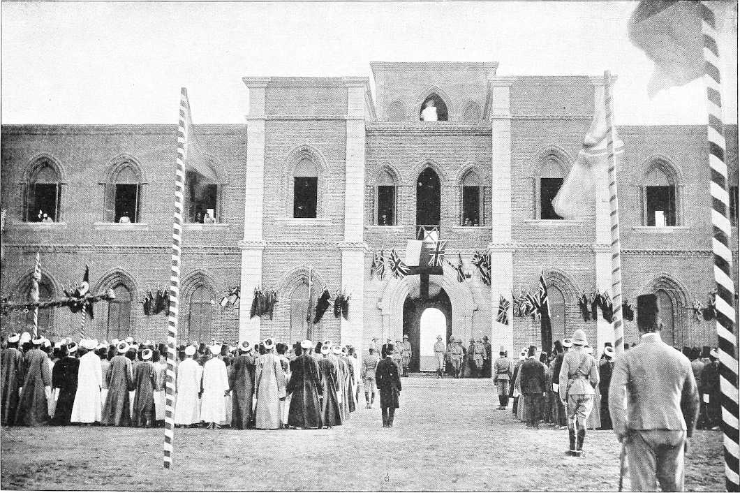
| By kind permission of] | [M. Venieris. |
RECEPTION OF LORD KITCHENER AT THE GORDON COLLEGE, KHARTOUM. NOVEMBER, 1902.
[211]Taken chiefly from an account of Wadai written by Captain Julien, formerly resident at Kuti, published in “L’Afrique Française.”
[212]The Agids are the important men in Wadai, i.e., the chief noblemen, governors of districts, generals, etc.
[214]Approximately N. Lat. 19°, E. Long. 20° 10′.
[215]“Mahmal” means literally “something carried.” It is said to have been originated about the 12th Century A.D. by a certain Queen of Egypt named Shagar El Durr, of the Ayubite Dynasty, who prepared a very sumptuous litter (hodag), on which she intended to visit Mecca by camel. State affairs, however, prevented her making personal use of the “hodag,” which she therefore sent to Mecca with presents of money. This sending of the “hodag” to Mecca gradually became a custom, and was eventually copied in Syria. Nowadays a Mahmal leaves Cairo and Damascus simultaneously each year, and consists of a richly ornamented dome-shaped “hodag” or litter which is carried on a camel to Mecca and lodged in the “Kaaba” there until the Mahmal returns, when it is taken back again. The richly embroidered curtains, however, are presented to the “Kaaba” or Mosque.
[216]Surra means “package”—in this case a package of money: it is sent partly as a present to the Sherif of Mecca for the maintenance of the “Kaaba” and partly to the Arab Sheikhs along the road, who otherwise would endeavour to loot the Mahmal on its journey.
[217]Died at Khartoum, October 10th, of blackwater fever.
[218]H. E. Governor-General visited Wau in November, 1904; H. E. left Khartoum at 3 a.m. on the 7th November, and arrived at Wau at 11 a.m. on the 17th, the journey having occupied 10½ days. The return journey was accomplished, including the inspection of intermediate stations, in under 8 days—a “record.”
[219]To 26th January, 1885.
TEXT OF TREATIES AND AGREEMENTS REGARDING THE ANGLO-EGYPTIAN SUDAN.
AGREEMENT BETWEEN HER BRITANNIC MAJESTY’S GOVERNMENT AND THE GOVERNMENT OF HIS HIGHNESS THE KHEDIVE OF EGYPT RELATIVE TO THE FUTURE ADMINISTRATION OF THE SUDAN.
WHEREAS certain provinces in the Sudan which were in rebellion against the authority of His Highness the Khedive have now been reconquered by the joint military and financial efforts of Her Britannic Majesty’s Government and the Government of His Highness the Khedive;
AND whereas it has become necessary to decide upon a system for the administration of and for the making of laws for the said reconquered provinces, under which due allowance may be made for the backward and unsettled condition of large portions thereof, and for the varying requirements of different localities;
AND whereas it is desired to give effect to the claims which have accrued to Her Britannic Majesty’s Government, by right of conquest, to share in the present settlement and future working and development of the said system of administration and legislation;
AND whereas it is conceived that for many purposes Wadi Halfa and Suakin may be most effectively administered in conjunction with the reconquered provinces to which they are respectively adjacent;
Now, it is hereby agreed and declared by and between the Undersigned, duly authorized for that purpose, as follows:—
ARTICLE I.
The word “Sudan” in this Agreement means all the territories South of the 22nd parallel of latitude, which:
1. Have never been evacuated by Egyptian troops since the year 1882; or
2. Which having before the late rebellion in the Sudan been administered by the Government of His Highness the Khedive, were temporarily lost to Egypt, and have been reconquered by Her Majesty’s Government and the Egyptian Government, acting in concert; or
3. Which may hereafter be reconquered by the two Governments acting in concert.
ARTICLE II.
The British and Egyptian flags shall be used together, both on land and water, throughout the Sudan, except in the town of Suakin, in which locality the Egyptian flag alone shall be used.
ARTICLE III.
The supreme military and civil command in the Sudan shall be vested in one officer, termed the “Governor-General of the Sudan.” He shall be appointed by Khedivial Decree on the recommendation of Her Britannic Majesty’s Government, and shall be removed only by Khedivial Decree, with the consent of Her Britannic Majesty’s Government.
[284]ARTICLE IV.
Laws, as also Orders and Regulations with the full force of law, for the good government of the Sudan, and for regulating the holding, disposal, and devolution of property of every kind therein situate, may from time to time be made, altered, or abrogated by Proclamation of the Governor-General. Such Laws, Orders and Regulations may apply to the whole or any part named of the Sudan, and may, either explicitly or by necessary implication, alter or abrogate any existing Law or Regulation.
All such Proclamations shall forthwith be notified to Her Britannic Majesty’s Agent and Consul-General in Cairo, and to the President of the Council of Ministers of His Highness the Khedive.
ARTICLE V.
No Egyptian Law, Decree, Ministerial Arrêté, or other enactment hereafter to be made or promulgated shall apply to the Sudan or any part thereof save in so far as the same shall be applied by Proclamation of the Governor-General in manner hereinbefore provided.
ARTICLE VI.
In the definition by Proclamation of the conditions under which Europeans, of whatever nationality, shall be at liberty to trade with or reside in the Sudan, or to hold property, within its limits, no special privileges shall be accorded to the subjects of any one or more Power.
ARTICLE VII.
Import duties on entering the Sudan shall not be payable on goods coming from Egyptian territory. Such duties may, however, be levied on goods coming from elsewhere than Egyptian territory, but in the case of goods entering the Sudan at Suakin, or any other port on the Red Sea littoral, they shall not exceed the corresponding duties for the time being leviable on goods entering Egypt from abroad. Duties may be levied on goods leaving the Sudan, at such rates as may from time to time be prescribed by Proclamation.
ARTICLE VIII.
The jurisdiction of the Mixed Tribunals shall not extend, nor be recognised for any purpose whatsoever, in any part of the Sudan, except in the town of Suakin.
ARTICLE IX.
Until and save so far as it will be otherwise determined by Proclamation, the Sudan, with the exception of the town of Suakin, shall be and remain under martial law.
ARTICLE X.
No Consuls, Vice-Consuls, or Consular Agents shall be accredited in respect of nor allowed to reside in the Sudan, without the previous consent of Her Britannic Majesty’s Government.
ARTICLE XI.
The importation of slaves into the Sudan, as also their exportation, is absolutely prohibited. Provision shall be made by Proclamation for the enforcement of this Regulation.
ARTICLE XII.
It is agreed between the two Governments that special attention shall be paid to the enforcement of the Brussels Act of 2nd July, 1890, in respect to the import, sale, and manufacture of fire-arms and their munitions, and distilled or spirituous liquors.
Done in Cairo, the 19th January, 1899.
| (Signed) | BOUTROS GHALI—CROMER. |
WHEREAS, under our Agreement made the 19th day of January, 1899, relative to the future administration of the Sudan, it is provided by Article VIII. that the jurisdiction of the Mixed Tribunals shall not extend nor be recognised for any purpose whatsoever in any part of the Sudan except in the town of Suakin;
And Whereas no Mixed Tribunal has ever been established at Suakin and it has been found to be inexpedient to establish any such tribunal in that locality, by reason notably of the expenses which the adoption of this measure would occasion;
And Whereas grievous injustice is caused to the inhabitants of Suakin by the absence of any local jurisdiction for the settlement of their disputes, and it is expedient that the town of Suakin should be placed upon the same footing as the rest of the Sudan;
And Whereas we have decided to modify our said agreement accordingly in manner hereinafter appearing;
NOW, it is hereby agreed and declared by and between the Undersigned duly authorised for that purpose, as follows:
ARTICLE I.
Those provisions of our Agreement of the 19th day of January, 1899, by which the town of Suakin was excepted from the general regime established by the said Agreement for the future administration of the Sudan, are hereby abrogated.
Done at Cairo, the 10th of July, 1899.
| (Signed) | BOUTROS GHALI—CROMER. |
DECLARATION.
Signed at London, March 21, 1899.
[Ratifications exchanged at Paris, June 13. 1899.]
The undersigned, duly authorised by their Governments, have signed the following Declaration:—
The IVth Article of the Convention of the 14th June, 1898, shall be completed by the following provisions, which shall be considered as forming an integral part of it:—
1. Her Britannic Majesty’s Government engages not to acquire either territory or political influence to the west of the line of frontier defined in the following paragraph, and the Government of the French Republic engages not to acquire either territory or political influence to the east of the same line.
2. The line of frontier shall start from the point where the boundary between the Congo Free State and French territory meets the water-parting between the watershed of the Nile and that of the Congo and its affluents. It shall follow in principle that water-parting up to its intersection with the 11th parallel of north latitude. From this point it shall be drawn as far as the 15th parrallel in such manner as to separate, in principle, the Kingdom of Wadai from what constituted in 1882 the Province of Darfur; but it shall in no case be so drawn as to pass to the west beyond the 21st degree of longitude east of Greenwich (18° 40′ east of Paris), or to the east beyond the 23rd degree of longitude east of Greenwich (20° 40′ east of Paris).
3. It is understood, in principle, that to the north of the 15th parrallel the French zone shall be limited to the north-east and east by a line which shall start from the point of intersection of the Tropic of Cancer with the 16th degree of longitude east of Greenwich (13° 40′ east of Paris), shall run thence to the south-east until it meets the 24th degree of longitude east of Greenwich (21° 40′ east of Paris), and shall then follow the 24th degree until it meets, to the north of the 15th parallel of latitude, the frontier of Darfur as it shall eventually be fixed.
4. The two Governments engage to appoint Commissioners who shall be charged to delimit on the spot a frontier-line in accordance with the indications given in paragraph 2 of this Declaration. The result of their work shall be submitted for the approbation of their respective Governments.
It is agreed that the provisions of Article IX of the Convention of the 14th June, 1898, shall apply equally to the territories situated to the south of the 14° 20′ parallel of north latitude, and to the north of the 5th parallel of north latitude, between the 14° 20′ meridian of longitude east of Greenwich (12th degree east of Paris) and the course of the Upper Nile.
Done at London, the 21st March, 1899.
| (L.S.) | (Signed) | SALISBURY. |
| (L.S.) | (Signed) | PAUL CAMBON. |
AGREEMENT BETWEEN GREAT BRITAIN AND HIS MAJESTY KING LEOPOLD II, SOVEREIGN OF THE INDEPENDENT STATE OF THE CONGO, RELATING TO THE SPHERES OF INFLUENCE OF GREAT BRITAIN AND THE INDEPENDENT STATE OF THE CONGO IN EAST AND CENTRAL AFRICA.
Signed at Brussels 12th May, 1894.
The undersigned, the Honorable Sir Francis Richard Plunkett, a Knight Grand Cross of the most distinguished Order of St. Michael and St. George, Her Britannic Majesty’s Envoy Extraordinary and Minister Plenipotentiary to the King of the Belgians on behalf of the British Government, and M. van Eetvelde, Officer of the Order of Leopold, Grand Cross of the Orders of St. Gregory the Great, of Christ of Portugal, and of the African Redemption, etc., Secretary of State of the interior of the Independent State of the Congo, on behalf of the Government of the Independent State of the Congo, duly authorised by their respective Governments, have agreed as follows:—
His Majesty the King of the Belgians, Sovereign of the Independent State of the Congo, having recognised the British sphere of influence, as laid down in the Anglo-German Agreement of the 1st July, 1890 (No. 129), Great Britain undertakes to give to His Majesty a lease of territories in the Western basin of the Nile, under the conditions specified in the following Articles:
Boundary. North of German Sphere. Watersheds between the Nile and the Congo.
Art. I. (a) It is agreed that the sphere of influence of the Independent Congo State shall be limited to the north of the German sphere in East Africa by a frontier following the 30th meridian east of Greenwich up to its intersection by the watershed between the Nile and the Congo, and thence following this watershed in a northerly and north-westerly direction.
(b) (Defines boundary from R. Zambezi to Lake Tanganyika.)
Lease of certain territories by Great Britain to the Congo State. West shore of Lake Albert and Watershed between the Nile and the Congo.
Art. II. Great Britain grants a lease to His Majesty King Leopold II, Sovereign of the Independent State of the Congo, of the territories hereinafter defined, to be by him occupied and administered on the conditions and for the period of time hereinafter laid down.
Boundaries.
The territories shall be bounded by a line starting from a point situated on the west shore of Lake Albert, immediately to the south of Mahagi, to the nearest point of the frontier defined in paragraph (a) of the preceding Article. Thence it shall follow the watershed between the Congo and the Nile up to the 25th meridian east of Greenwich, and that meridian up to its intersection by the 10th parallel north, whence it shall run along that parallel directly to a point to be determined to the north of Fashoda. Thence it shall follow the “thalweg” of the Nile southward to Lake Albert, and the western shore of Lake Albert to the point above indicated south of Mahagi.
This lease shall remain in force during the reign of His Majesty King Leopold II, Sovereign of the Independent Congo State.
Nevertheless, at the expiration of His Majesty’s reign, it shall remain fully in force as far as concerns all the portion of the territories above-mentioned situated to the west of the 30th meridian east of Greenwich, as well as a strip of 25 kilom. in breadth, to be delimitated by common consent, stretching from the watershed between the Nile and the Congo up to the western shore of Lake Albert, and including the port of Mahagi.
This extended lease shall be continued as long as the Congo territories as an Independent State or as a Belgian Colony remain under the sovereignty of His Majesty and his Majesty’s successors.
Flag.
Throughout the continuance of a lease there shall be used a special flag in the leased territories.
Lease of Territory by Congo State to Great Britain between Lake Tanganyika and Lake Albert Edward.
[Art. III.[220] The Independent Congo State grants under lease to Great Britain, to be administered when occupied under the conditions and for a period hereinafter determined, a strip of territory 25 kilom. in breadth, extending from the most northerly port on Lake Tanganyika, which is included in it, to the most southerly point of Lake Albert Edward.
This lease will have similar duration to that which applies to the territories to the west of the 30th meridian east of Greenwich.]
[287]Self-Denying Declaration.
Art. IV. His Majesty King Leopold II, Sovereign of the Independent Congo State, recognises that he neither has nor seeks to acquire any political rights in the territories ceded to him under lease in the Nile basin other than those which are in conformity with the present Agreement.
Similarly, Great Britain recognises that she neither has, nor seeks to acquire, any political rights in the strip of territory granted to her on lease between Lake Tanganyika and Lake Albert Edward other than those which are in conformity with the present Agreement.
Telegraphic Communication.
Art. V. The Independent Congo State authorises the construction through its territories by Great Britain, or by any Company duly authorised by the British Government, of a line of telegraph connecting the British territories in South Africa with the British sphere of influence on the Nile. The Government of the Congo State shall have facilities for connecting this line with its own telegraphic system.
This authorisation shall not confer on Great Britain or any Company, person, or persons, delegated to construct the telegraph line, any rights of police or administration within the territory of the Congo State.
Equality of Treatment in Territories Leased.
Art. VI. In the territories under lease in this Agreement the subjects of each of the Contracting Parties shall reciprocally enjoy equal rights and immunities, and shall not be subjected to any differential treatment of any kind.
In witness whereof the undersigned have signed the present Agreement, and have affixed thereto the seal of the arms.
Done in duplicate at Brussels, this 12th day of May, 1894.
| (L.S.) | FRANCIS RICHARD PLUNKETT. |
| (L.S.) | EDM. VAN EETVELDE. |
Claims of Turkey and Egypt in Basin of the Upper Nile not Ignored.
(1) Sir F. Plunkett to Mr. van Eetvelde.
British Legation, Brussels,
12th May, 1894.
M. le Secrétaire d’Etat,
The Earl of Kimberley, in authorising me to sign the Agreement of this day’s date for a lease of certain territories in the British sphere of influence in East Africa to His Majesty King Leopold II, has directed me to record the assurance that the parties to the agreement do not ignore the claims of Turkey and Egypt in the Basin of the Upper Nile.
I avail, etc.,
F. R. PLUNKETT.
(2) M. van Eetvelde to Sir F. Plunkett.
Brussels,
12th May, 1894.
Sir,
In signing on behalf of His Majesty King Leopold II, the Agreement of this day’s date, for a lease of certain territories in the British sphere of influence in East Africa, I reciprocate the assurance that the parties to the Agreement do not ignore the claims of Turkey and Egypt in the Basin of the Upper Nile.
I avail, etc.,
EDM. VAN EETVELDE.
Explanatory Despatch relating to the above Agreement between Great Britain and the Congo State, of 12th May, 1894.
The Earl of Kimberley to Mr. Hardinge.
Foreign Office,
23rd May, 1894.
Sir,
Claims of Egypt and Turkey to Equatorial Provinces.
* * * * * * * * *
On approaching His Majesty, Her Majesty’s Government found him fully disposed to enter into an arrangement which, while enabling him to continue the work he had commenced, would record his recognition of the position of[288] Great Britain in her sphere, and of such claims as Egypt, and, through her, Turkey, may have to the Equatorial Provinces whose administration was abandoned owing to the evacuation of the Sudan.
I enclose copy of agreement by which His Majesty, having recognised, on behalf of the Congo State, the British sphere of influence as laid down in the Anglo-German Agreement of 1890, received from Great Britain leases of the territory specified in the Agreement under certain conditions.
Her Majesty’s Government are satisfied that, under the Agreement, this portion of the British sphere will be administered in a spirit in full accordance with the requirements of civilisation, and of the Acts of Berlin and Brussels.
* * * * * * * * *
I have, etc.,
KIMBERLEY.
DECLARATION BETWEEN GREAT BRITAIN AND THE CONGO FREE STATE, WITHDRAWING ART. III OF THE AGREEMENT OF 12th MAY, 1894, RESPECTING THE TERRITORY BETWEEN LAKE TANGANYIKA AND LAKE ALBERT EDWARD.
Brussels, 22nd June, 1894.
DECLARATION.
In compliance with the request made by His Majesty the King of the Belgians, Sovereign of the Independent State of the Congo, that the Government of Her Britannic Majesty will consent to the withdrawal of Art. III. of the Agreement of the 12th May, 1894, the Undersigned, duly authorised by their respective Governments, agree that the said Article be withdrawn.
Done, in duplicate, at Brussels, the 22nd day of June, 1894.
| F. R. PLUNKET. |
| EDMOND VAN EETVELDE. |
AGREEMENT re TRIBES BETWEEN KHOR BARAKA AND RED SEA.
With a view to establishing in a permanent manner the dependence of the semi-nomadic tribes which exist on the frontier between the Baraka and the Red Sea, and to determining precisely the frontier separating the Italian and Egyptian territory in this region, H.E. Ferik Sir Herbert Kitchener, Pasha, Sirdar of the Egyptian Army, and H.E. Cavaliere Oreste Baratieri, Lieut. General, Governor of the Colony of Eritrea, authorised by their respective Governments have agreed to the following articles:—
I. In the district between the Red Sea and the Baraka, the frontier line between Egypt and Eritrea shall follow a line which, starting from Ras Kasar joins the principal branch of the Karora about 2 kilom. from the coast, and follows the course of the Karora up to a point marked Karora on the map. The frontier then follows the watershed between the torrents Aiet and Merib on the north and the torrents Falkat and Sela on the south, up to a point on the plateau of Hagar Nush, to be fixed by the delineators, and from that point so fixed shall proceed to join the Baraka at a point which is also left to the delineators to establish, following a clearly determined natural line. From the Baraka, the line of frontier goes straight to the intersection of the 17th parallel north with the 37th meridian east of Greenwich.
II. The semi-nomadic tribes on the frontier known as the Hazerandowa (Ad-Azeri), Felunda (Aflenda), Beit Maleh, and Rashaida, together with the sections of the Beni Amer at present acknowledging the authority of Sheikh Idris Hamen, are recognised as dependent on the Egyptian Government; and the Beni Amer acknowledging Sheikhs Ali Husseid, and Mahmud Sherif, as well as the Hababs, are recognised as dependent on the Government of Eritrea.
III. The two Governments bind themselves to concede reciprocally, reserving themselves the power of imposing a moderate tax in payment, rights of pasturage and cultivation in their respective territories to such alien tribes as apply for the concession through their respective Governments. Such concession shall be limited only by the requirements of public safety and by the needs of other local tribes dependent on the Government giving the concession.
IV. The two Governments bind themselves reciprocally to oppose as far as is practicable, and without necessarily having recourse to force, the settlement in their respective territories of tribes who may cross the frontier in consequence of rebellion or defection of their chiefs.
[289]In the interests of public tranquility, the two Governments further bind themselves to take into consideration according to the circumstances of each case, the expediency of total or partial disarmament of the tribes on the frontier, due allowance being made for the requirements of their defence.
Each of the two Governments, however, reserves to itself full liberty to decide upon the measures which it shall take in its own territory, both as regards the means of opposing the immigration of rebellious tribes, and in respect to the time, method and extent of the disarmament to which this article refers.
| (Signed) | HERBERT KITCHENER, Sirdar. | ||
| Asmara, 25th June, 1895. |
|||
| (Signed) | GENERALE O. BARATIERI. | ||
| 7th July, 1895. |
ERITREA-SUDAN FRONTIER BETWEEN RAS KASAR AND THE KHOR BARAKA, AS SETTLED BY THE PARSONS-MARTINI AGREEMENT, SIGNED AT ASMARA, 7th DECEMBER, 1898.
Being desirous of determining the Sudan and Italian frontier between Ras Kasar and Baraka, and thus ratifying the Kitchener-Baratieri Convention of the 7th July, 1895, the undersigned, El Lewa Parsons Pasha, Governor of Suakin and Commandant of Kassala Station, on behalf of His Highness the Khedive of Egypt; and Chevalier Ferdinando Martini, Extraordinary Civil Commissioner of the Colony of Eritrea, on behalf of His Majesty the King of Italy, have agreed as follows:—
Art. I. Starting from the Cape of Ras Kasar on the Red Sea the frontier between the Sudan and Eritrea follows a line which, following the heights of Halabai (Halibai) and Gaba Keli (Gabei-Helli) joins the bed of the Karora (Carora) and ascends the latter to the heights of Tefleinai (Teflanait), whence viâ Abbeinedu mountain it reaches the watershed between the valleys of Karora (Carora) and Tabbeh (Tabeh) on the south and the Aitara (Aitera) and Areirib (Arerib) on the north, it then runs in a westerly direction along the above-mentioned watershed to the hillock of Mashonkole (Sciancolet), and thence by the slopes of Sigat Alim (Sigat Tellim) it reaches a little to the north of Roribet mountain, the plateau of Hagar Nush (Nusch); thence it follows its northern edge to the summit of Hamoiet (Hamoet) and along the Hafta (Afta) torrent to the wells of the same name, thence to Jebel Aar (Monte Haar) over the undulating region which forms the watershed between the middle course of the Ambakta (Ambacta) and the Lui (Loi) torrent; from that rocky region it proceeds to the Baraka (Barca) and joins it at its confluence with the Ambakta (Ambacta) following the slopes which limit on the north the lower portion of this last named valley.
Art. II. Two Commissioners, delegated one by the Egyptian Government, and the other by the Italian Government, will proceed within six months to demarcate the frontier by erecting boundary pillars.
Done at Asmara in duplicate, in Italian and Arabic, on the 7th day of December, 1898.
| (Signed) | CHARLES PARSONS, PASHA. |
| (Signed) | MARTINI. |
(Names in brackets as spelt in Italian version—G.)
DELIMITATION OF FRONTIER BETWEEN ERYTHRÆA AND THE EGYPTIAN-SUDAN.
From the point of junction of the Ambakta with the Baraka, the line of frontier follows the course of the latter (Baraka) up-stream to its junction with the Khor Dada, and then turning in a westerly direction follows the Dada throughout its course to its source at the foot of the Iskénié range of hills.
The line now turns southwards and follows the watershed between the streams flowing directly to the Baraka on the east and those flowing to the Gash and Langeb on the west. This watershed is defined by the Iskénié Koreb and Yaet (Tai-yé) ranges of hills, by Jebel Meesat and finally by Jebel Benefer.
From Jebel Benefer the line of frontier passes in almost a direct line to the Sabderat range, being defined south of Jebel Benefer by the low hill Tedelaié, by Jebel Afada-Gumbib, by the hills Gelmabai and Dobadob, and finally by the peak called Deberenis on the Sabderat range.
[290]From Deberenis the line crosses the Sabderat range by Jebel Eunice to the peak called Kwasana, and thence crosses Khor Sabderat to a point on the range of hills south of the Khor.
This point has been marked by a pillar.
The cliff of Shababit is left in Sudanese territory.
| W. J. WALTER. |
| Capt. W. MEYER. |
| BONGIOVANNI SIMONE. |
Sabderat,
1st June, 1899.
(The above is the sense of the original British and Italian versions combined: they are not exact translations of each other.—G.)
GENERAL DESCRIPTION OF THE FRONTIER BETWEEN THE SUDAN AND ERITREA FROM SABDERAT TO TODLUC. (With Map.)
Commencing from the last pillar erected in 1899 by Major Walter and Captain Bongiovanni on the south of the Kassala-Sabderat road, the boundary runs in a southerly direction practically in a straight line to Jebel Anderaib, situated about 3 kilom. from the right bank of the Gash; from there it runs nearly due west to a point on the Gash south of Jebel Gulsa, which it leaves entirely in Sudan territory; from the right bank of the Gash it runs straight to the highest point of Jebel Abu Gamal.
[221][From Jebel Abu Gamal it proceeds in a straight line to a point in latitude 14° 52′ north, on the right bank of the Atbara in the small district of El Egeiri, which is bounded on the north by the districts of El Yoya and El Rumeila, and on the south by that of El Alim.]
[221][From this point it ascends the deepest channel of the Atbara till it reaches its junction with the Setit, where it leaves the Atbara and ascends the deepest channel of the Setit to a point between the districts of El Gereiish and Abuda.]
[221][From here it proceeds in a straight line on a true bearing of about 56° east of north to Todluc, leaving within the territory of Eritrea the group of low hills known as Jebel Alaklai.]
Done in double original at Todluk, the 16th day of April, 1901.
| (Signed) | M. G. TALBOT, Miralai, Commissioner for the Sudan. |
| (Signed) | GIUSEPPE COLLI DI FELIZZANO, Tenente Piemonte Reale Cavalleria incaricato per il Governo dell’ Eritrea. |
DESCRIPTION OF THE LINE AGREED UPON FOR THE RECTIFICATION OF THE BOUNDARY BETWEEN THE ANGLO-EGYPTIAN SUDAN AND THE COLONY OF ERYTHRÆA. (With Map.)
The rectified boundary shall run from the highest summit of Jebel Abu Gamal to the highest point of the group of low hills known as El Burak, situated on the magnetic bearing of 175° from Abu Gamal and 14 kilometres distant.
From El Burak it shall run in a straight line to the eastern ridge of the Koraiteb Hills, passing through the highest rock of this ridge, the highest of the whole group, and leaving to the Sudan the water-holes in the Koraiteb Rocks to the west of this line. The Sudan Government, however, shall allow Erythræan subjects with caravans from Sogada to Noggara, or vice versâ, or engaged in collecting gum in Erythræan territory, to use these water-holes. This privilege shall not be extended to hunters in Erythræan territory.
Between El Burak and Koraiteb, owing to the necessity of avoiding the tracts of pathless bush so frequently met with in this waterless area, the Commission was compelled to keep to the west of the direct line. It was, consequently, impossible to do more than to ascertain that the little hill of Murawi, the ridge of Ginjar, or Wad Ganjar, and the pond or marsh of Um Sagit, lie within Sudan territory without constituting them boundary points.
From Koraiteb the boundary shall pass in a straight line to the conspicuous clump of trees surrounded by stones at the western end of the hill known as J. Nuwar, and from there, on a magnetic bearing of 166°, to the road cleared this winter by Bimbashi Savile between Umbrega and El Hafeira, and striking it on the ridge between Wad Mizammil and El Hafeira at a distance of about 520 metres, measured along the track from the point where it crosses the nearest water channel immediately west of the ridge.
[291]The right of passage between the hills of J. Nuwar and J. El Batiota, as through the area known as El Makhram El Batiota, shall be enjoyed by the subjects of both Governments.
From the above-mentioned point on the Umbrega-El Hafeira road, now marked by a blazed “heglig” tree on the north side of the road, the boundary shall run straight to the bend of the Setit immediately opposite the mouth of the Khor Royan.
| (Signed) | M. G. TALBOT, Colonel, Commissioner for the Sudan. |
Umbrega Camp,
February 18, 1903.
Copy given to the Erythræan Commissioner.—M. G. T.
DECLARATION REGARDING THE SETTLEMENT OF THE ABYSSINIAN-SUDANESE-ERYTHRÆAN FRONTIERS.
It is agreed that, in order to complete the delimitation of the frontier between the Anglo-Egyptian Sudan and Erythræa, a line shall be drawn from Abu Gamal (see Talbot-Colli map) to be eventually demarcated by special delegates in accordance with geographical features, in a southerly direction as far as the junction of the Khor Um Hagar with the River Setit. (See Talbot-Colli map 36° 37′ east long.)
The territory to the east of this line which has been recognised as Sudanese territory by the Emperor Menelik shall be transferred, subject to his consent, to Erythræa.
The parallelogram west of this line and north of the Tomat-Todluk line shall be ceded by Italy to the Sudan.
As a consequence of this arrangement the boundary line between the Sudan and Abyssinia from the Setit to Matamma shall be deflected towards the west, so as to leave on the Abyssinian side Nogara and the trade-route from Gondar northwards towards Erythræa.
The British and Italian Agents in Abyssinia will work together in concert to obtain from the Emperor Menelik in return for this extension of the Abyssinian boundary, a zone of territory to the East of Todluk-Maieteb line, which will give to Erythræa the whole of the Kunama tribe up to the Mareb.
Should these negotiations, after a reasonable lapse of time, prove unsuccessful, negotiations shall be resumed in Rome between the Italian and British delegates with the object of tracing the boundary between the Anglo-Egyptian Sudan and Abyssinia on the basis of the Todluk-Ombrega or Maieteb-Jebel Obar lines, whilst, as regards the boundary between the Sudan and Erythræa, the status quo ante of the territory North of the Tomat-Todluk line shall be preserved.
The arrangement contemplated in the present declaration shall be regarded as secret until the consent of the Emperor Menelik has been obtained.
Done at Rome, this twenty-second day of November, in the year one thousand nine hundred and one.
| (Signed) | F. MARTINI. | RENNELL RODD. |
| G. AGNESA. | GLEICHEN, Kaimakam. | |
| F. CICCODICOLA. | J. L. HARRINGTON. | |
| A. BODRERO. |
SABDERAT AGREEMENT.
Between the undersigned:—Colonel John Collinson, C.B., Mudir of Kassala, on the part of the Anglo-Egyptian Government, and Chevalier Ferdinando Martini, Royal Commissioner of Eritrea, on the part of the Government of His Majesty the King of Italy, have agreed to the following Convention:—
ARTICLE I.
From the 1st March, 1901, “The Parsons-Martini Convention” regarding the question of pasturage[222] in the territory of the Erithrean Government signed at Asmara on the 7th of December, 1898, is abrogated.
ARTICLE II.
Each Government reserves to itself to permit or forbid the temporary emigration into its territory of tribes, or fractions of tribes, who desire to enter its territory for the purpose of pasturage of their flocks and herds, and reserves to itself the conditions under which such permission will be granted.
[292]ARTICLE III.
When temporary permission for grazing is given under Article II of this Convention, it is to be understood that those persons to whom such permission is given, are, from the time they cross the frontier, amenable to the laws at that time in force in the country they enter.
Made at Sabderat in duplicate in Italian and English this twenty-eighth day of February, 1901.
| (Signed) | J. COLLINSON, Colonel, Mudir, Kassala. |
| MARTINI. |
N.B.—The originals of this agreement in English and Italian are retained in the Kassala office.
(Signed) J. COLLINSON.
CUSTOMS CONVENTION BETWEEN THE ANGLO-EGYPTIAN SUDAN AND ERYTHRÆA.
ARTICLE I.
On the importation into the Anglo-Egyptian territory of the Sudan of any goods coming from the Italian Colony of Erythræa, no other or higher duties shall be imposed than those which are, or may be payable under the Egyptian Tariff for the time being in force on the importation into Egypt of the like goods coming from any third country, the most favoured in this respect, provided always that such duties shall not exceed five per cent. in the case of natural produce which may be proved, to the satisfaction of the Sudanese Custom House authorities at the place of entry into the Sudan, to be the bonâ fide produce of the said Colony of Erythræa, intended for consumption in the Sudan. Such goods however passing through the Sudan for consumption in Egypt, will have, on entering Egypt, to make good the difference between the duty here specified and the duty imposed by the Egyptian Tariff.
ARTICLE II.
On the importation into the Italian Colony of Erythræa, of any goods coming from the Anglo-Egyptian territory of the Sudan, no other or higher duties shall be imposed than those which are, or may be payable under the Tariff for the time being in force in the said Colony on the importation into the said Colony of the like foreign goods coming from any third country, the most favoured in this respect, provided always that such duties shall not exceed five per cent. in the case of natural produce which may be proved to the satisfaction of the Erythræan Custom House authorities at the place of entry into the said Colony to be the bonâ fide produce of the Anglo-Egyptian territory of the Sudan.
ARTICLE III.
Tobacco in all its forms coming from the Colony of Erythræa may be legally imported into the Anglo-Egyptian territory of the Sudan under the same conditions as may be applicable to tobacco imported into Egypt.
Tobacco in all its forms coming from the Anglo-Egyptian territory of the Sudan may be legally imported into the Colony of Erythræa on conditions to be established by the Governor of that Colony.
ARTICLE IV.
The importation of arms and ammunition of all kinds from the Anglo-Egyptian territory of the Sudan into Erythræa and from Erythræa into the Anglo-Egyptian territory of the Sudan is expressly prohibited.
ARTICLE V.
The importation of salt and of all alcoholic liquors into the Anglo-Egyptian territory of the Sudan from Erythræa and from the Anglo-Egyptian territory of the Sudan into Erythræa shall be subject to such conditions and restrictions as may be from time to time laid down by the respective Governments, which may at any time prohibit such importation if they shall think fit.
The importation of sugar and of manufactured cotton of all kinds from the Anglo-Egyptian territory of the Sudan into the Colony of Erythræa shall be subject to the conditions which shall be laid down by the Government of the Colony.
ARTICLE VI.
On the importation into the Anglo-Egyptian territory of the Sudan from the Italian Colony of Erythræa of any produce of the said Colony such as gum, india-rubber, ivory, or ostrich feathers, upon which a tax or royalty is imposed in the Sudan, there shall be levied on such produce the like tax or royalty as that which is for the time being in force in the Sudan, without prejudice to the payment of the duties leviable on such produce under the provisions of Article I.
[293]The same dispositions shall apply to these categories of produce when imported into the Colony of Erythræa from the Anglo-Egyptian territory of the Sudan.
Provided always that deduction of the amount already paid in respect of Customs duties on the entry of such produce into either territory shall be made from the amount payable in respect of the said tax or royalty.
ARTICLE VII.
As regards the load tax which may be levied in the Sudan on loaded camels or other loaded transport-animals proceeding towards Erythræa, no higher tax shall be levied on these than is levied on transport-animals in the Mudiria of Kassala or the Administrative District of Suakin.
ARTICLE VIII.
The drawback upon goods coming from the Anglo-Egyptian territory of the Sudan and passing through the Italian Colony of Erythræa in transit, as well as that upon goods coming from the said Colony and passing in transit through the said territory, shall be equal in amount to the whole of the duty paid on their entry into the country through which they pass in transit, on condition that they be duly sealed and accompanied by certificates of origin delivered by the competent authorities, either Anglo-Egyptian or Erythræan as the case may be.
Provided always that the provisions of this article shall not apply to goods imported into Egypt and not intended for re-exportation thence.
ARTICLE IX.
Each of the two Governments shall decide where its own Customs Houses shall be and shall make its own valuations on imported and exported goods on the basis of their value at the place of import or export.
These valuations shall be revised every six months and communicated to each other by the respective authorities, who will exchange views with the object of establishing by friendly understanding the approximate cost of transport for the following six months.
ARTICLE X.
Goods exported from the Anglo-Egyptian territory of the Sudan into Erythræa will pay the same export duty (not exceeding one per cent.) as is paid on goods exported from Suakin or other Red Sea ports.
Goods exported from Erythræa into the Anglo-Egyptian territory of the Sudan may be subjected to an export or statistical duty of one per cent.
ARTICLE XI.
The coasting trade between the Anglo-Egyptian territory of the Sudan and the Italian Colony of Erythræa shall be subject to the treatment granted to the most favoured nation by either of the contracting parties.
ARTICLE XII.
The present Convention shall remain in force for ten years, dating from the day of the exchange of ratifications, but shall be subject to revision after five years, on the application of either of the contracting parties, provided that the application is made six months before the expiration of the five years.
In case neither of the two contracting parties shall have given notice six months before the expiration of the said period of ten years of their intention to terminate the present Convention, it shall remain in force for a further period of five years, and thereafter for successive periods of the like duration, unless either of the contracting parties shall have given notice as aforesaid six months before the expiration of the quinquennial period then current.
Done at Rome this twenty-sixth day of November, in the year one thousand nine hundred and one.
| (Signed) | MARTINI. |
| (Signed) | GLEICHEN, Kaimakam. |
Ratified at Cairo, 2nd January, 1902.
POSTAL CONVENTION BETWEEN THE ANGLO-EGYPTIAN SUDAN AND ERYTHRÆA.
ARTICLE I.
From the date of the present Convention the Post Offices of the Anglo-Egyptian territory of the Sudan and of Erythræa will carry out the service of ordinary and registered (raccomandate) correspondence and of money orders between the Sudan and Erythræa, under the conditions, formalities and tariffs in force in the Universal Postal Union, except as hereinafter mentioned.
ARTICLE II.
The exchange of mails will take place weekly at Sabderat. Each Government will provide for the transport of the mails in its own territory.
ARTICLE III.
The Service of Money Orders between the Colony of Erythræa and the Sudan is carried out in accordance with the forms and regulations in force for the Money Order Service between Erythræa and Egypt.
ARTICLE IV.
This Convention is subject to revision every five years, dating from the exchange of ratifications, on the application of one of the contracting parties six months before the close of the quinquennial period.
ARTICLE V.
The Postal Convention (Parsons-Samminiatelli) of the 25th of December, 1897, is hereby cancelled.
Done at Rome this twenty-sixth day of November, in the year one thousand nine hundred and one.
| (Signed) | MARTINI. |
| (Signed) | GLEICHEN, Kaimakam. |
Ratified at Cairo, 8th January, 1902.
TELEGRAPHIC CONVENTION BETWEEN THE ANGLO-EGYPTIAN SUDAN AND ERYTHRÆA.
ARTICLE I.
Telegrams between the Anglo-Egyptian territory of the Sudan and Erythræa can be despatched from or to any telegraphic station in either country.
ARTICLE II.
The telegraph line of the Anglo-Egyptian Sudan is connected with that of Erythræa at the station of Sabderat which is worked by Italian personnel. The cost of the working of this telegraphic station will be divided equally between the two Governments.
ARTICLE III.
The total charge for telegrams between the two countries shall be at the rate of one lire (forty-two millièmes) for the first fifteen words or less, and five centesimi (two millièmes) per word after the first fifteen words.
The money received for such telegrams shall remain in the possession of the Administration from whose station the telegram is sent.
ARTICLE IV.
Telegrams from or to the Anglo-Egyptian Sudan through Erythræa and Perim to (or from) places beyond Perim will pay over and above the nominal tariff, a transit tax (over Erythræan lines and cables) of forty centesimi (sixteen millièmes) per word; which sum will be credited to the Administration of Erythræa in the half-yearly settlement of accounts.
ARTICLE V.
In like manner telegrams from (or to) the Erythræan Colony passing over Sudanese or Egyptian telegraph lines to (or from) places outside Egypt or the Sudan will pay, over and above the normal tariff, a transit tax of seventy-five centesimi (thirty millièmes) per word over the lines Kassala-Alexandria or Kassala-Suakin; which sum will be credited to the Administration of the Anglo-Egyptian Sudan in the half-yearly settlement of accounts.
[295]ARTICLE VI.
In case of interruption to the Italian Massawa-Perim cable, or to the lines and cables between the Sudan and abroad, it is agreed that the lines or cables of each Government shall be at the service of the other.
In this case the service telegrams of one Government passing over the lines and cables of the other will pay only half the transit taxes above mentioned.
ARTICLE VII.
The authorities of the Anglo-Egyptian Sudan and of Erythræa will exchange mutually and free of cost, in English, Italian, or Arabic, political or military news which might interest each other.
ARTICLE VIII.
The half-yearly accounts above-mentioned shall be regulated on the 1st January and 1st July of each year.
ARTICLE IX.
The said Convention shall remain in force for the space of one year from the date of exchange of ratifications, but after this period it shall continue in force sine die until revised at the request of one of the two contracting parties who shall give at least six months notice of his wish for such revision.
ARTICLE X.
The Telegraphic Convention (Parsons-Samminiatelli) of the 25th December, 1897, is hereby cancelled.
Done at Rome this twenty-sixth day of November, in the year one thousand nine hundred and one.
| (Signed) | MARTINI. |
| (Signed) | GLEICHEN, Kaimakam. |
Ratified at Cairo, 8th January, 1902.
TREATY BETWEEN GREAT BRITAIN AND ETHIOPIA. (With Map.)
His Majesty Edward VII, by the Grace of God, King of the United Kingdom of Great Britain and Ireland, and of the British Dominions beyond the Seas, Emperor of India, and His Majesty Menelik II, by the Grace of God, King of Kings of Ethiopia, being animated with the desire to conform the friendly relations between the two Powers, and to settle the frontier between the Sudan and Ethiopia; and His Majesty King Edward having appointed as his plenipotentiary Lieut.-Colonel John Lane Harrington, a Commander of the Royal Victorian Order, His Majesty’s Agent at the Court of His Majesty Menelik II, King of Kings of Ethiopia, whose full powers have been found in due and proper form, and His Majesty the Emperor Menelik, negotiating in his own name as King of Kings of Ethiopia, they have agreed upon and do conclude the following Articles which shall be binding on themselves, their heirs and successors.
ARTICLE I.
The frontier between the Sudan and Ethiopia agreed on between the two Governments shall be:—The line which is marked in red on the map annexed to this Treaty in duplicate, and traced from Khor Um Hagar to Galabat, to the Blue Nile, Baro, Pibor, and Akobo rivers, to Helile, thence to the intersection of the 6° lat. north with the 35° long. east of Greenwich.
ARTICLE II.
The boundary as defined in Article I shall be delimited and marked on the ground by a Joint Boundary Commission which shall be nominated by the two High Contracting Parties, who shall notify the same to their subjects after delimitation.
ARTICLE III.
His Majesty the Emperor Menelik II, King of Kings of Ethiopia, engages himself towards the Government of His Britannic Majesty not to construct or allow to be constructed any work across the Blue Nile, Lake Tsana, or the Sobat which would arrest the flow of their waters into the Nile, except in agreement with His Britannic Majesty’s Government and the Government of the Sudan.
[296]ARTICLE IV.
His Majesty the Emperor Menelik II, King of Kings of Ethiopia, engages himself to allow his Britannic Majesty’s Government and the Government of the Sudan to select, in the neighbourhood of Itang on the Baro River, a block of territory having a river frontage of not more than 2,000 metres, in area not exceeding 400 hectares, which shall be leased to the Government of the Sudan, to be administered and occupied as a commercial station so long as the Sudan is under the Anglo-Egyptian Government.
It is agreed between the two High Contracting Parties that the territory so leased shall not be used for any political or military purpose.
ARTICLE V.
His Majesty the Emperor Menelik II, King of Kings of Ethiopia, grants to his Britannic Majesty’s Government and the Government of the Sudan the right to construct a railway through Abyssinian territory to connect the Sudan with Uganda. A route for the railway will be selected by mutual agreement between the two High Contracting Parties.
The present Treaty shall come into force as soon as its ratification by His Britannic Majesty shall have been notified to the Emperor of Ethiopia.[223]
In faith of which His Majesty Menelik II, King of Kings of Ethiopia, in his own name, and Lieutenant-Colonel John Lane Harrington on behalf of his Majesty King Edward VII, King of the United Kingdom of Great Britain and Ireland, and of the British Dominions beyond the Seas, Emperor of India, have signed the present Treaty in duplicate, written in the English and Arabic languages, identically, both texts being official, and have thereto affixed their seals.
Done at Addis Abbaba, this 15th day of May, 1902.
NOTE.
ANNEX TO THE TREATY OF 10th JULY, 1900,[224] REGARDING THE FRONTIER BETWEEN ETHIOPIA AND ERITREA, AND THE TREATY OF 15th MAY, 1902, REGARDING THE FRONTIER BETWEEN THE SUDAN AND ERITREA.
His Majesty the Emperor of Ethiopia, Menelik II, Major Ciccodicola, Italian Minister in Ethiopia, and Lieutenant Col. Harrington, H.B.M’s. Agent in Ethiopia, have mutually agreed that:—
ARTICLE I.
The frontier treaty between Ethiopia and Eritrea previously determined by the line Tomat-Todluc is mutually modified in the following manner:—Commencing from the junction of the Khor Um Hagar with the Setit, the new frontier follows this river to its junction with the Maieteb, following the latter’s course so as to leave Mount Ala Tacura to Eritrea, and joins the Mareb at its junction with the Mai Ambessa.
The line from the junction of the Setit and Maieteb to the junction of the Mareb and Mai Ambessa shall be delimited by Italian and Ethiopian delegates so that the Cunama tribe belong to Eritrea.
ARTICLE II.
The frontier between the Sudan and Eritrea instead of that delimited by the English and Italian delegates by the Convention of the 16th April 1901, shall be the line which from Sabderat, is traced viâ Abu Gamal to the junction of the Khor Um Hagar with the Setit.
The present agreement shall come into force as soon as its ratification by the British and Italian Governments shall have been notified to the Emperor of Ethiopia.
In faith of which, His Majesty the Emperor of Ethiopia, Menelik II, in his own name and that of his successors, Major Ciccodicola in the name of his Majesty Victor Emmanuel III, King of Italy, and his successors, and Lieut.-Col. Harrington in the name of His Majesty Edward VII, King of the United Kingdom of Great Britain and Ireland, and of the British Dominions beyond the Seas, Emperor of India, and his successors have signed the present note in triplicate; written in Italian, English, and Amharic languages, identically, all texts being official, and have thereto affixed their seals.
Done at Addis Abbaba, this 15th day of May, 1902.
Sudan Agent’s Office,
Sudan Government, Cairo.
21st April, 1902.
My Lord,
I have the honour to inform Your Lordship that the Sudan Government has had under consideration the question of duties to be paid on goods coming from Uganda into or passing through the Sudan.
It has been decided that the Customs Convention[225] recently concluded with Eritrea shall apply to such goods under the following conditions:—
1. Certificates of origin should be furnished by the Uganda authorities in order to facilitate and ensure the efficient collection of the proper Customs dues.
2. In the event of goods not specially specified in Article VI of the Convention being imported into the Sudan from Uganda, there shall be levied the following:—
(a) On goods proved to the satisfaction of the Sudanese Custom House authorities to be the bonâ fide natural produce of Uganda, a duty equal to that payable under the Egyptian Tariff for the time being in force on the importation into Egypt of the like goods coming from any third country but in no case to exceed 5 per cent.
(b) On other goods, a duty equal to that payable under the Egyptian Tariff above-mentioned without the 5 per cent. reservation. This duty is at present 8 per cent. ad valorem on most articles.
3. On gum, india-rubber, ivory, ostrich feathers, etc., etc., an import duty in accordance with (a) or (b) and in addition the existing royalty (20 per cent. at present), minus the amount of the import duty paid under (a) or (b).
In other words, imported goods which are liable to pay royalty in the Sudan are allowed a drawback of the original amount of import duty paid.
4. (a) Goods duly sealed and accompanied by certificates of origin delivered by Uganda Authorities, passing in transit through Anglo-Egyptian territory, other than goods imported into Egypt and not intended for re-exportation thence, shall be entitled to a drawback of the whole of the duty paid on their entry into the Sudan, i.e., of import duty, or of royalty, or of both.
(b) The maximum time allowed for goods passing in transit through Anglo-Egyptian territory will be six months.
I have the honour to be, my Lord,
Your Lordship’s most obedient servant,
| (Signed) | GLEICHEN, Miralai, Sudan Agent, Cairo. |
| (For Governor-General of the Sudan.) | |
The Right Honourable,
The Earl of Cromer, G.C.B., G.C.M.G., K.C.S.I., C.I.E.
His Britannic Majesty’s Agent and Consul-General in Egypt.
Foreign Office,
12th May, 1902.
My Lord,
I have received Your Lordship’s despatch No. 61, Confidential of 23rd ultimo, forwarding copy of a letter from the Agent of the Government of the Sudan at Cairo in regard to the duties to be paid on goods coming from Uganda into or passing through the Sudan.
I approve the proposals in Count Gleichen’s letter, and will communicate them to H.M.’s Commissioner in Uganda.
I am, etc.,
| (Signed) | LANSDOWNE. |
The Earl of Cromer, G.C.B., etc., etc.
Cairo.
BOUNDARY AGREEMENT BETWEEN FRANCE AND THE CONGO FREE STATE, 14th AUGUST, 1894.
The undersigned, Gabriel Hanotaux, Minister for Foreign Affairs of the French Republic, etc.; Jacques Haussmann, Director of Political and Commercial Affairs at the Colonial Office, etc.; Joseph Devolder, ex-Minister of[298] Justice and ex-Minister of the Interior and Education of His Majesty the King of the Belgians, Vice-President of the Supreme Council of the Congo Free State, etc.; and Baron Constant Goffinet, etc., Plenipotentiaries of the French Republic and of the Congo Free State, deputed to prepare an agreement relative to the boundaries of the respective possessions of the two states and to settle the other questions pending between them, have agreed upon the following provisions:—
Boundary between the Congo Free State and French Congo, Oubanghi, etc.
Art. 1. The frontier between the Congo Free State and the Colony of French Congo, after following the thalweg of the Oubanghi up to the confluence of the Mbomou[226] and of the Ouelle (or Welle), shall be constituted as follows:—(1) The thalweg of the Mbomou up to its source. (2) A straight line joining the watershed between the Congo and Nile Basins. From this point the frontier of the Free State is constituted by the said watershed up to its intersection with long. 30° east of Greenwich (27° 40′ east of Paris).
Arts. 2 and 3. French right of Police over the waters of the Mbomou.
Renunciation by Free State of Occupation or Influence over certain Districts. Watershed of Congo and Nile Basins, etc.
Art. 4. The Free State binds herself to renounce all occupation, and to exercise in the future no political influence west or north of a line thus determined:—Long. 30° east of Greenwich (27° 40′ east of Paris), starting from its intersection of the watershed of the Congo and Nile Basins, up to the point where it meets the parallel 5° 30′, and then along that parallel to the Nile.
Art. 5. Ratifications to be exchanged within three months.
Art. 6. In token of which the Plenipotentiaries have drawn up the present arrangement and affixed their signatures.
Given at Paris in duplicate, August 14, 1894.
| G. HANOTAUX. |
| J. HAUSSMANN. |
| J. DEVOLDER. |
| BARON GOFFINET. |
(Approved by the Government of the French Republic, by Law of 21st December, 1894.)
AGREEMENT re FRONTIER ERITREA-ABYSSINIA. (With Map.)
In the name of the Holy Trinity:
His Majesty King Humbert I of Italy, and His Majesty Menelik II, King of Kings of Ethiopia, being desirous of settling the question of the frontier between Eritrea and Ethiopia, which was left unsettled at the conclusion of the Peace Treaty of Addis Abbaba of the 26th October, 1896, have agreed to conclude the following Convention.
Art. I. The line Tomat-Todluc-Mareb-Belesa-Muna, traced on the attached map, is acknowledged by the two contracting parties as the frontier between Eritrea and Ethiopia.
Art. II. The Italian Government hereby binds itself not to cede or sell to another Power, the territory lying between the line Tomat-Todluc-Mareb-Mai Ambessa-Mai Feccia-Mai Maretta-Mai Ha-Mahio-Plain of Pharaoh’s hens (1) and the line Tomat-Todluc-Mareb-Belesa-Muna, given by his Majesty Menelik II, King of Kings of Ethiopia, to Italy.
His Majesty Menelik II, King of Kings of Ethiopia, in his own name, his heirs and successors, and Captain Ciccodicola, in the name of His Majesty Humbert I, King of Italy, his heirs and successors, have with willingness and accord agreed to and written this Convention in Italian and Amharic, considering both as official (in case of error, however, in the writing, the Emperor Menelik will adhere to the Amharic text), and having approved of same they have affixed their seals thereto.
Written at the City of Addis Abbaba, this 10th day of July, 1900.
| (Signed) | Seal of the EMPEROR MENELIK. |
| (Signed) | Capt. FREDERICK CICCODICOLA. Representative of H.M. the King of Italy. |
(1) Line proposed by the Emperor Menelik to Major Nerazzini in 1897.
Berlin Act, 26.2.85: Free Trade in Congo Basin, etc.
Brussels Act, 2.7.90 (in force since 2.4.94): Slave Trade, Firearms, Ammunition, etc. Amongst others, Great Britain, France, Italy, Russia, Turkey, and Abyssinia are Signatories.
[220]This Article was withdrawn by a Declaration signed 22nd June, 1894 (vide below).
[221]These three paragraphs have been cancelled by the later agreement of 18.2.03—G.
[222]Not printed.—G.
[223]Done, September, 1902.—G.
[226]According to Junker’s map (Gotha, J. Perthes, 1888).
[227]Not printed here, but text may be found in Hertslet’s “Map of Africa by Treaty,” 1896 Edition, pp. 20 to 47, and pp. 48 to 106 respectively.
THE SUDD.
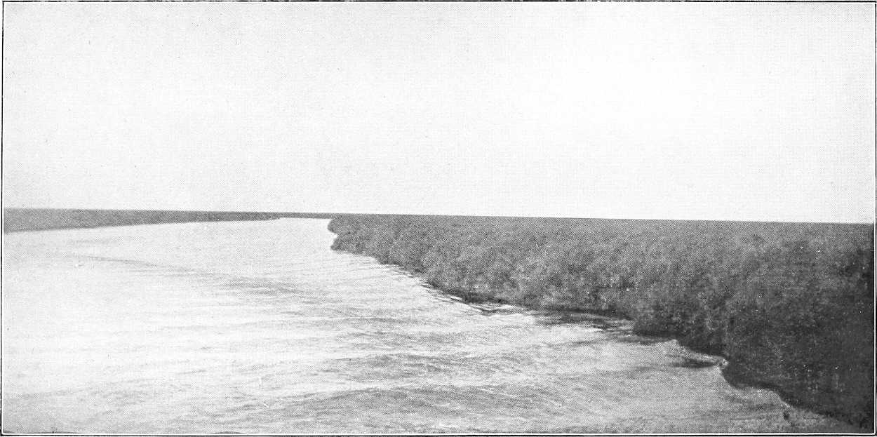
SUDDSCAPE.
General description. (Editor.)The “sudd” (in Arabic sadd = block) is a generic name by custom applied to the huge marshes through which the Bahr El Jebel, Bahr El Ghazal, Bahr El Zeraf and the lower portion of their tributaries wind their way. It forms an irregular triangle of which the northern base extends about 200 miles west from the mouth of the Bahr El Zeraf, and the southern apex lies about Bor, 250 miles S.S.E. of Lake No. It is difficult to estimate the area of these vast marshes, but it cannot be much less than 35,000 square miles.
These marshes are formed by the expansion of the rivers mentioned over this area, and probably represent the bed of an old prehistoric lake which has to a certain extent dried up. The theory has been put forward that in those far-off days a ridge about Kodok, subsequently broken through by the river, caused the holding-up of waters in this lake, but this is hardly the place to examine this theory in detail.
Suffice it to say that a great part of this area is covered with a shallow sheet of water, over almost the whole extent of which thick reeds and swamp-grasses have sprung up. Except in the actual river channels this water is probably nowhere more than 2 to 6 feet deep.
Scenery.To the eye the effect is one of a vast extent of brilliant green papyrus, feathery reeds and sword-grass, 5 to 15 feet above the water, broken by occasional patches of light ambach trees, with channels of water, pools and lagoons dotting the “swamp-scape,” and here and there a sparse tree or two on the horizon. Occasionally, and more especially towards the south, ridges, or patches of mud or solid ground are visible, Animal life.and in such parts there is much bird and animal life. In the lower (northern) reaches of the Sudd nearly all signs of life—except the brilliant little bee-eater,[300] an occasional heron, fish-eagle, or “anvil bird,” the ubiquitous crocodile, and, of course, the insects—disappear; but in the more southerly parts are found many varieties of game.
Inhabitants.On the Bahr El Jebel, for the first 150 miles south of Lake No there are no human inhabitants visible. Thereafter occasional Dinkas and their villages are seen up to about Bor (384 miles); whilst beyond this the Bari country commences, the population as the Lado Enclave is approached being considerably thicker on the east than on the west bank. The Bahr el Ghazal swamps and banks are almost uninhabited.
Of the larger species of game, elephant, giraffe, buffalo, and many sorts of antelope, including waterbuck, Leucotis, Cobus Maria, etc., etc., are seen towards the south, whilst the hippopotamus is excessively numerous almost throughout.[228] From the reeds and mudbanks arise clouds of wildfowl, crane, geese, (black and white, and brown), storks (saddleback, black, open-billed and marabou), herons (white, grey, egret, purple, “squacco,” and “Goliath”), bustard, and the quaint balaeniceps rex (whale-headed stork), besides pelican, spoonbill, ibis, and duck of every description; and of insect life the supply is unnecessarily large throughout. This latter includes several varieties of persistent and poisonous mosquitos (from the large scarlet one to the tiny anopheles), the trumpet-headed sudd insect and other kindred grasshopper-like creatures, millions of midges and mayflies, the serût fly, moths, spiders, fireflies, etc., etc. The sudd also swarms with coarse fish, some running to a considerable size.
The true Sudd.Some confusion has been caused by the word “sudd” being applied to the whole of these marshes. As a matter of fact, the real sudd is only the obstructive floating vegetation, originated in the lagoons as described below, which is driven by force of circumstances into the river channels and there forms the block or sudd. By far the greater portion of the marshes are covered by standing reeds, papyrus and the like, which, although they cover and assist in the formation of the floating vegetation and even, when uprooted, form part of it, yet are not, strictly speaking, sudd in their original state.
Thus, the traveller who proceeds along the cleared channel from Lake No to Gondokoro will, in all probability, although in the middle of the “sudd,” see little, if any, genuine sudd at all.
Formation of Sudd. (Sir W. Garstin.)In the Bahr El Jebel the main factors in forming sudd are the papyrus and the “um sûf.” These two, with the earth adhering to their roots, form the real obstruction. Many of the smaller swimming plants, such as the “Azolla” the “Utricularia” and the “Otellia Vallisneria” are mingled with the others, but they certainly do not play an important part in the formation of the obstacle. The ambach, too, has been unjustly accused of assisting in forming this barrier. This is not the case. This plant does not grow in any great quantity in the vicinity of the Bahr El Jebel, and its stem is so light and brittle that it would break when subjected to great pressure.
On the Bahr El Ghazal, on the contrary, the sudd is chiefly composed of the swimming plants above-mentioned. Their breeding places are Lake Ambadi and the other shallow lakes to the south.
The Ghazal sudd is much lighter in texture than that of the Jebel, and is consequently much easier to remove. At the same time, even in the former river, the sudd is at times dangerous, especially if it forms down-stream of a vessel, and if the latter has to work upon it from its up-stream end. The accident to Gessi Pasha’s expedition in 1880 proves that even the Bahr El Ghazal sudd can be an impassable obstacle under such circumstances.
Before alluding to the work done in removing the sudd, it may be as well to say a few words as to the principal causes of this remarkable barrier.
The Bahr El Jebel traverses the marshes between Bor and Lake No for some 380 miles of its course. South of Shambe the river has never been known to be blocked. On either side of the channel, in these immense swamps, extend large shallow lagoons, some of them covering a square mile or more of area. These lagoons are surrounded on every side by a luxuriant growth of aquatic plants, consisting chiefly of the papyrus and the grass known to the Arabs as the “um sûf” (the mother of wool). Both these plants grow in water, but not in any great depth. The papyrus attains a height of from 15 to 20 feet, with fibrous roots which strike deep into the ground. The “um sûf” rarely exceeds 5 feet in height, and its roots do not extend so deeply as do those of the papyrus. They are, however, very tough and difficult to break or cut through. These roots are bedded in the soil below the water, but the strong gales which blow in these regions loosen their hold to a large extent. If such a storm be accompanied by any rise of the water surface, large masses of these plants are set free from their original position, and begin to float on the surface of the lagoons. Their roots form such a tangled mass that large quantities of the earth in which they are embedded remain clinging to them. These act as ballast, and when the island of papyrus or reeds is detached and, under the influence of the wind, is set drifting about the lagoon, the weight of the earth retains the plants in their vertical position. Their roots, the moment they reach a shallow, act as anchors, and speedily strike down again into the muddy bottom of the lake. Large masses constantly change their position in this way. If the storm cease, they remain where they are. Unfortunately, at the commencement and end of the rainy season, stormy weather is the rule rather than the exception. At such seasons large areas of the marsh vegetation are in motion, driven hither and thither by the wind.
The Bahr El Jebel, where it passes through the swamps, has no banks whatever, and is, as a rule, separated from the lagoons merely by a narrow belt of papyrus. In many places it is in connection with them, and the water of the lakes[301] flows in and out of the river, according to the level of the latter. As the stormy season in these latitudes heralds the approach of the annual rains, the rise of the river follows very speedily. The channel of the Bahr El Jebel being only of sufficient section to carry the low water supply, with the first rise in the levels the river spreads over the marshes, flooding them in all directions, and increasing the depth of water in the lagoons. It thus causes the areas of reed, already detached by the wind, to float still more easily. The continuous gales which prevail set hundreds of acres of these floating masses moving in one direction. Eventually they reach a point on the river where they are forced into the channel. Once there the current speedily carries them down-stream. Ere long their course is arrested by a projection on the edge of the channel or by a sharp bend. It may happen that an area of reed, several acres in extent, bursts into the river in a large sheet, and in such a case it must be necessarily arrested at the first point where the section is contracted. The result is that the channel is quickly blocked, though, perhaps, not at first to any great depth. Masses of weed, however, follow one another in succession, brought down by the stream. The section of the channel being reduced by the first obstruction, the velocity of the water rapidly increases, and these masses, following the easiest course, pass under the obstacle thus created. Each fresh mass arriving is sucked underneath those originally arrested, until at last the whole becomes wedged into one solid block, composed partly of earth and partly of stalks and roots of papyrus and reed, broken up by the extreme compression into an inextricable tangle. So great is the pressure applied by the water, that the surface of the block is often forced several yards above the water-level and is seamed by alternate ridges and furrows. The thickness varies greatly, according to the conditions and sections of the channel. In some cases it is not more than 4 to 6 feet, but it not infrequently obtains a thickness of 16 feet, below water, and occasionally as much as 22 feet have been observed.[229] Underneath this bar the river manages to force an outlet, but with a velocity increased proportionately to the smallness of the aperture. At the same time, the up-stream level rises, flooding the marshes in every direction, the water making use of any side channel that it can find. In time, doubtless, if left to itself, it would desert its original course, and the stream would take an entirely new direction, the original channel becoming permanently blocked. It generally, however, happens from natural causes, such as strong winds or increased heading-up of the water, that these blocks burst, and the obstacle is carried away. On such occasions a great wave passes down the channel, carrying everything before it, and sweeping away any similar blocks which may have been formed down-stream. Only in this way can the clearance of the sudd in certain years which has undoubtedly occurred be explained. Many of these blocks extend for a considerable length, some being as much as several miles long. It is easy to understand that such closures of the river channel cause not only a complete bar to navigation, but also a very serious obstacle to the free passage of the water. More than this, each block thus formed assists in the formation of others, by raising the water level up-stream, and thus assisting the flotation of further areas of papyrus and reed, much of which eventually finds its way into the river.
The movement of these great masses of weed, and the way in which they burst into the river, bears a striking resemblance to the descriptions given of an icefield when in motion. Their steady and resistless movement, the manner in which the fields break up, and the way in which they pile upon one another when an obstruction is encountered to their course, recall irresistibly what travellers relate of the action of the ice-floes when the pack is breaking up.
The sudd in this river, and in a less degree that in the Bahr El Ghazal, constitutes a very real danger to navigation. Should a steamer happen to be surrounded by it when in motion, the compression would certainly strain her framework to the risk of crushing it. Even should she escape this she will most probably be imprisoned for an indefinite time, owing to the river blocking on either side of her. During the stormy season, it should if possible always be arranged that two steamers should work in conjunction, one remaining down-stream, so as to be able to go to the assistance of the other if necessary.
As no fuel is to be met with throughout the whole length of the sudd region, a solitary steamer, if detained for some time by a block, may find herself eventually prevented from proceeding, or from making any attempt to free herself, owing to the absence of any means of generating steam in her boilers.
The Bahr El Ghazal sudd is, as has been said, of a different kind to that of the Bahr El Jebel. It is, as a rule, much lighter in consistency and easier to remove. This is doubtless due to the fact that the velocity of this river is very low, and, consequently, the pressure exerted by the water upon a block is small compared with that caused by similar conditions in the Bahr El Jebel. Again, on the Bahr El Ghazal, the papyrus and reeds do not extend on either side to any distance, nor are continuous and large lagoons close at hand. Between miles 42 and 52, up-stream of the junction with the Khor Deleib, there must, it is true, be always a risk of a block. In this reach the river passes through papyrus swamps, which are miniature editions of the Jebel marshes. Even here, however, the obstruction can hardly attain to the same solidity as in the case of the Jebel sudd, as the sluggish current of the Ghazal would fail to wedge the mass between the banks as tightly as would the rapid stream of the other river. Lake Ambadi appears to be a great nursery for the smaller varieties of the sudd plants. In the beginning of the rainy season these[302] are carried down-stream and, as the channel wanders and twists, they form small obstructions. None of these, however, appear to be lasting, and it is rare that the Ghazal river is blocked for any length of time. It may be closed for a few months and then re-open itself. Thus in March and April, 1900, it was clear throughout its entire length, while in September of the same year it was blocked in more than one place. On this river, as on the Jebel, the sudd frequently sinks to the bottom, and decomposes, gradually raising the bed of the river. In this state it is very hard to remove.
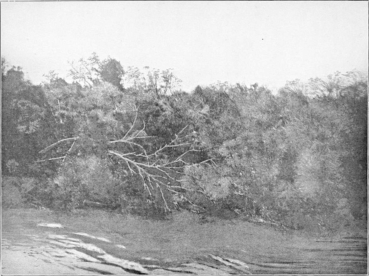
AMBACH.
Botanical Composition.The sudd-forming plants may be classed in three divisions.[230]
The first, which contains plants whose roots descend to the river bed, is chiefly composed of the papyrus (Cyperus Papyrus), the common reed or “Bus” (Phragmites communis), and the feathery-headed grass (Saccharum Spontaneum).
The second kind is composed entirely of plants whose roots are in the water, but do not strike down to the ground or bed of river. The principal plant in this class is the “Um sûf” (Panicum pyramidale), grass, so called by the Arabs (“Mother of wool”) on account of the irritant hairs found on its leaf-sheaths which adhere to the skin of anyone touching them. In addition to the above, the wild bean (Vigna Nilotica) and creepers with purple flowers (Ipomœa) are found in profusion.
[303]The third or last class of sudd is composed entirely of plants which swim upon the surface of the water. These form the cementing medium which binds the first two classes together.
The following are the principal components of this class:—
Pistia, a small cabbage-like plant with bright green leaves. Azolla, resembling moss in texture. Utricularia, Aldrovandia and Ceratophyllum, all resembling feathery floating streamers. The first variety has a series of small bulbs, like floats, attached to each streamer. The last is common in the canals and drains of Lower Egypt.
Otellia, a plant with big leaves and a white flower like a lily.[231] It is found everywhere in this class of sudd, and is met with at Damietta, where it is called by the Arabs “Lughmet el Kadi,” or the “Kadi’s pudding.”
In and among the above the blue-flowered creeper (Commellaria) is found.
Detail. (Mr. Broun.)Regarding the detail of the formation, the first point of interest is that all the most important sudd plants propagate themselves by means of tubular rhizomes which run along the surface of the water giving out shoots from point to point. These shoots, after developing, give out other runners which cross the others and weave themselves into them, a further consolidation being given by twiners which bind them all together.
Chief sudd plants.The most important sudd plants are, without doubt, Papyrus, “Um sûf” (Panicum pyramidale), and “Bus” (Phragmites communis).
“Um sûf” is probably the greatest source of blocks in the river courses, as it seems to thrive in deeper water than either the “Papyrus” or “Bus.” But all these give out long rhizomes. Those of the “Bus,” which is a very tall reed, extend sometimes quite 20 yards from the parent plants. These rhizomes either break away when the new shoots have developed and go to form new colonies elsewhere, or they are driven by the side of the others and gradually encroach on the river.
Among the climbers which bind the new growth (as well as the old) together, the principal are three kinds of Ipomœa, one vine and a leguminous twiner Vigna Nilotica. One of the Ipomœas (I. Reptans) deserves special mention, as it is not only a twiner, but possesses also tubular rhizomes, which enable it to float along the rhizomes of Papyrus, “Bus,” or “Um sûf,” and to knit them together as soon as they give out shoots. Among other plants which have also hollow stems are Jussiæa diffusa, which is also supplied with bunches of spine-shaped floats, and Polygonum tomentosum.
When all these floating masses are being tied together by the twiners the river brings down other plants as a packing to fill the interstices. The most common is Pistia Stratiotes, but there is also a constant supply of Ceratophyllum, Utricularia, Vallisneria and other plants of the same family; also Trapa bispinosa (the water-nut), Potomogetum, Azolla, etc. Little nooks are thus enclosed by runners from the Bus reed, the interior spaces of which are crammed with smaller plants.
It appears wonderful that with all this enormous mass of vegetation growing in these vast swamps in which no traces of human habitations can be seen, the natural decay of the plants does not gradually raise the level of the soil and force the water to keep to well-defined channels which, with the greater volume of water which they would contain would soon force for themselves a less winding course than they now follow.
Action of fires.It appears that one of the chief causes of continuation of the old order of things is fire. Sparsely inhabited as the swamps are, they are swept through from end to end by fierce fires which carry everything before them and kill nearly all the trees which attempt to gain a footing. Here and there a few Kakamut, Dôm, Deleib, Dabka or Talh have managed to spring up, but they are so scattered that they do not count. The papyrus and reeds, instead of dying a natural death and forming soil by decay, are burnt down, and what of the ashes is not blown away by the wind is carried away by the next flood. Were it not for these fires it is probable that trees of the species mentioned above would spring out more abundantly, and it would not be a difficult matter to define the banks of the channel by plantations of these or other river-side trees, such as are to be found in Ceylon, for example, lining the river, e.g., Terminalis glabra, Vitex Leucoxylon, Vateria acuminata.
Recent history of blocks and sudd-cutting. (Various.)In 1863, 1864, and 1868, heavy sudds blocked the Bahr El Jebel, and in the first mentioned year they extend to the north of Lake No.
In 1870, Sir Samuel Baker found the Bahr El Jebel closed with sudd at its mouth in Lake No. He attempted to ascend the Bahr El Zeraf but failed to reach the Upper Nile, and was obliged to return.
In 1871 he ascended the Bahr El Zeraf, and eventually forced his way into the main river near Shambe, literally lifting his boats and steamer over the intervening swamps and shallows.
In 1872 both the Bahr El Jebel and Bahr El Zeraf were closed, and in 1874 Ismail Pasha Ayub cleared away the sudd in the former river.
In 1878 Emin Pasha found it impossible to ascend the Bahr El Jebel from the south.
In 1879 and 1880 Marno (an Austrian) cleared the Bahr El Jebel of obstruction, completing his work in April, 1880.
[304]In this same year Gessi Pasha undertook his disastrous journey in the Bahr El Ghazal, his steamer being blocked in that river for many weeks, and his expedition only being extricated by the timely arrival of another steamer under Marno, not, however, before he had lost many men.
In 1881 and 1884 the Bahr El Jebel was again closed by the sudd. During the period of Dervish rule nothing detailed was known regarding the state of the river, but in 1895 it was reported to the Intelligence Department that the White Nile was closed by the sudd. During this period the steamer “Mansurah” sank in the main channel in what is now known as the 15th block. The steamer was discovered during the Sudd operations of 1903-04.
As soon as possible after the battle of Omdurman (2nd September, 1898) steamers were sent up-stream to investigate. Major M. Peake attempted (7th October, 1898) to penetrate the Bahr El Jebel, but in vain. He steamed, however, up the Bahr El Ghazal nearly as far as Meshra el Rek. With Major Stanton he shortly afterwards steamed 157 miles up the Bahr El Zeraf, and was then stopped by shallow water.
In the following year, after a visit by Sir W. Garstin and Lt.-Col. Sparkes in the spring, operations for clearing the Bahr El Jebel were seriously undertaken, and Major Peake left Omdurman at the head of an expedition on 16th December, 1899. The party consisted of five gunboats, five English and some Egyptian officers, some British N.C.O.’s, 100 Sudanese, and a gang of 800 Dervish prisoners.
By the 27th March 1900, by means of hard and continuous labour, 14 blocks had been cleared out of 19, opening up 82 miles of river. Major Peake then avoided the remaining blocks by using side channels, arrived at Shambe, 25th April, 1900, and proceeded in clear water to Rejaf (5th May, 1900). Four (16th to 19th) out of the remaining five blocks were cleared by Lieutenant Drury, R.N., in January, 1901, and only the last one, the 15th, 22 miles long, and just south of Hellet El Nuer, still remained. It was considered, however, desirable to make renewed efforts to clear this block. Accordingly an expedition under the direction of Major G. E. Matthews was sent up in the winter of 1901-02, but did not succeed in completely opening the channel. The work of clearing this block was vastly increased owing to the entire absence of current. Nothing was done in 1902-03, but in 1903-04 Lieutenant Drury, late R.N., was again sent to renew the clearing operations. Practically no traces of Major Matthews’ work were discernible, and when, after dogged perseverance, the accomplishment of the task was well in sight the work had to be again reluctantly abandoned.
The false channel now in use is still liable to slight sudd-blocks, especially from April to June. A monthly steamer and other craft, however, keep the fairway open, as a ride, merely by their passage, and there is little or no danger of the channel being seriously blocked again.
Method of clearing.The following was the method employed by Major Peake in clearing the sudd:—
The first operation was to cut and burn the whole of the vegetation growing on the surface; this was done by a party of men with swords, fasses,[232] and axes. Immediately this was done the line to be taken up for the first channel, generally about 12 yards in length, was marked out; this was trenched by the Dervish prisoners armed with fasses, picks, axes and saws, into pieces 4 yards square. After cutting down about 1 foot from the surface the water infiltrated; the men continued cutting until, owing to the depth of the water, they were unable to get any deeper. Holdfasts of telegraph poles were then driven as far as they would go around the edge of each piece. After this a 1½ inch flexible steel wire hawser was sunk as deep as it would go by means of the pronged poles, all round the piece to be removed; the ends of it were made fast to the bullards in the bow of the gunboat, one on the starboard side and one on the port, leaving sufficient slack wire to allow the steamer to go astern some 20 to 30 yards before she got the strain; “full speed astern” was then ordered. Full speed was kept up continually if the piece showed any sign of becoming detached until it came gradually away; as soon as the piece was quite clear, one end of the hawser was cast off and the piece was allowed to float down the stream; the holdfasts were pulled out by means of a rope, one end of which was made fast to the bow of the steamer, and the other by a hitch to the end of the holdfast. If the piece showed no signs of coming away, the engines were reversed and the steamer was brought close up to the sudd and then went astern again. This was repeated again and again until the piece was detached. Some pieces were known to take as much as two hours to get away. Sometimes with very thin sudd, after it had been trenched, the steamer would be run up with her bow on to the sudd, and on going astern would carry the piece with her; also with light sudd a grapnel anchor fixed to the steamer when going astern was found sufficient to tear away the piece.
Very often the sudd will be found with its roots adhering to the bottom; this is especially the case in a year when there is a very low Nile, like 1899-1900, or close up to the banks, when the first leading channel is being widened.
In this case a grapnel or ordinary anchor sunk to the bottom of the river and then dragged along by the steamer is useful. As soon as the leading steamer has opened up the channel a sufficient length to enable her not to interfere with a steamer working behind her, another steamer is put to work, the same way as the first, to widen the channel.[305] This is generally laborious work, as there is not much current to act on the sudd, and in consequence it takes longer to get it away.
In cutting the trenches care should be taken to cut or saw through all roots.
(For further details of the sudd, see H.B.S., pp. 4 and 207 to 213 inclusive (Dr. Junker’s account); Sir W. Garstin’s invaluable reports (Egypt Blue Books No. 5 of 1899, pp. 15 to 19, No. 2 of 1901, pp. 34 to 43, and No. 2 of 1904); Major Peake’s Reports, 1900; and Mr. Broun’s Note, 27.4.03—from all of which, besides some original work by the Editor, the above description has been compiled.)
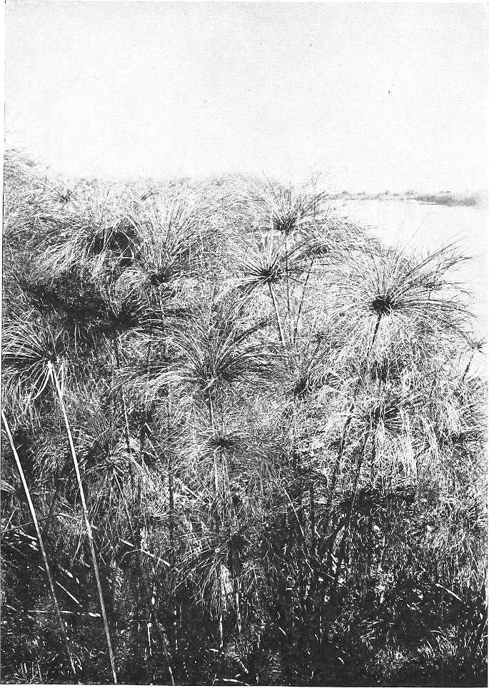
THE BAHR EL JEBEL—PAPYRUS.
[228]The writer counted 72 in one lagoon at Shambe.
[229]Such blocks are so solid that elephants have been seen to walk on them.
[230]The Director of Forests, Mr. A. Broun, does not agree with the classification, or all the details, &c., given. He has not found the feathery-headed grass, and states that the Um sûf would not, in any case, come in the second class.—Ed.
[231]Query Boottia Scabra or Nymphaea Lotus?—A. B.
[232]Native hoes.
ZOOLOGY OF THE SUDAN.
ZOOLOGY.
In preparing the following notes on the Zoology of the country, it has been assumed that the Mammals and Birds will present the most general interest. The variety and distribution of the large “game” animals has been briefly sketched, and, to make space for this, reference to the Invertebrate animals has been omitted.
Primates.Apes and Monkeys are well represented in the Sudan. The Chimpanzee (Anthropopithecus troglodytes schweinfurthi) occurs in the Bahr el Ghazal region, where also is found the beautiful black and white fur-bearing Colobus guereza; Baboons (Papio hamadryas and P. anubis), Grivet (Cercopithecus sabæus) and Patas Monkeys (C. patas) abound and are widely distributed. Lemurs (Galago) occur, but are seldom met with.
Carnivora.The Lion is found wherever the country is suited to its habits, and is in places plentiful. In 1880, one was seen half-way between Berber and Suakin, but at the present time it ranges little further north in the Sudan than Kassala. The Leopard, commoner than the Lion, but warier and less often seen, is even more widely distributed; the Cheetah or Hunting Leopard (Cynælurus jubatus) less so. Among smaller felines are the Serval, Caracal and Libyan Cat (Felis serval, F. caracal and F. libyca).
Hyænas, spotted and striped (H. crocuta and H. striata) are common; much rarer and more local is the Hyæna-like, but smaller, Aard Wolf (Proteles cristatus).
Jackals, Foxes and Fennecs are abundant; the Wild Dog (Lycaon pictus) is scarcer.
Smaller carnivora are Civets, Genets, the Mongoose, the Ratel, and the pretty little black-and-white Zorillas, which in coloration remind one of the American Skunks.
Insectivora.The Insectivora are represented by Hedgehogs and Shrews (Erinaceus and Crocidura).
Bats (Chiroptera) are plentiful.
Rodentia.Rodents (Rodentia) are represented by the common Porcupine, Hares, Ground-Squirrels (Xerus), Rats, and the Jerboas and Gerbilles—curious little nocturnal creatures living in holes in the desert sands. They have long hind legs and tails, progress by leaps like miniature kangaroos, are of a protective sandy coloration, and subsist entirely without water.
Ungulata.Much the most interesting to the general traveller and sportsman are the Ungulata or hoofed animals, and in this “big game” the Sudan is particularly rich.
The Elephant is found on the Setit (from which during the Kharif or rainy season it ranges as far north as the Gash), the Upper Atbara, the Rahad, the Dinder, and the Blue Nile; it ranges across the Gezira in smaller numbers and becomes more plentiful again along the Upper Sobat, Pibor, the Bahr-el-Jebel, in the Bahr-el-Ghazal Province, along and west of the Bahr-el-Arab as far north as Kalaka. The ivory from these southern swampy districts is much larger than that from the Blue Nile and Abyssinian frontier—tusks running up to 130 lbs. or so in weight—but it is not of quite as good quality. No organized effort to capture and train adult African elephants has been made in modern times, and attempts to rear the young on cow’s or goat’s milk or farinaceous substitutes have generally failed.
The Black Rhinoceros (R. bicornis) was found as far north as the Gash in 1880; a very few still remain on the Setit, the Rahad, Dinder and Blue Nile; on the Bahr-el-Jebel, in the Bahr-el-Ghazal Province, and on the Bahr-el-Arab it is less scarce, while there is some reason to believe that in this last-named tract of country the White Rhinoceros (R. Simus) is not yet extinct. The destruction of Rhinoceroses in the Sudan is absolutely prohibited.
A curious little animal somewhat doubtfully placed by naturalists near the Rhinoceroses is the Hyrax, a small animal, in shape somewhat resembling a guinea-pig, which inhabits rocky hills in many parts of the Sudan.
The Wild Ass is found in some of the Eastern deserts; while Zebras (probably Grant’s Zebra) just extend into Sudan territory north of Gondokoro on both banks of the Bahr El Jebel.
[308]Buffalo—the shorter-horned northern form (Bos caffer equinoctialis) are numerous in suitable localities, and appear to be holding their own; their distribution is roughly the same as that given for the Elephant.
Of Hartebeests, Bubalis tora is common on the Setit, the Upper Atbara and the Blue Nile tributaries; Bubalis jacksoni takes its place on the White Nile, Bahr-el-Ghazal and in S.W. Kordofan; a much scarcer and more local species, apparently Bubas Neumanni has been found on the White Nile near J. Ahmed Agha. The Tiang[233] or Bastard Hartebeest (Damaliscus tiang) is abundant in the Gezira, and in the southern and western parts of the Sudan; on the eastern side of the country it does not range north of the Dinder.
The Water-buck (Cobus defassa) is generally distributed where water and grazing are to be found; the beautiful Mrs. Gray’s Water-buck (C. maria)—the males of which are marked with a snow-white patch on the withers—is one of the most local of African Antelopes, inhabiting only the swamps of the Bahr-el-Ghazal and Bahr-el-Jebel.
The White-eared Cob (C. leucotis), commencing near Renk, follows the White Nile upwards, increasing in abundance in the Bahr-el-Ghazal, occurring also on the Sobat and the Pibor, and extending along the Bahr-el-Jebel into Uganda. On this last river the Uganda Cob (C. thomasi) has been shot.
The Roan Antelope (Hippotragus equinus bakeri) is locally distributed from the Setit to the south-west of the Sudan; the Blue Nile tributaries are perhaps the chief stronghold of this noble beast.
The Oryx leucoryx is plentiful in Western Kordofan; the Oryx beisa occurs in one or two localities east of the Atbara. The Addax ranges into the deserts of the Western Sudan, but very few have yet been shot by any European.
The greater Kudu (Strepsiceros capensis) is one of the scarcer Antelopes in the Sudan, occurring locally in Kordofan, and from the Blue Nile to the neighbourhood of Suakin.
The largest known form of Eland (the Taurotragus oryx gigas of Von Heuglin) is found in the Bahr-el-Ghazal Province.
The Lesser Reedbuck (Cervicapra bohor) occurs on both the Blue and White Niles and their tributaries, the Blue Nile examples carrying the finest heads. The Bushbuck of the White Nile is Tragelaphus scriptus, the Blue Nile form being T. decula.
The commonest Gazelles of the Sudan are the Ariel, the Red-fronted, the Dorcas, and Isabelline Gazelles (Gazella sœmmeringi, G. rufifrons, G. dorcas, and G. isabella), widely distributed; more local are the Addra Gazelle[234] of Kordofan (G. ruficollis) and Heuglin’s Gazelle of the Setit (G. ptilonura). Smaller common Antelopes are the Duiker, Dig-dig, and Oribi (Cephalophus, Madoqua, and Ourebia).
The Klipspringer (Oreotragus saltator) is found sparingly on the hills of the Red Sea Littoral.
Ibex (Capra nubiana) frequent the rocky hills of the Kassala and Suakin districts; Wild Sheep (Ovis lervia) have a wider range, but are much scarcer and shier, and have not been recently shot in the Sudan.
Giraffes are in parts numerous, their range in the Sudan area being approximately that of the Elephant, except that they are absent from localities which are entirely swampy.
A few Hippopotami still remain as far north as Dongola, and a few are to be found near Khartoum. Up the White Nile and the Bahr-el-Ghazal they abound, to such an extent that in places they become dangerous or a positive nuisance.
Wart-hogs (Phacochærus) are common and widely spread; while the Sennar Boar (Sus sennarensis) has only been obtained, and very rarely, in this one district.
Edentata.A scaly ant-eater (Manis) occurs, and also a curious ant-bear (Orycteropus æthiopicus), very similar to the “Aard Vaark” of the Cape.
Cetacea.No Cetaceans have been found in the Sudan rivers.
The Bird fauna of the Sudan is rich and interesting. Visitors will be most struck by the aquatic species whose abundance on the rivers forms one of the most pleasing features of the scenery. The practice of shooting at birds from steamers (forbidden by law, as is all trading in plumes) cannot be too strongly deprecated. This practice has within the last 30 years banished most of the bird-life from the Egyptian parts of the Nile for ever.
Most of the birds, which are summer visitors to Europe, winter in the Sudan, or pass through it on their way further south. Conspicuous among these winter visitors are Hoopoes, Golden Orioles, Bee-eaters, Shrikes, Warblers, Wagtails, Flycatchers, &c. Small resident species are abundant, the various kinds of Weaver-finches predominating in numbers and collecting in vast flights. Among this family the beautiful scarlet and black “Dura-bird” (Pyromelana franciscana) and the long-tailed Whydah Bird (Steganura paradisea) are specially noticeable. The handsome Glossy Starlings—characteristic African birds—are represented by the genera Spreo, Lamprocolius, and[309] Lamprotornis. Several species of Nightjars occur, noteworthy among which is the remarkable Standard-Wing (Macrodipteryx), bearing a large racket-shaped web at the end of an elongated wire-like feather in each wing.
Colies, or “Mouse-birds,” Kingfishers, Hornbills (chief among which is the great black-and-white Bucorax abyssinicus), Bee-eaters, Rollers and Cuckoos are well represented, as also are Larks and Wheatears. Shining little Sun-birds frequent the forests and enter the gardens in the towns.
Green parrakeets are common, and the grey parrot may be found on the Uganda boundary.
Of birds of prey there are Vultures, Eagles, Falcons, Ospreys, Harriers, Buzzards, Hawks, and Owls in great variety—among which may be mentioned the Noisy River Eagle (Haliaetus vocifer), the Secretary Bird (Serpentarius secretarius), and the handsome Bateleur Eagle (Helotarsus ecaudatus).
The rivers abound with Pelicans, Cormorants, Darters, Herons, Egrets, Bitterns, Storks, Ibises, and Spoonbills. Among these the great carrion-feeding Adjutant or Marabou (Leptoptilus crumeniferus) is conspicuous. The remarkable and very local Whale-headed Stork (Balæniceps rex) is found in the swamps of the Bahr-el-Ghazal and Bahr-el-Jebel, while the stately Saddle-billed Stork (Ephippiorhynchus senegalensis)—iridescent black and white with long brilliantly-coloured bill—is more widely met with. Flamingoes are scarce; Spur-winged and Egyptian Geese, and Whistling Teal, resident and plentiful. Their numbers are swelled by large hosts of northern-breeding ducks, which arrive in the autumn and remain till the spring. Vast numbers of Plovers, Godwits, Whimbrels, Sandpipers, and Terns also winter on the Nile. Snipe occur, but in comparatively small numbers, the area of irrigated land being very limited, and the grasses of the Nile swamps being too high and thick for them.
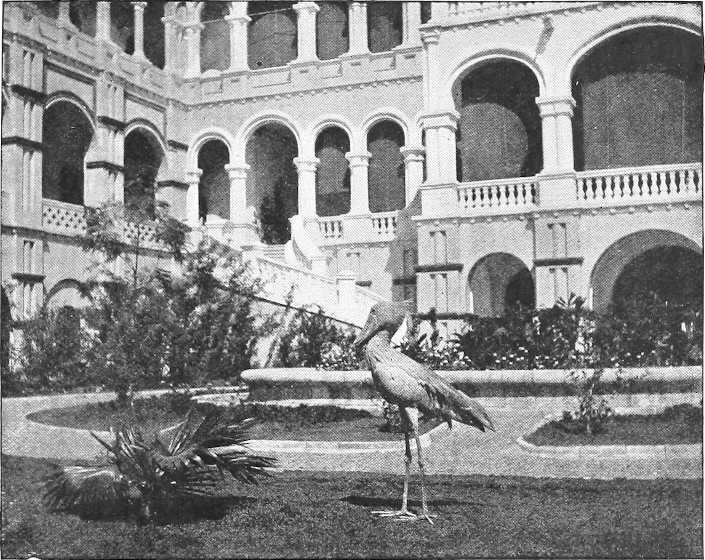
COURT OF THE PALACE, KHARTOUM, WITH Balæniceps rex.
Three species of Sandgrouse are very abundant; the commonest (Pterocles exustus) affords the best bird shooting in the country—in the dry season they daily flight in thousands from the deserts to drink at the rivers. Doves and Guinea-fowl swarm in most parts; Francolins are more local and less plentiful. Quail are also found in parts.
A large Bustard (Eupodotis arabis) is plentiful and gives pretty rifle shooting. Three or four smaller bustards also occur.
The strikingly-beautiful Crowned Crane (Balearica pavonina) is resident and common, and in the winter immense flights of Common Cranes (Grus grus) and smaller numbers of the Demoiselle (Grus virgo) spread over the country.
The Ostrich is generally distributed, but is most abundant in Western Kordofan.
The common African Crocodile (Crocodilus niloticus) abounds in the Sudan rivers. Large Monitor Lizards or “Waranas,” reaching 5 or 6 feet in length, are not uncommon: among smaller lizards are various Chameleons, Geckoes, and Skinks.
[310]Soft-backed river Turtles (Trionyx) are plentiful. A common land Tortoise is Testudo calcarata: a common aquatic Tortoise is Sternothærus adansoni.
Of snakes the largest is Python sebæ; of poisonous species the Cobra, the Horned Cerastes, and, further south, the Puff-Adder occur: harmless species are more numerous. On the whole, snakes in the Sudan are not plentiful enough to be troublesome, and the mortality due to snake-bite seems insignificant.
Batrachians are rather poorly represented: a Toad (Bufo regularis) very like the common European species is the most abundant.
The Nile fish have recently been very thoroughly investigated, the collection formed by Mr. Loat, under the auspices of the Egyptian Government, being the largest ever brought together from one country.
Those interested in the subject may note that the scientific results of the “fish survey” will shortly be published in the form of a Monograph, by Mr. G. A. Boulenger.
[Briefly speaking, it may be said that the rivers swarm, almost throughout, with fish; they are mostly of a coarse kind, some running to an immense size—40 to 50 lbs. being quite an ordinary weight for some species.—Note by Editor.]
[233]Quite recently a closely allied, but rather larger species, Damaliscus korrigum, has been shot in the deserts of Western Kordofan. It was previously believed to be entirely a West African form. Herr Matschie had, in fact, recorded it from near Lake Victoria, but leading English naturalists seemed inclined to consider him mistaken. That it ranges as far east as Long. 30° is now definitely proved.
[234]This species has recently, in the Khartoum Gardens, for the first time bred in captivity.
THE ANTIQUITIES OF THE SUDAN.
(Vide also pp. 221-228.)
The three decades following the Egyptian conquest of the Sudan in 1819 were each marked by the appearance of a large work dealing with the antiquities of the newly-opened provinces. Unfortunately the authors of these works, Cailliaud, Hoskins, and Lepsius, have found no successors of equal means and perseverance, so that our knowledge of the actual remains stands about as Lepsius left it. When Cailliaud (1820) and Hoskins (1833) visited the Sudan, nothing certain was known of the ancient relations of Egypt and Ethiopia, and the wildest philological theories were in the air. The imposing monuments which these travellers found fitted the theories that Egyptian art was the oldest art known; Ethiopia was supposed by some to be the mother of Egypt; here, then, at Meroe, Hoskins fancied that he had found the cradle, not of Egypt only but of the whole civilised world. Criticism began with Lepsius (1842): the style of these remains convinced him that they were not the archaic parents of Egyptian art but the late offspring of a mésalliance between Egypt and the luxuriant South. The progress made since his day enables us to recognise more clearly the main lines of development, though it will require years of research to fill in the details of our picture.
In the following notes the antiquities are grouped for convenience into four divisions—the Prehistoric, the Egyptian, the Meroitic, and the Christian.
1. Prehistoric.—We know now that the dynastic culture of Egypt was developed at Abydos, Memphis and elsewhere, long before it reached the Sudan, but from the very earliest days desire for the products of the south must have attracted the trader and the soldier, and so carried the culture of Egypt ever further to the south. The ivory and the skulls found in pre-dynastic Egyptian tombs, and the dwarfs and black troops referred to in the Historical Summary, are sporadic witnesses to a coming and going along the Nile Valley which must have lasted for tens of thousands of years. What and whom the early travellers found we cannot say: the country was probably partitioned among a number of petty princelets like the Meleks whom Burckhardt describes as reigning in the provinces of Dongola and Berber in the eighteenth century, and some of the old forts reported in this region and in the desert may date back to this period. To this epoch possibly belong also some of the groups of tumuli visible between the 4th and the 6th cataracts and elsewhere, but of them only one,[235] of the Bronze Age, has been hitherto excavated. A closer study of the surface will doubtless bring to light vestiges of the Stone Age, as it has already done in Egypt and Somaliland.
2. Egyptian.—The first effective occupation of the northern parts of the Sudan dates from the Middle Empire, but though it is represented by several monuments noted in the list below, it did not last for long. The kings and queens of the New Empire returned to the conquest and exploration of the south, and left much more striking memorials of their greatness. The tablets found at Tel el Amarna are full of requests from Syrian princes for gold, which was exported to them unworked, and by them smelted and wrought into ornaments and vessels. Now the bulk of this gold came from the numerous mines which still exist between the Red Sea and the Nile; in a word the Northern Sudan was the “Rand” of the ancient world. The shafts and huts of the miners, their washing-tables, grinders, and other appliances are found still in situ, and the position of some of the finest temples is now seen to be determined by their nearness to rich auriferous regions. This is, perhaps, the most important discovery made since the days of Lepsius.
Under the eighteenth and nineteenth dynasties the Northern Sudan was an Egyptian province, an appanage often of the heir-apparent, and the monuments of this date (see below) are thoroughly Egyptian in character. Under the twenty-second dynasty the conditions were reversed and Egypt became an Ethiopian province; but, as is usual, the civilised power conquered its conqueror, and although Napata now reached its zenith, the character of buildings, statuary, and inscriptions, was not native but Egyptian; this was only natural, seeing that the Ethiopians could command the best workmen in Egypt. It is not until the sixth century B.C. that we begin to see signs of a change. The inscriptions of[312] Heru-Sa-Atef and Nastasenen clearly betray the native origin of their authors; they were written in hieroglyphics by priests who aimed in vain at reproducing the old classical idiom of Thebes. Their last editor very aptly compares them to attempts of a Dongolawi to write Koranic Arabic.
3. Meroitic.—With the conquests of Alexander and his successors and the spread of the Roman Empire, Ethiopia was brought into touch with a wider system than any it had yet seen, and this Greco-Roman period coincides with the development of a complex original style, in which the African character seems to find its first articulate expression. Exact dates for the numerous monuments in this style cannot be given; some may go back before the time of Alexander, some of the most elaborate certainly fall late in the Roman period. The architectural forms of the latter show the gradual supersession of Egyptian conventions by European designs and construction, while the rich attire of the rulers portrayed bears witness not less to their barbaric taste than to the wealth which radiated under the Pax Romana even beyond the limits of the empire. In this mingling of East and West these works should be compared with those of other schools that arose under the shadow of the Roman Empire, such as the Palmyrene school in Syria and the Greco-Roman Buddhist school in the north-west of India.
The most characteristic works of this school are to be found in the Berber province. The pyramids (Bagarawiya) and the avenue of rams and the pylon-fronted temples (Nagaa and Wadi El Sufra) point back to Egyptian prototypes, but side by side with these we see temples where the pylons have given way to columns fluted and spaced in the fashion of a Roman peristyle shrine, and one small building which has even been described as a Christian basilica!
The Meroitic Pantheon is equally mixed: we pass from the Ammon of Thebes to the Ammon of Napata, and from him to a strange Ethiopian Serapis and a still stranger local or Indian lion-headed god.
The subjects are mostly, like those in Egypt, scenes of adoration or offerings of spoils of victory, but the persons sculptured are Egyptian neither in type nor costume. The best-known of these is the fat Queen “Candace,” whose very fleshly charms are set off by masses of jewellery, heavy necklaces, armlets, bracelets, sandals, and clinging feather-like garments. Her consorts and attendants are only less richly bedizened with jewels and rare stuffs, embroidered with crosses, crescents, “and other delights.” Other panels represent water goddesses and hunting scenes with wild beasts (lions, elephants, etc.), led in captivity by men and genii. The small objects found on these sites (now mostly at Munich and Berlin) give the same impression of barbaric wealth, and the relatively numerous bells show that the Ethiopian of those days was as fond of noise as his black successor.
Unfortunately the inscriptions which accompany these buildings cannot be deciphered. As we saw above, Egyptian was a foreign language to the people of Napata in the sixth century. On the Meroitic monuments not only is the language foreign, but new phonetic values have been given to the old hieroglyphic signs, which makes even transliteration impossible until more bilingual inscriptions turn up.[236] And these hieroglyphics persist until superseded by a script based on Egyptian demotic or perhaps some Arabian alphabet, which is equally unintelligible.
4. Christian.—The Christian antiquities have fared still worse at the hands of explorers than the earlier ones; the traveller notes “ruins of a Coptic convent” and hurries on to something more congenial. Lepsius collected a few inscriptions, and these have been supplemented from time to time; a few things have been found at Soba and rough sketches published of one or two churches.
The most interesting building known to the writer is the church at Old Dongola, a building in two storeys of burnt bricks, subsequently encased in a thick shell of sun-dried bricks. The ground plan of this is believed to be unique: it looks like an adaptation to Christian ends of old Egyptian structural motives. This building and the ruin-heaps into which many other churches—still called Kanisas by the natives—have been reduced, show that all the lessons of construction learnt under the Roman Empire were not forgotten under the rule of the Christian kings. The pottery of this period was, so far as one can judge from fragments still lying on the surface, more finely levigated, better baked, and more variously decorated than in earlier or later days.
Inscriptions in three languages have been found. At Soba, and perhaps at Geteina (White Nile), Christian inscriptions occur in an unknown language, but in the Greek alphabet eked out by five additional letters; from the Dongola province and from Northern Nubia come inscriptions in Greek and in Coptic. Some of these are dated in the eighth and ninth centuries A.D., and the formulæ used in them are similar to those found in Egypt.
The list of ancient sites, etc., appended does not pretend to be complete. Those who wish for further information are referred to the following authorities, which may be supplemented from the bibliography; but they must remember that the study of these antiquities is still in its infancy.
[313]Authorities.(1.) Discoveries.—Cailliaud, “Voyage à Méroé,” Paris, 1826; Hoskins, “Travels in Ethiopia,” London, 1833; Lepsius, “Denkmäler,” Berlin, 1842, etc.
(2.) Special Memoirs.—Ferlini, “Relation Historique,” 1838; Maspero, “Études de Mythologie et d’Archéologie Egyptiennes,” III, Paris, 1898; Heinrich Schäfer, “Die Aetiopische Königsinschrift des Berliner Museums,” Leipzig, 1901.
(3.) Much valuable information may be obtained also from the large histories of Egypt by Maspero, Budge, and Petrie, and from the handbooks published by Murray, Bædeker, and Cook (“The Nile,” by Dr. Budge). Illustrations and slight descriptions of some of the antiquities have been published by J. Ward in the “Monthly Review” for August, 1902, and May, 1903, and of the gold mines in the prospectuses issued by the companies prospecting.
Space does not suffice to give details of all the antiquities: a bare list must suffice. The initials given below are as follows:—Murray’s Handbook of Egypt, 1900 (M.); Dr. Budge’s “The Nile,” 1901 (B.N.); Lepsius “Denkmäler,” 1842 (L.); Cailliaud’s “Voyage à Méroé, 1820” (C.); Rawlinson’s Egypt (Story of the Nation Series) (R.); Dr. Budge’s “A History of Egypt,” 1902 (B.E.); Hoskins, 1833; J. Ward (articles in “Monthly Review,” August, 1902, and May, 1903, with illustrations) (W.).
About 2 miles above Halfa, on the west bank, is an ancient Egyptian site with several temples.
Abu Sir.Five and a half miles above the same town, on the west bank, is the rock of Abu Sir. The chief historical interest of this spot (from which a fine view of the 2nd Cataract is obtained) is the variety of names inscribed on it, reaching back several hundred years.
Matuka. B.C. 2760? or 2430?Three miles south of Abu Sir are remains of the fortress and small temple of Matuka, built by Usertsen I of the Twelfth Dynasty.
On a large island opposite are the remains of a similar fortress and on another small island to the south are the ruins of a Coptic church called Darbe (M. 983)
Semna and Kumma. B.C. 2320? B.C. 1600? B.C. 2300.Forty-three miles south of Halfa are the fortress temples of Semna and Kumma, built by Usertsen III. Rebuilt and extended by Thothmes III of the Eighteenth Dynasty. In good preservation. Amenemhat III also marked the rise of the Nile here (B.N. 489, 490; B.E. iii, 46, 48, etc., iv, 94, vi, 187, and vide p. 222).
Amara. B.C. 1000?At Amara are important ruins of a temple with sculptured columns (L.; B.N. 491).
At Selima Oasis, 55 miles west of Sagiet El Abd, are remains of old convents, built out of still older remains, on which there are unknown inscriptions. (Vide p. 203.)
Sai. B.C. 1660-1600?At Sai Island, 130 miles from Halfa, are remains of a town and Coptic church, and of cemeteries, also of a temple with inscriptions of Thothmes III and Amenhotep I (Eighteenth Dynasty).
Sedinga. B.C. 1800.At Sedinga, 6 miles further, are the ruins of a fine temple by Amenhotep III, a column and a cemetery (B.E. iv, 111).
J. Dush. B.C. 1620?Six miles to the south is Jebel Dush, with a tomb contemporary with Thothmes III (B.N. 402).
Solib. B.C. 1500.A mile further on is Solib, with the well-preserved remains of a magnificent temple by Amenophis III (L.; B.N. 492; B.E. iv, 59, etc.; Hoskins, etc.). Many treasures removed to Jebel Barkal.
Sesebi. B.C. 1370 or 1275?Sesebi, opposite Dalgo, contains a ruined temple by Seti I, father of Rameses the Great. (L.; B.E. v, 9.)
In the district between Dalgo and Koya are several ancient workings for gold and copper, which account for the presence of rich temples near.
Tombos.On the Island of Tombos, near Kerma, are granite quarries and one statue unfinished.
Argo.On the Island of Argo (Arkaw) are ruins of a temple and of two granite statues lying on the ground (about 24 feet long, including pedestal), of Sebekhotep III, of the Thirteenth Dynasty, or else, more probably, of the Napata period.
Karman.Near Argo, on the right bank at Karman are the ruins of a large town, and two large mud-brick tombs (B.N. 493, and L.), called Dafufa and Karman.
Six or seven miles south of New Dongola, on the right bank at a place named Kawa, is a delicate little Egyptian temple, date unknown, in good preservation. (Discovered and partially excavated by Colonel Hon. J. Colborne, 1885.)
Khandak marks the site of an ancient Egyptian town of which traces may be seen in the citadel.
South of Khandak are traces of Christian or older sites at Firgi and Khalewa on the west bank (Greek inscriptions have come from the latter), and on the east bank at Amentogo, Arab Hag (inscription from obelisk set up in Napata (?) by Piankhi) and a few miles east of Meganda, the last two in the Latte.
Old Dongola.Old Dongola, now almost deserted, was the capital of the Christian kingdom of Dongola in the sixth century.
[314]
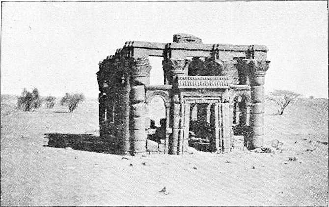
NAGAA: ROMAN BUILDING IN THE DESERT—SHOWING THE TRANSITION FROM EGYPTIAN TO ROMAN STYLE.
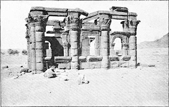
NAGAA: ROMAN BUILDING IN THE DESERT.
[315]The upper floor of the fine church there is now used as a mosque. On a ridge between the church and the river are remains of ancient fortification. An obelisk of Piankhi, now at Cairo, the fellow to that at Arab Hag, was found here, but had been probably carried from Jebel Barkal. Some Christian inscriptions have been found here (see “Journal of Theological Studies,” IV, p. 583).
Kurru, Zuma, Tangasi.At Kurru and Zuma (east bank), and Tangasi, 7 to 10 miles from Merowe, are remains of large groups of pyramids (B.N. 496), a few of stone, others of mud-brick from which the stone casing has been removed.
On Gimeti Island are traces of a church.
Merowe. B.C. 900 to B.C. 200.Merowe (north bank) and Abu Dom Sanam (south bank) mark the site of Napata (Nept or Nepita). The old city appears to have been on the south bank, and of considerable size (vide p. 222). A few miles from the river on this bank, in low hills, are the remains of a number of rock-hewn tombs, and 3 or 4 miles up-stream from Abu Dom, on the north bank, lie the pyramids and ruins of the temples of Napata.
Jebel Barkal.Jebel Barkal, 302 feet high, the “Holy Mountain” of the inscriptions, can be seen for many miles round; on the plain by the side of the hill are ruins of eight or nine pyramids, and on the rising ground are eight more, varying from 20 to 60 feet in height.
Circa B.C. 700. Nuri.The principal temples are those of Taharka and Piankhi, close to Jebel Barkal. At Nuri, 7½ miles from Merowe, on the south bank, are the remains of 35 pyramids, solidly built, and probably of the Middle (?) Empire. At Wadi Ghazal are the remains of a fine Christian monastery. (B.N. 496-503; Cailliaud; Lepsius.)
Belal.A few miles beyond Belal (foot of the 4th Cataract) and on the south bank are the remains of a Coptic church and fortified monastery.
Opposite Hamdab Island, 6 miles further on, are the ruins of a pyramid.
Berber.No further remains have been discovered for the next 250 miles or more. There is evidence that Berber was in the ancient days a starting point, as now, for caravans for Suakin, but there are no ancient remains, as far as is known.
Island of Meroe and Bagarawiya. B.C. 400 to A.D. 250.On crossing the Atbara the “Island of Meroe” is entered, and at Bagarawiya, some 45 miles south of the Atbara, three important groups of pyramids, about 100 in all, are reached. These, also called the pyramids of Assur, lie about 3 miles from the river, and are the tombs of kings and princes of the old capital, which lay somewhere near Shendi. An important find of jewellery of the Roman period was made here by Signor Ferlini, an Italian doctor, in 1834. (B.N. 509-513; L.; Cailliaud; Ferlini; W.) Since then the tops of many pyramids have been damaged in similar searches.
About 29 miles south of Shendi, on the east bank, is the entrance to the Wadi Ban Nagaa, and near it is a village of that name. Three miles down the river are the ruins of a small ancient Nubian temple.
Nagaa.Twenty-three miles south-east from the railway station of Wadi Ban Nagaa, and situated in a low waterless desert, are the extensive remains of an ancient town. The walls of six temples are still standing, at least in part, and the foundations of several others can be traced. Two of them are connected together by an avenue of rams. One of the temples is almost purely Roman in style, and belongs, perhaps, to the third century A.D.; others are transitional; these are in comparatively excellent preservation. (Description by Rev. L. Gwynne; B.N. 514, 515; Cailliaud [elaborate]; and W.). They were also visited by Wurt (1811), Demetrio (1822), Holroyd (1837), and Lepsius.
El Sufra.Twelve miles north-east of Nagaa are the ruins of El Sufra, also called El Masurat, a group of buildings within walls, of the Roman period, with a Meroitic inscription (C.; L.; and Hoskins, and B.N. pp. 515-516). One and a-half miles off are some Christian temples (?) (B.N. p. 515). A road track leads south-east from Shendi viâ Nagaa temples to Soba, and there are, it is reported, old temples on the way.
Khartoum.There are no visible ruins of ancient temples at Khartoum, though it is known that it was the site of a large town (vide p. 228). A colossal Christian (?) stone lamb has been brought here from Soba (W.).
Soba.At Soba, believed to be the old capital of the Christian Kingdom of Alwa, built on the old Ethiopic site of “Sobas,” 13 miles from Khartoum and on the east bank of the Blue Nile, are some remains of granite pillars and of a Christian church, including a decorated base with a large cross carved on it (W.). Little is known about this. There is said to have been a bridge here over the Blue Nile.
J. Geili.At Jebel Geili, 92 miles east from Khartoum, there is a carving in Meroitic style on a huge granite block at the south-eastern end of the hill, and on a neighbouring rock higher up the hill are the carved outlines of three horses (dates unknown).
Koliteb.At Koliteb, 113 miles from Tokar, on one of the Kassala roads, there are ancient and rude carvings of men and camels on the rocks (Junker).
Mamân.At Jebel Mamân, 201 miles from Suakin, on the “Ermenab” route to Kassala, there are some curious old Christian stone ruins and tombs (Schweinfurth; Z.A.E., 1865, p. 398).
Sennar.Little or nothing of the old Sennar Kingdom is left.
At Geteina, on the White Nile, some inscribed bricks and pottery of the Christian period have been found. These are now preserved at Khartoum in the Gordon College Museum.
[316]El Ein.Vide p. 211.
W. Mogaddam.Vide Vol. II, route Gabra—Korti.
W. El Fura.Just above the wells of El Fura are the remains of a large rectangular fort (about 60 by 50 yards), with massive stone walls some six feet high and eight to ten feet thick, with curious square projections, perhaps for flanking defence. It may belong to the same period as the great stone fortifications at Old Dongola and Khandak, but the masonry presents one curious feature not observed there, namely, the frequent use of stones with the long dimensions vertically placed. It would serve to command the wells on a road from Merowe to Napata.
Tombs, Atbai.North of the Berber-Suakin road, Lieutenant Newcombe, R.E., reports some curious tombs. Two are near the Wadi Amur (E. Long. 36° 15″, N. Lat. 19° 15″), and one is close to the watershed of Khor Garrar (E. Long. 36° 40″, N. Lat. 20°). The ground plan of these tombs is octagonal; they were roofed apparently by a dome supported on a hexagonal (?) drum, and lit by plain rectangular windows. It is impossible to say whether they belong to the late Christian or the early Mohammedan period. The rounded battlement which crowns the corners of the eight walls is a common feature on Sheikhs’ tombs.
It only remains to point out that the surface of Sudan antiquities has barely been touched. It is hoped that as money becomes available more of the ancient history of the Sudan may be brought to light, and more particularly is it hoped that the meaning of the Nubian and Meroitic hieroglyph inscriptions may shortly be discovered.
The whole matter is being gradually taken up by the Sudan Government, but want of funds hampers the work.
The distinguished Egyptologist, Dr. Wallis Budge, of the British Museum, has already paid several visits to the country.
[235]The contents of this are now preserved in the Gordon College Museum at Khartoum.
[236]Two cartouches on an altar preserved in Berlin enable us to recognise eight signs.
ETHNOLOGY OF THE SUDAN.
The wealth of the Nile Valley has at all times tempted invasion; the land presents no serious physical obstacles, and the people who live in the countries bordering it have always been unsettled and migratory. We expect, therefore, to find here a perfect babel of tongues and races. To mention invasions from the East alone and within the historic period, Africa has been overrun by the dynastic Egyptian, the Hyksos, the Abyssinians and the Arabs, and from the early cemeteries of Abydos archæologists have collected skulls which appear to show that from the time of the Stone Age four races at least have contributed to the population of Egypt. These races Kollmann[237] identifies as Punts, who were, perhaps, of Semitic origin, Nubians, Libyans, and Negroes, the last including several Pygmies and, to judge from their grave-offerings, some men of wealth and consideration. In the Sudan no detailed researches have been made in ancient burial-places, but we may confidently expect some day to read in the northern half the same story as in Egypt.
Invasion, moreover, is not the only disturbing element. The natives of the Sudan, even when they have adopted a more or less settled life, are great travellers: traffic in human flesh and conquest for the sake of human flesh have nowhere been pursued so long and so thoroughly. The native changes his abode without hesitation, and his love of strange women is passing Solomon’s. A hundred years ago Brown found Darfur full of Dongolawi traders. Fifty years ago the same race had turned their eyes to Kordofan and the Bahr El Ghazal, and wherever they go they intermarry with the women of the land. The Takruris have similarly in a peaceable way shifted their abode from Darfur to the province of Kassala within quite recent days.
Yet again, in the southern half we have seen within the last few centuries a succession of loosely-knit empires (Fungs, Shilluks, etc.) which carry the name and often the language of a single tribe over a wide area and then melt away, leaving behind only confusion to the ethnologist. What we know to have existed for the last thousand years, we can premise for the last fifty (?) thousand. So intricately mixed indeed is this southern half that the Nileland has been aptly described as the Negro Potpourri.
But there are mitigating circumstances which we must also take into account, otherwise the ethnologist would indeed be, of all men, the most hopeless.
In the first place, invaders do not exterminate and, by what seems to be almost a law, the old Somatic types tend continually to reassert themselves; a new invasion, that is, changes for a time the numerical proportion of different types, but as the newcomers are absorbed the old order returns, and the preponderating elements in the population become increasingly evident. It is a commonplace in Egypt that a Turk of the third generation is indistinguishable from a native.
In the second place, invasions and migrations have gone on from time immemorial, but they have always come from the same regions. Kollmann, as we saw, makes a four-fold division of the prehistoric inhabitants of Abydos; this corresponds to our four-fold division into Semites, Nubians, Libyans, and Negroes. The successive inroads into our area have meant, therefore, not the introduction of new constituents but the stiffening of an element already present by a fresh influx of kindred blood.
These two facts simplify the problem: they do not enable us to say that so-and-so is an Arab, indeed they make it impossible to say so with scientific certainty, but they will enable us ultimately to say which original stock has contributed most to the population of any given district. “Ultimately” because at present the data which[318] alone will permit us to delimit the frontiers of the various peoples are wanting.[238] Along the river, especially, one stock shades into another with such delicate gradations that no two observers seem to agree as to the point of division, and the theories of the people themselves as to their own origin and that of their neighbours—theories which seldom agree—have little foundation in fact, albeit to some they may prove of greater interest and political importance than the future classifications of the learned.
We must at present renounce all pretensions to scientific exactitude and confine ourselves to more or less popular distinctions; accordingly, eliminating from our survey all recent new-comers of European or Asiatic extraction, we shall divide the present inhabitants of the Sudan broadly into four groups—the Negro, the Nuba, the Bega, the Arab.
(i) Negroes.The ancient Egyptians referred to the South—it is difficult to say where it began—as the land of the black man, just like their successors, who named it Nigritia or Belad el Sudan; and they knew, as we know, that there were pygmy blacks as well as big fighting blacks. Whether the pygmies, relics of whom have been found all over the world, were evolved first in Africa or came in as immigrants, and whether the big blacks were developed by selection from them here or elsewhere we cannot here discuss. Suffice it to say that from before the dawn of history the two have always been in Africa, and that the Negroes of the Nile land are to-day more hopelessly subdivided than the Negroes of any other part. The pygmies have been now driven into the forests of Central Africa, and the big Negroes are now found in the Sudan only on the Upper reaches of the White and Blue Niles and in the hill countries to the west; north of this they occur merely as immigrants, soldiers, slaves, etc., amounting, though, in some parts to almost 50 per cent. of the population. They vary enormously in size, colour, language, institutions, and religion, so that in spite of the great work of such explorers as Schweinfurth, Emin, and Junker, we are still far from unravelling the intricate web of their interrelations. A recent writer, who has given a popular account of the researches of travellers before the Mahdia, disclaims as impossible any attempt at scientific classification, and we can only follow him in grouping the blacks of the White Nile and its tributaries according to the picturesque impression which they made upon their visitors. In this book (“Die Heiden Neger des Aegyptischen Sudan,” Berlin, 1893), Frobenius divides the blacks within our present frontiers into four groups:—
| I. | The Swamp Negroes—Shilluk, Shuli, Bari, Jur, Nuer, Dinka or Jange, Anuak, etc. |
| II. | The Iron-working Negroes—Bongo, Mittu, Golo, Sheri, Madi, Kreich, etc. |
| III. | The A-Zande or Nyam Nyam. |
| IV. | The Latuka. |
For further information about these people we must refer the reader to other chapters in this compendium, and to the authors mentioned above.
It only remains to point out that the blacks of Kordofan and the Blue Nile, offer practically virgin fields to the ethnologist.
(ii) Nubas.Under this head we include (a) the Barabra, who are found between the 1st and 4th cataracts, and are subdivided into natives of Dongola, Mahas, Sukkot, Halfa, each with a different dialect; (b) the Nubas of Kordofan, with their sub-tribes. To these some philologists add, on linguistic grounds, a number of tribes usually described as negro or negroid.[239]
Geographically, and perhaps physically also, these Nubians appear as a link between Egypt and Negro land. They are darker and smaller than the Egyptian, but still brown and not black,[240] although they often have, like so many Egyptians, the woolly hair of the Negro. It is probable that they represent the ancient Kushites, and the latest student of the old Ethiopian inscriptions has sought to prove that the Nubians and not the Begas were the rulers of ancient Napata.[241] They are enterprising people, apt linguists and great travellers, very ready to take on a veneer of European culture, the last trait being an old one caricatured by the wall-painters of ancient Thebes. It is the more strange that they should have preserved their own dialects, especially as they have been Muslims for some centuries.
[319]It was on the ground of their language that Lepsius[242] related the Nilotic Nubians with the Nubawis of Kordofan. The connection corresponds with traditions current in Dongola, where the traveller will hear again and again that, although the particular man he is interrogating is, of course, pure Arab from the Hejaz, yet most of the people round are Nubians like the Nubawis of Kordofan. Supposing this relationship to be proved, it would be still uncertain whether the Kordofan people are a colony from the Nilotes or vice versâ. But it is also possible that the Nubawis of Kordofan adopted a Nuba language in some by-gone age when there was a powerful Christian or pre-Christian Nubian kingdom on the Nile. If we are to believe Hartmann[243]—a very good observer—the majority of the Shaigia “Arabi” and many of the Jaalin really belong to the same stock.
(iii) Begas.This name is derived from medieval Arab historians and has been identified with the Bugatæ and Buka of earlier days. It is applied to the tribes living in the eastern desert who speak various languages belonging to the so-called Hamitic group of languages. The principal tribes are Ababda, Bisharin, Amarar, Hadendoa, Halenga, Beni Amer, Habab.
In type they are far more “Caucasian” than those we have previously mentioned, and they occupy the same position and present the same characteristics as many turbulent pastoral tribes mentioned by Egyptian scribes and classical writers.[242] As Hamites, one school of anthropologists represented by the Italian Sergi, regards them as an off-shoot of the great Euro-African stock which populated North Africa and Europe: others bring them from Asia. “Non nostri est tantas componere lites.” Nor do we like to hazard an opinion as to whether they or the Nubians were the creators of ancient Meroe. The termination ab which is so common throughout the Berber Province proves that people of the Bega stock once held this district, and their immediate descendants are probably to be looked for among the riverain “Arabs” rather than the desert Begas, for no civilized people would exchange a settled life for a nomad life, least of all so warlike a race as the Begas.
According to W. Max Müller (“Aethiopien,” Berlin, 1904, p. 19), we have in the legend quoted on p. 224, a distorted version of one Hamitic settlement in this very area. The word Sembridae or Semberritae is a hybrid name formed by a North Hamitic people out of a Semitic root, and means, not “Deserters,” but “Nomads,” “Wanderers.” The legend above-mentioned will therefore be the echo of an early Hamitic invasion of a district then peopled by Nubas or Negroes, and of the adoption of a sedentary life by these invading “Wanderers,” whose success may explain the shifting of the capital from Napata to Meroe (p. 225).
(iv) Arabs.The first three stocks have been in the country for as long as our records go. The Arabs are comparative newcomers; it is improbable that they came in any numbers until after the fall of the Christian kingdoms of Dongola and Alwa (Soba). The traditions of some tribes are against this, but historians only mention raids, and the traditions are not to be set against the historians’ testimony. The extension of these raids, which led to the downfall of Christianity and a consequent increase of Arab immigration, was probably due to pressure caused on tribes elsewhere by the conquests of Spain and Portugal on the one side and Turkey on the other. This would give the Arabs an occupation of from four to six centuries, though a slow infiltration from Arabia into the Sudan must have gone on from the beginning.
Now, at any rate, the Arab dominates the northern half of the Sudan, that is, from Egypt to Kordofan. He has nowhere exterminated the original inhabitants; he has in many cases not yet succeeded in forcing even his language upon them; he has, unlike the Arabs in Arabia, intermarried freely with them; but his conquest has been so far complete that his religious ideals and tribal organisation have replaced the older faith and institutions wherever he has cared to carry them. This fact upsets our perspective. The people call themselves Arabs and we accept the name, but it would certainly be a mistake to regard them as Arabians or to recognise as genuine their long pedigrees “of unsullied (?) Arab descent” “going back to early Mohammedan times” (Keane). The present writer believes that the materials newly published by Naum Bey Shoucair (“History of the Sudan,” Cairo, 1904—in Arabic), enable him to trace two distinct steps in the Arabization of the Central Sudan.
Up to 1500 A.D., the Christians reigned on the Blue Nile; there are no Gubbas, no mention of Fikis, earlier than this, as would certainly have been the case if many Arabs had been here. About this time the Fungs, a powerful black tribe under Amara Dunkas, became Muslims and, assisted by some Arab immigrants, overthrew the kingdom of Soba. Hardly had they done so when they were themselves menaced by Sultan Selim, the Turkish conquerer of Egypt and Suakin; it was their policy then to represent themselves as orthodox Muslims connected with the most venerated Arab tribes, and a certain Sheikh El Samarakandi, who had wandered to the court of Dunkas, provided the necessary pedigrees, which were duly sent to Selim and by him much admired (Naum II, pp. 73, 74). But the Sheikh did his work clumsily, if it may be judged from a Jaali pedigree which purports to be extracted[320] from his work, for he left at the crucial point several non-Arabic names, and few, if any, Sudanese pedigrees are accepted by Muslim genealogists elsewhere.
At this point the Arabization of Central Sudan seems to have stood almost still for three centuries. Gubbas were built and Fikis became powerful, but the tribal organization, although indigenous among the Begas, did not supplant the very different political division of the land into small kingdoms tributary to Sennar. The emblems of kingly power, a throne called the K-K-R and a two-horned cap (Naum II, pp. 100, 101), are also clearly African, not Arab. Burkhardt, again, who knew the Arabs in Syria and Arabia, is never tired of contrasting their manners and morals with those of the Sudanese Arabs.
This period was closed by the Egyptian conquest of Mohammed Ali, which continued the process begun in the time of Selim, and finally obliterated several of the most characteristic survivals from pre-Islamic days. Indeed, all the events of the last century, including the great upheaval in which it culminated, had the same tendency. Having lost their native kingdoms, the people have been forced to adopt the Arab tribal system, and, unlike the Berbers in Algiers, have identified themselves enthusiastically with all things Arab. The more striking is it that they should have still kept such African customs as the Akh-el-banat, the scarring of the cheeks, female excision,[244] all alien from the true Arab of Arabia.
If this reading of history be accepted, the people of the Central Sudan will be described as a mixed race recently forced into an Arab mould and in varying degrees modified by Arab blood. And we may prophesy that future researches will prove the other elements in this race to be akin to the other races on its borders, to the Nubians and Begas on the north, to the Negroes, Gallas, Abyssinians, etc., on the south and south-east.
In the above sketch there are so many necessary gaps, and so many controverted points of necessity passed over in silence, that it seems fair to the reader to give a brief statement of a different theory recently put forward by Sir H. H. Johnston on this subject. We therefore append a résumé of his views compiled by Captain Morant from “The Nile Quest”:—
In pre-historic times the land on each side of the Red Sea is said to have joined in the south as well as in the north. By these necks of land man came to Africa from Asia in the form of dwarfs of a very low negroid type, resembling the now much-advanced pigmy of the Congo or the bushman of South Africa. Thus perhaps, say, 10,000 years ago, the Nile basin south of N. latitude 15° was peopled by a negroid species from the east. It seems also not improbable that Egypt proper and Arabia were within the domains of this negroid race.
These indigenous pigmies appear to have been at an early date ousted (say 9,000 years ago) by races of Caucasian stock resembling the Dravidians of India, of aquiline type, possibly of nearly pure Caucasian “Khafra” origin, and probably emanating from Syria, Cyprus, or Libya.
In Gallaland, Somaliland, and Abyssinia a handsome race of Caucasian ancestry, mingled no doubt with proto-negroes and Dravidians, formed originally in Southern Arabia, sprang up. The lips of this people, destined to become the basis of a world-renowned and historic type, were full and their noses straight and finely shaped, whilst their skin was dark and their hair had a tendency to curl, and like the modern Somali, Galla, or Danakil, the men grew thin and wedge-shaped beards.
It was by emigrants of this new Hamitic race to the Lower Nile Basin that the stock of the ruling type of ancient Egyptians was formed. In the latter, nevertheless, an appreciable amount of Negro blood from the early Negro population must doubtless have been absorbed.
So degraded and transformed, however, has been the ancient Egyptian type by the infusion of the blood of their many successive rulers, that though facial resemblances may remain, their famous characteristics have vanished, and the Egyptian of to-day is the descendant of Slavs and Turks, Arabs, Armenians, and Circassians.
But it was not only to Egypt that this Hamitic race extended, but also, though more faint-heartedly, towards the negroid districts to the south-west to Uganda, Zululand, and even it is thought to the Atlantic. In Uganda their descendants are now distinctly traceable.
To recapitulate:—The country of Ethiopia, which included not only the highlands of Abyssinia but also the country north, to Berber or even Dongola, was probably originally populated by a very low type of pigmy or bushman, then perhaps partially by a race of big black negroes, such as Shilluk, Dinka, Nuer, and Bari, which in turn gave way to the Hamitic race already described. The ruling class of Ethiopia, however (the present “Abyssinian” in contradistinction to the “Galla or Somali”), became of Semitic origin through the Sabæan Arab conquest of Abyssinia some 3,000 to 4,000 years ago.
[321]The break up of the Israelitish Empire by the Abyssinians and subsequent scattering of the Jews, many of whom settled in Abyssinia, introduced a further admixture of Semitic blood.
In comparing this ancient history, much of which is little more than guesswork, with the state of affairs at the present day, we find the descendants of the original pigmies, but in a more advanced state, having been ousted from place to place at length survive in hiding, as it were, in the forests of the most central of Central Africa. The big black negro tribes have withdrawn to and are content to remain in the swampy fever-stricken districts of which no higher human race has ever yet desired to deprive them. The Ethiopians have retired before the Arab invaders to their hills, whilst the Arabs continue to dominate all the country they cared to conquer.
The Hadendoa, Ababda, Bisharin, Beni Amer, etc., Arabs who speak a “rotana” somewhat resembling the Somali language, are, undoubtedly, not true Arabs, but are probably descended from the Hamitic race above described which also was the origin of the Somali and Galla races.
[237]Die Gräber von Abydos. Correspondenzblatt der Deutschen anthropologischen Gesellschaft, 1902, pp. 119 foll.
[238]Only one ethnologist of the first rank—R. Hartmann—has spent any considerable time in the Sudan, and this was forty years ago. Except for his work we have to depend on (1) reports of officials and travellers: these are often very valuable, but the different criteria of race, language, etc., used by these writers make it very difficult to use them with any confidence; (2) the observations of “arm-chair savants” who base great theories upon stray skulls, fragmentary vocabularies, chance studies of natives touring about Europe “on show,” etc. This is not the place for a nice criticism of the respective values of these works.
[239]E.g., Cust (Modern languages of Africa, London, 1883, I, p. 142) includes as “Nubas-Berta, Fung, Hameg, Golo, Sheri Monbutto, Nyam-Nyam, and others.”
[240]The Nubas of Kordofan, although certainly not negroes, are black.—G.
[241]Heinrich Schäfer, “Die Aethiopische Königsinschrift des Berliner Museums,” Leipzig, 1901.
[242]“Nubische Grammatik,” Berlin, 1880, p. lxxvii.
[243]Skizze der Nilländer, Berlin, 1860, p. 258.
[244]Mentioned in Strabo and Makrizi. To these African customs in vogue among the Sudanese “Arabs” may be added the Dilka and the Tadkhin. The former is their method of cleaning themselves: instead of washing they prefer, like the ancient Greeks, first to grease themselves over and then scrape the skin with a stone or other scraper. For the Tadkhin, see Baker, “Nile Tributaries of Abyssinia,” p. 81.
LIST OF TRIBES AND SHEIKHS. (For Tribes in the Bahr El Ghazal Province, vide Chap. VII.)
| Tribe. | Head Sheikh. | Habitat. | Remarks. | |
|---|---|---|---|---|
| Berber Province. Population 83,000 (1904). | ||||
| Ababda (Bilhush) | Abdel Azim Bey Wad Khalifa and Mohammed Nura. | Abu Hamed, Ban Nagaa, and Segadi | Branch of the Ababda in Egyptian territory. Poor and unimportant. | |
| Arteiga | Abu Fatma Wad Omar | Adarama | Nomads. Unimportant tribe. | |
| Bisharin, Um Ali | No Nazir | Atbai | Sub-divided into Aliab, Shantirab, Amrab, and Hamadorab. Nomad Arabs, owners of camels, sheep, and goats; do a little cultivation. | |
| „ Um Nagi | Karar Ahmed | R. Atbara, between Adarama and its mouth. Also in the Southern Atbai. | Sub-divided into Hanr, Nafab, Mansurab, Hamdab, Ariab, (Negemab, Kurbab, and Bilanib). Nomads as above. | |
| Fadnia (east) | Ahmed El Haj Taher | Um Hatab | Nomads. Owners of camels, cattle, and sheep, etc. | |
| „ (west) | Abbas Shedid | Goz Naim | Mostly sedentary and cultivators with sagias. | |
| This tribe claims descent from Imam Ali, cousin of the Prophet, and therefore belong to the Alluia. They now consider themselves Jaalin. | ||||
| Hāmak | Abdalla Wad El Aila | Near Berber | Very few. Nomads; originally belonging to the Bisharin. | |
| Hassania | Omar Idris El Fazari | Upper part of basin of Wadi Bayuda, and whole of basin of Wadi Abu Dom. J. Gilif and J. Jakdul, Abu Tleh, and at times west bank of Nile, Metemma to Berber. | A large and important nomad tribe. Pay £250 tribute (1903). Owners of a few camels and cattle, but chiefly owners of sheep and goats. Small cultivators on rainland. Claim to be descended from Zubeir Ibn El Awam (Zubeir’s mother was aunt of the Prophet) and therefore from the Beni Hashim tribe. | |
| Jaalin | Hamad Suleiman Osman (nomads) | Debbaghat—El Hawad—Kabushia, etc. Both banks of the Nile from Metemma to the junction of the Atbara. | Nomads and sedentary. Formerly a large and powerful tribe; now much reduced in wealth and numbers by the Dervishes. | |
| Ibrahim Wad Ferah (sedentary) | Cultivators by sagias. Owners of sheep and goats. The Jaalin say they are descended from Abbas, uncle of the Prophet, and therefore belong to the Abbasia tribe. | |||
| Khawawir | Gar El Nabi Kador | Abu Safār | Nomads. Owners of camels, sheep and goats. | |
| Kimilab | Suleiman Hamad Salem | Shigla and El Nebis | This tribe was one of the first to settle on the Atbara, and fought the Bisharin who arrived later from the Atbai. They have now lost their pristine power and importance. | |
| Monasir | Osman Suleiman Wad Gamr | Dar Monasir; left bank of Nile, south and south-west of Abu Hamed at Sani. | Mostly sedentary Arabs. Poor tribe living in a poor country. | |
| Nefeidab | Ali Wad Sebib | Atbara | Of tribes now on Atbara the Nefeidab and Abdel Kerimab were the first to settle there. Formerly owned right bank from Goz Regeb-El Kian. Now very few. | |
| Mohammed Abu Abda. | ||||
| Rasheida | Abdalla Mubarak | Atbara and Gash | Nomads. Came from Arabia in 1846. The Dervish Emir Abu Girga, during the Mahdia, is said to have killed 75 men of this tribe and captured 1,700 of their camels. They then took refuge at Massaua and returned to the Sudan after the fall of Omdurman. Part of this tribe live near Agik in Suakin Province. | |
| [323]Robatab | Habiballa Abdel Majid | Both banks of the Nile from about the 5th Cataract to a little below Abu Hamed. | Sedentary. Cultivators. Poor. | |
| Shaigia, Onia (east) | Abdel Rahman Zayad | Goz El Basabir. Also east bank south of Metemma. | Chiefly nomads. Owners of camels, sheep, and goats. | |
| „ Onia (west) | Naim El Fiki Mohammed Kheir | Nasri Island and west bank. | ||
| „ Sauarab | Nasr El Meki | Wad Ban Naga | Nomads. Major part of this tribe lives in Dongola Province. Not a large tribe. | |
| Dongola Province.[245] Population 127,000 (1904). | ||||
| Gararish | El Ata Abdalla | Right bank Nile between Kerma and Debba. | Nomads. Small and unimportant tribe. Owners of camels, sheep, and goats. Pay £E47 tribute. | |
| Hawawir | Hassan Khalifa | Bayuda Desert between Korti, Debba, and Gabra. | Nomads. Large tribe owning camels, sheep, and goats. Pay £E480 tribute (1903). Head Sheikh lives at Korti. | |
| Kababish, Omatto | Fadi El Mula Wad Rekha | Wadi El Gab and south to Ein Hamed and Gabra. | Nomads. Owners of camels, sheep, and goats. Pay £E235 tribute. | |
| „ Dar Hamed | Isawi Salem | Wadi El Gab and south to Ein Hamed and Gabra. | Nomads. Owners of camels, sheep, and goats. Pay £E25 tribute. Head Sheikh lives at Dongola. | |
| Shaigia (Sauarab) | Ibrahim Wad El Kheir | Debba to Merowe and Bir Bayuda | Nomads. Not an important tribe; it is under Sheikh Hassan Khalifa of the Hawawir. | |
| Gezira (Blue Nile) Province.[246] Population 132,000 (1904) | ||||
| Agaliin[247] | Mohammed El Fiki Ahmed | Right bank White Nile, Gezira Um Garf, between Kalakla and Um Arda. In rains at Fatjuba and El Arak. | Sedentary. Not a large tribe but moderately wealthy. Owners of cattle and sheep; cultivators. | |
| Ahamda | Mohammed Kheiralla Ali Abu Zaman. | Eastern part of Kamlin district. Mesellemia district. | Sedentary. Rich in cattle. Number about 250 males. Comfortably off. | |
| Alkamab | Abdel Bagi Ghabashi | Mesellemia district | Sedentary. Fairly well off. | |
| Arakiin | Yusef Fadl El Mula | El Kreimet (Managil) | Sedentary. This section is neither numerous nor wealthy. | |
| Ibrahim Ahmed El Natifa[247] | Maatuk (Kawa) | Sedentary. Numerous and well off; chiefly cultivators. | ||
| Aramab[247] | Idris El Kinen and Mohammed Abu El Hassan. | Scattered on right bank White Nile between J. Breima and Geteina. In rains inland at Mikheirif El Kheiran, Kitra, and Abdel Magid. | Sedentary. Large tribe and very wealthy. During Mahdia and up to 1902 Mohammed Abu El Hassan was Nazir. It is now split into two sections. | |
| Arawab[247] | Magbul Ahmed Jar El Nebi | Scattered on right and left banks of White Nile from J. Auli to El Mohammedia and inland at Garada, Hashaba, Malaga. | Sedentary. A large and very wealthy tribe; chiefly cultivators. | |
| Awamra[247] | Ahmed Idris El Fadl | Interior of Gezira, east of J. Auli, and on left bank of White Nile near Um Rummat. | Sedentary. Large and moderately wealthy tribe. | |
| Batahin | Ali Abudi | Um Daka (Managil) | Sedentary. Few and poor. | |
| Mohammed Zein Shakhib | Mesellemia district | Nomads. Poor; have a few camels. | ||
| Mohammed Talha | Abu Deleig district | Nomads. Large tribe, rich in cattle, also owners of camels. | ||
| Bija[247] | Abdel Gader Ibrahim | Right bank of White Nile, Gezira Um Garf, and inland at Wazra. | Sedentary. A section of the Agaliin; few, but well off. | |
| Dabassiin | Rahmatalla Kheir El Sid | Gab El Gedad, El Dabiba, etc. | Sedentary. About 260 males in tribe. Cultivators. | |
| [324]Danagila | Ahmed El Niama | Mesellemia district | Sedentary. Small tribe, but well off. | |
| Mohammed Osman Abdel Rahman[247] | Geteina | Sedentary. Small tribe, but well off. | ||
| Dar Mahareb[247] | Ahmed Mohammed Abu Afsh | Scattered on right and left banks of White Nile from Hagar El Asalai to Jebelein. | Nomads. Divided into many branches; all fairly well off. | |
| Diwa[247] | Ali Babikr | Aba Island (Kawa) | Sedentary. Very small tribe. | |
| Eseilat | Mohammed El Haj Saad | Eseilat (Kamlin) | Sedentary Arabs. About 360 males. Cultivators. | |
| Fardiin | Ahmed El Taif | Managil and Um Talha | Sedentary. Very small tribe, but wealthy. | |
| Fung | Mohammed El Rih Guma | Dar Nail, Wad Odun (Managil) | Sedentary. Very small tribe, but wealthy. | |
| Gemmuiya[247] | Nasr Ibrahim El Mek | Left bank of White Nile, between Omdurman and Jebel Mandara. | Sedentary. Large tribe and well off. Cattle and sheep owners. | |
| Halawin | Abdalla Wad Musaid | Mesellemia | Sedentary. Excellent cultivators. | |
| Hassanab[247] | Abdalla Suleiman | Arak and Gezira, Um Garf (Geteina) | Sedentary. Very poor cultivators. | |
| Hassania | Ali Wad Yusef | Mahriba (Kamlin) | Sedentary. Small section. | |
| Idris Habbani, Musellim Magbul, and Ali Musa El Bida.[247] | Scattered on right and left bank of White Nile from Geteina to Dueim; also inland near eastern boundary of Geteina district. | Sedentary. Related to the Berber Hassania. A very large and very wealthy tribe. Idris was Sheikh of whole tribe during Mahdia, but it is now divided into three sections. Owners of cattle, sheep, and goats. | ||
| Hussanatt[247] | Ali Awadalla | Umat Shaar, Sharafat, J. Maturi (Kawa). | Sedentary. Large and wealthy tribe. Owners of cattle, goats, and few camels. | |
| Ahmed Sogheirun | Scattered on right and left banks of White Nile between Wad Belal and Geteina. | Sedentary. Large and wealthy tribe. Owners of cattle, goats, and few camels. | ||
| Kawahla | Imam Ali Ibrahim El Bedawi | Abud, El Walia, and Kadibat (Managil). | Nomad and sedentary. Largest and wealthiest tribe in Managil district. Owners of camels and cattle. Good lighting men. | |
| Lahawin[247] | Saleh Yagub El Imam | Um Hagar, Wad Badri (Kawa) | Sedentary. Not well off. | |
| Mesellemia | Mohammed Gamal El Din[247] | Um Shedida (Kawa) | Sedentary. | |
| Awad El Bari Mohammed | Wad El Meslami (Managil) | Sedentary. Few and poor. | ||
| Abbas Mohammed Badr (Sheikh El Obeid). | East of Kamlin district | Nomad and sedentary. Rich in cattle. Number about 500 males. | ||
| Mogharba | Mohammed Osman | El Abdanab, Wad El Zein (Managil) | Sedentary. Few and well off. | |
| Mubarak El Gezuli[247] | Um Sunta (Kawa) | Sedentary. Few and well off. | ||
| Mohammedia[247] | Abdalla Idris El Kereil | Scattered on right and left banks of White Nile between Hellet Wad El Kereil and J. Breima. In rains inland at Um Sidra. | Sedentary. Large and wealthy tribe. Owners of camels, cattle, and sheep. | |
| Nefeidia | El Melik Rahma | Abu Siwa (Managil) | Nomad and sedentary. Large and wealthy tribe. | |
| Nurab[247] | Saleh Wad El Imam | Shawal (Kawa) | Sedentary. | |
| Rufaa | Shai El Nur Tai El Din | El Azazi and Shukheir (Managil) | Sedentary. Few, but well off. | |
| Shaigia | Ahmed Wad El Awad | Wad Kunjari (Managil) | Sedentary. Few, but rich. | |
| El Gazuli Omar[247] | Tura El Khadra (Geteina) | Sedentary. Few, and very poor. | ||
| Shenabla | Musaid Mohammed | Mesellemia district | Sedentary. | |
| Shukria | Abdalla Awad El Kerim Abu Sin. | Rufaa district | Nomads and sedentary. Numerous, but now poor tribe. | |
| „ Gadurab | El Zubeir El Nur | Eastern part of Kamlin district | Nomads and sedentary. Rich in cattle. Number about 230 men. | |
| [325]Kassala Province. Population 74,700 (1904). | ||||
| Beni Amer | Mohammed Osman (Wakil Yagub Mohammed). | Debeloeid | Nomads. This is only a small branch of the large tribe living in Eritrea. Pay £E150 tribute. | |
| Debania | Awad El Kerim Wad Zaid (Wakil Mustafa Bakr Wad El Sultan). | Gedaref, Asar, Shasheina, Abu Gelud, Sofi, etc. | Sedentary Arabs. The Debania tribe are now very poor and reduced in numbers. Sheikh Awad Wad Zaid is also head of all the Forawis and blacks under Mustafa Bakr. | |
| Hadendoa | Sheikh Idris Gadi (Nazir)[249] | Kassala | The Hadendoa under the Governor of Kassala pay £E480 tribute (1904). Their principal grazing grounds are the right bank of the Atbara and the Gash, north of Kassala. Both these districts, however, are subject to invasions of the Suakin Arabs. Filik, on the Gash, used to be and is now to a lesser extent a great centre of the Hadendoa tribe. The Hadendoa are nomads and own large numbers of camels sheep, and goats, also cattle. They do a little cultivating. They speak a Rotana similar to that of the Beni Amer and Bisharin, etc., which is said to be allied to that spoken by the Somalis. They usually carry very neatly made spears with shafts about 5 feet long bound at intervals with silver or brass wire, also circular shields about 2 feet 6 inches in circumference made of hippo, buffalo, or giraffe hide. Like the Bisharin, Beni Amer, Kababish, etc., they wear their hair in the well-known “fuzzy-wuzzy” style. The Wililiab are the leading family of the Hadendoa tribe. | |
| „ El Berinab | Minni and Onur Ali, Mohammed Ahmed Abbas. | Adarghayai. | ||
| „ „ | Ahmed Belal | Maman. | ||
| „ Gemilab (Taulil) | Omar Lalai | Maman. | ||
| „ Haikolab | Mohammed El Hag | Tebilol. | ||
| „ „ (Odi) | Ahmed Wakili | Odi. | ||
| „ Kalulei | Ali El Hadab | Atbara. | ||
| „ Gism El Gash | Mustafa Hamed | Temitatei. | ||
| „ Shebodinab (Kokreb.) | Hammad Musa | Tendera. | ||
| „ Shebodinab (El Bahr.) | Hamed Isa | Atbara north of Goz Regeb. | ||
| Halenga | Jaafar Ali | Kassala | Sedentary Arabs. Cultivators. | |
| Hamran Arabs | Omar Burbur | Setit | Sedentary Arabs. Very few and poor, but nearly all own horses. Omar Burbur is under Awad El Kerim Wad Zaid. | |
| Shukria, Butana Section | Ali Awad El Kerim Abu Sin, called also “Ali El Had.” | Butana, Rera, El Sofeiya, Um Rueishid, Gileita, etc. | Nomads. Cultivators and graziers. Formerly owned many camels, now possess very few. Some of the Lahawin, Kawahla, and Batahin live in the Butana under “Ali El Had.” Pay £E450 tribute. | |
| „ Atbara Section | Amara Mohammed Hammad Abu Sin. | River Atbara between K. Kutut and Ramet Gaied. | The Lahawin (a White Nile camel-owning tribe), some of the Awaida, Kawahla, and Mogharba, also live on the Atbara under Amara Abu Sin. Pay £E325 tribute. | |
| „ Gedaref Section | Hammad Abu Sin | Gedaref, Wad Kabu, Beila, Rahad, Galaat Arang, etc. | Sedentary. Chiefly cultivators. There are more than 220 villages in the Gedaref district. | |
| Takarir | Sheraf Mohammed Abdalla | Gallabat and district | Shiekh Sheraf is head of all the Gallabat district, the people of which are chiefly Takruris, Forawis, Kunjara, etc. | |
| Khartoum Province.[248] Population 81,000 (1904). | ||||
| Ahamda | Mohammed El Ata | Geili | Sedentary. Small tribe. Vide Blue Nile Province. | |
| Batahin (Ashama) | Mohammed Talha Abdel Bagi | Geili-Elwan | Sedentary. Cultivators. Camel and sheep owners. Vide Gezira Province. | |
| Butukab | Mohammed Talha Abdel Bagi | Geili-Elwan | Sedentary. Cultivators. Camel and sheep owners. Vide Gezira Province. | |
| Ereikat | Jadalla Isa | Omdurman and Khartoum | Belong to Darfur. Like the Taaisha and Habbania are now poor and earn their living as best they can in Khartoum and Omdurman, or cultivate in Gezira. | |
| [326]Geriat | Mohammed Kirsha | Gaerin—Wadi Mogaddam | Nomads. Small tribe. | |
| Habbania | Mahmud Abu Saad | Omdurman and Khartoum | Belong to Darfur. Many are employed by Works Department, etc., at Khartoum. | |
| Hassanab | Hassan Meki | Wad Hassuna | Vide Gezira. | |
| Hassania | Awad El Kerim Suleiman Kasir | Wad Hassuna, Wadi Tibna, West Bishara, and north of Gabra. | Majority belong to White Nile Province. | |
| Mashaikha | El Taib Abdel Salam | Um Dom, Karkoj, etc. | ||
| Mogharba (nomad) | Hassan Hamad El Deisis | Wad Ramla district | Vide Gezira Province. | |
| „ (sedentary) | El Taib Abdel Salam | Melaha, etc. | ||
| Taaisha | Mahmud Abu Saad (of Habbania) | Omdurman, Khartoum, and scattered in Gezira. | Belong to Darfur. Vide also Ereikat. | |
| Zeiadia | Jadalla Isa | Omdurman, Khartoum, and scattered in Gezira. | Belong to Darfur. Vide also Ereikat. | |
| Kordofan Province. Population 550,000 (1904). | ||||
| Agrab Nahud | Mustafa Ibrahim Abu Renat | Nahud | Sedentary. | |
| Ahamda[250] | Abdel Rahim Taha | Dar El Ahamda | Very poor. Sedentary Arabs. | |
| Aulad Hameid | Didan El Dervish | South of Dar El Ahamda | Baggara. Nomads. Poor and now unimportant. Pay £E60 tribute. | |
| Bederia | Abdel Samad Abu Safia | Birket Sungikai and Abu Haraz | Large sedentary tribe. Pay £E400 tribute (1903). Good fighting men. | |
| Ebeid El Hag | El Obeid. | |||
| Beni Jerar[250] | Ahmed Mohammed Nubawi | Helba and Homra | Nomads. Large tribe. Pay about £E130 tribute. Camel and sheep owners. Good fighters. | |
| Feraha | Omar Wad Gash | Khor Kheiran | Unimportant tribe. | |
| Ghodiat | Ibrahim Baggara | Rahad | Unimportant tribe. | |
| Gimma[250] | Ahmed El Bedawi Asaker | Gedid | Sedentary Arabs. Important tribe. Good horsemen. Cultivators and gum collectors. | |
| Gowama | Yasin Yusef | Between El Obeid and Dueim | Large sedentary Arab tribe. Cultivators and collectors of gum, and owners of sheep, goats, etc. | |
| Adam Maznuk | Rahad. | |||
| „ (Nahud) | Bokhari Ali | Nahud. | ||
| Habbania | El Tom Audun | Sherkeila and Ageila | Sedentary Baggara Arabs. Not numerous. Branch of the Habbania of Darfur. | |
| Hamar, Asaker | Ismail Mohammed El Sheikh | Nahud to Foga | Large and important Arab tribe. Camel owners and cultivators. Pay £E1,200 tribute (1903). Partly sedentary and partly nomad. Good fighting men. | |
| „ Degegin | Hamid Bey Fatin. | |||
| „ Gherasia | Abdel Rahim Bey Abu Dagal. | |||
| Hawazma, Abdel Ali | A large and powerful Baggara nomad Arab tribe, scattered over the plains amongst the Nuba hills. Own many horses, cattle, sheep, etc. Pay about £E800 tribute (1903). | |||
| „ Dar Beti | Hamed Asosa | Sungikai, Nila, and Dilling. | ||
| „ Walad Ghabush. | ||||
| „ Dar Gawad | Gad El Kerim. | |||
| „ Khalifa | Nur Hanur | J. Kadero to J. Gedir. | ||
| Toto Mahub. | ||||
| Bedawi Gadum. | ||||
| Hamad Abu Shilluk. | ||||
| „ Rowauga | Soma Lua | J. El Joghub and south. | ||
| Mohammed Bahlul. | ||||
| Shein Tobein. | ||||
| Homr | Ali Gula (Nazir) | Large and comparatively rich Baggara tribe, owning cattle and horses. At present (1903) pay £E450 tribute. | ||
| „ Ageira Walad Omram | Mohammed Khadam | Muglad. | ||
| „ Ageira Walad Kamil | Masaud Iris | Muglad to Bahr El Arab. | ||
| „ Felaita | El Hag Wad Yagub | Keilak and Abiad Lakes. | ||
| [327]Kababish | Ali Tom | Kagmar and north | Large nomad Arab tribe owning camels, sheep, etc. Pay £E850 tribute. Another branch lives in Dongola Province. | |
| Kaja (Serrug) | Ibrahim Gurud | Kaja | Sedentary tribe. Poor; robbers. | |
| Kawahla | Abdalla Wad Gadalla | North-west of Bara | Large nomad Arab tribe, owning many camels. Pay £E1,000 tribute (1903). | |
| Badai Bakr | Dar Nuba. | |||
| Maagla | Beshir Dau El Beit | El Gleit. | ||
| Maalia | Abdalla Hanatir | El Mazrub | The bulk of this tribe belongs to Darfur. Pay £E60 tribute. | |
| Maganin | Mohammed Ali El Akheida | Dar Hamid | Sedentary Arabs, living in Dar Hamid. Pay £E150 tribute. | |
| Messeria | Mohammed El Fagir El Gaburi (Nazir). | Dar Messeria (east and south-east of El Eddaiya). | A large and powerful Baggara tribe, owning large numbers of cattle and horses. Pay £E800 tribute. | |
| „ Un Selim. | ||||
| „ El Ghazaya | Bigada Abu Edena | Dar Messeria (east and south-east of El Eddaiya). | ||
| „ El Derai | Nasr Mahil | Dar Messeria (east and south-east of El Eddaiya). | ||
| „ El Enenat | Zakharia Adam | Dar Messeria (east and south-east of El Eddaiya). | ||
| „ Aulad Abu Naaman | Omar Ahmed | Dar Messeria (east and south-east of El Eddaiya). | ||
| „ El Terg | Ahmed Nurein | Dar Messeria (east and south-east of El Eddaiya). | ||
| „ Aulad Haibun | Gebero Khalil | Dar Messeria (east and south-east of El Eddaiya). | ||
| Shanabla | Manhil Kheiralla | Between Um Dam and Dueim | Nomads. Camel and sheep owners. Pay £E400 tribute. | |
| Shankhab[250] | Gubara Wad Geifun | Left bank of White Nile between Kawa and Goz Abu Guma. | More or less nomadic. Own cattle and sheep. Cultivate and collect gum. | |
Some Nuba Mountains and their Meks.
| Mountain. | Mek. | Remarks. |
|---|---|---|
| Daier | Abu Zeida, etc. | All these Meks own to a varying number of rifles, with which they have been wont to fight each other, and which have hitherto been indispensable for defence against the raids of the Baggara Arabs of the surrounding plains. |
| Dilling | Isa El Deif. | |
| Eliri | Rizgalla Eluan (Hawazma Mowallad). | |
| Abdalla Kaka (Kawahla Mowallad). | ||
| Garada | El Fiki Fadl Zubeir. | |
| Gedir | Bosh Dau El Beit. | |
| Gulfan | El Ebeid El Nima. | Experience so far shows that neighbouring mountains will not support each other in combined opposition to the Government, but that rather almost any mountain is prepared to assist in the attack of any other. |
| El Joghub | Rahal Andal. | |
| Kadero | Gader Bey Ibrahim. | |
| Kawalib | Nasr Wad El Maksur. | |
| Kowarma | Orlandi and Kafi. | |
| Krongo | Kobang. | |
| Miri | Hamed Abu Sikin. | The Nuba mountains pay about £E1,000 per annum tribute (1903). |
| Niyima | Sultan Arauga. | |
| Rashad | Mohammed Zeibak. | |
| Saburi | Kafi Hamed. | |
| Sema | Gura Harun. | |
| Shat | Daldum Taib. | |
| Shuwei | Nasr Hamed. | |
| Tagale | Geili Adam. | |
| Tagoi | Mohammed Gedeil | At enmity with Mek Zeibak of Rashad. |
| Talodi | Sherif Am Omo (Homr Mowallad). | |
| Teisr | Toto Kilia. | |
| Tira El Akhdar | Ti Wad Ardila. | |
| Tira Mandi | Newi Omba. |
[328]LIST OF TRIBES AND SHEIKHS (continued).
| Tribe. | Head Sheikh. | Habitat. | Remarks. | |
|---|---|---|---|---|
| Sennar Province.[251] (Population 117,000 (1904). | ||||
| Agaliin | Mohammed Ahmed Abu Duma | Right bank of Blue Nile between Karkoj, Badus, and Khor Agaliin (K. Undul). | Partly nomads and partly sedentary. Poor and not numerous. Nomad portion graziers and breeders of camels, sheep, etc., and a few cattle. | |
| Sedentary, cultivators. Weapons: spears and swords. | ||||
| Arakiin | Mohammed Wad El Tom | Wad Medani and Arakiin Khor, in the Medani district. | Sedentary. Cultivators and breeders of sheep and goats. Poor and not numerous; indifferent fighters. | |
| Burun | Idris Wad Regab | Jebel Gule, Surkum, and south | A black race somewhat resembling the Nuers, but not warlike like them. Spears and bows and arrows. | |
| Dar Ageil | „ „ „ | Northern portion, Dar Fung | Nomads. Breeders of cattle, sheep, and horses. Small tribe. | |
| Fung | „ „ „ | Jebel Gule, etc. | Sedentary. Cultivators on small scale. Poor and not very numerous. Good fighters, about 150 rifles, also swords and spears. Breeders of sheep, goats, and a few cattle. | |
| Hameg | „ „ „ | J. Gerebin, Roro, and south. | ||
| „ | Ahmed Abu Shotal | Roseires and vicinity, both banks of Blue Nile. | Sedentary. Cultivators and breeders of sheep, and goats. Neither wealthy nor numerous. Good fighters. Spears and swords. | |
| Ingassana | Mohammed Ahmed El Fungiawi | J. Tabi and district. | Blacks. Armed with sickle-shaped swords. | |
| Jaalin | Saad El Shafii, Medani Ahmed, Mohammed Mahmud Agamia, Omar Mohammed. | Wad Medani, Senga, Karkoj | Sedentary. Cultivators and breeders of cattle, sheep, and goats. Wealthy and numerous. Good fighters. Spears and swords. | |
| Jebelawiin | Regab Hussein | Fazogli and Khor Tumat | Sedentary. Cultivators and breeders of sheep and goats. Fairly wealthy. Not numerous; fair fighters. 150 rifles, some spears and swords. | |
| Kawahla | Yusef Mohammed Wad Ais | Wad Medani on east bank of Blue Nile; also near Sennar. | Nomads. Poor, and are small section of the big tribe in Kordofan; breeders of camels, sheep, and goats. Fair fighters. Nomads are graziers. Spears and swords. | |
| Abdalla Shah El Din | Wad Medani and Kawahla Khot in Medani district. | Sedentary. Cultivators and breeders of sheep and goats. Poor and not numerous. Indifferent fighters. | ||
| Kenana, Abu Rihan | Hamed Abdalla Wad Gales | Wad Medani, between Rahad and Blue Nile. In rains move to El Butana. | Nomads. Small tribe. During the rains these nomads move into Kassala Province. Wealthy. Breeders of camels, cattle, and sheep, etc. Graziers, good fighters. Spears and swords. Pay £E270 tribute (1903). | |
| „ Kawatil | Vacant | Senga district, in the Kenana Khot; during winter and spring move as far south as Roseires; in rains partly to Segadi. | Partly sedentary (Abu Rihan), but own more cattle and less camels. A few horses; these are on the increase. During the rains the nomad section moves to Segadi. Pay £E160 tribute. | |
| „ El Siragia | Abd El Nabi Doheish | East bank of Blue Nile. Move to El Butana during rains. | Nomads. A few horses. Pay £E230 tribute (1903). | |
| El Khawalda | Mohammed Wad El Dau | Wad Medani and Khawalda Khot, in Wad Medani district. | Sedentary. Cultivators and breeders of sheep and goats. Indifferent fighters. Numerous and wealthy. A few spears and swords. | |
| Rufaa El Hoi | Vacant | Left bank of Blue Nile, between Gesheish and El Disa. | Mostly nomads. Some sedentary. (Same as Agaliin.) Pay about £E100 tribute. | |
| [329]Rufaa El Sharg | El Agab Abu Gin | R. Dinder | Partly nomads, partly sedentary. Wealthy and numerous. The nomad portion are breeders and graziers of camels, sheep, and goats. The sedentary portion are cultivators with few cattle. Spears and swords; fair fighters. During the rains a certain number move into Kassala Province. Pay £E200 tribute. | |
| Suakin Province.[252] Population 60,000 (1904); without Nomads, 14,000. | ||||
| Amarar, Fadlab | None appointed | Dissibil and Akarbei | The Amarar are a large and comparatively wealthy nomad tribe about whom, however, little is known at present. Their tribute was assessed at £E1,100 (1903). Hamed Bey was formerly Nazir, but is now so no longer. He is in receipt of monthly pension (£4) for his past loyalty to Government. There is at present (1904) no Nazir of this tribe. | |
| „ Abdel Rahmanab | Onur Ali Lebab | Wadi Amur and Agent. | ||
| „ Kilab and Aliab | Mohammed Dobalob | Hadai and Wadi Amur | Another branch “Minniab” live on Atbara under Musa Adlan. | |
| „ Kurbab (Hawan) | Mohammed Ali Hamed | Selalat and K. Haieit. | ||
| „ „ (Wagadab) | Hassan Bufori | J. Girba and K. Asser. | ||
| „ Nurab | Abu Fatma Hassab | Abdalla Rai, Tokar | Ali Adam, formerly Sheikh, is in receipt of monthly pension (£2) for past good services. | |
| „ Musaiab | Ahmed Bakash | Ariab, Amur, etc. | ||
| „ Sandarait | Mohammed Gwali Or | Sotriba and Bawati | Gwali Or was the last Amarar Sheikh to acknowledge Government. | |
| Arteiga | Badani Rashid | Tokar | Cultivate near Tokar. | |
| Ashraf | O’Sheikh Walad Koi | Ambakta, Tantik, and Tokar. | ||
| Beni Amer | Mohammed Osman Hamed (Nazir) | Khor Haieit, Karora, Agik, and Tokar | Mohammed Osman lives at Kassala—Saleh Idris is his Wakil at Suakin. The Suakin Beni Amer pay £350 tribute (1903). | |
| Habab | Mahmud Kantibai | Adwan and Tokar | Came from Eritrea where greater part of tribe is still. | |
| Hadendoa (Amerab) | Said El Hassan (Nazir)[253] | Sinkat | The Hadendoa are a powerful nomad tribe owning many camels, sheep and goats, and few cattle. They live, roughly speaking, between Suakin, Goz Regeb, and Kassala. Like the Bisharin, Beni Amer, etc., they speak a Rotana said to be allied to that of the Somalis. Vide also Kassala. The Suakin Hadendoa pay £E600 tribute (1903). | |
| „ (Bishariab) | Mohammed Adam Halgo | Hadarbab and Tebilol. | ||
| „ (Garieb) | Ismail Abu Aisha | Sidate, Dirbob, and K. Abent. | ||
| „ (Gemilab) | Abu Bakr Ahmed El Amin | Warriba, Dageint, Shaba, K. Osir, and Siterab. | A large sub-tribe, divided into two main branches “Hararwab” and “Taulil,” former belong to Suakin, latter to Kassala. Hararwab section pay £120 tribute (1903). | |
| „ (Hamdab) | Abdel Gader Hamed Dau | Wadi Amur, K. Arab, Kokreb, and Hareitri. | Cultivate a good deal of dura. Pay £150 tribute (1903). | |
| „ (Samarar — Abdel — Aar). | El Amin Mohammed Hamagab | Warateb. | ||
| „ (Samarar — Farag — aliab). | Musa Mohammed Ali | Khor Baraka | Part graze on Gash in autumn, part cultivate near Tokar. | |
| „ (Sharaab) | Omar Tita | Erkowit | Visit the Gash for grazing in the autumn. | |
| [330]Kemilab | Mohammed Abdel Gader | Tokar and Durur | Most go to Gash for grazing in autumn, rest cultivate near Tokar. | |
| Shaiab | Mohammed Musa Adam | Tokar and K. Langeb | Cultivate near Tokar. Pay £E150 tribute. | |
| Rasheida | Marshud Saleh | Atbara | In 1900 Marshud’s father, formerly Sheikh of this tribe, was imprisoned for slave-dealing and was subsequently expelled from the Sudan. Vide also tribes of Berber Province. | |
| Upper Nile Province.[254] Population 150,000 (?). | ||||
| Agiba | Nadgweir | R. Gnatila and Agwei (Upper Pibor). | Visited for first time in September, 1904. | |
| Aliab | Anok | Left bank of Bahr El Jebel from a little north of 5° 30′ to a little north of Bor. | Said to be a distinct tribe, neither Baris nor Dinkas, but with characteristics of both. Rich in cattle and grain. Visited for first time in April, 1904. | |
| Anuak[255] (Sobat) | Aiwil Agwot | Fatiwangyang; right bank of Sobat | A poor feeble tribe much down-trodden by the Nuers. Most of the Anuaks are under Abyssinia. The Sudan Anuaks appear to have lost their individuality and to have become more or less absorbed by the Nuers. | |
| „ (Pibor) | Okani or Okwai | Shian Okan | ||
| „ (Baro) | Geilo[255] | Itang | These Anuaks are friendly and industrious. | |
| Bari | Lowala (right bank), Leggi (right bank). | Both banks of Bahr El Jebel from north latitude 6°, to Gondokoro and south. | Friendly but poor. Government not yet much in touch with any except those near Mongalla. Cultivate a good deal of dura. | |
| Lado (right bank), Lado Kanga (right bank). | ||||
| Mudi (left bank). | ||||
| Beri or Beir (north) | Lom | About 60 miles inland from Bor (?) | Government has not yet visited this branch of the tribe (1904). Dinkas of Bor much afraid of Lom. | |
| „ (south) | Alikori | J. Lafol, 47 miles east-south-east from Mongalla. | Friendly to Government. Visited by Captain W. N. Borton, May, 1904. | |
| Dinka (White Nile) | The Dinkas are cattle-owners principally, but cultivate as a rule little more than is sufficient for their own needs. They have no head Sheikh, but each section is independent. Their characteristics and language vary considerably, according to the locality they inhabit. The only sections with which the Government is now (1904) really in touch are those living on the White Nile. A census of these sections was made in February, 1903, and their number was then estimated at 7,300 men, women, and children, possessing 8,000 cattle, 16,000 sheep, and 13,000 goats, on which their taxes are assessed at about £800. | |||
| „ Bowom | Yol Wad Kur | Right bank of White Nile at and near Renk. | ||
| „ Akon | Bakhit Niok | Right bank of White Nile from 1 mile to 10 miles south of Renk. | ||
| „ Giel | Salem Banga | Right bank of White Nile from Elwat to Meshra Zeraf-Awitong. | ||
| „ Ageir | Akol Wad Shol | Right bank of White Nile from Meshra Zeraf to Khor Adar. | ||
| „ Beia | Anyan Wad Yor Din | Right bank of White Nile up Khor Adar. | ||
| „ Niel | Wol Wad Lual | Right bank of White Nile up Khor Adar and near Kodok. | ||
| „ Dunjol (Sobat) | Aiyung Wad Agwot | Right bank of White Nile opposite Kodok. | The Dinkas of the Sobat and Bahr El Jebel are now (1904) being taken in hand, and the headquarters of the Inspector for this district is at Abwong. | |
| „ Gnok Deng | Maiang | Gokjak to Wang Nait. Right and left banks. | Pay £E450 taxes, 1904. These two sections own about 7,000 cattle and 7,500 sheep. | |
| „ Rueng | Kur Mantoj | From Khor Filus across to J. Zeraf and behind K. Atar. | ||
| „ Left bank White Nile, near Lake No | Bilkwai | Left bank of White Nile near Lake No. | During Mahdia lived near Jebel Iliri. | |
| „ (Bahr El Zeraf) | Twi or Twich | Right bank of Bahr El Zeraf nearly opposite to Shambe. | The chief with whom Mr. Grogan had some difficulty. Appear to be not unfriendly to Government, but are not on good terms with the Dinkas at Bor. | |
| [331] „ (Bahr El Jebel) | Byor and Kur | Bor and neighbourhood | Much afraid of Sheikh Lom of the Beri tribe. Very friendly to Government. | |
| Nuer | Kwandai | At Torkoyt on the right bank of Sobat opposite Nasser. Fishing quarters on Pibor in January and February. | Said to be friendly to Government. Frequently visits Nasser Post. Reported to have left Torgoyt opposite Nasser, May, 1904, and to have moved into the Anuak country further west. | |
| Gang | Tawfot, east of Nasser, right bank of Sobat, and fishing quarters on River Mokwai and Pibor in January and February. | Said to be unfriendly to Government (1904). Nyal, Sheikh of Ajungmir on Baro, who is under Gang appears, however, quite friendly. | ||
| Jok | Koratong, fishing quarters lower down on Pibor at Bil, etc. | Friendly to Government. Jok is a son of the late Sheikh Yohe. | ||
| Denkur | Keik-Khor Filus | Sheikh of Lau section. Powerful and said to be still opposed to the Government. Other Nuer chiefs on K. Filus are Kwoin Gol (Nerol), Lemtut Thiang (Wunleng), and Adol, the two former are said to be in favour of the Government, whilst the latter adheres to Denkur. | ||
| Fadur | Between Bahr El Zeraf and Bahr El Jebel. | Sheikh of Lak district. Believed to be friendly. | ||
| Toi Wad Thief | Kuek, right bank of Bahr El Zeraf | Friendly to Government; visited Khartoum January, 1904. Sheikh of Thiang district. | ||
| Diu | Faki, right bank of Bahr El Zeraf, near Ajiung. | Said to be powerful and unfriendly to Government. | ||
| The Nuers are very large cattle owners. Government is at present little in touch with them as they appear unable to eradicate from their minds the memories of the slave raids in the time of the old Government. They are expert hunters of elephants with spears, and great fishermen. They appear to be more powerful than the other tribes adjoining them, but seem to have little combination. The Nuer tribal mark consists of six horizontal lines across the forehead. | ||||
| Nyal | Island formed by Bahr El Jebel and Bahr El Zeraf. | Sheikh of Gaweir section. Visited Khartoum May, 1904. | ||
| Shilluk | Fadiet Wad Kwad Keir | Mostly on left bank of White Nile from Kaka to Lake No. A few live further north, and there is a section living on both sides of the Sobat near its mouth, also on Khor Atar. | The Shilluks are governed by a Mek or king elected according to tribal custom, subject to the approval of the Governor General. The Mek has judicial powers based on tribal customs, but all decisions are subject to the right of appeal to the Governor at Kodok. Their number was estimated (1903) at 10,300 males, and 29,000 women and children. In 1903 their cattle was estimated at 12,200 and their sheep and goats at 63,000. They also do a good deal of cultivation, and in years of good harvest their grain is an important factor in the food supply of Omdurman and Khartoum. | |
| Arabs, Gowama | Abu El Gasim | Fama | Small branch of Gowama from Taiara. | |
| „ Hawazma | Abdel Wahab | Fama and J. Iliri | Branch of the Kordofan Hawazma. | |
| „ Kenana | Faki Hamed | Atara, north-west of Kodok | Few and poor. Wear their hair brushed back in long curls or plaits. | |
| „ Selim | El Hag Suleiman | Left bank of White Nile from Jebelein to near Kaka. | Baggara Arabs, who, however, own few cattle, but many sheep and goats. Do little cultivating. Tribute, £200. | |
| Right bank from Jebelein to near Renk. | ||||
[332]List of Tribes in Darfur arranged according to their former Provinces.[256]
| Name of Tribe. | Head Sheikh. | Residence. | Remarks. |
|---|---|---|---|
| I. Fasher Province. | |||
| Baza | El Fiki Mohammed | Fasher and surroundings | Sedentary. Small tribe. |
| Beni Fadl | Mohammed Nasr El Din | Burush to J. El Hella | Sedentary Arabs. Cultivators and small owners of cattle and sheep. |
| Berti | Adam Tamim | From Melit to J. El Hella and Tagabo | Large tribe. Sedentary. Originally slaves. Cultivators. |
| Beshir | Saleh Daud | Near Fasher | Arabs. Cultivators. |
| Fellata | Bakr Geigar | Masarra | Sedentary black tribe. Cultivators. |
| Fors, Kunjara | ? | ||
| „ Masabat | ? | ||
| „ Tungur | Ahmed Rashid | Kutum, and east of J. Marra, to J. Haraz. | Fors. Related to Royal Family. |
| Tarjam | Salem | Near Fasher | Fors. Cultivators. |
| Gimma | Under Sheikh of Berti | Ergud | Arabs. Small tribe. Cultivators. |
| Gimr | Ahmed Beida, Sultan Dar Gimr. | West of Kebkebia | Cultivating Arabs. Considered very aristocratically bred. |
| Hawara | Hasabo | Around Fasher | Originally Egyptian Arabs. Very few. Traders and owners of cattle. |
| Jileidat | ? | J. Oba, near J. El Hella | Arabs. Cultivators. |
| Kaja | ? | Kaja Serrug | A large black tribe. Cultivators. |
| Kurubat | Fiki Fakhr El Din | Fasher | Arabs. Traders. |
| Meidob | ? | Near El Fasher | Black sedentary tribe. Poor. Cultivators. Owners of sheep and donkeys. |
| Mima | Ahmed Bakr | J. Fafa; 2 days south of El Fasher | Small sedentary tribe. Originally from Borgu. Cultivators. |
| Tireifia | Ahmed Karar | Fasher. Formerly living at Kobe | Sedentary Arabs. Originally from Dongola. Traders and owners of cattle. |
| Takarir | No Sheikh | El Fasher, and scattered about Darfur | Black tribe. Few. Traders. |
| Wahia | Dau El Beit | Around Fasher | Originally from the oases. Traders and cultivators. Very few. |
| Zaghawa | Mustafa Wad Bakr | Dar El Zaghawa, 1 day north of Fasher, and west to north of Wadai. | Black Arabs. Large tribe. Mostly sedentary. Cultivators and breeders of camels and cattle. |
| Zeiadia | Hemedo (Jadalla Isa, now at Omdurman). | Melit | Arabs. Cultivators. Formerly rich and breeders of best horses in Darfur. Now small tribe, poor. |
| II. Dara Province. | |||
| Beigo | Abu Bakr Naga (now with Ali Dinar at Fasher). | South of Dara | Blacks. Originally from Faroge in B. El Ghazal. Cultivators. Sedentary. |
| Beni Helba | Abdel Rahman Habbo | South-west of Dara in Wadi Azum | Baggara Arabs. Nomads and sedentary. Cultivators, and formerly owners of large numbers of horses, cattle, sheep, and donkeys. Now poor. |
| Birgid | ? | South of Dara | Blacks; not slaves. Cultivators. Sedentary. |
| Bornu | ? | Menawashi | Black tribe. Traders and small cattle owners. |
| Dajo | Suleiman | Near Dara | A black tribe, poor. Cultivators. |
| Habbania | Bahri Wad Osman (Mohammed Abu Saad, Omdurman). | Kalaka | Large sedentary Baggara Arab tribe. Cultivators and traders (Sheikh Mohammed Abu Saad, Omdurman). |
| Maalia, Maaglia | Belal Wad Ahmed Dau Dau | Between Shakka and Taweisha | Arabs. Mostly sedentary. Cultivating dukhn and water-melons. |
| „ Um Kreim | |||
| Rizeigat, Um Ahmed. | Musa Madibbo | Abu Gabra and Shakka. (Bounded on north by Fors and Maalia; east by Homr; on south by Bahr El Arab; and west by Habbania. | Large nomad Baggara tribe. Formerly most powerful tribe in Darfur, possessing 3.000 horses. Now comparatively poor. |
| Rizeigat, Abu Salim | |||
| Taaisha | (Kubr Abd el Rahman, Omdurman). | Between Habbania on east and Dar Sula on west; south of Beni Helba and north of Dar Fertit. | Formerly cultivating nomad Baggara Arabs. Now mostly sedentary. Cultivators. Formerly rich, now poor. |
| [333]III. Kebkebia Province. | |||
| Bedaiat | ? | North and north-east of Wadai | Black nomad Arabs, connected with the Zaghawa. Owners of camels, horses, and sheep. They never cultivate, but live on meat, milk, and dates. |
| Beni Hussein | ? | West of Kebkebia | Nomad Arabs—now few in number. |
| Mahria, Ereigat | Mahakkar Mohammed Ali | From Kebkebia to Fasher, and at Melit. | Formerly nomad Arabs. Cultivators. Poor tribe. Originally belonged to Rizeigat. |
| „ Nawaiba | ? | ||
| „ Mahamid | ? | ||
| Masalat | Abu Bakr Ismail | Dar Masalat, south of Dar Tama | A large independent black tribe. |
| Tama | Senin | Kebkebia, on west frontier of Darfur, between Zaghawa and Dar Masalat. | Black tribe owning horses. Cultivators. Will not acknowledge Ali Dinar. |
| Mountaineers | ? | Nurnia, and other villages in J. Marra | Black tribes. Owners of cattle and cultivators of wheat, etc. Collectors of honey and salt. |
[334]GENEALOGICAL TREE SHOWING THE DESCENT OF THE PRINCIPAL BAGGARA TRIBES.
(According to Kubr Abdel Rahman, Sheikh of the Guberat Section (late Khalifa’s) of the Taaisha.)
| Shaker (descended from Beni Abbas tribe). | |||||||||||||||||||||||||
| Ahmed El Ajdum (the leper). | Hamed El Afzar (the hollow backed). | ||||||||||||||||||||||||
| Shaker | |||||||||||||||||||||||||
| Salama (stepson) (Salamat in Borgu). | Jeneid. | Helba (slave) (Beni Helba, Darfur). | Hamid (Dar Hamid in Kordofan). | Hamar (Hamar in Kordofan). | Zeiad (Zeiadia, Darfur). | Maalla (Maalia, Darfur). | |||||||||||||||||||
| “Abala,” or camel-owning tribes. Not Baggara. | |||||||||||||||||||||||||
| Rashid. | Heimad. | Atia | |||||||||||||||||||||||
| Zebada (Zebadia in Darfur). | Ziut. | Hamda. | Azid. | Hasaballa. | Habbana (Habbania at Kalaka in Darfur). | Firan (Feierin with Homr and in Borgu). | Hameid (Aulad Hameid, J. Gedir), brother of Nazir, killed with Khalifa. | Rizeig (Rizeigat at Shakka), in Darfur. | Messir (Messeria, south-west El Obeid). | Hawazma (south of El Obeid). | Talab (Taelba). | Reiyan (Rowaina). | |||||||||||||
| (Aulad Rashid, living mostly in Borgu.) | Unimportant tribes in Darfur. | ||||||||||||||||||||||||
| Amr. | |||||||||||||||||||||||||
| Ahmed (nicknamed “Taaish” by his nurse (Taaisha, west of Kalaka, Darfur). | |||||||||||||||||||||||||
The Selim are true Arabs and Baggara; they are said to be descended from the Beni Abbas tribe. The Gimma, Gowama, and Bederia are not true Arabs, and are said to be descended from Nubas and others. The Kenana Khazama, Geheina (Kawahla, Shenabla, etc.) are descended from the Koreish tribe, and are chiefly Abâla, or camel owners. It is stated that many of the Baggara, who moved westwards into Borgu after the fall of Omdurman, are now moving eastwards into Southern Darfur.
N.B.—Tribes shown in the above table as nearly allied are found residing in adjoining districts at the present day.
[245]In addition to these tribes, there is a considerable sedentary population residing along the river banks.
[246]In addition to the tribes mentioned below, there is a large sedentary mixed population in the Gezira, composed of representatives of most tribes in the Sudan.
[247]These tribes belong to the White Nile Province (1905).
[248]In addition to the above tribes there is a large sedentary population composed of representatives of almost every tribe in the Sudan.
[249]Sheikh Ibrahim Musa was appointed Nazir of the whole of the Hadendoa in Kassala and Suakin in October, 1904.
[250]Belong to White Nile Province (1905).
[251]In addition to the above tribes there is a large mixed sedentary population comprising amongst others Arabs of many of the Baggara tribes of Western Kordofan and Darfur.
[252]As the majority of these tribes wander far and wide in search of pasture, which varies in accordance with the rains, it is impossible to give their localities accurately.
[253]Ibrahim Musa is Nazir of the whole tribe, including the Hadendoa in Kassala Province as well as in Suakin Province. He is paid by Government, and has certain responsibilities as regards the collection of tribute, etc.
[254]With the exception of the Arab tribes the inhabitants of the Upper Nile Province are pagans. The Dinkas, Shilluks, etc., who return to their country from north having been converted to Islam, seem to exercise no religious influence over their heathen brethren.
[255]The head Sheikh of the Abyssinian Anuaks or Yambos is Odial; he is called by the Abyssinians Abajali. The Sheikh of Anuaks at Finkio is Ojilo.
[256]From information by Sir R. Von Slatin Pasha and natives of Darfur.
BOUNDARIES OF PROVINCES (DEFINED).
North.The southern frontier of Kordofan and thence westwards up the Bahr El Arab to the French frontier.
East.The western boundary of the Upper Nile Province between Lake No and N. lat. 5° 30′.
South.The frontier of the Lado Enclave and thence westwards along the Congo-Nile watershed.
West.The Congo-Nile watershed and the French frontier.
North.The northern boundary of the Sudan from about E. long. 33° to the Red Sea.
East.From the point where the northern boundary touches the sea the line runs in a southerly direction to Kokreb, leaving the Hamedorab, Shantirab, and other Bisharin tribes to Berber and the Amarar to Suakin.
From Kokreb, on the Suakin-Berber road, nearly due south to Tendera well (Kassala), leaving Talgwarab and Mib to Suakin, thence to J. Ayob and Mitateb on the right bank of the Atbara.
South.From Meshra Kelitawi on the left bank of the Atbara the line runs south-west to J. El Beida, thence north of El Farukh, through El Ashanik, south of Um Masarin (Asherin (?)), north of El Abala, and the wells of Shag El Walia, across Wadi El Basai, north of El Geleita to Wadi Faragalla, dividing the cultivation of the Morghamab and Bisharin from that of the Shukria. From Wadi Faragalla, dividing the cultivation of the Morghamab (Berber) and Batahin (Blue Nile Province) in the Wadi Shahaheit, to Hafir Wad Um Berwa in the Wadi Sideira. Thence to Hafir El Babunotat and Isna Bir. Thence according to the well-known boundaries of the Jaalin (Berber) and Batahin (Blue Nile Province) to Hafir Giriaa (Magarin). Thence the boundary skirts the land of the Jaalin (Nafaab) in the W. Adeik, and runs northwards round the cultivation of the Batahin in the Wadi Hawad, thence to Hafir Giriaa of Debbaghat and south of Id Gerasa. From here the line divides the cultivation of the Ababda (Berber) from the Batahin (Blue Nile Province), the boundary passing through the following hafirs and hills to Hagar El Asal on the Nile, viz.: Dunieib, Kadabona, Shueir, Salmaniat, Um Serya, El Surat, Geiliat, Wad Kambelawi, J. Ganatir; it crosses the S.G.R. at mile post 515.
From Hagar El Asal the line crosses the Nile to Meshra Lemeki, thence to J. Rueis to the eastern boundary of Dongola, the Hassania belonging to Berber and the Hawawir to Dongola.
West.On the west the boundary is formed by the eastern boundaries of Halfa and Dongola Provinces, the whole of the Bisharin of the Atbai belonging to Berber.
North.The northern boundary is the southern boundary of Halfa Province as far as its junction with the Berber boundary at a point due north of Berti.
East.The eastern boundary runs due south to Berti on the Nile, thence southwards to Sani well (Dongola) and Jakdul (Berber), thence south-east to Gambar well, leaving the Sauarab and Hawawir to Dongola, the Monasir, and the Hassania to Berber, and the Geriat tribe and Gabra wells to Khartoum.
South.From Gambar to Hobagi and thence due west to the eastern frontier of Dongola.
West.The western boundary includes the Arbain road from Lagia wells (Halfa) to the northern frontier of Darfur.
North.The northern boundary is the southern boundary of the Berber Province from Hafirs Kambelawi and Wad Edeid El Sid to Wadi Faragalla.
East.From Wadi Faragalla to Ein El Lueiga on the Rahad the boundary is the same as that detailed as the western boundary of Kassala. From Ein El Lueiga down the thalweg of the Rahad to Abu Haraz, thence down the thalweg of the Blue Nile to a point 2 miles south of Fadasi Amarab on the left bank.
South.From this spot in a westerly direction, including Talha, Fares, Wad Kerar, Telub, Um Dueina, Zahara, to Kremet El Mogharba; then in southerly direction west of the villages Wad Haleo and Abu Dign; then south-east, between Barh El Din and Gebelia; then south, leaving Teleih on the west and Um Hamra and El Homr on the east; then south-south-west to J. Atshan.
West.The eastern boundary of Khartoum Province from Hafir Kambelawi to Soba, thence to a point half-way to Meshra Abadam on the White Nile. Thence the boundary runs to J. Atshan as detailed in eastern boundary of White Nile Province.
North.Faras is the northern boundary on the Nile; on the left bank the boundary includes the oasis of Sheb, Nakhia, etc., and on the right bank runs due east along the 22nd parallel until it meets the 33rd meridian.
East.From the eastern extremity of the northern boundary the line runs due south to Murrat wells leaving the desert tribes to Berber, thence in a south-west direction across the railway, a few miles north of No. 6 Station, to Abu Fatma on the right bank of the Nile.
South.From Abu Fatma the southern boundary runs westwards to Lagia which belongs to Halfa.
West.The western boundary includes the oasis of Lagia, Selima, and Sheb on the Arbain road.
North.The southern boundary of Suakin Province.
East.The Sudan-Eritrea frontier from the junction of K. Ambakta and K. Baraka to R. Setit opposite the junction of Khor Royan; thence the Sudan-Abyssinia frontier to J. Madbara (south of Gallabat).
South.From J. Madbara along the Abyssinian frontier to the R. Rahad, thence down the thalweg of that river to Ein El Lueiga.
West.The eastern boundary of Berber Province from Tendera (Kassala) to Mitateb (Kassala) and thence viâ J. Kelitawi to Wadi Faragalla. From this point southwards to J. Daein, leaving Geili (Blue Nile Province) to the west, and thence to Hafir Sueih, J. Nasub, J. Arafi, J. Geriya to Ein El Lueiga (Kassala) on the Rahad.
North.The southern boundary of Berber from the Wadi Mogaddam (W. El Melh)[258] viâ J. Rueis to Hagar El Asal.
East.From Hagar El Asal the boundary runs to mile post 515 on the railway, thence through J. Ganatir to the Hafirs of Kambelawi and Wad Edeid El Sid, 35 miles east of the Nile, thence south to Jebel Dura, and thence to Soba on the Blue Nile, thence straight across the Gezira to Meshra Abadam on the White Nile.
South.Meshra Abadam to J. Medaha to Fatasha well (Khartoum).
West.From junction of W. El Melh with W. Mogaddam; leaving the whole of the Geriat tribe and Gabra wells to Khartoum, the boundary runs south to J. El Sufar, thence to Fatasha.
North.The southern frontier of Dongola.
East.The western frontier of Khartoum, White Nile, and Upper Nile Provinces. The Selim Baggara, who live on left[337] bank near Jebelein and further south, belong to the Upper Nile Province. From the south of Dar El Ahamda (White Nile Province) the boundary includes the Aulad Hemeid tribe and runs to Fungor (Kordofan), thence to Lake No.
South.From Lake No up the Thalweg of the Bahr El Ghazal and roughly westwards along the 9° parallel. Sultan Rob and Dar Jange belonging to Kordofan.
West.The western boundary is the eastern frontier of Darfur, which leaves Um Badr and Foga to Kordofan and Kaja Serrug to Darfur, thence in a south-westerly direction to Dam Jamad, thence southwards, leaving Zernak, Um Bahr, Tom Wad Zarag, Gad El Habub and Sherafa to Kordofan. Thence southwards to the Bahr El Arab, leaving the Maalia and Rizeigat to Darfur, and the Homr and Dar Jange to Kordofan.
North.The boundary of the Gezira (Blue Nile) Province from Ein El Lueiga to a point on the left bank of the Blue Nile two miles south of Fadasi Amarab.
East.The thalweg of the Rahad from Ein El Lueiga to the Abyssinian frontier, thence the Abyssinian frontier to the K. Yabus south of Kirin.
South.Not settled, but roughly the parallel 10° N. Lat.
West.The southern boundary of the Gezira (Blue Nile) Province, from Fadasi Amarab to J. Atshan, and thence southwards, leaving the Segadi-Moya-Gule road to Sennar, to Jebel Gerauid, and thence to about the intersection of 33° E. Long. with 10° N. Lat.
North.The northern portion of the eastern boundary of Berber Province.
East.The Red Sea.
South.The Eritrean frontier from Ras Kasar to the junction of the Ambakta and Baraka Khors, thence down the Khor Baraka to the junction of the Khor Langeb, thence up the Khor Langeb to the junction of the Khor Dageint, thence to Bir Tihamrori in Khor Derudeb, thence to Bir Tendera (Kassala).
West.The eastern boundary of Berber Province.
North.Jebelein.
East.The western and southern boundary of Sennar, thence the Abyssinian frontier to Uganda (5° N. Lat.)
South.N. parallel 5°.
West.The eastern frontier of Kordofan from Jebelein to Lake No, thence the left bank of the Bahr El Jebel to N. Lat. 5° 30′, including the Aliab and western Baris. Shambe and its immediate vicinity belongs to the Bahr El Ghazal Province.
North.From Meshra Abadam on the White Nile (13 miles south of Khartoum) to a point about half-way between it and Soba on the Blue Nile.
East.From the abovementioned point, the eastern boundary runs in a S.S.W. direction, leaving El Sid Wad Isa, Wad El Eiselat, El Sideira, Mahareiba, Um Seneita and Salim to the east (i.e. to Blue Nile Province), thence westwards round N. end of Goz El Naga (Blue Nile Province) and southwards, leaving Abdel Majid, Hashaba, Hemedana and Faki Medawi to the west (i.e. to White Nile Province), thence westwards round N. of Tahamid (Blue Nile Province) and S.E. round N. of the Um Shadida (White Nile Province), west of Id Nibeihi (Blue Nile Province), and east of Baashiin and Ghefeil (White Nile Province). Thence due S.W. of Deshanat and Gemeil (Blue Nile Province) and east of Jebels El Duhum, Atshan, Gelata Gedad, and Byut (White Nile Province) to J. Mir, thence to the White Nile at Jebelein.
[338]South.Jebelein on the right bank of the White Nile, and on the left bank the southern boundary of Dar El Ahamda, the Selim Baggara Arabs belonging to the Upper Nile Province.
West.From a point on the left bank of the White Nile opposite Meshra Abadam, the western boundary runs in a southerly direction west of J. Adara, east of J. Mandara, 7 miles E. of J. Menuk to Id Fatma (White Nile Province). Thence leaving El Lithi to the west, it includes the whole of Shageig hamlets and cultivation (White Nile Province), and runs south to Fulo Um Sunta (White Nile Province), 12 miles west of Id El Ud. From here line runs southwards, west of Bachi, Shat, and Zereiga, thence towards J. Kon, leaving Gowama and Baza villages to Kordofan and the Busata district and Beni Jerar tribe to White Nile Province. Thence to Um Kueika (White Nile Province), the whole of the Gimma and Mesellemia belonging to White Nile Province, and the whole of Gowama to Kordofan. From Um Kueika the line runs S.S.E. to about the intersection of N. Lat. 12° and E. Long. 32°, and thence due east to the White Nile, the whole of Dar El Ahamda belonging to White Nile Province, and the Selim Baggara to Upper Nile Province.
N.B.—The Shanabla and Kawahla who cultivate east of the frontier specified above belong to White Nile Province for purposes of “ushr” taxation.
[257]In 1905 it is probable that Gezira Province will include Wad Medani and District. This will alter the detail of the Eastern and Southern boundaries.
[258]The Wadi El Melh joins the W. Mogaddam on the left bank 40 miles north of Gabra wells.
[259]In 1905 the Headquarters of Sennar Province will probably be at Senga, and Wad Medani will belong to Gezira. This change will alter the detail of the Northern and Western boundaries.
BIBLIOGRAPHY AND CARTOGRAPHY OF THE SUDAN.
The following lists do not pretend to be exhaustive: at the same time they contain the chief European works referring to the Sudan which may be of use for reference, etc.
Confidential Publications are marked *; particularly useful ones †.
I.D.W.O. — Intelligence Division, War Office, London.
| Narrative of the Expedition to Dongola and Sennar, 1820-21. 1822. | ||
| † | Report on the Proposed Railway between Wadi Halfa and Shendy; and the Ship Incline at the 1st Cataract. By Mr. Fowler. Cairo, 1873. | |
| Reconnaissance from Berenice to Berber. By Col. R. E. Colston. Cairo, 1874. | ||
| † | Survey of the White Nile. Lieutenants Watson and Chippendall. 1874. | |
| † | General Report on the Province of Kordofan. Col. Prout. Cairo, 1877. | |
| Provinces of the Equator. Egyptian Staff. Cairo, 1877. | ||
| Psychrometrical Observations taken at Fascher, Darfour. By Col. E. S. Purdy. Cairo, 1877. | ||
| † | Report on the Sudan. Lieut.-Col. Stewart. 1883 (Blue Book, Egypt, No. 11). 1883. | |
| † | The Nile above the 2nd Cataract. By Lieut.-Col. R. H. O’Grady Haly. 1884. Messrs. Harrison and Sons. | |
| † | Report on Egyptian Provinces of the Sudan, Red Sea and Equator. I.D.W.O. 1884. 3s. 6d. | |
| Parliamentary Papers respecting the Sudan Campaigns, 1884-1892:— | ||
| Correspondence respecting General Gordon’s Mission to Egypt, 1884. | ||
| Further Instructions to General Gordon, 1884. | ||
| Text of Proclamation of General Gordon to the Inhabitants of the Sudan. 1884. | ||
| Telegram relative to a British Force to be collected at Suakin, 1884. | ||
| Admiralty Telegrams relative to Affairs at Suakin, 1884. | ||
| Agreement between the Secretary of State for War and Messrs. Lucas and Aird for the Construction of a Line of Railway from Suakin towards Berber, 1885. | ||
| Papers relating to Withdrawal of Troops from Dongola, 1885. | ||
| Return of the Total Number of Cases of Sickness, Deaths, and Admissions to Hospital for Wounds in Action, 1885. | ||
| Relief of General Gordon. 1885. | ||
| Return showing the Approximate Distribution and Organisation of Medical Staff Corps during the Recent Campaign in Egypt and the Sudan, 1885. | ||
| Supplementary Estimate of H.M.’s Navy for the Year 1884-5. | ||
| Return of the Approximate Cost of the Military Expedition to Suakin. 1885. | ||
| Supplementary Estimate, 1884-5. Sum required to make good the deficiency in the provision made for the service of the Navy and Army during the year ending 31st March, 1885, owing to the non-payment by Egypt of the extra cost of the Army of Occupation. 1885. | ||
| Correspondence respecting the British Military operations in the Sudan. 1885. | ||
| Further correspondence respecting the British Military operations in the Sudan. 1885. | ||
| Nile Expedition casualties. 1885. | ||
| [340]Return of the total sums spent by the Imperial and Indian Government on Naval and Military Operations in or connected with Egypt, since 1st January, 1882, to the present time; also return of the officers and men who have lost their lives, and of the number invalided home in consequence of our operations in Egypt between the above-mentioned dates. 1886. | ||
| Correspondence regarding the claims of the Egyptian Government and counter-claims of the British Government arising from the operations in the Sudan, etc. 1887. | ||
| Despatch addressed to Sir H. D. Wolff by Lieut.-Col. Parr, from the Headquarters of the Egyptian Army at Cairo, relative to the efficiency and gallantry of the native Egyptian Troops. 1887. | ||
| Correspondence respecting affairs at Suakin. 1888. | ||
| Further correspondence respecting the affairs at Suakin. 1888, 1889. | ||
| Correspondence respecting Military Operations in Egypt and the Sudan. 1882-89. | ||
| Correspondence respecting the re-occupation of Tokar by the Egyptian Government. 1892. | ||
| Correspondence respecting the Valley of the Upper Nile, 1898. | ||
| Rapport à S. E. le Ministre des Finances sur le règlement des comptes pour le service postal de l’armée d’expédition au Soudan. Cairo, 1885. | ||
| Camel Mounted Infantry. Cairo, 1886. | ||
| † | History of the Sudan Campaign, 1884-85. By Col. Colvile. 2 vols. 1889. 15s. | |
| † | Perennial Irrigation. By W. Willcocks. 1894. | |
| † | The Map of Africa by Treaty. By Sir E. Hertslet. 1893. | |
| Catalogue of the War Office Library and Accessions to Ditto. 1893-1896. | ||
| † | Report on the Nile and Country between Dongola, Suakin, Kassala and Omdurman. Capt. Count Gleichen, I.D.W.O. 2 Editions, 1897 and 1898. 4s. 6d. | |
| † | Handbook of the Sudan. Capt. Count Gleichen. I.D.W.O. 1898. 2s. | |
| *† | Intelligence Reports—Egypt. Compiled by Intelligence Department, Egyptian Army. 1891-1898. Printed by I.D.W.O. | |
| *† | Précis of Events on the Upper Nile, 1878-98. Foreign Office. | |
| † | Annual Report on Egypt and the Sudan. British Agent and Consul-General. 1899 to date. Issued by Foreign Office. Price varies. | |
| *† | Intelligence Reports—Sudan. Compiled by the Intelligence Department, Egyptian Army. 1899 to date. Printed by I.D.W.O. | |
| † | Supplement to Handbook of the Sudan. Major Count Gleichen. I.D.W.O. 1899. 2s. 6d. | |
| † | Report on the Sudan. Sir W. Garstin (Blue Book, Egypt, No. 5). 1899. | |
| The Sudan Code of Criminal Procedure. 1899. | ||
| The Sudan Code of Criminal Procedure. Instructions to Officers in Civil Employment. 1899. | ||
| The Sudan Penal Code. 1899. | ||
| † | Red Sea Pilot. Admiralty. 1900. 3s. 6d. | |
| Sudan Military Railways. Traffic Regulations. 1900. | ||
| Regulations for the Government of Sudan Prisons. 1901. | ||
| † | Report on the Forests of the Sudan. By E. C. Muriel. 1901. | |
| Regulations for the Examination in Arabic and Law of Civilian Officials serving in the Sudan Civil Administration. 1901. | ||
| † | Rules of Orthography for Native Names of Places, Persons, etc., in Egypt and the Sudan. 1901. Price P.T.3. | |
| † | Instructions for Destruction of Locusts, White Ants and Mosquitos in the Sudan. 1901. | |
| † | Report as to Irrigation Projects on the Upper Nile, etc., with 12 maps. Sir W. Garstin (Blue Book, Egypt, No. 2), 1901. 3s. 6d. | |
| † | Report on the Woods and Forests of the Sudan. By A. F. Broun. 1902. | |
| † | Notes for Travellers and Sportsmen in the Sudan. Agent-General’s Sudan Government Office, Cairo. 1902. Price 1s. Corrected annually to date. Supplement to Ditto. Price P.T.1. | |
| † | Notes on Outfit. Agent-Genera’s Sudan Government Office, Cairo. 1902. P.T.2. | |
| † | Report on Cultivable Products of the Sudan. By W. W. A. Fitzgerald. Agent-General’s Office, Cairo. 1903. | |
| Mining and Prospecting Licenses in the Sudan. 1903. | ||
| London Convention. Africa. Game. | ||
| Budget of the Sudan. Annual. | ||
| Catalogue of the War Office, Cairo, Library. (Up to date). (In the Press.) | ||
| † | Sudan Almanac. Intelligence Department, Cairo. Annual. P.T.5. | |
| *† | Foreign Office and various Despatches and Prints. Blue Books—Egypt, Africa and Uganda. | |
| [341]Report on the Wellcome Research Laboratories. Gordon College. 1904. | ||
| † | Report on the Basin of the Upper Nile. Sir W. Garstin. Egypt. Blue Book No. 2, 1904. 17s. (with numerous diagrams and illustrations). | |
| * | Annual Reports of Mudirs of Provinces. | |
| Sudan Finance Reports. (Annual). | ||
| Sudan Government Telegraphs—Regulations and Tariffs. | ||
| Sudan Ordinances, viz.:— | ||
| An Ordinance for Setting Questions as to Lands situated within the Towns of Khartoum, Berber, and Dongola, and for providing for the laying out and re-building of the said towns. 1899. | ||
| An Ordinance for Settling Disputes as to Land and for the Registration of Titles. 1899. | ||
| An Ordinance for Regulating the Land and Date Tax. 1899. | ||
| An Ordinance for Regulating the Royalties on Gum, Ostrich Feathers, Ivory, and India-rubber. 1899. | ||
| An Ordinance for Regulating the Carrying of Fire-arms. 1899. | ||
| An Ordinance for Regulating and Licensing the Sale of Alcoholic Liquors. 1899. | ||
| An Ordinance for Regulating the House Tax. 1899. | ||
| An Ordinance for Regulating the Boat Tax. 1899. | ||
| An Ordinance for Regulating and Licensing the Occupation of Auctioneer and Pedlar. 1899. | ||
| An Ordinance for Regulating the application of General Laws and Regulations to the Districts of Wadi-Halfa and Suakin. 1899. | ||
| An Ordinance for Regulating the Herd Tax. 1899. | ||
| An Ordinance for Regulating the Prospecting for Metals, Minerals, etc. 1899. | ||
| An Ordinance for Providing for the Deportation of Offenders from the Sudan. 1899. | ||
| An Ordinance for Regulating Public Ferries, 1900. Repealing the 1899 Ordinance. | ||
| An Ordinance for Sudan Civil Justice. 1900. | ||
| An Ordinance for Extending the time within which Allottees of Land at Khartoum and Berber are required to erect Buildings. 1901. | ||
| An Ordinance for Amending the Land Tax Ordinance, 1899. 1901. | ||
| An Ordinance for Providing that the Royalty taken on Gum, Ostrich Feathers, Ivory and India-rubber, shall be taken in Money. 1901. | ||
| An Ordinance for Imposing and Regulating a Tax upon Animals. 1901. | ||
| An Ordinance for the Preservation of Wild Animals and Birds, 1903. Repealing the 1901 Ordinance. | ||
| An Ordinance for Regulating the Levying of Tribute. 1901. | ||
| An Ordinance for Regulating Woods and Forests. 1901. | ||
| An Ordinance for Regulating the Position of Civil Judges. 1901. | ||
| An Ordinance for Dealing with the Cattle Plague. 1901. | ||
| An Ordinance for Egyptian Judgments. 1901. | ||
| An Ordinance for Preventing and Regulating the Introduction of Contraband Goods in the Sudan. 1902. | ||
| An Ordinance for Regulating Liquor Licences. 1902. | ||
| An Ordinance for Licensing Seal Engravers and for the Registration of Seals. 1902. | ||
| An Ordinance for the Acquisition of Land for Public Purposes. 1903. | ||
| An Ordinance for Amending the Taxation of Animals Ordinance, 1901. 1903. | ||
| An Ordinance for Amending the Title of Lands Ordinance, 1899. 1903. | ||
| An Ordinance for Amending the Royalties on Gum, etc., Ordinance, 1899. 1903. | ||
| An Ordinance for Regulating the Manufacture and Sale of native Liquors. 1903. | ||
| An Ordinance for the Detection and Punishment of Adulteration of India-rubber and Gutta-percha. 1903. | ||
| An Ordinance for Regulating the Storage of Petroleum and other substances of a like nature. 1903. | ||
| An Ordinance for Regulating the Carrying of Fire-arms, 1903. Repealing the 1899 Ordinance. | ||
| Railway Ordinance. 1904. | ||
| Kassala and Kordofan Town Lands Ordinance. 1904. | ||
| Egyptian Judgments Ordinance, 1904. Amending 1901 Ordinance. | ||
| Suakin Town Land Registration Ordinance, 1904. | ||
| Name of Work. | Author. | Date. | Publisher. | Publishing Price. | Remarks. | |||
|---|---|---|---|---|---|---|---|---|
| †The Literature of Egypt and the Sudan | Prince Ibrahim-Hilmy | 1886 | Trübner & Co., London. | |||||
| A Journey to the Courts of Sennar and Abyssinia | Poncet | 1698 | — | — | Sketchy. | |||
| Nouveau voyage dans la Haute et Basse Égypte, la Syrie, le Darfour | W. G. Browne | 1800 | Dentu, Paris | — | No great value. | |||
| Travels in Nubia | J. L. Burckhardt | 1819 | J. Murray, London. | — | Valuable historically. | |||
| Narrative of the Operations and Recent Discoveries in Egypt and Nubia | G. Belzoni | 1821 | J. Murray, London. | |||||
| Notes during a Visit to Egypt, Nubia, the Oasis, Mount Sinai, and Jerusalem | Sir F. Henniker | 1823 | J. Murray, London. | |||||
| †Voyage à Méroé, etc. | F. Cailliaud | 1826 | Imprimerie Royale, Paris | — | With atlas and plates; valuable. | |||
| Relation Historique, etc. | Ferlini | 1834 | — | — | Treasure at Meroe. | |||
| †Reisen in Nubien, etc. | Russegger | 1838 | Vienna (?) | — | 16 vols, 60 maps; scarce. There is an abridged edition. Valuable. | |||
| Premier voyage à la recherche des sources du Nil Blanc | Capt. Selim | 1842 | C. A. Bertrand, Paris. | |||||
| Voyage au Darfour | Cheykh Mohd. Ebn-Omar El-Tounsy | 1845 | B. Duprat, Paris | — | Interesting. | |||
| Voyage en Égypte, en Nubie | E. Combes | 1846 | Desessart, Paris. | |||||
| †Expedition to discover the Sources of the White Nile, 1840-41 | F. Werne | 1849 | London. | |||||
| †Denkmäler aus Aegypten, etc. | R. Lepsius | 1849 | — | — | Valuable; 500 plates. | |||
| Le Désert et le Soudan | Cte. d’Escayrac de Lauture | 1853 | J. Dumaine, Paris. | |||||
| Mémoire sur le Soudan | Cte. d’Escayrac de Lauture | 1855-1856 | A. Bertrand, Paris. | |||||
| †Travels and Discoveries in North and Central Africa | H. Barth | 1857 | London | — | Useful. | |||
| Étude sur la Conquête de l’Afrique par les Arabes | H. Fournel | 1857 | B. Duprat, Paris. | |||||
| †Travels in Central Africa | J. Petherick | 1862 | London | — | Useful. Ghazal. | |||
| †Journal of the Discovery of the Source of the Nile | Capt. J. H. Speke | 1864 | Edinburgh. | |||||
| What led to the Discovery of the Source of the Nile | Capt. J. H. Speke | 1864 | W. Blackwood & Sons, Edinburgh. | |||||
| [343]†A Walk across Africa | Grant | 1864 | ||||||
| Voyage aux deux Nils | G. Lejean | 1865 | L. Hachette & Co., Paris | — | With atlas; detailed, but not accurate. | |||
| L’Égypte, la Basse Nubie et le Sinai | Dr. Stacquez | 1865 | Imprimerie de L. Grandmont Donders, Liège. | |||||
| Skizze der Nilländer | Hartmann | 1866 | Berlin. | |||||
| Sul N’Yanza Alberto | M. Erizzo | 1866 | G. Antonnelli, Venice. | |||||
| †The Nile Tributaries of Abyssinia | Sir S. W. Baker | 1867 | MacMillan & Co., London. | |||||
| †Discovery of the Albert Nyanza | Sir S. W. Baker | 1868 | MacMillan & Co., London. | |||||
| Travels in Egypt and Nubia, Syria and the Holy Land | Hon. C. L. Irby and J. Mangles | 1868 | J. Murray, London. | |||||
| Les jardins et les champs de la vallée du Nil | G. Delchevalerie | 1870 | Imprimerie C. Annoot-Braeckmann, Gand. | |||||
| †The Heart of Africa | Dr. G. Schweinfurth | 1871 | Sampson, Low & Co., London | 7s. | Useful. | |||
| Vocabulaire de la langue du Darfour | Dr. Perron | 1874 | Imprimerie de l’État-major, Cairo. | |||||
| †Reise in der Egyptischen Aequatorial-Provinz und in Kordofan | E. Marno | 1875 | — | — | Useful. | |||
| †Reisebriefe vom oberen Nil | E. Marno | 1875 | Wien. | — | Useful. | |||
| Central Africa | Col. C. C. Long | 1876 | London. | |||||
| Life with the Hamran Arabs | A. B. R. Myers | 1876 | Smith & Co., London. | |||||
| Dell’ arrivo fra i Niam-Niam e del soggiorno sul lago Tzana in Abissinia | C. Piaggia | 1877 | Lucca. | |||||
| Reisen und Forschungen im Gebiete des Weissen und Blauen Nil | K. Zoppritz | 1877 | J. Perthes, Gotha. | |||||
| †The Cradle of the Blue Nile | E. A. de Cosson | 1877 | J. Murray, London. | |||||
| †Reisen im Gebiete des Nil | E. Marno | 1880 | — | — | Useful. | |||
| Nubische Gramatik | Lepsius | 1880 | — | |||||
| Incidents of a Journey through Nubia and Darfur | F. Ensor | 1881 | London. | |||||
| †Col. Gordon in Central Africa, 1874-79 | G. B. Hill | 1881 | T. de la Rue & Co., London. | |||||
| To the Central African Lakes and back | J. Thomson | 1881 | Sampson, Low & Co., London. | |||||
| †Uganda and the Egyptian Sudan | Rev. C. T. Wilson and R. W. Felkin | 1882 | London. | |||||
| †Wild Tribes of the Soudan | F. L James | 1883 | J. Murray, London | — | Useful. | |||
| Itinéraire de Souakin à Berber | — | 1883 | Typo-Lithographie, V. Penasson, Alexandria | |||||
| Modern Languages of Africa | L. Cust | 1883 | London. | |||||
| [344]The English in Egypt, England and the Mahdi | Lieut.-Col. Hennebert | 1884 | W. H. Allen & Co., London. | |||||
| My Wanderings in the Soudan | Mrs. Speedy | 1884 | R. Bentley & Son, London | — | 2 vols. | |||
| Life in the Soudan | J. Williams | 1884 | London. | |||||
| The Soudan and the British Ministry | The Patriotic Association | 1884 | W. H. Allen & Co., London | 6d. | ||||
| †Ismailia: Expedition to Central Africa | Sir S. W. Baker | 1884 | London | — | Useful. | |||
| Letters from Khartoum | F. Power | 1885 | London. | |||||
| Gordon and the Mahdi | — | 1885 | London. | |||||
| The Sudan Military Railway | Lieut. M. Nathan | 1885 | London. | |||||
| †Report on Gordon and the Fall of Khartoum | Nushi Pasha | 1885 | Cairo | — | Arabic and English MS. | |||
| L’Afrique Septentrionale | E. Reclus | 1885 | L. Hachette & Co., Paris | 37 frs. | Useful. | |||
| With Hicks Pasha in the Sudan | Col. Hon. J. Colborne | 1885 | Smith & Co., London. | |||||
| Three Months in the Soudan | E. Sartorius | 1885 | Kegan Paul & Co., London. | |||||
| †Egyptian Campaigns, 1882-1885 | C. Royle | 1886 | London | — | Useful. | |||
| †La Confrérie Musulmane de Sidi Mohammed Ben ’Ali Es-Senussi | H. Duveyrier | 1886 | Société de Géographie, Paris | — | Useful. | |||
| Les Explorations égyptiennes en Afrique | A. Khlat | 1886 | Khedivial Geographical Society, Cairo | — | Arabic. | |||
| †Journals of General Gordon at Khartoum | A. E. Hake | 1886 | Remington & Co., Paris. | |||||
| Suakin, 1885 | Major E. G. Parry | 1886 | Kegan Paul & Co., London. | |||||
| Diario storico militare delle Rivolte al Sudan, Dal 1878 in poi | G. B. Messedaglia | 1883 | Typo-Lithographie, V. Penasson, Alexandria | |||||
| Charles Gordon | F. Grin | 1886 | Fischbacher, Paris. | |||||
| Events in the Life of Charles George Gordon | H. W. Gordon | 1886 | Kegan Paul & Co., London. | |||||
| Days and Nights of Service with Sir G. Graham’s Field Force at Suakin | Major E. A. de Cosson | 1886 | J. Murray, London. | |||||
| †From Korti to Khartoum | Sir C. W. Wilson | 1886 | London | — | Useful. | |||
| La Tripolitaine | M. Fournel | 1887 | C. Ainé, Paris. | |||||
| Too Late for Gordon and Khartoum | A. Macdonald | 1887 | J. Murray, London. | |||||
| The Story of Chinese Gordon | A. E. Hake | 1887 | Remington & Co., London. | |||||
| The late Battles in the Sudan | Capt. C. B. Mayne | 1887 | Gale & Polden, Chatham | 2s. | ||||
| †Campaign of the Cataracts | Col. Sir W. F. Butler | 1887 | London. | |||||
| [345]Notes on Transport and Camel Corps | Major G. B. Burn | 1887 | Harrison & Sons, London | 3s. 6d. | ||||
| Recent Events in the Soudan | W. H. D. Adams | 1887 | T. Nelson & Sons, London | 3s. 6d. | ||||
| Emin Pasha in Central Africa | Mrs. R. W. Felkin | 1888 | London. | |||||
| With the Camel Corps up the Nile | Lieut. Count Gleichen | 1888 | Chapman & Hall, London | 9s. 6d. | Nile Expedition, 1884-85. | |||
| †’83 to’87 in the Sudan | A. B. Wylde | 1888 | London | — | Useful. | |||
| Chinese Gordon | A. Forbes | 1889 | G. Routledge & Sons, London. | |||||
| †Emin Pasha and the Rebellion at the Equator | J. Mounteney-Jephson | 1890 | Sampson, Low & Co., London | — | Useful. | |||
| †Chronological Index of Events in the Sudan, 1881-1889 | Major F. R. Wingate | 1890 | Harrison & Sons, London | — | Useful. | |||
| †In Darkest Africa | H. M. Stanley | 1890 | Sampson, Low & Co., London. | |||||
| Travels and Discoveries in North and Central Africa | H. Barth | 1890 | London | — | Reprint. | |||
| Ten Years in Equatoria | G. Casati | 1891 | F. Warne & Co., London. | |||||
| †Sette anni nel Sudan Egiziano (Gessi) | Capt. M. Camperio | 1891 | G. Chiesa and F. Guindani, Rome. | |||||
| †Le Nil, le Soudan, l’Égypte | A. Chélu | 1891 | G. Frères, Paris | — | Useful; rather inaccurate. | |||
| My Personal Experiences in Equatorial Africa | T. H. Parke | 1891 | Sampson, Low & Co., London. | |||||
| The Other Side of the Emin Pasha Relief Expedition | H. R. F. Bourne | 1891 | Chatto & Windus, London. | |||||
| †Herodotus | H. Cary | 1891 | G. Bell & Sons, London. | |||||
| †Mahdism and the Egyptian Sudan | Major F. R. Wingate | 1891 | MacMillan & Co., London | Valuable. | ||||
| Seven Years in the Sudan | R. Gessi Pasha | 1892 | London. | |||||
| The Fate of the Sudan | — | 1892 | London | “Edinburgh Review,” January, 1892. | ||||
| †Travels in Africa, 1879-1886 | Dr. W. Junker | 1890-1892 | Chapman & Hall, London | £3 3s. | Valuable. 3 vols. | |||
| The Sudan Past and Present | Major F. R. Wingate | 1892 | Royal Artillery Institution, Woolwich. | |||||
| Notice sur quelques monnaies en argent frappées à Omme Dirman (Soudan) | J. Artin Pacha | 1892 | Imprimerie Nationale, Cairo. | |||||
| Charles George Gordon | Col. Sir W. F. Butler | 1892 | Macmillan & Co., London. | |||||
| The Ruin of the Sudan | H. Russell | 1892 | Macmillan & Co., London. | |||||
| [346]The Siege and Fall of Khartoum | Major F. R. Wingate | 1892 | London | — | “United Service Magazine,” 1892. | |||
| The Rise and Wane of the Mahdi Religion in the Sudan | Major F. R. Wingate | 1892 | Woking | — | Proceedings of the Oriental Congress. | |||
| Notes on the Geology of Northern Etbai | E. A. Floyer | 1892 | London | — | “Journal of the Geological Society,” November, 1892, Vol. 48. | |||
| La Chute de Khartoum 26 Janvier, 1885 | Borelli-Bey | 1893 | J. Barbier Cairo. | |||||
| Die Heiden-Neger des ägyptischen Suda | H. Frobenius | 1893 | Berlin. | |||||
| †Etude sur le Nord-Etbai entre le Nil et le Mer Rouge | E. A. Floyer | 1893 | Cairo | — | Valuable. | |||
| Guide to Health in Africa | Surgeon T. H. Parke | 1893 | London. | |||||
| Plus loin que l’Oubanghi. Les Pères Blancs en Afrique | A. Excoffon | 1893 | Jouvet & Co., Paris. | |||||
| The Dwellers on the Nile | E. A. W. Budge | 1893 | The Religious Tract Society, London | 2s. | ||||
| †England in Egypt | A. Milner | 1893 | E. Arnold, London | — | Valuable. | |||
| †Die Wahrheit über Emin Pascha | V. Hassan | 1893 | D. Reimer, Berlin | 7 marks. | ||||
| Father Ohrwalder’s Captivity | E. M. Clerke | 1893 | M. H. Gill & Sons, London. | |||||
| La Région du Haut Ubangi ou Ubangi-Dua. | G. le Marinel | 1893 | Paris. | |||||
| Six semaines sur le Nil | M. E. Cotteau | 1894 | L. Hachette & Co., Paris | 50c. | ||||
| British Trade in the Soudan | A. B. Wylde | 1894 | J. E. Cornish, Manchester. | |||||
| Agordat | Col. Arimondi | 1894 | V. Enrico, Rome. | |||||
| I Dervisci nel Sudan Egiziano | Gen. L. Dal Verme | 1894 | V. Enrico, Rome | Lire, 1.50 | ||||
| Mit Emin Pascha ins Herz von Afrika | Dr. F. Stuhlmann | 1894 | D. Reimer, Berlin. | |||||
| Révélations sur la prochaine campagne de l’Angleterre au Soudan | L. I. Picard | 1894 | A. Costagliola, Cairo | PT.3 | ||||
| The Mahdi | H. Caine | 1894 | Longmans & Co., London | 1d. | ||||
| †The Camel: its Uses and Management | Major A. G. Leonard | 1894 | Longmans & Co., London | — | Useful. | |||
| More about Gordon | “One who knew him” | 1894 | R. Bentley & Sons, London. | |||||
| Sir Samuel Baker: a Memoir | T. D. Murray and A. S. White | 1895 | London. | |||||
| L’Égypte et le Soudan égyptien | H. Pensa | 1895 | L. Hachette & Co., Paris. | |||||
| [347]†Dictionary of Islam | T. P. Hughes | 1895 | W. H. Allen & Co., London | — | Valuable. | |||
| †Ten Years’ Captivity in the Mahdi’s Camp | ⎰ ⎱ |
(Ohrwalder) | 1892 | ⎱ ⎰ |
Sampson, Low & Co. | — | Useful and interesting. | |
| Major F. R. Wingate | 1895 | |||||||
| †The Partition of Africa | J. S. Keltie | 1895 | E. Stanford, London | — | Useful. | |||
| Communication sur la Mahdisme et le Soudan égyptien | Cte. C. Zaluski | 1895 | Imprimerie Nationale, Cairo | — | Journal officiel du Gouvernement égyptien, No. 138. | |||
| †North Africa | A. H. Keane | 1895 | E. Stanford, London. | |||||
| Les Expéditions Anglaises en Afrique | Lieut.-Col. E. Septans | 1895 | H. C. La Vaugelle, Paris | |||||
| †Albert Nyanza | Sir S. W. Baker | 1896 | Macmillan & Co., London | — | Reprint. | |||
| The Story of the Church of Egypt | Mrs. E. L. Butcher | 1897 | Smith, Elder & Co., London | 16s. | Useful for ancient history. | |||
| Towards Khartoum | A. H. Atteridge | 1897 | A. D. Innes & Co., London. | |||||
| Life of Gordon | H. D. Boulger | 1897 | London. | |||||
| Letters from the Soudan | E. F. Knight | 1897 | London. | |||||
| †The Journals of Major-Gen. C. G. Gordon at Khartoum | A. E. Hake | ⎰ ⎱ |
1885 | ⎱ ⎰ |
Kegan Paul & Co., London | — | Valuable. | |
| 1898 | ||||||||
| †Fire and Sword in the Soudan | Col. Rudolf Slatin Pasha | 1896-1898 | E. Arnold, London | 21s. | Valuable and interesting; English, French, German, Italian. | |||
| Le Soudan égyptien sous Mehemet Ali | H. Dehérain | 1898 | ||||||
| †Campaigning on the Upper Nile and Niger | Lieut. S. Vandeleur | 1898 | Methuen & Co., London. | |||||
| Emin Pascha | G. Schweitzer | 1898 | Berlin | — | Useful. | |||
| The Egyptian Sudan: Its Loss and Recovery | H. S. L. Alford and W. D. Sword | 1898 | Macmillan & Co., London. | |||||
| Fachoda et le Bahr el Ghazal | P. Barré | 1898 | ||||||
| Downfall of the Dervishes | E. N. Bennett | 1898 | ||||||
| Sirdar and Khalifa | B. Bennett | 1898 | Chapman & Hall, London | 12s. | ||||
| †Egypt in the Nineteen th Century | D. A. Cameron | 1898 | Smith, Elder & Co., London. | |||||
| With Kitchener to Khartoum | G. W. Steevens | 1898 | W. Blackwood & Sons, London. | |||||
| From Cairo to the Sudan Frontier | H. D. Traill | 1898 | ||||||
| †The River War | W. S. Churchill | 1899 | Longmans, Green & Co., London | 36s. | Very good. | |||
| La Question du Haut Nil au point de vue Belge | V. Collin | 1899 | ||||||
| [348]In the Mahdi’s Grasp | G. M. Fenn | 1899 | ||||||
| A Prisoner of the Khalifa | G. Neufeld | 1899 | G. Bell & Sons, London. | |||||
| Sudan Campaign | An Officer | 1899 | Chapman & Hall, London. | |||||
| The Expansion of Egypt | A. S. White | 1899 | Methuen & Co., London | 15s. | Mostly statistics. | |||
| †Handbook for Travellers in Upper and Lower Egypt | J. Murray | 1900 | E. Stanford, London | 15s. | ||||
| Story of the Nations (Egypt) | Rawlinson | 1900 | Fisher Unwin | — | Useful. | |||
| African Incidents (Egypt and Unyoro) | Major A. J. Thruston | 1900 | J. Murray, London. | |||||
| From the Cape to Cairo | E. S. Grogan and A. H. Sharp | 1900 | Hurst & Blackett, London | — | Useful. | |||
| Die Aethiopische Königsinschrift des Berliner Museums | H. Schäfer | 1901 | Leipzig. | |||||
| †The Nile | Dr. W. Budge | 1901 | T. Cook, Cairo. | — | Useful. | |||
| †Vers Fachoda | C. Michel | 1901 | P. Nourrit & Co., Paris. | (From Abyssinia). | ||||
| Egypt and the Nile | T. Cook & Son | 1901-02 | T. Cook & Son, Cairo | |||||
| †Handbook for Travellers in Egypt | K. Baedeker | 1902 | K. Baedeker, Leipzig | 15 marks | ||||
| †A History of Egypt | Dr. W. Budge | 1902 | Kegan, Paul & Co. London | — | Valuable for B.C. history. | |||
| †Amongst Swamps and Giants in Equatorial Africa | Major H. H. Austin | 1902 | ||||||
| †Geography of Egypt and the Anglo-Egyptian Sudan | H. W. Mardon | 1902 | Blackie & Son, London. | |||||
| The Mines of the Northern Etbai, or of Northern Ethiopia | E. A. Floyer | — | Royal Asiatic Society of Great Britain and Ireland. | |||||
| Egypt and Nubia | J. A. St. John | — | Chapman & Hall, London. | |||||
| Le Nil | — | — | Société d’Etudes du Nil, Paris. | |||||
| L’Afrique explorée et Civilisée, 1881-1885, etc. | — | — | — | — | Periodical. Useful. | |||
| †The Nile Quest; Story of Explorations | Sir H. Johnston | 1903 | ||||||
| Discovery of Lake Rudolf and Stefanie by Count Teleki’s Expedition | Lieut. Ludwig Von Höhnel. | 1903 | ||||||
| †The Binding of the Nile and New Sudan | Hon. Sydney Peel. | 1904 | E. Arnold, London. | |||||
| Aethiopien | W. Max Müller | 1904 | Berlin. | |||||
| †History of the Sudan | Naum Bey Shoucair | 1904 | Cairo | — | In Arabic. | |||
[349]And numerous articles in Periodicals and Newspapers, especially:—
Bulletin du Comité de l’Afrique Française. (Paris.)
Mouvement Géographique. (A. J. Wauters, Brussels.)
Revue Française de l’Etranger et des Colonies. (Paris.)
Petermann’s Mittheilungen. (Justus Perthes, Gotha.)
The Geographical Journal. (Royal Geographical Society, London).
The Scottish Geographical Magazine. (Royal Scottish Geographical Society, Edinburgh.)
Journal of the African Society. (Macmillan and Co., London);
etc., etc., etc.
See Map Catalogue[260] of War Office Library, Cairo, for details.
For general maps the following are recommended:—
The Anglo-Egyptian Sudan. I.D.W.O., No. 1856, 1904. 1:4,000,000. (Latest and most up-to-date general map).
Afrika: Justus Perthes; 1892; Sections 6-8. 1:4,000,000.
Stieler’s, or the Times, Atlas.
Berber to Victoria Nyanza. I.D.W.O., No. 1319, 1898. 1:2,500,000.
Nile Basin. I.D.W.O., No. 860, 1891-98. 1:611,434.
French Staff Map: good; 1:2,000,000.
Ancient.For old maps of particular portions, see reproductions of ancient maps in Scott Keltie’s “Partition of Africa,” Cailliaud’s Atlas (along the Nile); the same and Lepsius, for Antiquities; Lejean’s Atlas of Voyage aux deux Niles—somewhat inaccurate; Russegger—valuable mineralogical and other maps of east Sudan and Kordofan; Junker—Modern.chiefly Bahr El Ghazal and Eastern Sudan; and the recently published one of Marchand’s, etc., journeys—Bahr El Ghazal to Abyssinia, 4 sheets (published by the “Société de Géographie, Paris,” 1903. 1:1,000,000.)
Petermann’s Mittheilungen and other geographical periodicals occasionally contain good maps of portions.
The most modern and most accurate maps however are the series of Ordnance Survey Maps now being constructed by the Director of Surveys, Sudan Government, and printed and published by I.D.W.O. (No. 1489) on a, scale of 1:250,000 (about 4 miles to the inch). Of these, each covering 1 degree of latitude and 1½ of longitude, there are over 50 now on sale, out of about 140 projected. They can be obtained (price 1s. 6d. each) from the leading map-sellers in England, and exceptionally a few are to be had from the Director of Intelligence, Cairo.
A reference to the last pages of the Monthly British Army List will show all the I.D.W.O. sheets that have been published. At present they are as follows:—
Abba Island, Adarama, Akobo, Atbara, Beni Shangul, Boma, Debba, Doka, Dongola, El Obeid, El Safia, Fazogli, Gallabat, Gedaref, Geili, Goré, Jebelein, Kagmar, Kaka, Karkoj, Karora, Kassala, Keili, Khartoum, Khor Langeb, Kirin, Kosha, Lower Omo, Lower Sobat, Ma’atuk, Maman, Merowe, Middle Dinder, Middle Sobat, Mt. Lubur, Murrat, Musha, Nasser, Nogara, Renk, Rera, Roseires, Salmia, Senna, Setit, Shabluka, Shendi, Sinkat, Suakin, Talgwarab, Tokar, Wadi Halfa, Wadi Keheli, Wad Medani, Walega.
Index to above sheets, October, 1904. Scale 14000000. I.D. No. 1578. Price 1s. 6d.
Sheets of the Sudan on the scale of 11000000 are now in the course of production.
[260]In the press, 1904.
LONDON: PRINTED FOR HIS MAJESTY’S STATIONERY OFFICE, BY HARRISON AND SONS, ST. MARTIN’S LANE.
THE ANGLO-EGYPTIAN
SUDAN
Compiled in the Intelligence Office, Khartoum. May, 1904.
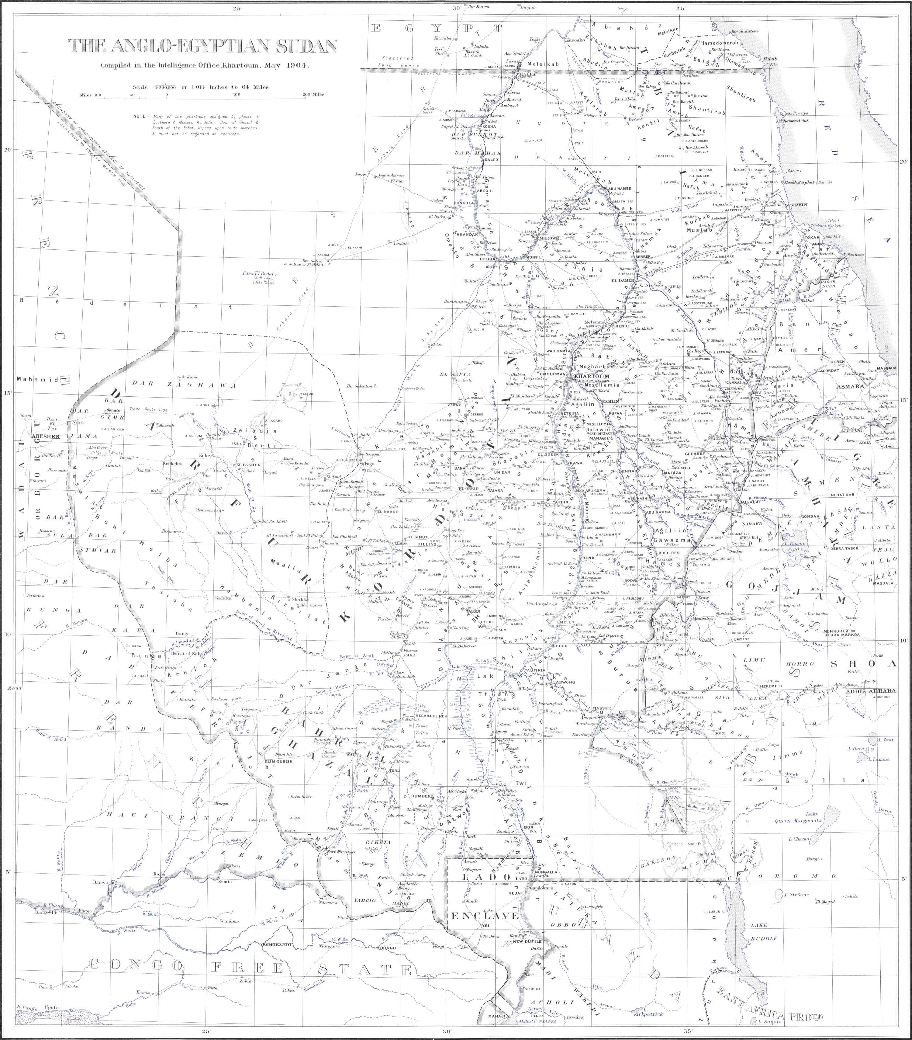
(Largest size: legend, top-left, top-right, bottom-left, bottom-right)
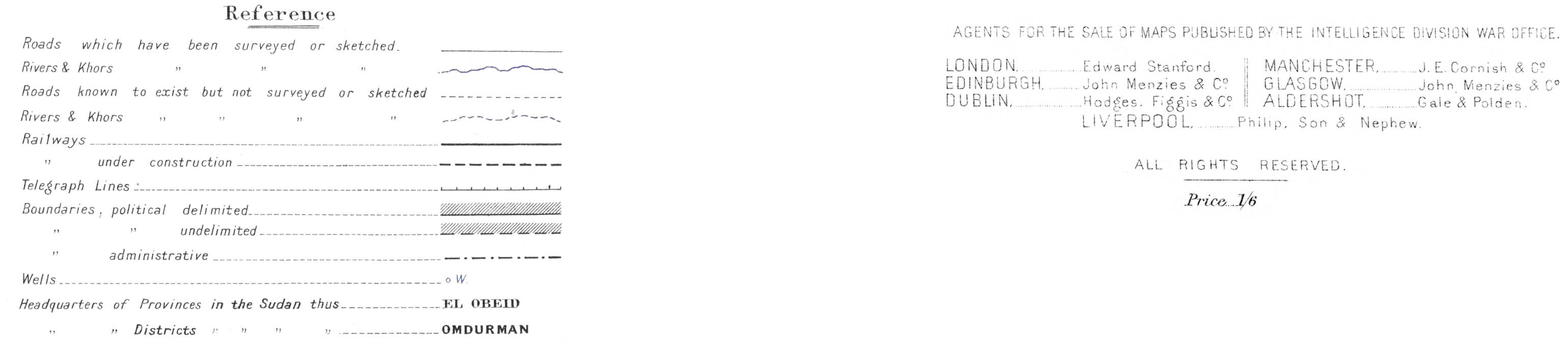
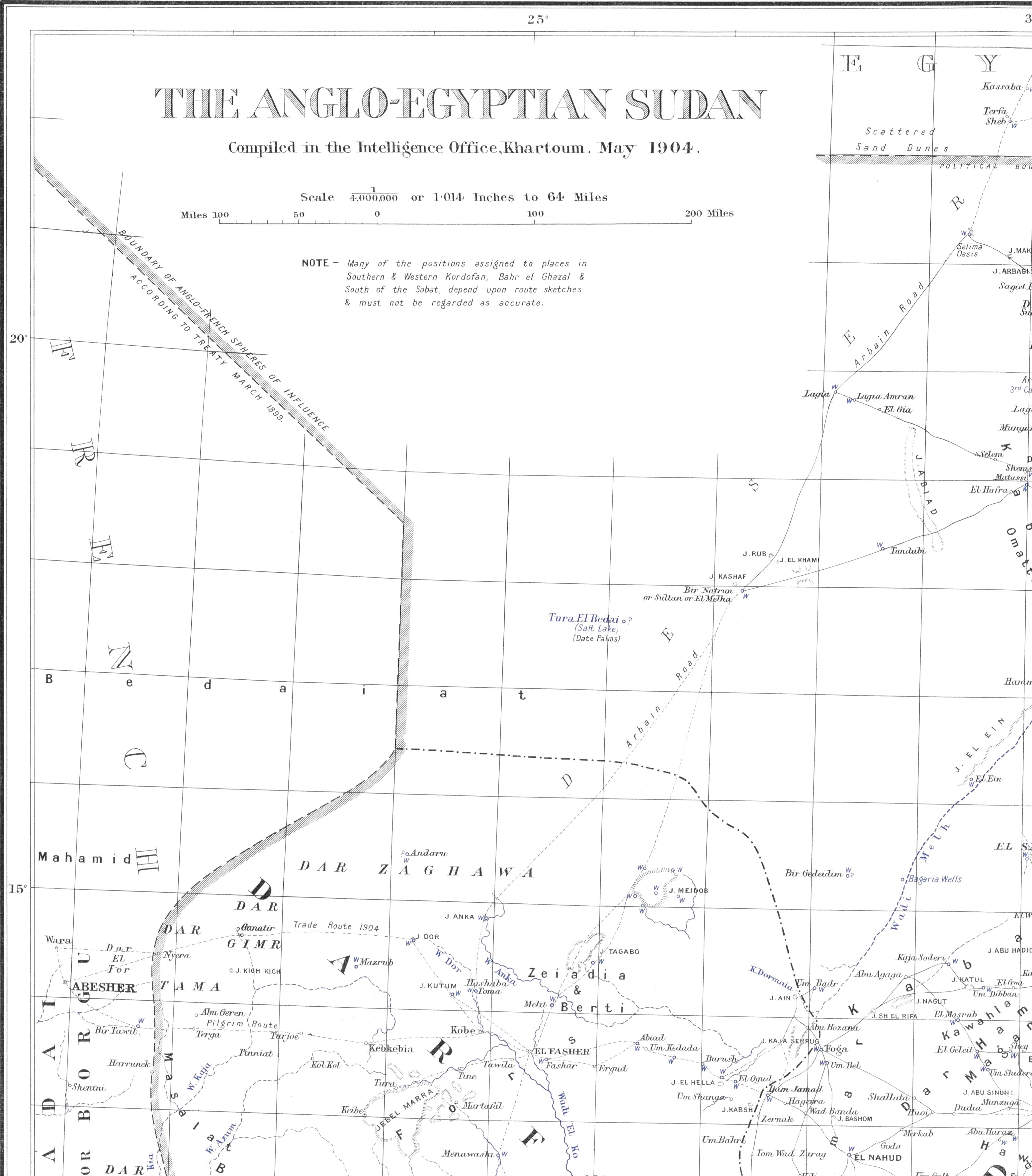
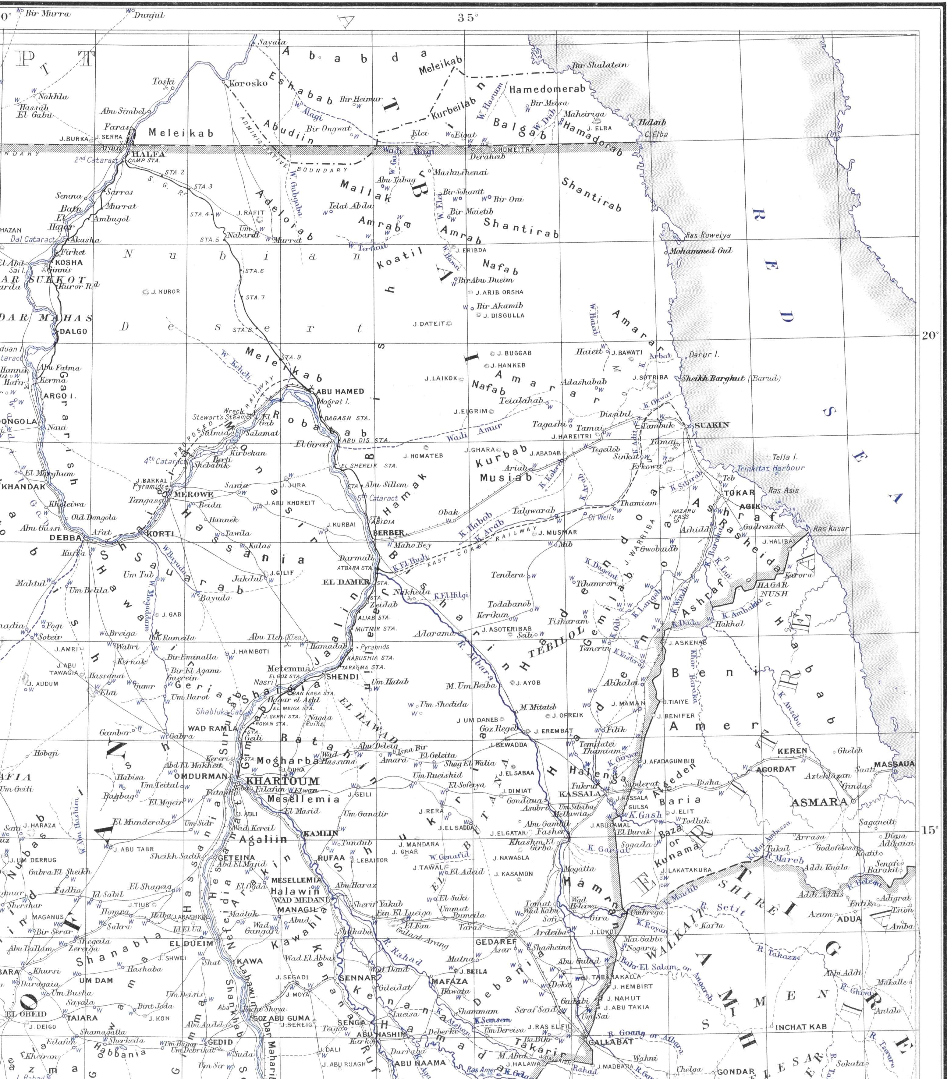
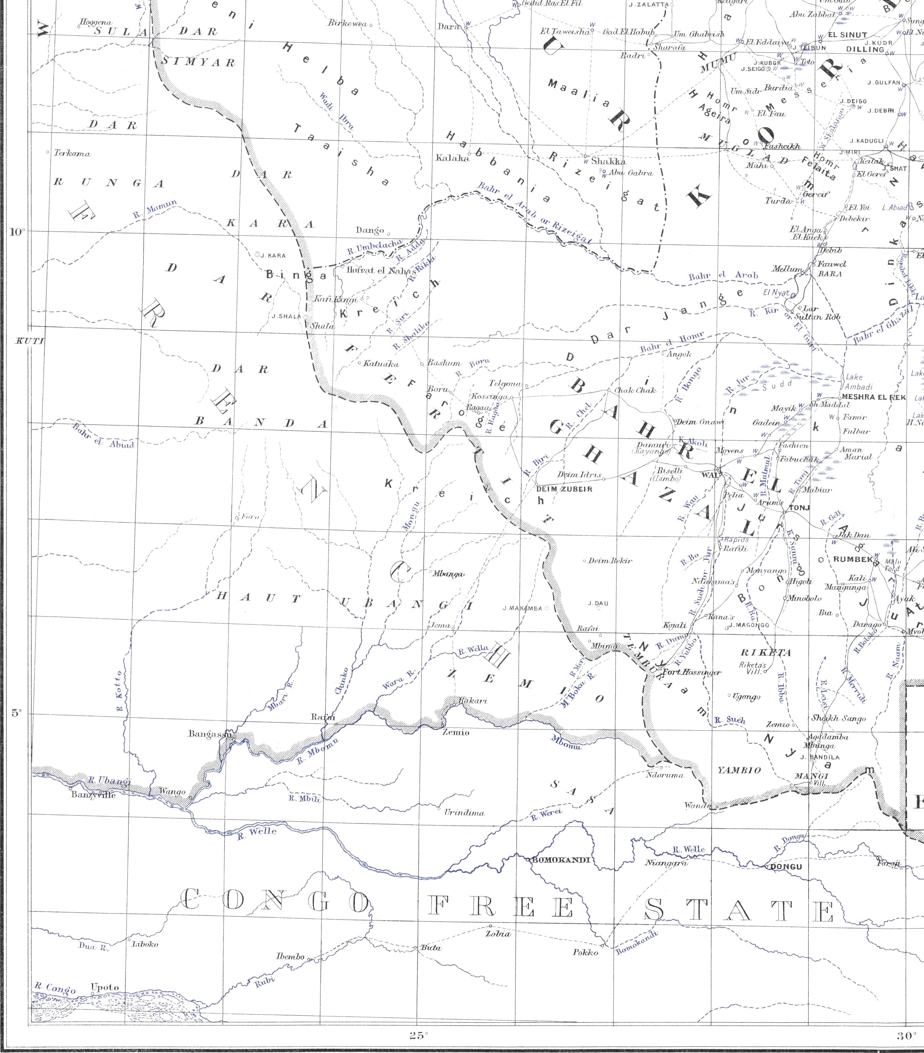
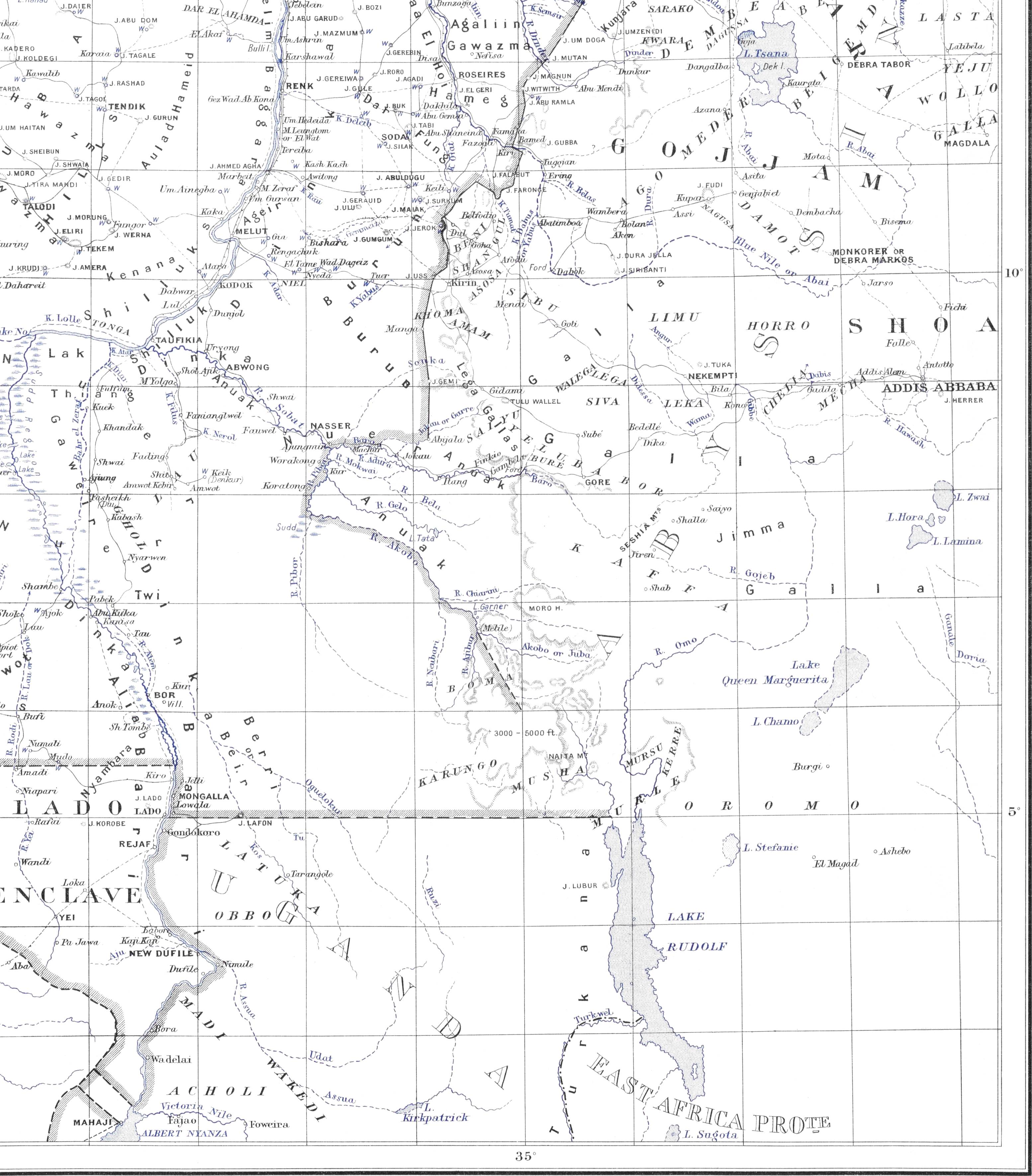